A Collection of Montenegro Maps provides a detailed visual exploration of Montenegro’s diverse geography, including its regions, cities, and natural features. It offers valuable insights for travelers and geography enthusiasts alike.
Brief information about Montenegro
Montenegro, nestled along the Adriatic Sea in Southeastern Europe, is a hidden gem known for its stunning natural landscapes and rich cultural heritage. Despite being one of the smallest countries in the region, it offers diverse experiences, from picturesque coastal towns like Kotor and Budva to the rugged beauty of the Durmitor National Park. This country’s captivating blend of mountains, beaches, and medieval architecture makes it a perfect destination for travelers seeking both relaxation and adventure.
Map of Montenegro
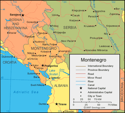
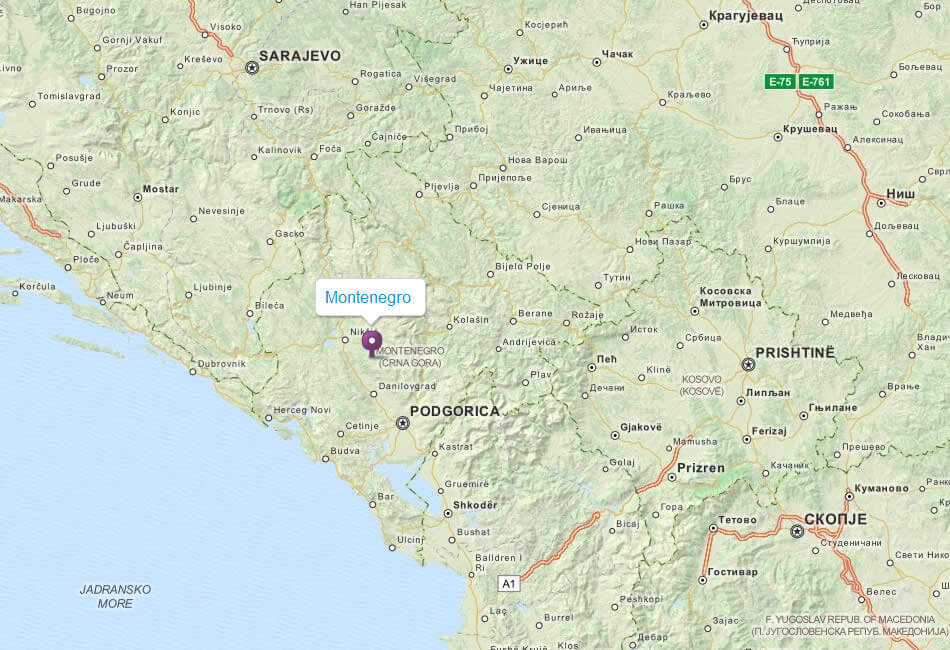
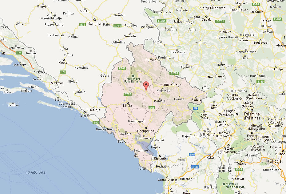
This map of Montenegro shows its geographical location in south-eastern Europe, bordered by Bosnia and Herzegovina, Serbia, Kosovo, Albania and Croatia, with a coastline along the Adriatic Sea. It shows major cities such as the capital, Podgorica, as well as road networks, rivers and the division of the country into provinces.
Beyond its natural beauty, Montenegro has a fascinating history shaped by various empires, including the Romans, Ottomans, and Venetians. Visitors can explore centuries-old churches, fortified towns, and charming villages that reflect the region’s unique blend of cultures. Plus, with its welcoming locals and delicious Mediterranean cuisine, Montenegro promises a warm and enriching travel experience for anyone looking to discover Europe’s lesser-known treasures.
Where is located Montenegro on the World Map
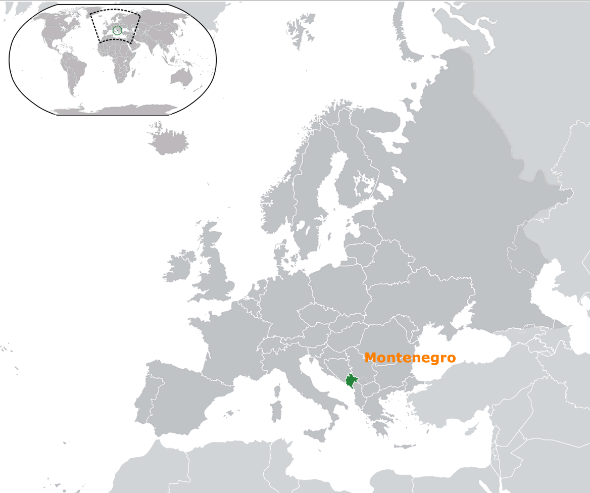
Montenegro is a small yet beautiful country in Southeastern Europe, positioned along the Adriatic Sea. It borders Croatia to the west, Bosnia and Herzegovina to the northwest, Serbia to the northeast, Kosovo to the east, and Albania to the southeast. Despite its compact size, it offers a variety of landscapes that make it a hidden gem in the region.
Known for its diverse geography, Montenegro combines stunning coastal areas with impressive mountain ranges. The Bay of Kotor, a UNESCO World Heritage site, is famous for its breathtaking scenery, while the Dinaric Alps offer incredible hiking opportunities. This mix of sea and mountains makes Montenegro a unique destination where you can explore beaches and rugged nature all in one trip.
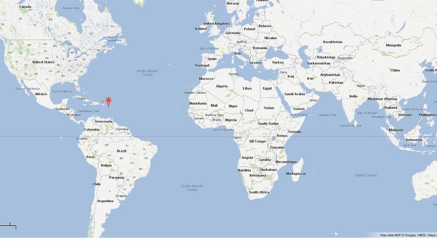
On the world map, Montenegro is nestled in the heart of the Balkans, directly across the Adriatic Sea from Italy. Its strategic location makes it a perfect gateway between Western Europe and the Balkans, attracting travelers who wish to explore the rich cultural heritage and natural beauty of Southeastern Europe.
Here are some statistical information about Montenegro:
Former Yugoslavia Montenegro Map
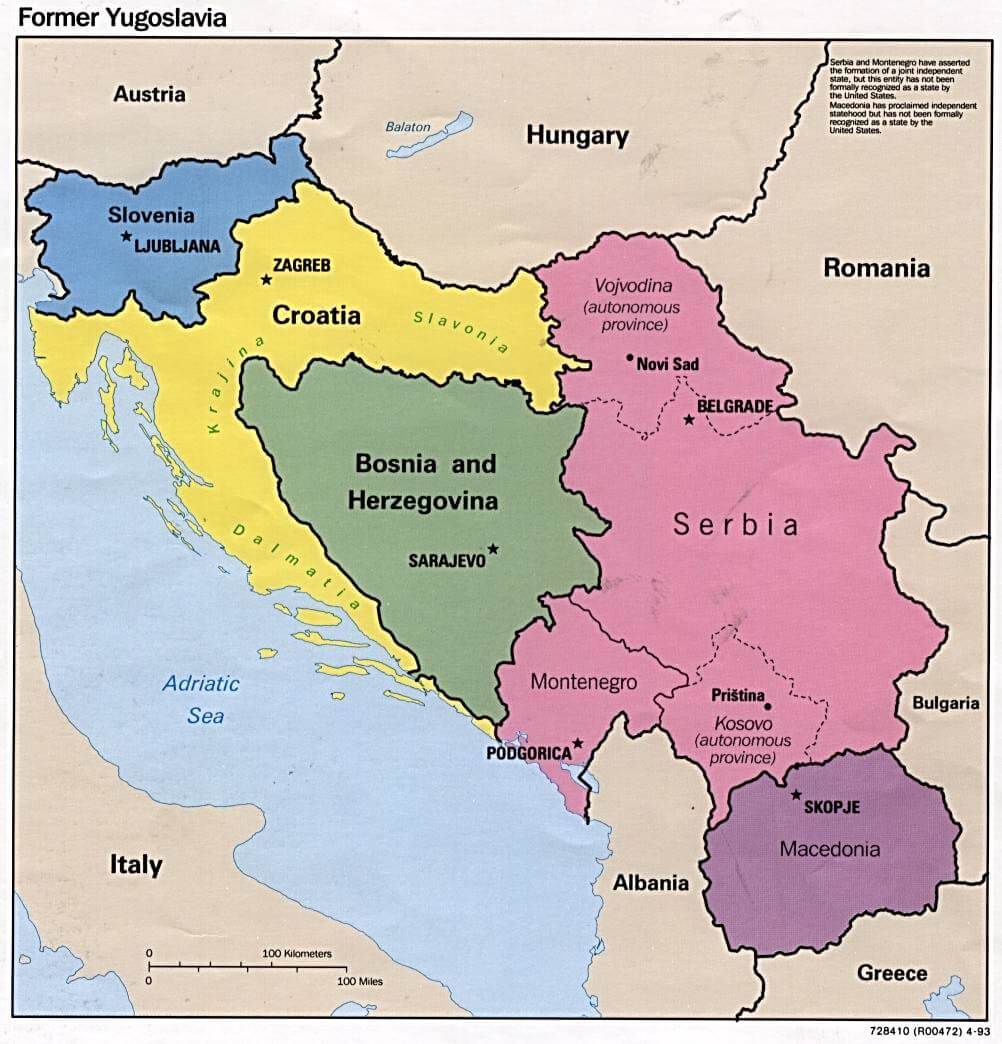
This map shows the former Yugoslavia, illustrating the different countries that emerged after its dissolution, including Slovenia, Croatia, Bosnia and Herzegovina, Serbia, Montenegro, Macedonia, and Kosovo, along with their capitals and neighboring countries in Southeastern Europe.
Map Montenegro
Map of The Republic of Montenegro
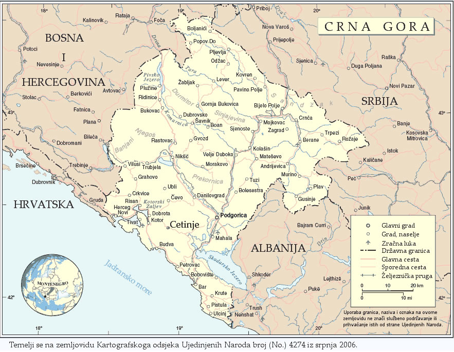
This map of Montenegro, labeled as “Crna Gora” in Montenegrin, shows the country’s main cities, towns, and transportation routes, including major roads and railways. It highlights Montenegro’s borders with neighboring countries: Croatia to the west, Bosnia and Herzegovina to the northwest, Serbia to the northeast, and Albania to the southeast. Key cities like Podgorica, the capital, and Cetinje, the historical capital, are marked, along with the beautiful Adriatic coastline and natural landmarks like the Durmitor mountain range.
Montenegro Physical Map
Montenegro Tourist Map
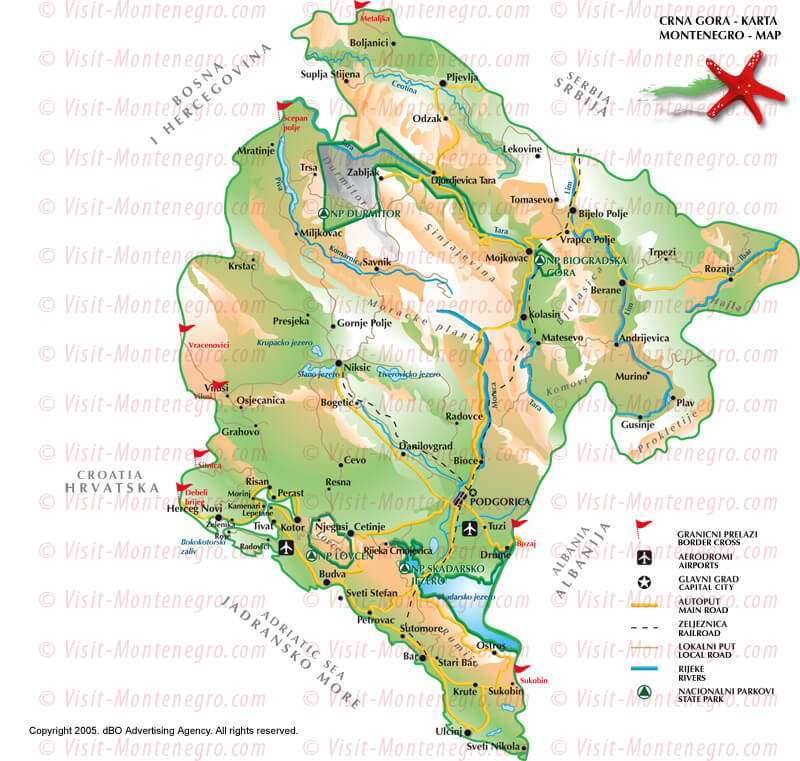
This tourist map of Montenegro highlights key destinations, natural parks, and important travel routes throughout the country. It features attractions like Durmitor National Park, Biogradska Gora, and the beautiful Adriatic coastline with cities such as Kotor, Budva, and Tivat. The map also marks the main roads, borders, and natural landmarks, making it a helpful guide for travelers exploring Montenegro’s blend of cultural heritage and stunning landscapes.
Montenegro Relief Map
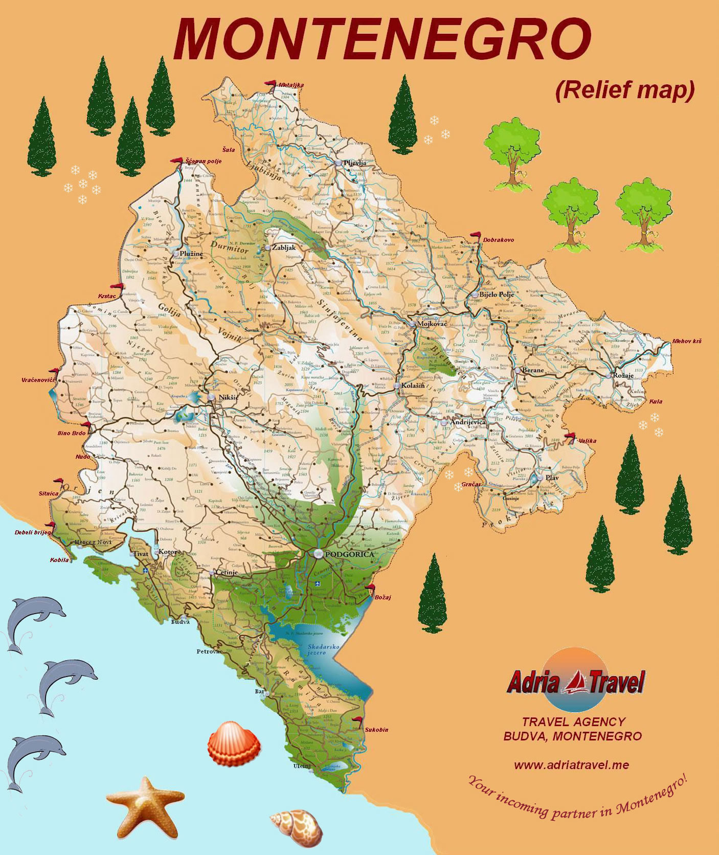
This relief map of Montenegro highlights the country’s diverse geography, including its coastal regions along the Adriatic Sea, mountainous areas, and key cities such as Podgorica, the capital. The map also features major natural landmarks like Durmitor National Park and Skadar Lake, showcasing Montenegro’s blend of rugged terrain and scenic beauty, making it a popular destination for both beach lovers and nature enthusiasts.
Montenegro Provinces Map
Montenegro Major Cities Map
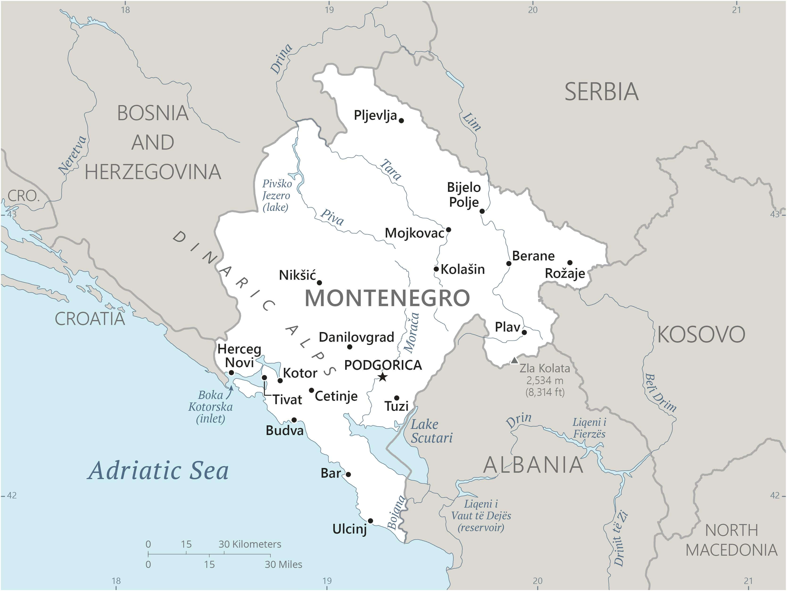 This map of Montenegro highlights the country’s major cities, including the capital Podgorica, as well as other key locations such as Nikšić, Bar, Kotor and Herceg Novi. The map shows Montenegro’s borders with neighbouring countries including Bosnia and Herzegovina, Serbia, Kosovo and Albania, as well as its Adriatic coast. Major natural features such as the Dinaric Alps and Pivsko Jezero (Lake) are also marked, providing a comprehensive overview of the region’s geography.
Montenegro Physical Map Largest Cities Podgorica
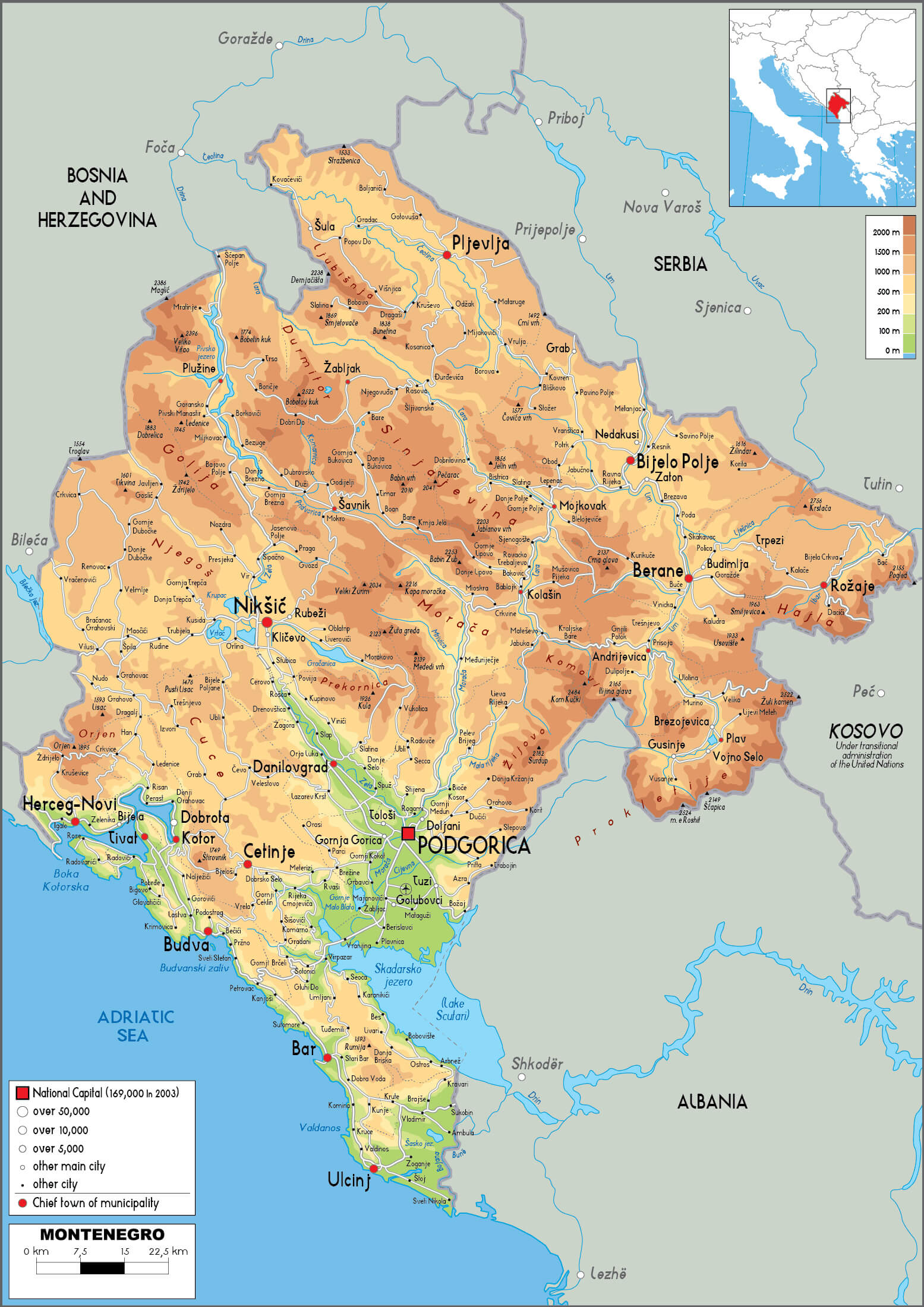 This physical map of Montenegro highlights the country’s varied topography, including its mountainous regions and lowlands. Podgorica, the national capital, is prominently featured, along with other major cities such as Nikšić, Bar and Herceg Novi. The map also shows Montenegro’s rivers, lakes such as Skadar and the Adriatic coastline. The relief shading illustrates the changes in elevation across the country, with rugged mountain ranges dominating the northern regions.
Montenegro Byzantine Empire Map in 1045 AD
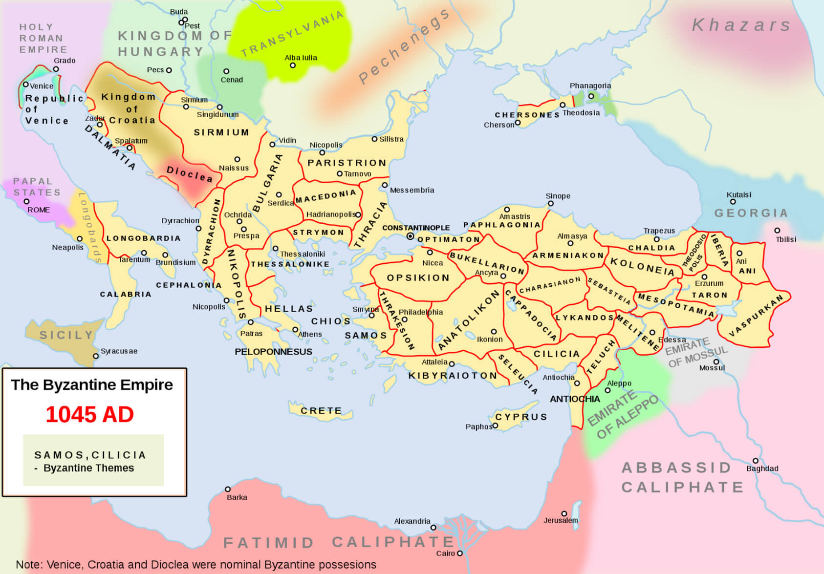 This map of the Byzantine Empire in 1045 AD shows the territorial extent of the Empire and its various administrative themes, including key regions such as Anatolia, Thrace and Armenia. It also shows neighbouring powers such as the Kingdom of Hungary, the Fatimid Caliphate to the south, and emerging regions such as Georgia and the Pechenegs. The map reflects the Byzantine Empire’s strategic control over significant parts of south-eastern Europe and western Asia during this period.
Montenegro Roman Balkans Map in the 4th Century
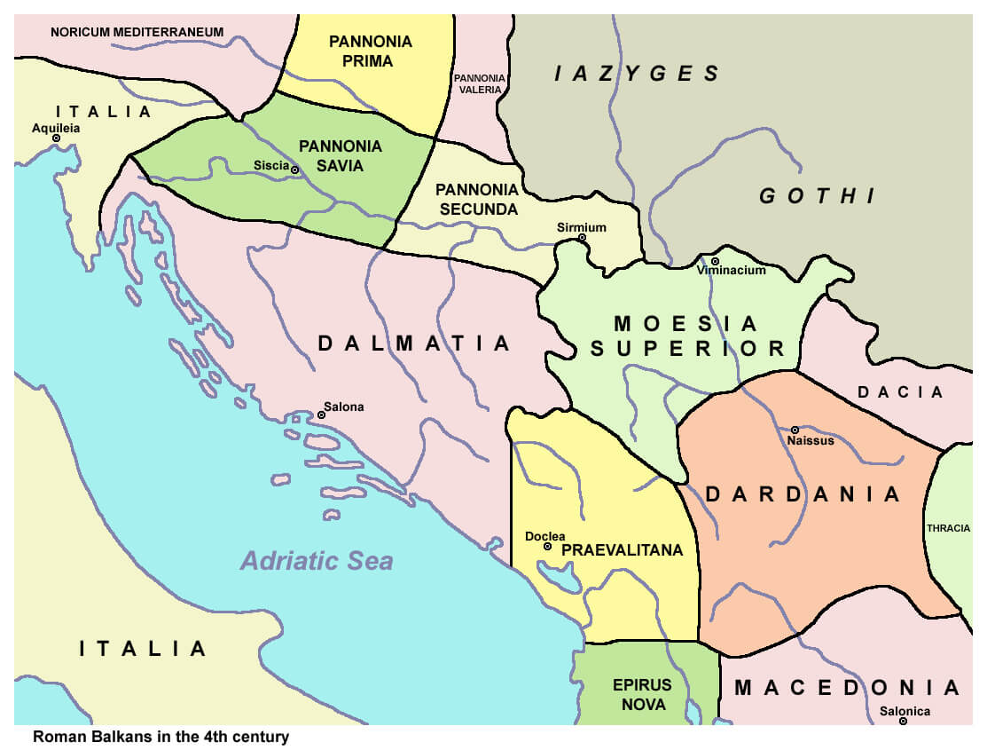 This map of the Roman Balkans in the 4th century highlights the various provinces of the Roman Empire, such as Dalmatia, Moesia Superior, Dardania and Praevalitana, and illustrates the Roman territorial organisation in the region, which corresponds to parts of modern-day Montenegro, Serbia and surrounding areas.
Montenegro Rivers Map with Largest Cities
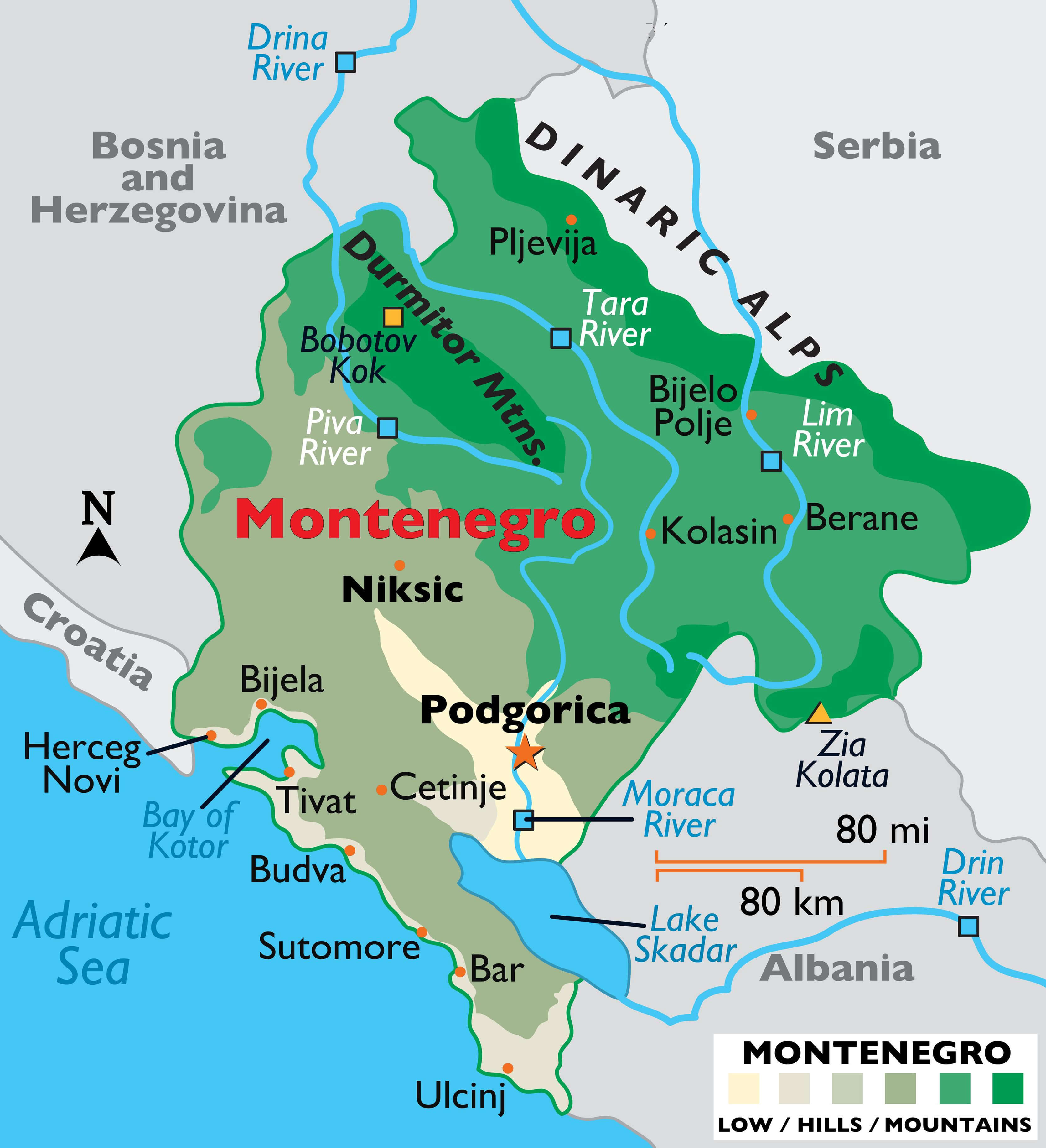 This map highlights the topography of Montenegro, including its major rivers, such as the Tara, Piva and Moraca, and its major cities, such as Podgorica, Nikšić and Bar. It also shows the mountainous terrain, including the Dinaric Alps and the Durmitor mountain range, which play a significant role in shaping the country’s geography.
Montenegro Kingdom of Yugoslavia Map
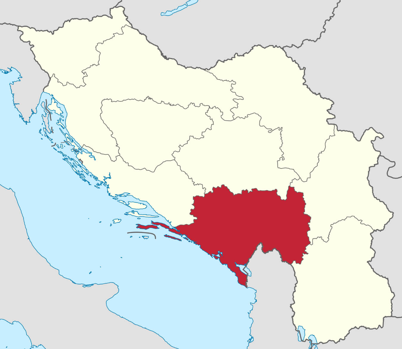 This map shows the territory of Montenegro within the Kingdom of Yugoslavia and shows its position in relation to other regions. Montenegro, shown in red, was part of the larger federation of Yugoslavia, which was formed after World War I and existed until its dissolution in the 1990s. The map illustrates how Montenegro’s borders were defined within the kingdom, highlighting its geographical relationship with neighbouring areas such as Croatia, Bosnia and Herzegovina and Serbia.
Montenegro Former Yugoslavia Map in 2008
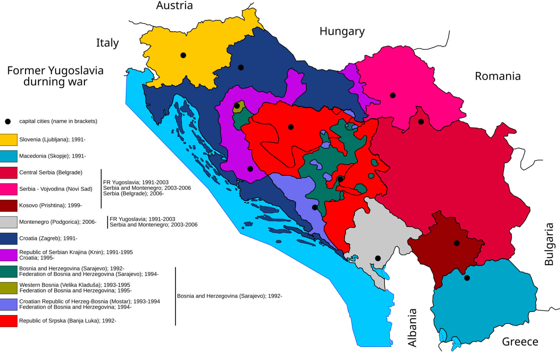 This map shows the territorial changes in the region of former Yugoslavia since 2008, depicting the break-up of Yugoslavia into independent states including Slovenia, Croatia, Bosnia and Herzegovina, Serbia, Montenegro, North Macedonia and the disputed territory of Kosovo. Montenegro, shown separately, gained independence from its union with Serbia in 2006, contributing to the evolving political landscape of the Balkans. The map illustrates the complex history and shifting borders that have defined the region’s post-Yugoslav era.
Montenegro National Map with Roads
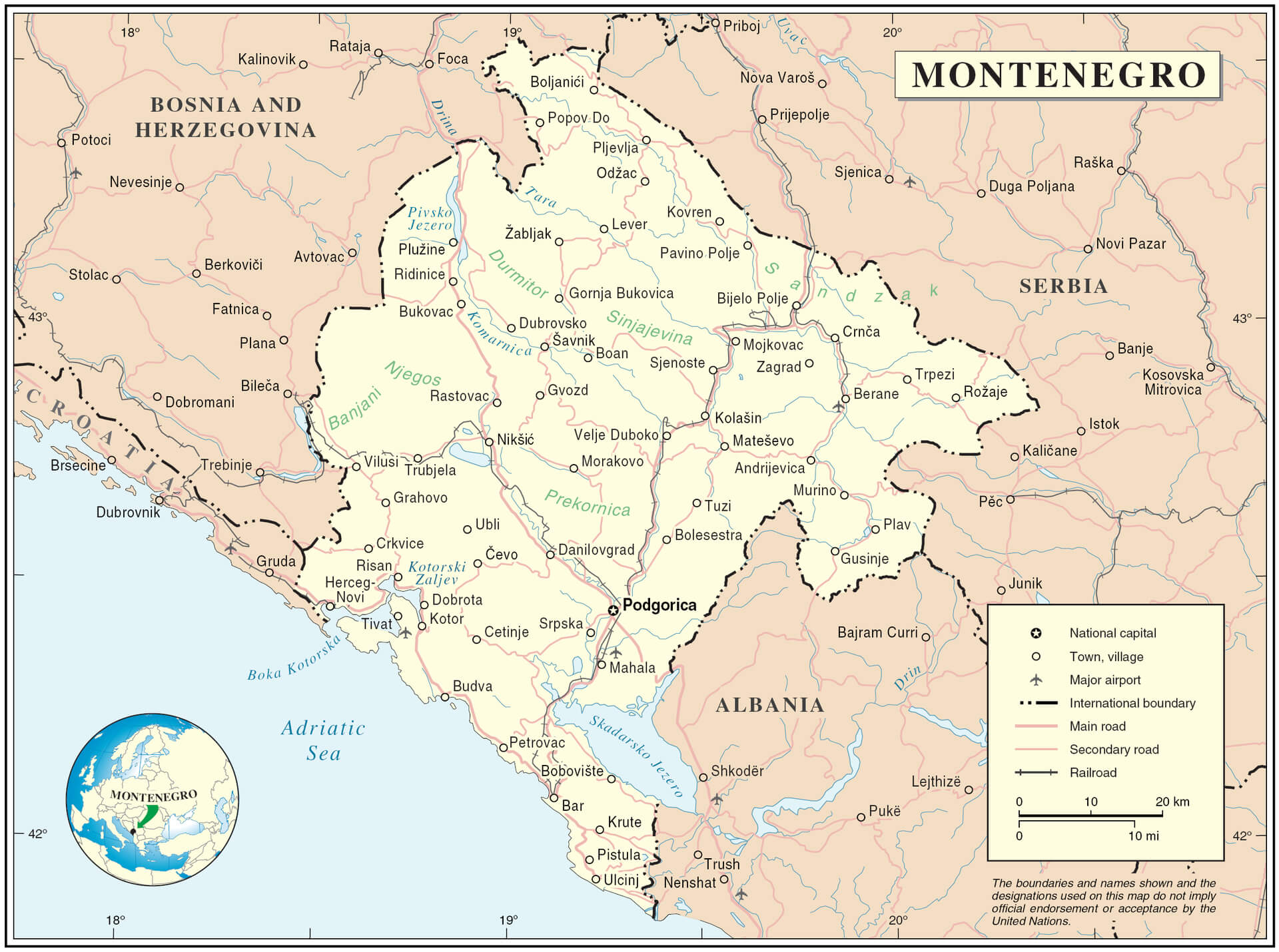 This map of Montenegro shows the country’s road network, including major and minor roads and railways, as well as national and administrative boundaries. It includes major cities such as Podgorica, the capital, and important towns such as Nikšić, Bar and Cetinje. The map also outlines international borders with neighbouring countries such as Albania, Serbia, Bosnia and Herzegovina and Croatia, demonstrating Montenegro’s strategic links with the Adriatic Sea and the wider Balkan region. The inclusion of natural features such as mountain ranges and rivers provides a comprehensive view of the region’s geography.
Montenegro Administrative Map
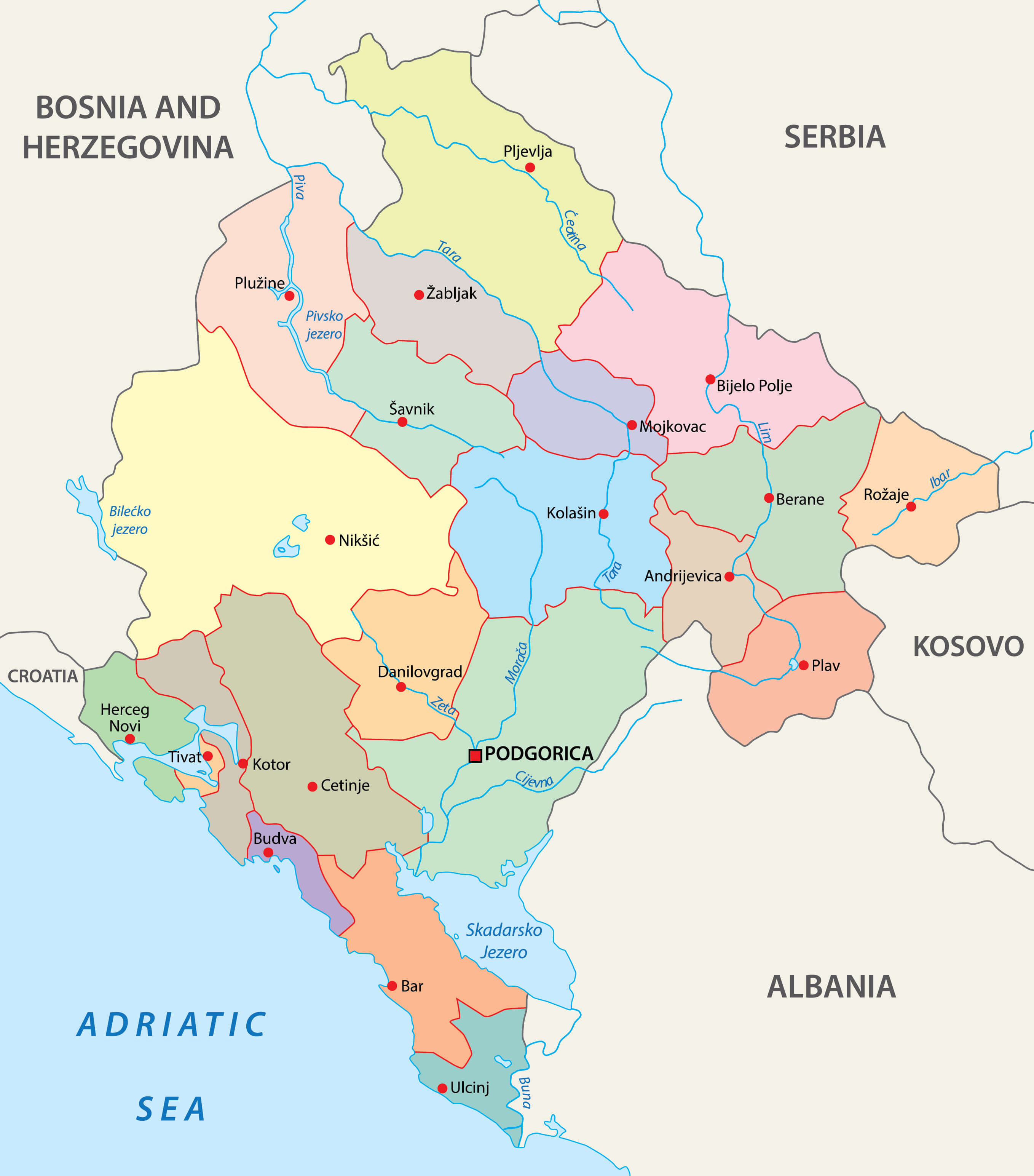
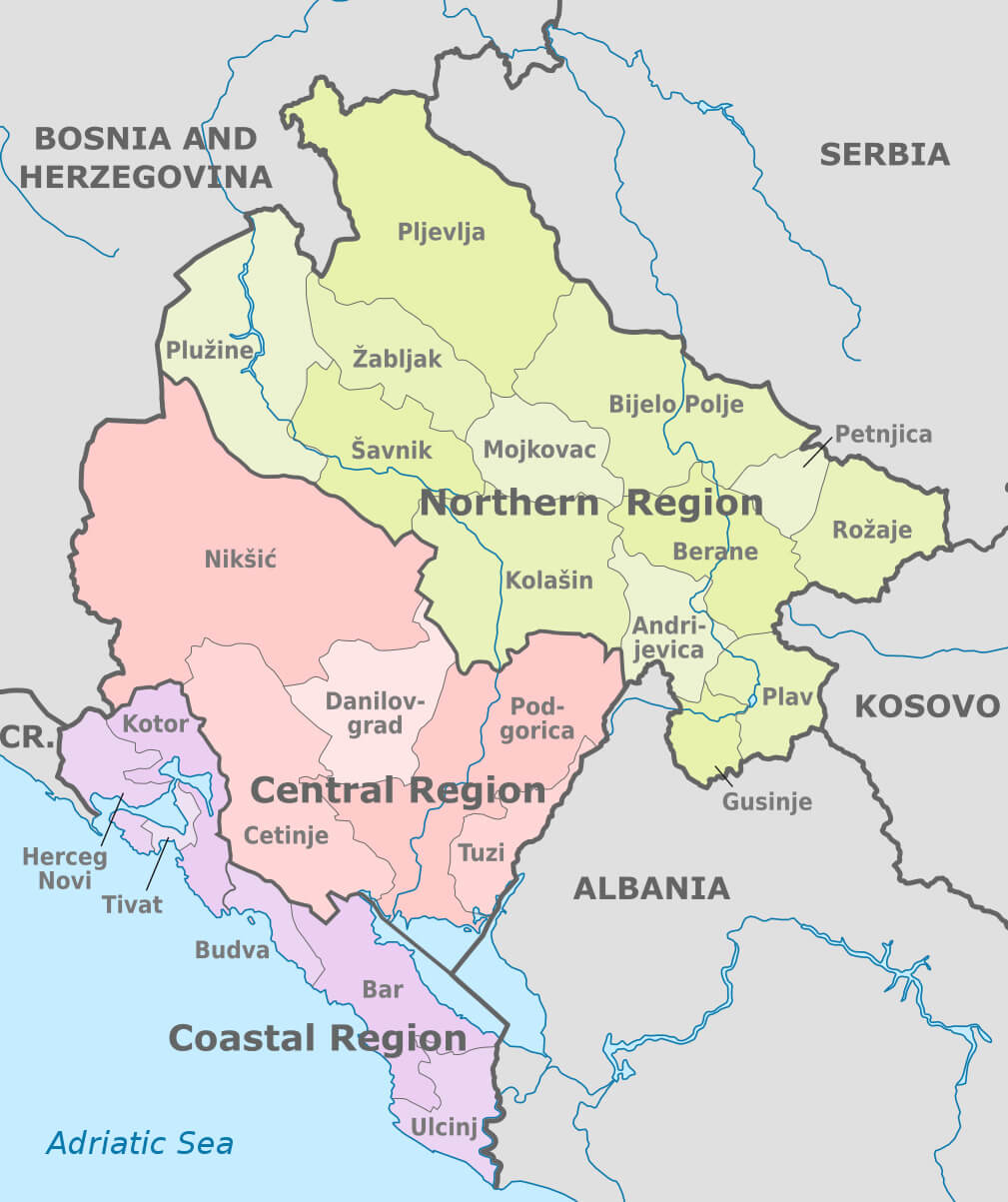 This map of Montenegro highlights the country’s administrative regions, including the northern, central and coastal regions. It shows how these regions are organised within Montenegro’s borders, neighbouring countries such as Bosnia and Herzegovina, Serbia, Albania and Kosovo, and Montenegro’s Adriatic coast, which is part of the coastal region.
Montenegro Regions Map with Major Cities
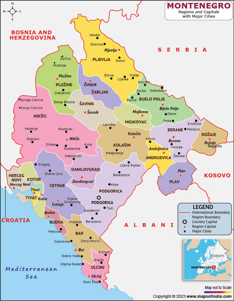 This map of Montenegro highlights its regional divisions, showing the country’s administrative regions as well as major cities such as Podgorica, the capital. It illustrates the distribution of municipalities across the country, from coastal towns such as Budva and Bar to northern areas such as Pljevlja and Bijelo Polje. The map also provides an understanding of the geographical layout of Montenegro in relation to neighbouring countries such as Albania, Serbia and Bosnia and Herzegovina.
Map of Montenegro Europe
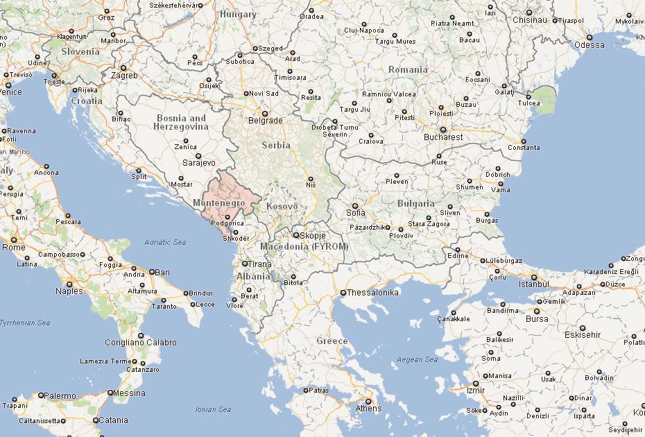
Map of Montenegro World
Montenegro Map
Where is Montenegro on the Europe Map?
Show Google map, satellite map, where is the country located.
Get directions by driving, walking, bicycling, public transportation and travel with street view.
div>Feel free to explore these pages as well:
- Croatia Map ↗️
- Italy Map ↗️
- France Map ↗️
- The 10 Best Things to Do in Venice ↗️
- Map of Europe ↗️
- Europe Map ↗️
- A Collection of Europe Maps ↗️
