- Advertisement -
A collection of France Maps; View a variety of France physical, political, administrative, relief map, France satellite image, higly detalied maps, blank map, France world and earth map, France’s regions, topography, cities, road, direction maps and atlas.
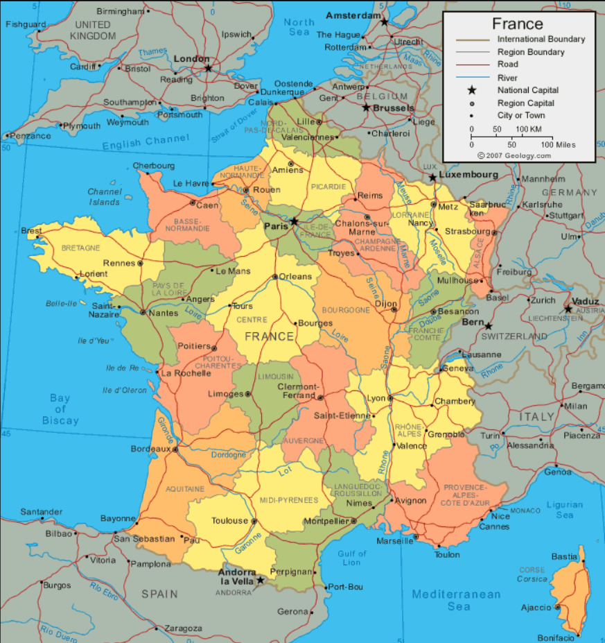
France Political Map with Cities and Regions
 Highly detailed France political map with cities and regions, road map.
France Map with Earth
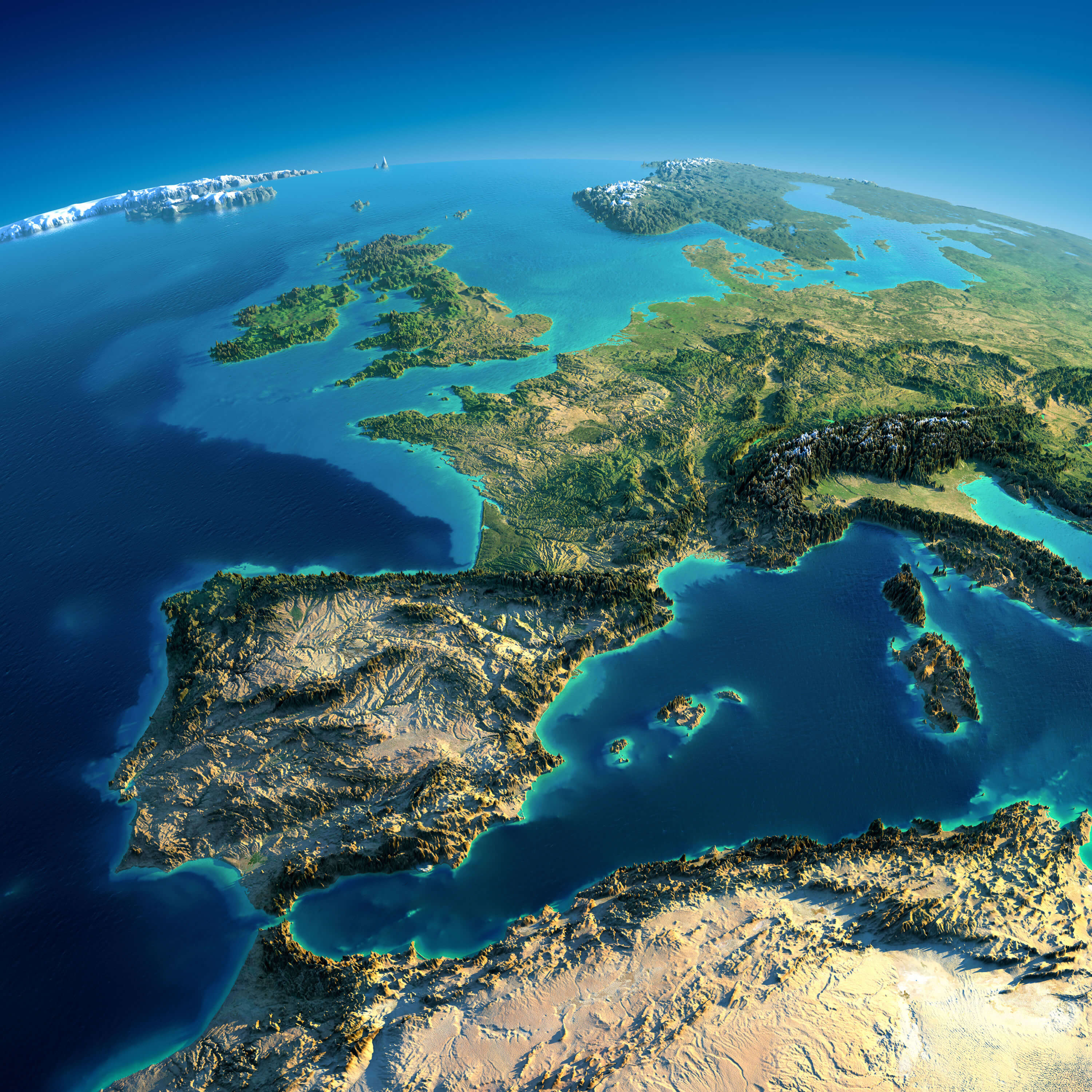 Highly detailed France map with planet Earth. Exaggerated precise relief is illuminated by the rising sun from the east. Part of Europe, Spain, the Mediterranean Sea.
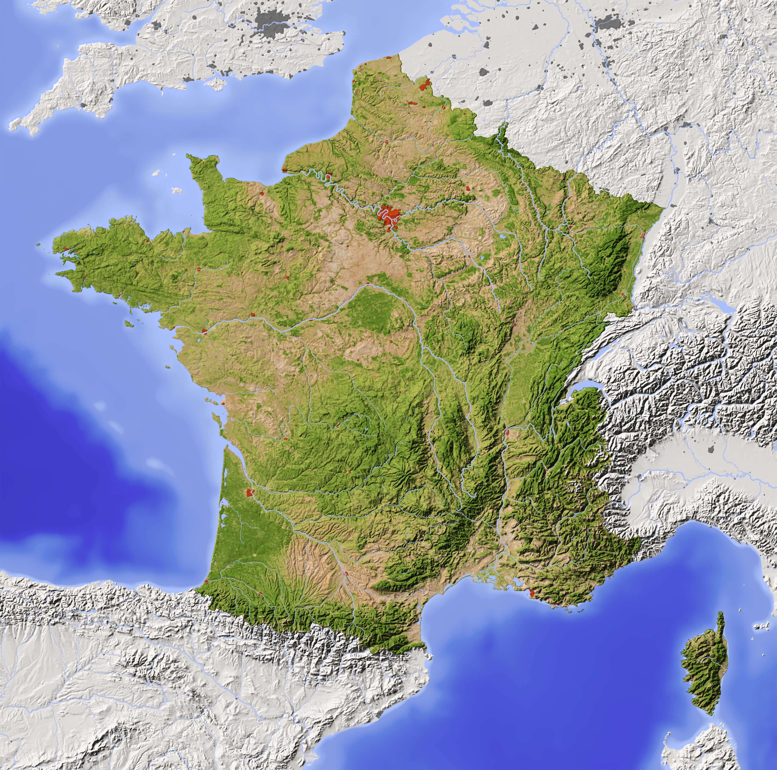
France Relief Map
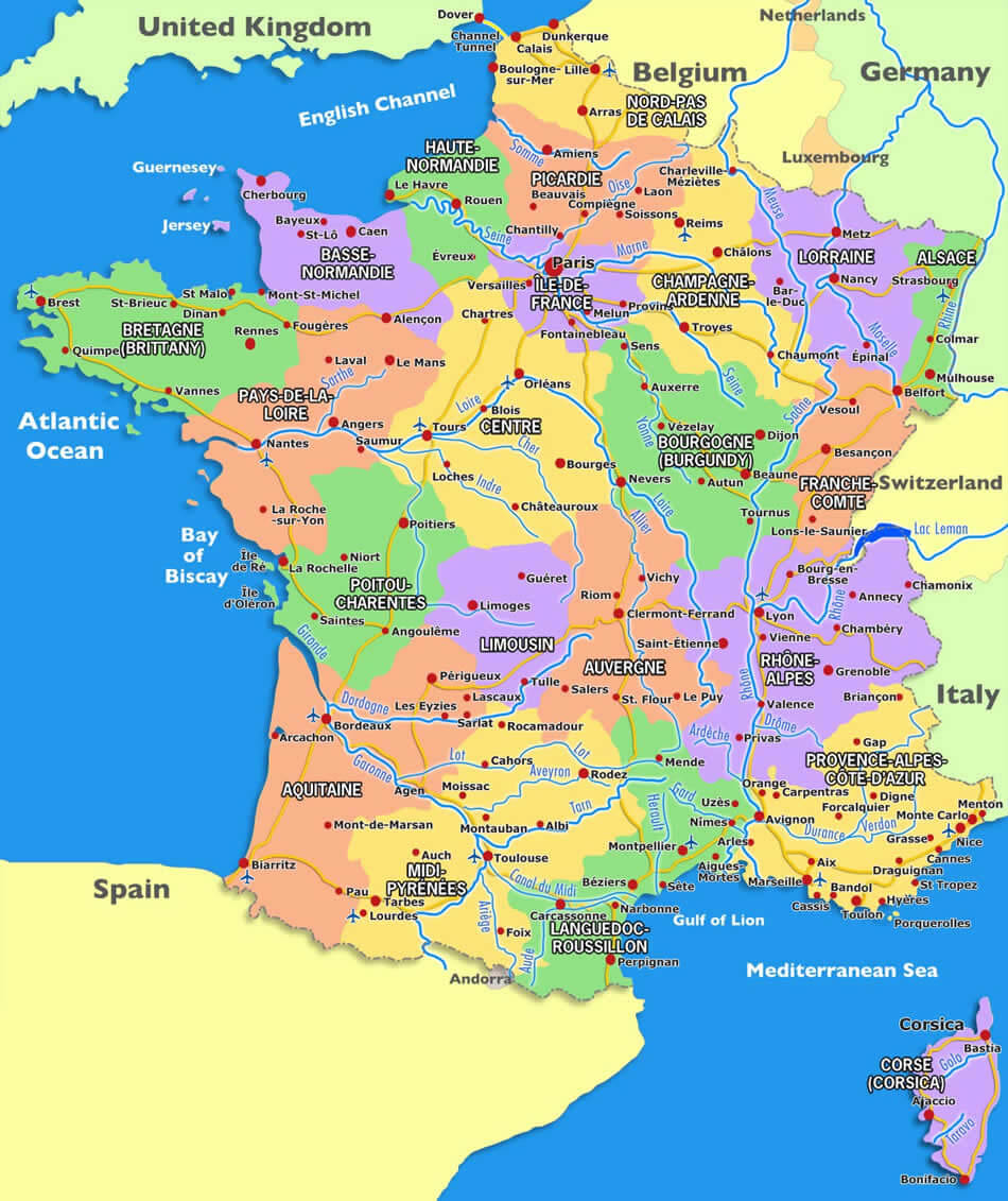
France Road River Map
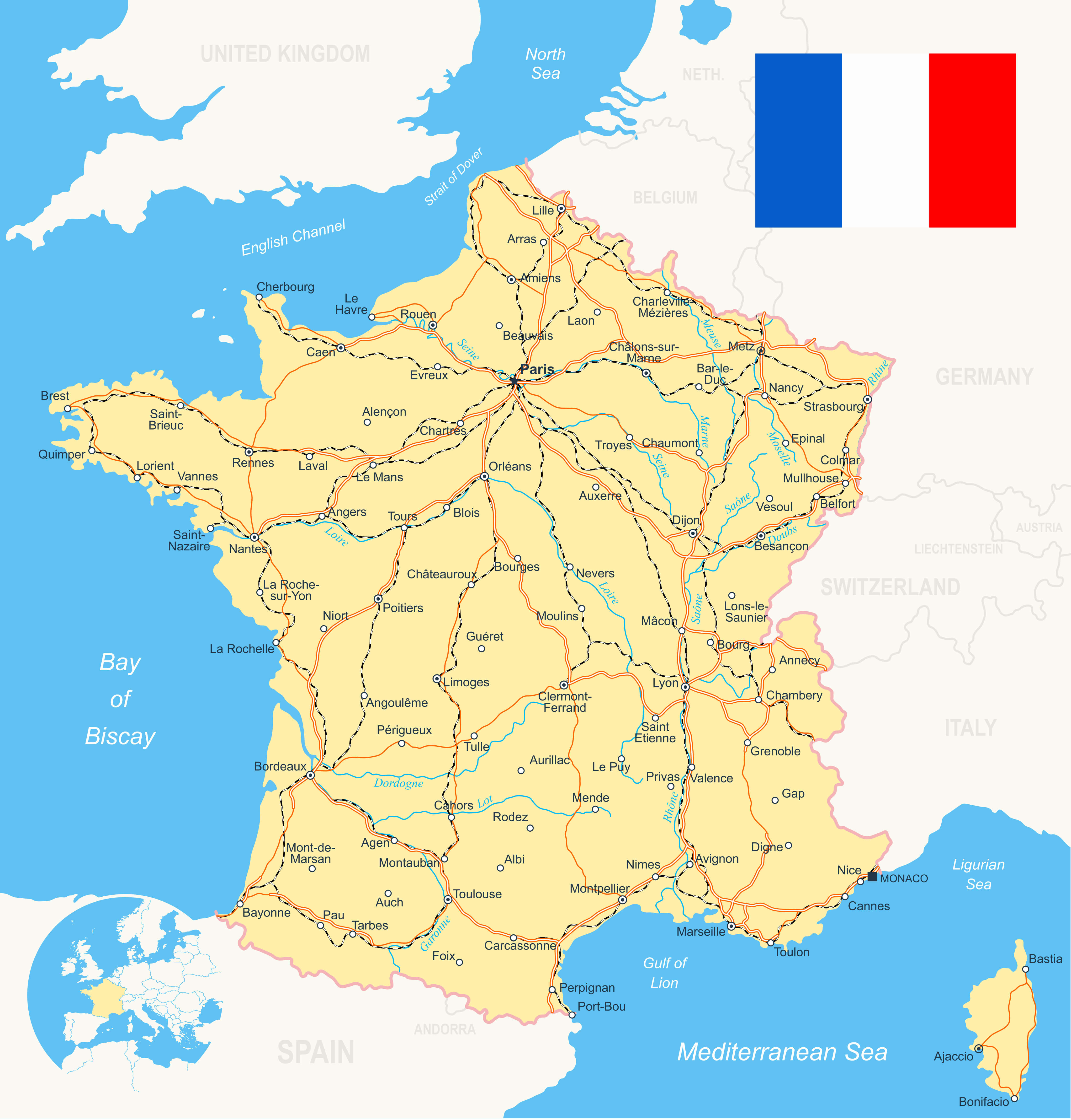 France Road River Map with flag, navigation icons, roads, rivers, land contours – country and land names – city names – water object names, roads – railways – rivers.
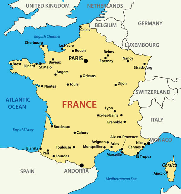
Map of France with Major Cities and Rivers
 Map of France as an overview map in green, major cities and rivers.
France Major Cities Map
France Travel Map
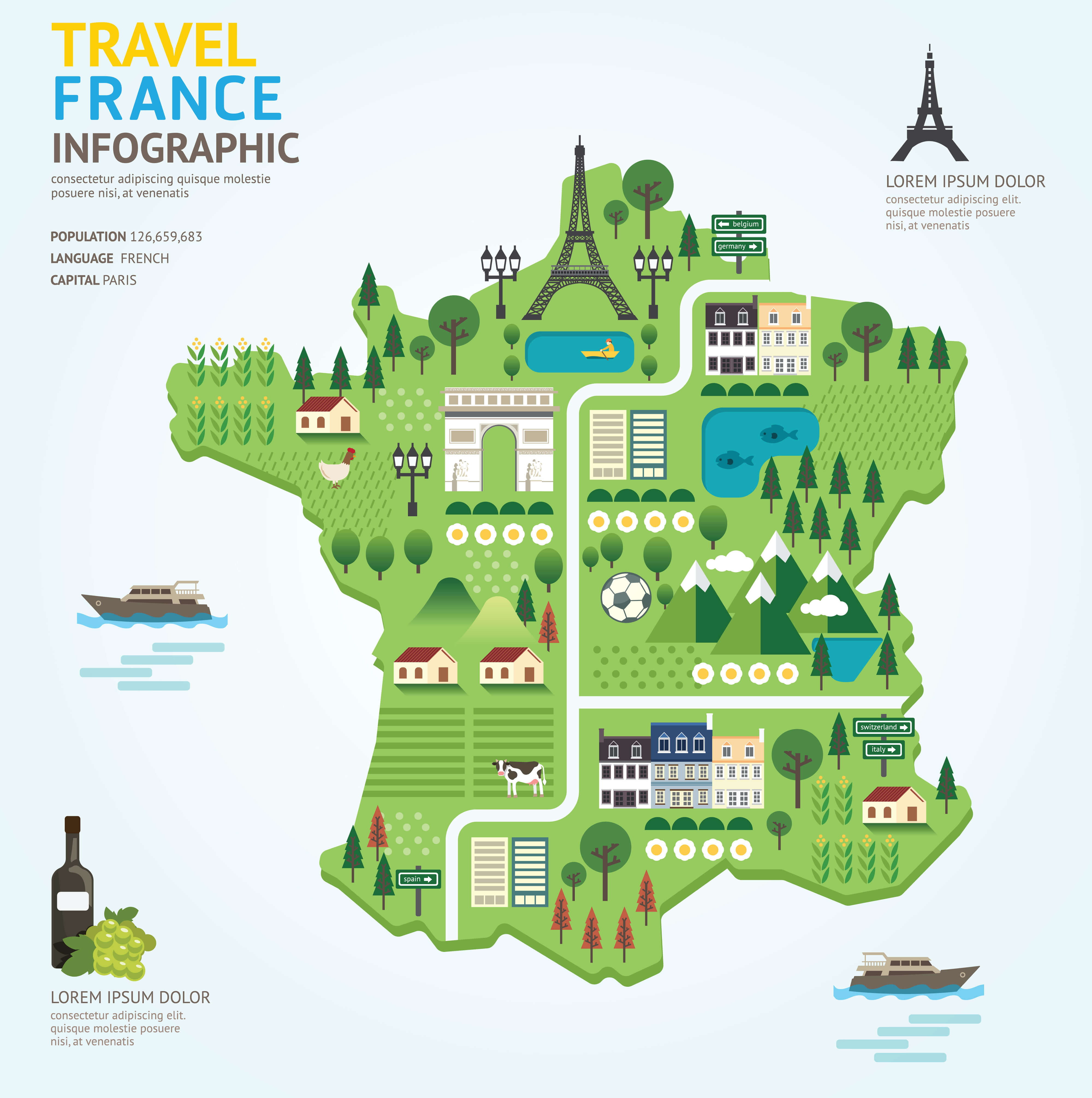 This is a fun and colorful infographic map of France that highlights key travel landmarks such as the Eiffel Tower, vineyards, riverside activities, and the Arc de Triomphe. The design uses a playful approach to showcase famous sights and local culture, including countryside scenery, famous monuments, and rural life. Perfect for travelers wanting a visual snapshot of what to explore in France!
Colorful France Map with Regions
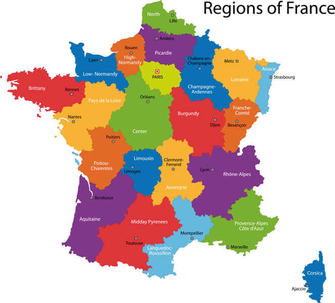 This colorful map of France highlights its various regions, each distinguished by vibrant hues. From the sunny Provence-Alpes-Côte d’Azur in the southeast to Brittany in the northwest, it provides a clear and visually engaging overview of the country’s administrative divisions. Major cities like Paris, Lyon, and Marseille are clearly marked, making it a useful reference for understanding France’s geographical layout and cultural diversity. The map also includes the island of Corsica, emphasizing its position in the Mediterranean.
France Administrative Map
 This
This
Map of France with Rivers
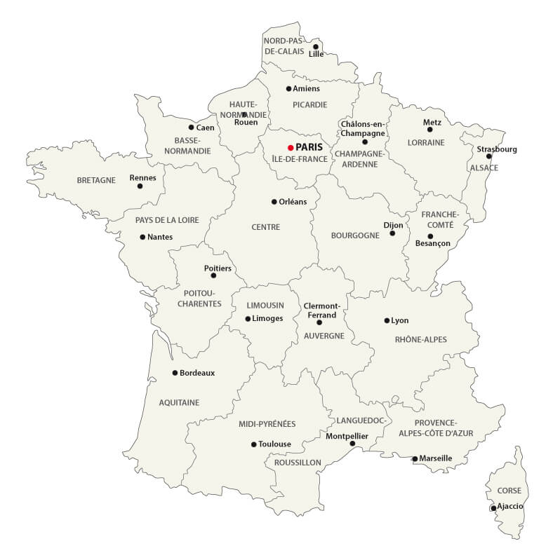
France Regions Map
 This map of France shows its regions, national boundaries, and major cities, providing a clear geographic breakdown. Key cities like Paris, Lyon, and Bordeaux are marked along with important rivers, roads, and borders connecting France with its neighboring countries.
France Highways Maps with Cantons
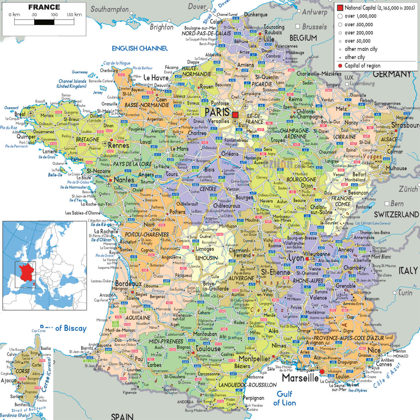 This map of France highlights the country’s extensive highway network, outlining major routes connecting key cities like Paris, Marseille, and Lyon, as well as smaller cantons across the regions. It’s an excellent guide for travelers planning road trips, offering a clear depiction of regional capitals, highways, and the connectivity between various towns and cities throughout France. The inclusion of cantons adds a layer of detail, perfect for those exploring the less tourist-heavy areas of the country.
France Provinces Map
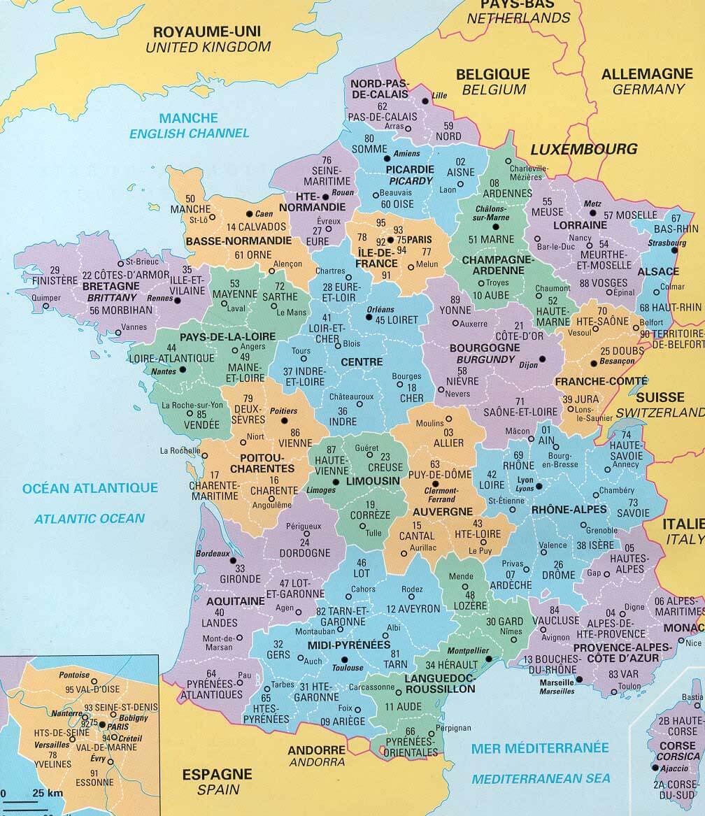 This map of France shows the country’s various provinces, along with their respective administrative numbers and regional boundaries. It highlights each province’s unique geographic location, as well as nearby bordering countries such as Spain, Germany, and Belgium. The map is a useful tool for understanding France’s internal divisions and is often used for administrative or regional planning purposes. Each province is color-coded, making it easier to differentiate between regions and understand the layout of France’s provincial structure.
Where is France in the World?
Show Google map, satellite map, where is the country located.
Get direction by driving, walking, bicycling, public transportaion and travel with street view.
Feel free to explore these pages as well:
- Discovering Angers: The Gem of France’s Loire Valley ↗️ ↗️
- France Map Collection ↗️
- Top 10 Destinations in France ↗️
- Map of France ↗️
- France Map ↗️
- Nice’s Top 10 Attractions for Every Traveler ↗️
- Europe Map ↗️
- Map of Europe ↗️
- A Collection of Europe Maps ↗️
- France Map ↗️
- Map of Spain ↗️
- Italy Map ↗️
- Ireland Map ↗️
- Political Map of the World ↗️
- United Kingdom Map ↗️
- Israel Map ↗️
- Germany Map ↗️
- Turkey Map ↗️
- Map of Sweden ↗️
- Map of Portugal ↗️
- Poland Map ↗️
- Switzerland Map ↗️
- Belgium Map ↗️
- Norway Map ↗️
- Finland Map ↗️
- Advertisement -