A collection of Europe Maps; View a variety of Europe physical, political, administrative, relief map, Europe satellite image, higly detalied maps, blank map, Europe world and earth map, Europe’s regions, topography, cities, road, direction maps and atlas.
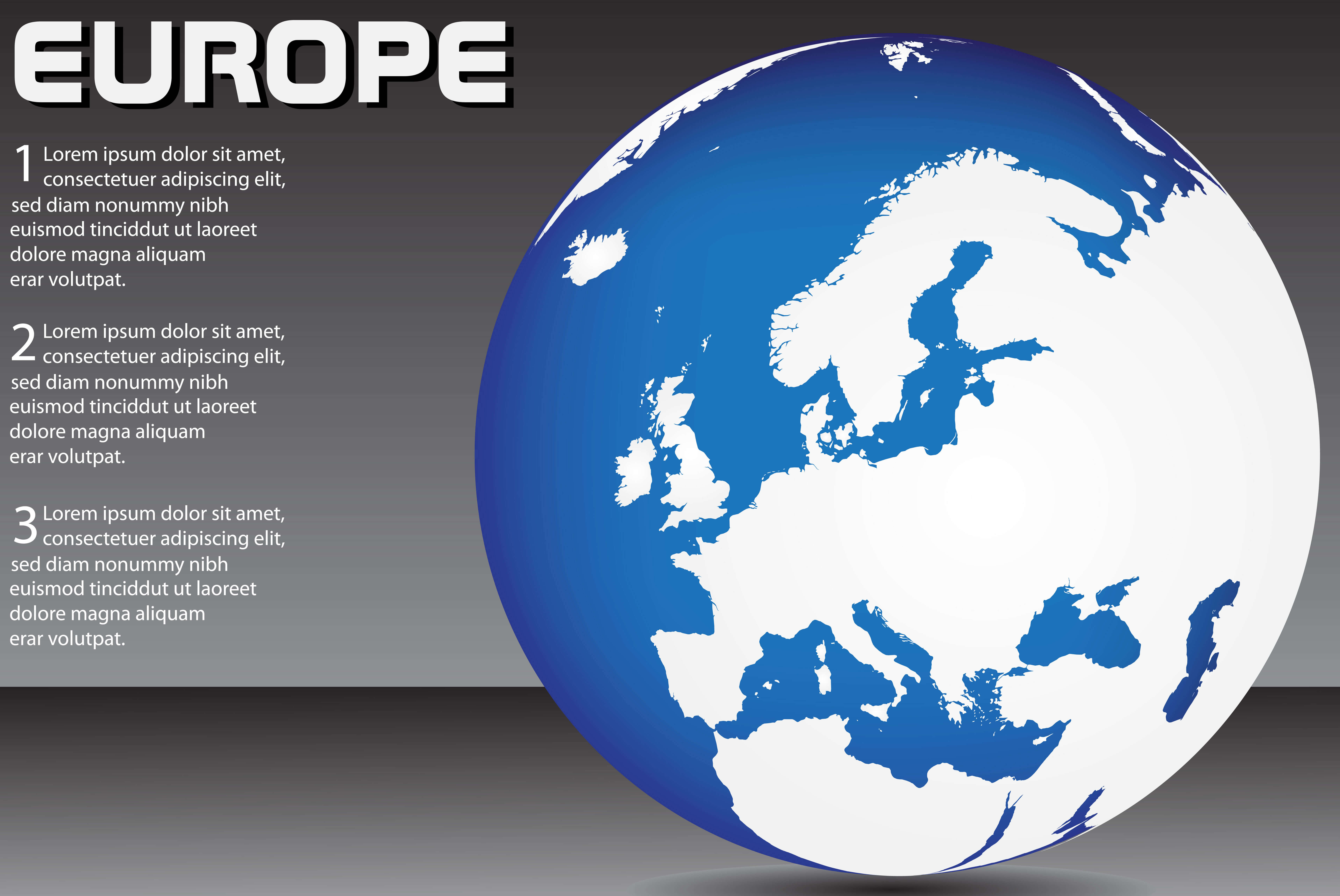
Europe Map
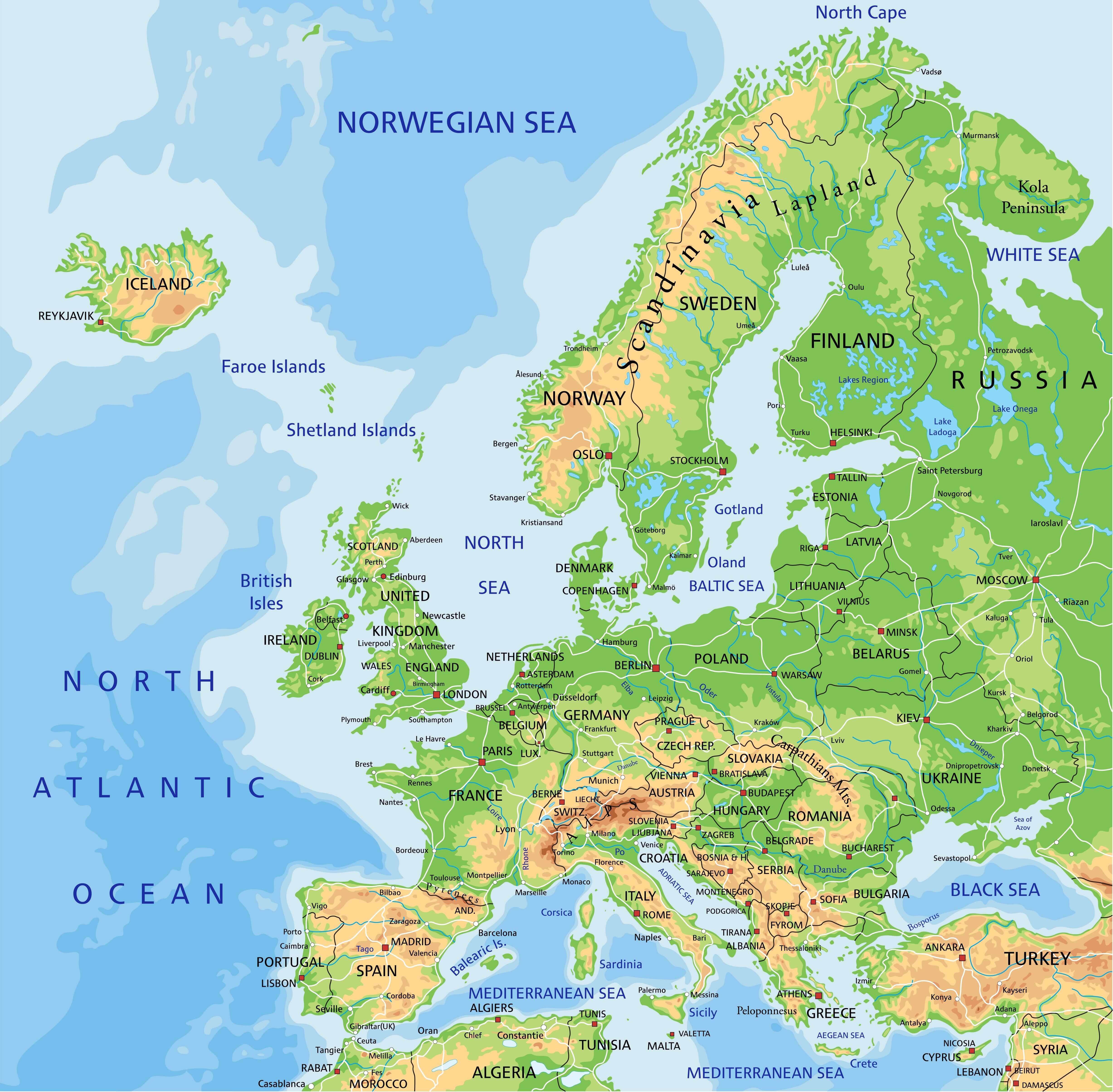 Europe Map, EU countries, physical map of Europe.
Blank Europe Map
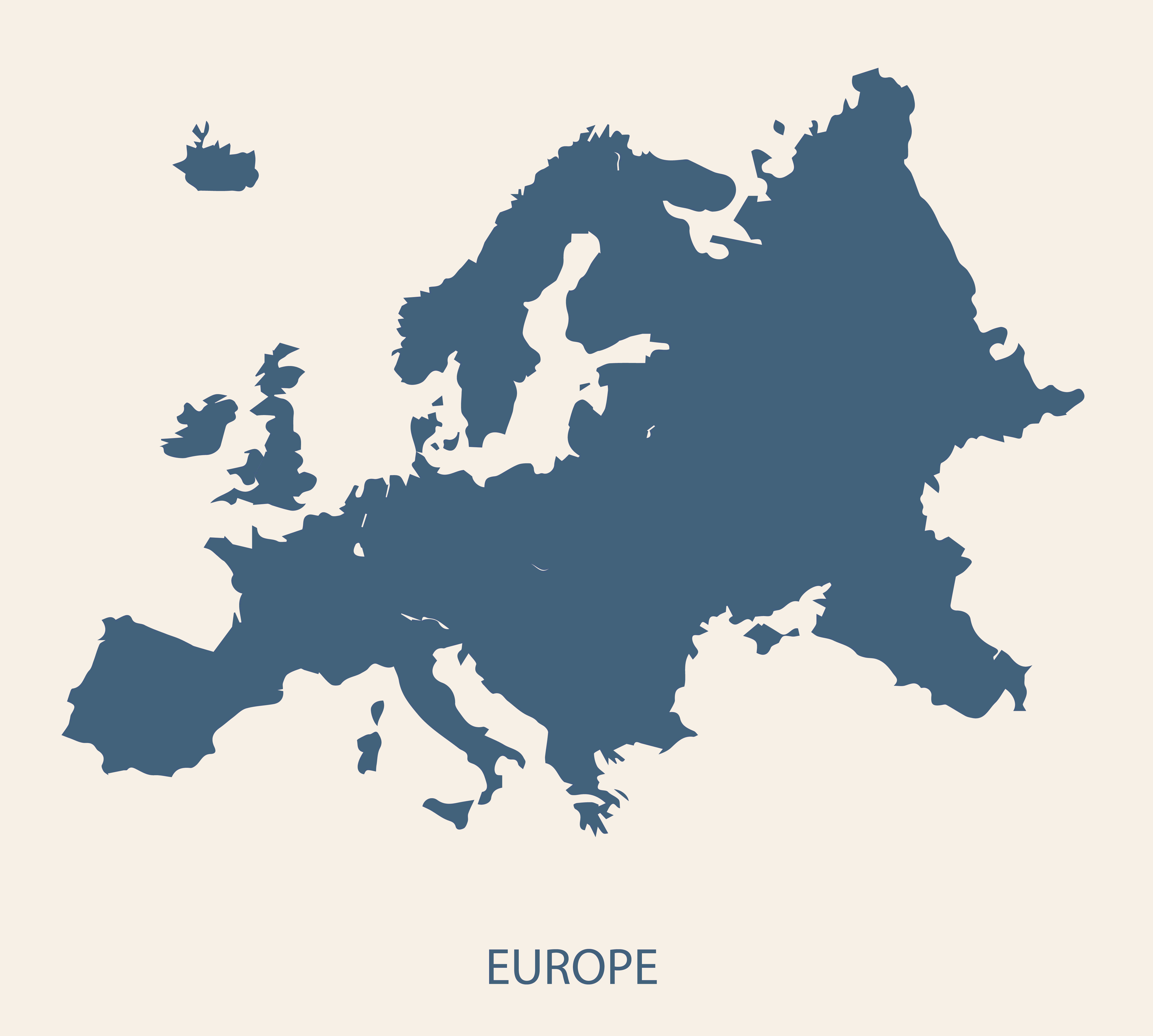 Blank Map of Europe without country boundaries.
Blank Map of Europe
Eastern Europe Map
 Eastern European Countries Map; Polan, Ukraine, Belarus, Latvia, Estonia, Romania, Lithunia, Slovakia, Bulgaria, Hungary, Crotia, Serbia
Europe World Map
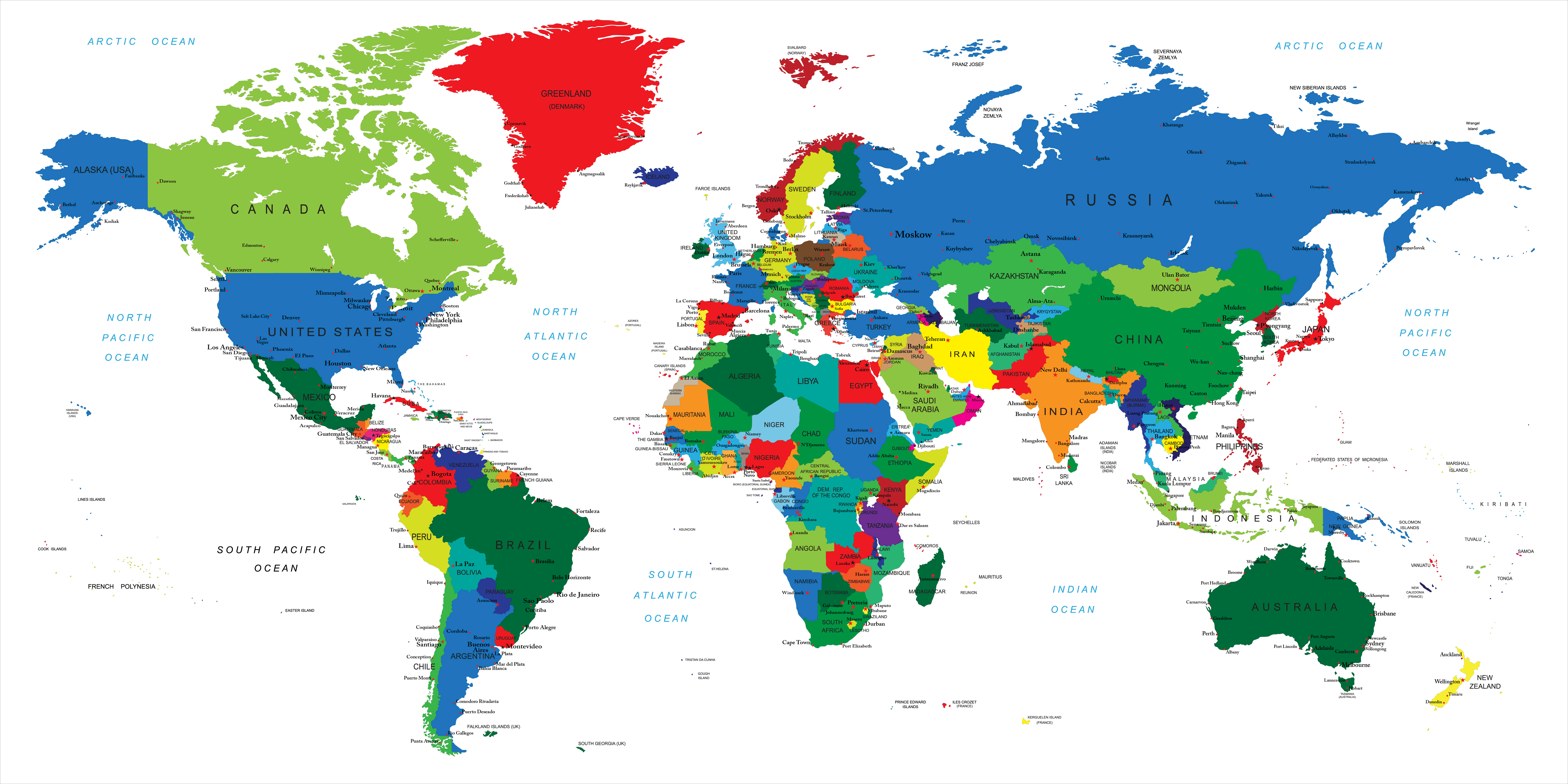
Large World Map with Europe and European Countries Political Map
European Countries National Borders Map
Map Europe

Countries Capitals of the Europe Map

Countries Map of Europe

This map of Europe showcases the diverse countries with clear national borders, allowing you to see the distinct areas each country occupies. It also highlights major highways and cities, helping to visualize key transportation routes that connect the countries. You can see major bodies of water such as the North Atlantic Ocean, Mediterranean Sea, and the Baltic Sea, giving context to how Europe’s geography shapes travel and trade routes across the continent. The political divisions and geographic features are represented for easy understanding of European geography.
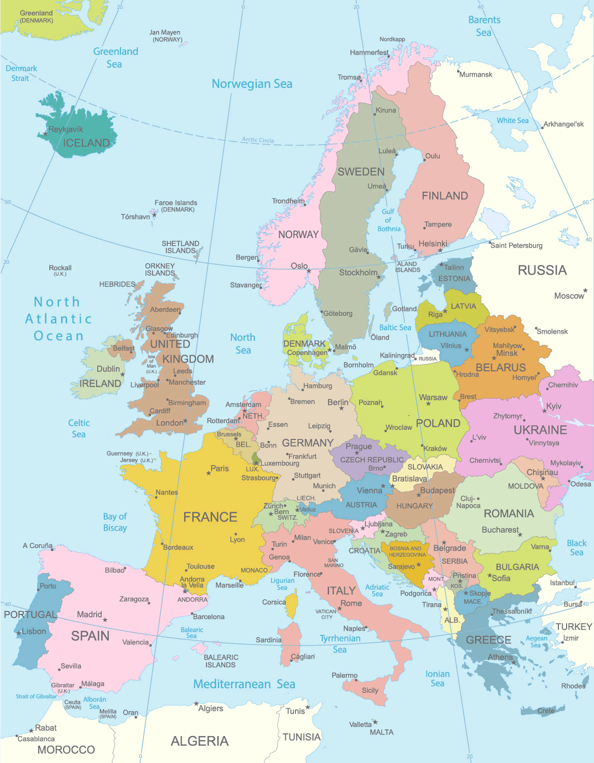
Europe Countries Political Map

This map of Europe displays its countries, with clear national borders, capital cities, and regions, providing a political perspective on the continent. Each country is distinctively colored, highlighting the diverse political landscape and offering an easy reference for the location of each nation. Major capital cities such as Paris, Madrid, Rome, Ankara, Bern, London, Brussels, Kyiv, Warsaw, Oslo, Helsinki, Stockholm, Vienna, Riga, Tallinn, Athens, Lisbon, Dublin, Prague, Baku, Minsk, Belgrade, Berlin, and Moscow are labeled, helping to identify key urban centers in Europe. Additionally, smaller maps of each country are provided below, offering a detailed and comprehensive view of the continent’s geopolitical structure.
Europe Hand Illustrated Vector Map
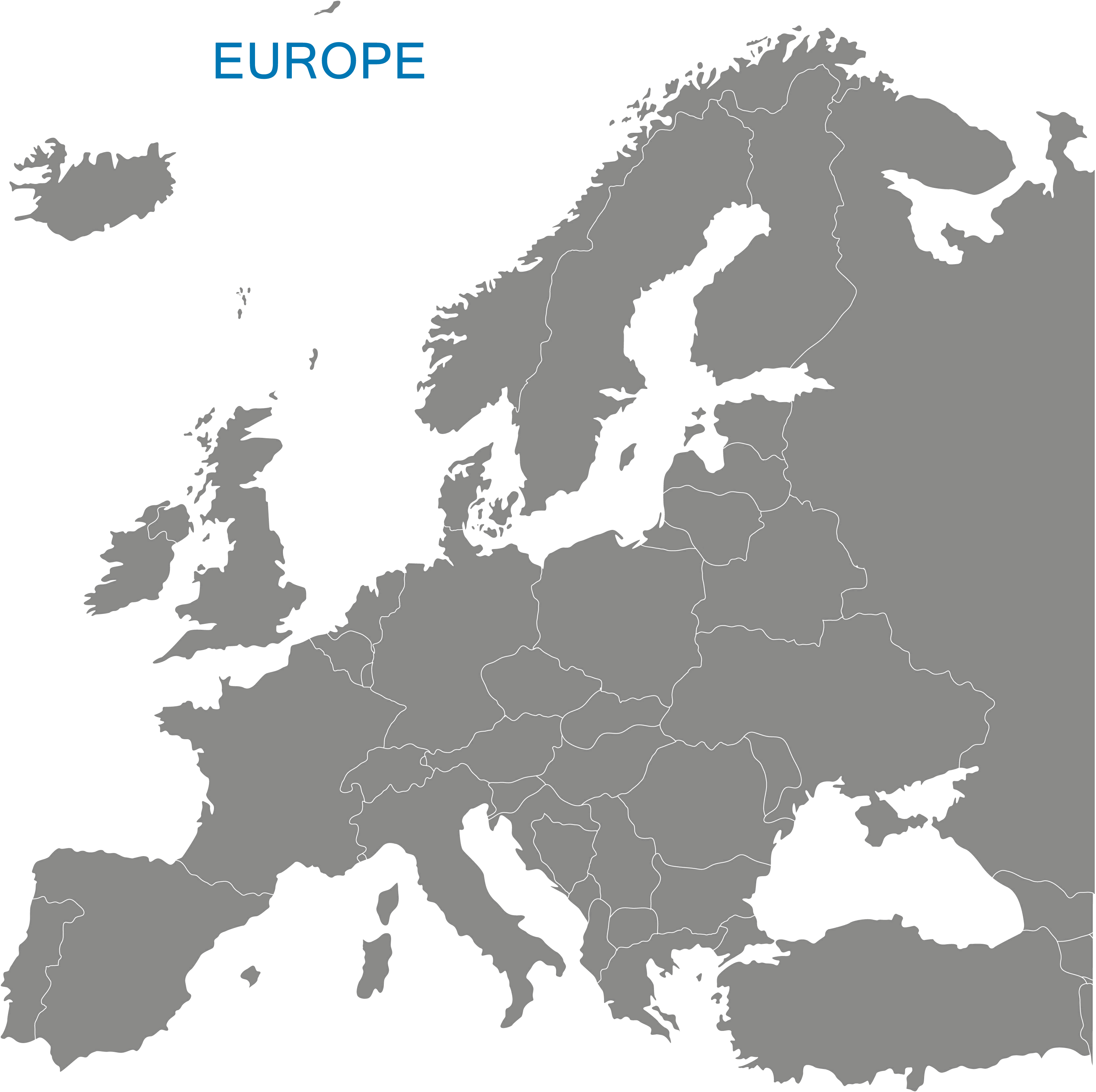
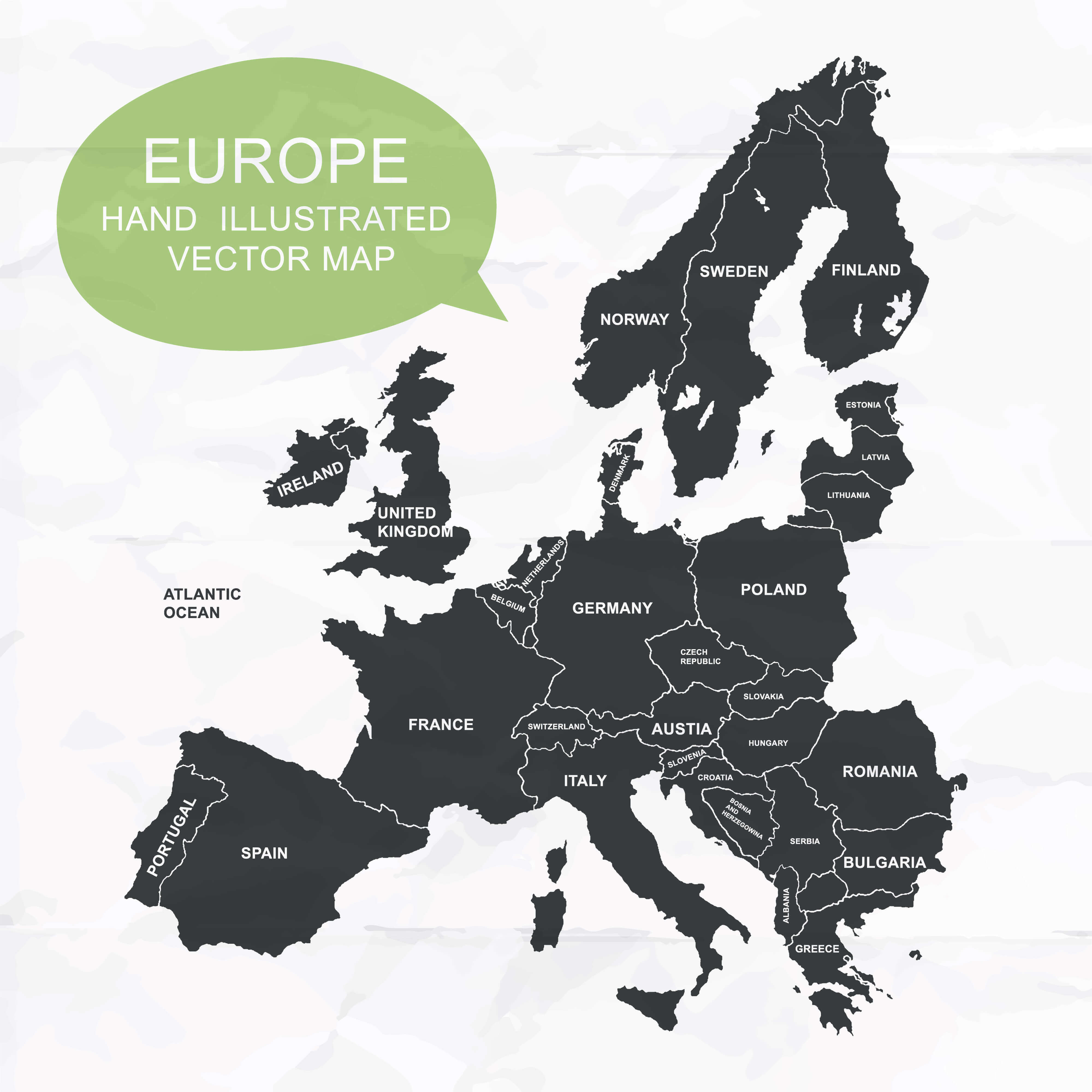 This hand-illustrated vector map of Europe provides a simplified yet clear representation of the continent, showcasing major countries such as France, Germany, Italy, and the United Kingdom. With its minimalist design, it emphasizes the key geographic outlines and borders between the nations. This type of map is useful for quickly visualizing Europe’s country locations without the distraction of additional details like cities or topographical features, making it perfect for educational or illustrative purposes.
Europe Physical Map from Space
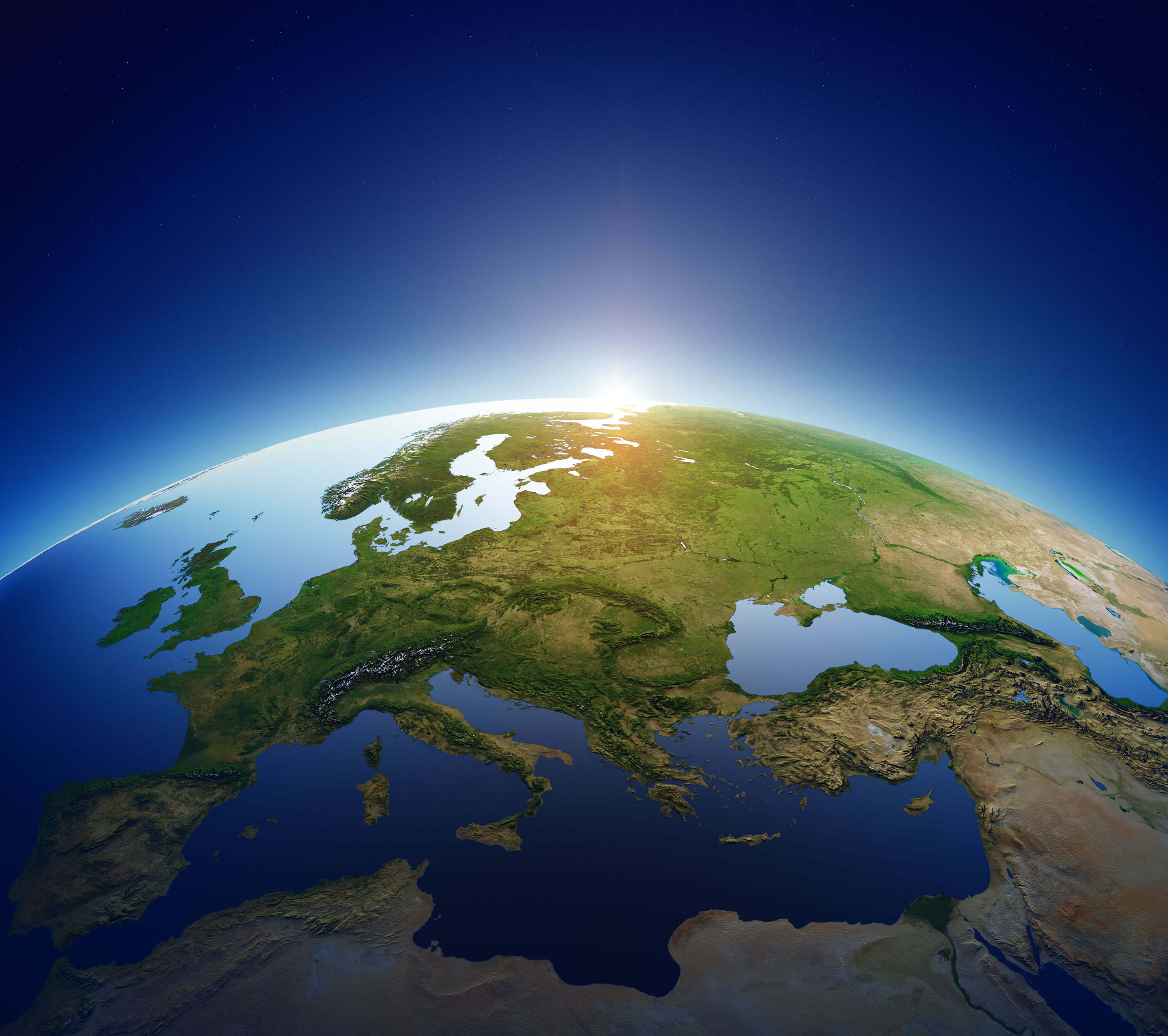
This image shows a detailed view of Europe from space, highlighting the continent’s physical geography with visible features like mountain ranges, rivers, and coastlines. The map captures the vast expanse of Europe, including the Iberian Peninsula, the Alps, and parts of Eastern Europe, bordered by bodies of water such as the Mediterranean, Black Sea, and the North Atlantic Ocean. The topography is clearly defined, giving an excellent perspective of the natural landscape of Europe from a global viewpoint.
European Countries Political Map
This Europe Political Map offers a clear depiction of national borders, country names, and major cities across the continent. It shows the geographic relationships between nations and highlights key countries like France, Germany, and Spain, as well as Scandinavian countries and Eastern European nations. Major bodies of water such as the Mediterranean Sea, North Atlantic Ocean, and Norwegian Sea are labeled, enhancing its utility for understanding Europe’s political landscape.
Europe Satellite Map
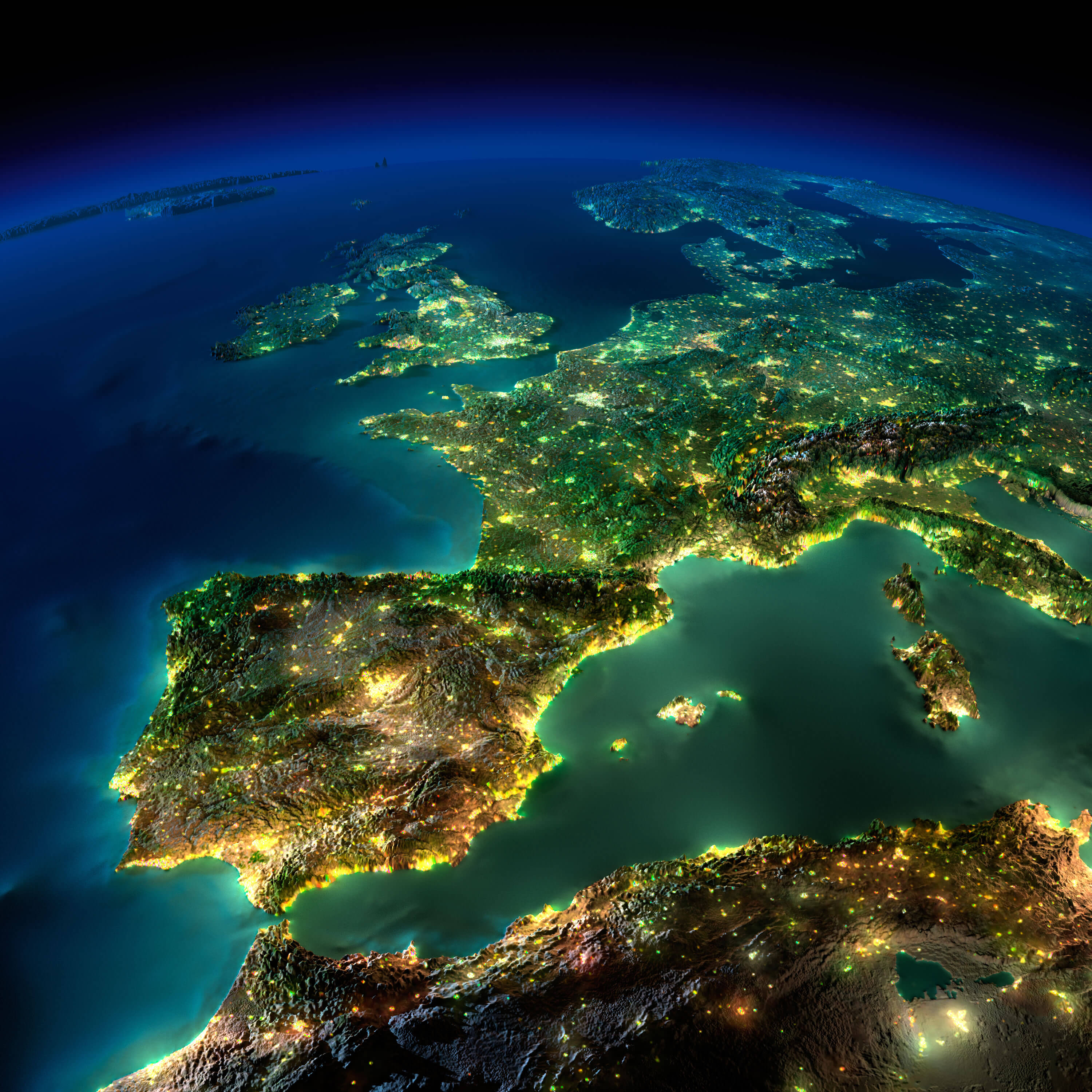
This satellite image of Europe beautifully highlights the continent at night, with the lights from major cities and coastal areas clearly visible. The image captures the Iberian Peninsula, France, Italy, and the Mediterranean Sea, creating a vivid visual representation of Europe’s geographic layout. The contrast between the illuminated urban areas and the darker mountainous regions showcases the varied terrain, while the glowing borders of countries like Spain, France, and Italy illustrate the vast connectivity across Europe.
Europe Africa and Asia Map
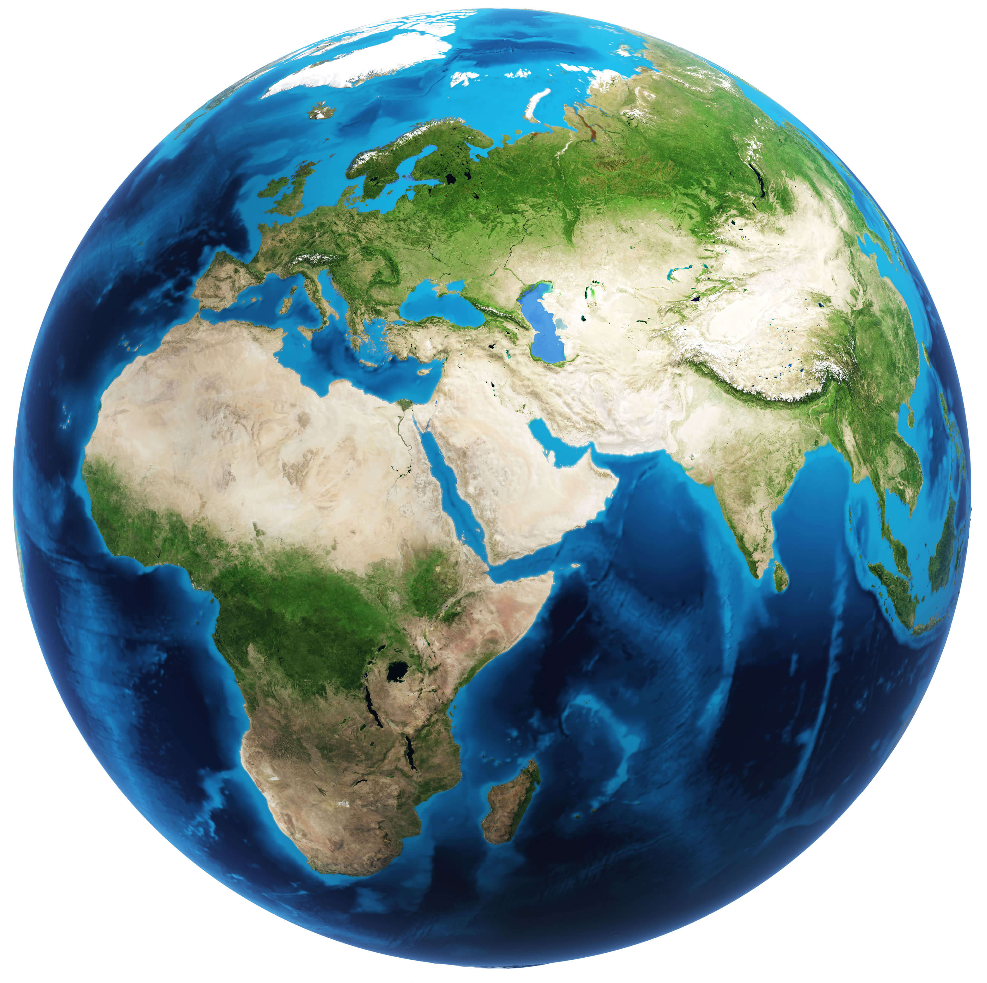
This image shows a perspective of Europe, Africa, and Asia as seen from space. The distinct geographic features of each region are visible, including the lush greenery of Europe, the arid deserts of Africa, and the vast mountain ranges of Asia. The major bodies of water like the Mediterranean Sea, Red Sea, and the Arabian Sea stand out, creating a striking visual contrast between land and water.
Europe Satellite Map
This satellite map of Europe beautifully showcases the illuminated urban areas at night, highlighting the major cities across the continent. It offers a unique perspective of Europe’s geography, where the bright lights of France, Spain, Italy, and the United Kingdom clearly stand out, giving a stunning visualization of population density and development. This view emphasizes the continent’s connection through coastlines and proximity to neighboring regions, creating a striking image of Europe at night from space.
Physical Map of Europe
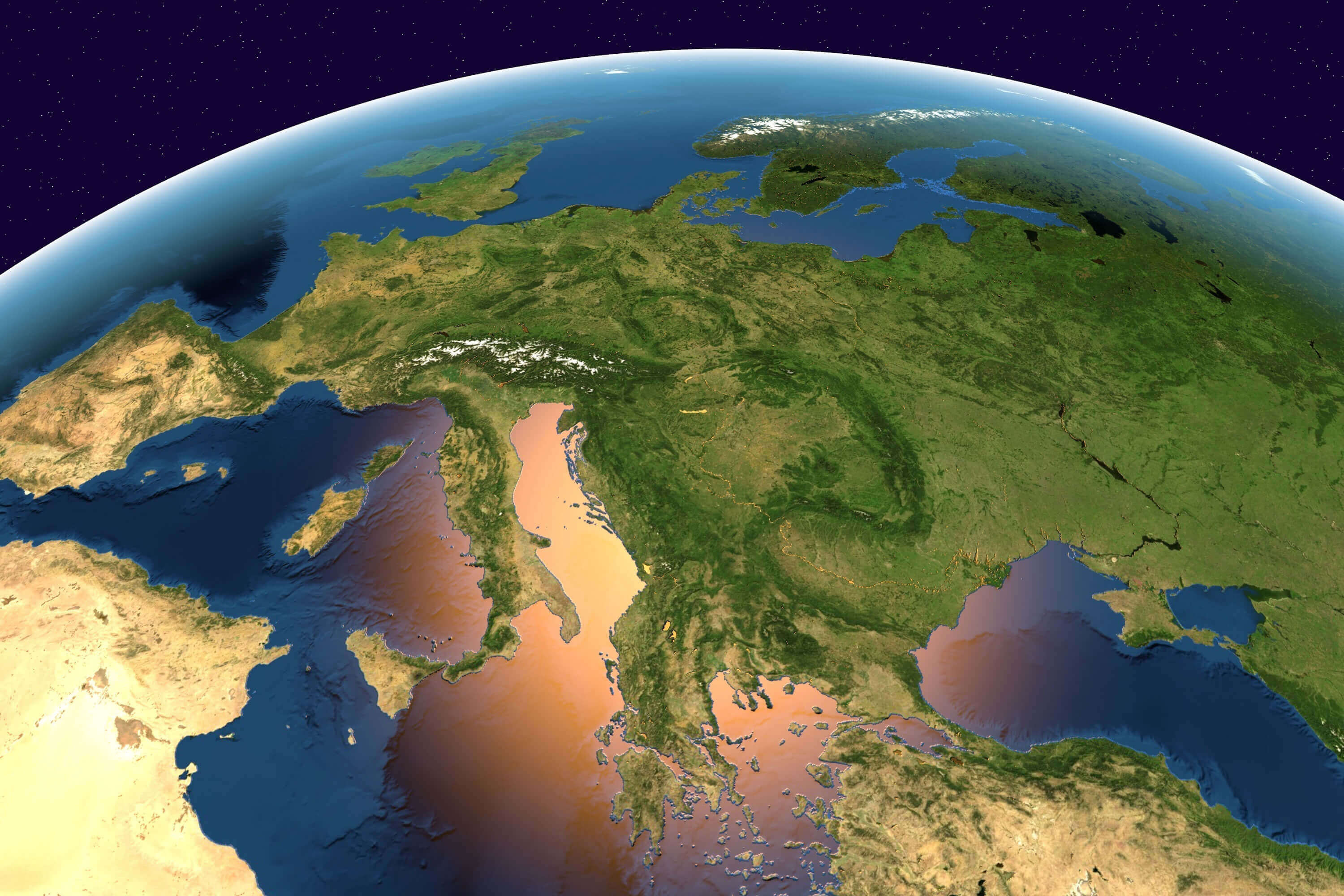
This satellite view of Europe’s physical geography showcases its diverse terrain, from the rugged Alps in central Europe to the expansive plains of Eastern Europe. The Mediterranean and Adriatic seas stand out, alongside the recognizable coastlines of Italy, Greece, and the Balkans. This image offers a stunning depiction of Europe’s varied landscapes, highlighting natural boundaries and features like the mountains, valleys, and coastlines that have historically shaped the continent’s cultures and civilizations.
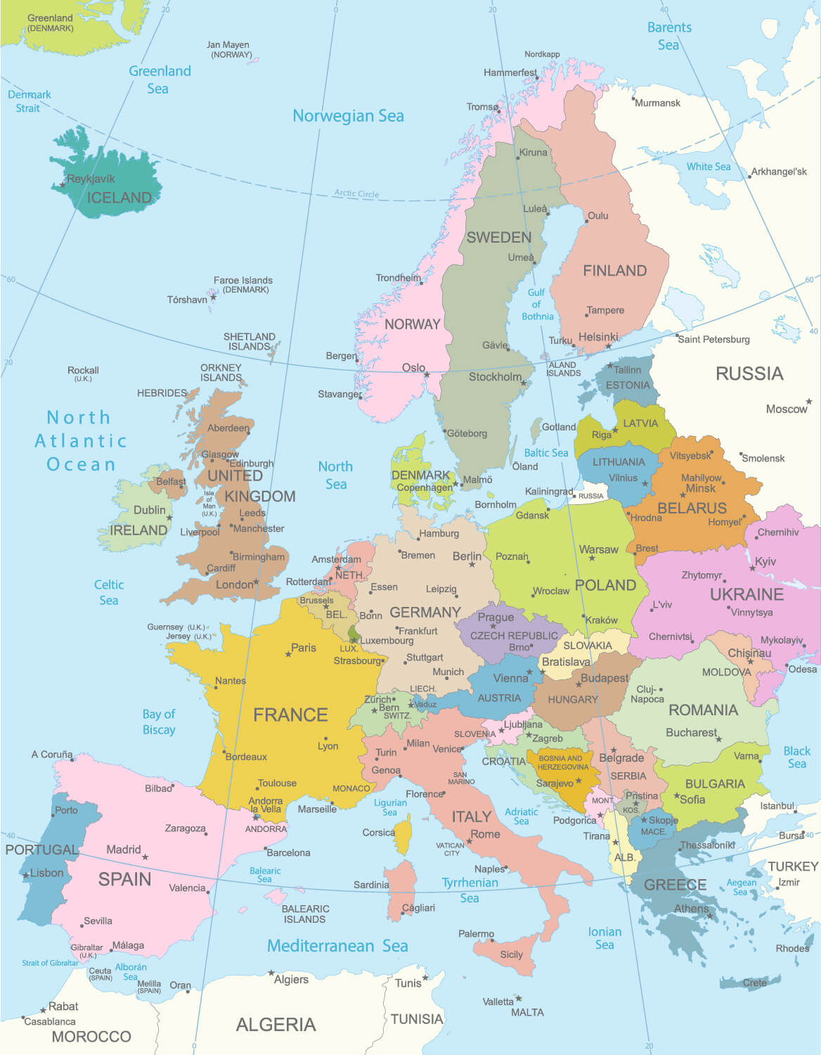
Political Map of Europe

This political map of Europe highlights the boundaries of each country, from the Scandinavian nations in the north to Mediterranean countries in the south, and the large stretches of Russia to the east. It includes major cities, national capitals, and significant water bodies such as the North Atlantic Ocean, Mediterranean Sea, and the Baltic Sea. The map helps visualize the geography and political layout of Europe, making it easier to understand the relationships and proximities between countries in this diverse continent.
Western Europe Map
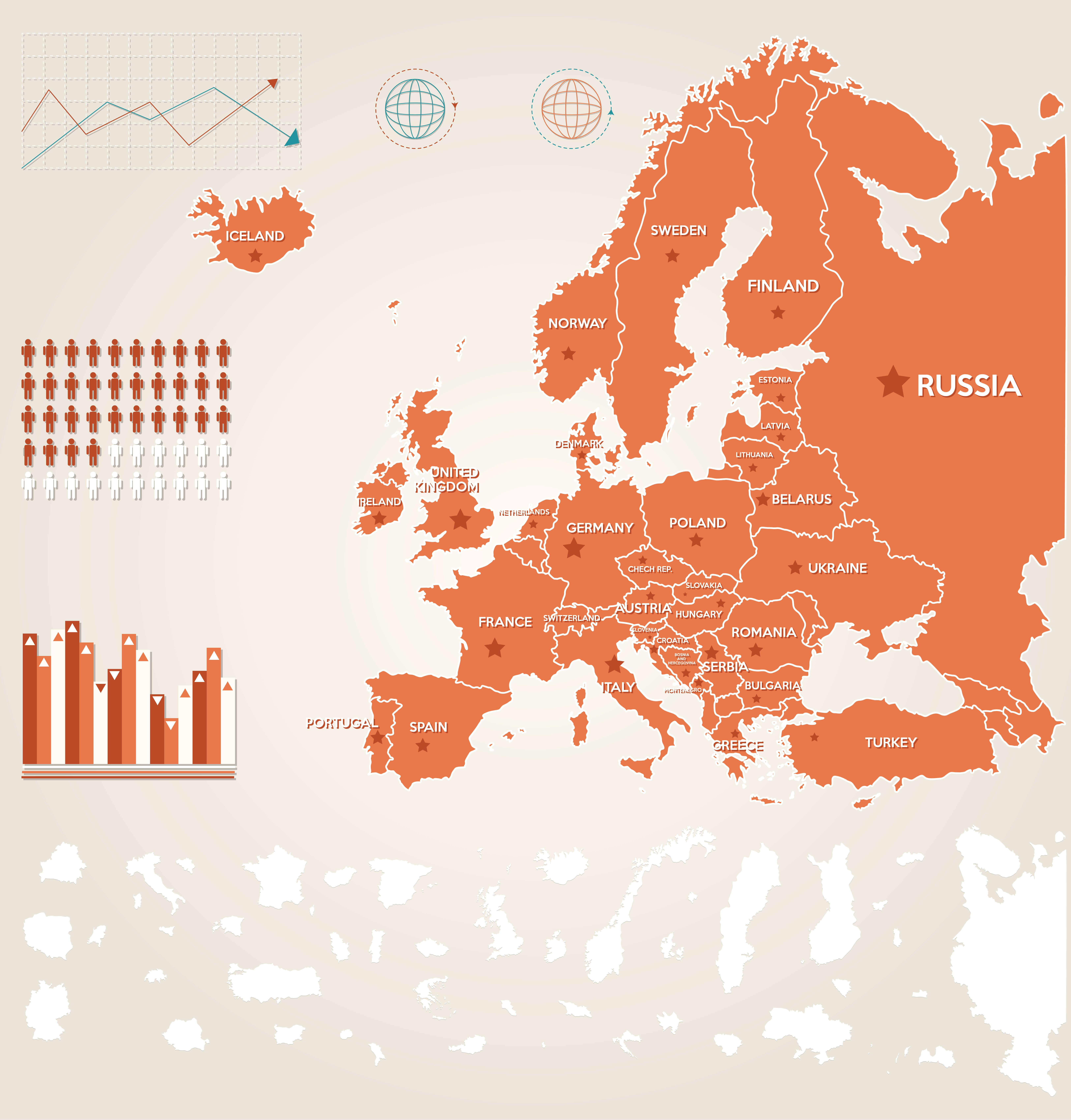
This map of Western Europe highlights countries like the United Kingdom, France, Germany, and others, with key symbols representing population statistics and economic data. It emphasizes major geographical areas such as Russia to the east and Iceland to the northwest. The use of graphics and charts provides a visual summary of population distribution and economic performance across these nations, making it an informative overview of the region’s demographics and economic trends.
World Map Europe
This image shows a view of Europe as part of a world map, highlighting the continent’s geographical position with its familiar countries and regions. From the Scandinavian Peninsula in the north to the Mediterranean in the south, Europe’s diverse landscape is illustrated in a simplified yet visually appealing form, making it easy to see how the continent fits into the broader map of the world. This map could be useful for educational or illustrative purposes to explore the globe’s geographical layout.
Where is Europe in the World?
Show Google Maps and satellite maps of where the country is located.
Get direction by driving, walking, bicycling, public transportaion and travel with street view.
Feel free to explore these pages as well:
- Europe Map ↗️
- Map of Europe ↗️
- A Collection of Europe Maps ↗️
- France Map ↗️
- Map of Spain ↗️
- Italy Map ↗️
- Ireland Map ↗️
- Political Map of the World ↗️
- United Kingdom Map ↗️
- Israel Map ↗️
- Germany Map ↗️
- Turkey Map ↗️
- Map of Sweden ↗️
- Map of Portugal ↗️
- Poland Map ↗️
- Switzerland Map ↗️
- Belgium Map ↗️
- Norway Map ↗️
- Finland Map ↗️