Explore the diverse geography, history and culture of Belarus with this collection of detailed maps, political, physical, demagraphic charts, covering everything from administrative divisions to economic regions.
Brief information about Belarus
Belarus, a landlocked country in Eastern Europe, is known for its rich cultural heritage and picturesque landscapes of vast forests, rivers and lakes. The capital, Minsk, is the largest city and serves as the historical, cultural and political centre. Belarusian culture is strongly influenced by its Slavic roots, and the country is celebrated for its traditional music, dance and festivals that showcase its deep connection to nature and folklore.
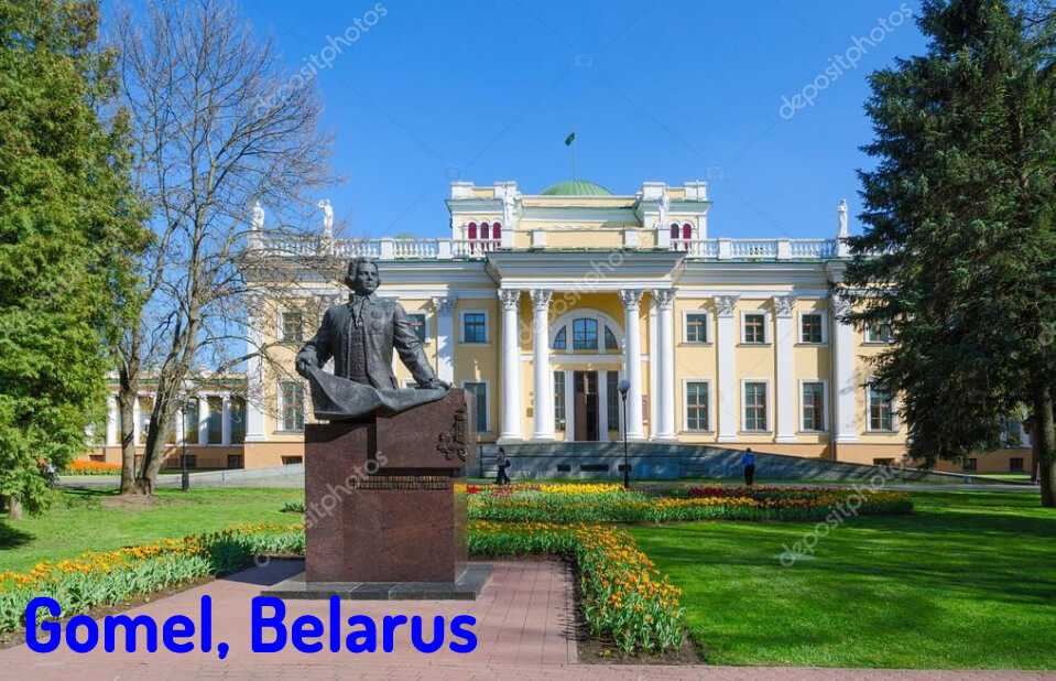 Area: 207,595 km2 (80,153 sq mi)
Despite its close ties to Russia, Belarus retains its own identity and language, Belarusian, although Russian is also widely spoken. The country has a strong tradition of visual arts and architecture, with stunning Orthodox churches, Soviet-era buildings and castles dotting the landscape. Known for its peaceful villages and slower pace of life, Belarus offers travellers a glimpse into a distinct blend of Eastern European charm and resilient history.
Where is located Belarus on the World Map
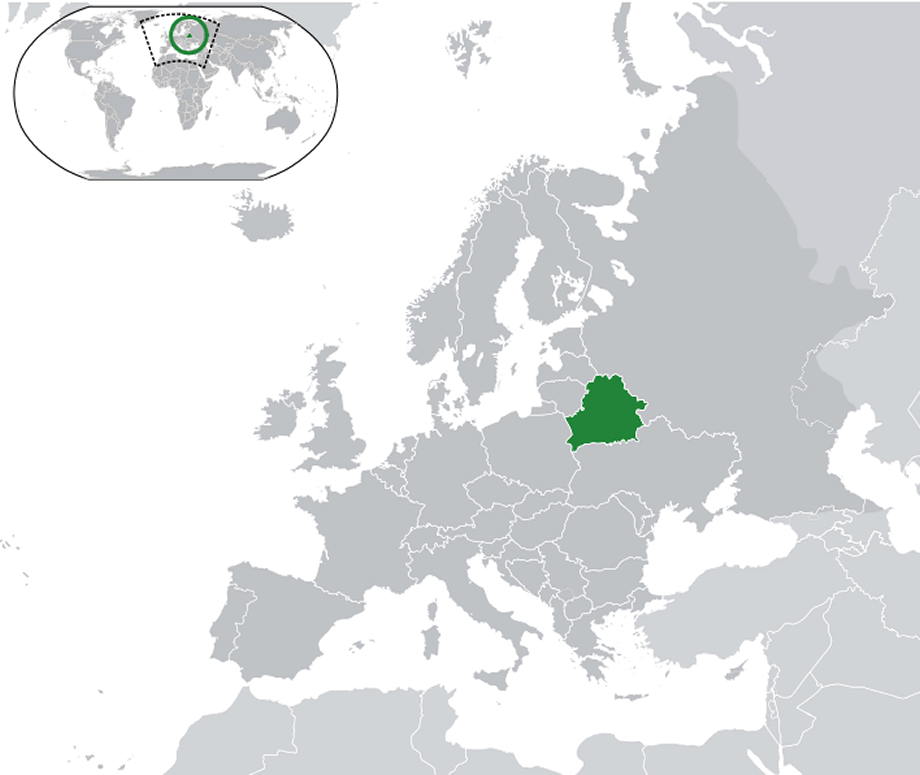 Where is belarus on the World Map
Belarus is located in Eastern Europe, bordering Russia to the east, Ukraine to the south, Poland to the west, and Lithuania and Latvia to the northwest. As a landlocked country, Belarus has no coastline, but is centrally located between its neighbours, making it a crossroads between Eastern and Western Europe. This location has shaped much of Belarus’ history, with influences from both Slavic and European cultures.
The country is relatively flat, with a landscape dominated by forests, rivers and marshes. Belarus has a continental climate, with cold winters and mild to warm summers, similar to other Eastern European countries. Belarus’ geographical location has allowed it to be rich in natural resources, including forests and fertile soil, which support its agricultural sector.Belarus’ central location has historically made it a key area for trade routes and strategic military routes throughout European history. Today, its borders place Belarus at a unique cultural and political crossroads, connecting it both to the European Union through its western borders and to Russia to the east. This location plays a significant role in its current political and economic relations on the world stage.Here are some statistical information about Belarus:
Belarus Population Trend (1933-2024)
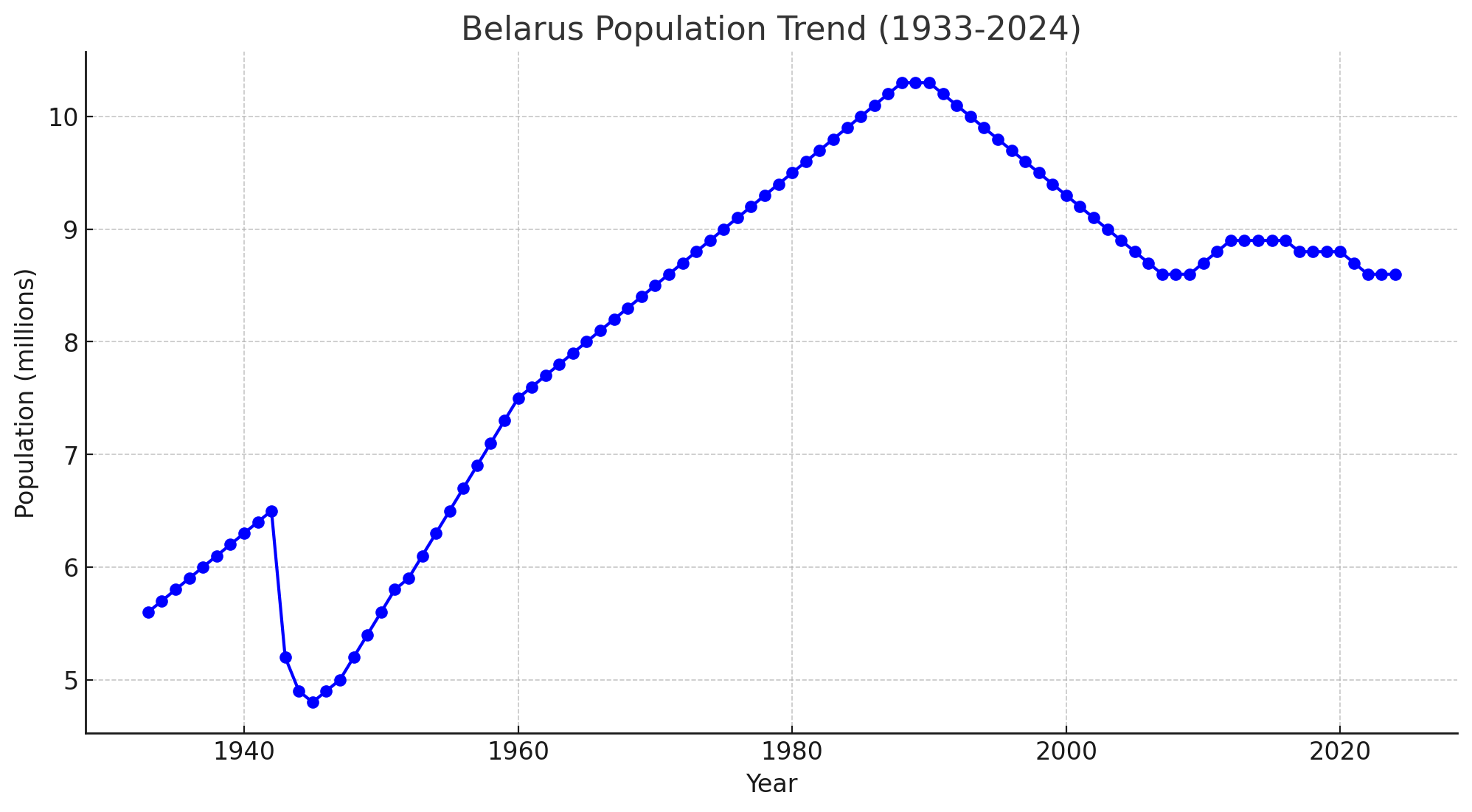 Belarus Population Trend between 1933 and 2024
Belarus Ethnic Demographic Composition in 2024
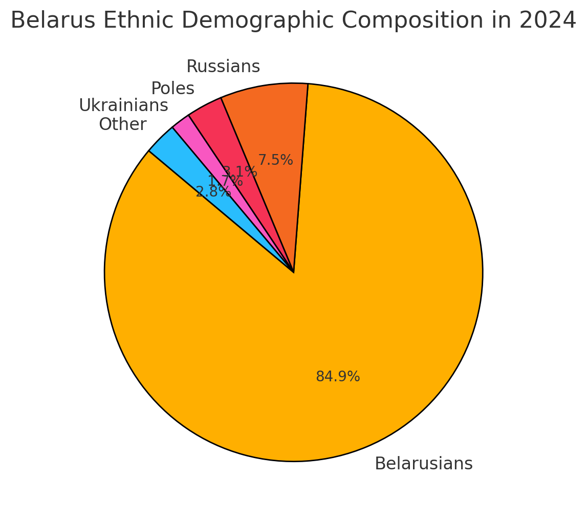 Belarus Ethnic Demographic Composition in 2024
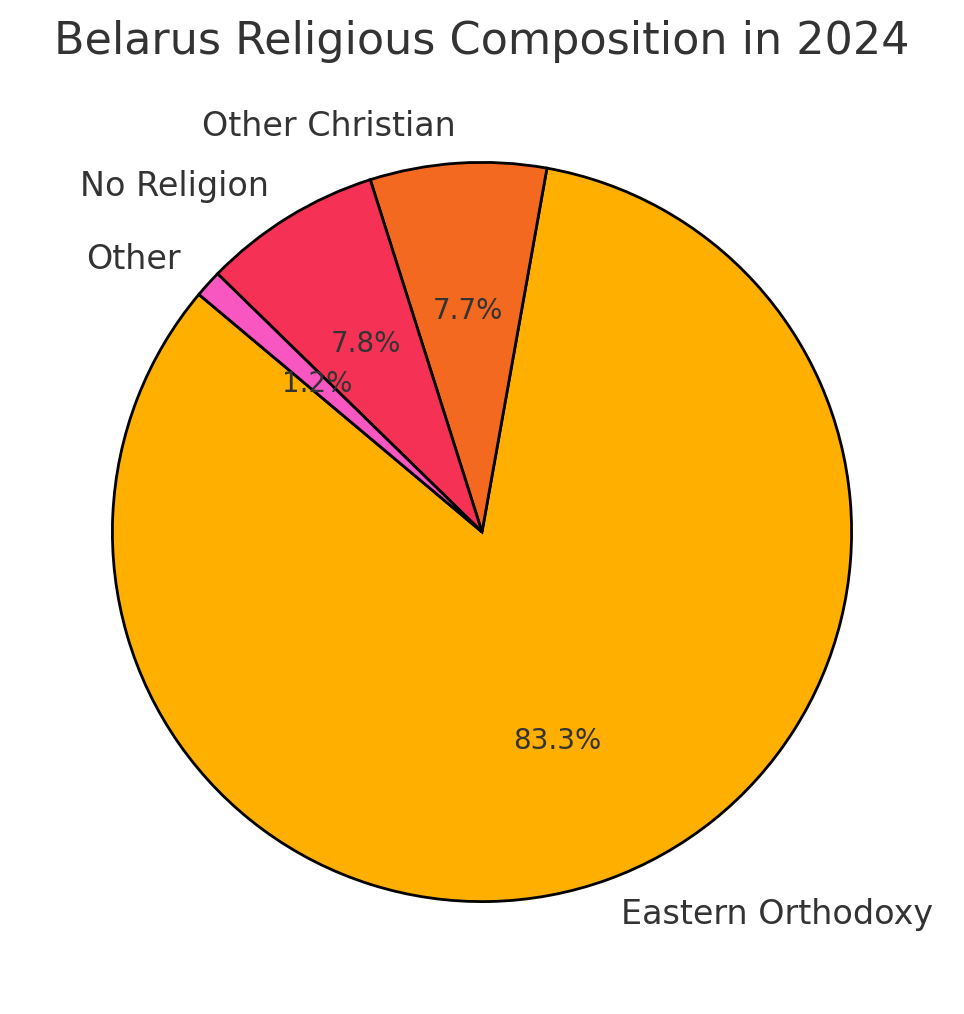
Belarus Religious Composition in 2024
Map of Belarus
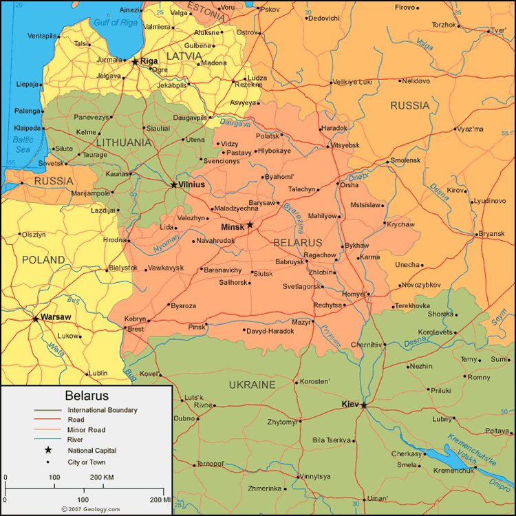 Belarus map with regions, major cities, and bordering countries.
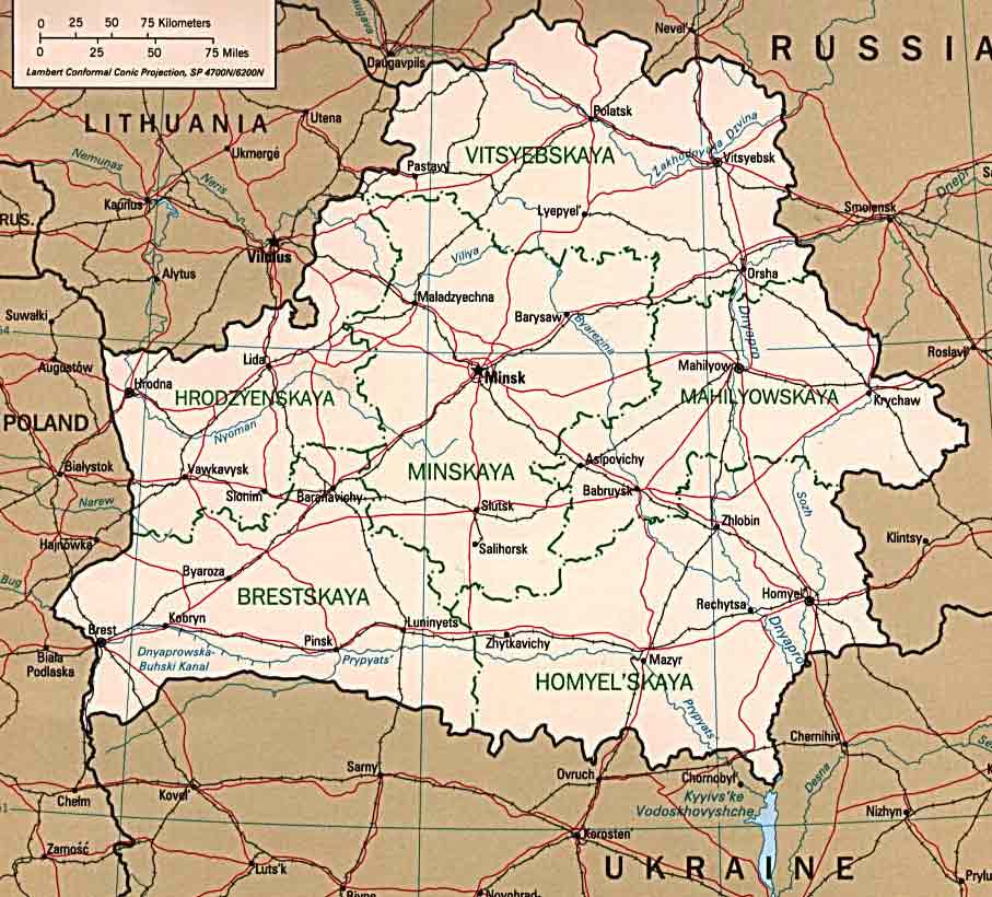
This map shows the administrative regions and major cities of Belarus, which is bordered by Lithuania to the northwest, Latvia to the north, Russia to the east, Ukraine to the south, and Poland to the west. Belarus is divided into several major regions, including Minskaya (home to the capital, Minsk), Brestskaya, Hrodzyenskaya, Homyel’skaya, Mahilyowskaya, and Vitsyebskaya. Each region has its own major cities, connected by an extensive network of roads and railways, as shown on the map. Key cities such as Brest, Hrodna, and Homyel serve as cultural and economic hubs, while rivers such as the Dnieper and Pripyat flow through, contributing to Belarus’ lush landscape and supporting trade routes.
Belarus Capital Minsk Map
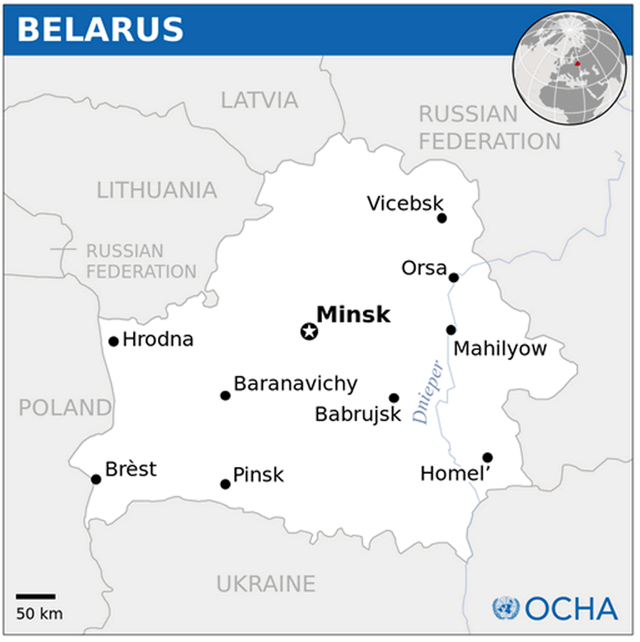
Belarus Cities Map
Belarus Regions Map
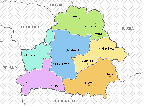
This map shows the main administrative regions of Belarus, with each region highlighted in a different color. The map focuses on Minsk, the capital, which is located in the central blue region. Surrounding regions include Brest in the southwest, Hrodna in the northwest, Vitsyebsk in the north, Mahilyov in the east, and Homyel in the southeast, with key cities such as Brest, Hrodna, Orsha, Mahilyov, and Homyel marked in each region. The map also shows Belarus’ neighboring countries: Poland, Lithuania, Latvia, Russia, and Ukraine, providing context for its strategic location in Eastern Europe.
Belarus Political Map
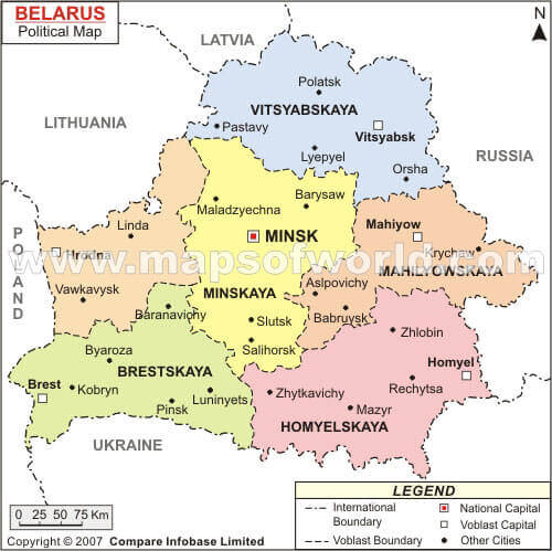 Belarus map with neighbors and major cities like Minsk, Riga
This map shows Belarus and its surrounding countries in Eastern Europe, with the capital city of Minsk marked by a star in the center. Neighboring countries include Latvia to the north, Lithuania to the northwest, Poland to the west, Ukraine to the south, and Russia to the east. Major nearby cities such as Riga, Vilnius, Warsaw and Kyiv are also indicated, highlighting Belarus’s central position among these nations. The map provides a clear view of Belarus’ location in relation to the Baltic States and Eastern Europe.
Map Belarus
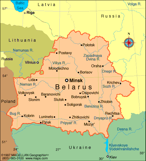 Belarus map with cities, rivers, and bordering countries.
This map provides a comprehensive view of Belarus, showing its major cities, rivers, and neighboring countries. The capital, Minsk, is shown in the center, surrounded by major cities such as Brest, Grodno, and Gomel. Major rivers, including the Dnieper, Berezina, and Pripyat, are indicated, highlighting Belarus’ extensive network of waterways. The map also shows Belarus’ borders with Poland to the west, Lithuania and Latvia to the north, Russia to the east, and Ukraine to the south, emphasizing its strategic location in Eastern Europe. This geographic positioning has influenced Belarus’ historical and economic ties within the region.
List major cities and population in Belarus
Here is a list of some of the major cities in Belarus along with their approximate population figures as of recent estimates:- Minsk – 2,020,600
- Gomel (Homyel) – 510,300
- Mogilev (Mahilyow) – 370,000
- Vitebsk (Viciebsk) – 370,000
- Hrodna (Grodno) – 370,000
- Brest – 345,000
- Babruysk – 215,000
- Baranovichi – 179,000
- Barysaw – 140,000
- Pinsk – 130,000
Belarus Highways and Major Roads Map
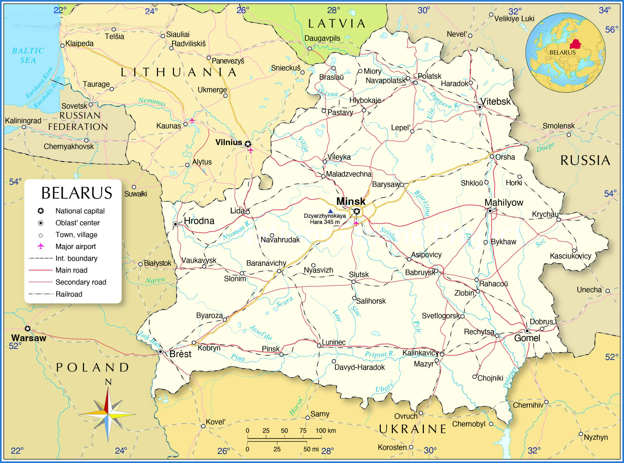 Map of Belarus showing highways, main roads, and railroads.
Belarus National Map with Provinces and Major Cities
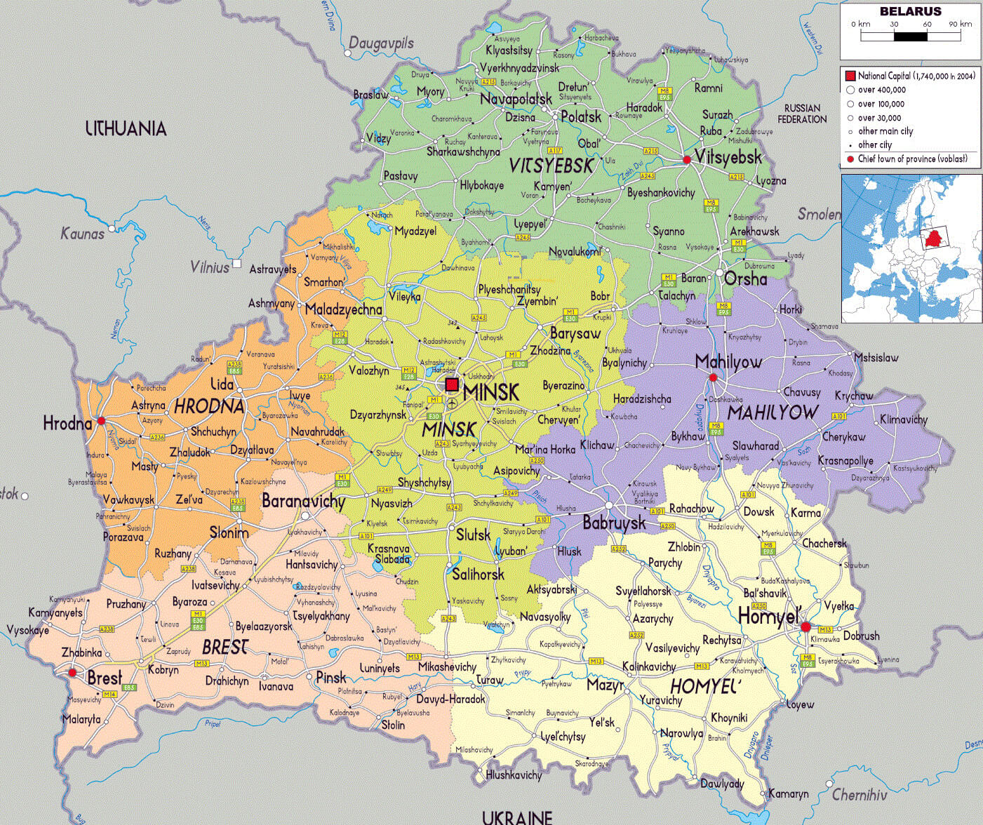 Belarus map showing provinces, cities, and national capital Minsk.
Belarus Political Map with Regions and Borders
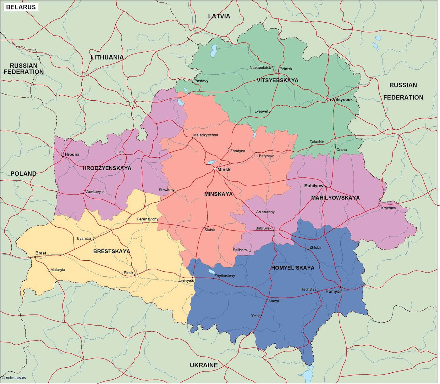 Belarus political map highlighting regions and neighboring countries.
Belarus Physical Map Showing Major Landforms and Rivers
 Belarus physical map with uplands, lowlands, rivers, and Dzyarzhynskaya Hara.
Mongol and Lithuanian Invasions of Kievan Rus’ (1220-1240)
 Map of Mongol and Lithuanian invasions between 1220 and 1240
Map of the Grand Duchy of Lithuania in the 15th Century
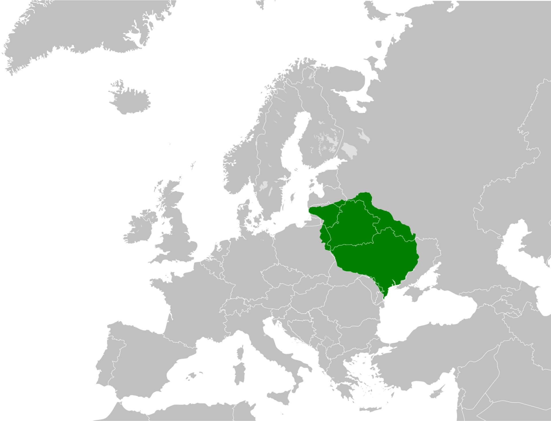 Map showing the Grand Duchy of Lithuania’s extent in the 15th century
Belarus International Boundary Map (1997)
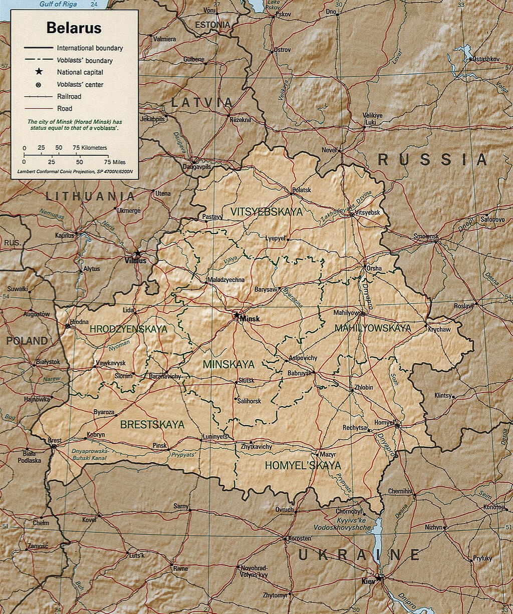 Map of Belarus with international boundaries in 1997
Belarus Map of Largest Cities and Natural Features
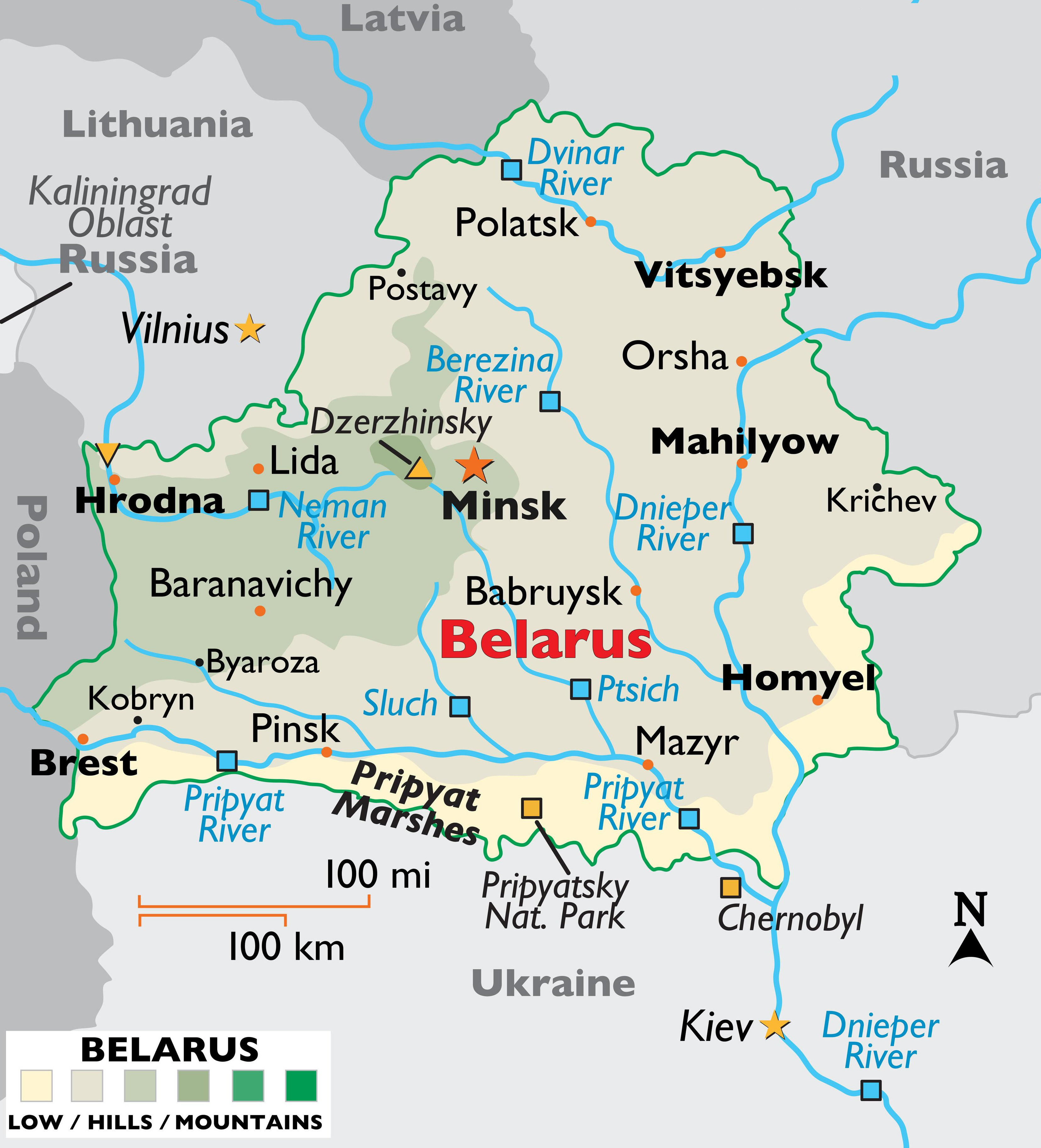 Map of Belarus showing major cities, rivers, and natural landmarks
Map of Major Rivers in Belarus
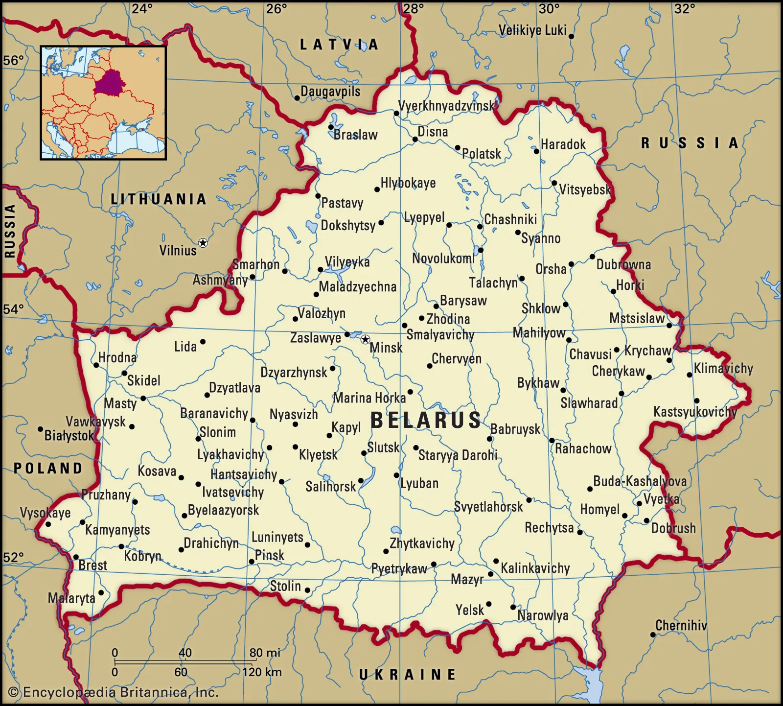 Map highlighting Belarus with key rivers and surrounding borders
Belarus Regions by Gross Regional Product (GRP) in 2022
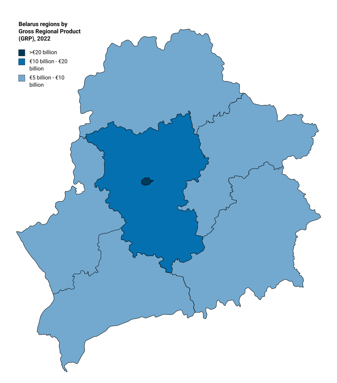 Map of Belarus regions by Gross Regional Product (GRP) in 2022
Belarus Administrative Map with Oblasts
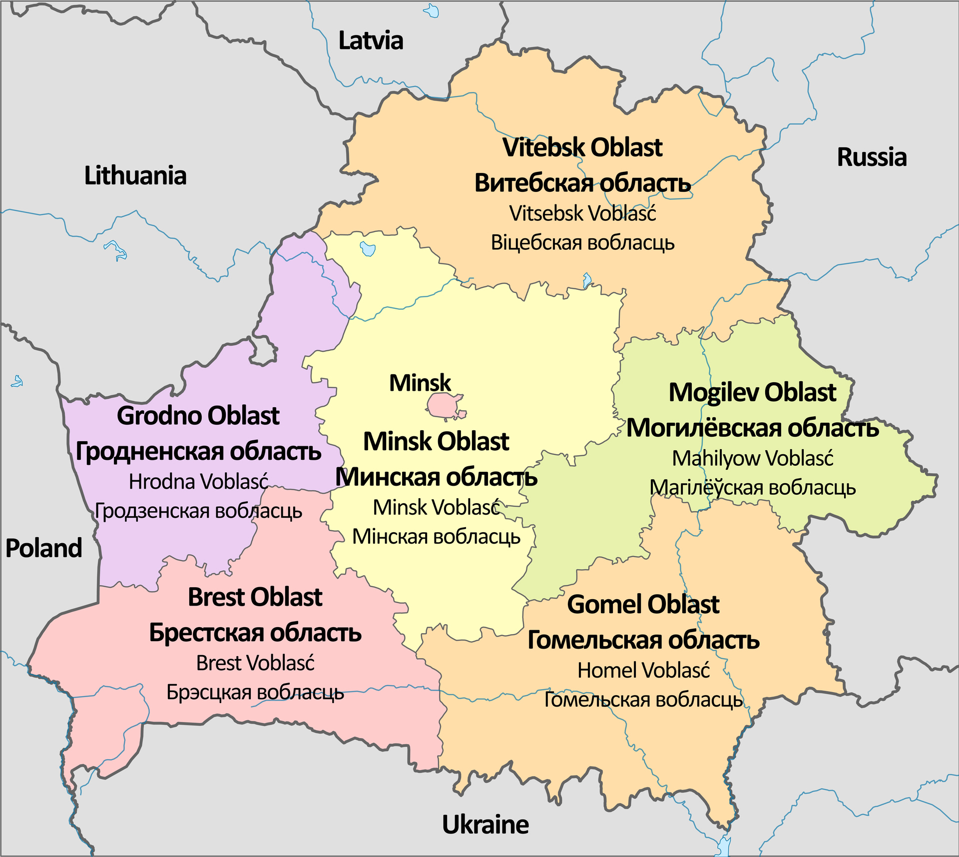 Map showing Belarus’s administrative divisions with Oblast
Belarus Map
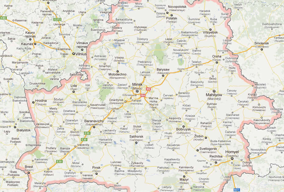
Belarus Map Baltics
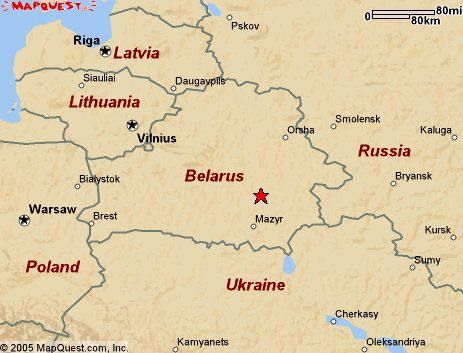
Map of Belarus Europe
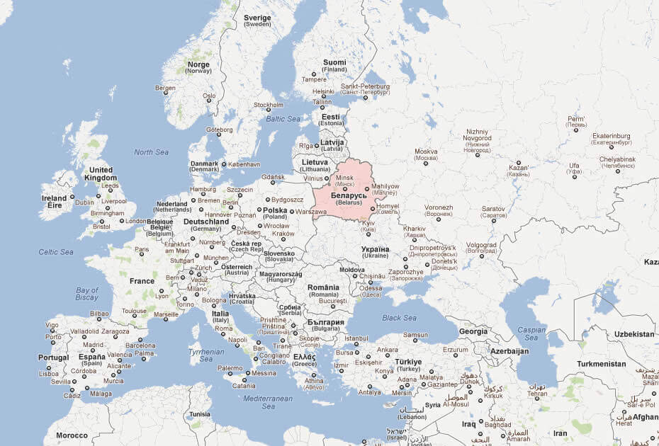
Belarus Earth Map
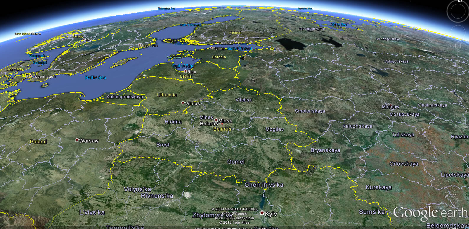
Where is Belarus on the Europe Map?
Show Google interactive map, satellite map, where is the country located.
Get directions by driving, walking, bicycling, public transportation and travel with street view.
Feel free to explore these pages as well:
- Russia Map ↗️
- Poland Map ↗️
- Ukraine Map ↗️
- Germany Map ↗️
- Lithuania Map ↗️
- Latvia Map ↗️
- Estonia Map ↗️
- Finland Map ↗️
- Map of Russia ↗️
- About Russia ↗️
- Largest Cities of Russia: From Moscow to Rostov ↗️
- Top 10 Must-Visit Places in Moscow ↗️
