Lithuania’s physical geography includes the sandy Curonian Spit, lush forests, and over 3,000 lakes, with the Neman River being a key waterway. Lithuania is divided into counties and municipalities, each with local governance and development. Vilnius, the capital, is the cultural and economic heart, while cities like Kaunas and Klaipėda add to its diverse urban landscape. Historically, Lithuania has seen influences from the Polish-Lithuanian Commonwealth and Soviet occupation, which have shaped its modern identity. The country’s history and geography are reflected in its detailed maps, showcasing everything from topography to the intricate roadways that knit the regions together.
Brief information about Latvia
Latvia is a small yet captivating country located in Northern Europe, bordered by Estonia, Lithuania, Russia, and the Baltic Sea. Known for its picturesque landscapes, Latvia boasts vast forests, serene lakes, and beautiful sandy beaches. The country’s rich history, which includes influences from German, Swedish, and Russian cultures, is visible in its medieval towns, grand castles, and diverse architecture. Riga, the capital city, is a UNESCO World Heritage site famous for its stunning Art Nouveau buildings and vibrant cultural scene.
Latvia Regions Map with Main Roads
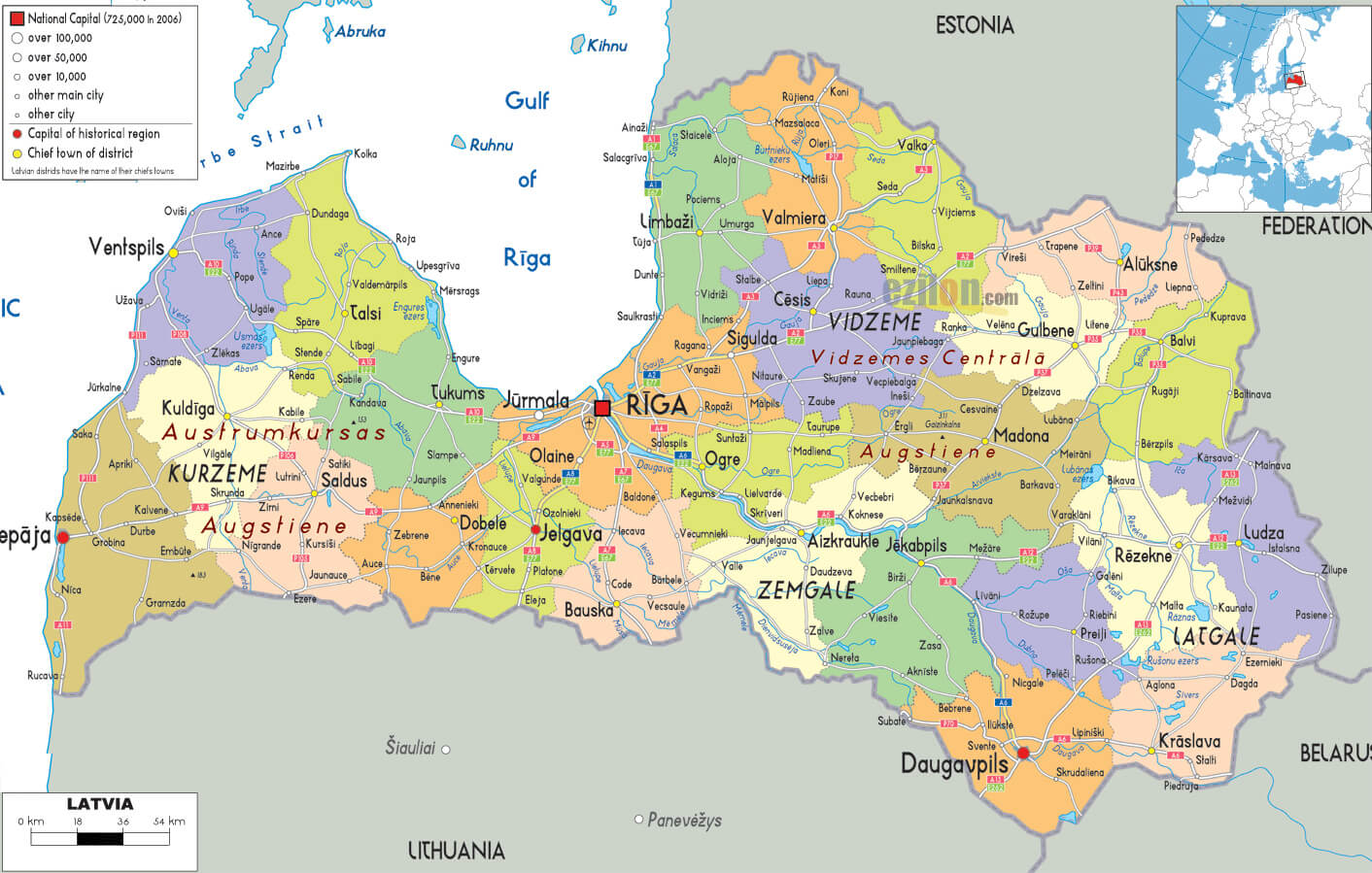
The map of Latvia illustrates the country’s different regions, such as Vidzeme, Kurzeme, Zemgale and Latgale, and highlights the main roads connecting major cities such as Riga, Daugavpils, Liepāja and Ventspils. It also covers the Gulf of Riga and neighbouring countries, including Estonia, Lithuania and Russia, providing a comprehensive overview of the country’s administrative and transport layout.
Despite its small size, Latvia has a strong national identity and a deep connection to its traditions. Latvians are proud of their folklore, music, and dance, often celebrated during festivals such as the famous midsummer “Jani.” The country’s natural beauty and charming villages make it an excellent destination for travelers seeking tranquility and a glimpse into the cultural heart of the Baltics.
Where is located Latvia on the World Map
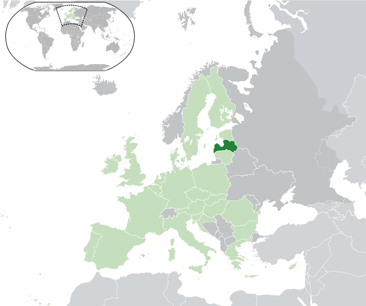
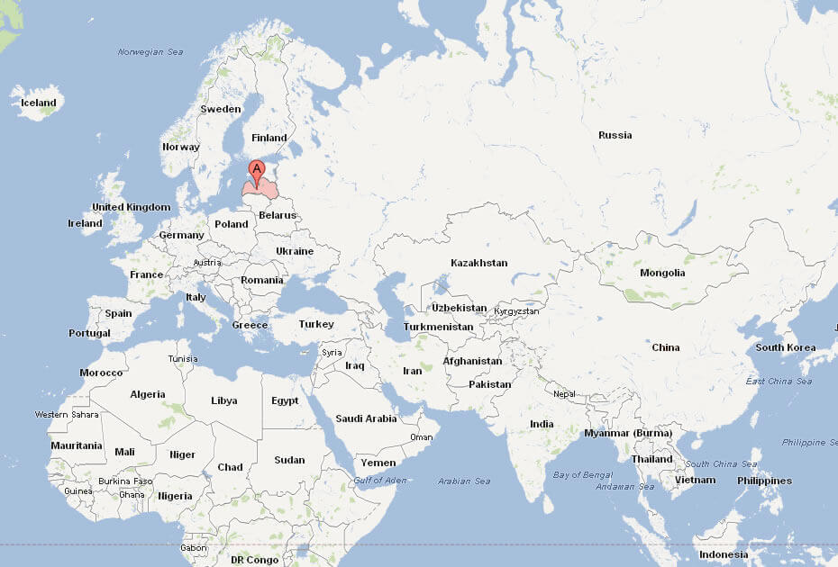
Latvia is located in Northern Europe, nestled between the Baltic Sea to the west and four other countries: Estonia to the north, Lithuania to the south, Russia to the east, and Belarus to the southeast. This strategic position places Latvia at the crossroads of Northern and Eastern Europe, making it a gateway between Scandinavia and Eastern Europe. The country’s coastline along the Baltic Sea stretches for about 500 kilometers, offering stunning beaches and seaside towns.
If you look at a world map, Latvia is positioned near the northeastern part of the European continent, slightly below Finland and across the sea from Sweden. Its location gives Latvia a cool, temperate climate, with distinct seasons that bring snowy winters and mild summers. Being part of the Baltic region, Latvia shares much of its culture and history with its neighboring Baltic states, Estonia and Lithuania.
Although small in size, Latvia’s location has played a significant role in its history, with various empires and nations leaving their mark over the centuries. Today, Latvia is a member of the European Union and NATO, firmly establishing its place on the map as an independent and thriving nation within the international community.
Here are some statistical information about Latvia:
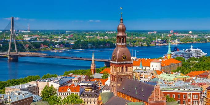
Latvia Location Map
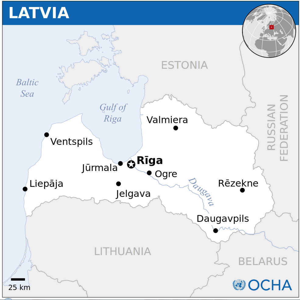
Latvia Political Map
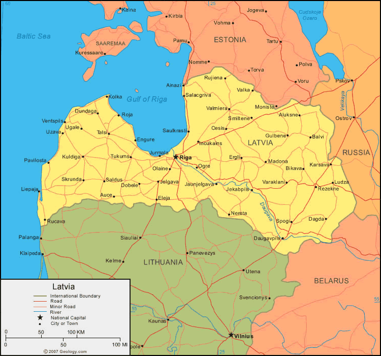
This map shows Latvia bordered by Estonia, Lithuania, and Russia, with the Baltic Sea to the west. It highlights the capital, Riga, and key roads, rivers, and towns across the country.
Latvia Road Map
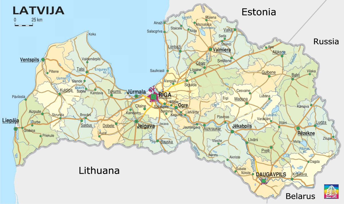
Latvia Map
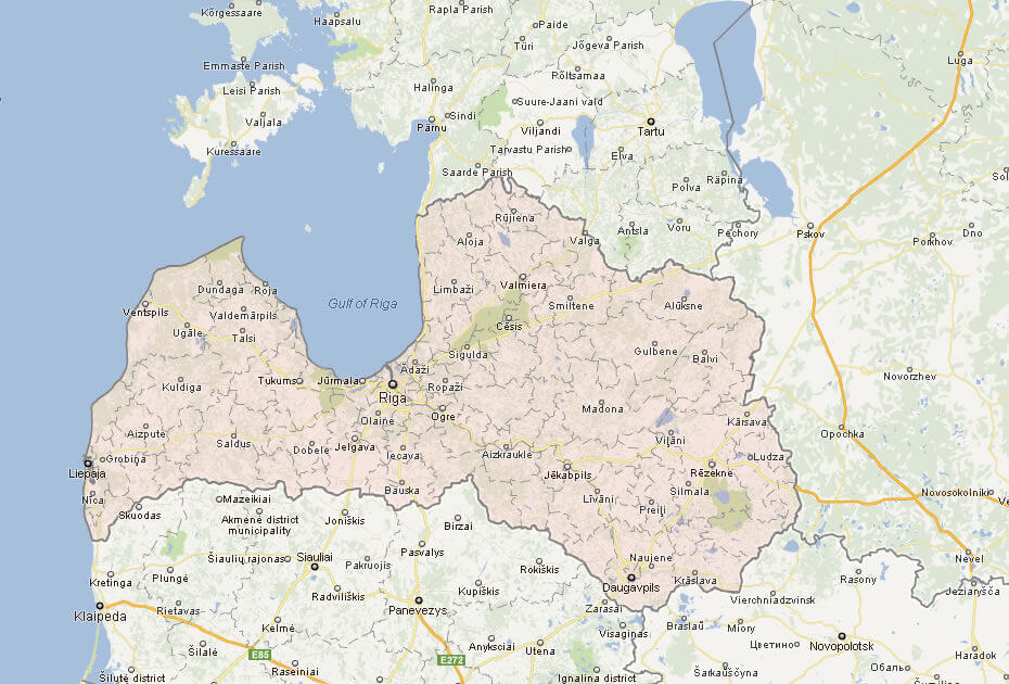
This map shows Latvia and its surrounding countries, highlighting key cities like Riga, as well as neighboring nations such as Estonia, Lithuania, Russia, and Belarus, along with the locations of major towns, regions, and bodies of water, including the Baltic Sea.
Latvia Cities Map
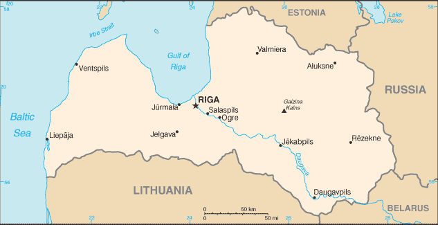
This map of Latvia highlights major cities, including the capital Riga, as well as other key locations like Ventspils, Daugavpils, and Liepaja. It shows Latvia’s borders with Estonia, Lithuania, Russia, and Belarus, along with its coastline along the Baltic Sea and the Gulf of Riga.
Latvia Cities Map with Highways
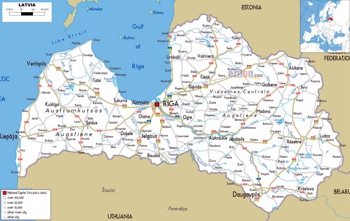 This map of Latvia shows the country’s cities and main highways, with detailed routes connecting key urban centers like Riga, Ventspils, and Daugavpils. It highlights Latvia’s road network, including major highways that facilitate travel across the regions and towards neighboring countries like Estonia, Lithuania, and Russia
Latvia Administrative Map
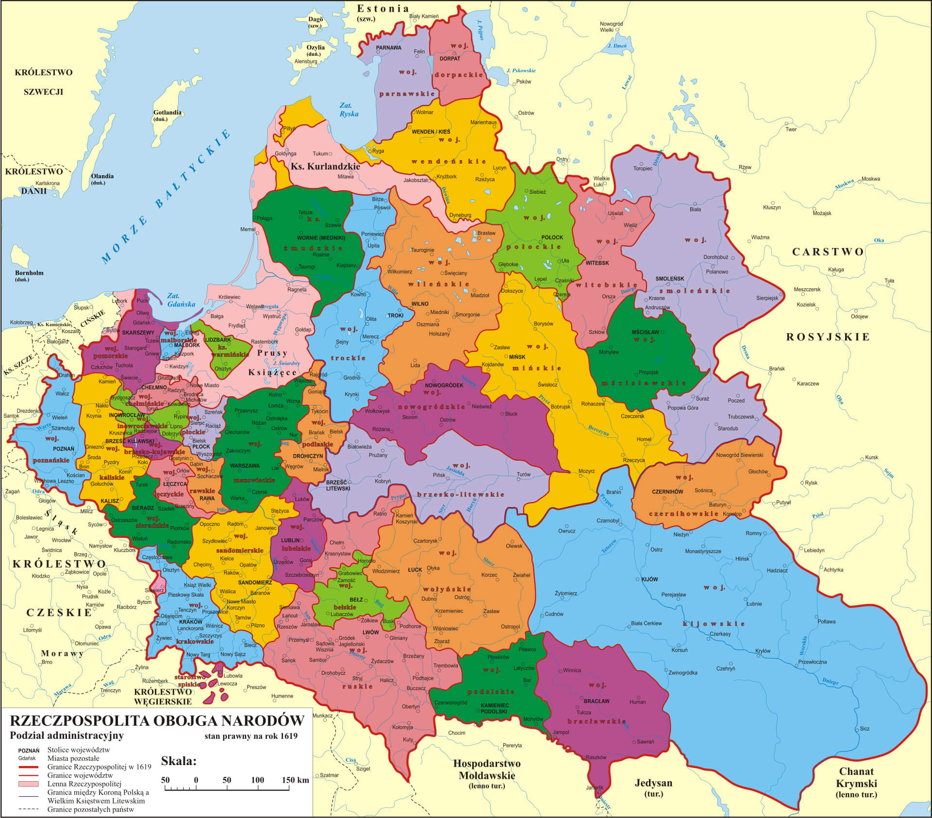 This map shows the administrative divisions of the Polish-Lithuanian Commonwealth as of 1619, including regions that are now part of modern-day Latvia. The map highlights the complex territorial boundaries of the era, with various voivodeships (provinces) and duchies, such as the Duchy of Courland and Semigallia, and includes neighboring regions like the Kingdom of Poland and the Grand Duchy of Lithuania. The detailed administrative layout provides insight into the historical structure of governance within the Commonwealth during the early 17th century, emphasizing the extent of its influence across the region
Latvia Provinces Map with Cities
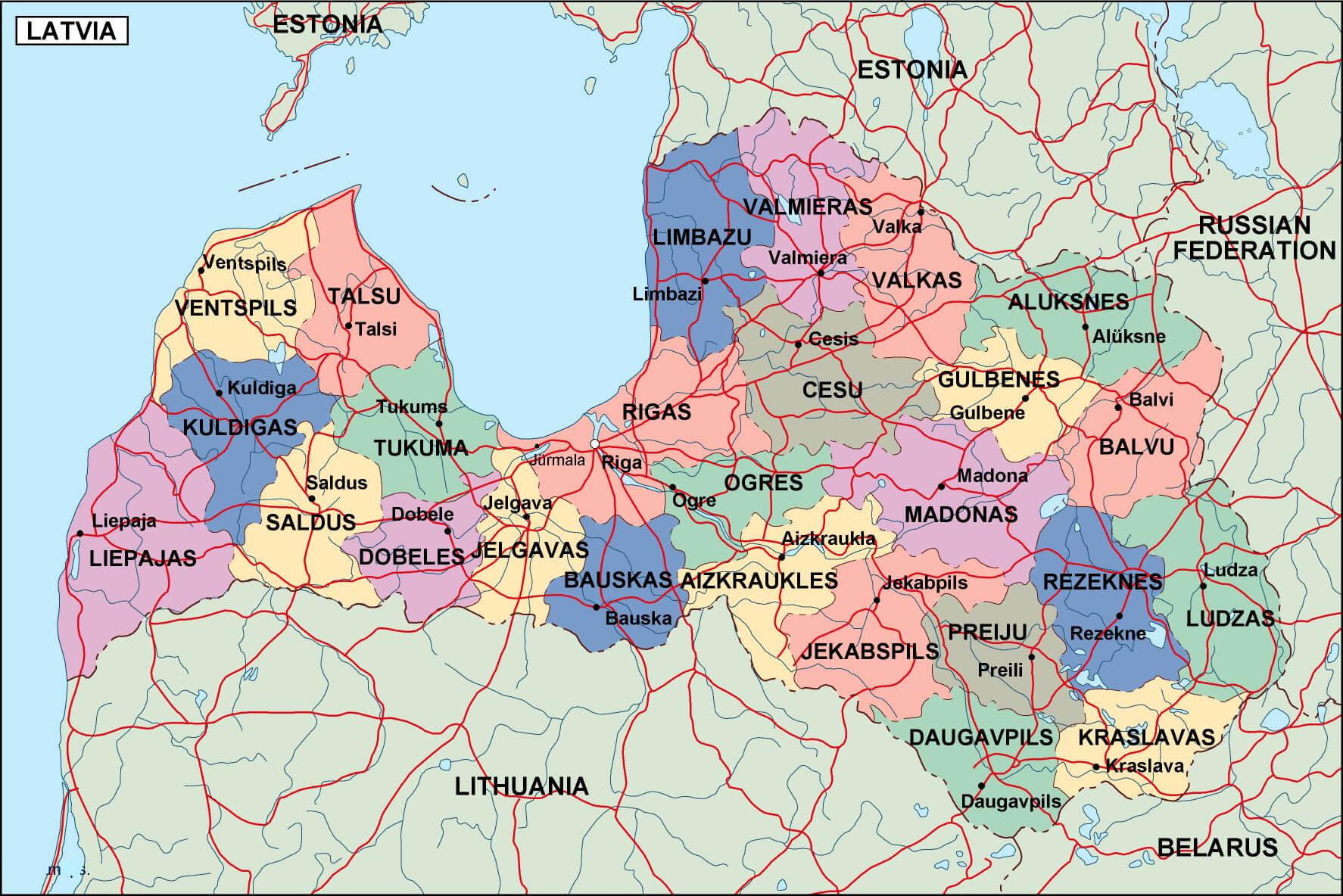 This map of Latvia shows administrative boundaries, including provinces, major cities and road networks. It highlights major cities such as Riga, Daugavpils and Ventspils, as well as various regional boundaries, providing a detailed overview of Latvia’s urban and administrative structure.
Latvia Swedish Empire Map from 1560 to 1815
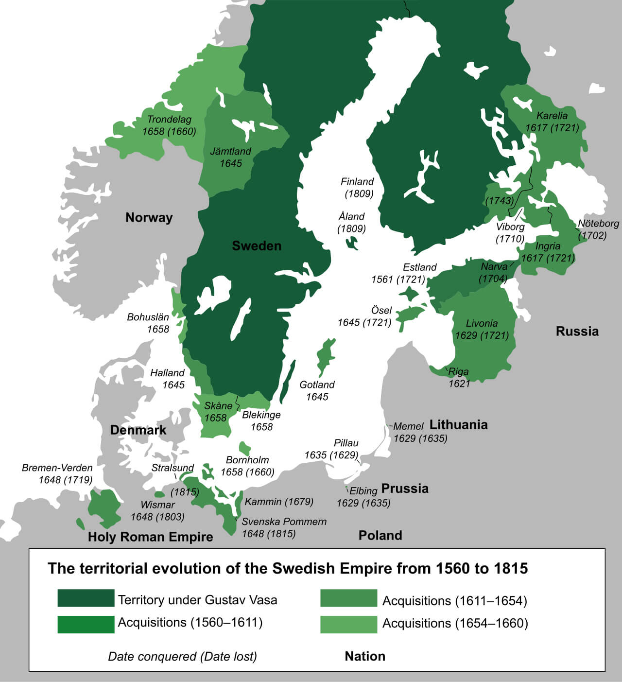 This map illustrates the territorial development of the Swedish Empire from 1560 to 1815, highlighting its acquisitions and expansions. It shows the regions under Swedish control at different times, including territories gained under Gustav Vasa and subsequent acquisitions during the 17th century. Notable regions such as Livonia, Estonia and Finland were under Swedish control before being lost in various conflicts, including those with Russia and other European powers. The map also marks the years in which territories were gained or lost, providing a visual representation of the changing borders of the Swedish Empire during this period.
Latvia Regions Map
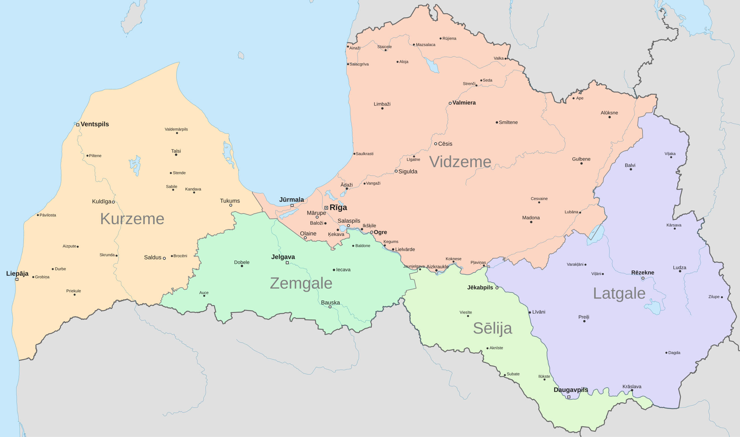 This map of Latvia highlights the country’s regions, including Vidzeme, Latgale, Kurzeme, Zemgale and Sēlija, as well as major cities such as Riga, Ventspils and Daugavpils. The map provides a clear visual representation of the country’s administrative divisions, making it useful for understanding Latvia’s geographical layout and regional distinctions.
Latvia Largest Cities Map
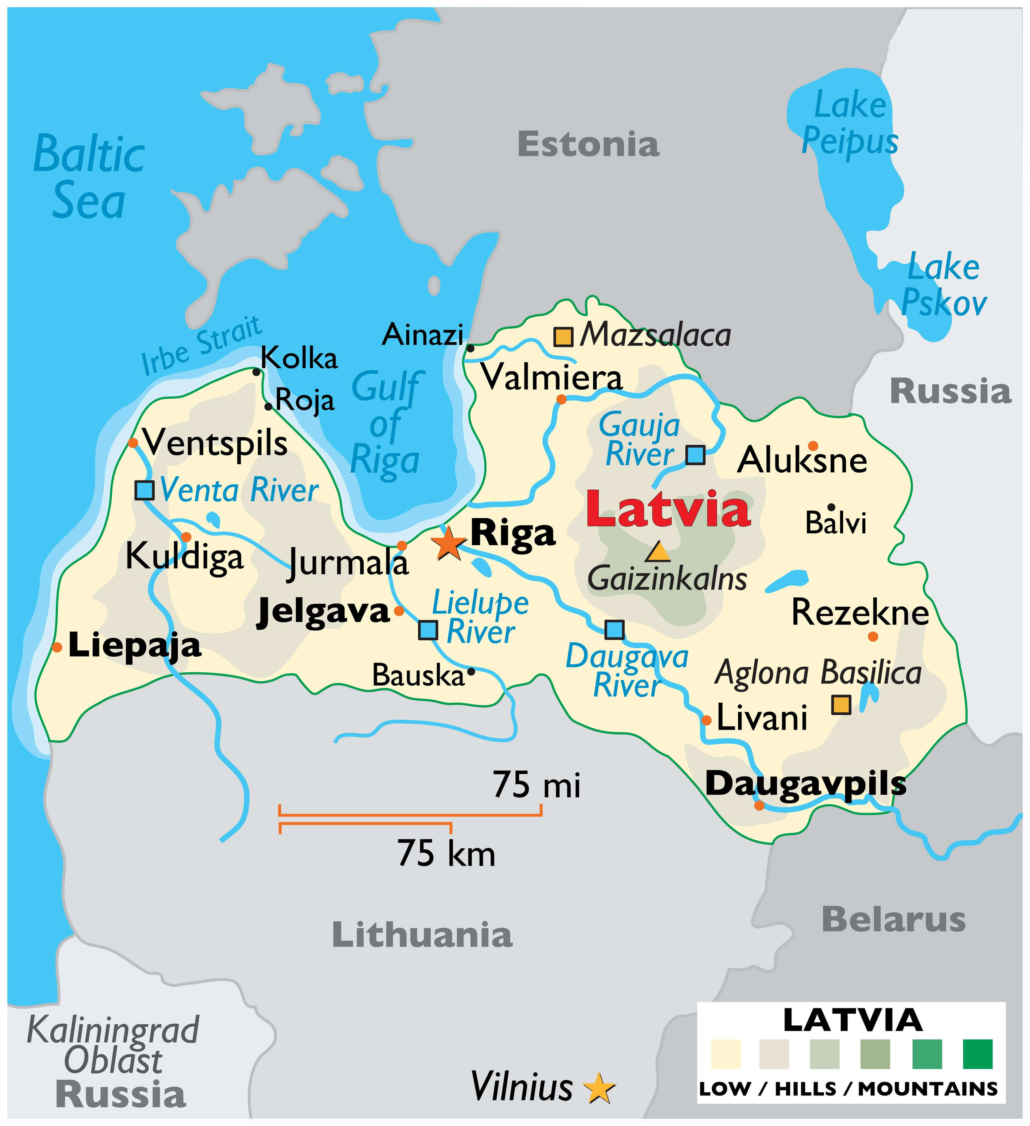 This map of Latvia highlights major cities, rivers and geographical features. Riga, the capital, stands out as a central hub on the Gulf of Riga, while other major cities such as Liepaja and Jelgava are also marked. Major rivers, including the Daugava and Gauja, cross the country, adding to the rich natural landscape of hills and lowlands. The map also shows the relative position of neighbouring countries such as Estonia, Lithuania and Russia.
Latvia Administrative Divisions Map
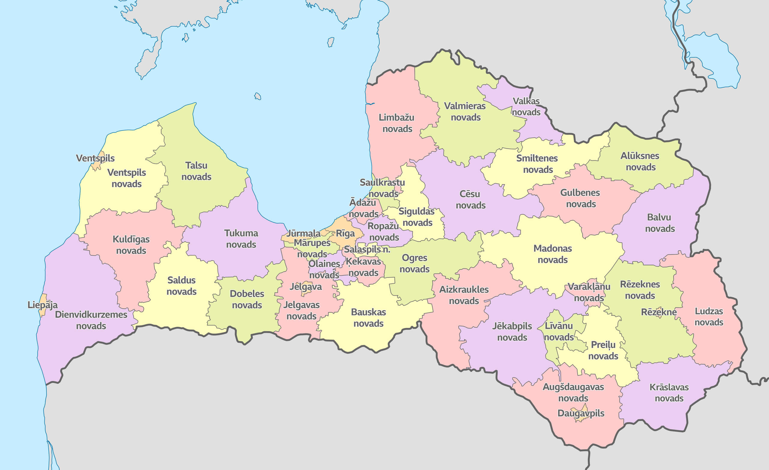 This map of Latvia shows its administrative divisions, highlighting regions such as Kurzeme, Zemgale, Vidzeme, Latgale, and their respective municipalities or novads. Each region is color-coded to distinguish between the various divisions, providing a clear view of how the country is organized. It includes notable cities like Riga, Jelgava, and Daugavpils, offering a detailed overview of Latvia’s internal structure.
Latvia National Borders Map
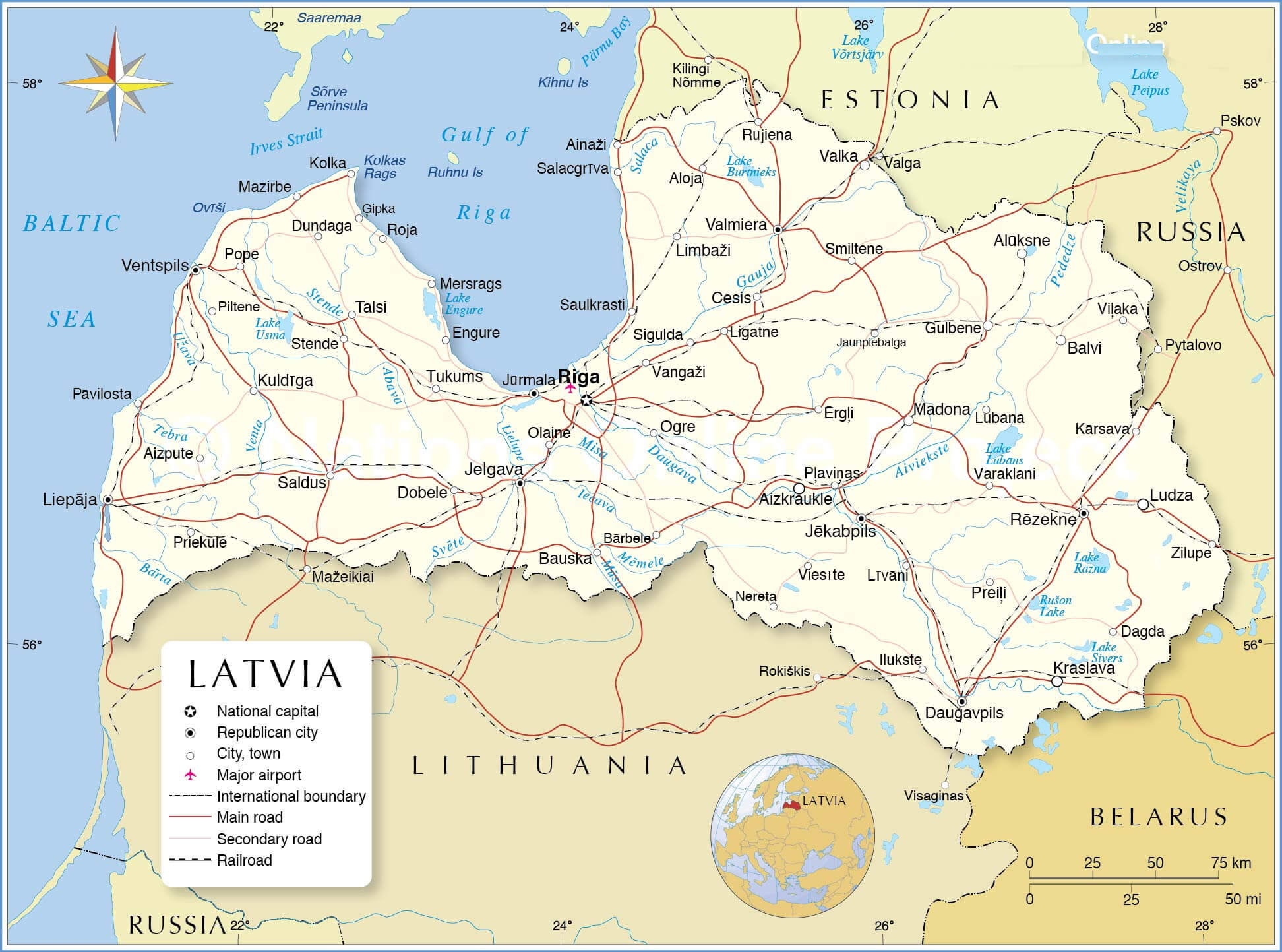 This map of Latvia shows the national boundaries, highlighting the main cities, roads, and key geographical features. It includes details such as international borders with Estonia, Russia, Belarus, and Lithuania, as well as major rivers and lakes like the Daugava River and Lake Burtnieks. Riga, the capital city, is prominently marked, serving as a central point of reference for the country’s transportation network and proximity to the Gulf of Riga.
Latvia Riga Map
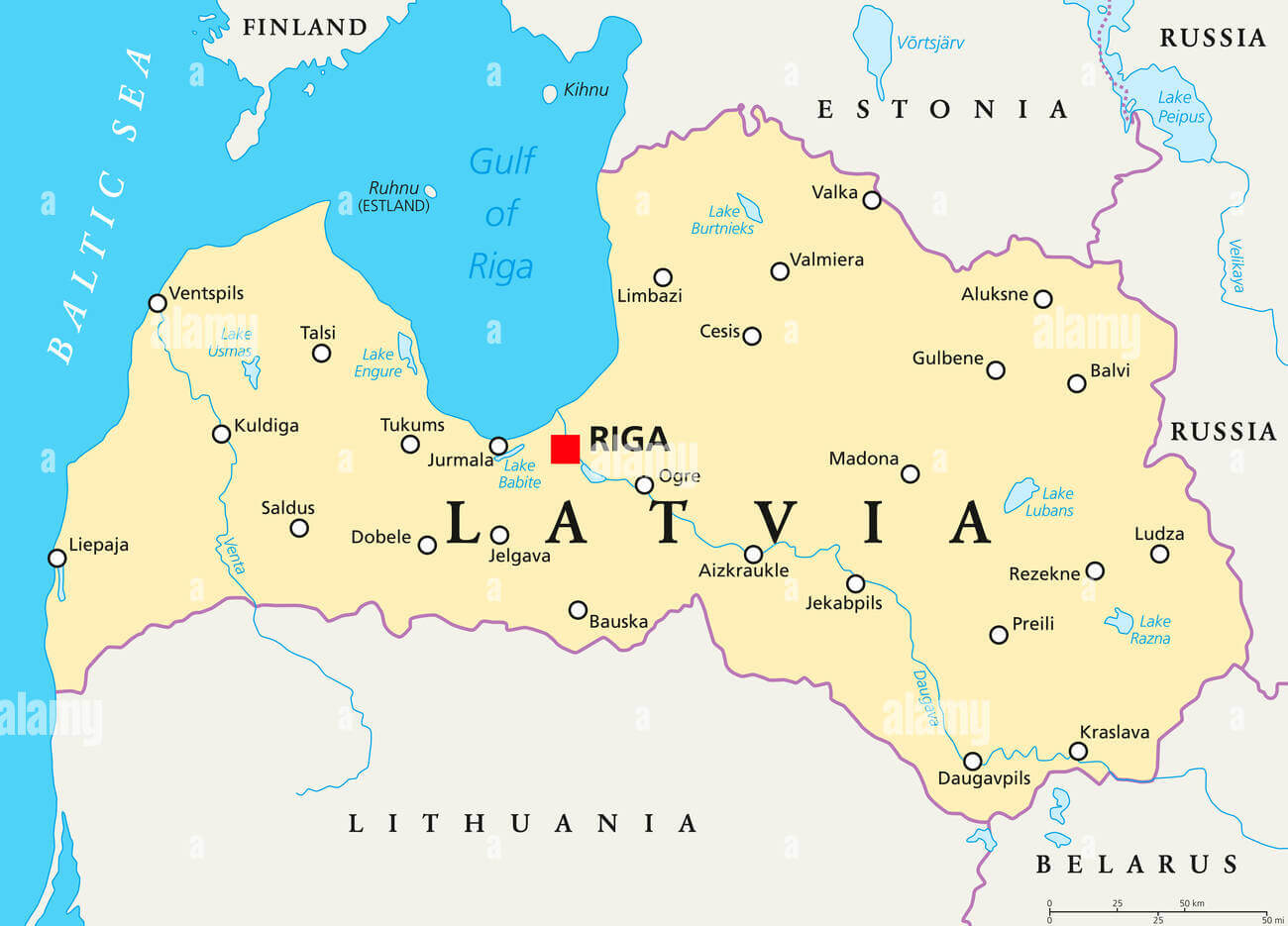 This map illustrates Latvia, highlighting its capital Riga and surrounding major cities, lakes and rivers. It emphasises the country’s geographical location, bordered by Estonia to the north, Russia to the east, Lithuania to the south and the Baltic Sea to the west, with Riga situated near the Gulf of Riga.
Latvia Physical Map
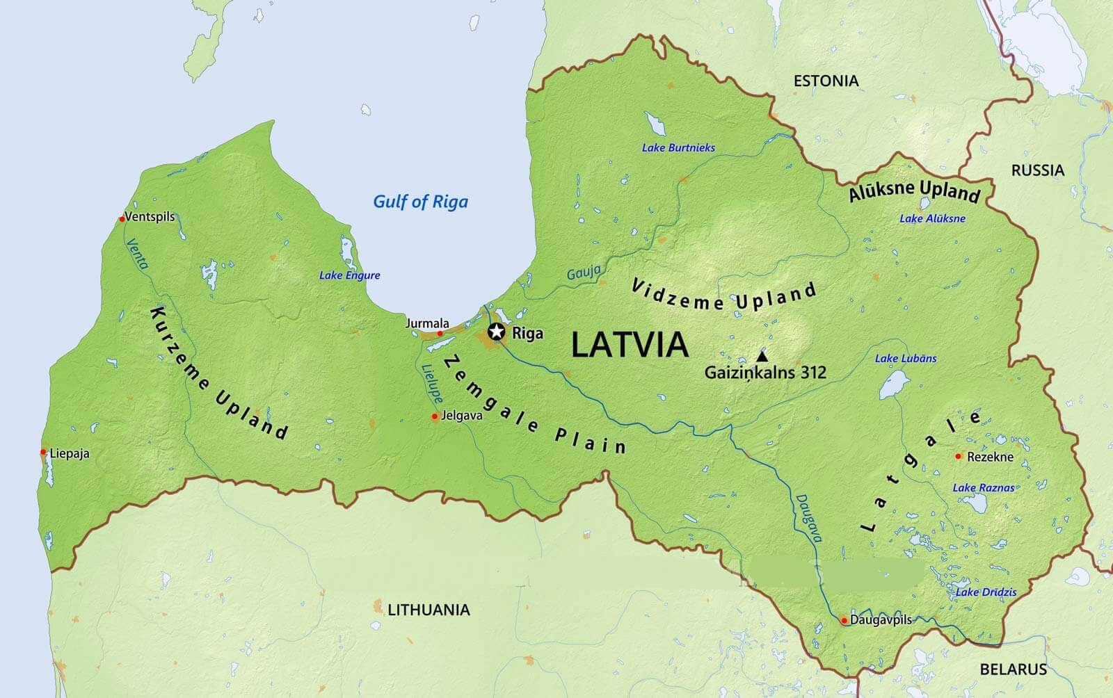 This physical map of Latvia highlights the country’s diverse landscapes, including the Vidzeme and Kurzeme Uplands, the Zemgale Plain and the Latgale region. It shows important geographical features such as the Gulf of Riga, the Daugava River and major lakes such as Lake Lubans and Lake Raznas. Riga, the capital, is centrally located along the Gulf, while cities such as Daugavpils and Liepaja are marked, along with important natural landmarks such as Gaiziņkalns, Latvia’s highest point.
Latvia Map
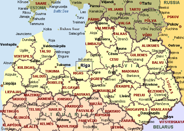
Map of Latvia
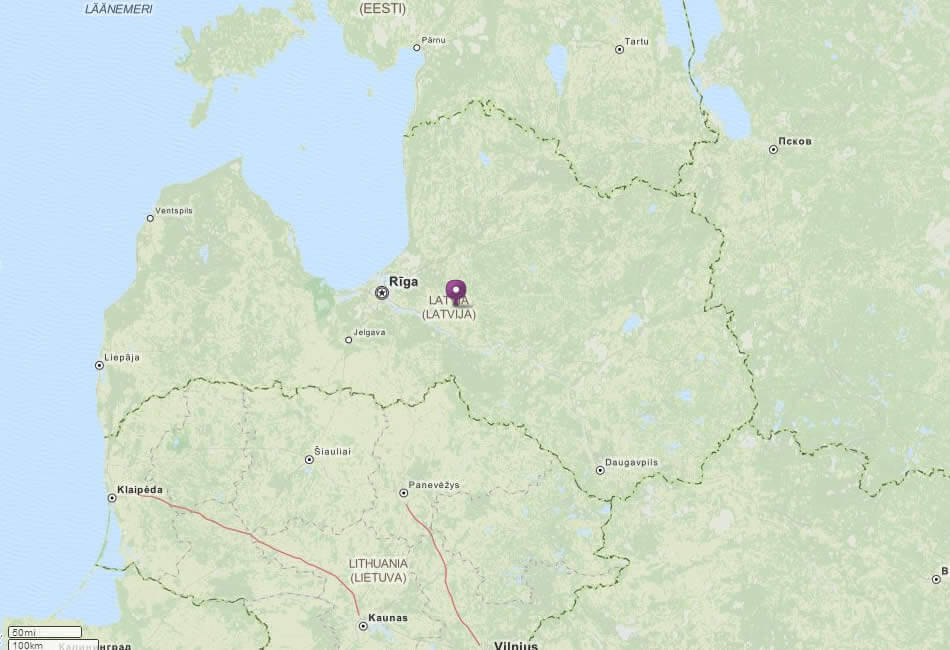
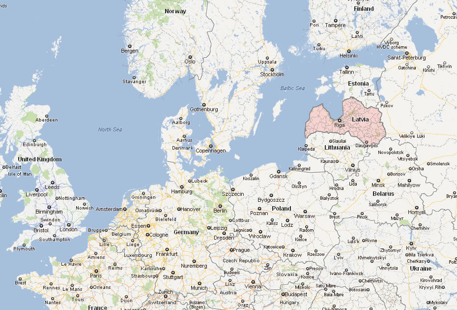
This map highlights Latvia, focusing on its capital, Riga, and shows its geographic location in Northern Europe, bordered by the Baltic Sea, with neighboring countries such as Estonia to the north, Lithuania to the south, and Russia to the east.
Map of Latvia Europe
Map of Latvia World
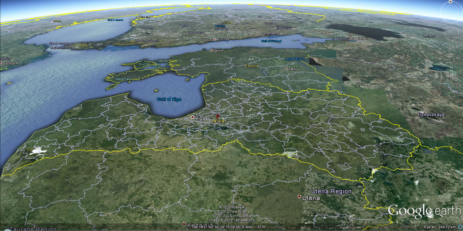
Latvia Earth Map
Where is Latvia on the Europe Map?
Show Google map, satellite map, where is the country located.
Get directions by driving, walking, bicycling, public transportation and travel with street view.
div>Feel free to explore these pages as well:
- Lithuania Map ↗️
- Estonia Map ↗️
- Finland Map ↗️
- A Collection of Poland Maps ↗️
- A Collection of Germany Maps ↗️
- Norway Map ↗️
- Sweden Map ↗️
- EuropeMap ↗️
- United Kingdom Map ↗️
- A Collection of Europe Maps ↗️
- Europe Top 10 Tourist Arrivals Countries by 2017 ↗️
