Explore Estonia’s rich geography and history through this detailed collection of maps. From its vibrant capital, Tallinn, to the serene countryside and Baltic coastline, these maps provide a comprehensive view of Estonia’s diverse landscapes and cultural landmarks. These maps help you explore Estonia’s charming towns and stunning coastlines.
Brief information about Estonia
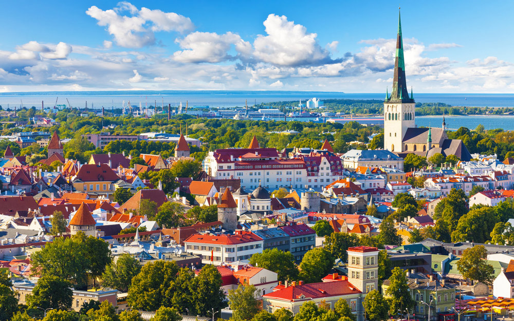
Estonia, located in Northern Europe along the Baltic Sea, is a small but vibrant country known for its stunning landscapes and rich cultural heritage. With a population of just over 1.3 million, it boasts a unique blend of medieval architecture, picturesque forests, and a strong digital presence, often being called one of the most advanced digital societies in the world. Tallinn, the capital, is famous for its well-preserved Old Town, which is a UNESCO World Heritage site.
Estonia Location Map
What makes Estonia stand out even more is its commitment to technology and innovation. It was one of the first countries to offer e-Residency, a program allowing global citizens to start and manage a business online. Despite its rapid digital development, Estonia remains deeply connected to nature, with over half of its land covered in forests, making it a perfect destination for both tech enthusiasts and nature lovers.
Where is located Estonia on the World Map
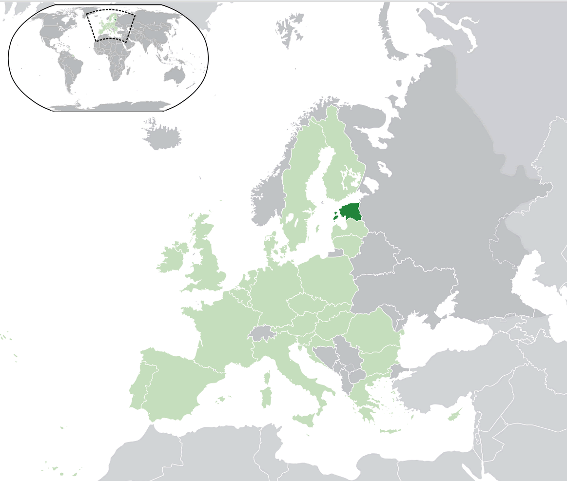
Estonia is located in Northern Europe, nestled along the eastern shores of the Baltic Sea. It shares borders with Russia to the east and Latvia to the south, while its northern coast faces Finland across the Gulf of Finland. Estonia’s strategic location places it at the crossroads of Scandinavian and Eastern European influences, giving it a unique cultural blend.
Though it may be small in size, Estonia’s proximity to major European cities makes it a convenient travel destination. Tallinn, the capital, is just a short ferry ride from Helsinki, and flights to cities like Stockholm, Riga, and Saint Petersburg are less than two hours away. This central position in the Baltic region has historically made Estonia a key player in trade routes and geopolitics.
Estonia’s location also offers travelers access to stunning natural scenery, with over 2,000 islands dotting its coastline. The country’s forests, lakes, and beaches make it an attractive spot for nature lovers, while its position on the world map connects it easily to both Eastern and Western Europe.
Here are some statistical information about Estonia:
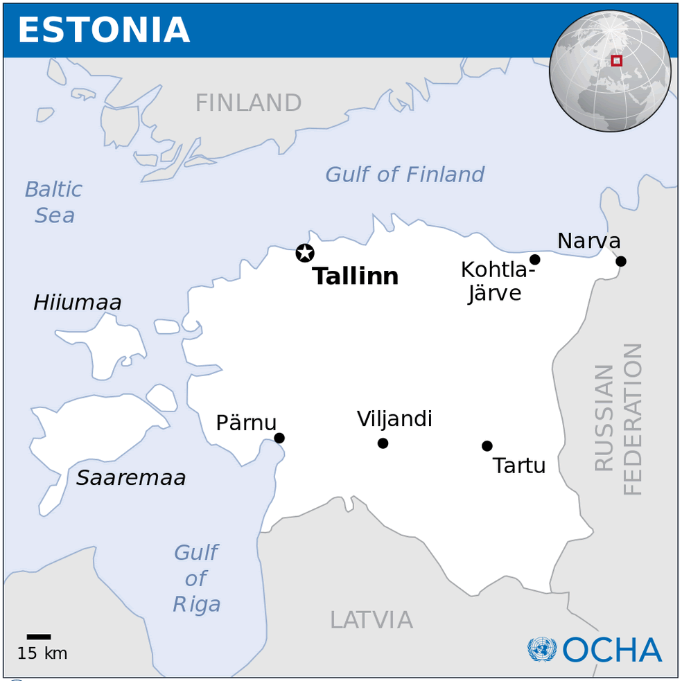
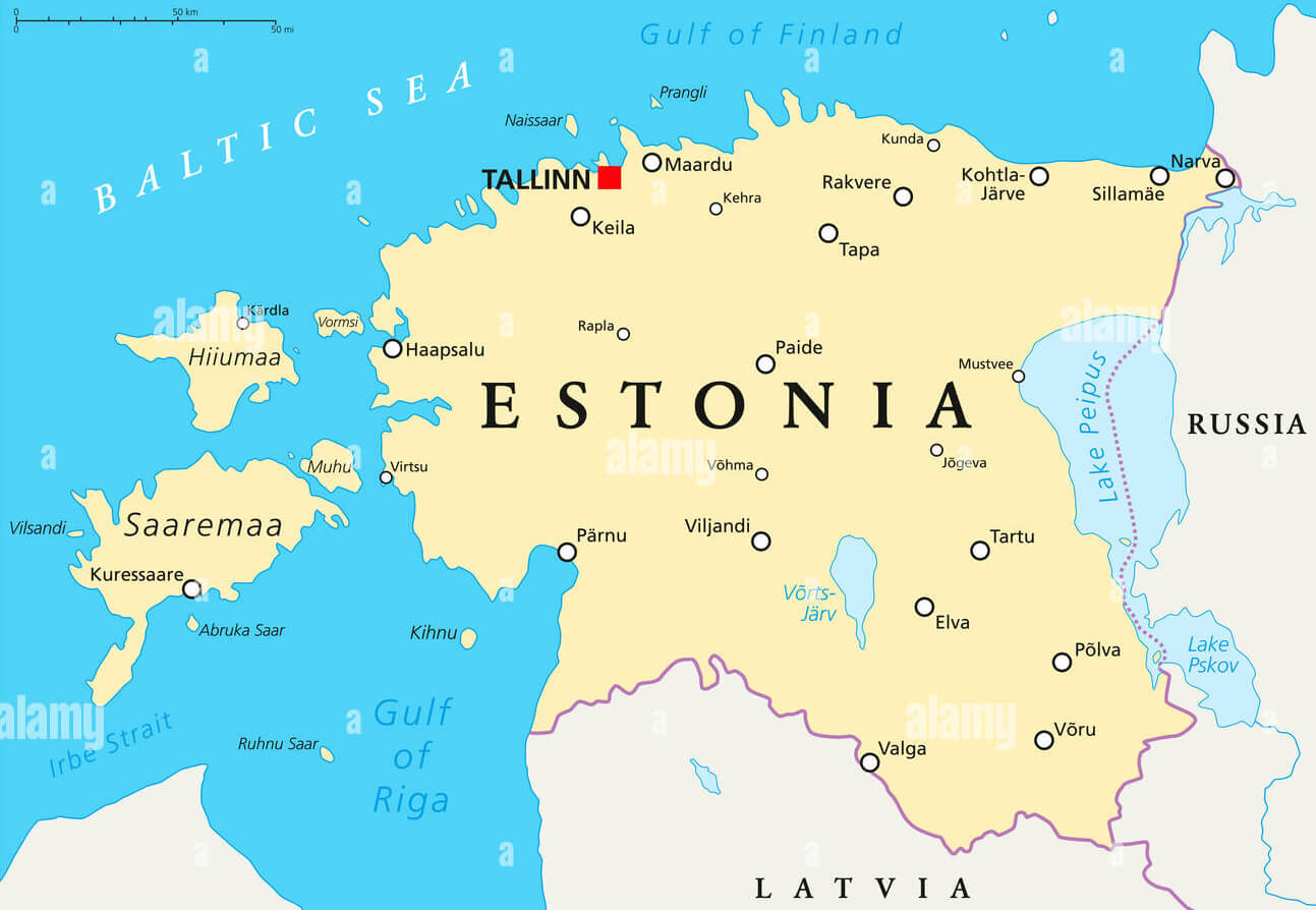
Map of Estonia
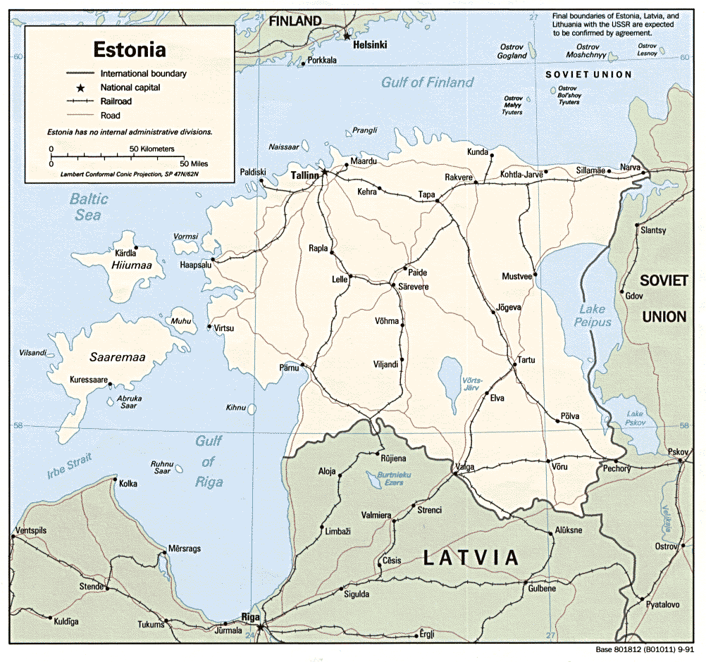
This map displays Estonia and its neighboring countries. It highlights Estonia’s borders, the capital city Tallinn, major roads, and nearby nations such as Finland, Latvia, and Russia.
Estonia Map
Estonia Political Map
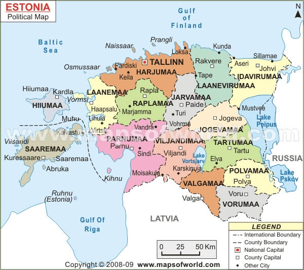
This map shows the political boundaries and regions of Estonia, including major cities, national borders, and its islands like Saaremaa and Hiiumaa.
Estonia Baltic Map
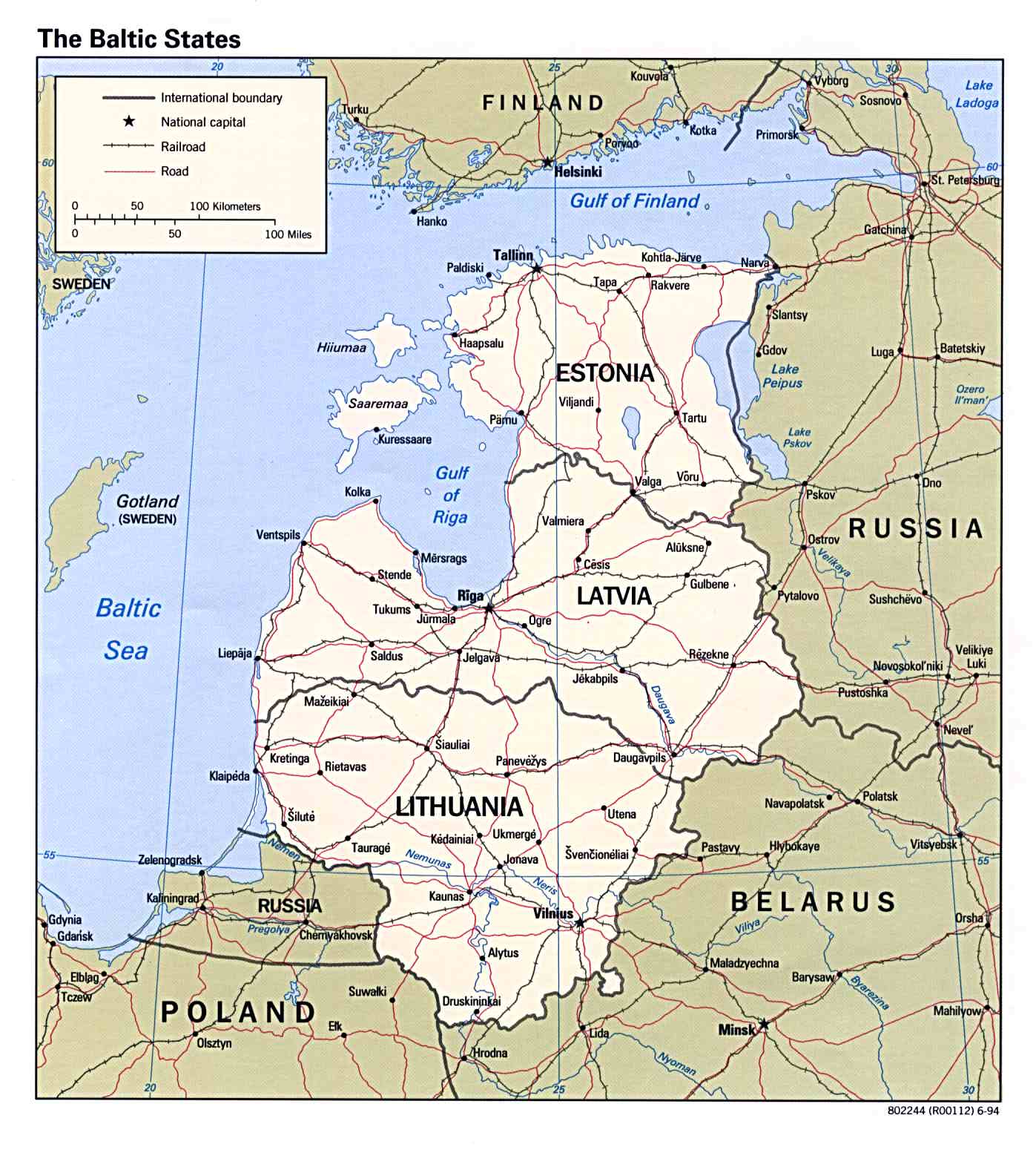
This map displays the Baltic States—Estonia, Latvia, and Lithuania—highlighting their national capitals, borders, and neighboring countries such as Russia, Finland, and Poland.
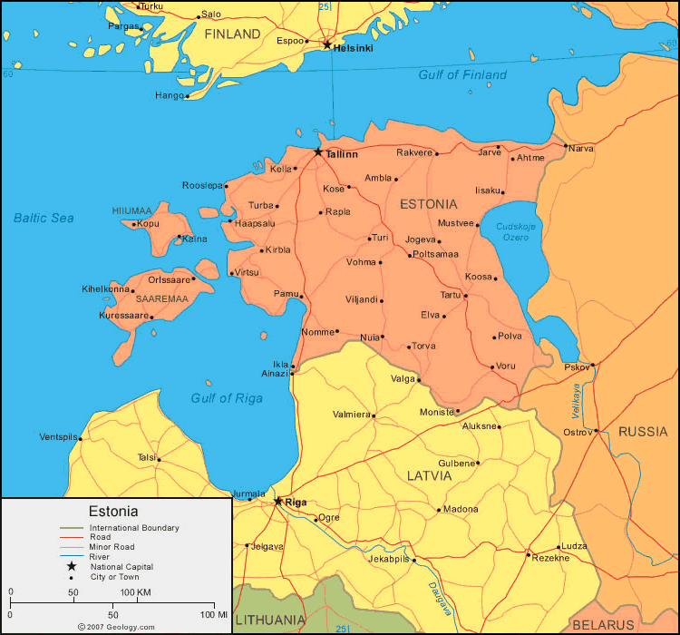
Estonia Road Map
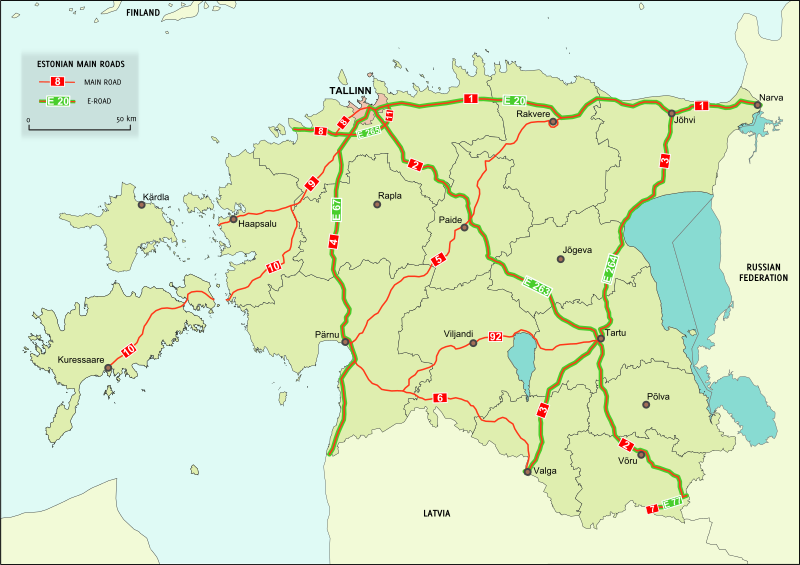
This map highlights Estonia’s main roads, connecting key cities like Tallinn, Tartu, and Narva, and routes to Latvia and Russia.
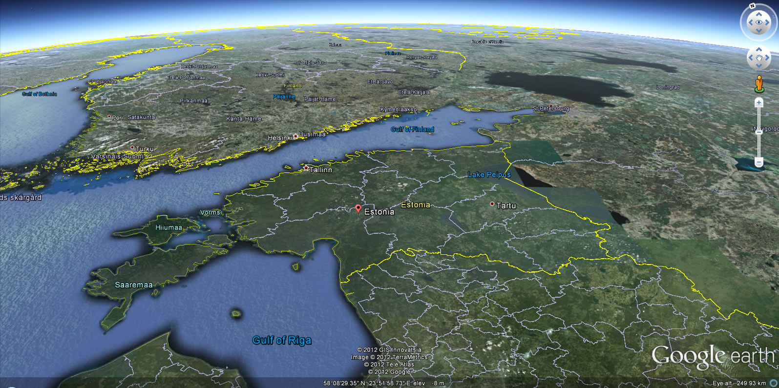
Estonia Earth Map
Estonia Provinces Map
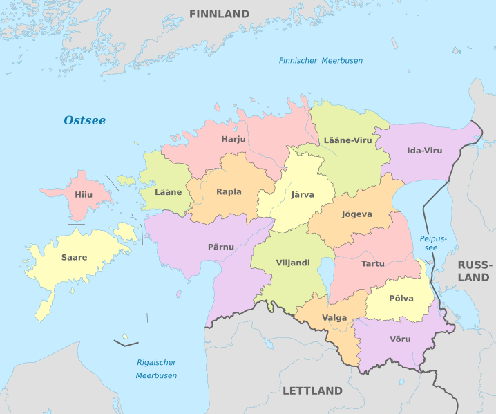
This map illustrates the administrative divisions of Estonia, showcasing its various counties such as Harju, Saare, and Tartu, along with their proximity to neighboring countries like Finland, Russia, and Latvia.
Estonia Administrative Divisions Map
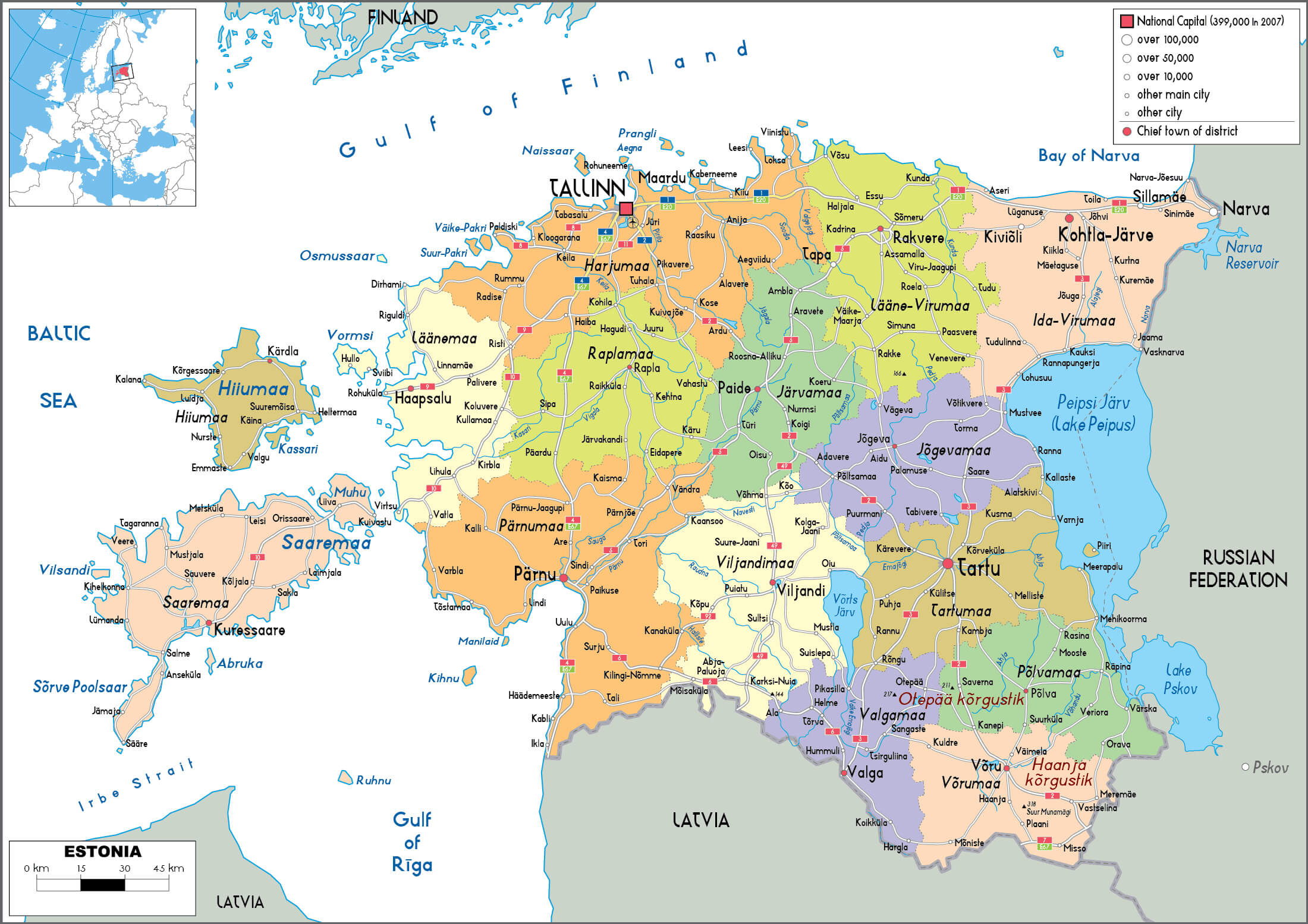
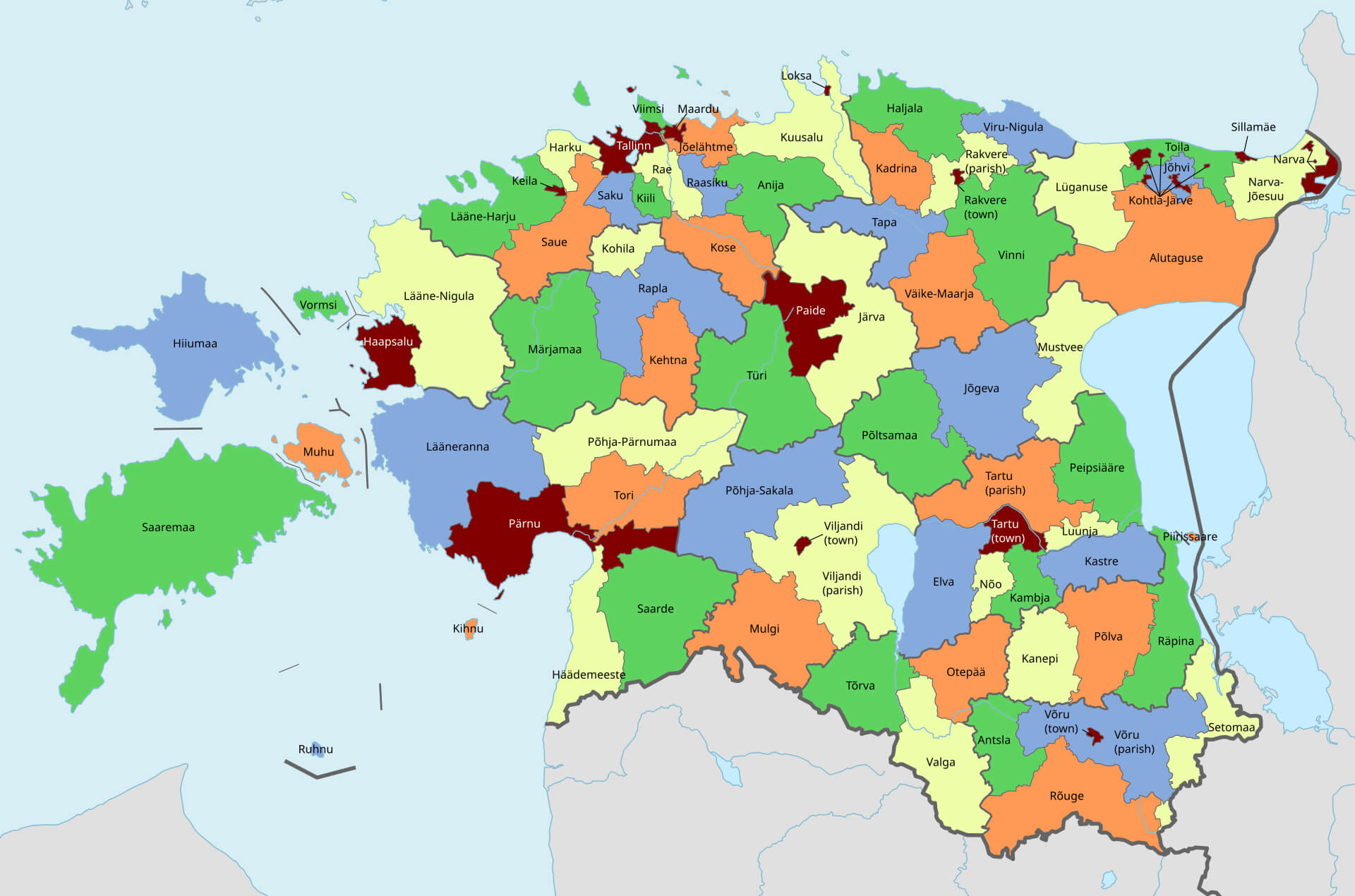 This map of Estonia shows the country’s administrative divisions, including counties, cities and municipalities, illustrating the regional organisation of the country. The map highlights major urban centres such as Tallinn, Tartu and Pärnu, as well as smaller administrative regions, each shown in a different colour for easy identification. It also provides an overview of Estonia’s islands, such as Saaremaa and Hiiumaa, emphasising the geographical spread of the country’s administrative areas.
Estonia and Finnic Languages Map in Northern Europe
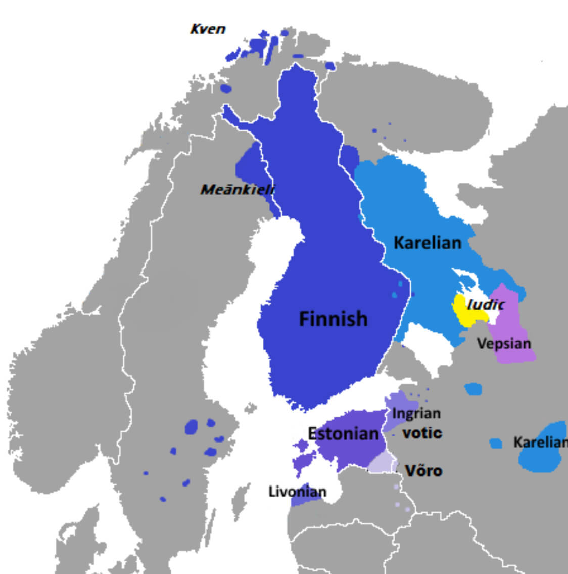 This map illustrates the distribution of Finnic languages across Northern Europe, highlighting regions where languages such as Finnish, Estonian, Karelian, Vepsian, and others are spoken. It shows Finland as the primary region for Finnish, with Estonia for Estonian, and other smaller areas for less widely spoken Finnic languages like Karelian, Votic, and Livonian. The map reflects the cultural and linguistic diversity of the Finnic peoples in this region.
Estonia Political Map with Counties
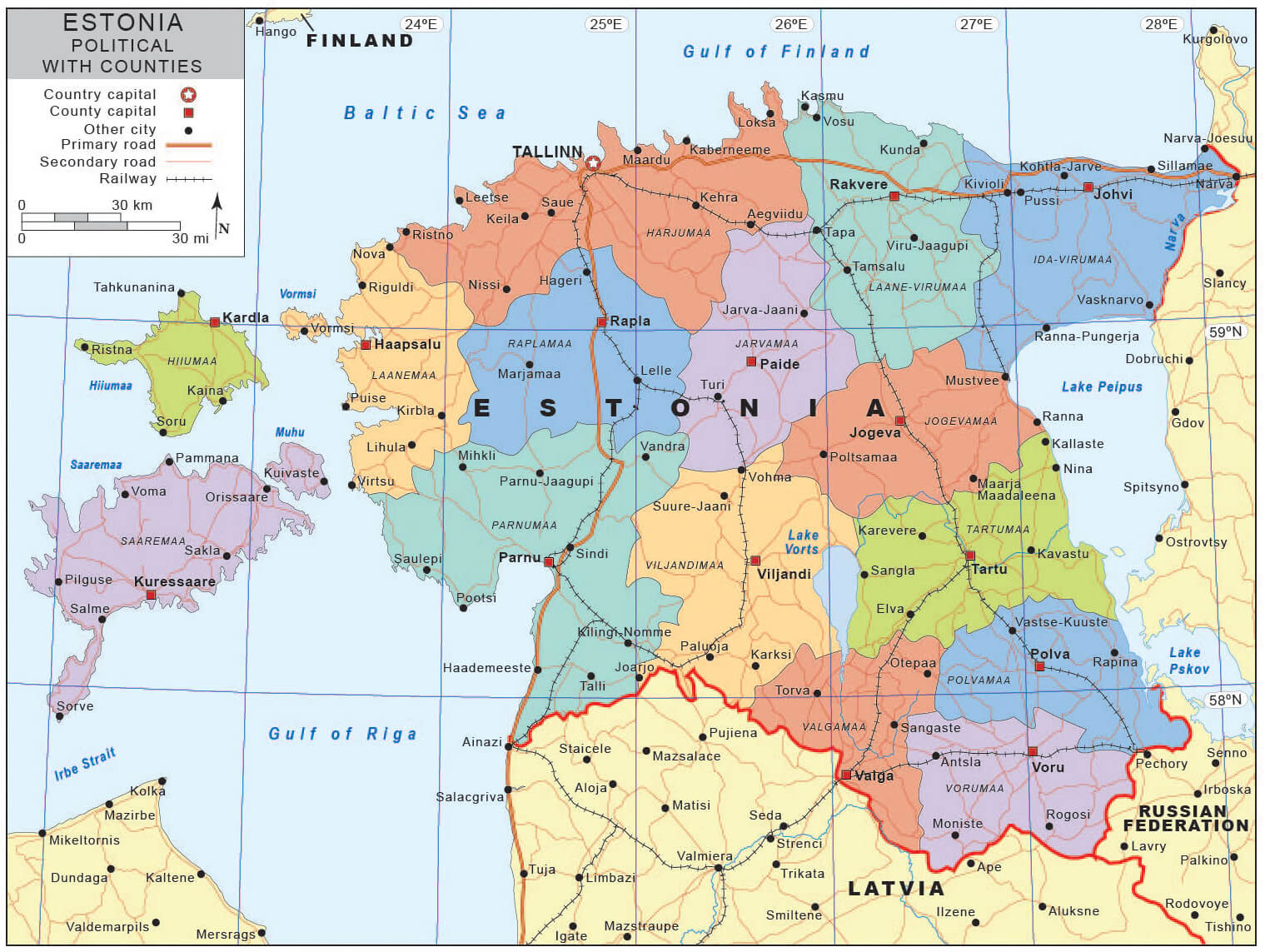 This political map of Estonia shows the country divided into its various counties, each indicated by a different colour. It highlights major cities, county capitals and major transport routes such as primary and secondary roads and railways. The map also shows Estonia’s proximity to neighbouring countries such as Finland, Latvia and Russia, and its coastal location on the Baltic Sea and Gulf of Finland.
Estonia Cities Map
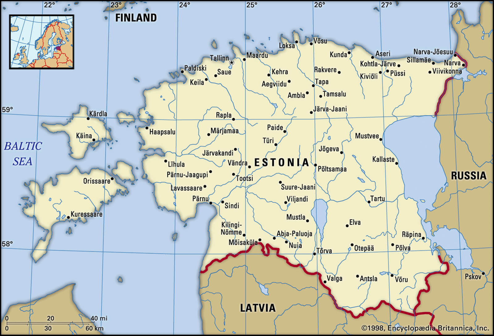 This map of Estonia highlights the major cities and towns throughout the country, showing its geographical layout from the Baltic Sea to the borders with Latvia and Russia. Key cities such as Tallinn, the capital, and Narva, near the Russian border, are prominent, while island regions such as Saaremaa and Hiiumaa are also featured.
Estonia Largest Cities Map
 This map of Estonia highlights the country’s major cities, including the capital Tallinn, Tartu, Parnu and Narva. It also shows key geographical features such as the Gulf of Finland, various lakes and Estonia’s islands, including Saaremaa and Hiiumaa, providing a clear view of Estonia’s urban centres and natural landscape.
Estonia Political Map with Main Cities
 This political map of Estonia highlights the country’s major cities, including the capital Tallinn, Tartu, Narva, Pärnu and Viljandi. It also includes Estonia’s major islands, including Saaremaa and Hiiumaa, and major bodies of water, such as Lake Peipus and the Baltic Sea, providing a clear overview of the country’s geographical and urban layout.
Estonia Cities and Regions Map
 This map of Estonia illustrates the country’s various cities and regions, including the capital Tallinn and other major cities such as Tartu, Narva and Pärnu. It also highlights Estonia’s different regions, such as Harjumaa, Saaremaa and Ida-Virumaa, providing an organised view of administrative divisions and major urban areas..
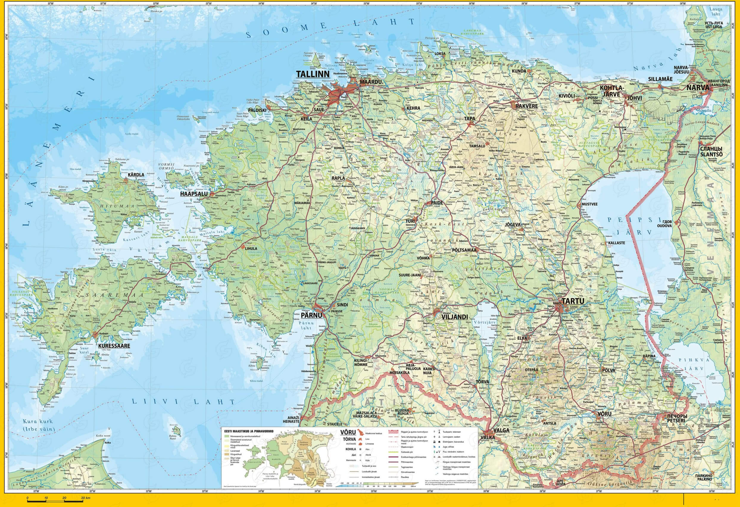
Estonia National Map with Main Roads
 This map of Estonia shows the country’s national layout, highlighting its main cities, regions, and major roads connecting important areas such as Tallinn, Tartu, Pärnu, and Narva. The map provides a clear view of Estonia’s road network, including routes leading to coastal areas like Saaremaa and Hiiumaa islands.
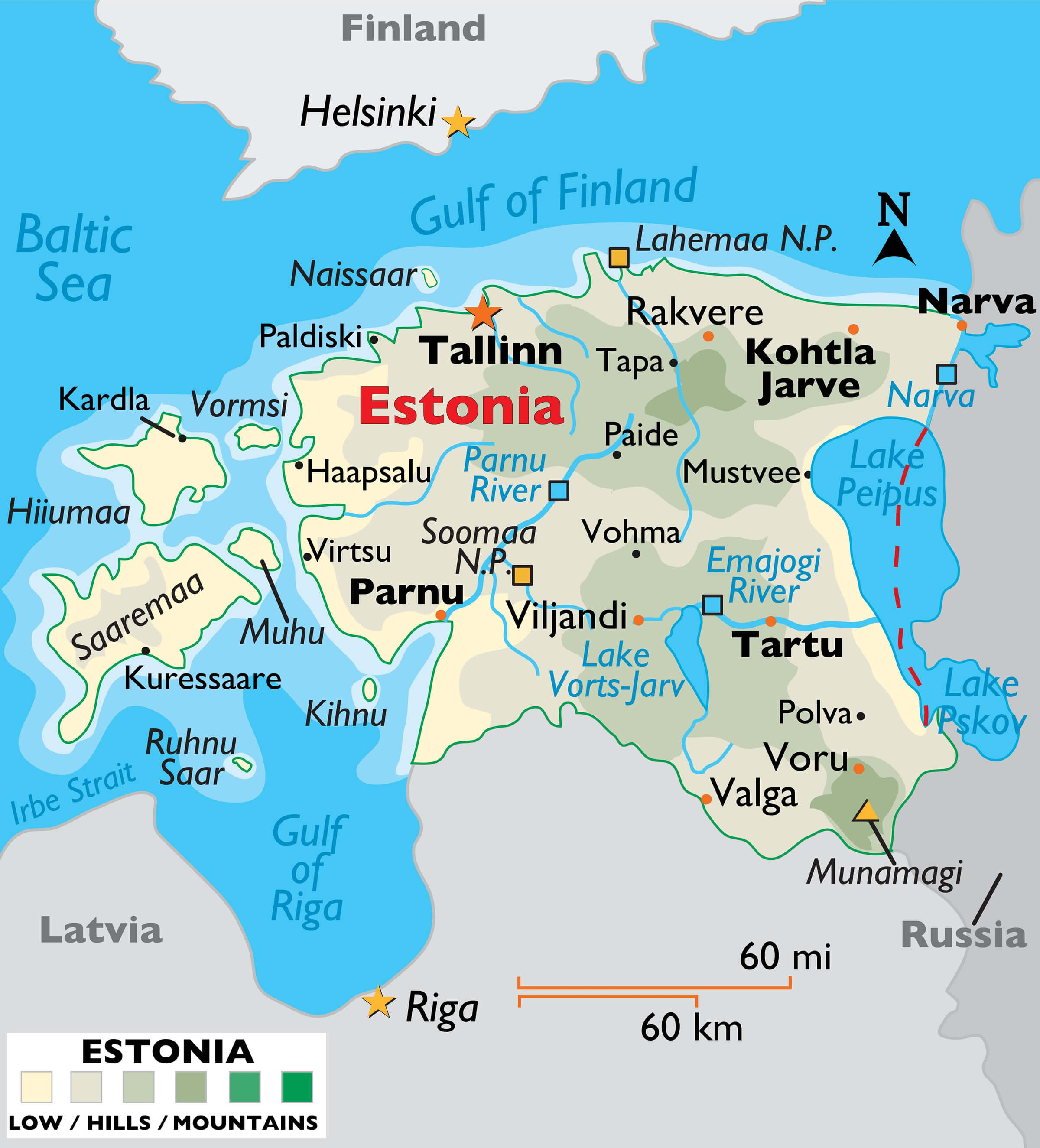
Estonia Physical Map
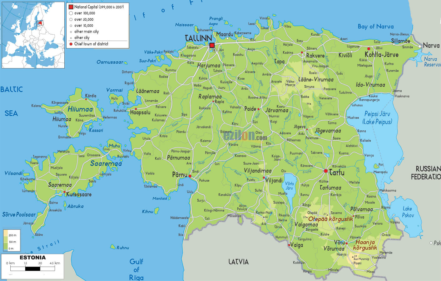
 This detailed physical map of Estonia highlights the country’s natural features, including its varied terrain, forests, lakes and rivers. Major cities such as Tallinn, Tartu and Pärnu are shown alongside the road network, while the map also includes the coastal regions, islands such as Saaremaa and Hiiumaa, and the border areas with neighbouring countries.
Estonia Elevation Map
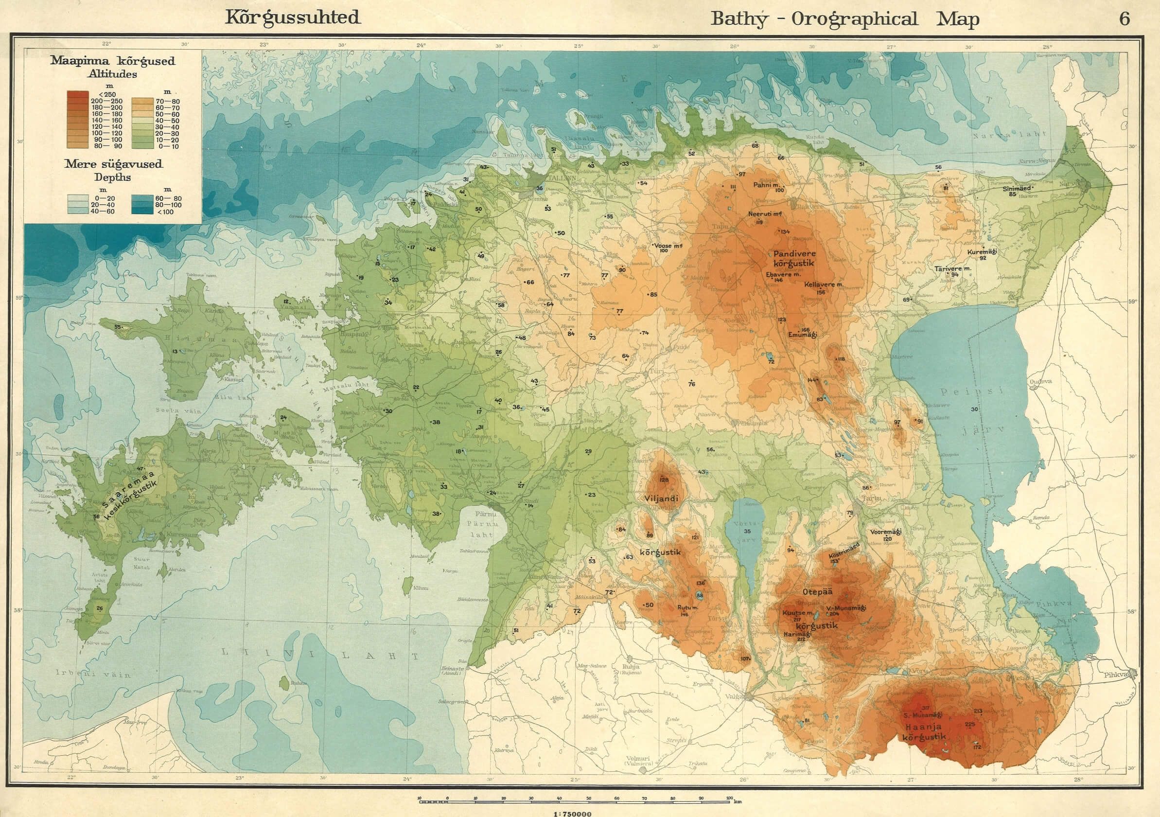 This is an elevation map of Estonia showing the topography of the country with colour gradations representing different altitudes. The highest areas, such as the Haanja Uplands in the south-east, are highlighted in red and orange, while the lower areas, particularly along the coast and in western Estonia, are shown in lighter green. The map illustrates Estonia’s varied terrain, including its highlands and coastal plains.
Medieval Estonia Livonia Map in 1260
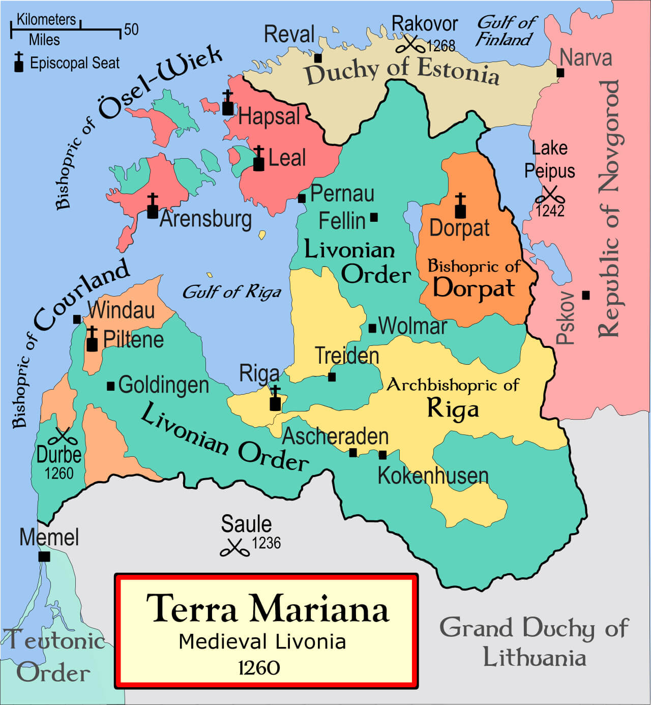 The “Medieval Estonia Livonia Map in 1260” shows the political boundaries of Terra Mariana, also known as Medieval Livonia, during the 13th century. At this time, the region was controlled by various powers, including the Livonian Order, the Bishopric of Dorpat, the Archdiocese of Riga, and the Bishopric of Ösel-Wiek. It illustrates key locations such as Reval (modern-day Tallinn), Dorpat (Tartu), and Riga, highlighting the religious and military control of the Livonian Confederation. The map emphasizes the ecclesiastical divisions, with bishoprics and the territories of the Teutonic Order also shown in relation to neighboring regions like the Republic of Novgorod and the Grand Duchy of Lithuania.
Estonia and Finland Russian Empire Map of 1897 Census Literacy
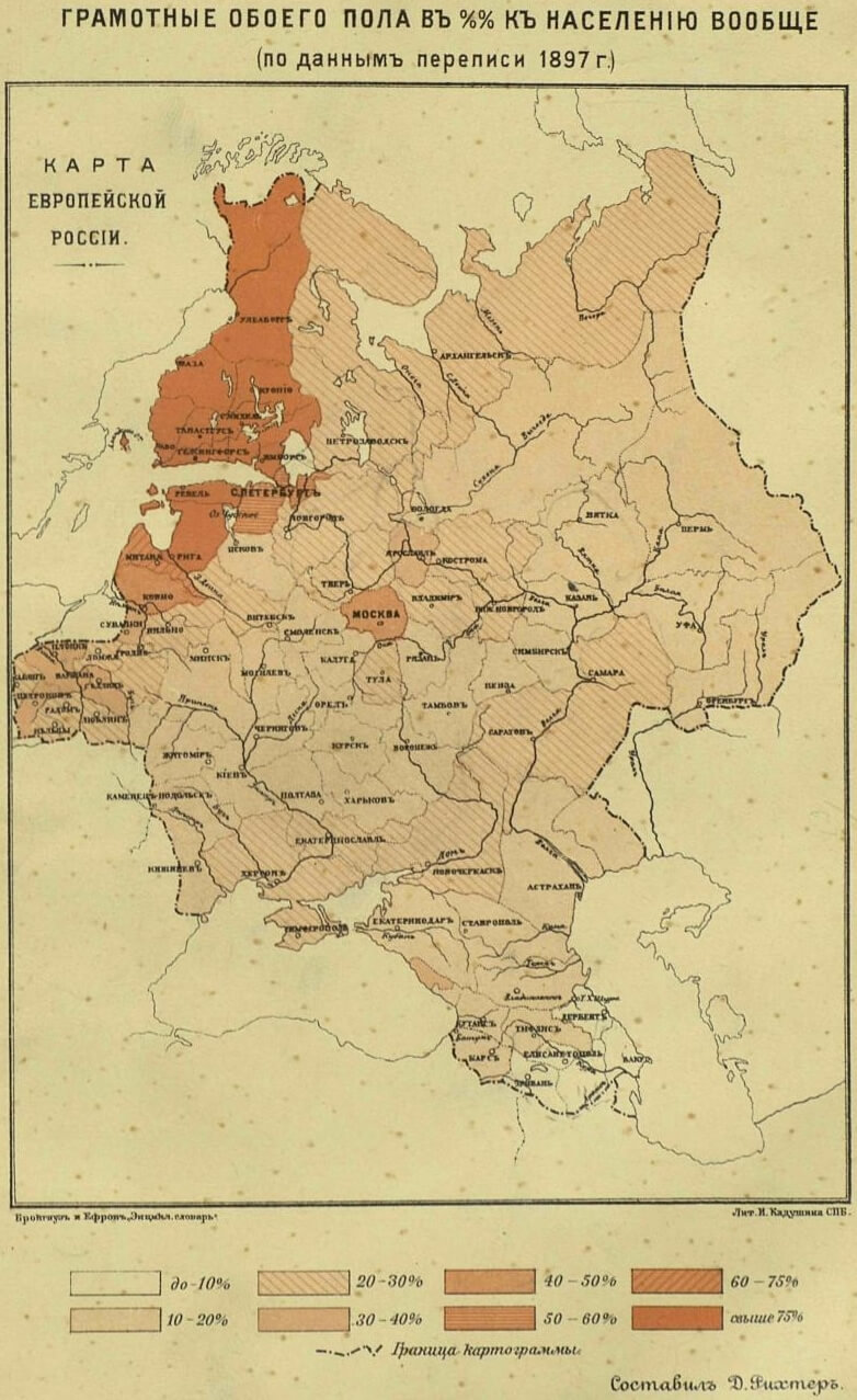 This map from the 1897 census of the Russian Empire shows the literacy rates in different regions, including Estonia and Finland, using different colour codes. The map shows higher literacy rates, particularly in the north-western parts, including Estonia and Finland, compared to the central and eastern regions of the Russian Empire. The darker areas, such as those covering Estonia and parts of Finland, indicate literacy rates above 60%, while the lighter areas further east reflect much lower literacy rates, often below 20%.
Map of Estonia Europe
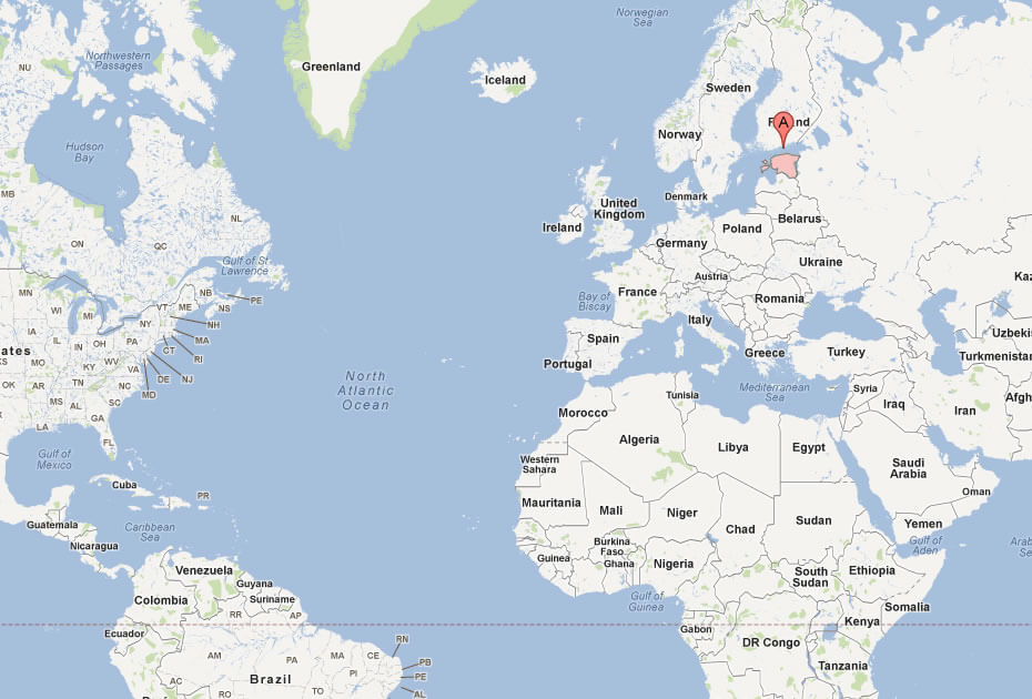
Map of Estonia World
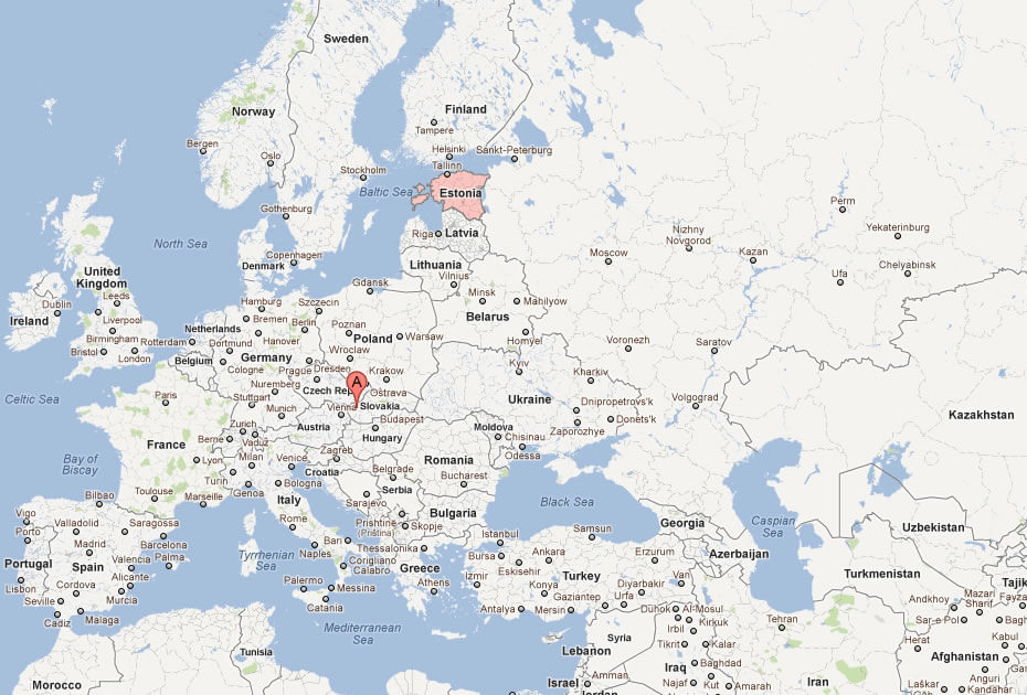
Where is Estonia on the Europe Map?
Show Google map, satellite map, where is the country located.
Get directions by driving, walking, bicycling, public transportation and travel with street view.
Feel free to explore these pages as well:
- A Collection of Poland Maps ↗️
- A Collection of Germany Maps ↗️
- Norway Map ↗️
- Sweden Map ↗️
- EuropeMap ↗️
- United Kingdom Map ↗️
- A Collection of Europe Maps ↗️
- Europe Top 10 Tourist Arrivals Countries by 2017 ↗️