A Collection of Monaco Maps offers a detailed look at this tiny yet glamorous principality on the French Riviera, showcasing its unique geography, urban layout, and important landmarks.
Brief information about Monaco
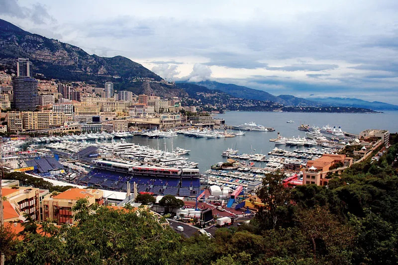
Monaco is a tiny yet glamorous principality nestled on the French Riviera, known for its luxurious lifestyle, stunning Mediterranean views, and being a playground for the rich and famous. Despite its small size—only about 2 square kilometers—Monaco is home to iconic landmarks like the Monte Carlo Casino, the royal Grimaldi family’s palace, and the Formula 1 Grand Prix, which attracts visitors from all over the world.
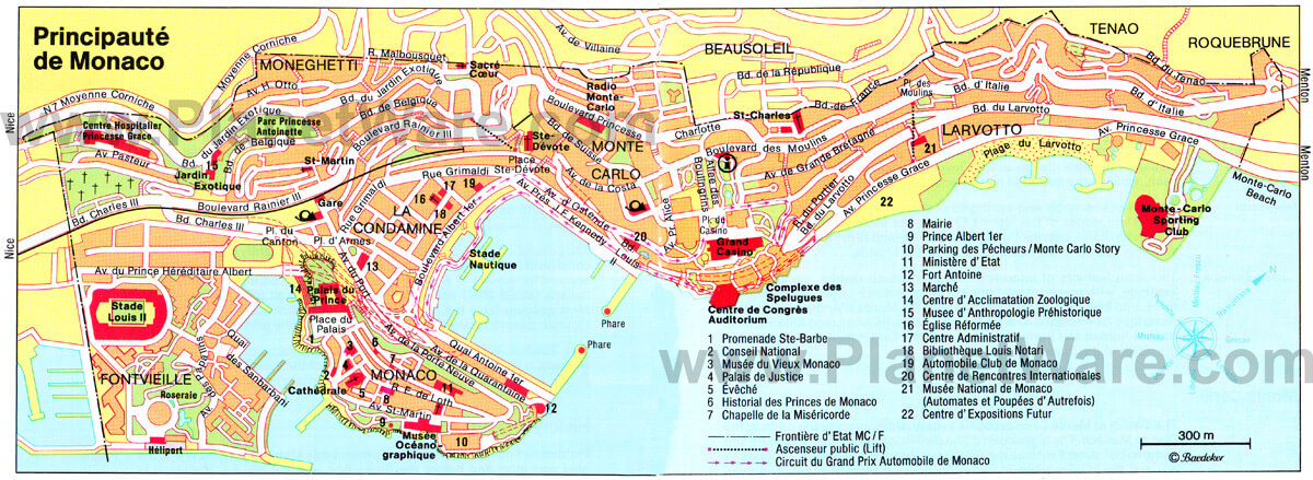
City Map of Monaco
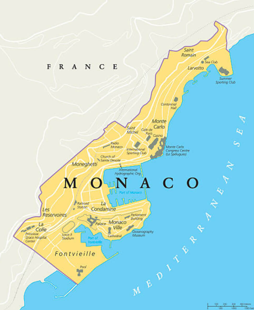
This map shows Monaco’s major districts, including Monte Carlo, Fontvieille, and La Condamine, highlighting famous landmarks such as the Casino, the Prince’s Palace, and the Oceanographic Museum, as well as its scenic coastline along the Mediterranean.
While it may be famous for its wealth and elegance, Monaco is also a tax haven, attracting individuals and businesses with its favorable tax policies. With a population of around 39,000 people, this coastal gem enjoys a mild climate and boasts one of the highest life expectancies in the world, making it a dream destination for tourists and residents alike.
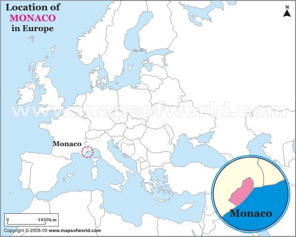
Where is located Monaco on the World Map
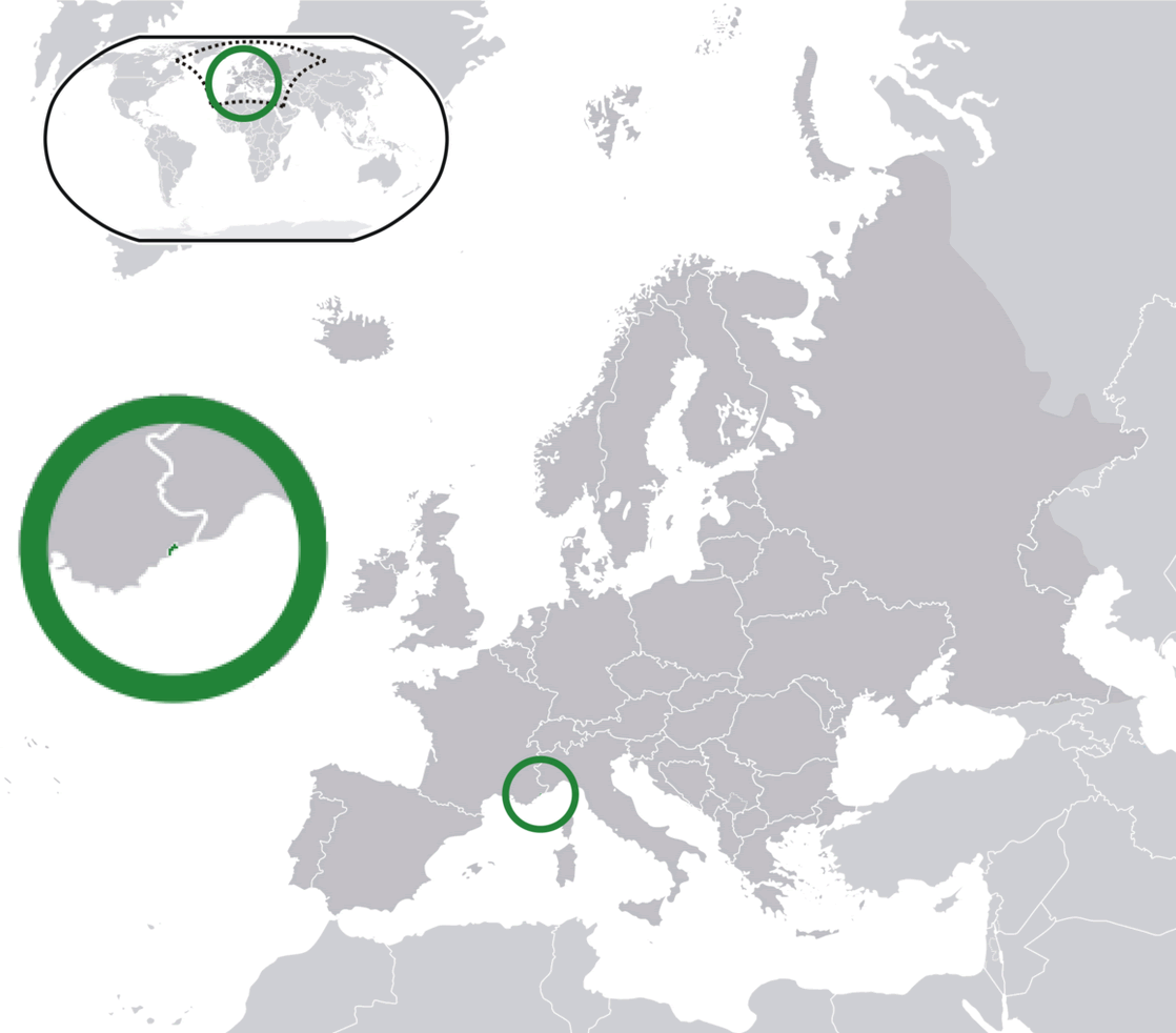
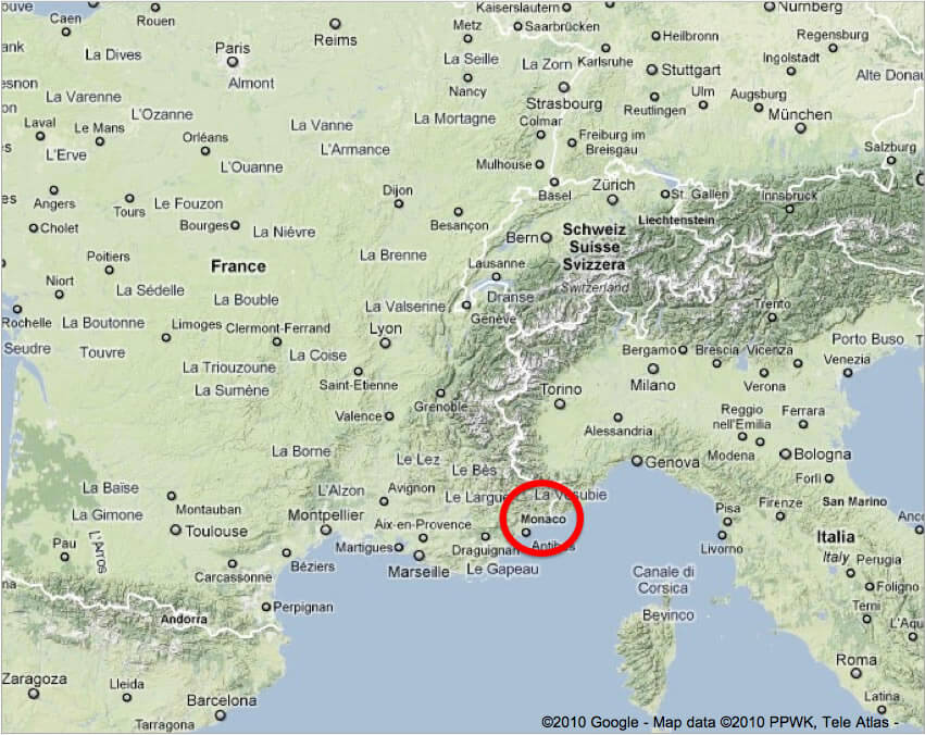
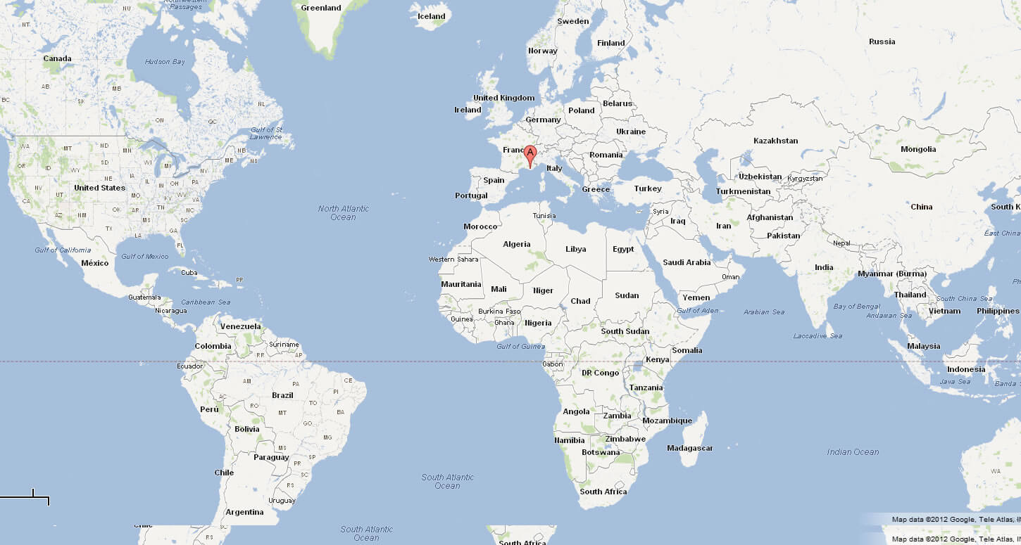
Monaco is located in Western Europe, nestled along the stunning French Riviera, right on the Mediterranean coast. It is bordered by France on three sides and the Mediterranean Sea on the other, making it a prime spot for those who love coastal views and sunny weather. Despite its small size, it’s one of the most recognizable places on the world map thanks to its glamorous reputation.
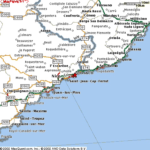
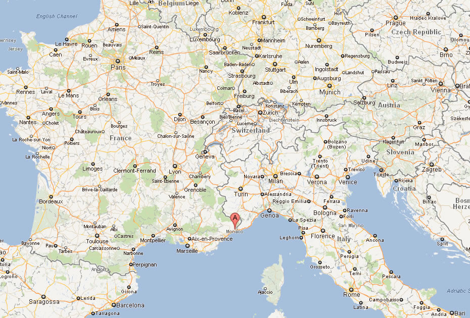
Just a short distance from Italy, Monaco enjoys the perfect location between the French and Italian borders. The nearest major city is Nice, France, which is about 13 kilometers away. This proximity to popular European destinations makes Monaco an easy and attractive stop for travelers exploring the region.
On the world map, you’ll find Monaco tucked in between the Alps and the Mediterranean Sea, offering a blend of mountainous landscapes and sparkling waters. Its small size often requires zooming in on a map, but it holds a big presence in terms of cultural significance and luxury.
Here are some statistical information about Monaco:
City Center Map of Monaco
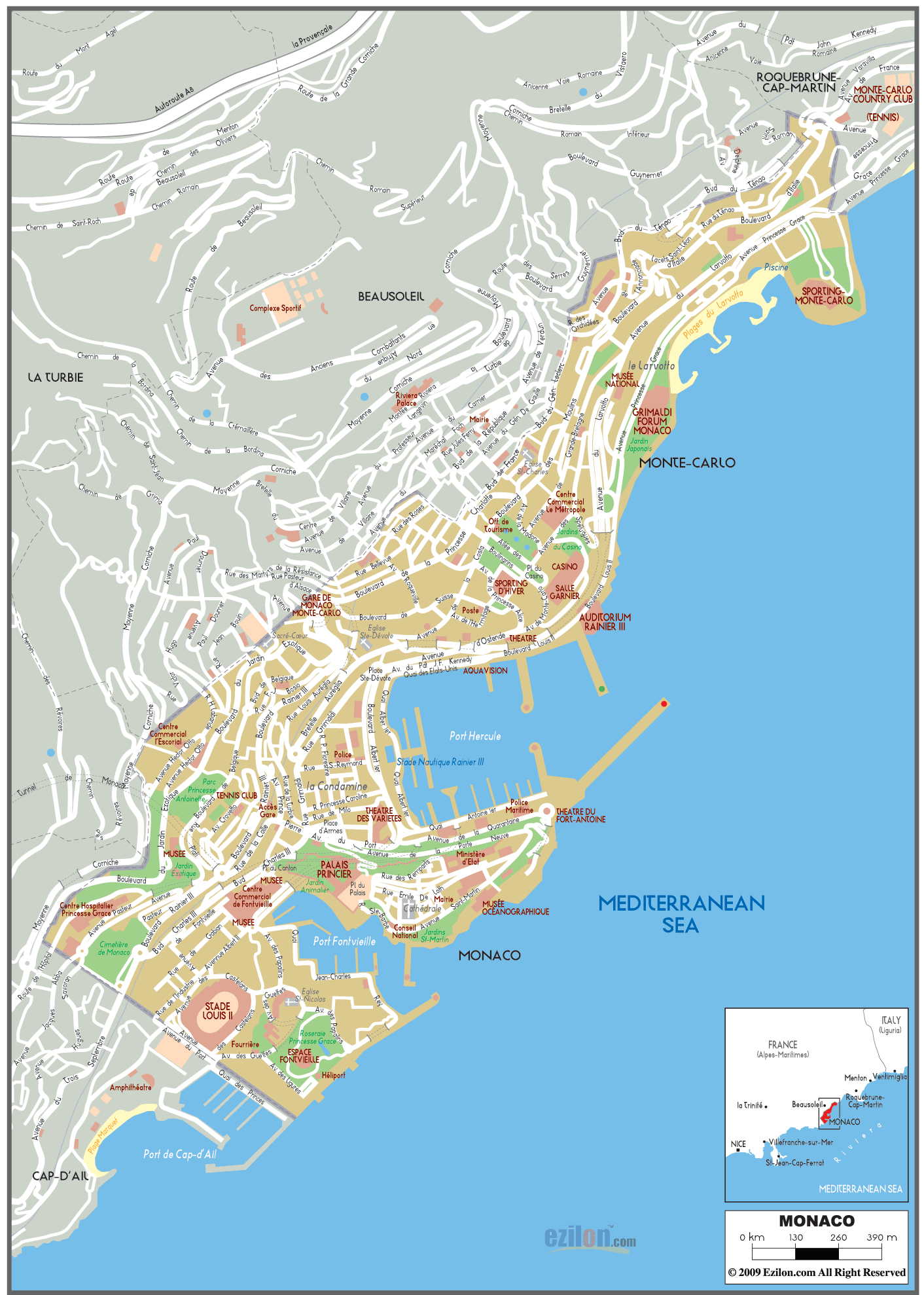
This map provides a detailed view of Monaco, showcasing the main districts such as Monte Carlo, La Condamine, and Fontvieille. It highlights key landmarks like the Casino, the Prince’s Palace, the Oceanographic Museum, and the famous harbor, Port Hercule, all set along the Mediterranean coastline.
Monaco City Center Map
The map illustrates the central areas of Monaco, highlighting key landmarks such as Monte Carlo, the Prince’s Palace, the famous casino, and various cultural sites, all within its compact, scenic layout along the Mediterranean coast.
Monaco Road Map
Physical Map of Monaco
Monaco Map
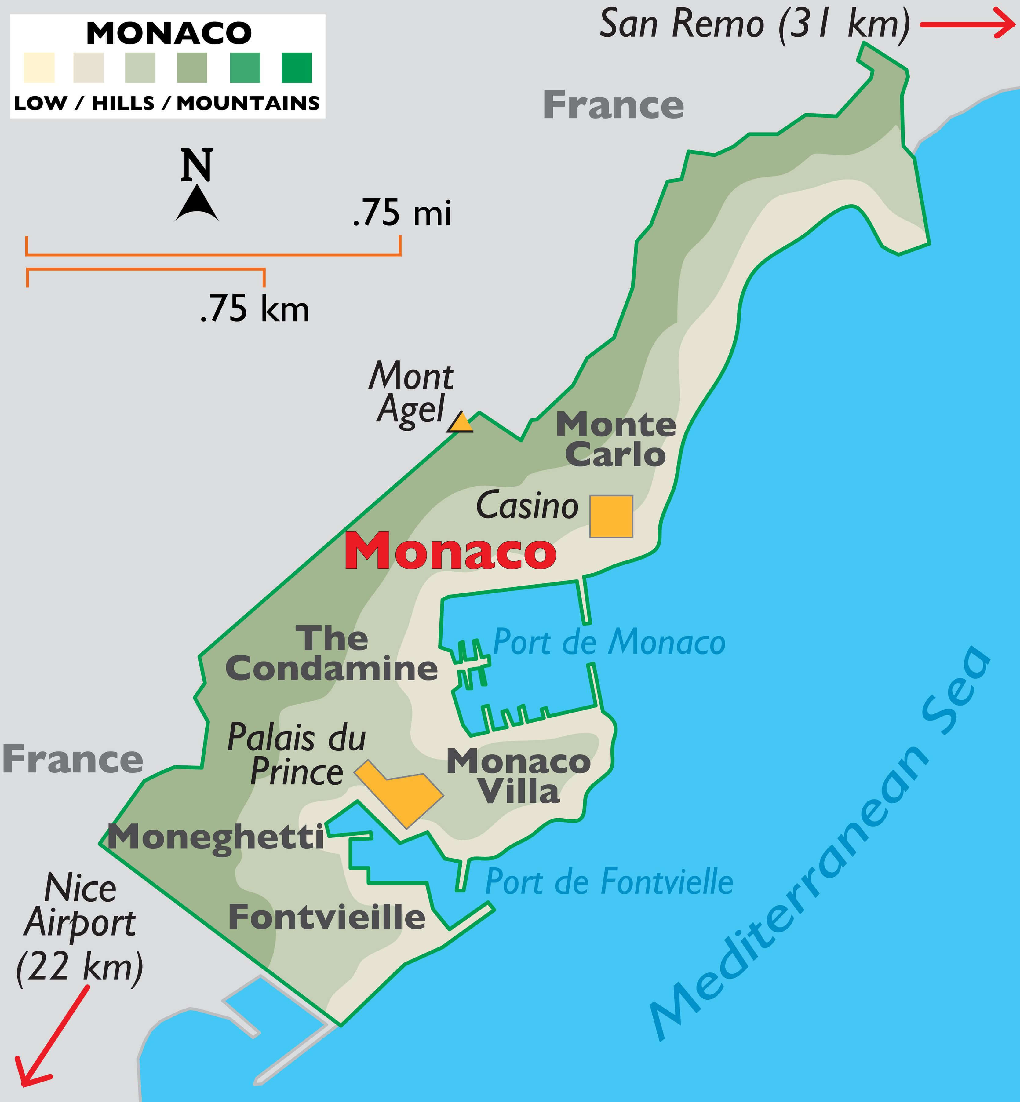 This map of Monaco highlights the country’s compact size, with key landmarks like Monte Carlo, The Condamine, and Fontvieille, all nestled along the Mediterranean Sea. The map shows Monaco’s proximity to France, with nearby locations such as Nice Airport and the French town of San Remo.
Monaco Territorial Extension Map
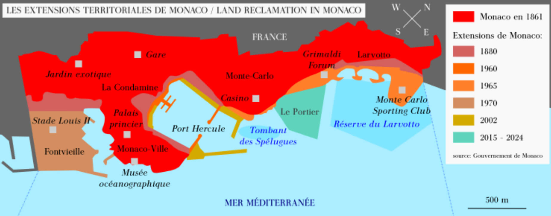 This map illustrates the territorial expansion of Monaco over time, highlighting the phases of land reclamation since 1861. The different shades indicate different periods of growth, including recent projects such as “Le Portier” and extensions between 2015 and 2024. This expansion has allowed Monaco to gain valuable land along the Mediterranean coast, enhancing areas such as Fontvieille, Monte Carlo and the Port Hercule region.
Monaco Political Map
Monaco Monte Carlo Map
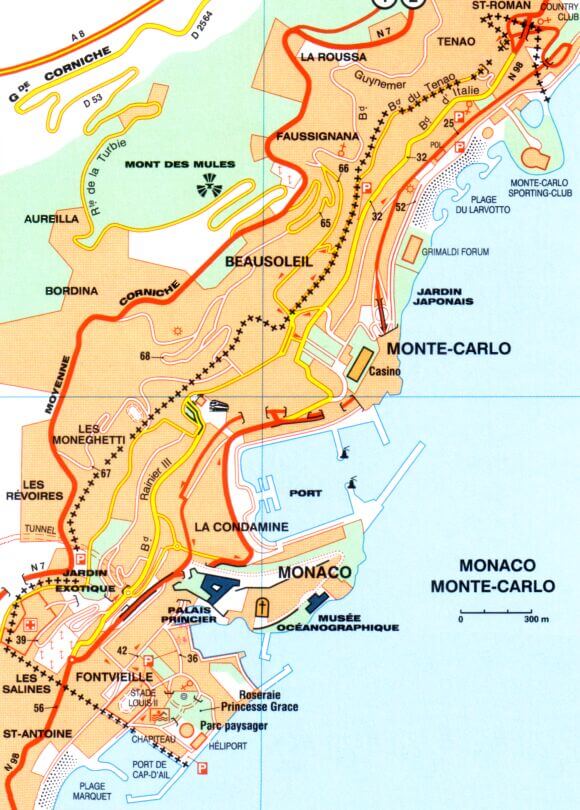
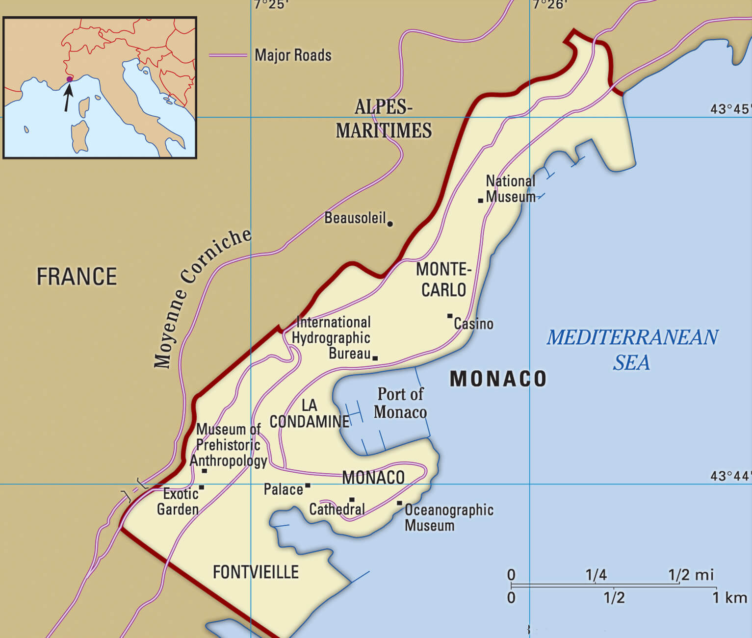 This map of Monaco shows the famous district of Monte Carlo, along with key landmarks such as the Port of Monaco, the Oceanographic Museum and the Casino. It also shows major roads such as the Moyenne Corniche, which connects Monaco to the surrounding French Riviera, emphasising the compact size of the city on the Mediterranean coast.
Monaco Travel Map
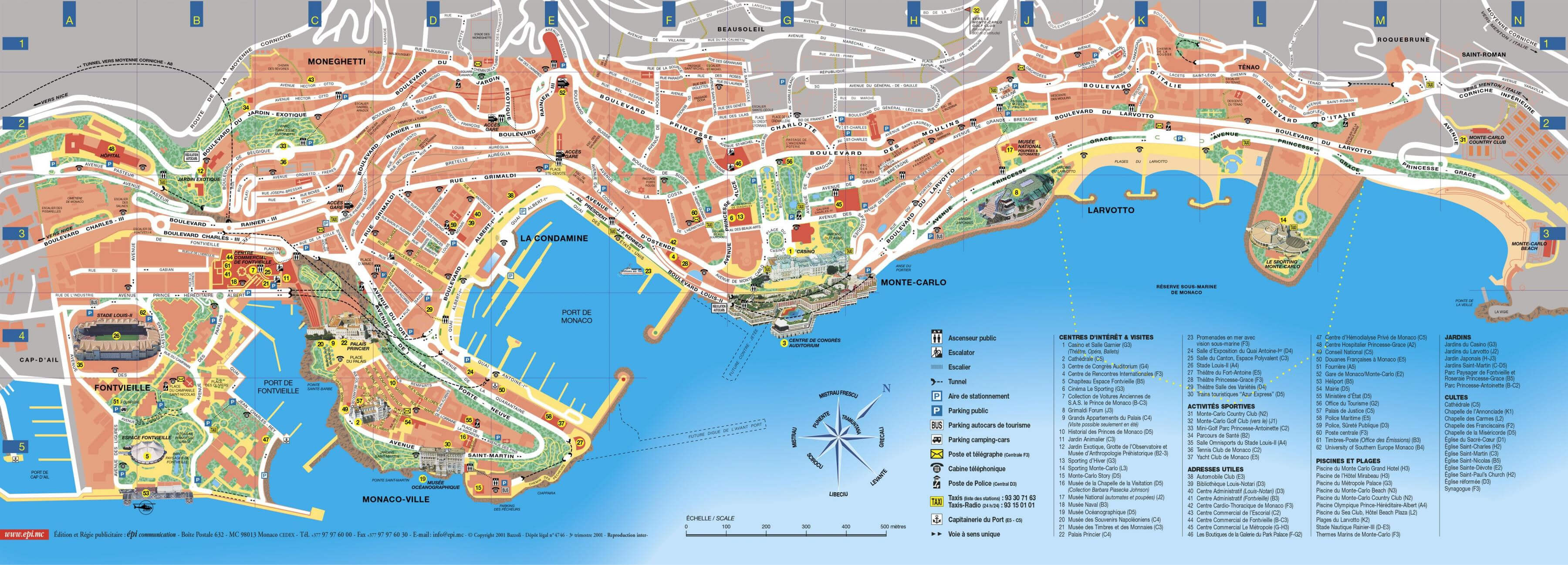 This Monaco travel map highlights key areas and landmarks throughout the Principality, including Monte Carlo, La Condamine, Monaco-Ville and Fontvieille, and features detailed locations such as the Casino, the Prince’s Palace and the Port of Monaco, making it ideal for visitors wanting to explore the city’s attractions and layout.
Monaco Republic of Genoa Map in 1494
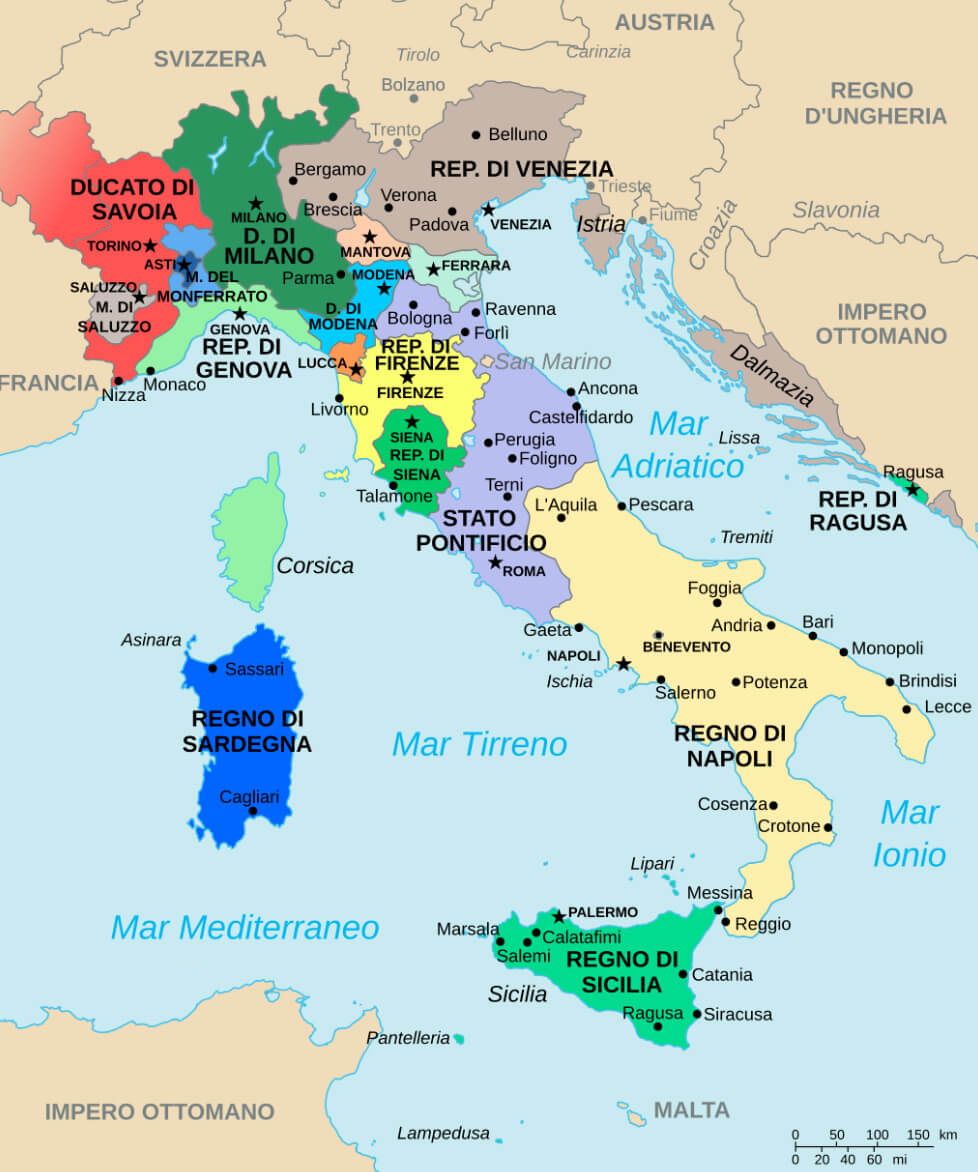 This historical map of the Italian Peninsula in 1494 shows the Republic of Genoa, which included the territory of modern-day Monaco along the Ligurian coast. The map highlights the different states and republics of the time, illustrating the complex political landscape of Italy before its unification, with Genoa being a significant maritime power in the region.
Monaco Kingdom of Sardinia Map in 1860
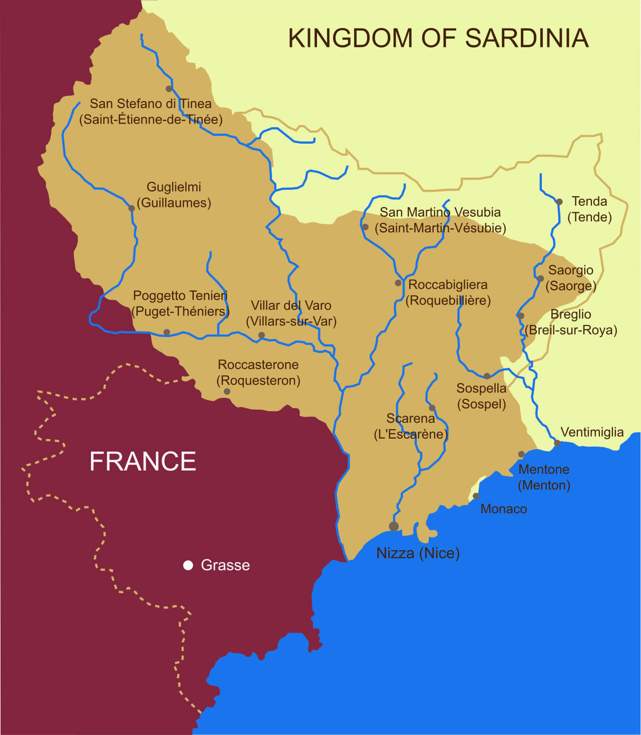 This map of the Kingdom of Sardinia in 1860 illustrates the regions along the border between France and the then Kingdom of Sardinia, including cities such as Monaco, Menton and Nice. The map highlights the transition of territories and the strategic geographical locations of settlements, many of which would soon become part of France following the Treaty of Turin that year.
Monaco Administrative Map
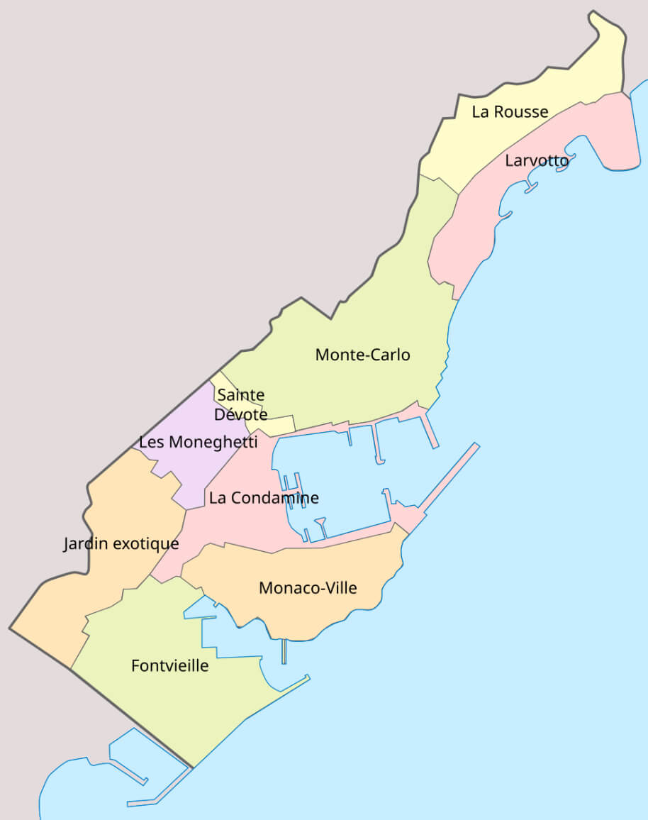 This administrative map of Monaco shows the various districts within the Principality, such as Monte-Carlo, La Condamine, Monaco-Ville and Fontvieille, highlighting the compact and densely populated nature of this Mediterranean city-state.
Monaco Map Europe
Map of Monaco
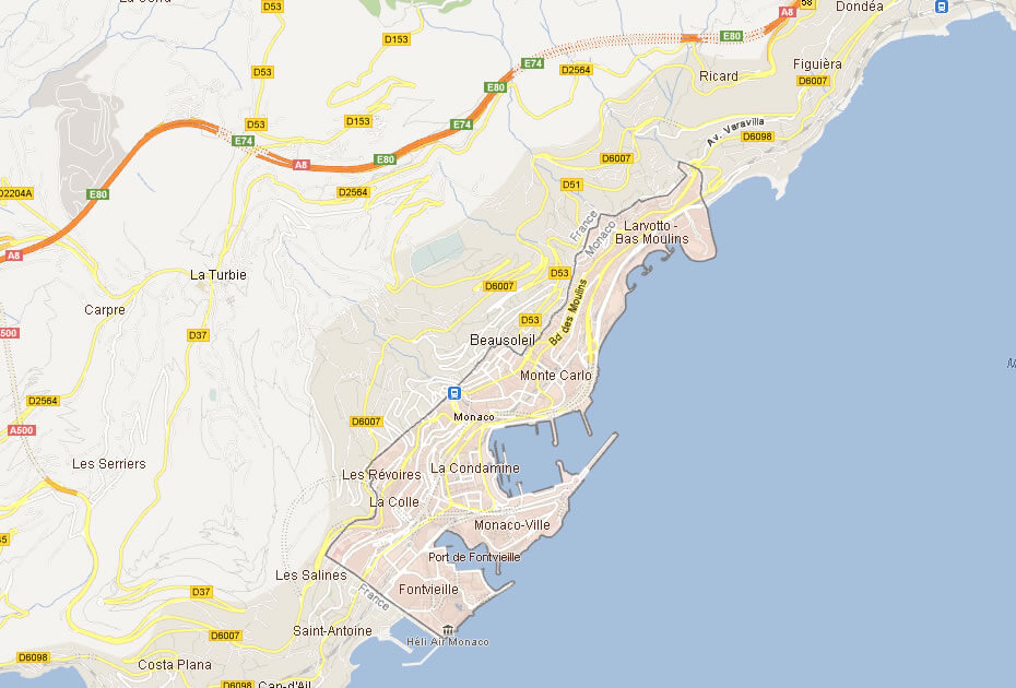
This map highlights Monaco and its surrounding areas, including neighboring regions like Beausoleil and La Turbie. It provides a clear view of the city-state’s compact layout along the Mediterranean Sea, with key areas such as Monte Carlo, La Condamine, and Fontvieille shown near the coastline, and major roads connecting Monaco to nearby towns.
Map of Monaco France
Map of Monaco World
Monaco Earth Map
Where is Monaco on the Europe Map?
Show Google map, satellite map, where is the country located.
Get directions by driving, walking, bicycling, public transportation and travel with street view.
div>Feel free to explore these pages as well:
- France Map ↗️
- Discovering Angers: The Gem of France’s Loire Valley ↗️ ↗️
- France Map Collection ↗️
- Top 10 Destinations in France ↗️
- Map of France ↗️
- Nice’s Top 10 Attractions for Every Traveler ↗️
- Europe Map ↗️
- Map of Europe ↗️
- A Collection of Europe Maps ↗️
- France Map ↗️
- Map of Spain ↗️
- Italy Map ↗️
- Ireland Map ↗️
- Political Map of the World ↗️
- United Kingdom Map ↗️
- Israel Map ↗️
- Germany Map ↗️
- Turkey Map ↗️
- Map of Sweden ↗️
- Map of Portugal ↗️
- Poland Map ↗️
- Switzerland Map ↗️
- Belgium Map ↗️
- Norway Map ↗️
- Finland Map ↗️