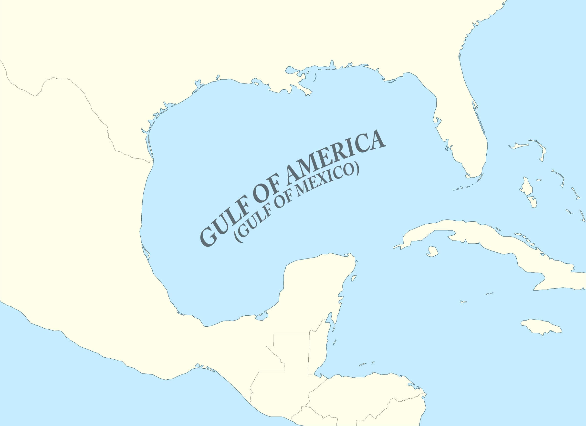
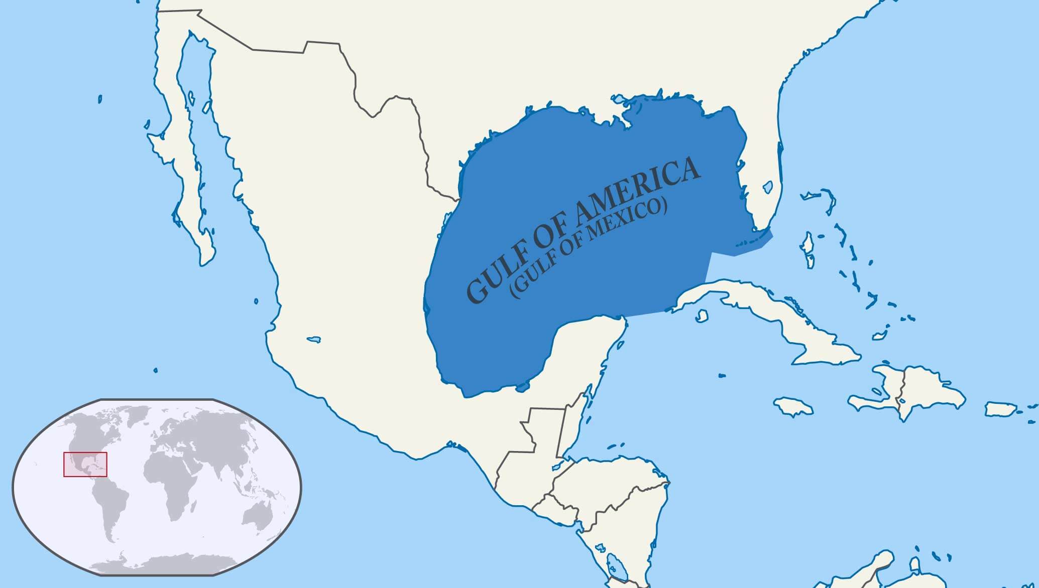
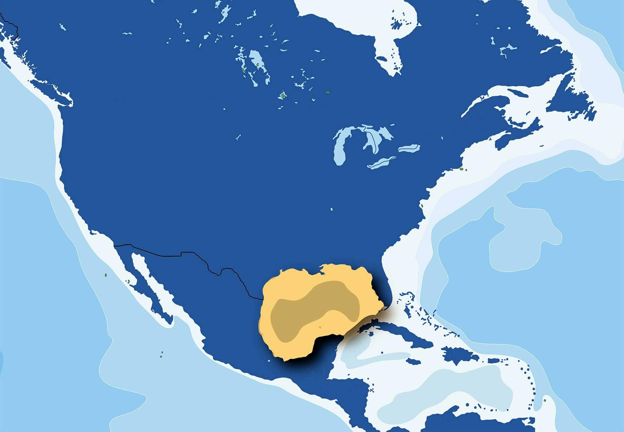
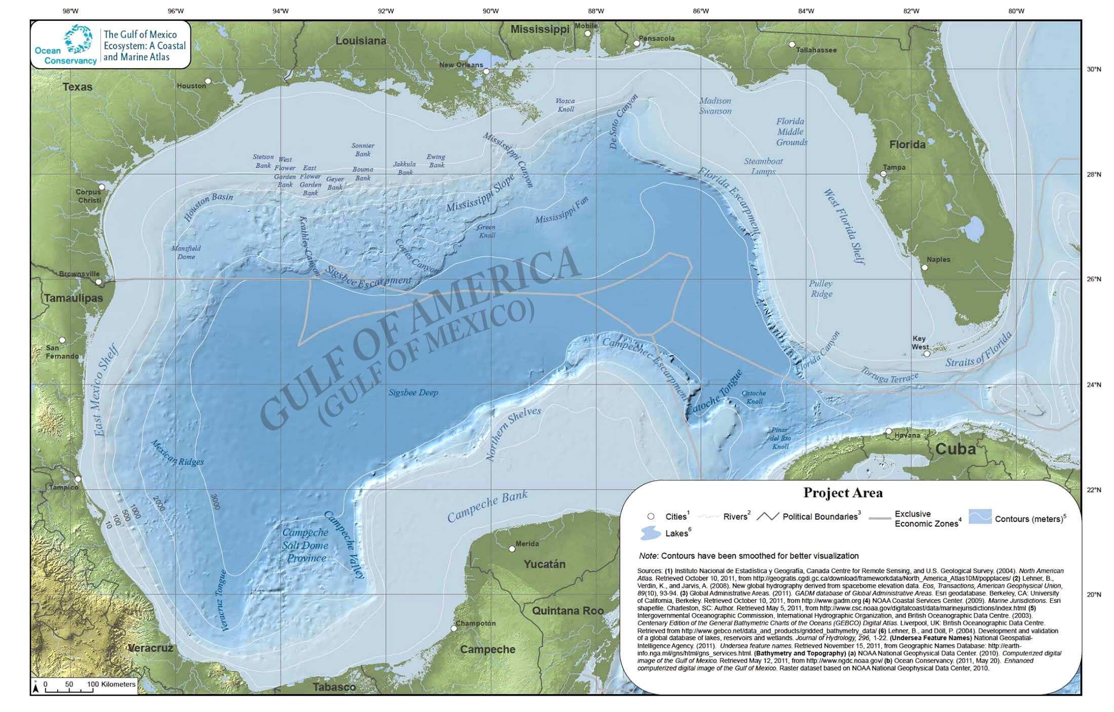
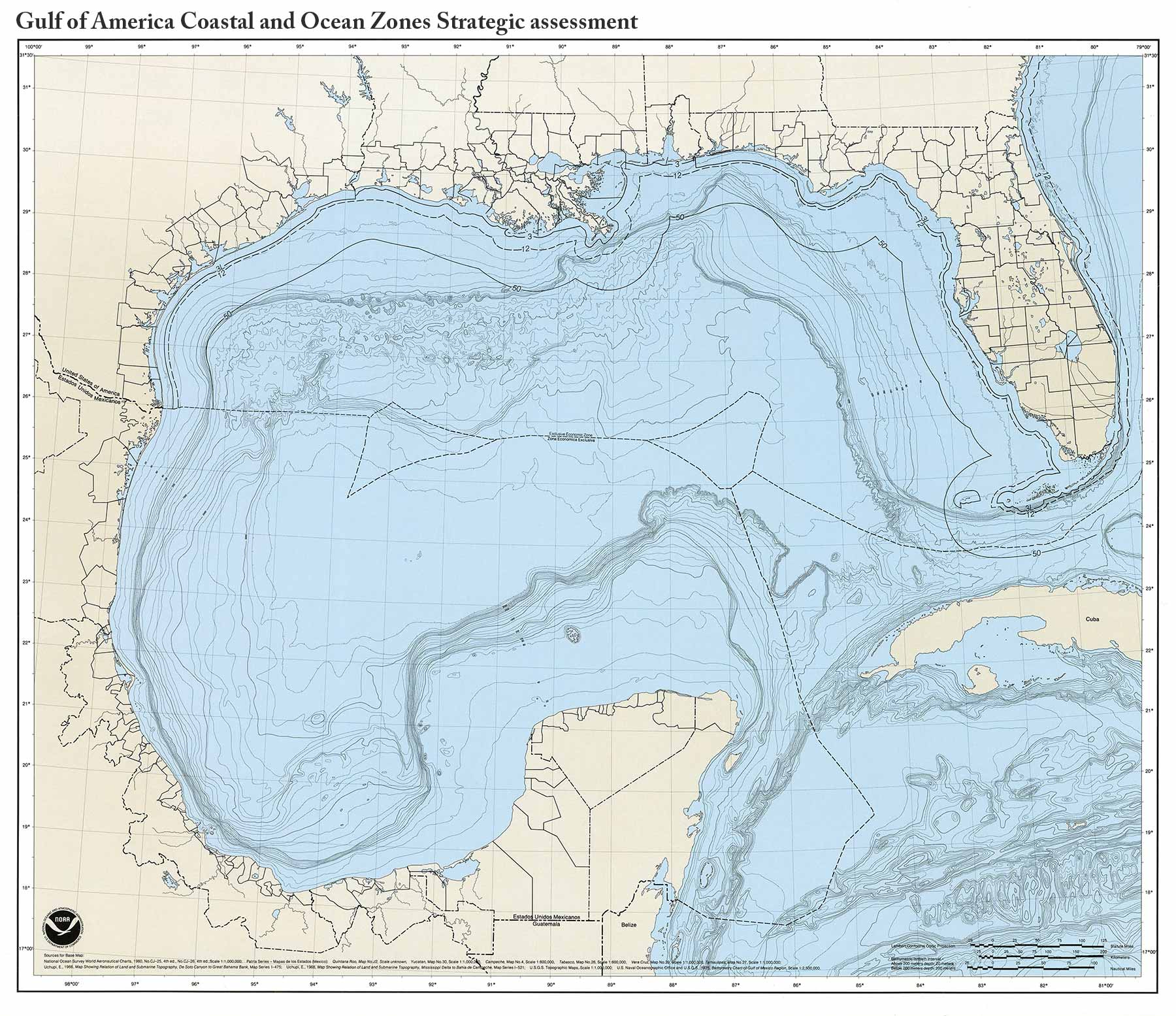
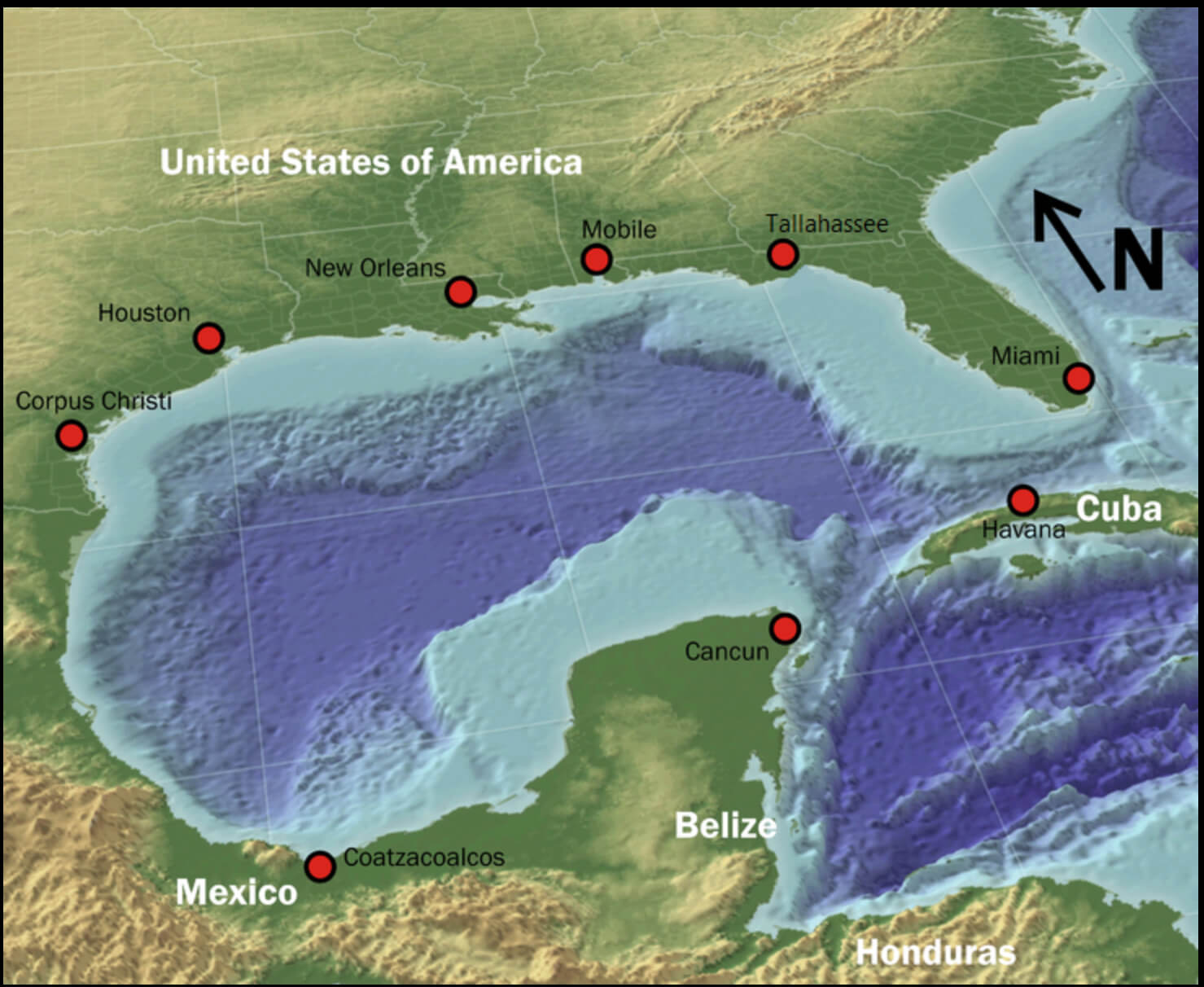
A Collection of The Gulf of America Maps (The Gulf of Mexico); The Gulf of Mexico (Spanish: Golfo de México) is a large ocean basin and marginal sea of the Atlantic Ocean, bordered primarily by the North American continent. It is bounded to the northeast, north and northwest by the Gulf Coast of the United States, to the southwest and south by the Mexican states of Tamaulipas, Veracruz, Tabasco, Campeche, Yucatán and Quintana Roo, and to the southeast by Cuba. The southern US states of Texas, Louisiana, Mississippi, Alabama and Florida have coastal areas along their coastlines.
Gulf of America Mexico topographic map
In 2025, US President Donald Trump issued Executive Order 14172, directing the Secretary of the Interior to rename the US portion of the Gulf as the Gulf of America. This order specifically applies to the region of the continental shelf extending seaward to the borders of Mexico and Cuba.
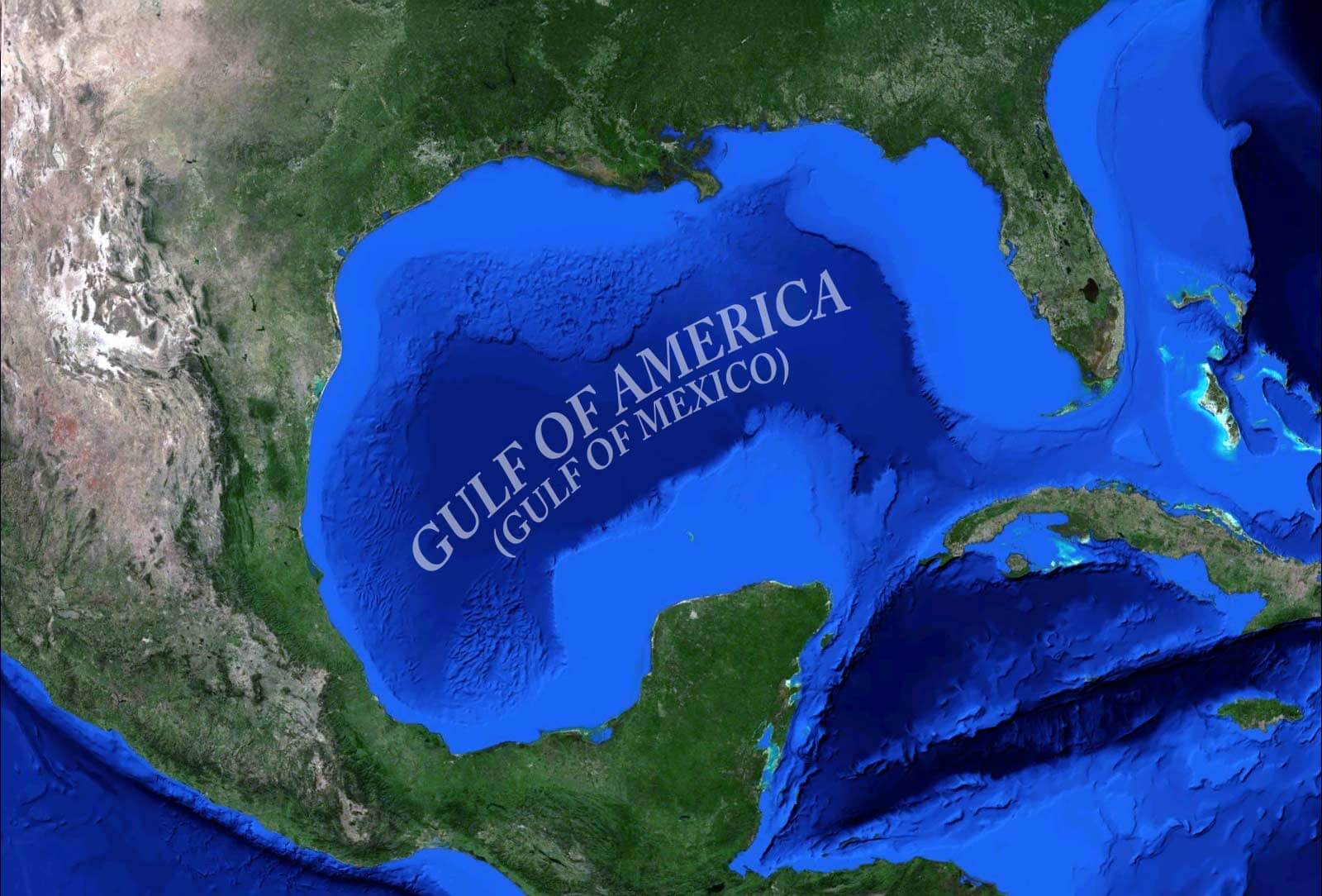
Gulf of America Mexico earth satellite map
The name displayed for this body of water on Google Maps may change depending on the user’s geographic location.
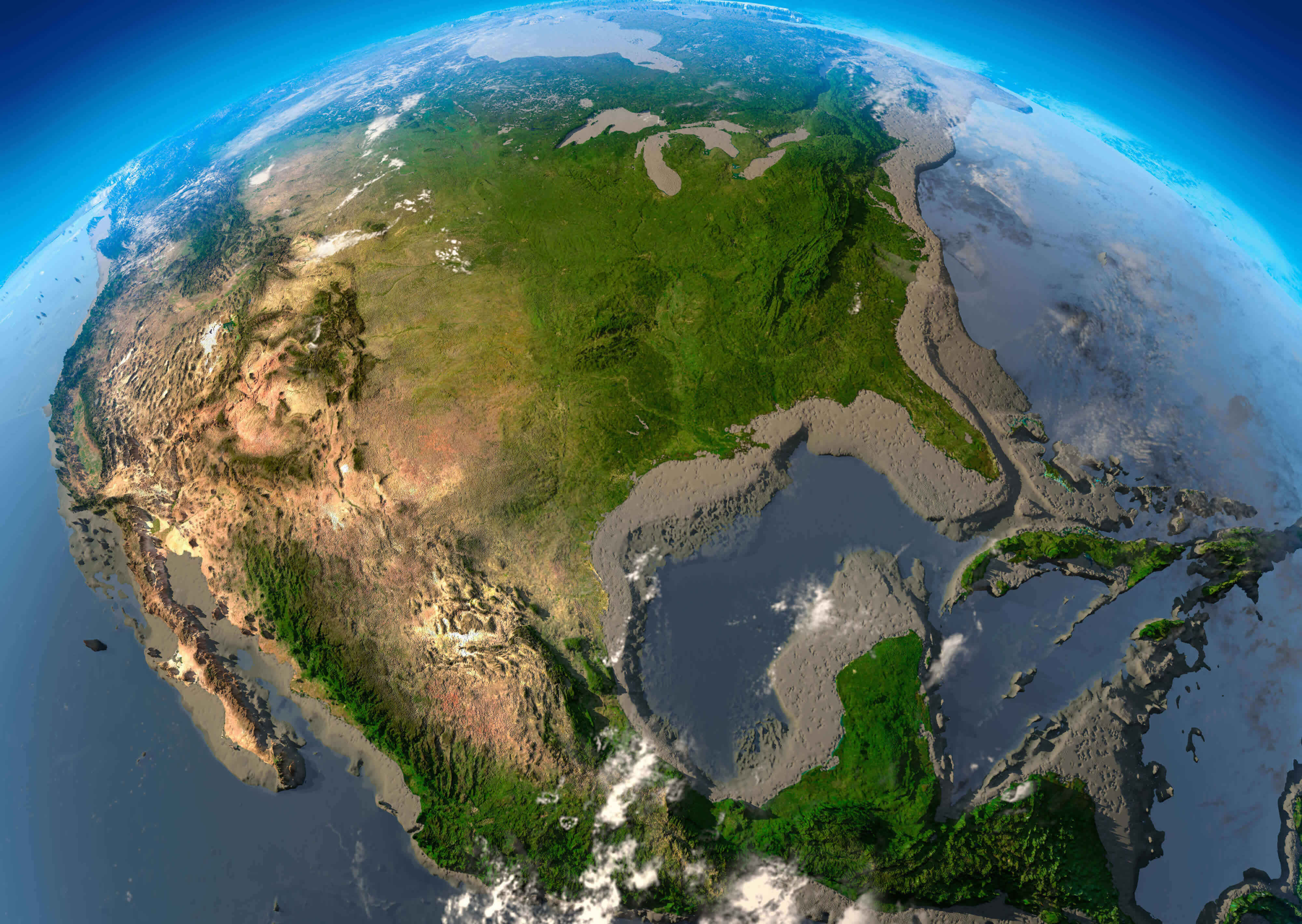
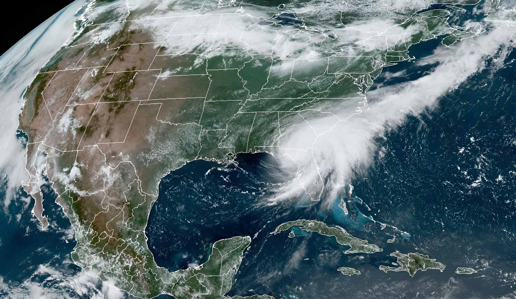
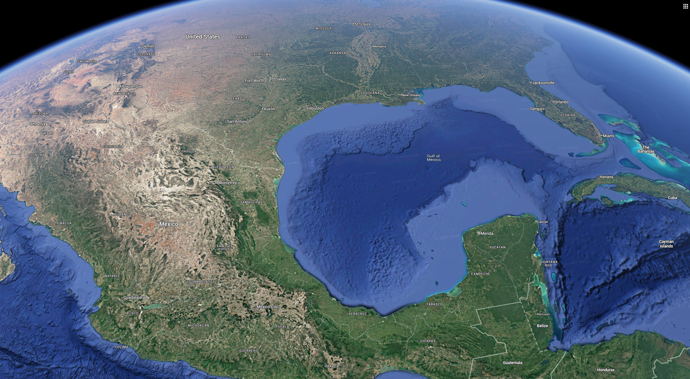
US Mexico and Gulf of America map from space
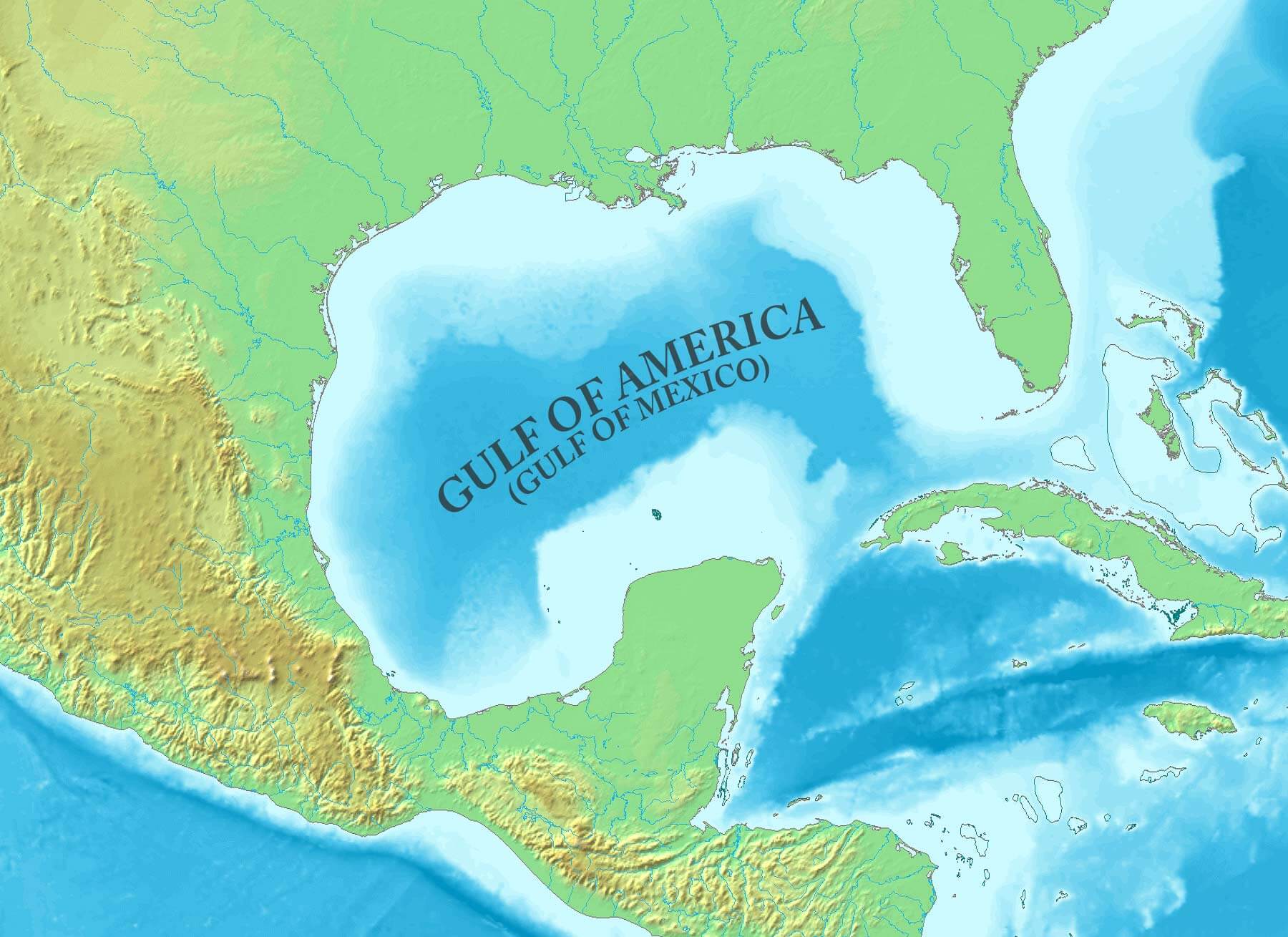
Gulf of Mexico terrain map
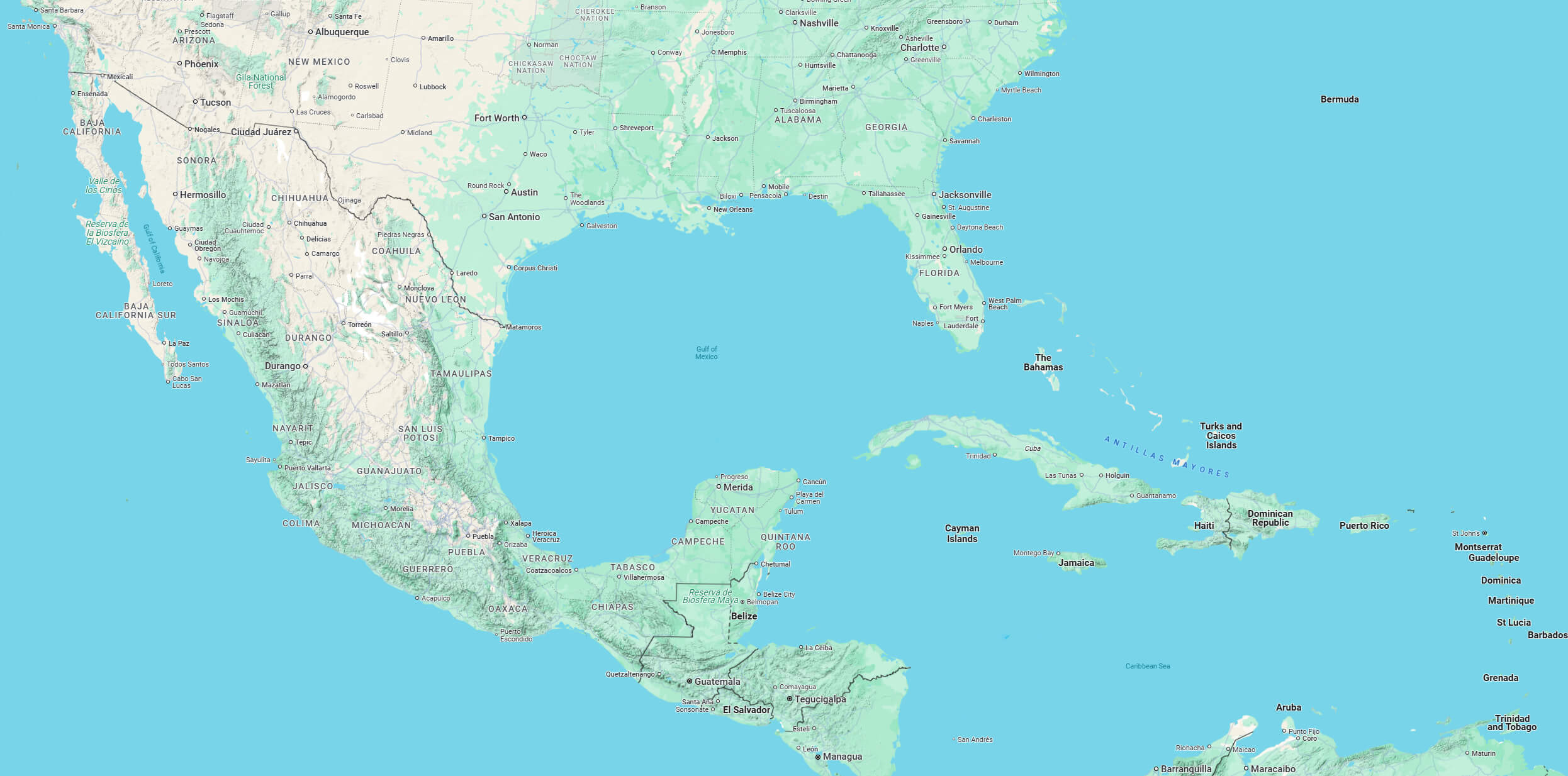
The five US states bordering the Gulf have a total population of 67 million, of which 15.8 million live in coastal counties directly bordering the Gulf.
Satellite image map of america gufl mexico
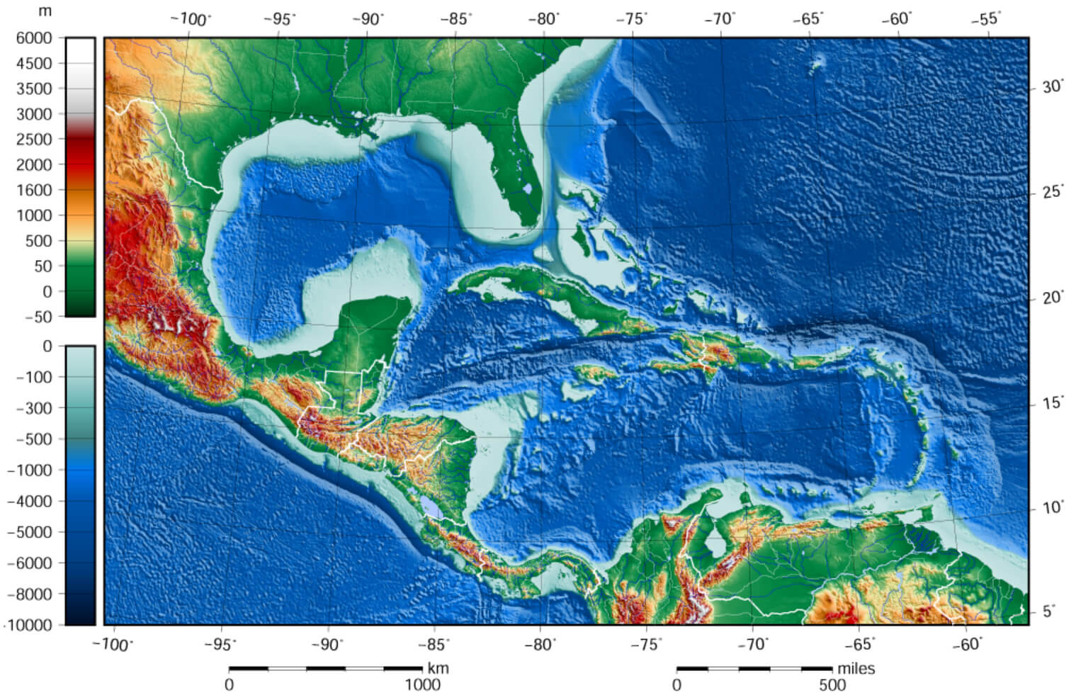
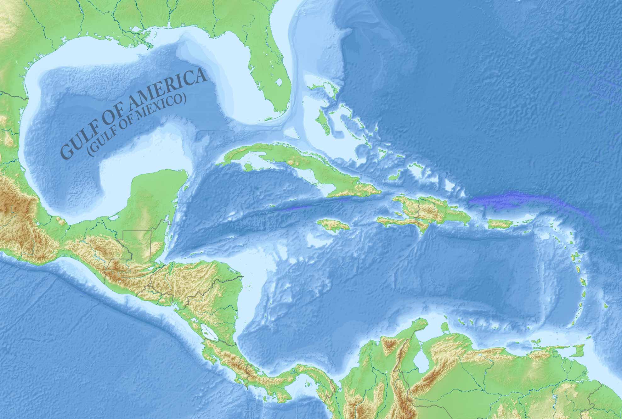
Relief map of the Gulf of Mexico and the Caribbean Islands
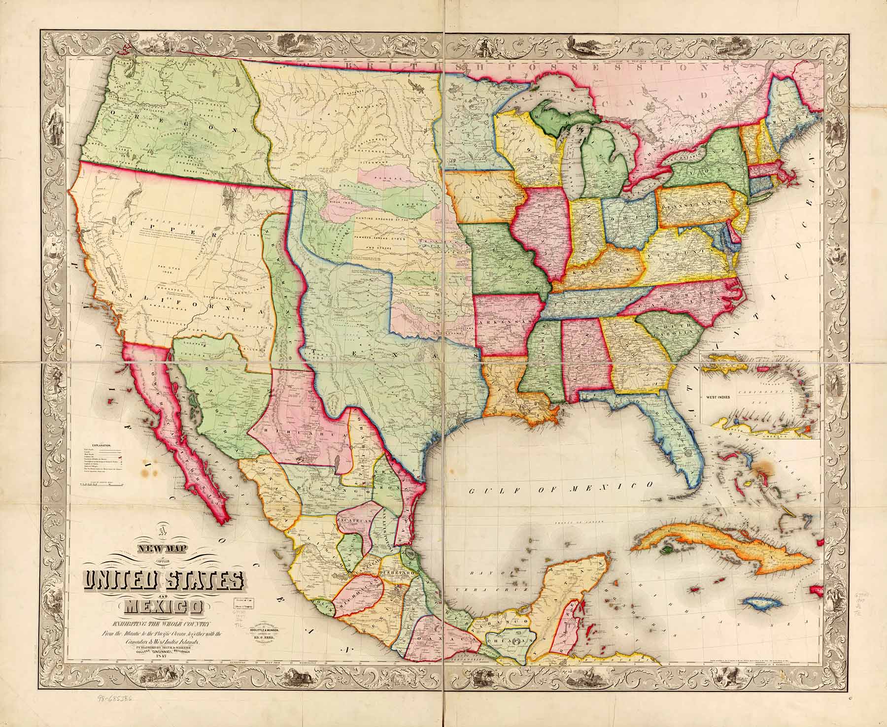
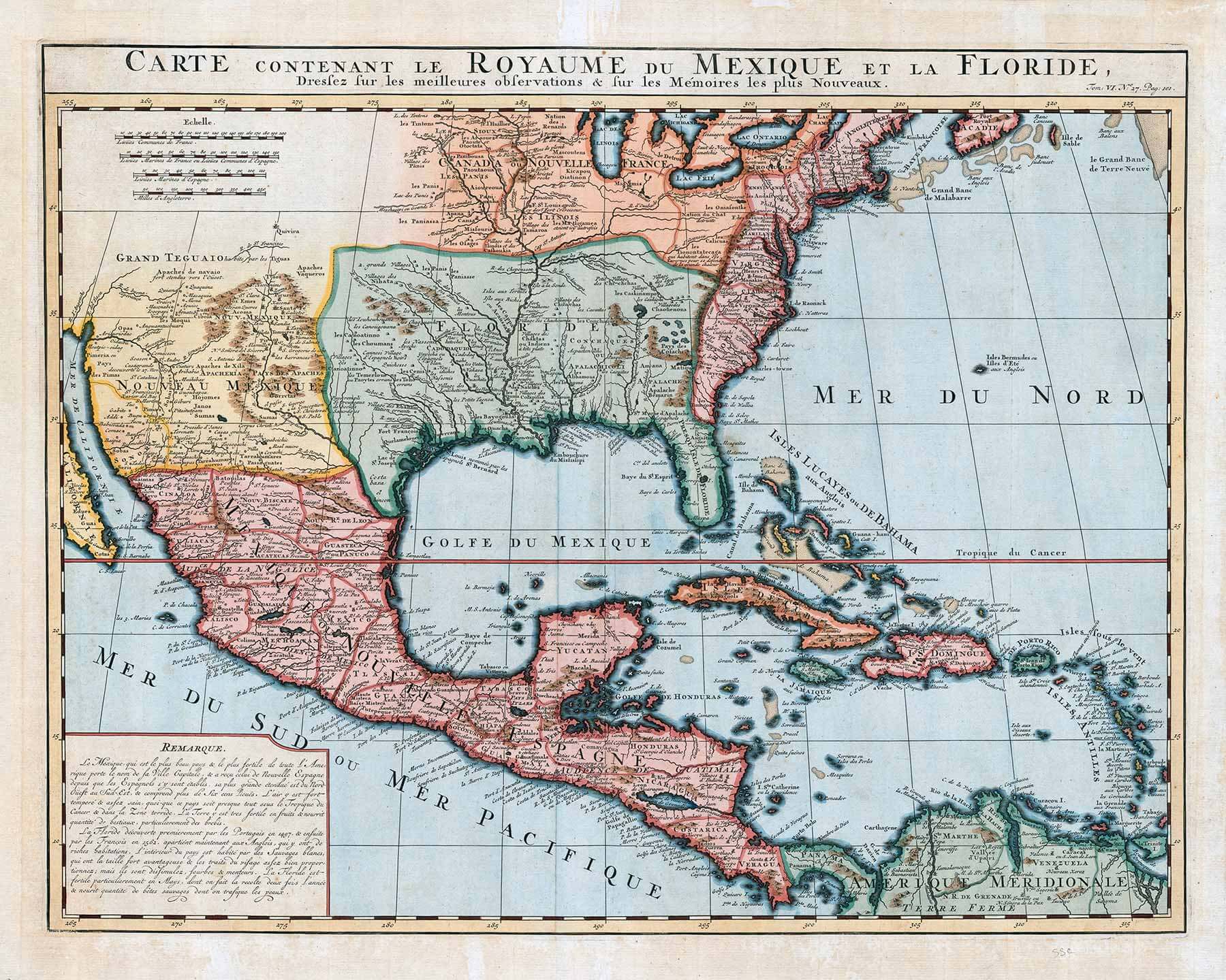
Gulf of America Mexico and US historical map 1847
Gulf of America Mexico blank map
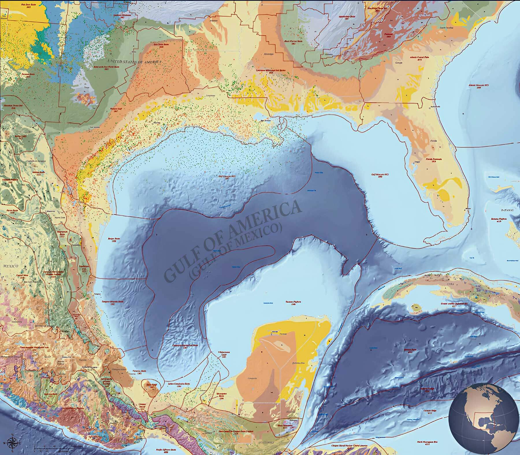
Gulf of America Mexico geology map oil and gas fields
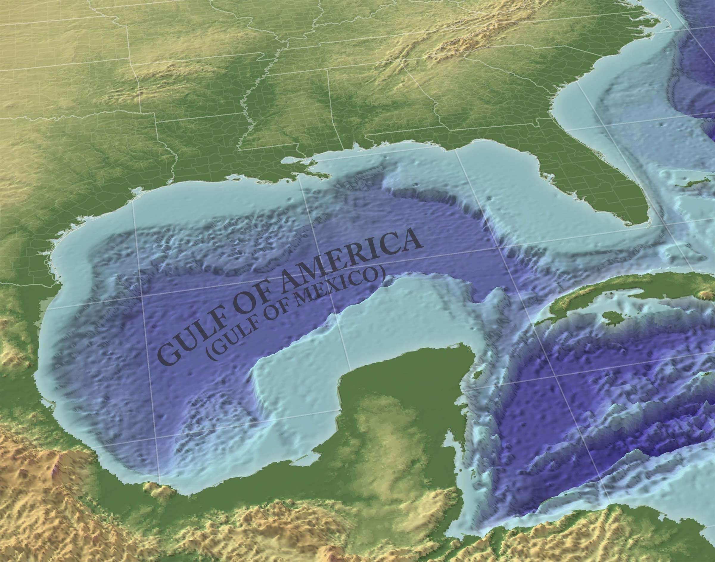
Gulf of America Mexico gulf 3d perspective map
Gulf of America Mexico historical map 1732
Gulf of America Mexico historical map
Gulf of America Mexico location map with regions
Gulf of America Mexico location of america blank map
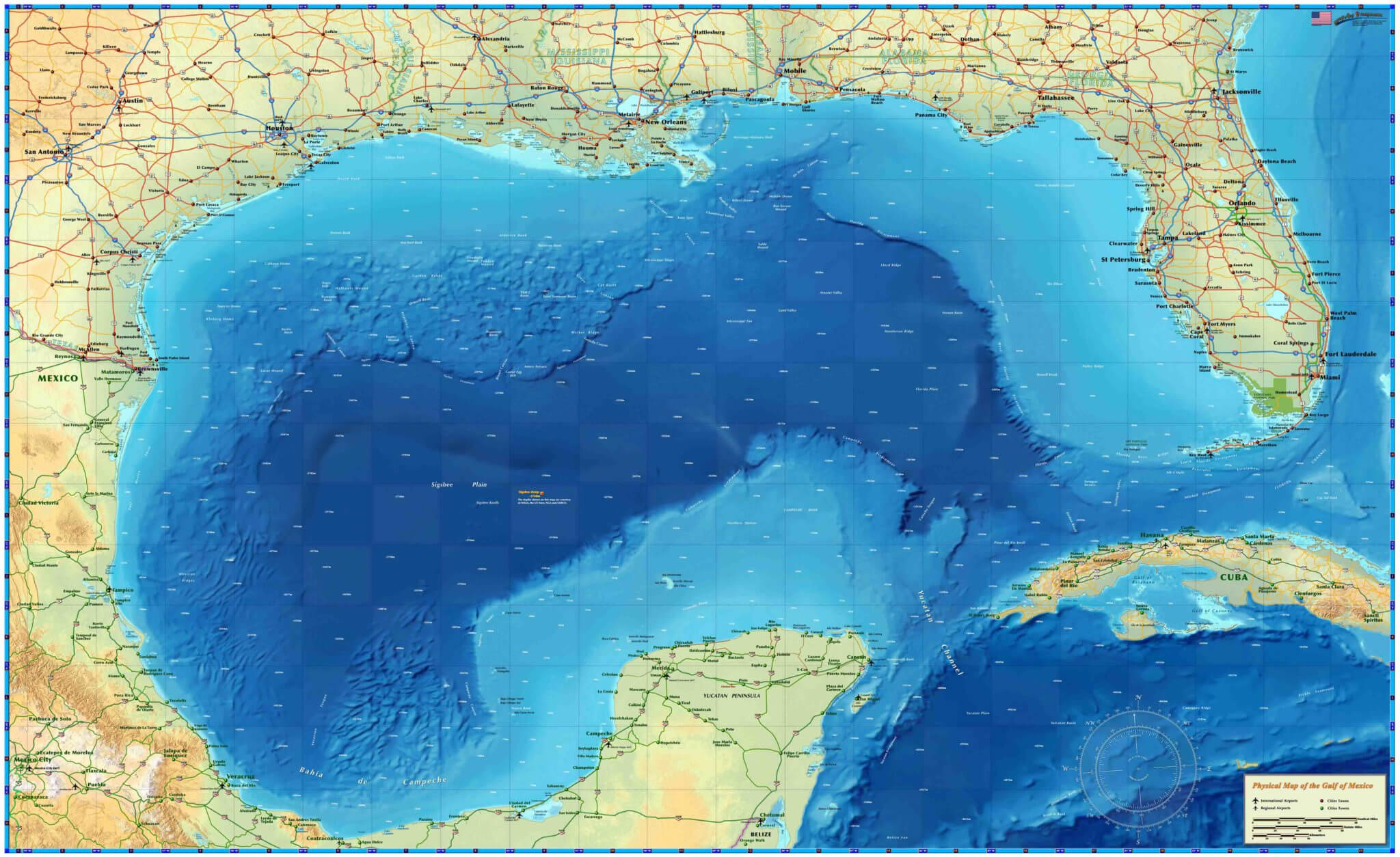
Gulf of America Mexico physical map
Gulf of America Mexico political boundaries and maritime zones map
Gulf of America Mexico relief map
Gulf of Mexico map
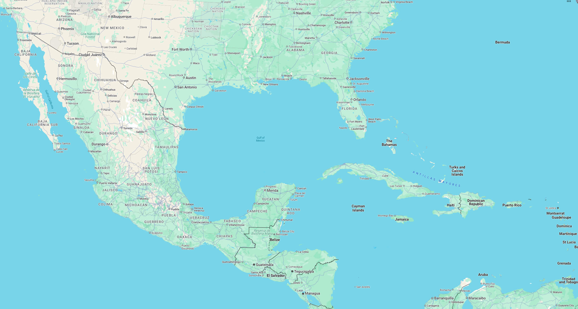
Gulf of Mexico satellite map
Gulf of Mexico US and Mexico political map
Map of Gulf of Mexico
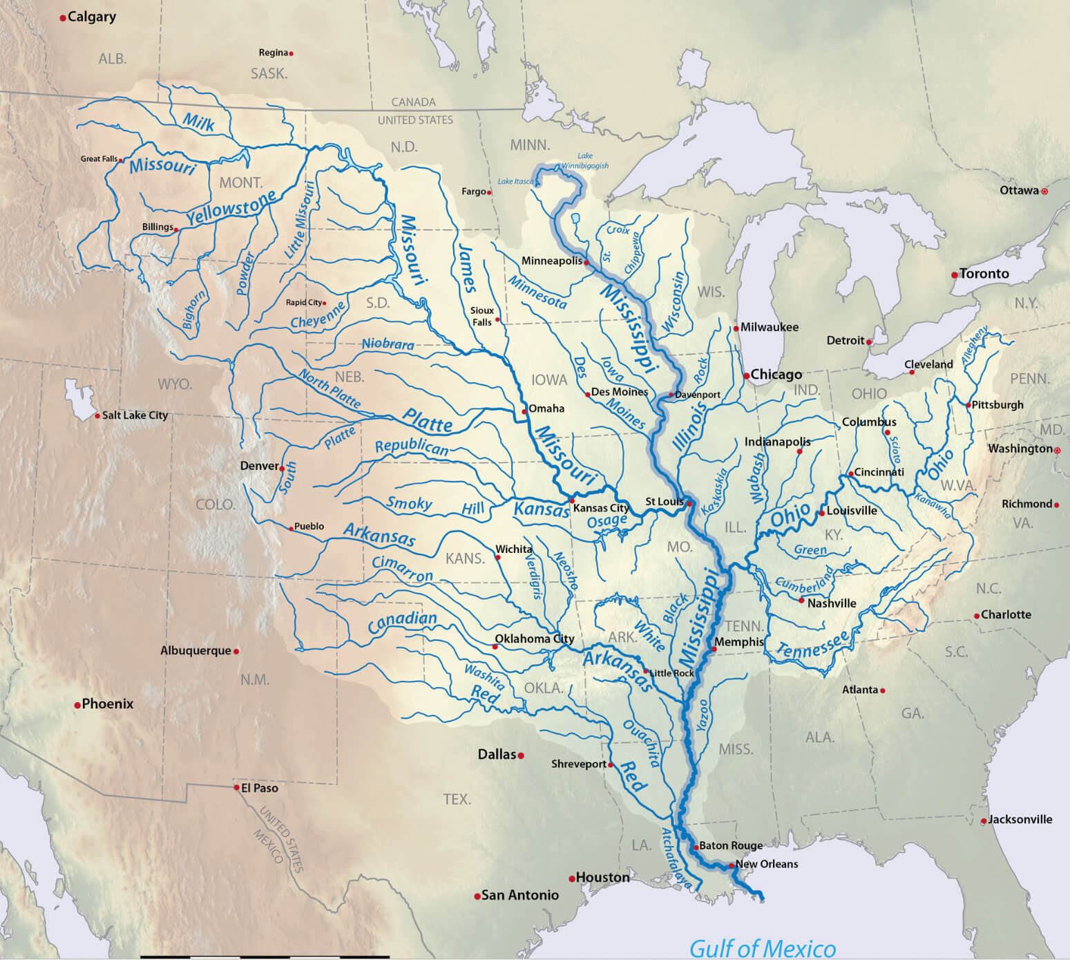
Mississippi river watershed and Gulf of Mexico map USA
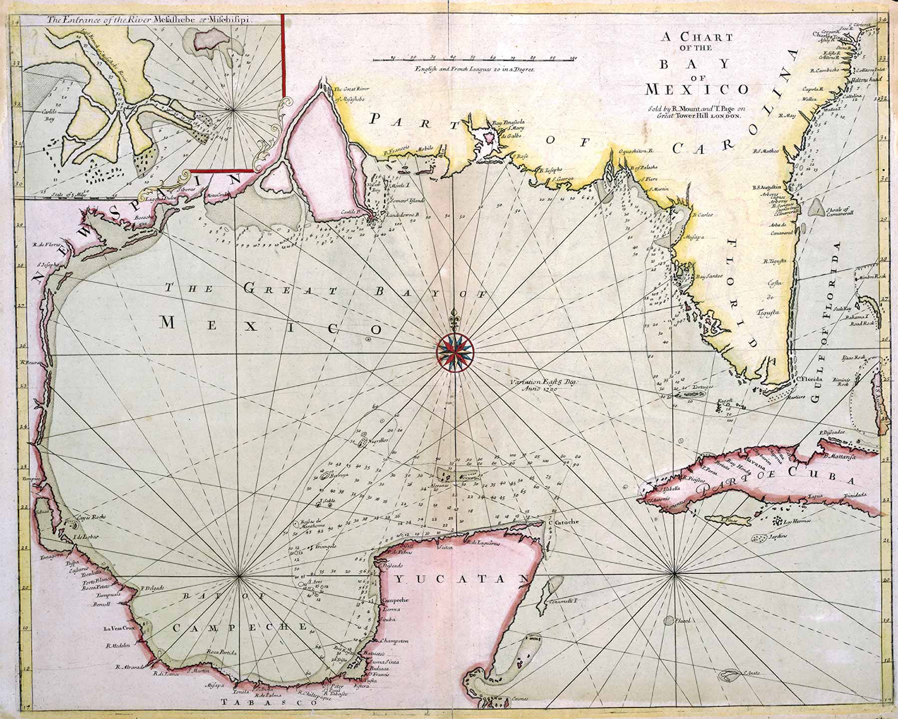
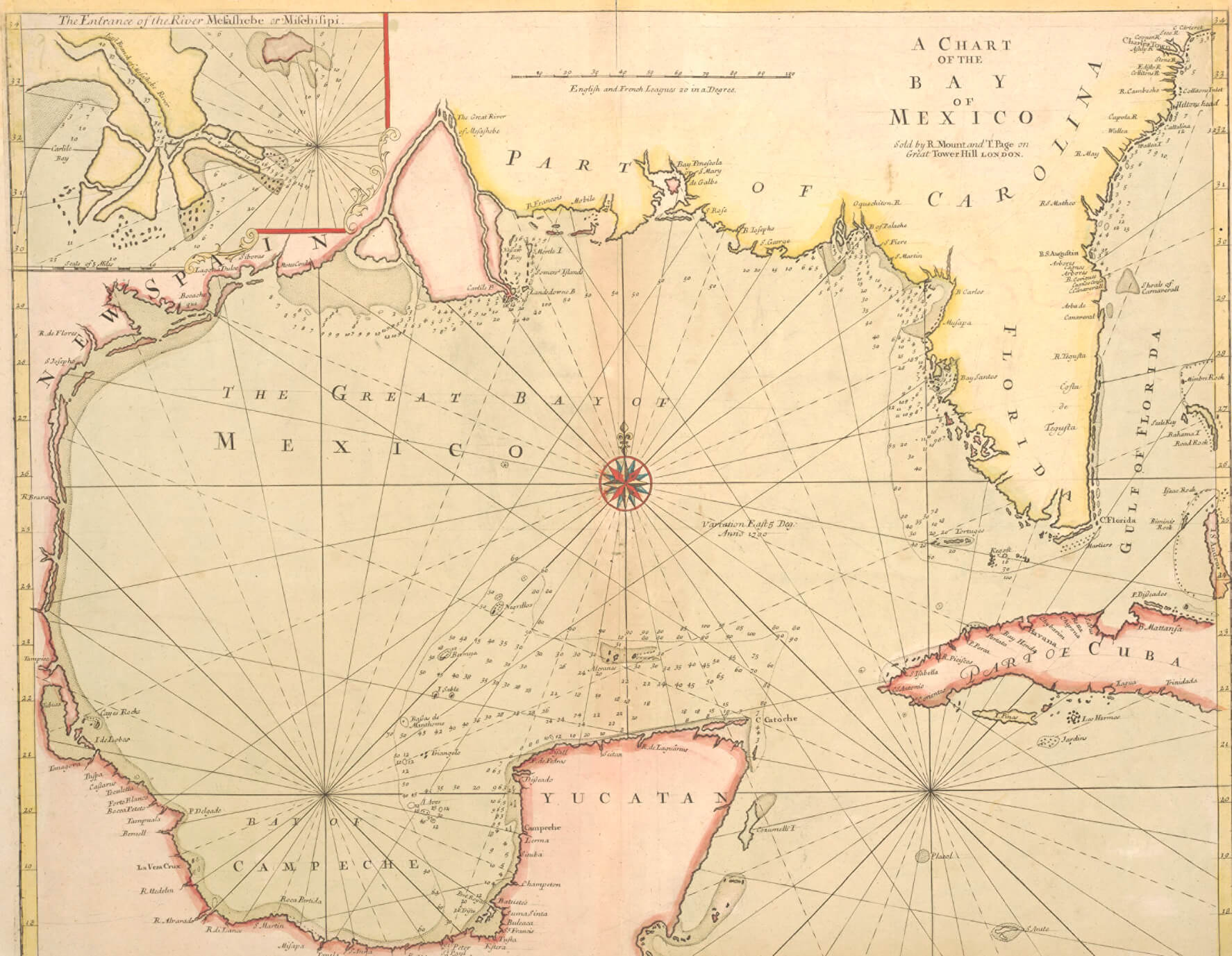
The great bay of Mexico map 1700
Where is Gulf of America (Gulf of Mexico) on the World Map?
Show Google interactive map, satellite map, where is the country located.
Get directions by driving, walking, bicycling, public transportation and travel with street view.
Feel free to explore US states maps:
- United States Map ↗️
- Map of United States ↗️
- US Population Map ↗️
- California Map ↗️
- Texas Map ↗️
- New York Map ↗️
- Florida Map ↗️
- Illinois Map ↗️
- Pennsylvania Map ↗️
- Ohio Map ↗️
- Michigan Map ↗️
- Georgia Map ↗️
- New Jersey Map ↗️
- North Carolina Map ↗️
- Virginia Map ↗️
- Massachusetts Map ↗️
- Indiana Map ↗️
- Tennessee Map ↗️
- Arizona Map ↗️
- Missouri Map ↗️
- Maryland Map ↗️
- Washington Map ↗️
- Minnesota Map ↗️
- Colorado Map ↗️
- Alabama Map ↗️
- Louisiana Map ↗️
- South Carolina Map ↗️
- Kentucky Map ↗️
- Oregon Map ↗️
- Oklahoma Map ↗️
- Connecticut Map ↗️
- Iowa Map ↗️
- Mississippi Map ↗️
- Arkansas Map ↗️
- Kansas Map ↗️
- Utah Map ↗️
- Nevada Map ↗️
- Illinois Map ↗️
- North America Map ↗️
- Map of North America ↗️