Explore Wales with detailed maps showing its location in the UK and Europe. Explore political, physical and geographical maps including cities, regions, satellite views, topography, demographics and language distribution in this culturally rich part of the UK.
Political Map of Wales
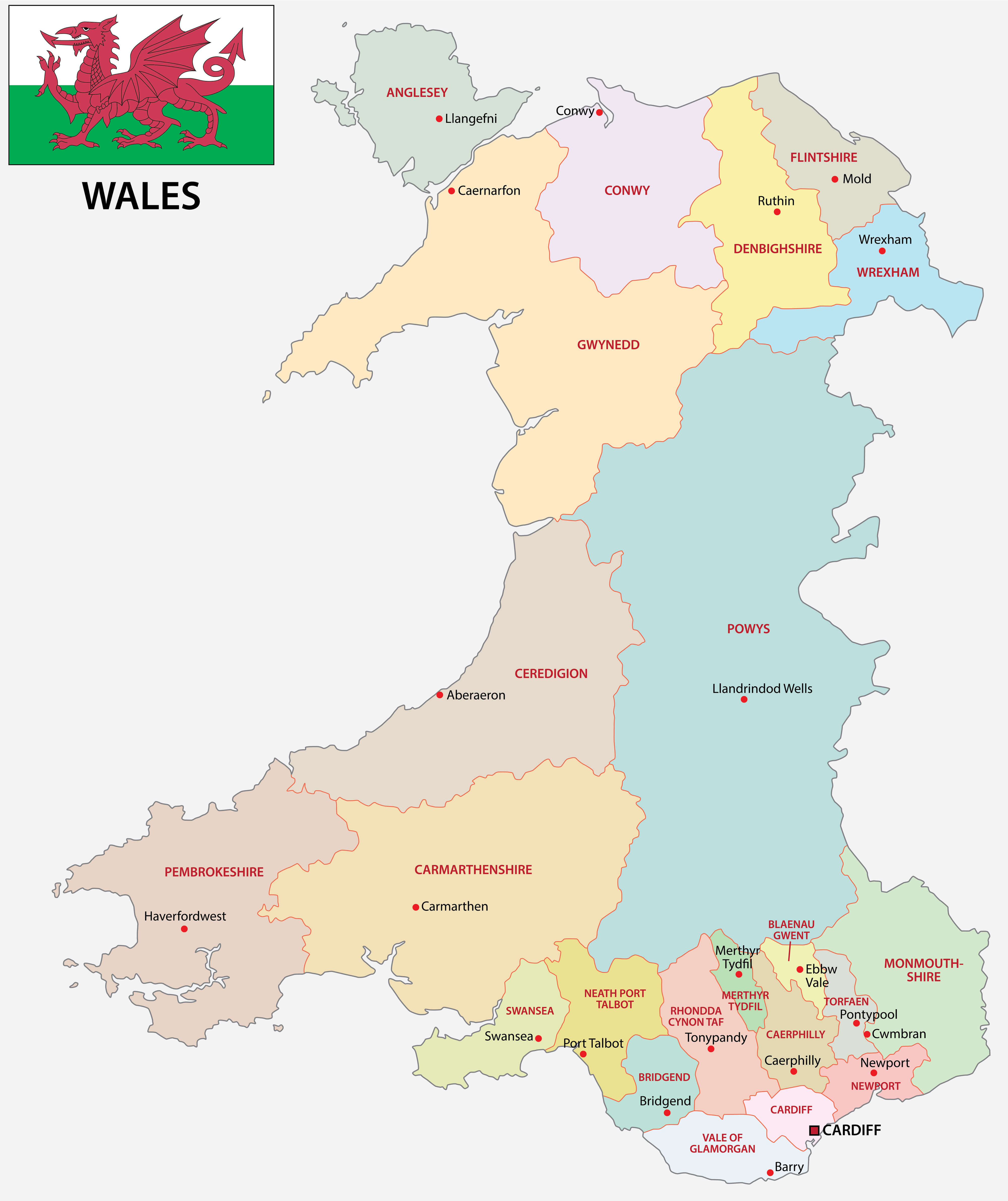
Wales Profile Map
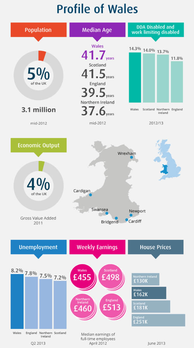
Brief information about Wales
Wales is a country in the United Kingdom, located on the western side of the island of Great Britain. It borders England to the east and is surrounded by the Irish Sea to the north and west and the Bristol Channel to the south. Cardiff, the capital of Wales, is its largest city and a cultural and economic centre.
Wales Maps
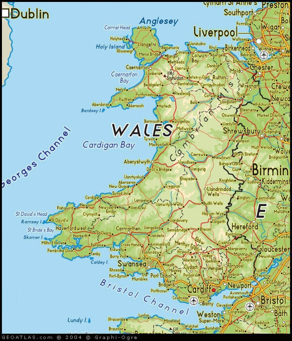
Known for its rugged landscapes, Wales is home to beautiful national parks such as Snowdonia and the Brecon Beacons, as well as a rich cultural heritage, including its own language, Welsh, which is still widely spoken. The country has a strong tradition of music, poetry and folklore, and is dotted with historic castles and scenic coastal areas. Wales is recognised for its distinct identity within the United Kingdom, combining modern influences with deep-rooted Celtic traditions.
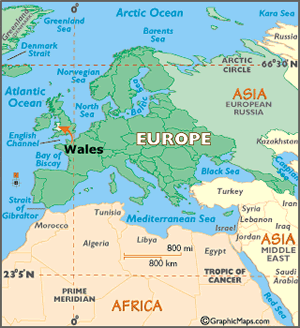
Where is located Wales on the World Map
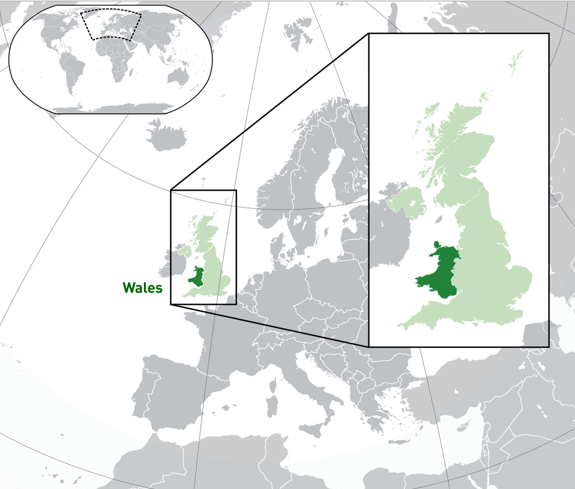 Where is located Wales on the World Map
Wales is located in Western Europe, on the island of Great Britain, which it shares with England and Scotland. Situated on the western side of Great Britain, Wales is bordered by England to the east, the Irish Sea to the north and west, and the Bristol Channel to the south. Cardiff, the capital, is in the southern part of the country, near the coast.
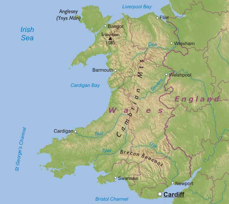
Wales and Great Britain Topography Map
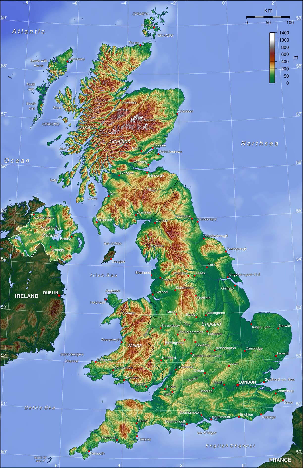
On the world map, Wales is part of the United Kingdom and lies just off the north-west coast of mainland Europe, across the Irish Sea from Ireland. Its location within the British Isles gives it a mild maritime climate and a landscape of rolling hills, mountains and extensive coastline.
Wales’ position within the United Kingdom has influenced its historical and cultural development, allowing for strong links with neighbouring England while maintaining a distinct identity rooted in its Celtic heritage. Wales is a popular destination for its natural beauty, historic sites and traditional culture.
Here are some statistical information about Wales:
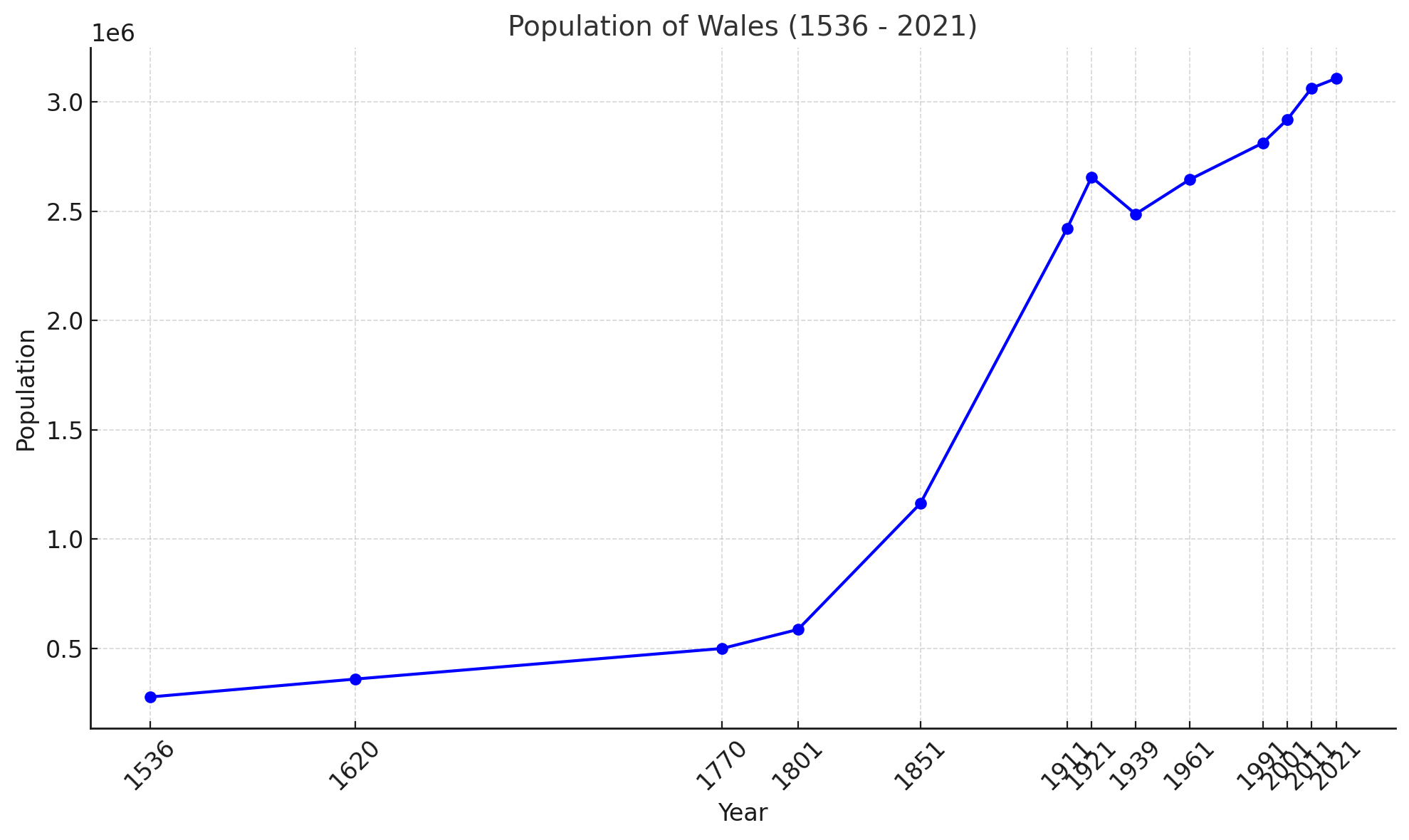
Population of Wales (1536 – 2021)
 Religion: No religion 46.5%, Christianity 43.6%, Islam 2.2%, Hinduism 0.4%, Buddhism 0.3%, Sikhism 0.1%, Judaism 0.1%, Other 0.5%, Not stated 6.3%.
 Wales Map
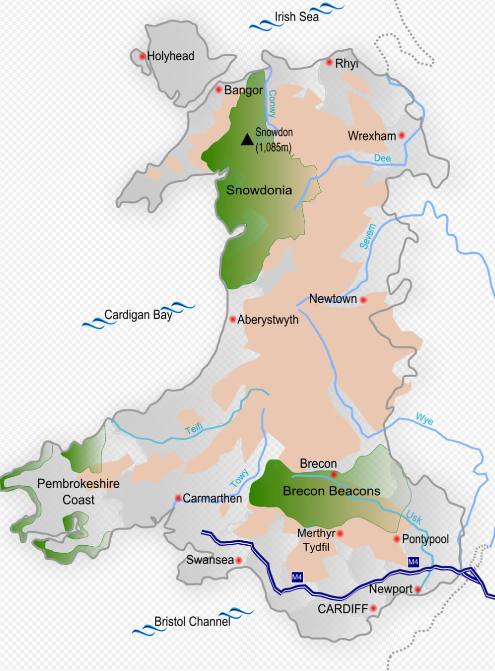
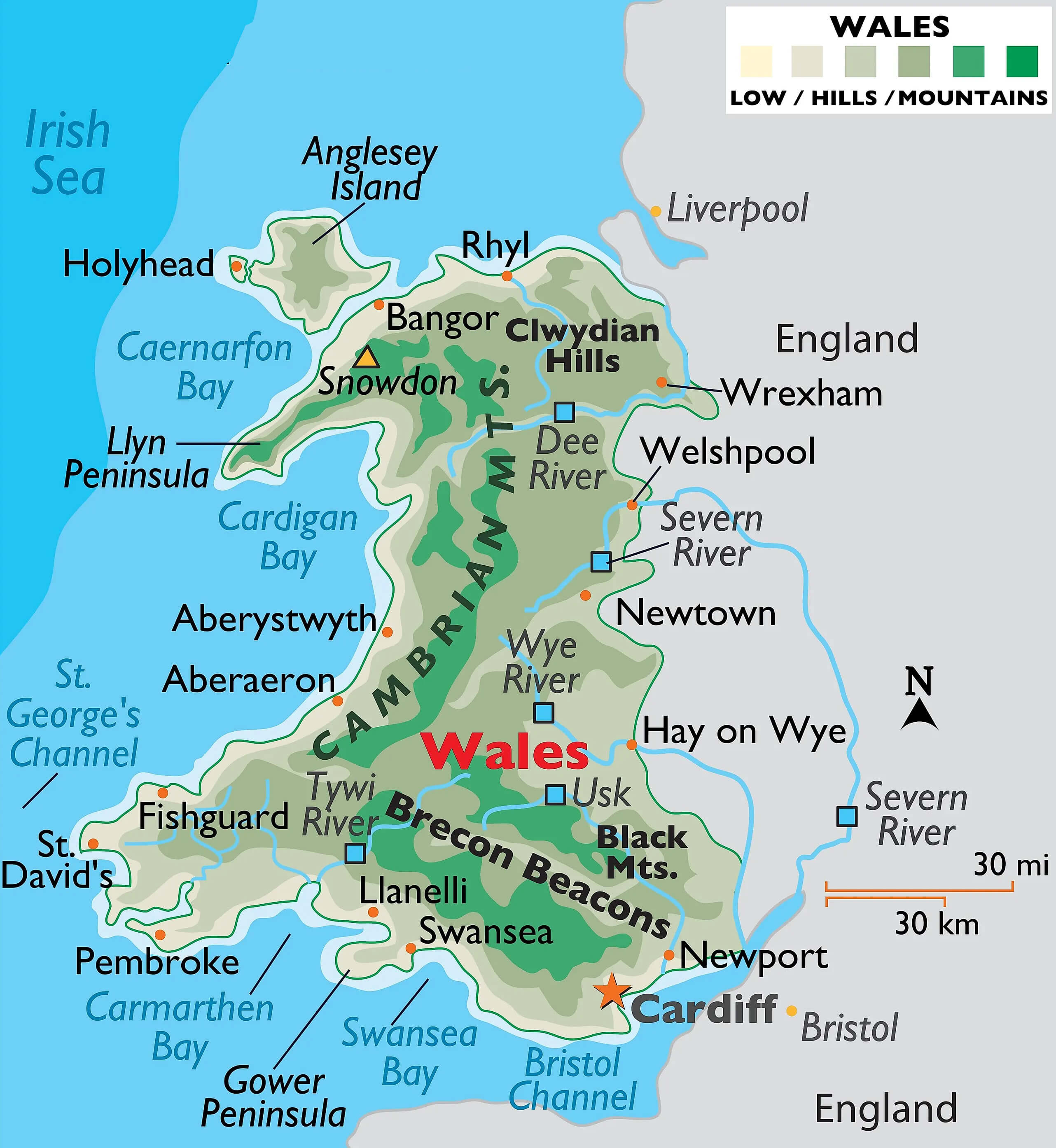 Map of Wales with major cities, rivers, and mountain ranges
This physical map of Wales highlights key features, including major cities like Cardiff, Swansea, and Bangor, as well as notable mountain ranges like the Cambrian Mountains and the Brecon Beacons. Important rivers such as the Wye, Tywi, and Dee are marked, along with coastal areas like Cardigan Bay and the Gower Peninsula. The map provides a detailed view of Wales’s diverse geography, including lowlands, hills, and mountainous regions.
Welsh Speakers 2011 Census Wales
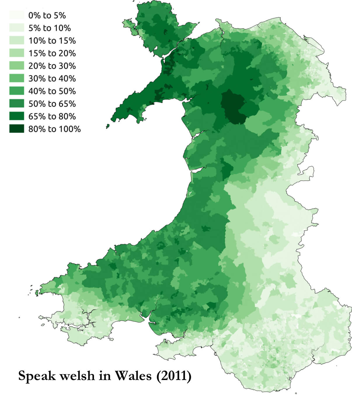 Map of Wales showing percentage of Welsh speakers by area
This map shows the distribution of Welsh speakers across Wales, based on the 2011 Census data. Areas are shaded from light to dark green, indicating the percentage of Welsh speakers, with darker shades representing higher percentages. Northern and western regions show the highest concentrations of Welsh speakers, with some areas reaching over 80%, while eastern and southern regions have lower percentages. This map highlights the linguistic diversity within Wales and the regions where the Welsh language is most widely spoken.
Roman Wales Forts Map 300
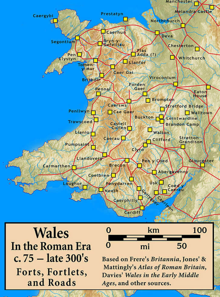
This map illustrates Roman forts, fortlets, and road networks across Wales from around 75 to the late 300s AD. Key Roman sites are marked, showcasing the strategic locations of forts and connecting roads used during the Roman occupation. Roads and forts spanned much of Wales, indicating the extent of Roman influence, with notable sites such as Segontium and Caerleon. This historical map provides insight into Roman military organization and infrastructure in ancient Wales.
Wales Britain 500
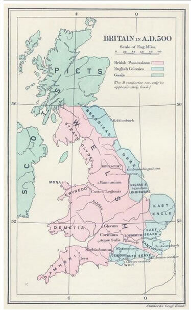 Map of Britain in AD 500 with British and English territories
This historical map of Britain in A.D. 500 displays regions under British control, English colonies, and Gaelic areas. The map highlights the territories held by various groups, such as the Picts in Scotland, the Britons in Wales and parts of England, and the emerging English settlements in the southeast. It provides a glimpse into the early medieval landscape of Britain, showing the fragmented and evolving control of different cultures and tribes across the island during this period.
Map of Wales
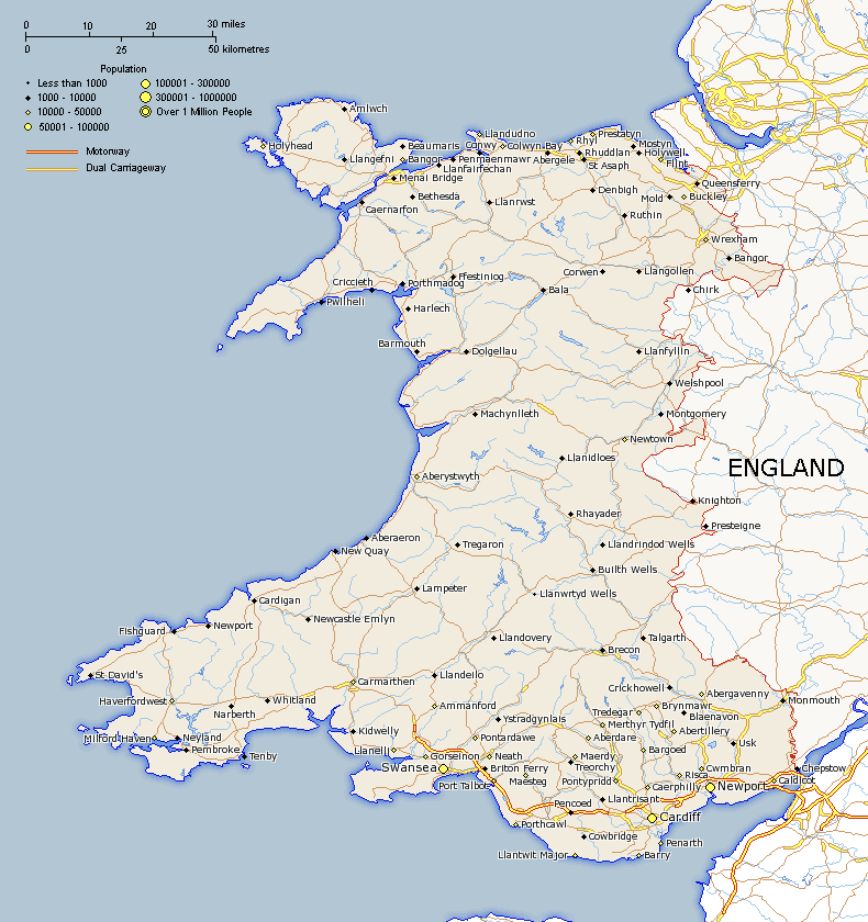
Wales Cities Map
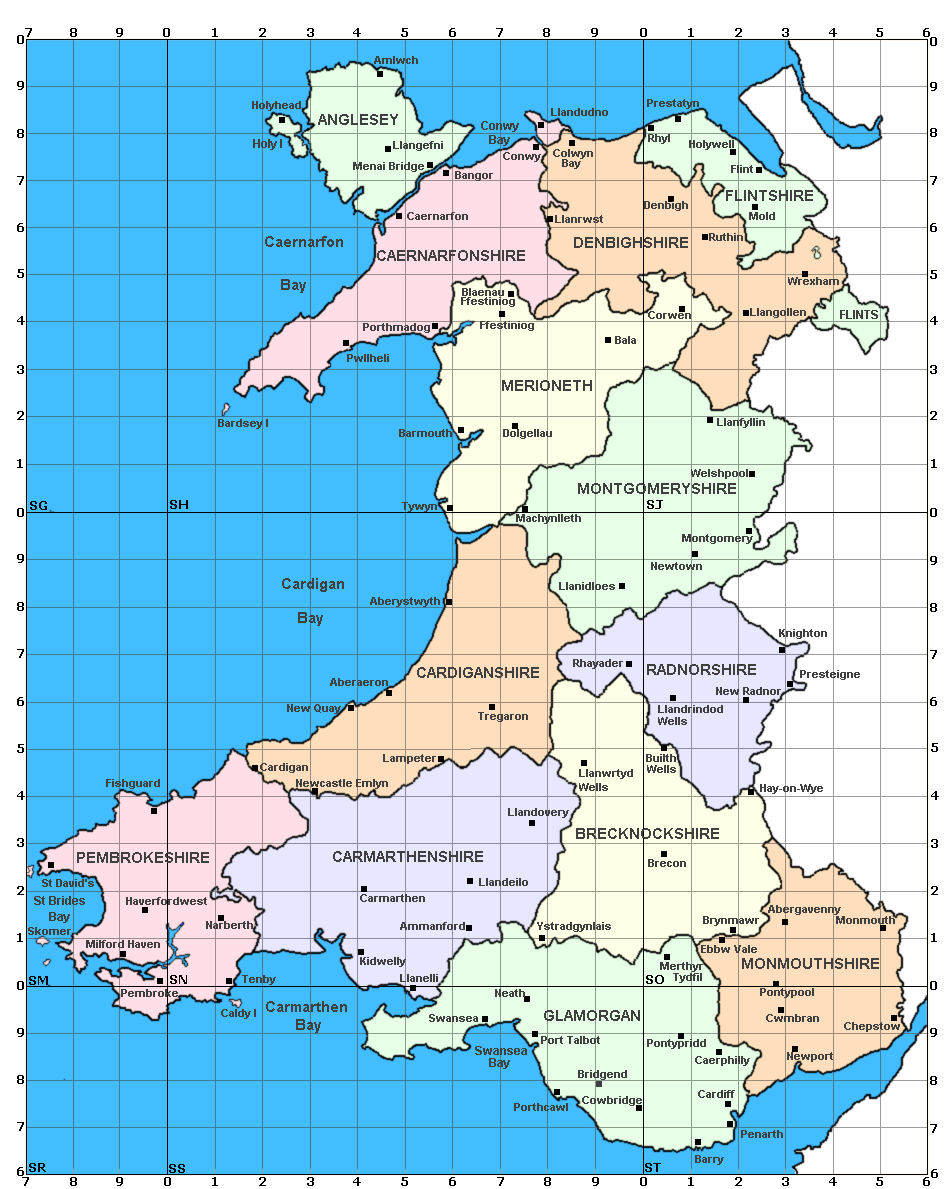
Wales Physical Map
Wales Europe Map
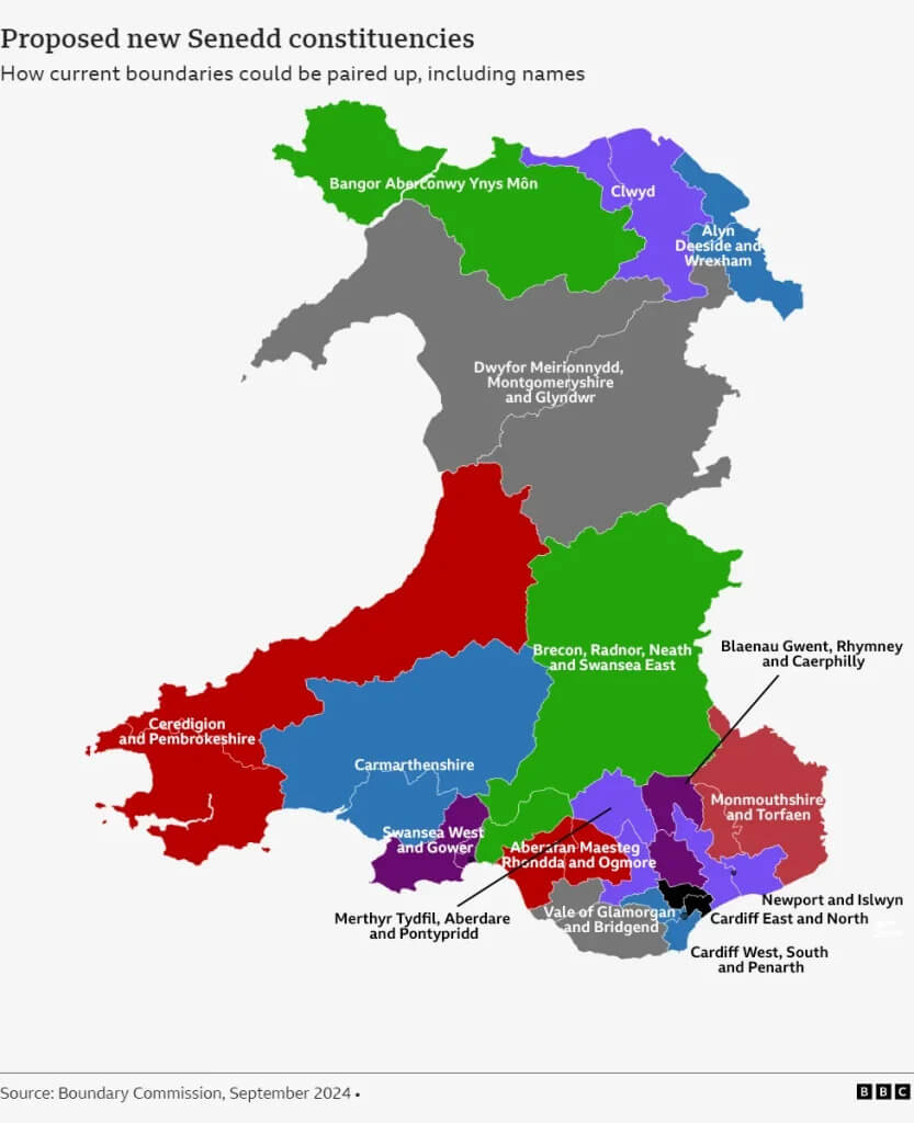
Wales Political Map
Relief map of Wales with national parks
Wales National Parks Map
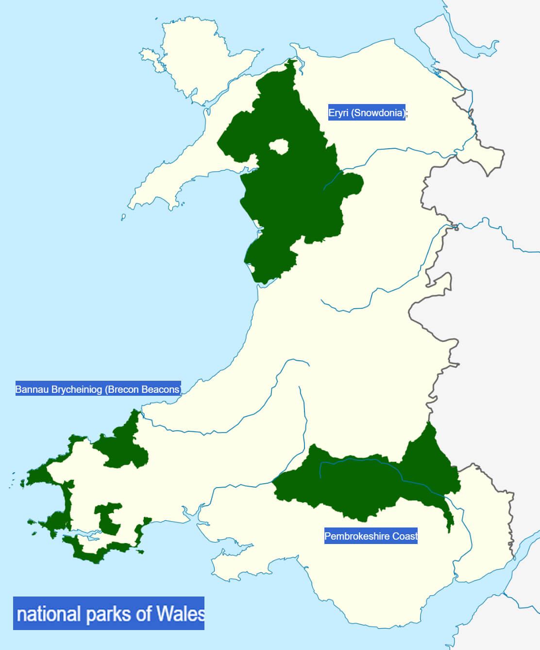
Wales National Parks Map

Wales Rail Network Map
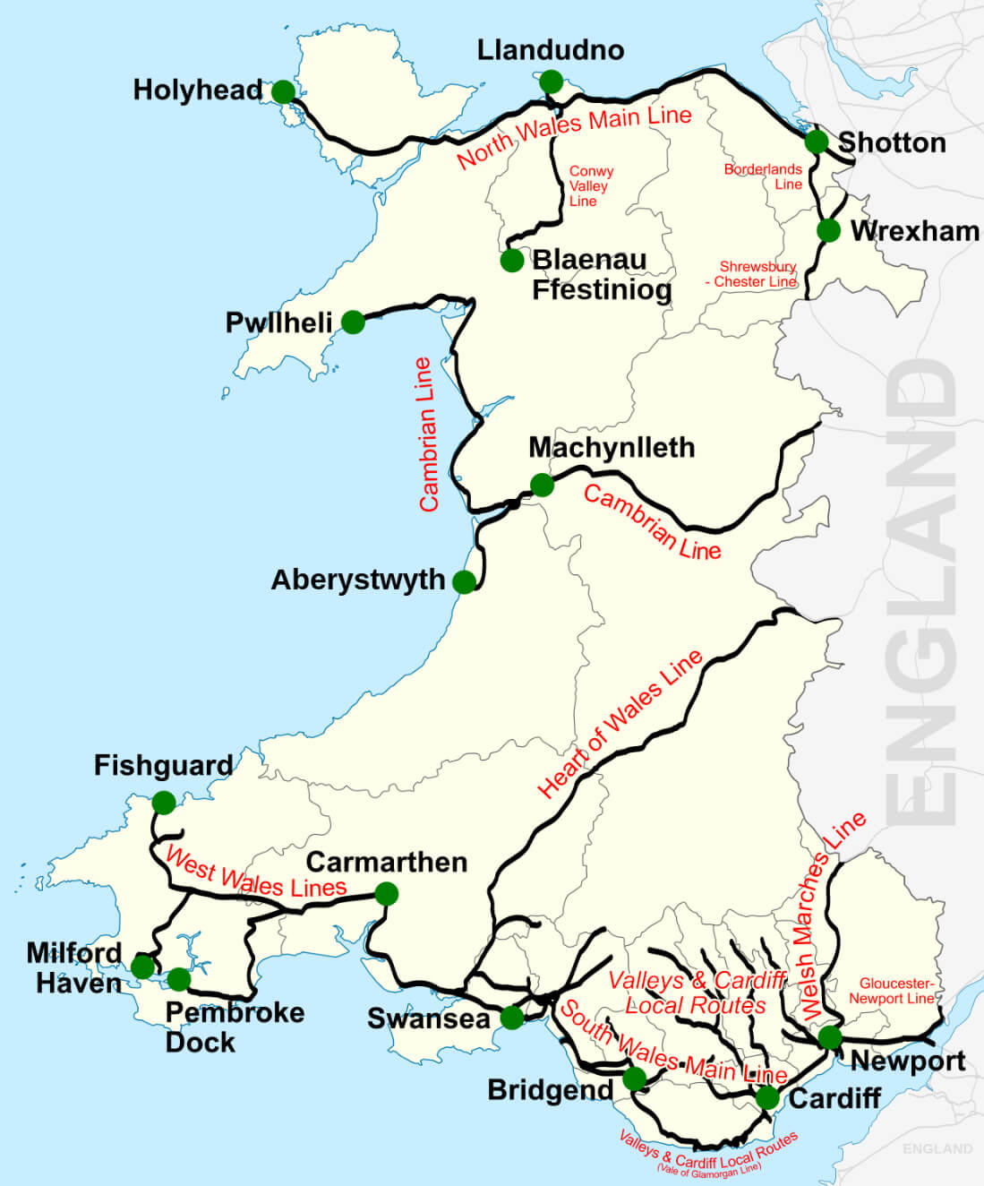
Physical Map of Wales
Wales Counties Map
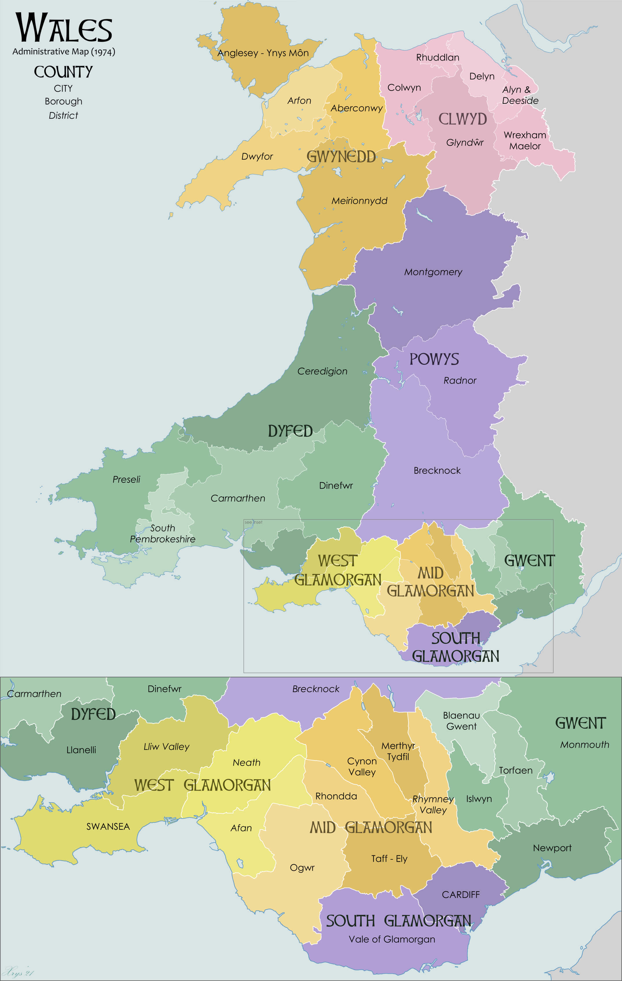
Wales Road Map
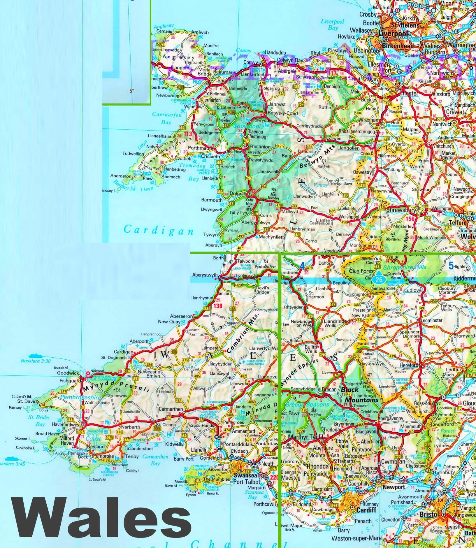
Wales Satellite Map
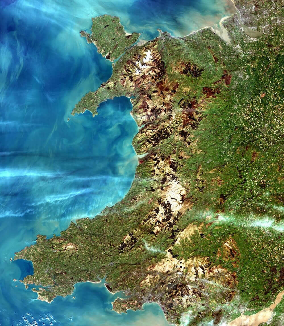
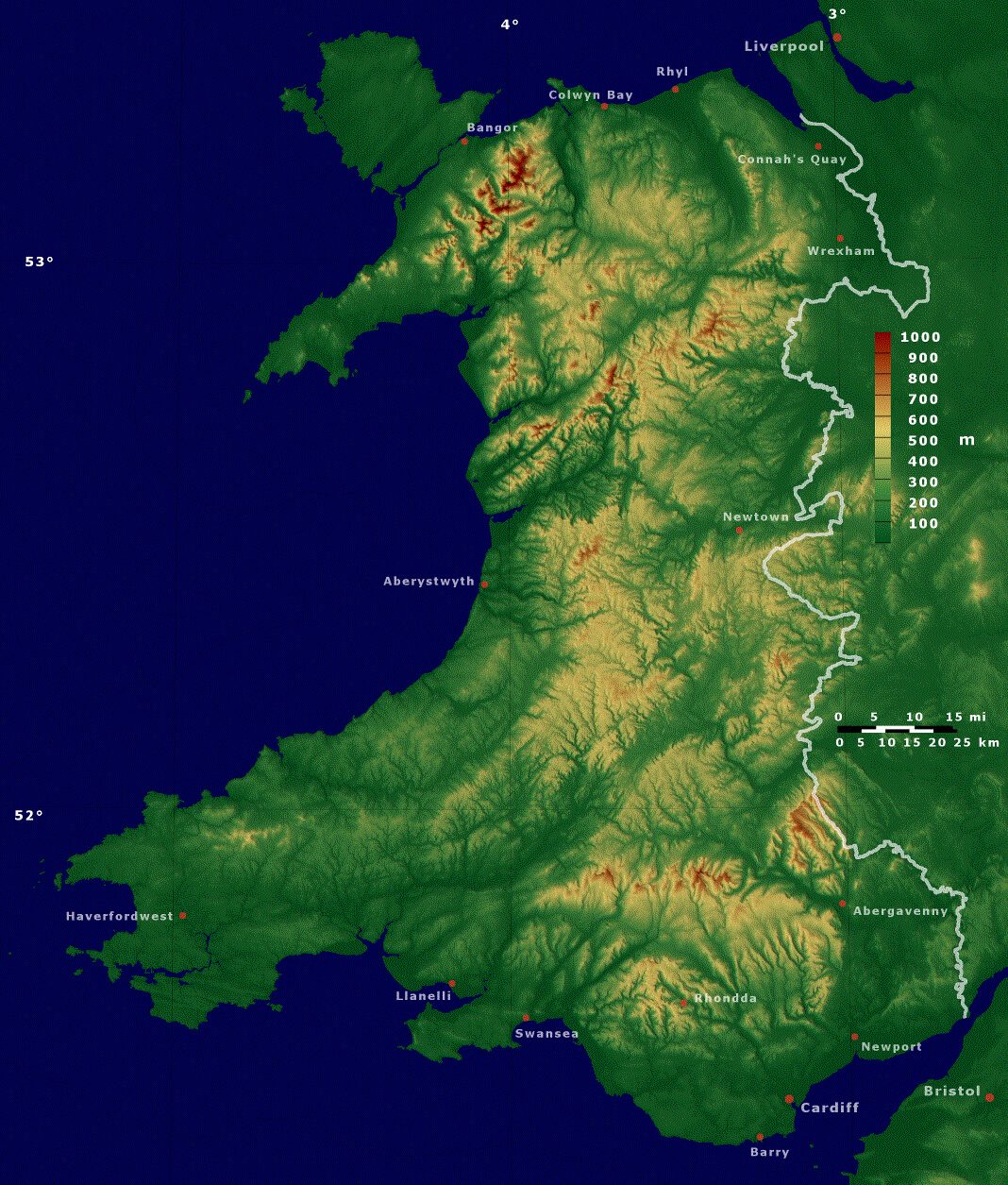
Wales and Great Britain Topography Map

Satellite Map of Wales
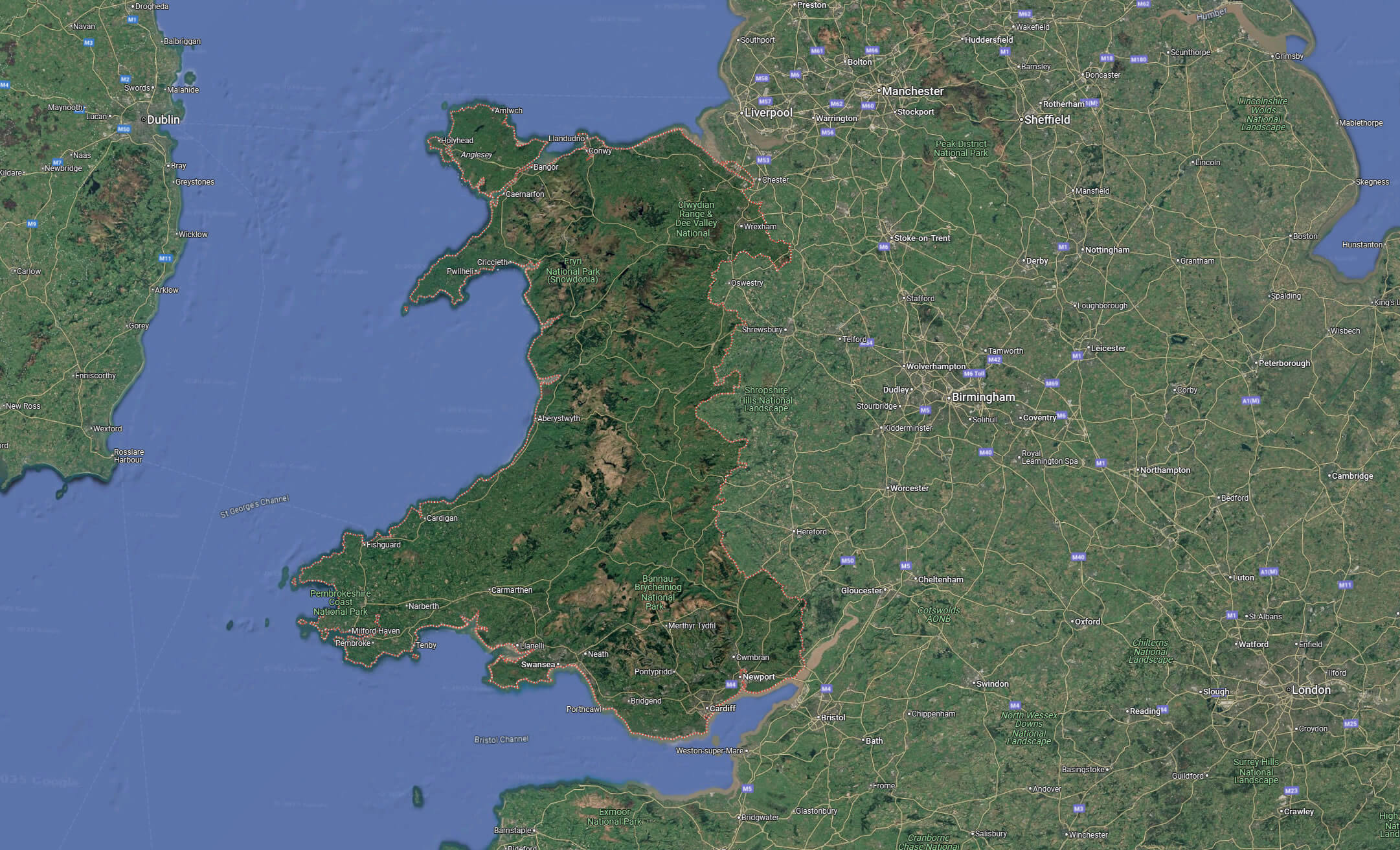
Wales map with cardiff
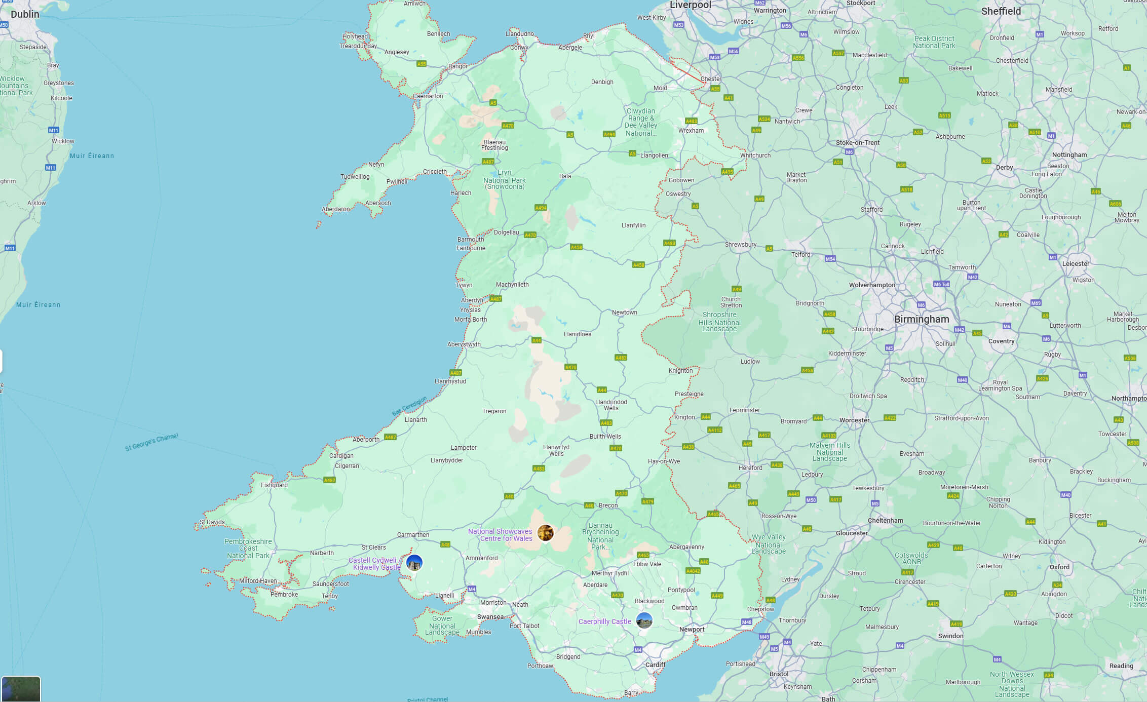
Wales Terrain Map
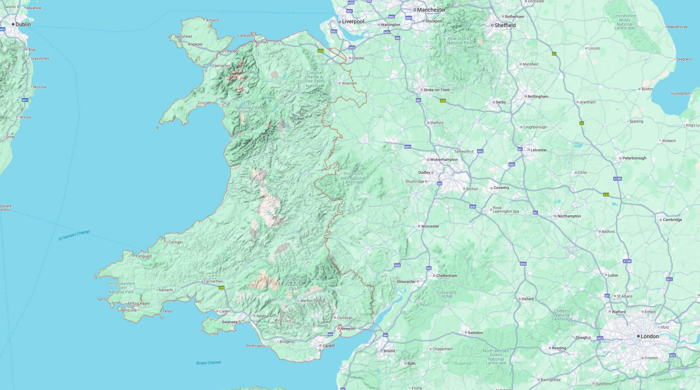
Where is Wales on the Europe and UK Map?
Show Google Maps and satellite maps of where the country is located.
Get directions by driving, walking, bicycling, public transportation, and travel with street view.
Feel free to explore these pages as well:
- A Collection of United Kingdom Maps ↗️
- Map of United Kingdom ↗️
- United Kingdom Map ↗️
- England Map ↗️
- Wales Map ↗️
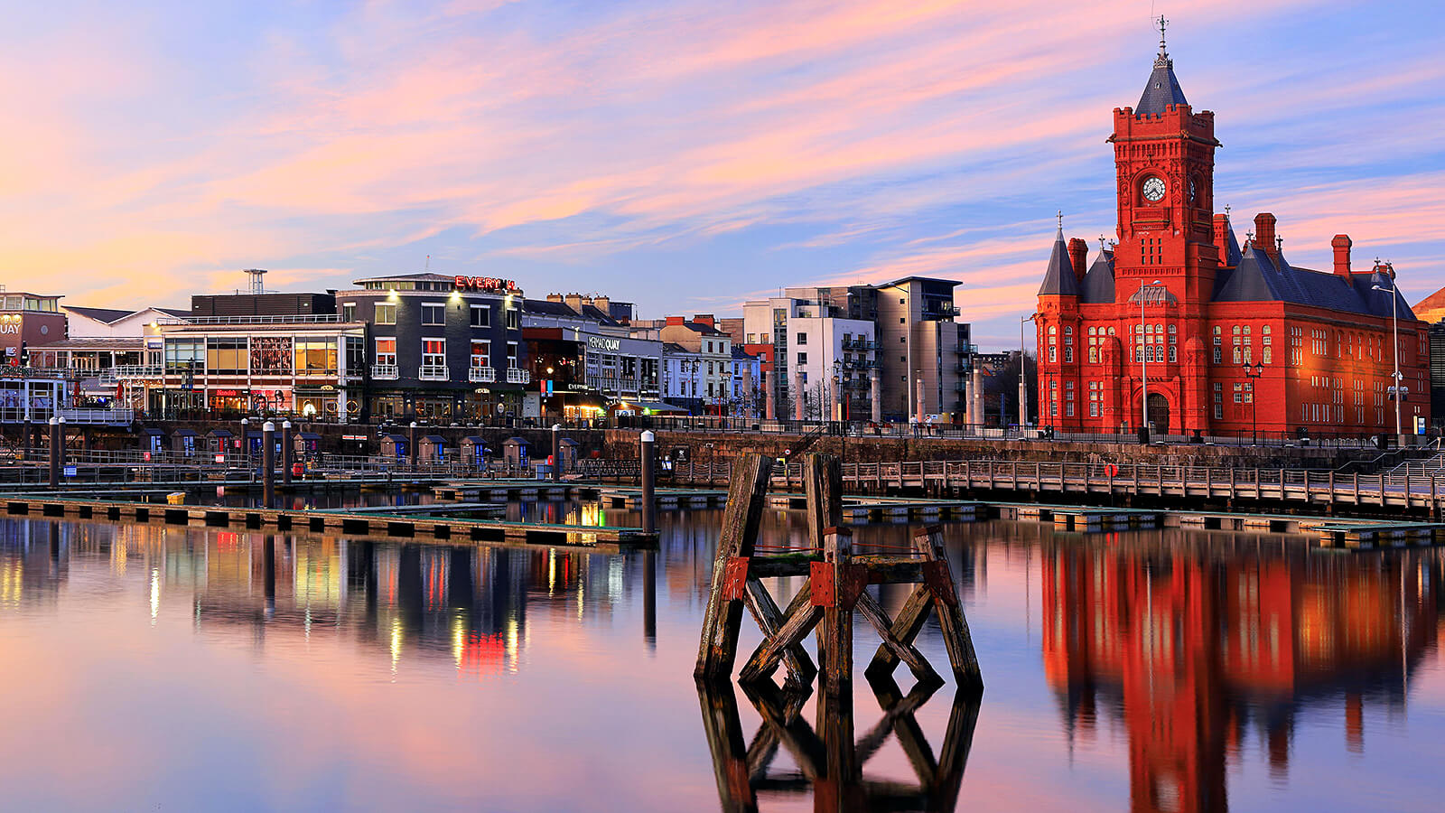
- Discovering Cardiff: A Gem in the Heart of Wales ↗️
- Birmingham Unveiled: The Heart of England’s Hidden Gems ↗️
- Discovering Belfast: The Northern Gem of the UK ↗️
- Bradford, United Kingdom: A Vibrant Tapestry of Culture and History ↗️
- Scotland Map ↗️
- United States Map ↗️
- France Map ↗️
- Canada Map ↗️
