The United Kingdom, with its rich tapestry of cultures, traditions, and histories, is a mosaic of diverse landscapes and narratives. Comprising the distinct countries of England, Scotland, Wales, and Northern Ireland, each region boasts its unique flavor and significance. As we embark on this cartographic journey through the vast expanses and intimate corners of the UK, we are not merely observing geographical representations but diving into the stories, legacies, and passions that have sculpted this nation. Whether you’re a seasoned traveler, a history enthusiast, or simply someone with a thirst for knowledge, these maps promise to offer insights that go beyond borders and boundaries. Let’s set forth on this exploration, allowing the maps to unfold the mysteries and wonders of the United Kingdom!
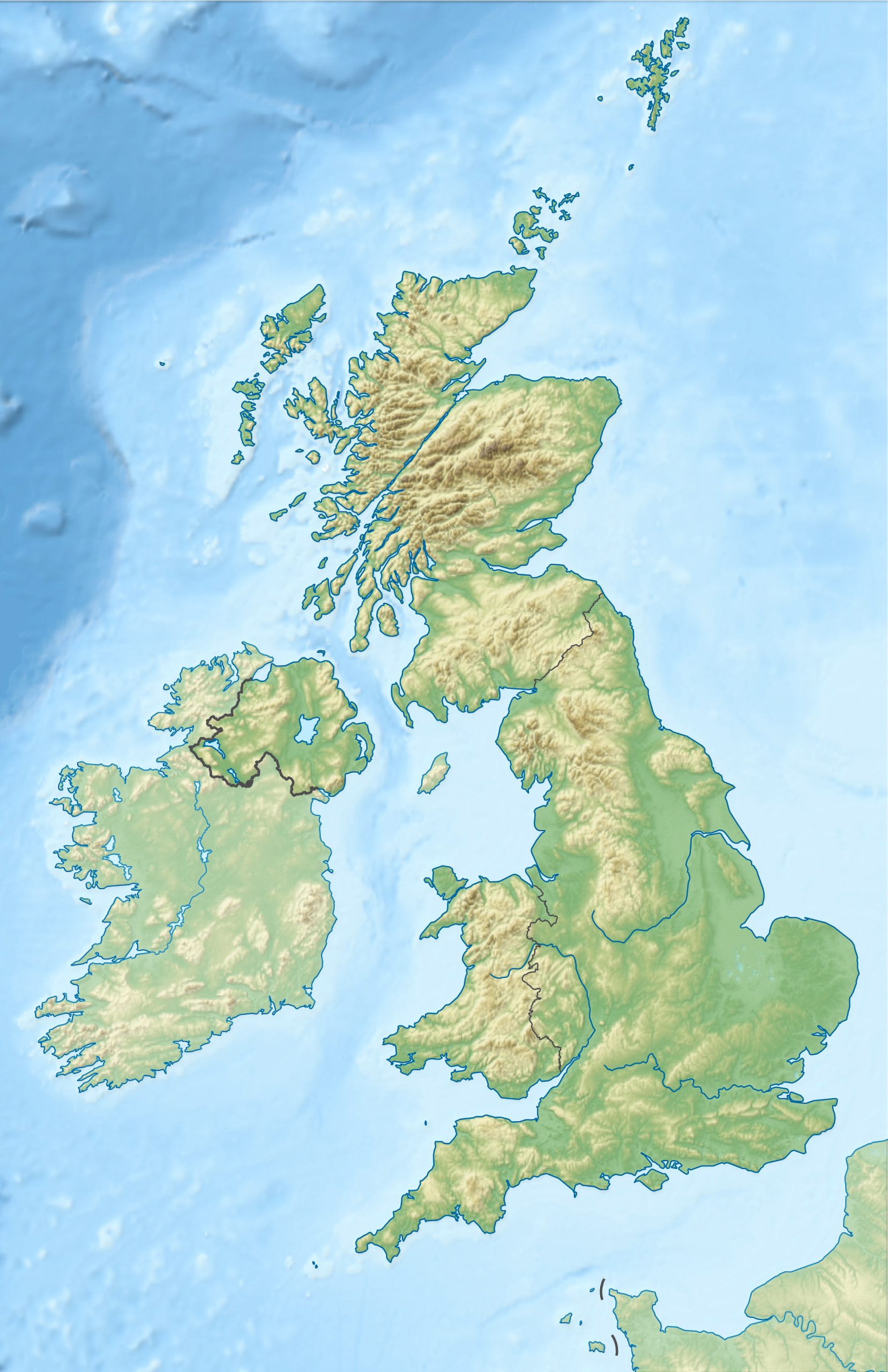
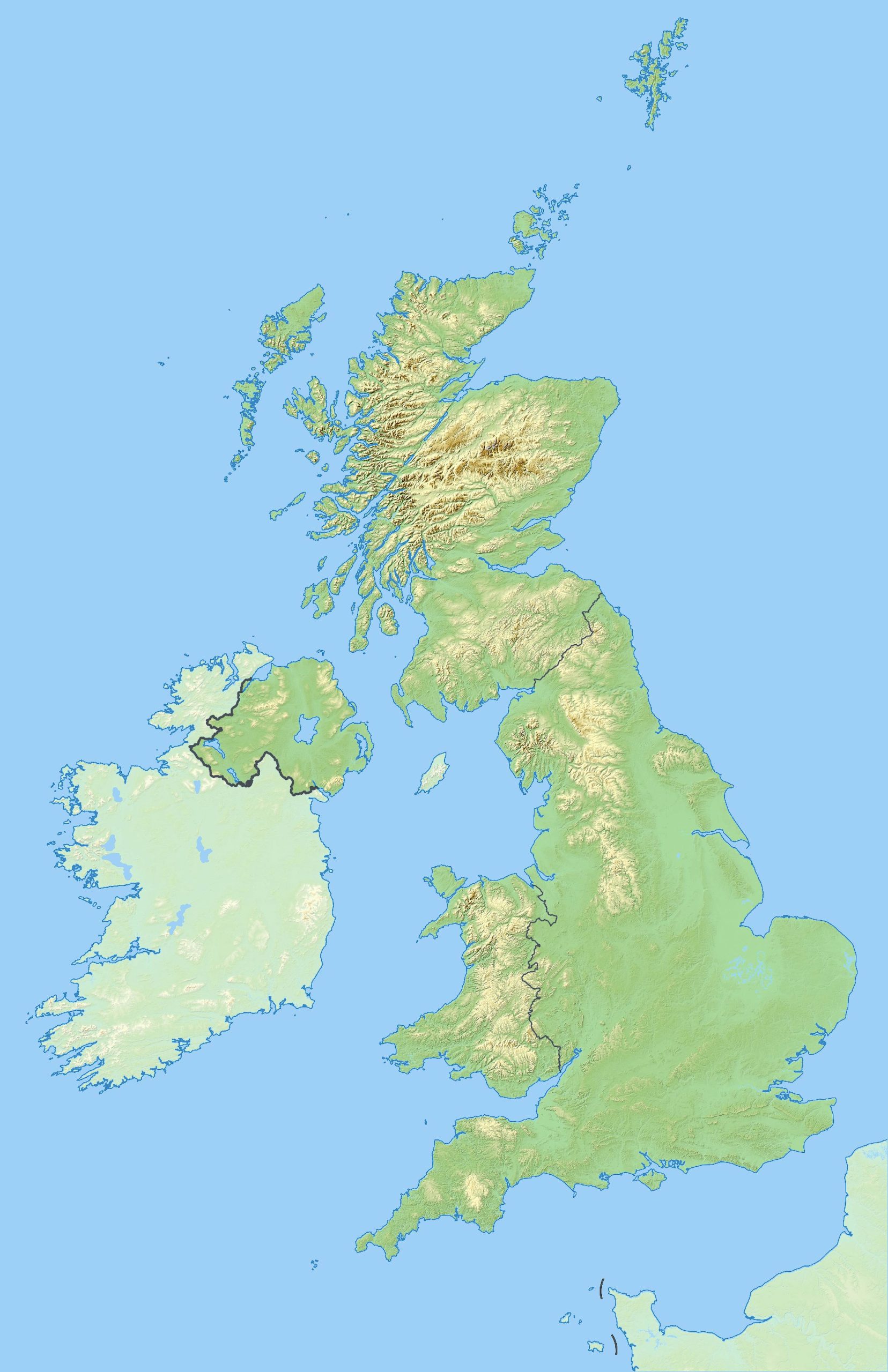
1. United Kingdom Physical Map
Delve into the natural beauty of the UK! This map showcases the mountains, plains, rivers, and coastlines in their raw form.
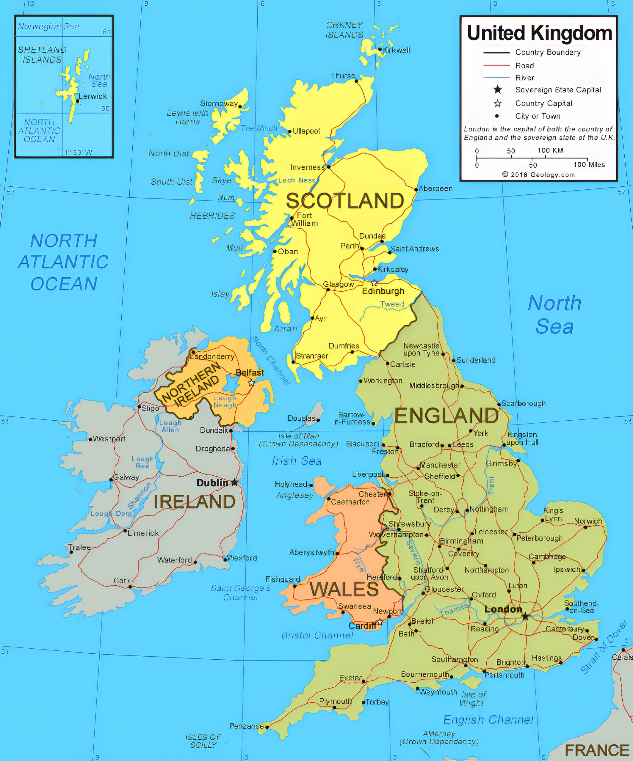
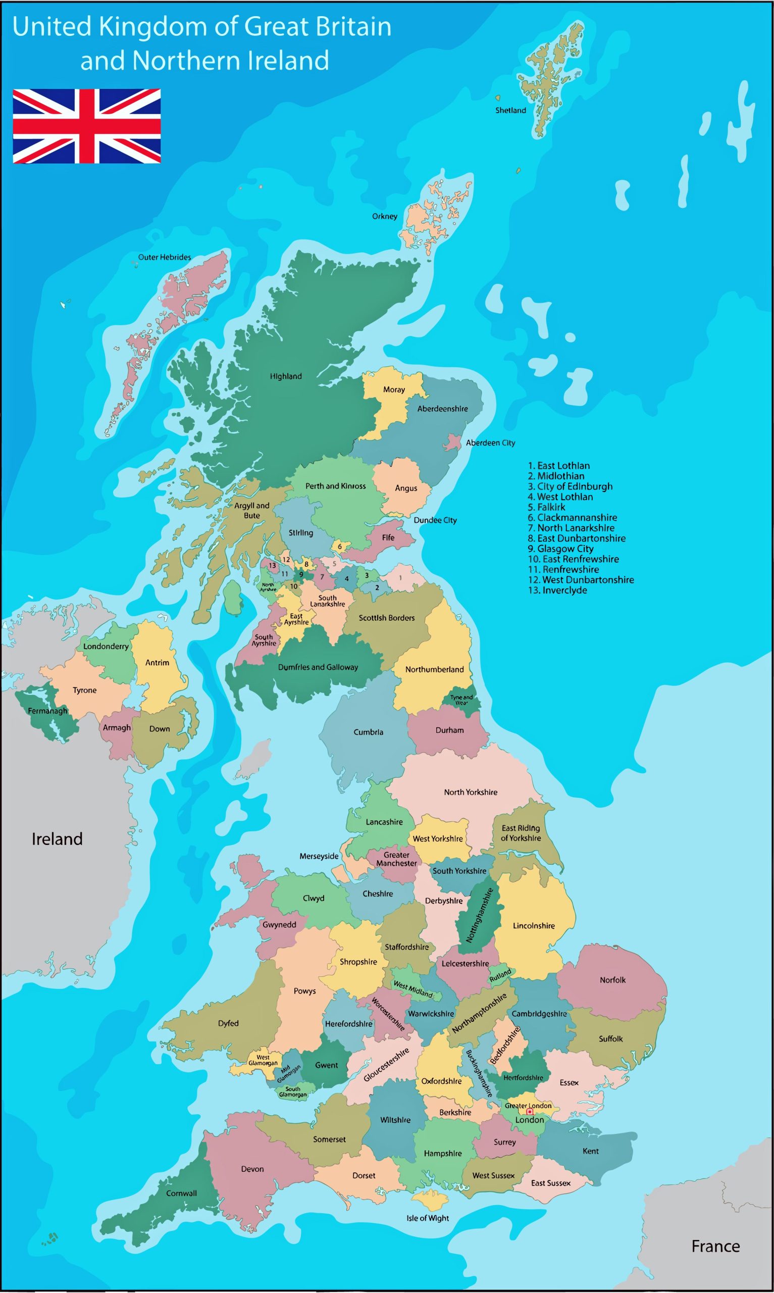
2. United Kingdom Political Map
Discover the administrative divisions, boundaries, and key political zones across the United Kingdom.
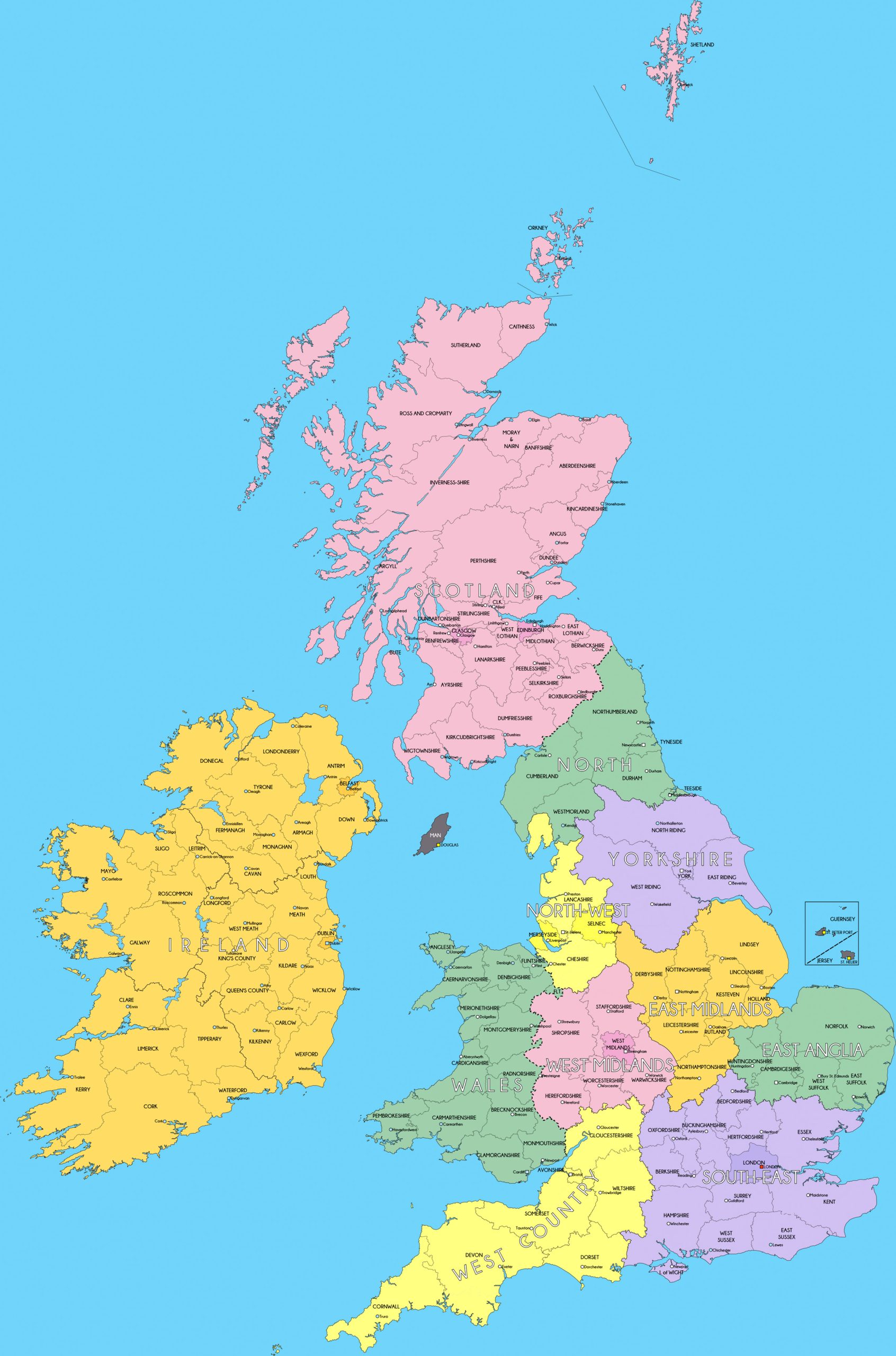
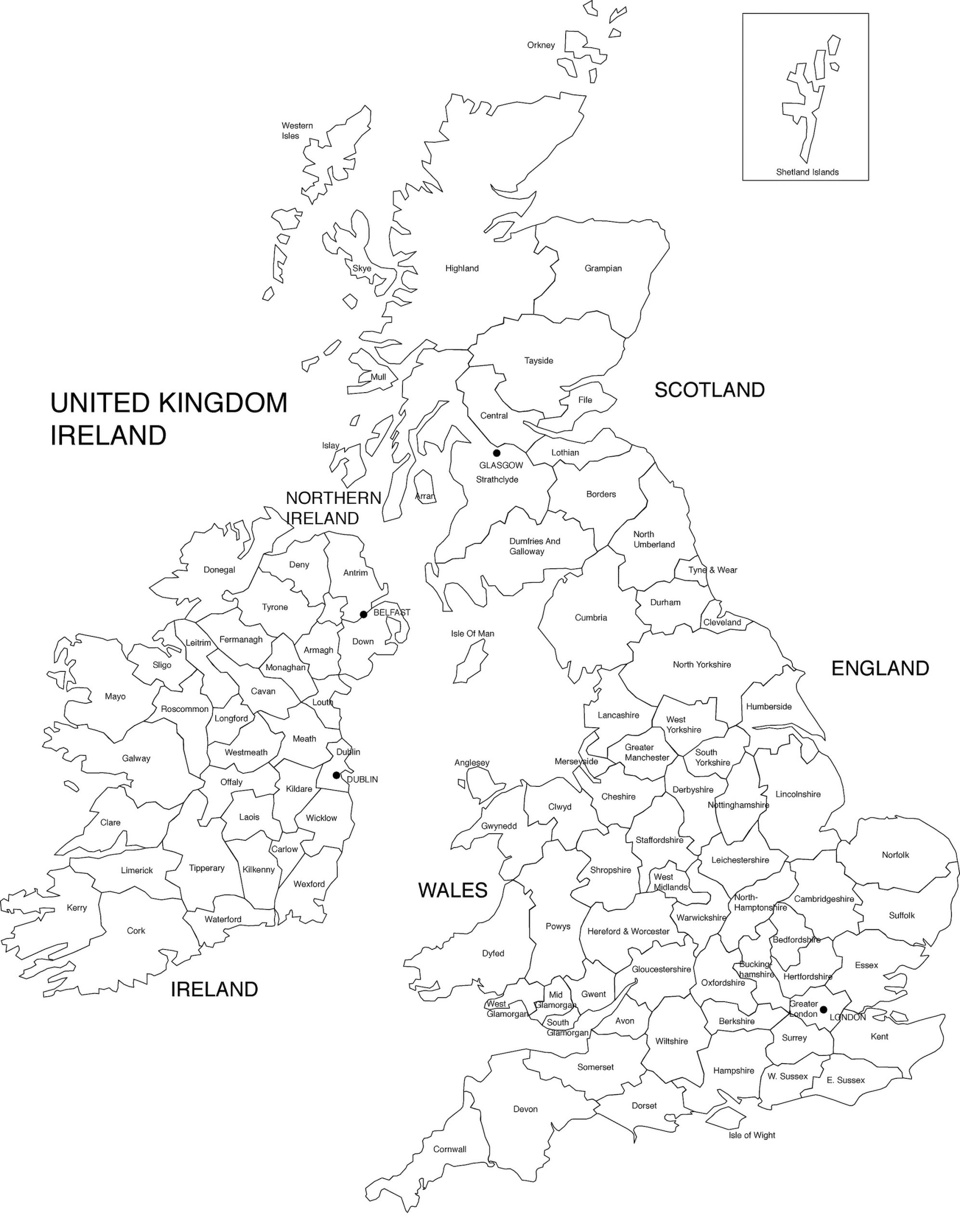
3. United Kingdom Administrative Divisions Map
Dive into the intricate structure of the United Kingdom with our Administrative Divisions Map. Discover the boundaries that define counties, regions, and jurisdictions, offering a comprehensive view of the UK’s governmental layout.
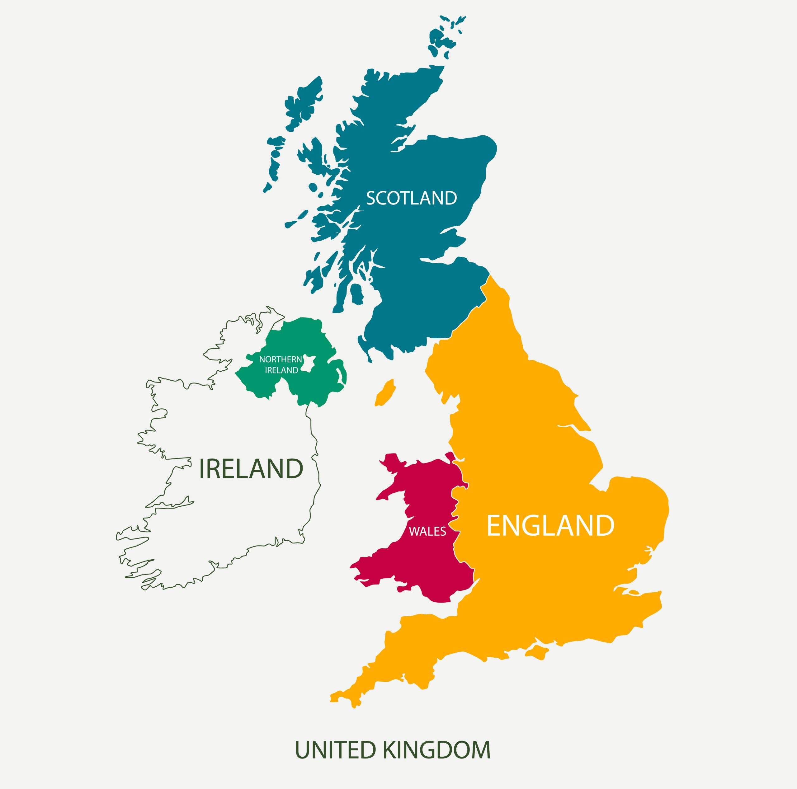
4. United Kingdom Countries Map
Explore the distinct nations that form the United Kingdom: England, Scotland, Wales, and Northern Ireland, each with its unique heritage and charm.
5. United Kingdom Municipalities Blank Map
Delve into the granularity of the UK’s local governance with this blank municipalities map. An open slate for understanding and marking the intricate subdivisions.
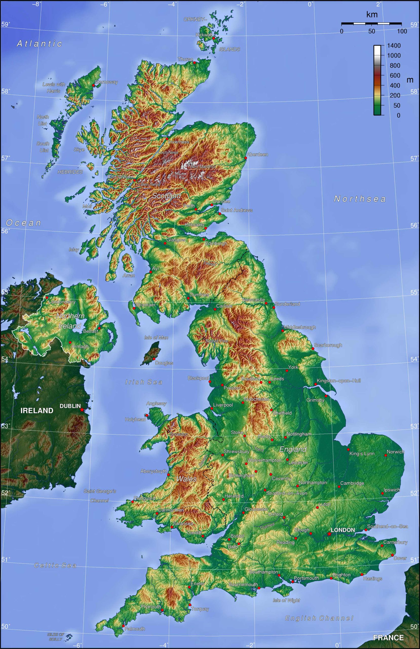
6. United Kingdom Topographic Map
Study the contours, elevations, and detailed terrain of the land. A perfect pick for hikers and adventure seekers!
7. United Kingdom Geographical Map
Navigate the diverse terrains of the UK with this Geographical Map, showcasing the natural landscapes, elevations, and defining features of this storied isle.
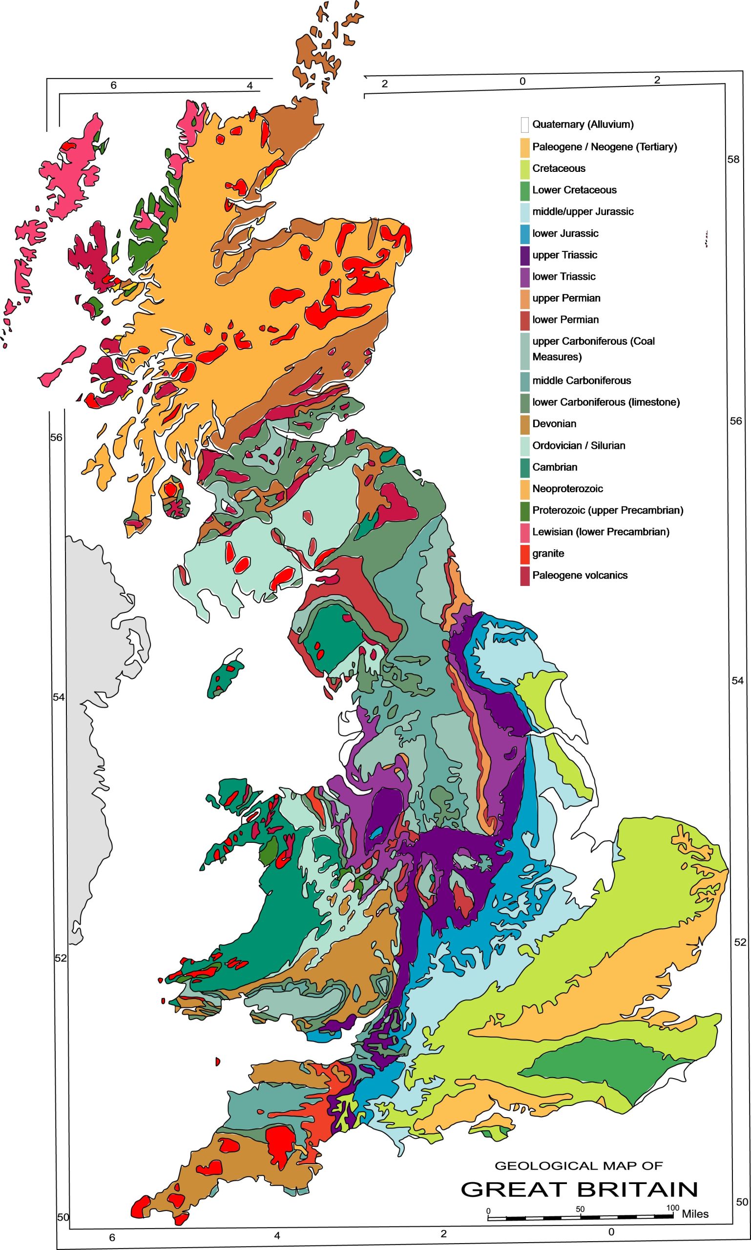
8. United Kingdom Geological Map
Get a glimpse of the underlying rocks, minerals, and geological features that have shaped the UK over millennia.
9. United Kingdom Cities (Urban) Map
Zoom into the urban layout of major UK cities. From London to Glasgow, explore them all!
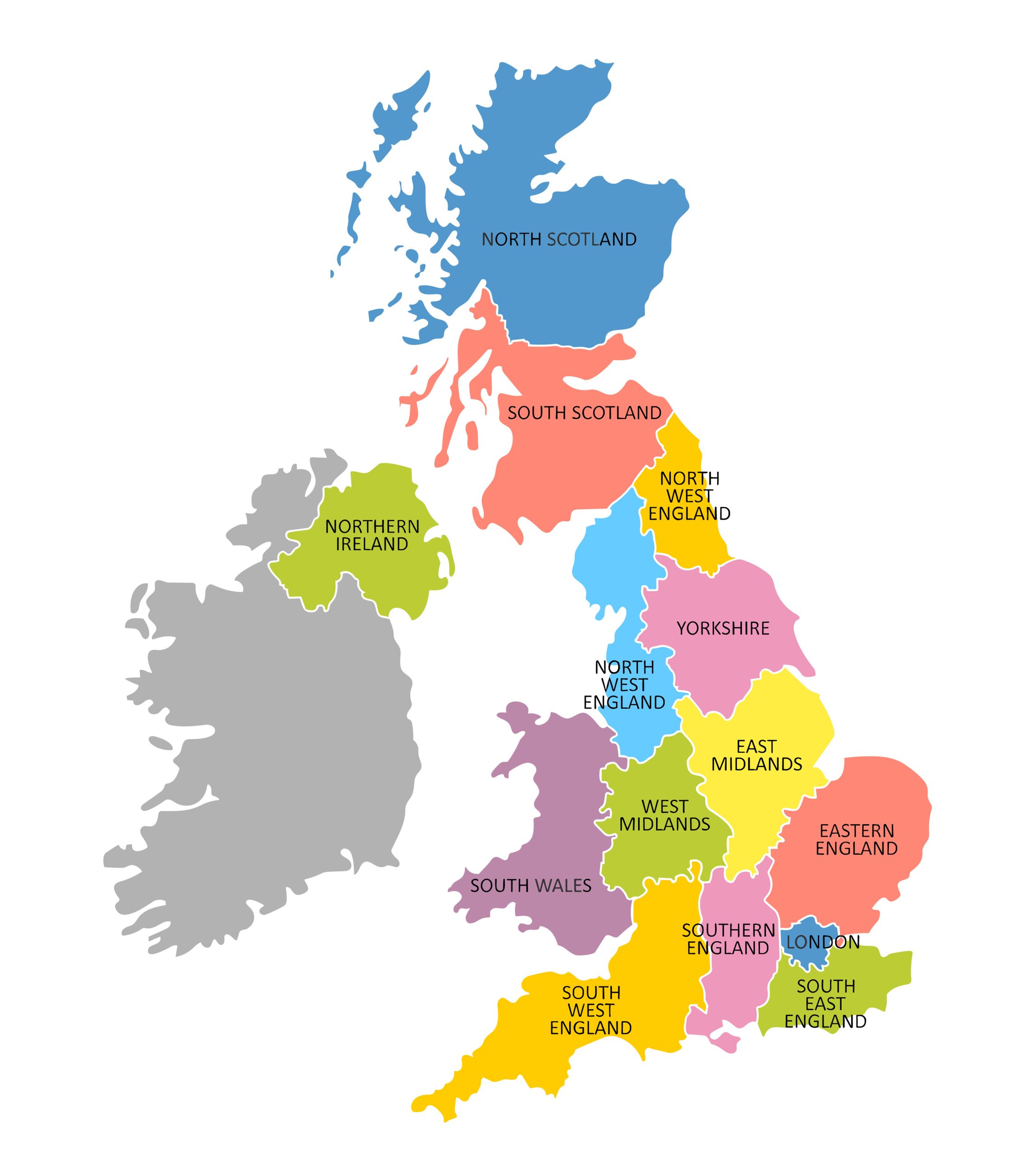
10. United Kingdom Regions Map
The UK is divided into various regions. This map showcases these divisions with clarity.
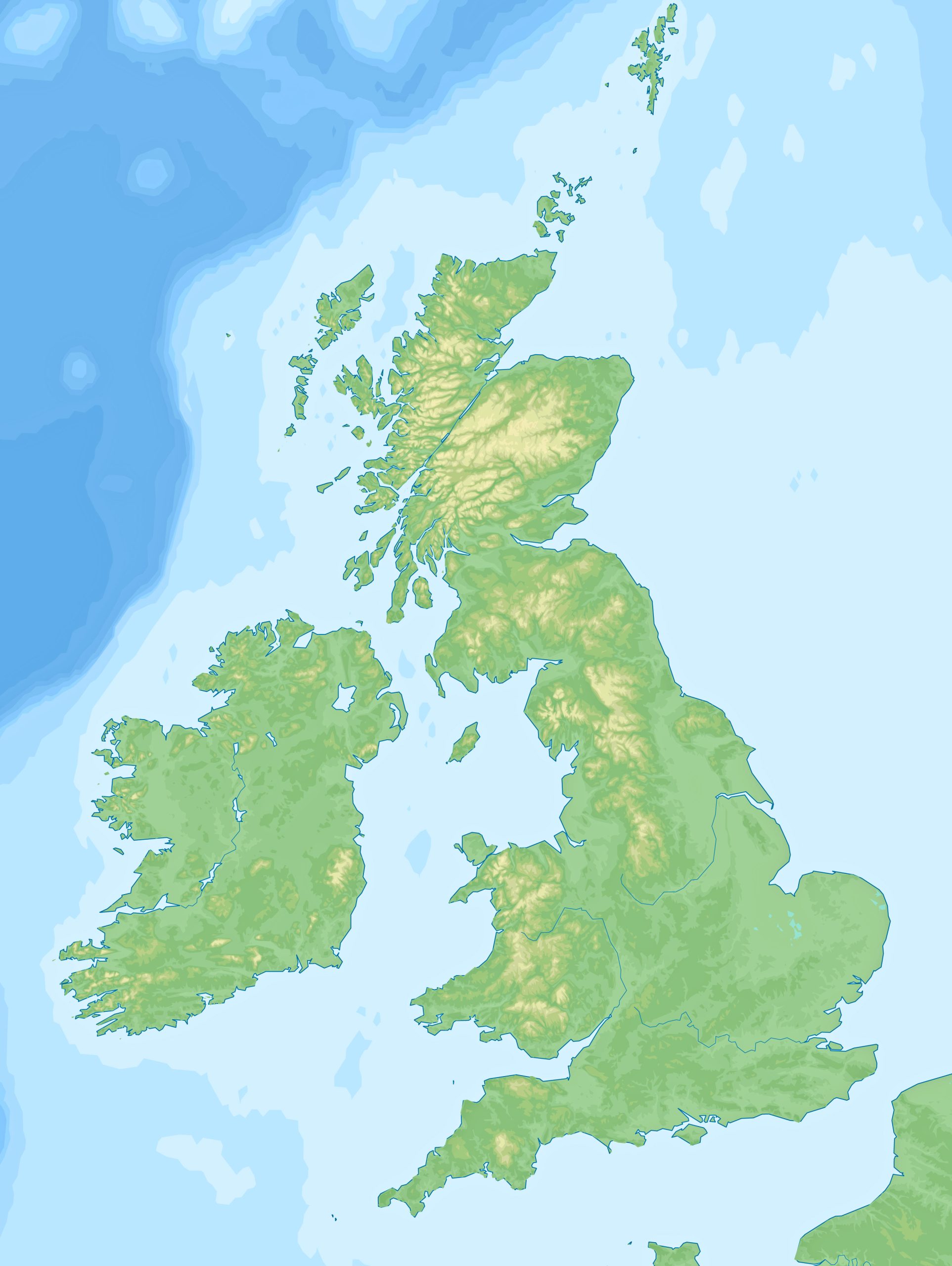
11. United Kingdom Blank Map
Test your knowledge or let your creativity flow by filling in this blank map of the UK.
12. United Kingdom Relief Map
Understand the altitudes and elevations in a vivid, 3D format with the relief map.
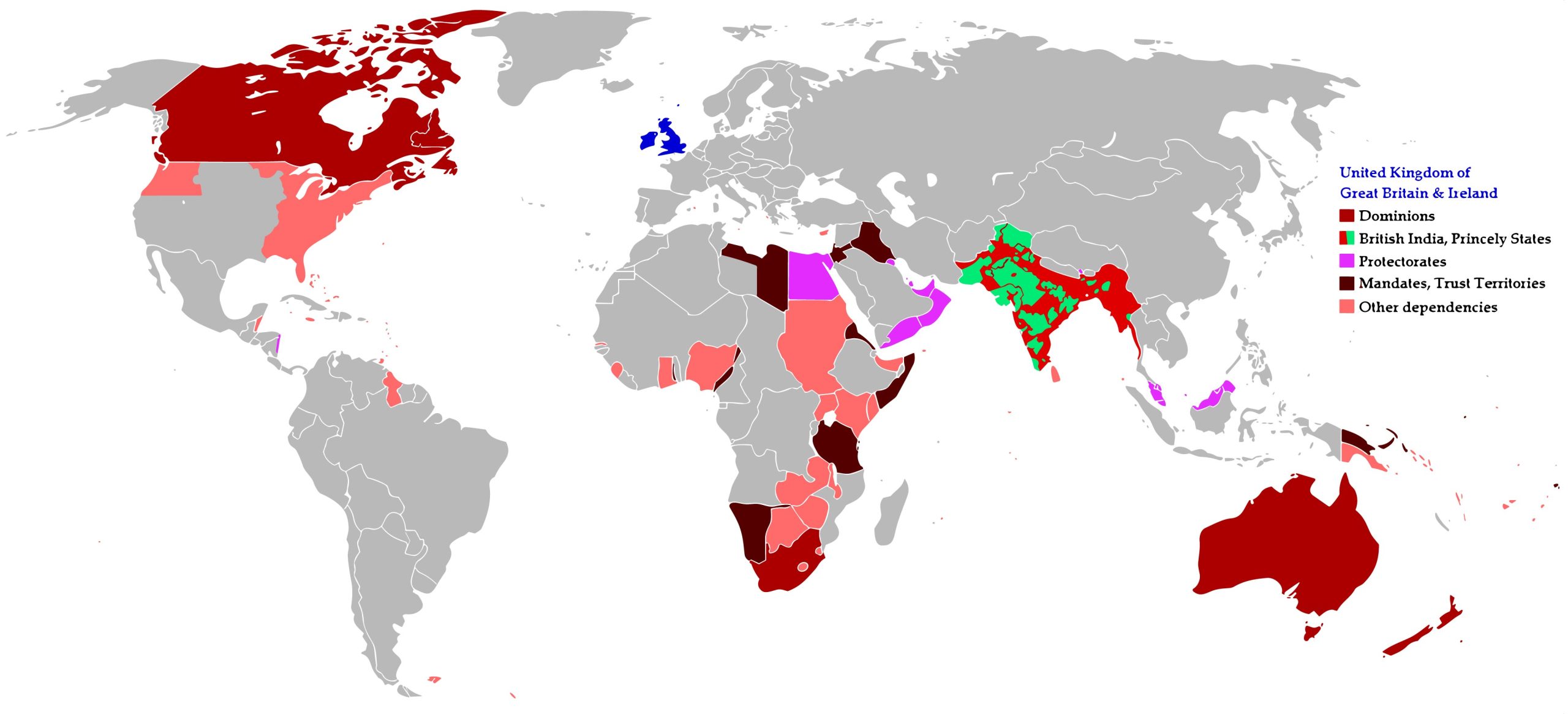
13. British Empire (United Kingdom) Colonial Map
Journey through history and view the vast expanse of the British Empire during its zenith.
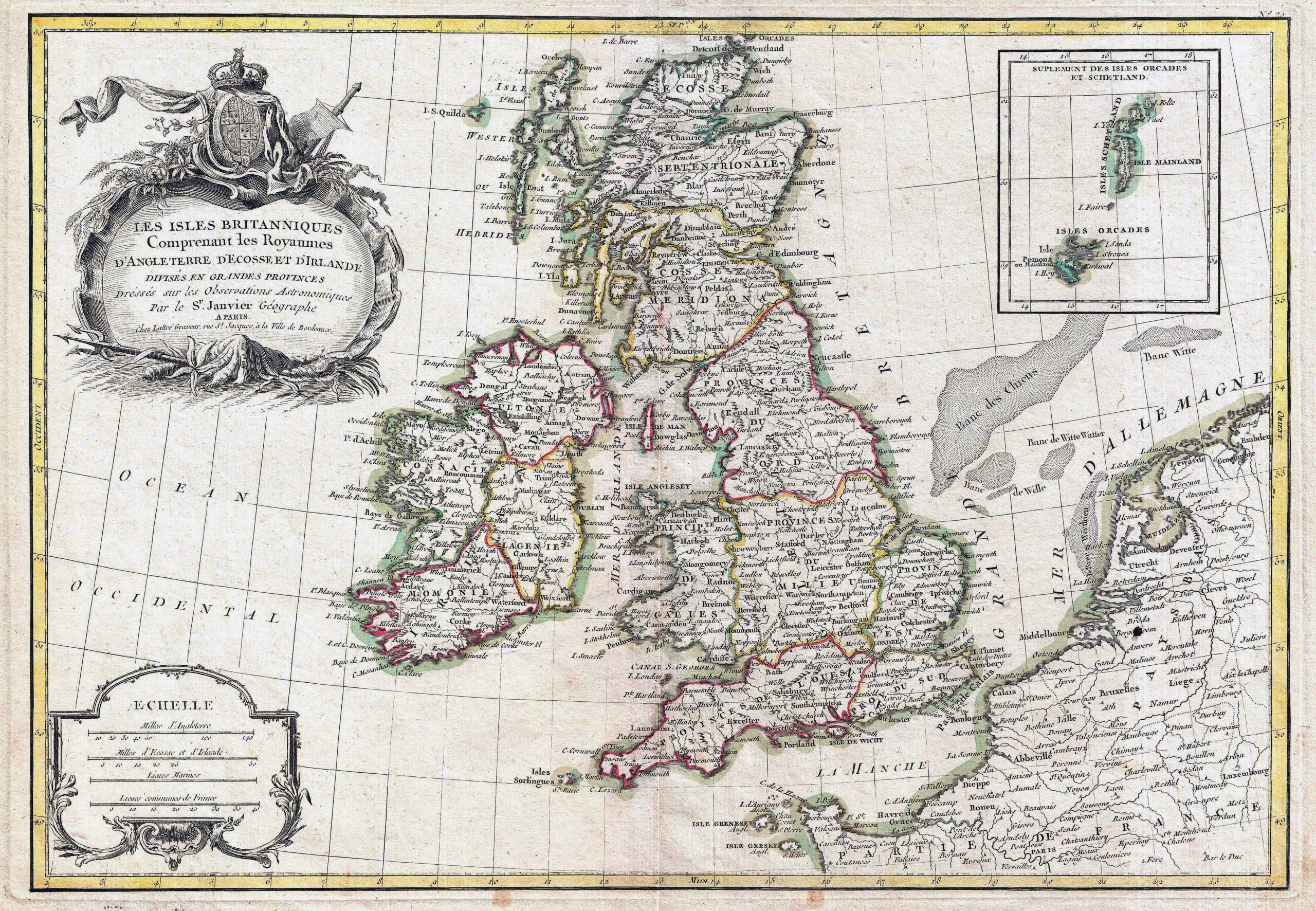
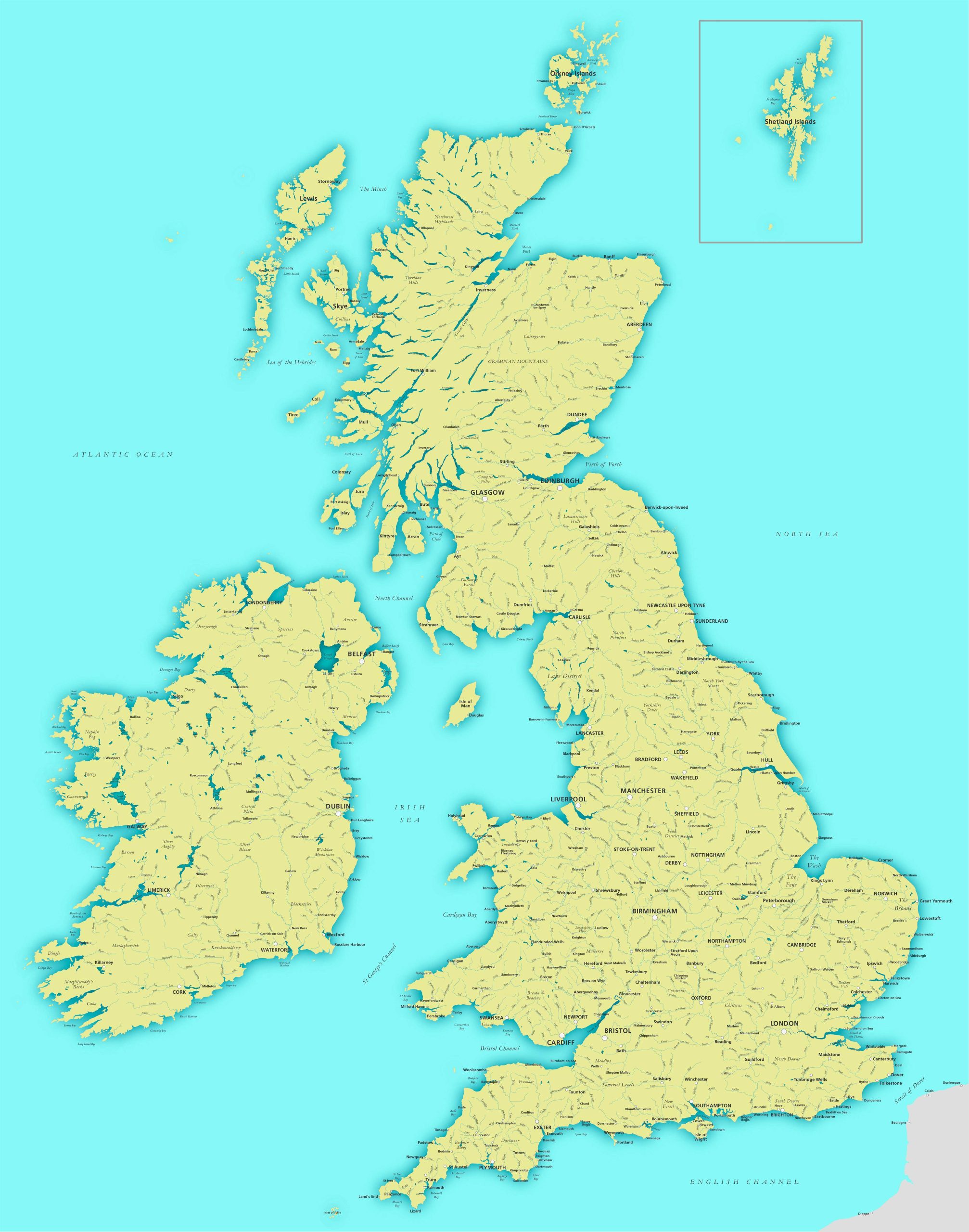
14. United Kingdom Historical Map (1771)
A striking representation of Janvier’s 1771 ornamental map highlighting the British Isles. An additional inset at the top right showcases the Shetland and Orkney Islands. This map was featured in Jean Lattre’s “Atlas Moderne” from 1776.
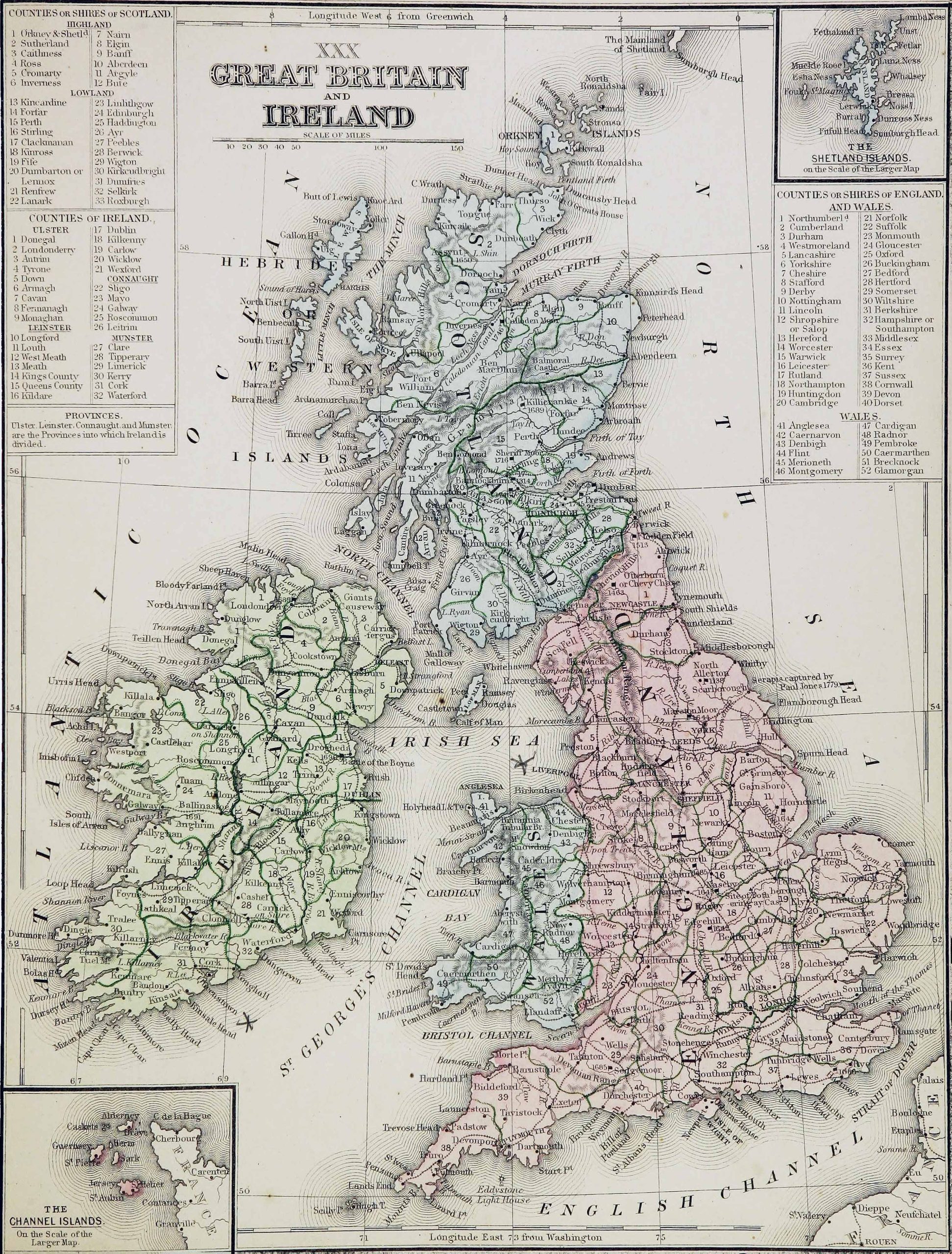
15. United Kingdom Historical Map (1865)
It meticulously lists all the counties within Scotland, England, Wales, as well as both Northern and Southern Ireland. This map, crafted by Samuel Augustus in 1865, is housed in the Cornell University Library.
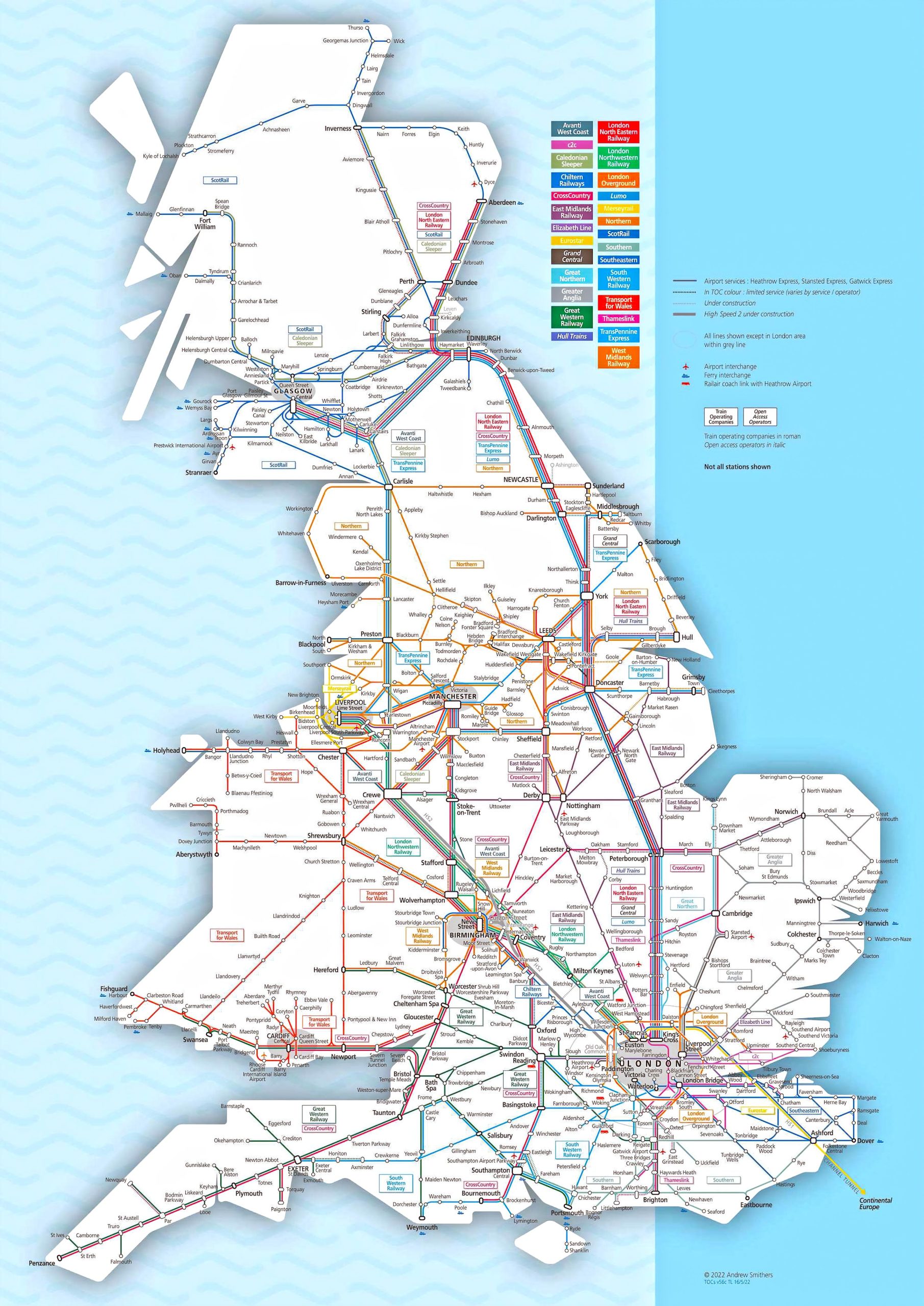
16. United Kingdom Train-Railway Map
Traverse the railways of the UK. Perfect for those looking to journey by train.
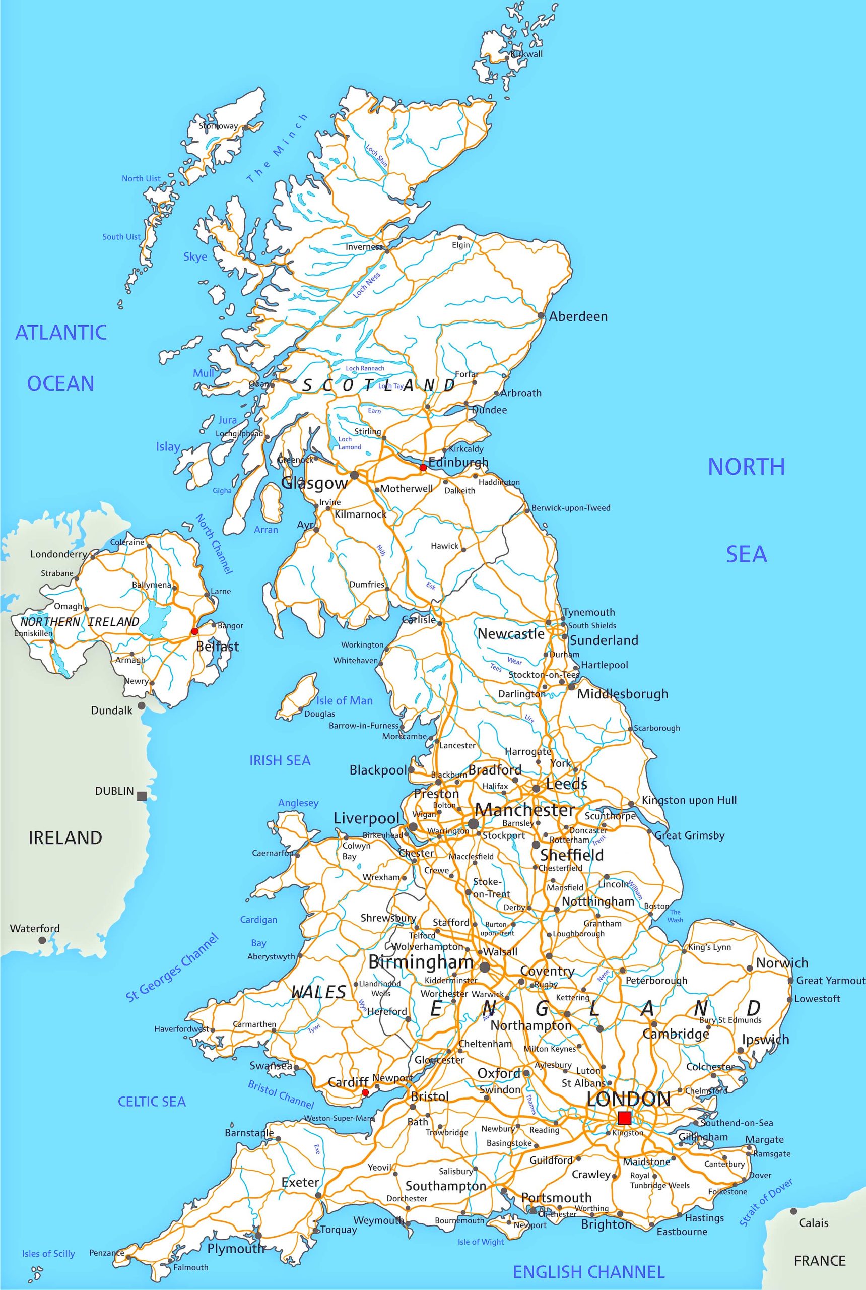
17. United Kingdom Road Map
For the road trippers out there, this map provides a clear view of the UK’s intricate road network.
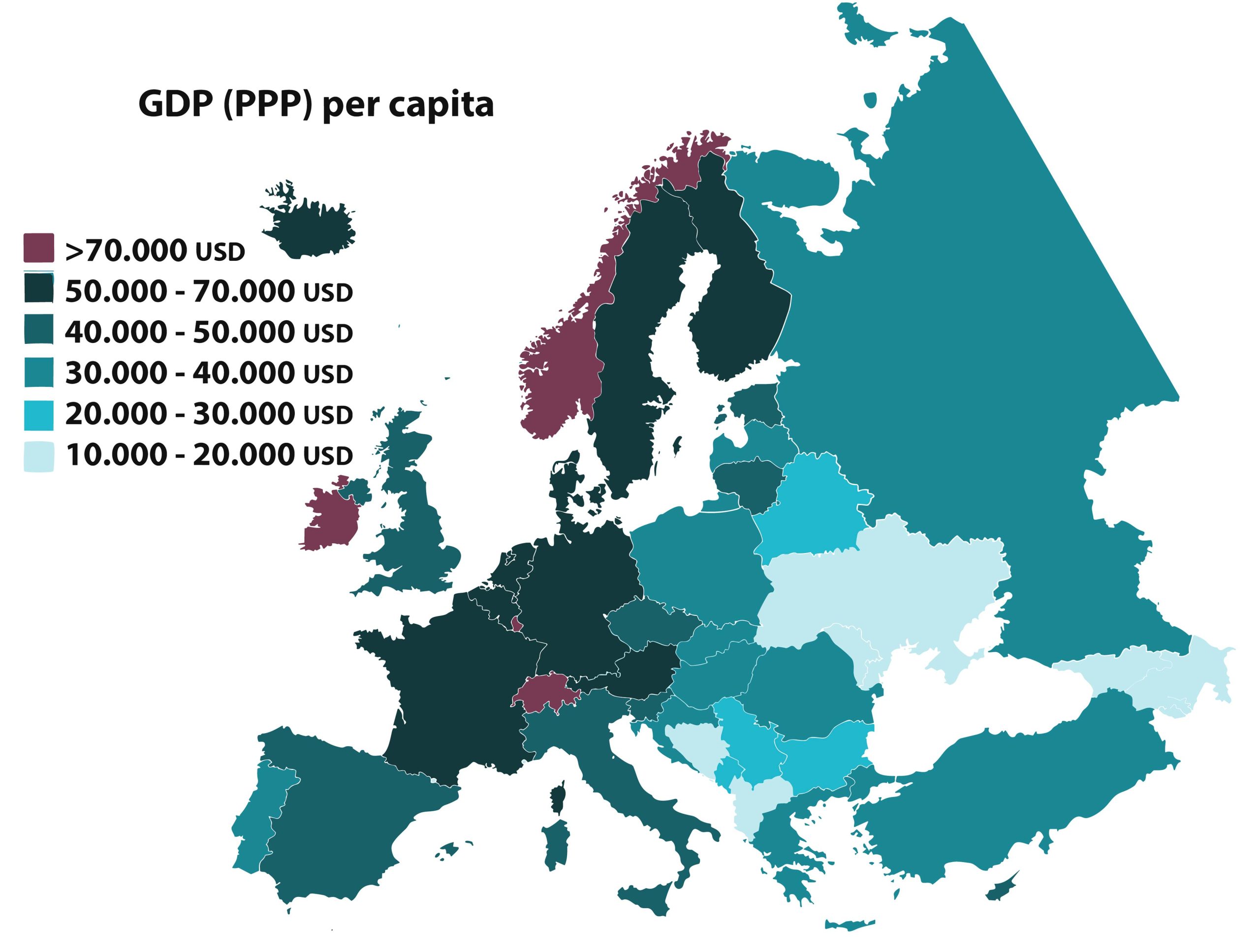
18. United Kingdom GDP (PPP) Per Capita Map in Europe (2021)
A modern perspective map showcasing the economic status of UK countries based on GDP (PPP) per capita.
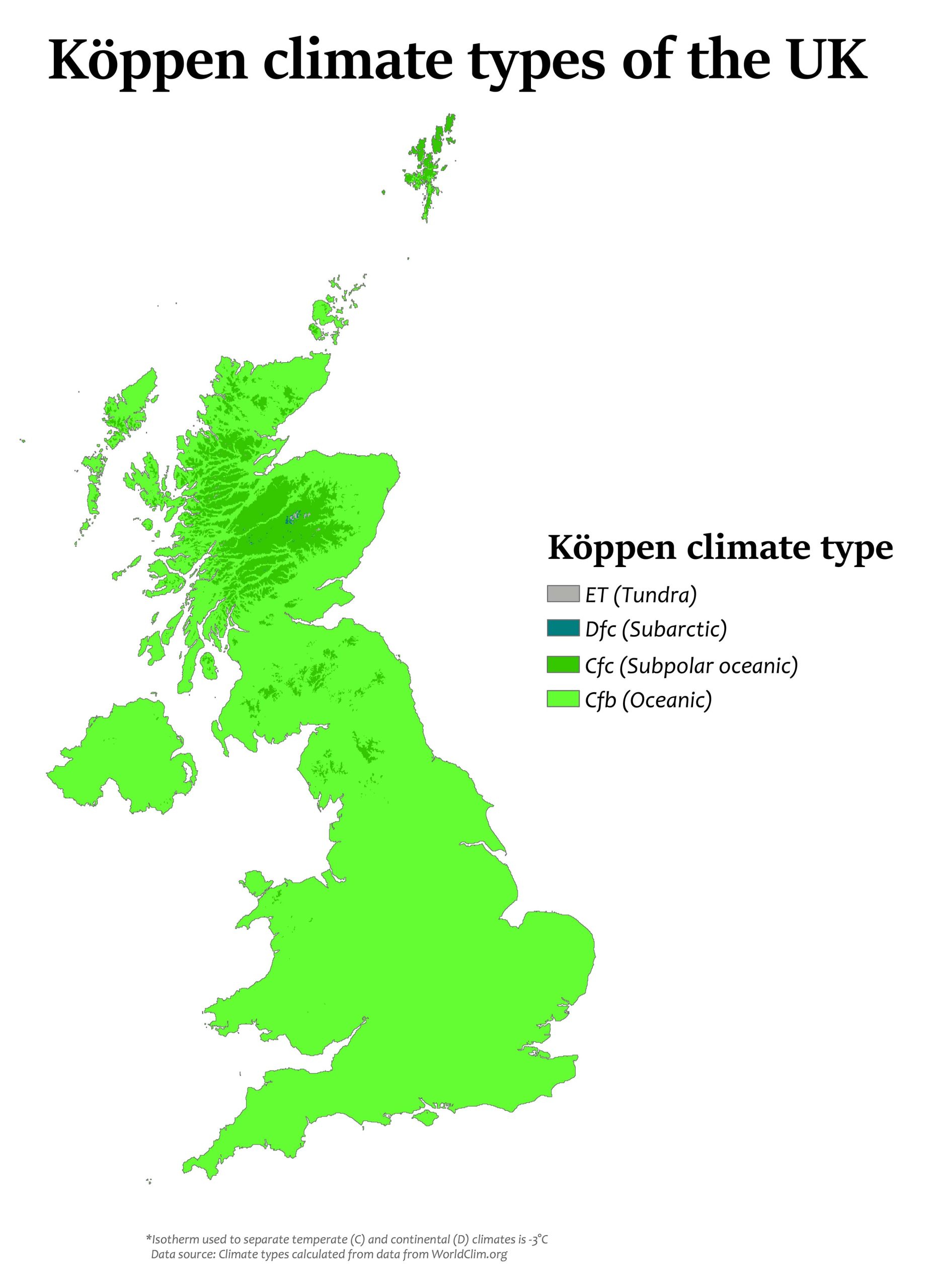
19. United Kingdom Climatic Map
Get familiar with the varied climatic zones of the UK, an essential for travelers.
20. United Kingdom Water Map (River)
The Spain Water Map (River) intricately charts the flow of Spain’s rivers, tracing their paths from mountain springs to coastal deltas.
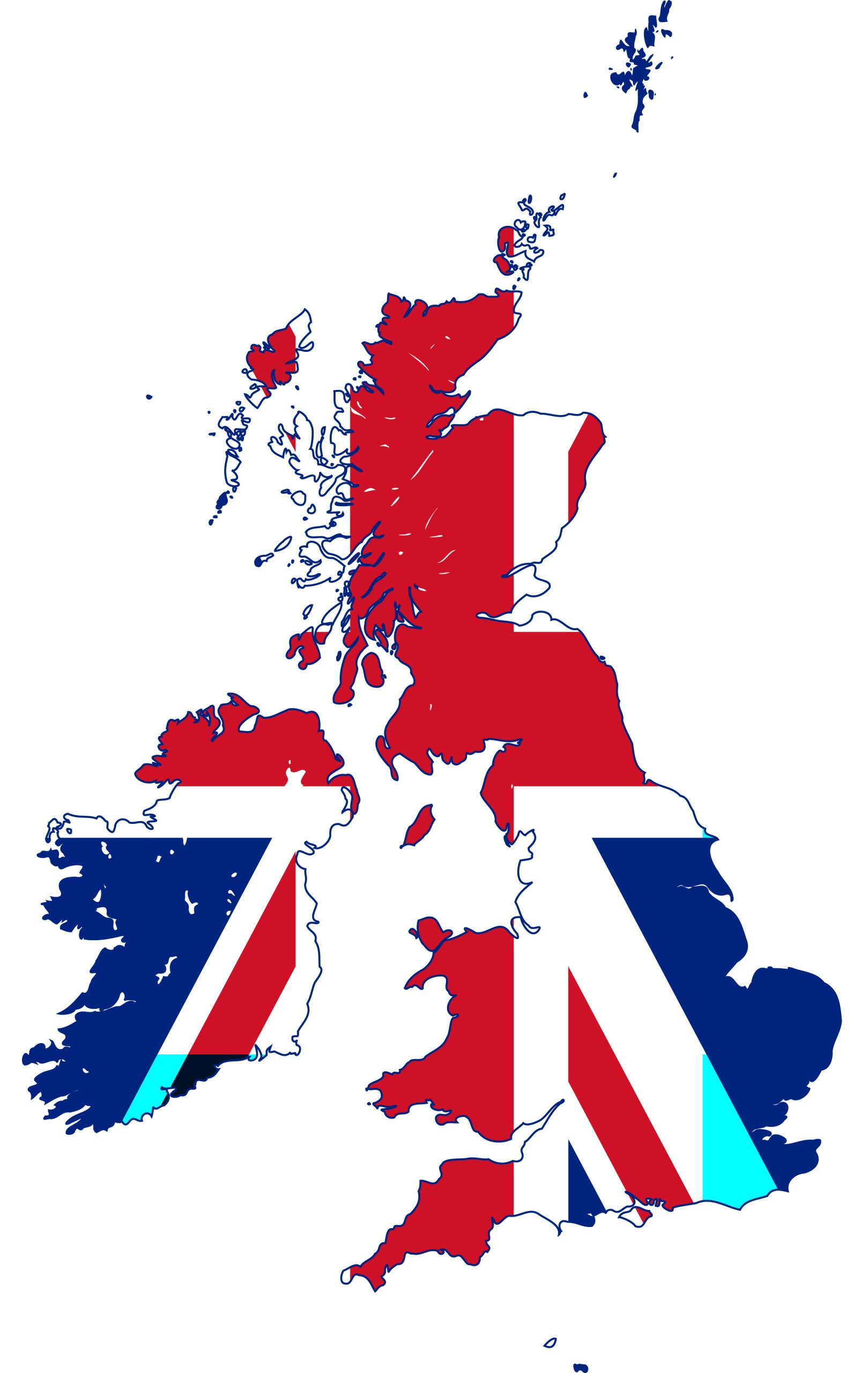
21. United Kingdom Flag Map
A fusion of geography and patriotism, this map paints the UK with its iconic flag.
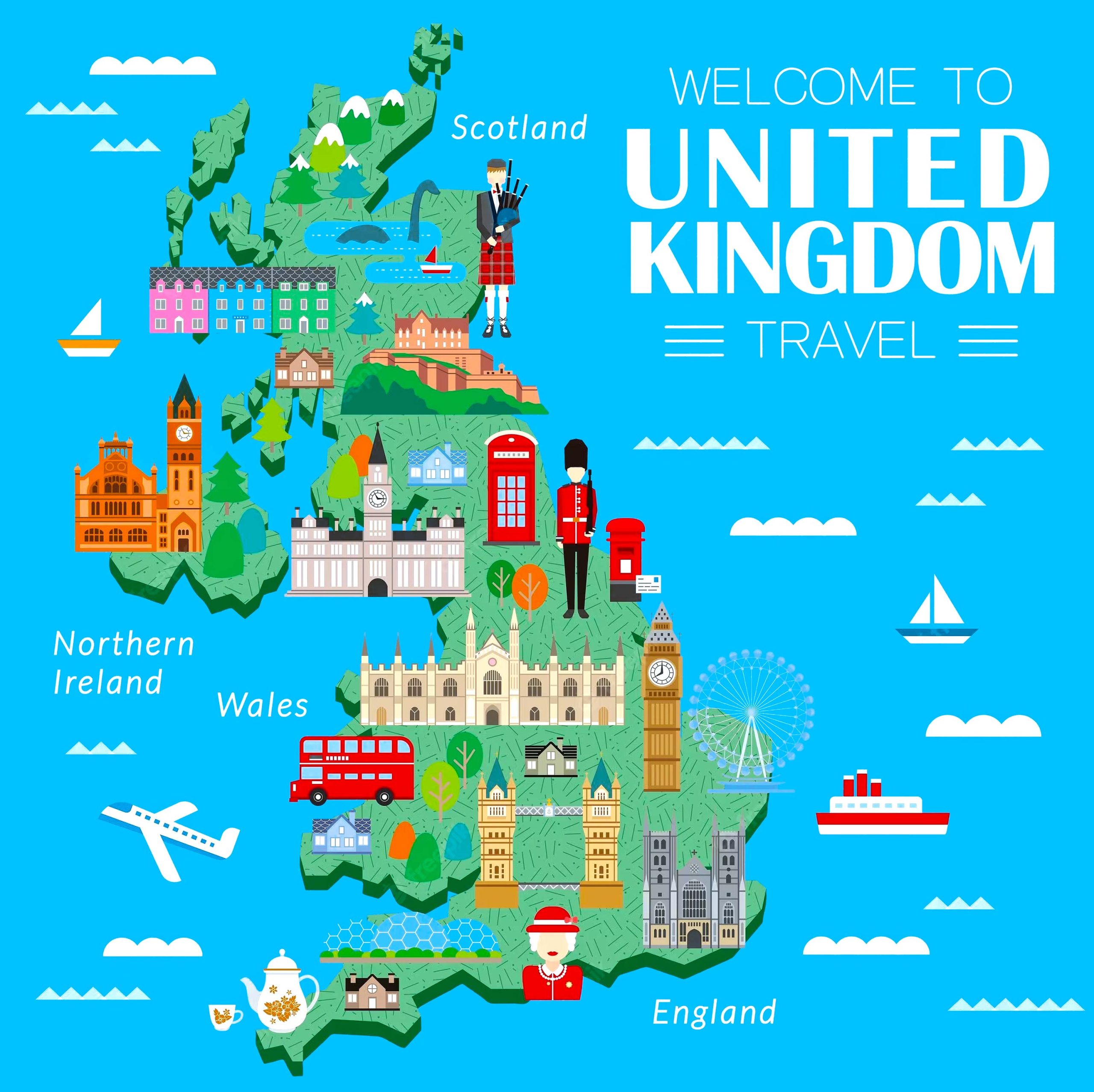
22. United Kingdom Travel (Tourist) Map
Curated for travelers, highlighting tourist hotspots, attractions, and hidden gems.
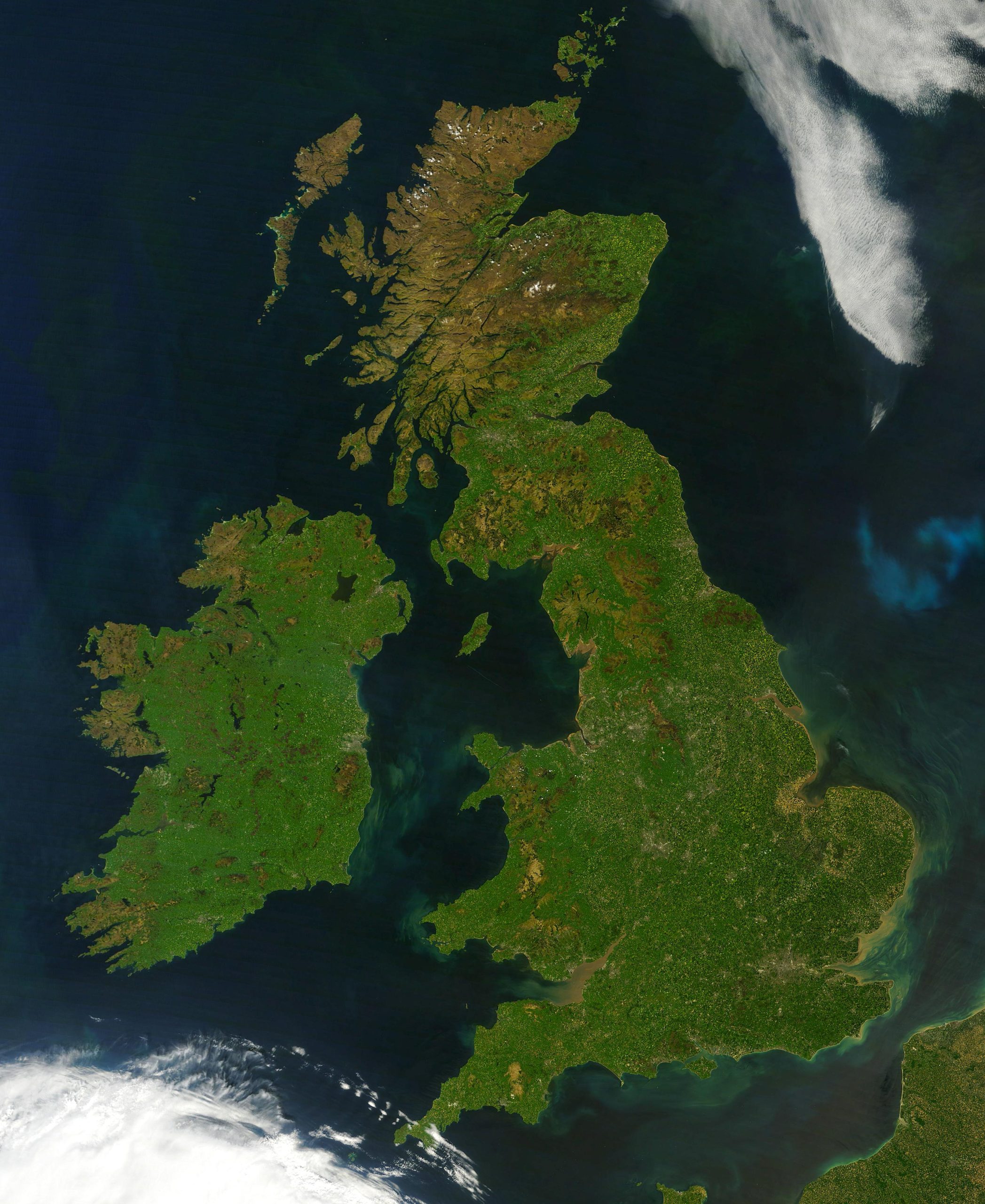
23. United Kingdom Earth Satellite Map
Gaze upon the UK from space, offering a satellite perspective of this majestic land.
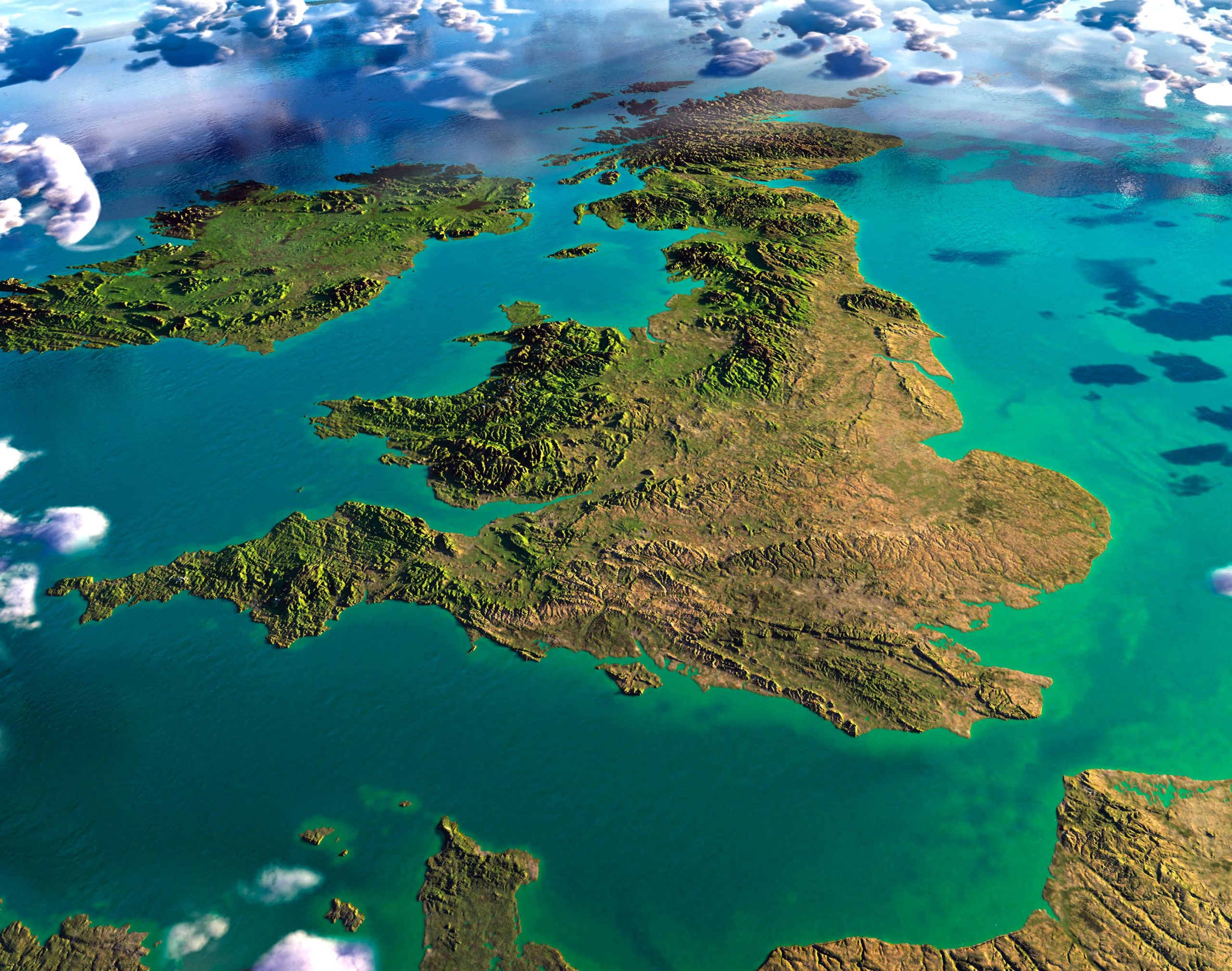
24. United Kingdom 3D View From Space
Experience the splendor of the United Kingdom from an unparalleled perspective. Witness its unique contours, vast landscapes, and iconic landmarks in a stunning 3D visualization as seen from the vastness of space.
The United Kingdom is a tapestry of rich cultures, traditions, and histories between its constituent countries: England, Scotland, Wales, and Northern Ireland. Each brings its unique charm, landscapes, and stories to the table. From the rolling hills of the English countryside, the rugged Scottish highlands, the mystic valleys of Wales, to the captivating landscapes of Northern Ireland, every corner holds a tale waiting to be told. As we traverse through these maps, let’s remember that they are more than just illustrations; they are an embodiment of the heritage, spirit, and indomitable will of the people that have shaped these lands. So, whether you’re a traveler, historian, or just a curious soul, may these maps guide you deeper into the heart and soul of the United Kingdom. Here’s to the journeys and revelations that await!
Where is United Kingdom on the Europe Map?
Show Google Maps and satellite maps of where the country is located.
Get directions by driving, walking, bicycling, public transportation, and travel with street view.
Feel free to explore these pages as well:
- Ireland Map ↗️
- Map of Ireland ↗️
- Discovering Belfast: The Northern Gem of the UK ↗️
- A Collection of United Kingdom Maps: A Comprehensive Atlas ↗️
- United Kingdom Map ↗️
- Map of United Kingdom ↗️
- Scotland Map ↗️
- Wales Map ↗️

