Discover Scotland with a detailed map showing its position in Europe and the world. Explore political, physical and terrain maps showing major cities, highways, railways and geographical landmarks in this stunning region of the UK.
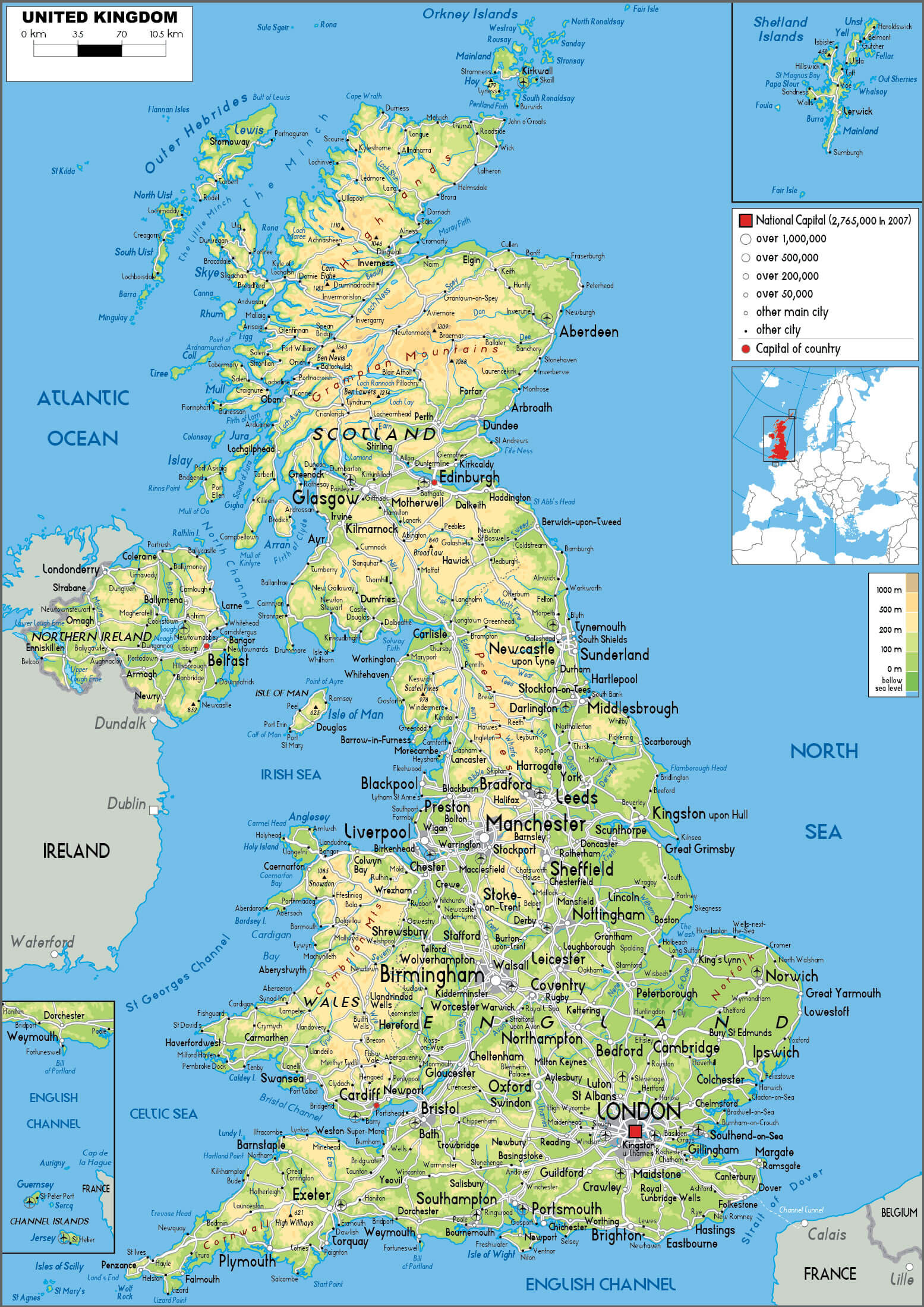
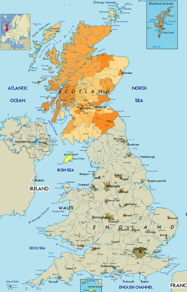
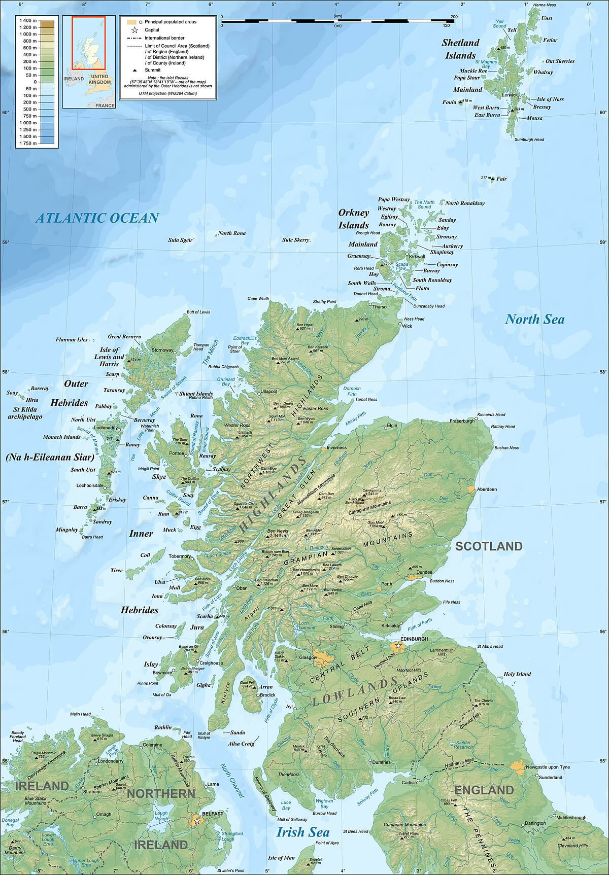
Physical map of Scotland with UK
Brief information about Scotland
Scotland is a country in the United Kingdom, occupying the northern third of the island of Great Britain. It borders England to the south, the Atlantic Ocean to the west and north, and the North Sea to the north-east. Scotland has over 790 islands, including the Hebrides, Orkney and Shetland. The capital is Edinburgh, known for its historical and cultural importance, while Glasgow, the largest city, is a centre of commerce and industry.
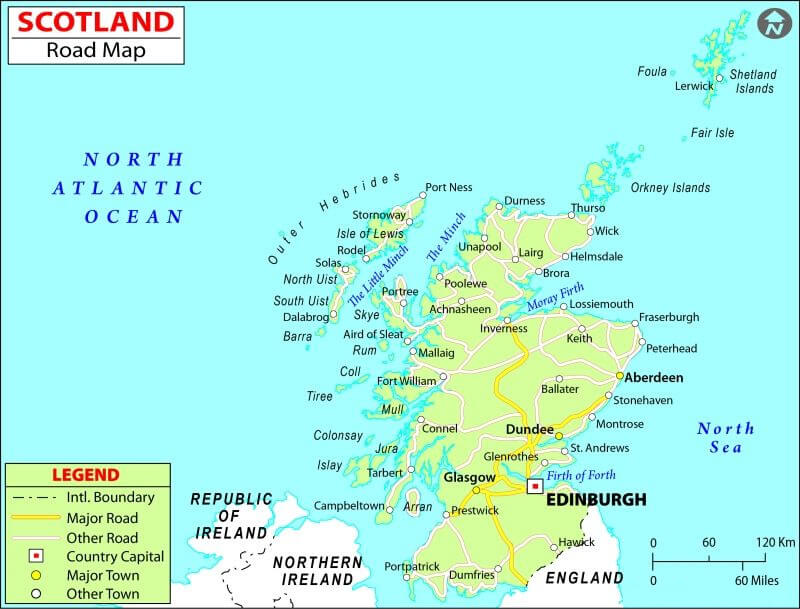
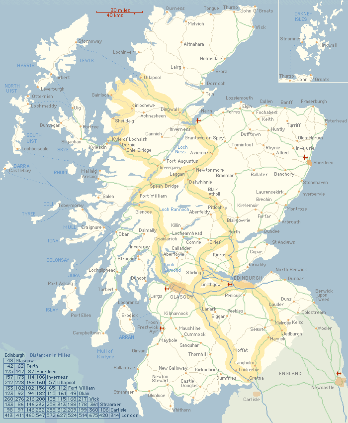
Scotland road map
Scotland is renowned for its rich history, from its ancient Celtic roots to its role in shaping the United Kingdom. It has its own legal system, educational institutions and cultural traditions, including the Gaelic language, bagpipes, kilts and Highland games. The landscape is diverse, with famous highlands, lochs (such as Loch Ness) and beautiful coastlines, making it a popular tourist destination. Today, Scotland maintains a degree of political autonomy within the United Kingdom, with its own parliament in Edinburgh.
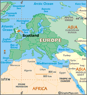
Where is located Scotland on the World Map
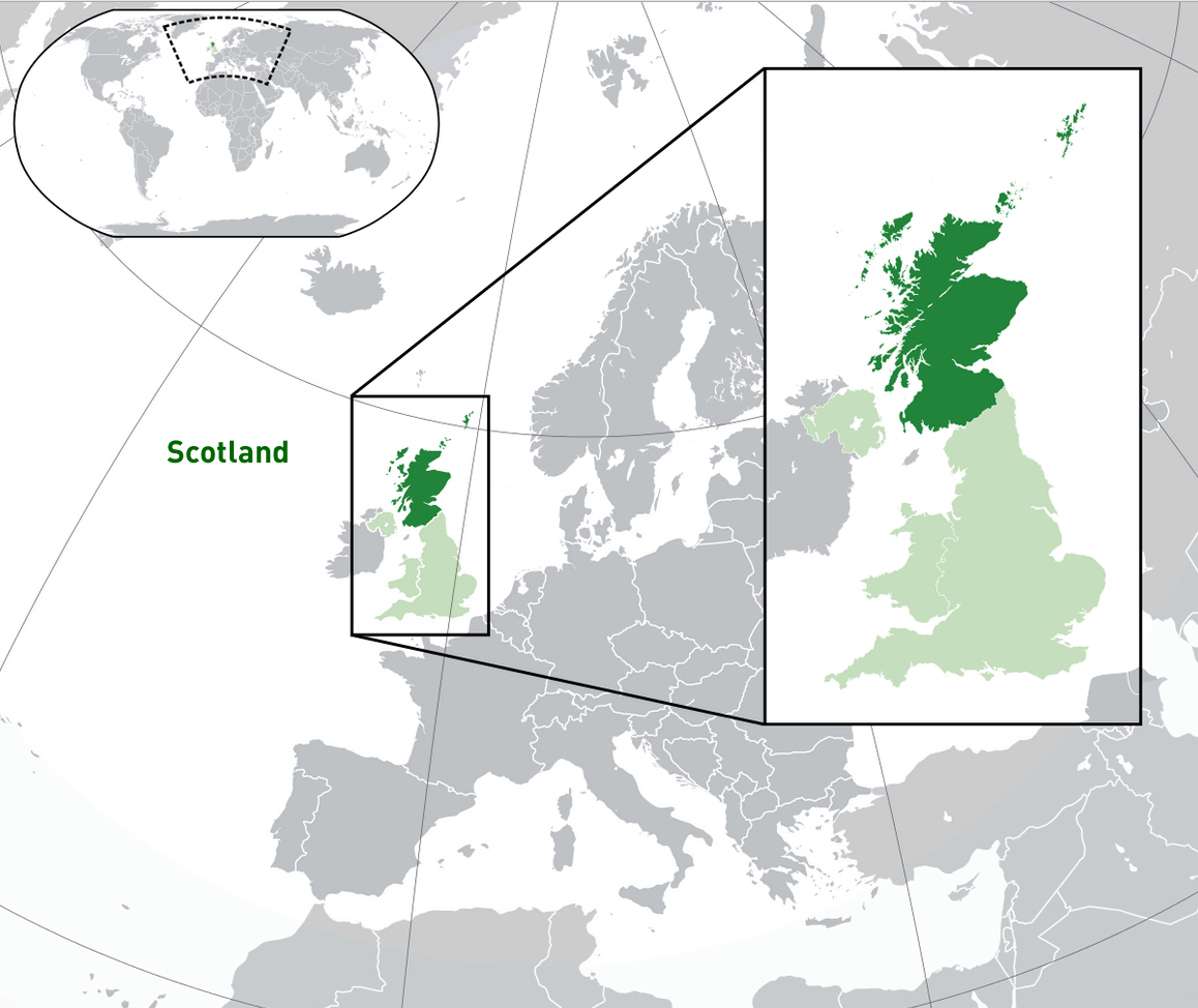
Scotland is located in the northern part of the United Kingdom, occupying the top third of the island of Great Britain in Western Europe. It is bordered by England to the south, the Atlantic Ocean to the west and north, and the North Sea to the east. Scotland is part of the British Isles, which include other countries such as England, Wales and Ireland.
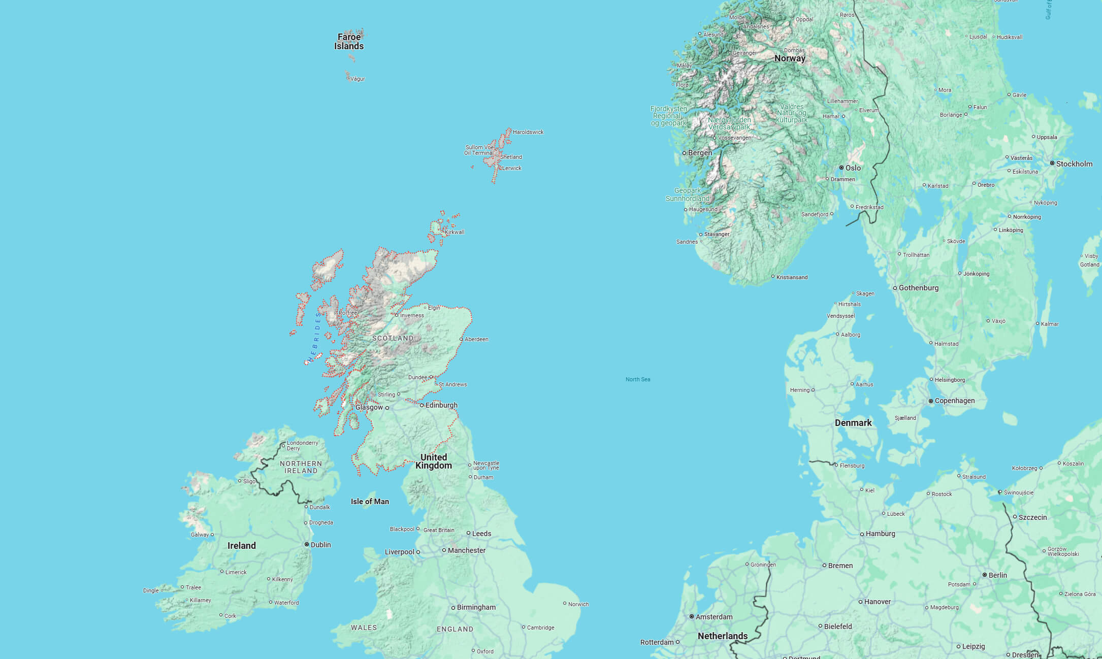
On the world map, Scotland lies to the north-west of mainland Europe, across the North Sea from Norway and Denmark. Its location gives it a rugged, mountainous landscape, especially in the Highlands, and a long, irregular coastline with numerous islands, including the Hebrides, Orkney and Shetland archipelagos.
Scotland’s strategic location has influenced its history, with close links to northern Europe and a longstanding relationship with England. Today it is renowned for its rich cultural heritage, historic castles and scenic landscapes, attracting visitors from all over the world.
Here are some statistical information about Scotland:
 Area: 80,231 km2 (30,977 sq mi)
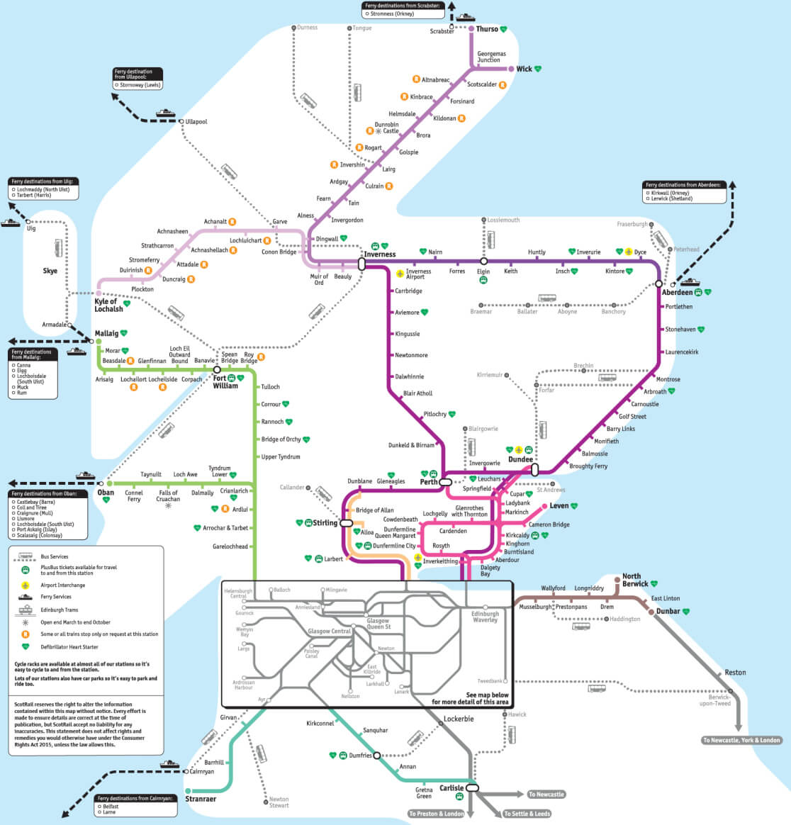
Scotland railway map
 Religion: No religion (51.1%), Christianity (38.8%) [Church of Scotland (20.4%), Roman Catholic (13.3%), Other Christian (5.1%)], Islam (2.2%), Hinduism (0.6%), Buddhism (0.3%), Sikhism (0.2%), Judaism (0.1%), Other (0.6%), Not stated (6.2%).
 Scotland Map
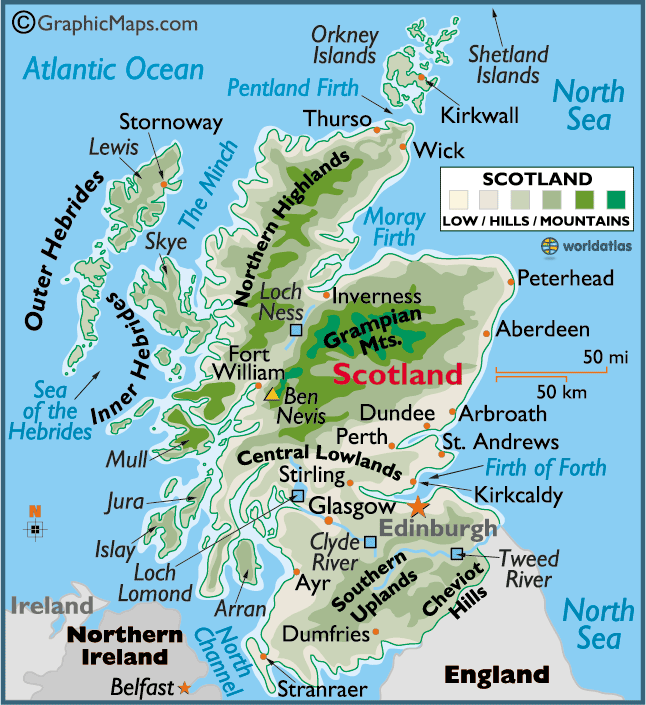
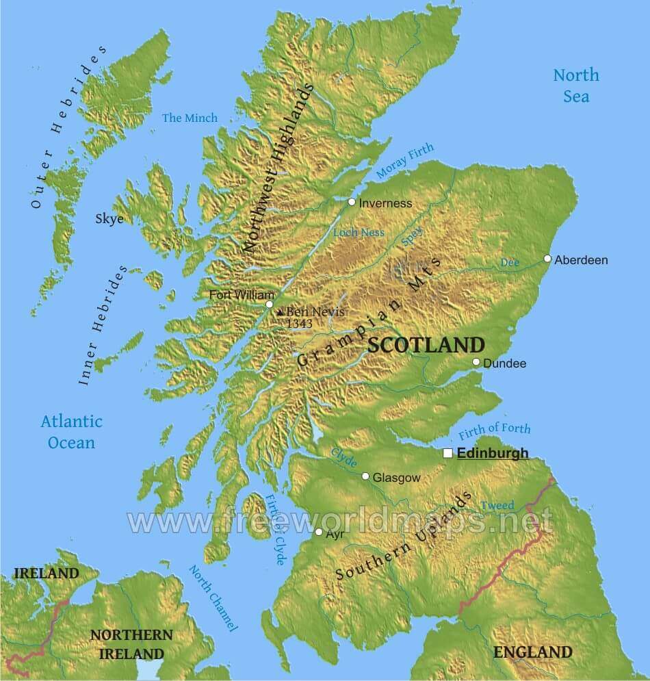
This detailed map of Scotland highlights key geographical features, including major cities like Edinburgh, Glasgow, and Inverness, as well as significant mountain ranges like the Grampian Mountains and the Northern Highlands. Scotland’s surrounding islands, such as the Shetland Islands, Orkney Islands, and Hebrides, are also displayed.
Map of Principal Areas of Scotland
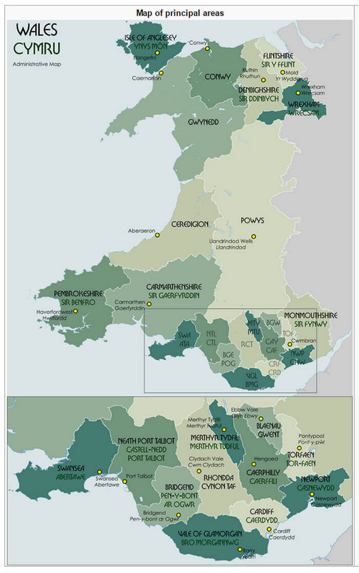 Map showing administrative principal areas in Scotland.
This map illustrates the administrative divisions of Scotland, with areas such as Highland, Edinburgh, and Glasgow clearly labeled. Each principal area is shown in various shades to indicate boundaries for local governance and organization.
Cities Map of Scotland
Map of Scotland
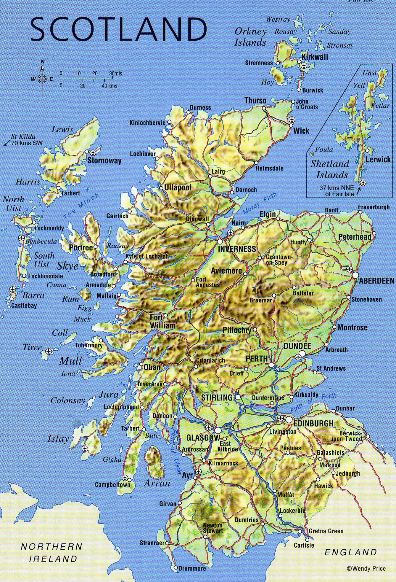
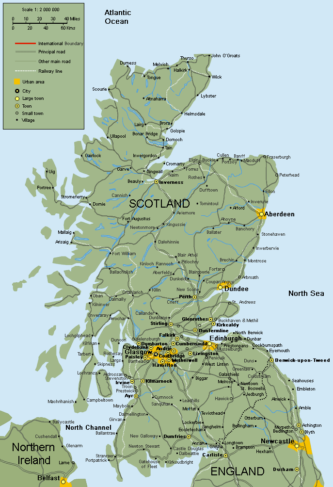 Scotland map showing cities, towns, roads, and railways
This map provides a detailed view of Scotland, highlighting major cities like Edinburgh, Glasgow, and Aberdeen, along with smaller towns, villages, and rural areas. It includes major roadways, railways, and urban areas, making it easy to see transportation routes across the country. Scotland’s neighboring regions, including parts of Northern Ireland and England, are also visible, providing geographic context. The map is useful for understanding the layout of Scotland’s urban and rural regions and their connectivity.
Scotland Cities Map
Scotland Region Map
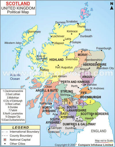
Scotland Political Map
Map Scotland
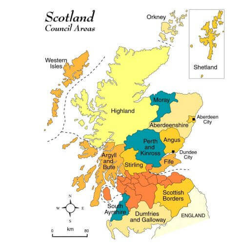 Map showing council areas of Scotland with major regions highlighted
This map illustrates the council areas of Scotland, highlighting major regions and key administrative divisions. Areas such as Highland, Aberdeenshire, and Dumfries and Galloway are marked, along with significant islands like the Shetland and Orkney. The map provides a clear overview of Scotland’s administrative structure, displaying each council area in distinct colors, which is useful for understanding regional governance across the country.
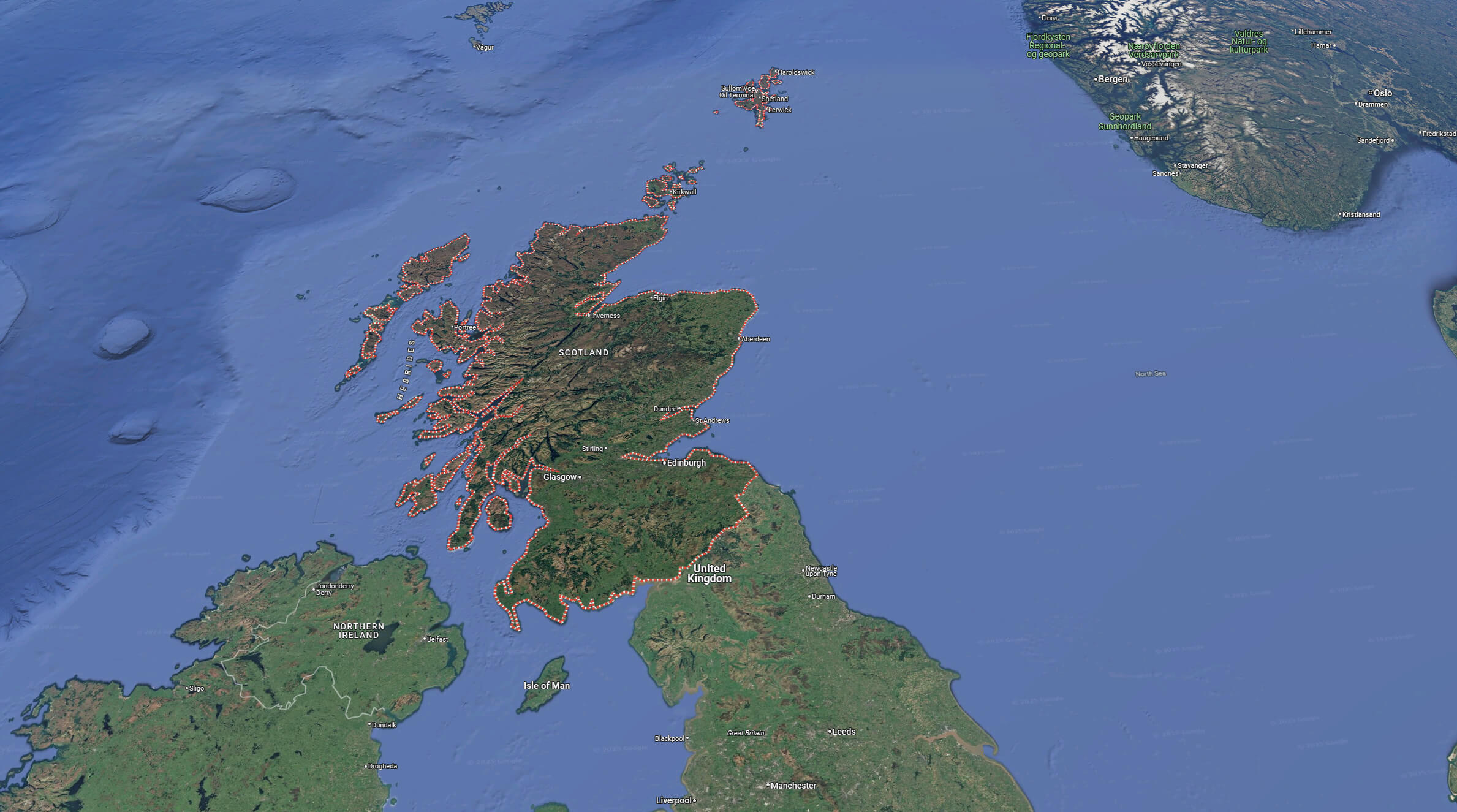
Scotland Europe Map
Scotland Geography Map
Scotland topography map
Scotland satellite map
Scotland satellite map with UK
Scotland map with cities
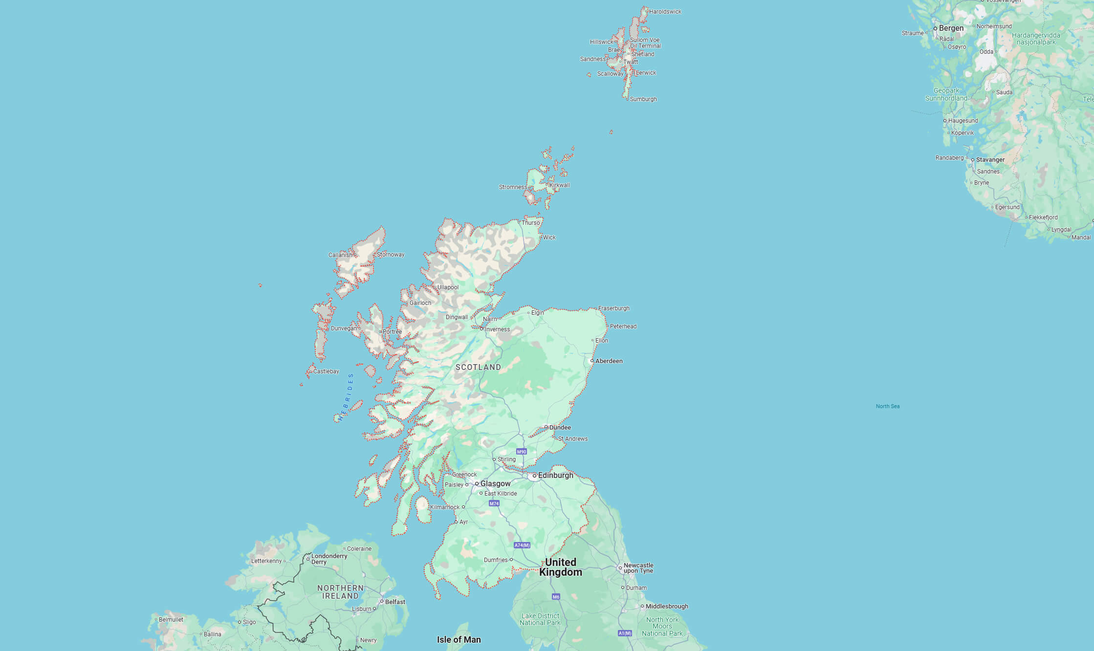
Scotland terrain map
Where is Scotland on the World and UK Map?
Show Google Maps and satellite maps of where the country is located.
Get directions by driving, walking, bicycling, public transportation, and travel with street view.
Feel free to explore these pages as well:
- A Collection of United Kingdom Maps ↗️
- Map of United Kingdom ↗️
- United Kingdom Map ↗️
- England Map ↗️
- Wales Map ↗️
- Discovering Cardiff: A Gem in the Heart of Wales ↗️
- Birmingham Unveiled: The Heart of England’s Hidden Gems ↗️
- Discovering Belfast: The Northern Gem of the UK ↗️
- Bradford, United Kingdom: A Vibrant Tapestry of Culture and History ↗️
- Isle of Man Map ↗️
- United States Map ↗️
- France Map ↗️
- Canada Map ↗️