The Essential Collection of Isle of Man Maps for Travelers and Geographers: Discover the Isle of Man with our detailed map showcasing its towns, roads, political, physical, satellite maps, and natural beauty.
Map of Isle of Man
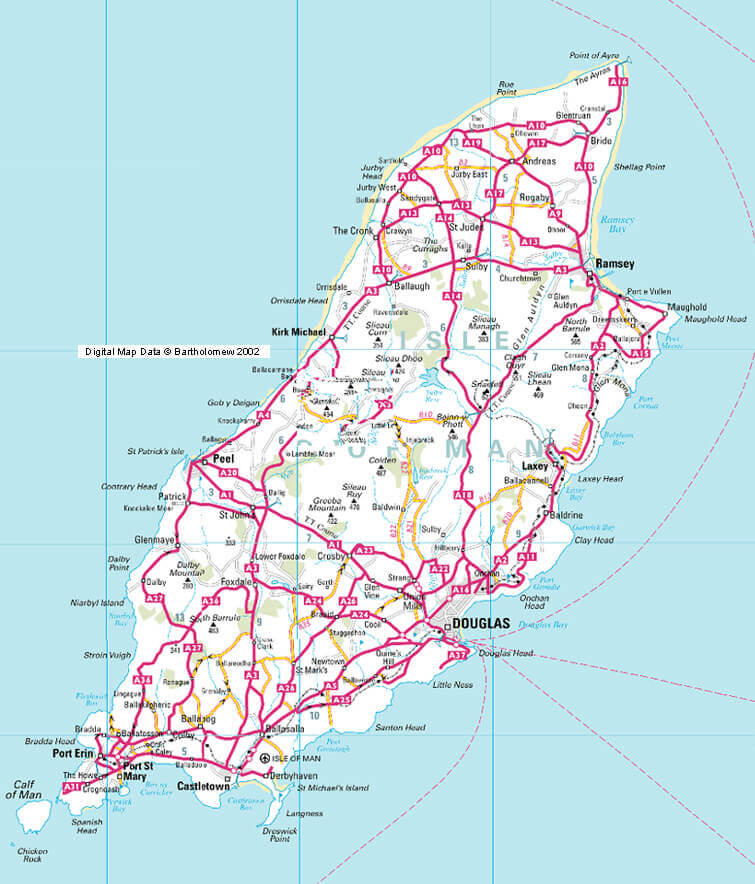
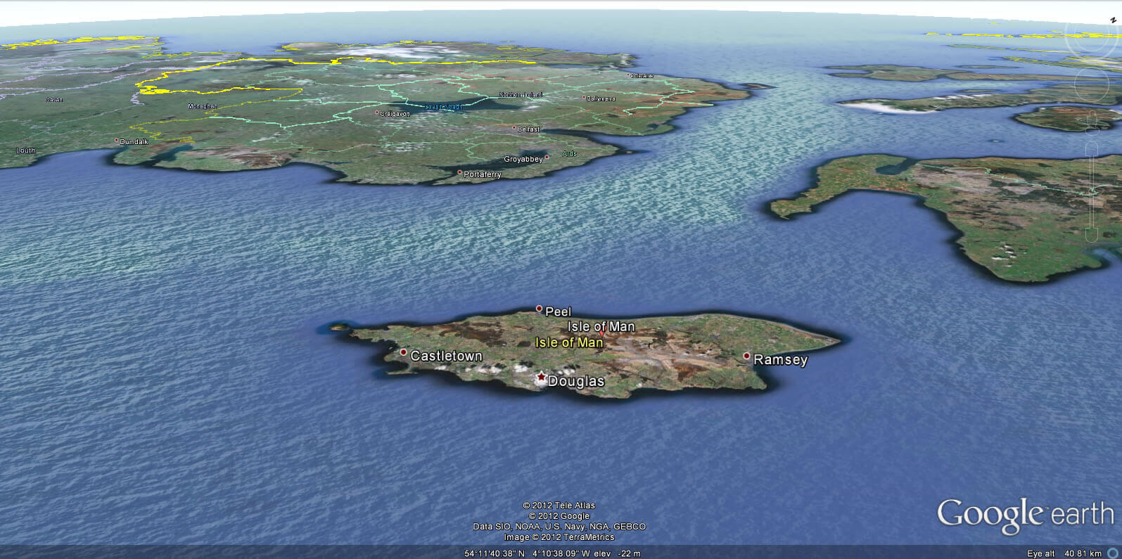
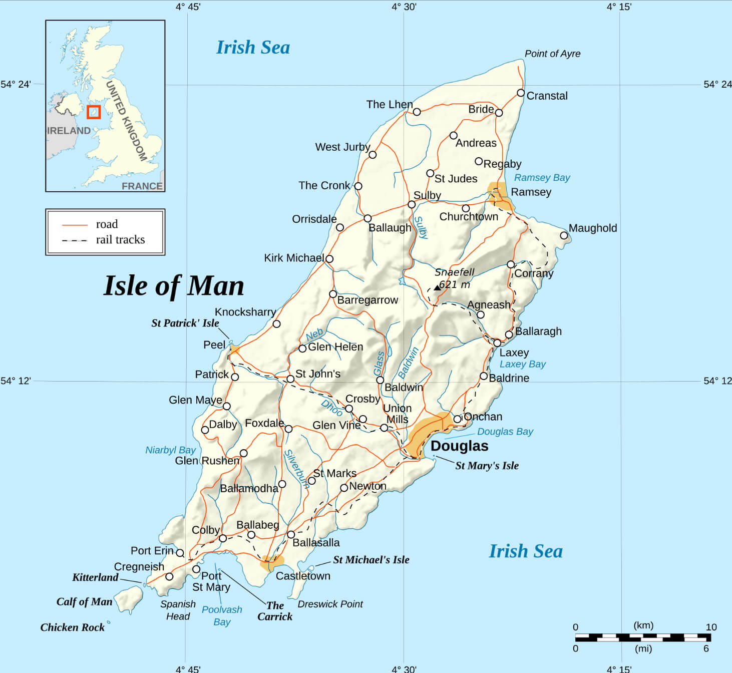 Detailed map of the Isle of Man with towns, roads, and railways.
This map of the Isle of Man shows its main towns, roads, and railways, with Douglas as the capital. It highlights coastal regions, notable landmarks, and elevation points. The map also includes an inset showing the island’s location relative to the British Isles.
Brief information about Isle of Man
Nestled in the Irish Sea between Great Britain and Ireland, the Isle of Man is a small but captivating island renowned for its natural beauty and unique culture. With a population of just over 80,000, the Isle of Man is renowned for its stunning landscapes, from rugged coastlines and tranquil beaches to green valleys and rolling hills. It’s an autonomous British Crown dependency, meaning it has its own parliament, laws and traditions, making it distinct from both the United Kingdom and Ireland.
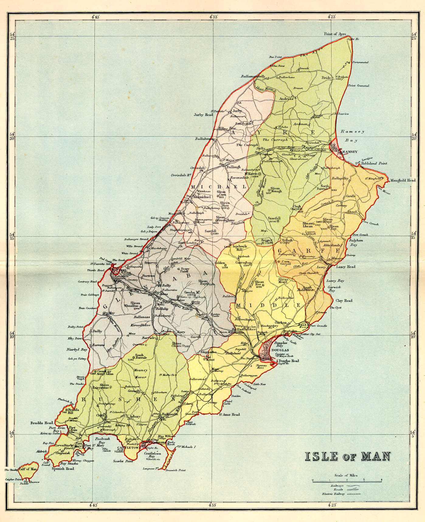
Isle of Man Political Map
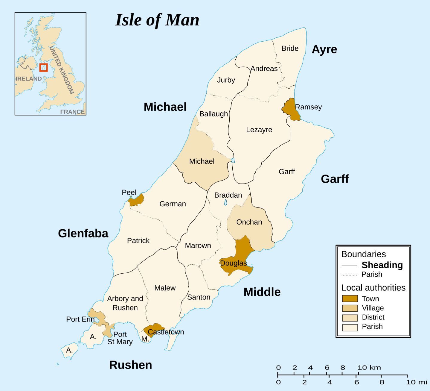 Isle of Man political map with towns, districts, and boundaries
This political map of the Isle of Man shows its administrative divisions, including parishes, towns, and local authorities. Major areas like Douglas, Peel, and Ramsey are highlighted, along with the island’s traditional sheading boundaries. An inset locates it within the British Isles.
One of the island’s most famous traditions is the Isle of Man TT (Tourist Trophy) motorcycle race, a thrilling event that attracts racers and spectators from all over the world. Held annually, this challenging race takes place on the island’s winding roads and is a spectacular display of skill and speed. Aside from racing, the Isle of Man also has a rich folklore, with tales of fairies, or “themselves” as the locals call them, adding an air of mystery and charm to this beautiful island.
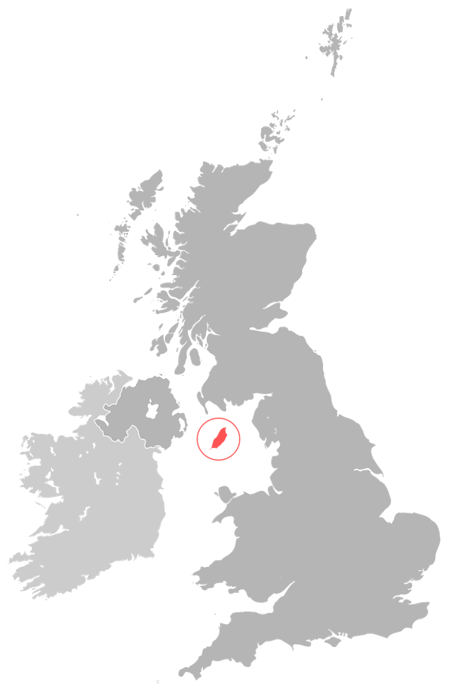
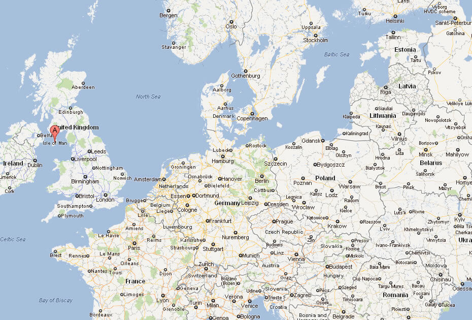
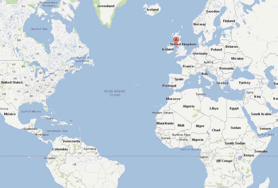
Where is located Isle of Man on the World Map
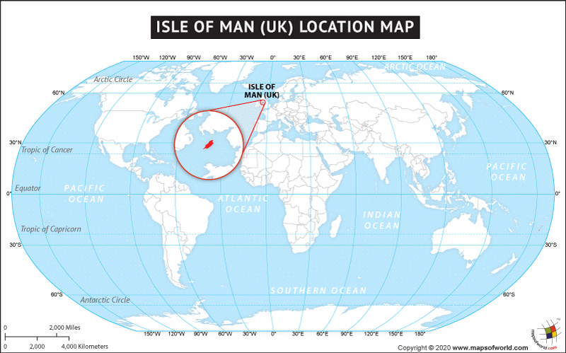
The Isle of Man lies in the Irish Sea, between the west coast of England and the east coast of Northern Ireland. Although geographically close to the UK and Ireland, the Isle of Man is a self-governing British Crown Dependency, making it distinct in both its governance and cultural identity. Its strategic location has historically made it a point of connection between neighbouring countries, while retaining its own unique heritage.
On a world map, the Isle of Man appears as a small island nestled between Great Britain and Ireland. Despite its size, the island’s location has given it an important place in regional trade and travel for centuries. The island is approximately 33 miles (53 km) long and 13 miles (21 km) wide, offering a compact yet varied landscape of coastal cliffs, rolling hills and picturesque towns.
The island’s proximity to major cities such as Liverpool in England and Belfast in Northern Ireland makes it easily accessible by ferry or air. The Isle of Man may appear small on the map, but it is rich in history, natural beauty and a distinct cultural charm that attracts visitors from all over the world. Its location offers a tranquil escape, yet within easy reach of the bustling British Isles.
Here are some statistical information about Isle of Man:
 Area: 574 km2 (222 sq mi)
Isle of Man Kingdom of Mann, in 1100
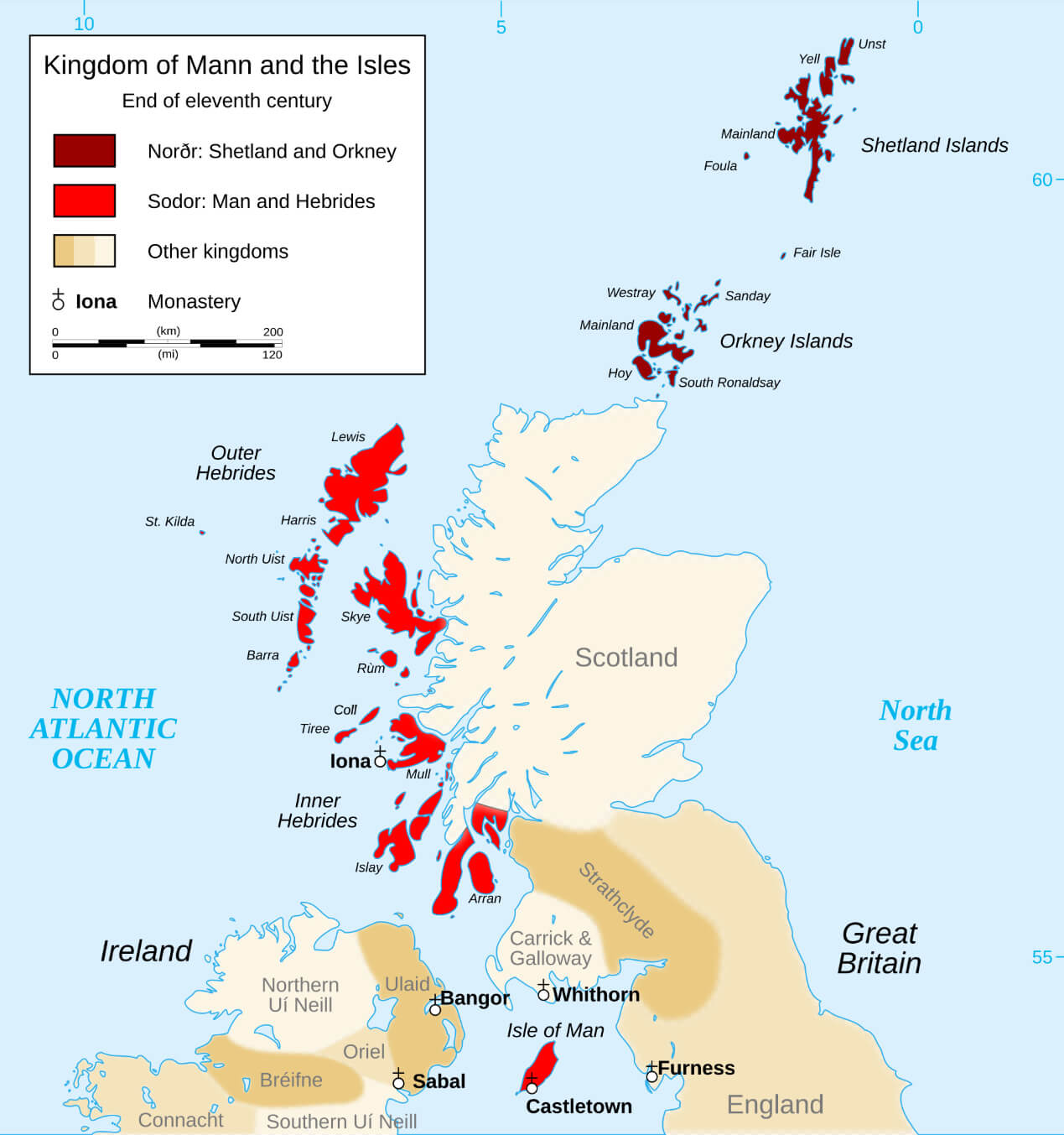 Map depicting the ancient Kingdom of Mann on the Isle of Man
This image illustrates the historical Kingdom of Mann, representing the Isle of Man during the medieval period when it was an independent realm. The map highlights significant locations and territorial boundaries, showcasing the island’s rich heritage and its importance in regional history.
Isle of Man Roads Map
Isle of Man Location Map
Isle of Man Map
Where is located Isle of Man in the World
Map of Isle of Man Europe
Map of Isle of Man World
Physical Map of the Isle of Man
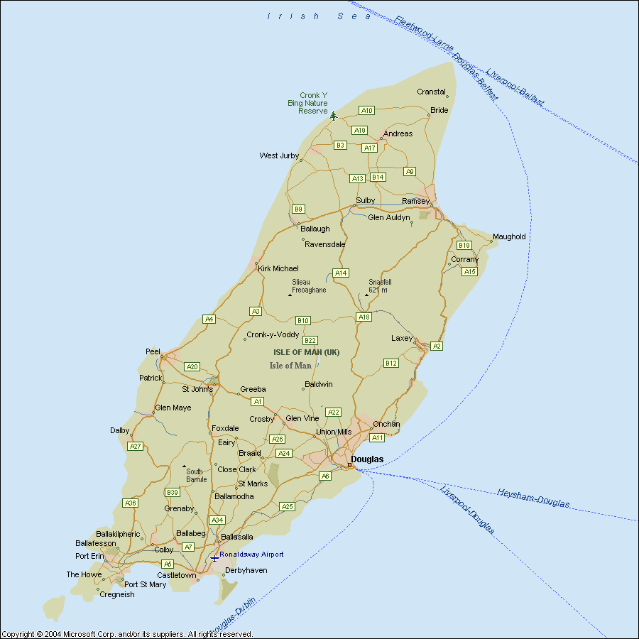
 Map of the Isle of Man with geographic and district divisions
This is a detailed physical map of the Isle of Man, showing its geographic layout, including coastal regions, districts, and main towns. The map highlights major roads, rivers, and natural landmarks, offering a historical perspective on the island’s division.
Isle of Man Earth Map
Isle of Man satellite map
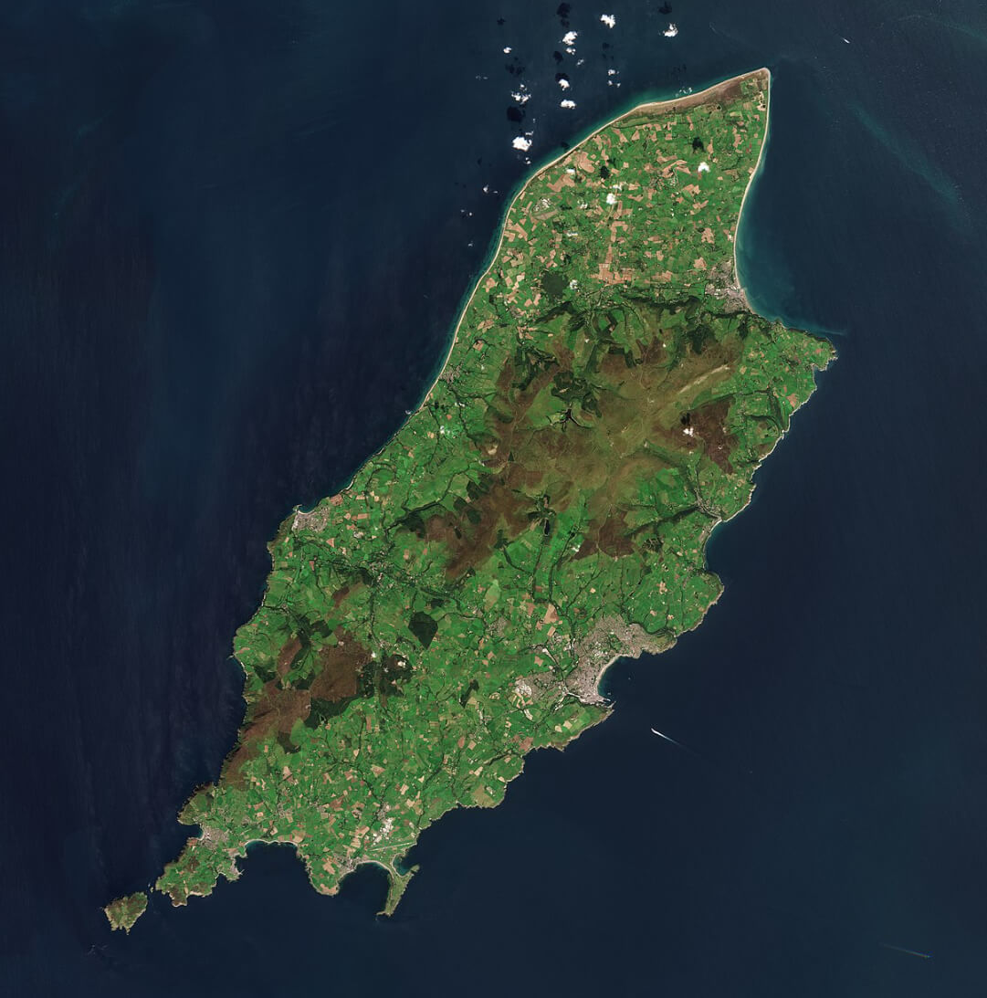
physical map of the isle of man
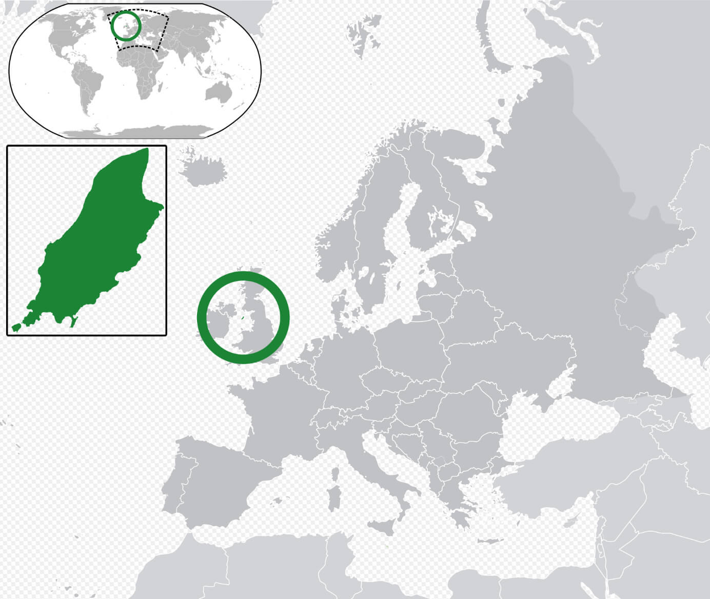
Where is Located Isle of Man on the Europe and the World Map?
Show Google interactive map, satellite map, where is the country located.
Get directions by driving, walking, bicycling, public transportation, and traveling with street view.
Feel free to explore these pages as well:
- Guernsey Map ↗️
- Jersey Map ↗️
- France Map ↗️
- United Kingdom Map ↗️
- Map of United Kingdom ↗️
- A Collection of United Kingdom Maps ↗️
- Ireland Map ↗️
- Map of Ireland ↗️
- Discovering Cardiff: A Gem in the Heart of Wales ↗️
- Birmingham Unveiled: The Heart of England’s Hidden Gems ↗️
- Discovering Belfast: The Northern Gem of the UK ↗️
- Bradford, United Kingdom: A Vibrant Tapestry of Culture and History ↗️
- Map of Europe ↗️
- Europe Map ↗️
- A Collection of Europe Maps ↗️