Our curated collection explores every aspect of this unique island, from physical maps highlighting Jersey’s natural beauty to detailed political and road maps. Our Jersey map collection covers everything from political boundaries to road networks, offering a complete guide to navigating this stunning island.
Brief information about Jersey
Jersey is a small island located just off the coast of France, though it’s part of the British Isles. Despite being a British Crown Dependency, it has its own government and laws, giving it a unique identity. The island is known for its mild climate, stunning landscapes, and beautiful beaches. Jersey is also famous for its high-quality dairy products, particularly its Jersey cows.
Jersey Road Map
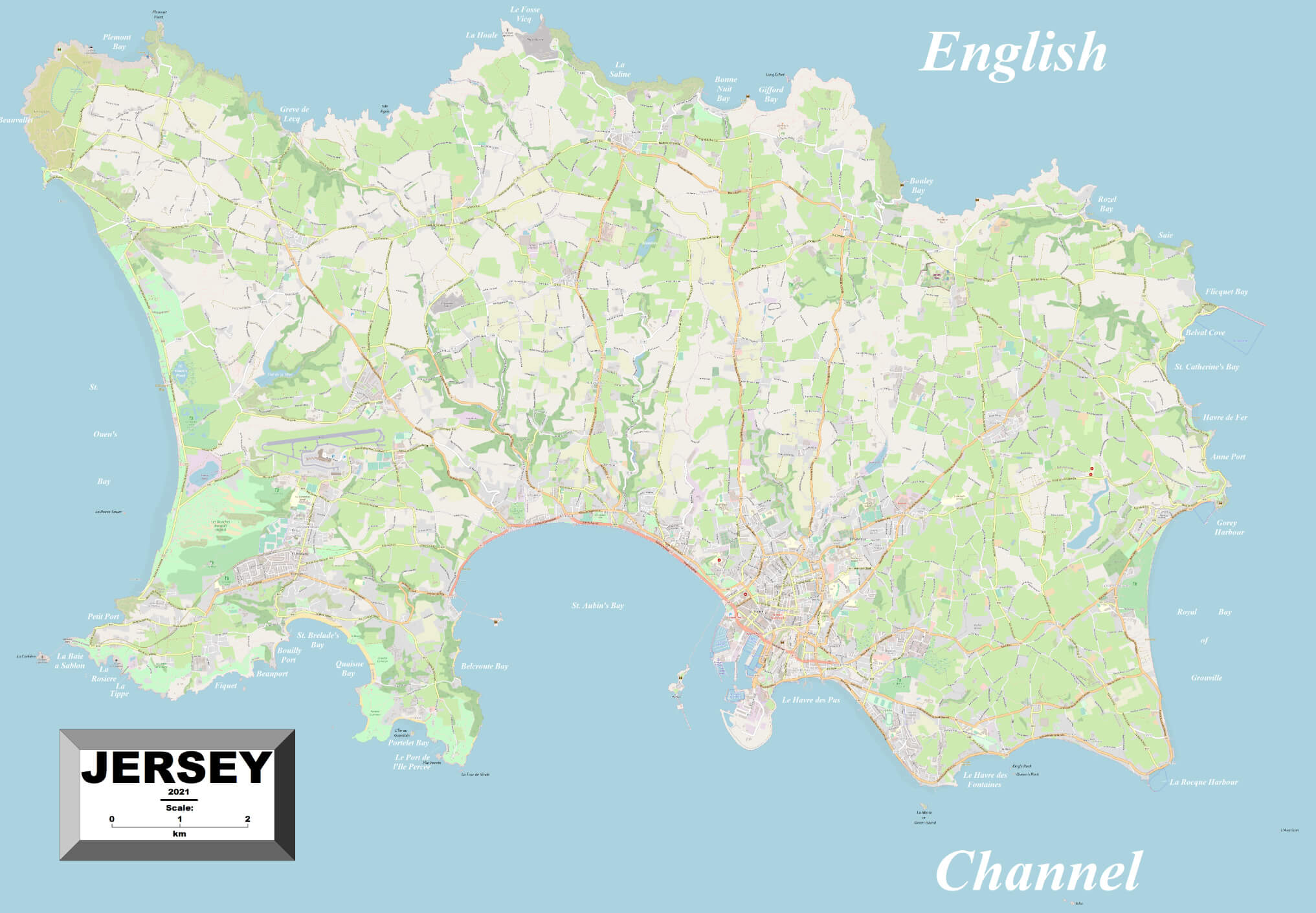
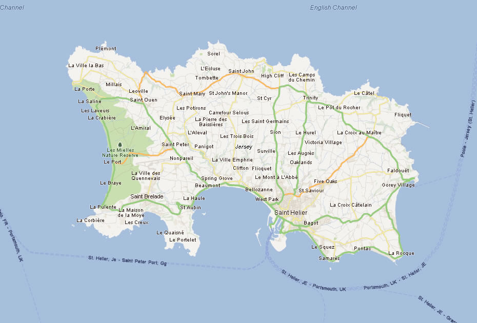
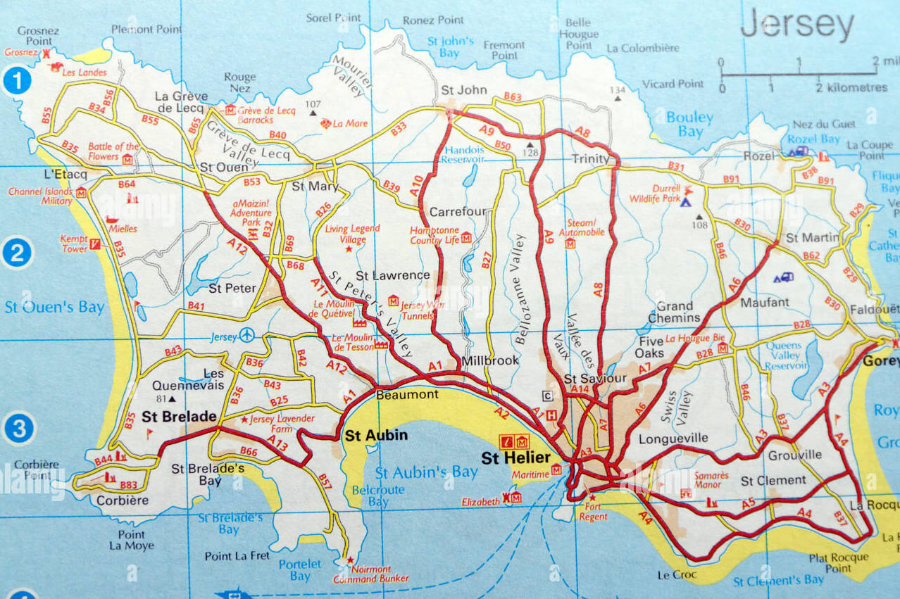 This map of Jersey shows the detailed road network, with major routes leading to key destinations such as St Helier, St Aubin and Gorey. The map highlights key landmarks, bays and tourist attractions such as the Durrell Wildlife Park, St Ouen’s Bay and Elizabeth Castle, providing a clear overview for travelers navigating the island.
The island has a rich history, with ancient castles and medieval architecture still standing. One of the most notable historical facts about Jersey is that it was occupied by German forces during World War II, making it a fascinating destination for history buffs. Visitors are drawn to its blend of natural beauty and historical significance.
Where is located Jersey on the World Map
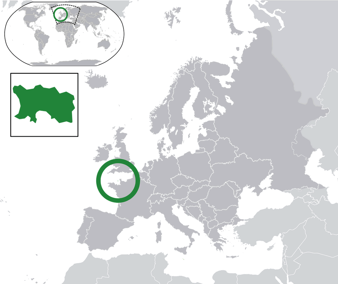
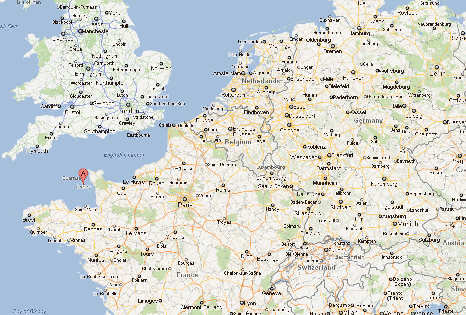
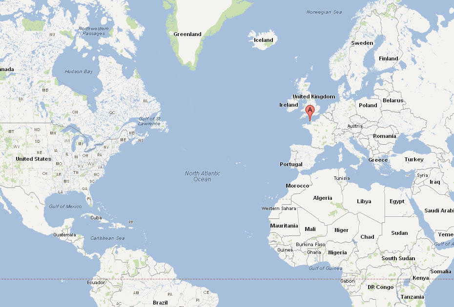
Jersey is located in the English Channel, just off the coast of Normandy, France. While it’s geographically closer to France, Jersey is part of the British Isles and operates as a British Crown Dependency. It’s a tiny island, but its strategic location has made it historically important.
If you look at a world map, Jersey sits between England and France, just south of the UK and a short distance from mainland Europe. Its location in the Channel has given it a unique blend of British and French influences in its culture, language, and cuisine.
Despite its small size, Jersey’s position on the world map places it at a crossroads of history, trade, and travel. It’s a popular spot for tourists looking for a peaceful retreat with stunning views, as well as those interested in its rich historical background.
Here are some statistical information about Jersey:
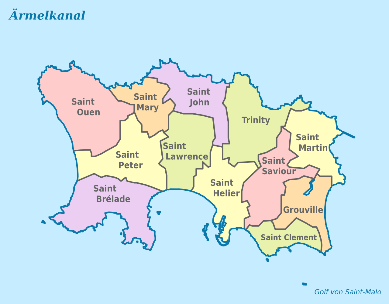
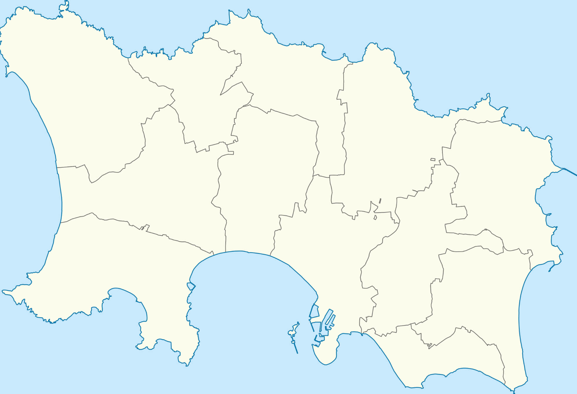
Map of Parishes of Jersey
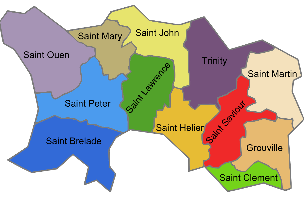
This map illustrates the parishes of Jersey, each highlighted in different colors, including Saint Helier, Saint Brelade, Saint Saviour, and others, showing their distinct boundaries.
Political Map of Jersey
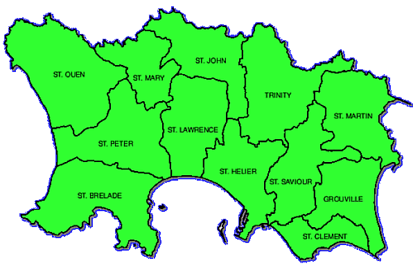
This map shows the administrative divisions of Jersey, highlighting its 12 parishes, including St. Helier, St. Brelade, St. Ouen, and others.
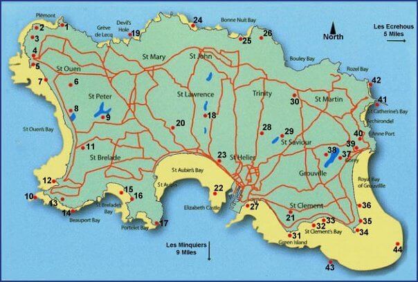
Road Map of Jersey
This map displays Jersey’s road network, highlighting major routes, towns, and parishes, making it easy to navigate the island’s key areas like St. Helier, St. Brelade, and St. Ouen.
Jersey Administrative Map
Map Jersey
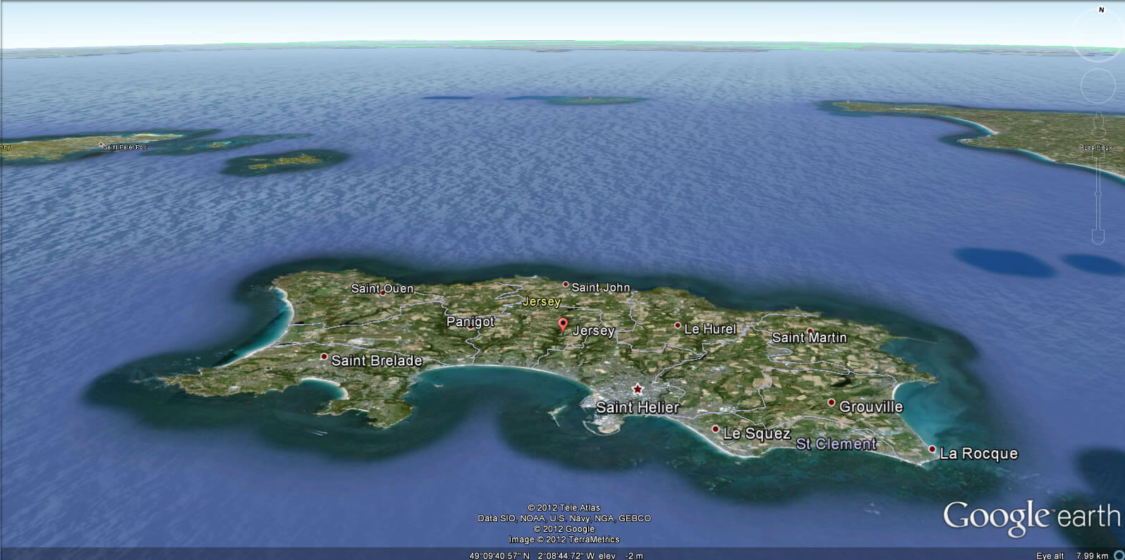
This satellite map shows the island of Jersey, highlighting its towns, natural reserves, and road network, with St. Helier as the main urban area.
Jersey Earth Map
Jersey Map
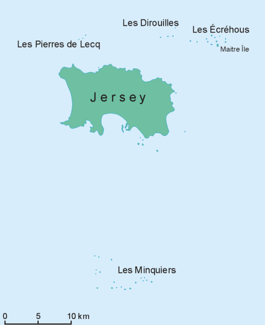
This map shows the island of Jersey, highlighting its main parishes, roads, bays, and some notable offshore locations such as Les Minquiers and Les Ecrehous.
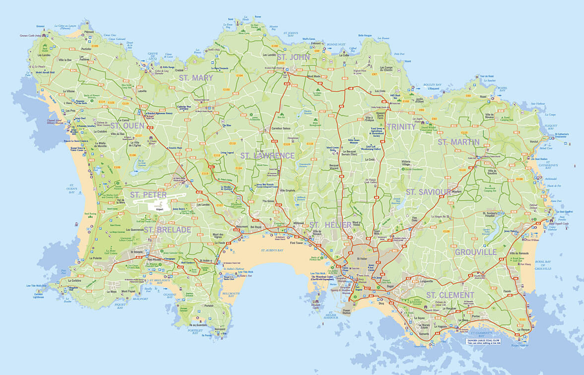
Jersey Detailed Jersey Map
 This detailed map of Jersey highlights the island’s extensive road networks, settlements, and natural features. You can clearly see the various bays, including St. Aubin’s Bay and St. Ouen’s Bay, along the coast, as well as inland areas with lush green landscapes and the town of St. Helier. The map provides a comprehensive view of Jersey’s geography, ideal for travelers or anyone looking to understand the layout of this island in the English Channel.
Jersey Political Map
 This
This
Jersey Physical Map
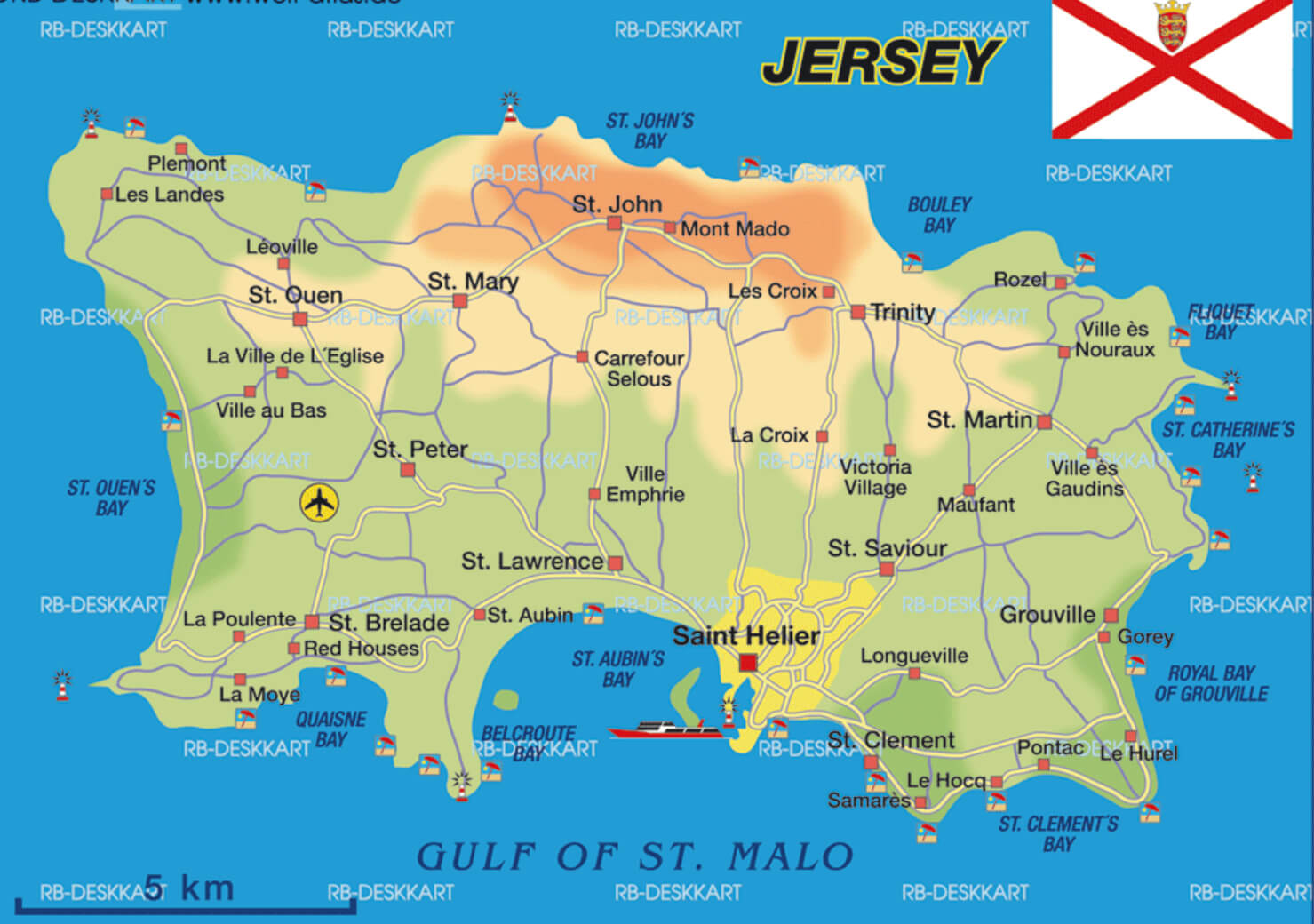 This map of Jersey highlights its major physical features, including towns such as St. Helier, St. Saviour, and Grouville, as well as St. Aubin’s Bay and other prominent coastal areas along the Gulf of St. Malo. It also marks notable landmarks, roads, and geographic elevations throughout the island.
Jersey Population Density Map
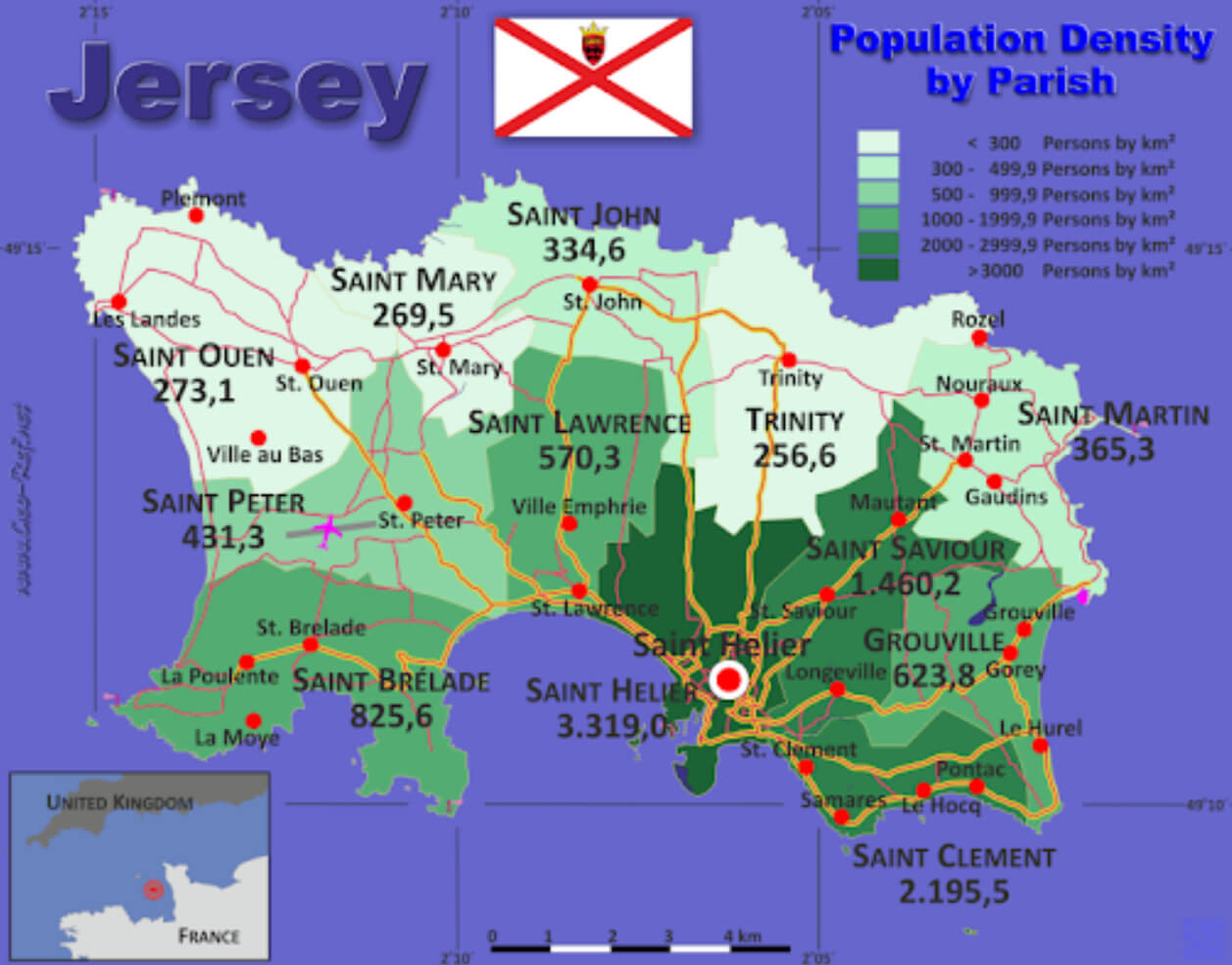 This map of Jersey shows population density by parish. The darker green areas, such as Saint Helier, indicate higher population densities, with over 3,000 people per km², while the lighter green areas, such as Saint Ouen, have lower population densities, under 300 people per km². This visualization highlights the concentration of people in the central and southern parts of the island, with Saint Helier being the most densely populated.
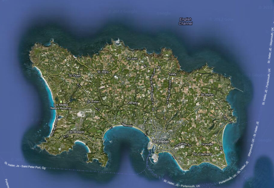
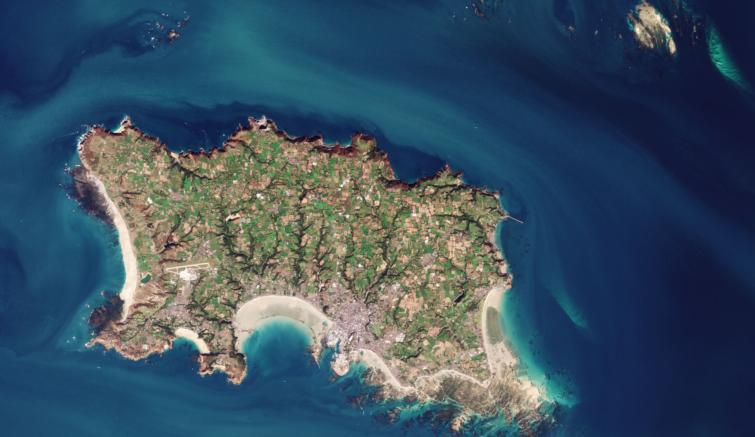
Jersey Satellite Map
 This
This
Jersey Blank Map
 This satellite map of Jersey provides a detailed aerial view of the island, showcasing its coastline, rural areas, and urban settlements, with prominent beaches and green farmlands clearly visible. The map allows you to observe the island’s natural beauty and geographical layout, including the clear waters of the surrounding English Channel.
Map of Jersey England France
Map of Jersey World
Map of Jersey
Where is Jersey on the Europe Map?
Show Google map, satellite map, where is the country located.
Get directions by driving, walking, bicycling, public transportation and travel with street view.
Feel free to explore these pages as well:
- Guernsey Map ↗️
- France Map ↗️
- Isle of Man Map ↗️
- United Kingdom Map ↗️
- Map of United Kingdom ↗️
- A Collection of United Kingdom Maps ↗️
- Ireland Map ↗️
- Map of Ireland ↗️
- Discovering Cardiff: A Gem in the Heart of Wales ↗️
- Birmingham Unveiled: The Heart of England’s Hidden Gems ↗️
- Discovering Belfast: The Northern Gem of the UK ↗️
- Bradford, United Kingdom: A Vibrant Tapestry of Culture and History ↗️
- Map of Europe ↗️
- Europe Map ↗️
- A Collection of Europe Maps ↗️