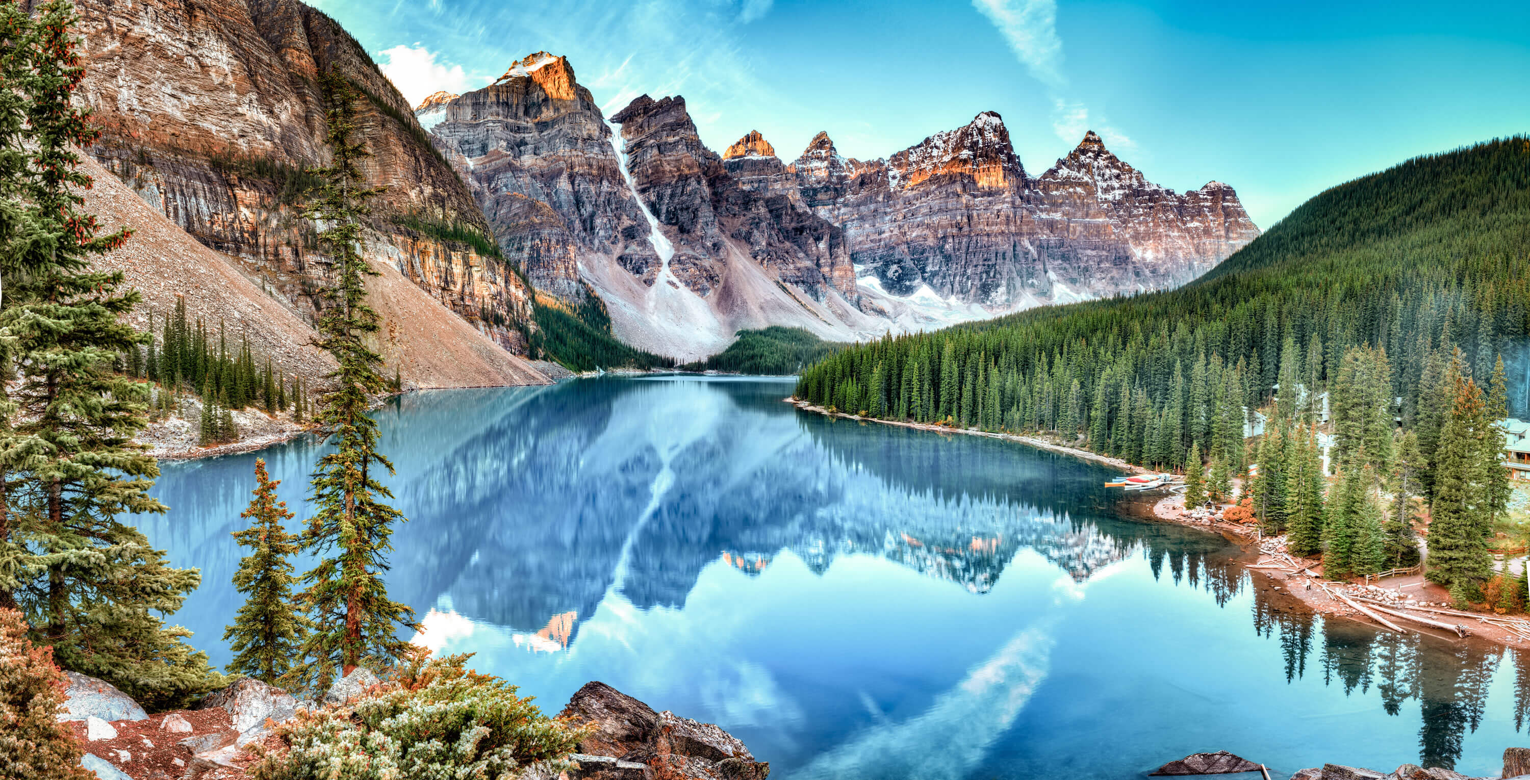
A collection of maps of Canada; View a variety of maps of Canada’s physical, political, administrative, and relief map—satellite image of Canada, highly detailed maps, and blank maps of Canada, the World, and Earth. And find more about Canada’s country, regions, provinces, topography, cities, roads, rivers, national, directions maps, and atlas.
Canada Vector Map
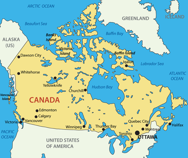
Canada vector map with main cities and the United States of America.
Canada Country Map

Colorful Canada Map

Colorful Canada map with provinces and capital cities
Canada Country Map with Cities

Canada Country Map with Major Cities of Canada.
Canada Political Map
 Political map of Canada with Canadian states and major cities, United States of America country national border map.
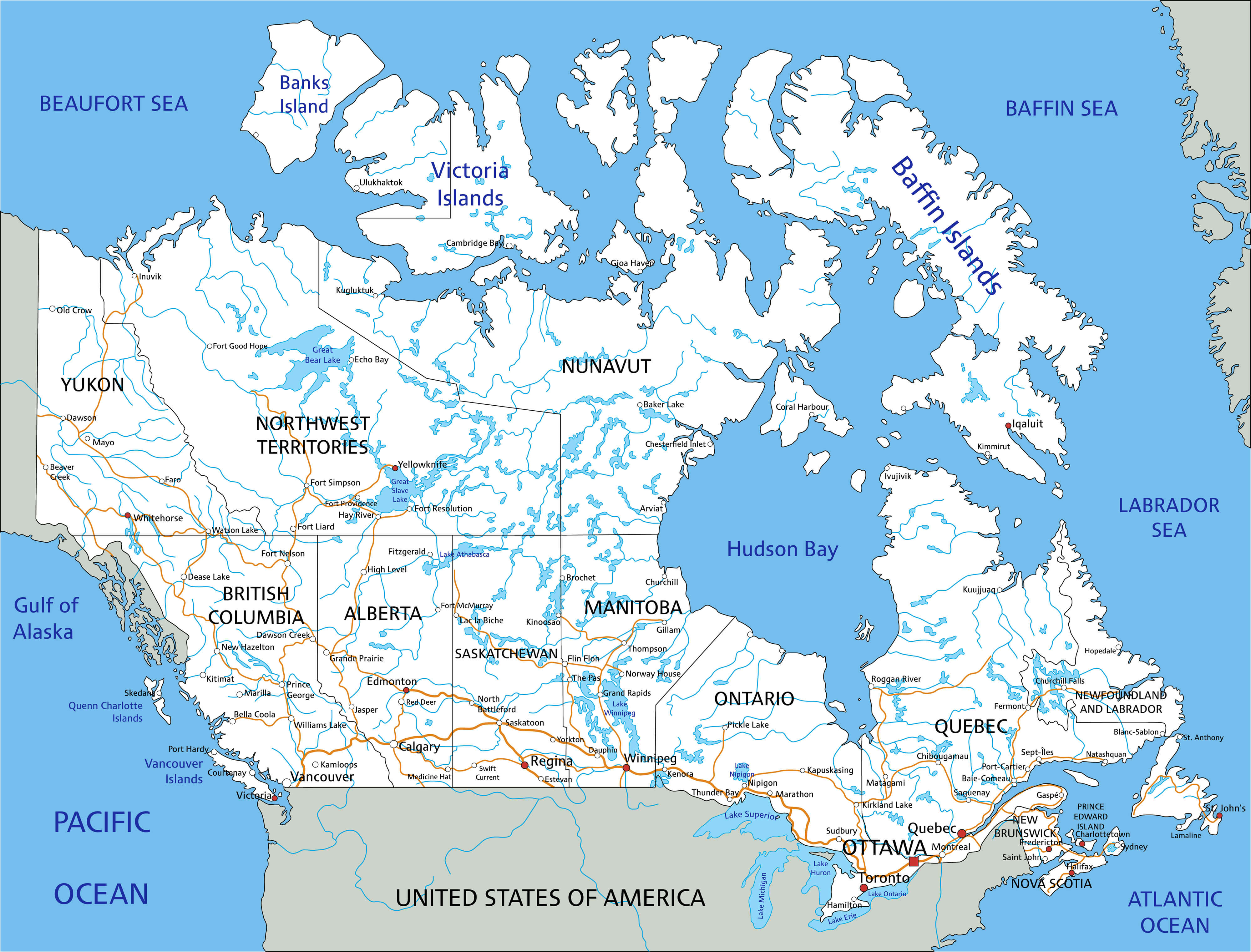
High Detailed Canada Road Map
Canada Map with North and Central America
 Canada Map with North and Central America. Vector illustration
Explore a diverse collection of maps showcasing Canada’s geography, provinces, climate, political, physical, road, territorial, colonization, cities, and more maps.
Brief information about Canada
Canada, the second-largest country in the world by land area, stretches from the Atlantic Ocean in the east to the Pacific Ocean in the west and reaches the Arctic Ocean in the north. Known for its breathtaking landscapes, Canada is home to a diverse geography that includes vast forests, towering mountains and pristine lakes. This natural beauty is complemented by bustling metropolitan areas such as Toronto, Vancouver and Montreal, known for their multiculturalism and vibrant urban life. Canada is also famous for its friendly people, high quality of life and progressive values, and is often ranked among the top countries in the world for quality of life and social stability.
 Area: 207,595 km2 (80,153 sq mi)
A parliamentary democracy and constitutional monarchy, Canada has Queen Elizabeth II (or her successor) as its symbolic head of state and an elected government led by a prime minister. The country’s economy is strong and diverse, with significant natural resources industries such as oil, gas and minerals, as well as advanced sectors such as technology, finance and healthcare. Canada is also known for its commitment to cultural diversity and inclusion, welcoming immigrants from around the world and supporting a range of languages and cultures within its borders.
Where is located Canada on the World Map
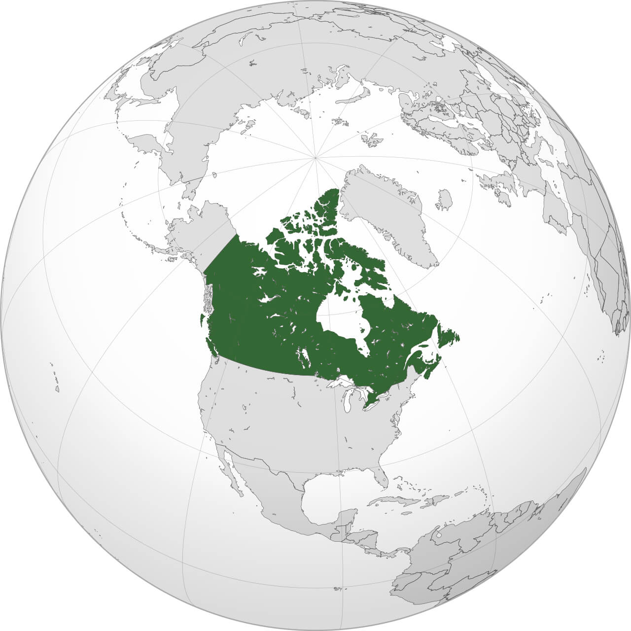
Where is Canada on the World Map
Canada is located in the northern part of North America, bordered by the United States to the south and Alaska to the northwest. It stretches from the Atlantic Ocean on the east coast to the Pacific Ocean on the west, making it the only country to border three major oceans, including the Arctic Ocean in the north. On a world map, Canada lies above the United States and covers a vast area of nearly 10 million square kilometres (3.85 million square miles). Its large northern latitude means that much of Canada lies within the cold, Arctic climate, while the southern regions experience more temperate weather.</p
The country’s geography gives it a diverse landscape, with major features including the Rocky Mountains in the west, the vast boreal forests and prairies in the centre, and the Appalachian Mountains in the east. Canada’s Arctic Archipelago consists of thousands of islands in the far north, close to Greenland. Because of its northern location, Canada experiences extreme seasonal variations, with long, harsh winters and relatively short, warm summers, especially in the northern and central regions. This unique position on the world map makes Canada a land of contrasts, from icy tundra to bustling cities, and a natural gateway to both the Atlantic and Pacific trade routes.
Here are some statistical information about Canada:
Area: 9,984,670 km2 (3,855,100 sq mi)
Population: 41,288,599 (2024 estimate)
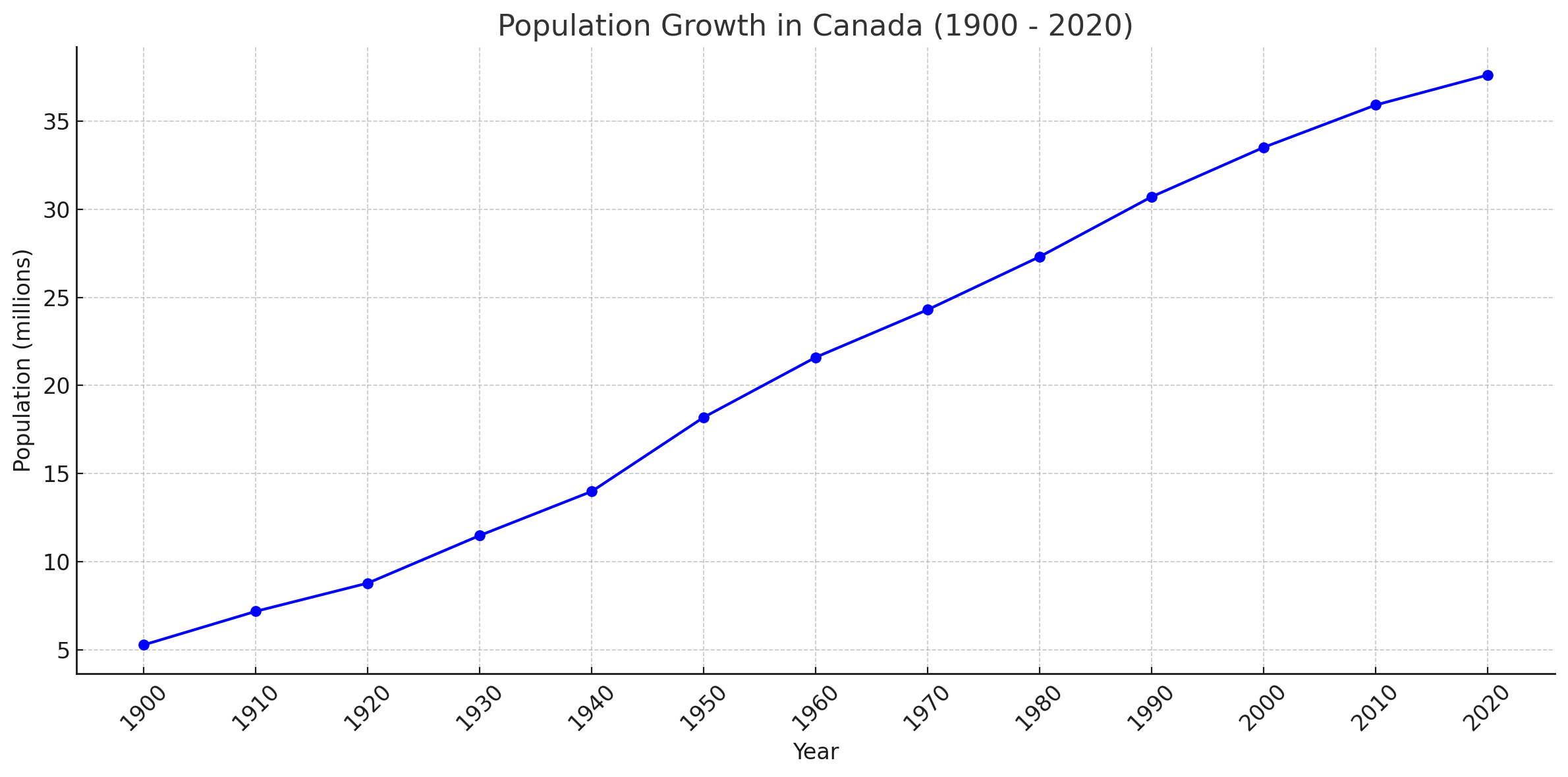
Canada population growth since 1900
 <
<
This chart illustrating the population growth in Canada from 1900 to 2020, showing a steady increase over time. The data indicates significant growth, especially post-World War II, as Canada expanded its population base through natural growth and immigration
Capital and Largest city: Ottawa – Toronto
Official languages: English, French
Canada Ethnic Demographic Composition in 2021
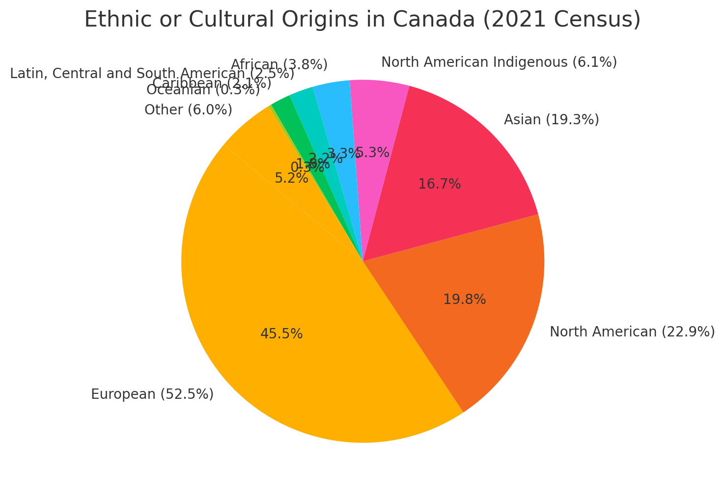
Canada Ethnic Demographic Composition in 2024
This pie chart that represents the ethnic or cultural origins reported in the 2021 Canadian census. The major groups include European (52.5%), North American (22.9%), and Asian (19.3%). Smaller portions of the population identify as North American Indigenous, African, Latin, Central and South American, Caribbean, Oceanian, and other origins, showcasing Canada’s cultural diversity.
Canada Religious Composition in 2021
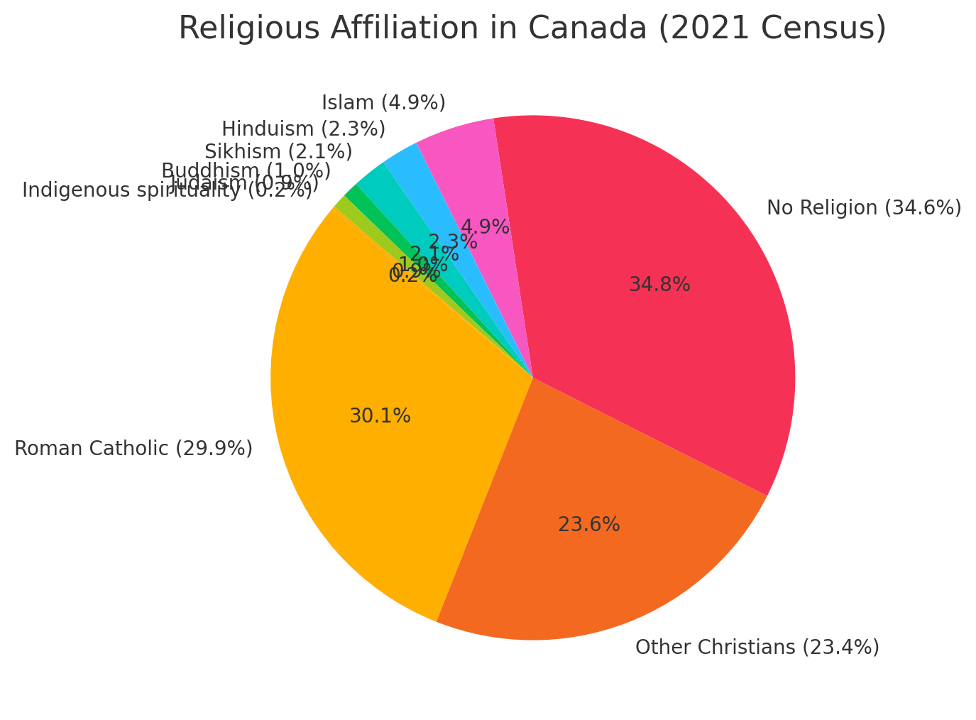
Canada Religious Composition in 2024
This pie chart that visualizes the religious affiliations in Canada according to the 2021 census. This chart highlights that Christianity, led by Roman Catholicism, remains the largest religious group at 53.3%, while 34.6% of the population reports having no religion. Other religions, such as Islam, Hinduism, Sikhism, Buddhism, Judaism, and Indigenous spirituality, make up smaller portions of the population.
GDP (nominal): $2.242 trillion (2024 estimate)
Per capita: $54,866 (2024 estimate)
Currency: Canadian dollar ($) (CAD)
Calling code: +1
Time zone: UTC−3.5 to −8
Map of Canada with North and Central America, Including Major Lakes and Regions
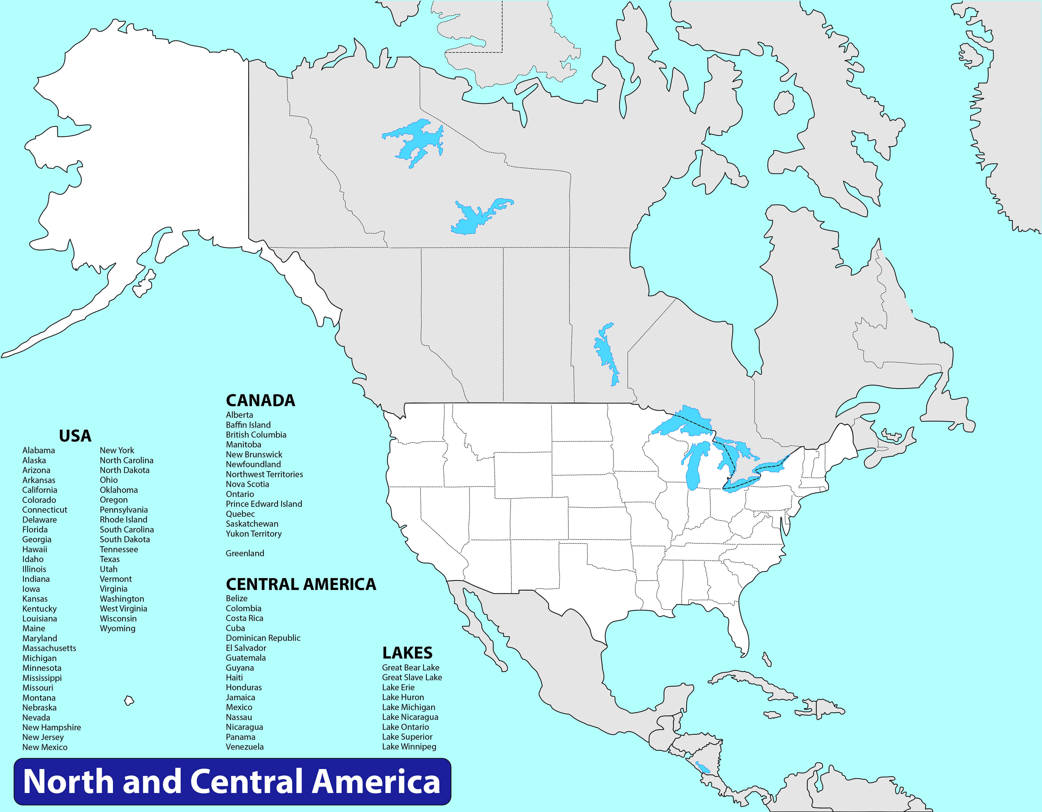
Map of Canada, USA, and Central America with labeled regions and major lakes.
This map displays Canada alongside the USA and Central American countries, providing a clear view of North America’s regional layout. Major states, provinces, and territories are labeled, along with significant lakes such as the Great Lakes. This map serves as a helpful reference for understanding the geographic relationships within North and Central America.
Detailed Political Map of Canada with Provinces, Territories, and Key Cities
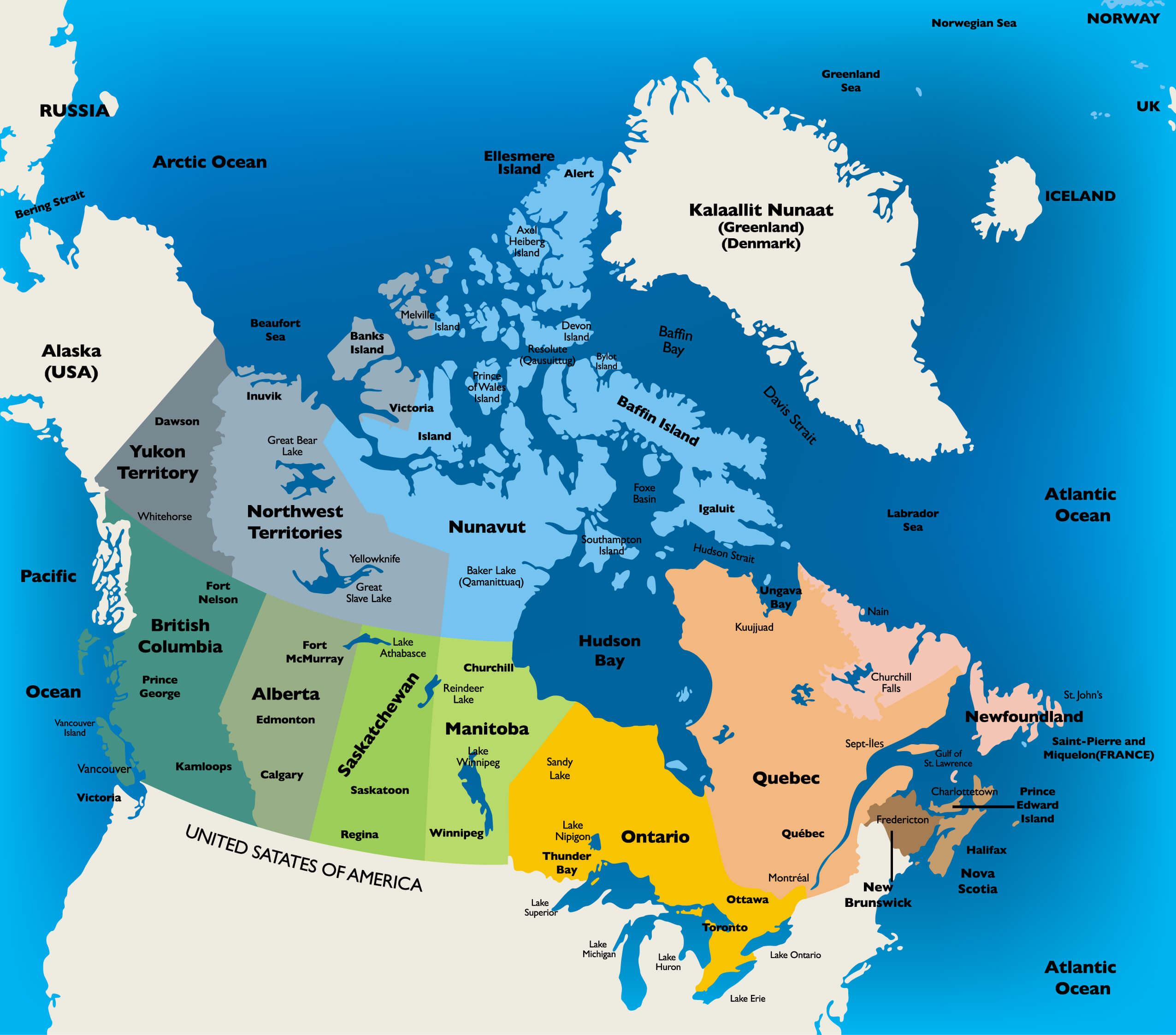 Canada political map showing provinces, territories, and major cities
This political map of Canada illustrates the country’s provinces and territories, as well as major cities and geographic landmarks. From British Columbia in the west to Newfoundland in the east and Nunavut in the north, this map provides a comprehensive overview of Canada’s administrative regions, neighboring countries, and surrounding oceans, making it ideal for geographic reference.
Map of Canada Highlighting Major Cities and Geographic Features
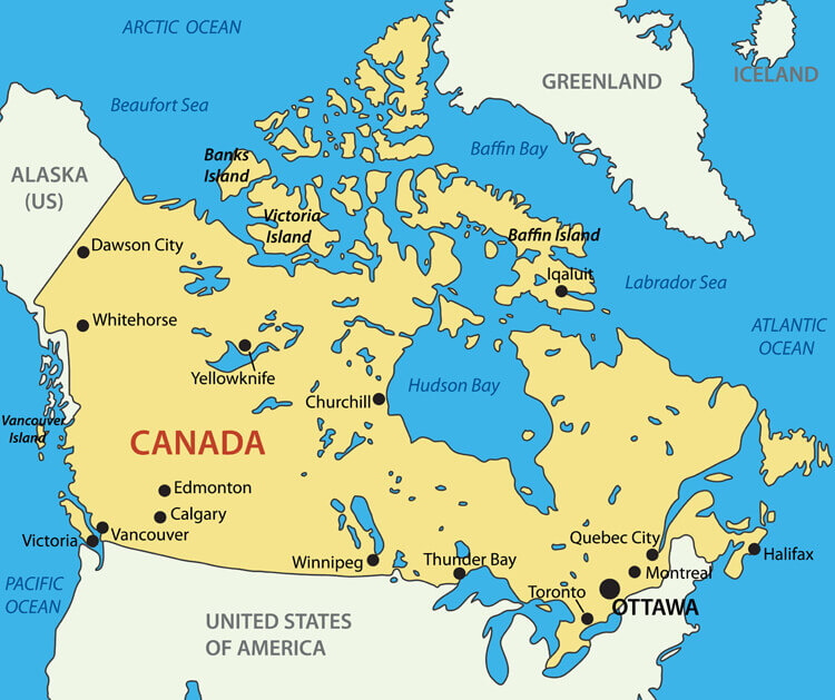
Canada map with major cities and geographic features like islands and oceans.
This map of Canada includes major cities such as Ottawa, Toronto, Vancouver, and Montreal, as well as key geographic features such as Victoria Island, Baffin Bay, and Hudson Bay. It provides a quick reference to Canada’s urban centres and neighbouring regions, making it ideal for understanding the spatial distribution of major locations across the country.
Colorful Map of Canada’s Provinces and Territories
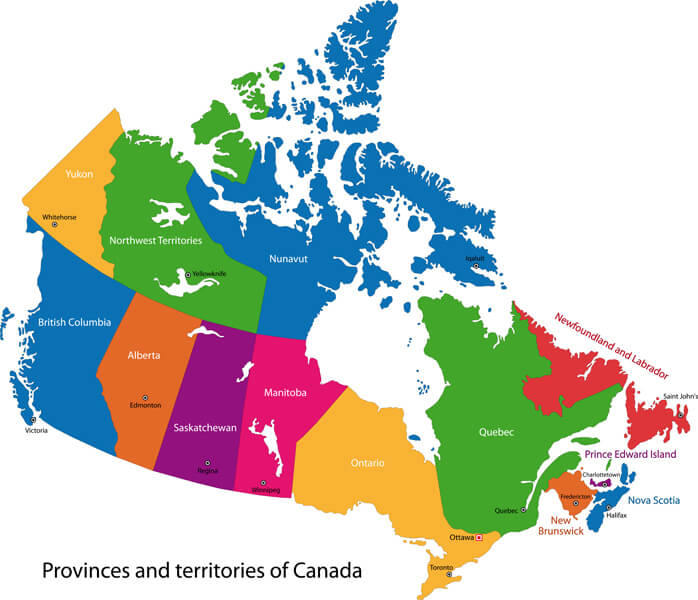
Colorful map of Canada with labeled provinces and territories
This vibrant map of Canada uses distinct colors to highlight each province and territory, making it easy to distinguish regions like Ontario, Quebec, Alberta, and British Columbia. Labeled with major cities, it provides a clear, visual representation of Canada’s political divisions, ideal for educational use and geographic reference.
Administrative Map of Canada with Provinces, Territories, and Major Cities
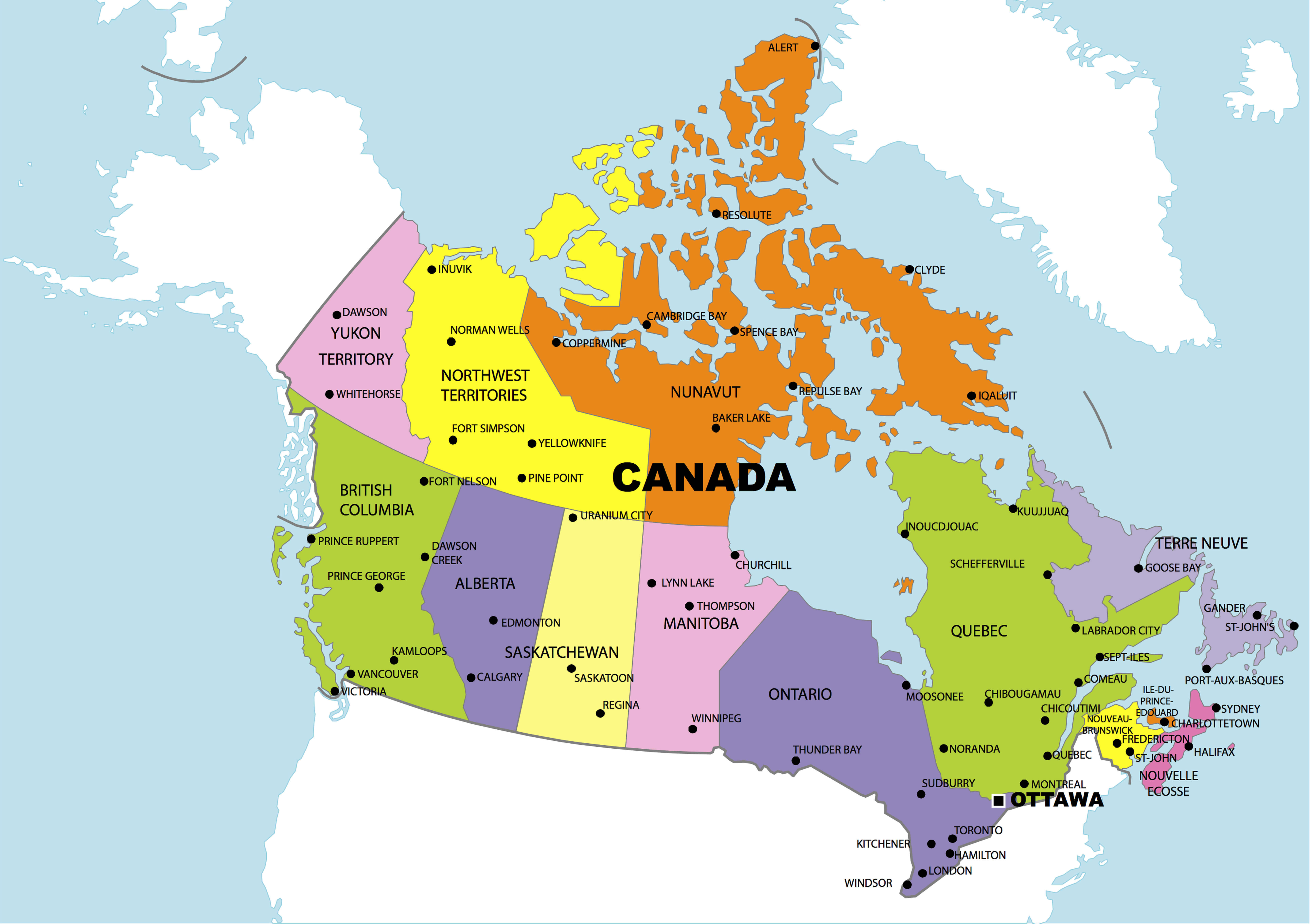
Canada administrative map showing provinces, territories, and key cities.
This administrative map of Canada highlights the country’s provinces and territories, with major cities and regional boundaries clearly indicated. It provides a comprehensive overview of Canada’s political divisions, including areas such as British Columbia, Nunavut and Quebec, making it ideal for understanding the structure of Canadian administration and regional distribution.
Comprehensive Administrative Map of Canada with Provinces and Territories

Canada administrative map showing provinces, territories, and key cities.
This administrative map of Canada clearly delineates provinces and territories, including notable regions like Quebec, Ontario, and British Columbia. Major cities, waterways, and geographical features like Hudson Bay are labeled, providing a detailed view of Canada’s political and regional structure. This map is ideal for educational and reference purposes.
Map of Canada Highlighting Provinces and Territories
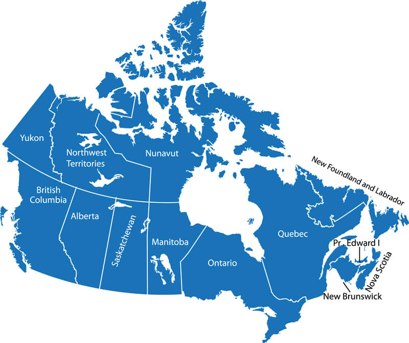
Map of Canada showing provinces and territories in a simple blue design.
This map of Canada provides a clear layout of the country’s provinces and territories, including regions such as the Yukon, British Columbia, Ontario, and Quebec. Each area is outlined, offering a straightforward layout ideal for understanding Canada’s regional divisions. The minimalist design is suitable for educational reference and geographical studies.
Map of Canada and the United States with North America Regions
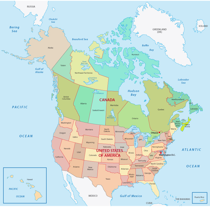
Map of Canada, United States, and North America regions, including states and provinces
This map shows Canada and the United States within North America, detailing provinces, states, and key geographic features. With clear labels for Canadian provinces and U.S. states, it also highlights surrounding bodies of water, such as the Pacific Ocean, Atlantic Ocean, and Arctic regions. This map is ideal for understanding the geographical relationship between Canada, the U.S., and nearby regions.
Blank Map of Canada, United States, and North America with Key Regions Labeled
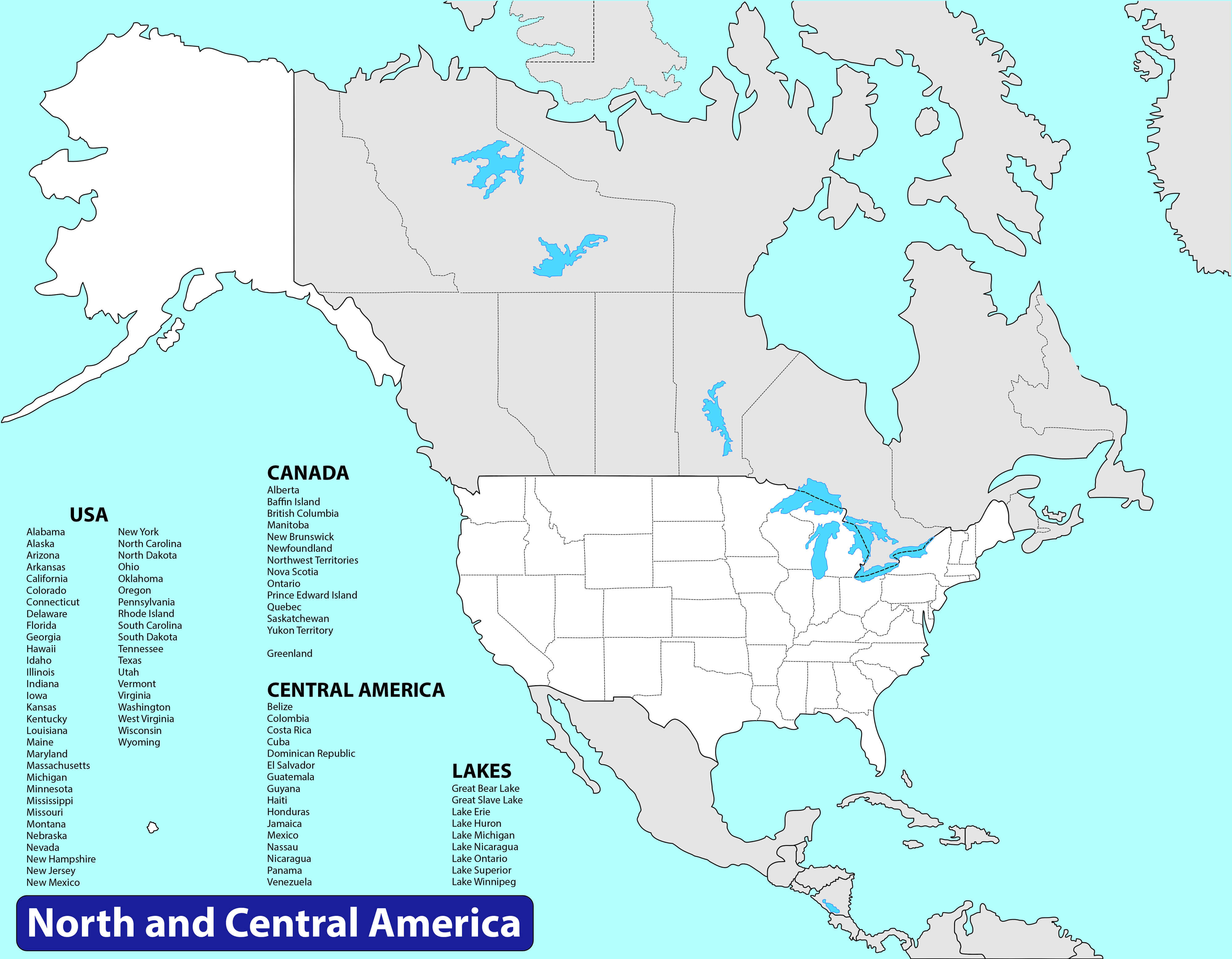
Blank map of Canada, United States, and North America with state and province labels
This blank map outlines Canada, the United States and parts of North and Central America, with labels for the major US states, Canadian provinces and notable lakes. Ideal for educational purposes, it provides a simple, clear layout of North America’s political divisions without city markers or detailed topography.
Map of Canada’s Provinces and Territories with Capital Cities
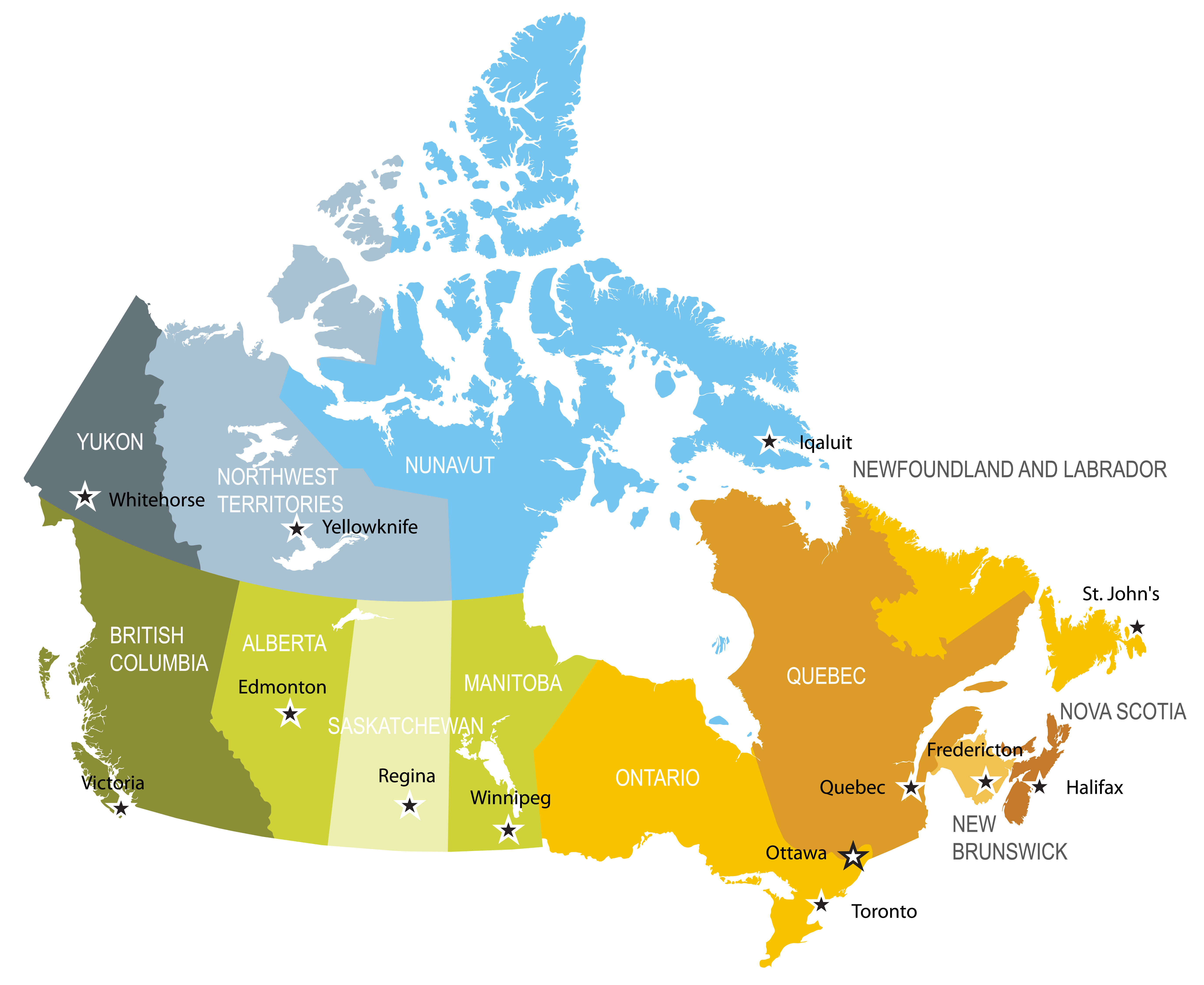
Canada map showing provinces, territories, and capital cities with color-coded regions
This map of Canada highlights its provinces and territories, each color-coded for easy distinction. Major capital cities like Ottawa, Edmonton, and Toronto are marked with stars, offering a clear view of Canada’s regional divisions and governance centers. Ideal for educational and reference purposes, this map provides a straightforward overview of Canadian geography.
Köppen Climate Types of Canada
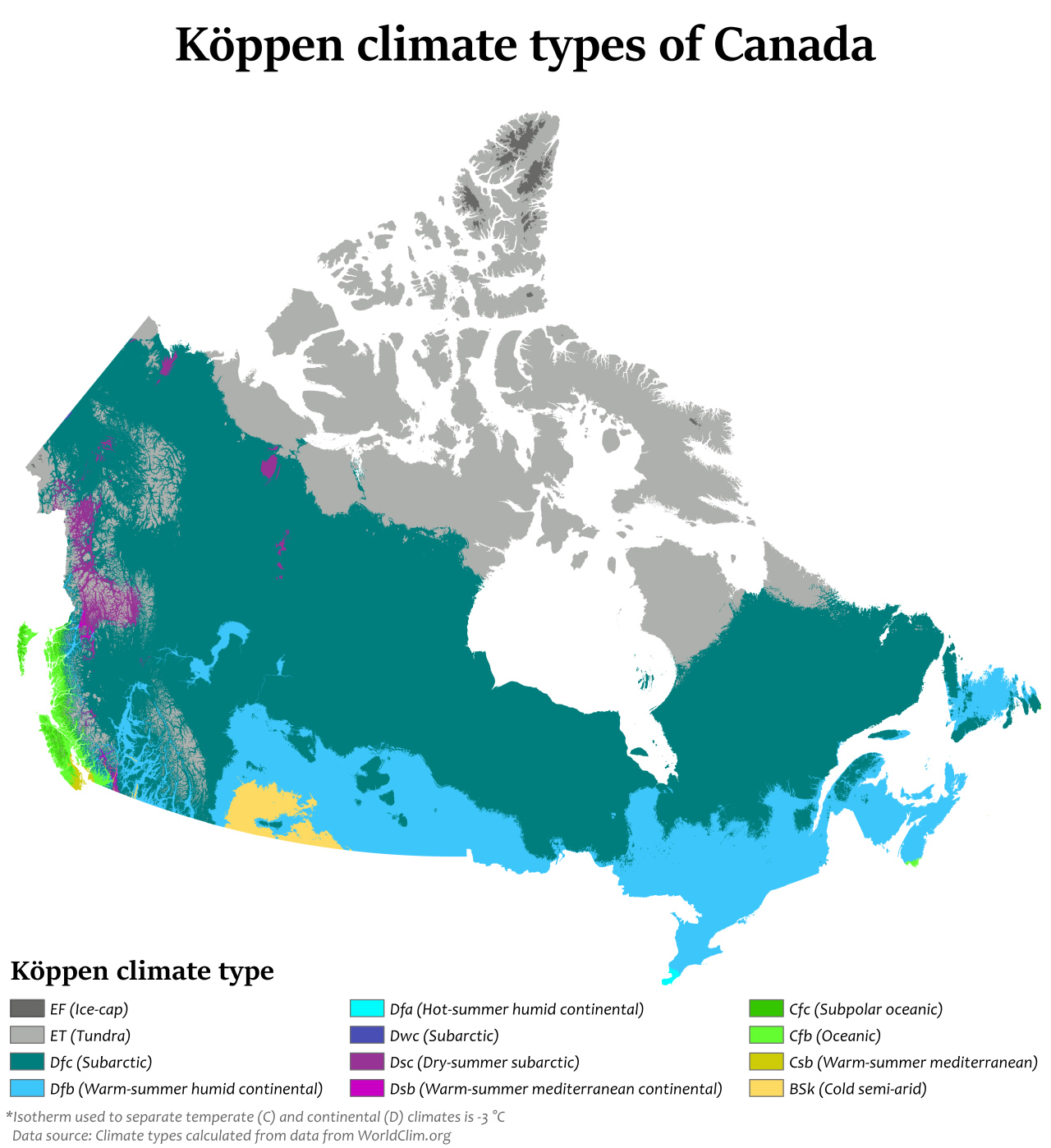
Map of Canada showing Köppen climate types across different regions.
This map illustrates the different Köppen climate types in Canada, detailing zones such as subarctic, tundra, humid continental and oceanic. Each colour represents a different climate classification, highlighting Canada’s diverse weather patterns from coast to coast. This map is useful for understanding regional climate variations in Canada.
Language Distribution in Canada
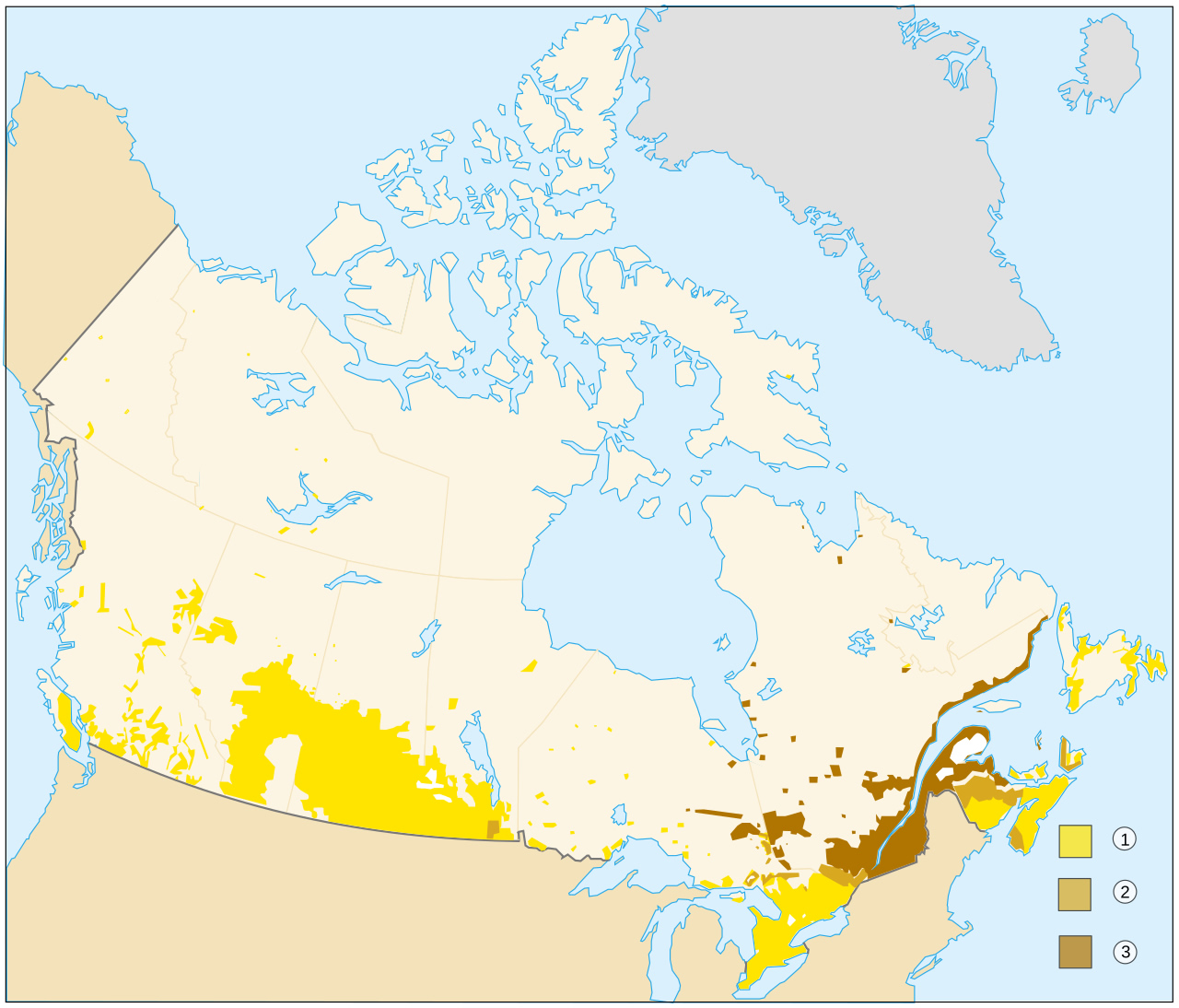
Map of Canada showing distribution of languages spoken across different regions.
This map illustrates the distribution of languages across Canada, highlighting areas where English, French, and Indigenous languages are predominantly spoken. Darker shades represent regions with a stronger presence of specific languages, providing insight into Canada’s linguistic diversity and regional language concentration.
Canada Physical Map with Rivers and Lakes
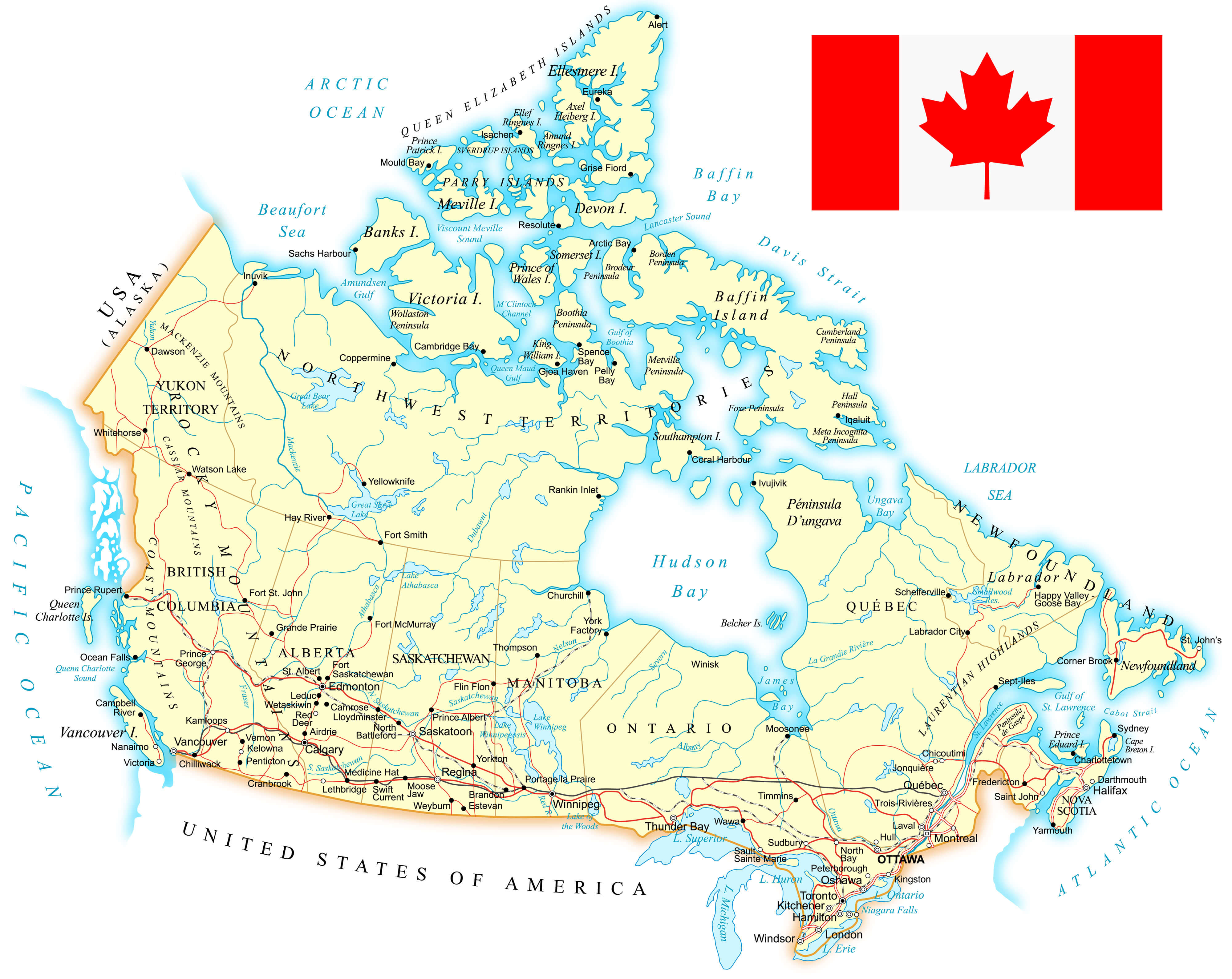
Detailed physical map of Canada showing rivers, lakes, and geographic features
This detailed physical map of Canada highlights the country’s rivers, lakes and significant geographic features. It includes major bodies of water such as Hudson Bay, the Great Lakes, and the various rivers that crisscross Canada’s vast landscape. The map provides an overview of Canada’s natural waterways and terrain in each province and territory.
Canada Population Density Map
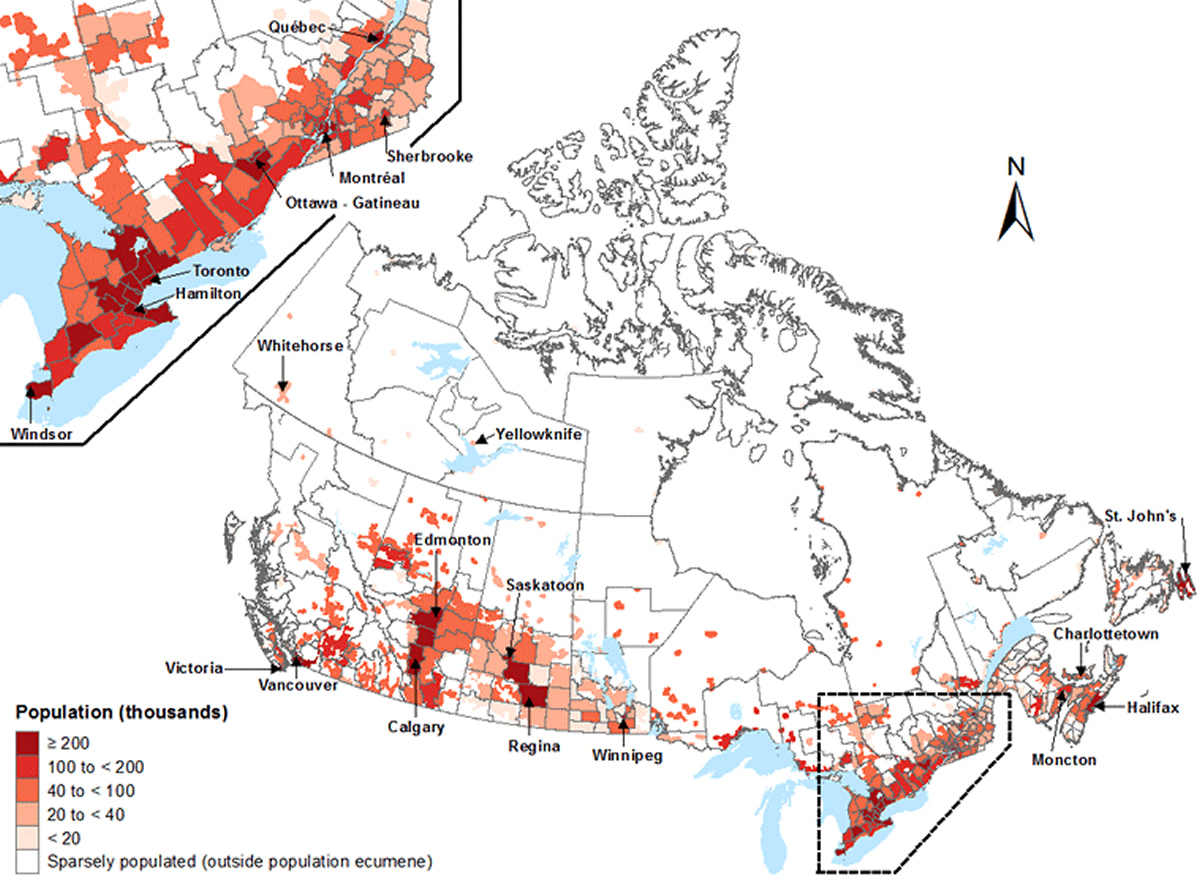
Map showing population density distribution across Canada
This map illustrates Canada’s population density, highlighting regions of varying population density. Darker shades represent densely populated areas, mainly in southern Ontario, Quebec and parts of British Columbia and Alberta, while lighter shades indicate sparsely populated or uninhabited regions, particularly in northern areas.
Canada Provinces Map with National Flag
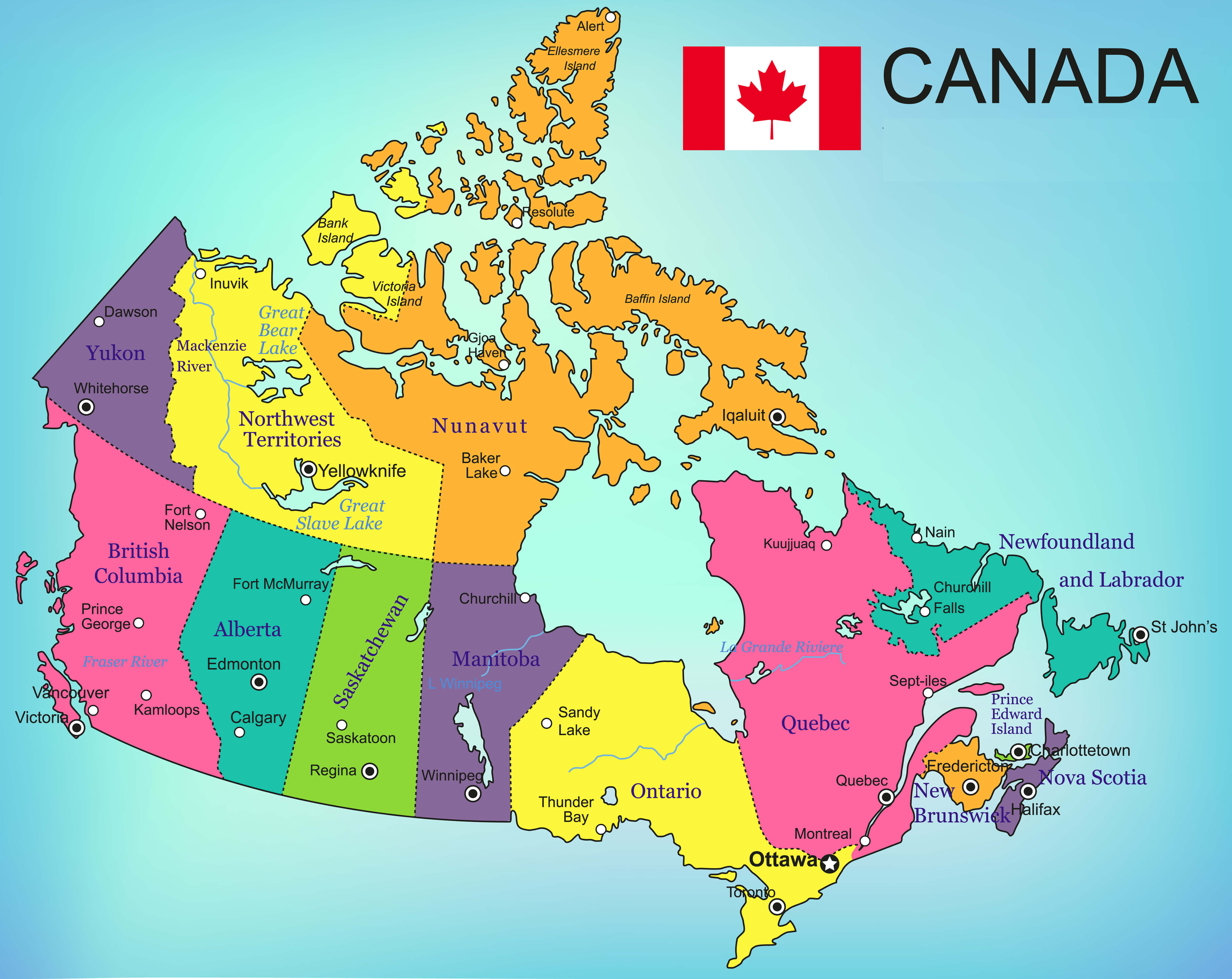
Map of Canada showing provinces with vibrant colors and national flag.
This map highlights Canada’s provinces and territories, each color-coded for clarity. Major cities and geographic features like lakes and rivers are labeled, providing a detailed view of the country’s political and natural landscape. The Canadian flag in the top corner adds a patriotic touch to the map’s design.
Canada Road Map with Major Highways and Waterways
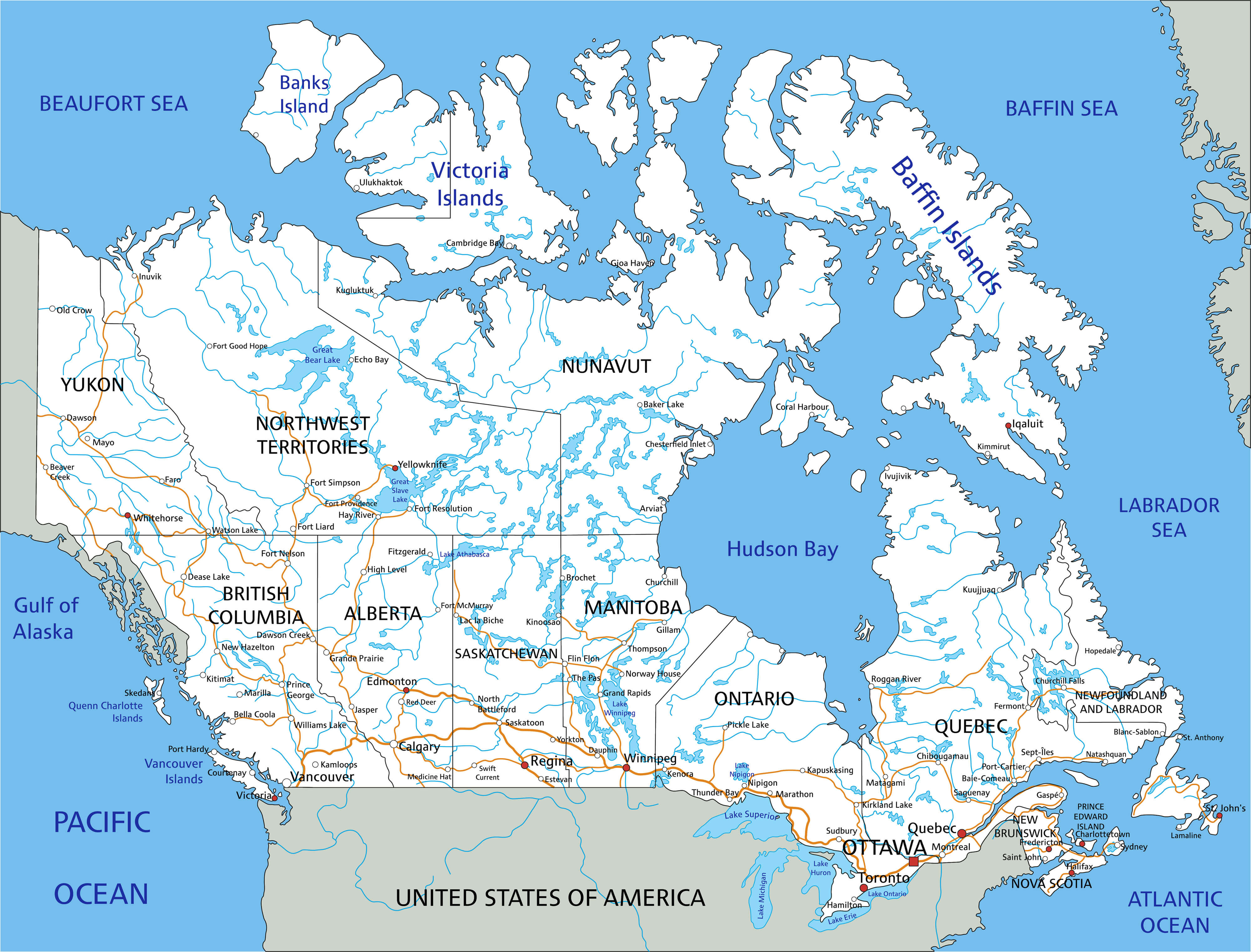
Detailed map of Canada showing major roads, highways, and waterways
This map of Canada depicts an intricate network of major roads, highways, and waterways throughout the country. Major cities, rivers and geographic features are labelled, providing a comprehensive representation of Canada’s transportation infrastructure. Ideal for understanding travel routes and connections within provinces and territories.
Canada Provinces Map and Blank Outline of Canada
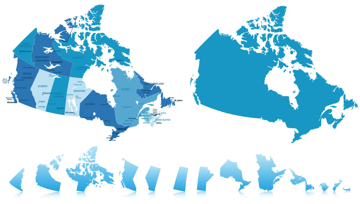
Canada map showing provinces and territories, plus a blank outline map for customization.
This visual features two maps of Canada: a labeled map highlighting provinces and territories with key cities, and a blank outline map of Canada suitable for custom labeling or educational purposes. It also includes various location markers and icons, useful for marking specific areas on the maps.
Blank Map of Canada with Territories and Provinces
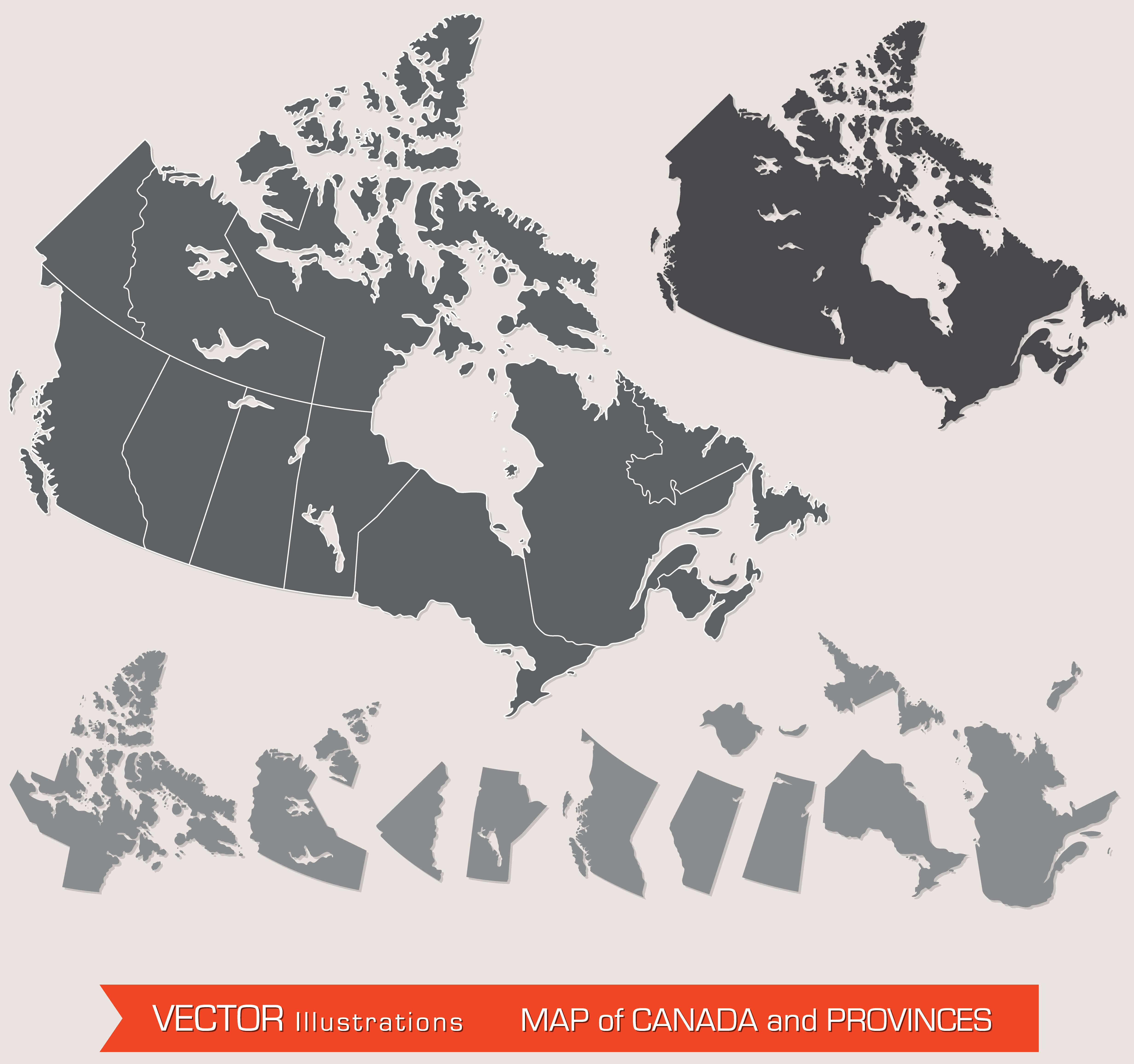
Canada blank map showing territories and provinces in gray, vector illustration.
This vector illustration of Canada features a blank map with outlined territories and provinces. Each region is individually separated, providing a clean, minimalist layout ideal for educational, labelling or customisation purposes. Perfect for presentations or projects requiring a simple geographic outline of Canada.
Topographic Map of Canada
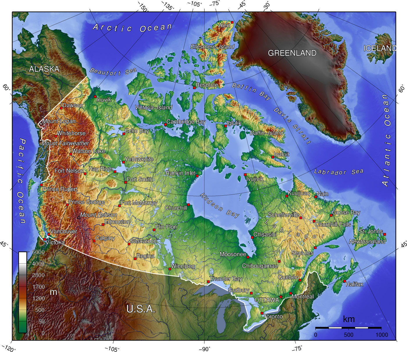
Canada topographic map showing elevation, mountains, and geographical features.
This detailed topographical map of Canada illustrates the country’s varied elevations, highlighting mountain ranges such as the Rockies in the west, the Canadian Shield, and the lowlands. Coloured shading indicates elevation, with specific locations marked for geographic reference. Ideal for understanding Canada’s diverse landscapes and physical geography.
Vintage Map of Canada with Flag
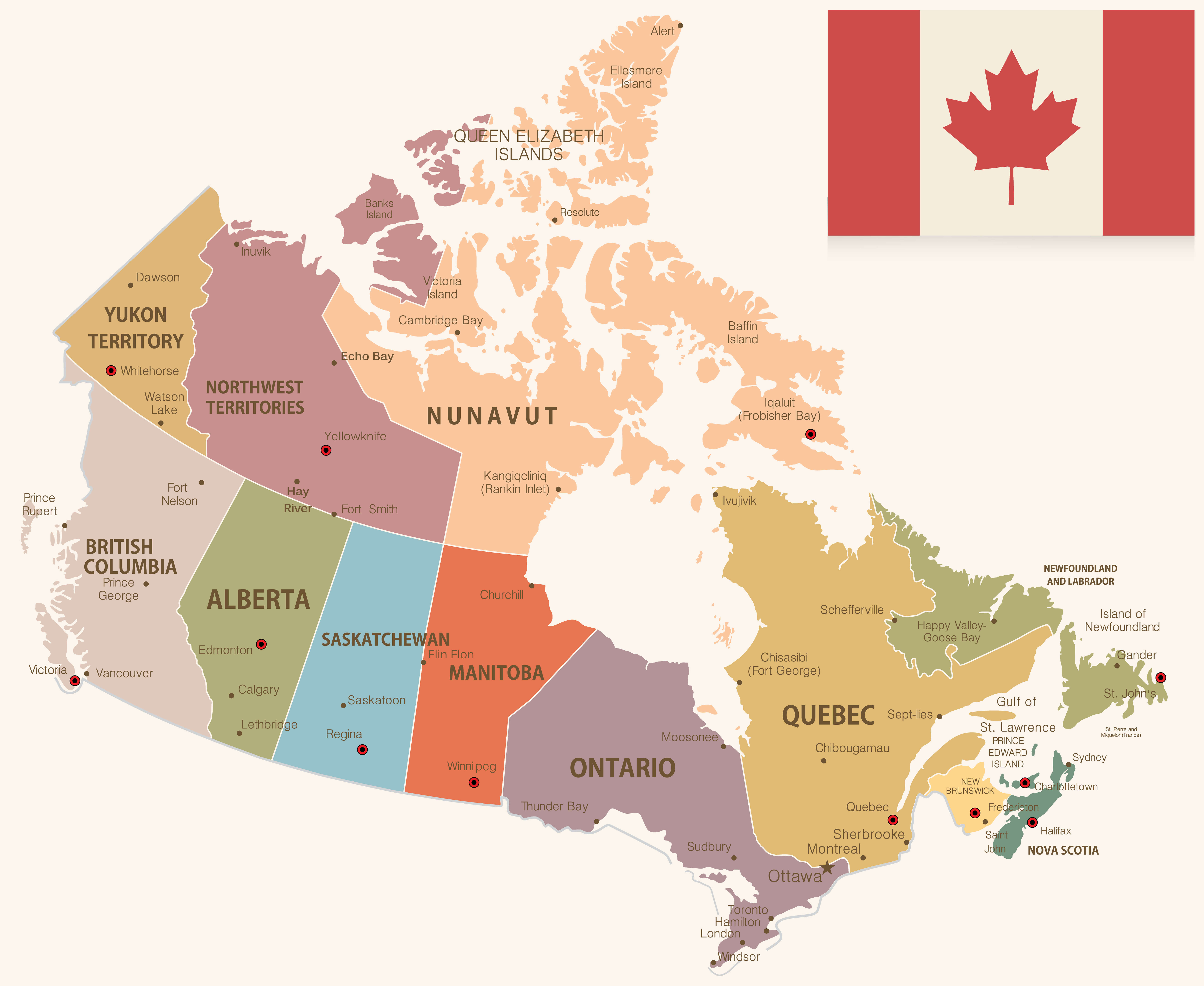
Canada vintage map with provincial borders, cities, and national flag.
This vintage-style map of Canada displays provinces and territories with labeled cities and towns. It includes the national flag in the top corner, offering a nostalgic, antique aesthetic while clearly marking geographic and political divisions. Ideal for visualizing Canada’s layout with a classic, retro design.
Countries with Free Trade Agreements with Canada
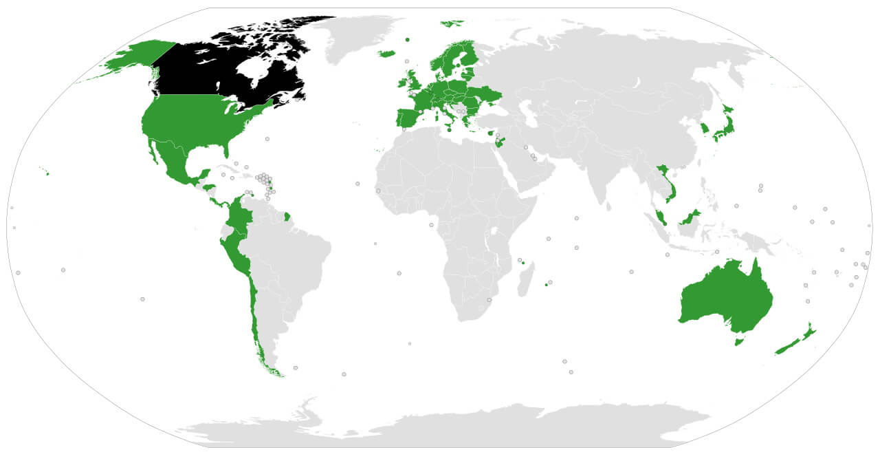
Map of countries with free trade agreements with Canada, highlighted globally.
This world map highlights countries that have free trade agreements with Canada. The countries highlighted span North America, Europe, South America, Asia and Oceania, showcasing Canada’s global trade links and economic partnerships that facilitate easier and duty-free trade.
European Colonization Map with Canada Territories in 1750
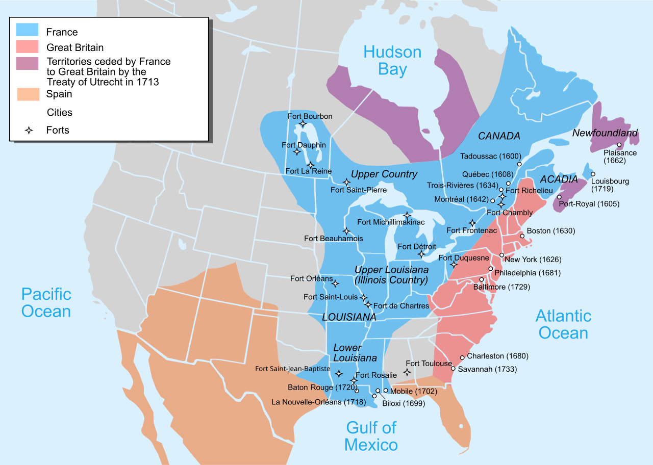 Map of European colonization in North America, highlighting Canada territories in 1750.
This historical map illustrates European colonial territories in North America as of 1750, showing areas controlled by France, Great Britain, and Spain. It highlights Canadian territories and significant forts, settlements, and boundaries established by treaties like the Treaty of Utrecht in 1713, offering insight into colonial expansion and influence across the continent.
North America Map with Canada and United States Regions
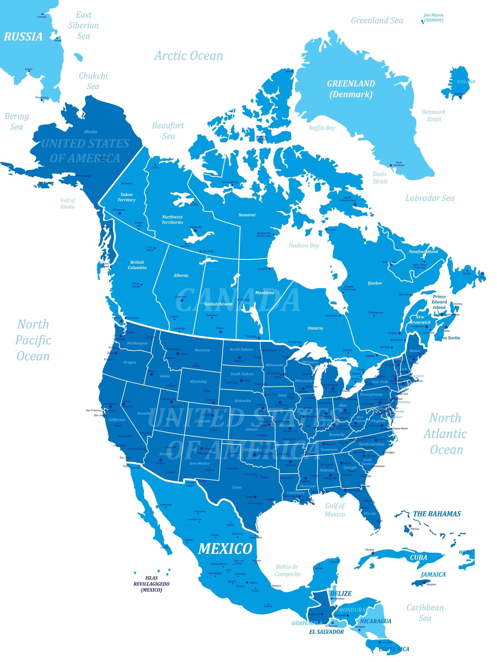
Map of North America showing Canada, United States, and Mexico in blue tones with major cities.
This map of North America highlights Canada, the United States and Mexico, as well as key geographic features such as oceans, seas and major cities. The map also shows US states, Canadian provinces and Mexican states, providing a clear representation of political boundaries across the continent.
Provinces and Territories of Canada Map with Capitals and Borders
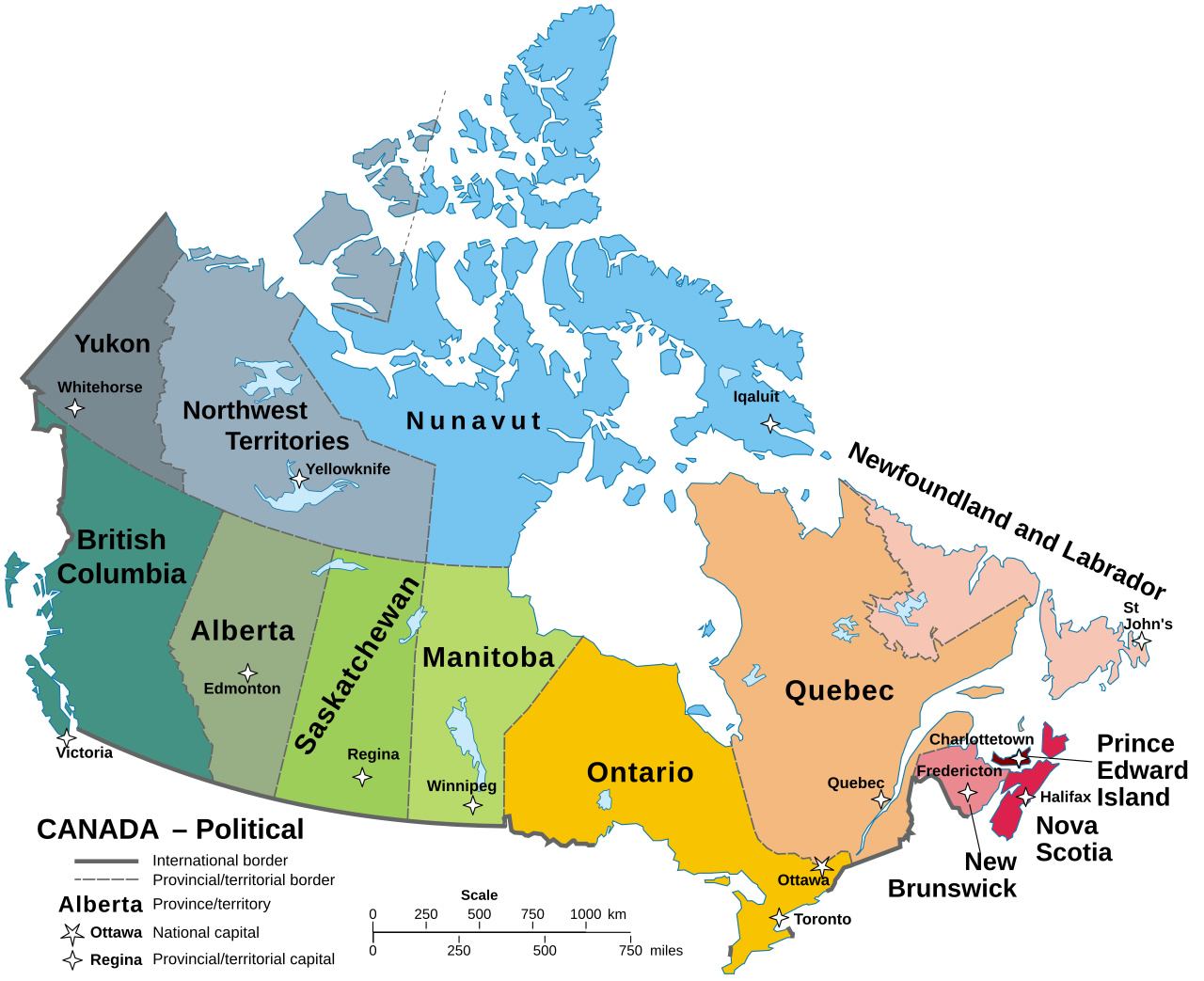
Map of Canada’s provinces and territories with borders, capitals, and international boundaries.
This map shows the provinces and territories of Canada, highlighting international borders, provincial/territorial boundaries and capital cities. Each region is colour-coded for easy identification, and major cities and major administrative capitals are marked for reference.
Map of Canadian Embassies and Diplomatic Missions Worldwide
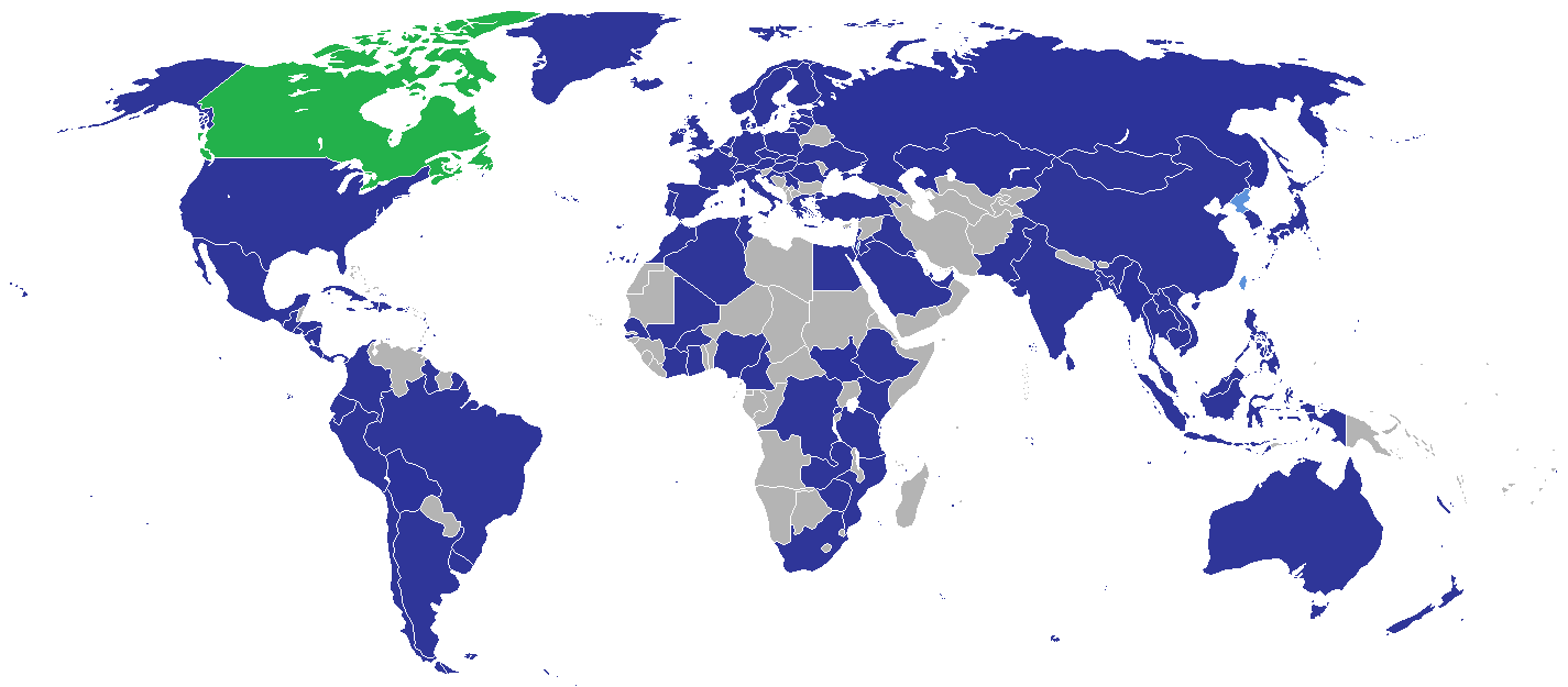
Global map showing locations of Canadian embassies and diplomatic missions.
This map highlights Canada’s embassies and diplomatic missions around the world. Countries with Canadian diplomatic representation are shown in blue, while Canada is marked in green. This visual aids in understanding Canada’s global diplomatic presence and its international partnerships.
Where is Canada on the World Map?
Show Google Maps and satellite maps of where the country is located.
Get directions by driving, walking, bicycling, public transportation, and traveling with street view.
Feel free to explore these pages as well:
- Canada Map ↗️
- Canada Political Map ↗️
- Canada Physical Map ↗️
- Canada Cities Map ↗️
- Canada Population Map ↗️
- Canada Road Map ↗️
- A Collection of Canada Maps ↗️
- Canada’s Largest Maps ↗️
- Vancouvers top 10 places to visit ↗️
- Montreal’s Top 10 Best Can’t-Miss Experiences for Tourists ↗️
- 10 must visit cities from the 2023 liveability index ↗️
- United States Map ↗️
- North America Map ↗️

