Explore Canada’s cities, towns and road networks with our detailed maps. Discover largest cities by population, economic regions and provincial capitals. Learn about Canada’s 10 provinces and 3 territories, their geographic locations and key census data. Perfect for travellers, researchers and geography buffs!
Canada Cities Map with Provinces, Territories, and Major Highways
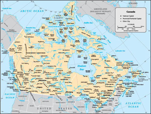
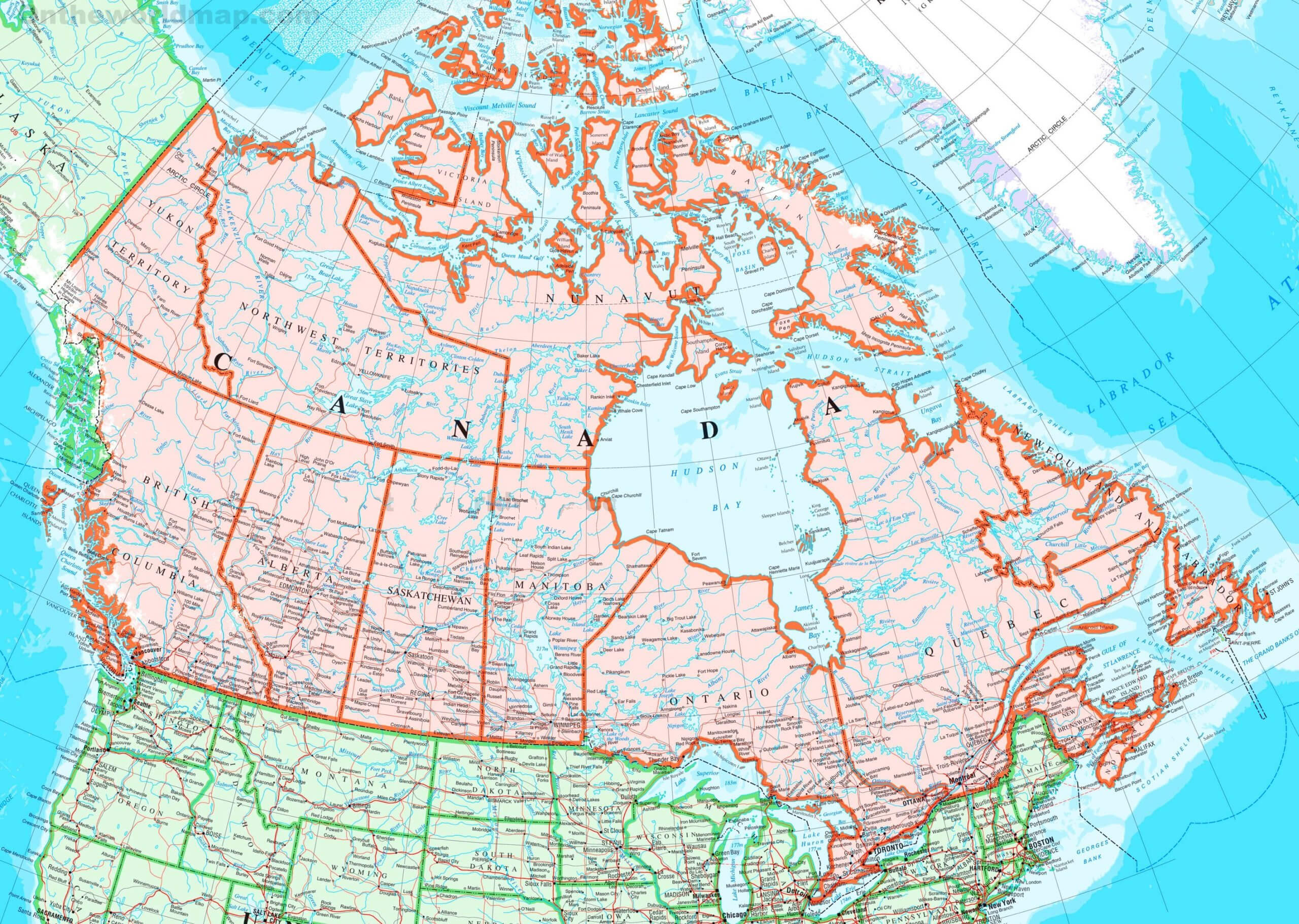
 Canada map with cities, provinces, territories, roads, and national capital Ottawa.
This map of Canada shows the provinces, territories, major cities and road networks. It includes national and provincial capitals, major population centres, and transportation routes. The map also highlights boundaries, highways, rivers and lakes, providing a complete geographic overview of Canada’s urban and regional layout.
Detailed Map of Canada with Cities, Provinces, and Major Roads
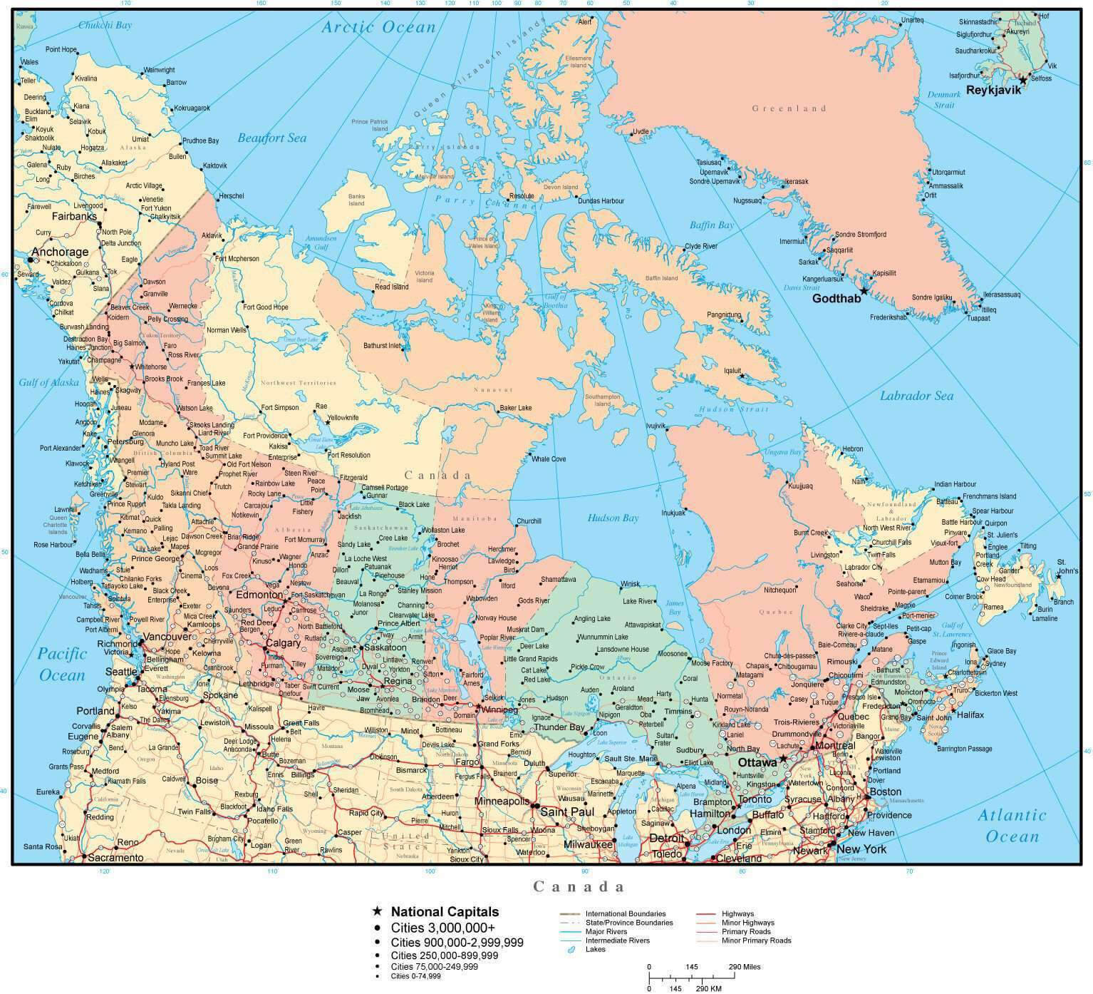
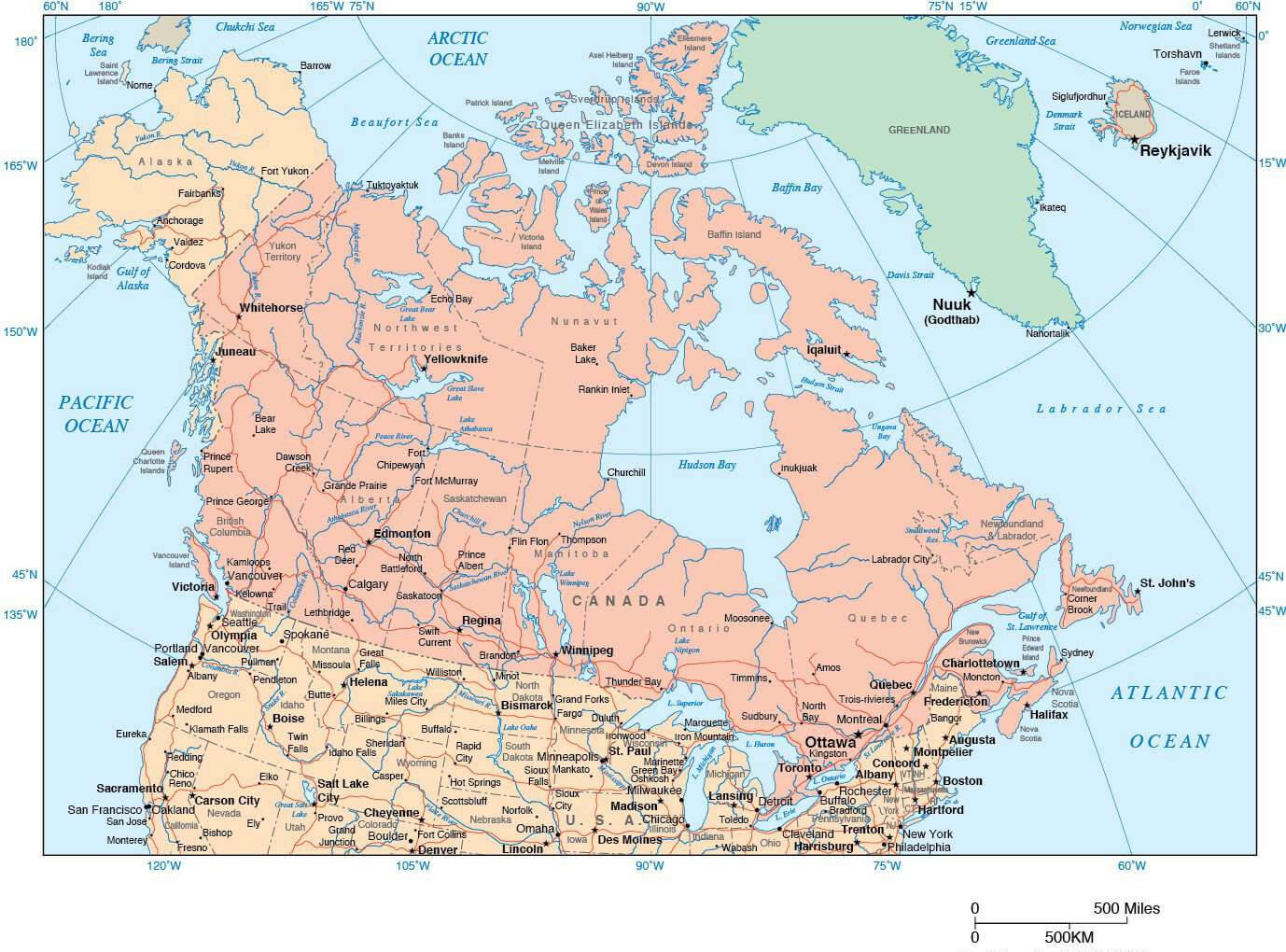
 Canada map showing cities, provinces, territories, capitals, and major highways.
This detailed Canada country map highlights major cities, provinces, and territories, including provincial capitals and the national capital, Ottawa. The map also showcases major highways, lakes, and coastal boundaries, providing a comprehensive view of Canada’s geography. Perfect for travelers, researchers, and geography enthusiasts!
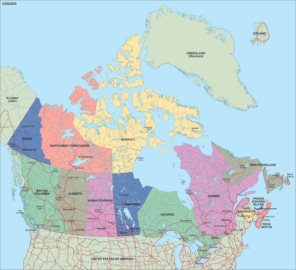
Canada Map with 10 Provinces, 3 Territories, and Their Capitals
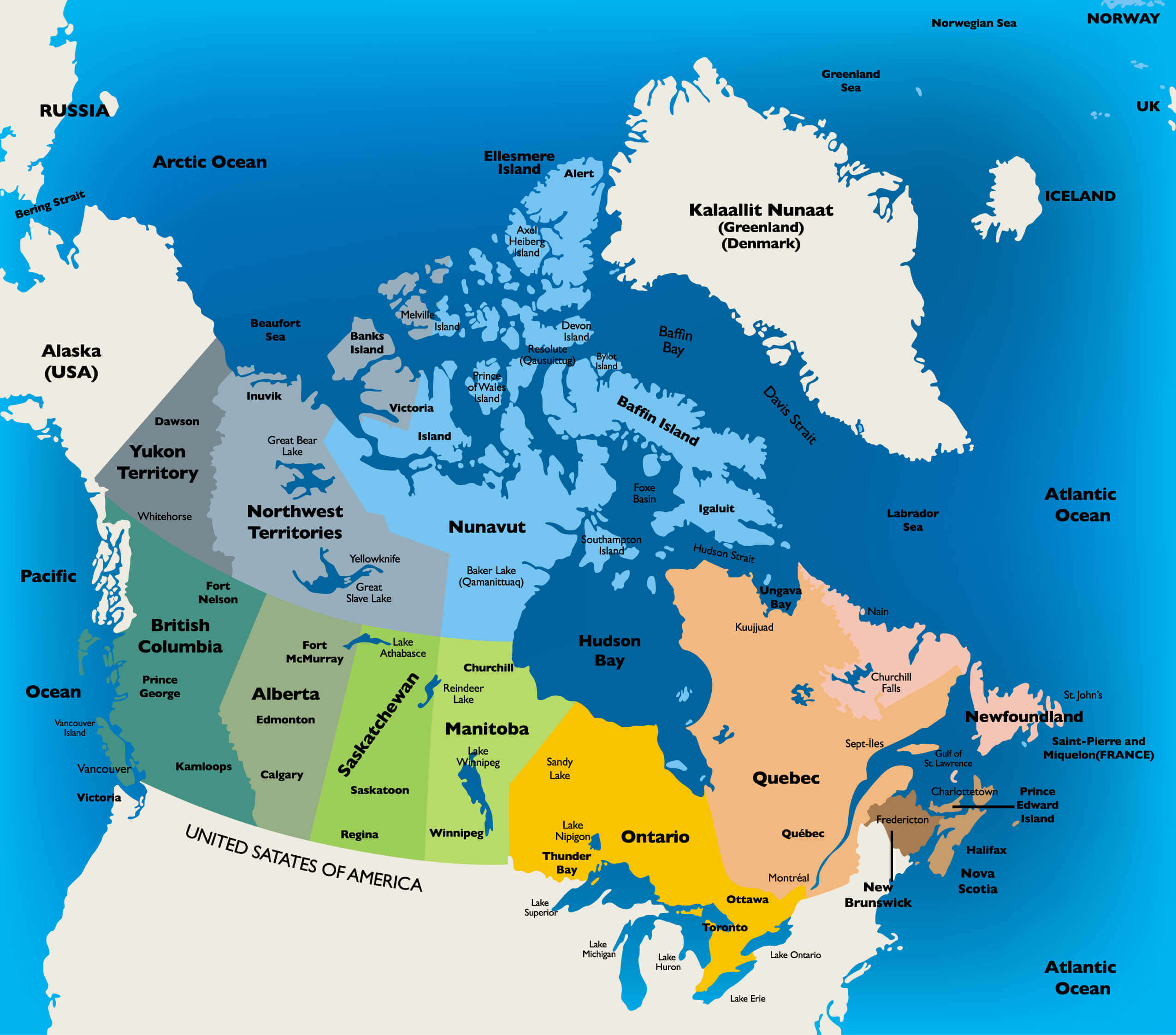
This Canada map highlights its 10 provinces and 3 territories along with their capital cities. The map provides a clear view of regional divisions, key cities, and geographic features like oceans, lakes, and borders. Perfect for understanding Canada’s political and geographical structure, from Ottawa to Yellowknife and Iqaluit.
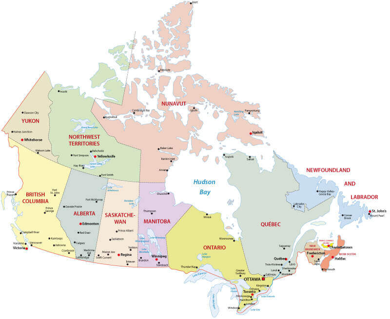
Canada administrative map with major cities
Canada cities and towns map with highways
Canada cities map with provinces and roads
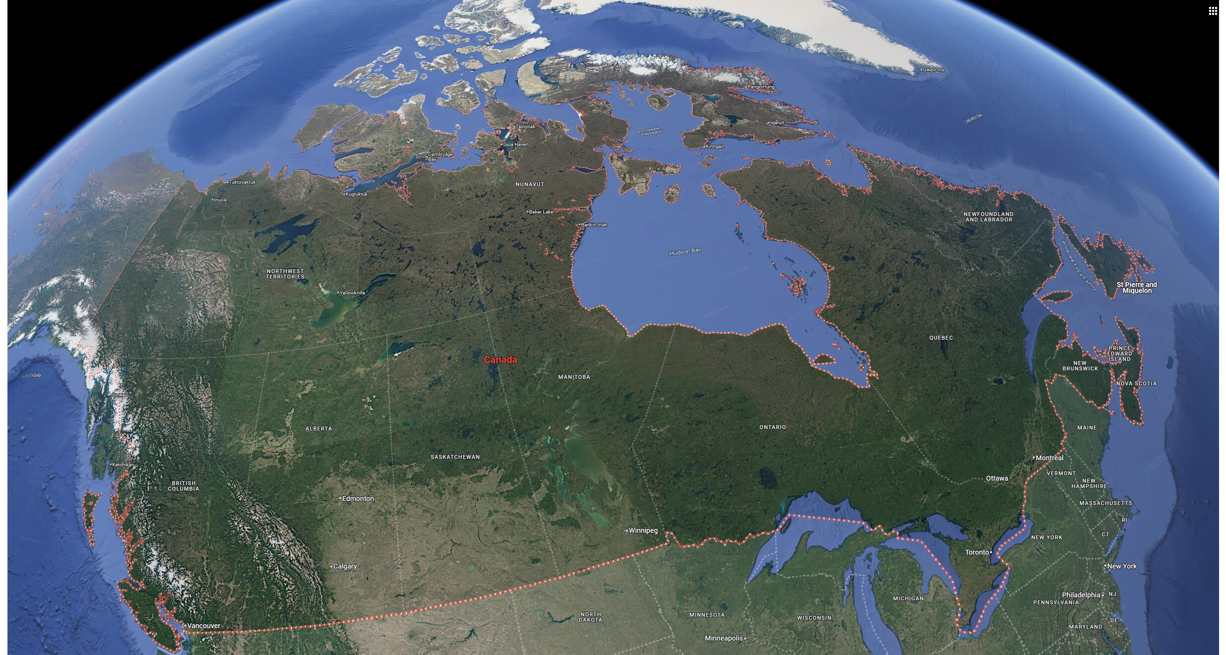
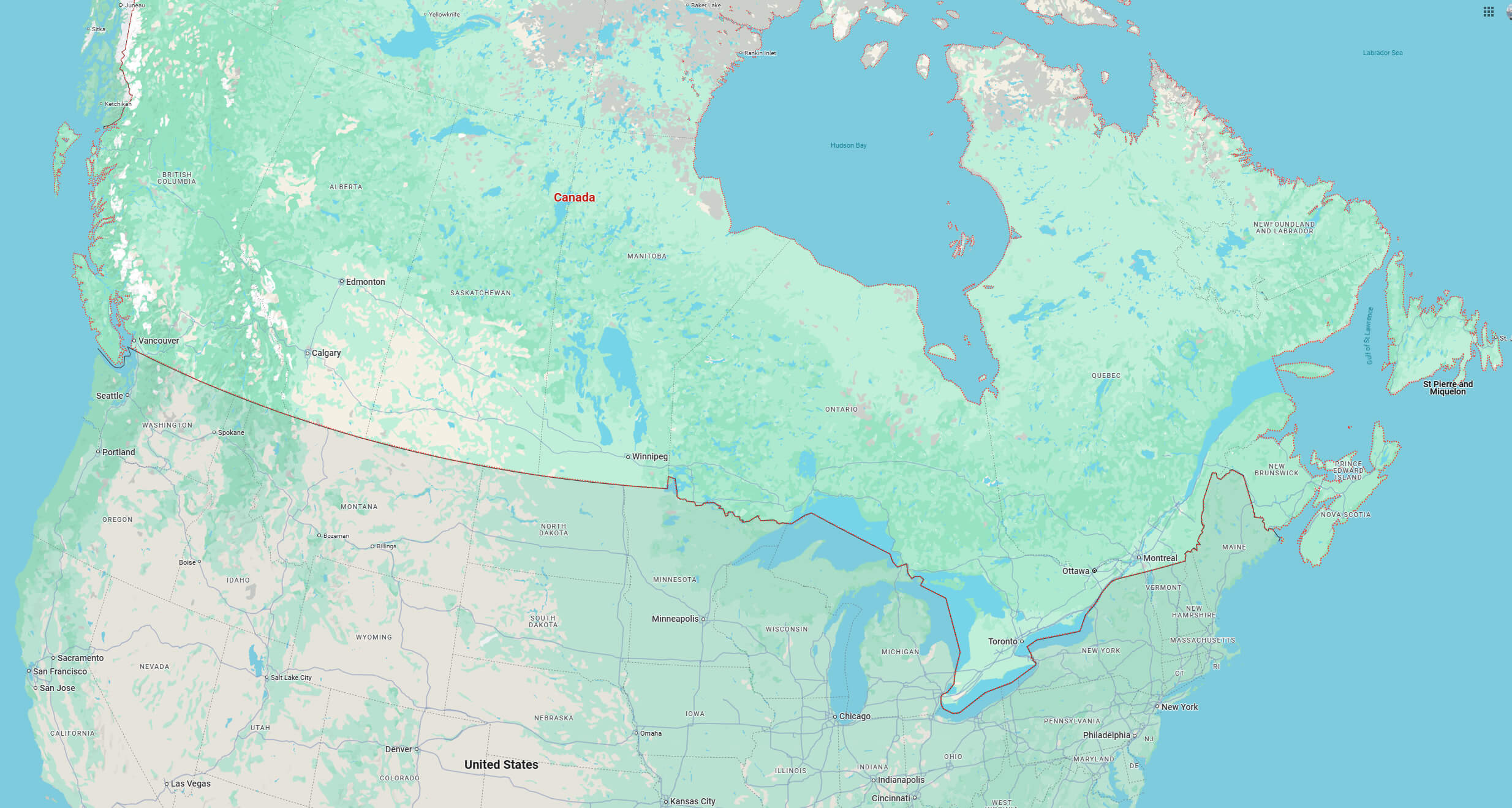
Canada cities map with satellite image
Canada cities map
Canada major cities map
Canada map with cities
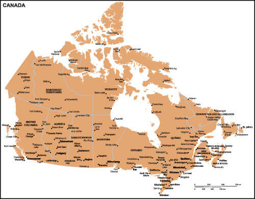
Canada provinces map with cities
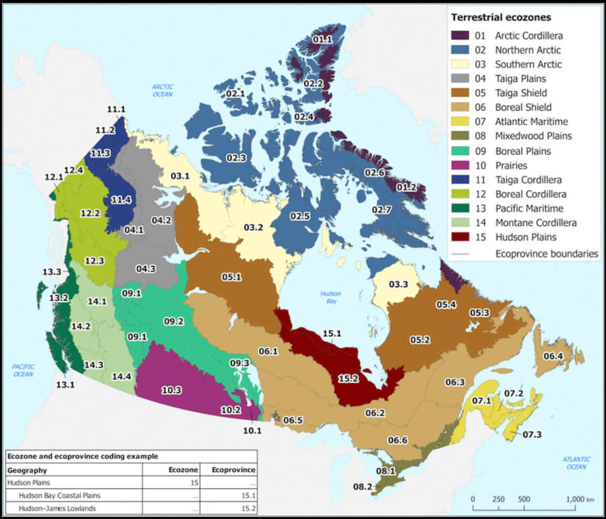
Canada terrestrial ecozones map
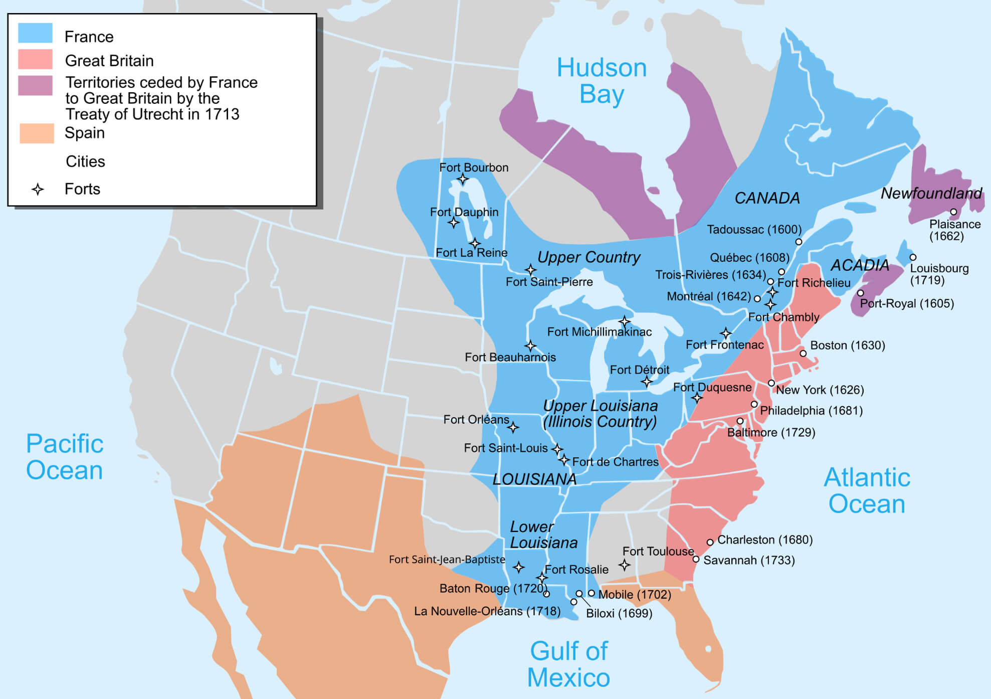
Canada US cities map in 1713
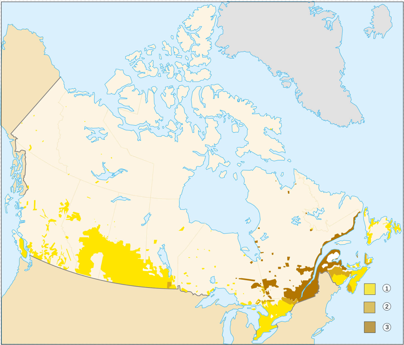
Canadians speaks english and french language map
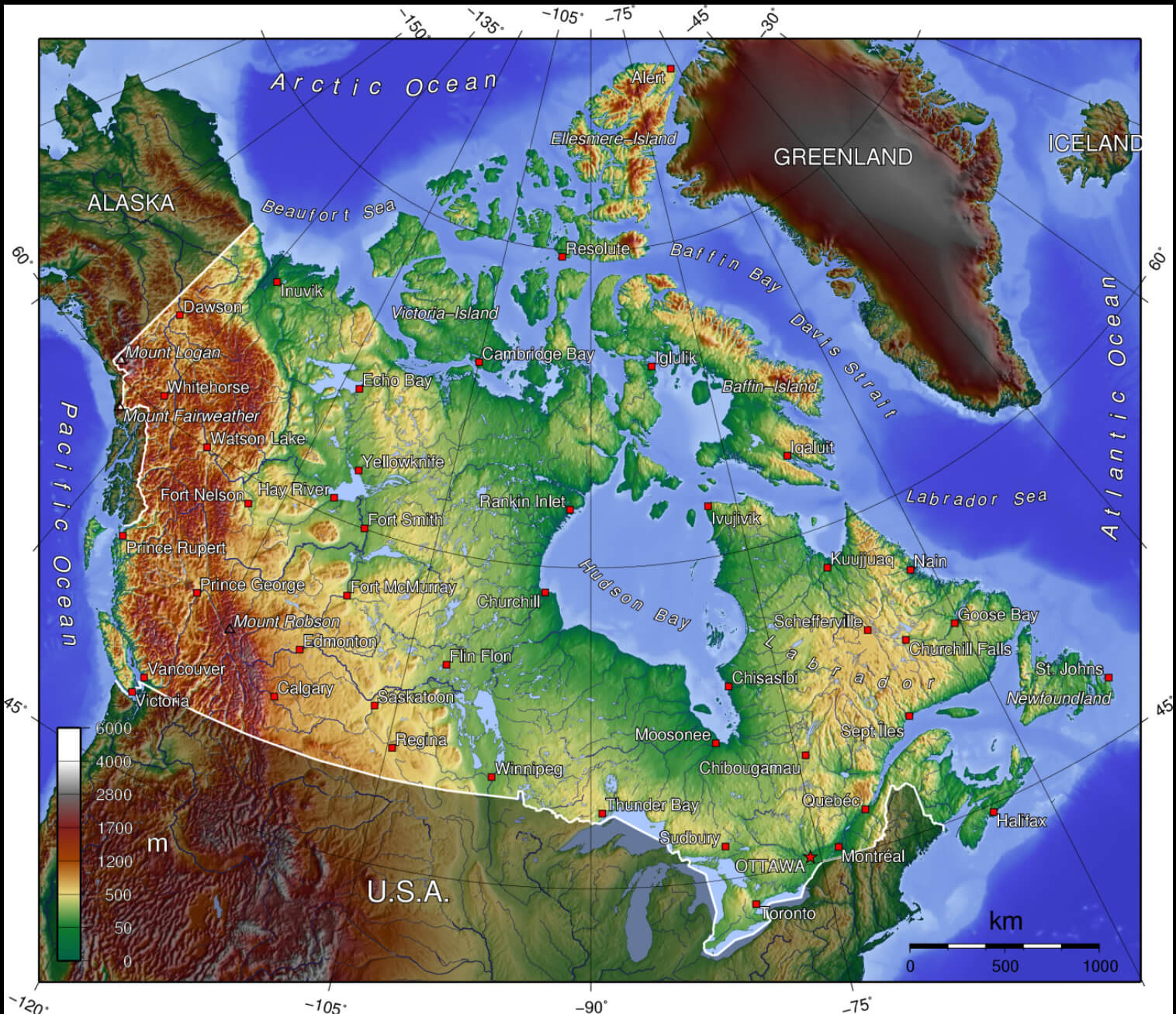
Topographic map of Canada with cities
Where is Canada on North America Map?
Show Google interactive map, satellite map, where is the country located.
Get direction by driving, walking, bicycling, public transportation and travel with street view.
Feel free to explore these pages as well:
- Canada Map ↗️
- Map of Canada ↗️
- A Collection of Canada Maps ↗️
- Canada Political Map ↗️
- Canada Physical Map ↗️
- Canada Population Map ↗️
- Canada Road Map ↗️
- Canada’s Largest Maps ↗️
- Vancouvers top 10 places to visit ↗️
- Montreal’s Top 10 Best Can’t-Miss Experiences for Tourists ↗️
- 10 must visit cities from the 2023 liveability index ↗️
- United States Map ↗️
- North America Map ↗️