Canada is a vast and diverse country, and its maps provide a unique perspective on its geography, politics, and place in the world. The political map highlights its provinces and territories, including Quebec, Ontario and the northern territories of Yukon, Nunavut and the Northwest Territories.
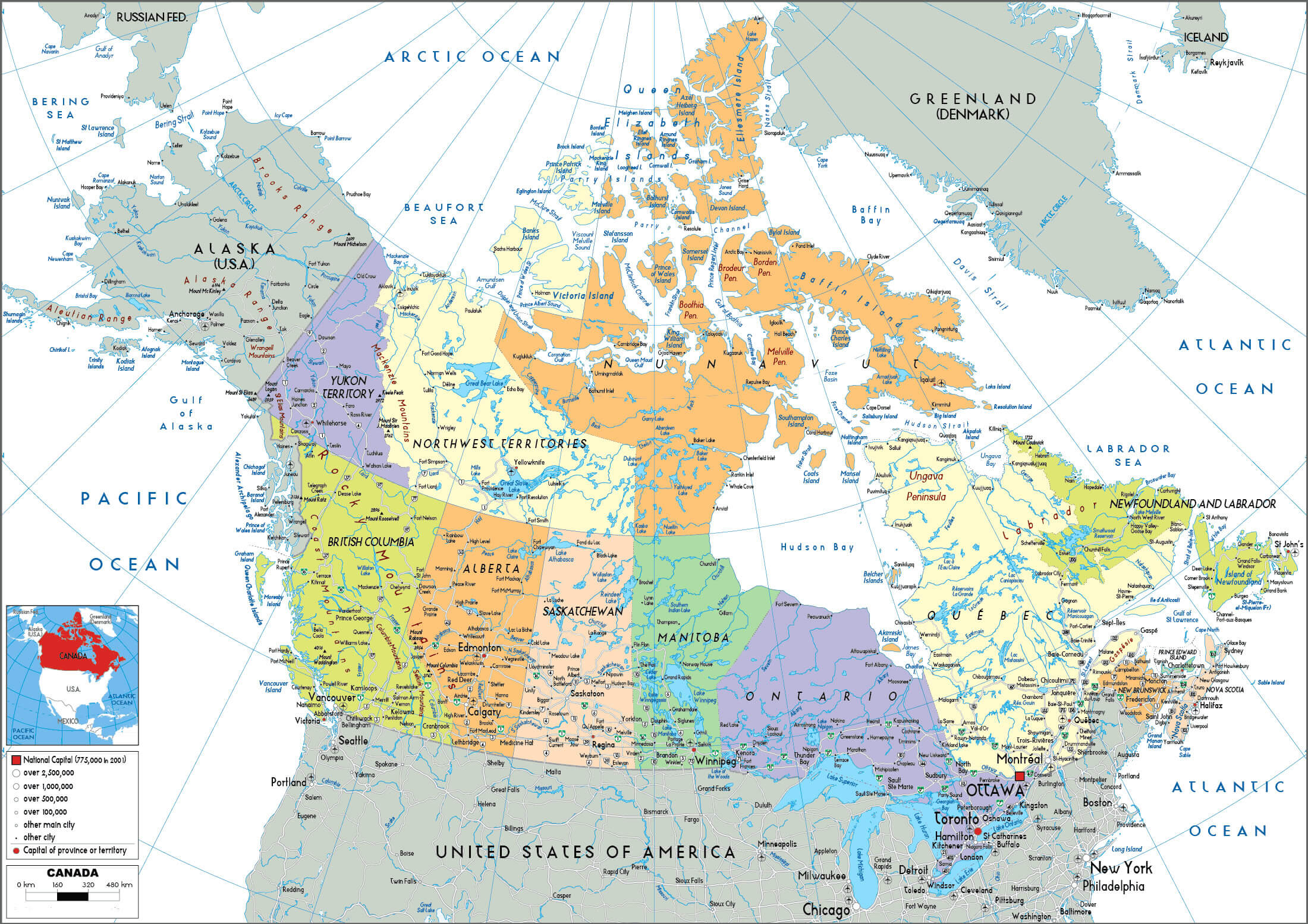
Canada Political Map
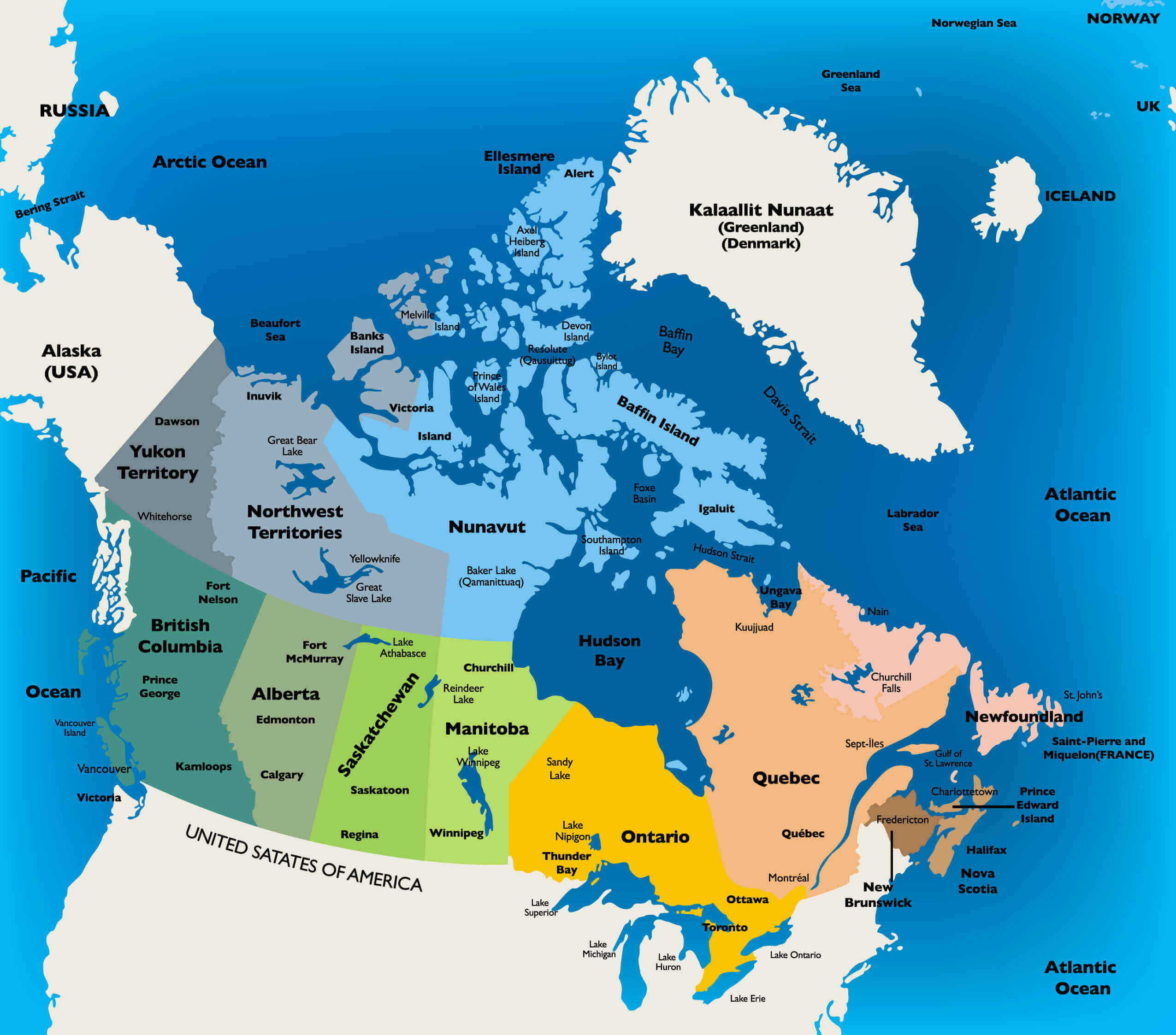 Political map of Canada showing provinces, territories, and surrounding oceans.
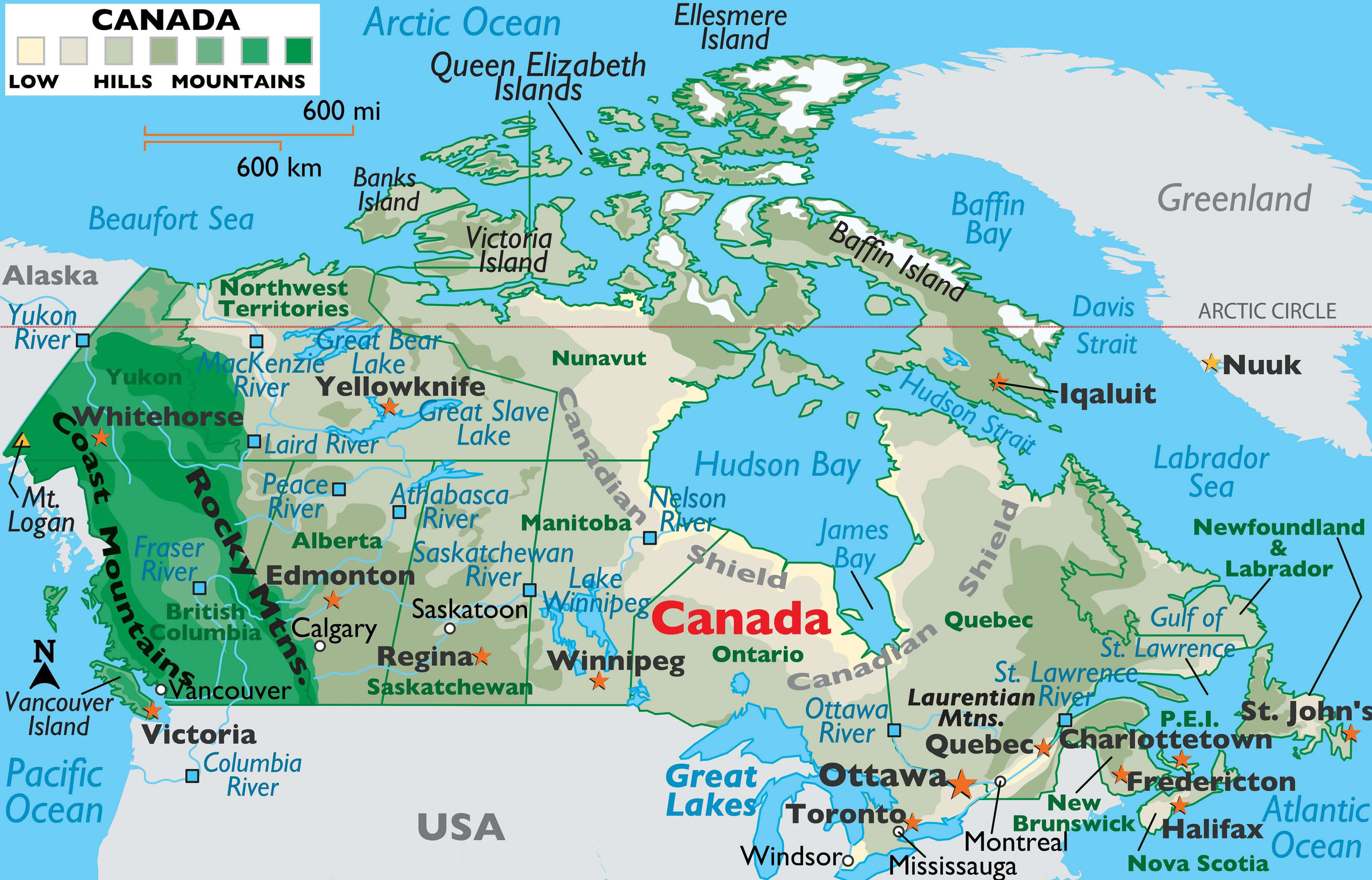
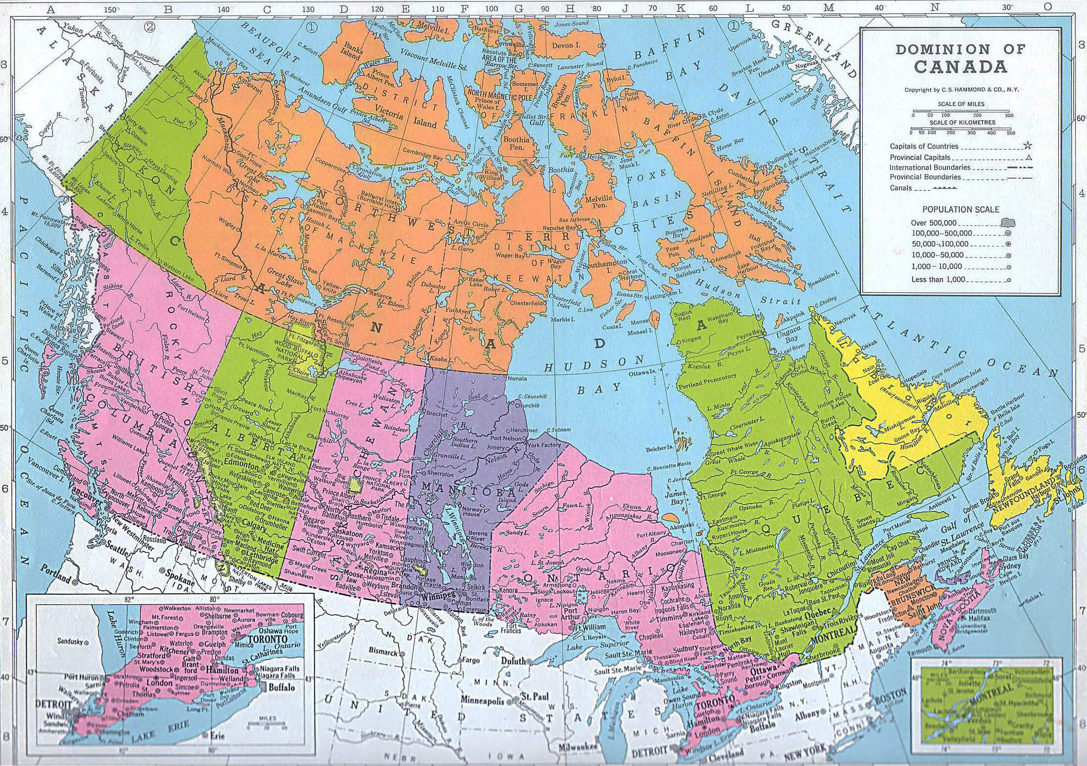
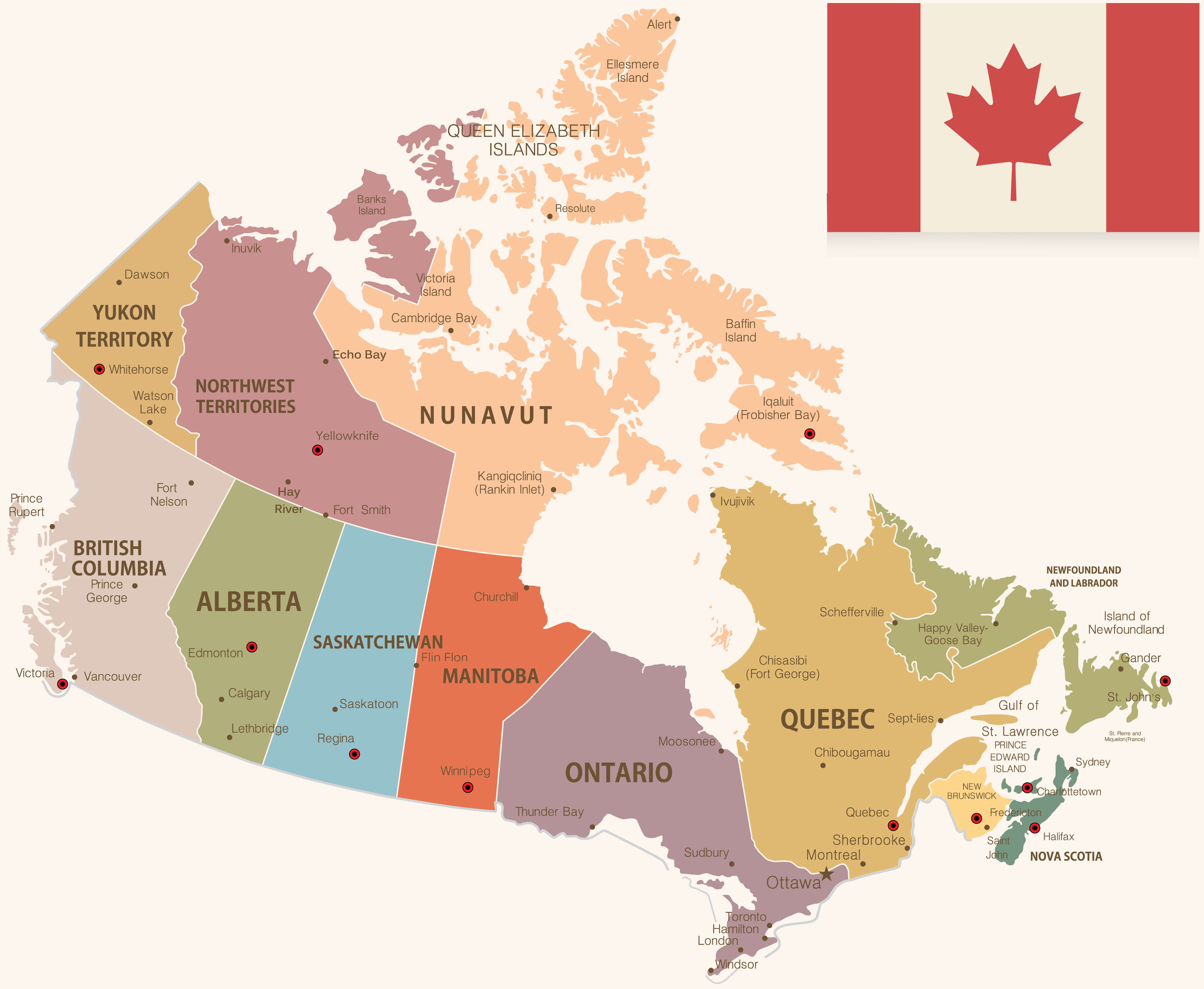
Canada Administrative Map
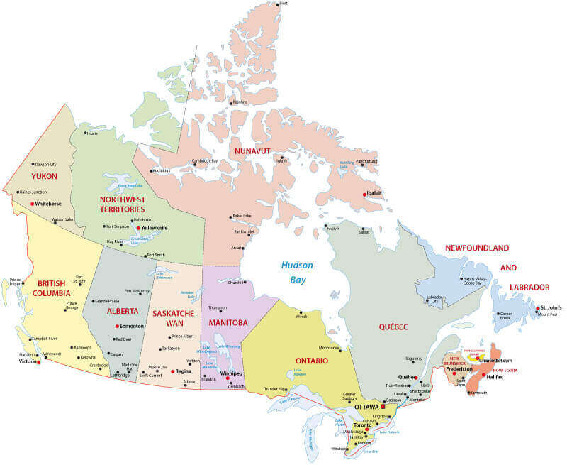 Administrative map of Canada showing provinces, territories, and major cities.
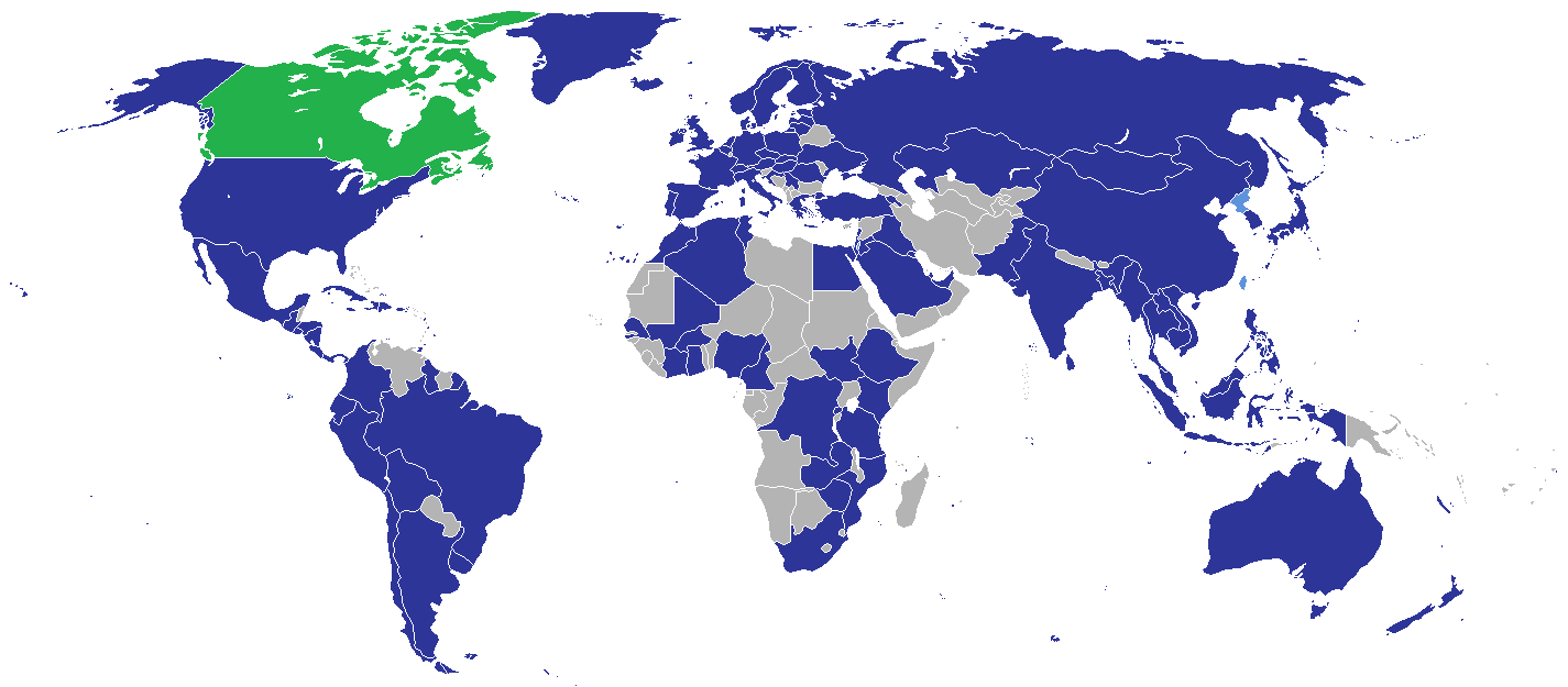
Canada’s Location on the World Map
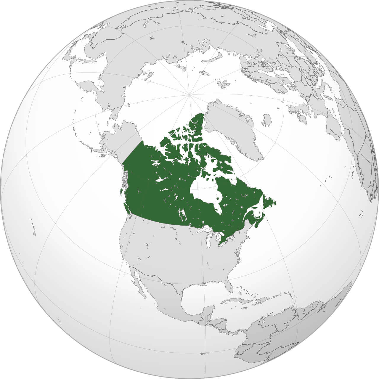
Canada administrative map with territories
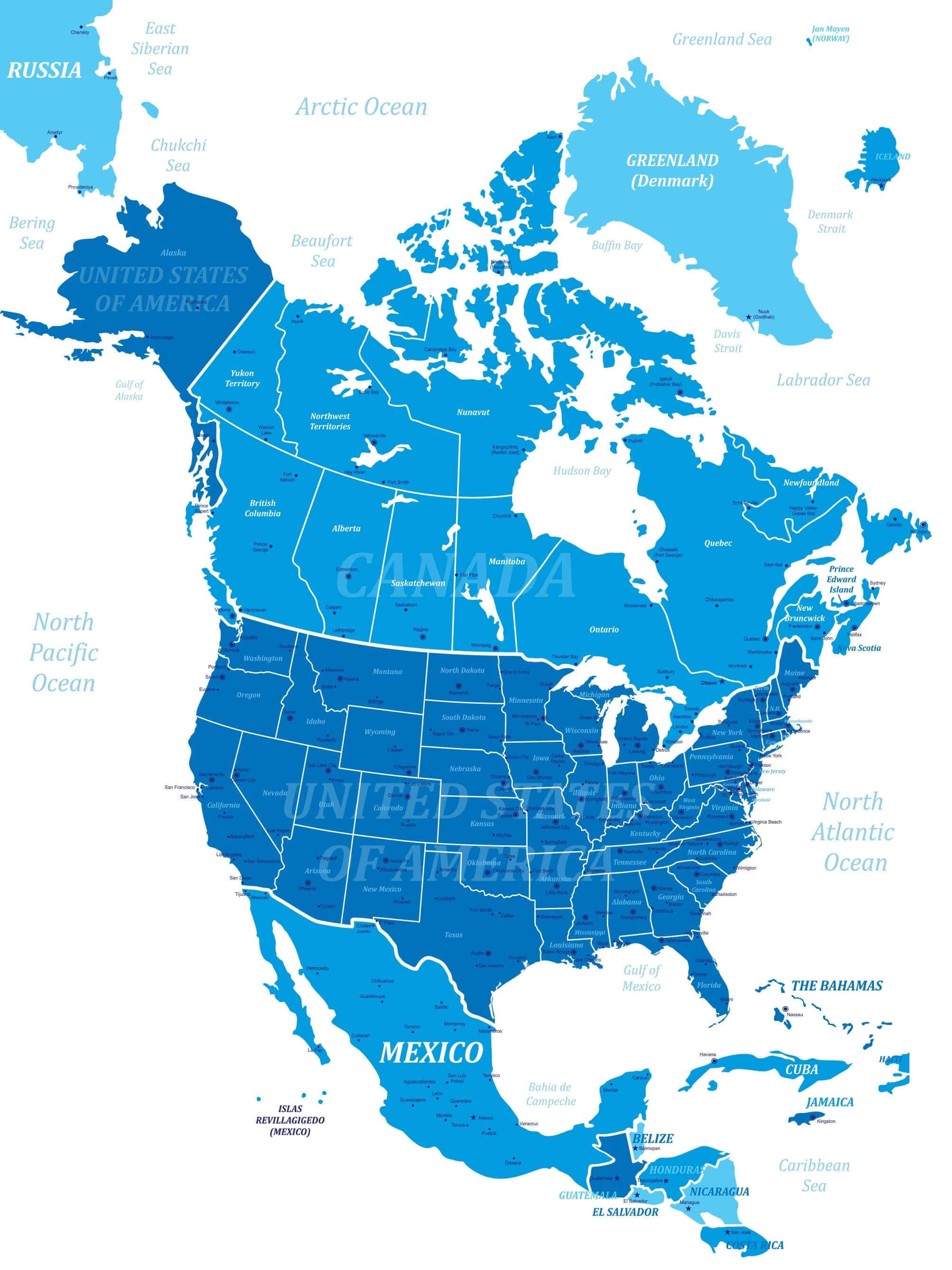
The map of the territory shows its vast landmass, bordered by the United States to the south and the Arctic Ocean to the north. When viewed alongside the North America map, Canada shares a prominent position with its neighbour, the USA, emphasising its continental connections. A colourful map of Canada brings cities and regions to life, from Vancouver to Halifax, while administrative maps focus on political divisions and governance.
North America and Canada Political Map
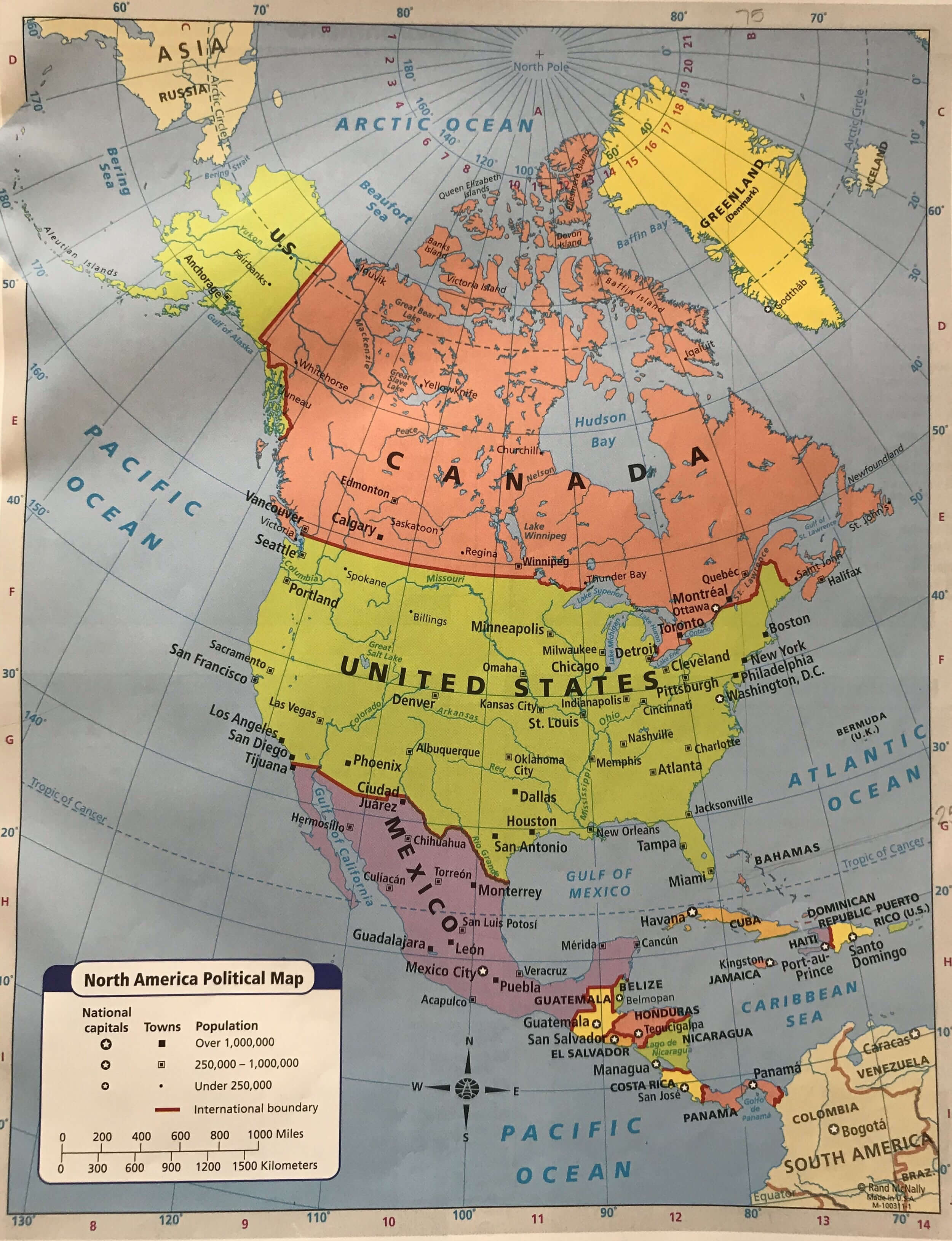 Political map of North America showing Canada, the U.S., and Mexico.
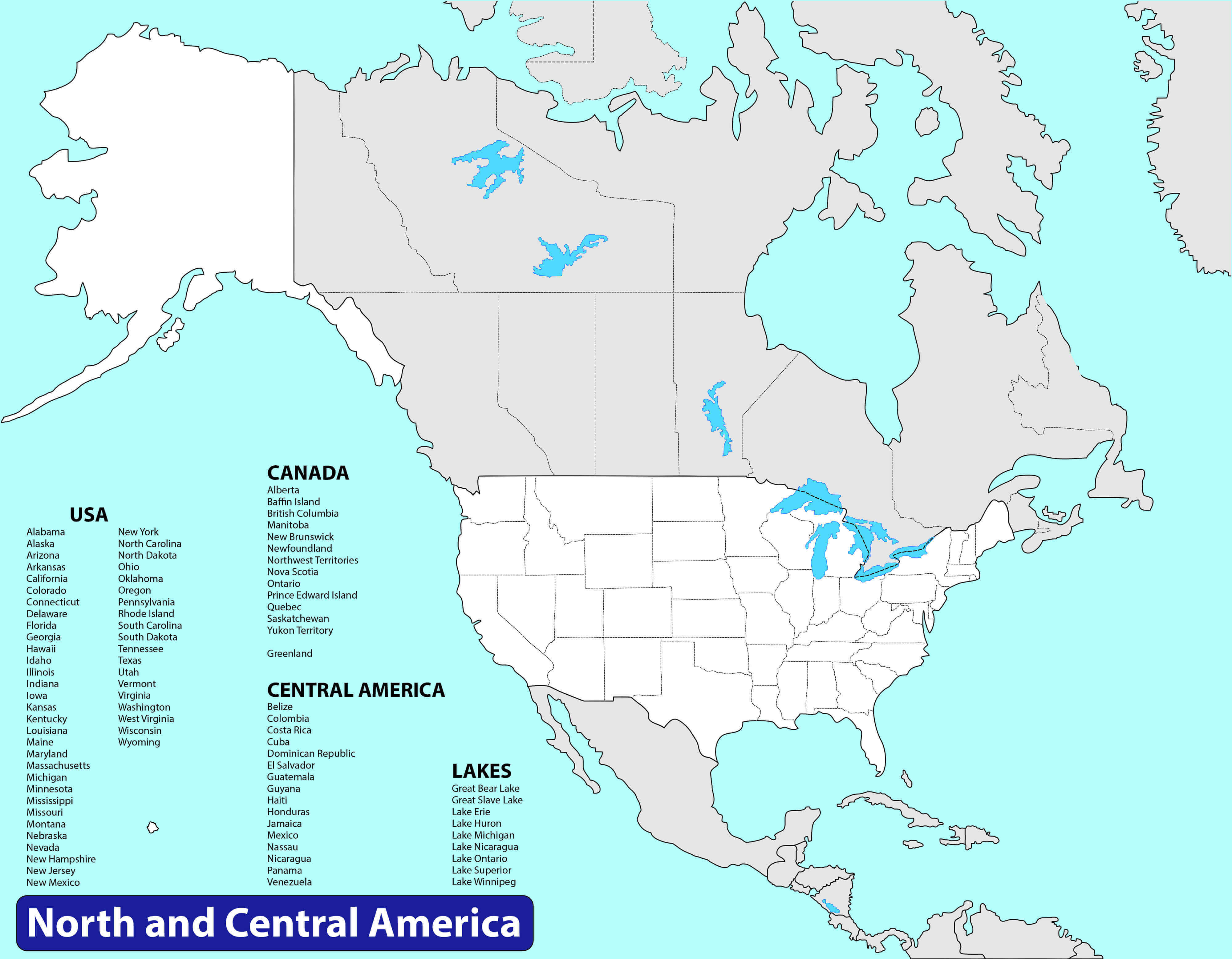
Canada and US map with North America
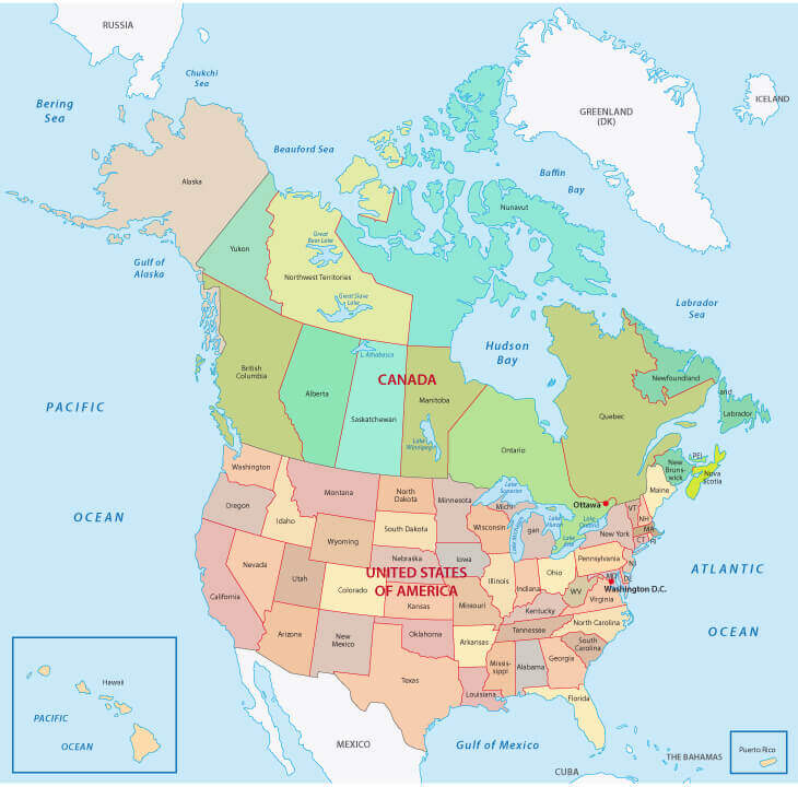
Canada and U.S. Map with Provinces and States
 Map showing Canada’s provinces, territories, and U.S. states with boundaries.
Canada map with provinces and Canada’s flag
The geographical map reveals stunning natural features such as the Rocky Mountains, the Great Lakes and endless forests. Finally, Canada’s position on the world map reminds us of its strategic location in the northern hemisphere, balancing its proximity to global powers with its rich, unspoiled wilderness.
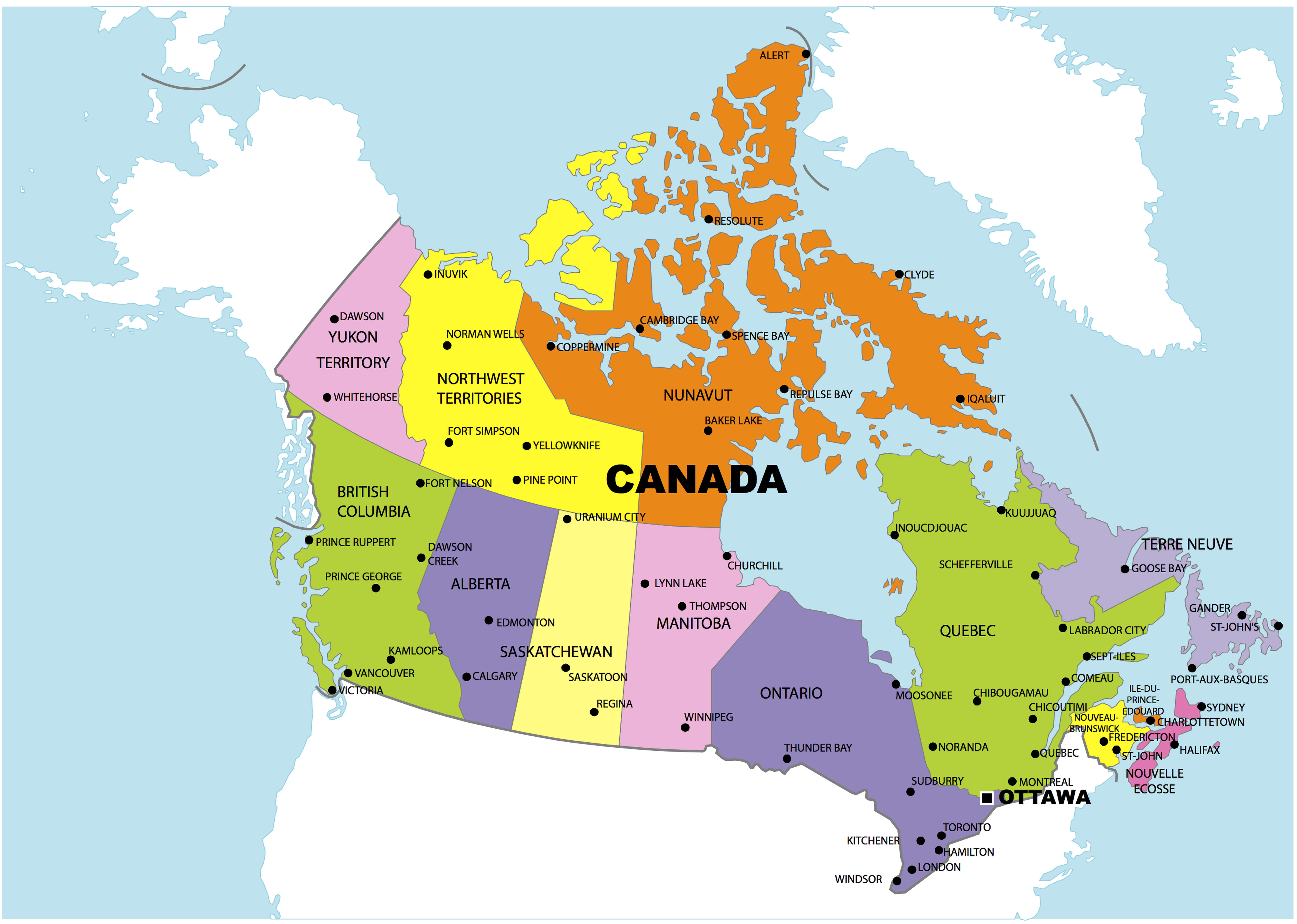
Canada’s Political Map with Cities
 Political map of Canada showing provinces, territories, and major cities.
Canada’s Political Map with Mountains
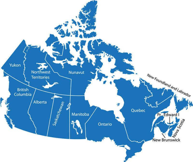
Canada provinces and territories map
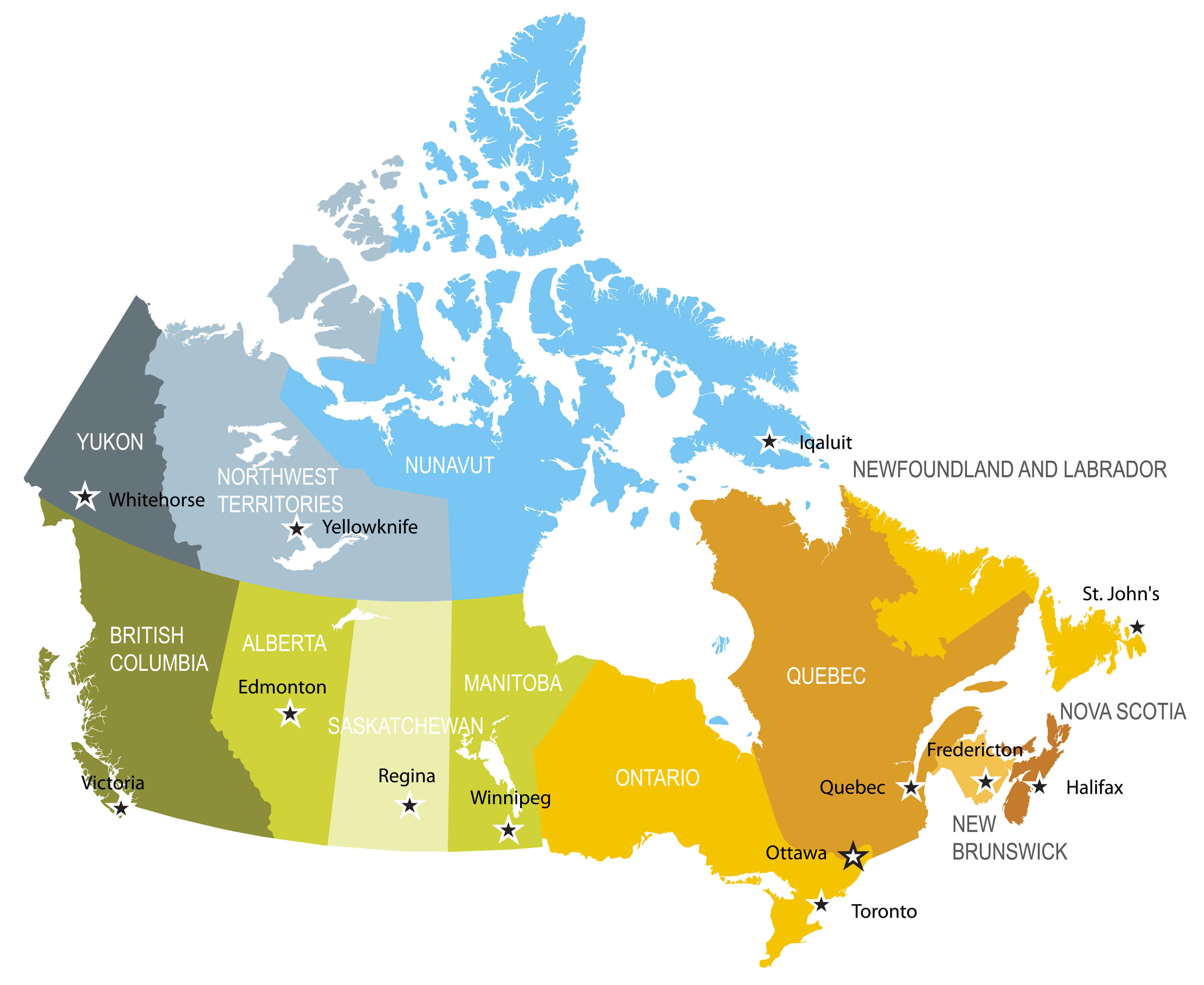
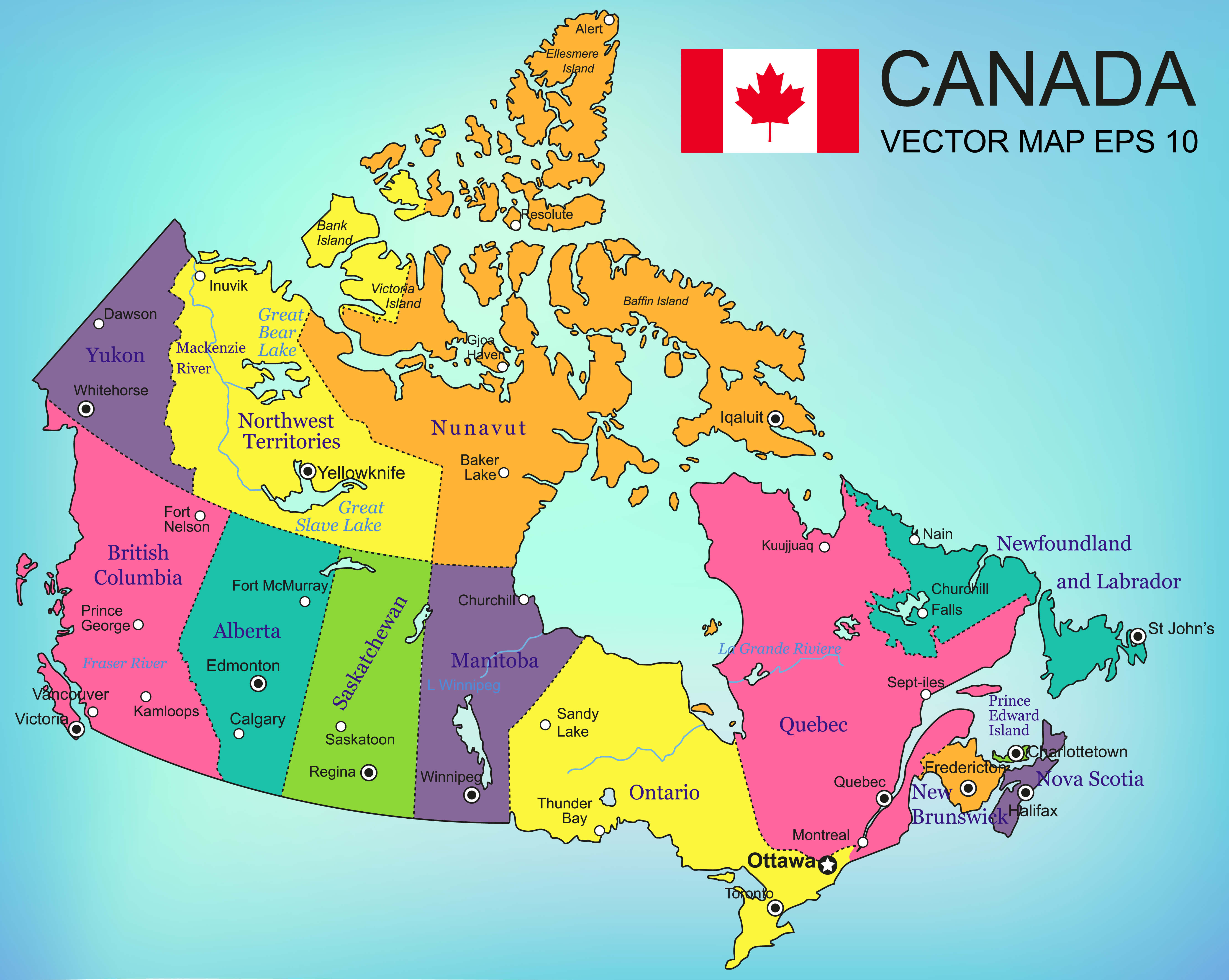
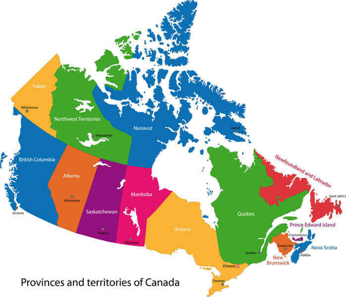
Canada’s Provincial and Territorial Map
 Map of Canada showing provinces, territories, and their capitals.
Canada states map
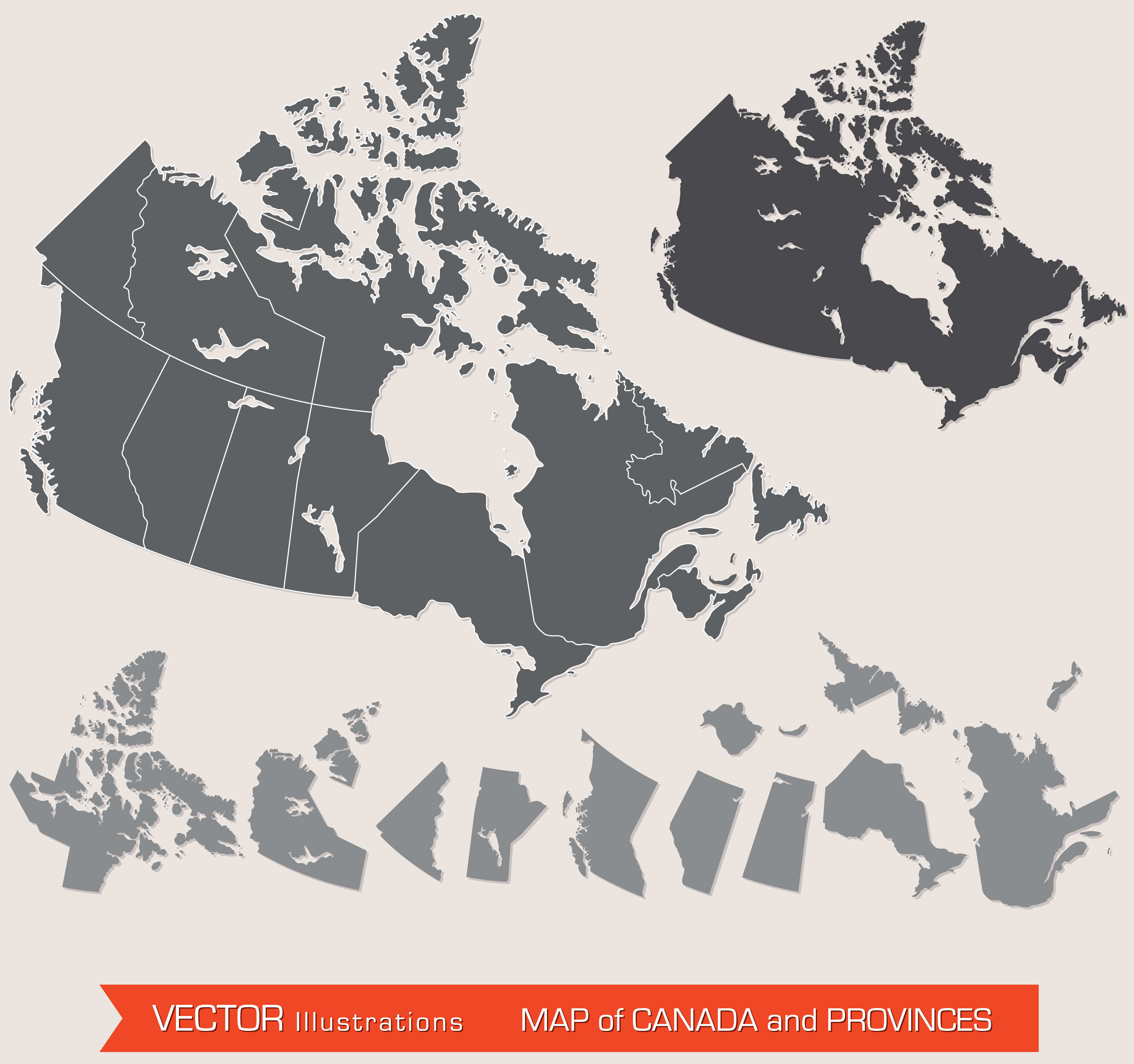
Canada states map and blank Canada map
Canada territories blank map
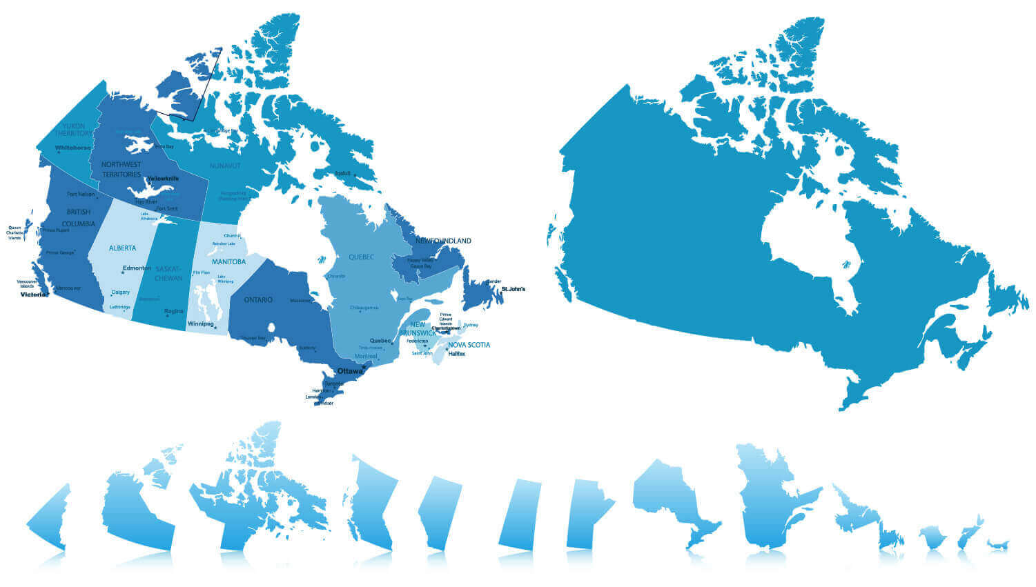
Canada’s Map of Provinces and Territories
 Map of Canada showing provinces and territories with labeled boundaries.
Canada and United States blank map with North America
Colorful Canada Map
Countries free trade agreements map with Canada
European Colonization Map with Canada Territories in 1750
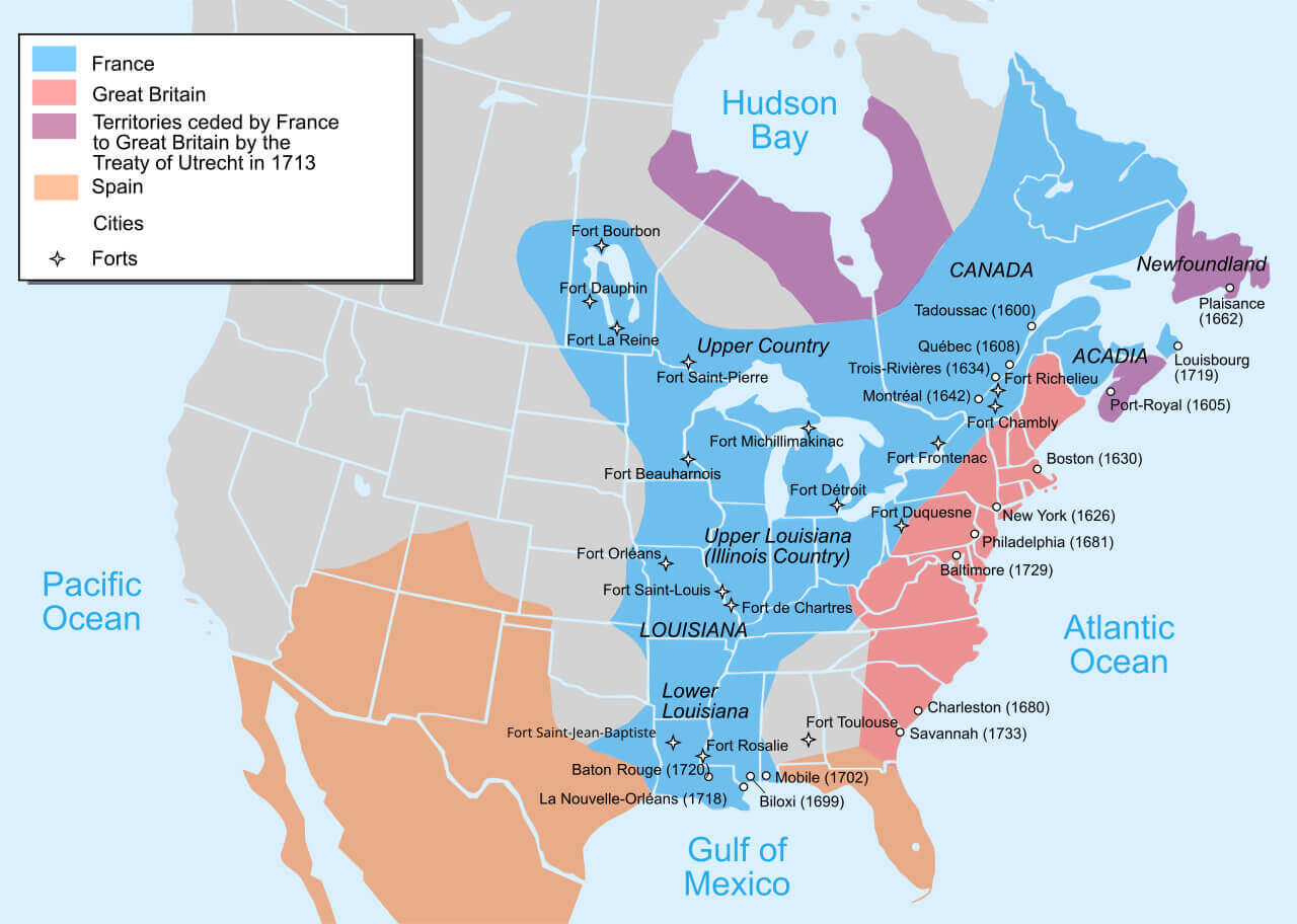 Map of European colonization in 1750 showing Canada territories and forts.
North America map with Canada
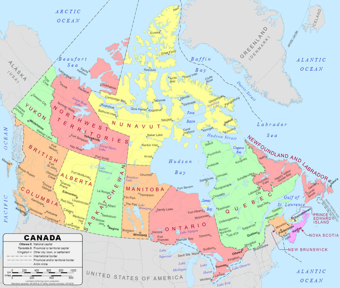
Provinces and Territories of Canada Map
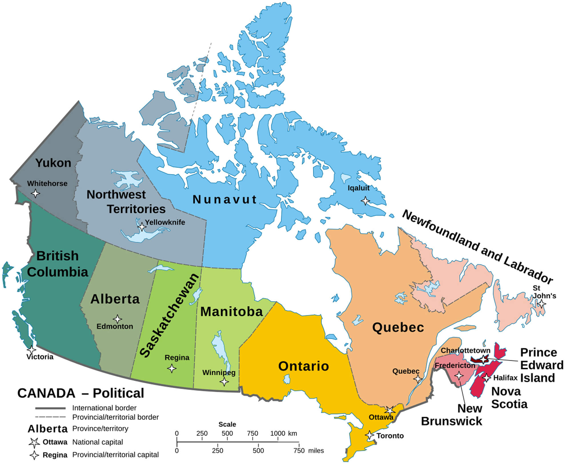 Map of Canada showing provinces, territories, and their capitals.
Vintage map of Canada with Canada flag
Canadian embassies map with diplomatic missions
Where is Canada on North America Map?
Show Google interactive map, satellite map, where is the country located.
Get direction by driving, walking, bicycling, public transportation and travel with street view.
Feel free to explore these pages as well:
- Canada Map ↗️
- Map of Canada ↗️
- A Collection of Canada Maps ↗️
- Canada Physical Map ↗️
- Canada Cities Map ↗️
- Canada Population Map ↗️
- Canada Road Map ↗️
- Canada’s Largest Maps ↗️
- Vancouvers top 10 places to visit ↗️
- Montreal’s Top 10 Best Can’t-Miss Experiences for Tourists ↗️
- 10 must visit cities from the 2023 liveability index ↗️
- United States Map ↗️
- North America Map ↗️