- Advertisement -
Canada’s physical maps and atlases provide a detailed view of its stunning geography, including cities such as Toronto and Vancouver, provinces such as Alberta and Quebec, and natural features such as the Rocky Mountains and Hudson Bay. These maps highlight rivers such as the St. Lawrence, huge lakes such as Lake Superior and Canada’s extensive coastline along the Pacific Ocean. Satellite imagery and terrain maps show the country’s diverse topography, including rolling plains, towering peaks and Arctic tundra. In addition, North America maps place Canada in relation to the United States, highlighting the vast landmass and unique physical features that make it the world’s second largest country.
Canada’s Rivers and Lakes Map
 Map of Canada highlighting rivers, lakes, and water systems in green and blue.
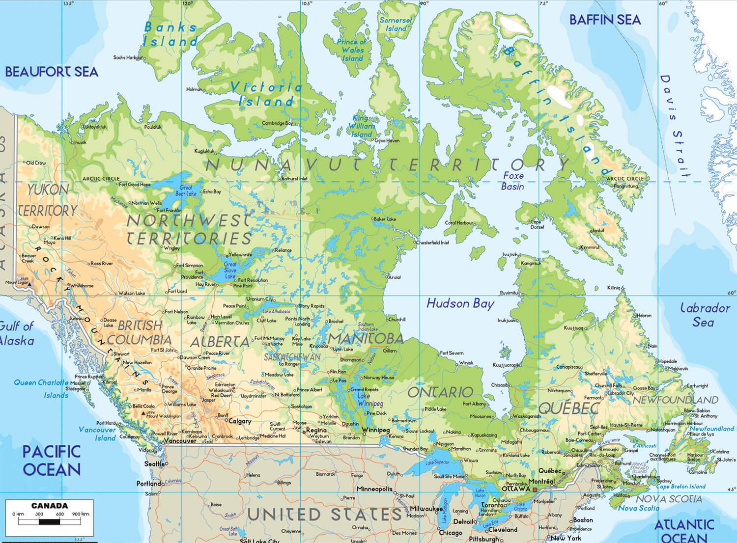
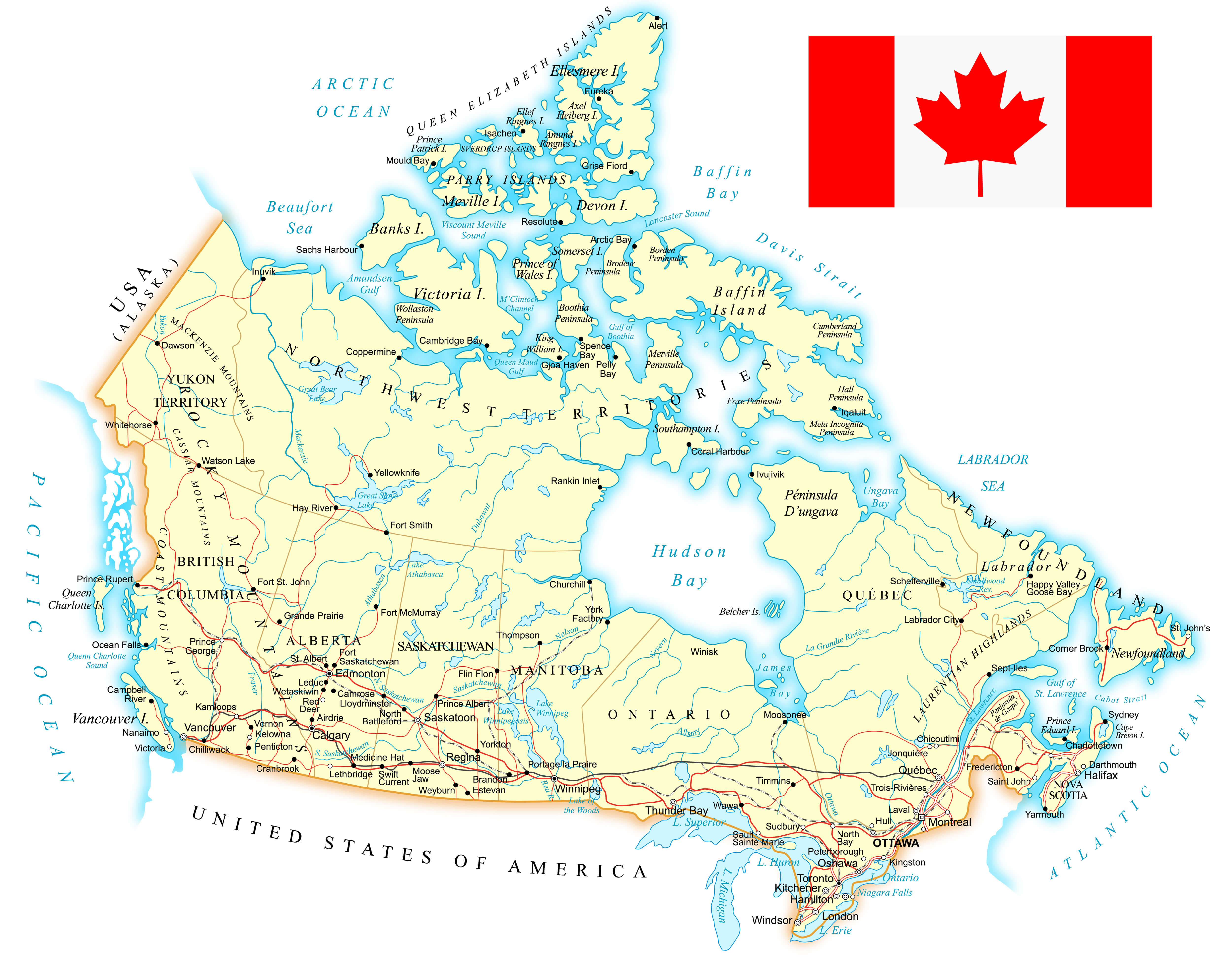
Canada’s Geography Map
 Map of Canada showing cities, landmarks, and natural features across provinces.
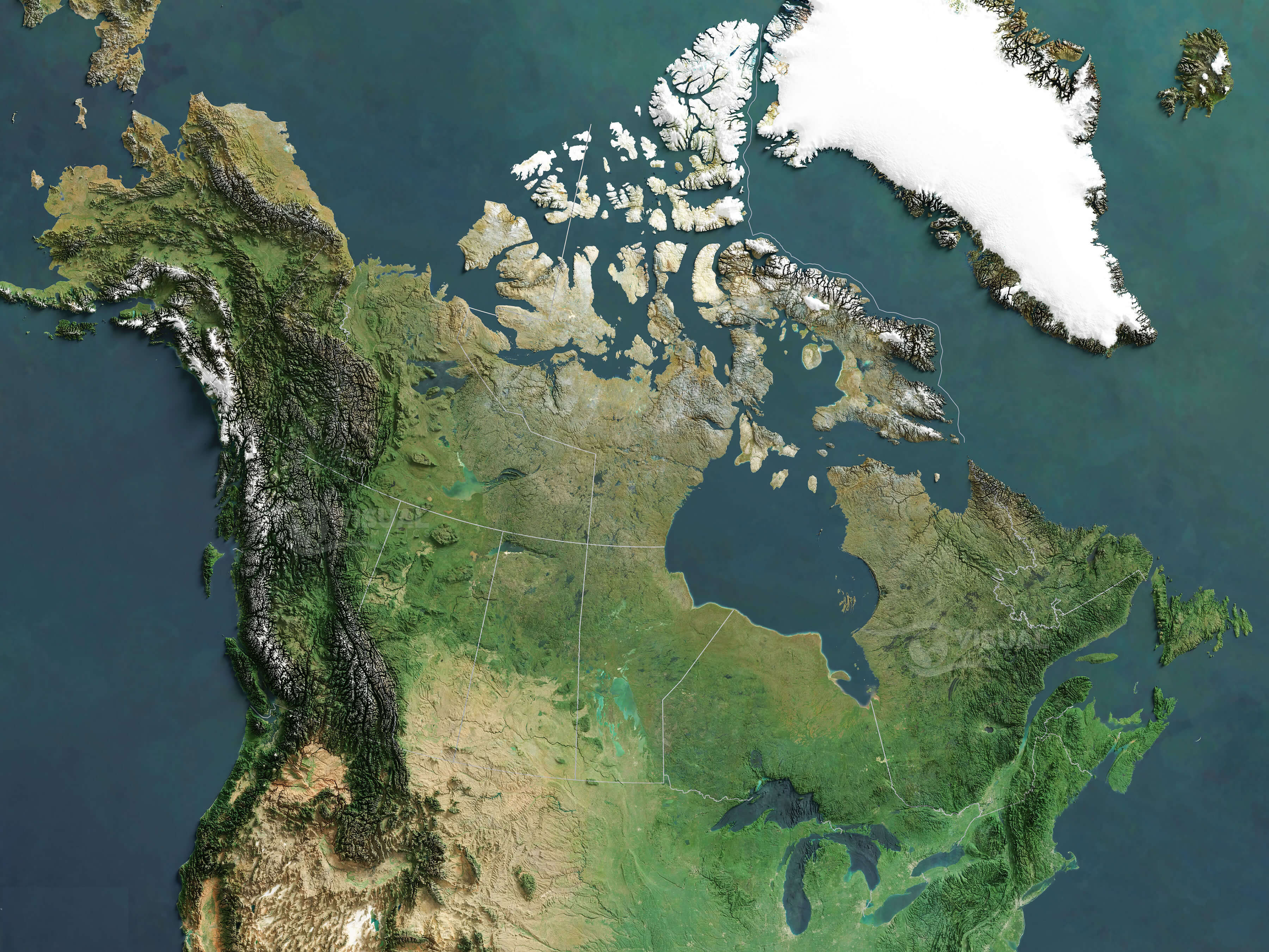
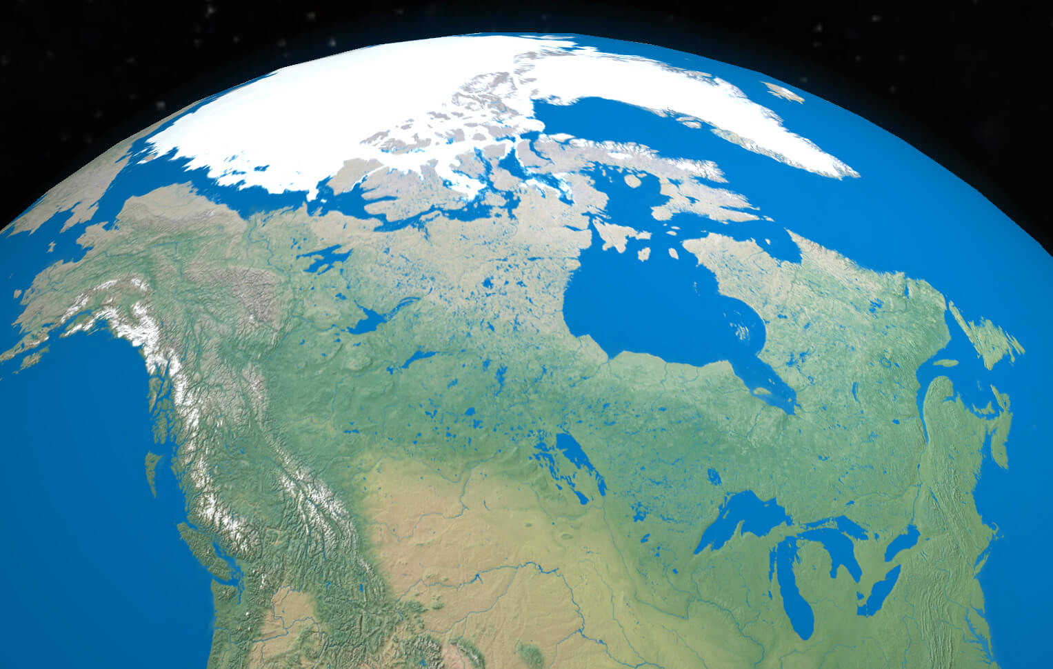
Canada and U.S. Satellite Map
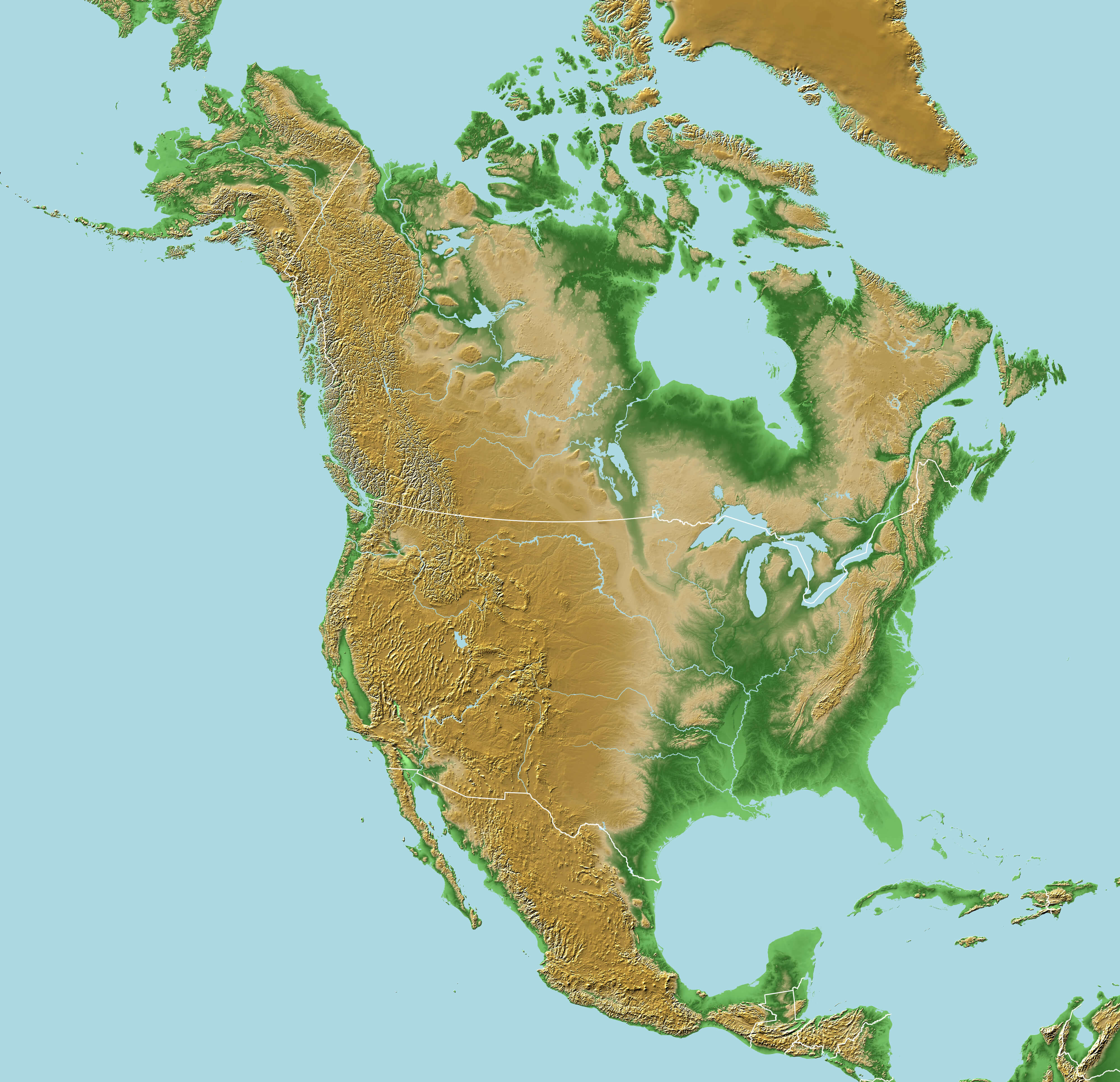
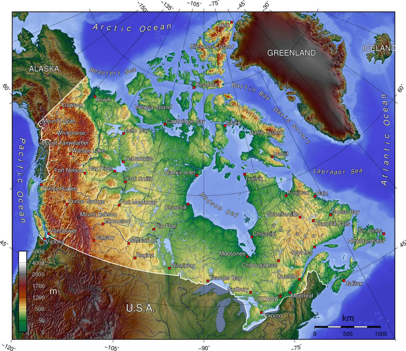
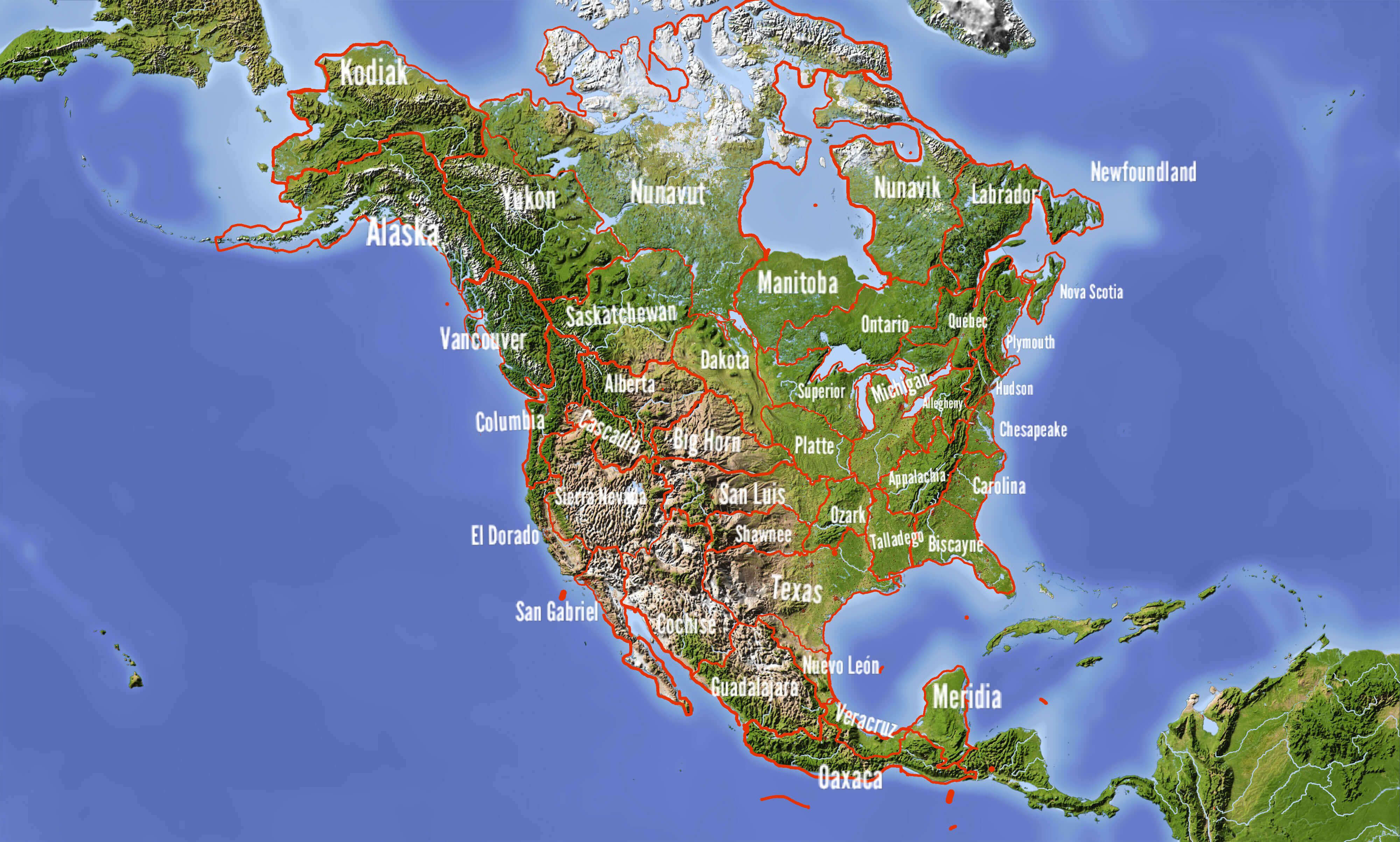
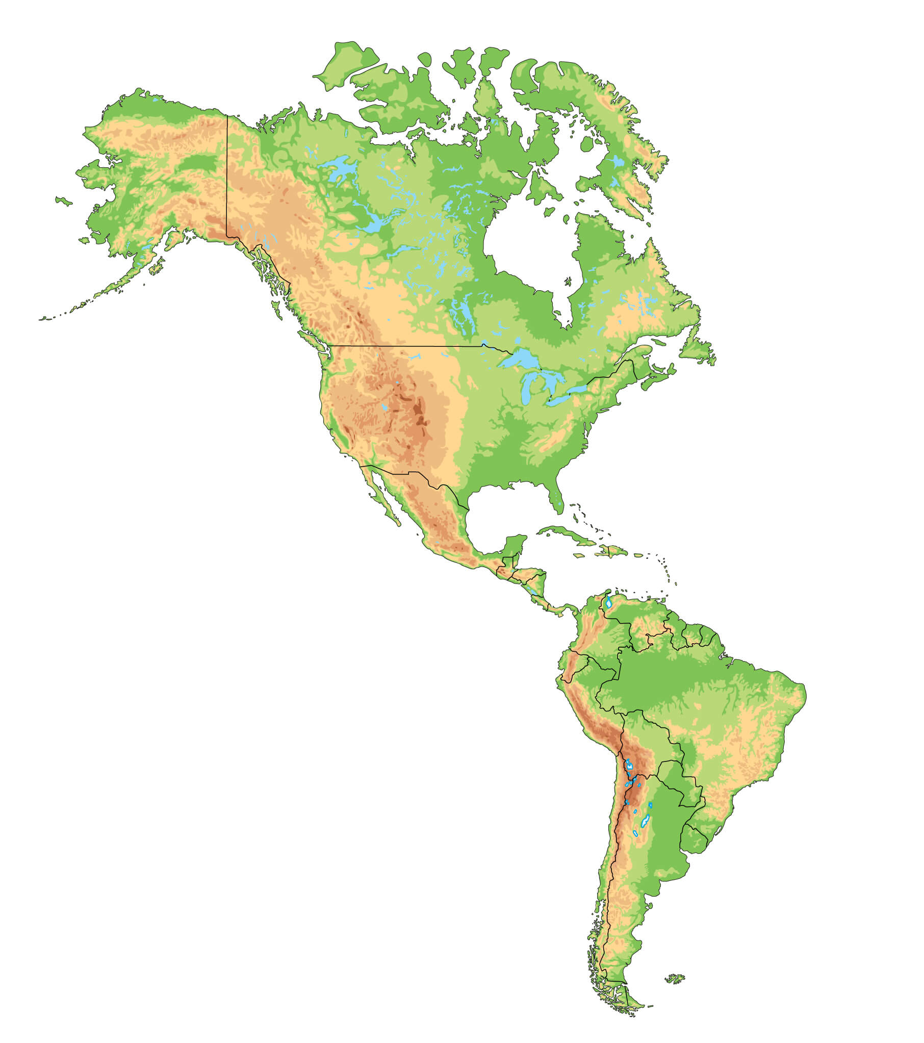
Physical Map of North America with Canada
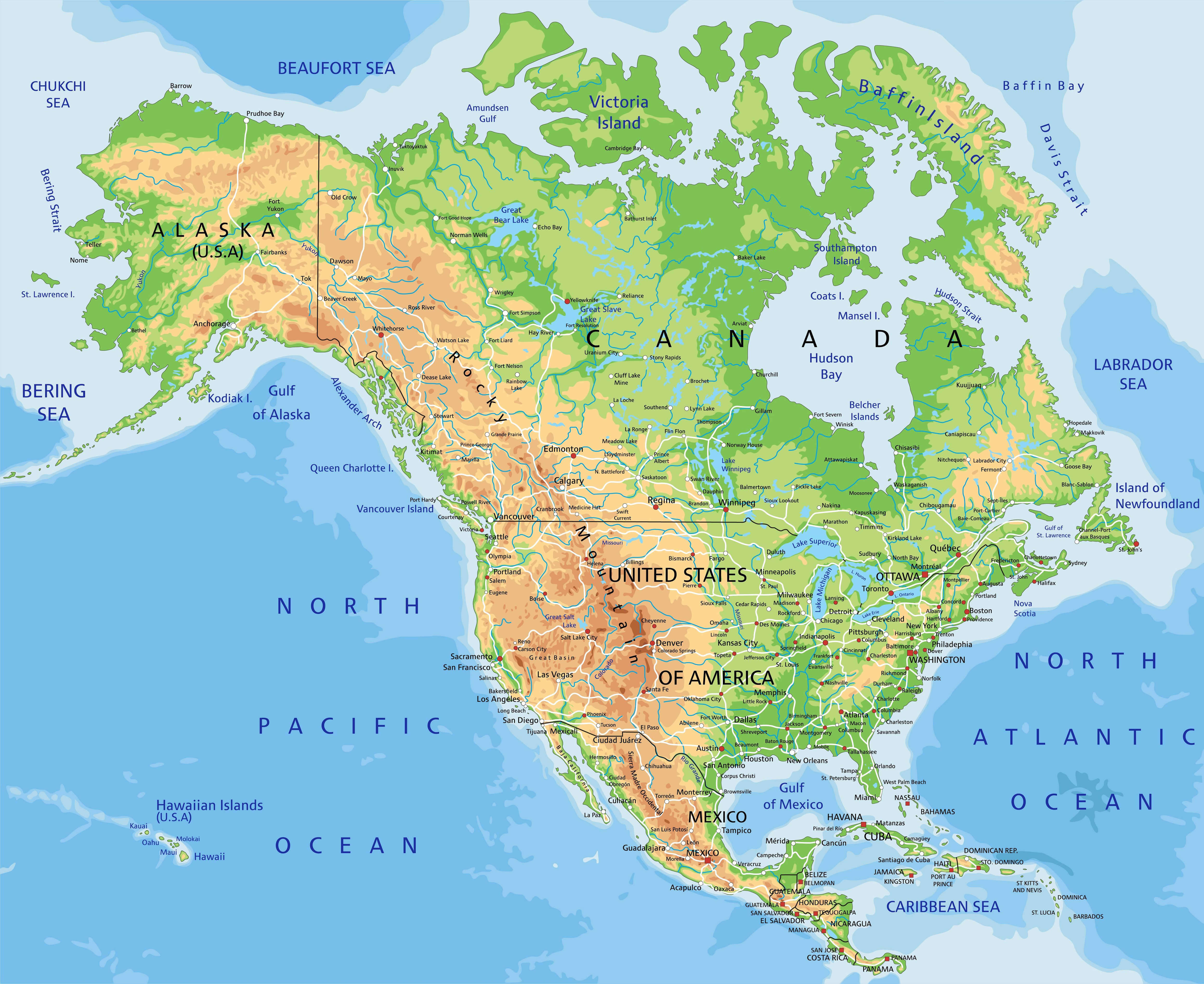 Physical map of North America showing Canada, U.S., and Mexico with terrain features.
Canada’s Physical Map with Pacific and Atlantic Oceans
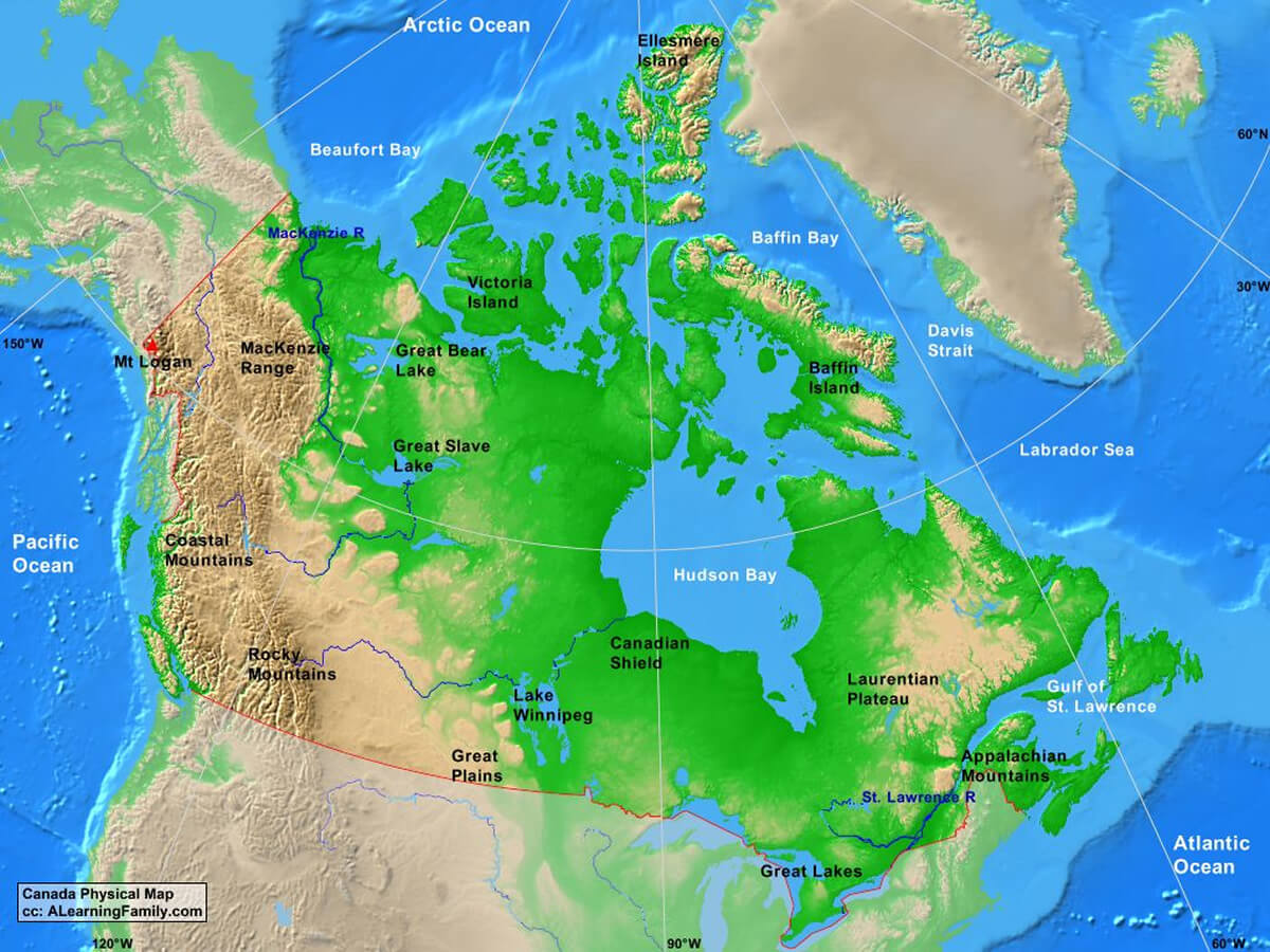 Physical map of Canada showing mountains, rivers, and oceans.
Physical map of Canada mountains and rivers
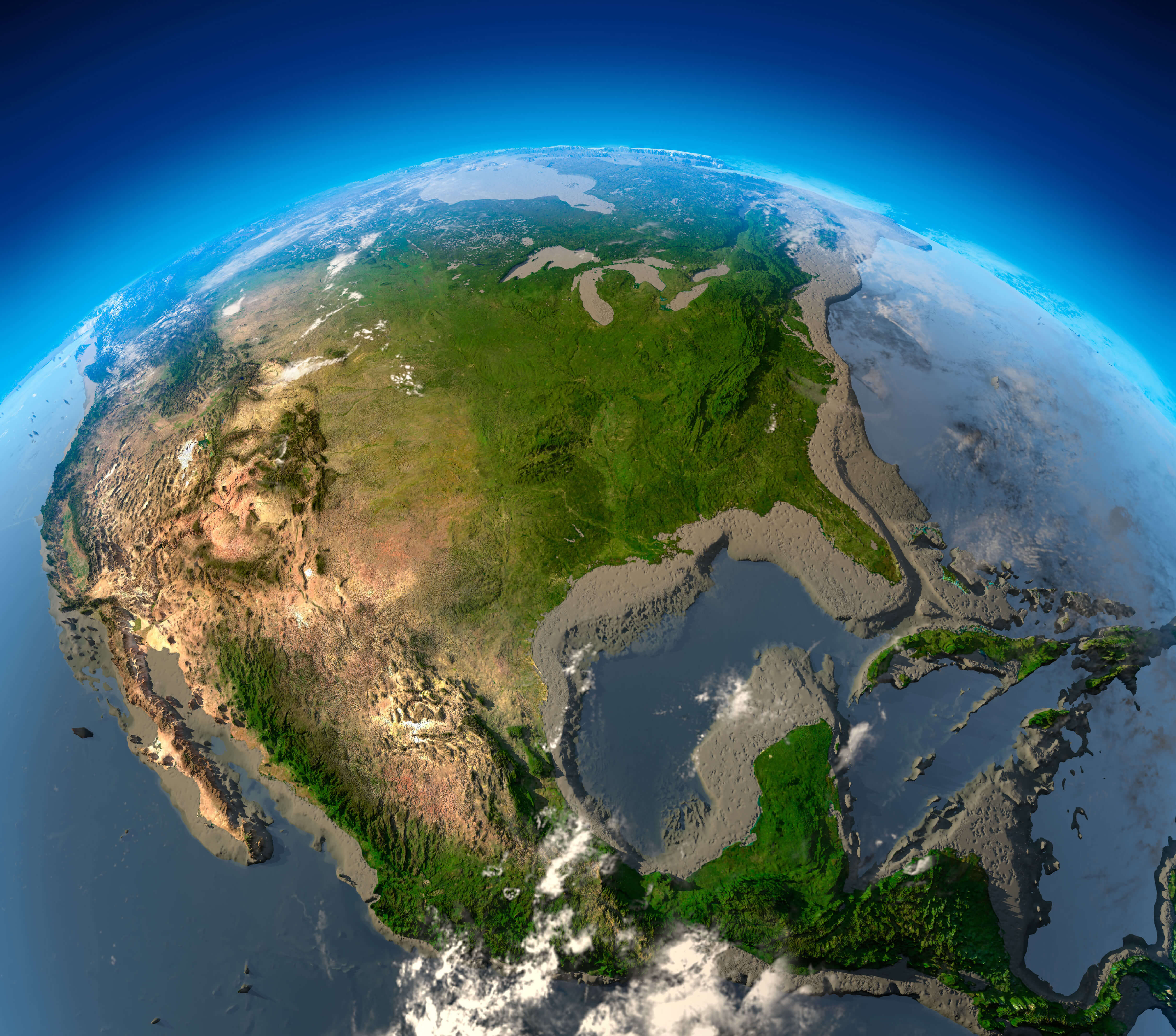
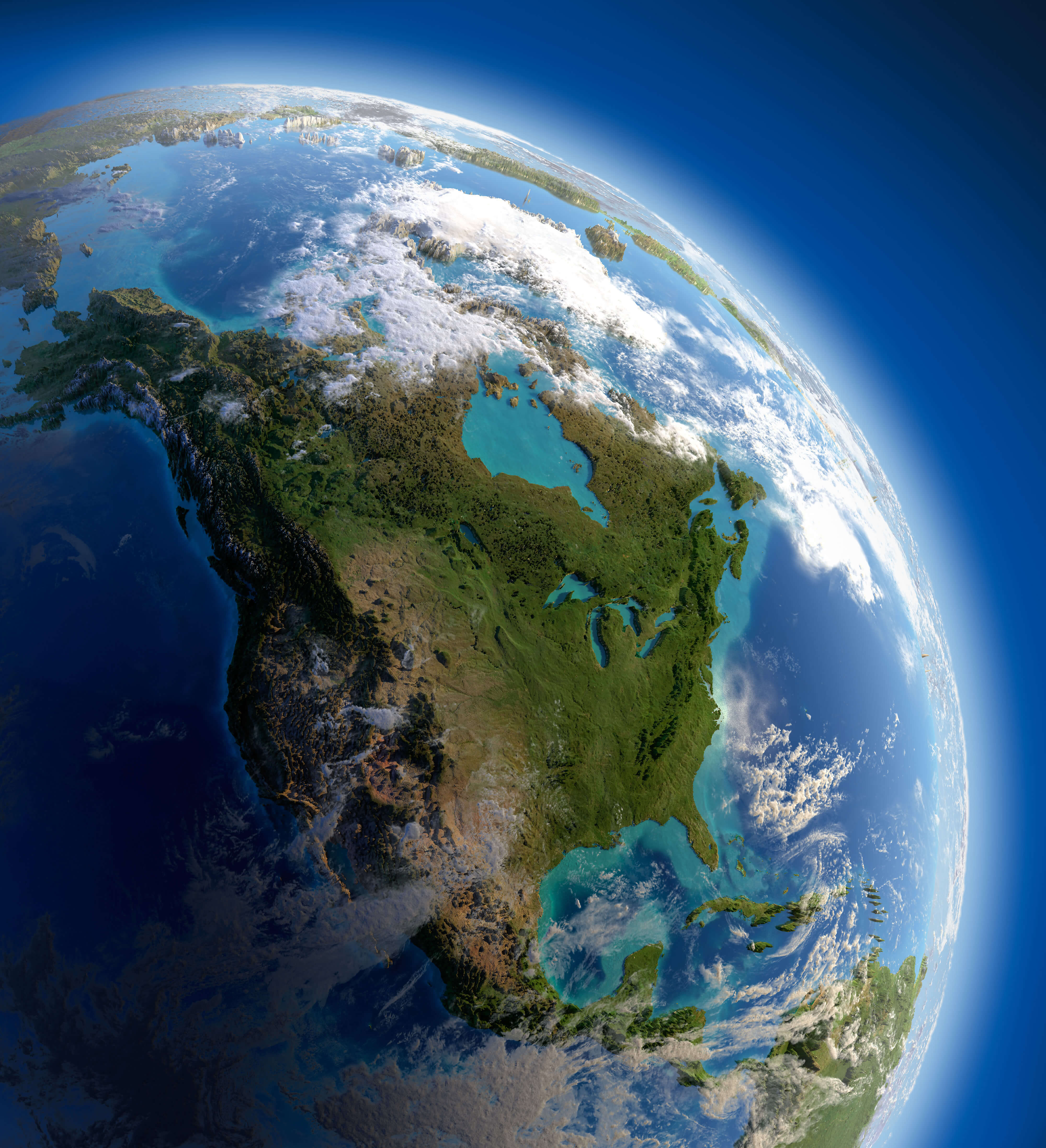
Canada and United States map from space
Canada and North America elevation map
Physical Map of North America with Canada
 Physical map of North America showing Canada, U.S., and Mexico with terrain features.
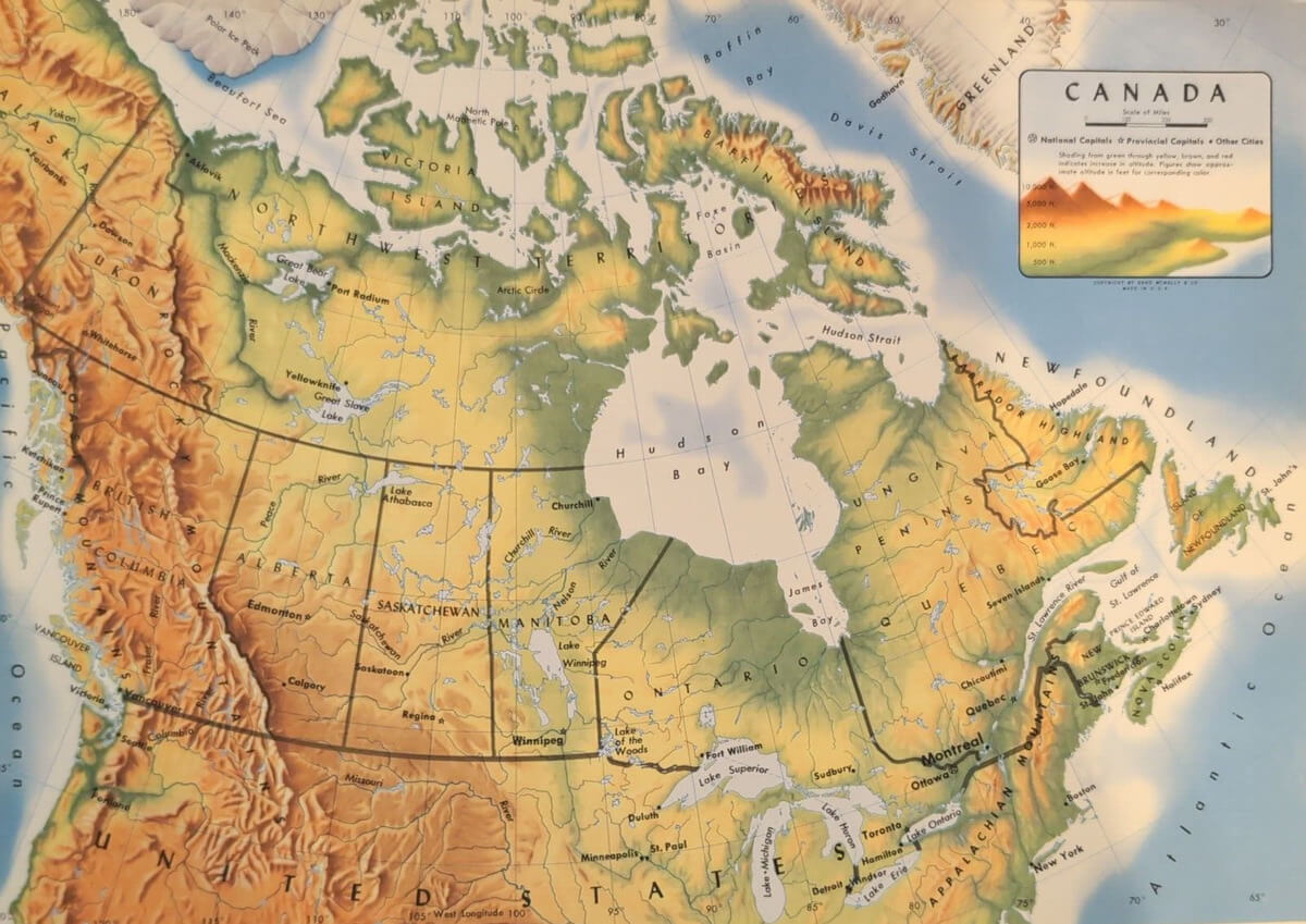
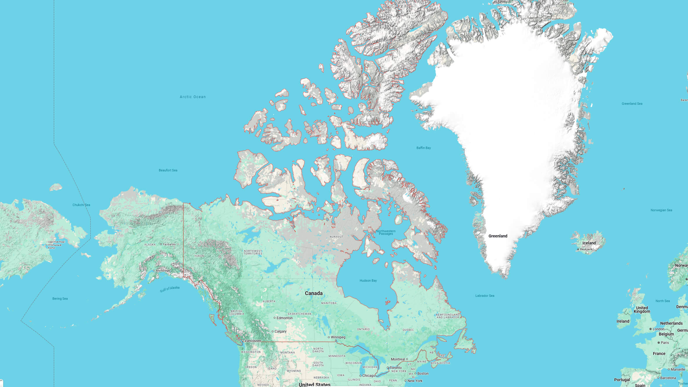
Canada Topography Map
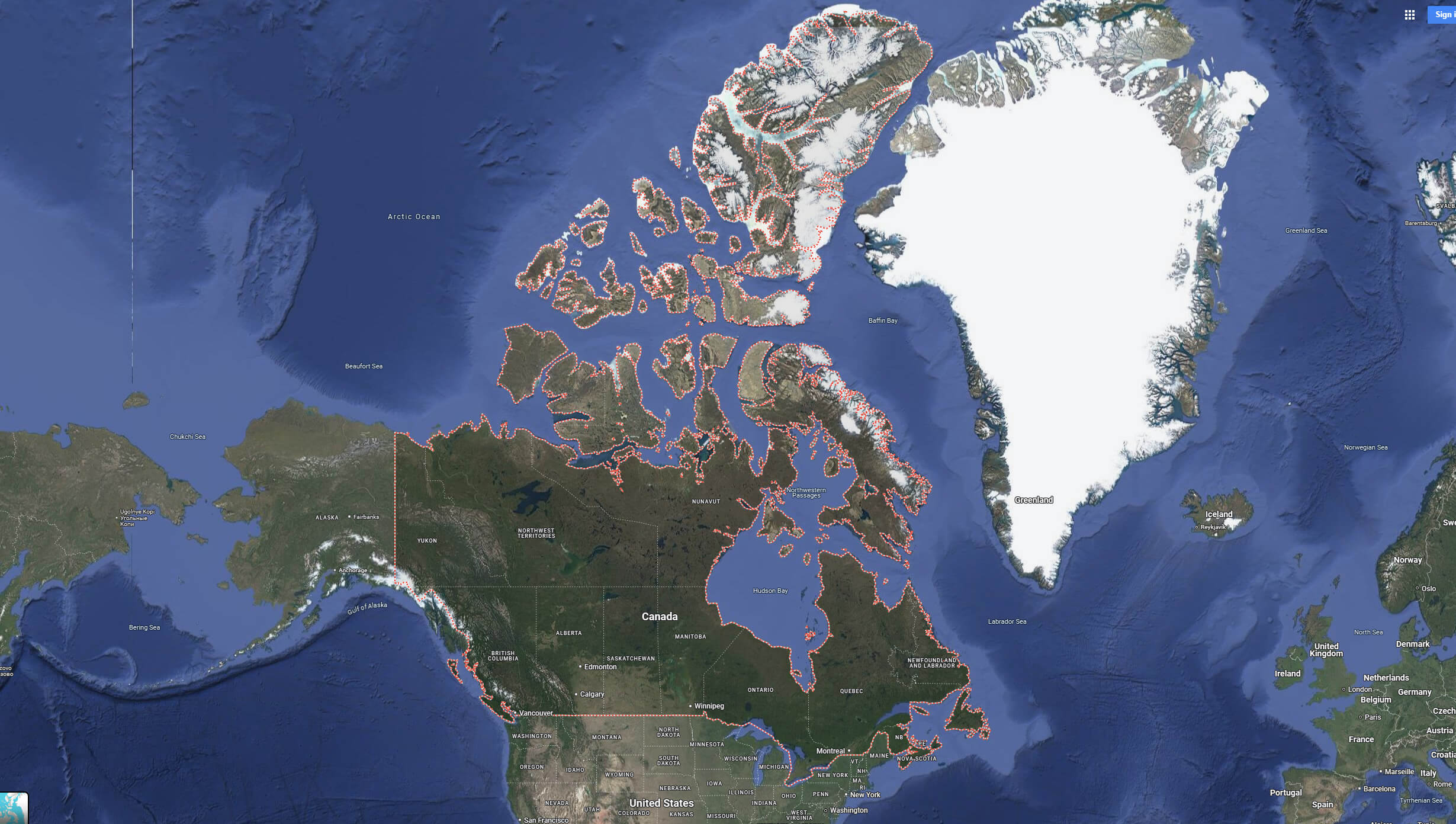
Canada satellite map with Canada territories borders
Canada Physical map with mountains plains
Physical map of Canada with territories and United States
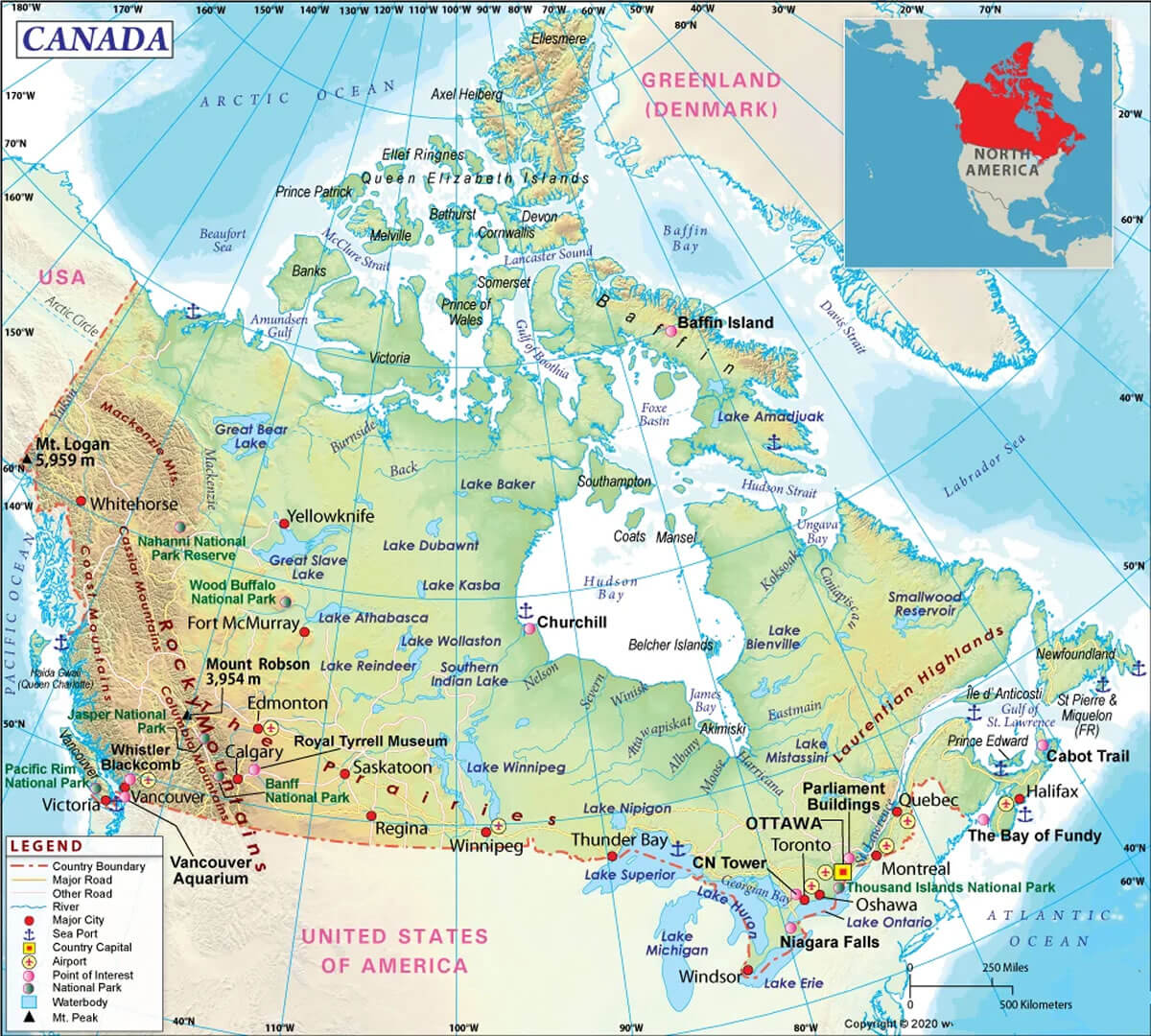
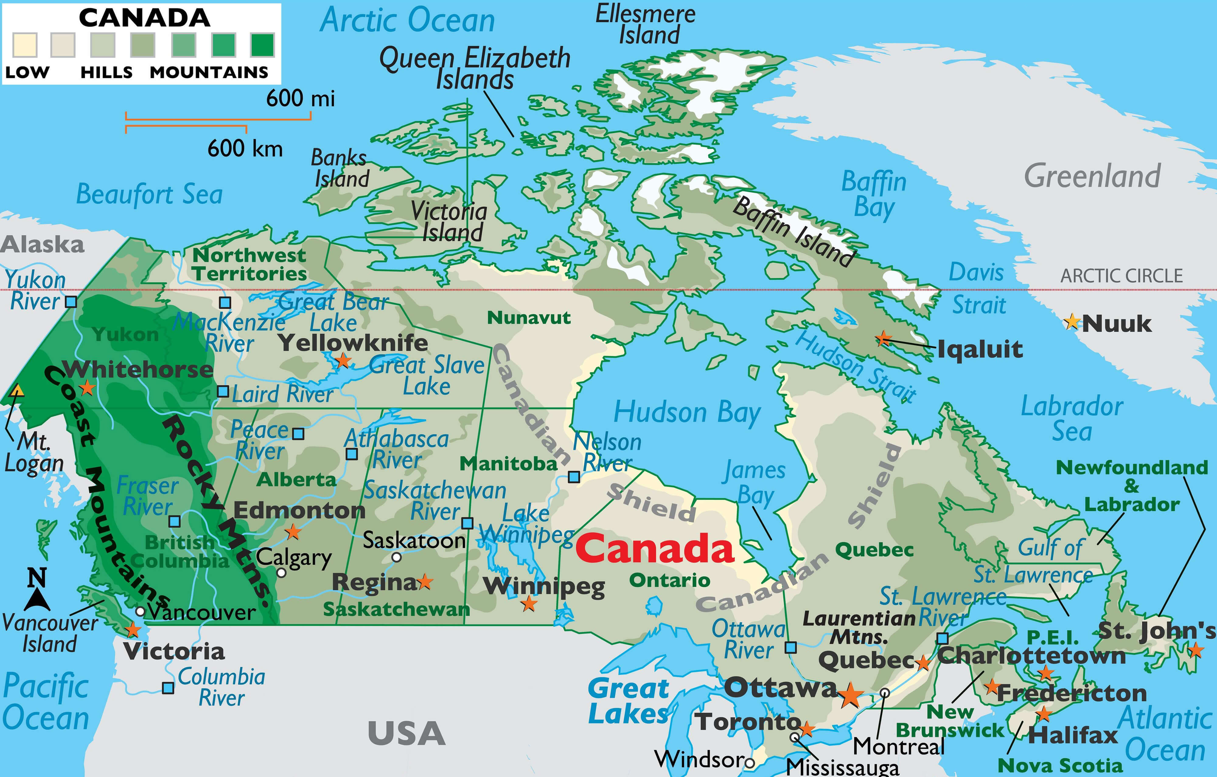
Canada Physical Map with Cities
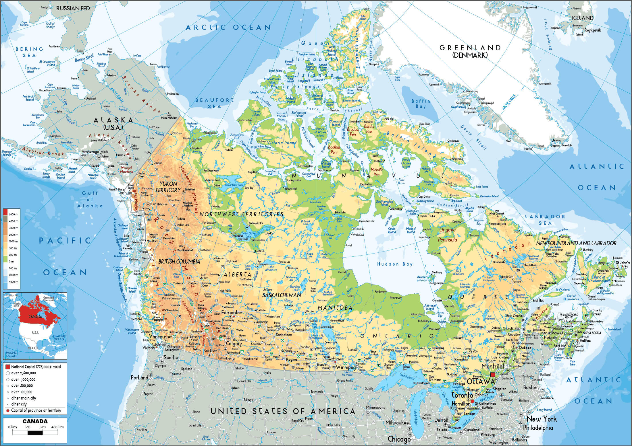 Physical map of Canada showing cities, provinces, and natural features.
Canada Physical map with US and greenland
Canada Terrain Map
Canada map from space
Canada map with north and south america continents
Where is Canada on North America Map?
Show Google interactive map, satellite map, where is the country located.
Get direction by driving, walking, bicycling, public transportation and travel with street view.
Feel free to explore these pages as well:
- Canada Map ↗️
- Map of Canada ↗️
- A Collection of Canada Maps ↗️
- Canada Political Map ↗️
- Canada Cities Map ↗️
- Canada Population Map ↗️
- Canada Road Map ↗️
- Canada’s Largest Maps ↗️
- Vancouvers top 10 places to visit ↗️
- Montreal’s Top 10 Best Can’t-Miss Experiences for Tourists ↗️
- 10 must visit cities from the 2023 liveability index ↗️
- United States Map ↗️
- North America Map ↗️
- Advertisement -