A Collection of Armenia Maps offers a variety of maps, including satellite imagery, topographic, physical, political, and historical maps, as well as maps highlighting rivers, national boundaries, and key geographical features, providing a comprehensive visual overview of Armenia’s landscape and history.
Brief information about Armenia
Armenia is a small yet historically rich country located in the South Caucasus region, nestled between Turkey, Georgia, Azerbaijan, and Iran. With its breathtaking landscapes of rugged mountains and deep valleys, Armenia offers a stunning blend of natural beauty and ancient heritage. The capital, Yerevan, is one of the world’s oldest continuously inhabited cities, offering a mix of Soviet-era architecture and modern developments. Armenia’s history dates back thousands of years, making it a treasure trove for history enthusiasts.
Armenia Political Map
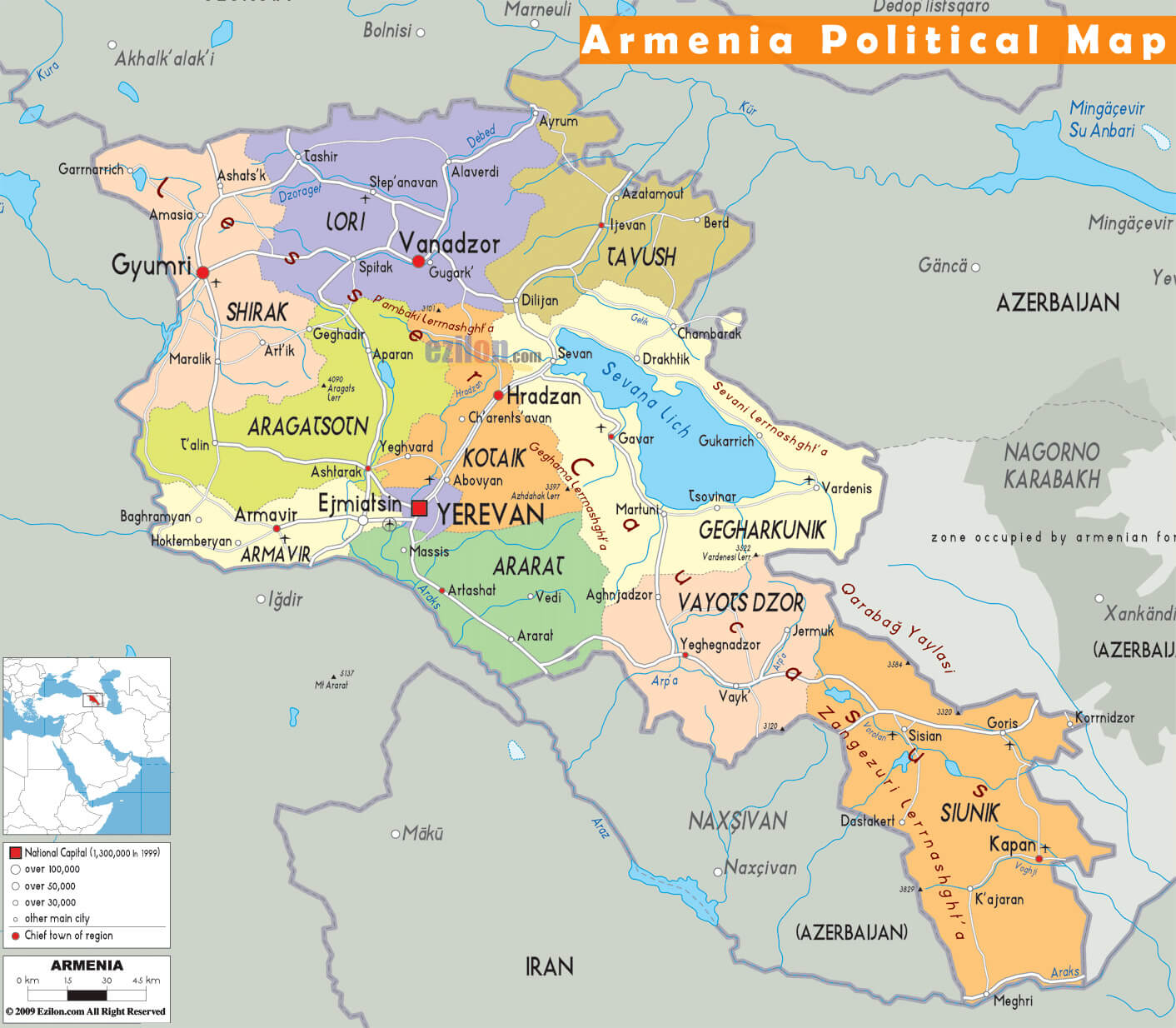
Armenia is also known for being the first nation to adopt Christianity as its official religion in 301 AD, which is still a central part of its cultural identity. The country is dotted with ancient monasteries and churches, including the UNESCO World Heritage Sites like Geghard Monastery and the iconic Etchmiadzin Cathedral. Armenians are known for their warm hospitality, rich traditions, and a deep sense of pride in their culture and history. Visitors to Armenia often leave with a sense of awe, not only from its scenic landscapes but also from the resilience and spirit of its people.
Where is located Armenia on the World Map
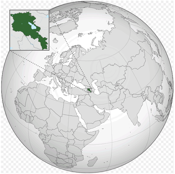
Armenia is situated in the South Caucasus region of Eurasia, at the crossroads of Eastern Europe and Western Asia. It is a landlocked country bordered by Turkey to the west, Georgia to the north, Azerbaijan to the east, and Iran to the south. Its location places Armenia in a unique position, blending the influences of both European and Asian cultures.
Nestled in a mountainous landscape, Armenia’s geography is dominated by highlands, including the famous Mount Ararat, which is a symbol of Armenian heritage despite being just across the border in Turkey. The country’s location makes it a gateway between the Caspian and Black Sea regions, historically serving as a trade route between Europe and Asia.
Armenia’s strategic position has played a significant role throughout its history, making it a cultural and commercial hub in ancient times. Today, Armenia continues to be a point of interest for travelers seeking to explore its rich cultural heritage and beautiful landscapes, all while sitting at the heart of the South Caucasus.
Here are some statistical information about Armenia:
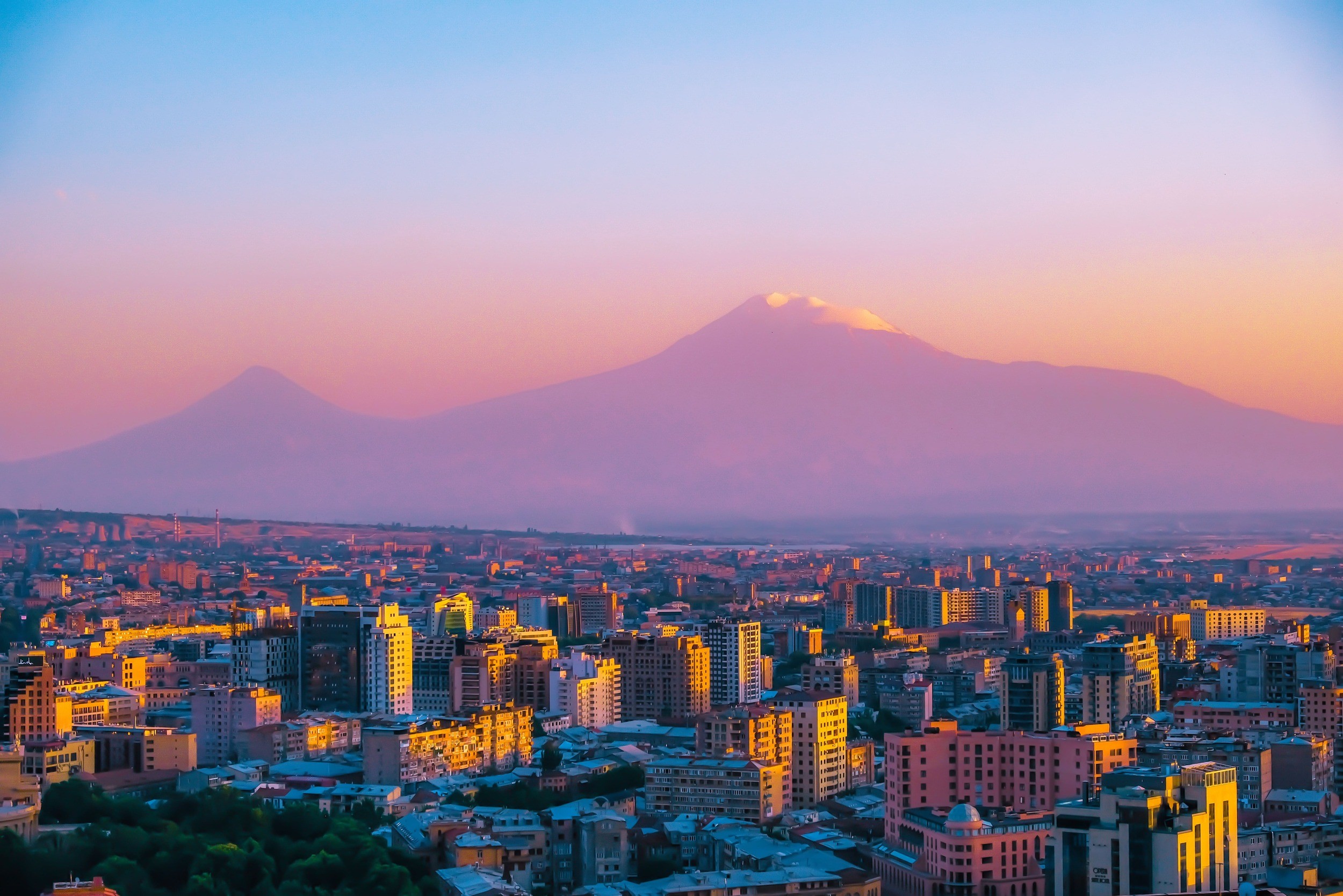
Armenia National Map
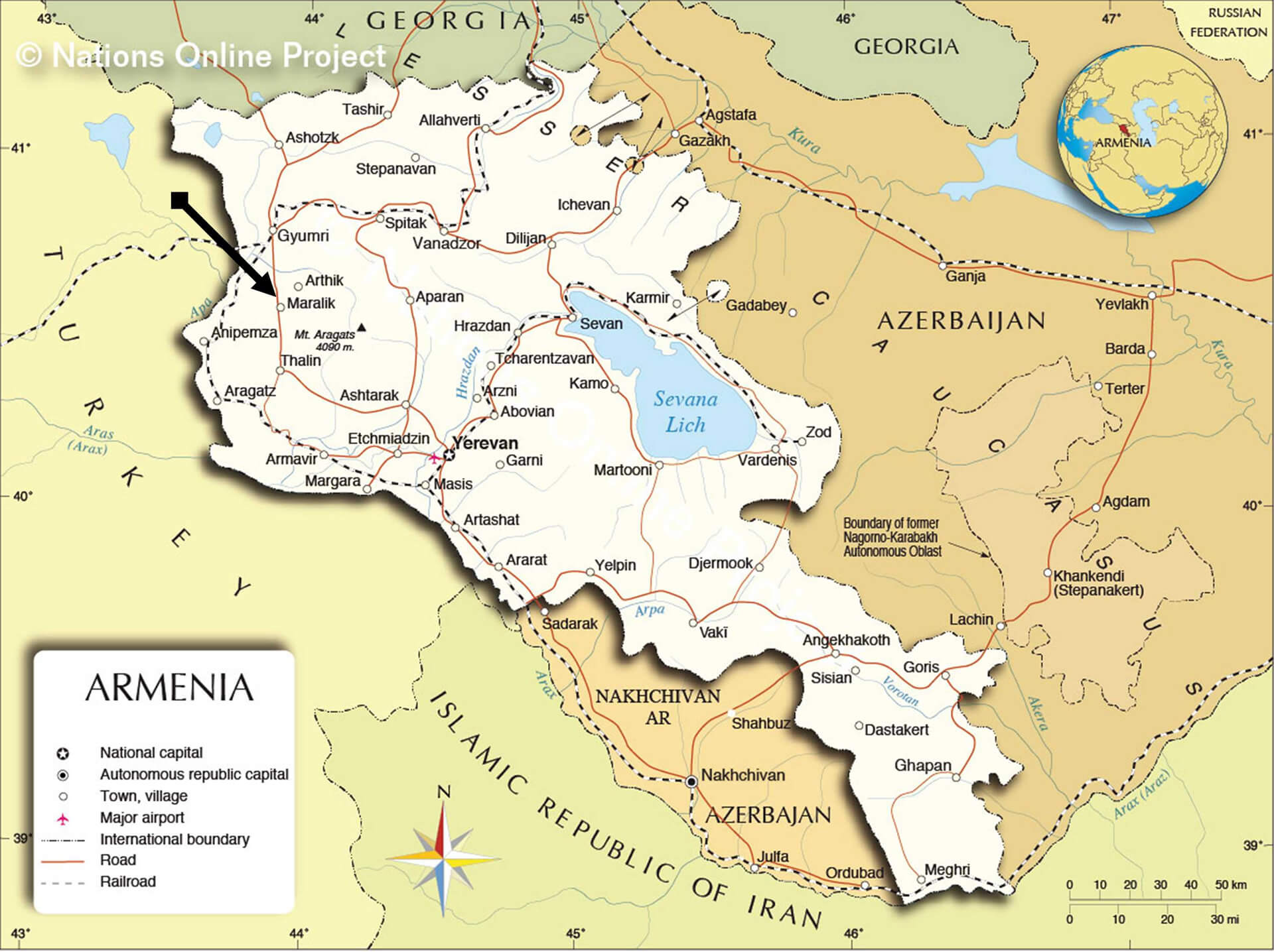
This map shows Armenia and its surrounding borders, including neighboring countries like Turkey to the west, Georgia to the north, Azerbaijan to the east, and Iran to the south. Key features include the capital city, Yerevan, and other towns such as Gyumri, Vanadzor, and Sevan near Lake Sevan (Sevana Lich). The map also highlights the location of Mount Aragats and the boundary of the former Nagorno-Karabakh Autonomous Oblast. Important transportation routes like major roads, railroads, and international boundaries are also marked, providing a detailed view of Armenia’s geographical and political landscape.
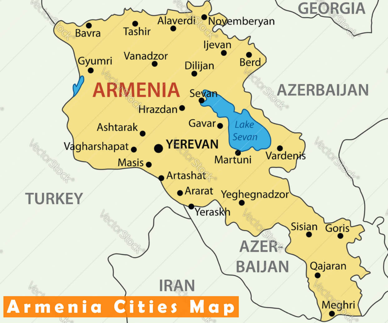
Armenia Cities Map
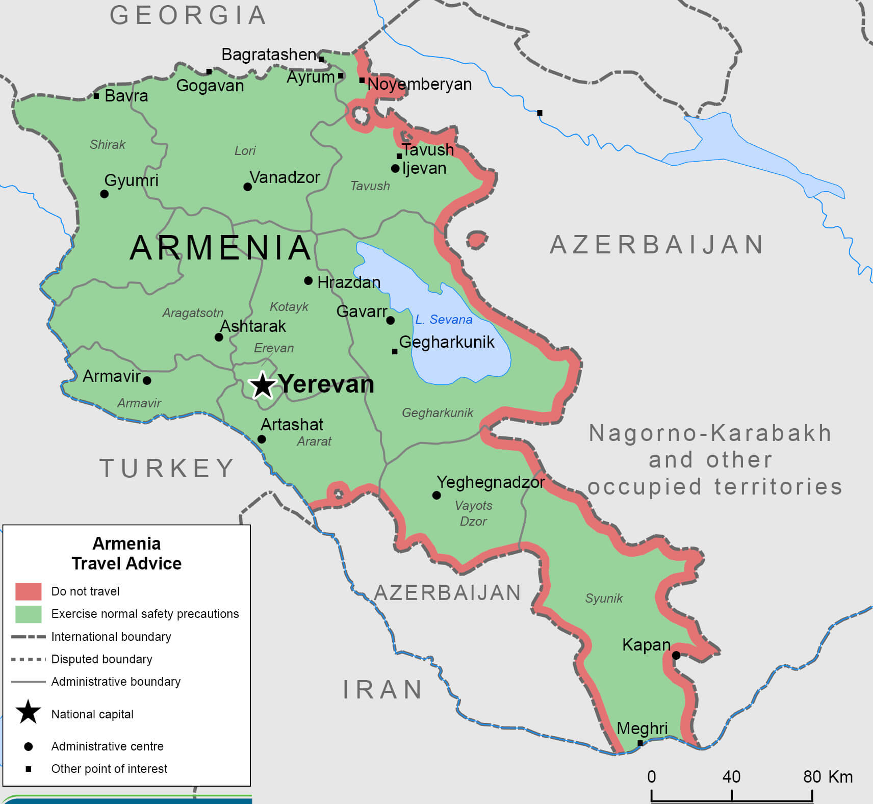
Armenia Travel Map
Map of Armenia and Nagorno Karabakh
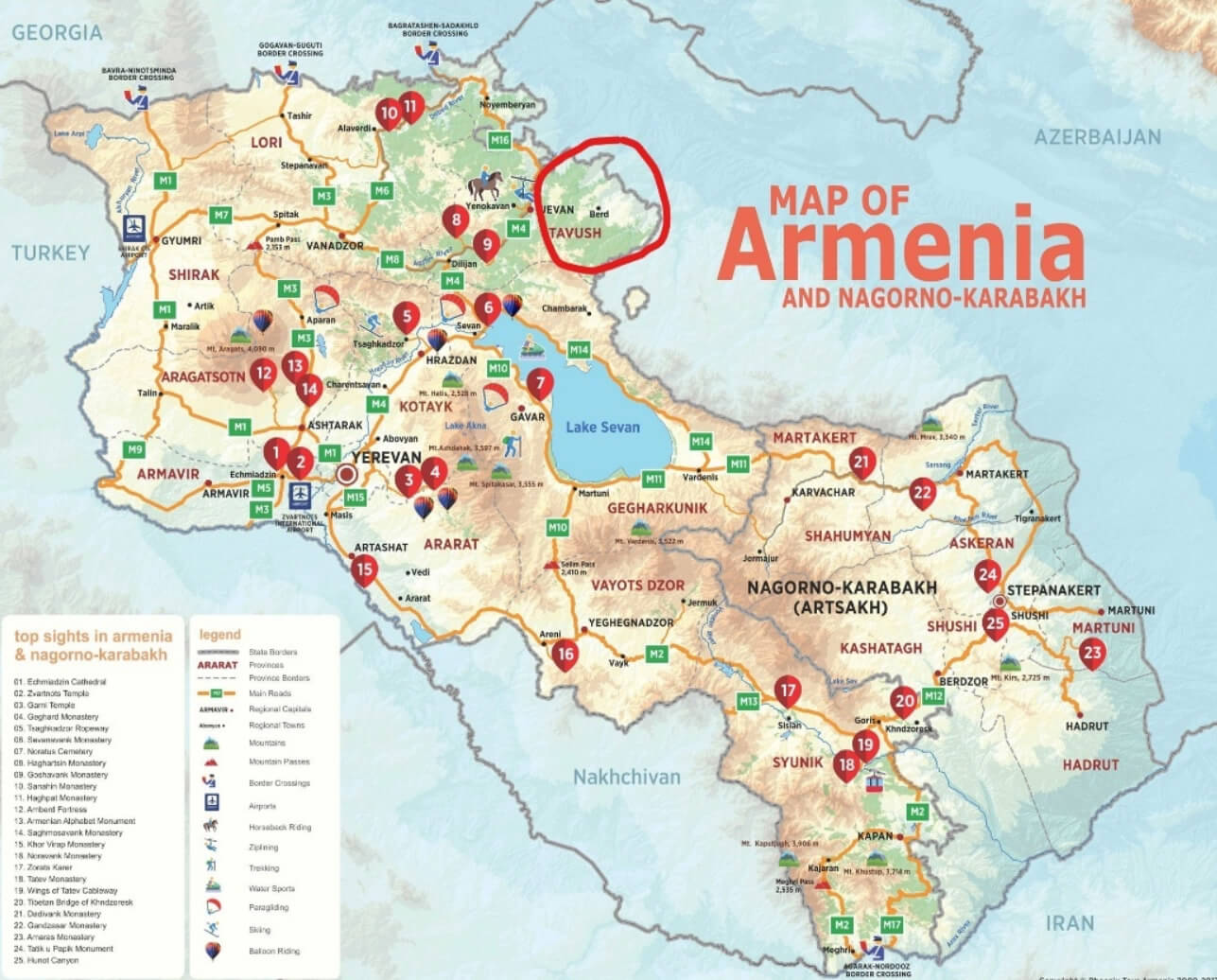
This map shows Armenia and the disputed region of Nagorno-Karabakh (Artsakh), highlighting key cities, tourist attractions, and natural landmarks such as Lake Sevan, along with routes and border crossings with neighboring countries like Turkey, Georgia, and Iran.
Kingdom of Armenia Map
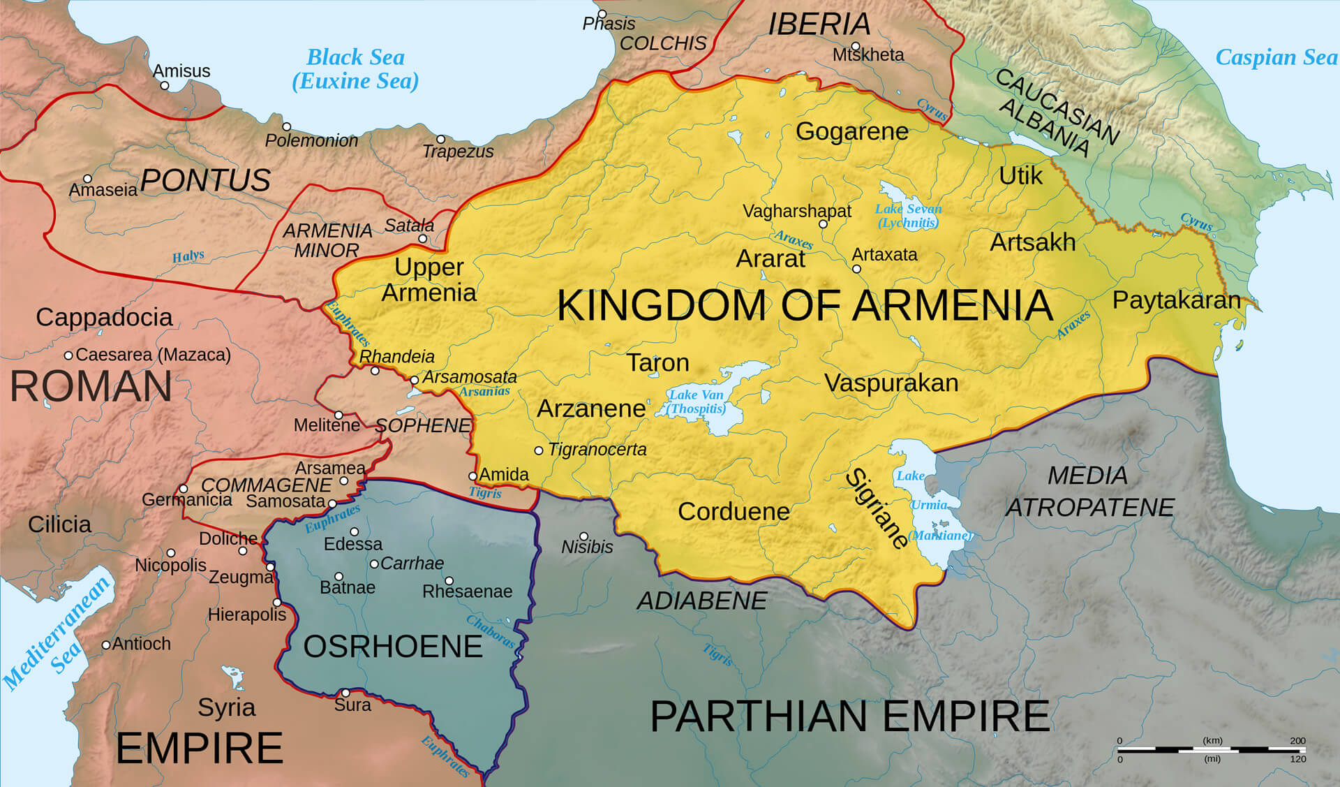
This map illustrates the Kingdom of Armenia during antiquity, highlighting its extent across Upper Armenia, Armenia Minor, and regions like Taron, Ararat, and Artsakh. The map shows Armenia bordered by the Roman Empire to the west, the Parthian Empire to the south, and other ancient regions like Caucasian Albania, Iberia, and Media Atropatene to the northeast and east. Key ancient cities and geographical landmarks, such as Lake Van, Lake Urmia, and the Euphrates and Tigris rivers, are also marked, showcasing Armenia’s strategic position between major ancient powers.
Armenia Map Caucasus Region
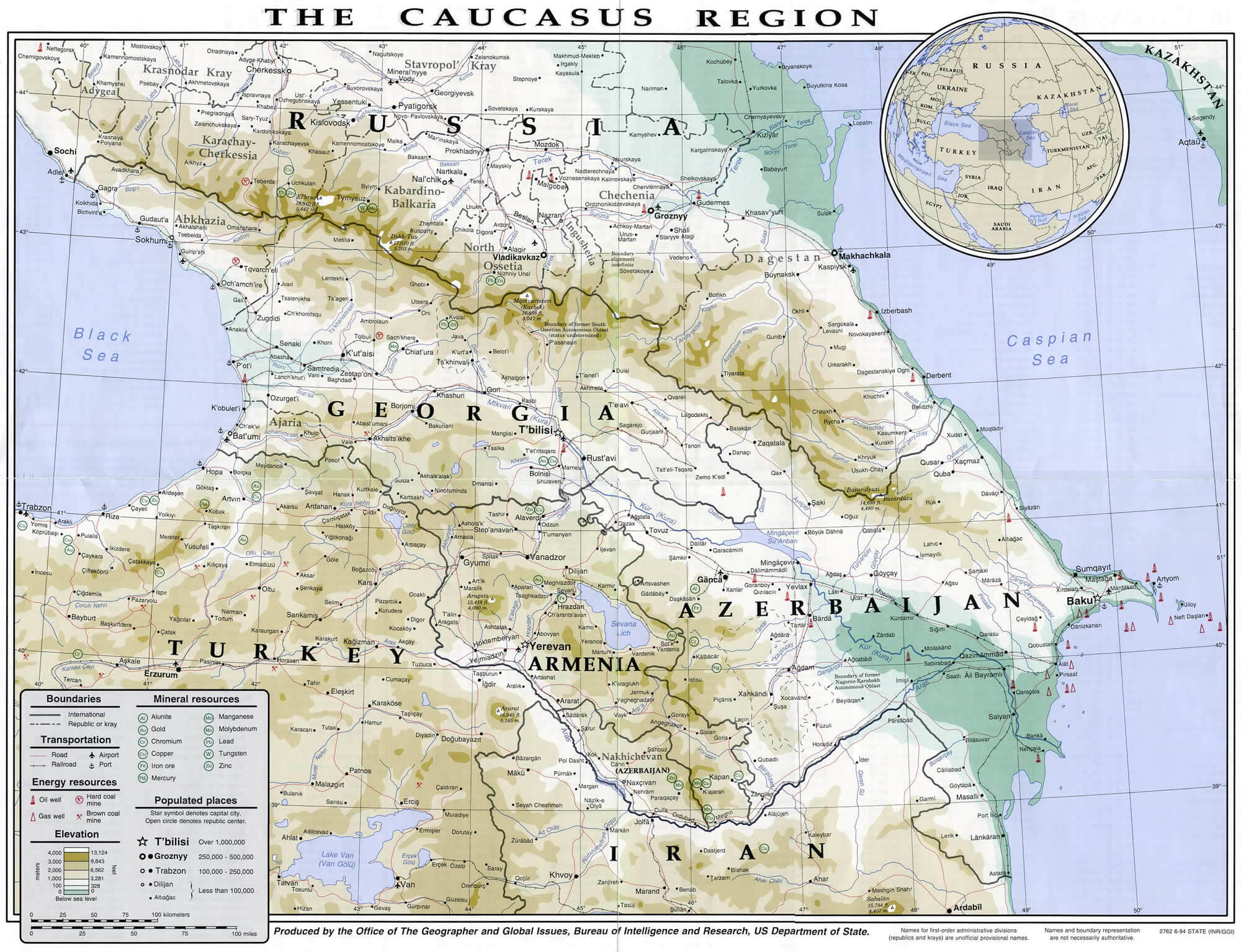
This map displays the Caucasus region, highlighting Armenia’s position between neighboring countries like Georgia to the north, Azerbaijan to the east, Iran to the south, and Turkey to the west. The map also features other regional details, including the Black Sea to the northwest and the Caspian Sea to the east, along with major cities such as Yerevan, Tbilisi, and Baku. The geographical landscape includes mountain ranges, valleys, and key transportation routes that connect the region’s countries.
Map of Armenia
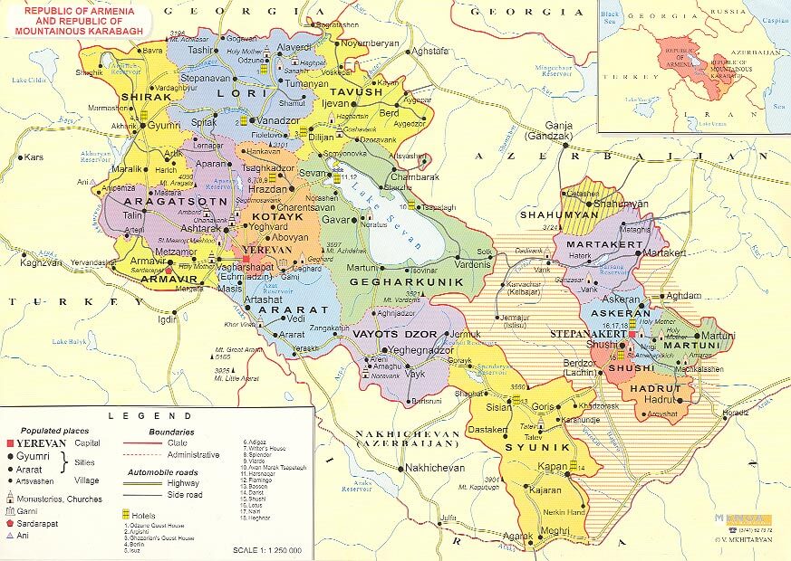
This map illustrates the Republic of Armenia and the disputed region of Nagorno-Karabakh, highlighting various provinces such as Shirak, Lori, Tavush, Kotayk, Ararat, and Syunik. It also marks key cities like Yerevan (the capital), Gyumri, and Stepanakert. The map provides details on administrative boundaries, main roads, and major sites, including monasteries, churches, and villages. It shows Armenia’s borders with Turkey to the west, Georgia to the north, and Azerbaijan to the east, along with the Nakhichevan exclave and Iran to the south.
Armenia Highways Map
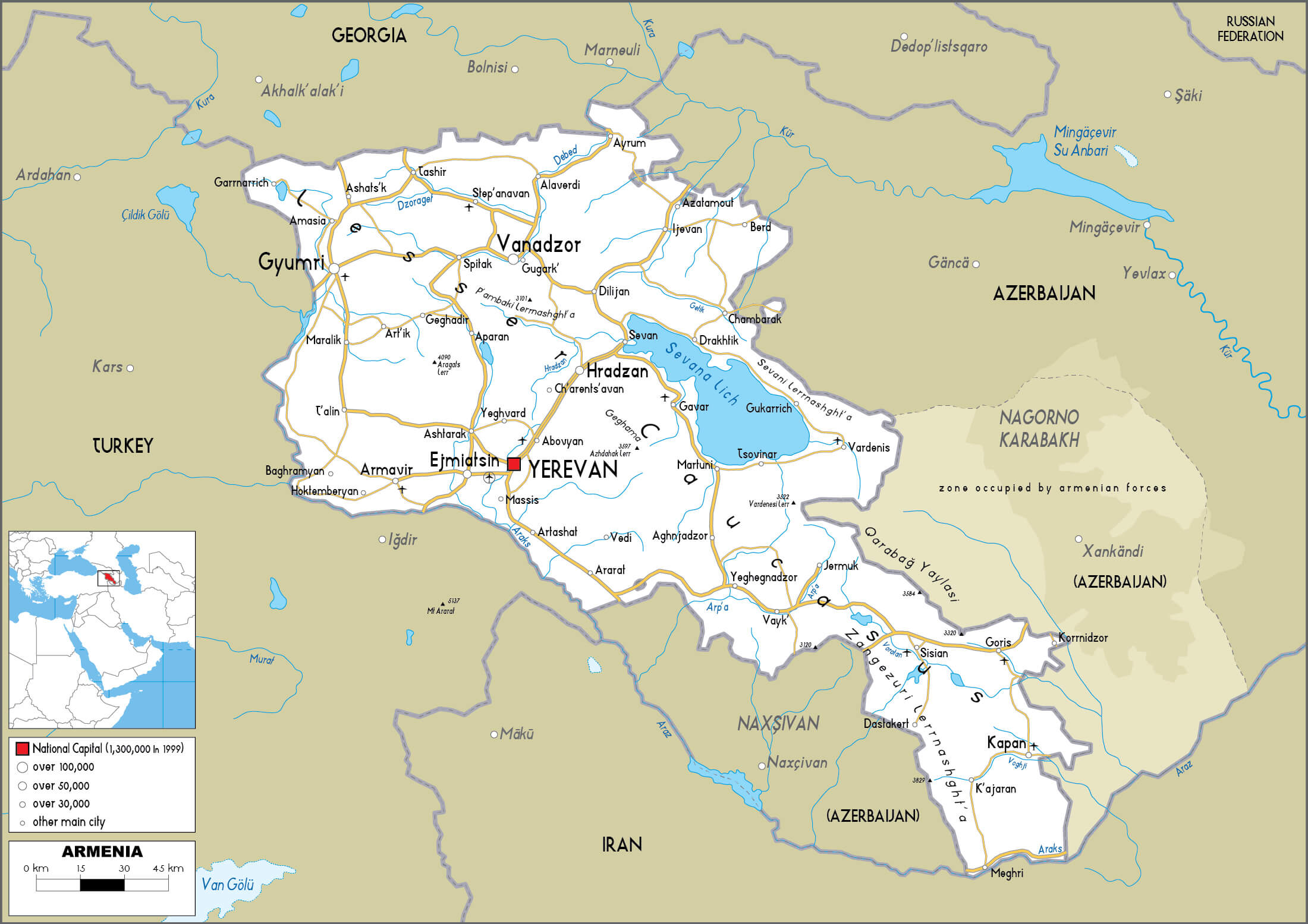 This map of Armenia highlights the main highways connecting major cities, including the capital Yerevan, and regions extending into neighbouring countries such as Turkey, Iran and Azerbaijan, providing a comprehensive overview of Armenia’s transport network.
Kingdom of Armenia Map with Roman Empire
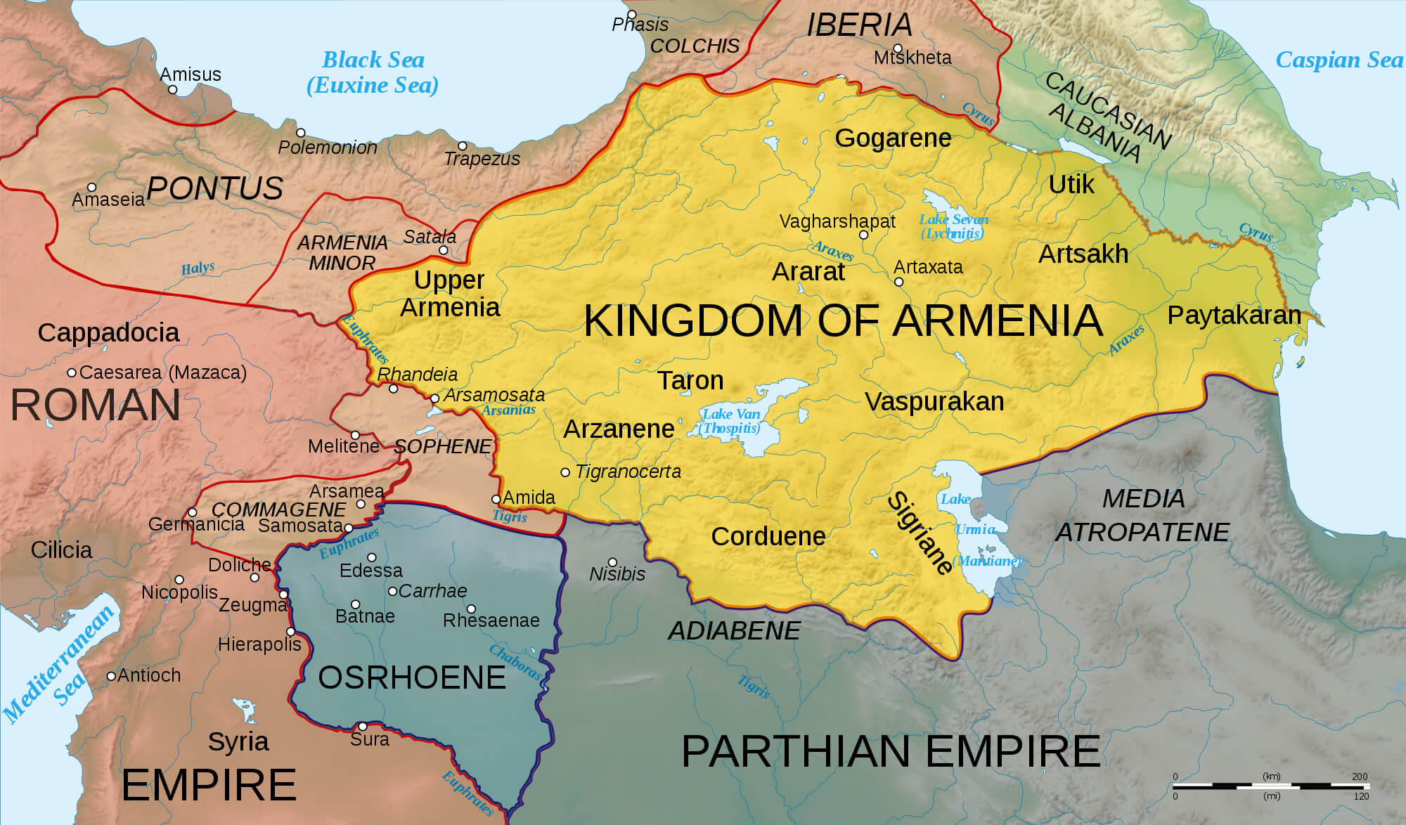 This map illustrates the territorial extent of the Kingdom of Armenia alongside the neighbouring Roman and Parthian Empires. It highlights key regions within the Kingdom of Armenia, such as Upper Armenia, Sophene and Vaspurakan, and shows its strategic location at the crossroads of major empires in ancient times.
Historical Armenia Map 150 BC
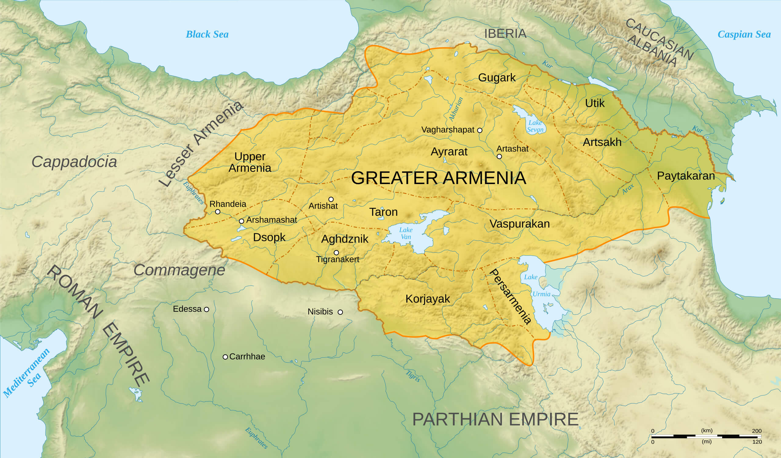 This map illustrates the territory of Greater Armenia around 150 BC, showing its significant extent at that time, bordered by the Roman Empire to the west and the Parthian Empire to the south.
Armenia Physical Map
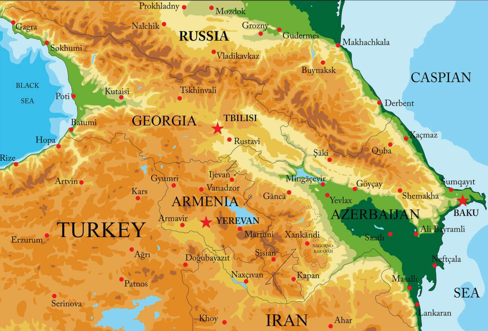 This physical map of Armenia highlights the country’s rugged terrain, showing major mountain ranges such as the Caucasus in the north, as well as major cities such as Yerevan, Vanadzor and Gyumri. Neighbouring countries including Georgia, Azerbaijan, Iran and Turkey are also shown, along with nearby bodies of water such as the Caspian and Black Seas to provide geographical context.
Eastern Armenian Territories Map in 1501
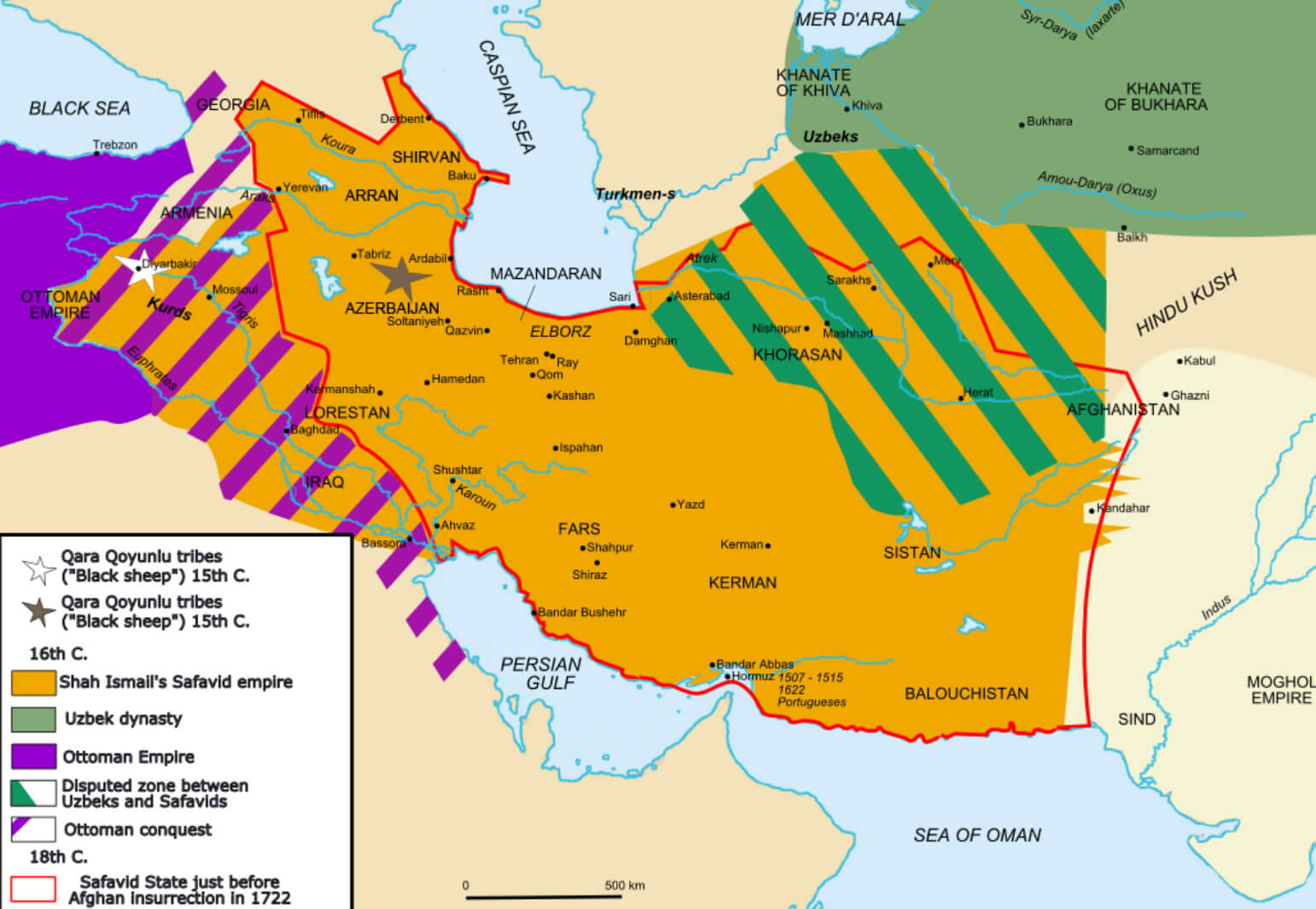 This map illustrates the extent of Eastern Armenian territories in 1501, highlighting the influence of regional powers such as the Safavid Empire, the Qara Qoyunlu (Black Sheep Turkmen tribes), the Ottoman Empire and the Uzbek dynasty. The boundaries show key zones of influence and disputed areas, particularly between the Uzbeks and Safavids in regions such as Khorasan.
Armenia and Karabakh Map Treaty of Sevres
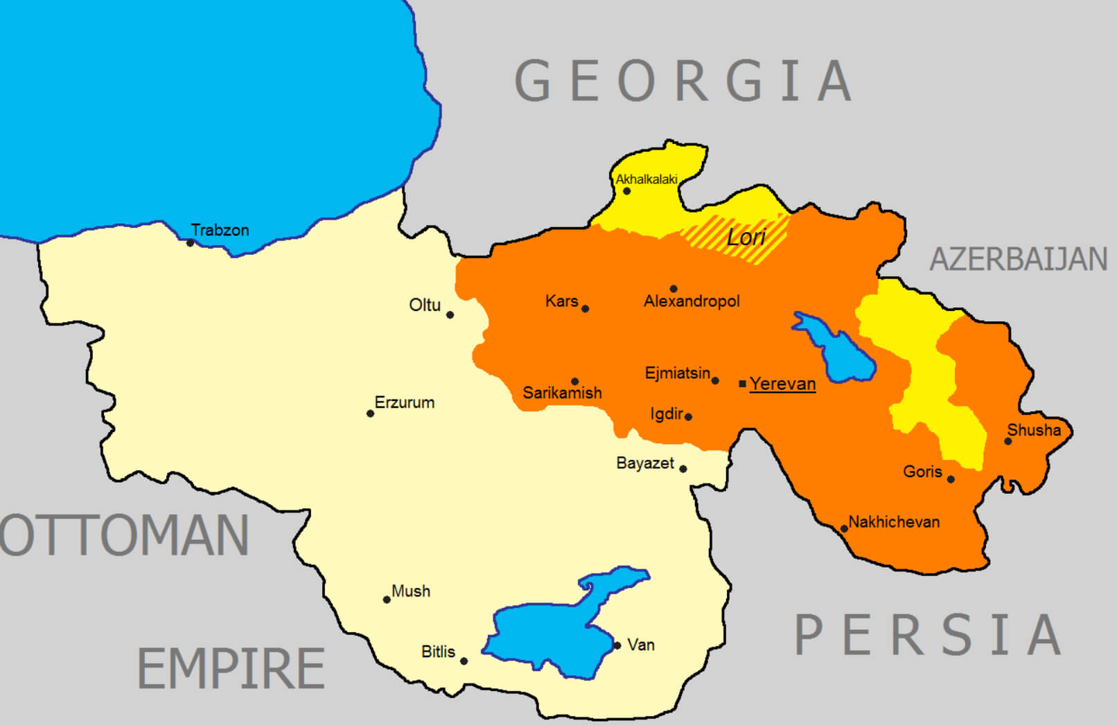 This map of Armenia and Karabakh shows the territorial arrangements following the 1920 Treaty of Sèvres. This treaty proposed an independent Armenia with expanded borders, recognising areas such as Lori, Alexandropol and parts of Nakhichevan, as well as the Karabakh region. However, the treaty was not fully implemented as subsequent treaties and Soviet influence altered these territorial promises.
Armenia Oblast Map between 1828 and 1840
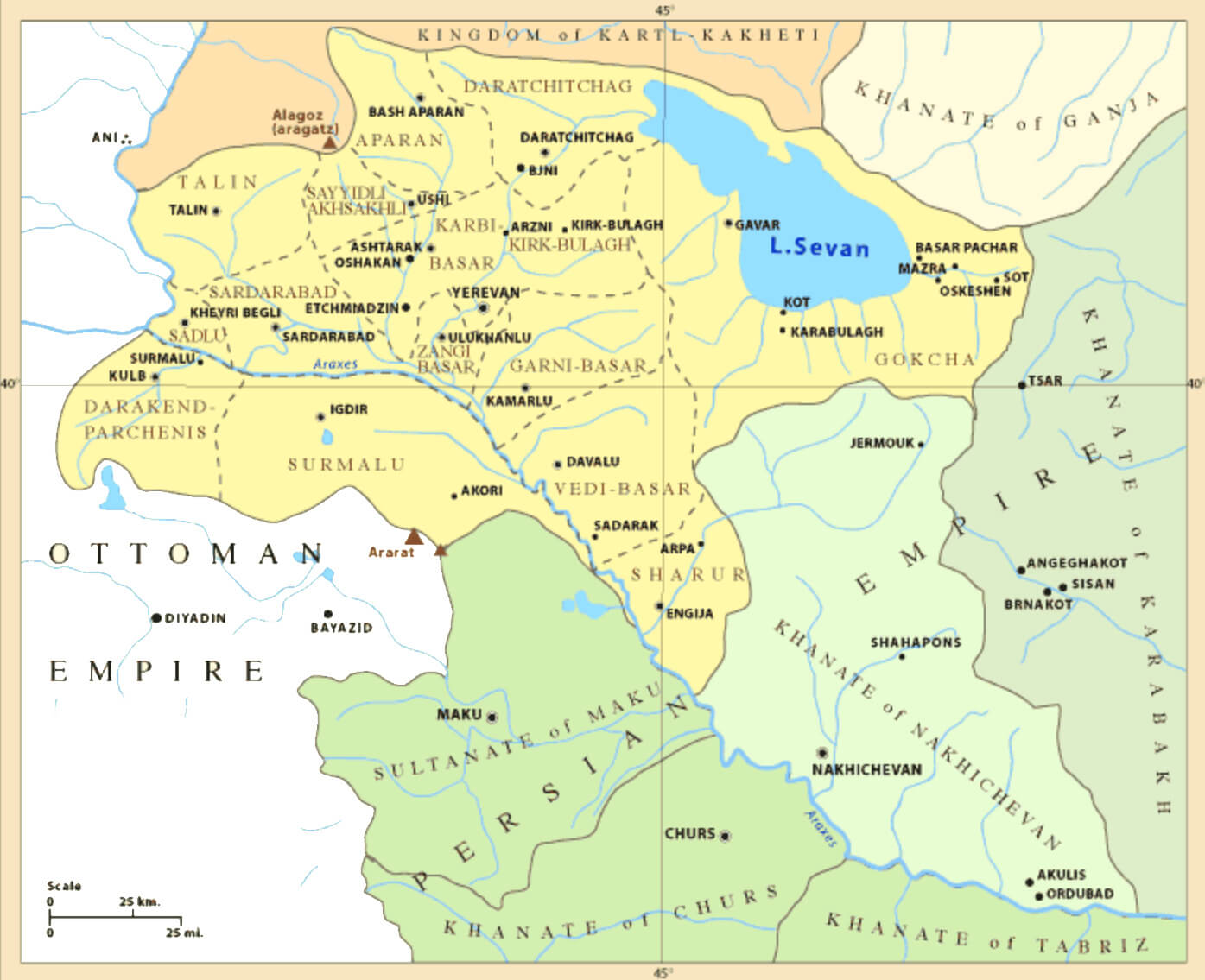 This map shows the Armenian Oblast, a region created by the Russian Empire between 1828 and 1840, following the Treaty of Turkmenchay. The Oblast included areas around Lake Sevan and parts of modern-day Armenia, marking the division between Russian-controlled Armenian lands and neighbouring territories of the Persian and Ottoman Empires.
Armenia Climate Map
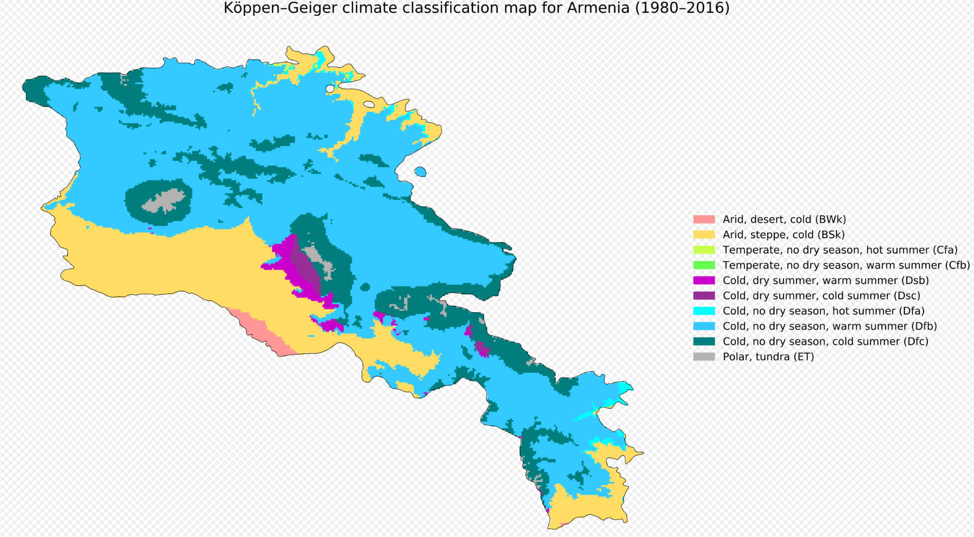 Based on Köppen-Geiger climate classifications, this climate map of Armenia illustrates the many climatic zones that exist there between 1980 and 2016. The southwestern sections of Armenia experience arid desert climates (BWk), while the highland regions experience cold, snowy winters with no dry season and cold summers (Dfc).
Armenia Topography Map
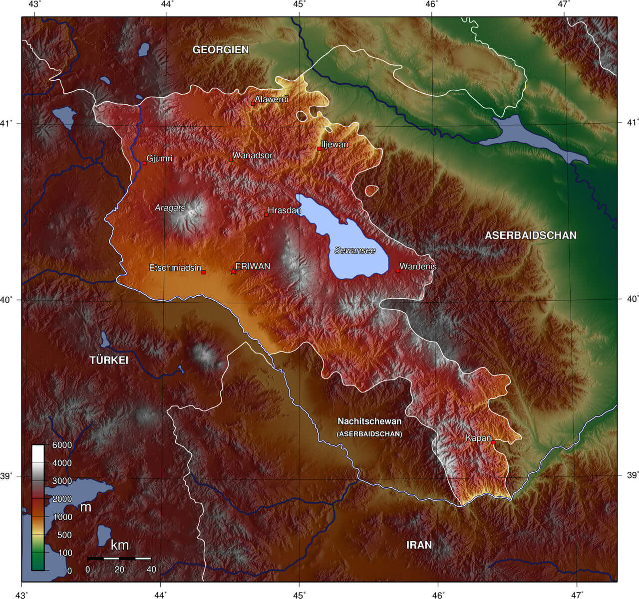 This topographical map of Armenia shows the country’s mountainous terrain, with significant differences in elevation between regions. The highest peaks, such as Mount Aragats, are prominently featured, while Lake Sevan is shown in the centre of the lower valleys. Bordering countries such as Turkey, Azerbaijan and Iran are labelled to show Armenia’s position in the South Caucasus. This map effectively illustrates Armenia’s varied landscape, from its high mountains to its lower-lying basins and lakes.
Armenia Satellite Map
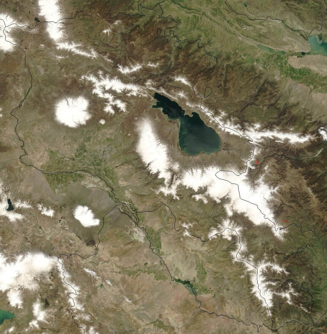 This satellite map of Armenia provides a high-resolution view of the country’s varied landscapes, including mountainous regions, valleys and the prominent Lake Sevan in the north-east. Snow-capped peaks, rugged terrain and patches of green showcase the diverse topography of Armenia, which borders neighbouring countries including Georgia, Azerbaijan, Iran and Turkey.
Armenian Population Map Around the World
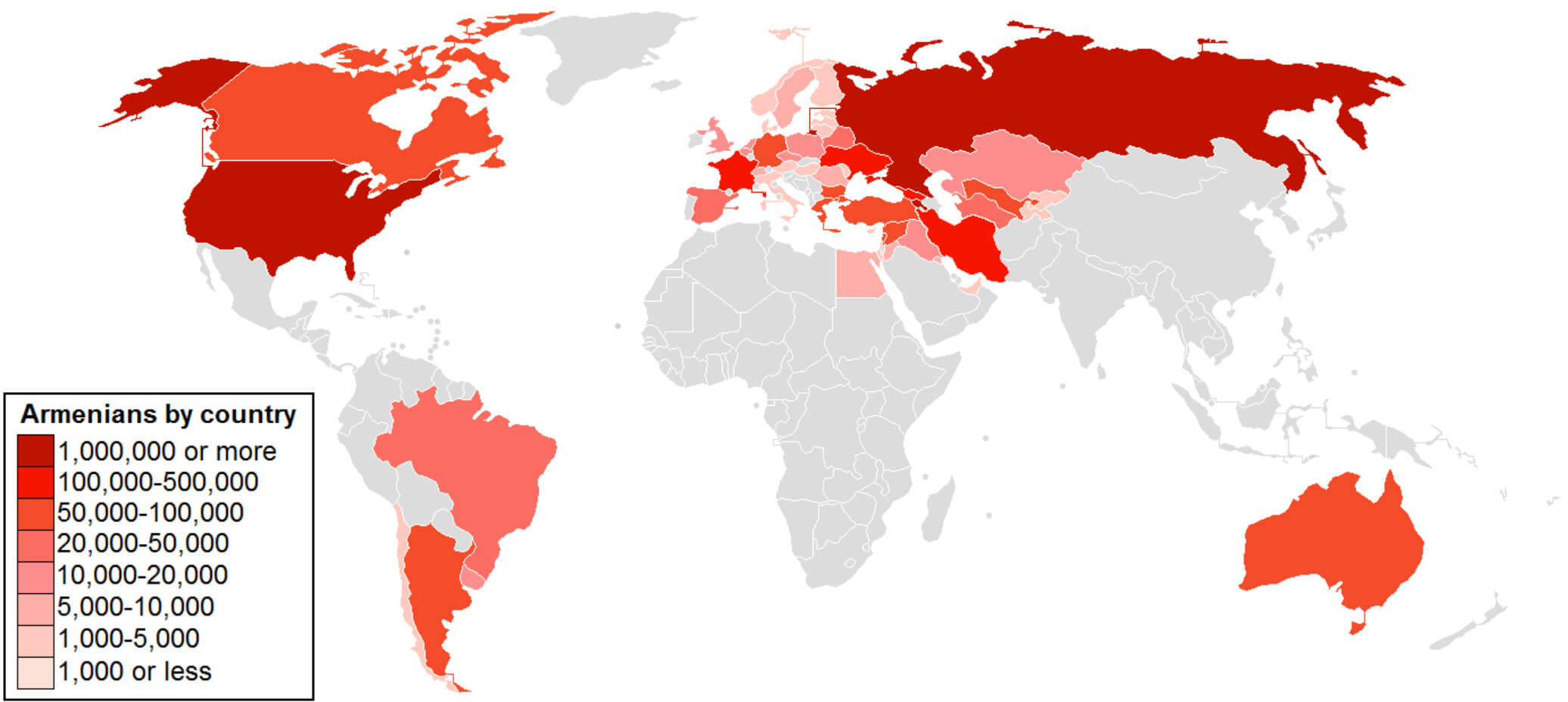 This map shows the global distribution of the Armenian population, highlighting significant diaspora communities. Darker shades of red indicate countries with larger Armenian populations, such as Russia, the United States and France, each home to over 100,000 Armenians, while lighter shades represent countries with smaller Armenian communities spread across various continents, including South America, the Middle East and Europe.
Settlement Area Map of Armenians
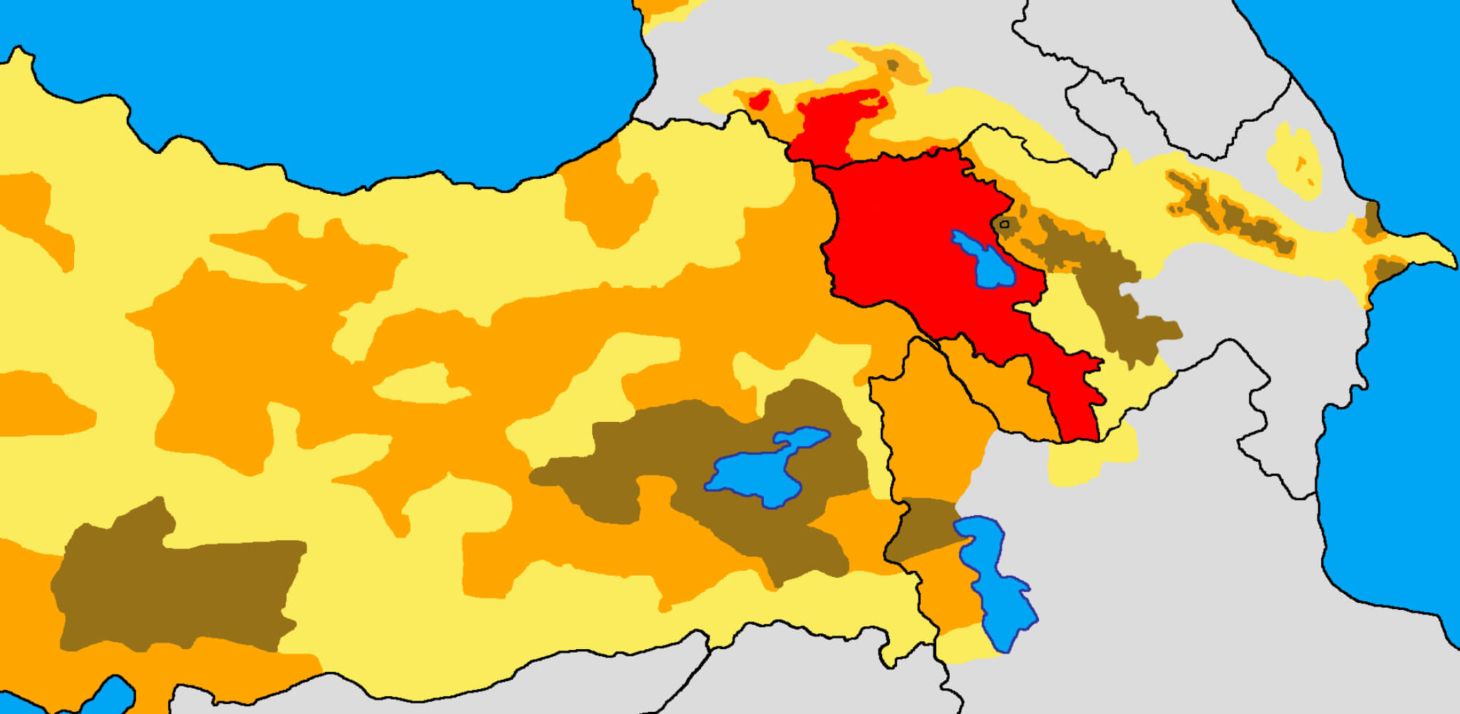 This map of Armenian settlement areas highlights the historical distribution of Armenian populations, showing regions densely populated by Armenians (in red) and areas with significant Armenian communities (in various shades of orange and brown) in Eastern Anatolia, the Southern Caucasus and parts of Iran. This map serves as a visual representation of the historical presence and spread of Armenian communities in these regions over the centuries.
Armenia Political Map with International Borders
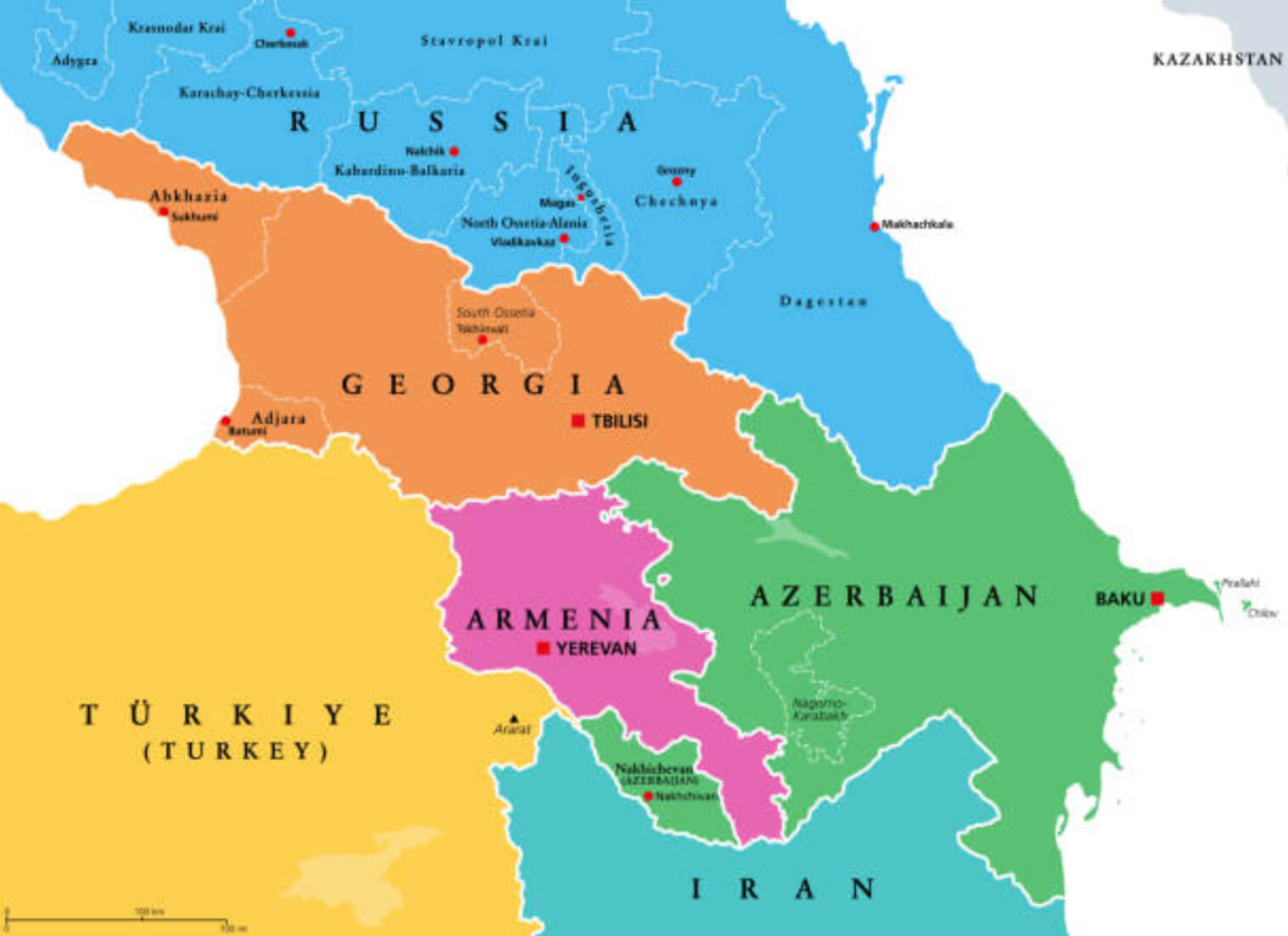 This political map of Armenia shows the country’s borders with neighbouring countries, including Georgia to the north, Azerbaijan to the east, Iran to the south and Turkey to the west. Key features include Armenia’s capital city, Yerevan, and major cities in neighbouring countries, providing a clear overview of the region’s geopolitical landscape.
Armenia Rivers Lakes Map
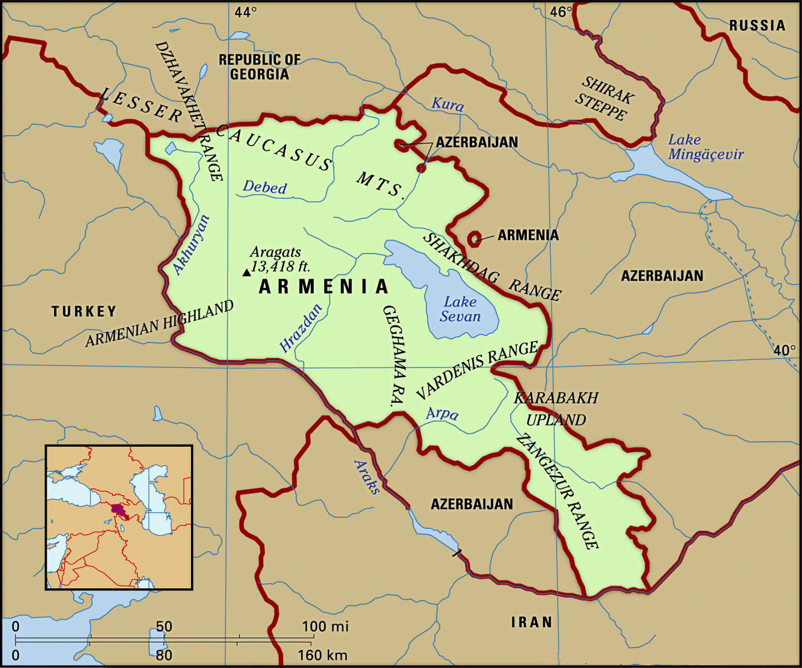 This map of Armenia highlights the country’s rivers and lakes, including the prominent Lake Sevan in the central region. The map also shows major mountain ranges, such as the Caucasus Mountains in the north, and various mountain ranges within Armenia, such as the Geghama and Vardenis ranges, illustrating the country’s diverse terrain and water resources.
Armenia Roads Main Cities Map
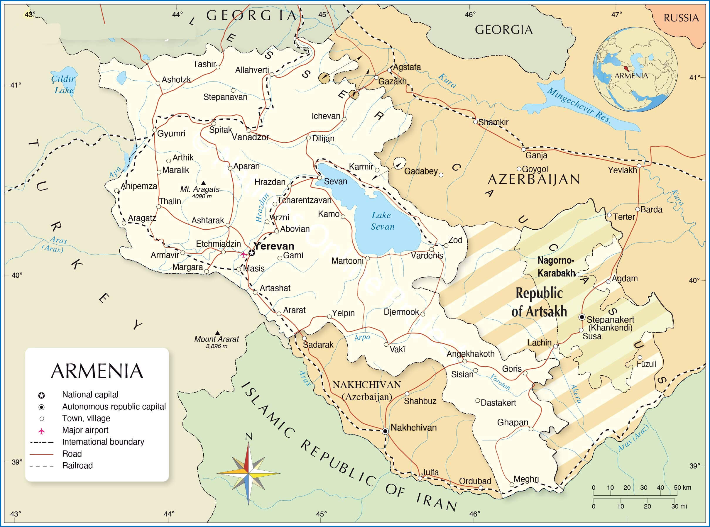 This map of Armenia shows major roads and cities, including Yerevan, Gyumri and Vanadzor, as well as key geographical features such as Mount Ararat and Lake Sevan.
Armenia Yerevan Map
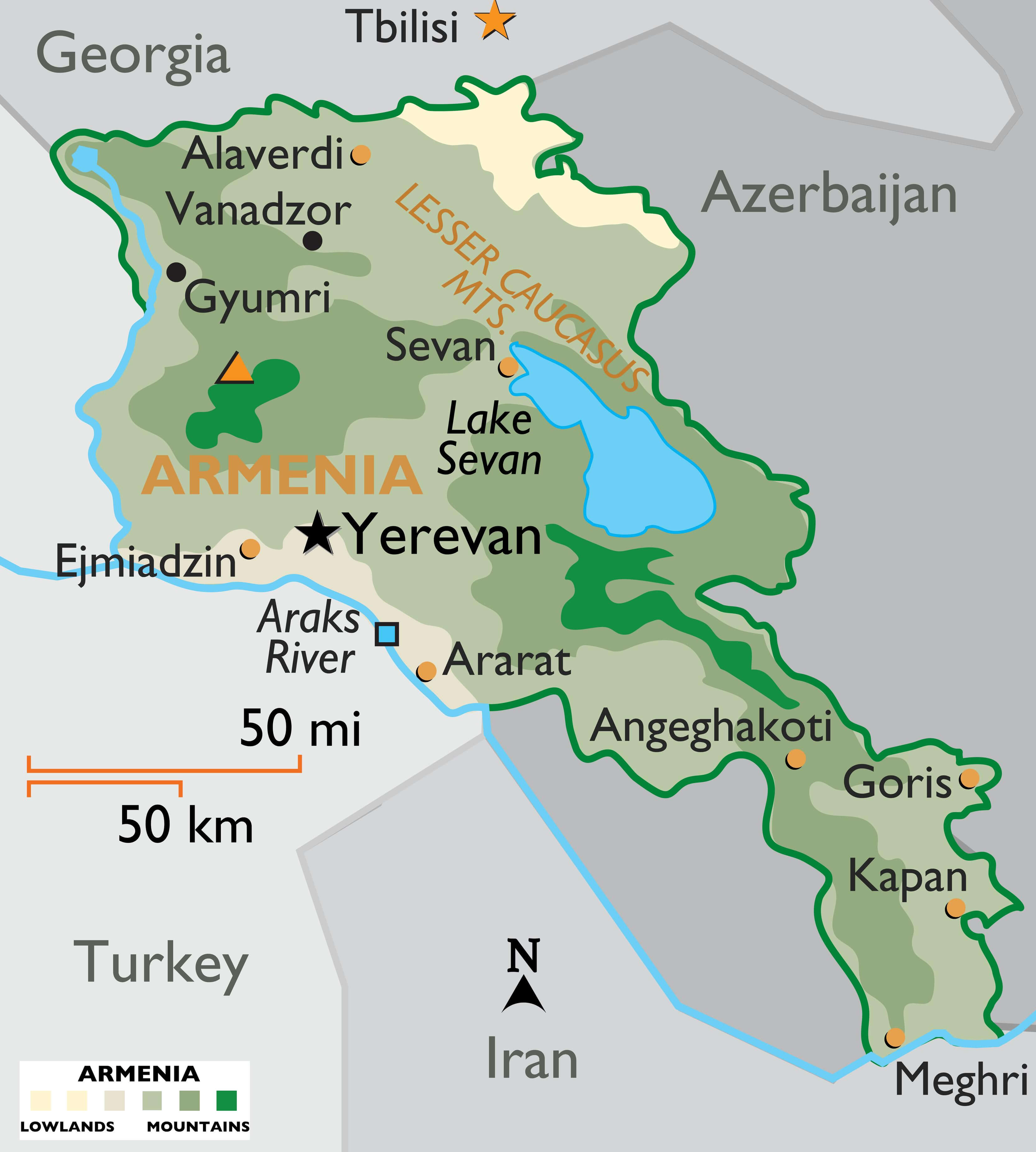 This map provides a focused view of Armenia, highlighting Yerevan, major cities and key geographical features such as Lake Sevan, the Lesser Caucasus Mountains and the Araks River. It illustrates Armenia’s varied terrain, from lowland to mountainous regions, and provides an insight into the country’s topography and neighbouring borders with Turkey, Georgia, Azerbaijan and Iran.
Armenia Administrative Map
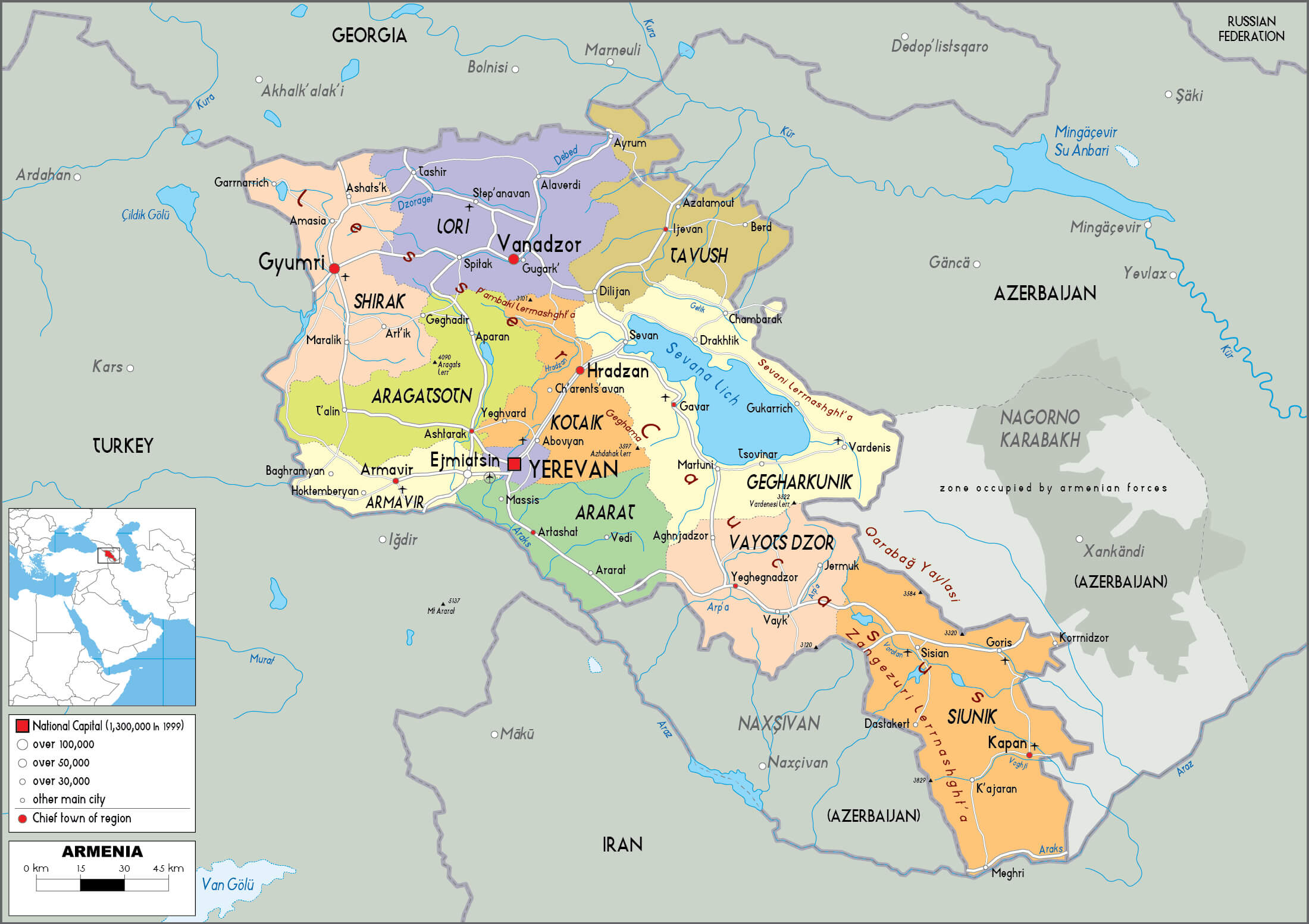 This map illustrates the administrative divisions of Armenia, highlighting the various provinces (marzers) and major cities, including the capital, Yerevan. It provides an insight into Armenia’s internal regional structure, neighbouring countries and significant geographical features such as Lake Sevan.
Armenia Major Cities Map
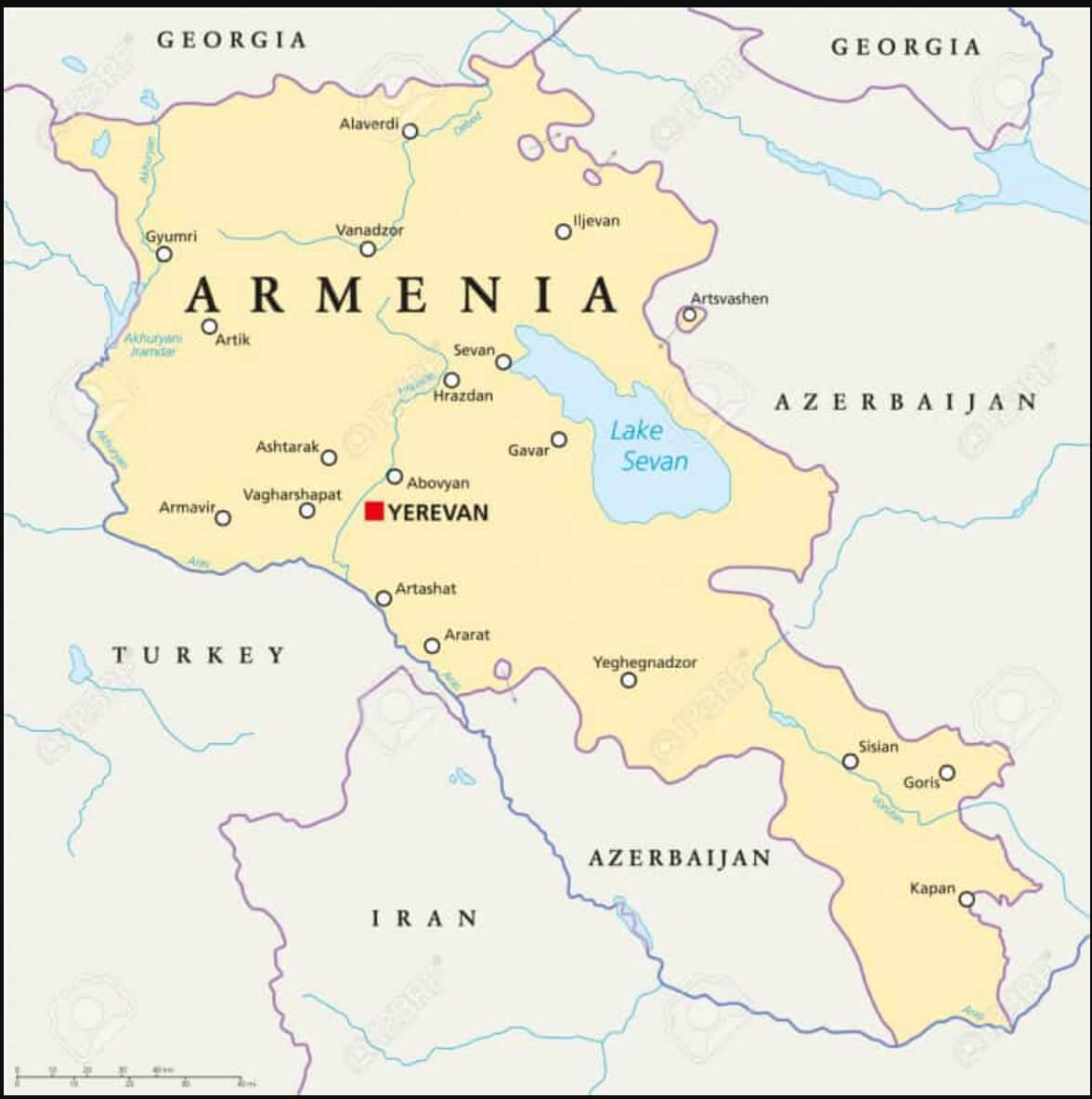 This Armenia major cities map shows the locations of the country’s major cities, including the capital Yerevan and other key urban areas such as Gyumri, Vanadzor and Kapan. These cities are shown in relation to key neighbouring countries, including Turkey, Iran, Georgia and Azerbaijan, providing a comprehensive overview of Armenia’s major urban centres and their geographical context within the region.
Historical United Armenia Map
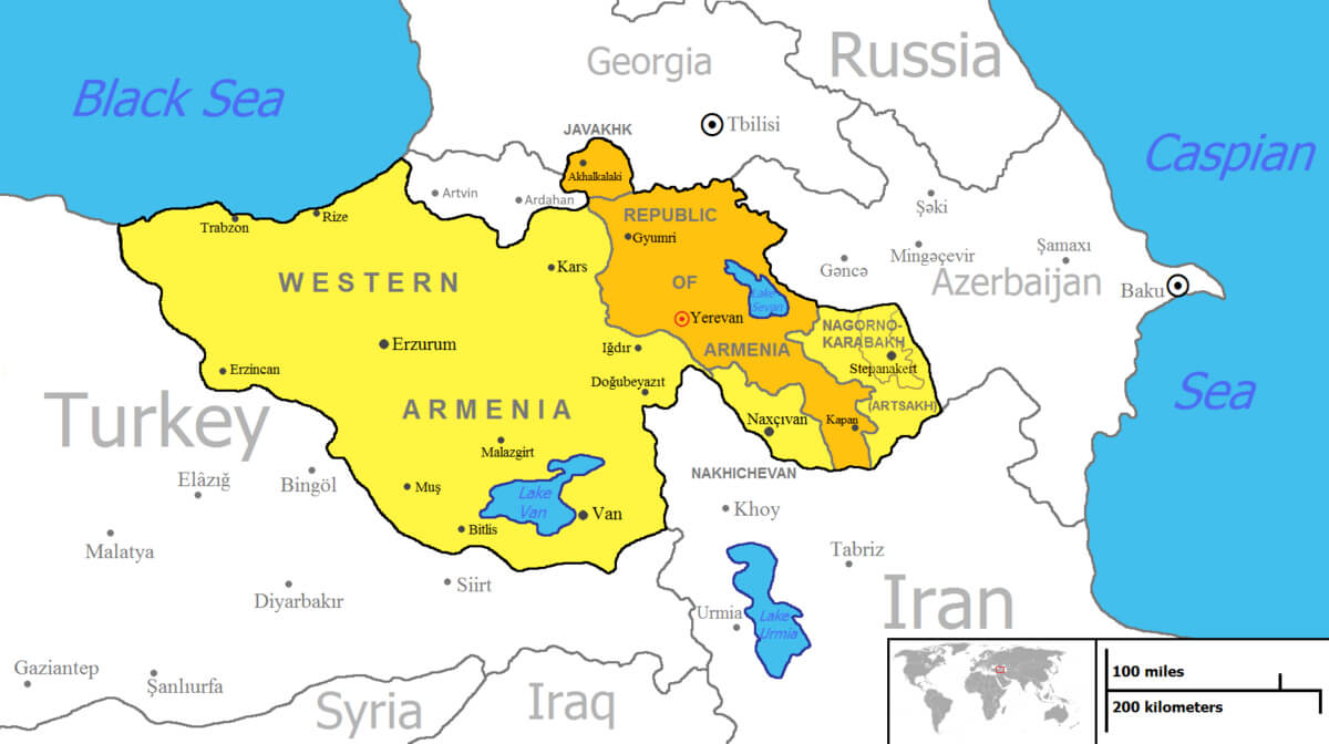 This map depicts the concept of ‘United Armenia’, highlighting historical Armenian territories in what is now Turkey, Armenia, Azerbaijan and surrounding regions. It includes areas such as Western Armenia, now within Turkey, and Nagorno-Karabakh, which has been a disputed territory between Armenia and Azerbaijan. This visualisation reflects the historical aspirations of Armenian unity by illustrating regions with significant Armenian populations or cultural influence over the centuries.
Armenia Earth Map
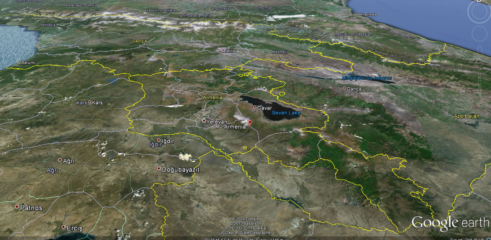
Where is Armenia on the Europe Map
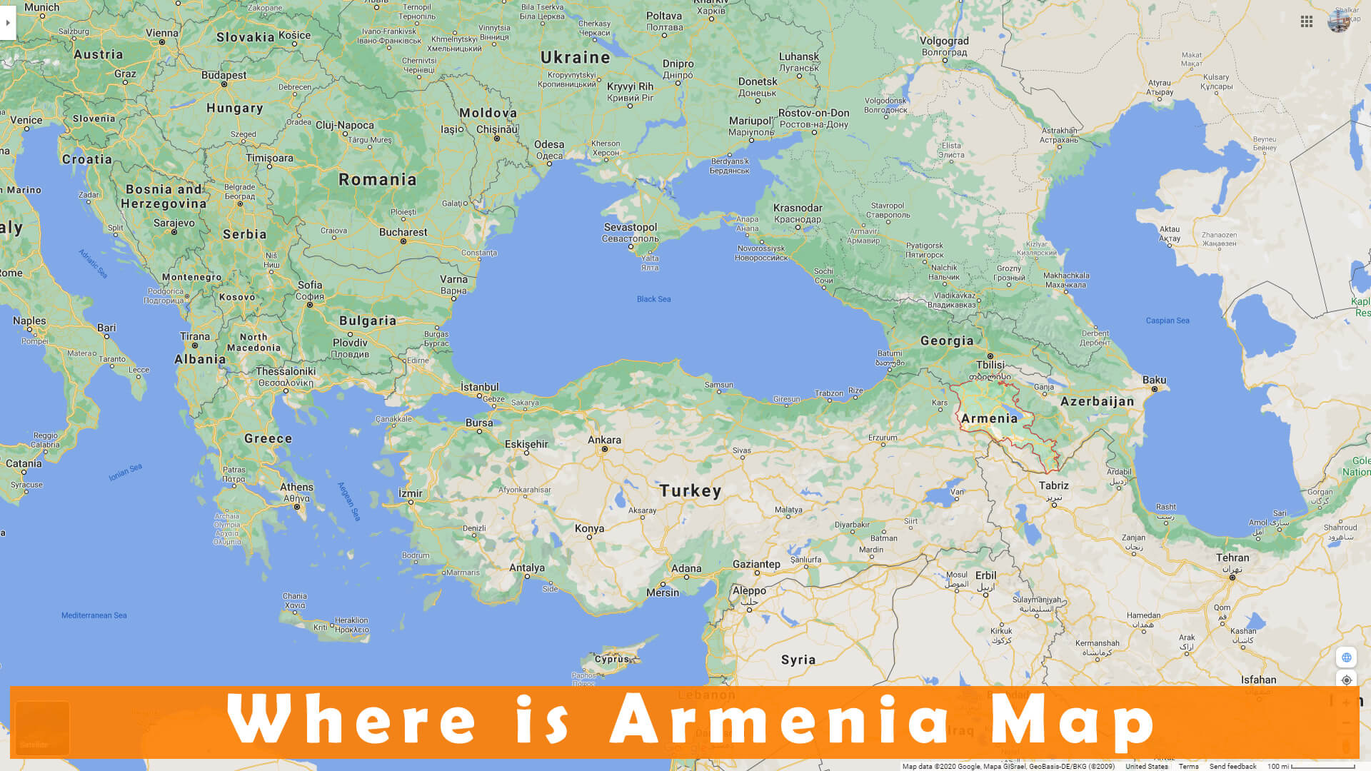
Where is Armenia on the Europe Map?
Show Google interactive map, satellite map, where is the country located.
Get directions by driving, walking, bicycling, public transportation and travel with street view.
Feel free to explore these pages as well:
- Russia Map ↗️
- South Ossetia Map ↗️
- United States Map ↗️
- United Kingdom Map ↗️
- Germany Map ↗️
- Ukraine Map ↗️
- Turkey Map ↗️
- France Map ↗️
- Map of Russia ↗️
- About Russia ↗️
- Largest Cities of Russia: From Moscow to Rostov ↗️
- Top 10 Must-Visit Places in Moscow ↗️
- Abkhazia Map ↗️
- Nagorno Karabakh ↗️
