A Collection of Moldova Maps offers an insightful overview of the country’s geography, showcasing everything from political boundaries and major cities to physical features and historical changes, providing a thorough perspective of this Eastern European nation.
Brief information about Moldova
Moldova is a small, landlocked country located in Eastern Europe, nestled between Romania to the west and Ukraine to the east. Its capital, Chi?inau, is the cultural and political hub of the nation. Known for its rich history and strong agricultural roots, Moldova has a long tradition of winemaking and is home to some of the largest wine cellars in the world, including Mile?tii Mici and Cricova.
Moldova Political Map
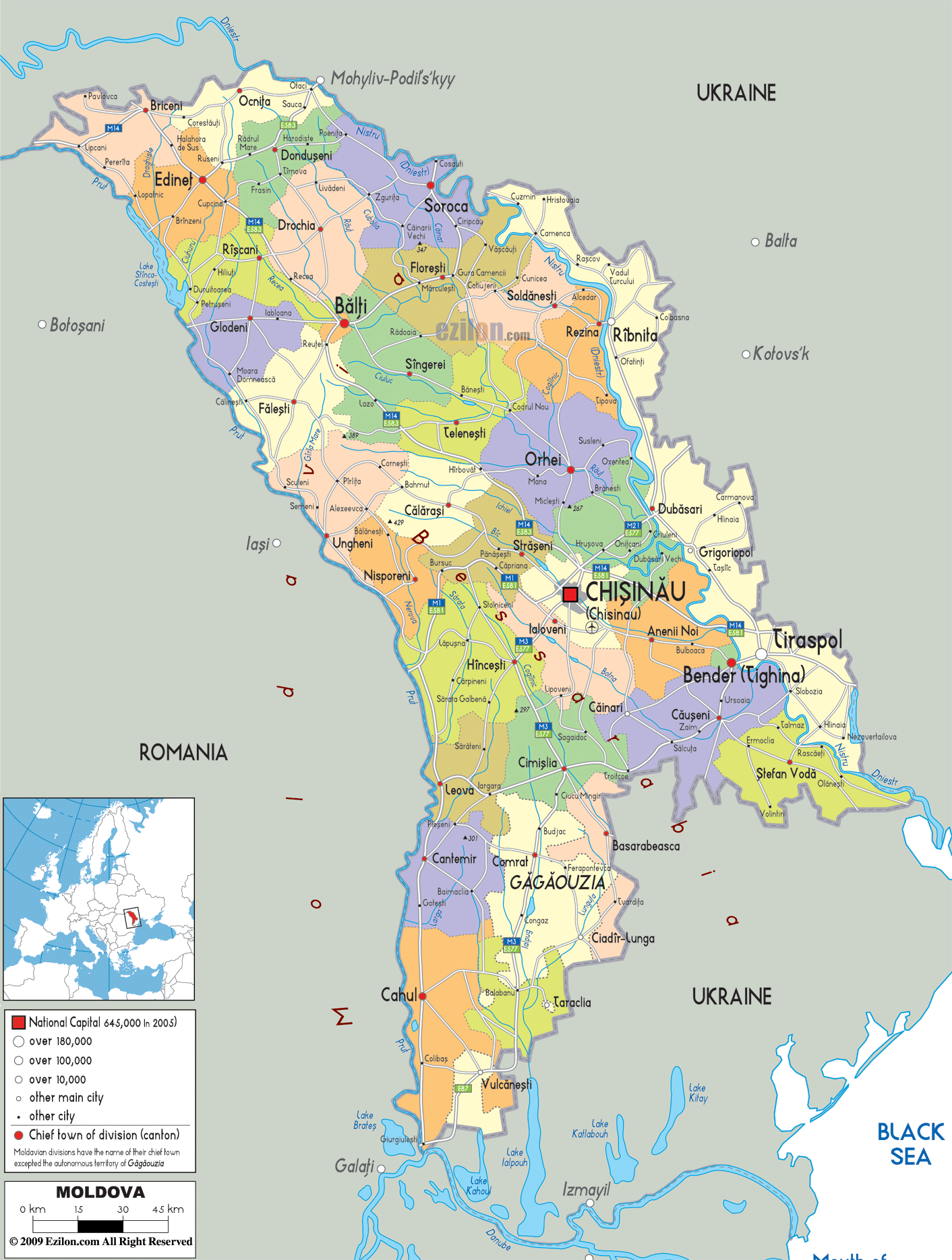
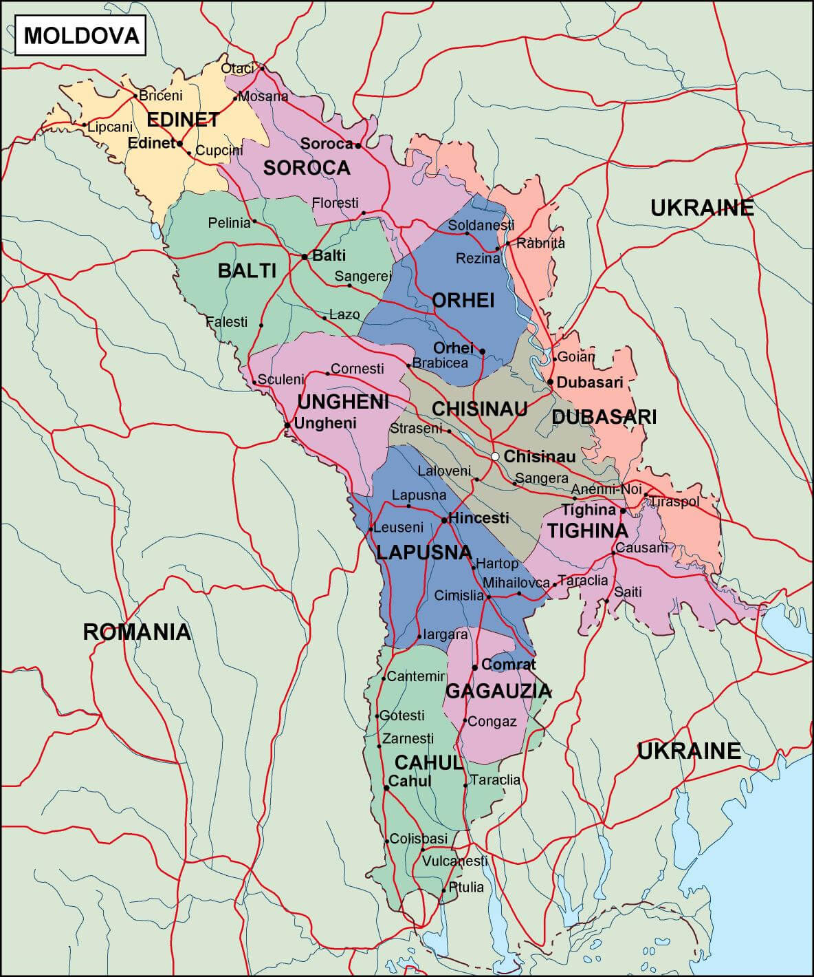
This political map of Moldova shows its key cities, including the capital Chi?inau, Bal?i, and Tiraspol, as well as the autonomous region of Gagauzia in the south. It outlines Moldova’s borders with Romania to the west and Ukraine to the east, while also highlighting its administrative divisions and main transportation routes.
Although Moldova is one of Europe’s poorest countries, it boasts a beautiful countryside with rolling hills and historic monasteries. The country has a diverse cultural heritage, influenced by both Romanian and Slavic traditions, reflecting its complex history under various empires and political powers. Moldova is also known for its efforts to strengthen ties with the European Union while balancing relationships with neighboring countries.
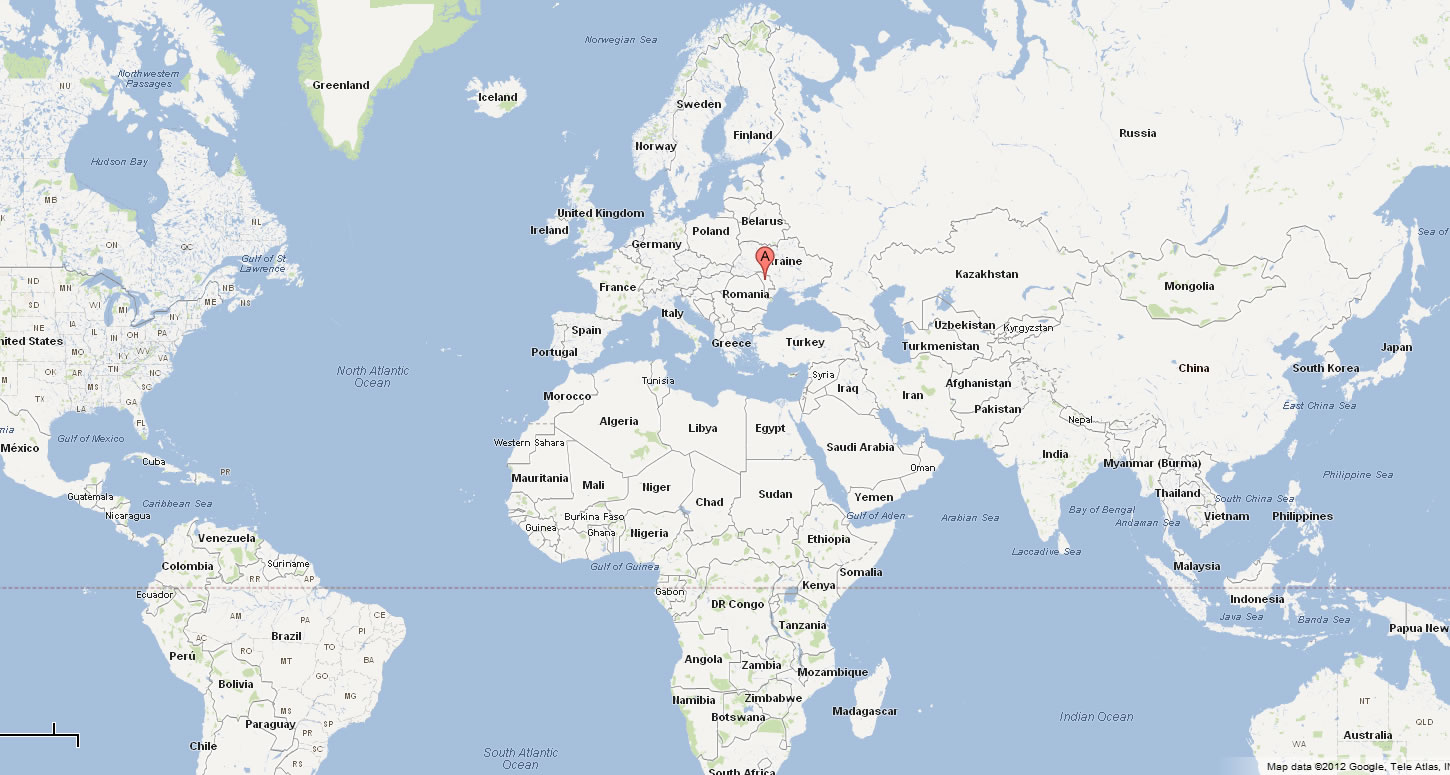
Where is located Moldova on the World Map
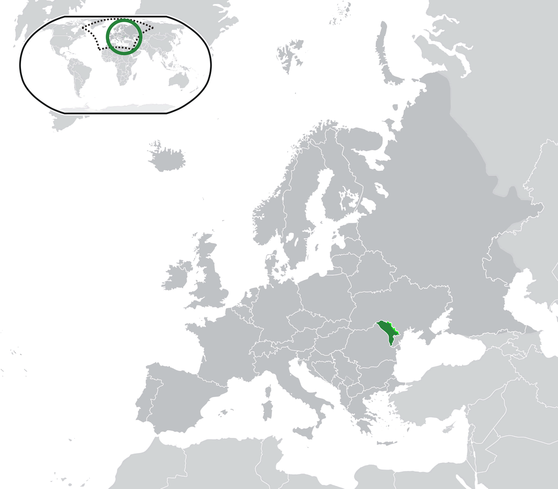
Moldova is located in Eastern Europe, bordered by Romania to the west and Ukraine to the north, east, and south. It is a landlocked country, meaning it has no coastline. Moldova is situated between the Carpathian Mountains and the Black Sea, though it does not touch either of them.
On the world map, you can find Moldova to the northeast of the Balkans, close to the Black Sea, although it doesn’t have direct access to it. The country is positioned at the crossroads of Central, Eastern, and Southeastern Europe, making it an important, albeit small, geographical location.
Moldova’s location has historically placed it between larger powers, influencing its culture, politics, and economy. Its proximity to Romania results in strong cultural and linguistic ties, while its border with Ukraine connects it to broader Eastern European dynamics.
Here are some statistical information about Moldova:
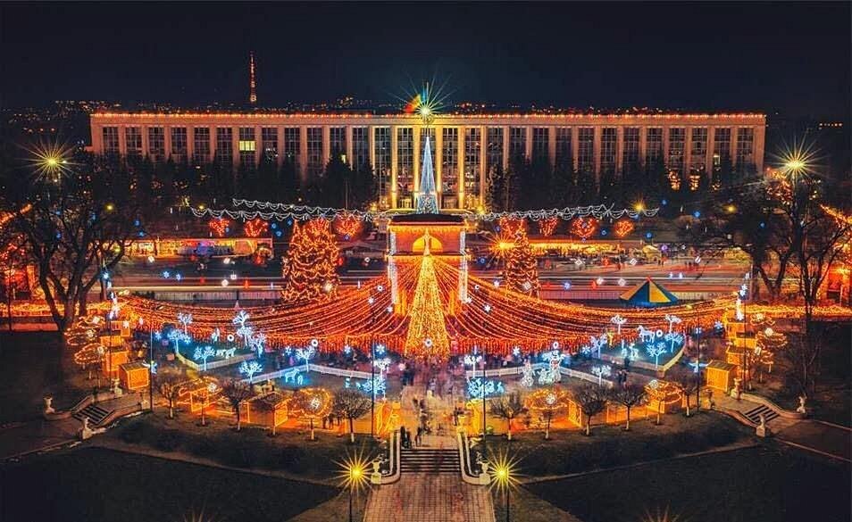
Map of Moldova
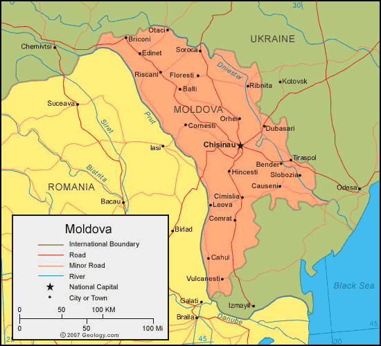
Moldova Location Map
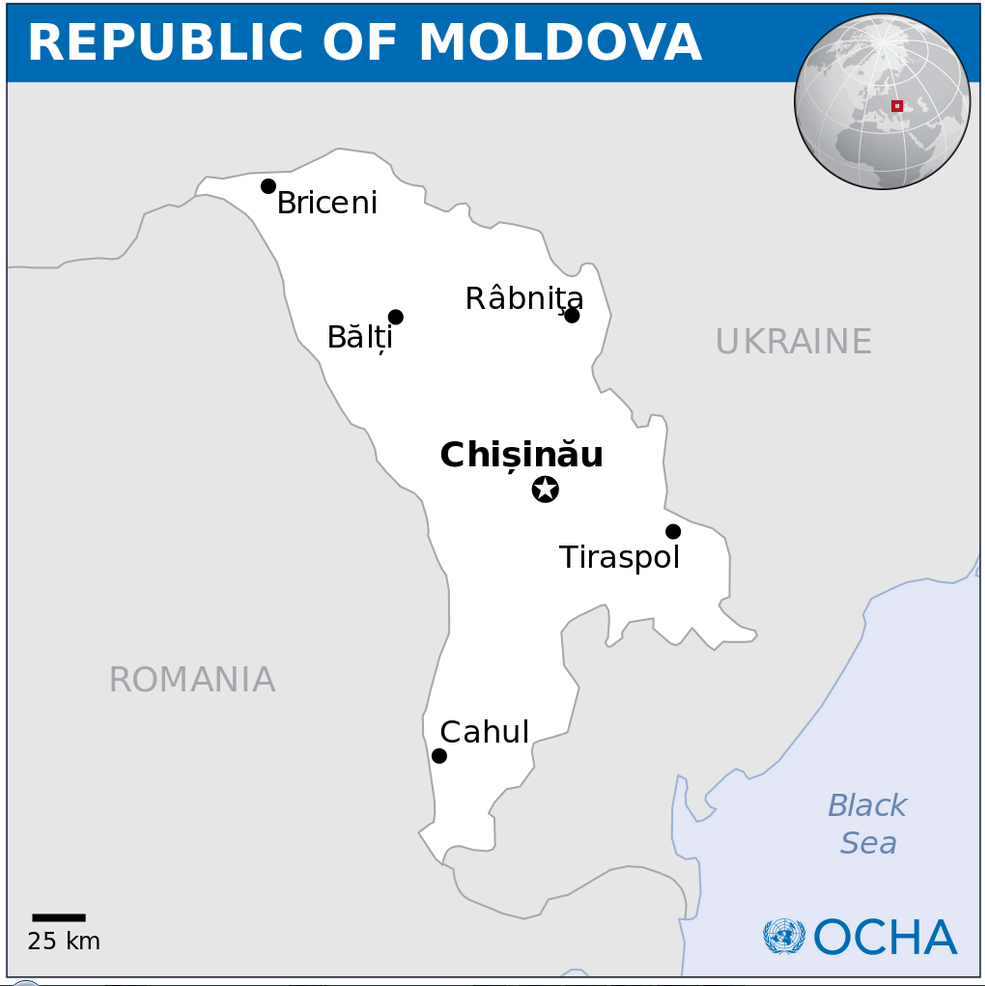
Cities Map of Moldova
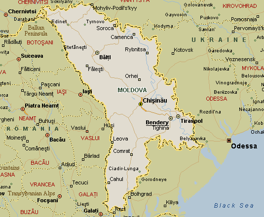
This map of Moldova highlights its major cities, including Chi?inau, Bal?i, Tiraspol, and Bender, as well as its neighboring countries, Romania to the west and Ukraine to the east. It also shows Moldova’s proximity to the Black Sea and the key surrounding cities in Romania and Ukraine.
Moldova Map Romaina Ukraine
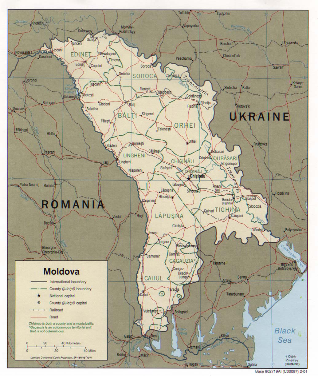
This map of Moldova highlights its borders with Romania to the west and Ukraine to the north, east, and south. Key cities such as Chi?inau (the capital), Bal?i, and Tighina are marked, along with major roads and railways. The map also shows Gagauzia, an autonomous territorial unit in the south, and the Dniester River along the eastern border near Transnistria.
Moldova Cities Map
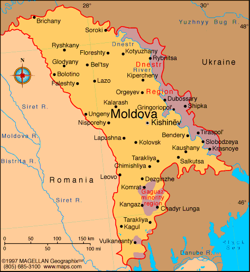
This map of Moldova shows key cities like Chi?inau, Tiraspol, and Bal?i, along with its borders with Romania and Ukraine. It highlights the Dniester River and the Gagauzia region in the south.
Moldova History Map in 1483
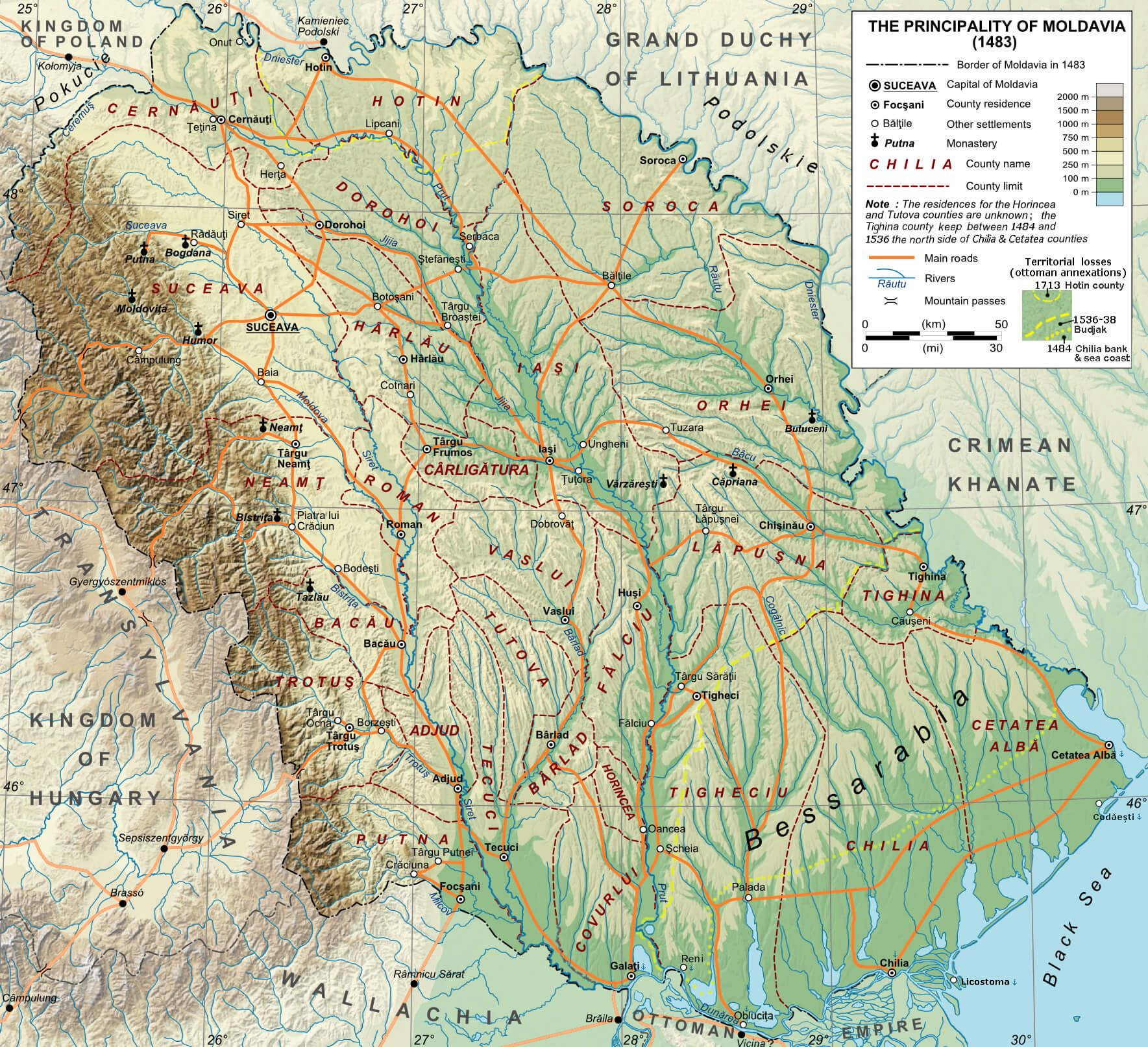 This map shows the Principality of Moldavia in 1483, illustrating its borders, major towns, monasteries and geographical features at the time, and highlighting the historical context of the region before later territorial changes.
Moldova Provinces Map
Moldova Map Cucuteni Trypillia in 4000 BC
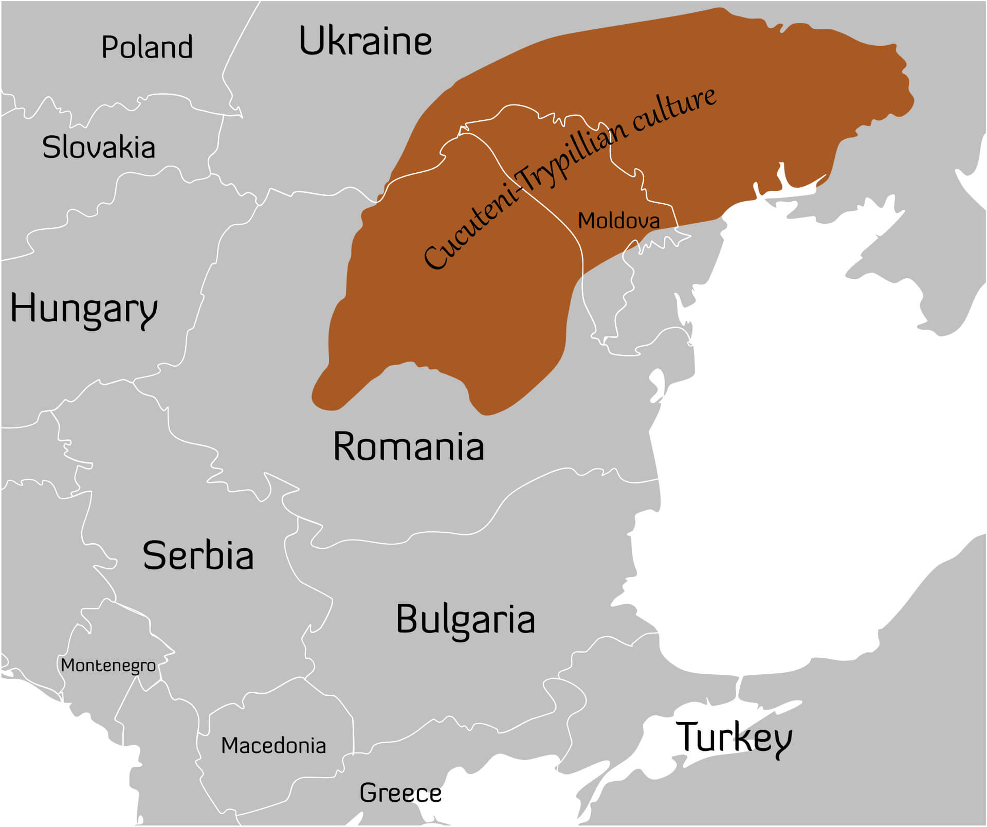 This map shows the region of the Cucuteni-Trypillia culture around 4000 BC, spanning parts of present-day Moldova, Romania, and Ukraine. This ancient Neolithic civilization is known for its advanced pottery, large settlements, and intricate social structures, making it one of the most notable prehistoric cultures in Eastern Europe.
Moldova Map Greater Romania between 1920 and 1940
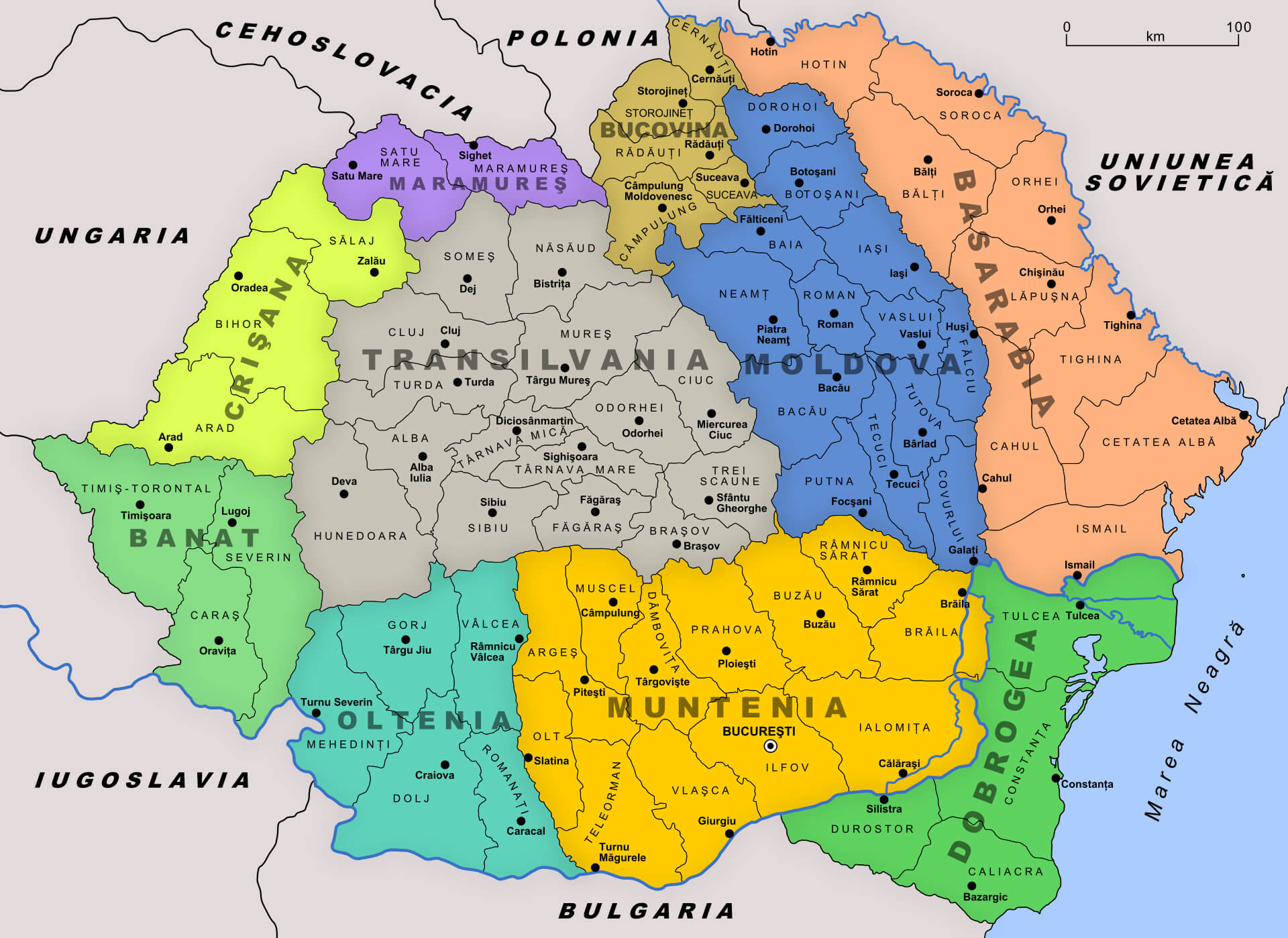 This map of Greater Romania between 1920 and 1940 shows the borders of Romania during the interwar period, highlighting the inclusion of regions like Moldova, Transylvania, Banat, and Basarabia. The map reflects the changes that occurred after World War I, emphasizing Romania’s territorial expansion to include these historically significant areas.
Moldova Europe Map
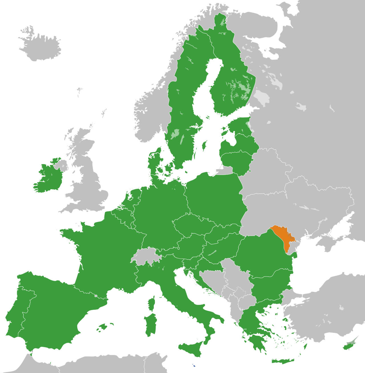 This map highlights Moldova in relation to European Union member states, showing Moldova (in orange) alongside EU countries (in green), emphasising its geographical position on the continent and its distinction from EU membership.
Moldova National Border Map
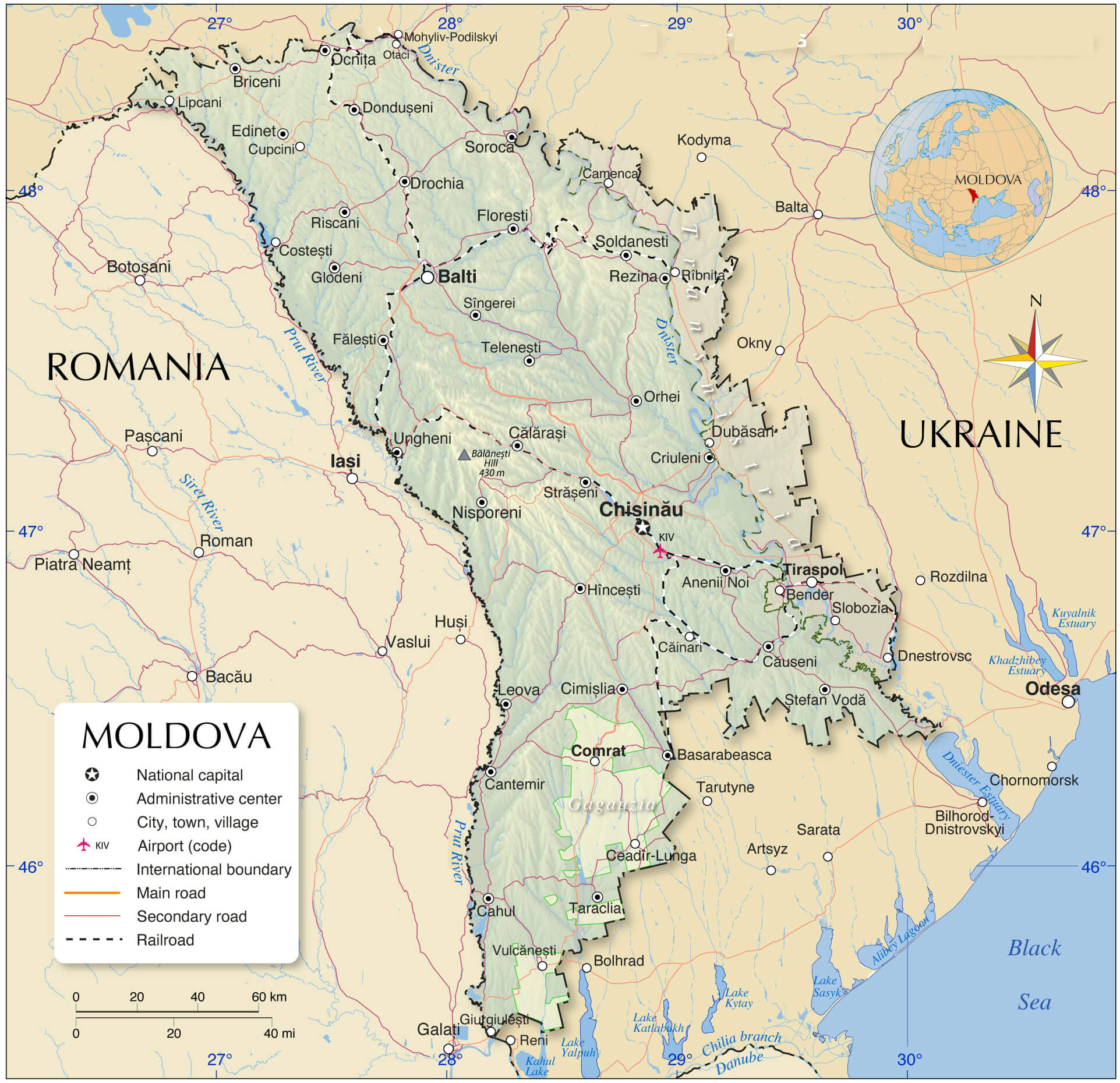 This map of Moldova highlights the country’s borders, with a clear distinction between Moldova, Romania and Ukraine, and shows key cities such as Chișinău, Bălți and Tiraspol, as well as important geographical features such as the Dniester River and nearby railways, major roads and administrative centres.
Moldova Rivers Map
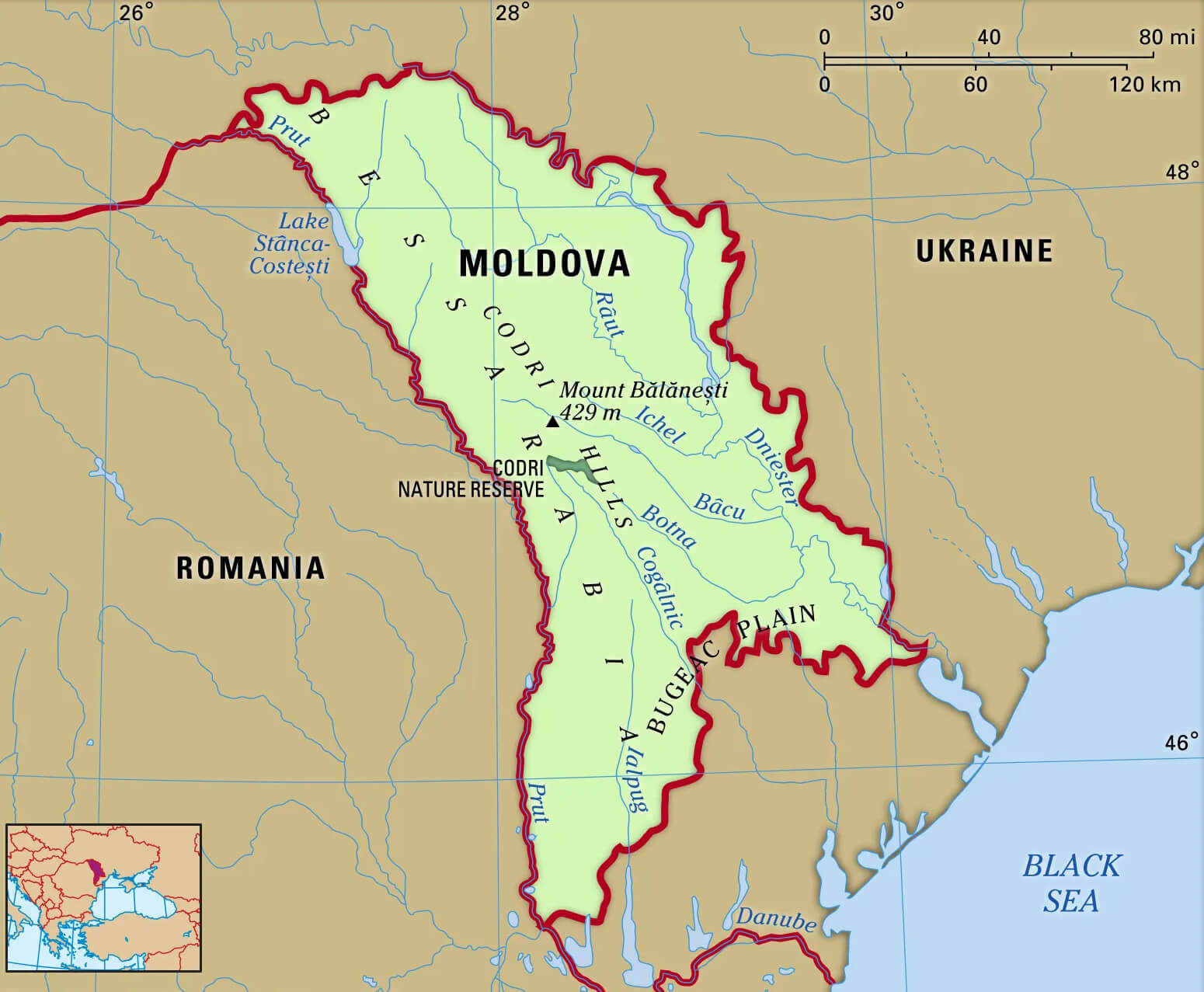 This map illustrates the geography of Moldova, highlighting its main rivers, including the Prut and Dniester rivers, which serve as significant natural borders. The map also displays Moldova’s terrain features, such as the Codri Hills and the Bugeac Plain, providing a detailed overview of the country’s landscape.
Moldova Divisions Major Cities Map
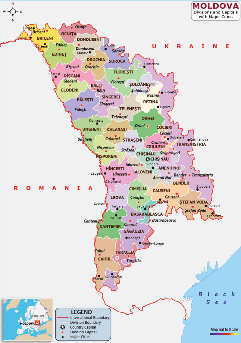 This map of Moldova shows the country’s various administrative divisions and major cities. It highlights regions such as Gagauzia, Cahul and Orhei, among others, and identifies major urban centres such as Chișinău, Bălți and Tiraspol. The map provides a clear view of Moldova’s geographical position, bordered by Romania to the west and Ukraine to the north, east and south.
Moldova Rivers Mountains Map
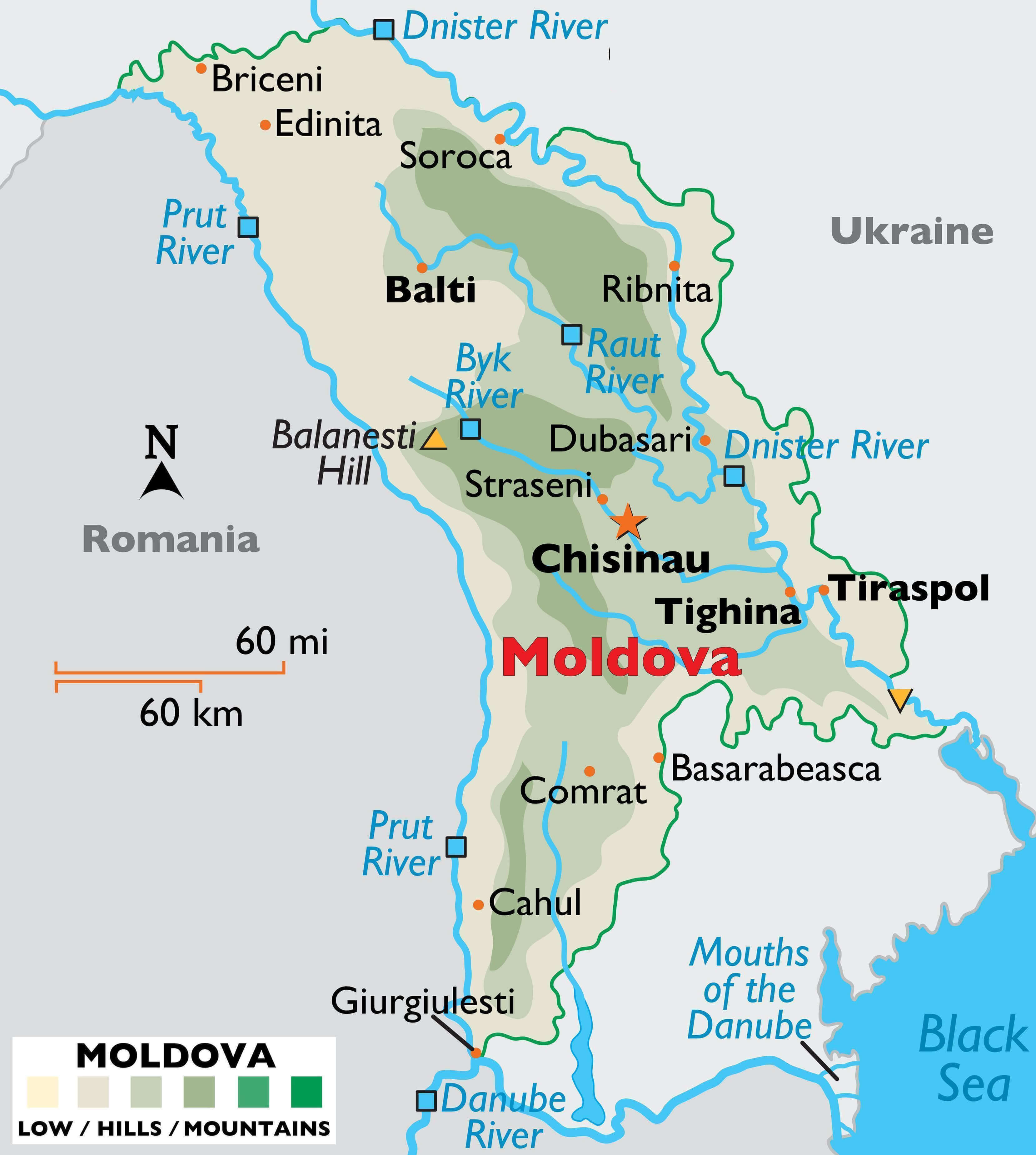 This map of Moldova highlights the country’s river systems, including major waterways such as the Prut and Dniester rivers, as well as notable geographical features such as Balanesti Hill. The map also provides a detailed view of Moldova’s topography, showing areas of lowland and hilly terrain, as well as major cities such as Chisinau and Balti.
Moldova, Ukraine, and Romania Map
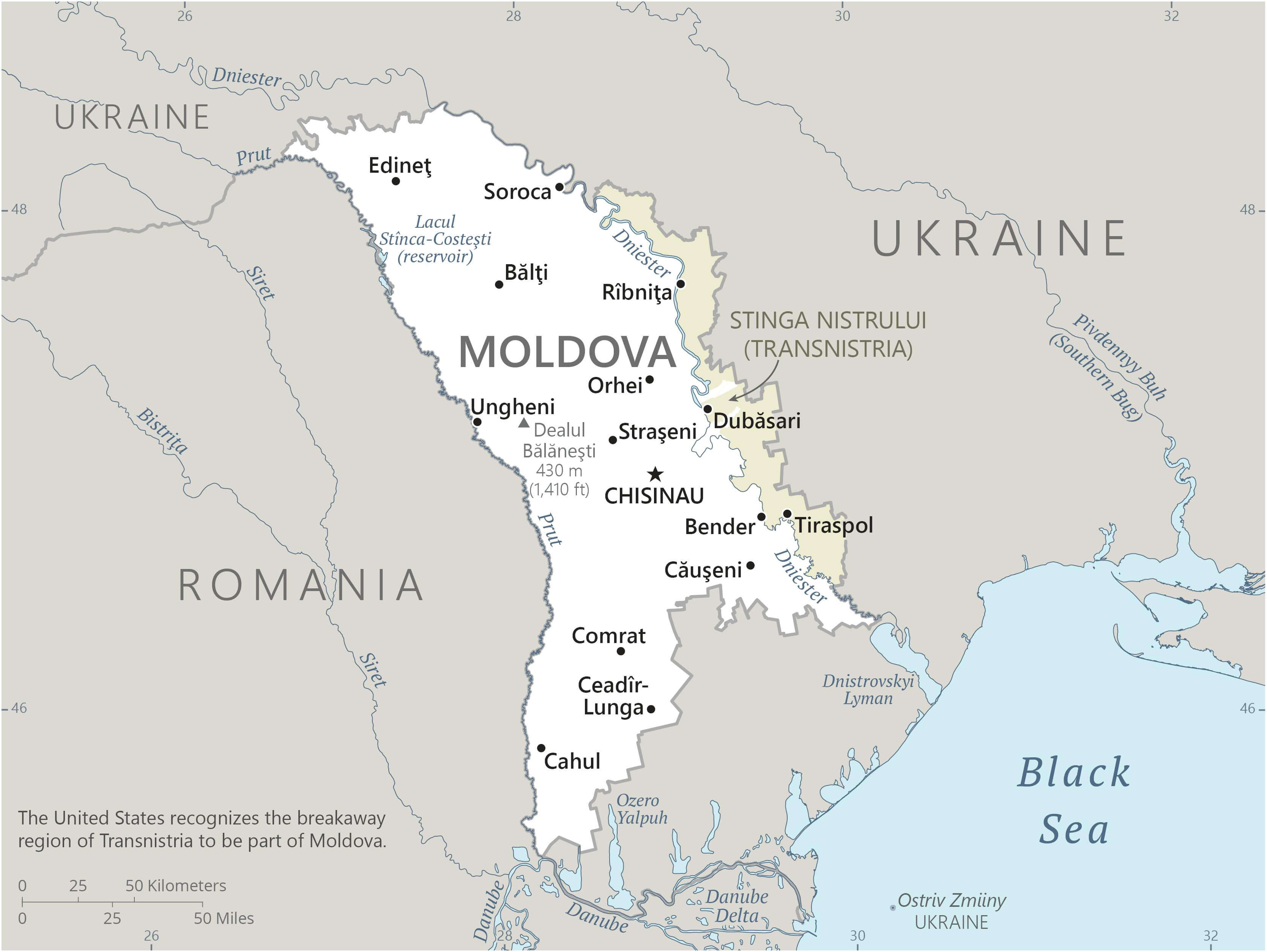 This map shows Moldova and its neighbours Ukraine and Romania. It highlights Moldova’s borders, key cities such as Chișinău, Tiraspol and Bălți, and the breakaway region of Transnistria, which the United States recognises as part of Moldova. The map also highlights important geographical features such as the Dniester River and Moldova’s proximity to the Black Sea through the Ukrainian coast.
Map Moldova
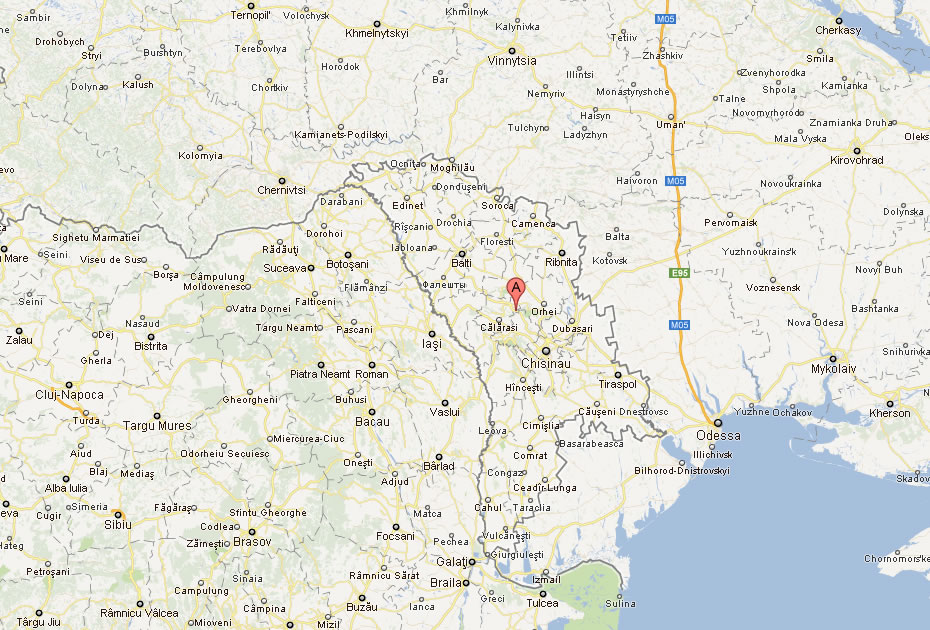
Map of Moldova Europe
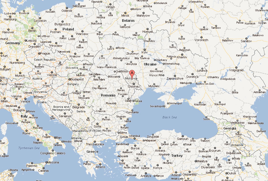
Map of Moldova World
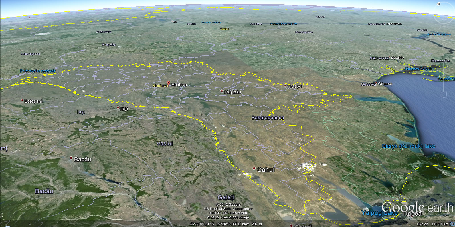
Moldova Earth Map
Where is Moldova on the Europe Map?
Show Google map, satellite map, where is the country located.
Get directions by driving, walking, bicycling, public transportation and travel with street view.
div>Feel free to explore these pages as well:
- Transnistria Map ↗️
- Ukraine Map ↗️
- Germany Map ↗️
- Map of Germany ↗️
- Discover Bochum ↗️
- A Collection of Czechia Maps ↗️
- A Collection of Poland Maps ↗️
- Europe Map ↗️
- Map of Europe ↗️
