Discovering Lithuania through Maps: Exploring Lithuania is a journey through history, culture, and geography, and what better way to start than with a collection of maps? Whether planning a trip, studying the country’s unique layout, or just curious about the region, these maps offer a detailed look at Lithuania’s cities, landscapes, and rich past. From political boundaries to nature reserves, our collection has it all.
Brief information about Lithuania
Lithuania, a small country nestled in the Baltic region of Europe, is known for its rich history and stunning landscapes. Once a powerful empire in the Middle Ages, Lithuania now boasts beautiful natural reserves, charming old towns, and a growing capital, Vilnius, which blends history and modernity seamlessly. From the historic Gediminas Tower to the tranquil Curonian Spit, there’s a lot to explore for nature lovers and history buffs alike.
Lithuania Major Cities Physical Map
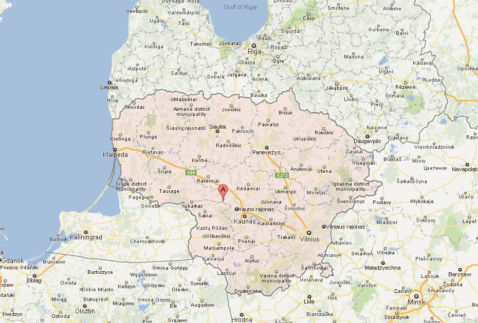
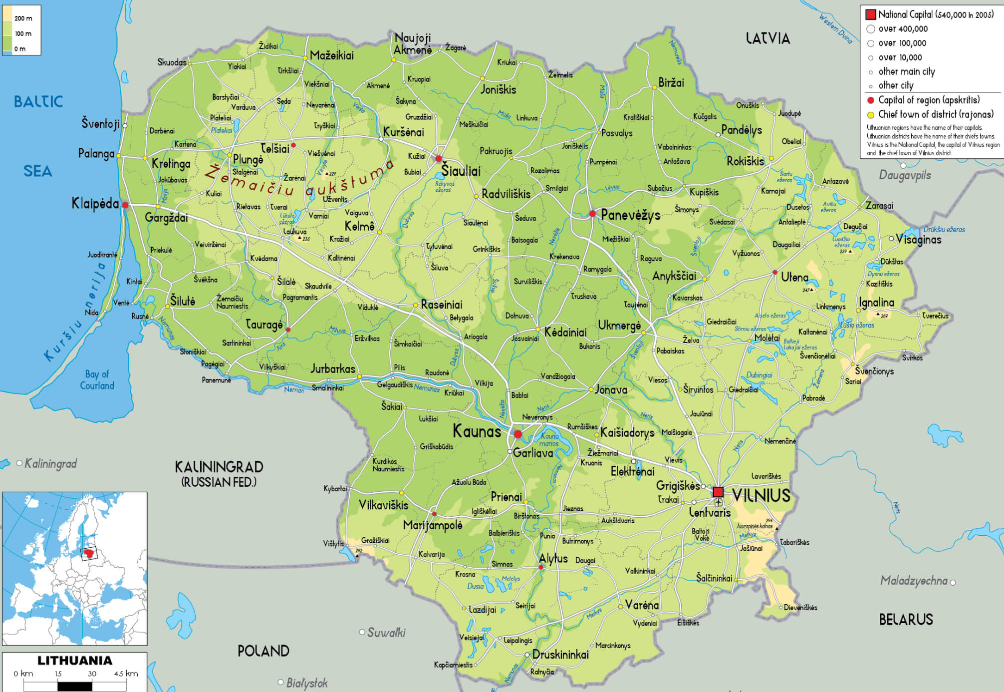 This map of Lithuania highlights the major cities and the physical landscape, including prominent features such as rivers, forests, and regions like the Žemaitija Upland. The map also emphasizes key cities like Vilnius, the capital, and Kaunas, the second-largest city, along with other notable towns like Klaipėda, Šiauliai, and Panevėžys. The physical terrain is clearly represented, showing the diversity of landscapes from the coastal areas along the Baltic Sea to the inland plateaus and plains.
With a population of just under 3 million, Lithuania is also one of the greenest countries in Europe, making it a perfect destination for outdoor adventures. The Lithuanian people take pride in their unique traditions and language, which is one of the oldest in the world. Despite its small size, Lithuania offers a vibrant cultural scene, and its role in the Baltic States makes it a fascinating place to visit or learn about.
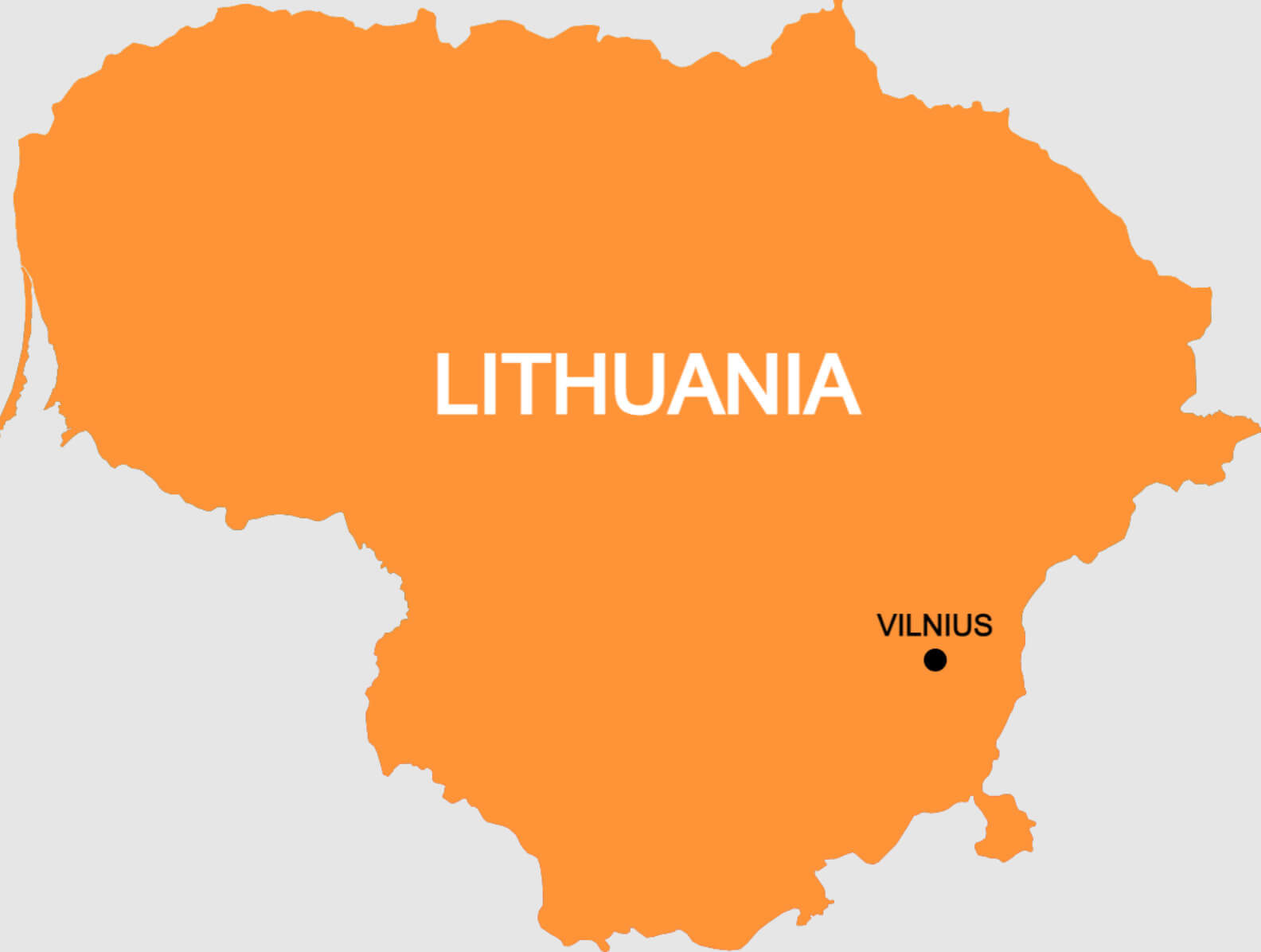
Where is located Lithuania on the World Map
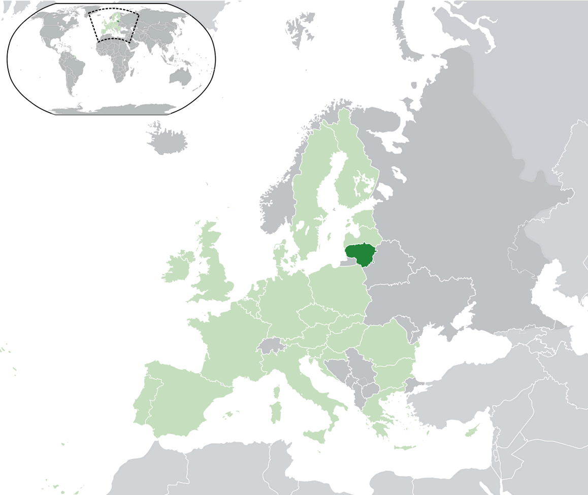
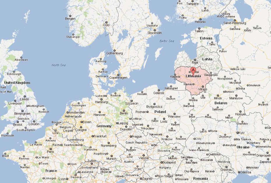
Lithuania is located in Northern Europe, nestled along the southeastern coast of the Baltic Sea. It shares borders with Latvia to the north, Belarus to the east and south, Poland to the south, and a small portion of Russia’s Kaliningrad region to the southwest. Despite its relatively small size, Lithuania’s strategic location has played a key role in its history, as it connects Eastern and Northern Europe.
Sitting at the crossroads of various cultural and trade routes, Lithuania has long been a bridge between different European regions. Its Baltic Sea coastline provides access to maritime trade and beautiful beaches, while the flat landscapes of forests, rivers, and lakes define its inland geography. Vilnius, the capital city, lies in the southeastern part of the country, close to the Belarusian border.
Lithuania is part of the Baltic States, a group of three countries (Lithuania, Latvia, and Estonia) that share historical and cultural ties. This location, right on the northeastern edge of the European Union, gives Lithuania a blend of both Western and Eastern European influences, making it a unique and fascinating spot on the world map.
Here are some statistical information about Lithuania:
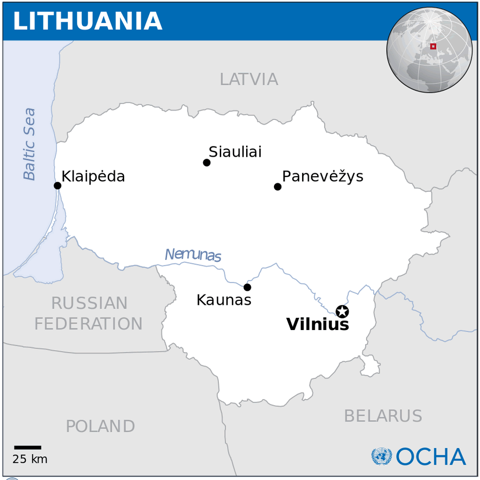
Lithuania Physical Map
Administrative Map of Lithuania
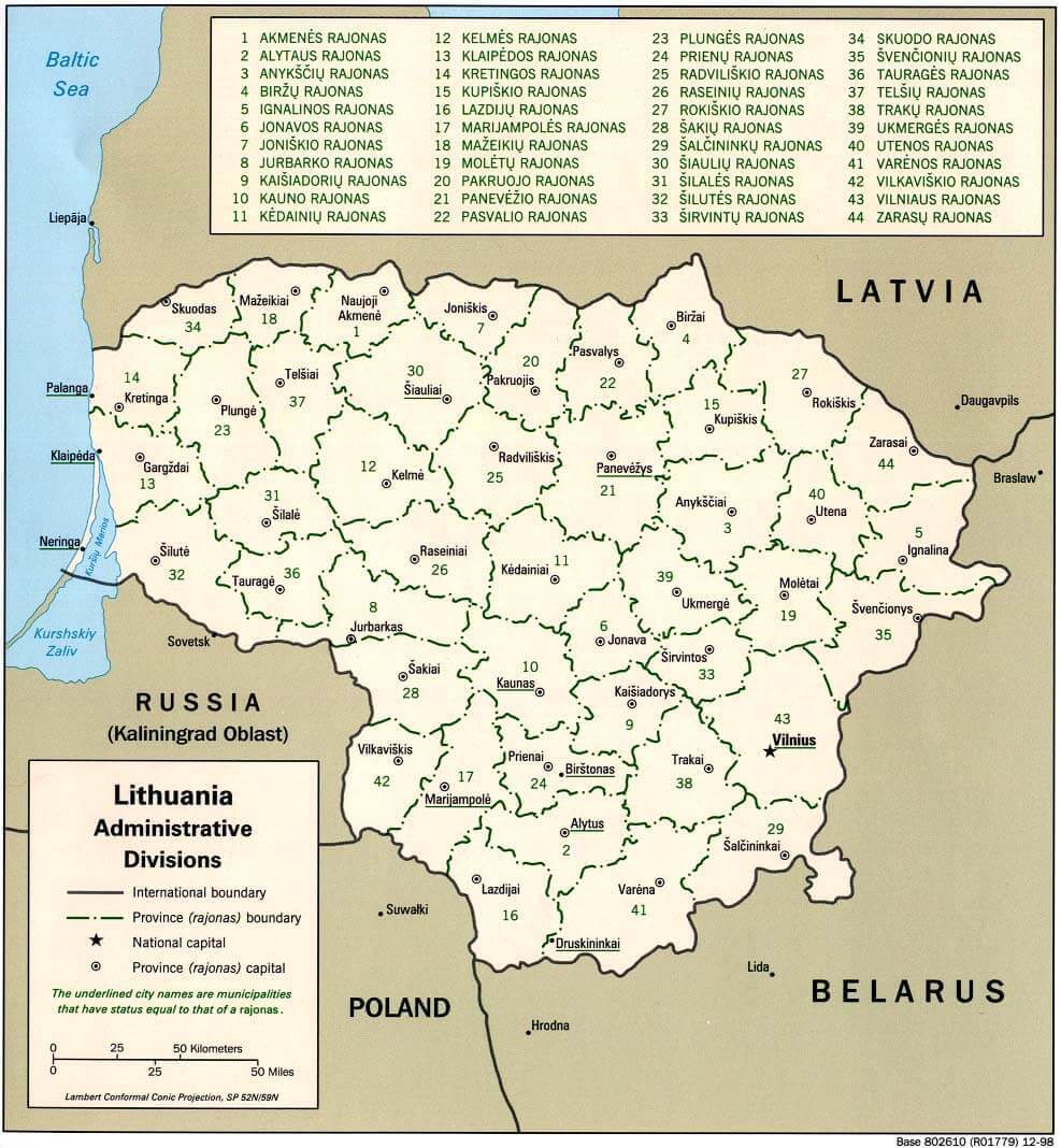
This map shows Lithuania’s administrative divisions, including 43 regions (rajonas), with borders to Latvia, Belarus, Poland, Russia, and the Baltic Sea.
Lithuania Maps
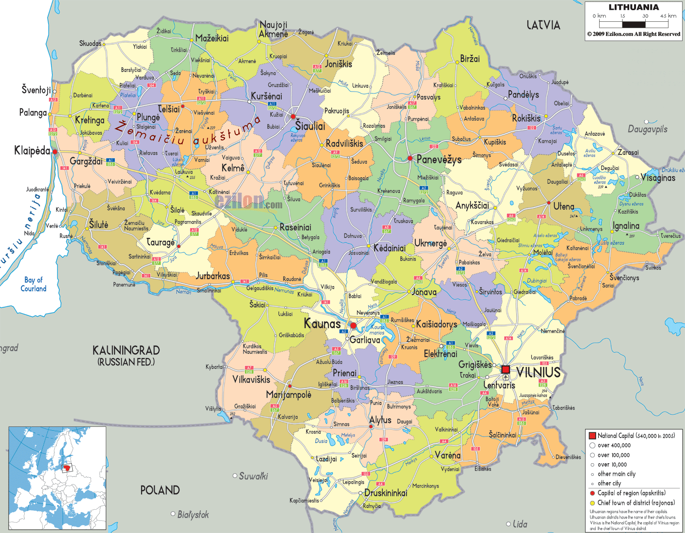
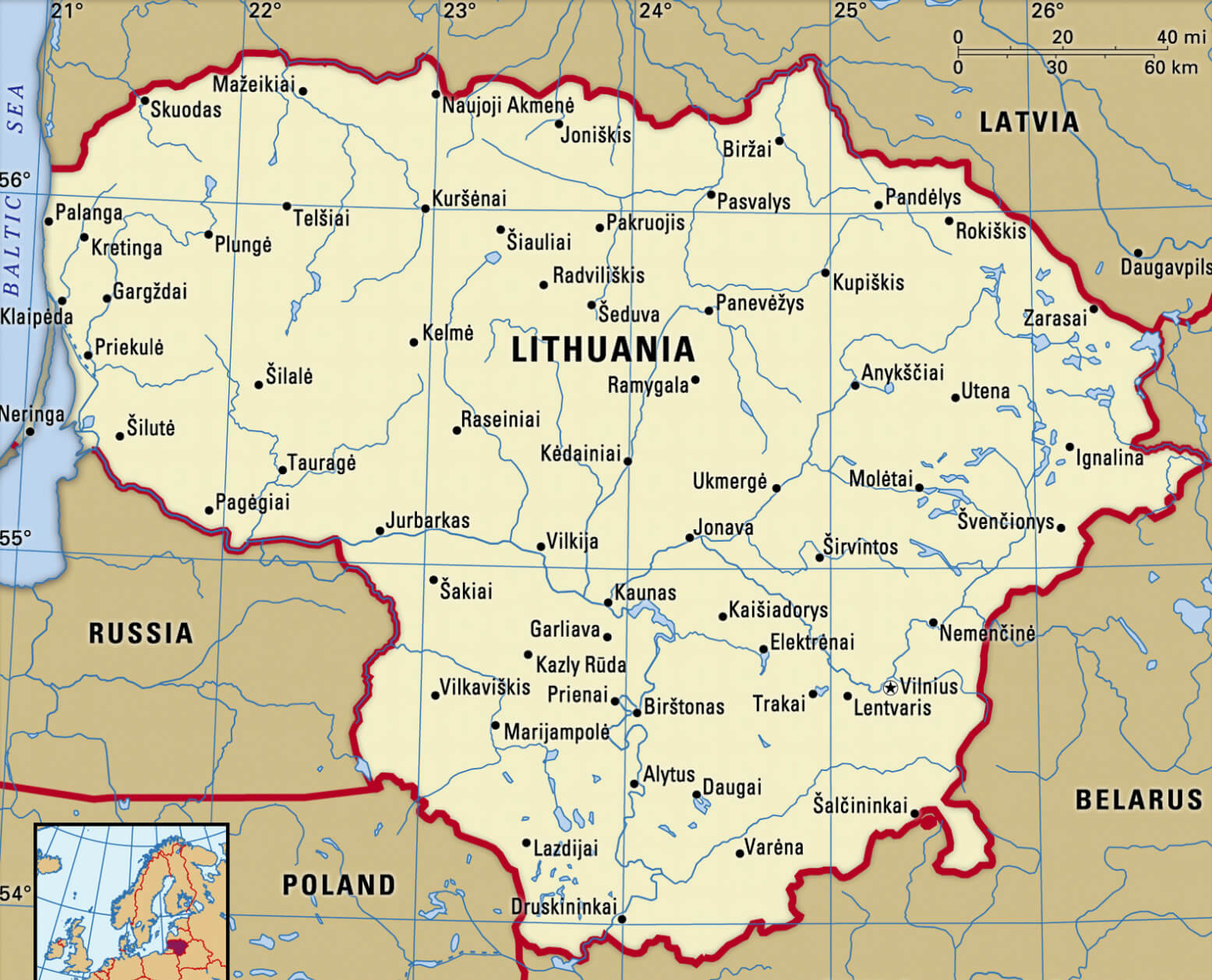
This map of Lithuania shows its regions, major cities like Vilnius and Kaunas, and borders with Latvia, Belarus, Poland, and Russia (Kaliningrad).
Lithuania Political Map
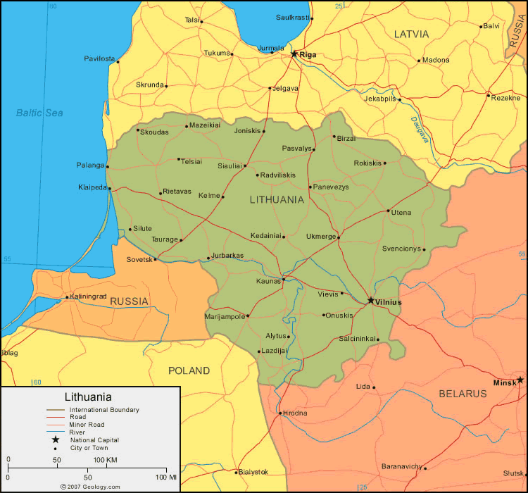
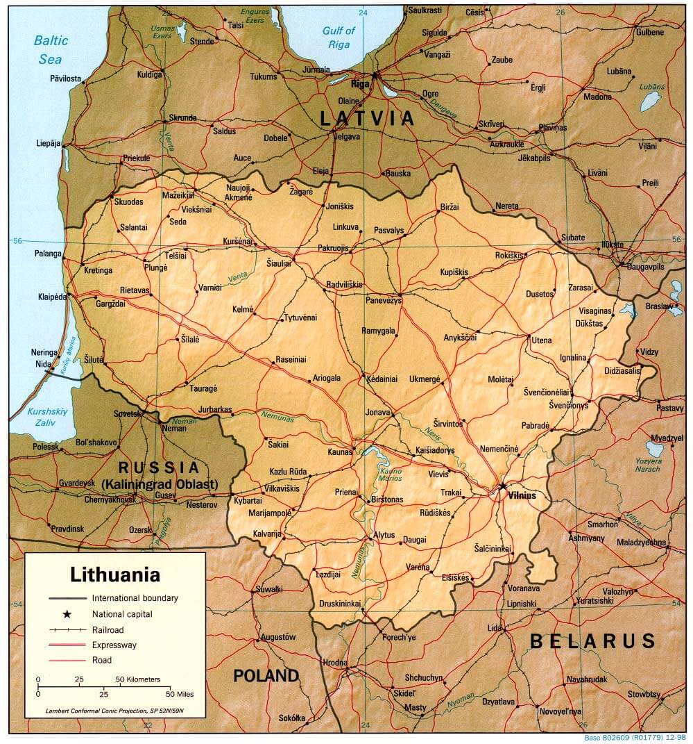
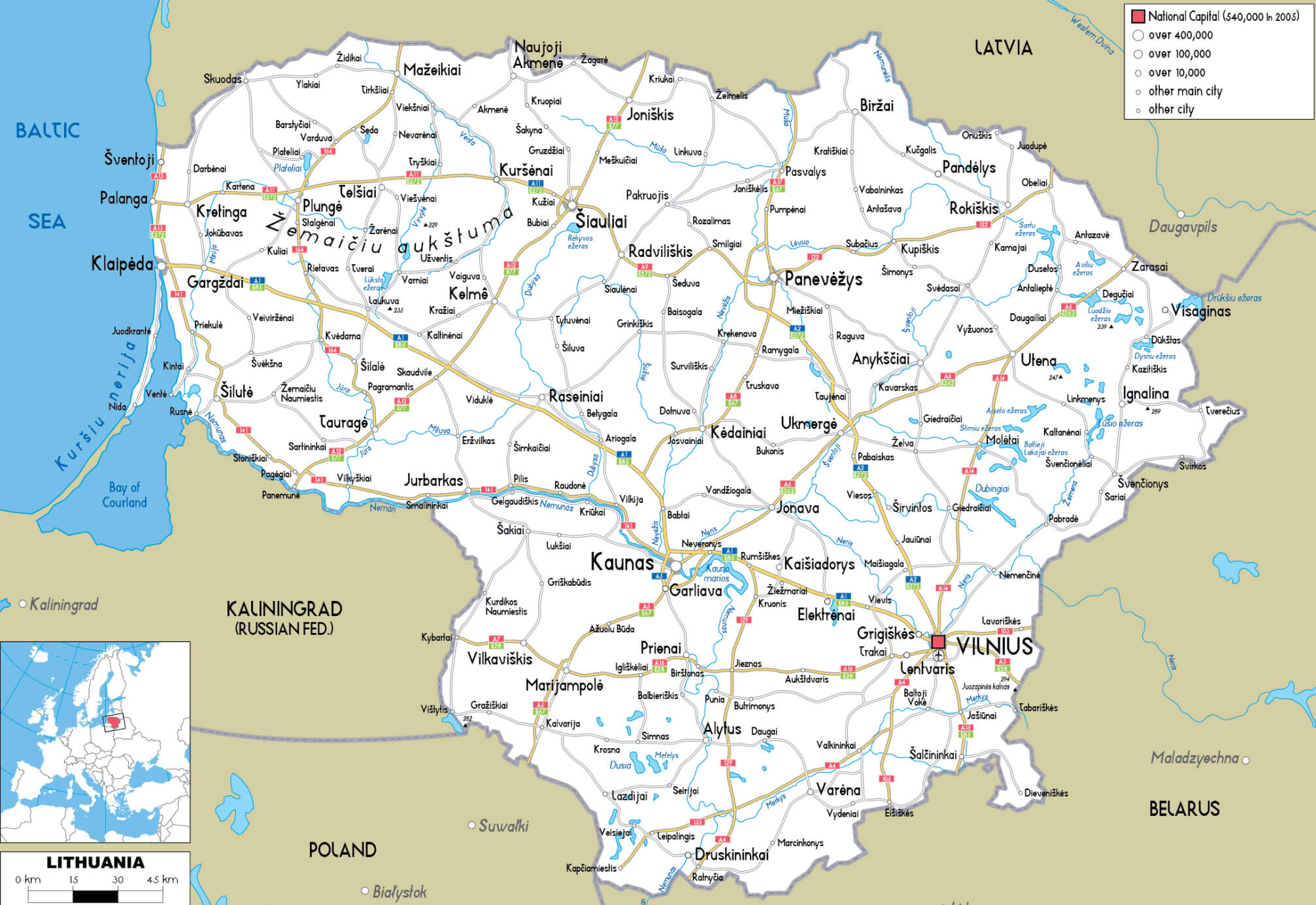
This political map of Lithuania highlights its major cities, including Vilnius and Kaunas, and shows its borders with Latvia, Belarus, Poland, and Russia’s Kaliningrad region. Key roads and rivers are also marked.
Lithuania Location Map
Lithuania Map
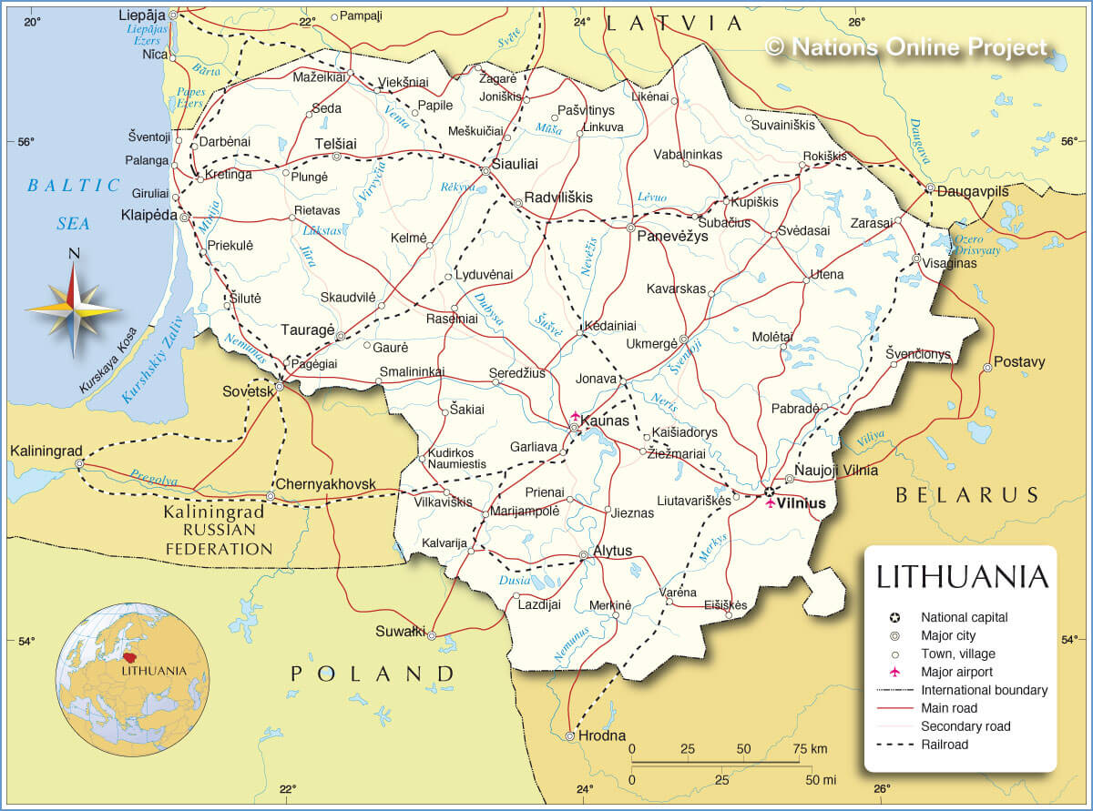
This map of Lithuania highlights the major cities, roads, and railways, with Vilnius as the national capital. It also shows Lithuania’s borders with Latvia, Belarus, Poland, and the Russian exclave of Kaliningrad, as well as its coastline along the Baltic Sea.
Lithuania Cities Map
Lithuania Highways Map with Cities
 This map of Lithuania’s highways illustrates the major roads that connect key cities such as Vilnius, Kaunas and Klaipėda, highlighting the country’s well-structured transport network. The map helps visualise how these highways facilitate travel across the country, making it easier to navigate between urban centres and access neighbouring countries such as Latvia, Poland and Belarus.
Lithuania Physical and Geomorphological Map
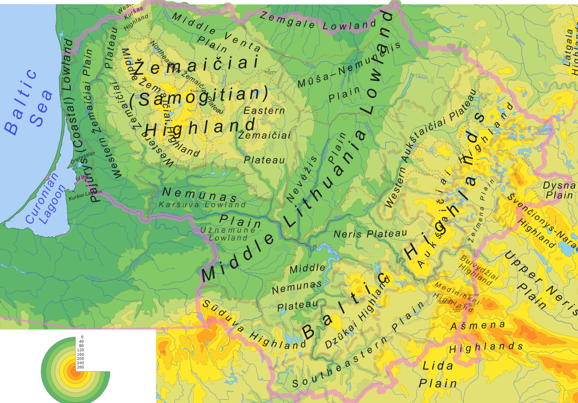 This map of Lithuania displays the country’s physical and geomorphological features, highlighting the distinct highlands and lowlands. Key regions like the Samogitian (Žemaičiai) Highland, Middle Lithuania Plain, and the Baltic Highlands are clearly marked, with elevation and landforms distinguished by color gradients. The coastal areas along the Baltic Sea, including the Curonian Lagoon, are also notable, showing Lithuania’s varied landscape ranging from plains to highlands.
Lithuania Blank Map
Lithuania Population Density Map by Municipality
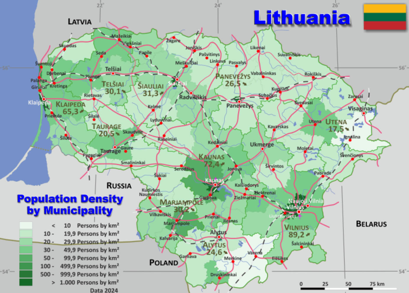 This map of Lithuania shows the population density by municipality, highlighting major cities such as Vilnius, Kaunas, and Klaipėda. The darker green areas represent higher population densities, with Vilnius and Kaunas standing out as the most densely populated regions.
Administrative Map of Lithuania
This administrative map of Lithuania shows the various administrative divisions of the country, also known as ‘rajonas’ or regions. The map highlights major international boundaries, including Lithuania’s borders with Latvia, Russia (Kaliningrad region), Poland and Belarus. In addition, the map highlights the regional and national capitals, with Vilnius marked as the national capital. Each region is numbered and listed in a key at the top, showing the specific areas governed by local administrations. This layout provides a clear and organised presentation of Lithuania’s administrative structure.
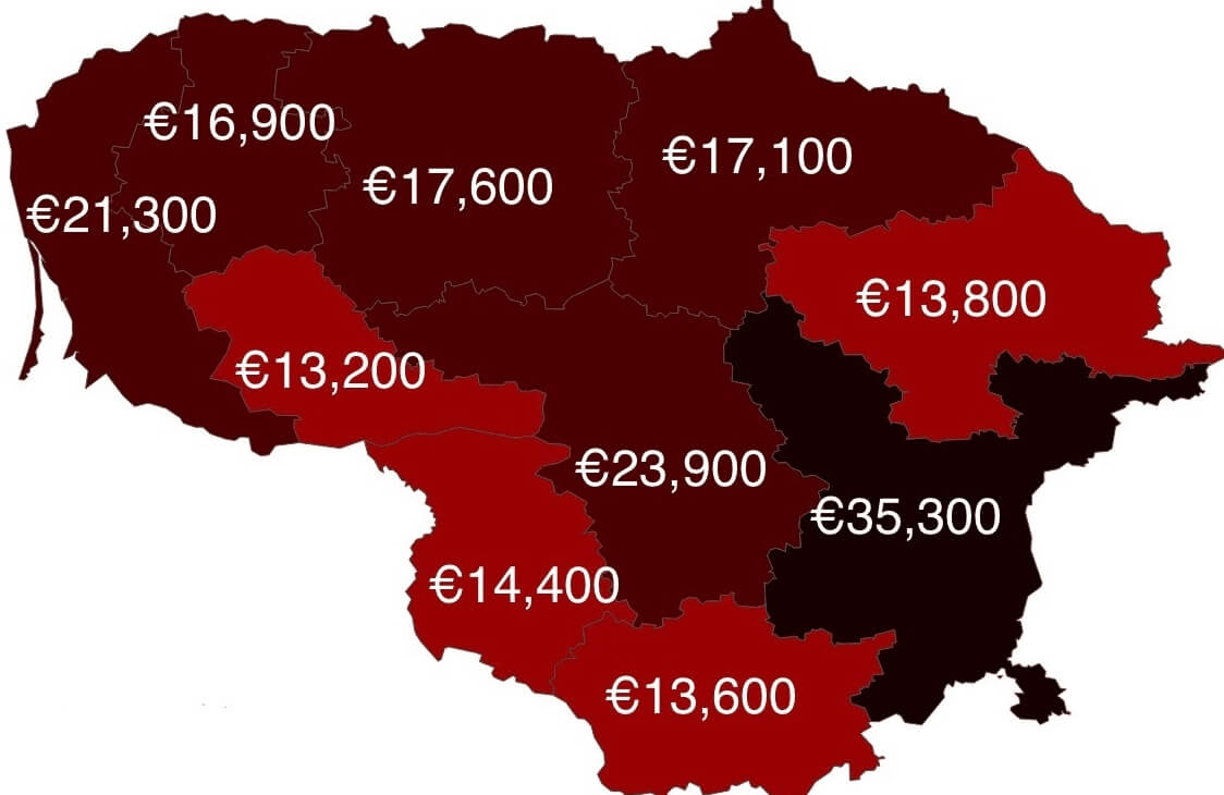
Lithuania Counties by GDP per Capita Map in 2022
Lithuania Population Density Map
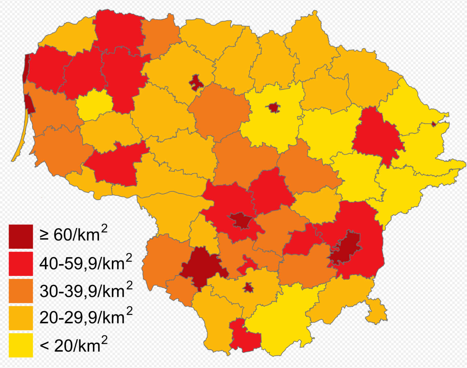 This map of Lithuania shows the population density in different regions of the country. The colour gradient ranges from deep red, indicating areas with a population density of 60 or more people per square kilometre, to yellow, representing regions with less than 20 people per square kilometre. The map provides a clear picture of where the population is most concentrated, particularly around urban areas such as Vilnius, Kaunas and Klaipeda, as well as sparsely populated rural regions.
Scandinavian and Baltic Countries Map with Lithuania
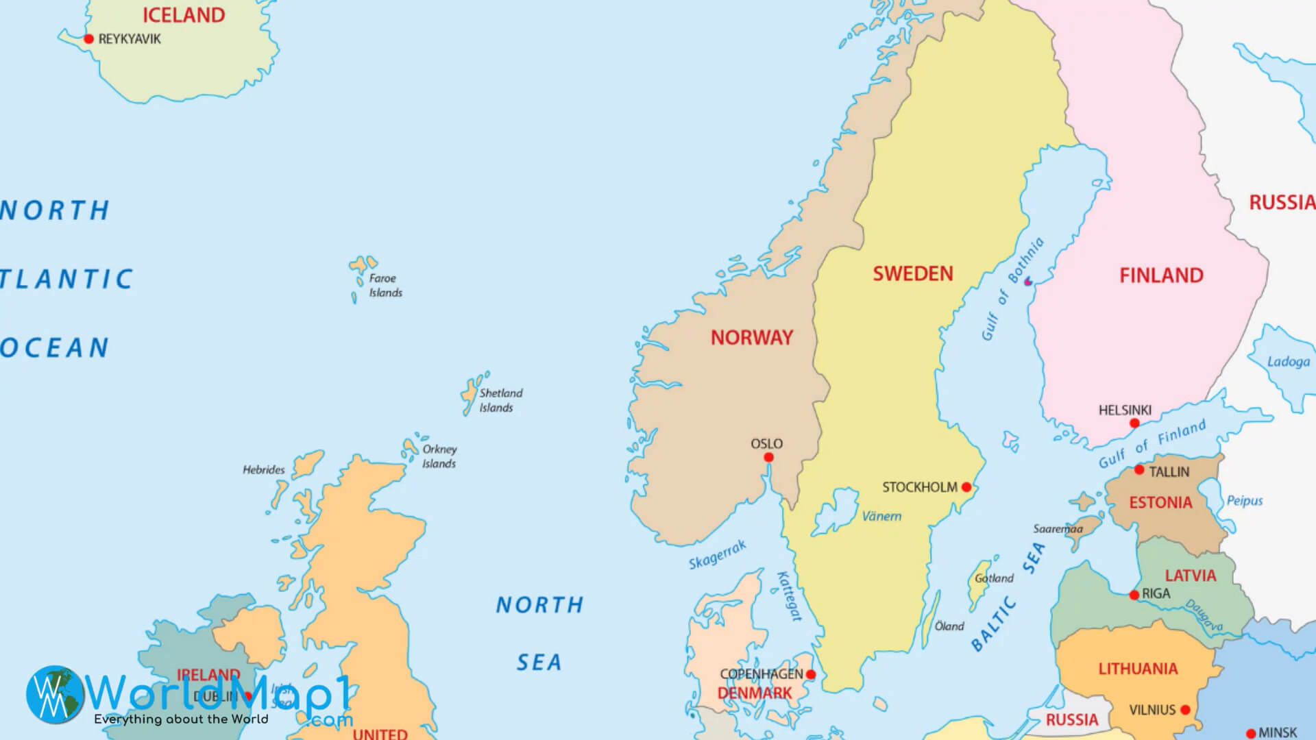
This map showcases the Scandinavian and Baltic countries, with Lithuania located at the southeastern coast of the Baltic Sea, bordered by Latvia, Belarus, Poland, and Russia. It also highlights nearby countries like Sweden, Finland, and Estonia across the Baltic Sea.
Map of Lithuania Europe
Map of Lithuania
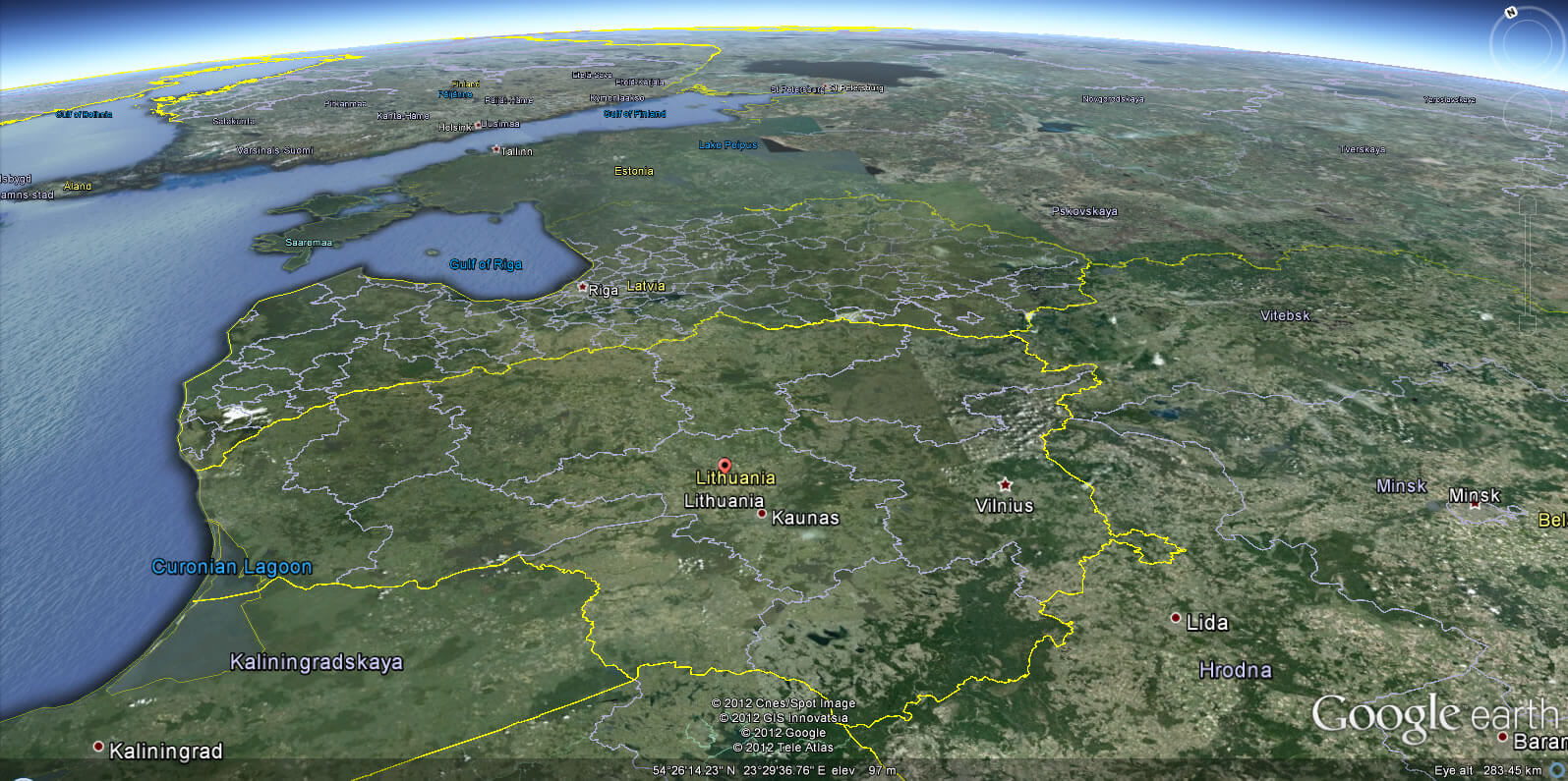
Lithuania Earth Map
Where is Lithuania on the Europe Map?
Show Google map, satellite map, where is the country located.
Get directions by driving, walking, bicycling, public transportation and travel with street view.
Feel free to explore these pages as well:
- Estonia Map ↗️
- Finland Map ↗️
- A Collection of Poland Maps ↗️
- A Collection of Germany Maps ↗️
- Norway Map ↗️
- Sweden Map ↗️
- EuropeMap ↗️
- United Kingdom Map ↗️
- A Collection of Europe Maps ↗️
- Europe Top 10 Tourist Arrivals Countries by 2017 ↗️