Canada Political Map

HomeMapsCanada Political Map
- Advertisement -

Canada is a vast and diverse country, and its maps provide a unique perspective on its geography, politics, and place in the world. The political map highlights its provinces and territories, including Quebec, Ontario and the northern territories of Yukon, Nunavut and the Northwest Territories.

Canada Political Map
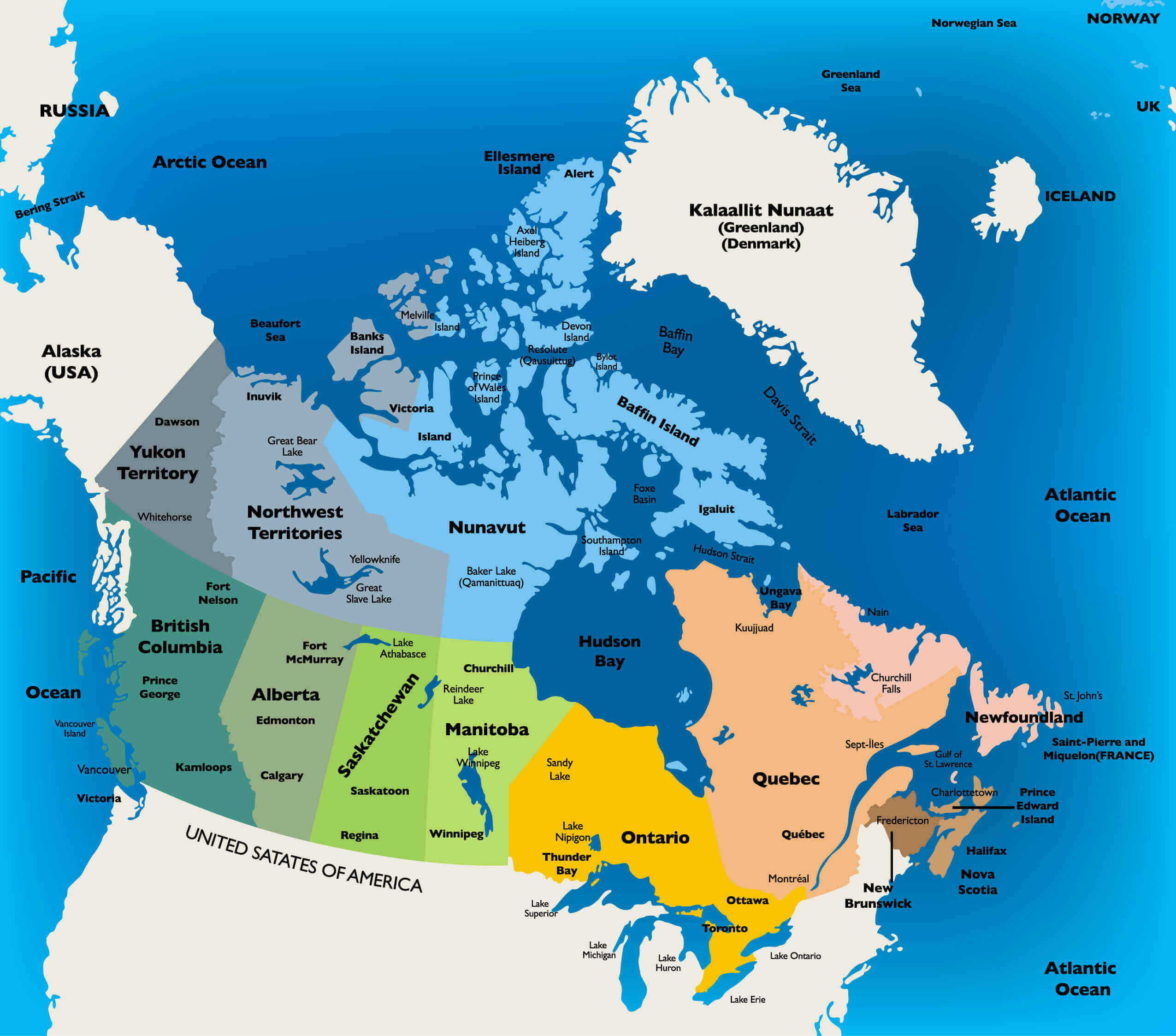
Canada Political Map displays provinces, territories, and surrounding oceans
Political map of Canada showing provinces, territories, and surrounding oceans.

This map shows Canada’s political divisions, including provinces such as Quebec and Alberta, territories such as Nunavut, and major cities such as Toronto and Vancouver. It also shows Canada’s geographical location, bordered by oceans and neighbouring the USA, Greenland and the Arctic regions.

Canada Administrative Map

Canada administrative map shows provinces, territories, and major cities
Administrative map of Canada showing provinces, territories, and major cities.

This map illustrates Canada’s provinces and territories, including major cities like Toronto, Vancouver, and Montreal, as well as vast northern regions such as Nunavut. It highlights political boundaries, administrative divisions, and key urban centers.

Canada’s Location on the World Map

Canada's Location on the World Map
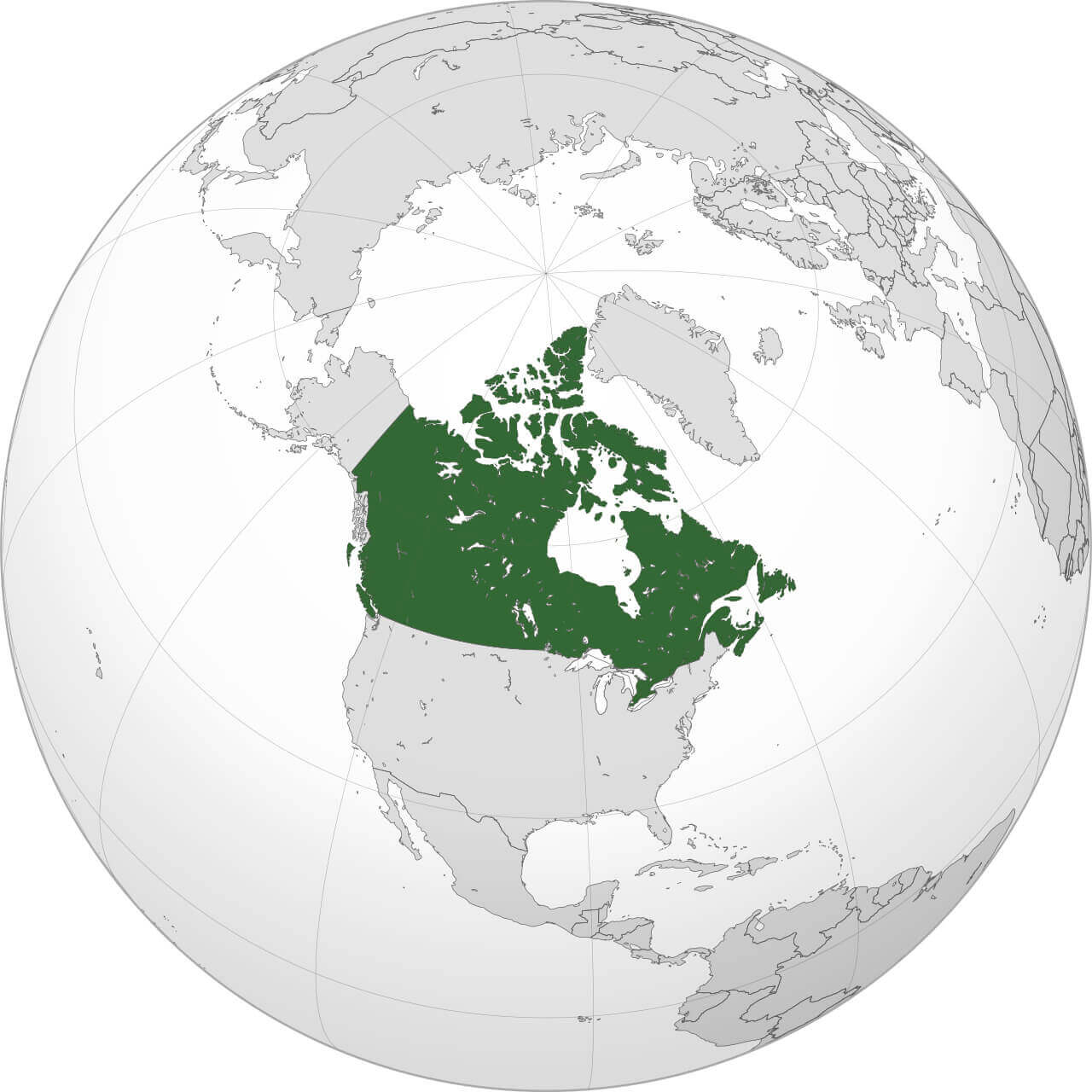
World map showing Canada highlighted in green.

This map shows Canada’s position on the globe, occupying the northern part of North America. Highlighted in green, it shows Canada’s vast landmass stretching from the Atlantic to the Pacific and up to the Arctic, emphasising its position as the world’s second largest country.

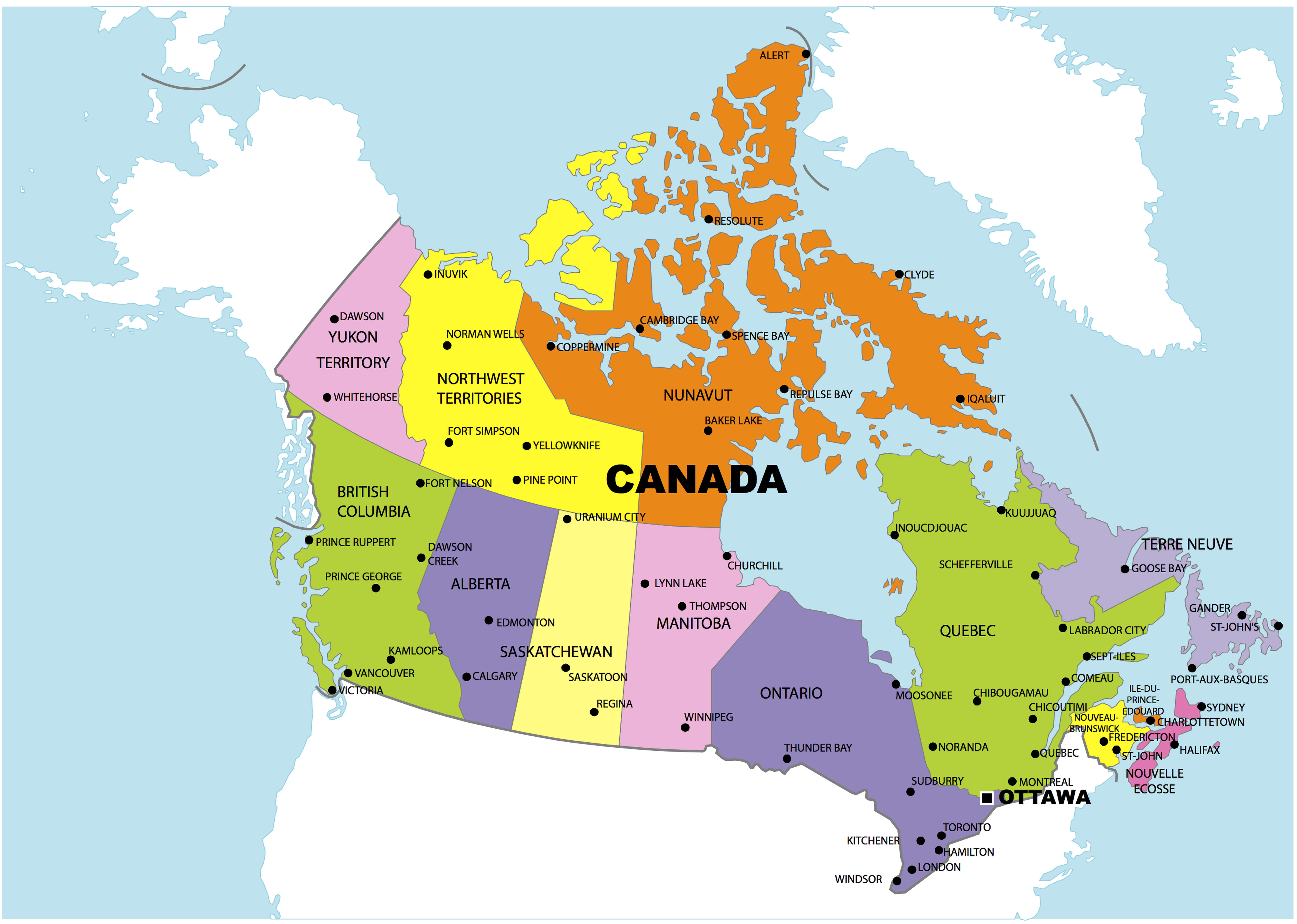
Canada administrative map with territories
Canada administrative map with territories

The map of the territory shows its vast landmass, bordered by the United States to the south and the Arctic Ocean to the north. When viewed alongside the North America map, Canada shares a prominent position with its neighbour, the USA, emphasising its continental connections. A colourful map of Canada brings cities and regions to life, from Vancouver to Halifax, while administrative maps focus on political divisions and governance.


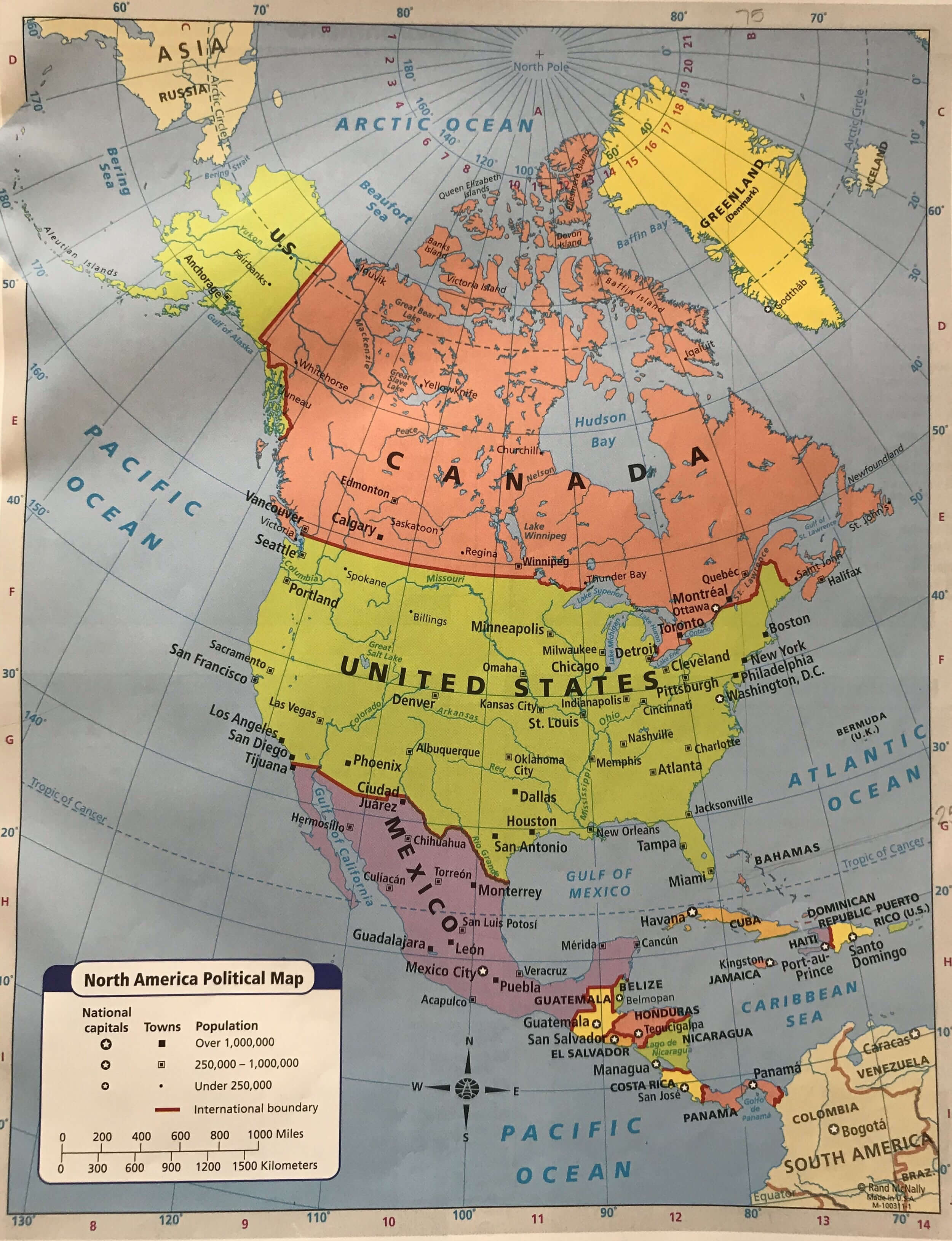
North America and Canada Political Map
North America and Canada Political Map
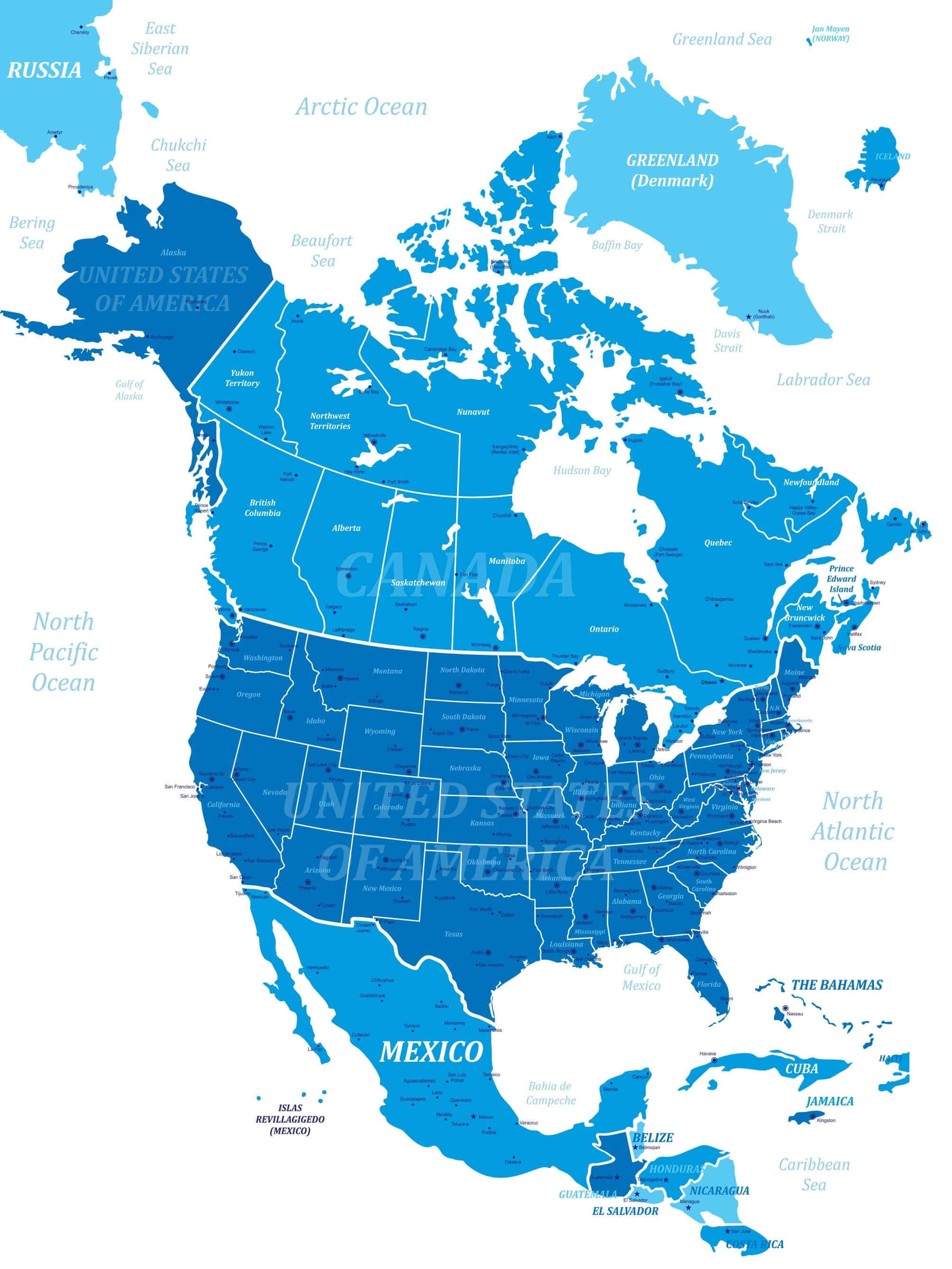
Political map of North America showing Canada, the U.S., and Mexico.

This map depicts the political boundaries of North America, highlighting Canada’s provinces and territories, the United States’ states, and Mexico’s regions. It also marks major cities like Toronto, Washington D.C., and Mexico City, offering a comprehensive view of the continent’s political geography.

Canada and US map with North America

Canada and US map with North America

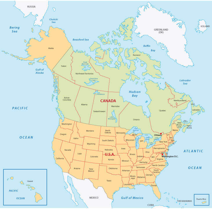
Canada and U.S. Map with Provinces and States
Canada and U.S. Map with Provinces and States
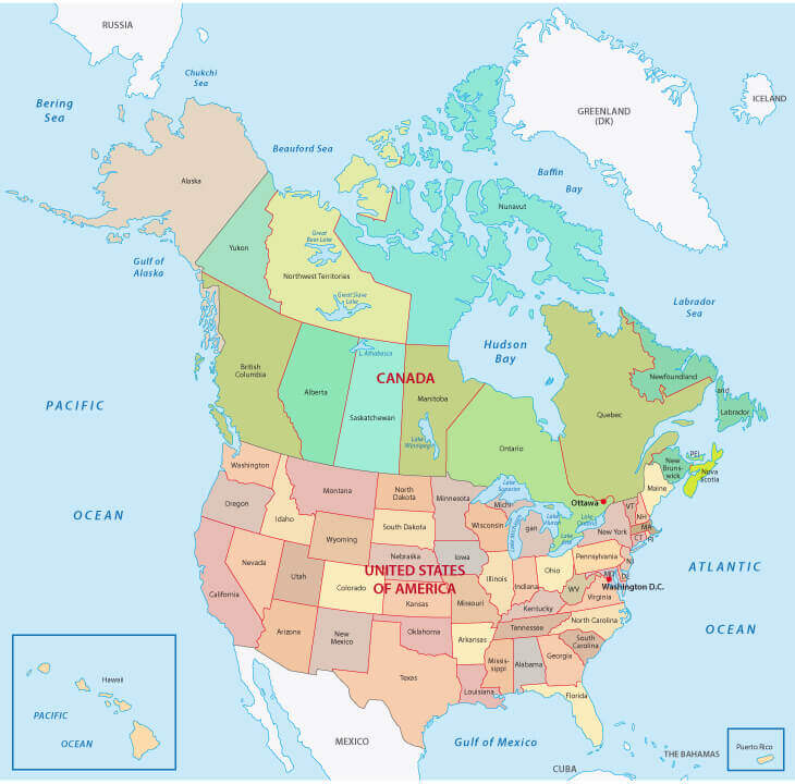
Map showing Canada’s provinces, territories, and U.S. states with boundaries.

This map highlights the provinces and territories of Canada and the United States, showing their geographical and political boundaries. It offers a clear view of key regions such as Alberta and Texas, major bodies of water such as Hudson Bay, and the close connections between these neighbouring countries.

Canada map with provinces and Canada’s flag
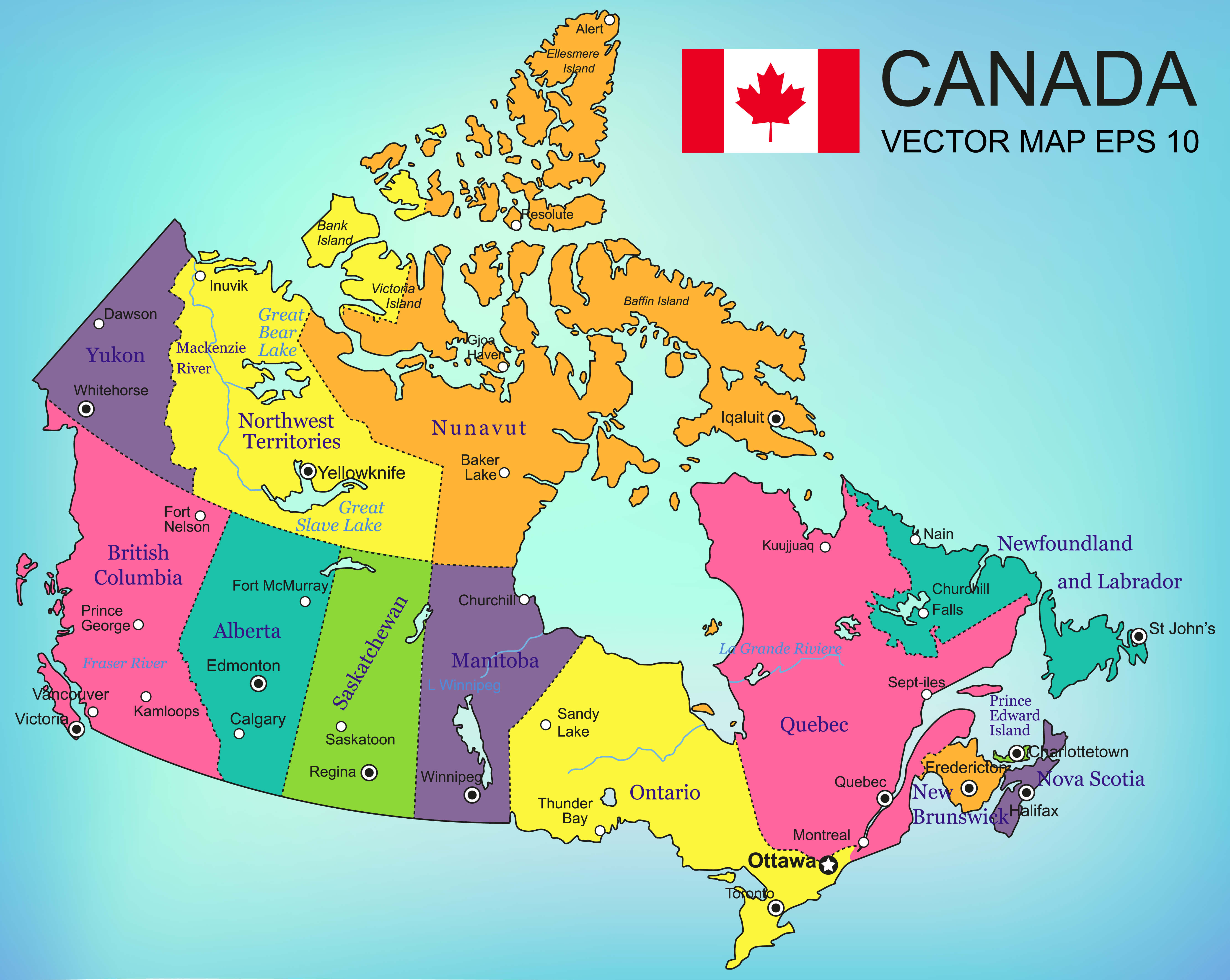
Canada map with provinces and Canada's flag

The geographical map reveals stunning natural features such as the Rocky Mountains, the Great Lakes and endless forests. Finally, Canada’s position on the world map reminds us of its strategic location in the northern hemisphere, balancing its proximity to global powers with its rich, unspoiled wilderness.

Canada’s Political Map with Cities
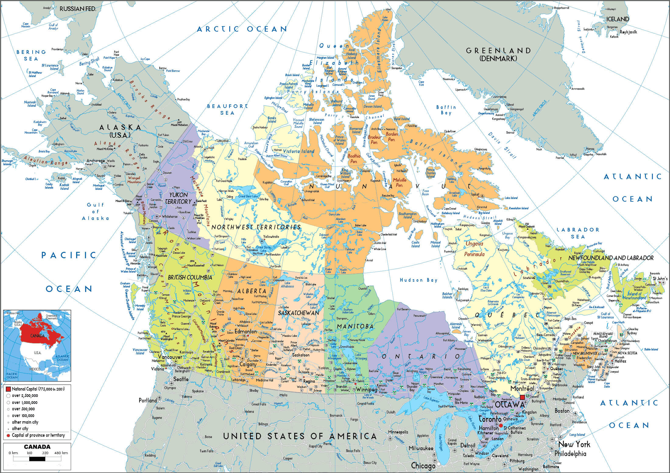
Canada's Political Map with Cities
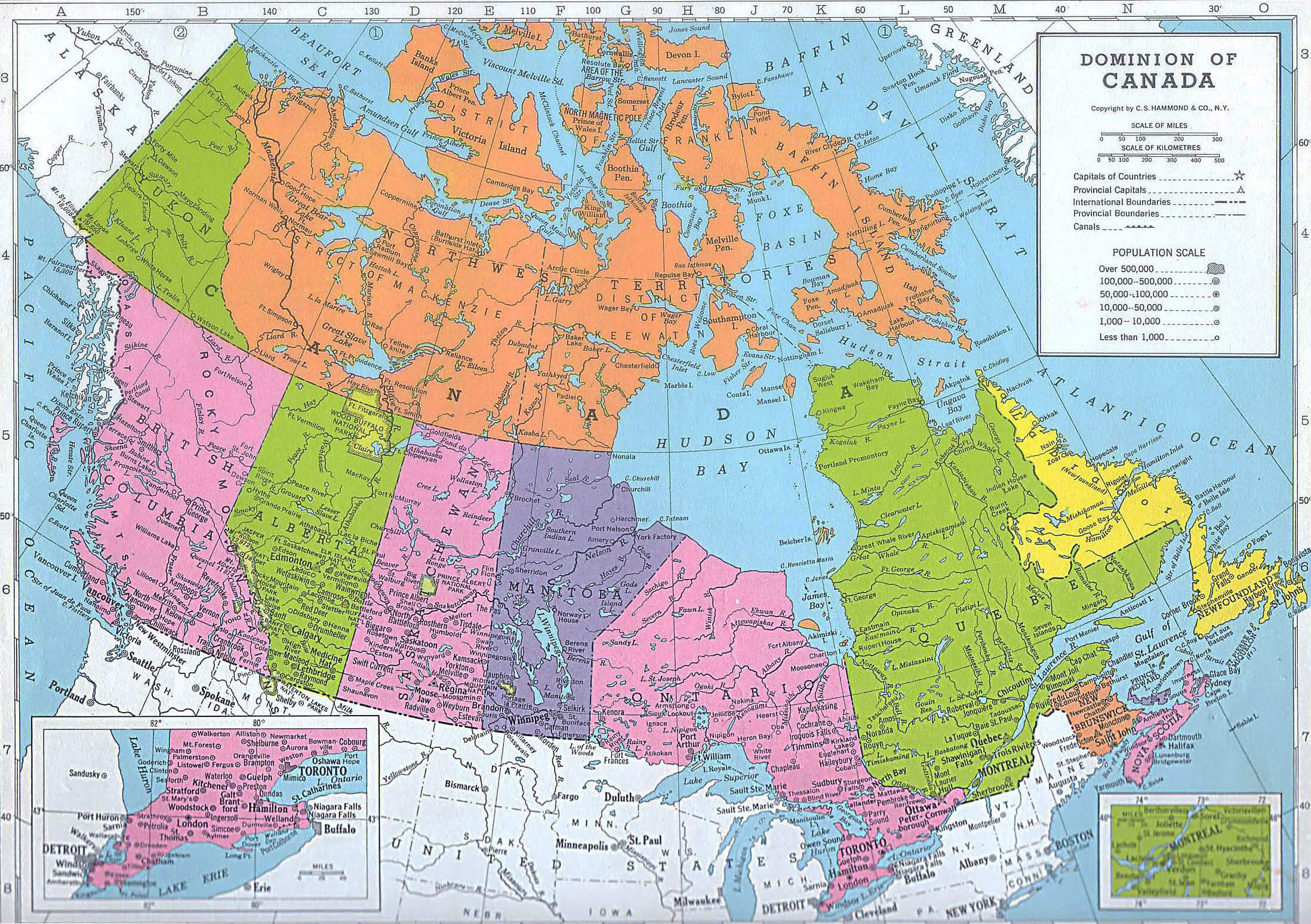
Political map of Canada showing provinces, territories, and major cities.

This detailed map of Canada shows provinces, territories and major cities such as Toronto, Vancouver and Ottawa. It highlights political boundaries and urban centres, and shows connections between regions and their geographical features, bordered by oceans, the USA and Greenland.

Canada’s Political Map with Mountains
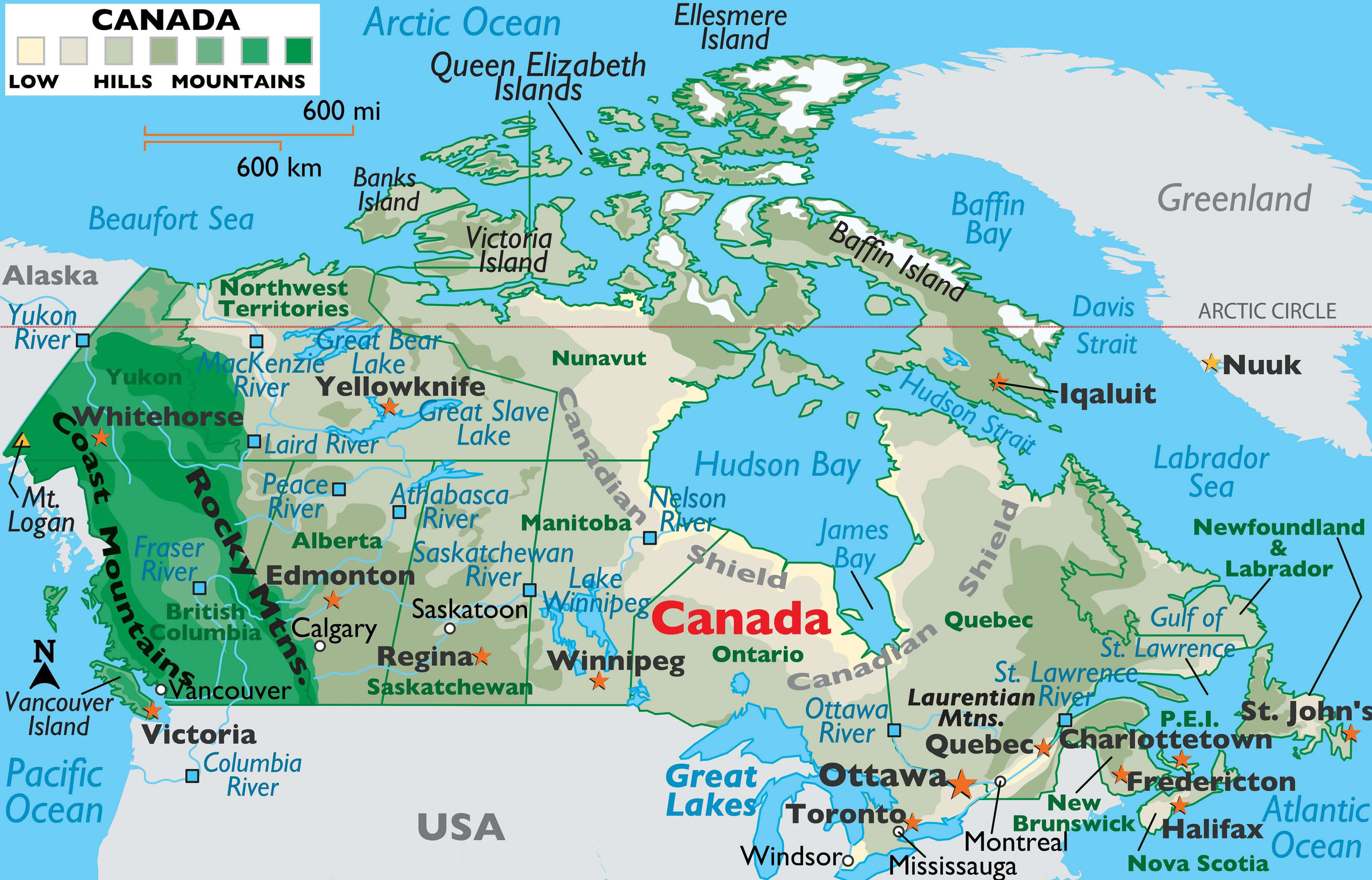
Canada's Political Map with Mountains highlights provinces, major cities, and mountain ranges
Political map of Canada showing provinces, major cities, and mountain ranges.

This map combines Canada’s political boundaries with key geographic features, highlighting major cities such as Toronto and Vancouver alongside mountain ranges such as the Rockies and Coast Mountains. It shows the interaction between Canada’s natural landscapes and its urban and administrative regions.

Canada provinces and territories map
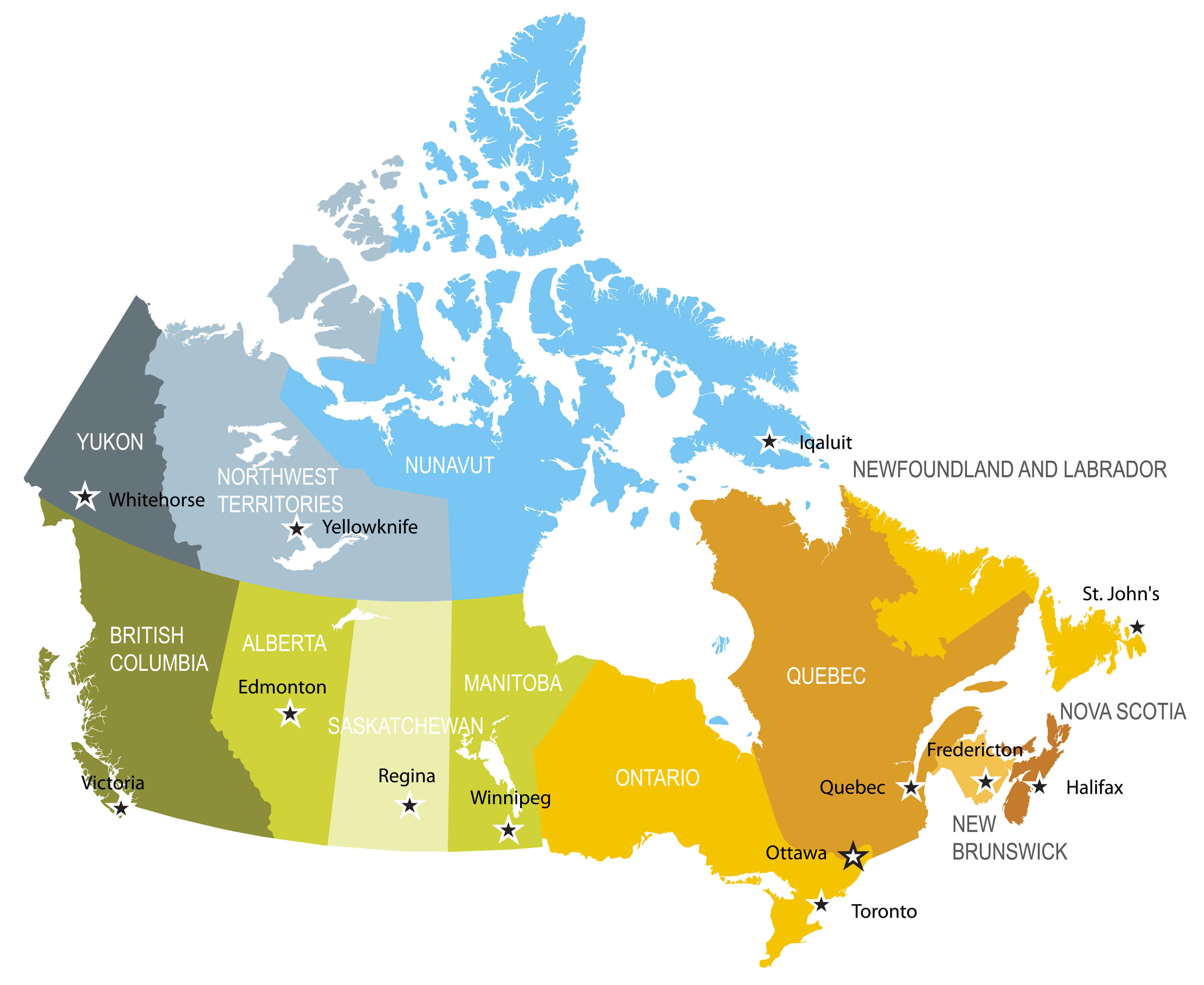
Canada provinces and territories map

Canada’s Provincial and Territorial Map
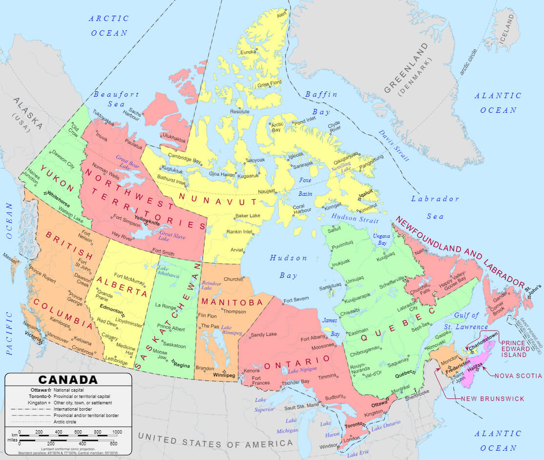
Canada's Provincial and Territorial Map
Map of Canada showing provinces, territories, and their capitals.

This map shows Canada’s provinces and territories, including Ontario, Quebec and Yukon, and their capital cities, such as Toronto, Quebec City and Whitehorse. It highlights international borders, major waterways and geographic features, providing a comprehensive overview of Canada’s administrative divisions.

Canada states map

Canada states map

Canada states map and blank Canada map
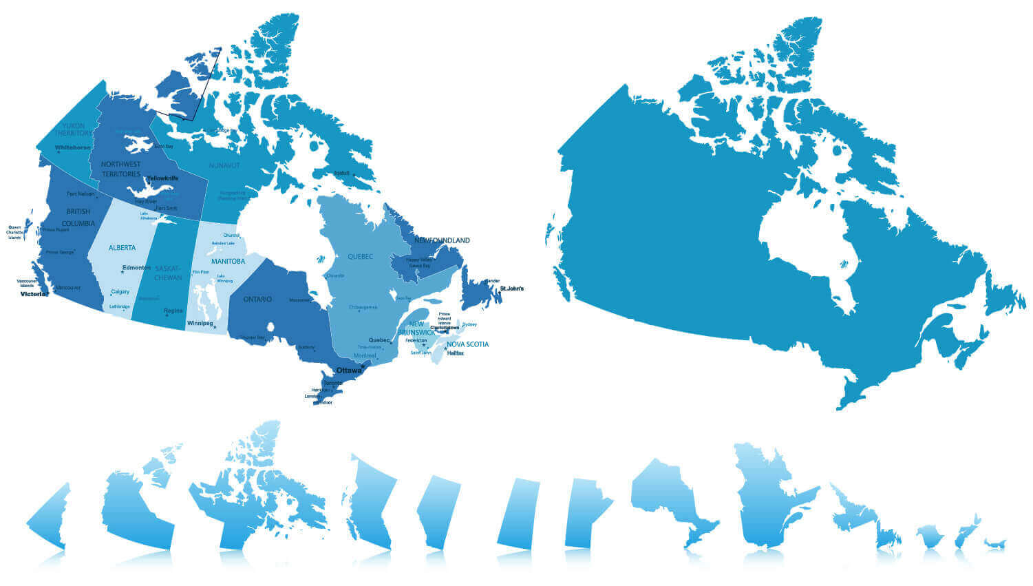
Canada states map and blank Canada map

Canada territories blank map
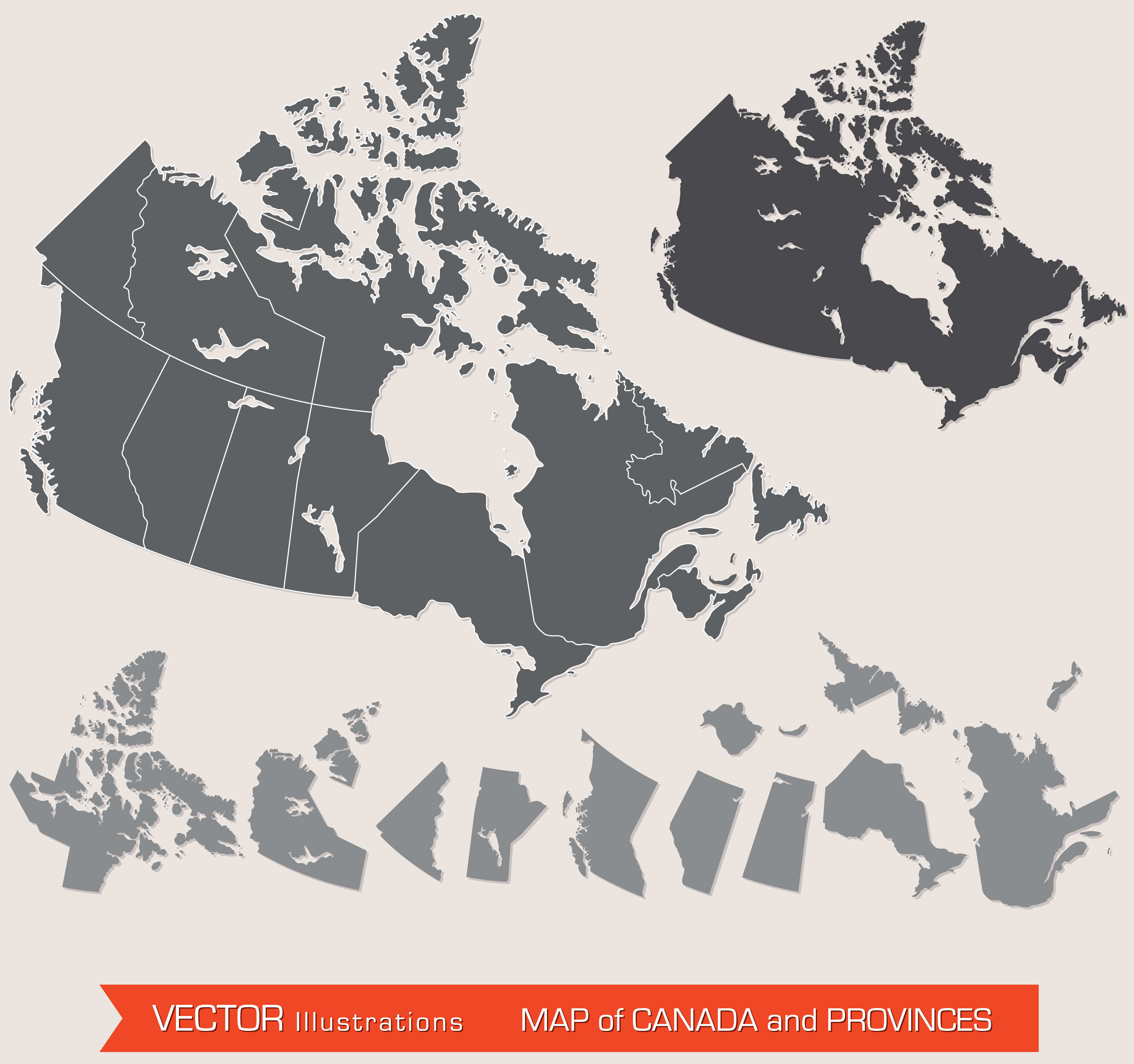
Canada territories blank map

Canada’s Map of Provinces and Territories
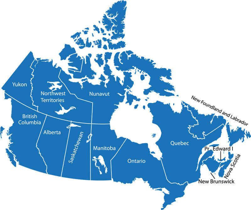
Canada’s Map of Provinces and Territories
Map of Canada showing provinces and territories with labeled boundaries.

This simplified map outlines Canada’s provinces and territories, including Nunavut, Yukon, and Ontario, with clear borders and labels. It provides a straightforward overview of the country’s political divisions, offering an easy reference for understanding Canada’s vast geographic layout.

Canada and United States blank map with North America
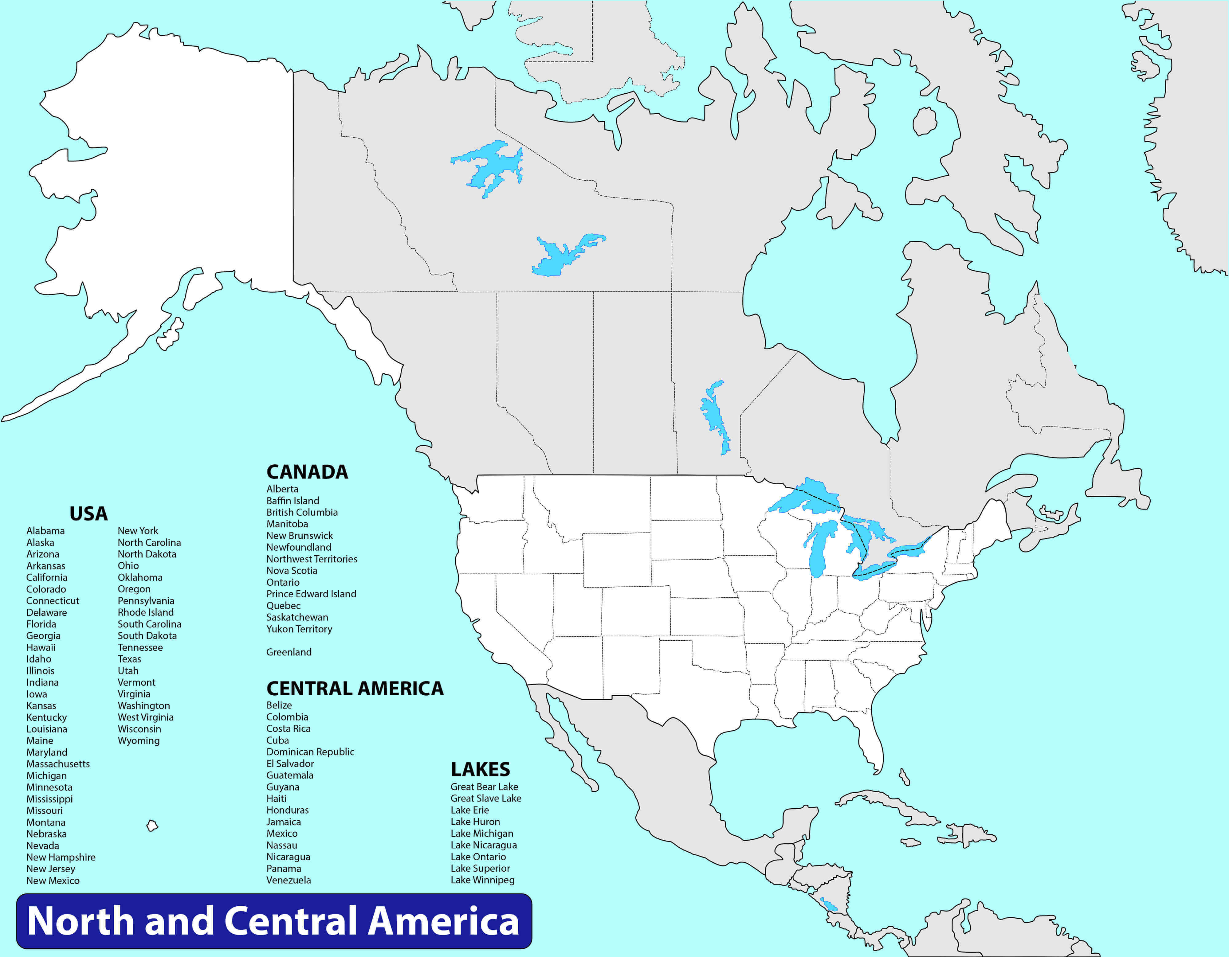
Canada and United States blank map with North America

Colorful Canada Map
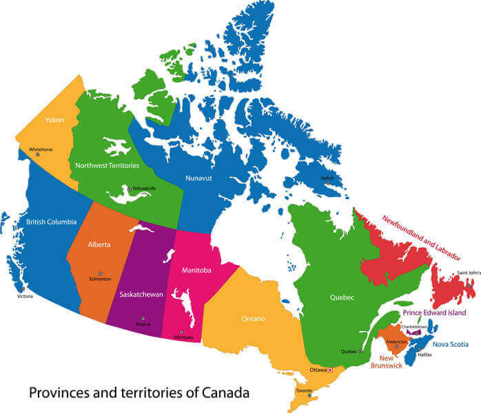
Colorful Canada Map

Countries free trade agreements map with Canada
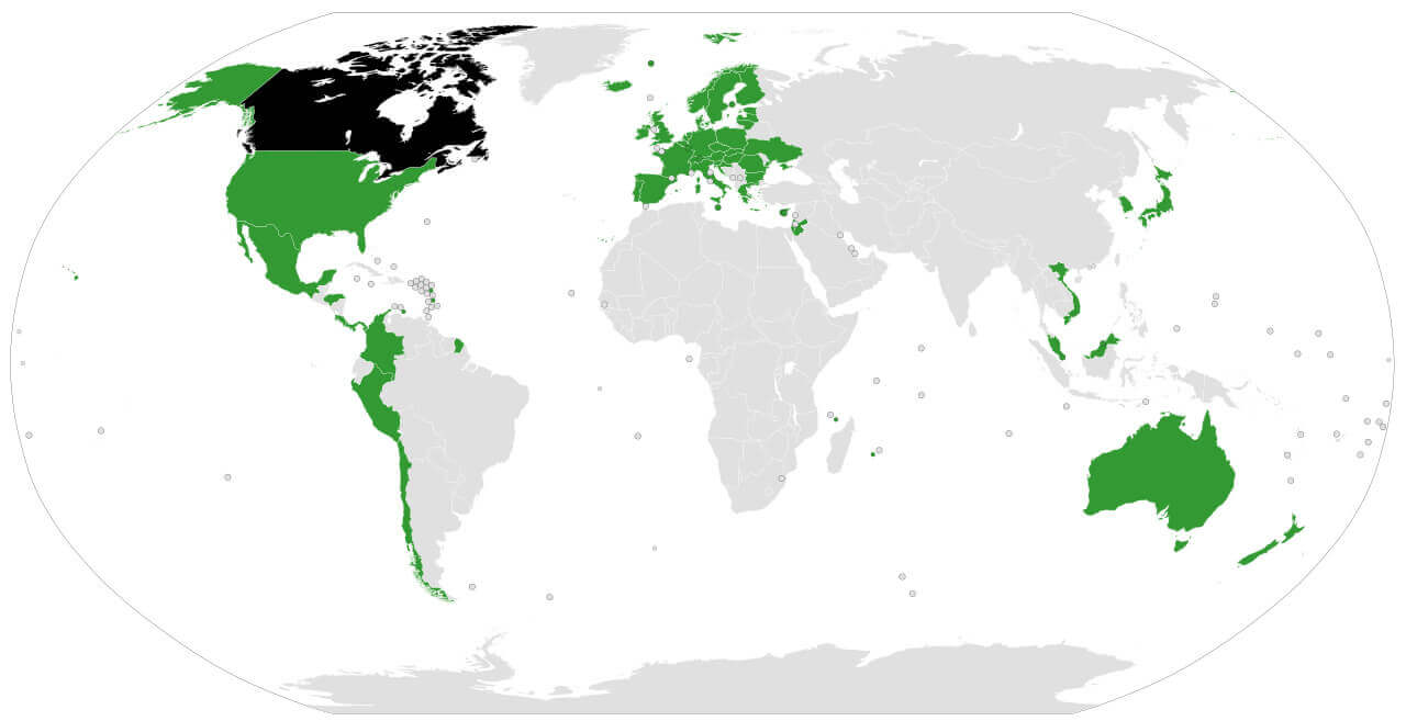
Countries free trade agreements map with Canada

European Colonization Map with Canada Territories in 1750
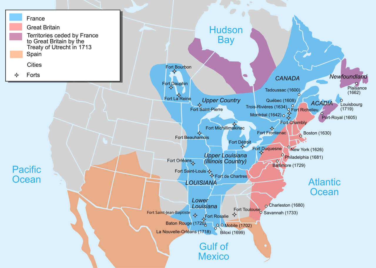
European Colonization Map with Canada Territories in 1750
Map of European colonization in 1750 showing Canada territories and forts.

This map illustrates European colonisation in North America around 1750, highlighting territories controlled by France, Britain and Spain, including Canada. It marks key cities, forts, and regions such as Acadia, Upper Louisiana, and Lower Louisiana, reflecting the geopolitical dynamics of the time.

North America map with Canada

North America map with Canada

Provinces and Territories of Canada Map
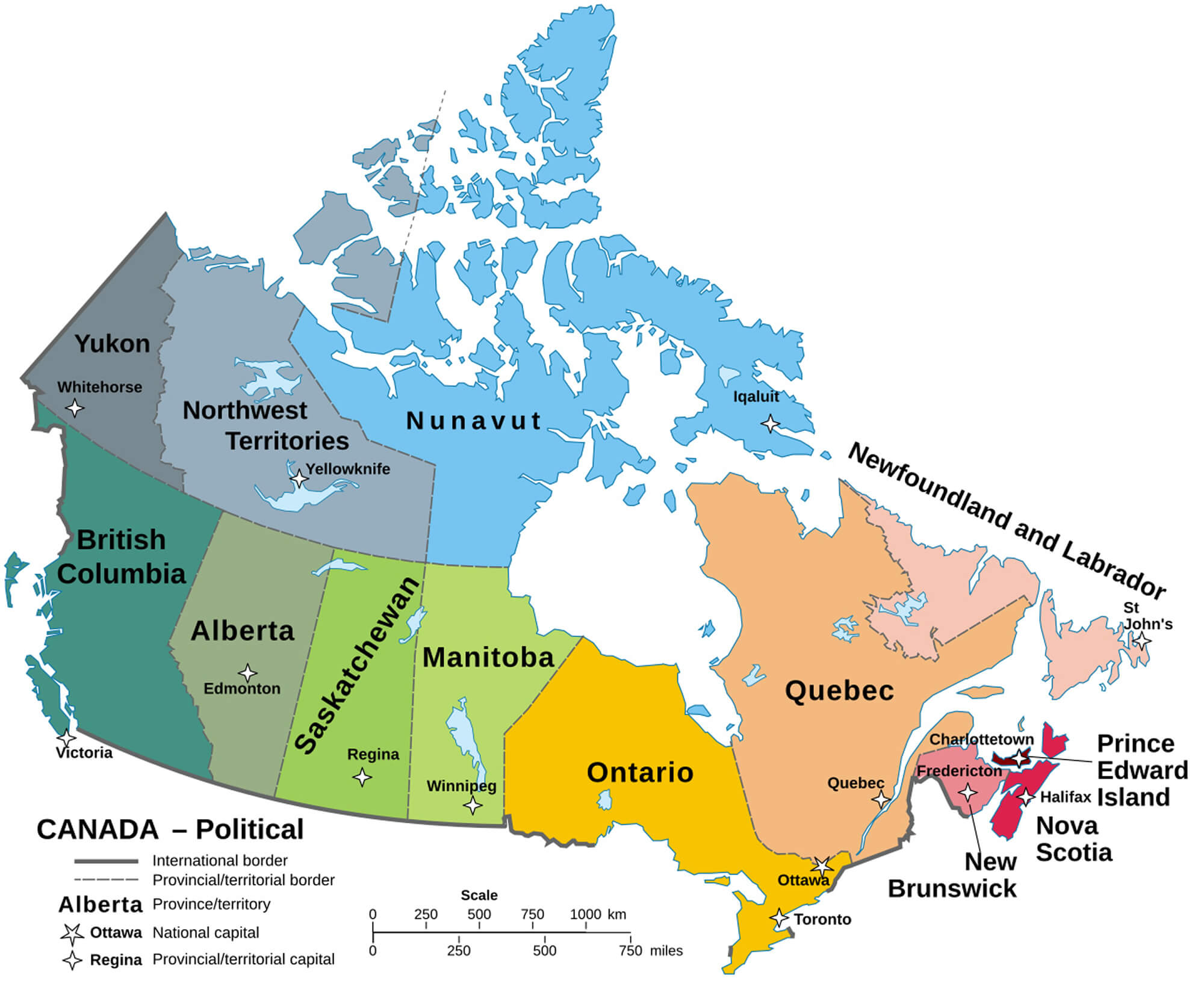
Map of Canada shows provinces, territories, and their capitals.
Map of Canada showing provinces, territories, and their capitals.

This map highlights Canada’s provinces and territories, such as British Columbia, Quebec, and Nunavut, with their capitals like Victoria, Quebec City, and Iqaluit. It also marks Ottawa, the national capital, and displays international and provincial borders for a detailed political overview.

Vintage map of Canada with Canada flag
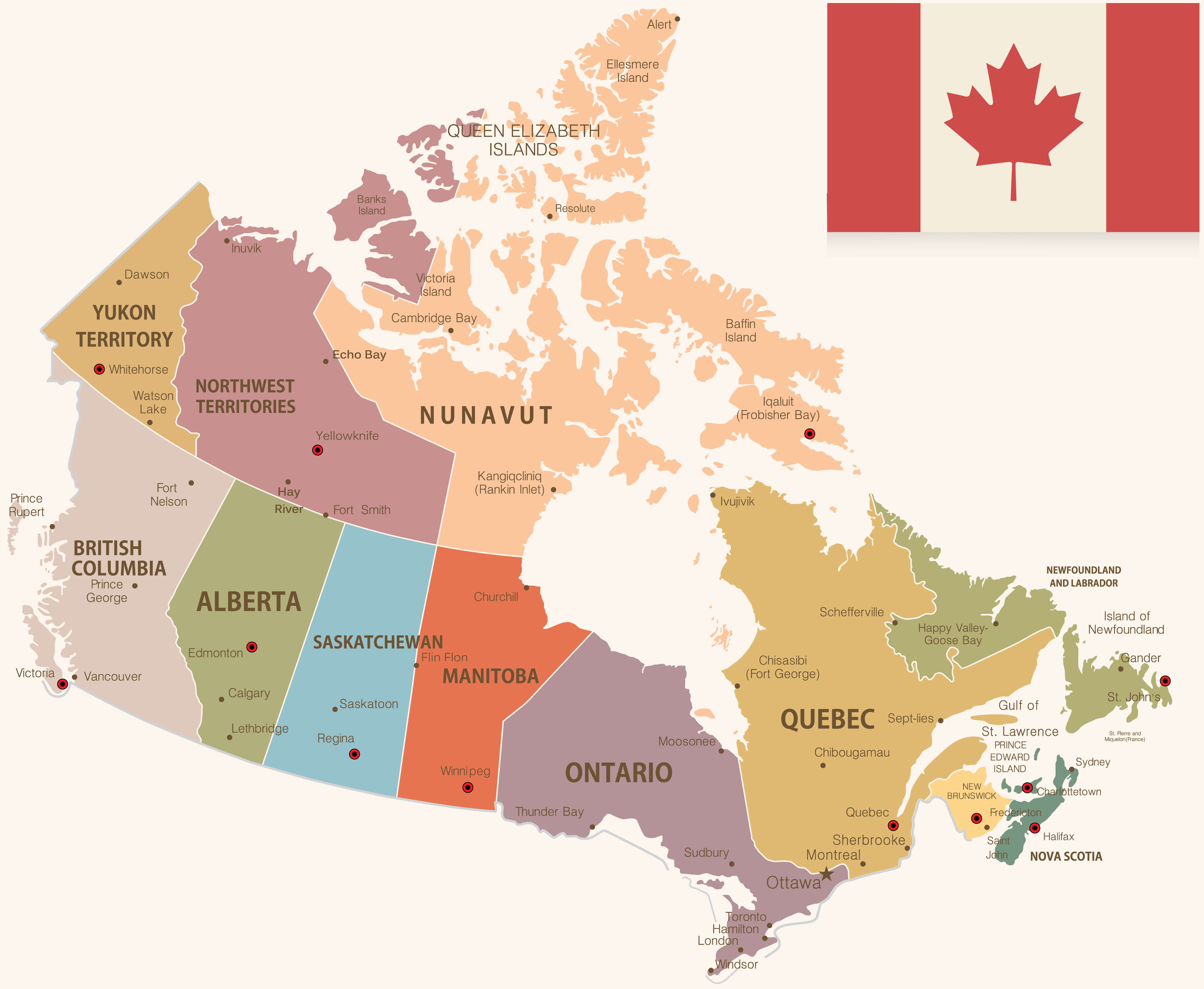
vintage map of Canada with Canada flag

Canadian embassies map with diplomatic missions
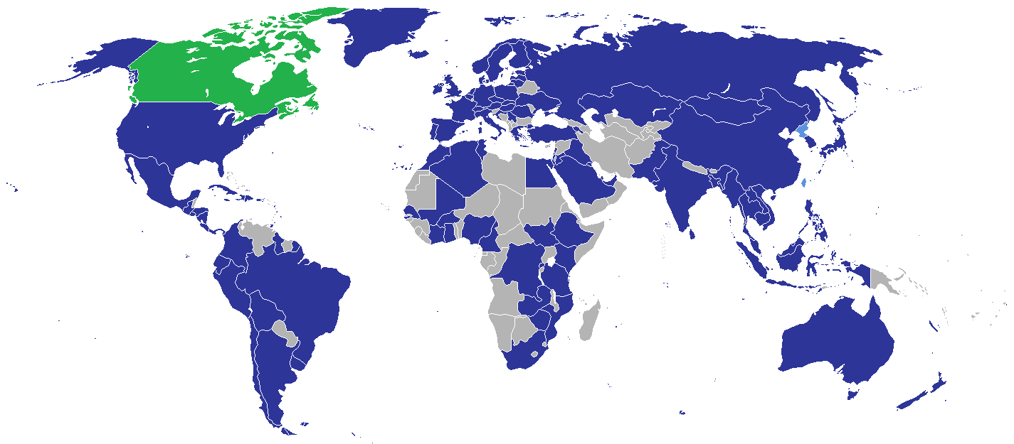
canadian embassies map with diplomatic missions

Where is Canada on North America Map?

Show Google interactive map, satellite map, where is the country located.

Get direction by driving, walking, bicycling, public transportation and travel with street view.

Feel free to explore these pages as well:

- Advertisement -

Discover

Sponsor

Latest Posts

Top 15 Places to See in Istanbul, Turkey – Ancient City Constantinople

https://youtu.be/0fFSyfSm7rA Best place to see in Istanbul, Turkey - Ancient Roman Empre City of Constantinople.   1. Hippodrome - Sultanahmet Meydanı The Hippodrome of Constantinople was a Byzantine...

Alaska Map

A collection of Alaska Maps; View a variety of Alaska physical, political, administrative, relief map, Alaska satellite image, higly detalied maps, blank map, Alaska...

Missouri Photos

A Collection of Missouri Photos St. Louis, Missouri St. Louis, Missouri - Keiner Plaza and the Gateway Arch in St. Louis, Missouri. University of Missouri Columns in front...

Cuba Map

A collection of Cuba Maps; View a variety of Cuba physical, political, administrative, relief map, Cuba satellite image, higly detalied maps, blank map, Cuba...

World Political Map English

Find World Political Map English, World Mega Cities Map, World Nuclear Map, World per Capita Income Map, World Precipitation Map, World Religions Map and...