Explore detailed maps of Uzbekistan including physical, political, road, and terrain maps. Discover major cities, regions, country borders, population data, and blank maps for educational use. See Uzbekistan’s geographical location in Asia and view its satellite imagery.
Uzbekistan Geography Map
 Map of Uzbekistan showing administrative regions, borders, and key features.
This map provides a detailed view of Uzbekistan’s geography, highlighting its administrative divisions, including Tashkent, Samarkand, and Karakalpakstan. It also marks international borders, major roads, railways, and natural features like the Aral Sea.
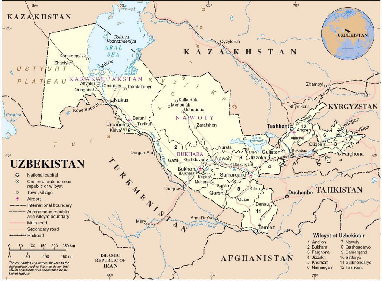
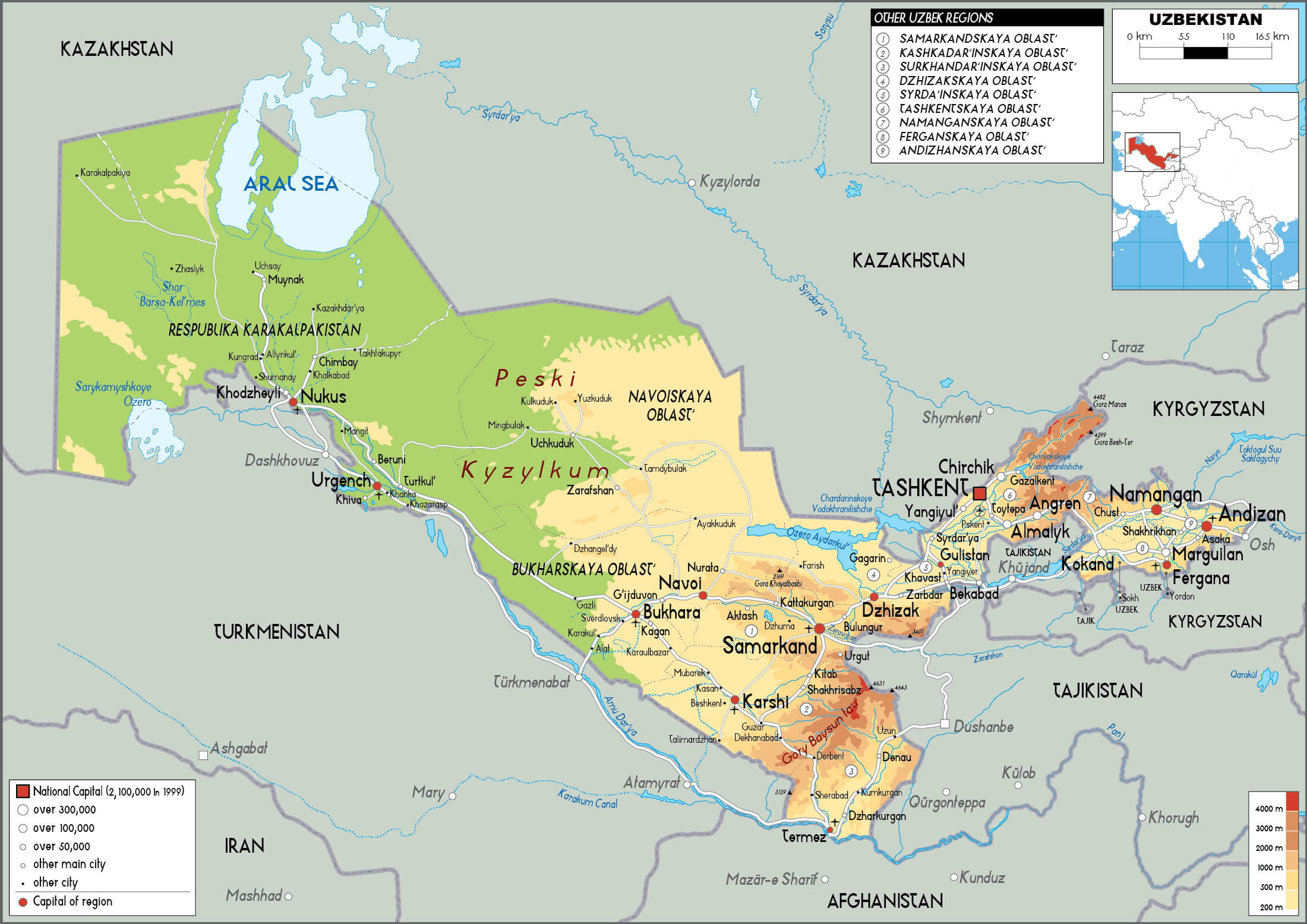
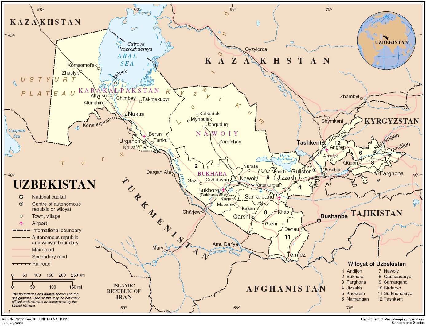
Political Map of Uzbekistan with Provinces, Capitals, and Neighboring Countries
 Political map of Uzbekistan with provinces, regional capitals and national borders.
This political map of Uzbekistan shows all provincial divisions in different colours, including Karakalpakstan and major regions such as Samarkand, Tashkent and Andijan. It highlights regional capitals, major cities and shows international borders with Kazakhstan, Kyrgyzstan, Tajikistan, Turkmenistan and Afghanistan.
Brief information about Uzbekistan
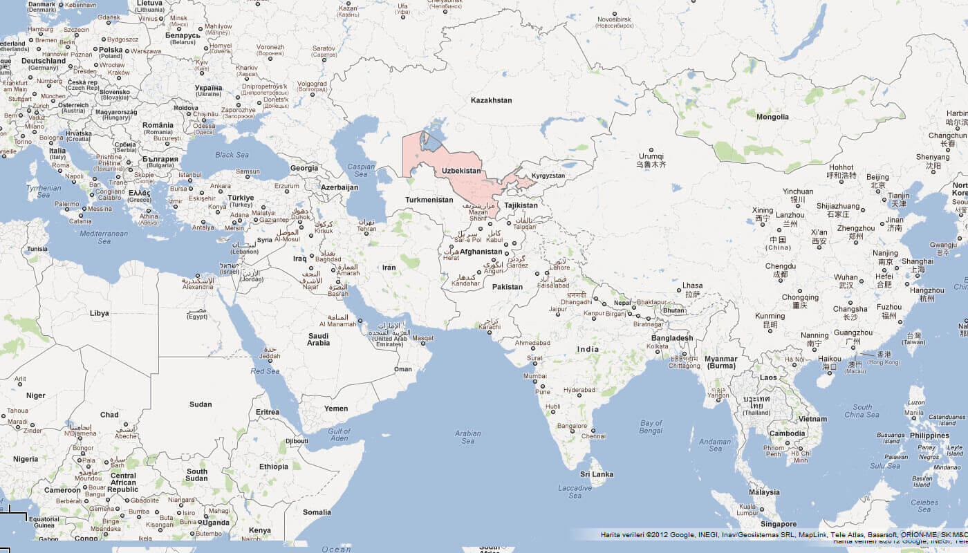
Located in Central Asia, Uzbekistan is a landlocked country bordered by Kazakhstan to the north, Kyrgyzstan to the northeast, Tajikistan to the southeast, Afghanistan to the south and Turkmenistan to the southwest. Its capital, Tashkent, is the political, cultural and economic centre of the country. Known for its ancient Silk Road cities such as Samarkand, Bukhara and Khiva, Uzbekistan is rich in history, with stunning Islamic architecture, ancient fortresses and vibrant bazaars.
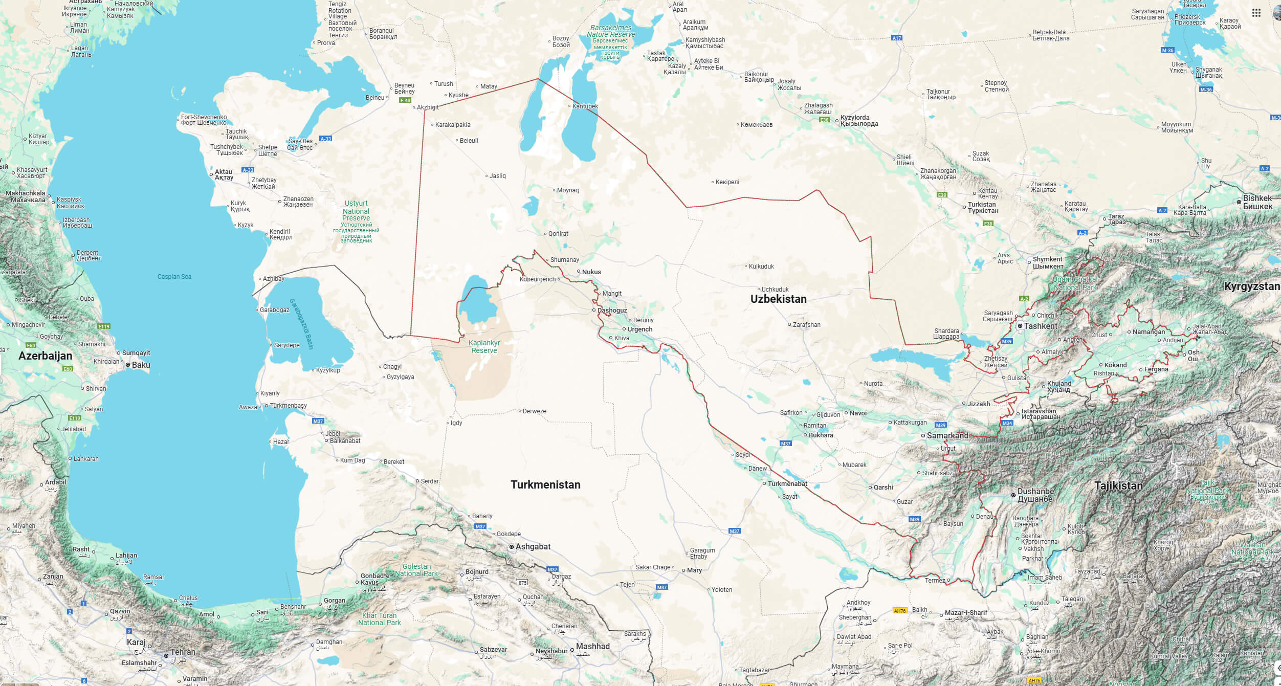
Uzbekistan Road Map with Cities, Borders, and Major Highways
This detailed Uzbekistan road map shows major highways, national borders, and cities such as Tashkent, Samarkand, and Bukhara. It highlights connections with neighboring countries like Kazakhstan, Kyrgyzstan, Turkmenistan, Tajikistan, Afghanistan, and Iran.
The country has a diverse cultural heritage, combining Persian, Turkic and Soviet influences. Uzbek is the official language and Islam is the predominant religion, practised by the majority of the population. Uzbekistan is also known for its cotton production and natural gas resources, which play an important role in its economy. Since gaining independence from the Soviet Union in 1991, Uzbekistan has pursued economic reforms and infrastructure development, making it a growing tourist destination.
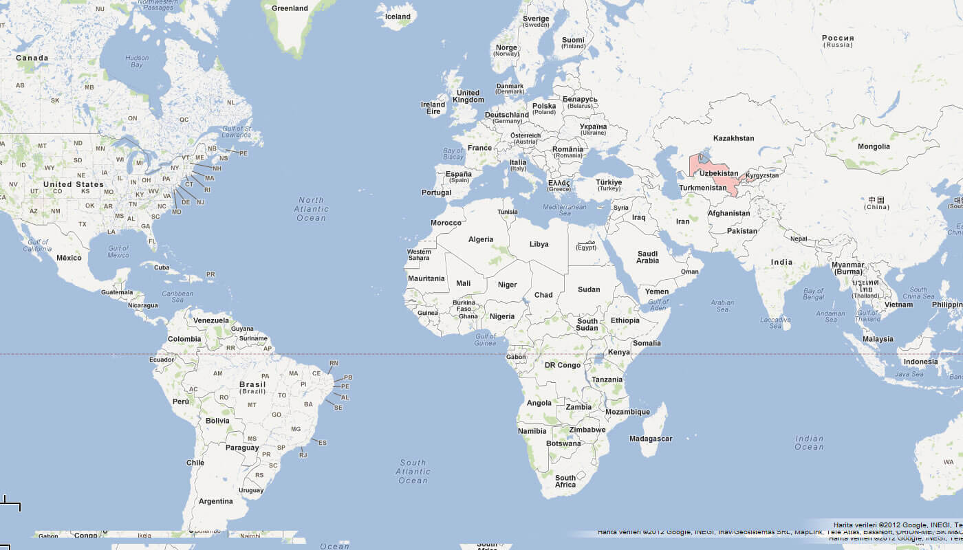
Where is located Uzbekistan on the World Map
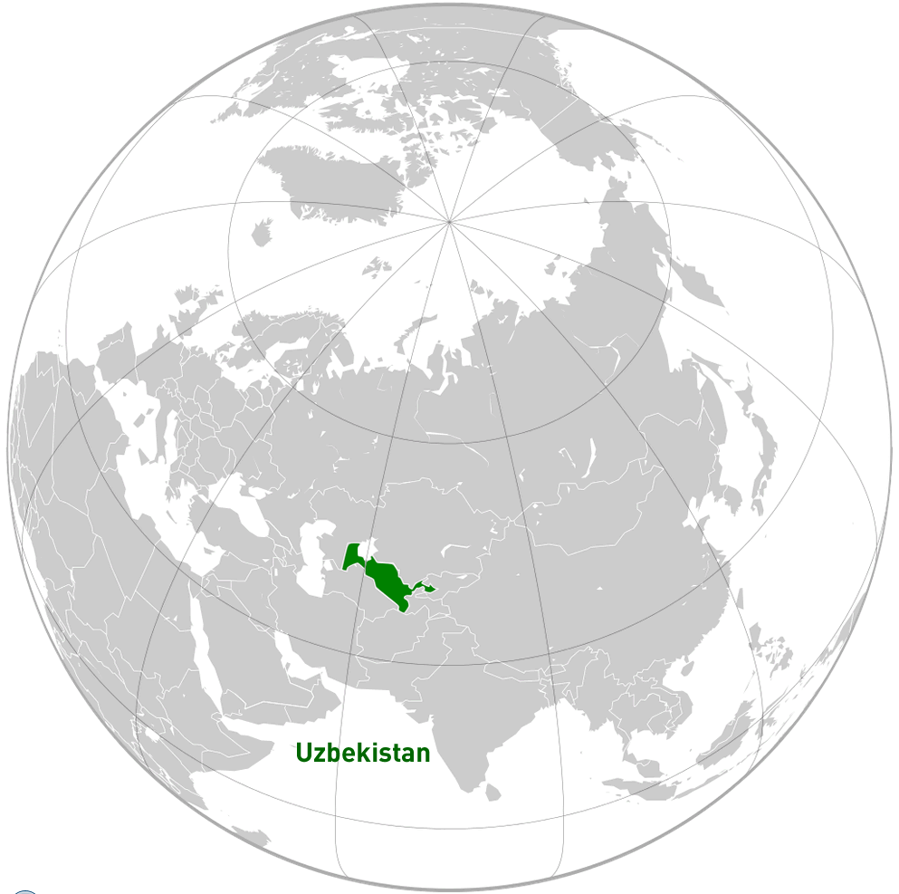 Where is located Uzbekistan on the World Map
Uzbekistan is a landlocked country in the heart of Central Asia. It is uniquely one of only two doubly landlocked countries in the world, meaning that it is surrounded by countries that are themselves landlocked. Its strategic location on the ancient Silk Road has historically made it a cultural and economic crossroads between Europe and Asia.
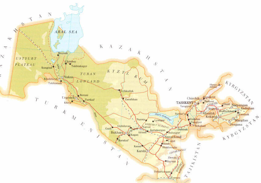
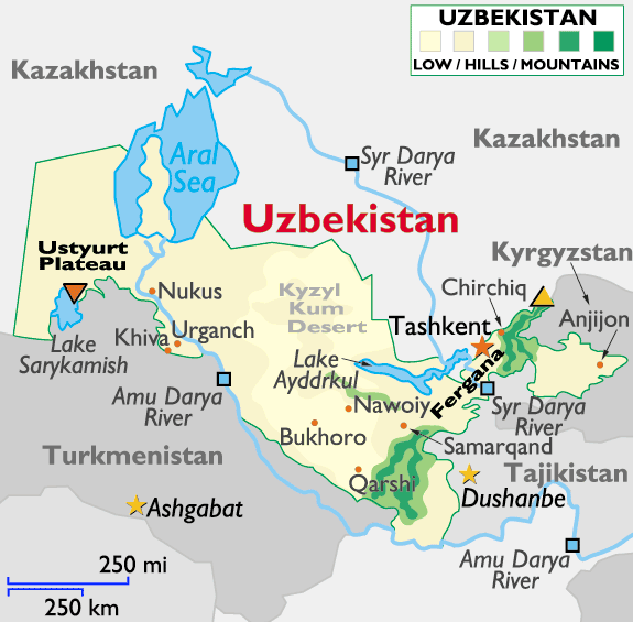
Uzbekistan Physical Map with Mountains, Rivers, Regions, and Elevation
 Uzbekistan physical map with terrain, rivers, mountains and regional boundaries.
This physical map of Uzbekistan highlights the country’s diverse terrain, including deserts, mountain ranges and river systems. It shows regions such as Karakalpakstan, Samarkand and Tashkent, as well as elevations from lowlands to highlands along the eastern and southern borders.
Bordered by Kazakhstan to the north and north-west, Kyrgyzstan to the north-east and Tajikistan to the south-east, Uzbekistan is surrounded by mountainous terrain and vast deserts. It shares a small border with Afghanistan to the south and Turkmenistan to the south-west. The country’s geography is dominated by the Kyzylkum Desert and the fertile Fergana Valley, which serves as an important agricultural centre.
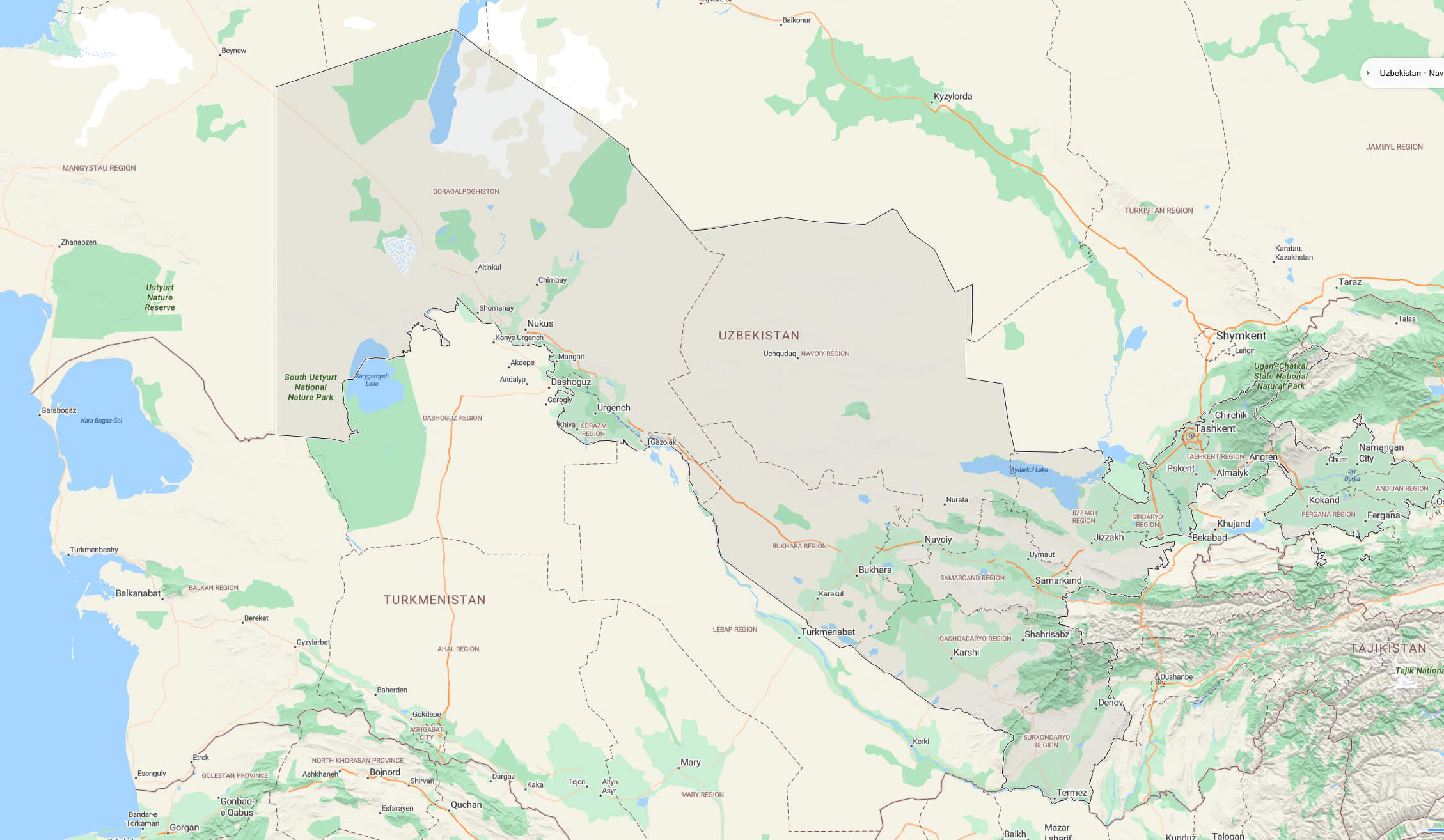
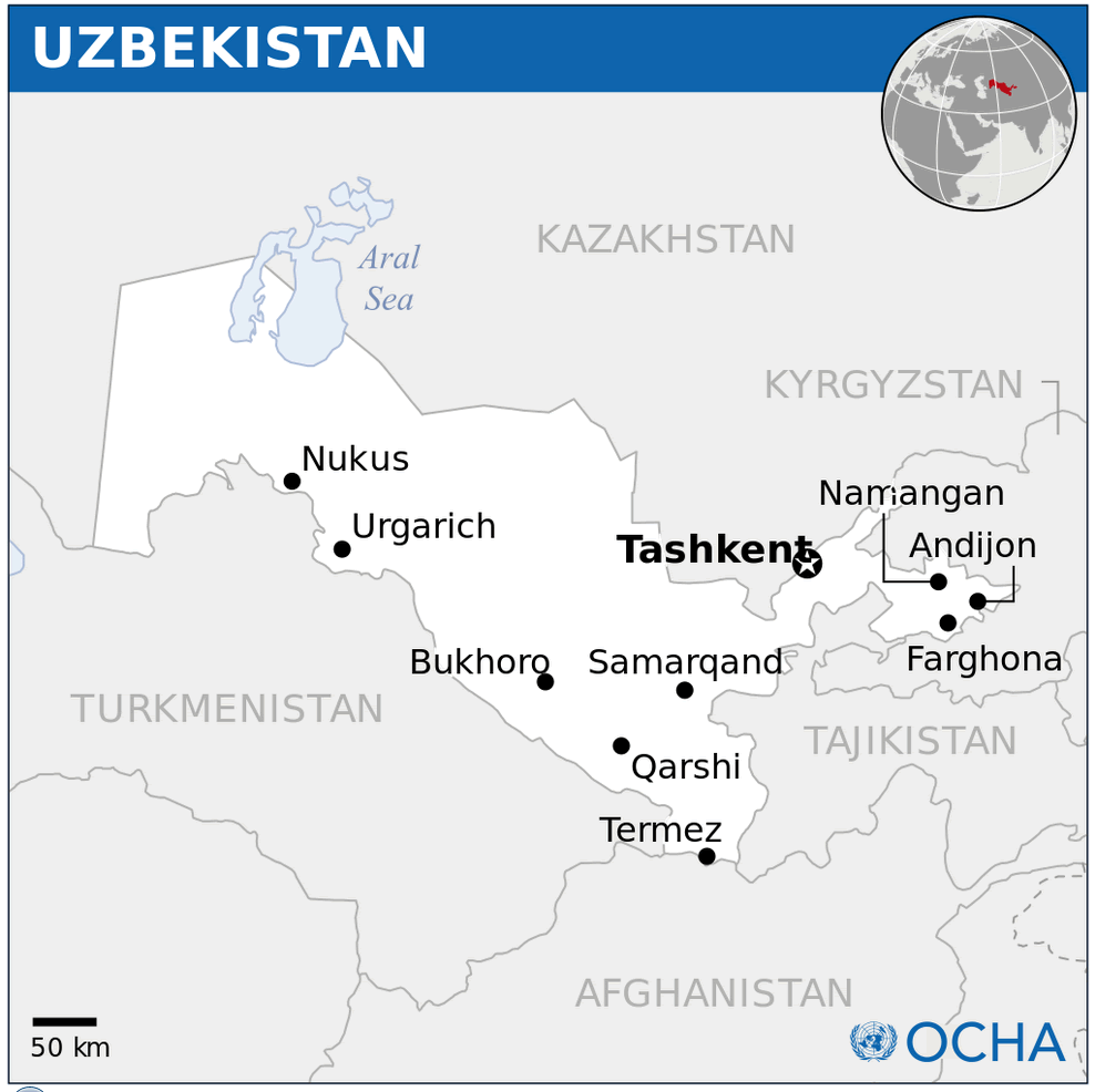
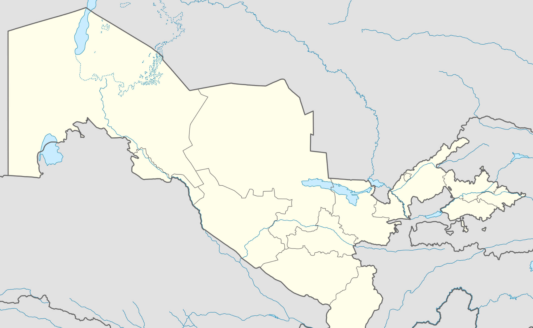
Uzbekistan political map
Uzbekistan’s central location in the region has shaped its role as a cultural melting pot throughout history. Cities such as Samarkand and Bukhara became important centres of trade, religion and scholarship during the Silk Road era. Today, Uzbekistan remains a key transit point for trade and commerce within Central Asia, connecting neighbouring countries to major routes and economic corridors.
Here are some statistical information about Uzbekistan:
 Area: 447,400km2 (172,700 sq mi)
 Historical Map of Uzbekistan During the Timurid Empire
 Map of Uzbekistan and Central Asia showing major cities during the Timurid Empire.
This historical map shows Uzbekistan and its surrounding regions during the Timurid Empire. Major cities such as Samarkand, Bukhara, Tashkent and Herat are marked, illustrating the vast reach of Timur’s rule across Central Asia, Iran, Mesopotamia and parts of the Middle East and South Asia.
Capital city: TashkentUzbekistan physical map with cities
 Per capita: $3010 (2024 estimate)
 Political Map of Uzbekistan
Map of Uzbekistan
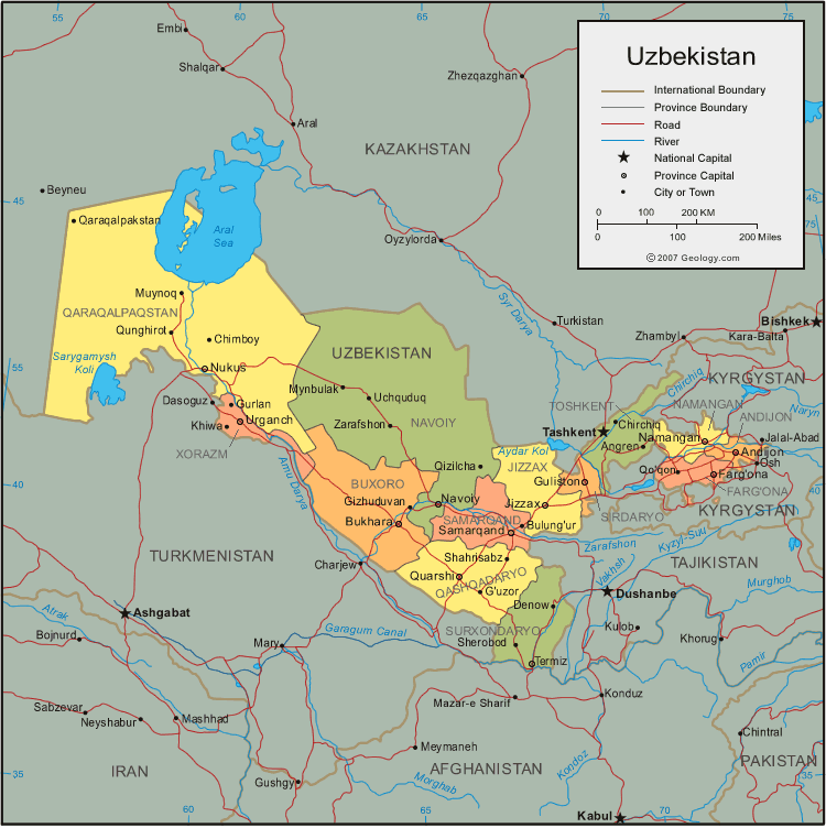 Map of Uzbekistan showing provinces, borders, rivers, and major cities.
This map highlights Uzbekistan’s provinces, including its capital Tashkent, as well as key cities, rivers, and neighboring countries like Kazakhstan, Kyrgyzstan, Turkmenistan, Afghanistan, and Tajikistan.
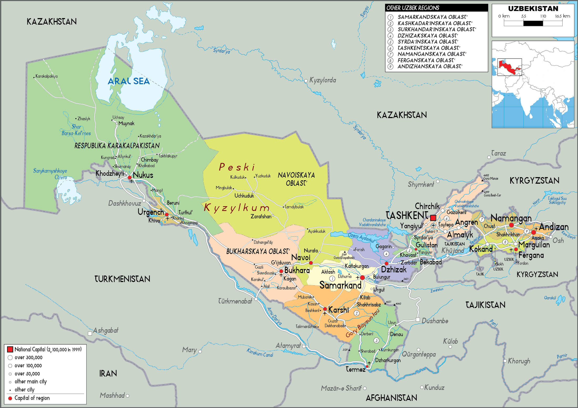
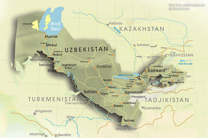
Regional Map of Uzbekistan
 Map of Uzbekistan showing geographical features, cities, and borders.
This map highlights Uzbekistan’s major geographical features like the Aral Sea, Ustyurt Plateau, Kyzyl Kum Desert, and Syr Darya River. It also displays key cities including Tashkent, Samarkand, and Bukhoro, alongside neighboring countries.
Uzbekistan Relief Map
 Relief map of Uzbekistan showing key cities, rivers, and terrain features.
This relief map highlights Uzbekistan’s diverse geography, including the Aral Sea, major rivers, and urban centers like Tashkent and Samarkand. It shows the country’s proximity to neighboring states, emphasizing its central location in Central Asia.
Uzbekistan terrain map
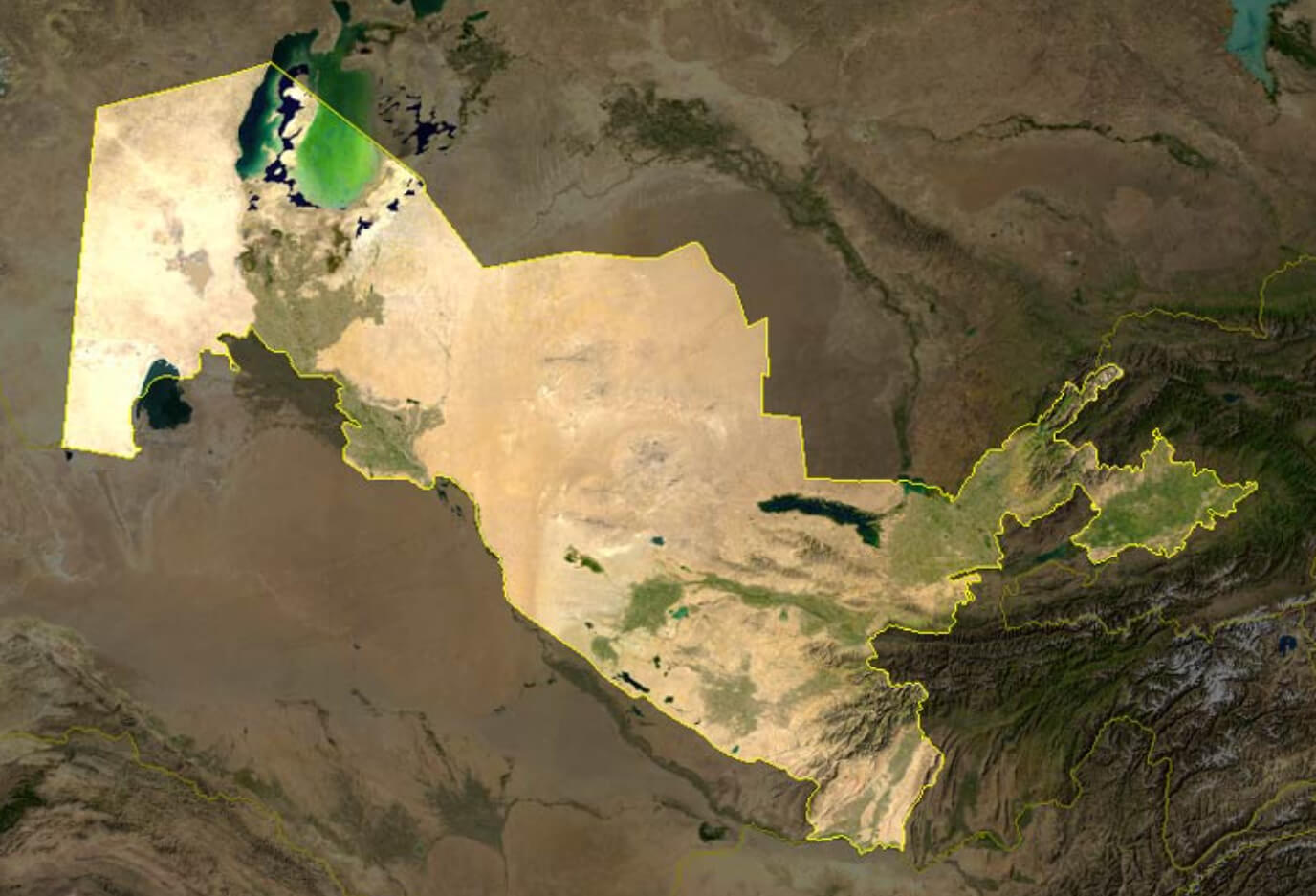
Uzbekistan satellite map
Uzbekistan Location Map
Map Uzbekistan
Uzbekistan earth map
Uzbekistan blank map
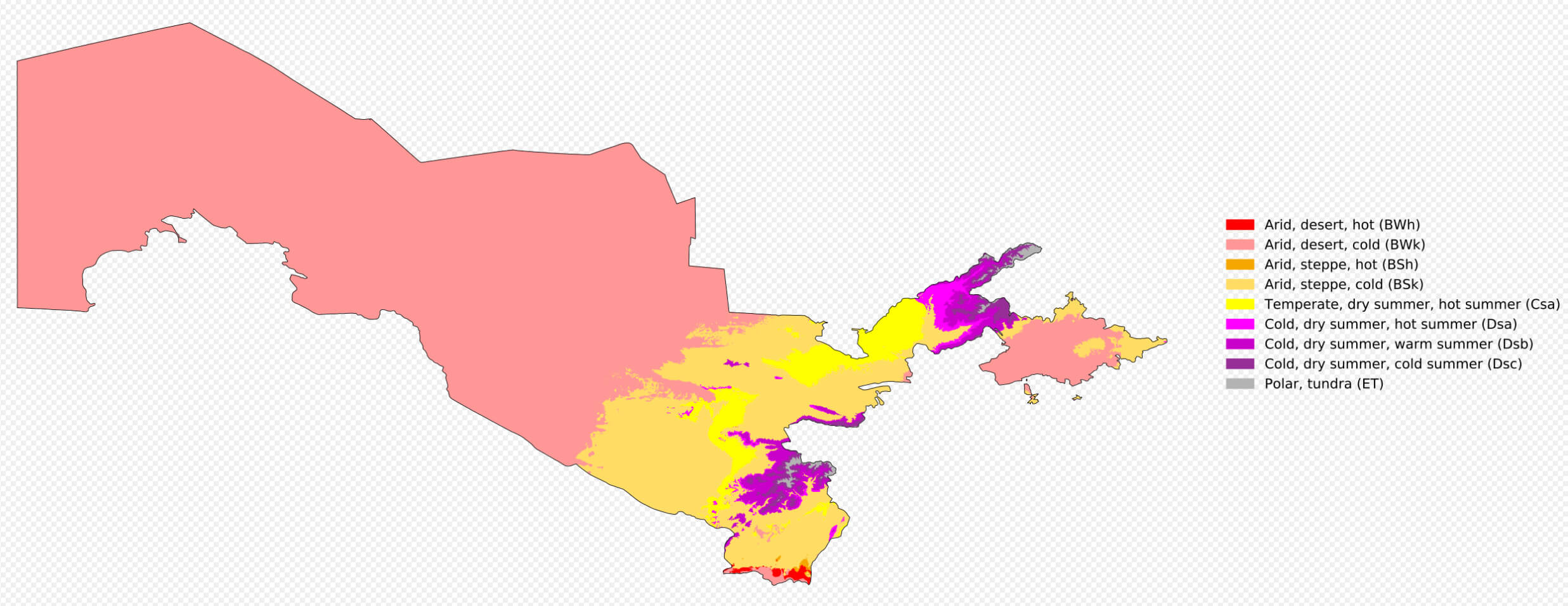
Uzbekistan climate map
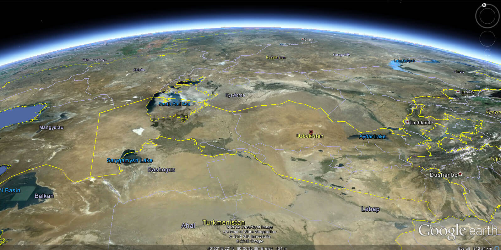
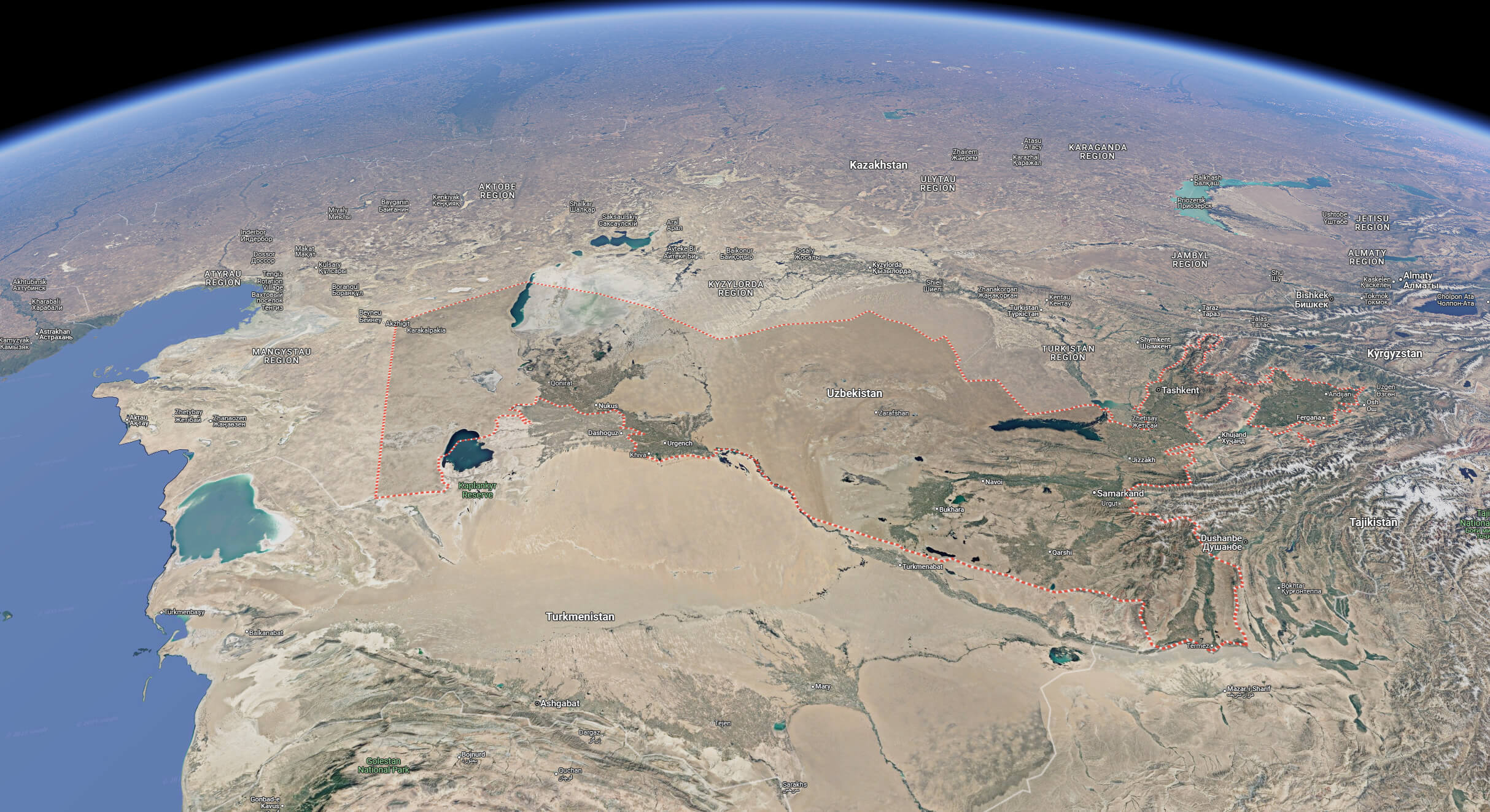
Uzbekistan satellite map from space
Map of Uzbekistan Asia
Map of Uzbekistan World
Where is Uzbekistan on the Asia Map?
Show Google interactive map, satellite map, where is the country located.
Get directions by driving, walking, bicycling, public transportation and travel with street view.
Feel free to explore these pages as well:
- Russia Map ↗️
- Abkhazia Map ↗️
- Kazakhstan Map ↗️
- Georgia Map ↗️
- Nagorno Karabakh ↗️
- Azerbaijan Map ↗️
- Turkey Map ↗️
- South Ossetia Map ↗️
- Mongolia Map ↗️