A Collection of Luxembourg Maps provides a detailed look into the country’s geography, from its districts and administrative divisions to physical landscapes and historical boundaries, offering a comprehensive understanding of this small yet diverse European nation.
Brief information about Luxembourg
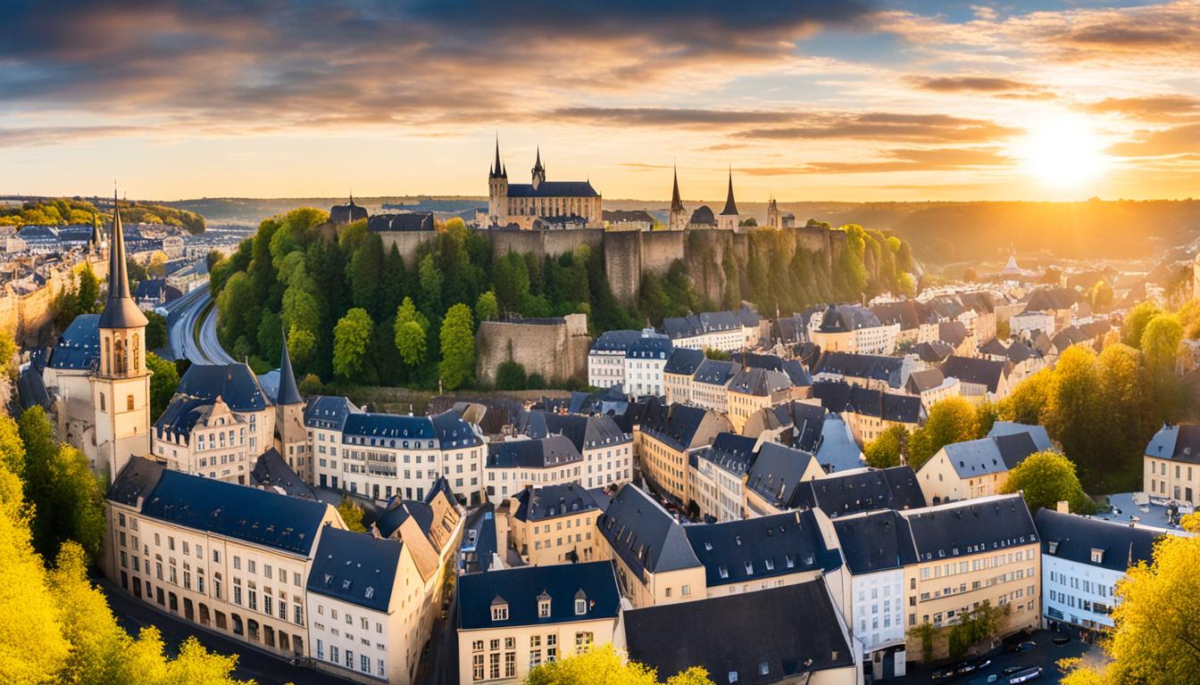
Luxembourg, one of Europe’s smallest countries, is nestled between Belgium, France, and Germany. Known for its picturesque landscapes and medieval castles, the country offers a charming blend of natural beauty and rich history. Luxembourg City, the capital, is famous for its fortified old town, a UNESCO World Heritage site, where visitors can wander through cobblestone streets and take in breathtaking views from the ancient walls.
Luxembourg Political Map
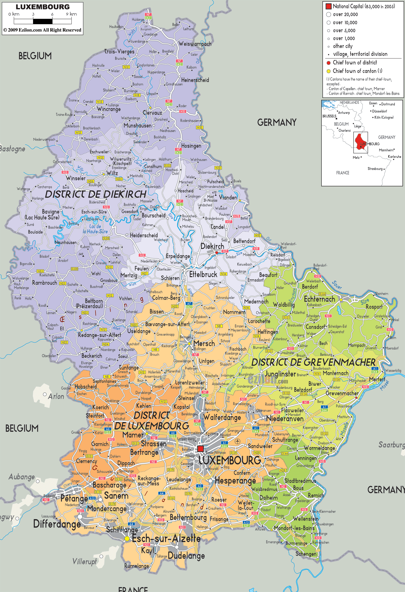
This political map of Luxembourg provides a detailed overview of the administrative divisions of the country, including its three main districts: Diekirch, Grevenmacher and Luxembourg. It highlights major cities such as the capital, Luxembourg City, and other towns, and shows the location of major roads and borders with neighbouring countries such as Belgium, Germany and France. The map is useful for understanding Luxembourg’s geography, population distribution and transport links within the country.
Despite its small size, Luxembourg is a global financial hub, attracting businesses and professionals from around the world. With a high quality of life, multilingual culture, and excellent public services, it’s a great destination for both tourists and expats. The country’s official languages—Luxembourgish, French, and German—reflect its cultural diversity, making it a unique place to explore in the heart of Europe.
Where is located Luxembourg on the World Map
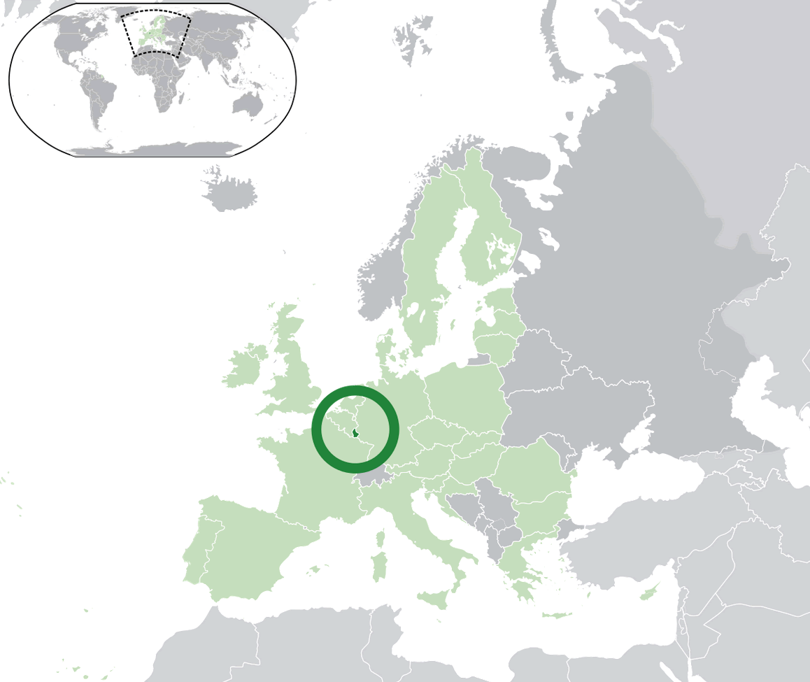
Luxembourg is located in Western Europe, nestled between Belgium to the west and north, Germany to the east, and France to the south. Despite being one of the smallest countries in the world, its strategic position in the heart of Europe makes it an ideal gateway for exploring the region.
On the world map, Luxembourg might seem easy to miss due to its tiny size, but its central location has played a significant role in European history. It’s a landlocked country, meaning it has no coastline, but its close proximity to major European cities like Brussels, Paris, and Frankfurt allows for convenient travel by train, car, or plane.
While its size is small, Luxembourg’s influence is notable, particularly in international finance and European politics. The country is a founding member of the European Union, and its location at the crossroads of major European powers has long given it a unique blend of cultures, languages, and traditions.
Here are some statistical information about Luxembourg:
Luxembourg Cities Map
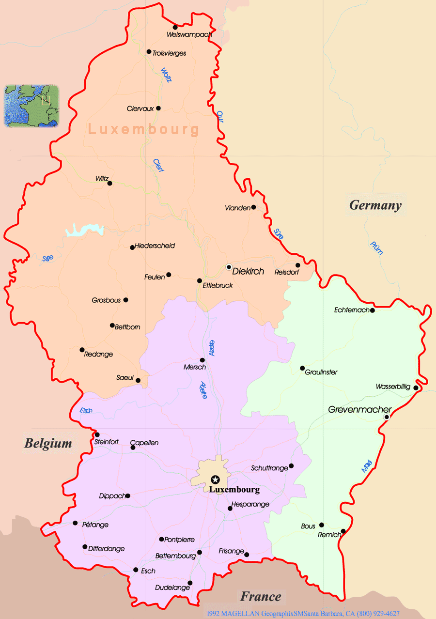
This map of Luxembourg highlights key cities like Luxembourg City, Esch, and Diekirch, along with its borders with Belgium, Germany, and France. Major rivers such as the Mosel and Alzette are also shown.
Luxembourg Map
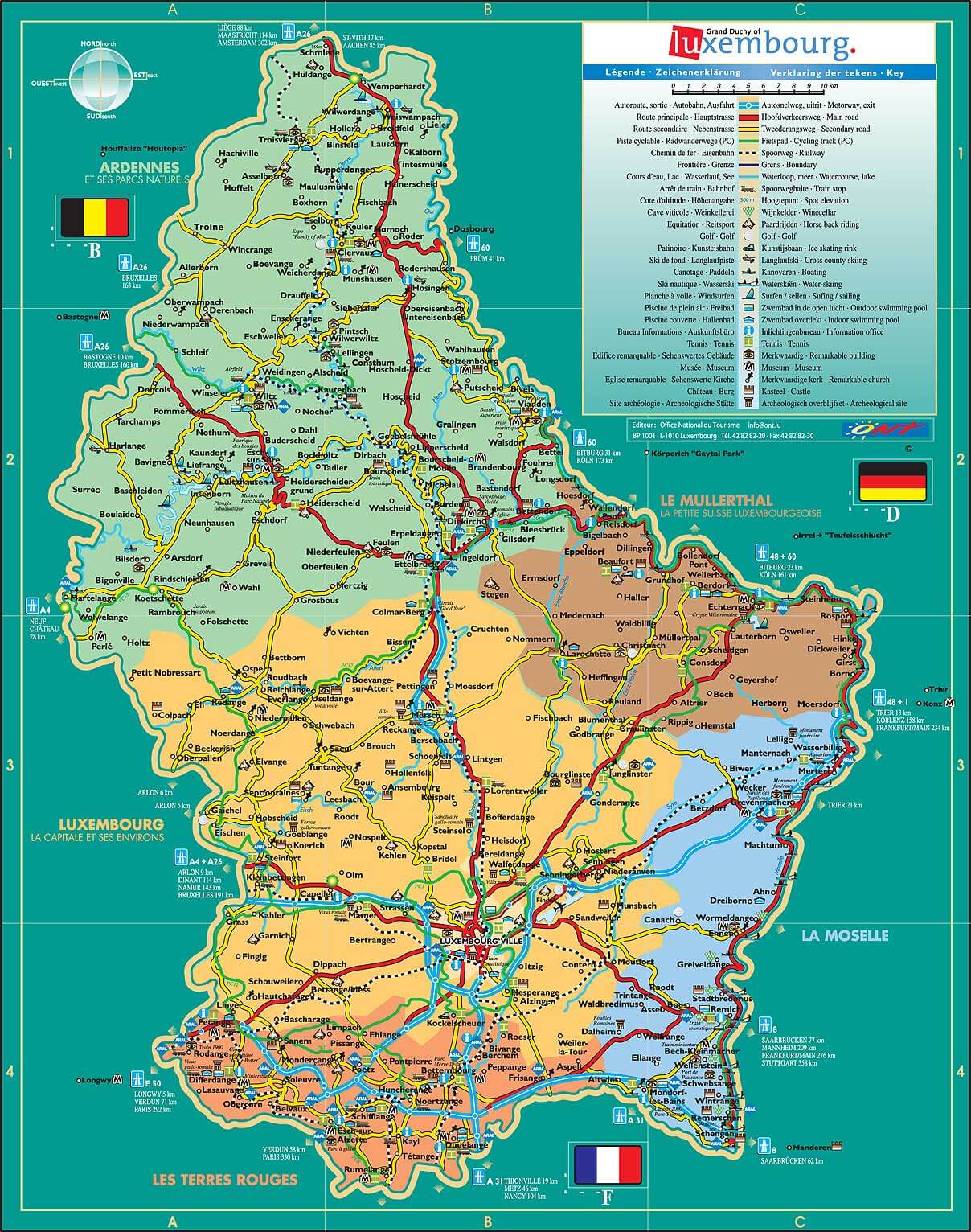
The map of Luxembourg highlights key cities, roads, natural parks, and its connections to Belgium, France, and Germany.
City Map of Luxembourg
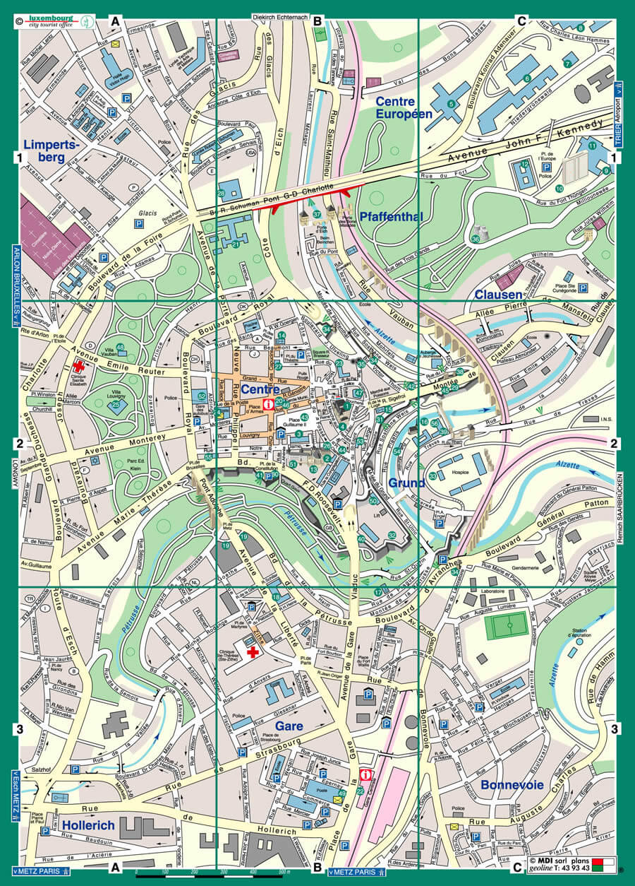
This city map of Luxembourg highlights the central districts, including Limpertsberg, Gare, Pfaffenthal, and Clausen. The map shows key landmarks, streets, and major roads, with Luxembourg City’s center clearly marked, along with important areas like the European Quarter, parks, and public transport routes.
Luxembourg Location Map
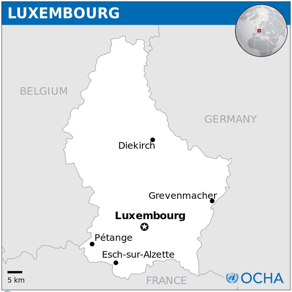
Luxembourg Maps
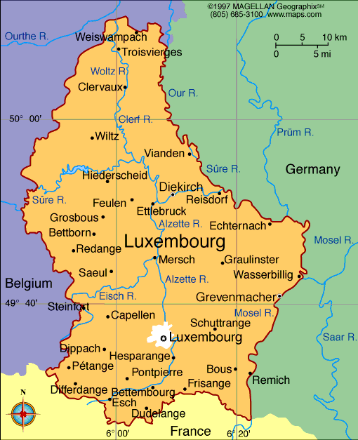
The map shows Luxembourg’s key cities, rivers, and its borders with Belgium to the west, Germany to the east, and France to the south. Luxembourg City is centrally located, with major towns like Ettelbruck, Clervaux, and Diekirch highlighted, alongside important rivers such as the Alzette and Mosel.
Luxembourg Physical Map
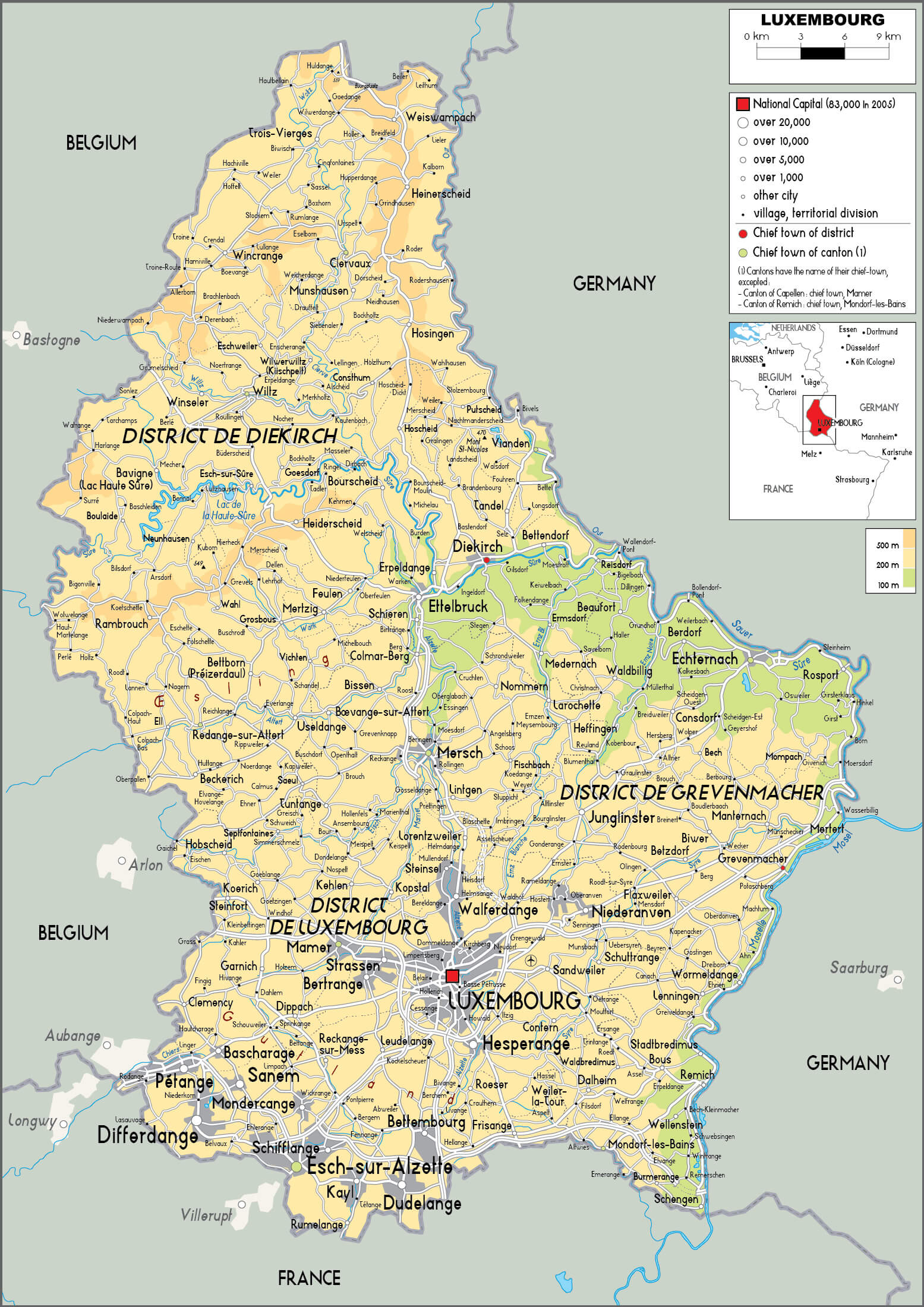 This map of Luxembourg shows the country’s diverse geographical features, including the key districts of Diekirch, Luxembourg and Grevenmacher. The map highlights the country’s varied terrain, with rivers such as the Sauer and the Moselle running through the landscape, alongside major towns such as Esch-sur-Alzette, Differdange and the capital, Luxembourg. It provides a clear view of Luxembourg’s physical landscape, highlighting the topographical elements that shape its picturesque scenery.
Luxembourg Provinces Map
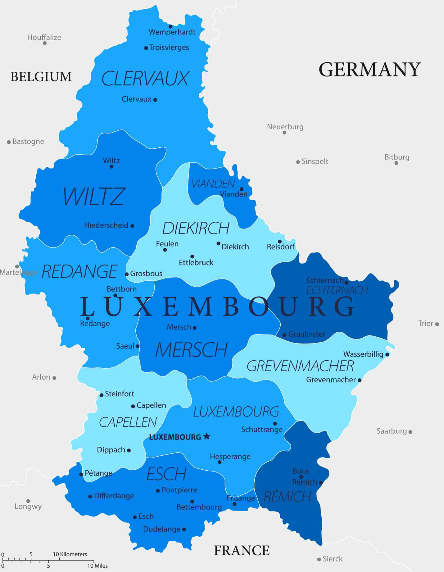
Luxembourg Roads Map
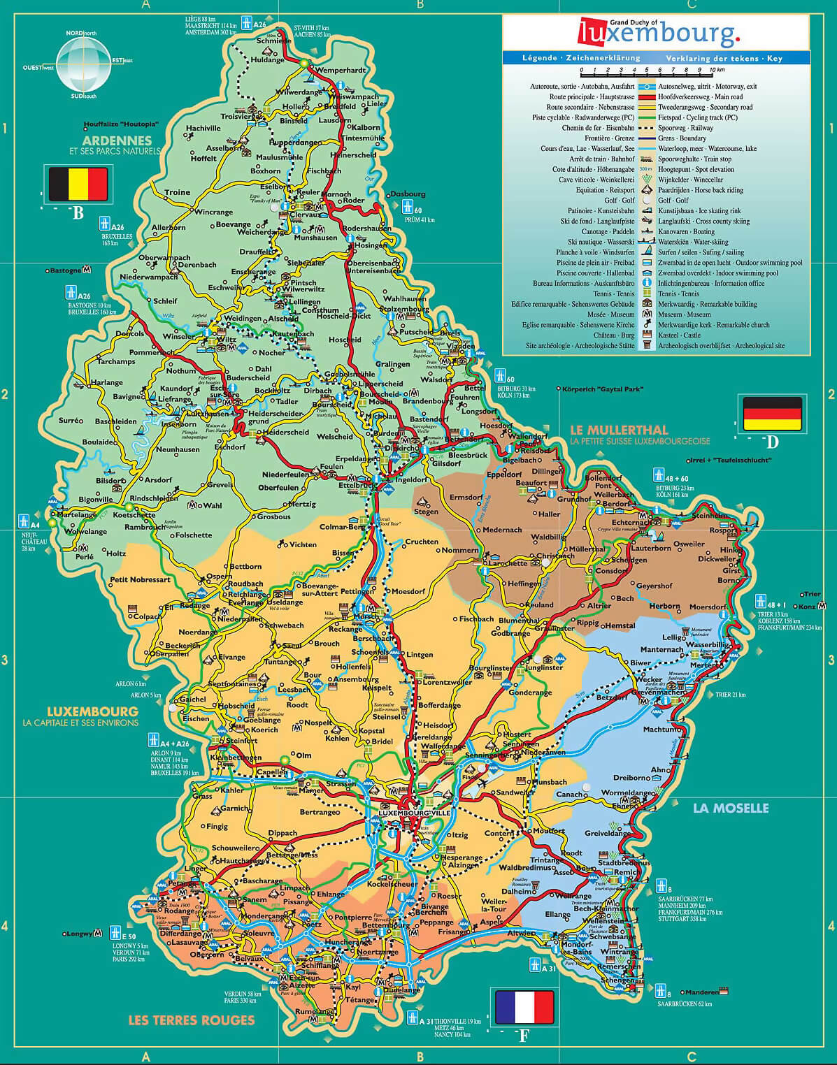 This map of Luxembourg highlights the country’s complex road network, showing major motorways, regional routes and links with neighbouring countries such as Belgium, Germany and France. It provides a detailed overview of the country’s geography, highlighting major cities, natural parks and the diverse landscape of the Grand Duchy, including the Ardennes region in the north and the Moselle valley in the east.
Luxembourg Regions Map
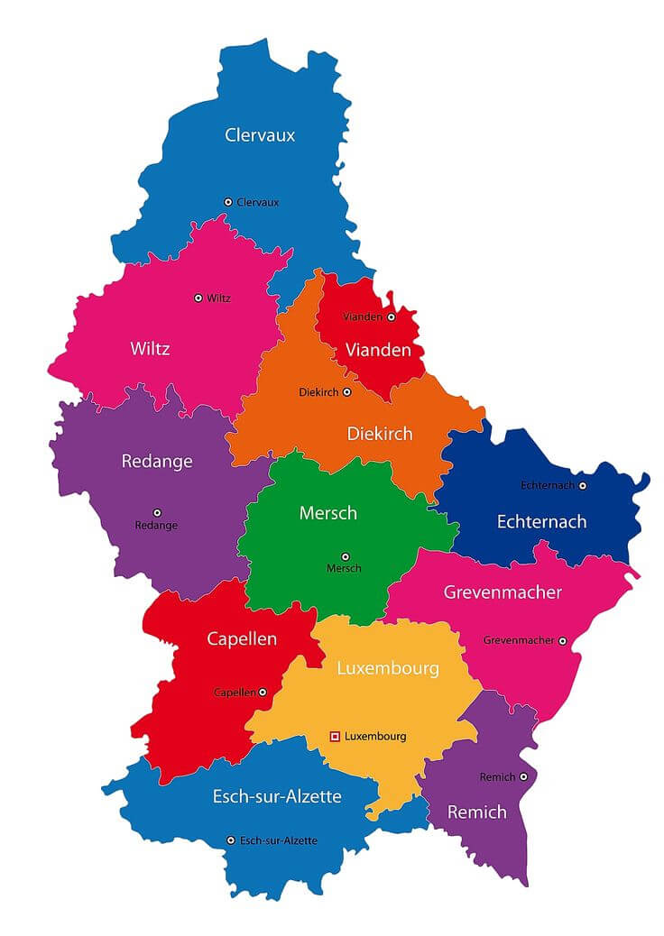 This map of Luxembourg’s regions provides a clear visual overview of the country’s administrative divisions, highlighting each area with different colours to represent different districts such as Diekirch, Grevenmacher and Luxembourg City, making it easy to identify the main regions and their locations within the country.
Luxembourg Administrative Map
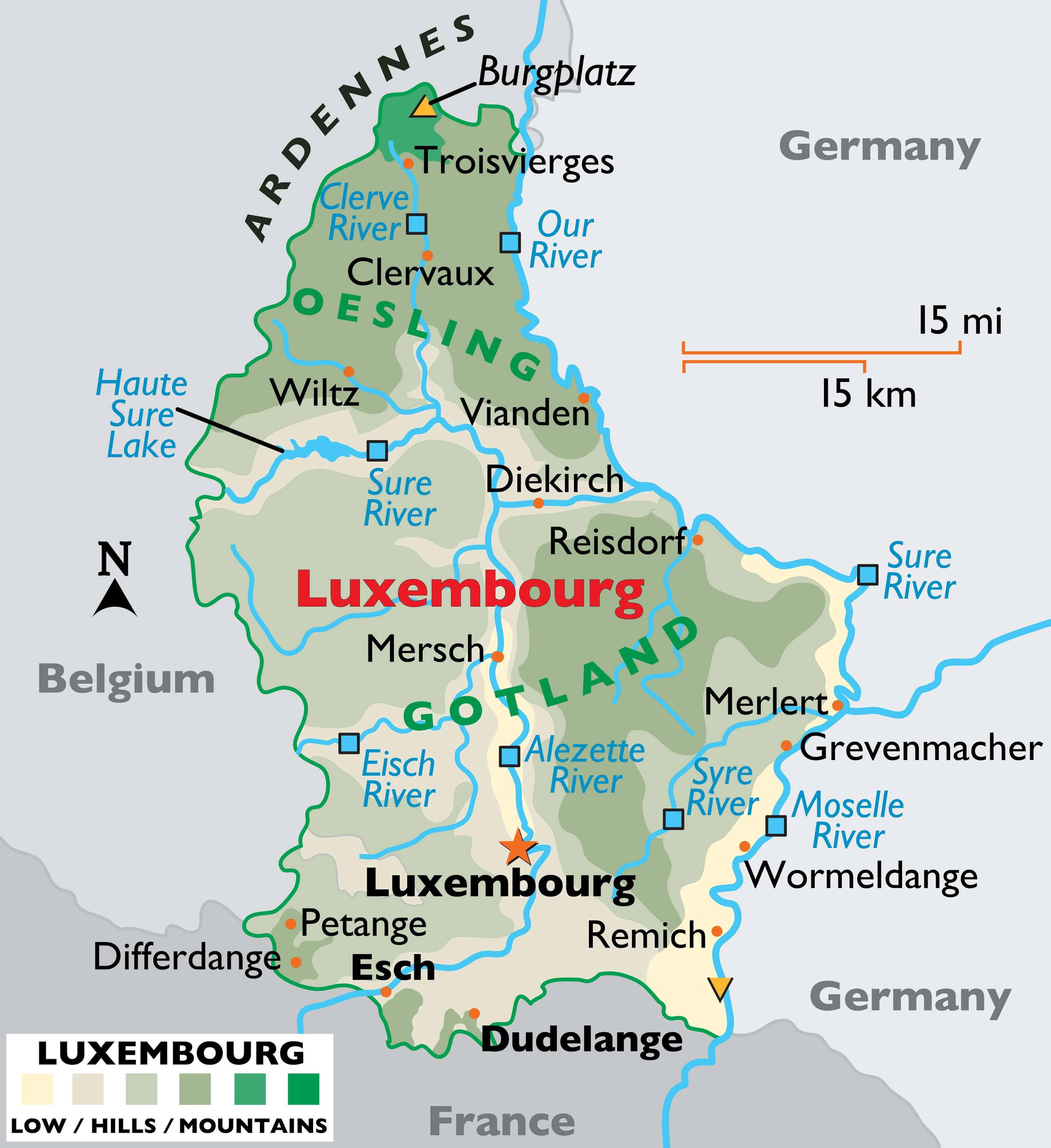 This Luxembourg administrative map highlights the country’s divisions, showing key regions like Oesling in the north, featuring mountainous terrain and the Ardennes, and Gotland in the south, with major urban areas like Luxembourg City, Esch, and Grevenmacher. The map includes rivers like the Sure, Eisch, and Alzette, providing a clear overview of the geographical and political landscape.
Luxembourg German Empire Map
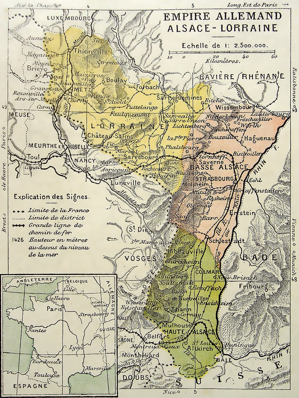 This historical map of Luxembourg during the German Empire illustrates the region’s strategic location and neighbouring territories, including Alsace-Lorraine, as it appeared under German control. The map highlights the borders between France and Germany and shows the main towns and districts within the disputed region. The inset shows Luxembourg’s position in relation to Western Europe, highlighting its proximity to major cities such as Paris and Strasbourg.
Luxembourg History Map
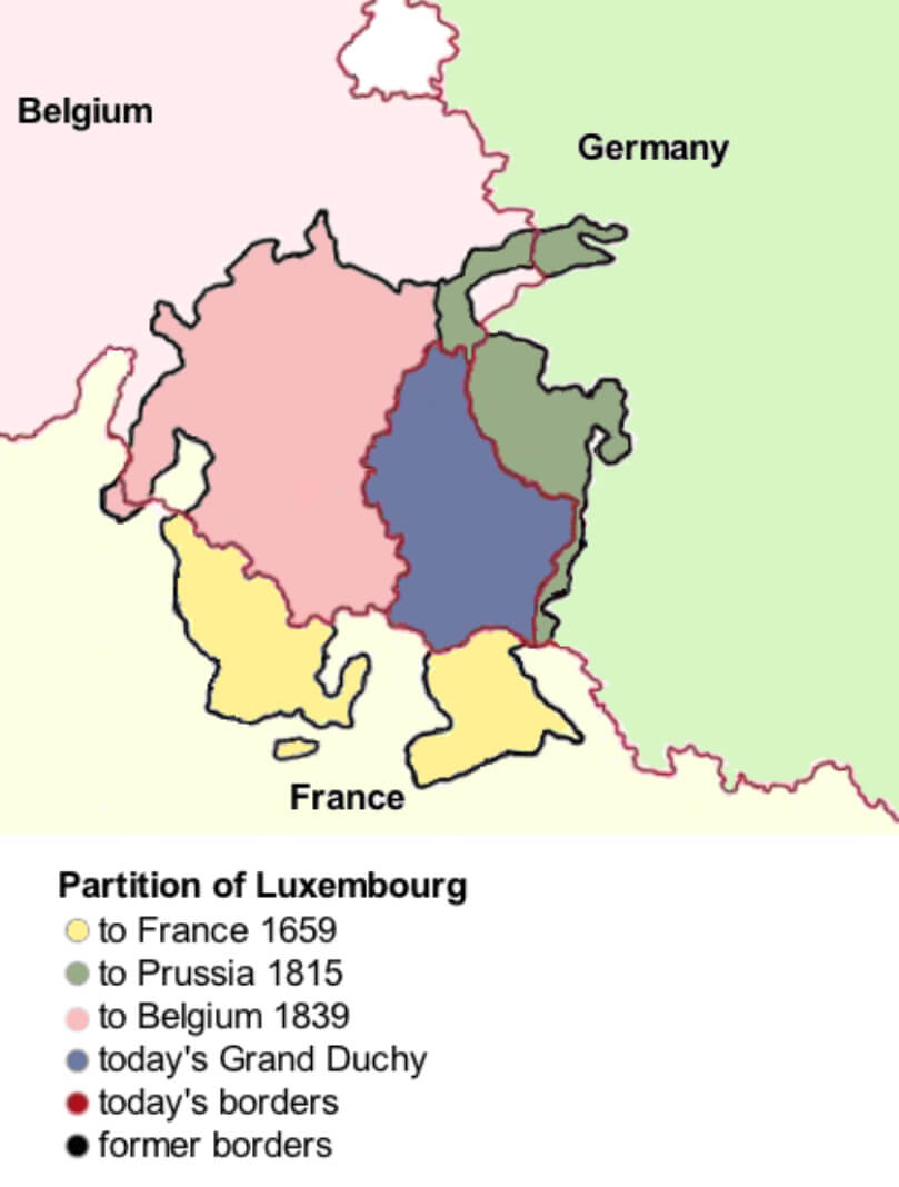 This map illustrates the historical division of Luxembourg, highlighting the areas that were ceded to France in 1659, Prussia in 1815 and Belgium in 1839, as well as the area that makes up the Grand Duchy of Luxembourg today. It emphasises the shifting borders over time, showing how the territorial extent of Luxembourg has changed to reflect key events in European history.
Luxembourg Population Density Map
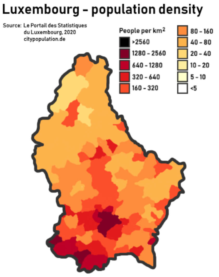 This map of Luxembourg shows the country’s population density distribution in 2020, highlighting areas with higher and lower concentrations of people per square kilometre. The darkest areas, mainly around the capital, Luxembourg City, have the highest population density of more than 2,560 people per km², while the lighter areas indicate regions with less than 160 people per km². The variation in density reflects the concentration of population in urban centres compared to the more rural and less densely populated northern regions.
Luxembourg Districts Map
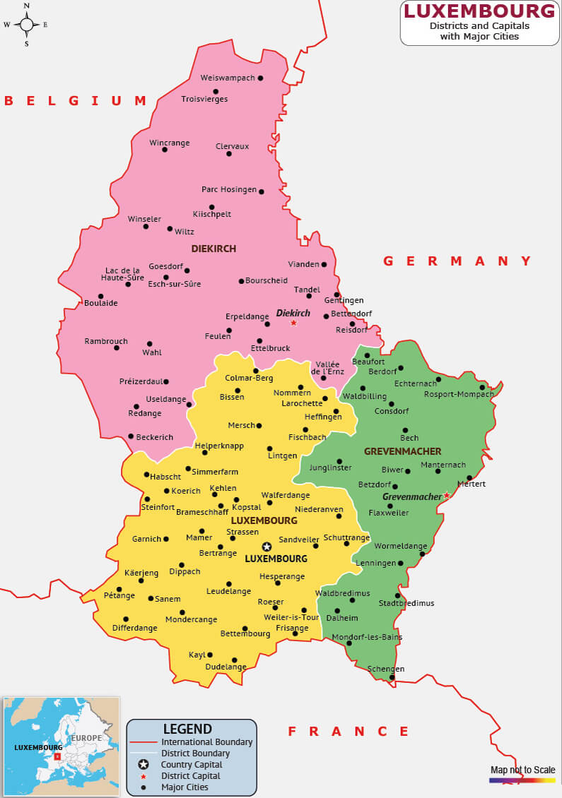 This map of Luxembourg shows the country’s division into districts, including Diekirch, Grevenmacher and Luxembourg, and highlights major cities, towns and administrative boundaries throughout the country. The map also illustrates the geographical position of Luxembourg in relation to neighbouring countries such as Belgium, Germany and France, providing a clear view of its regional layout.
Map of Luxembourg Europe
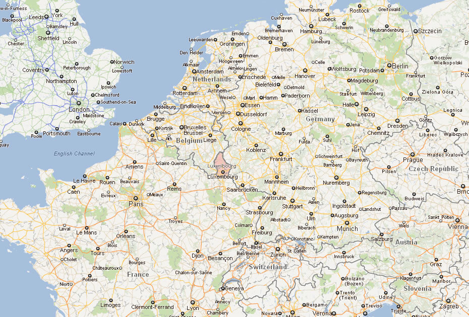
Map of Luxembourg
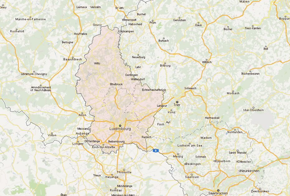
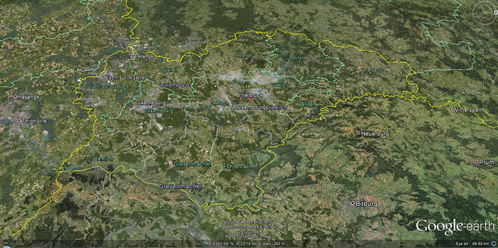
Luxembourg Earth Map
Where is Luxembourg on the Europe Map?
Show Google map, satellite map, where is the country located.
Get directions by driving, walking, bicycling, public transportation and travel with street view.
div>Feel free to explore these pages as well:
- Germany Map ↗️
- Belgium Map ↗️
- Netherlands Map ↗️
- Map of Germany ↗️
- Discovering the Charms of Cologne ↗️
- Exploring the Charm of Bremen ↗️
- Discover Bochum ↗️
- Discovering Bielefeld ↗️
- A Collection of Czechia Maps ↗️
- Europe Map ↗️
- Map of Europe ↗️
- A Collection of Poland Maps ↗️
