Spanning from the vast icy landscapes of Siberia in the north to the tropical rainforests of Southeast Asia, and stretching from the historic cities in the Middle East to the sprawling metropolises of the Far East, Asia represents an intricate blend of geographies, cultures, histories, and modern-day marvels. Such diversity and vastness are rarely seen in any other part of the world. Embarking on a journey to understand this magnificent continent requires tools that capture its essence — and what better way to begin than through meticulously crafted maps? This blog post offers a curated ensemble of maps designed to guide you through the many facets of Asia, whether you’re a dedicated scholar, an avid traveler, or simply someone looking to expand their horizons.
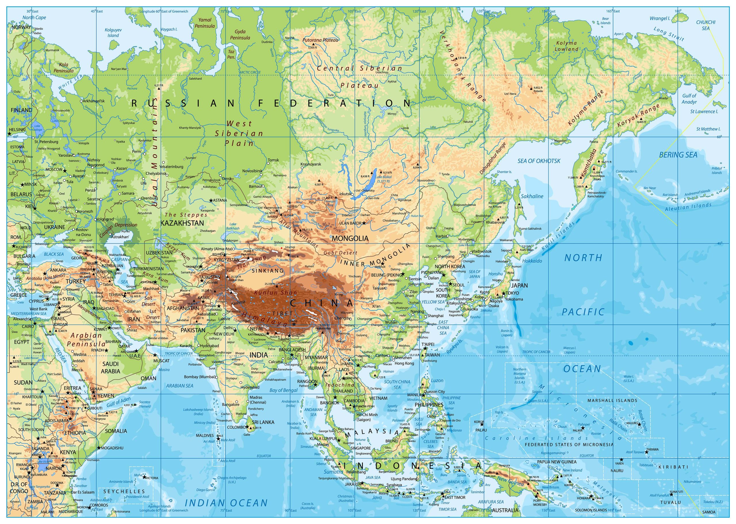
1. Asia Physical Map
Start with the basic. Understand the natural landforms – the mountains, plains, and rivers that have shaped Asia’s civilizations.
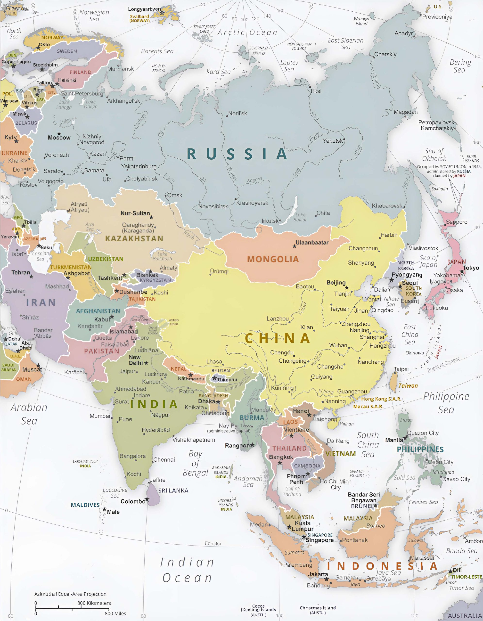
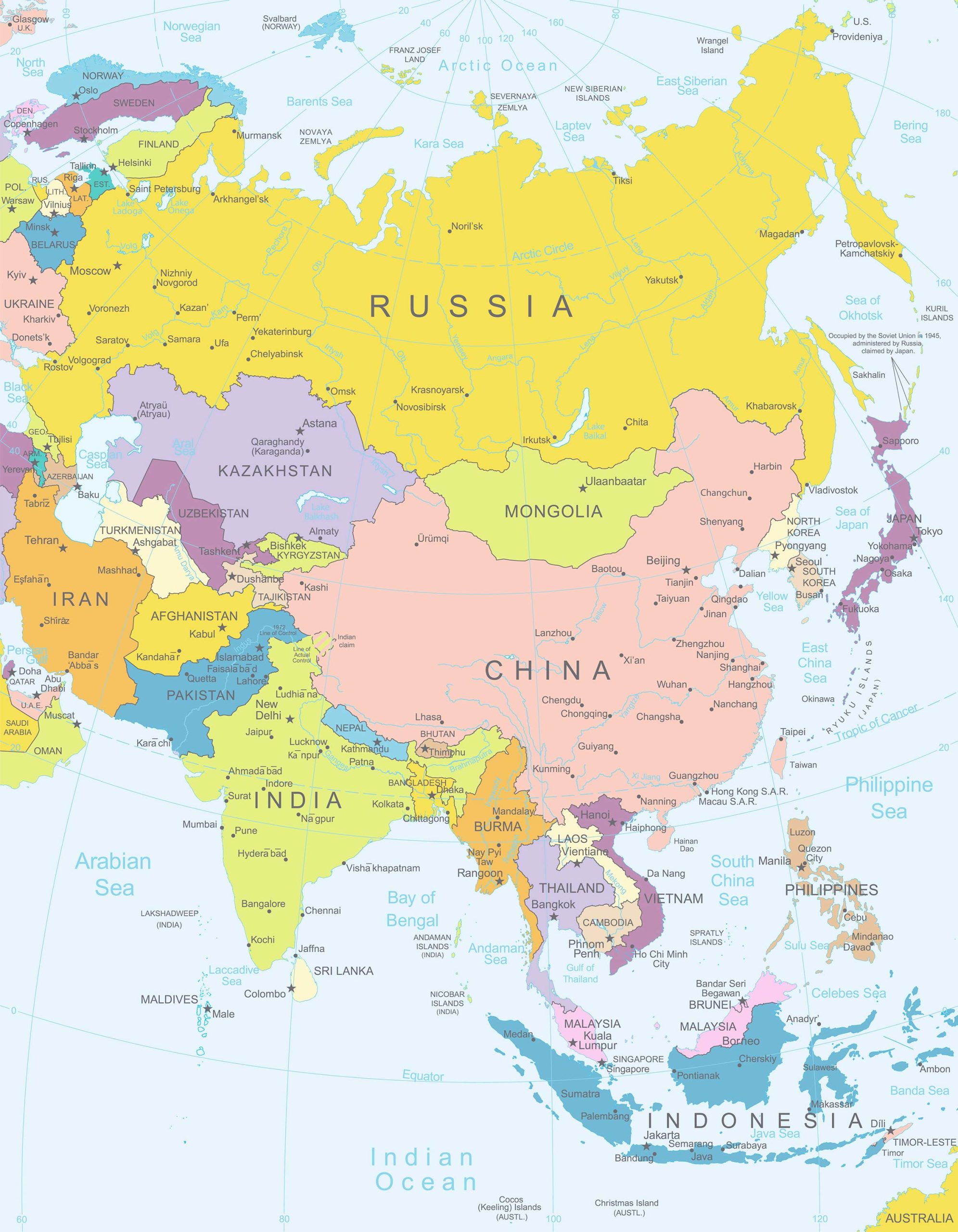
2. Asia Political Map
Navigate the contemporary boundaries, countries, and capitals. See how politics has redrawn the landscape over the ages.
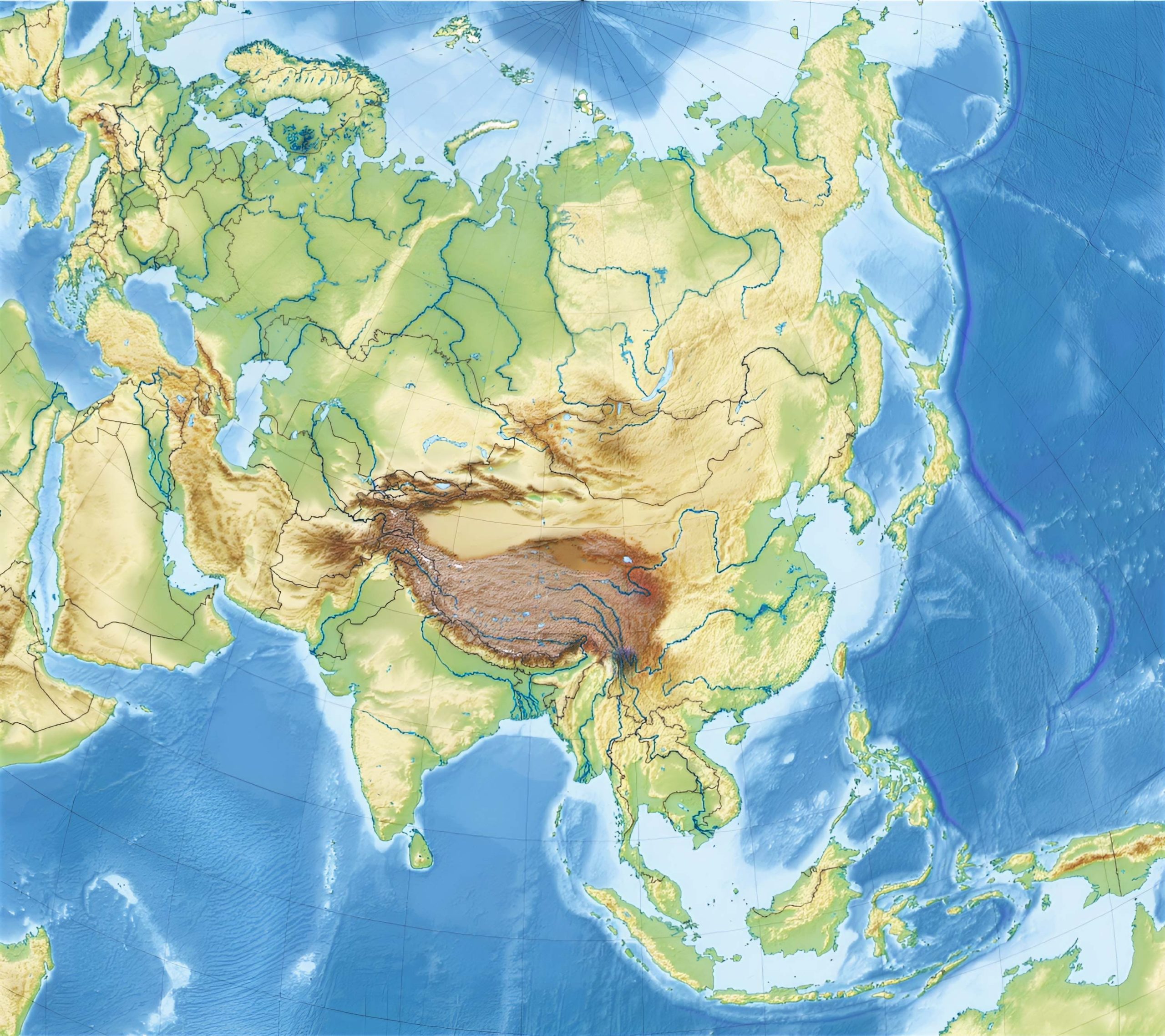
3. Asia Topographic Map
Experience the elevations and depressions, from the towering Himalayas to the Dead Sea’s depths.
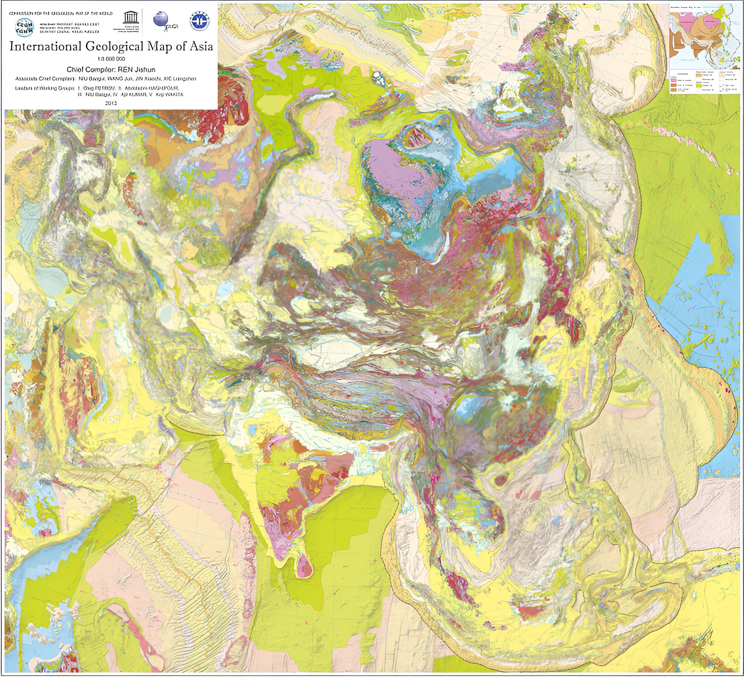
4. Asia Geological Map
Discover the tectonic stories beneath your feet. Learn about the earthquakes, volcanoes, and the natural resources hidden below.
5. Countries, Capitals and Major Cities of the Asia Map
A comprehensive guide to get familiar with the buzzing urban centers and the seats of governance.
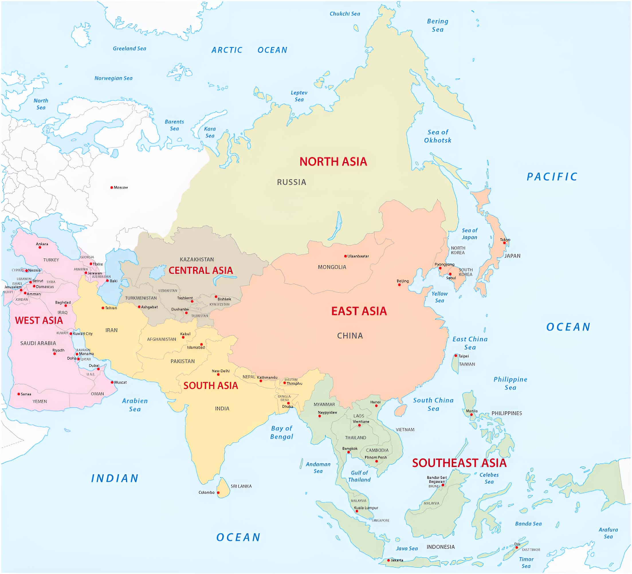
6. Asia Regions Map
Break down Asia into its sub-regions: East Asia, South Asia, Southeast Asia, and more. Recognize the cultural and geographical clusters.
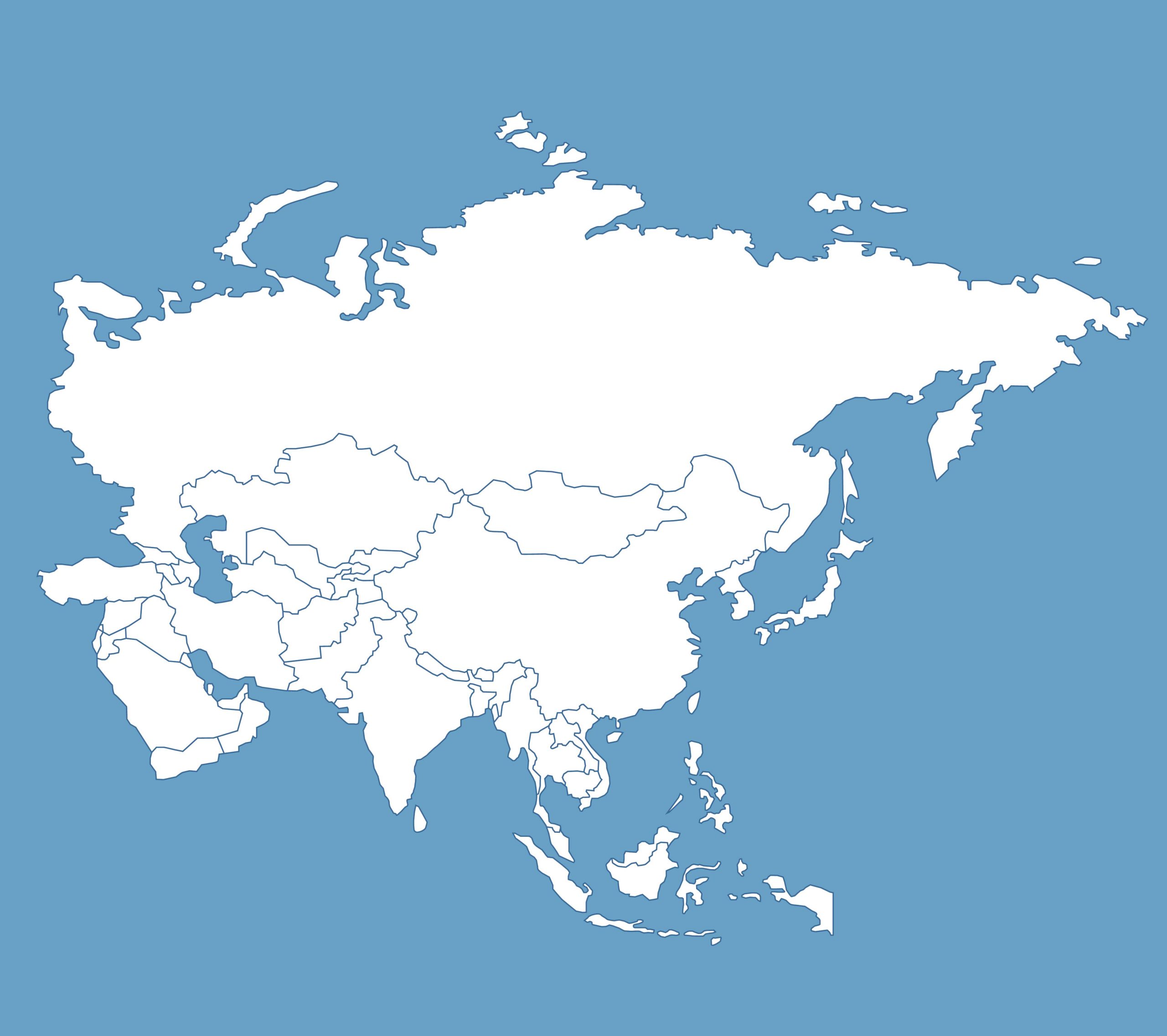
7. Asia Blank Map
A canvas for students, educators, and anyone eager to test their geographical knowledge.
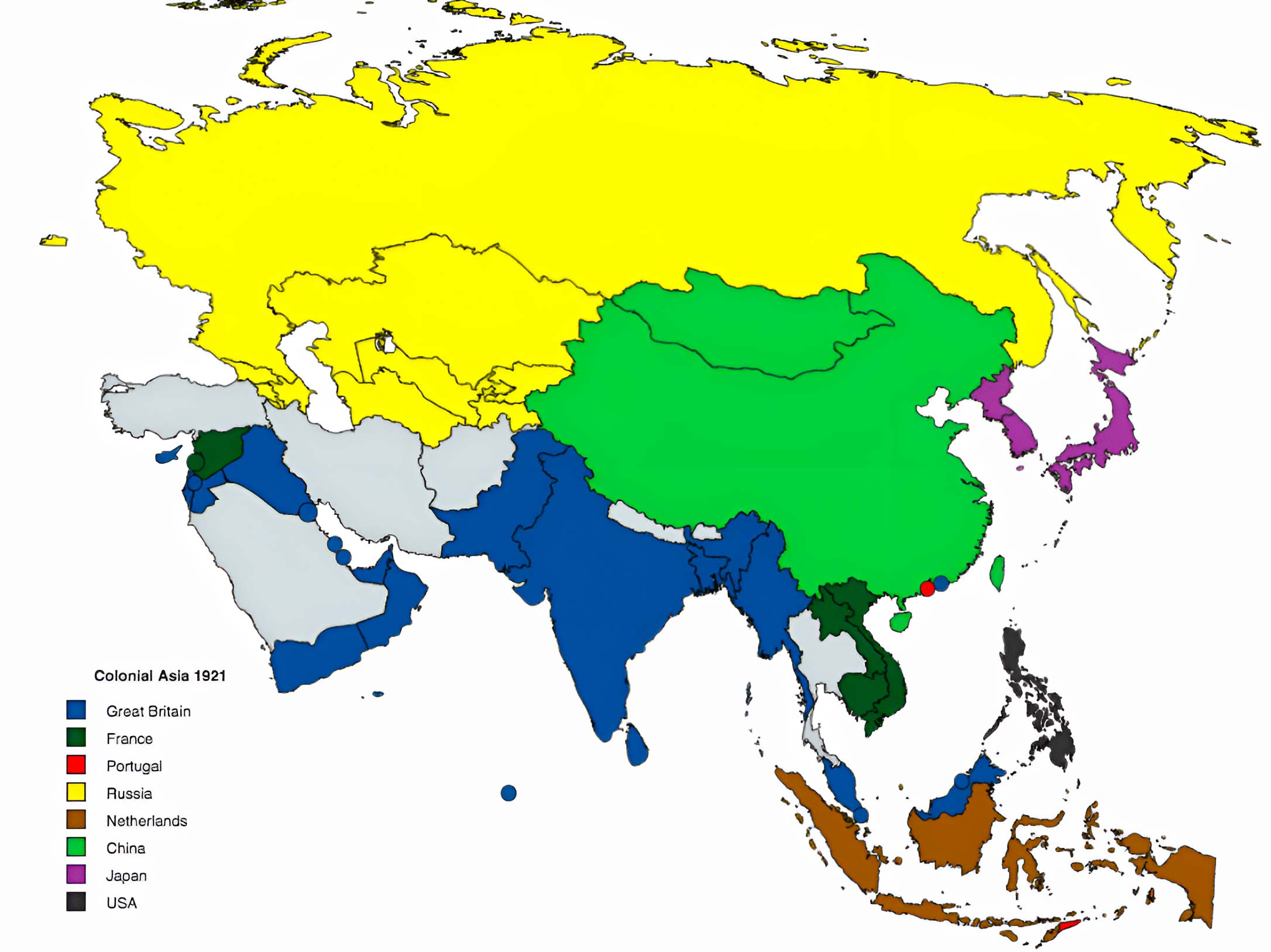
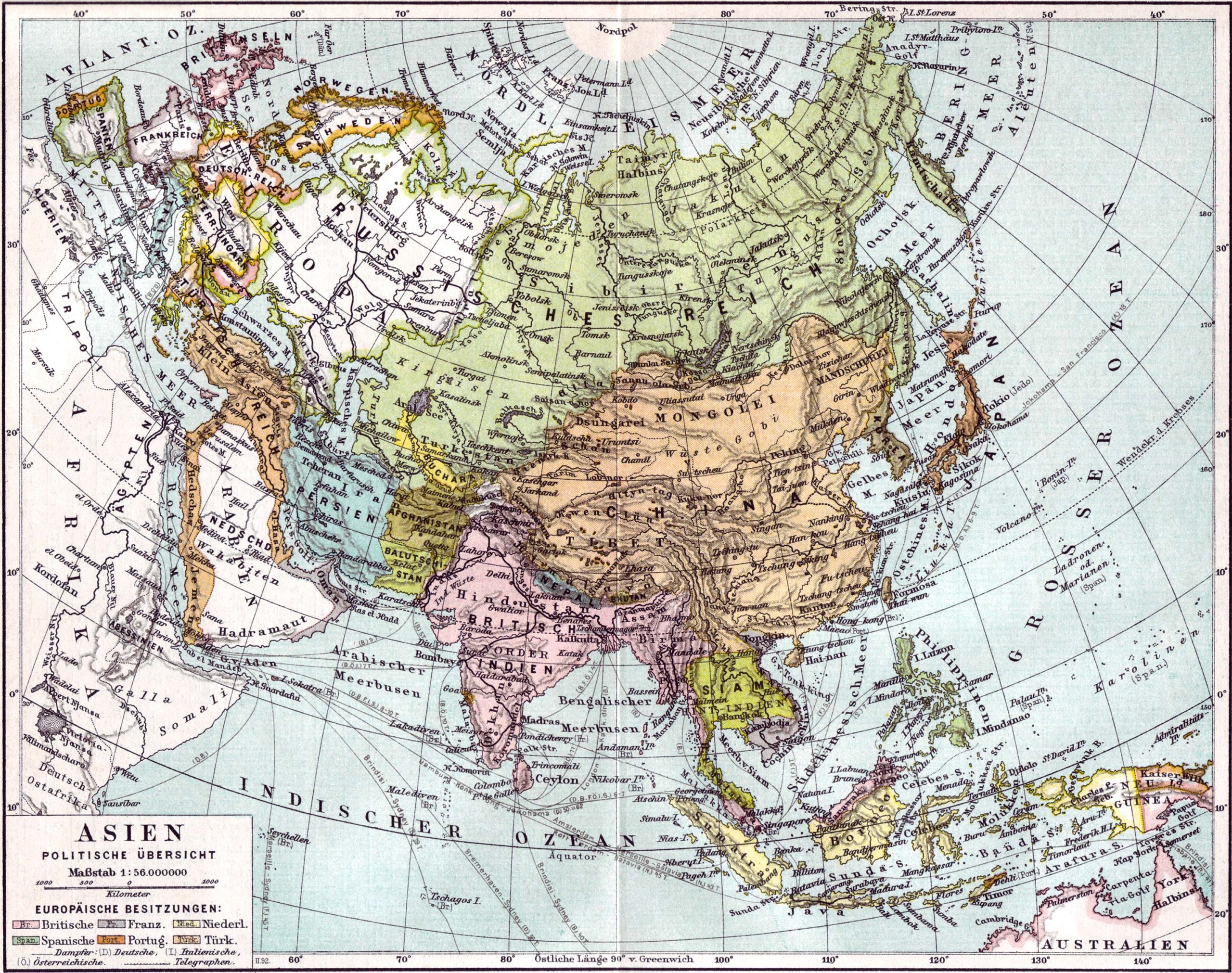
8. Asia Colonial Map 1921
Step back in time and see how colonial powers divided the continent.
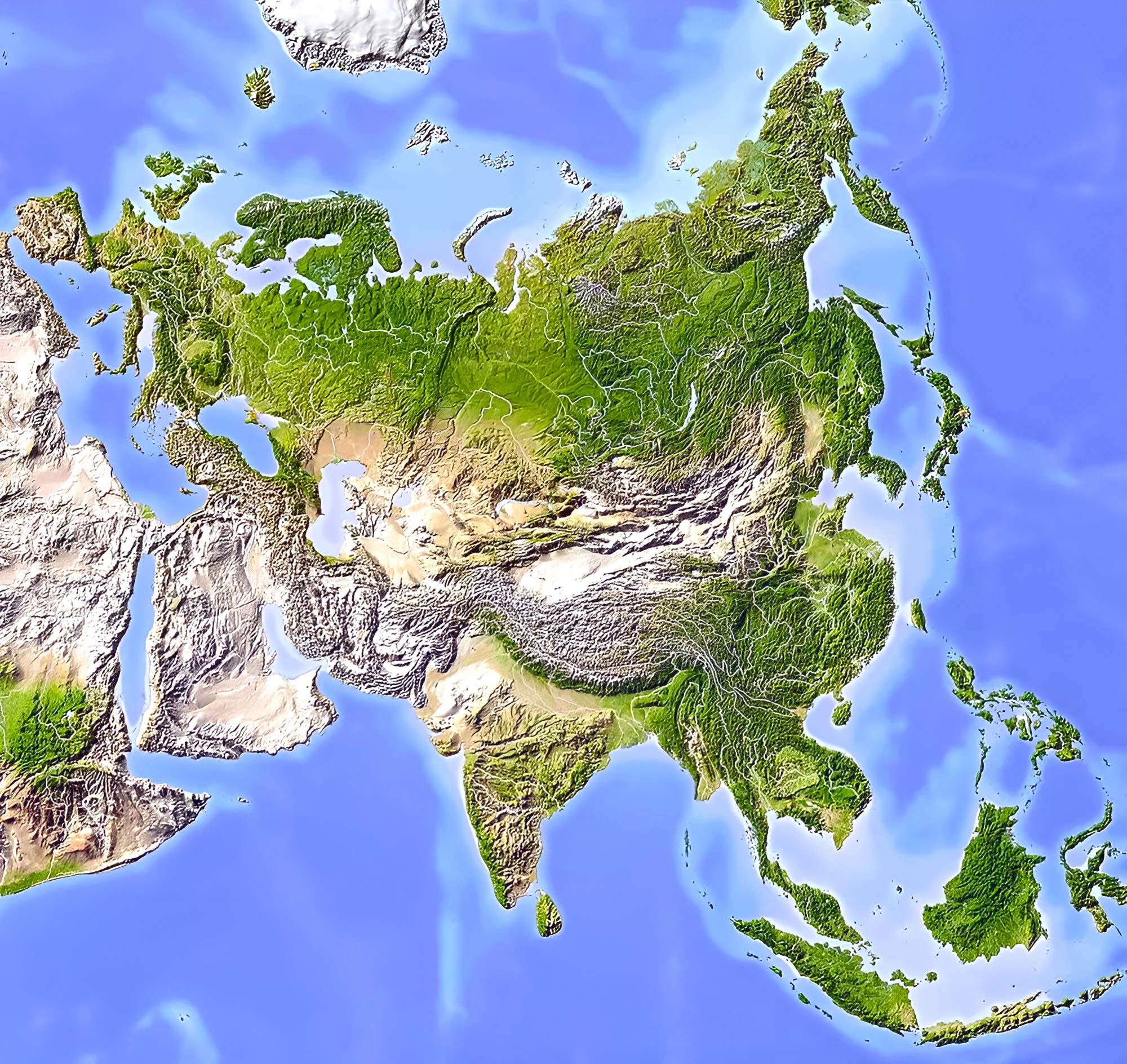
9. Asia Relief Map
Visualize the continent’s altitude and depth, emphasizing mountain ranges, plateaus, and valleys.
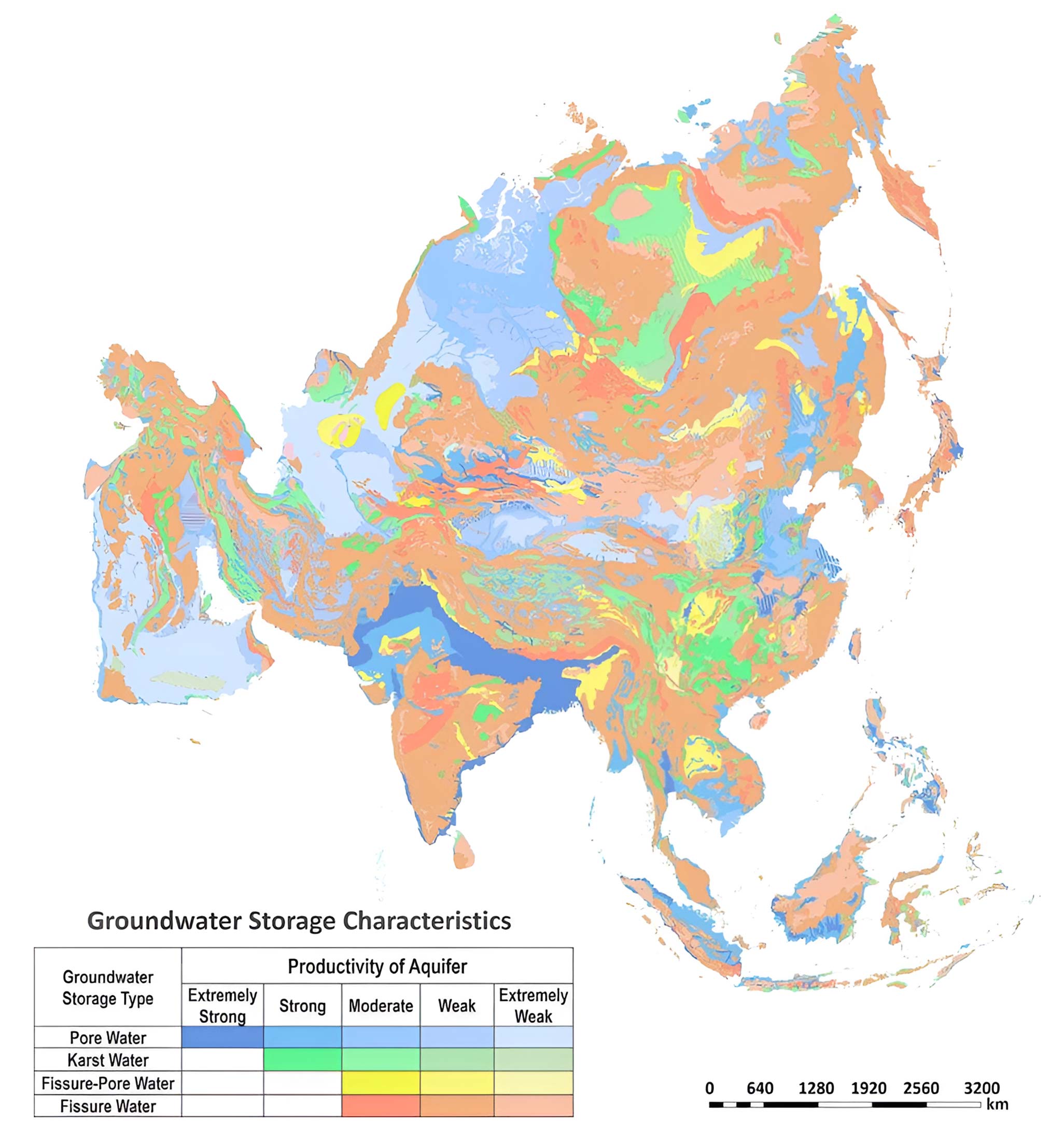
10. Asia Water (Hydrogeology) Map 2012
Unearth the rainfall patterns. Know where the monsoons bless and where deserts stretch.
11. Asia Historical Map
Travel back in epochs, and explore Asia through various ages and empires.
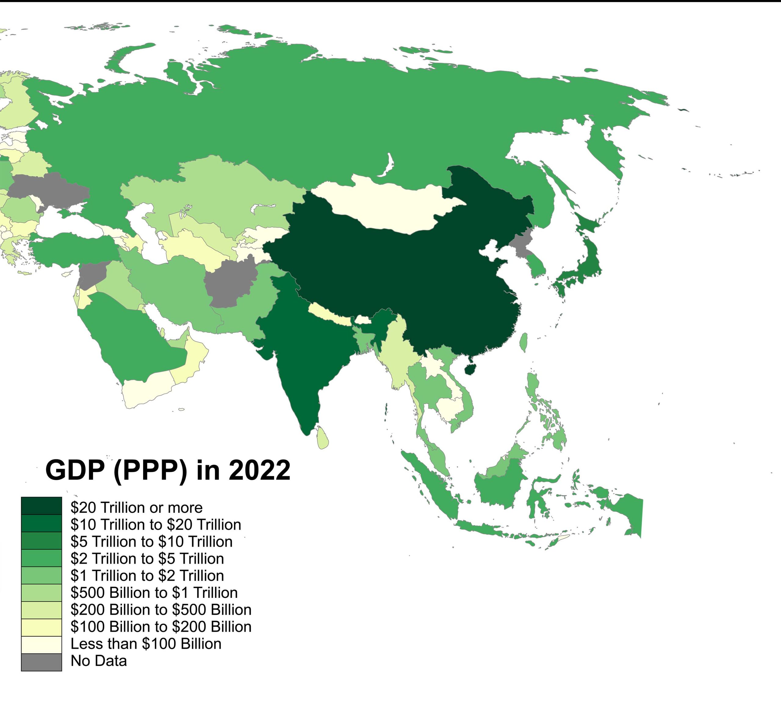
12. Asian Countries by GDP (PPP) Map (2022)
Grasp the economic powerhouses, their prosperity scales, and contrasts across the continent.
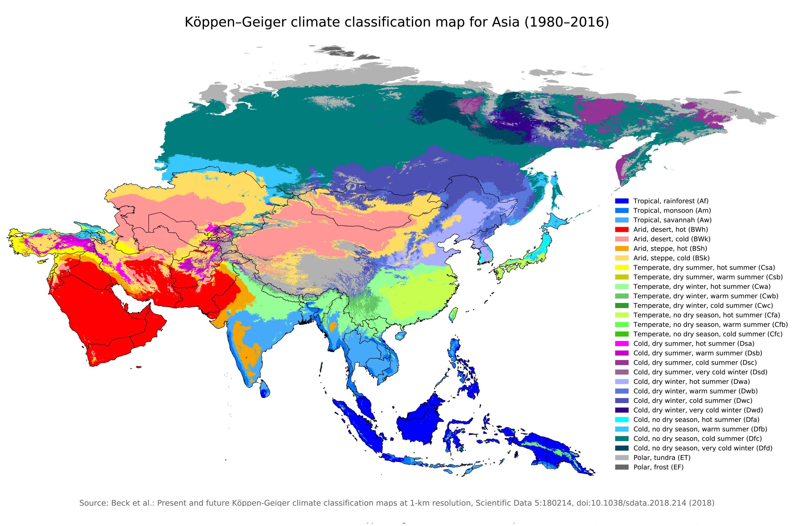
13. Asia Climate Map (1980-2016)
From torrid deserts to frozen tundras, understand the climatic zones that define Asia.
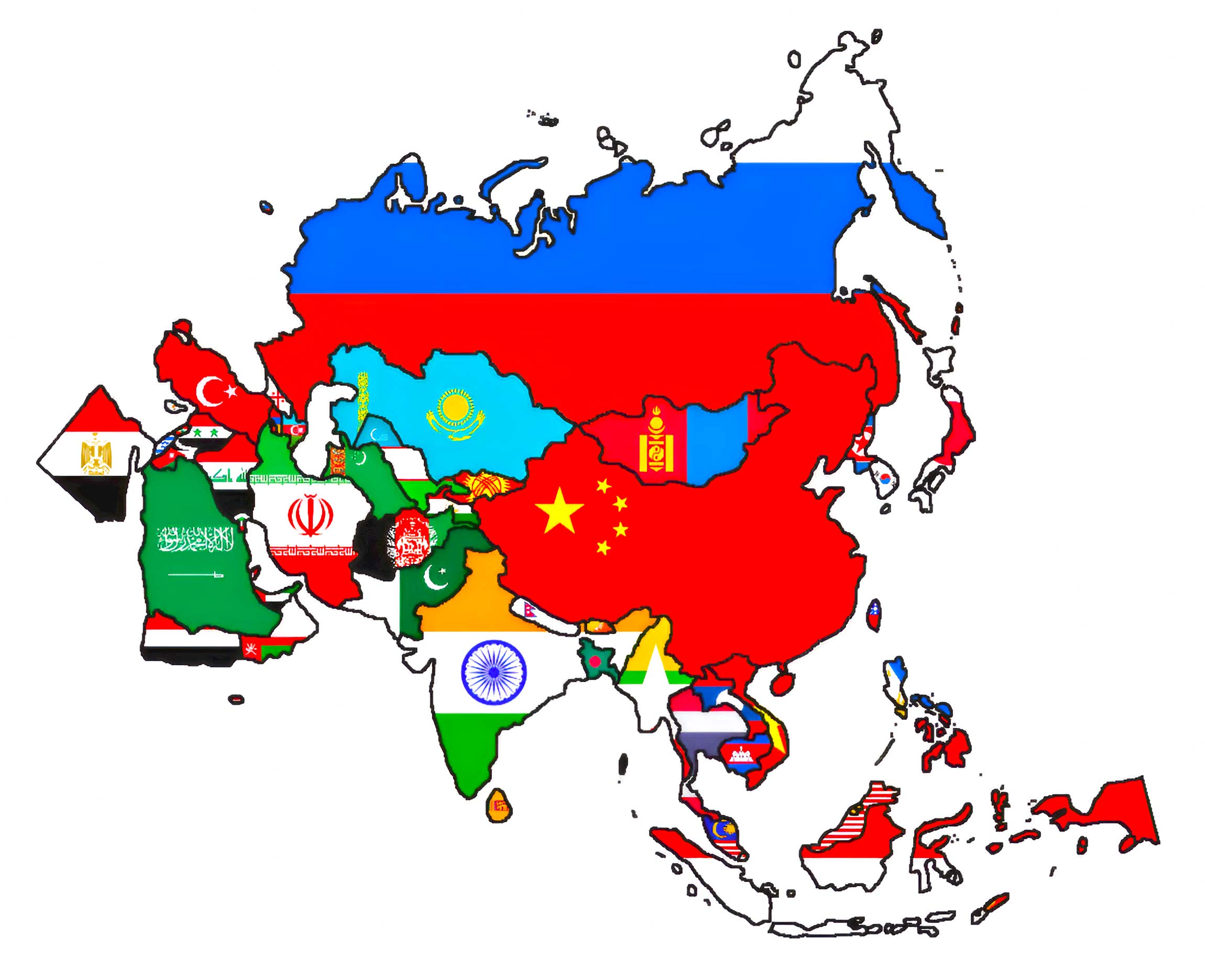
14. Asia Flag Map
Celebrate the diversity with a vivid display of national flags across the continent’s geographical silhouette.
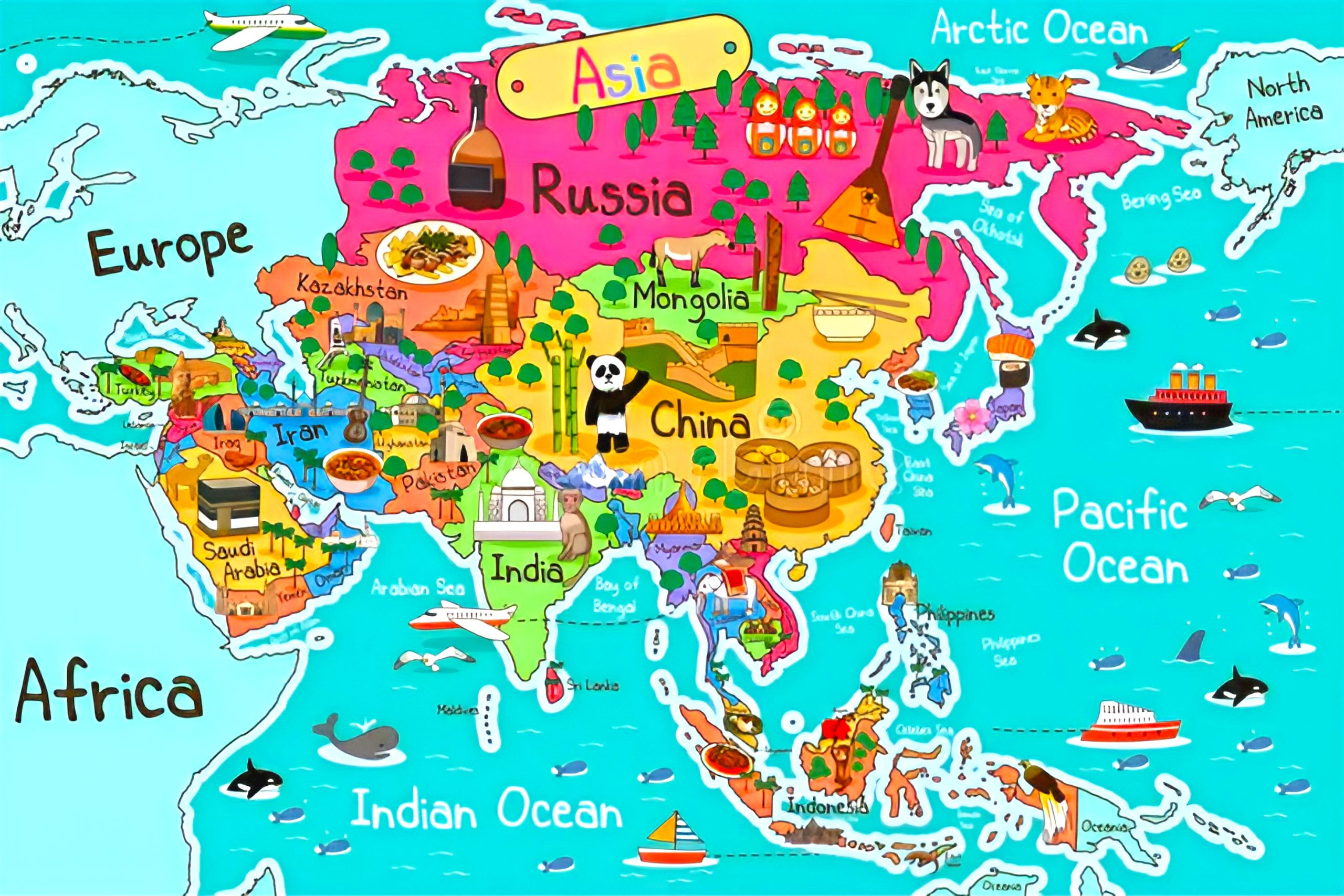
15. Asia Travel (Tourist) Map
For the adventurers and explorers, find the top tourist spots, hidden gems, and the paths less traveled.
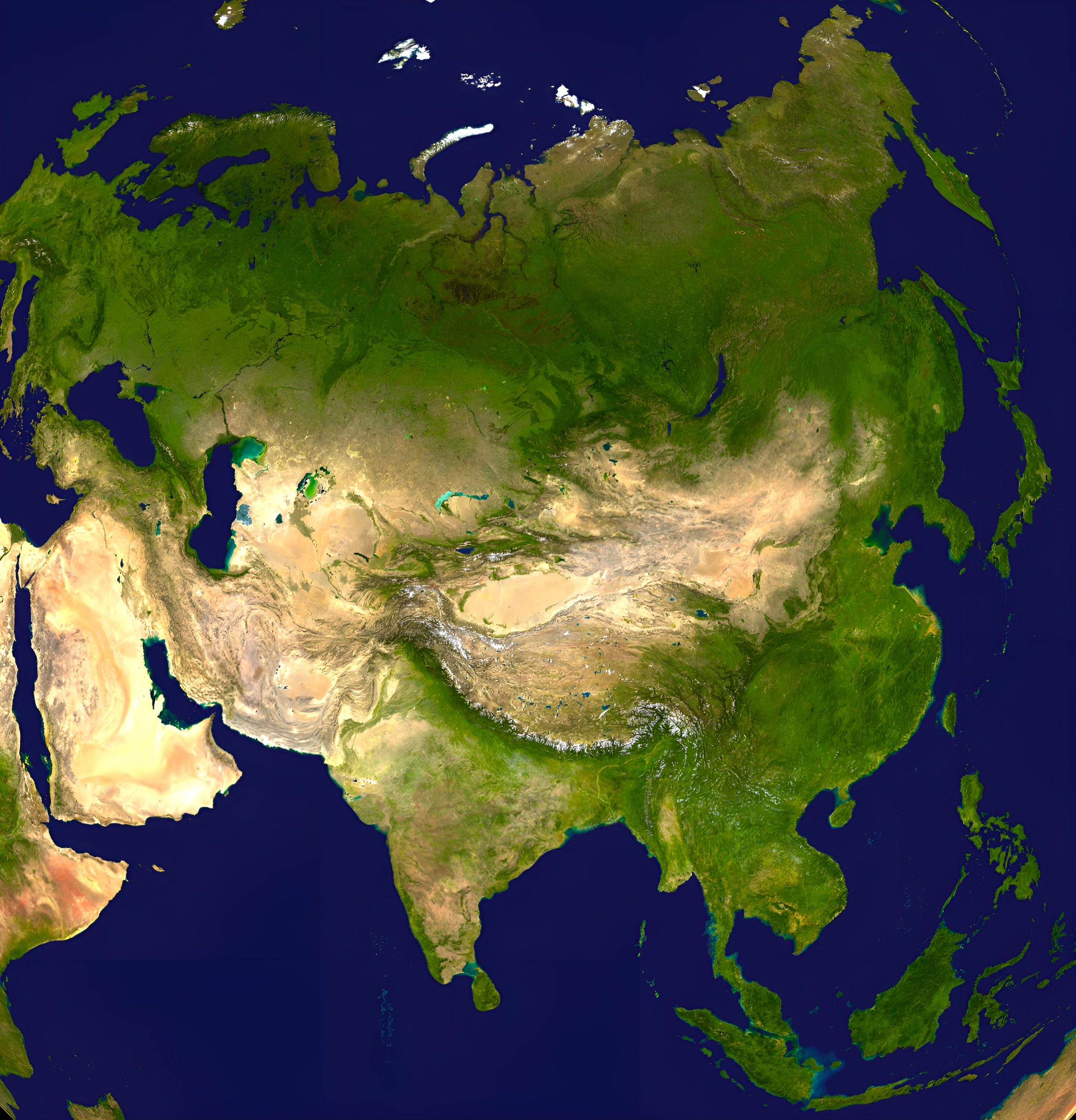
16. Asia Earth Satellite Map
Experience a digital elevation model, offering a mesmerizing 3D visualization satellite of Asia’s terrains.
Asia’s vastness and complexity can be overwhelming, but through these maps, one can embark on a structured journey – understanding its geographies, histories, and modern challenges. So, whether you’re planning a trip or just satiating your curiosity, this map collection is your perfect companion. Don’t forget to check out the interactive features and videos accompanying each map for an enriched experience!
Where is Asia on the World Map?
Show Google Maps and satellite maps of where the country is located.
Get directions by driving, walking, bicycling, public transportation, and travel with street view.
Feel free to explore these pages as well:
- Asia Map ↗️
- Map of Asia ↗️
- Iran Map ↗️
- Bangkok: Asia’s City of Angels and Its Hidden Gems ↗️
- A Collection of Asia Maps ↗️
- About Asia and Maps ↗️
- A Collection of China Maps ↗️
- China’s Largest Cities ↗️
- A Collection of Bangladesh Maps ↗️
- Thailand Map ↗️
- About Thailand ↗️
- Thailand Photos ↗️
- Top 10 Experiences in Phuket ↗️
- Bangkok: Asia’s City of Angels and Its Hidden Gems ↗️

