Welcome to the ultimate collection of Algeria maps! Whether you’re a geography buff, a travel enthusiast, or someone with an interest in the various facets of Algeria’s landscape, this page is tailor-made for you. Dive into the mesmerizing world of maps, each offering a unique perspective on this North African gem.
1. Algeria Physical Map
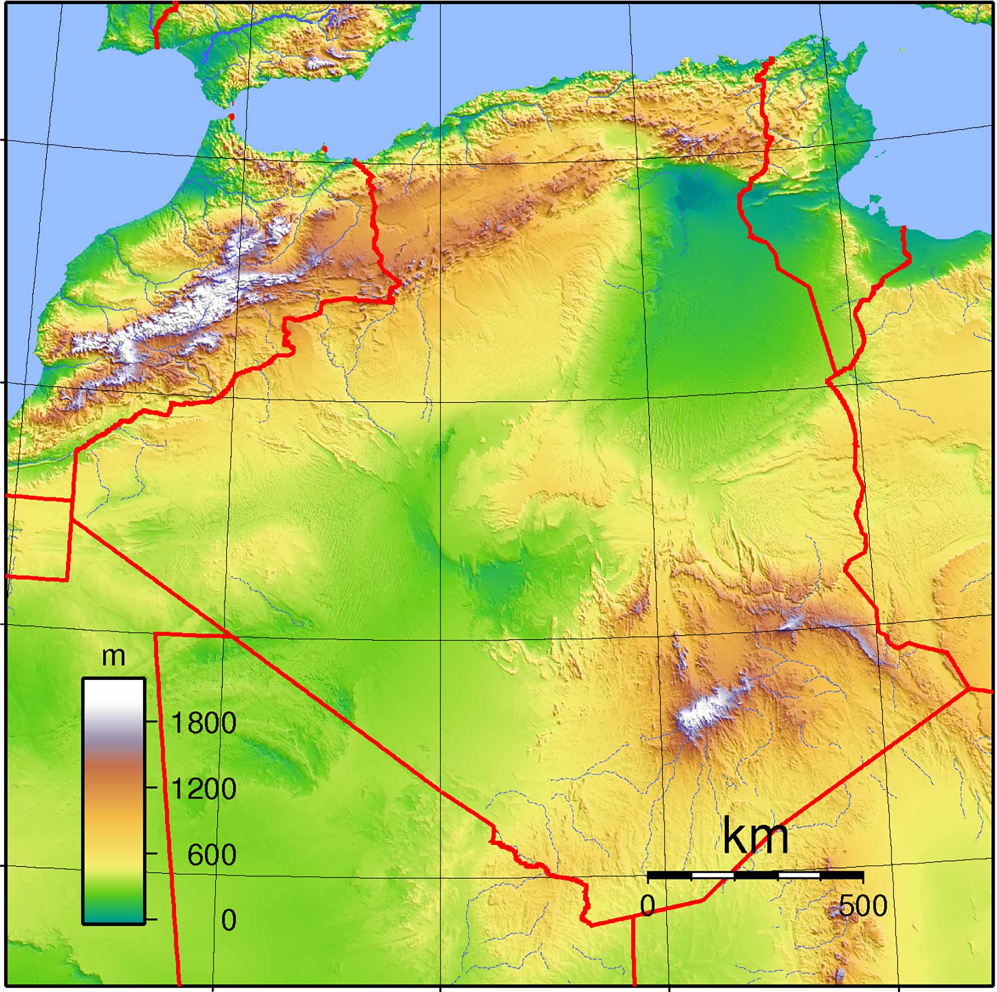
A physical map showcases the physical features of Algeria, highlighting its mountains, plateaus, and coastline. From the Sahara desert to the Atlas Mountains, the diverse landscapes of Algeria come to life.
2. Algeria Political Map
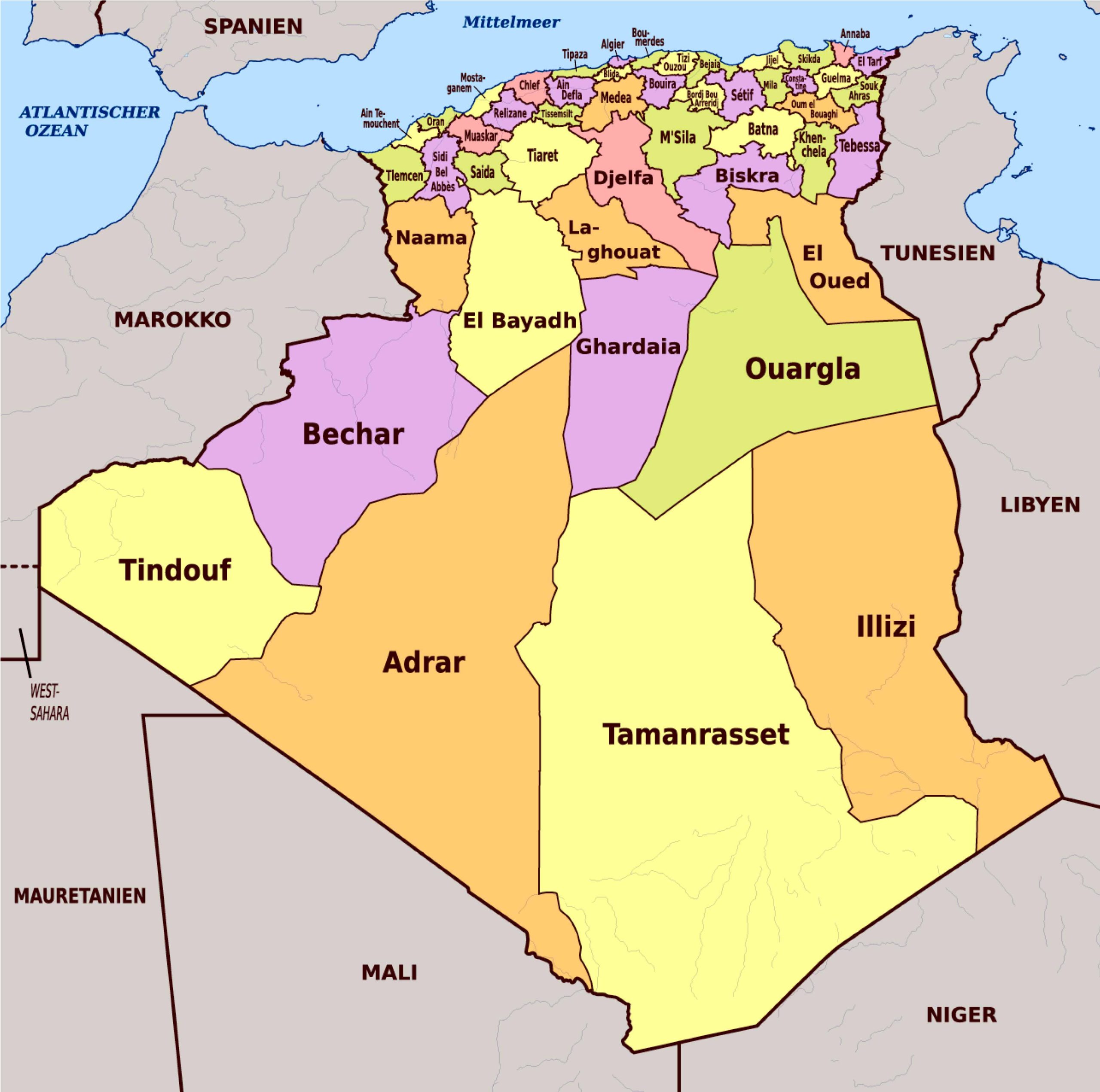
Get to know the administrative divisions of Algeria with a political map. This map reveals the borders of the wilayas (provinces), giving you an understanding of the nation’s governmental structure.
3. Algeria Topographic Map
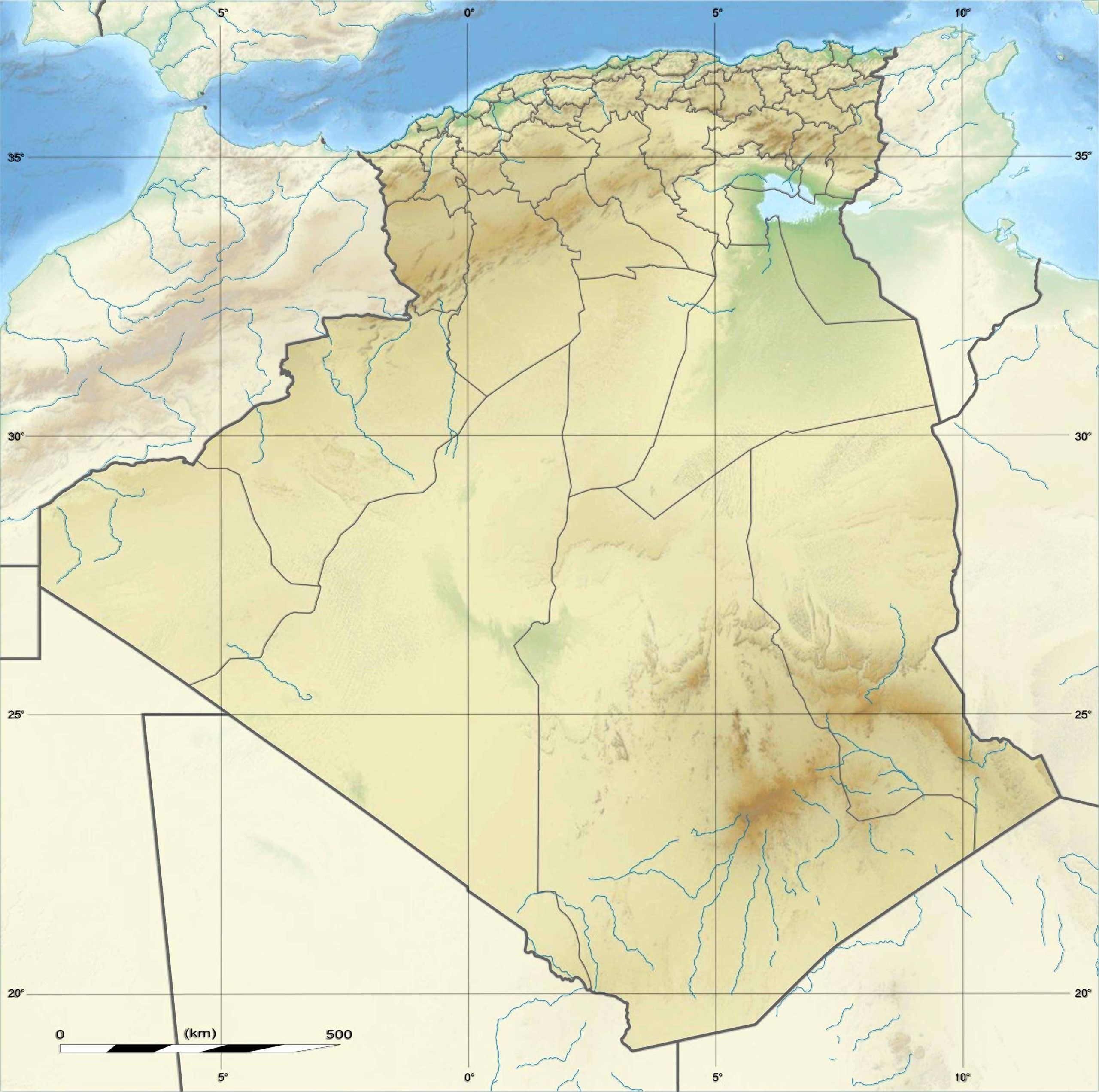
Elevate your understanding! The topographic map illustrates the elevations and depressions across Algeria. Perfect for hikers and outdoor enthusiasts!
4. Algeria Geological Map
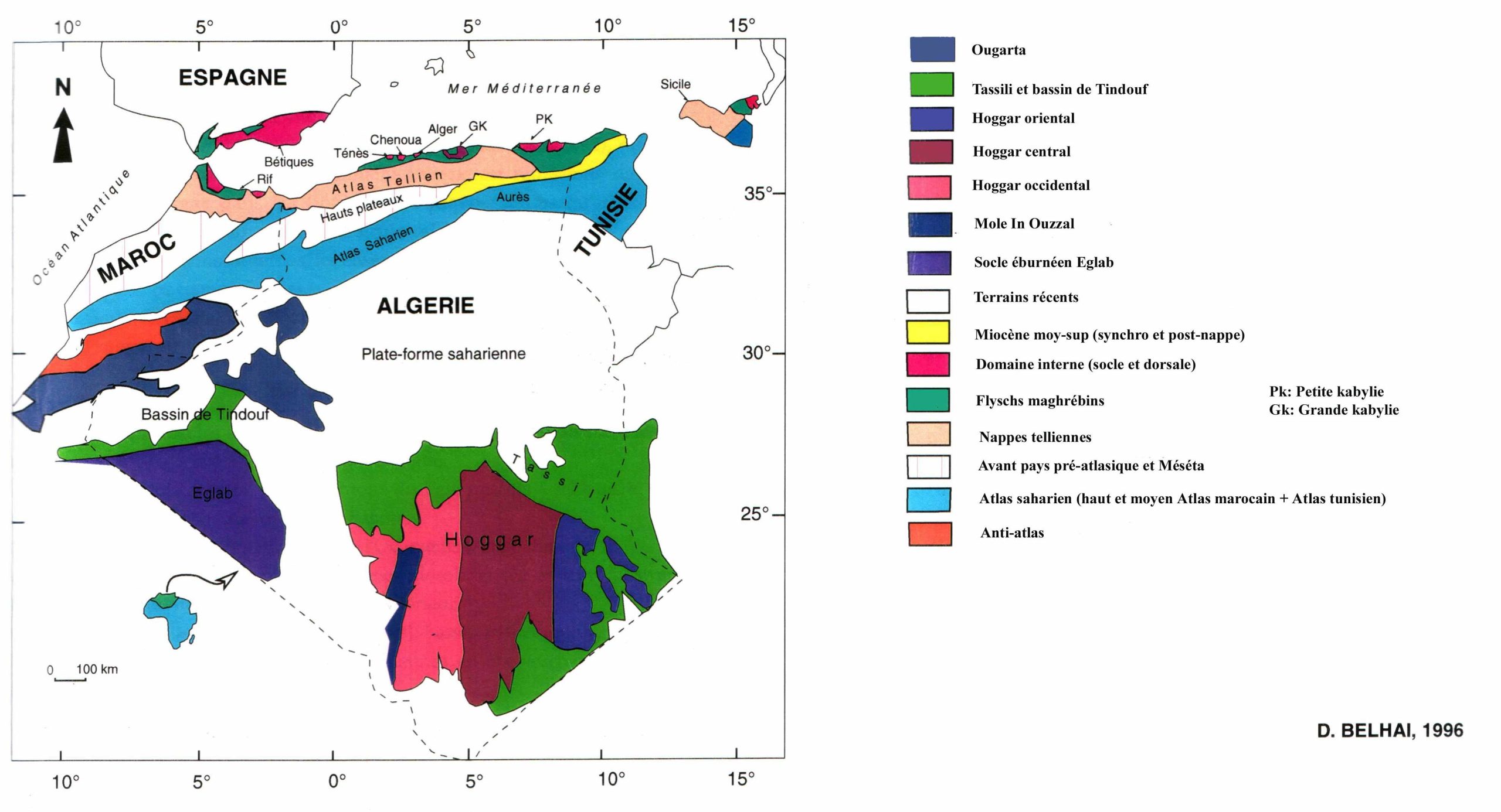
Dig a little deeper into Algeria’s earth with a geologic map. Discover the rock formations and structures beneath the surface.
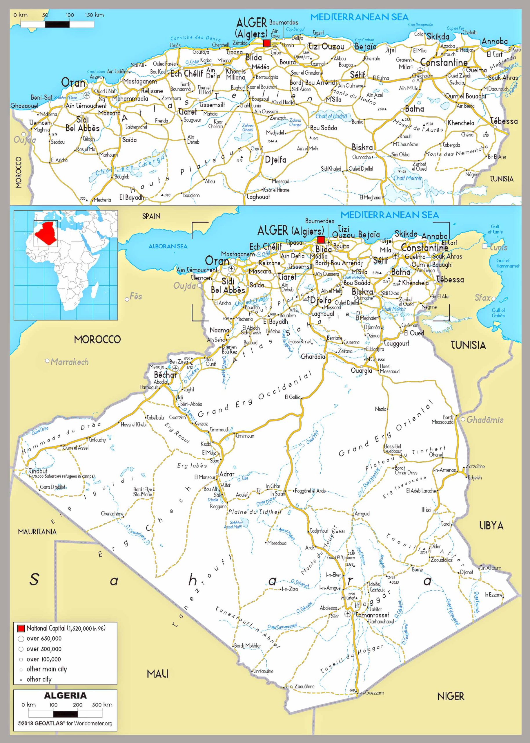
5. Algeria Cities (Urban) Map
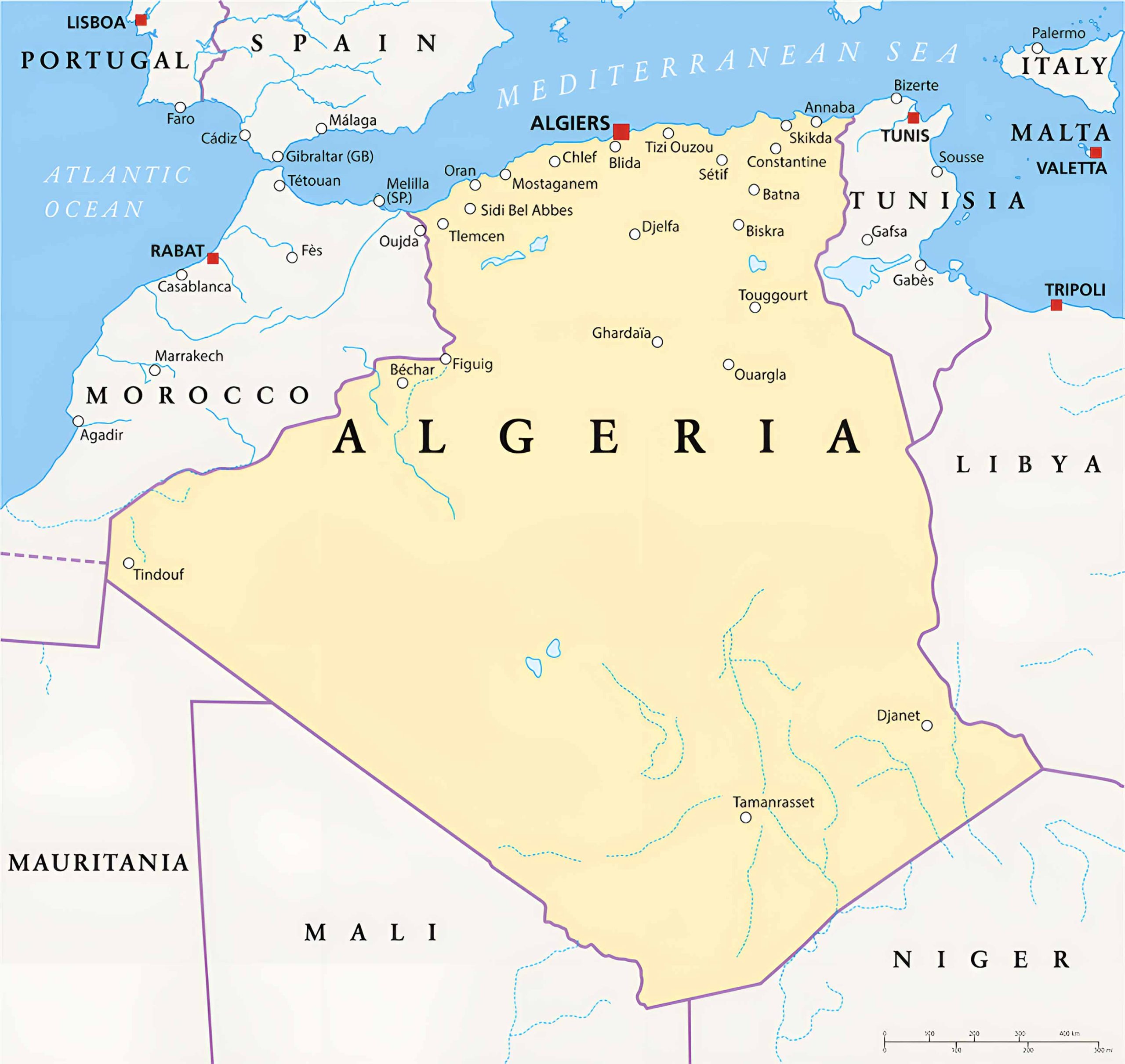
Planning to visit? Navigate your way through Algiers, Oran, Constantine, and other bustling cities with the detailed urban maps.
6. Algeria Regions Map
Explore the distinct regions of Algeria, from the coastal plains to the sweeping Saharan expanses.
7. Algeria Administrative Divisions Map (2019)
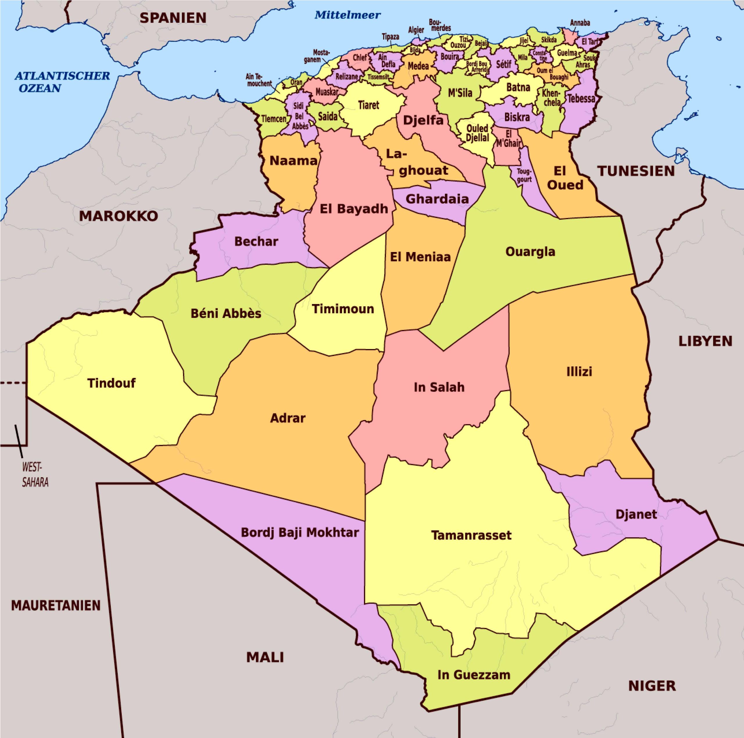
To gain a comprehensive understanding of Algeria’s governmental regions and their boundaries. This up-to-date map provides a clear representation of the wilayas (provinces), ensuring you’re informed about the country’s latest administrative structures.
8. Algeria Relief Map
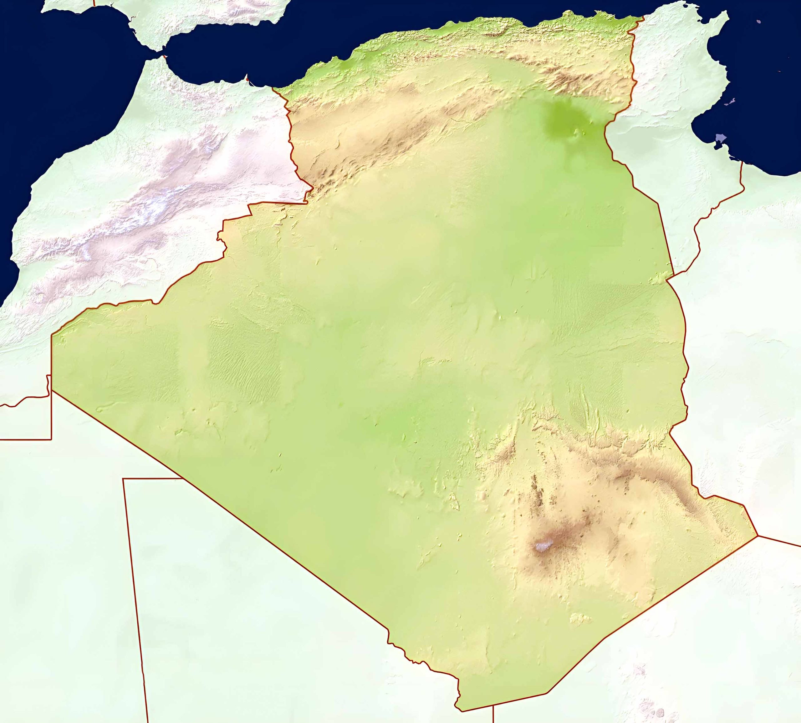
Gain a three-dimensional sense of Algeria’s terrain. The relief map accentuates the highs and lows of the Algerian landscape.
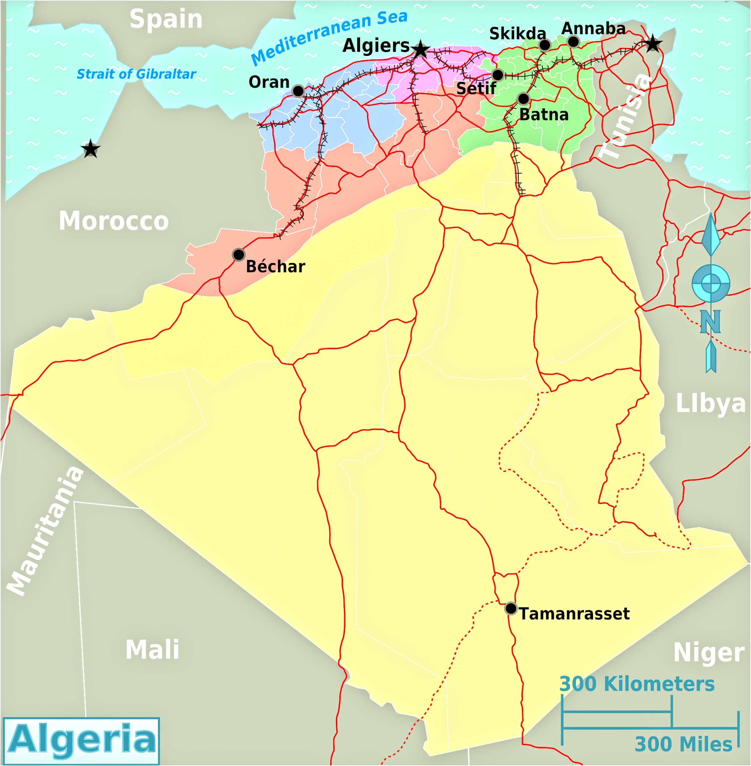
9. Algeria Transit Map
Hop on board Algeria’s transit system. Find major transit hubs, routes, and stations on the transit map.
10. Algeria Historical Map
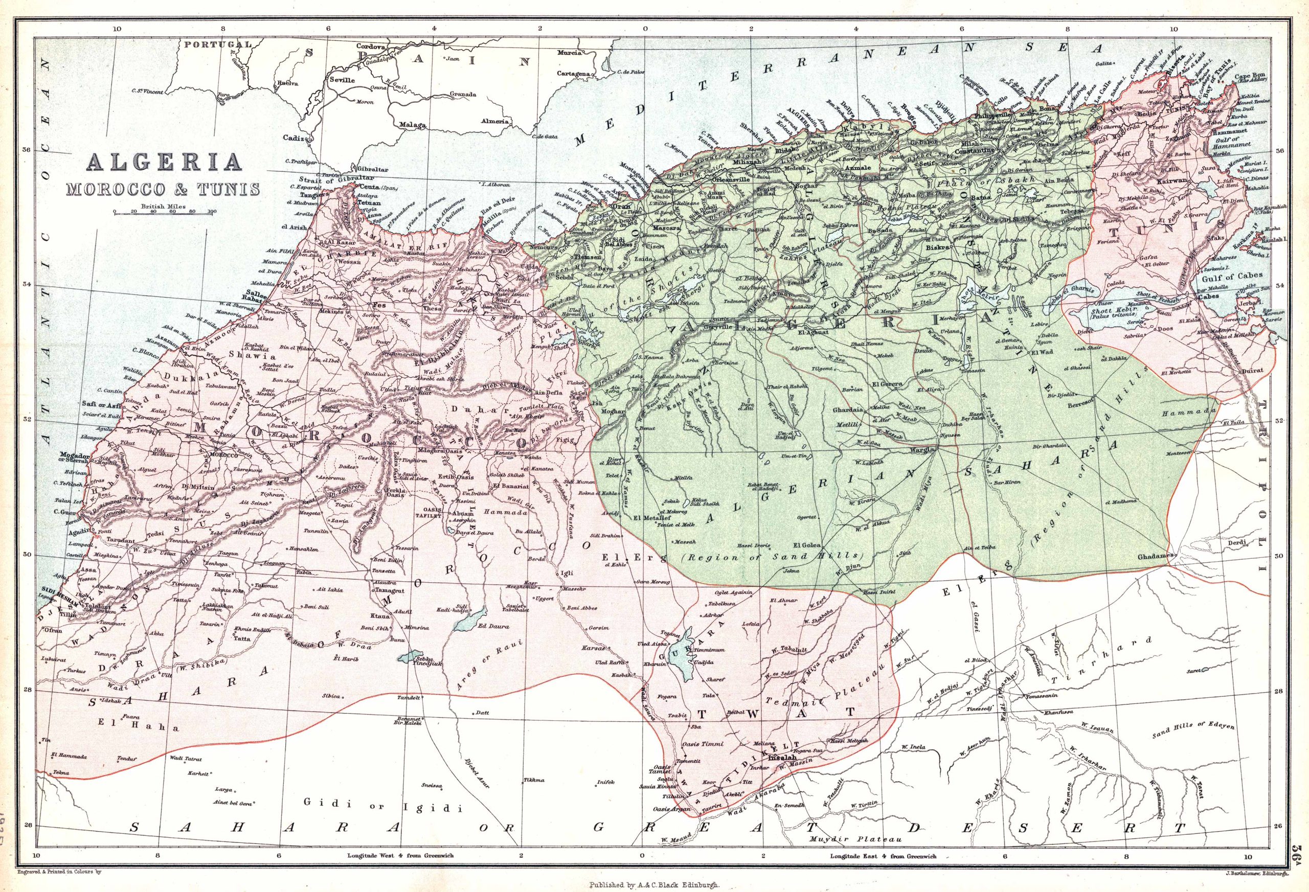
Step back in time and witness the evolution of Algeria’s borders, regions, and key landmarks.
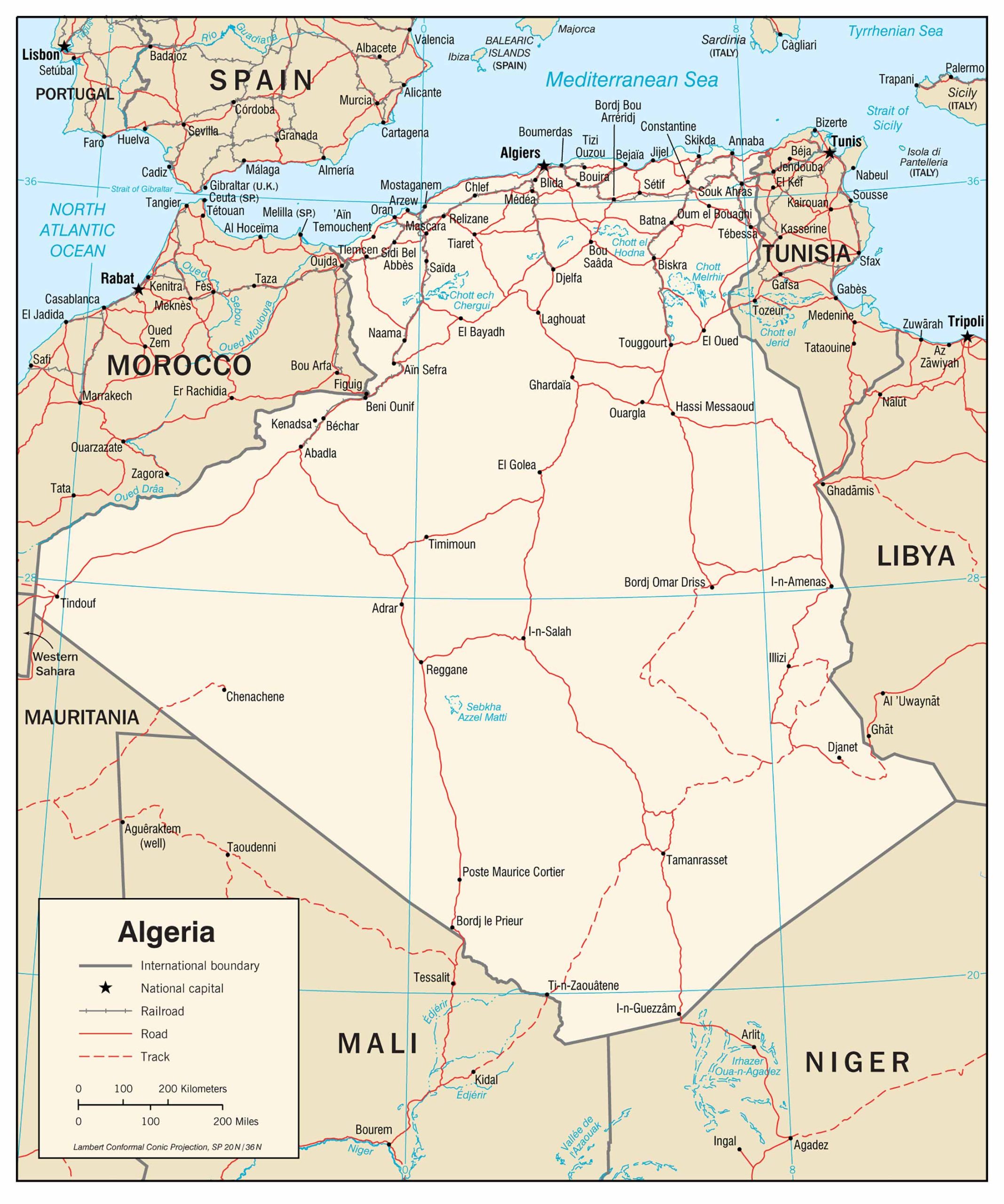
11. Algeria Road Map
Ready for a road trip? Navigate the highways, main roads, and rural routes with ease.
12. Algeria Train-Railway Map
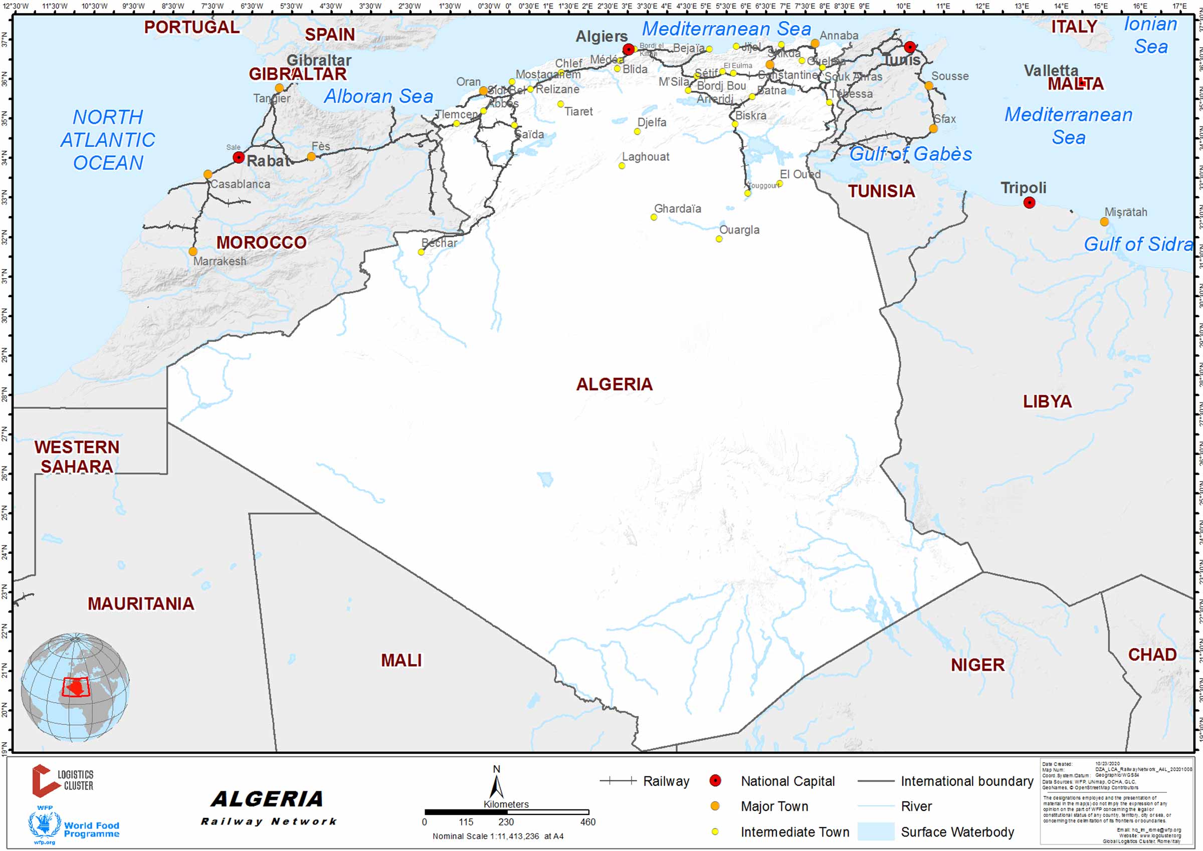
Choo choo! The train-rail map showcases Algeria’s railway network, connecting major cities and towns.
13. Algeria Climatic Map
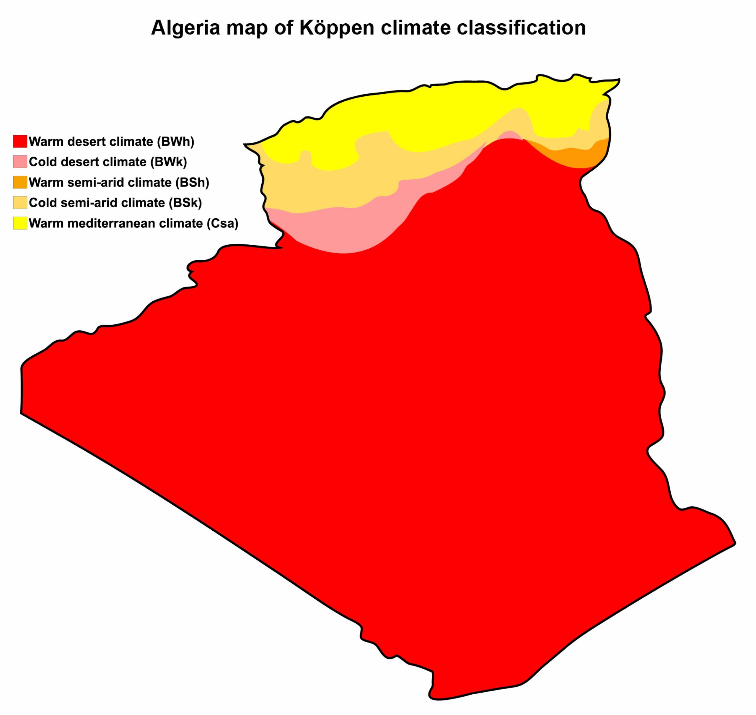
From Mediterranean breezes to desert heat – the climatic map gives you a colorful representation of Algeria’s climate zones.
14. Algeria Flag Map
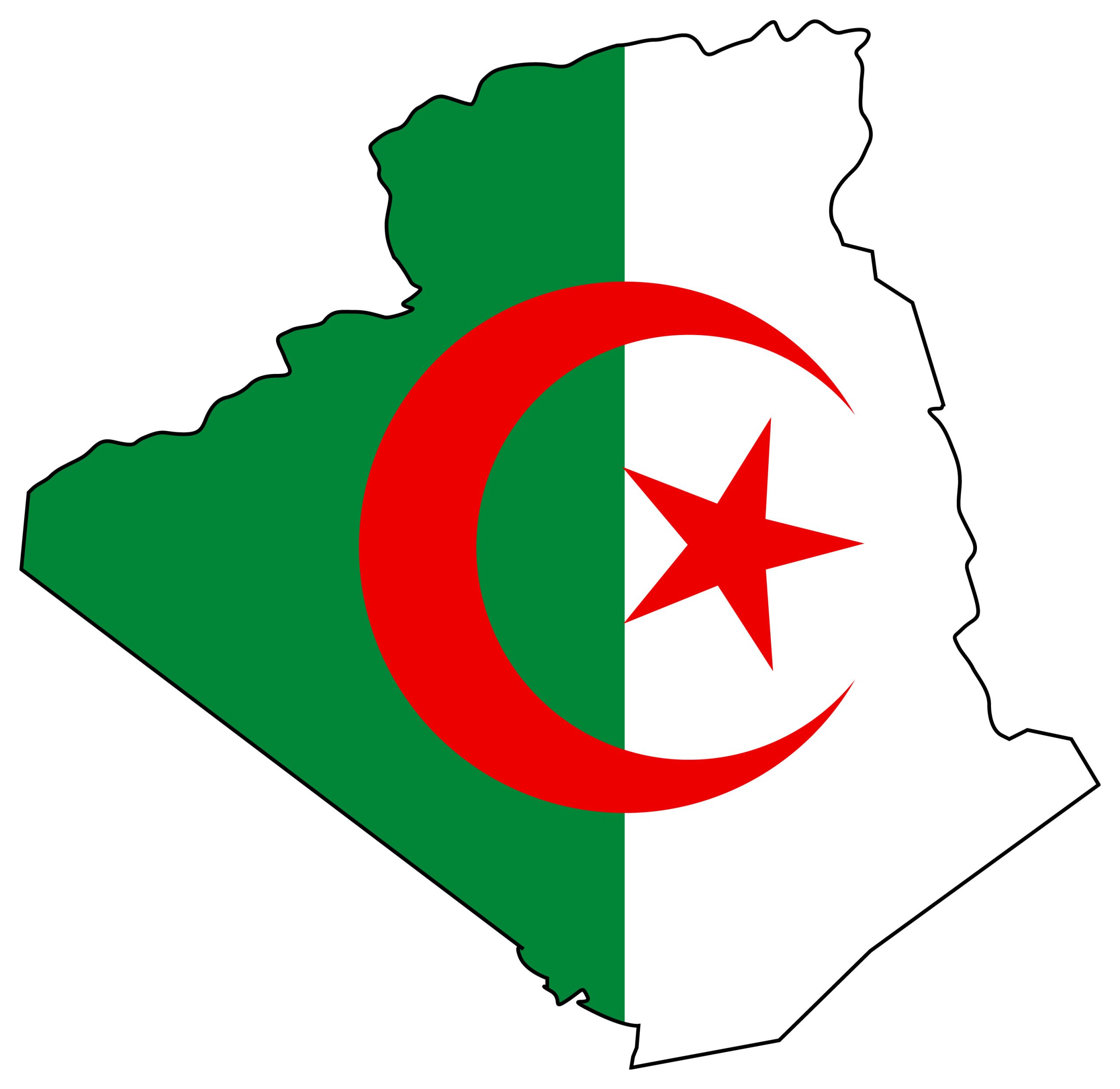
Show off your Algerian pride! The flag map superimposes Algeria’s national flag over its borders – a harmonious blend of identity and geography.
15. Algeria Travel-Tourist Map
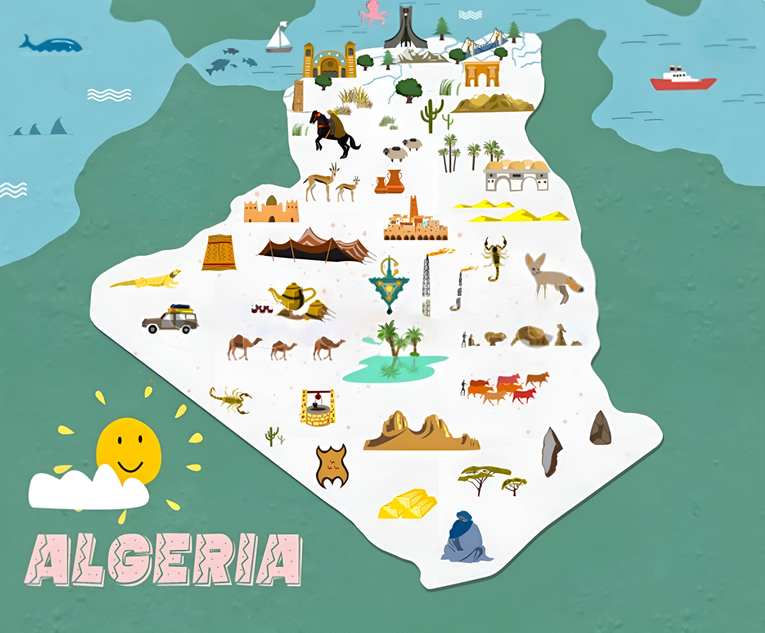
The ultimate guide for travelers. Highlighting popular tourist attractions, routes, and must-visit spots, this map will be your best companion.
16. Map of Algeria’s Location in the World Map
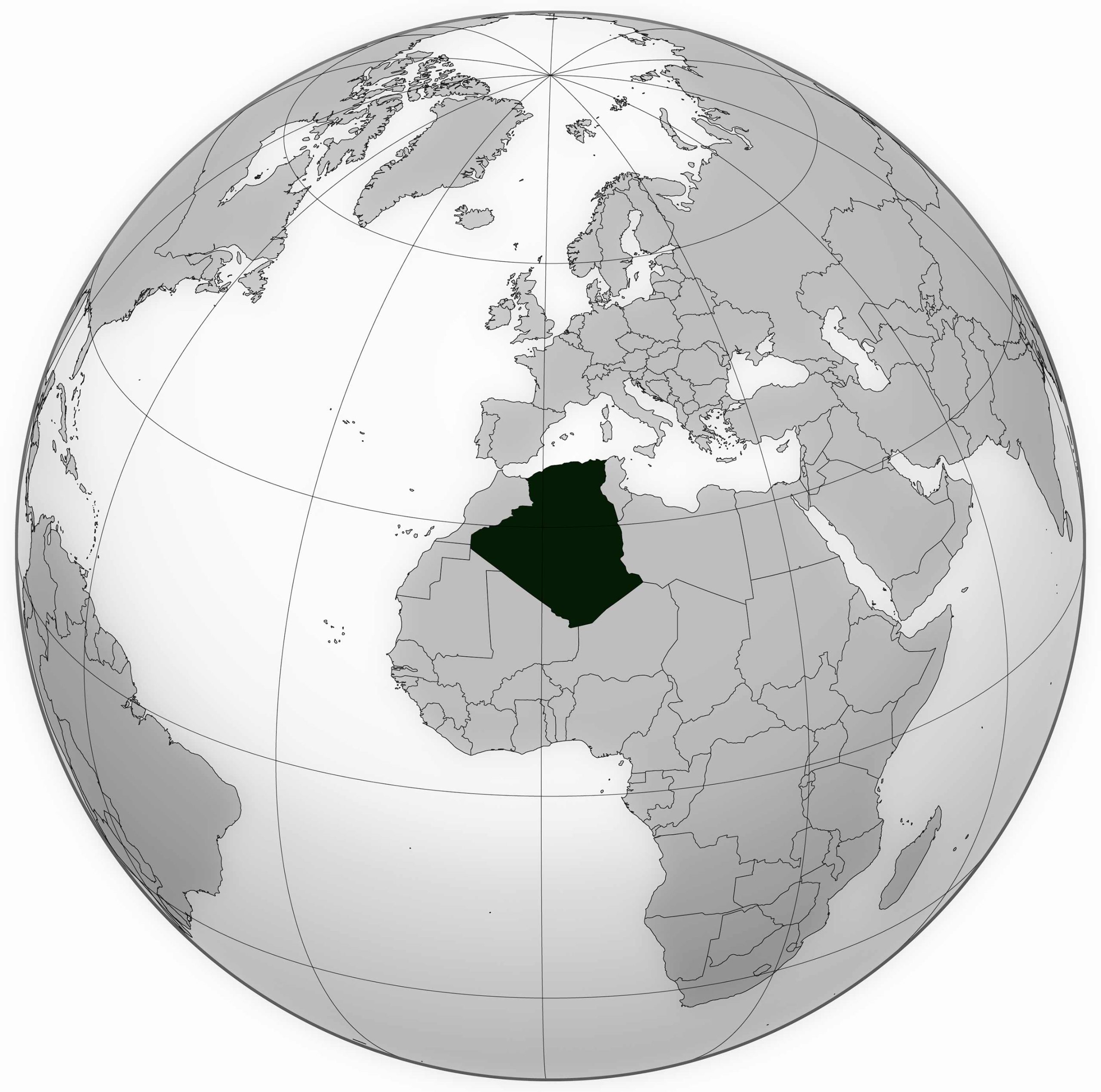
To pinpoint exactly where this North African gem situates globally. This map offers a contextual view, placing Algeria within the vast tapestry of global geography.
17. Algeria Earth Satellite Map
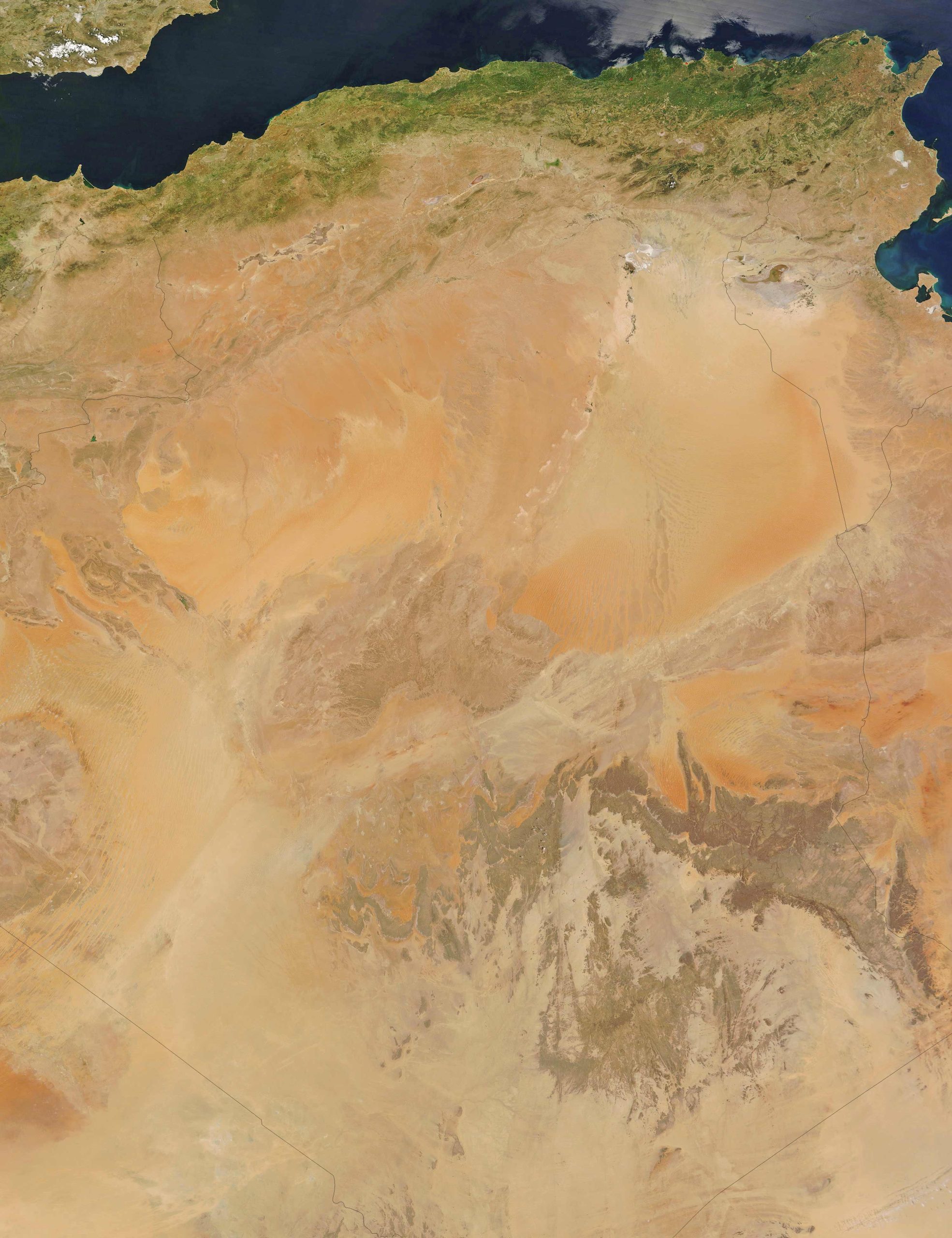
This stunning view captures Algeria’s terrain and topography from space, offering a breathtaking snapshot of its natural beauty from the stars.
Algeria, with its rich history and diverse landscapes, has so much to offer. We hope these maps provide you with a deeper understanding and appreciation of this beautiful nation. Whether you’re planning your next trip or indulging in armchair travel, let these maps guide your journey.
Where is Algeria on the Africa Map?
Show Google map, satellite map, where is the country located.
Get directions by driving, walking, bicycling, public transportation and travel with street view.
Feel free to explore these pages as well:
- Africa Map ↗️
- Africa Map I ↗️
- Africa Map II ↗️
- Africa Map III ↗️
- Africa Map IV ↗️
- Africa Map V ↗️
- Map of Africa ↗️
- Gibraltar Map ↗️
- A Collection of Africa Maps ↗️
- About Africa and Maps ↗️
- Visit Africa ↗️
- A Collection of Algeria Maps ↗️
- Discover Addis Ababa ↗️