Explore Denmark’s diverse terrain and vibrant cities through our extensive map collection. From bustling cities like Copenhagen to the serene coastline, these maps offer a unique glimpse into the landscapes that define the country.
Brief information about Denmark
Denmark, a small but vibrant country in Northern Europe, is known for its rich history, stunning landscapes, and high quality of life. As part of Scandinavia, Denmark boasts a mix of modern cities and scenic countryside, with Copenhagen as its lively capital. The country is famous for its Viking heritage, beautiful coastlines, and iconic landmarks like the Little Mermaid statue and Tivoli Gardens. Danish people are often considered some of the happiest in the world, thanks to their strong social welfare system and a balanced work-life culture.
Map of Denmark
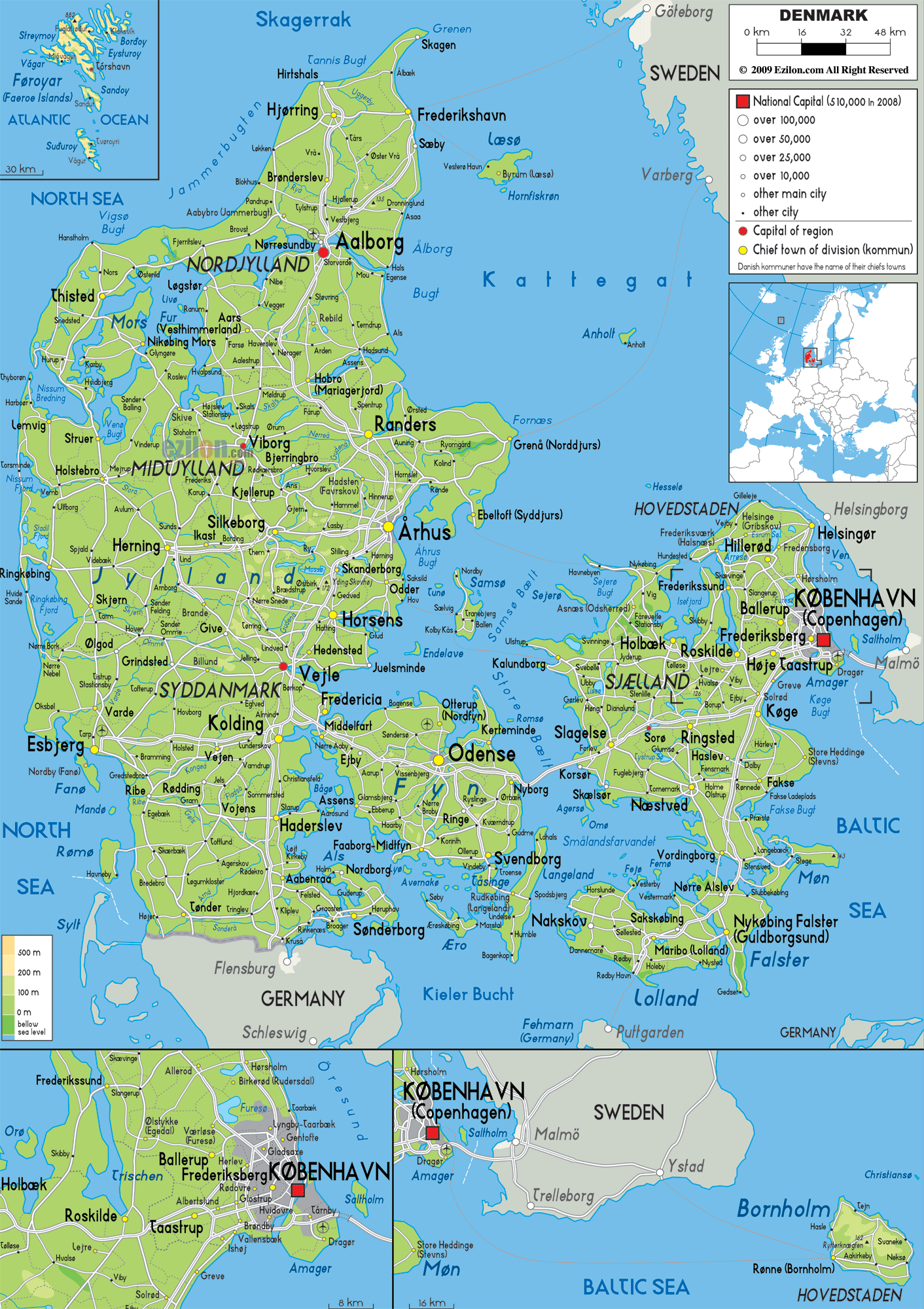
This map shows Denmark’s major cities, regions, roads, and neighboring countries like Germany and Sweden.
Beyond its cultural treasures, Denmark has a strong commitment to sustainability and green living. The nation is a leader in renewable energy, especially wind power, and has ambitious goals for a carbon-neutral future. Whether you’re strolling through cobblestone streets in Copenhagen or exploring the picturesque Danish countryside, this small country offers a unique blend of history, innovation, and a welcoming atmosphere.
Where is located Denmark on the World Map
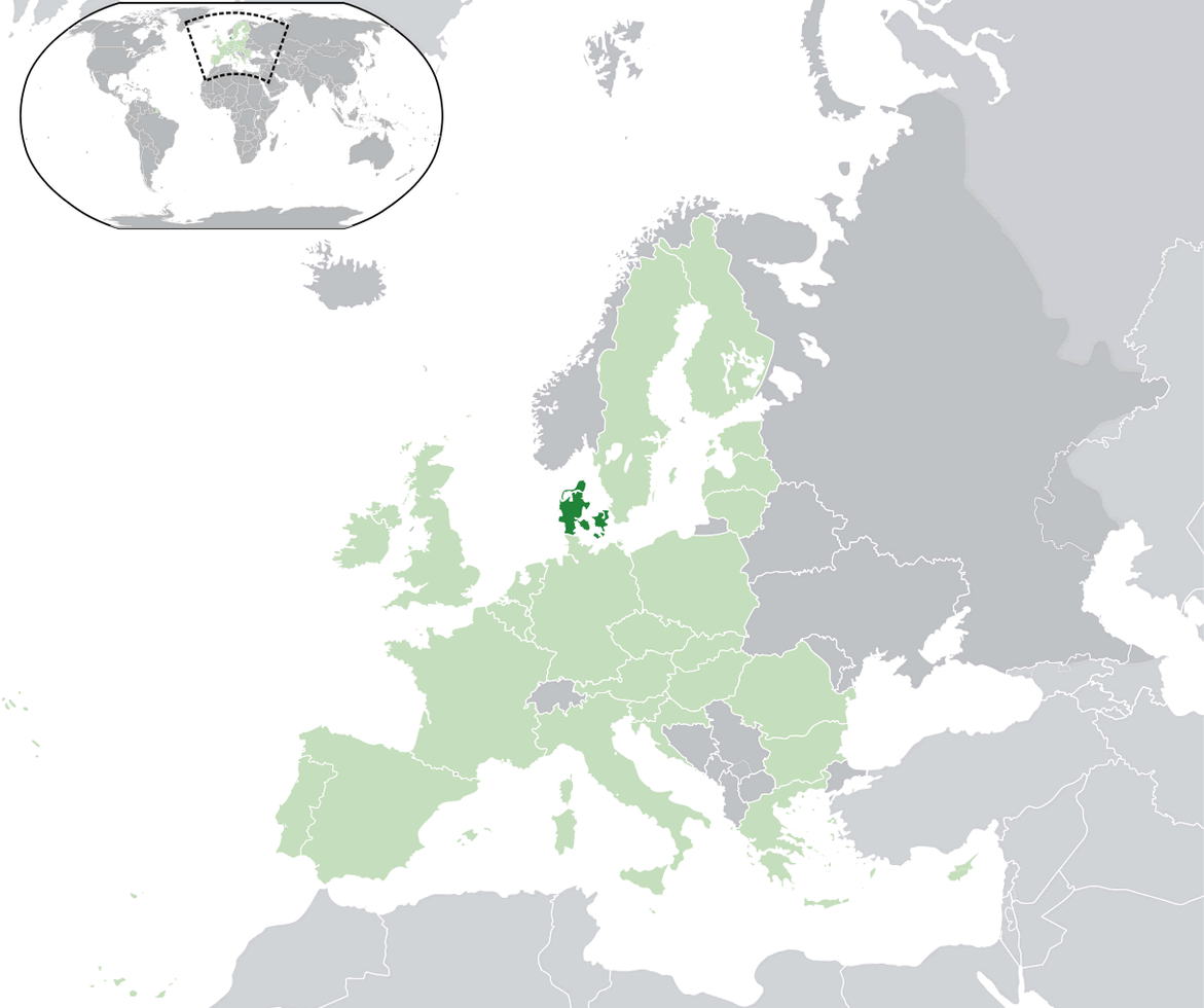
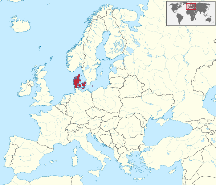
Denmark is located in Northern Europe, situated between the North Sea and the Baltic Sea. It is part of the Scandinavian region and shares a border with Germany to the south. The country is made up of the Jutland Peninsula and several islands, with Zealand being the largest where the capital, Copenhagen, is located.
To the north, Denmark is close to Norway, and to the east, it’s separated from Sweden by the Øresund Strait. A bridge connects Copenhagen to the Swedish city of Malmö, making it easy to travel between the two countries.
Though small in size, Denmark’s strategic location gives it access to both the Atlantic and the Baltic, making it historically significant for trade and exploration. It’s well-connected to the rest of Europe and is a gateway to the Nordic countries.
Here are some statistical information about Denmark:
Denmark World Map
Denmark Maps
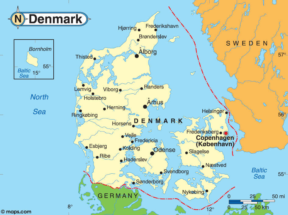
This map highlights Denmark’s major cities, including Copenhagen, Aarhus, and Odense, as well as its borders with Germany and Sweden, and key surrounding seas such as the North Sea and Baltic Sea.
Denmark Industry Map
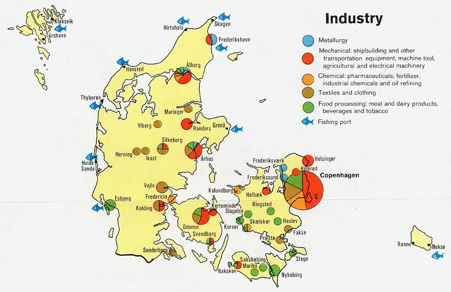
This map of Denmark illustrates the distribution of major industries, including metallurgy, mechanical equipment, chemical production, textiles, food processing, and fishing ports across various regions.
Denmark Physical Map
Denmark Europe Map
Denmark Population Map
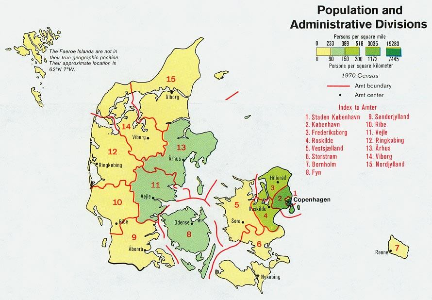
This map illustrates Denmark’s population density and administrative divisions, highlighting different regions (Amter) and their population per square mile or kilometer based on the 1970 Census. The map also marks administrative boundaries and centers for each region.
Denmark Road Map
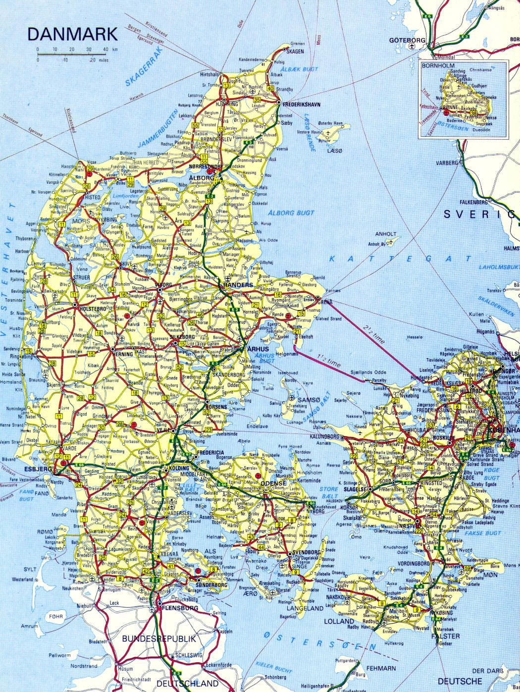
Denmark Earth Map
Denmark Provinces Map
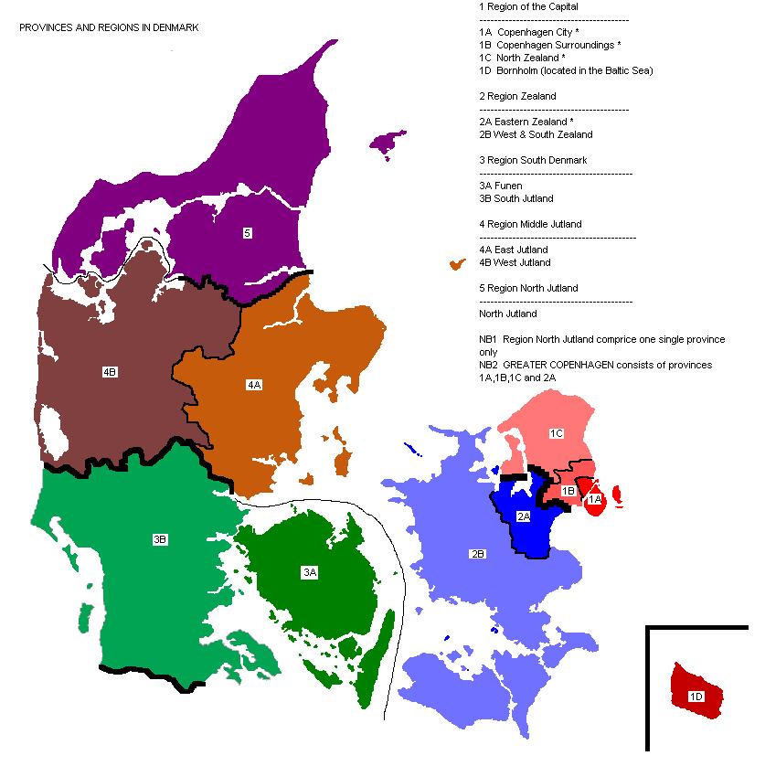
This map shows the provinces and regions of Denmark, including the Capital Region (Copenhagen), Zealand, South Denmark, Central Jutland, and North Jutland, with subdivisions for each area.
Denmark Regions Map
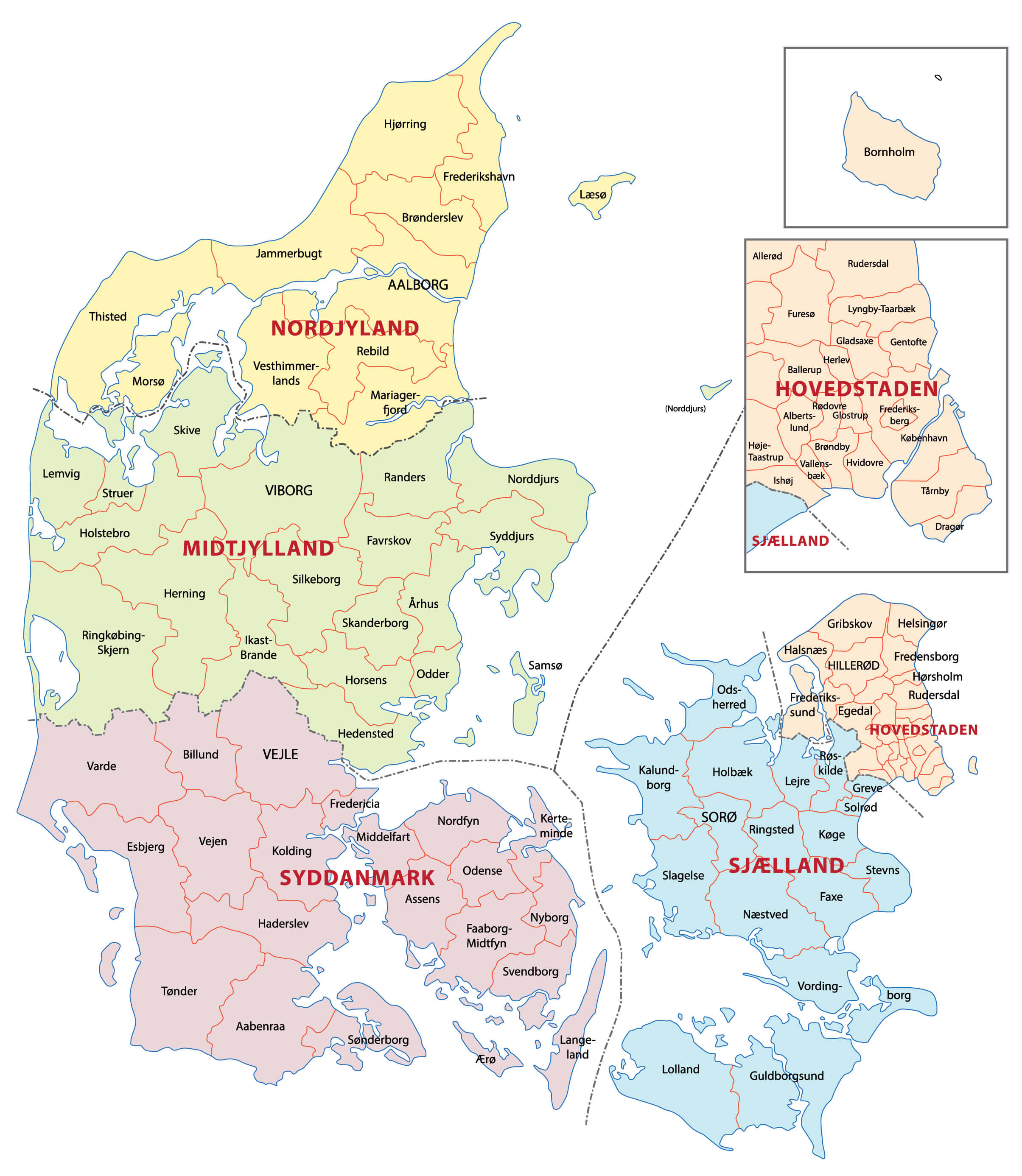 This map of Denmark shows the different regions, including Nordjylland, Midtjylland, Syddanmark, Sjælland and Hovedstaden, as well as the island of Bornholm. Each region is further divided into municipalities, highlighting key cities such as Aalborg in Nordjylland, Aarhus in Midtjylland, Odense in Syddanmark and Copenhagen in Hovedstaden. The map clearly shows Denmark’s administrative divisions and provides a useful overview of the geographical layout of the country’s regions and municipalities.
Denmark Roads Map with Largest Cities
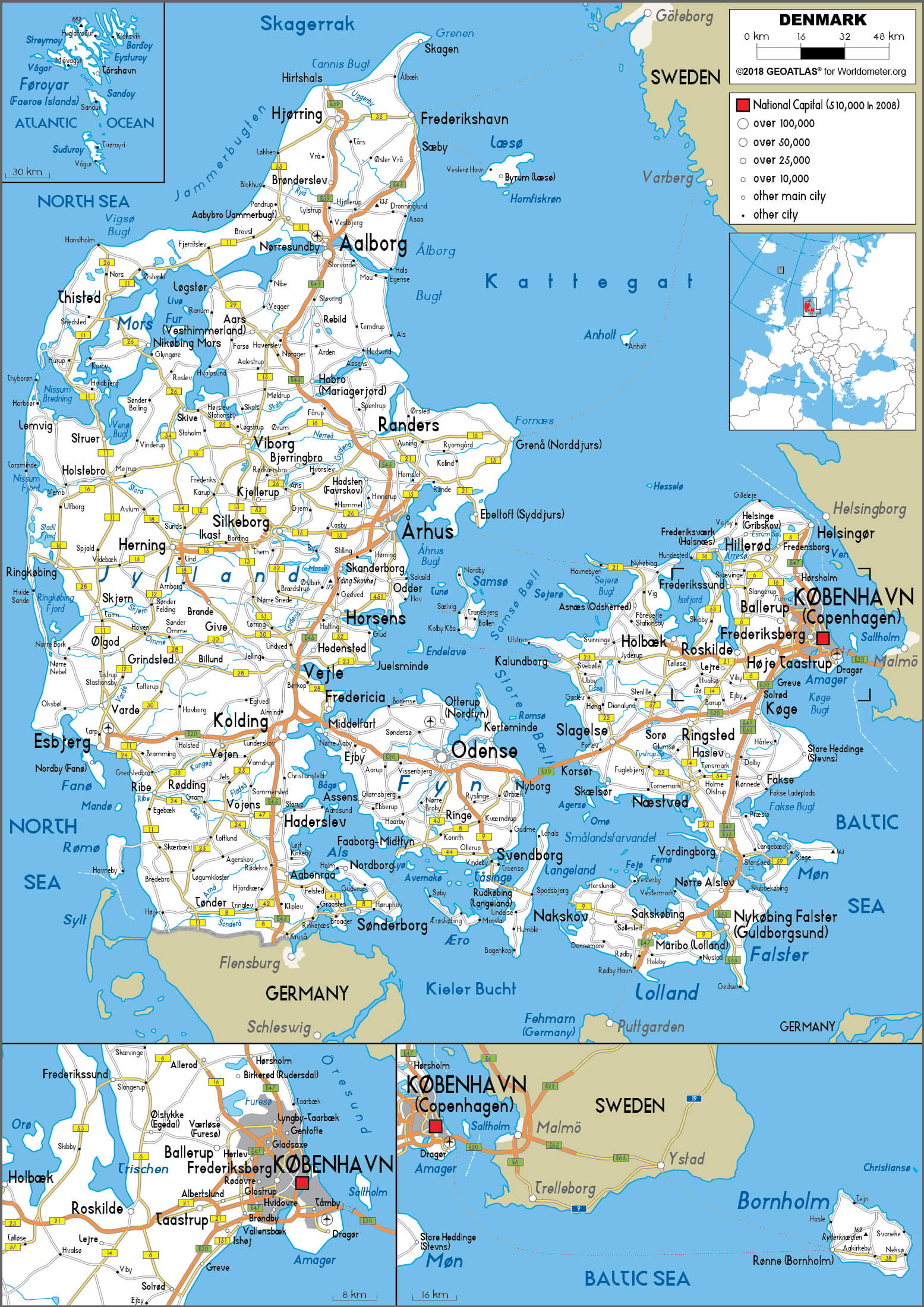 The map of Denmark’s road network and major cities shows the main transport routes and urban centres throughout the country. It shows how major cities such as Copenhagen, Aarhus, Odense and Aalborg are linked by a network of motorways and trunk roads, facilitating transport across Denmark’s islands and mainland. The map also shows regional links to neighbouring countries, including Germany and Sweden, via bridges and ferries, demonstrating Denmark’s strategic position in Northern Europe.
Denmark Satellite Map
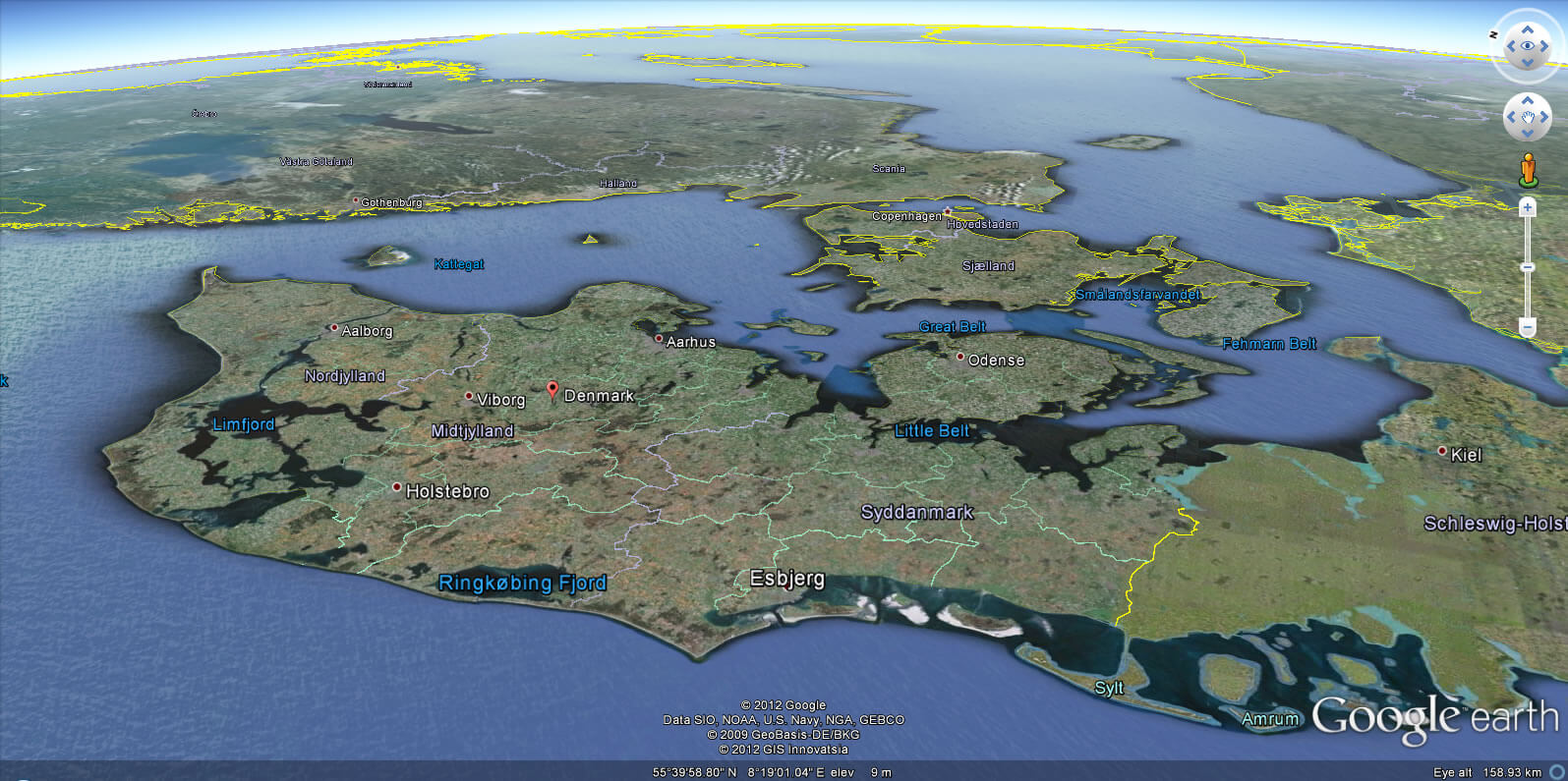
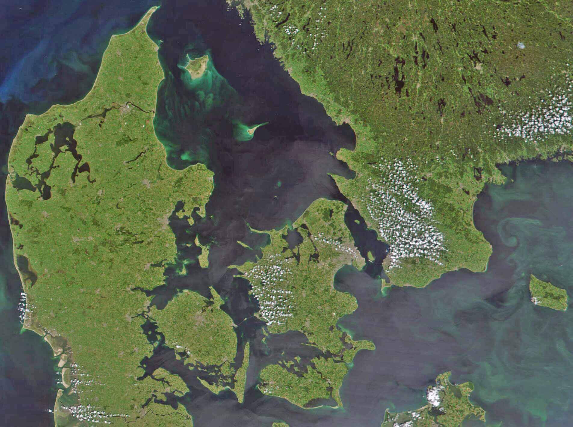 This satellite map of Denmark shows a detailed aerial view of the country’s geography, highlighting its islands, coastlines, and surrounding seas. The map captures Denmark’s varied terrain, including the Jutland Peninsula and major islands like Zealand, Funen, and Lolland, set against the waters of the North Sea and the Baltic Sea. This perspective helps visualize the geographical layout and the interconnectedness of Denmark’s landmasses and waterways.
Denmark Travel Map
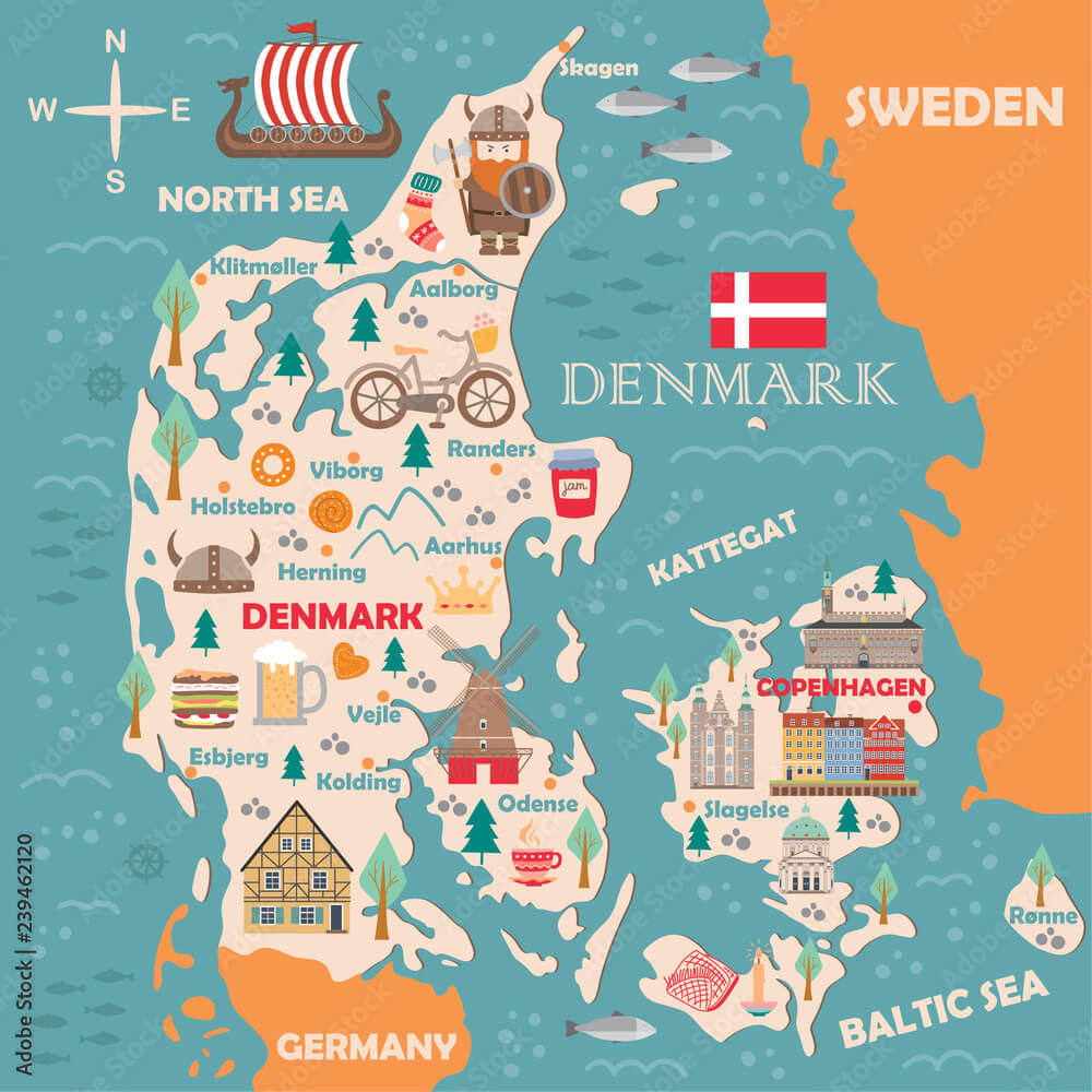 This illustrated map of Denmark highlights popular destinations and cultural features. It features major cities such as Copenhagen, Aalborg, Aarhus and Odense, as well as landmarks such as windmills and castles. The map also includes charming illustrations of Viking ships, traditional Danish pastries and other symbols representing Denmark’s heritage and attractions. Located between the North and Baltic Seas, this playful depiction captures the country’s charm, making it ideal for travellers interested in exploring Danish culture and scenery.
Denmark Major Cities Map
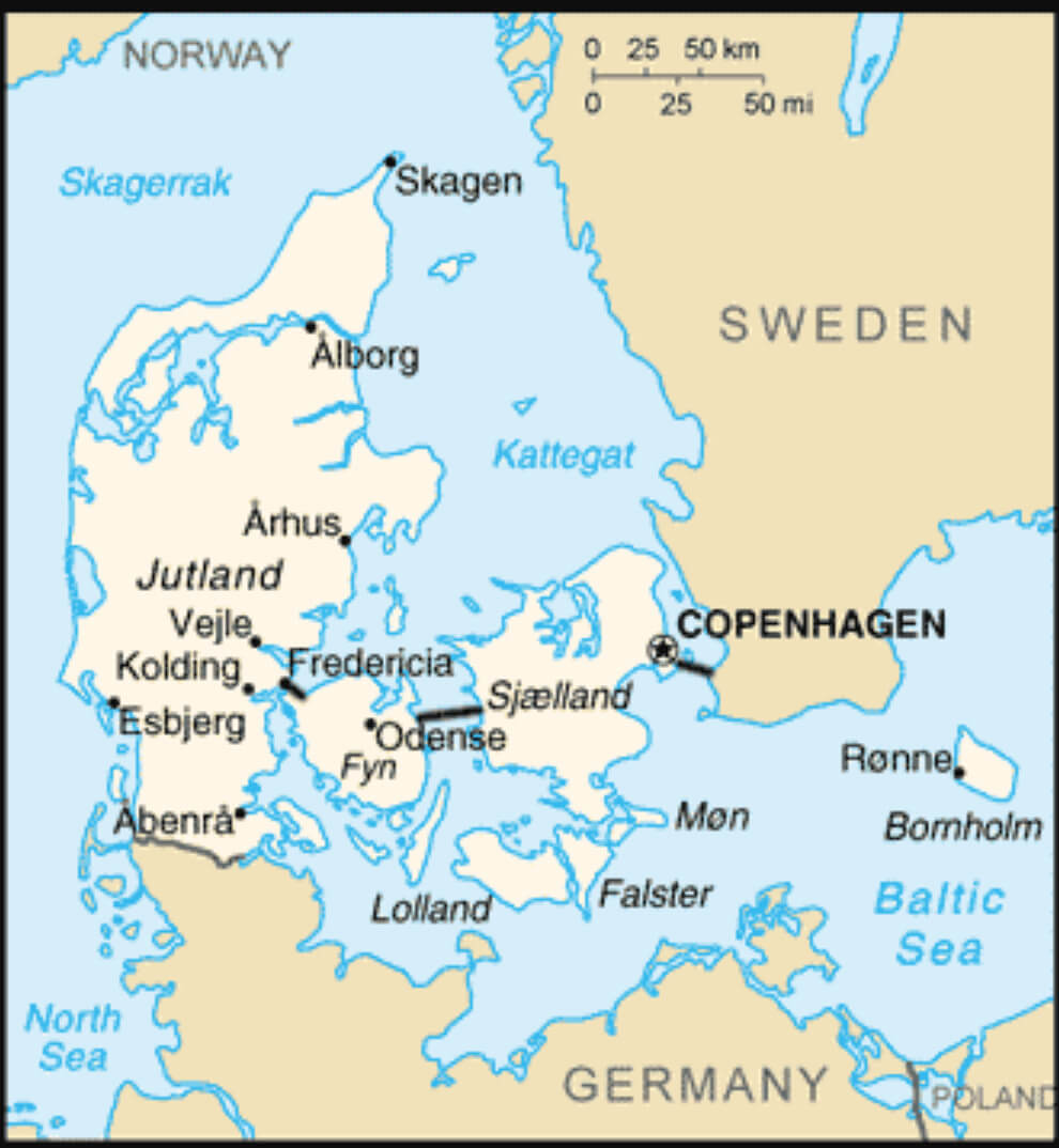 This map of Denmark’s major cities highlights the country’s main urban centres, including Copenhagen, Århus, Odense and Aalborg. The map shows Denmark’s location between the North Sea and the Baltic Sea, with neighbouring countries such as Germany to the south and Sweden to the east. It also shows important islands such as Fyn (Funen) and Sjælland (Sealand), providing a clear view of Denmark’s geographical layout and connectivity through its cities and waterways.
Denmark Topography Map
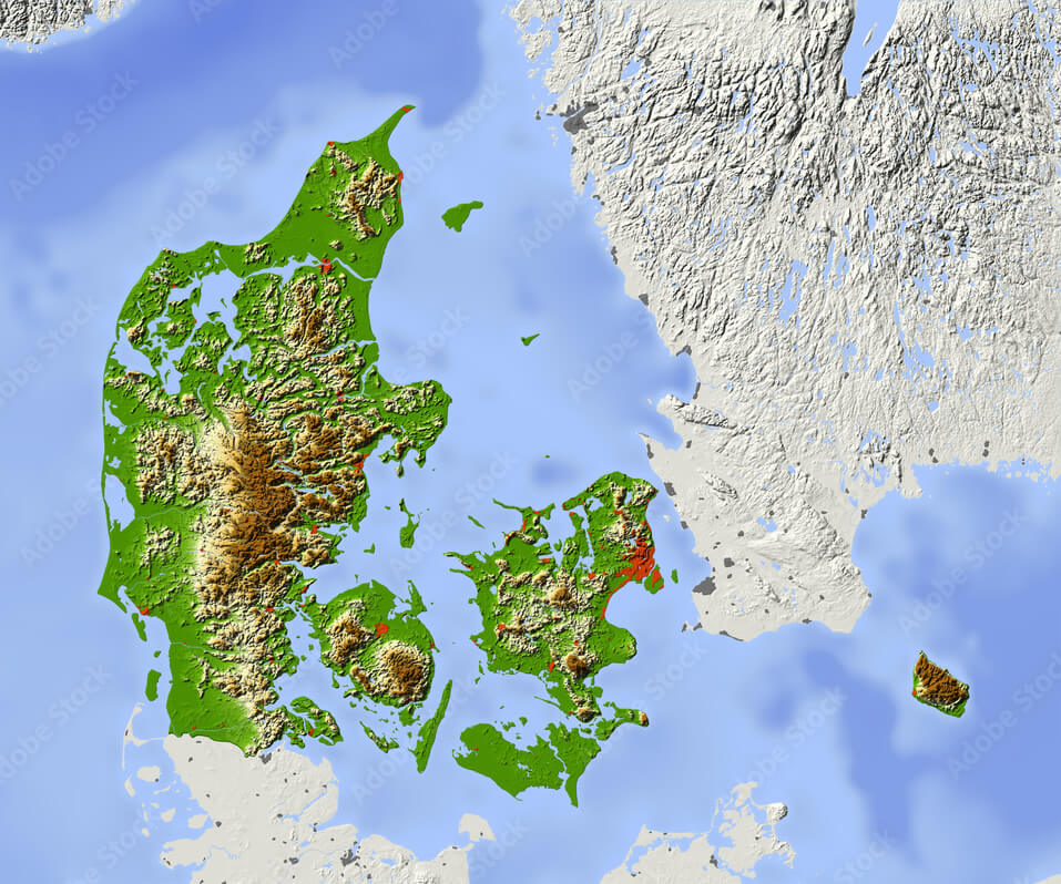 This topographical map of Denmark shows the country’s varied landscape, including gently rolling hills, low-lying coastal areas and the elevated terrain of the Jutland peninsula. The map also shows Denmark’s many islands, such as Zealand and Funen, surrounded by the North Sea, Baltic Sea and neighbouring waters. The shades of green represent lower elevations, while the shades of brown indicate higher areas, providing a clear view of Denmark’s diverse topography.
Denmark Highways Map
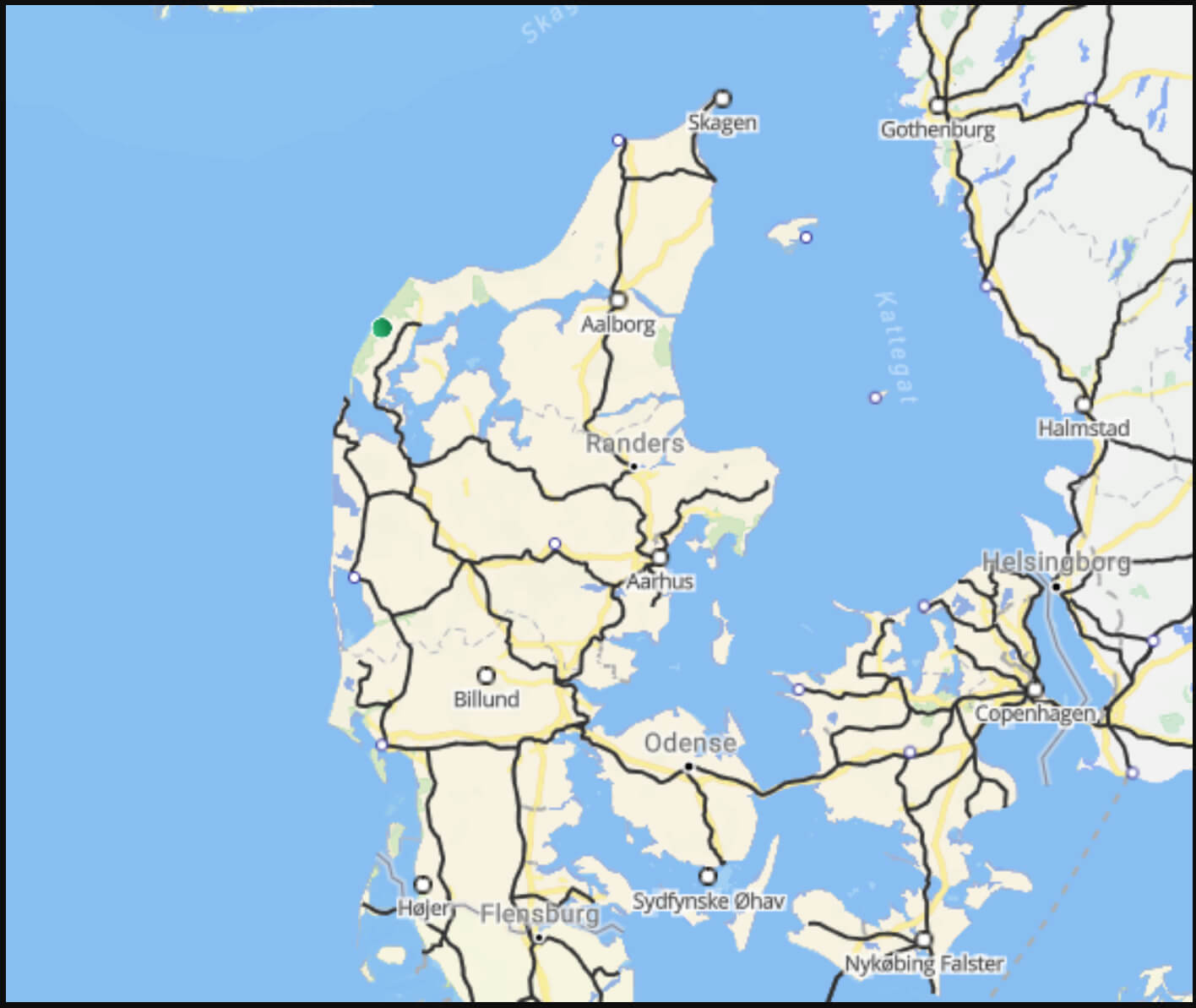 This map of Denmark highlights the major highways that connect different regions and cities across the country. It shows the main routes that link cities like Copenhagen, Aarhus, Aalborg, and Odense, emphasizing Denmark’s well-developed road network, which facilitates easy travel throughout the Jutland peninsula and the surrounding islands.
Denmark National Map with Borders
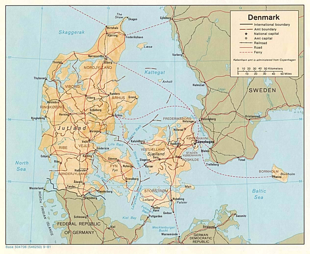
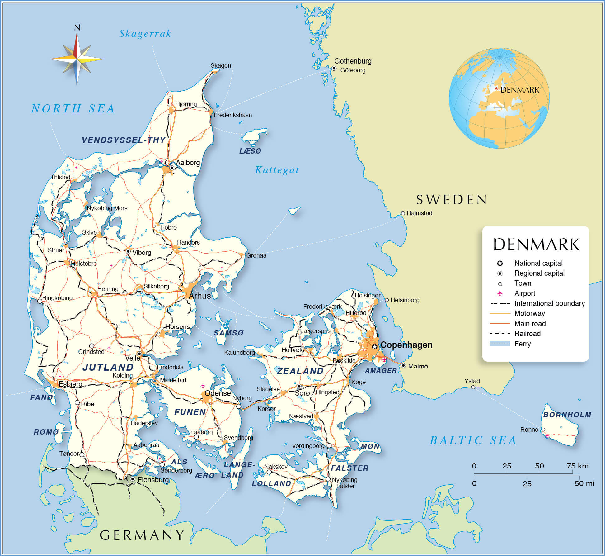 This map of Denmark highlights key regions, cities and transport networks, including major roads, railways and ferry routes. It provides a detailed view of how the country is connected internally and with neighbouring countries such as Germany and Sweden. In addition, the map highlights geographical features such as Jutland, Funen, Zealand and various smaller islands, making it useful for understanding Denmark’s national layout and borders.
Denmark Map with Nordic Countries
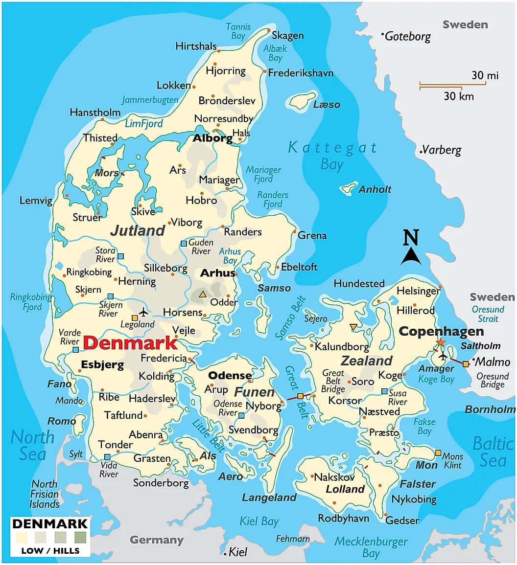 This map of Denmark highlights its geographical location and neighbouring Nordic countries, showing key areas such as Jutland, Zealand and Funen. It provides a clear view of Denmark’s surrounding waters, including the North Sea, Kattegat Bay and the Baltic Sea, as well as connections to Sweden and Germany. The map also highlights key cities such as Copenhagen, Århus, Odense and Aalborg, providing a visual understanding of Denmark’s position within the wider Nordic region.
Denmark Administrative Map
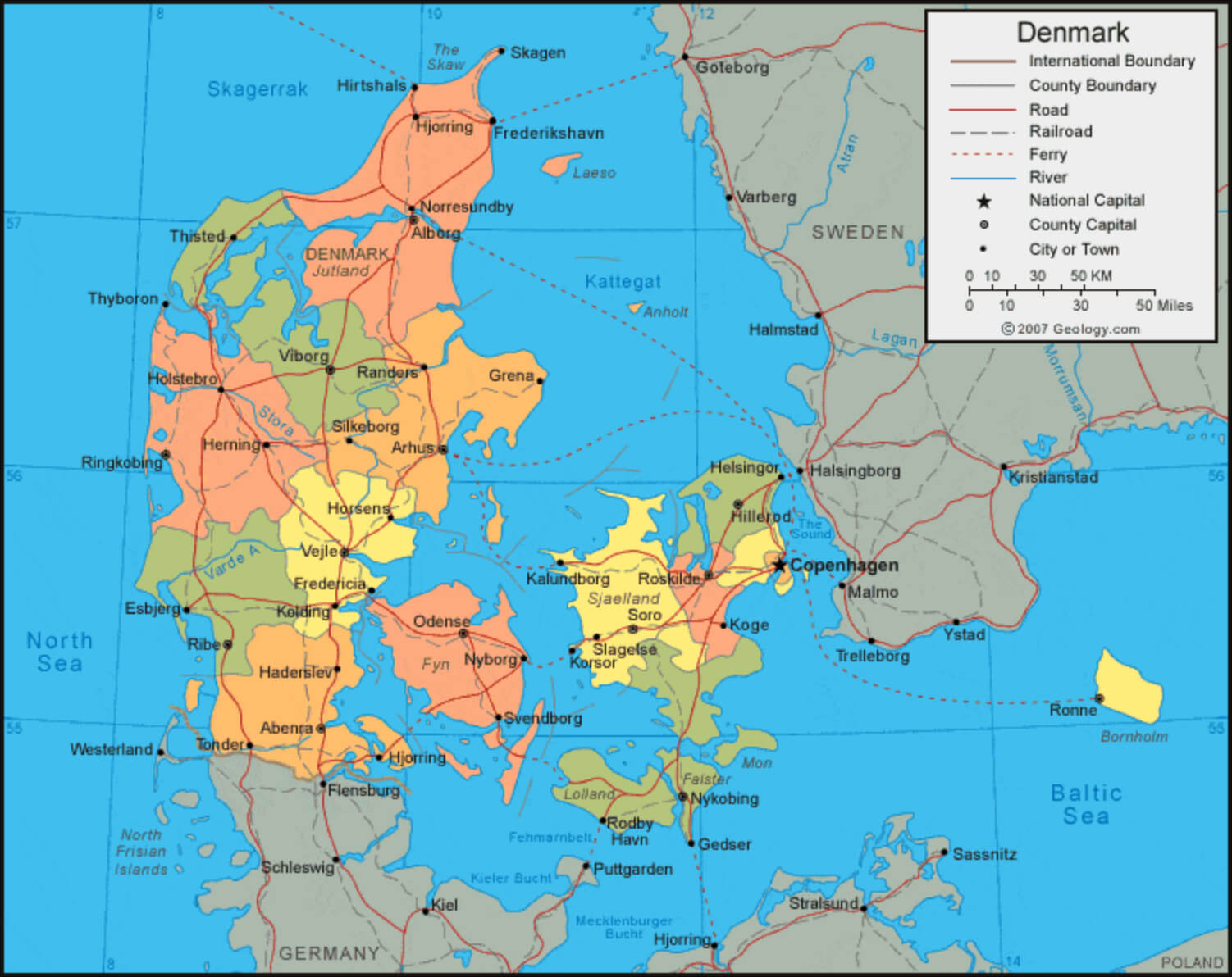 This map shows the administrative divisions of Denmark, highlighting counties, major cities, roads and transport routes. Denmark is divided into several regions, with clear boundaries separating the counties. Major cities such as Copenhagen, Århus, Odense and Aalborg are marked, as well as transport links such as ferries and railways that connect Denmark with its neighbours, including Germany and Sweden.
Denmark Main Cities Map with Copenhagen
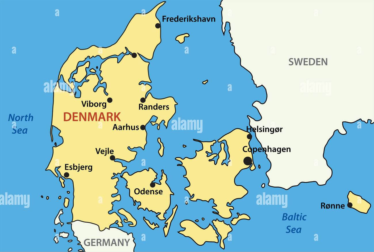 This Denmark map highlights the major cities, including the capital, Copenhagen, as well as Aarhus, Odense, Esbjerg, Viborg, and Randers. It shows the country’s geographical position relative to nearby countries like Sweden and Germany, and features key cities that play a central role in Denmark’s economy and cultural heritage.
Denmark Regions and Capitals Map with Cities
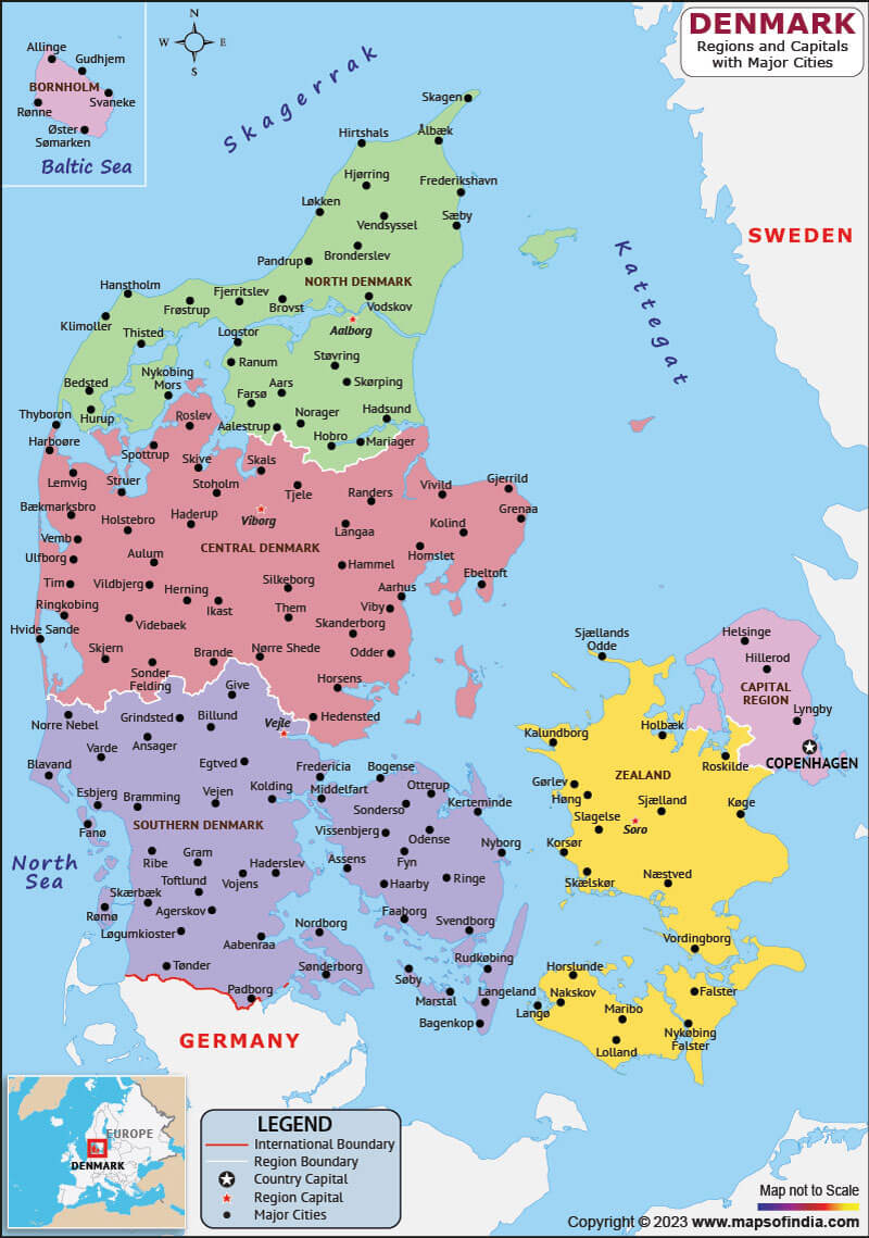 This map shows Denmark’s regions and their respective capitals, as well as the country’s major cities. It highlights areas such as North Denmark, Central Denmark, South Denmark, Zealand and the Capital Region, providing a detailed look at the administrative divisions and their geographical locations. The map also highlights Denmark’s position in relation to neighbouring countries such as Sweden and Germany, as well as surrounding bodies of water such as the North Sea and the Baltic Sea.
Where is Denmark on the Europe Map?
Show Google map, satellite map, where is the country located.
Get directions by driving, walking, bicycling, public transportation and travel with street view.
Feel free to explore these pages as well:
- Ireland Map ↗️
- Norway Map ↗️
- Sweden Map ↗️
- EuropeMap ↗️
- Map of Ireland ↗️
- A Collection of United Kingdom Maps: A Comprehensive Atlas ↗️
- United Kingdom Map ↗️
- A Collection of Europe Maps ↗️
- Amsterdam: Europe’s Venice and Its Hidden Wonders ↗️
- Europe Top 10 Tourist Arrivals Countries by 2017 ↗️
