Explore Czechia’s rich history and geography through this detailed collection of maps. From its iconic capital, Prague, to its scenic countryside, these maps offer a comprehensive view of the country’s diverse landscapes and cultural landmarks. From bustling urban areas to peaceful rural regions, these maps provide a glimpse into the beauty and diversity of this central European country
Brief information about Czechia
Czechia, also known as the Czech Republic, is a small yet historically rich country in Central Europe. Famous for its beautiful medieval towns, picturesque countryside, and impressive castles, it offers visitors a glimpse into Europe’s past. Its capital, Prague, often called the “City of a Hundred Spires,” is renowned for its Gothic architecture, charming old streets, and vibrant cultural scene. The country’s history is deeply intertwined with the Habsburg Empire, and it was part of Czechoslovakia until it peacefully split with Slovakia in 1993.
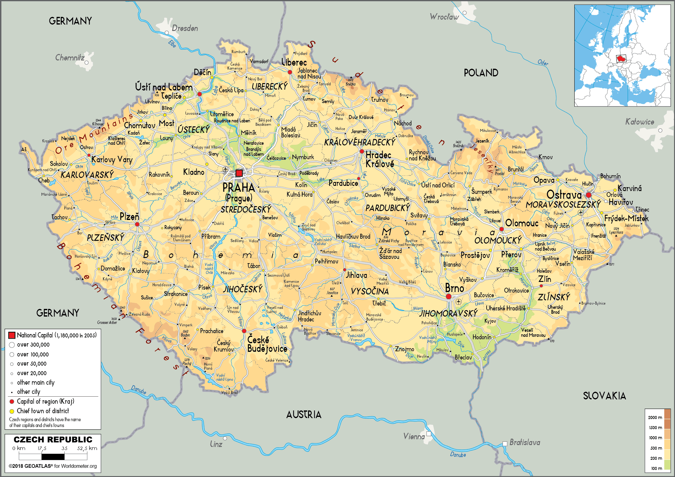
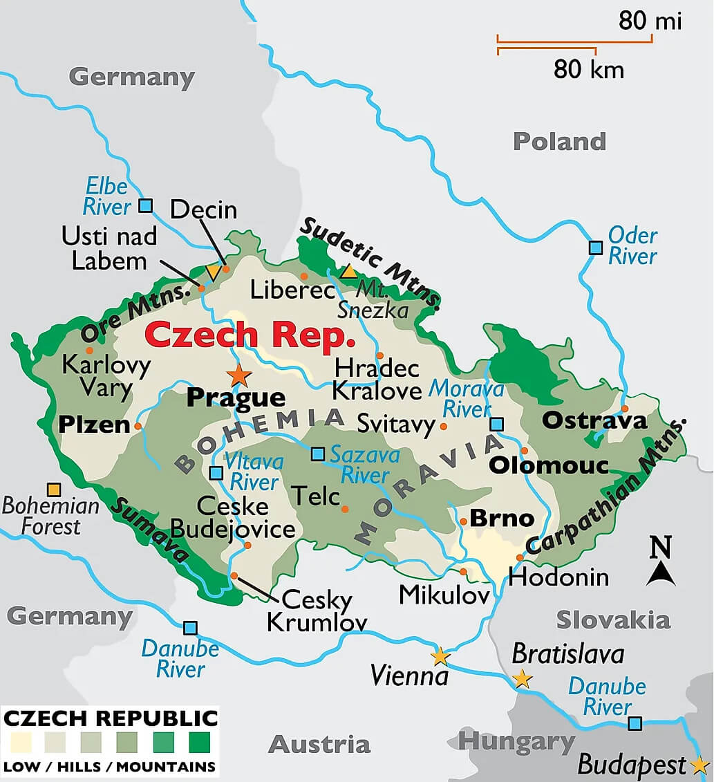
Czechia Physical Map
Beyond its history, Czechia is a modern nation known for its excellent beer, warm hospitality, and stunning nature. From hiking in the Bohemian Switzerland National Park to exploring the thermal baths in Karlovy Vary, there’s something for every type of traveler. The country is also a hub of music and arts, home to famous composers like Antonín Dvorák. With its rich traditions and lively atmosphere, Czechia offers a perfect mix of old-world charm and contemporary European culture.
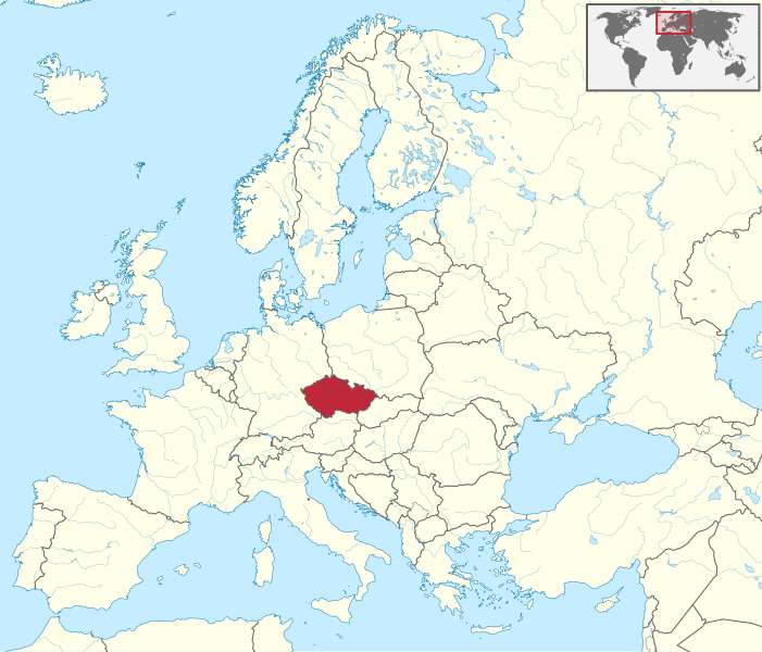
Where is located Czechia on the World Map
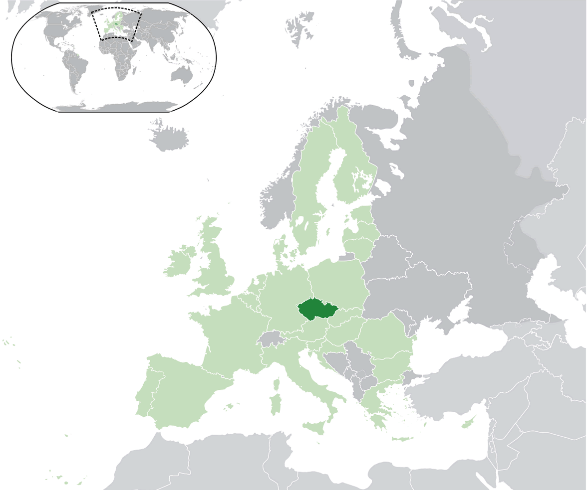
Czechia, also known as the Czech Republic, is located in Central Europe. It’s a landlocked country bordered by Germany to the west, Austria to the south, Slovakia to the east, and Poland to the north. Its central position makes it an important crossroads between Western and Eastern Europe.
The country features a diverse landscape of rolling hills, forests, and historic rivers like the Elbe and Vltava. Prague, its capital, is famous for its stunning medieval architecture and vibrant culture, attracting visitors from all over the world.
Czechia’s location has influenced its rich history, from its time under the Austro-Hungarian Empire to the formation of Czechoslovakia. Today, its central position makes it easily accessible from other major European cities, making it a perfect spot for travelers exploring the region.
Here are some statistical information about Czechia:
Czechia Location Map
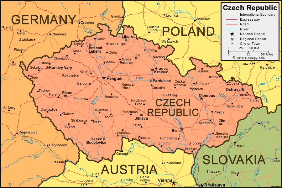
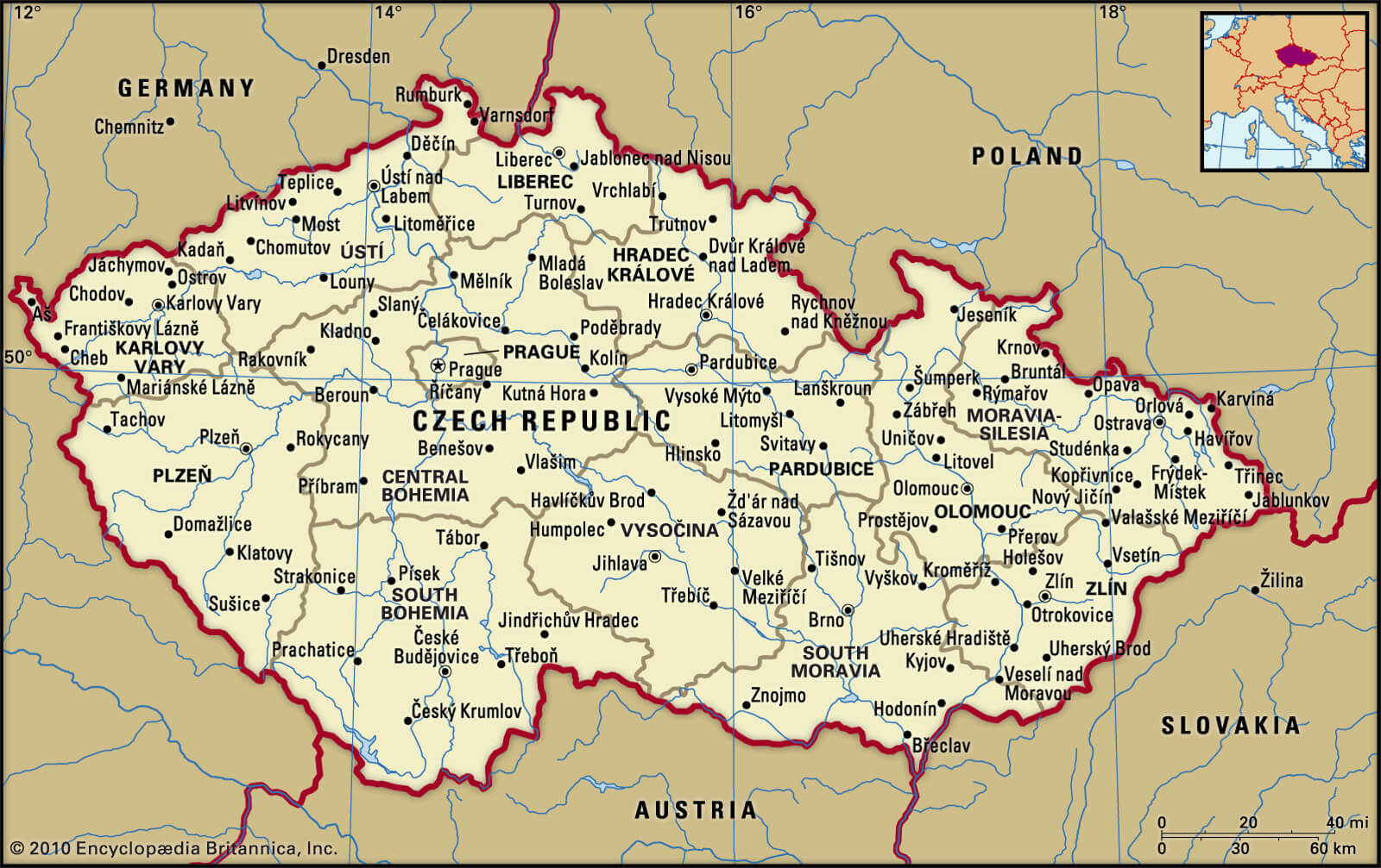
Czechia Political Map
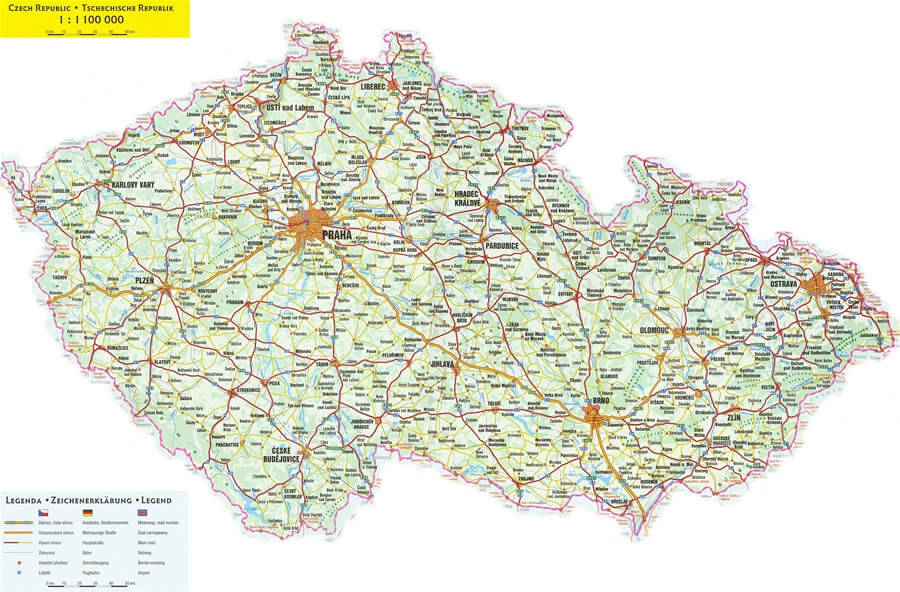
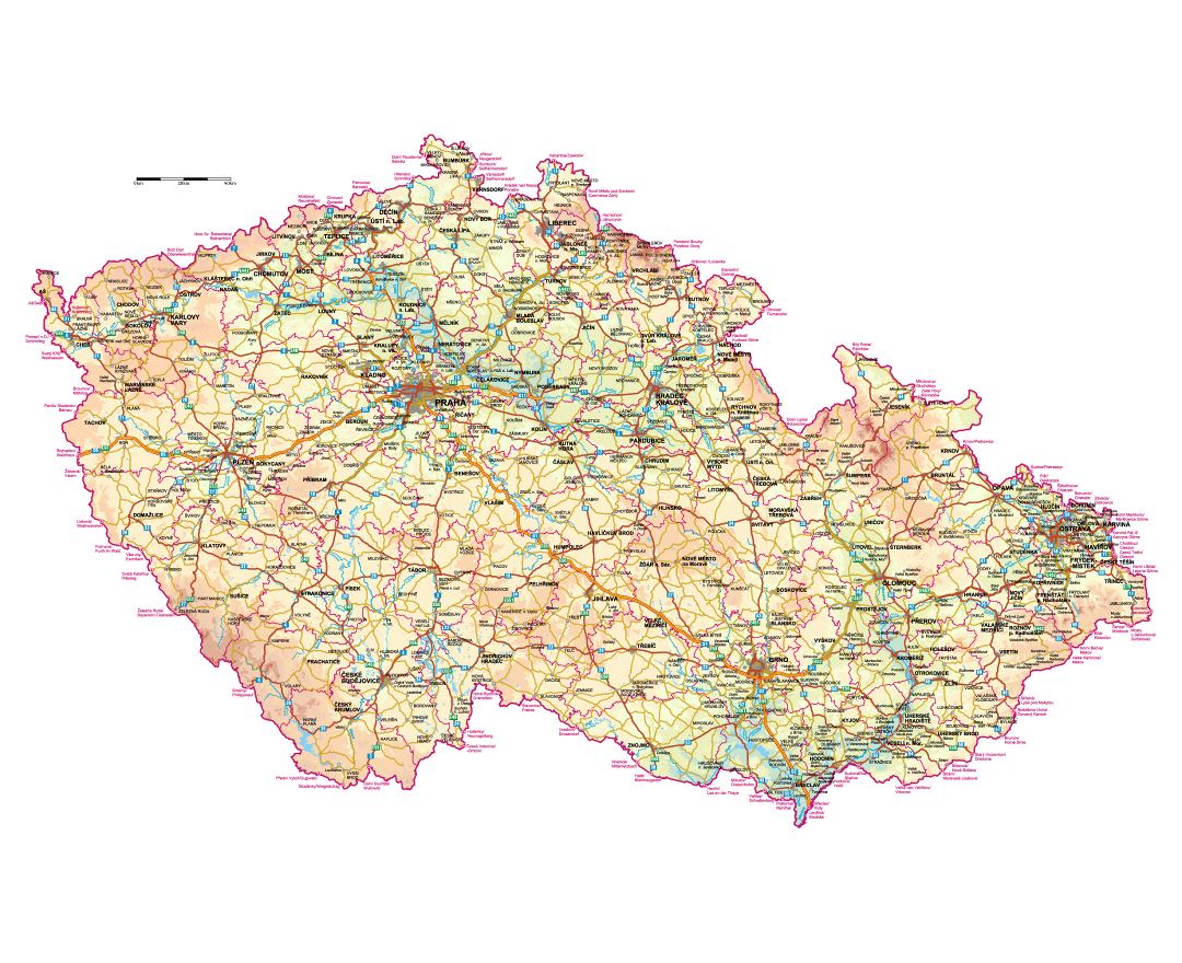
Czechia Road Map
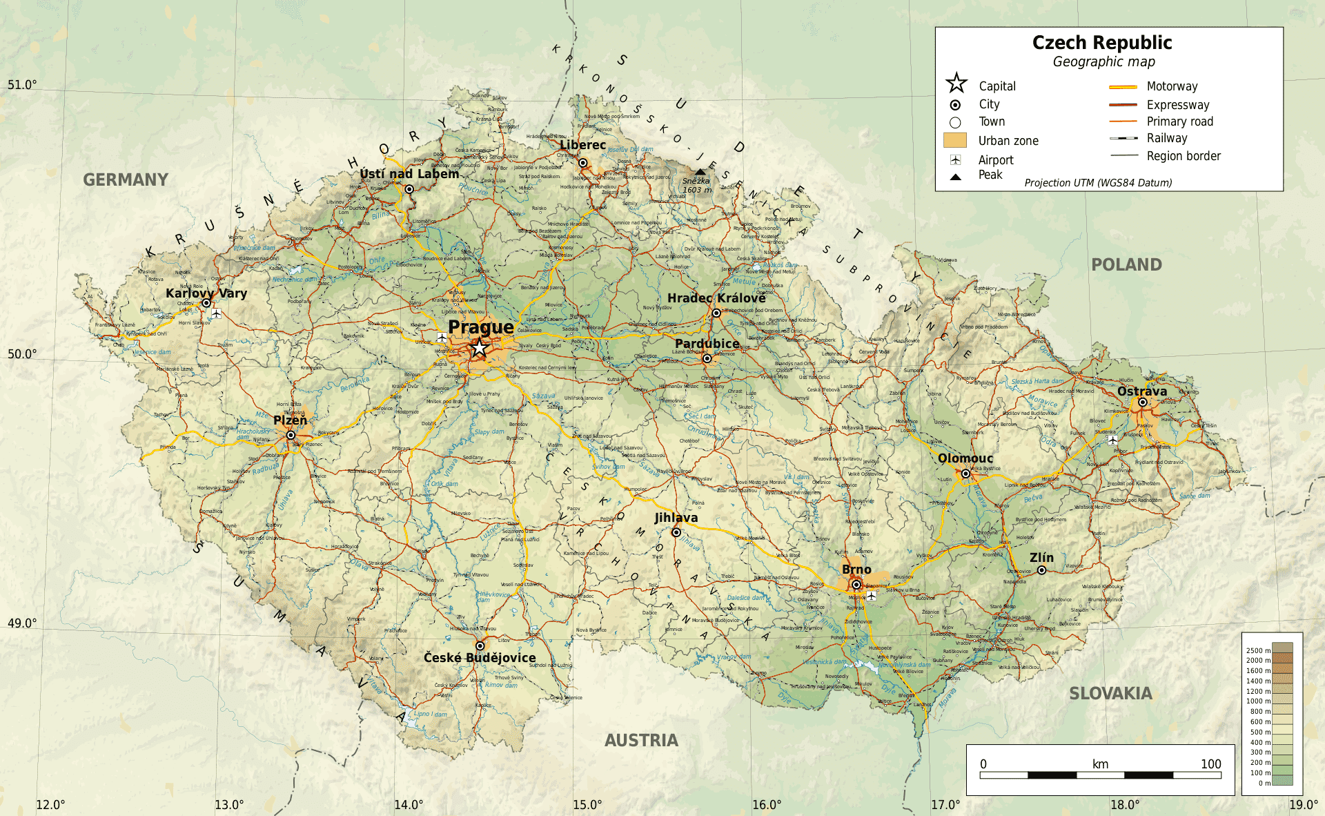
Czechia Geographic Map
Czechia Europe Map
Czechia Cities Map
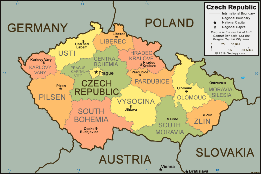
Czechia Regions Map
Czechia Map
Czechia Tourist Map
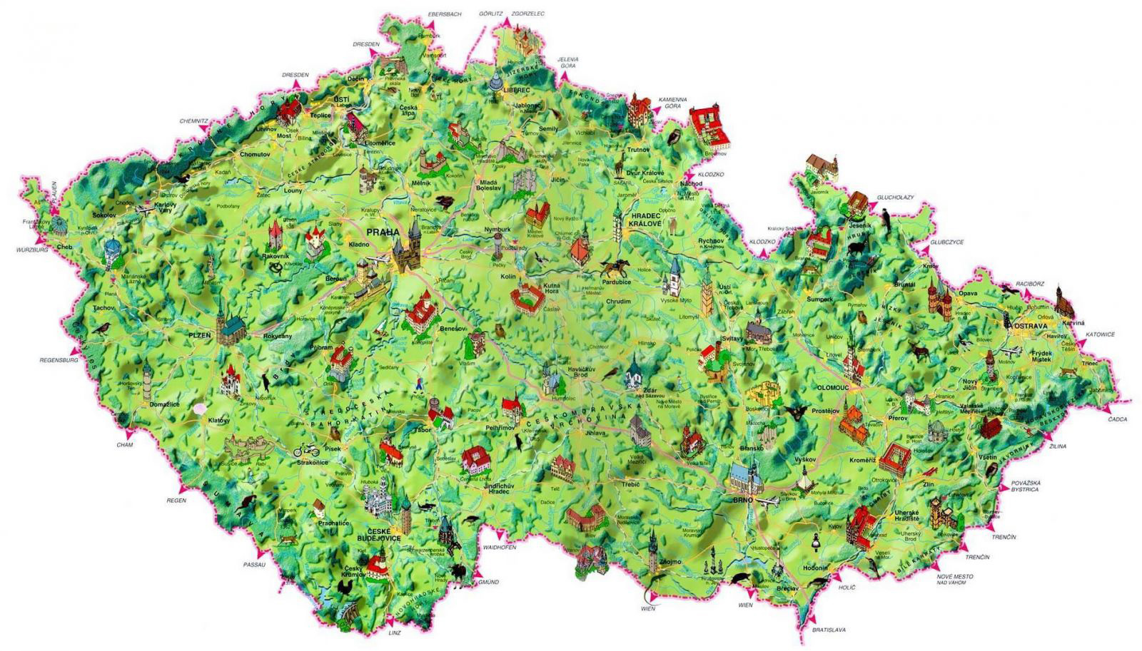 This map of Czechia highlights various tourist attractions throughout the country. It includes iconic landmarks, historic castles, natural parks, and picturesque towns, offering a visual guide for travelers. Regions such as Bohemia, Moravia, and Silesia are depicted with charming illustrations that make it easy to identify popular destinations like Prague, Karlovy Vary, and Cesky Krumlov, alongside lesser-known but equally intriguing sites. The map emphasizes the rich cultural heritage and diverse landscapes of Czechia, making it a valuable resource for planning a visit to this central European nation.
Czechia Provinces Map
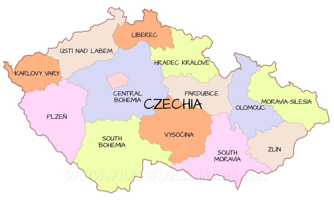 The Czech provinces map illustrates the administrative regions of the Czech Republic, highlighting major regions such as Central Bohemia, Southern Moravia and Moravia-Silesia. It shows the geographical distribution of each province, highlighting their relative locations, from Karlovy Vary in the west to Zlín in the east. This map is a useful reference for understanding the regional divisions within the country.
Czech Republic Map with National Flag
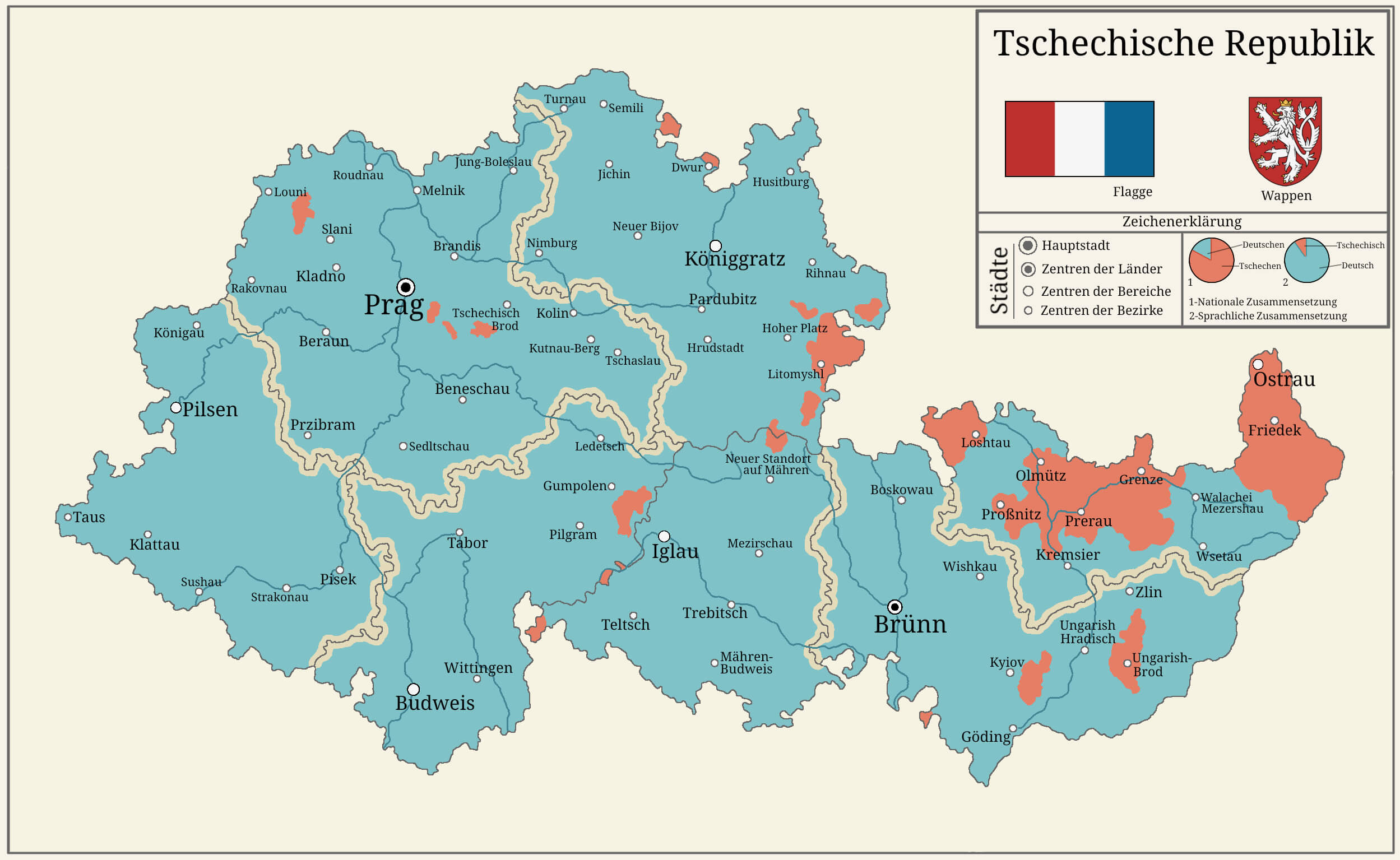 This map of the Czech Republic shows the country’s administrative regions, highlighting cities and their distribution across the country. It also includes national symbols like the flag and coat of arms, providing a visual representation of the regions and their cultural distinctions. The map can help understand the geographic distribution of urban centers and key regions within the Czech Republic.
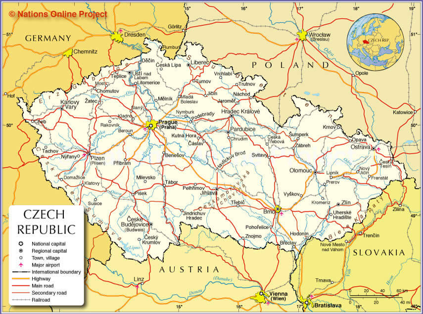
Czechia Highways Map
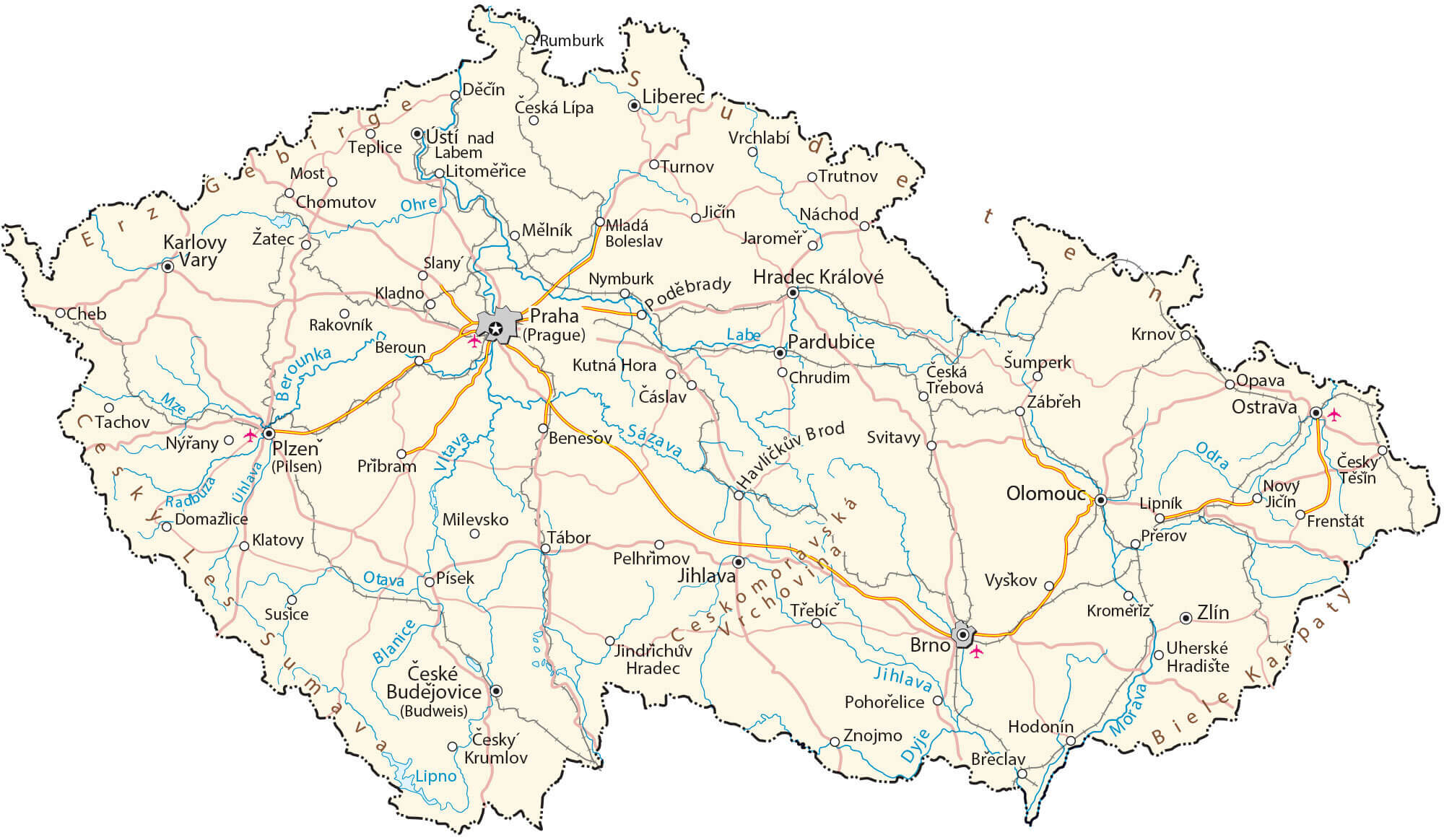 This map of the Czech Republic shows the country’s major motorway network, which connects major cities such as Prague, Brno and Ostrava. It highlights the extensive roads and rivers, providing a clear view of how transport infrastructure connects different regions of the country, facilitating travel and trade throughout the Czech Republic.
Czech Republic Topographic Map
 This map of the Czech Republic illustrates its topographical features, including elevation changes, major cities such as Prague, Brno and Ostrava, and key natural landmarks such as mountain ranges and rivers. It highlights the country’s varied terrain, from the lowlands of the central regions to the higher elevations of the Sudetes and Šumava mountains, which border on Germany and Poland. The map also details the network of motorways and main roads, showing how transport links the different regions of the country.
Czech Republic Regions and Administrative Regions Map
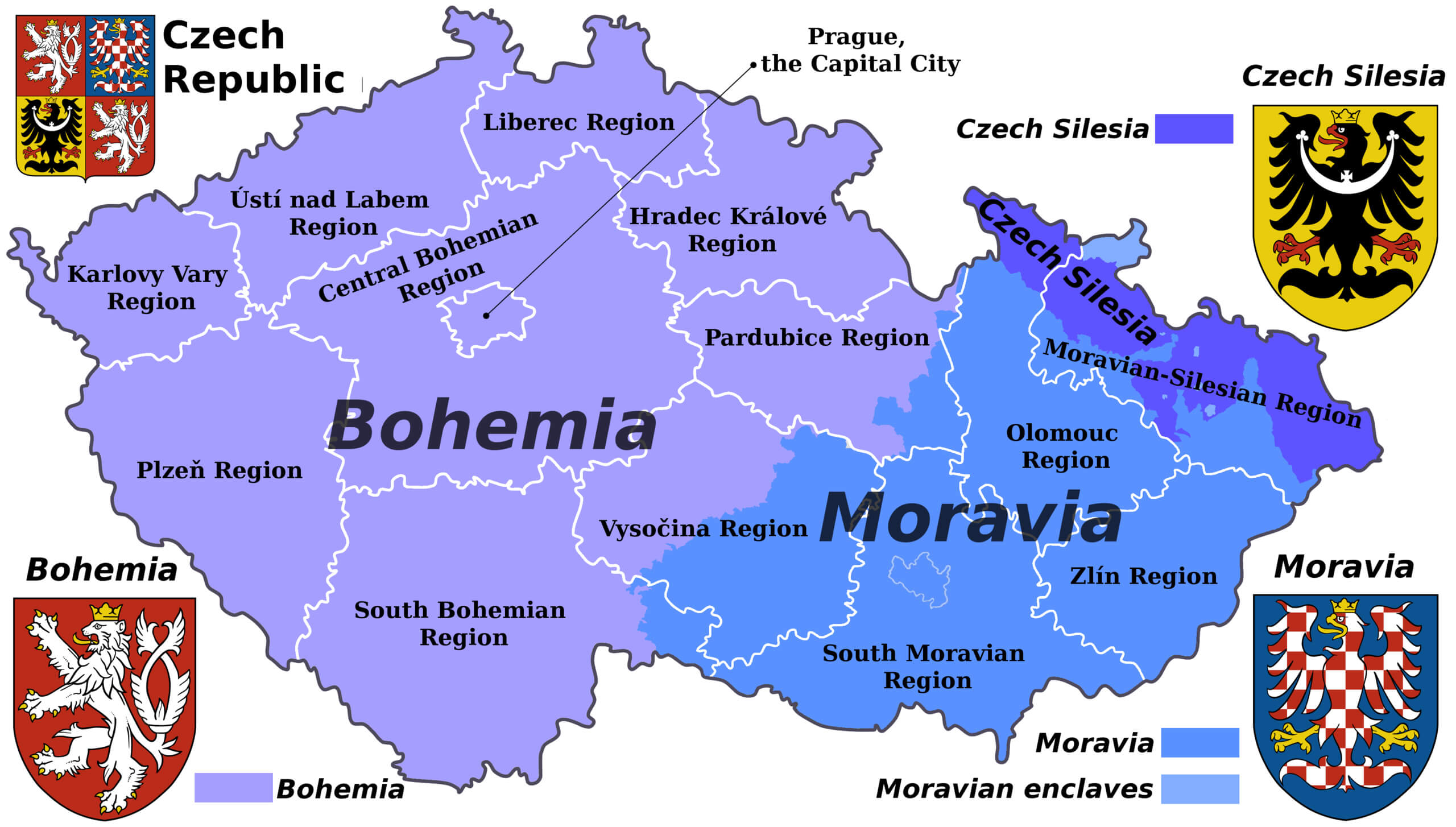 This map of the Czech Republic shows the historical regions of Bohemia, Moravia and Czech Silesia, along with their corresponding administrative divisions. Each area is colour-coded for clarity, showing how the modern administrative regions correspond to these historical territories. The map also shows the coat of arms of each region, symbolising their distinct cultural identities.
Czech Republic Climate Map
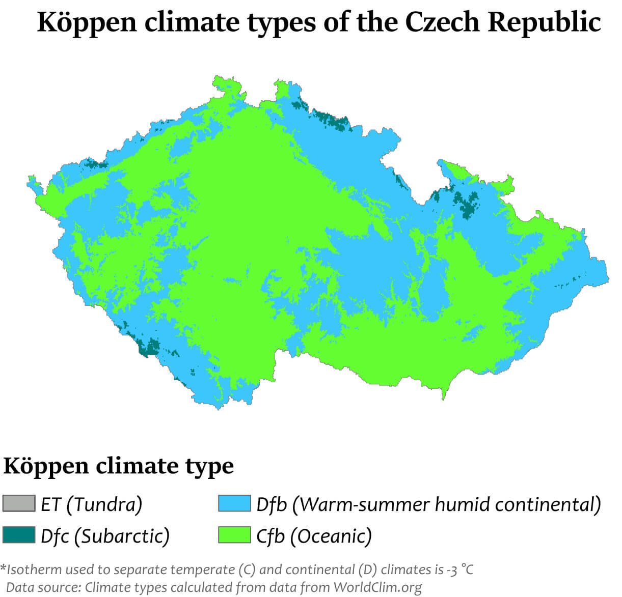 This map of the Czech Republic shows the distribution of different climate types according to the Köppen classification. Most of the country is classified as having a Cfb climate, which indicates an oceanic climate with mild summers and no dry season. There are also regions with a Dfb climate, which is a humid continental climate with warm summers, particularly in the higher elevations. This map highlights the different climatic zones within the country, influenced by its geographical diversity and position in Central Europe.
Czechia Cities River Map with National Border
 This map of the Czech Republic shows the country’s cities, rivers and national boundaries, highlighting key regions such as Central Bohemia, Moravia and South Bohemia. It illustrates the geographical layout connecting major urban centres such as Prague, Brno and Ostrava with their surrounding rivers, emphasising the natural boundaries and regional divisions within the Czech Republic.
Czechia Rivers Map
 This map of the Czech Republic highlights the country’s river systems, including major waterways such as the Elbe, Vltava and Morava rivers, which flow through different regions such as Bohemia and Moravia. It also highlights major cities such as Prague, Brno and Ostrava, showing how river networks connect major urban areas. The map also shows neighbouring countries such as Germany, Poland, Austria and Slovakia, emphasising the Czech Republic’s geographical position in Central Europe.
Czechia Geography Map
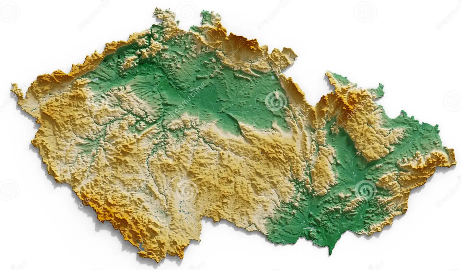 This map provides a detailed representation of the geographic features of Czechia, highlighting variations in elevation across the country. It showcases the diverse terrain, from mountainous regions to lowlands, illustrating the natural topography that defines the landscape of the Czech Republic. The map’s elevation color gradients emphasize areas of higher altitude in green and lower regions in yellow, giving a clear visual of the country’s physical geography
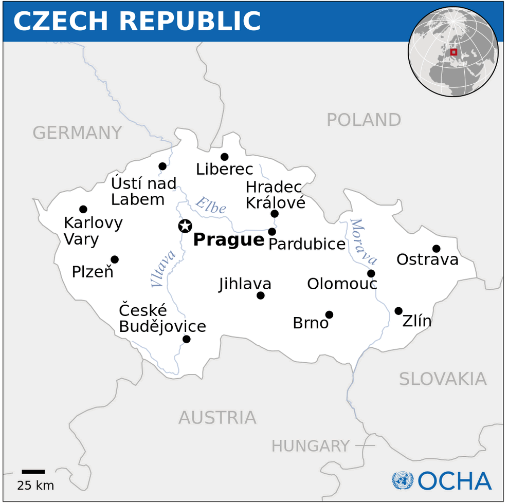
Czechia Major Cities Map
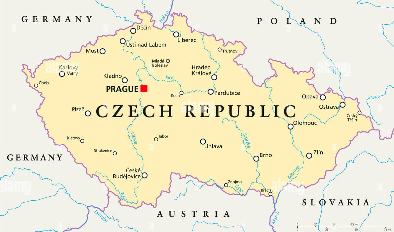 This map of Czechia highlights the major cities across the country, including Prague, the capital. Other key urban centers such as Brno, Ostrava, and Plzeň are marked, showing their geographical locations in relation to neighboring countries like Germany, Austria, Poland, and Slovakia. The map provides a clear view of the primary urban areas, illustrating the distribution of cities throughout the Czech Republic.
Where is Czechia on the Europe Map?
Show Google interactive map, satellite map, where is the country located.
Get directions by driving, walking, bicycling, public transportation and travel with street view.
Feel free to explore these pages as well:
- Czech Republic Map ↗️
- Czech Republic ↗️
- Czechia Map ↗️
- Czech Republic Photos ↗️
- Map of Czech Republic ↗️
- Slovakia Map ↗️
- Germany Map ↗️
- Europe Map ↗️