- Advertisement -
A Collection of Asia Maps; Asia Countries Political Map with National Borders, Political Map of Asia, Countries Map of Asia, Asia World Map with Globes, Asia Physical, Economical Maps.
Asia Map
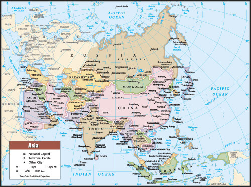
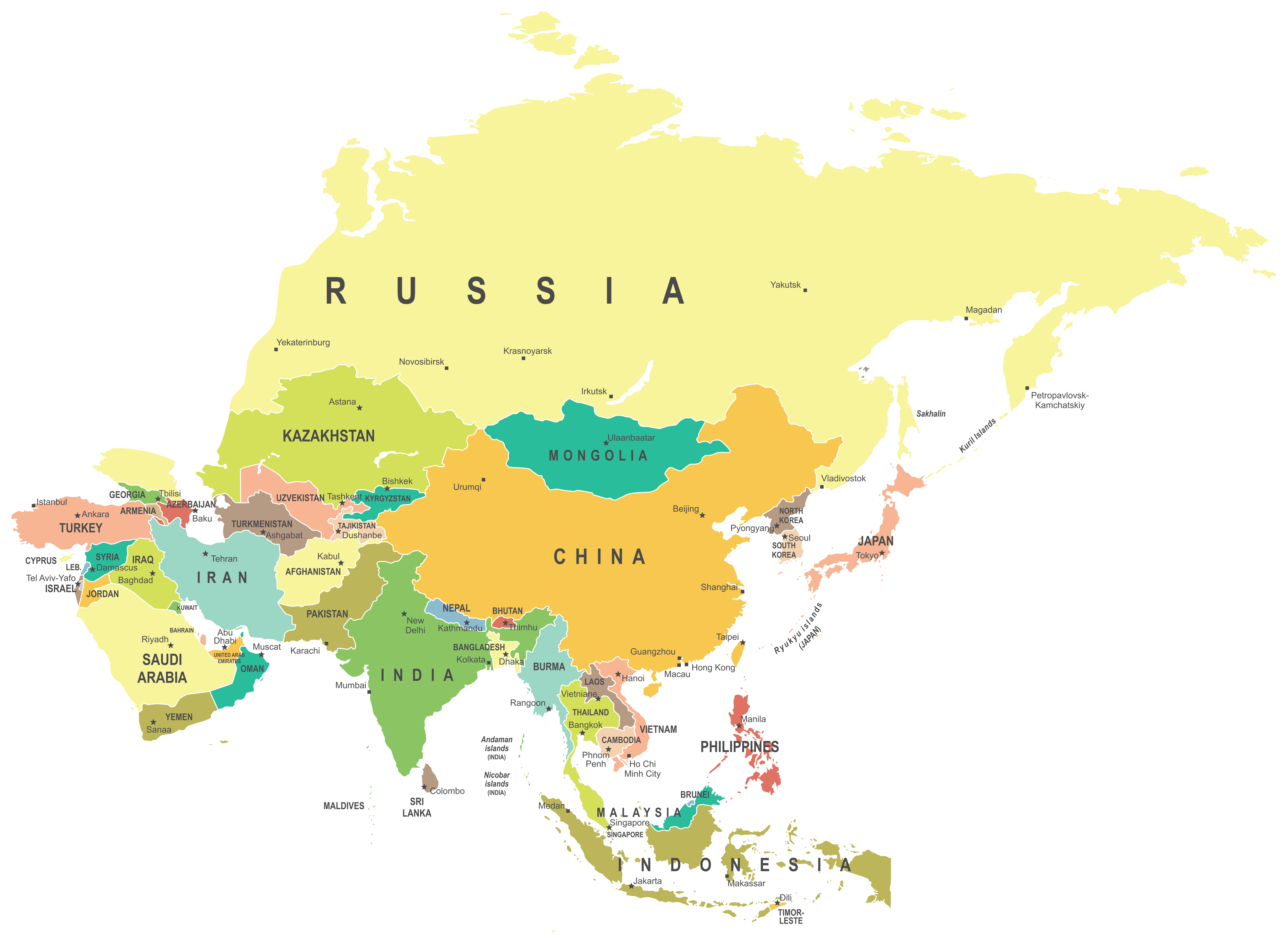 Asia Map with countries, national borders, Russia, China, India, Turkey, Iran, Indonesia, Saudi Arabia political maps.
Political Map of Asia
Asia Countries Political Map with National Borders
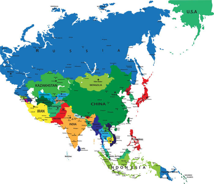
 Asian Countries China, Russia, Turkey, Iran, Afghanistan, Pakistan, Thailand, Malaysia, Indonesia, Mongolia, Kazakhstan, Japan, South Kore, North Korea, Qatar, Oman, Turkmenistan, Uzbesitan maps.
Countries Map of Asia
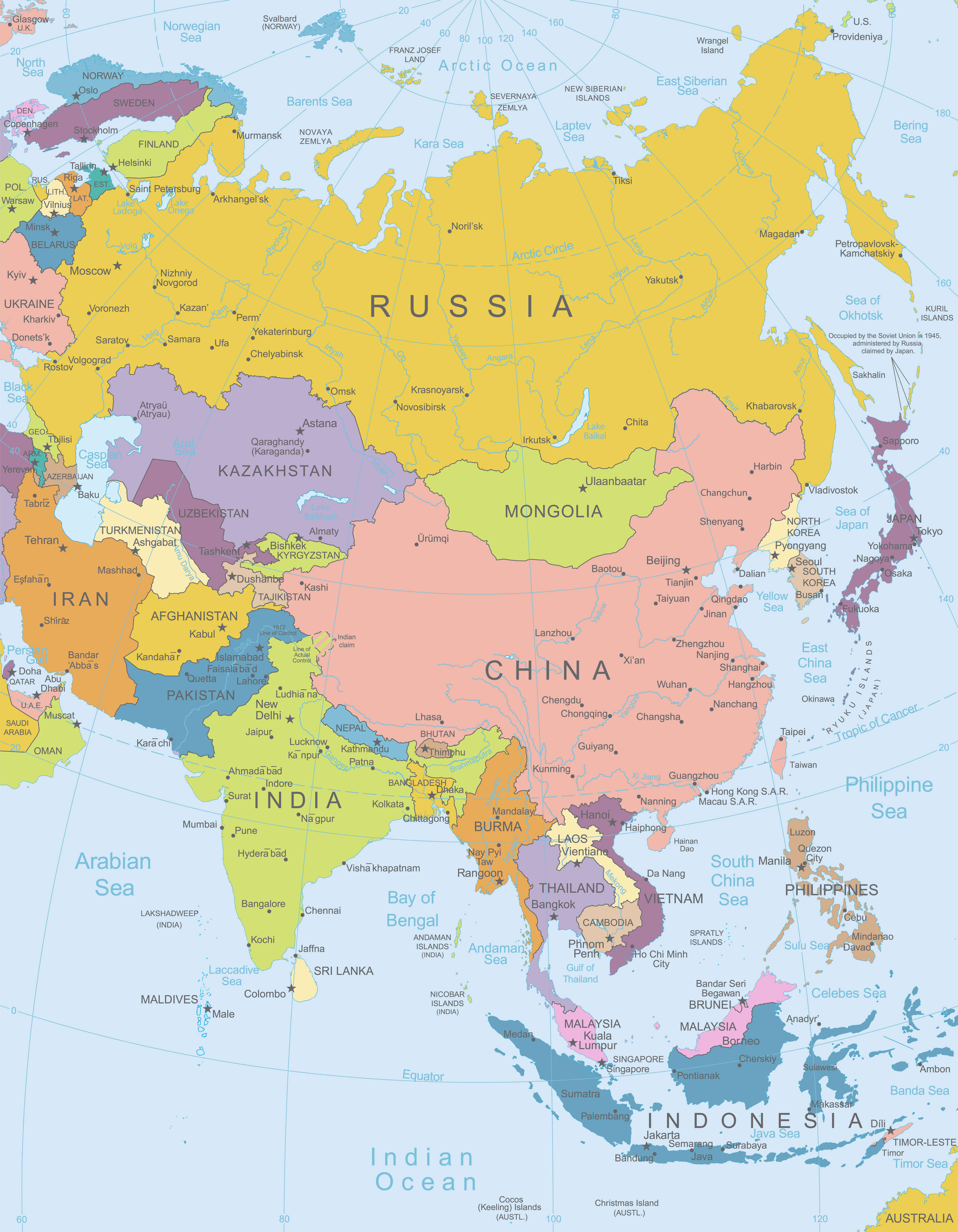
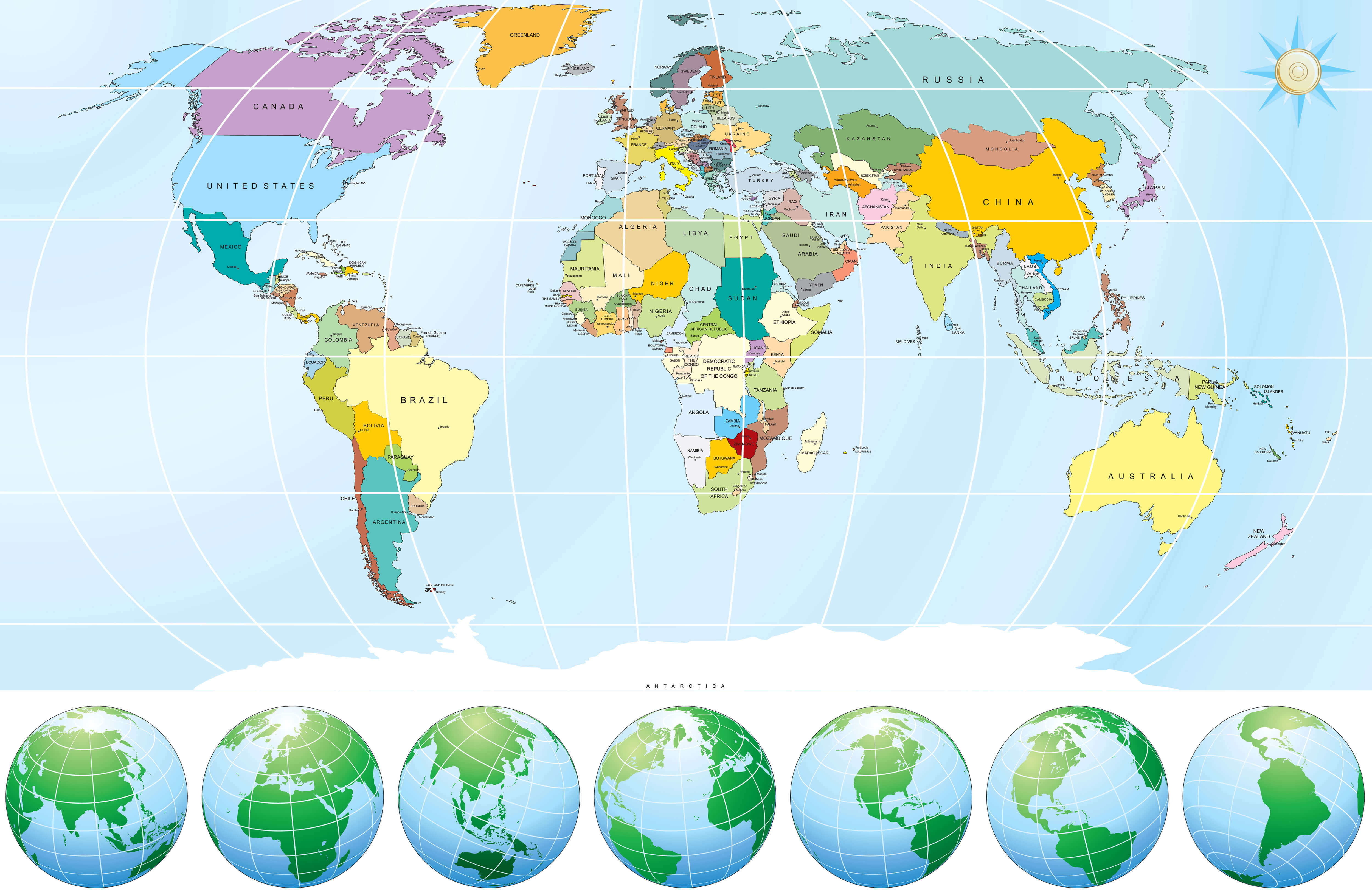
Asia World Map with Globes
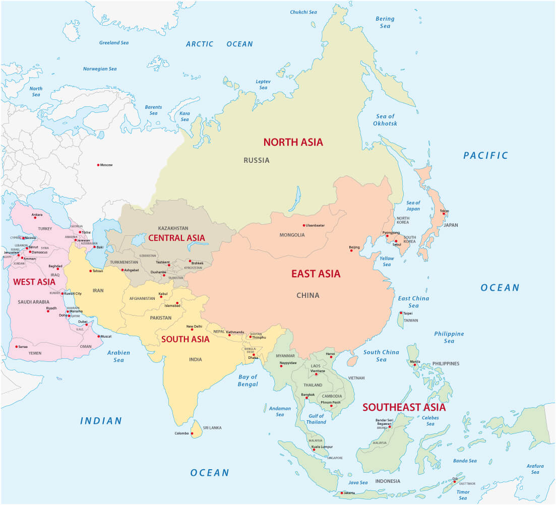
2012 Asia Political Continent Map
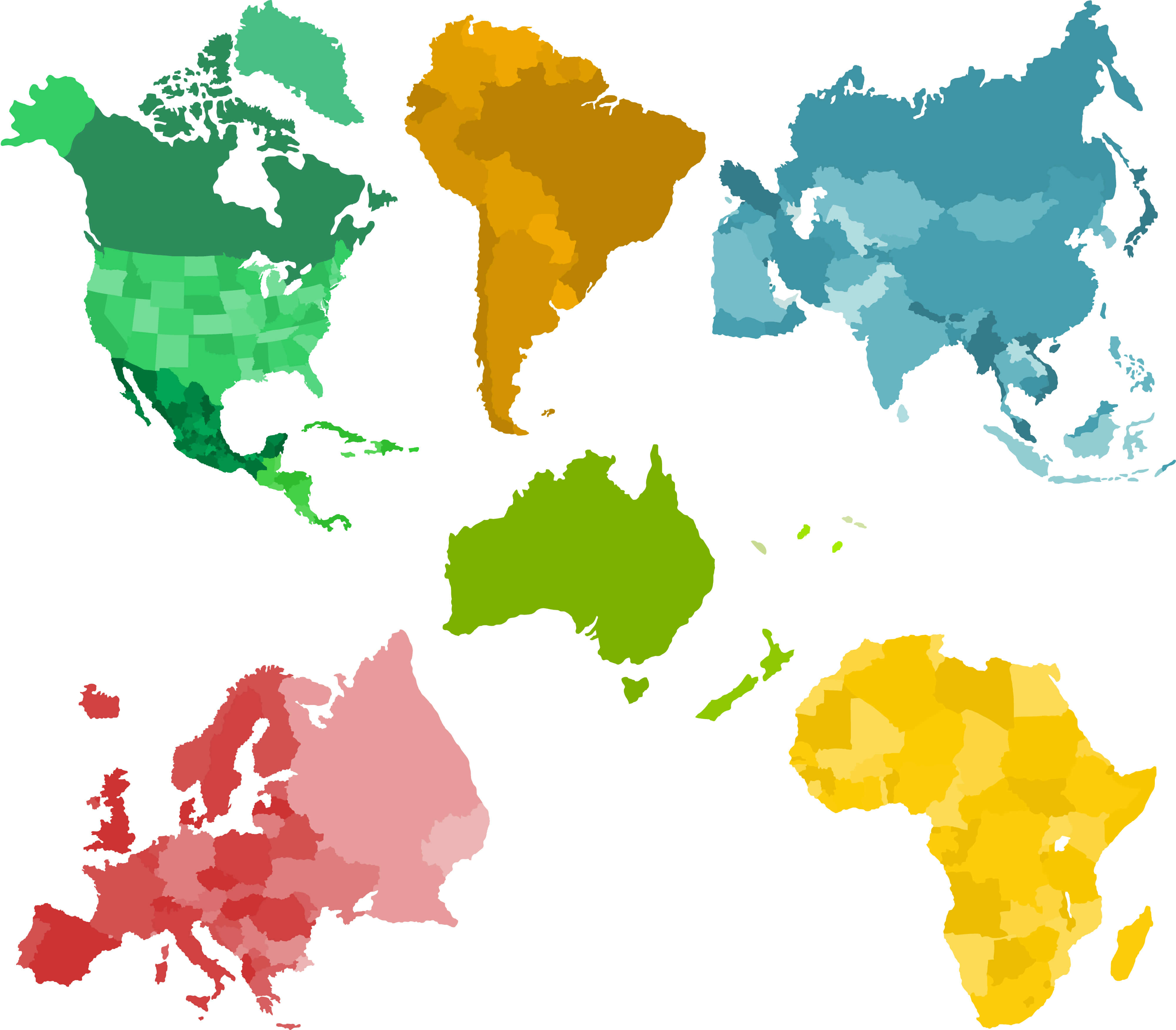
Asia and Set of a Six Silhouettes of a Continents
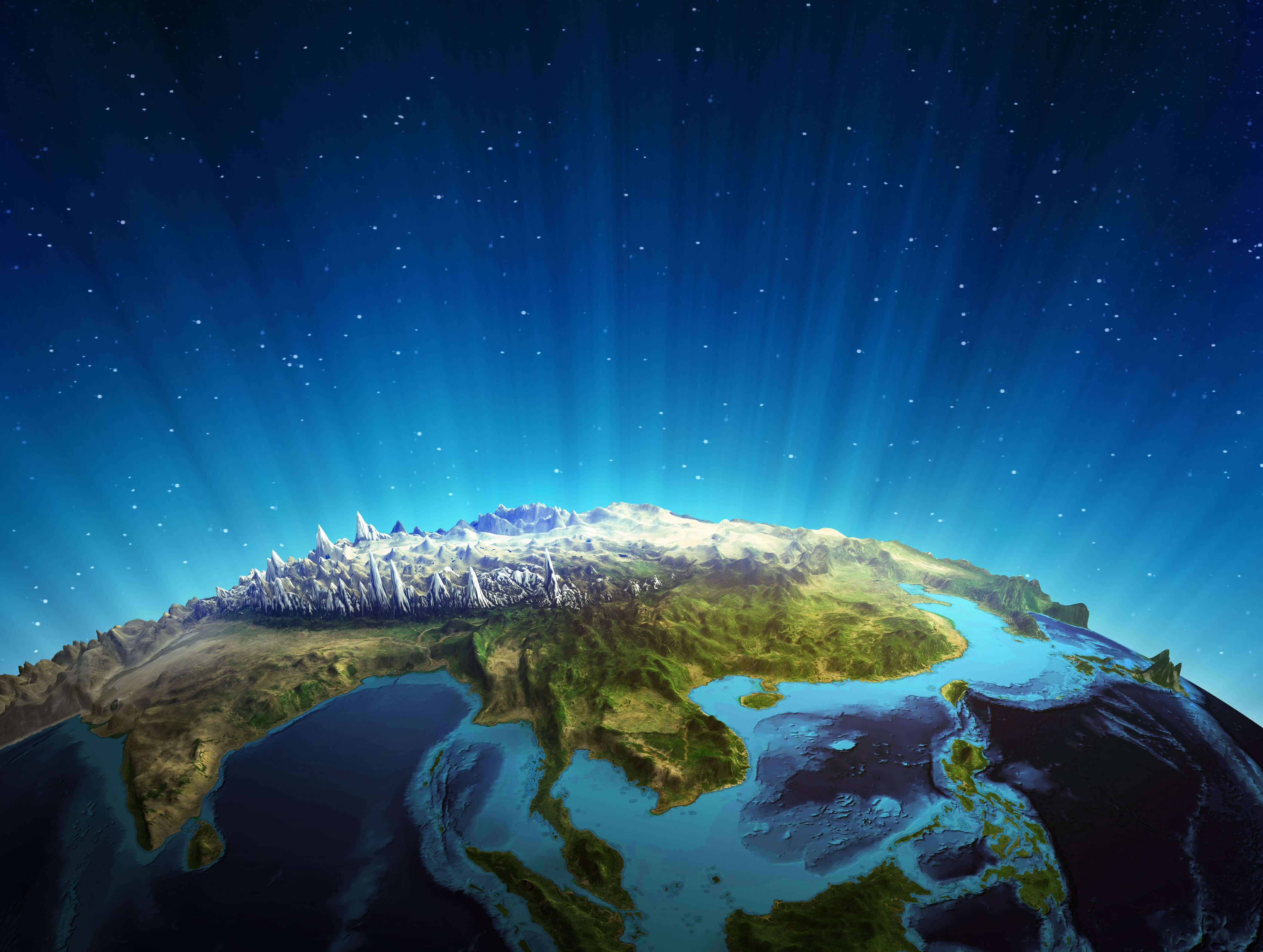
South East Asia Real Relief Satellite Map, Image Furnished by NASA
Where is Asia in the World?
Show Google Maps and satellite maps of where the country is located.
Get directions by driving, walking, bicycling, public transportation and travel with street view.
For More Maps of Asia
Feel free to explore these pages as well:
- Asia Map ↗️
- Map of Asia ↗️
- Bangkok: Asia’s City of Angels and Its Hidden Gems ↗️
- A Collection of Asia Maps ↗️
- About Asia and Maps ↗️
- A Collection of China Maps ↗️
- China’s Largest Cities ↗️
- A Collection of Bangladesh Maps ↗️
- Thailand Map ↗️
- About Thailand ↗️
- Thailand Photos ↗️
- Top 10 Experiences in Phuket ↗️
- Bangkok: Asia’s City of Angels and Its Hidden Gems ↗️
- Advertisement -