Explore Vietnam through various maps including physical, political, road, climate, terrain, and satellite views. Discover its major cities, regions, topography, population, borders, and blank map. Learn about Vietnam’s geographic location in Asia with detailed insights.
Vietnam Provinces and Regions Map with Geographic Zones and Key Cities
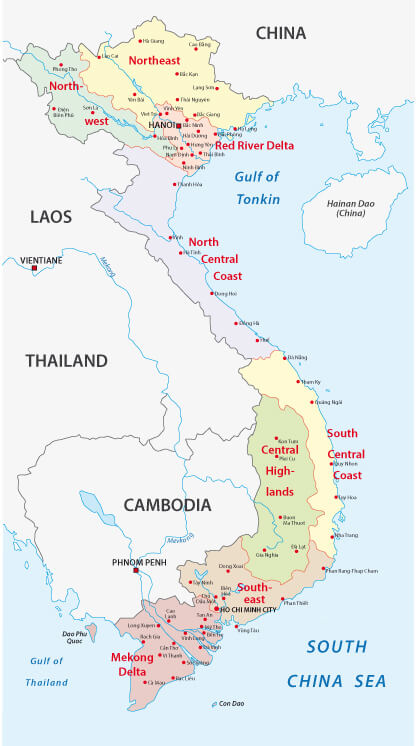 Vietnam map with provinces, regions, and borders with Laos, Cambodia, and China.
This Vietnam map displays the country’s major provinces and regions such as the Mekong Delta, Red River Delta, Central Highlands, and North Central Coast. It also highlights regional divisions and shows Vietnam’s borders with Laos, Cambodia, and China along with key cities like Hanoi and Ho Chi Minh City.
Vietnam Political Map with Provinces, Major Cities, and International Borders
 Vietnam political map with cities, provinces, borders, and neighboring countries.
This political map of Vietnam shows the provinces, major cities including Hanoi and Ho Chi Minh City, and international borders with China, Laos and Cambodia. It also shows surrounding seas, including the Gulf of Tonkin and the South China Sea, providing a detailed view of Vietnam’s administrative geography.
Brief information about Vietnam
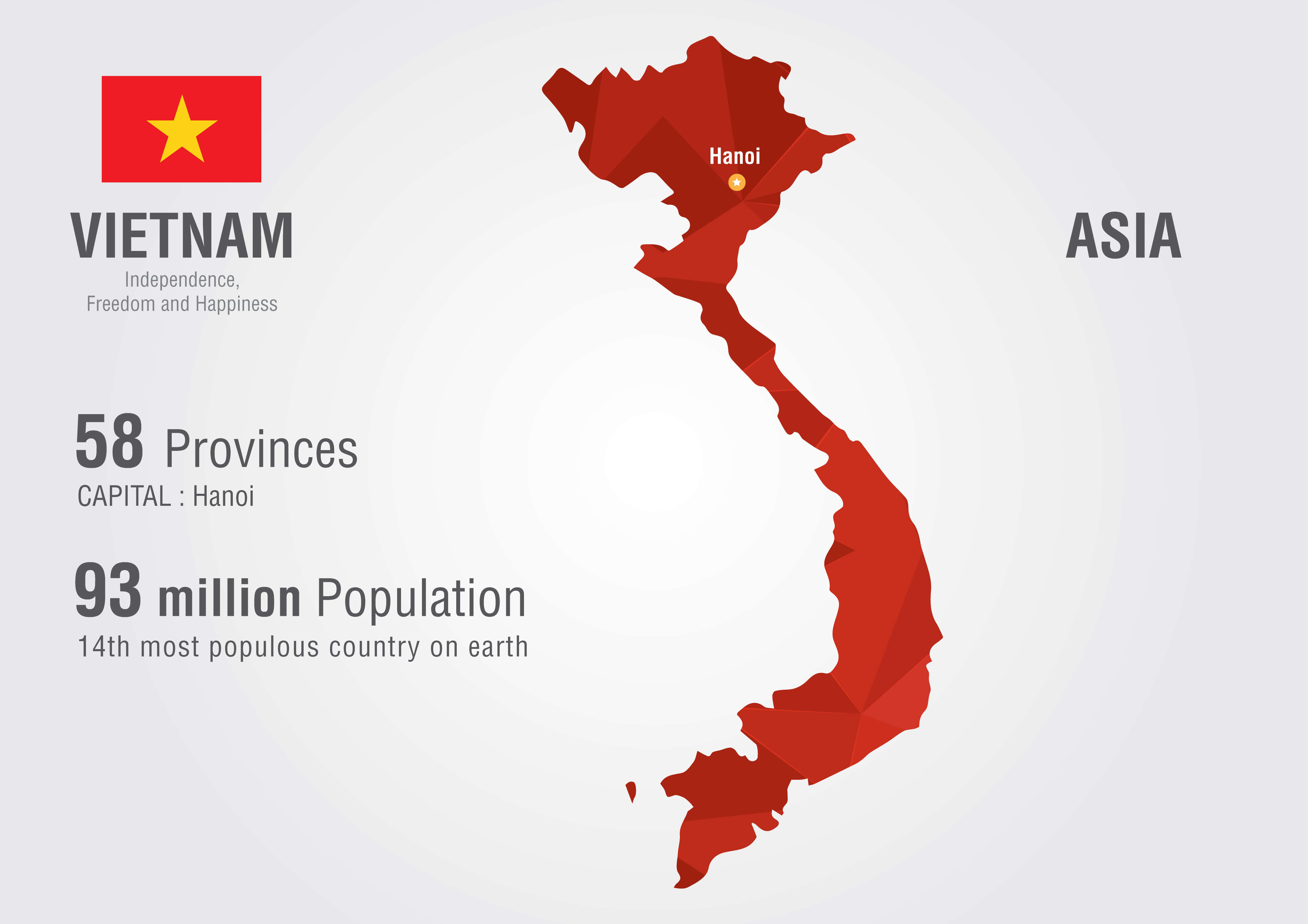
Vietnam, officially the Socialist Republic of Vietnam, is a Southeast Asian nation situated on the easternmost part of the Indochina Peninsula. Boasting a population exceeding 97 million, it ranks as the 15th most populous country globally. Hanoi serves as its capital, while Ho Chi Minh City, previously called Saigon, stands as the largest and most vibrant urban hub.
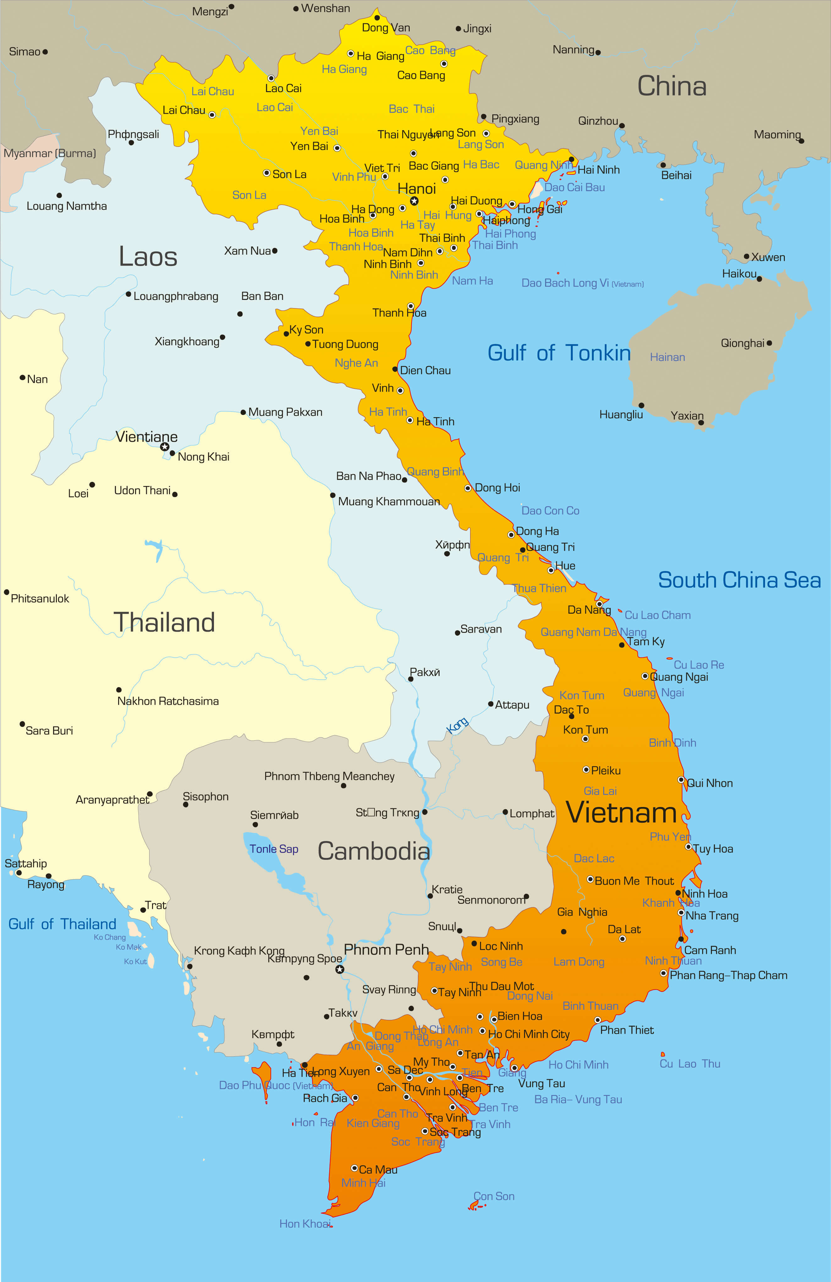
Vietnam Road Map with Neighboring Countries and Major Transportation Routes
This Vietnam road map displays major highways and transportation routes connecting key cities such as Hanoi and Ho Chi Minh City. It also highlights Vietnam’s borders with China, Laos, Cambodia, and nearby areas of Thailand. Coastal roads and regional connections across Southeast Asia are clearly illustrated.
Vietnam is celebrated for its breathtaking landscapes, ranging from the verdant rice terraces of Sapa to the dramatic limestone karsts of Ha Long Bay. The nation boasts a deep cultural heritage, shaped by its ancient history, periods of Chinese influence, and its French colonial legacy. Economically, Vietnam is one of the fastest-growing economies globally, with a robust emphasis on agriculture, manufacturing, and tourism.
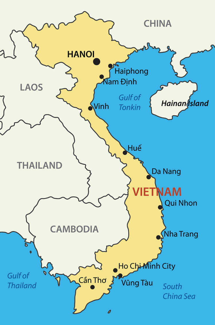
Where is located Vietnam on the World Map
 Where is located Vietnam on the World Map
Vietnam is a Southeast Asian country located on the eastern edge of the Indochinese peninsula. It borders China to the north, Laos and Cambodia to the west, and the South China Sea to the east. Its long coastline stretches over 3,260 kilometres, making it an important maritime hub in the region.
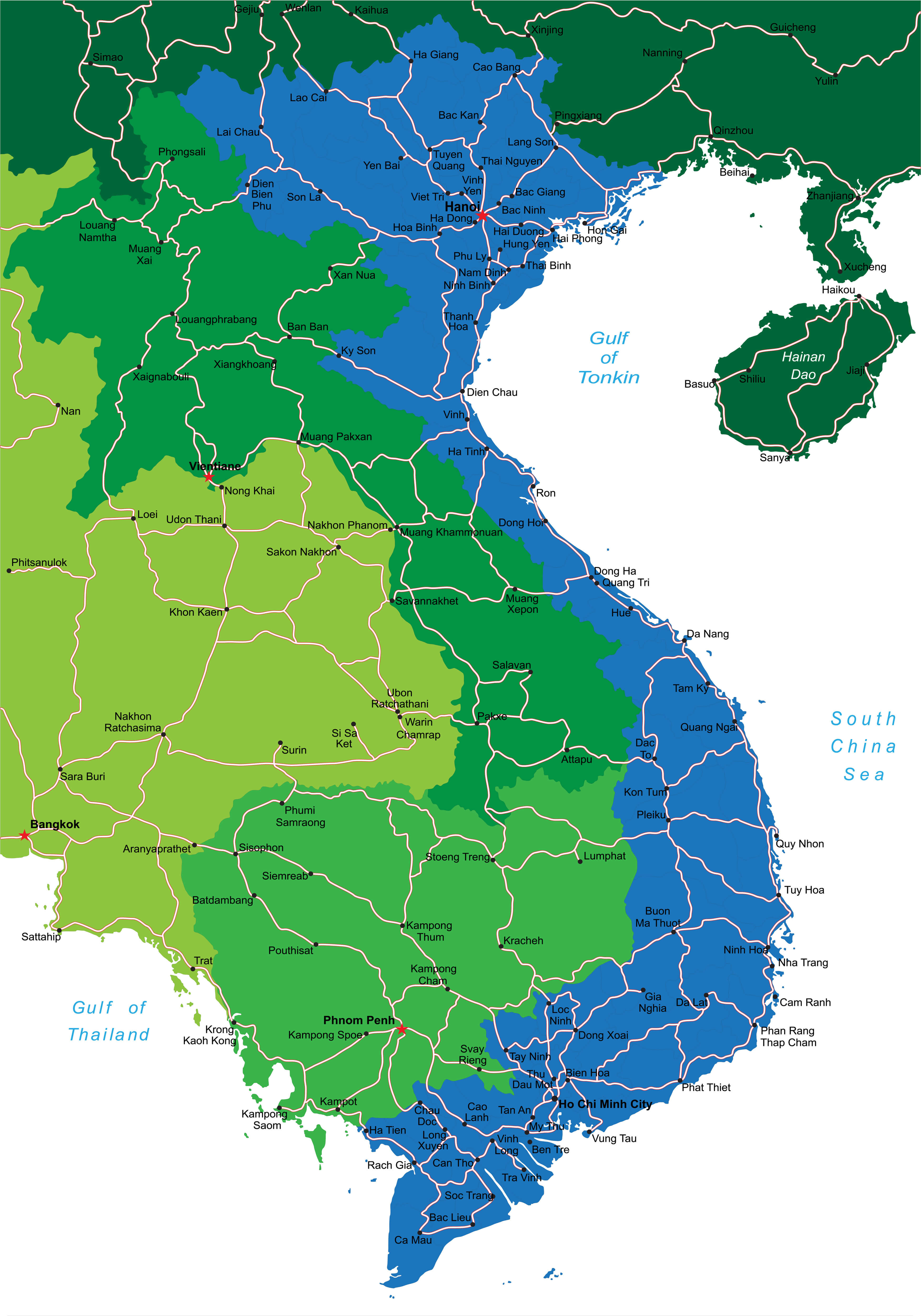
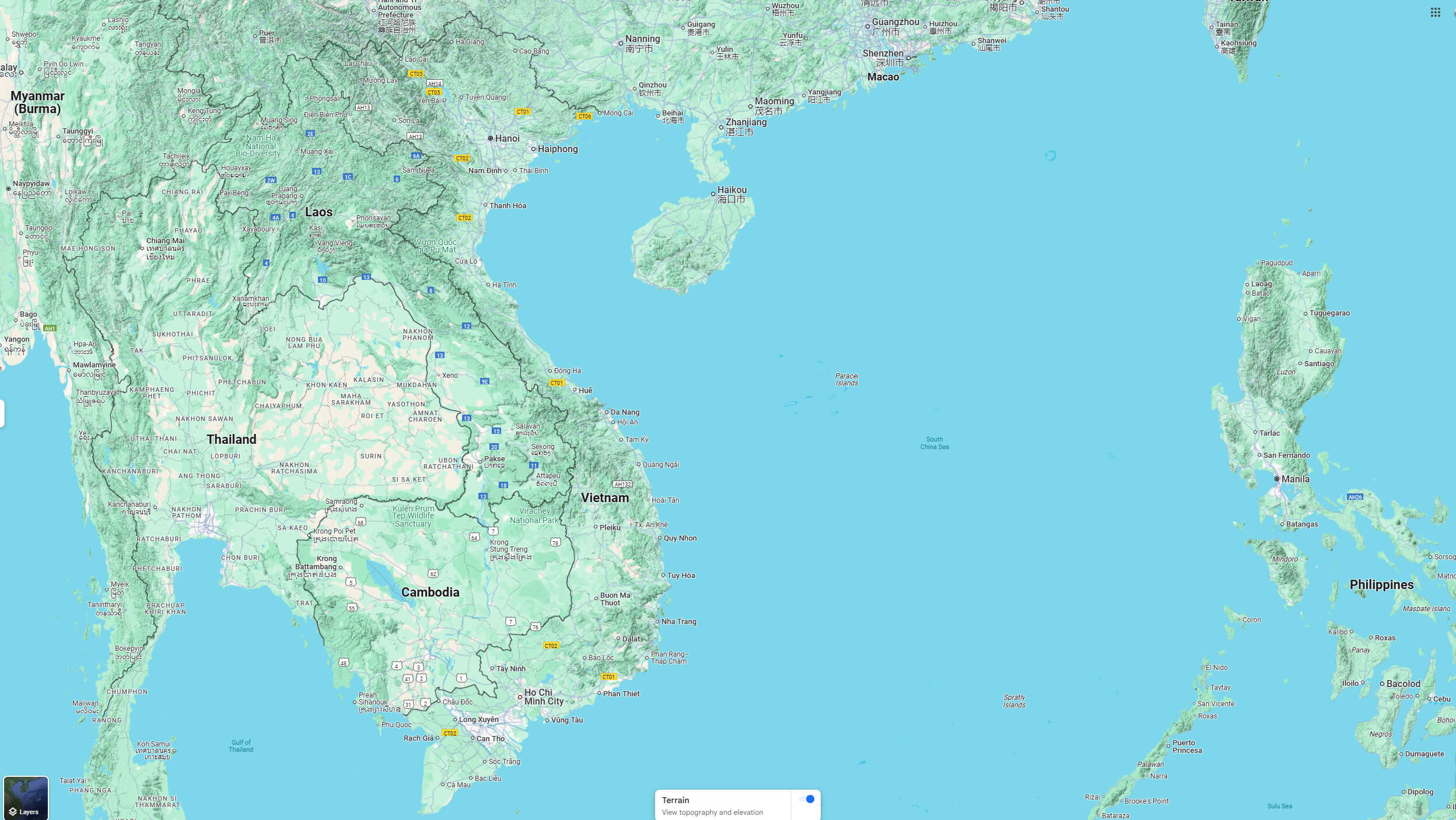
Vietnam and Neighboring Countries on the South Asia Political Map
 Map of Vietnam with Myanmar, Thailand, Laos, Cambodia, and southern China.
This map of South Asia highlights Vietnam’s position relative to its neighboring countries, such as Myanmar, Thailand, Laos, Cambodia, and southern China. Key cities like Hanoi, Ho Chi Minh City, Bangkok, and Phnom Penh are marked, offering a regional overview of Vietnam’s geographical and political context within Southeast Asia.
Vietnam lies entirely within the tropical zone, endowing it with a warm climate and vibrant, lush landscapes. Situated in the ASEAN region, the country is closely connected to its neighbors through trade and cultural ties. Its strategic location provides access to major shipping routes in the South China Sea, enhancing its regional significance.
Vietnam Road Map with Highways, Cities, and Border Connections
This Vietnam road map shows the national road network connecting major cities such as Hanoi and Ho Chi Minh City. It includes detailed routes, regional roads and border crossings with Laos, China and Cambodia, providing a complete overview of Vietnam’s transport infrastructure.
Historically, Vietnam’s location has made it a meeting point for various civilizations, leading to a diverse blend of cultural influences. Today, it holds a crucial role in the geopolitical and economic dynamics of Southeast Asia. The country’s diverse geography, featuring mountainous areas and fertile deltas, not only supports its agricultural economy but also adds to its stunning natural beauty.
Here are some statistical information about Vietnam:
 Area: 331,344.82km2 (127,932.95 sq mi)
 Vietnam info map
 Capital city: Hanoi
 Vietnam Location Map
Vietnam toursim map
Vietnam regions map
Map of Vietnam
Vietnam physical map
Vietnam political map
Vietnam Map Cambodia
 Detailed map of Vietnam and Cambodia, showing cities and landmarks.
This map highlights Vietnam and Cambodia’s geography, major cities like Hanoi and Phnom Penh, and tourist destinations. It showcases roads, rivers, and surrounding regions, including the Gulf of Tonkin and South China Sea.
Vietnam Map Indo China 1886
 Historic map of Indo-China, 1886, showing proposed Burma-Siam-China railway.
This map from 1886 highlights the Indo-China region, including modern-day Vietnam, Thailand, Laos, and Myanmar. It features proposed railways and major geographical features, offering insights into the area’s historical trade and colonization.
South Vietnam Land Map
 Map of South Vietnam showing land utilization and vegetation types.
This map illustrates the land use and vegetation in South Vietnam, highlighting cultivated areas for rice, rubber, and vegetables, alongside noncultivated regions like forests, grasslands, and mangroves.
Touristic Map of Vietnam
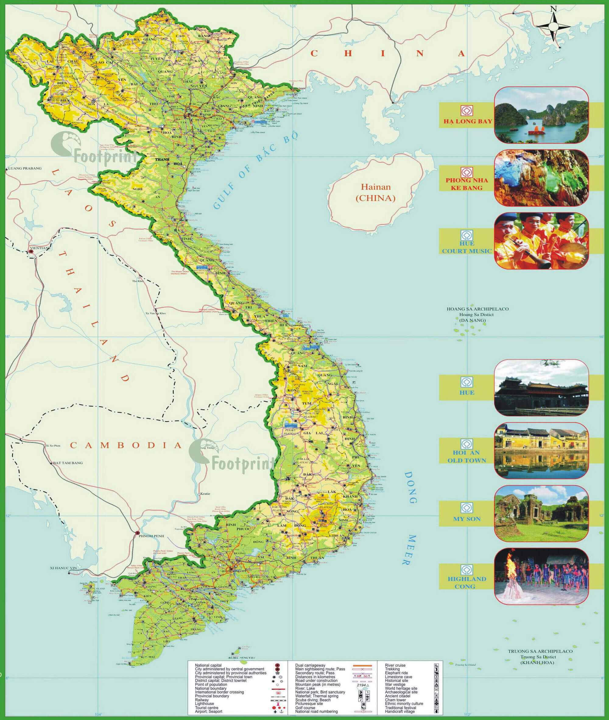 Tourist map of Vietnam highlighting key landmarks and attractions.
This map displays Vietnam’s geography with major cities, roads, and landmarks. Key sites such as Ha Long Bay, Hue, Hoi An, and My Son are showcased with images, providing a comprehensive guide to Vietnam’s cultural and natural attractions.
Vietnam French Indo China Map
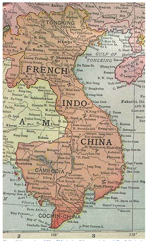 Map of French Indochina showing Vietnam, Cambodia, and Laos.
This historical map illustrates French Indochina, including Vietnam’s divisions as Tonking, Annam, and Cochinchina, alongside Cambodia and Laos during the colonial era. It highlights key cities and regions under French administration.
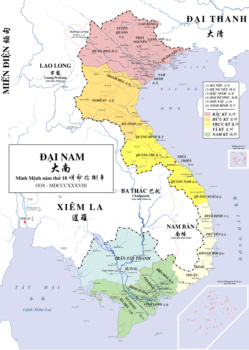
Vietnam nguyen dynasty administrative map in 1838
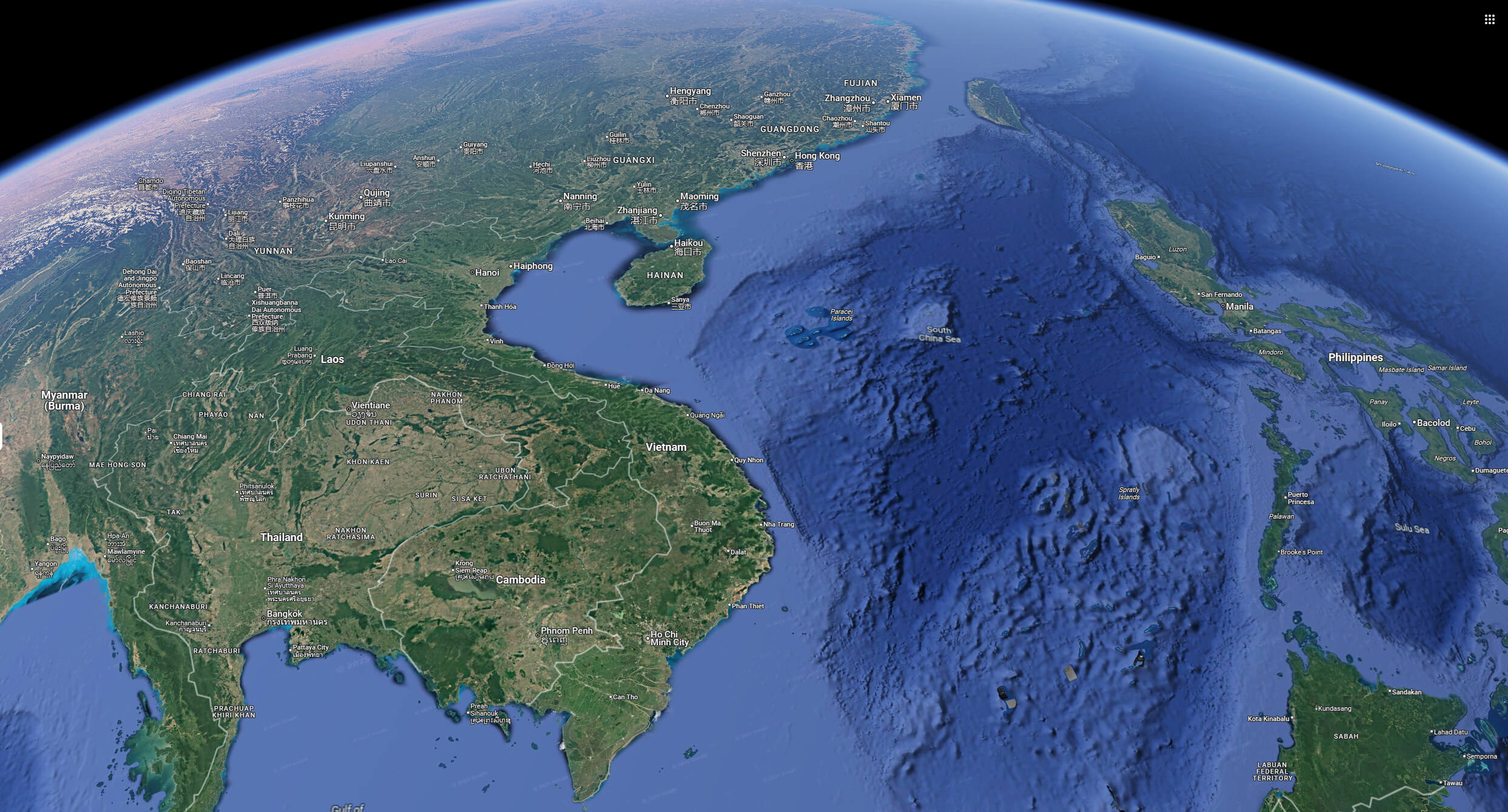
Vietnam satellite map from space
Vietnam Country Regions Map
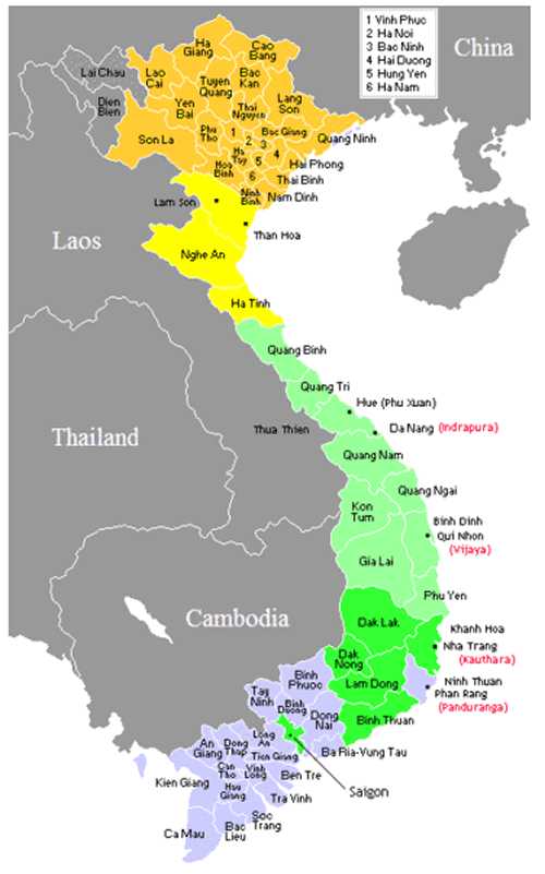 Map of Vietnam with regions and neighboring countries.
This map displays the regions of Vietnam categorized by provinces, along with its neighboring countries: China, Laos, Cambodia, and Thailand. Regions are color-coded to indicate their geographical distinctions within Vietnam.
Satellite Image of Vietnam
Sketch of Vietnam
Vietnam and major cities map
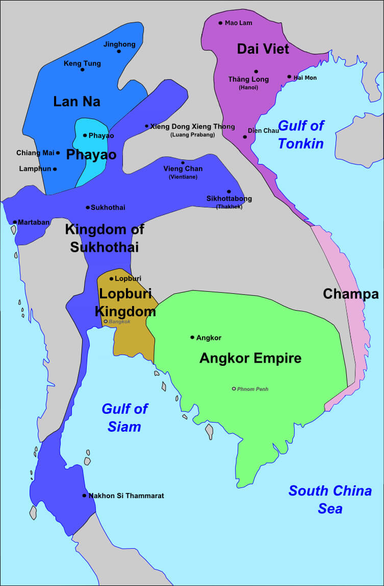
Vietnam and southeast asian history map 13th century
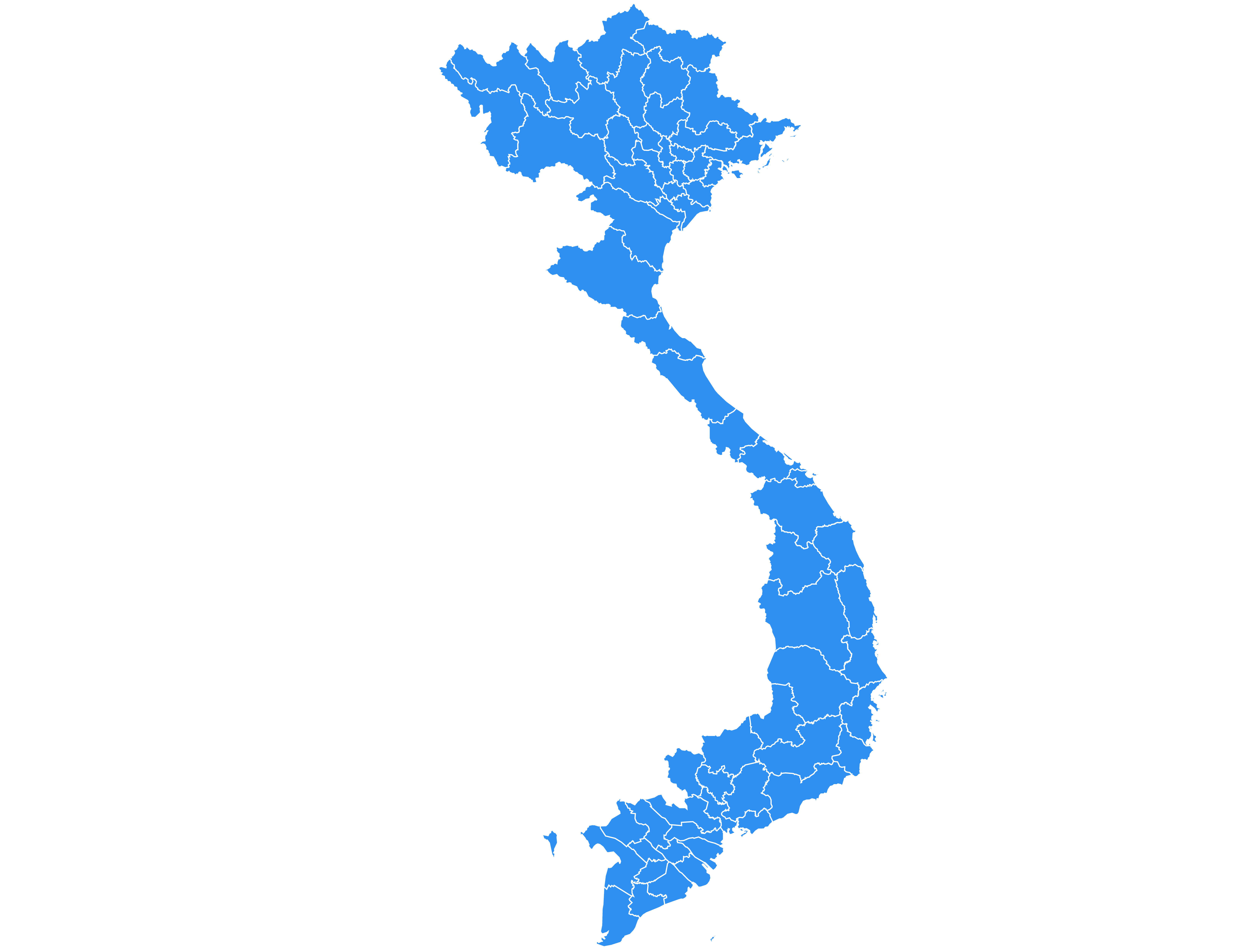
Vietnam blank map
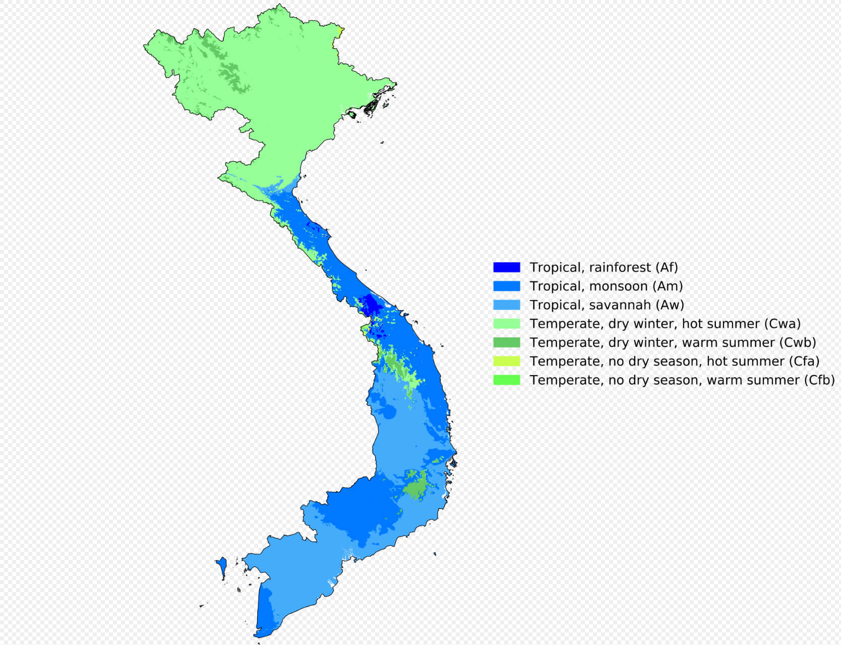
Vietnam climate map
Vietnam map with flag and population info
Vietnam map with hanoi and major cities
Vietnam map with national flag
Vietnam map
Vietnam satellite map
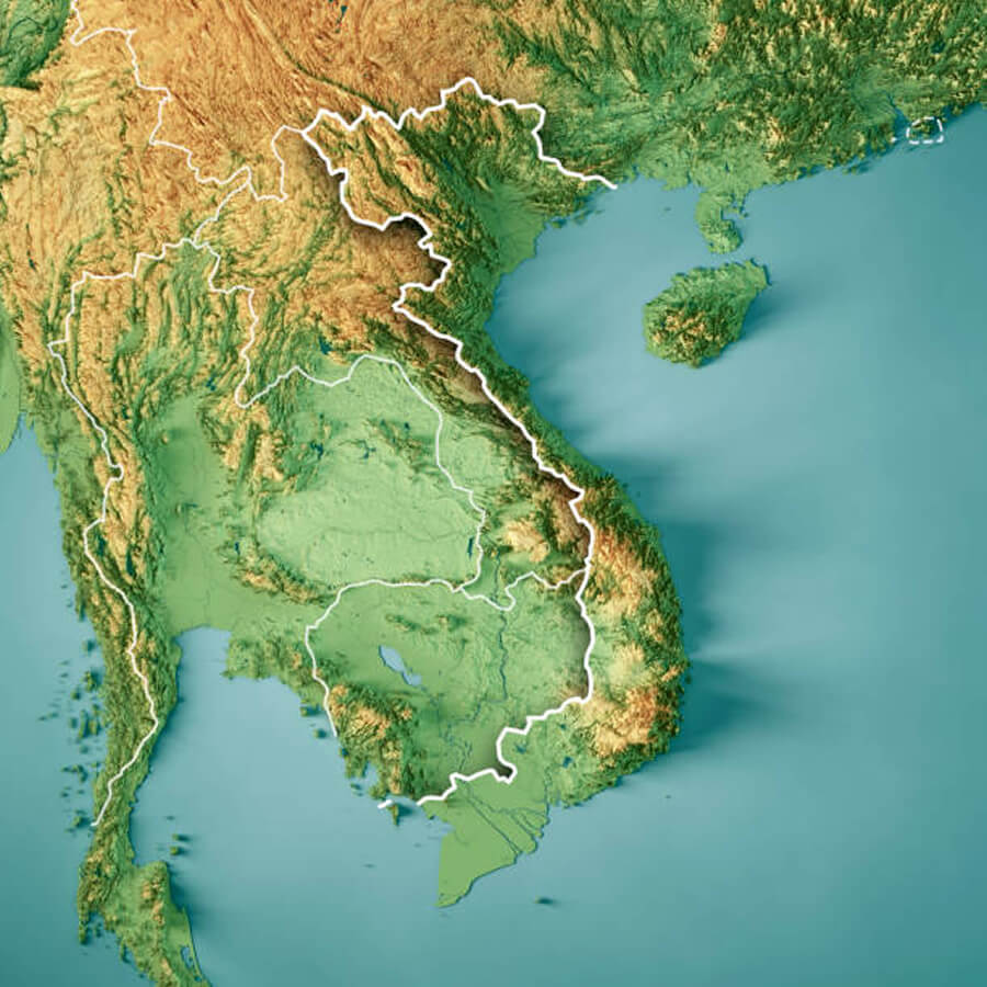
Vietnam terrain map
Vietnam topography map
Where is located Vietnam in asia
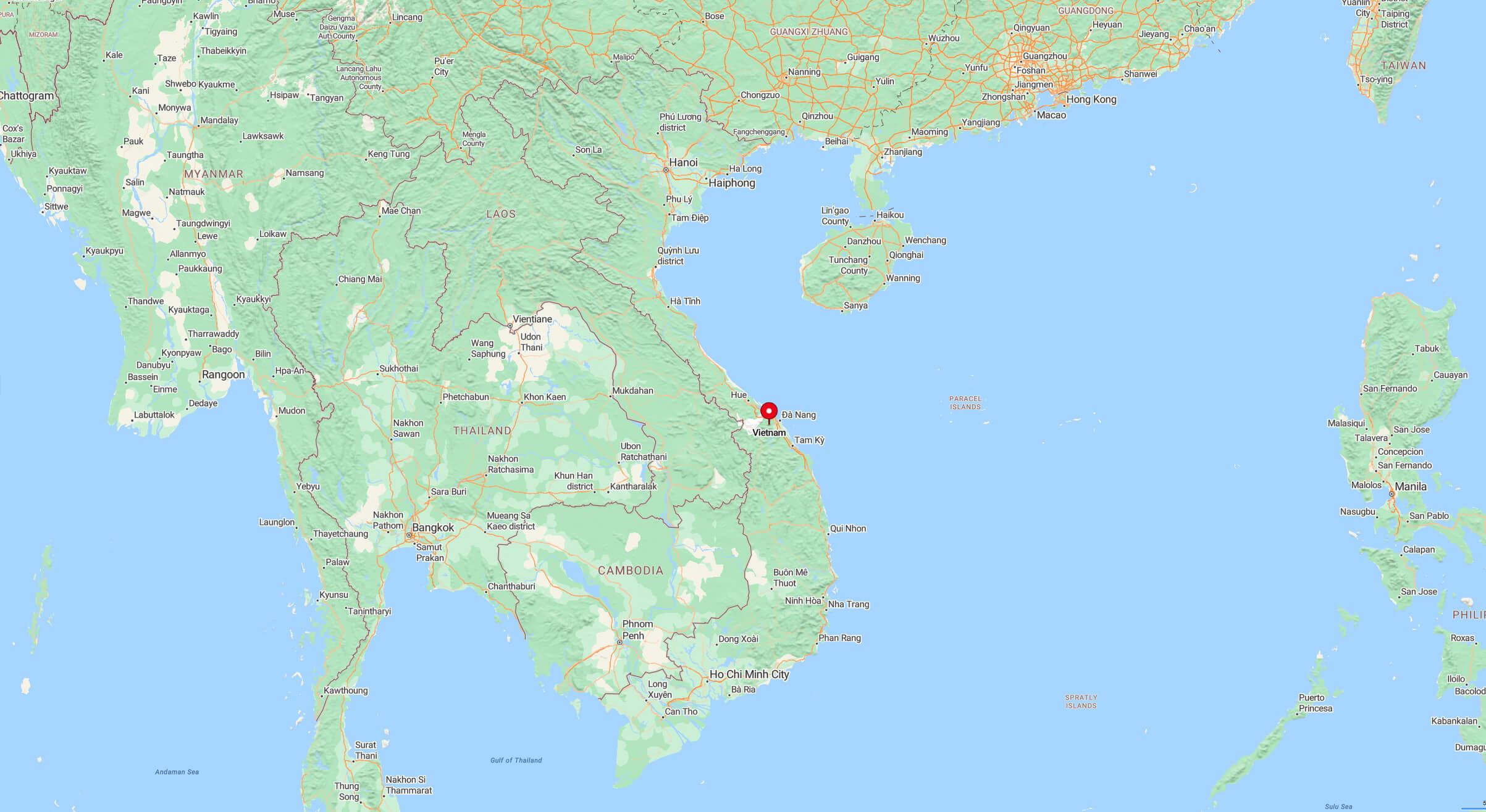
Where is Vietnam on the Asia Map?
Show Google interactive map, satellite map, where is the country located.
Get directions by driving, walking, bicycling, public transportation, and traveling with street view.
Feel free to explore these pages as well:
- China Map ↗️
- Indonesia Map ↗️
- Myanmar (Burma) Map ↗️
- Philippines Map ↗️
- Brunei Map ↗️
- Malaysia Maps ↗️
- Where is Taiwan in the World and A Collection of Taiwan Maps ↗️
- Japan Map ↗️
- North Korea Map ↗️
- South Korea Map ↗️
- Asia Maps ↗️