Explore Sri Lanka’s diverse geography with political, physical and satellite maps. Explore its cities, terrain and regions, including its proximity to India. Learn about Sri Lanka’s historical significance, major provinces and stunning landscapes from mountains to coastal plains. View detailed satellite imagery and topographic maps for a deeper understanding of this island nation.
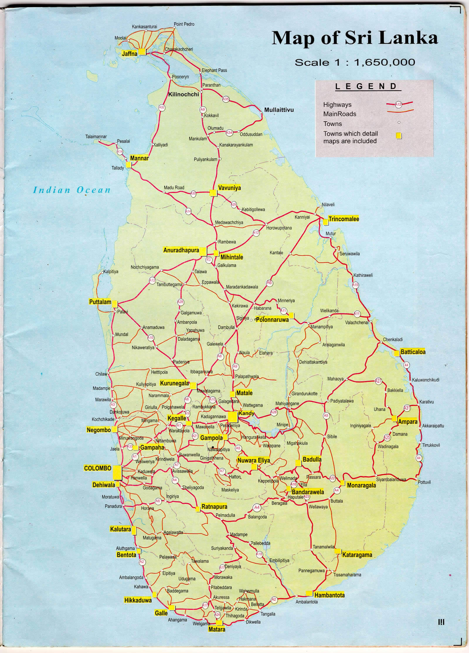
Sri Lanka Road Map – Highways, Cities, and Key Routes
 Sri Lanka road map with cities and major highways
Explore the Sri Lanka road map featuring major cities, highways, and transportation routes. The map highlights key locations like Colombo, Kandy, Jaffna, and Galle, along with road networks connecting different regions. See how Sri Lanka’s road infrastructure links cities, ports, and travel destinations across the island.
Brief information about Sri Lanka
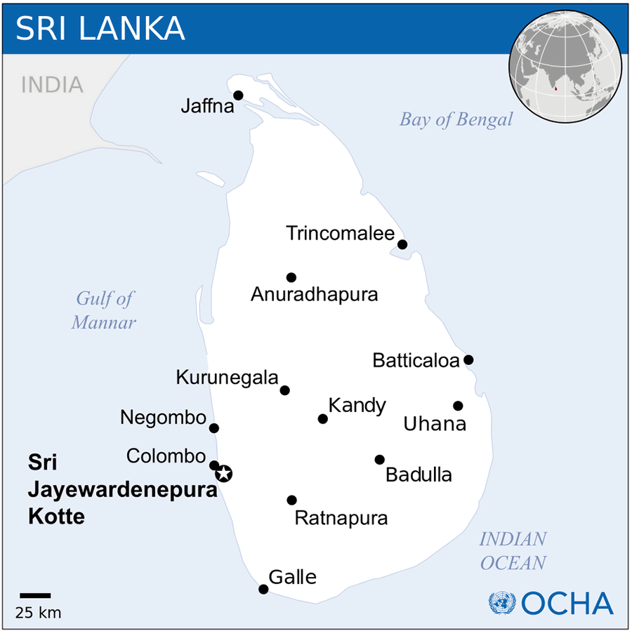
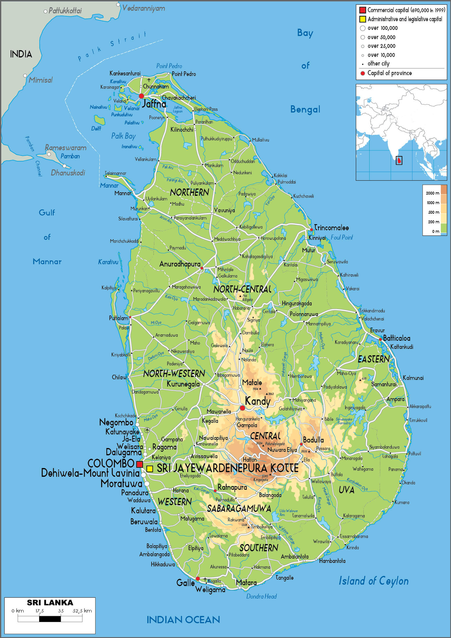
Sri Lanka, an island nation situated in the Indian Ocean, is located just off the southeastern coast of India. Often referred to as the “Pearl of the Indian Ocean,” its history spans over 2,500 years and is deeply intertwined with its role as a crucial point on ancient trade routes. The country is celebrated for its breathtaking landscapes, which include tropical beaches, lush rainforests, and scenic mountainous tea plantations. Sri Jayawardenepura Kotte serves as the administrative capital, while Colombo is the economic center.
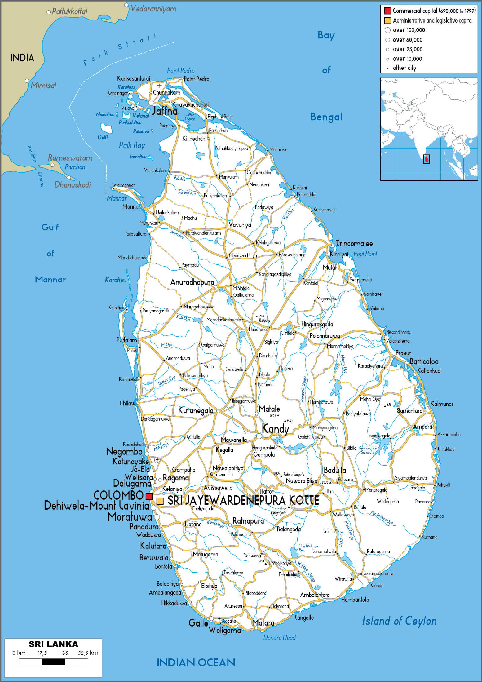
Sri Lanka map with major cities
Home to a population of approximately 22 million, Sri Lanka is a diverse, multi-ethnic, and multi-religious nation. The Sinhalese form the majority ethnic group, followed by Tamils, Muslims, and other minority communities. Sinhala and Tamil are the official languages, with English widely used in business and education. The country boasts a rich cultural heritage shaped by Buddhism, Hinduism, and its colonial past. Iconic landmarks such as Sigiriya, Kandy, and Galle Fort draw visitors from across the globe, showcasing Sri Lanka’s historical and natural beauty.
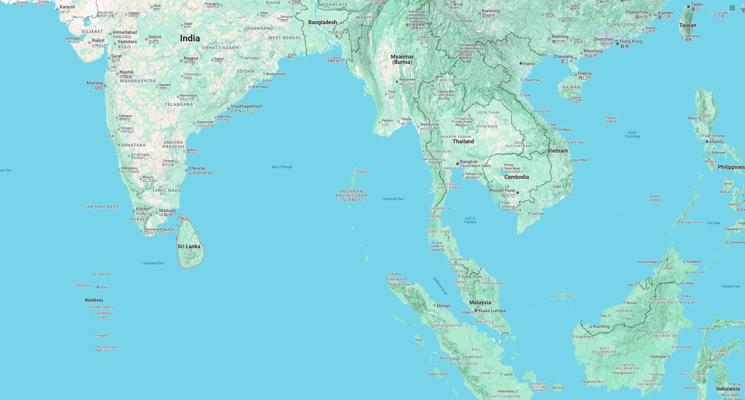
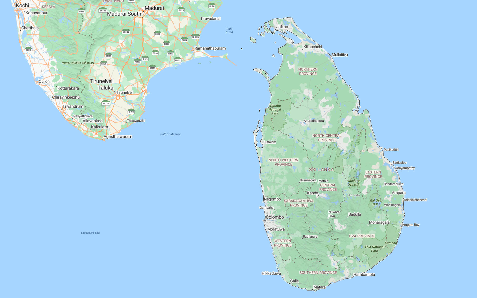
Where is located Sri Lanka on the World Map
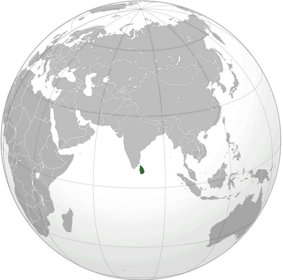
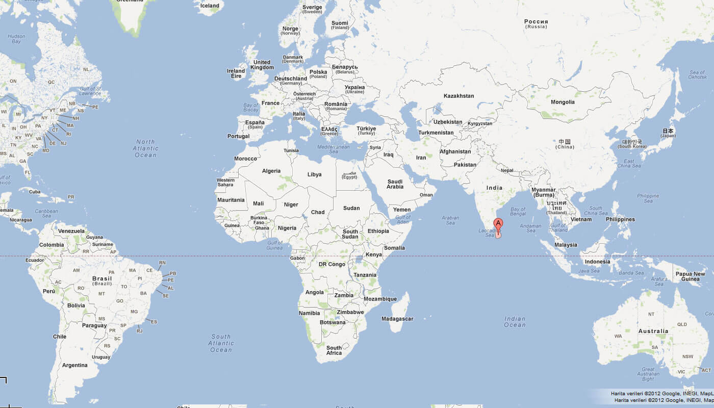
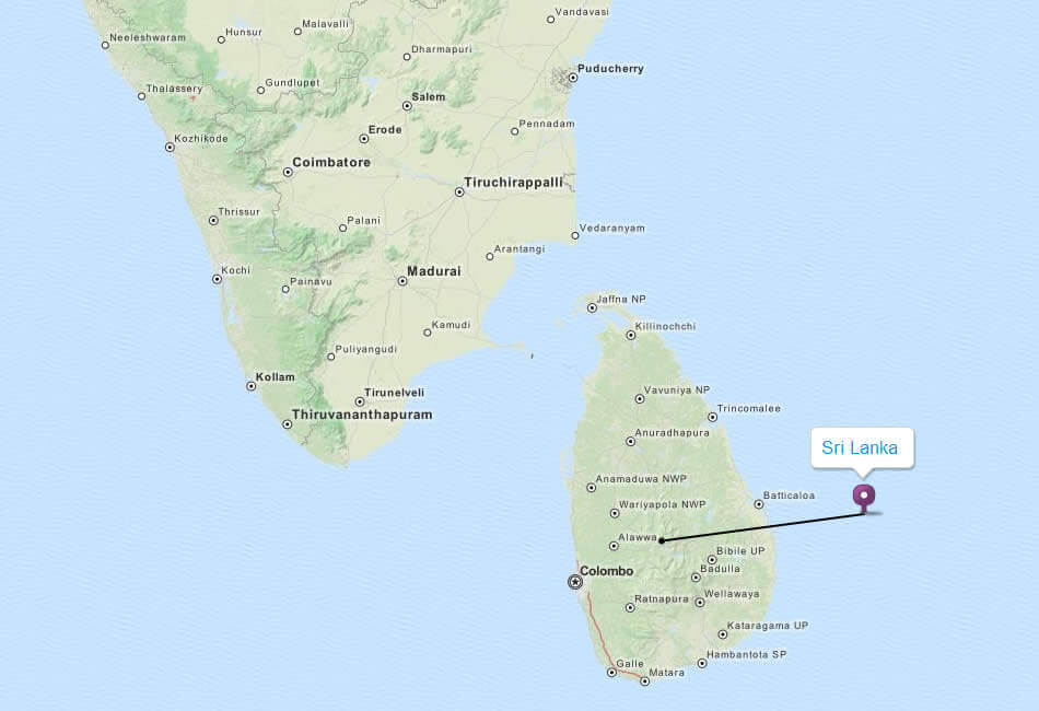
Sri Lanka is an island nation located in the Indian Ocean, off the southeastern coast of India. It lies southwest of the Bay of Bengal and southeast of the Arabian Sea, positioning it as part of South Asia.
The country is separated from India by the narrow Palk Strait and the Gulf of Mannar. At its closest point, Sri Lanka is only about 30 kilometers from India, historically connected by Adam’s Bridge, a series of limestone shoals.
Sri Lanka’s strategic location places it along major maritime trade routes, making it a significant hub between the Middle East, Southeast Asia, and East Asia. This advantageous position has influenced trade and cultural exchange for centuries, shaping the island’s rich history and global significance.
Here are some statistical information about Sri Lanka:
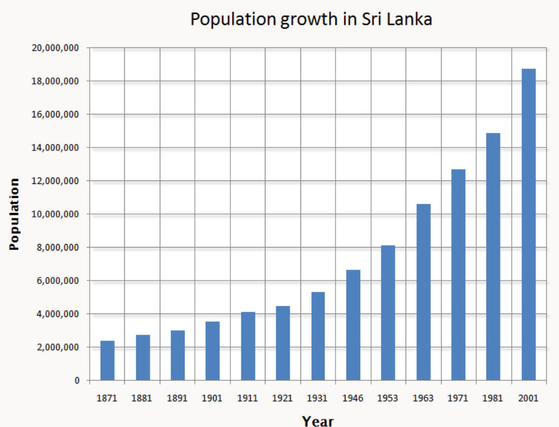
 Area: 65,610.2 km2 (25,332.2 sq mi)
 Population growth in Sri Lanka
 Capital city: Sri Jayawardenepura Kotte
 Sri Lanka Tourism Map – Attractions, National Parks, and Cultural Sites
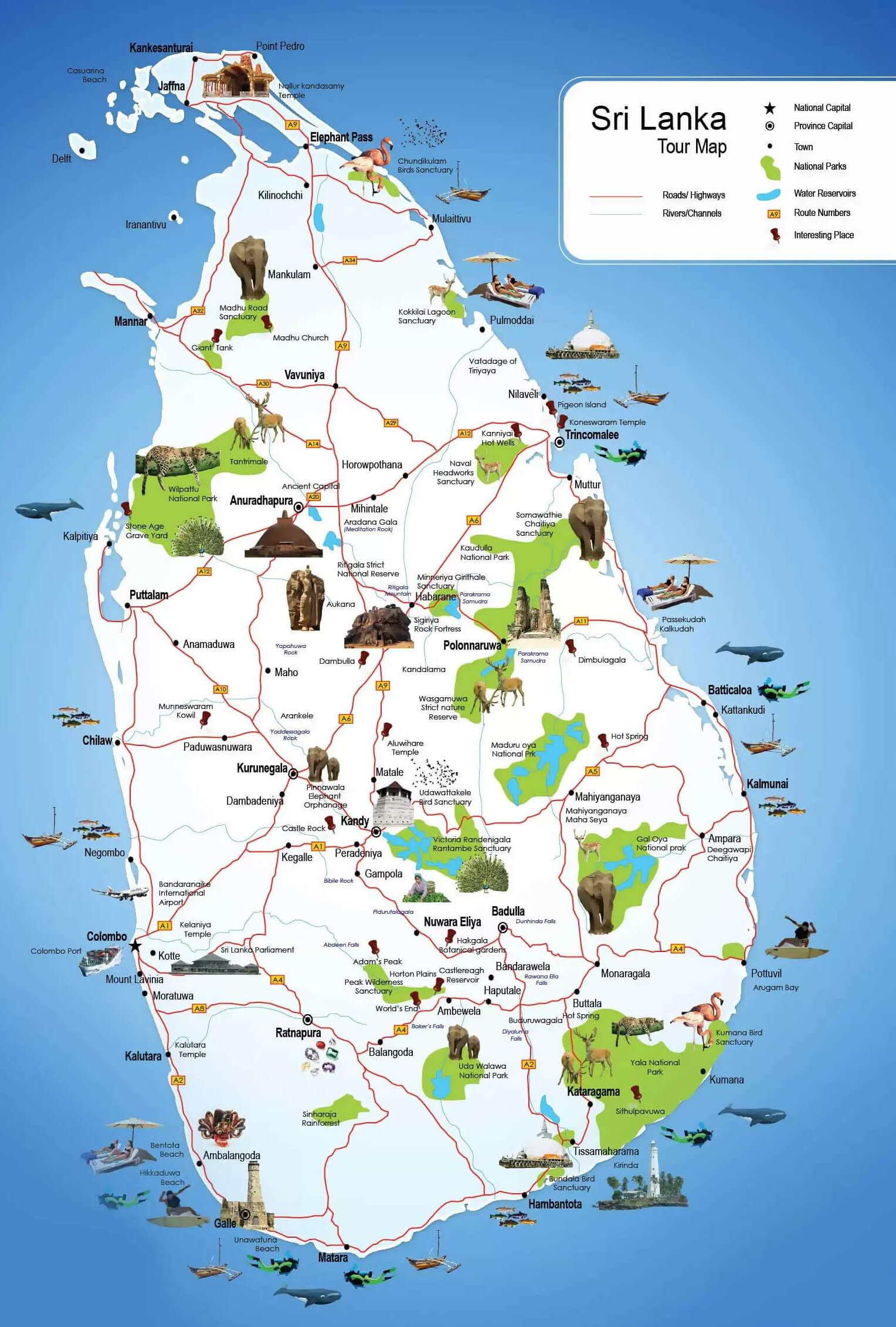
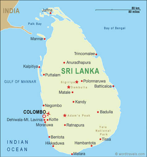
Explore Sri Lanka’s tourism map, featuring top attractions, historic sites, national parks and beautiful beaches. Discover must-see places such as Sigiriya, Yala National Park, Kandy, Galle and Colombo. This map highlights major highways, cultural landmarks and nature reserves, making it perfect for planning your next adventure in Sri Lanka.
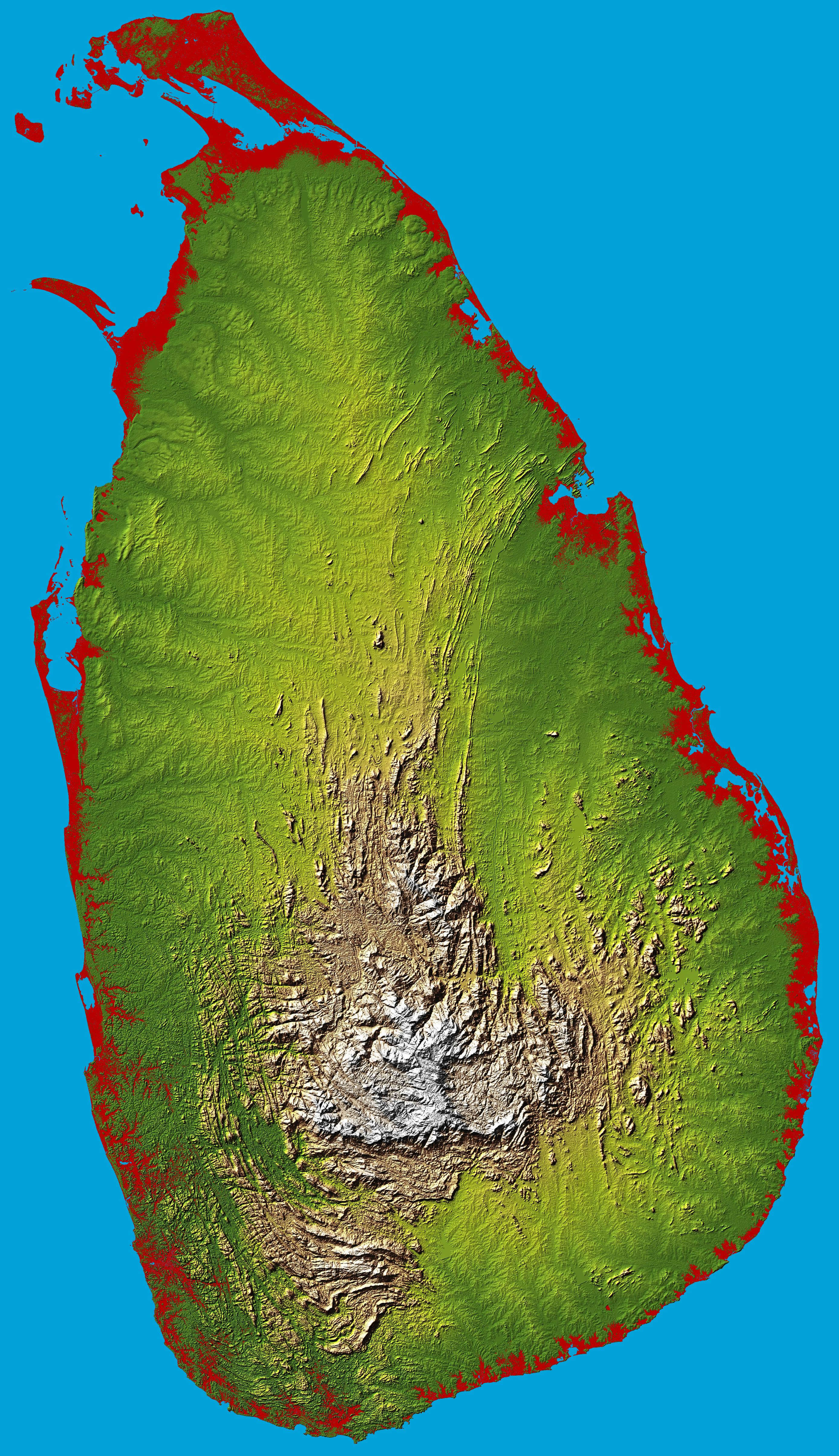
Topographic map of Sri Lanka
 Calling code: +94
 Map of Sri Lanka
Sri Lanka Location Map
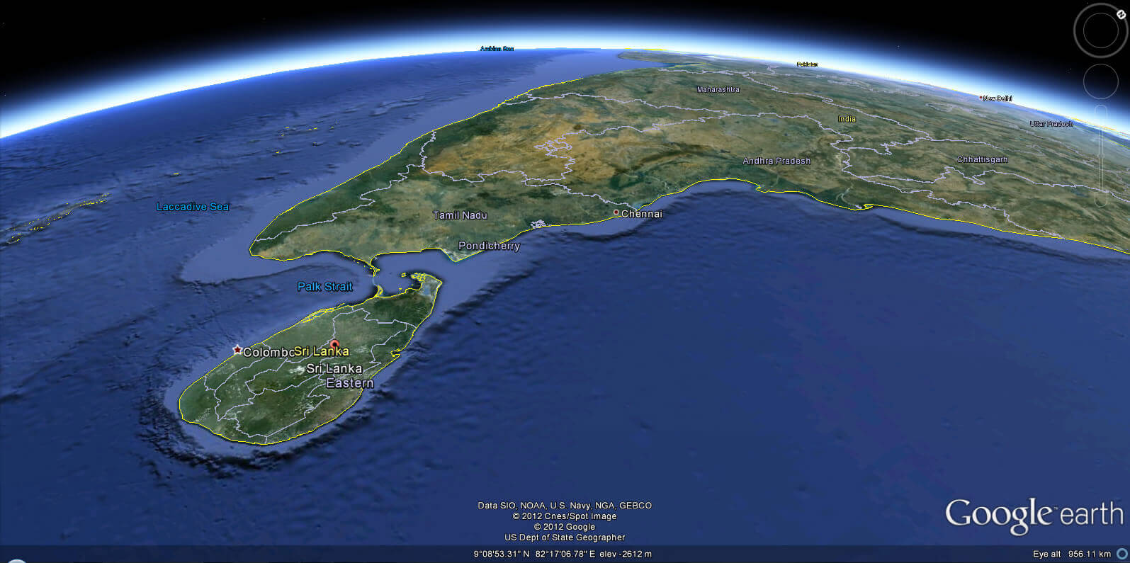
Map of Sri Lanka India
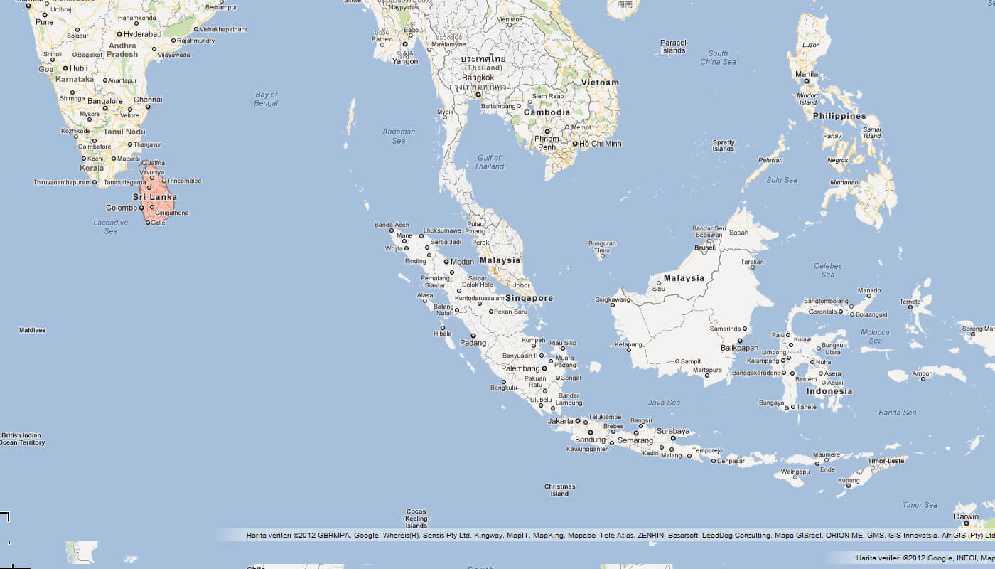
Sri Lanka, an island nation in the Indian Ocean, lies southeast of India. This map highlights Sri Lanka’s proximity to India’s Tamil Nadu state and its central location relative to Southeast Asia, including Malaysia and the Philippines.
Map of Sri Lanka World
Map Sri Lanka
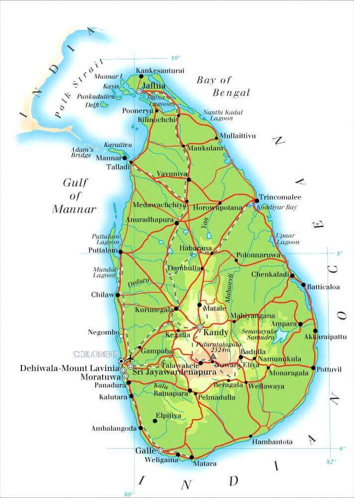 Sri Lanka map with cities, roads, and geographic features.
This map of Sri Lanka highlights its major cities, road networks, and geographic features like rivers and mountains. It showcases key locations such as Colombo, Kandy, and Jaffna, along with surrounding seas like the Bay of Bengal and Gulf of Mannar.
Physical Map of Sri Lanka
 Physical map of Sri Lanka with cities, provinces, and elevation.
This physical map of Sri Lanka shows major cities, provincial divisions, road networks, and elevation levels. Key locations include Colombo, Kandy, and Jaffna, with details on natural features like rivers, mountains, and the coastal plains along the Indian Ocean.
Maps Sri Lanka
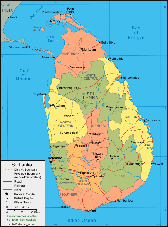
Sri Lanka Political Map
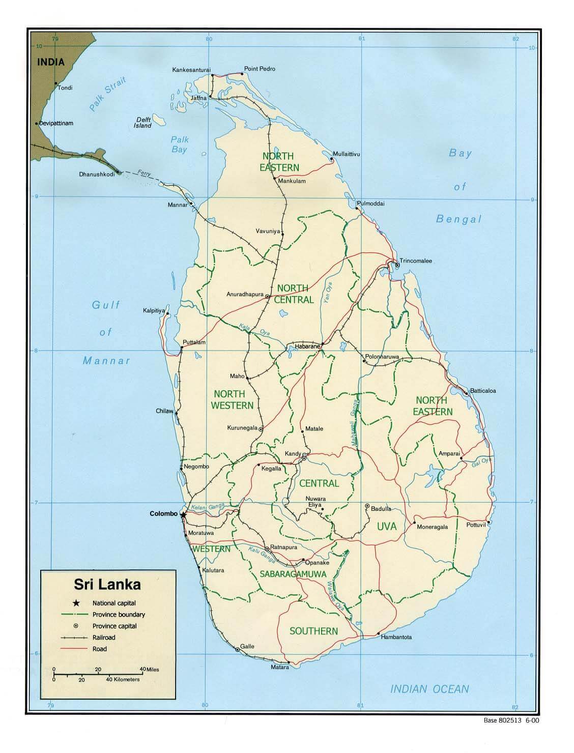 Political map of Sri Lanka showing provinces and roads.
This map illustrates Sri Lanka’s provincial divisions and major transportation routes. It highlights key regions such as North Eastern, Central, and Western provinces. The map also marks Colombo as the national capital, along with major cities and railroads.
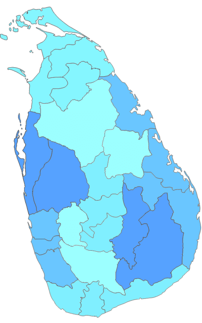
Sri Lanka Regional Map
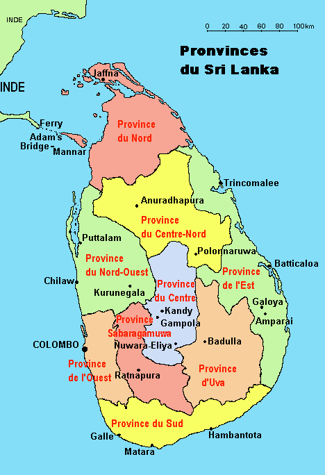 Regional map of Sri Lanka highlighting provinces in different colors.
This map shows the provincial divisions of Sri Lanka with clear demarcations. Each province is color-coded for distinction, including North, Central, Uva, and Western regions. Colombo is marked as the capital, along with major towns like Jaffna and Galle.
Sri Lanka terrain map
Sri Lanka Earth Map
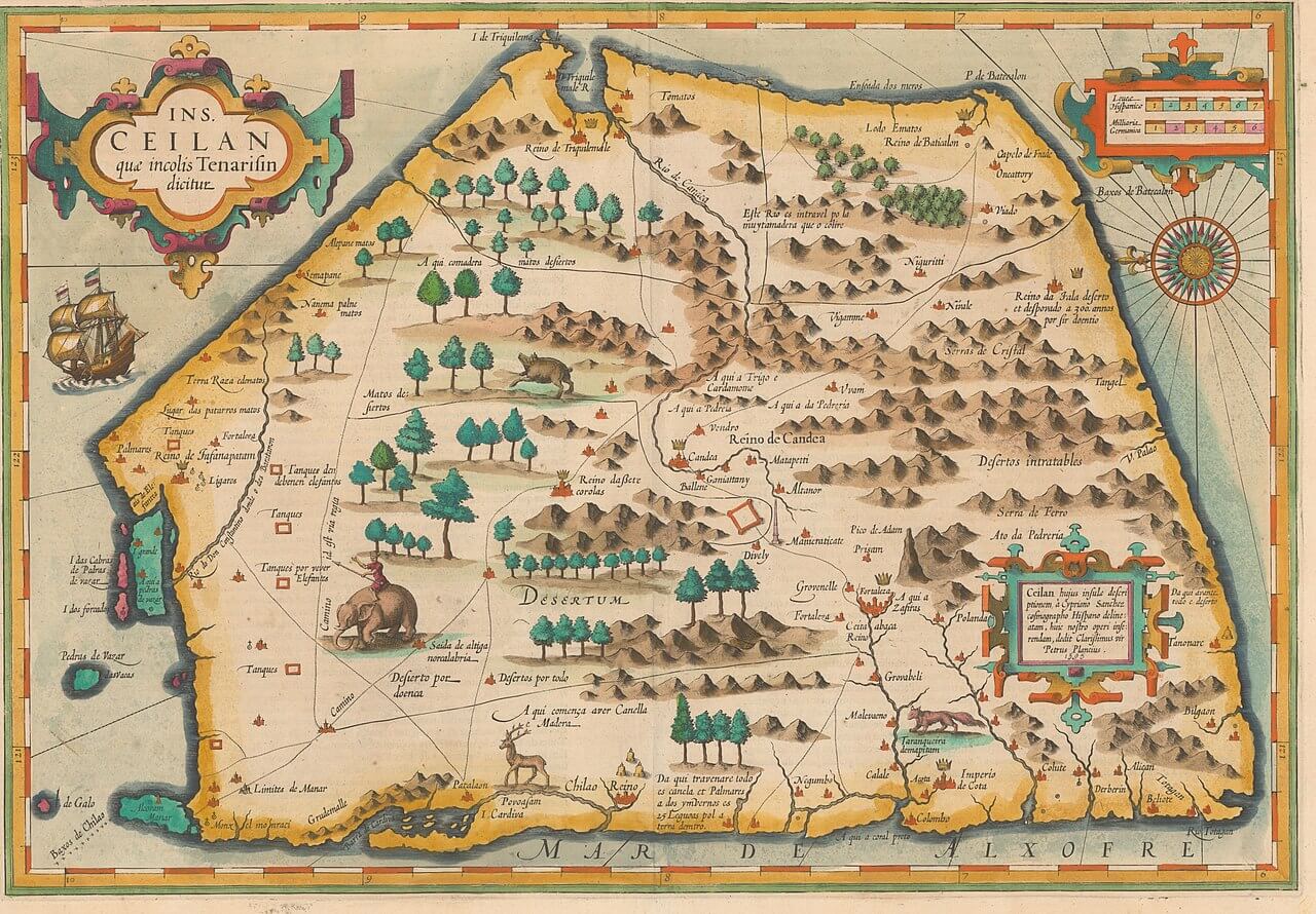
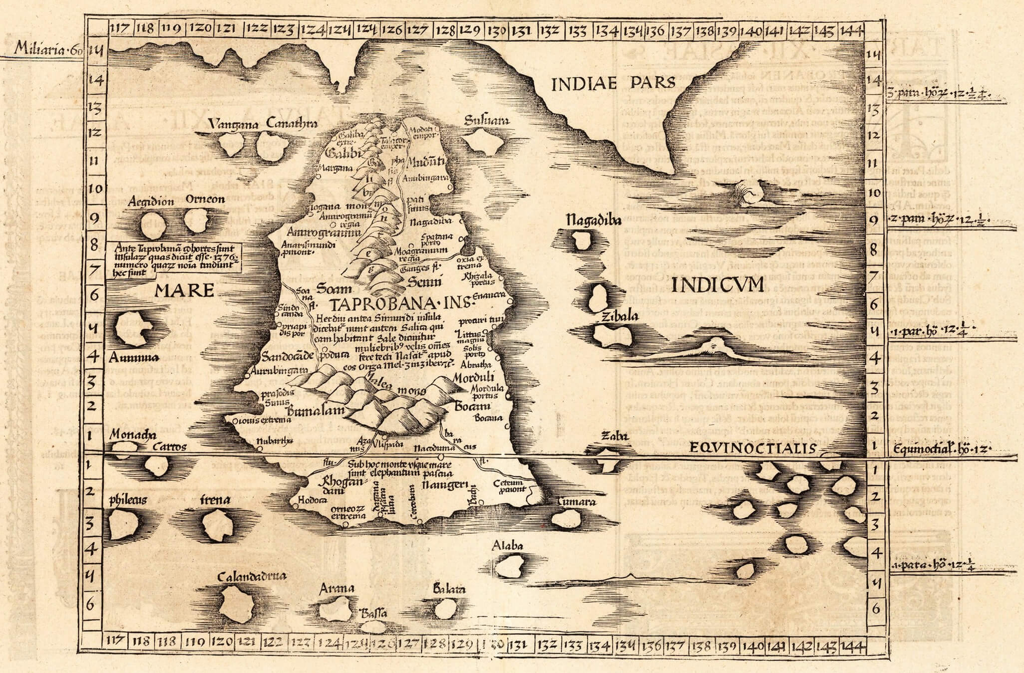
Map of Sri Lanka by dutch cartographer 1595
Sri Lanka blank provinces map.png
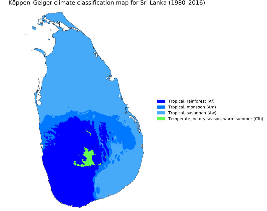
Sri Lanka climate map
Sri Lanka history map in 1535
Sri Lanka map with cities
Sri Lanka road map
Where is Sri Lanka on the Asia and the World Map?
Show Google interactive map, satellite map, where is the country located.
Get directions by driving, walking, bicycling, public transportation and travel with street view.
Feel free to explore these pages as well:
- India Map ↗️
- Map of India ↗️
- Mumbai’s Must-Visit Guide to Attractions ↗️
- Delhi’s Top 10 Must-Visit Attractions for Every Traveler ↗️
- Discover Bangalore: The Silicon Valley of India ↗️
- Discovering Ahmedabad: India’s Historical and Cultural Gem ↗️
- Pakistan Map ↗️
- Bangladesh Map ↗️
- Muslim Population Map in Asia by Country ↗️
- A Collection of Bangladesh Maps ↗️
- China Map ↗️
- Maldives Map ↗️
- Nepal Map ↗️