Explore a variety of maps of Mongolia, including political, physical, satellite and relief maps. Explore major cities, rivers, elevation, terrain and administrative divisions. Learn about Mongolia’s provinces, neighbouring countries and its unique geographical location in Asia. Perfect for travellers, researchers and geography enthusiasts!
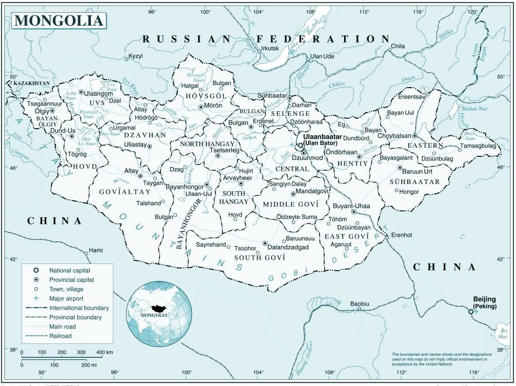
Political Map of Mongolia: Provinces, Cities, and Borders
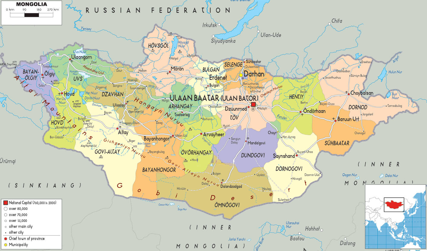 Mongolia political map showing provinces, cities, rivers, and neighboring countries.
This political map of Mongolia shows its provinces, major cities and neighbouring countries such as Russia and China. The capital, Ulaanbaatar, is prominently featured. The map highlights regional divisions, major cities, rivers and key geographical features, providing a clear overview of Mongolia’s political landscape.
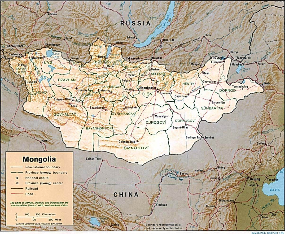
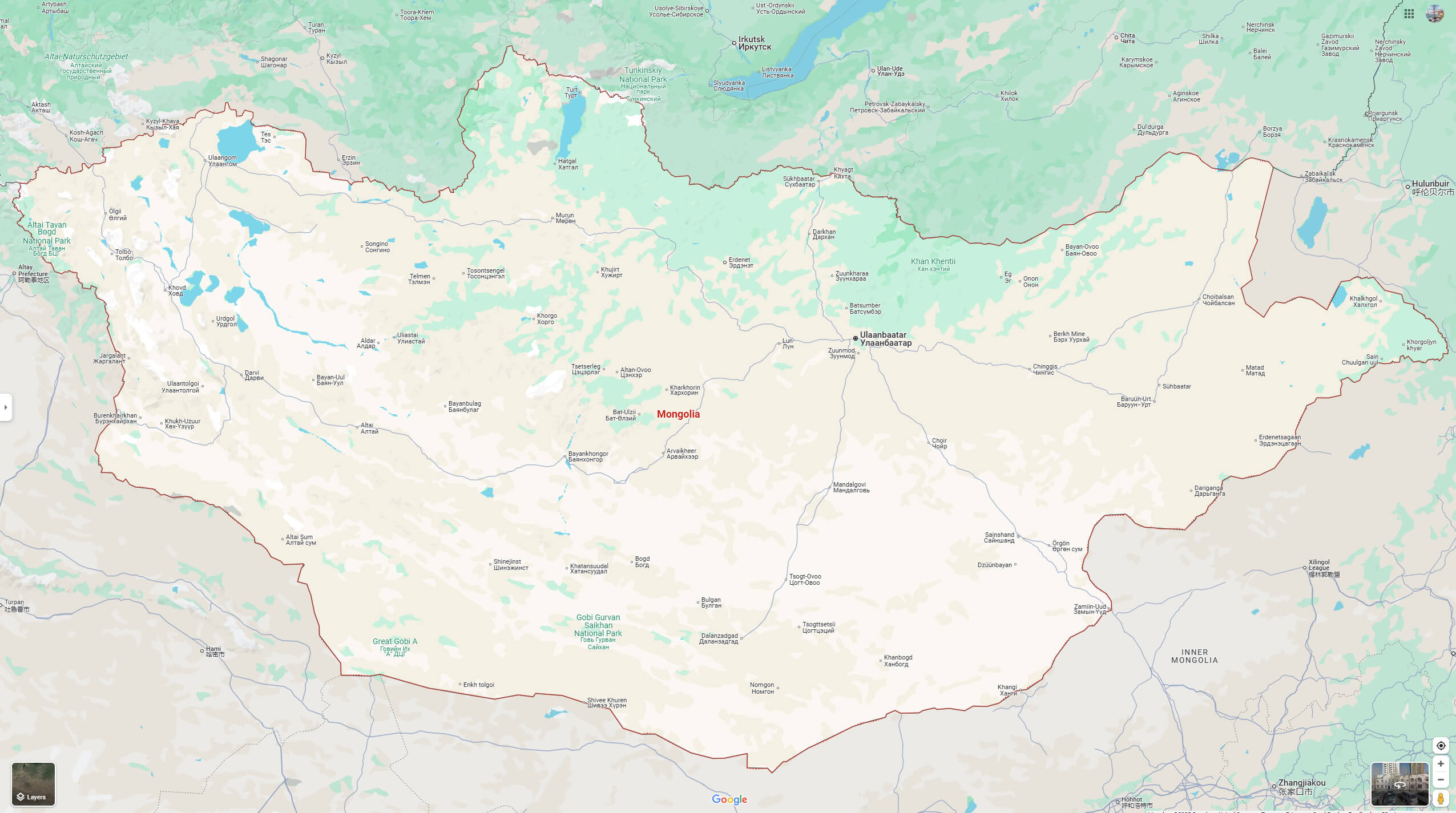
Physical Map of Mongolia with Cities and Elevation Details
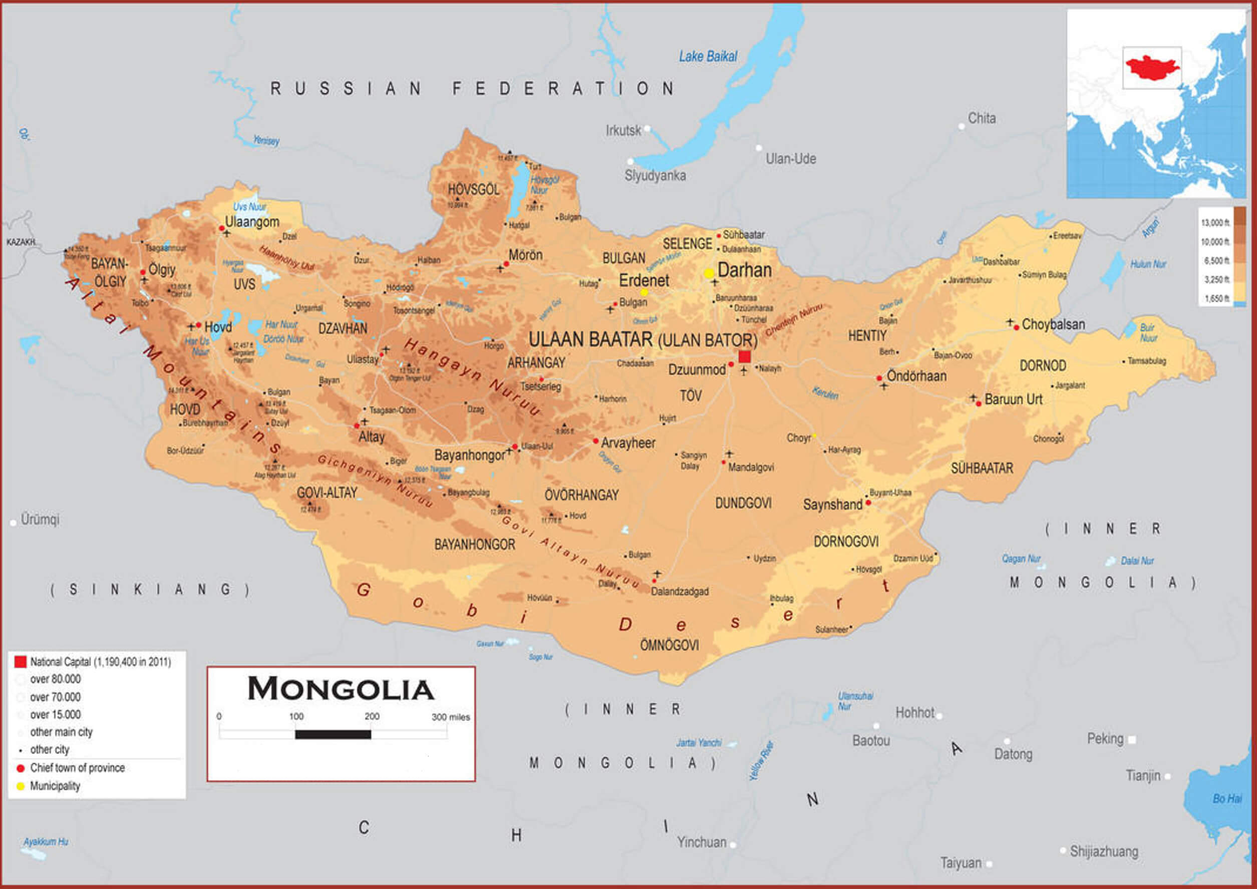 Detailed physical map of Mongolia showing cities, elevation, and terrain features.
This physical map of Mongolia shows the country’s elevations, terrain features and major cities, including Ulaanbaatar, Erdenet and Choybalsan. The map also features the Gobi Desert, mountain ranges and lakes such as Uvs Nuur and Hovsgol. It provides a geographical overview, including neighbouring regions and international borders.
Brief information about Mongolia
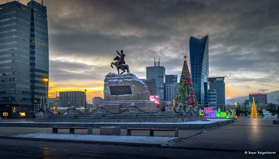
Mongolia, a landlocked country in East Asia, is known for its vast steppes, rugged mountains and the iconic Gobi Desert. Sandwiched between Russia to the north and China to the south, Mongolia has a small population of around 3.3 million people, almost half of whom live in the capital, Ulaanbaatar. The country is famous for its nomadic culture and traditions, which have shaped Mongolian society for centuries.
Mongolia Map
This map of Mongolia shows provincial boundaries, major roads, railways and major cities, including the capital Ulaanbaatar. Bordering Russia to the north and China to the south, Mongolia’s varied terrain includes mountainous regions in the west and the vast Gobi Desert in the south.
Historically, Mongolia is best known as the birthplace of Genghis Khan and the Mongol Empire, one of the largest empires in history. Today, Mongolia has a growing economy based mainly on mining, agriculture and tourism. The majority of Mongolians practice Tibetan Buddhism, and the country’s landscapes, wildlife and traditional festivals, such as Naadam, attract visitors eager to experience its unique cultural heritage.
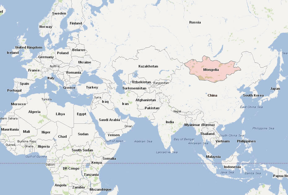
Where is located Mongolia on the World Map ?
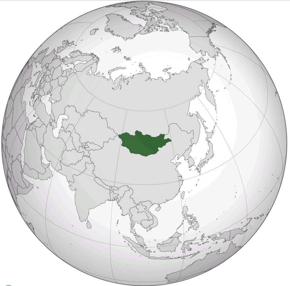 Where is located Mongolia on the World Map
Mongolia is located in East Asia, sandwiched between Russia to the north and China to the south. This landlocked country occupies a vast area on the world map, characterised by its vast grasslands, deserts and mountain ranges. Its strategic location in Asia gives it a unique cultural and historical mix, influenced by both its neighbours.
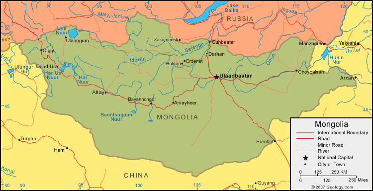
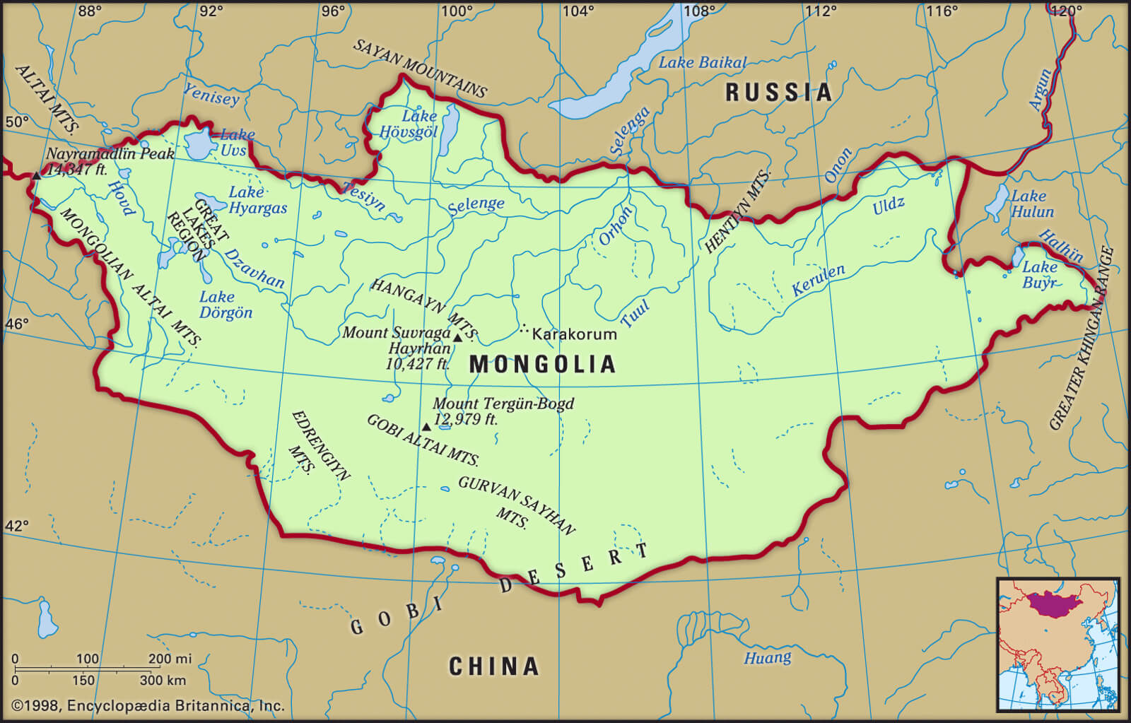
Mongolia Map: Mountains, Rivers, and Geographical Features
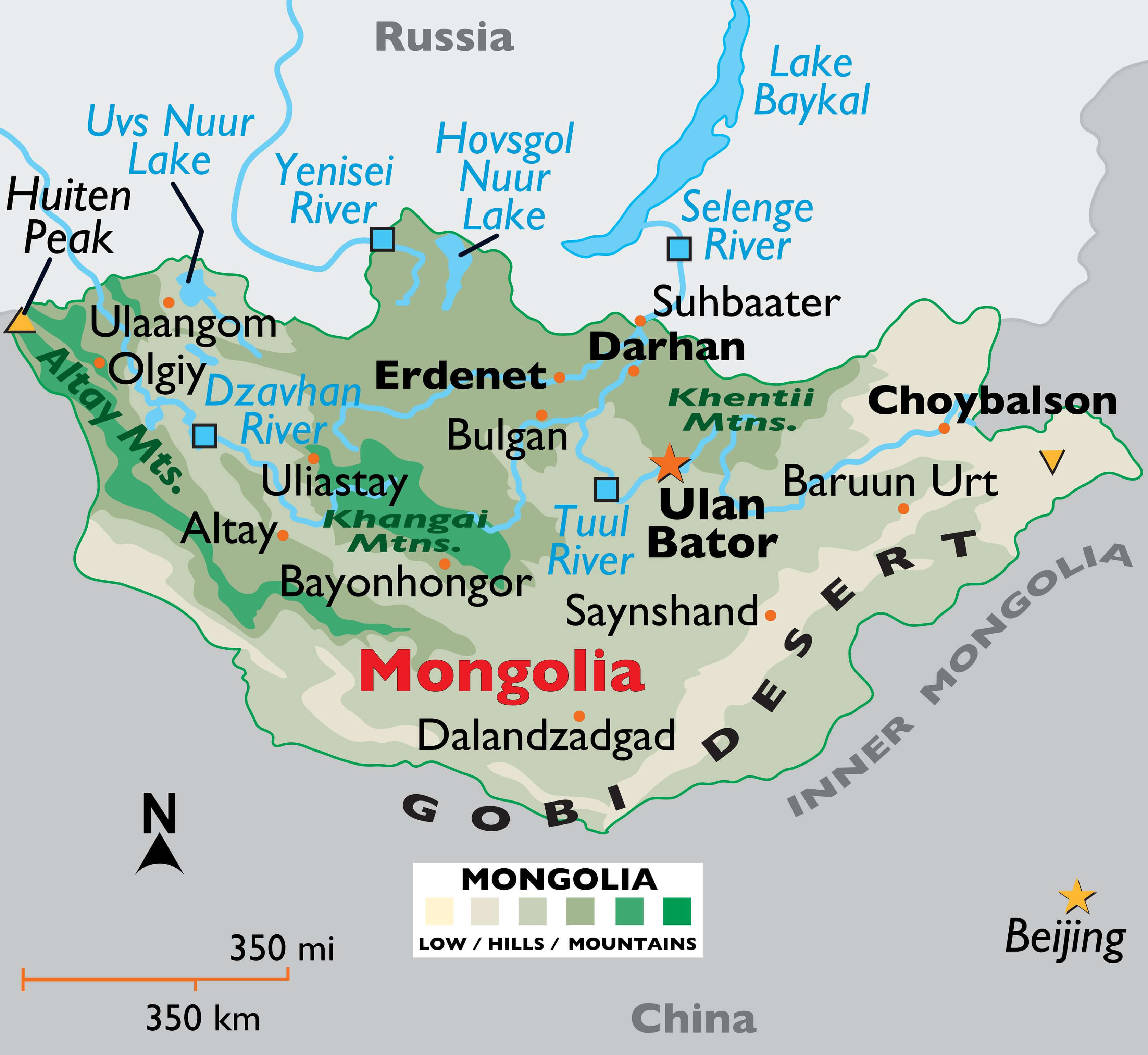 Mongolia map showing mountains, rivers, lakes, and major cities.
This map of Mongolia highlights its mountains, rivers, and lakes. The Altai, Khangai, and Khentii mountain ranges are visible, along with major rivers like the Yenisei, Tuul, and Selenga. Ulaanbaatar, Erdenet, and other key cities are marked. The Gobi Desert dominates the south, while lakes such as Hovsgol Nuur and Uvs Nuur stand out in the north.
The capital, Ulaanbaatar, is located in the north-central part of Mongolia and is the cultural, economic and political centre of the country. Mongolia’s location has historically made it a crossroads for various nomadic tribes, including the Mongol Empire, which once controlled vast territories across Asia and Europe. Despite being bordered by two large nations, Mongolia retains its own identity and traditions.
Geographically, Mongolia’s terrain is defined by its diverse landscape, from the Gobi Desert in the south to the mountainous regions of the north and west. Its high altitude and landlocked position contribute to Mongolia’s extreme continental climate, with hot summers and bitterly cold winters.
Here are some statistical information about Mongolia:
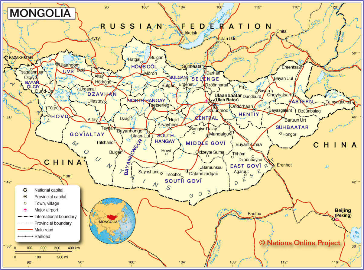
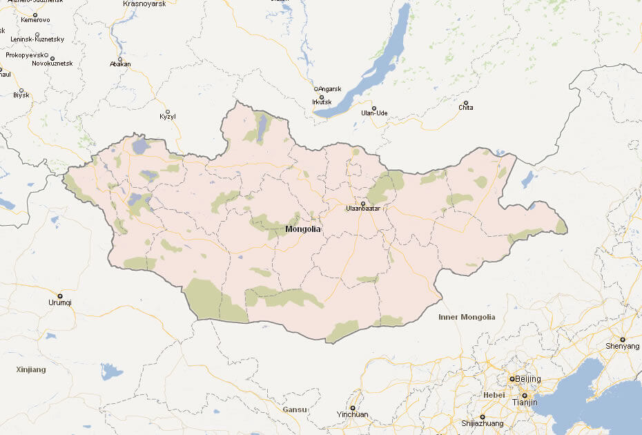
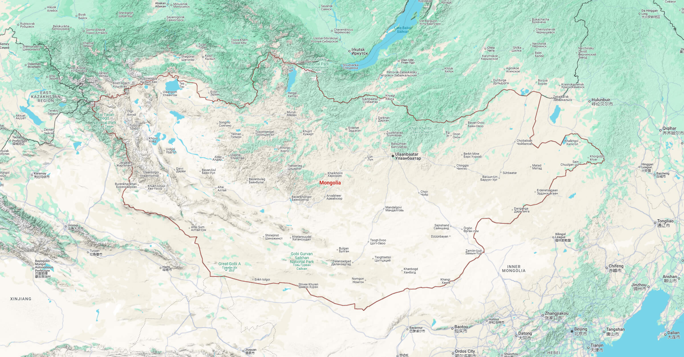
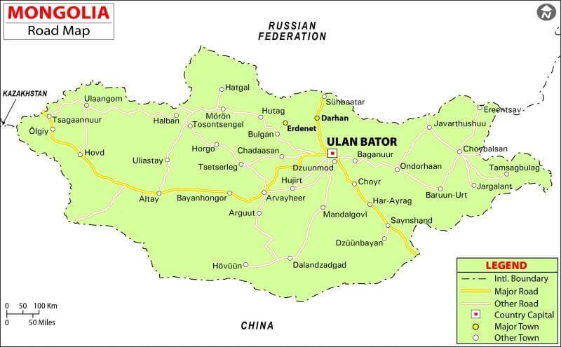
Mongolia Cities Map with Roads and Railways
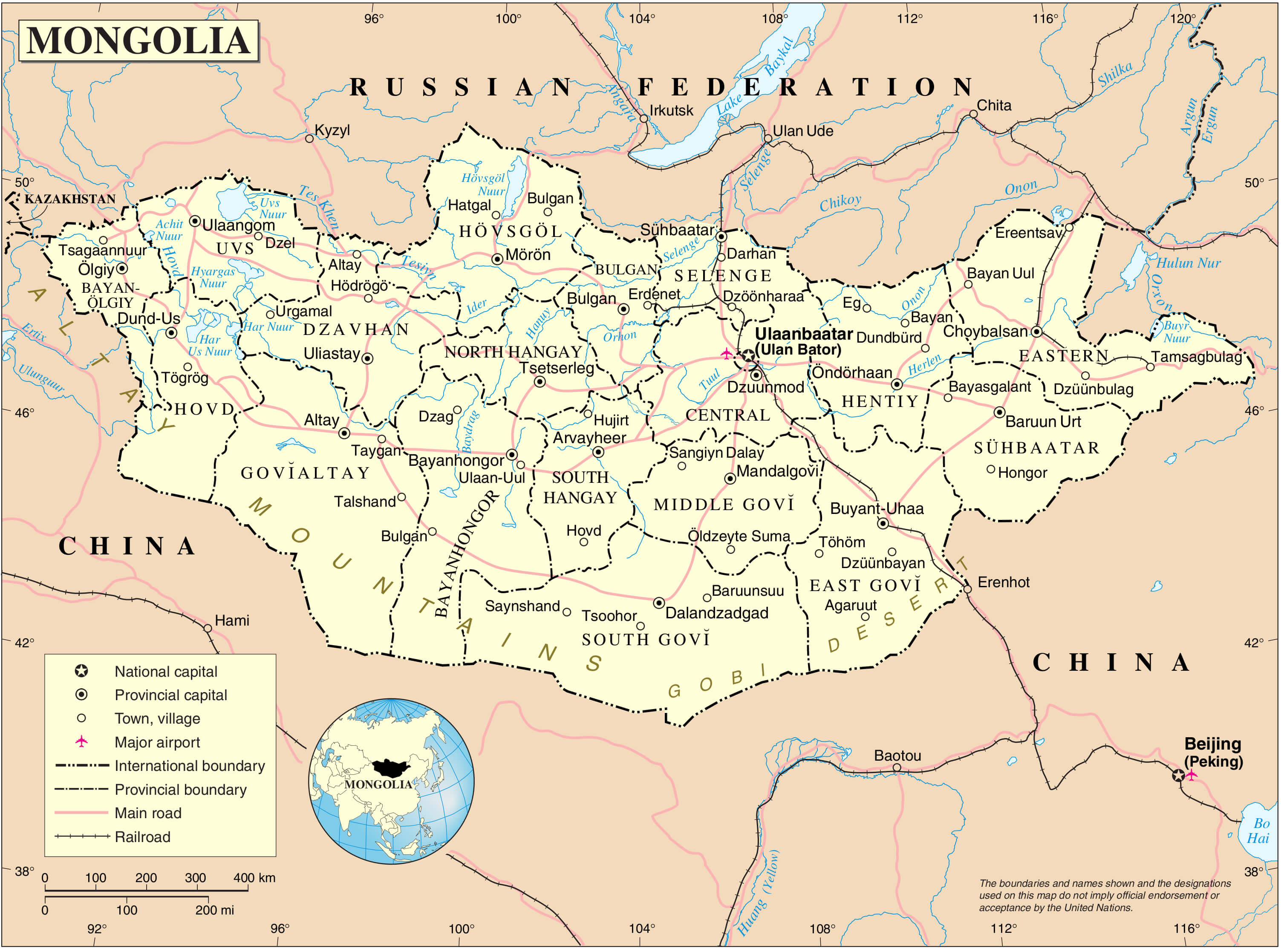 Detailed map of Mongolia showing cities, roads, railways, and provincial boundaries.
This Mongolia cities map highlights major cities, towns, and villages, including Ulaanbaatar, Erdenet, and Choybalsan. It displays provincial boundaries, roads, railways, and international borders with Russia and China. The map also marks major airports and key transportation routes, providing a comprehensive view of Mongolia’s infrastructure and geography.
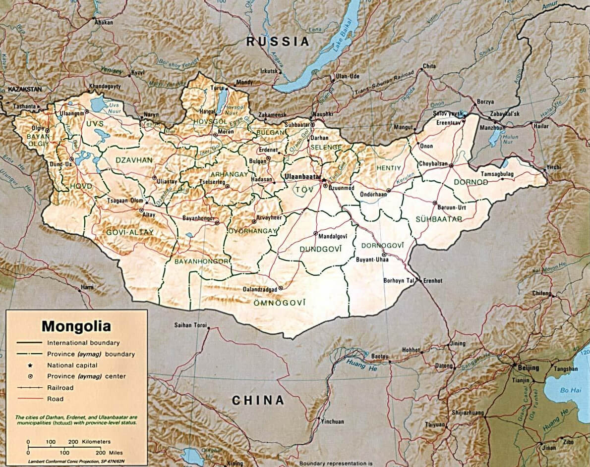
Capital city: UlaanbaatarMongolia Provinces Map: Administrative Divisions and Major Cities
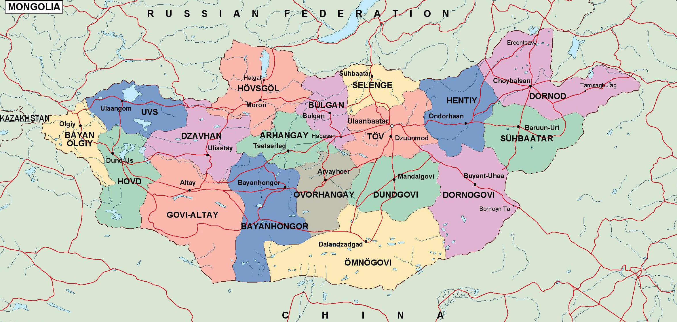 Map of Mongolia showing provinces, borders, roads, and major cities.
This detailed map of Mongolia shows the country’s administrative divisions, including provinces (aimags), major cities and transportation routes. Ulaanbaatar, the capital, is centrally located, while regions such as Dornod, Hovd and Bayan-Ölgii are highlighted. The map also highlights the main road networks that connect Mongolia’s vast landscape.
GDP (nominal): $18.782 billion (2023 estimate)Map of Mongolia
Boundary Map of the 13th Century Mongol Empire
This map highlights the vast expanse of the Mongol Empire at its peak during the 13th century, covering large parts of present-day Mongolia, China, Central Asia, and beyond. The map illustrates the empire’s dominance across Asia, stretching from Eastern Europe to the Pacific.
Mongolia Regions Map
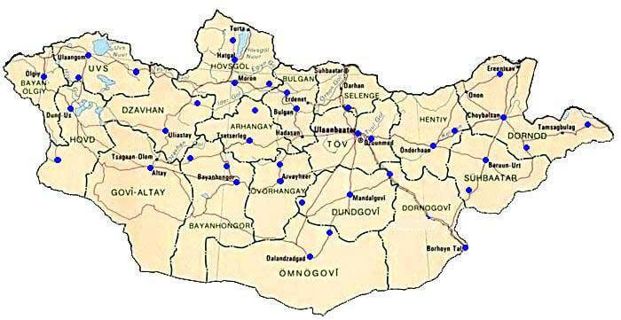 Map showing regions and major towns of Mongolia with blue markers.
This map highlights Mongolia’s regions, displaying major towns across provinces, such as Ulaanbaatar in Töv, Uvs, Govi-Altay, and Dornod. Blue markers indicate key locations, providing an overview of the geographic layout within the country.
Mongolia States Map
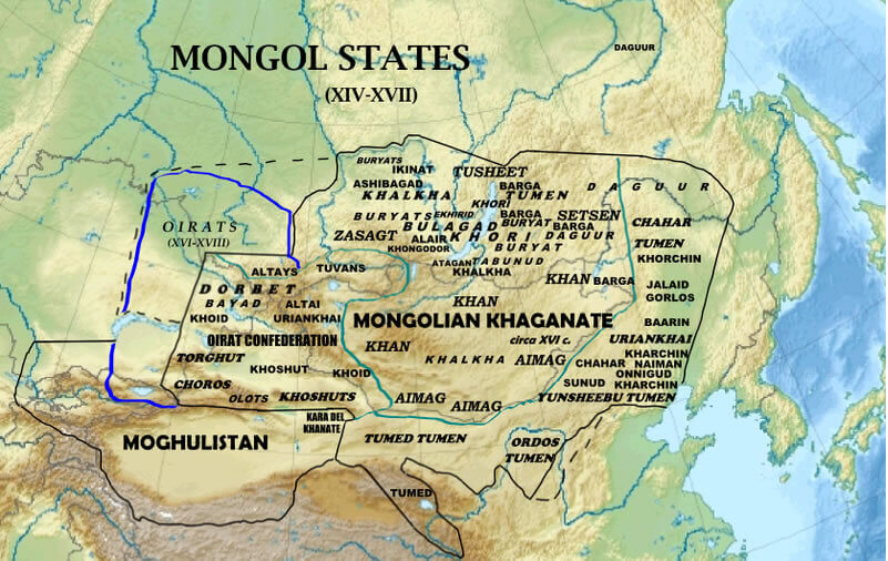 Map of Mongol states from the 14th to 17th centuries, showing Mongolian Khaganate, Oirats, and surrounding regions.
This historical map displays the Mongol states from the 14th to 17th centuries, including the Mongolian Khaganate, Oirat Confederation, and Moghulistan. It highlights the territories and significant Mongol tribes of the era, illustrating the Mongolian empire’s fragmentation into smaller khanates and confederations.
Map of Mongolia Asia World
Map of Mongolia
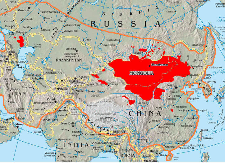
Mongolia Map Asia
 Map showing Mongolia’s location in Asia and surrounding regions.
This map highlights Mongolia’s location in Asia, bordered by Russia to the north and China to the south. It includes Mongolia’s major cities and geographical features like the Gobi Desert and Altai Mountains, with an inset world map showing its position relative to other continents.
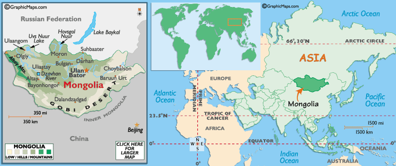
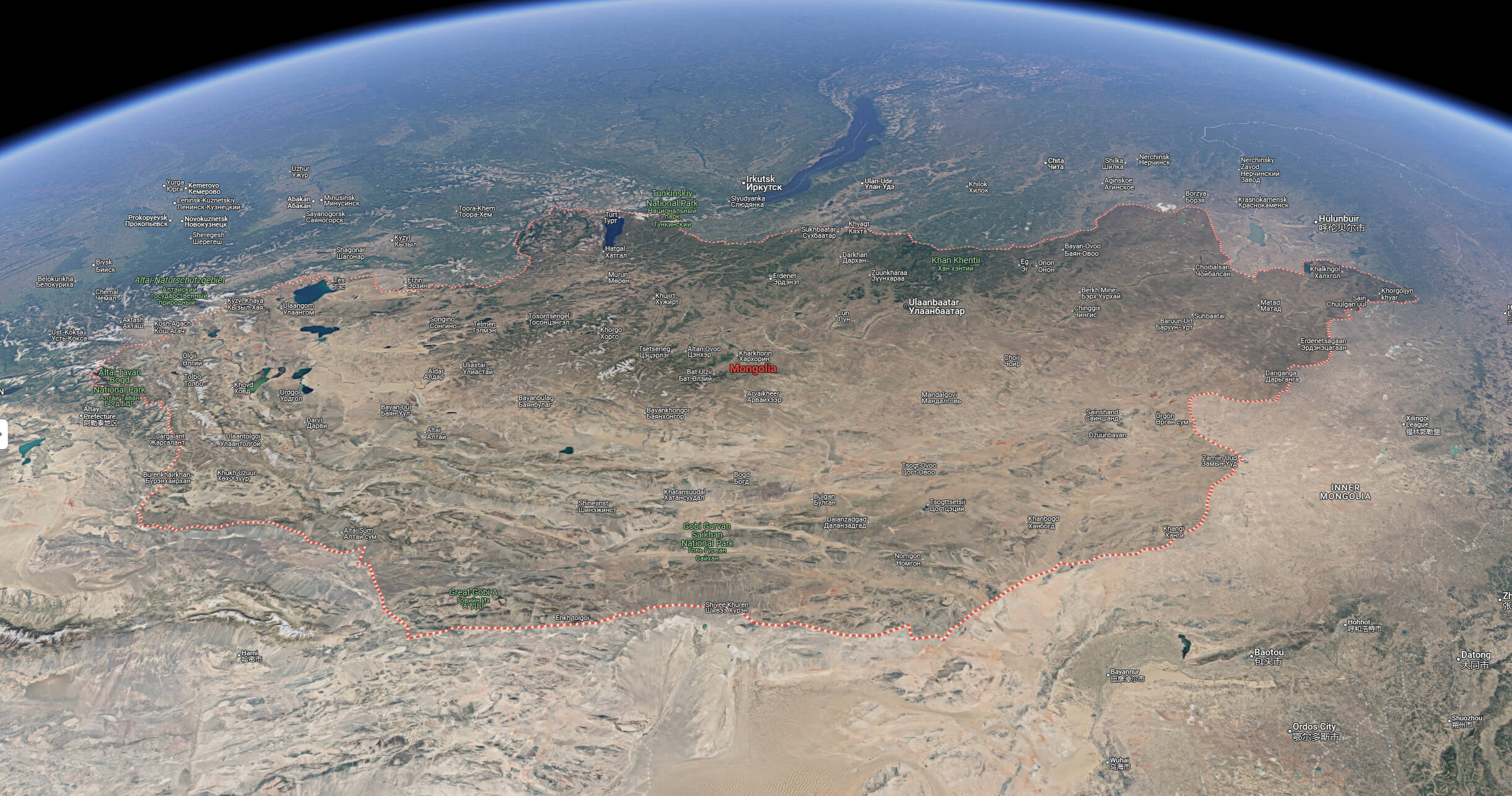
Mongolia Relief Map
Mogolia terrain map
Mongolia international boundary map with elevation
Mongolia map with rivers
Mongolia national borders map
Mongolia political map
Mongolia road map
Mongolia satellite map
Where is Mongolia on the Asia Map?
Show Google interactive map, satellite map, where is the country located.
Get directions by driving, walking, bicycling, public transportation and travel with street view.
Feel free to explore these pages as well:
- Russia Map ↗️
- China Map ↗️
- Map of China ↗️
- A Collection of China Maps ↗️
- China’s Largest Cities ↗️
- The Heartbeat of China ↗️
- Japan Map ↗️
- Uzbekistan Map ↗️
- North Korea Map ↗️
- South Korea Map ↗️
- Kazakhstan Map ↗️
- Asia Map ↗️