Kosovo in Maps: This collection showcases a region’s geography, politics, and history that has been at the crossroads of civilizations for centuries. In this collection of Kosovo maps, you’ll find more than just geographical markers; you’ll uncover layers of history, cultural shifts, and political transitions that have shaped the country.
Political Map of Kosovo
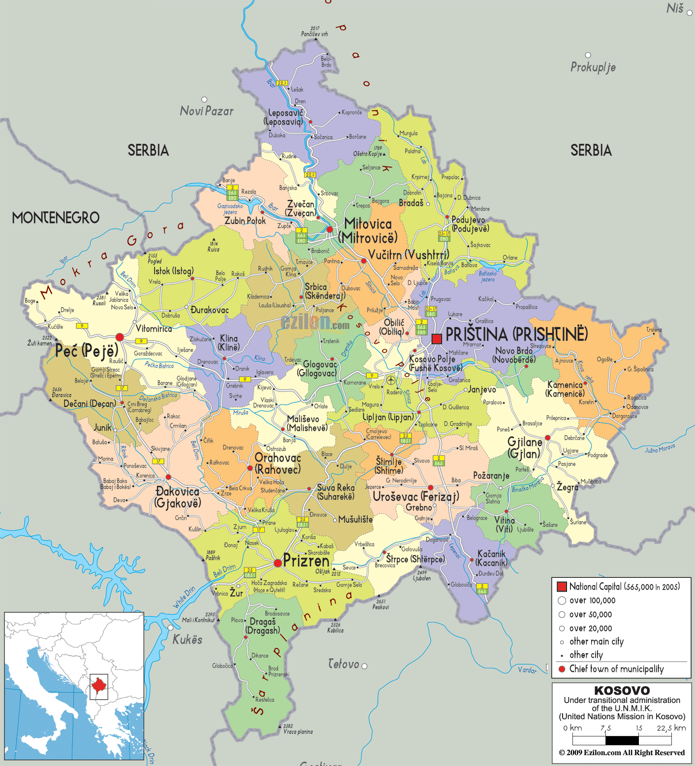 This political map of Kosovo shows the country’s municipalities, highlighting major cities such as Pristina, Peja and Prizren. It also uses different colours to indicate population density and shows the borders with neighbouring countries such as Serbia, Montenegro and Albania.
Brief information about Kosovo
Kosovo is a small landlocked country located in the Balkans, known for its rich history and diverse cultural heritage. It declared independence from Serbia in 2008, although not all countries recognize its sovereignty. The capital city, Pristina, is a bustling hub with a blend of Ottoman, Serbian, and Albanian influences, making it a fascinating destination for travelers seeking a mix of history and modernity.
Nature lovers will also appreciate Kosovo’s stunning landscapes, from the rolling hills of the Rugova Valley to the scenic beauty of the Mirusha Waterfalls. Despite its complex past, Kosovo is gradually becoming more popular among tourists who are eager to explore its unique culture, cuisine, and welcoming people.
Where is located Kosovo on the World Map
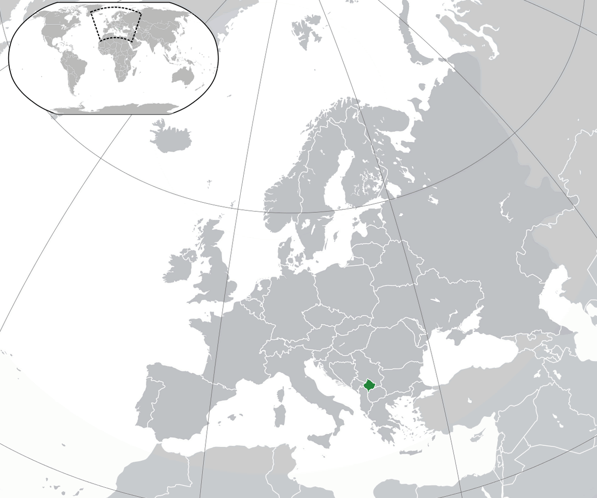
Kosovo is located in southeastern Europe, in a region known as the Balkans. It is a landlocked country bordered by Serbia to the north and east, Montenegro to the west, Albania to the southwest, and North Macedonia to the southeast. Its location in the heart of the Balkans places it at a crossroads of cultures and histories, making it a significant part of the region.
Due to its positioning, Kosovo has been influenced by various empires and cultures over centuries, including the Ottoman Empire and the former Yugoslavia. This blend of influences is reflected in its architecture, cuisine, and traditions. Though it’s a small country, Kosovo’s location has given it a unique cultural identity within Europe.
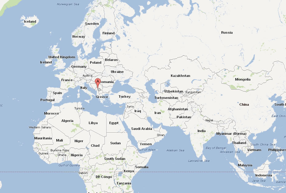
On a world map, you can spot Kosovo just below Central Europe, nestled between countries like Serbia and Albania. It’s a key player in the Balkan region and has a strategic location that links the Adriatic Sea to continental Europe, making it an intriguing spot for history enthusiasts and travelers alike.
Here are some statistical information about Kosovo:
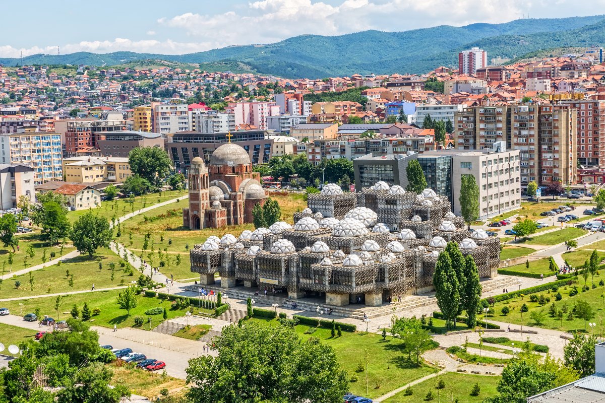 Area: 10,887 km2 (4,203 sq mi)
Vilayet of Kosovo Map 1900 Ottoman Empire
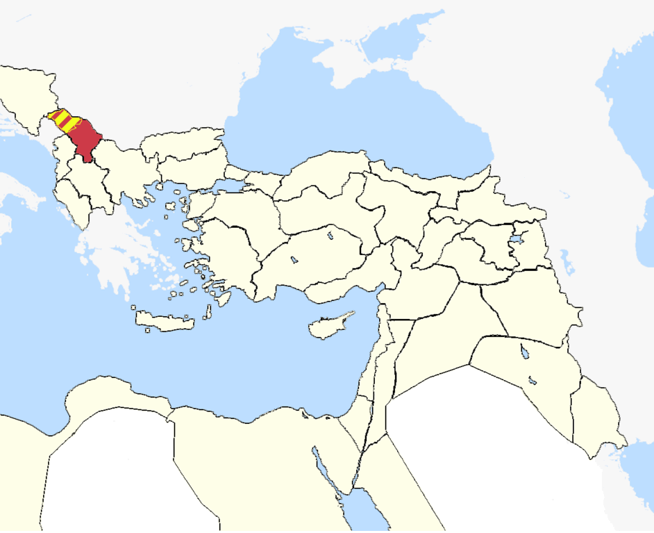
This map shows the historical Vilayet of Kosovo within the Ottoman Empire around 1900, located in the Balkan region, including parts of present-day Kosovo, Serbia, and Macedonia.
Kosovo Physical Map
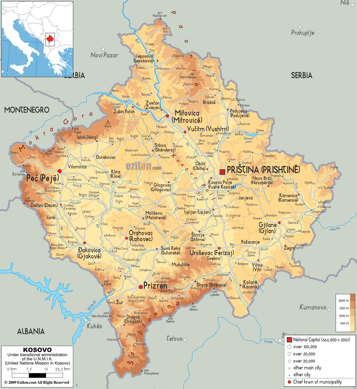 This physical map of Kosovo highlights the country’s varied terrain, showing mountain ranges, such as the Mokra Gora near Peja, and flatlands surrounding cities like Pristina and Mitrovica. It illustrates the elevation levels, with darker shades representing higher altitudes, and includes major rivers and cities across Kosovo
Kosovo Map 1959
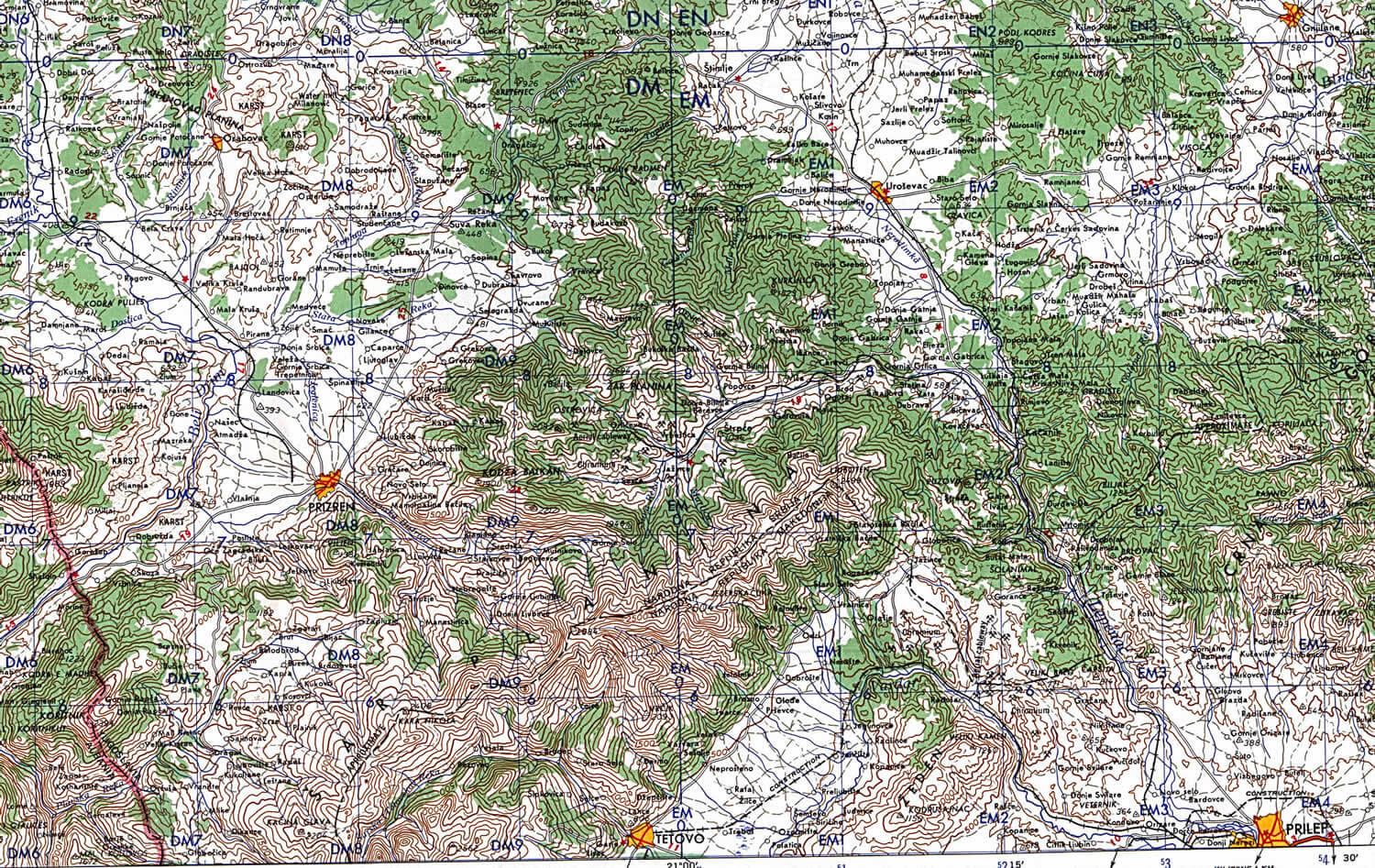
This 1959 map highlights the topography and geographical features of southern Kosovo, showing the mountainous terrain, roads, and key cities like Prizren during that period.
Kosovo Regions Map
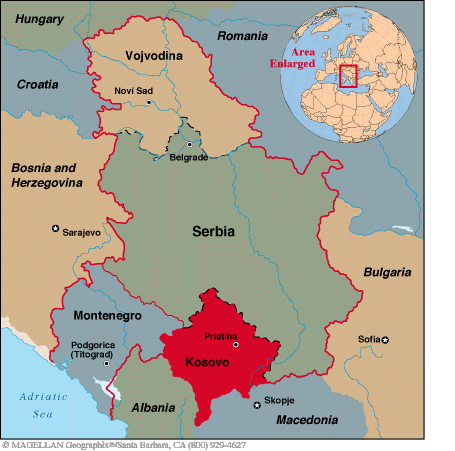
This map shows Kosovo’s location in southeastern Europe, bordered by Serbia, Montenegro, Albania, and North Macedonia.
Map of Kosovo
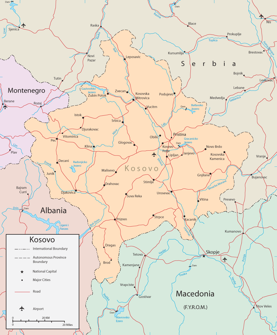
This map displays Kosovo’s borders with neighboring countries, major cities, roads, and airports, highlighting its location within the Balkans and key transportation routes.
Kosovo Earth Map
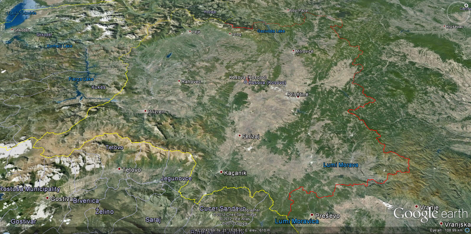
Kosovo Map Serbia
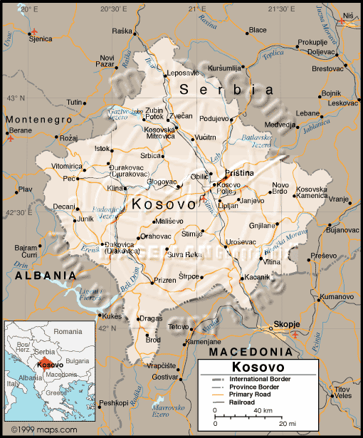
This map highlights Kosovo’s borders with Serbia, Montenegro, Albania, and North Macedonia, showing its main cities, roads, and geographical features within the region.
Kosovo Provinces Map
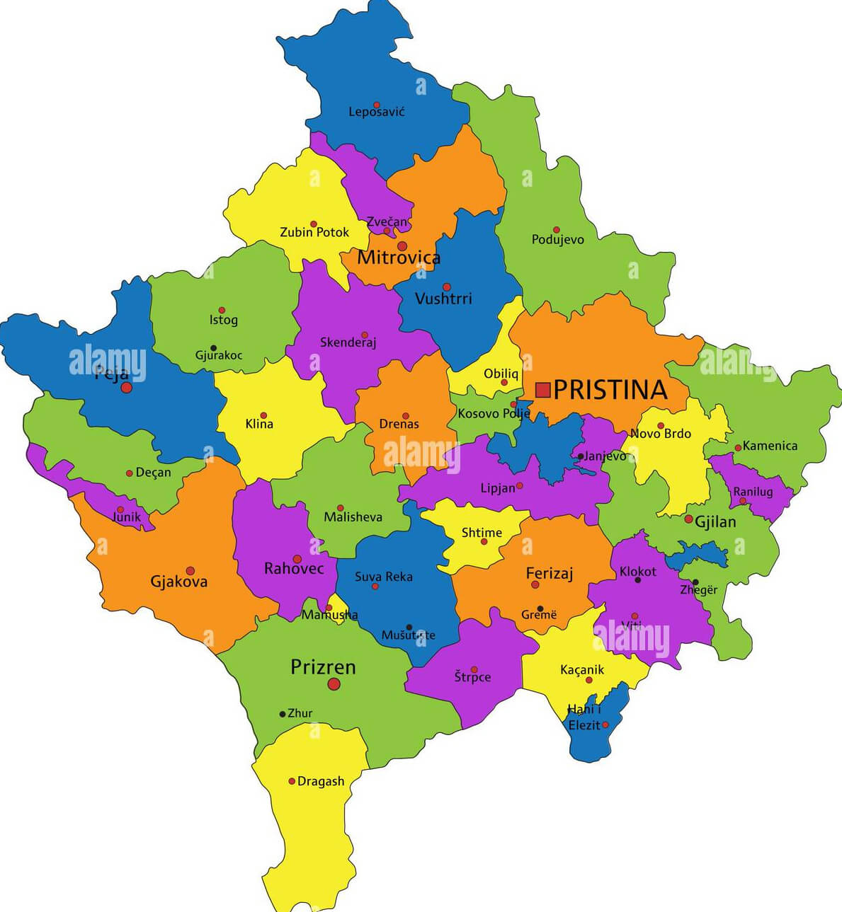 This is a map of Kosovo, divided into its various municipalities and regions. The provinces shown in different colors represent the administrative divisions within the country, with major cities like Pristina, Prizren, and Mitrovica clearly marked. This map highlights the geographical distribution and the location of key towns and districts across Kosovo.
Highly Detailed Political Map Kosovo
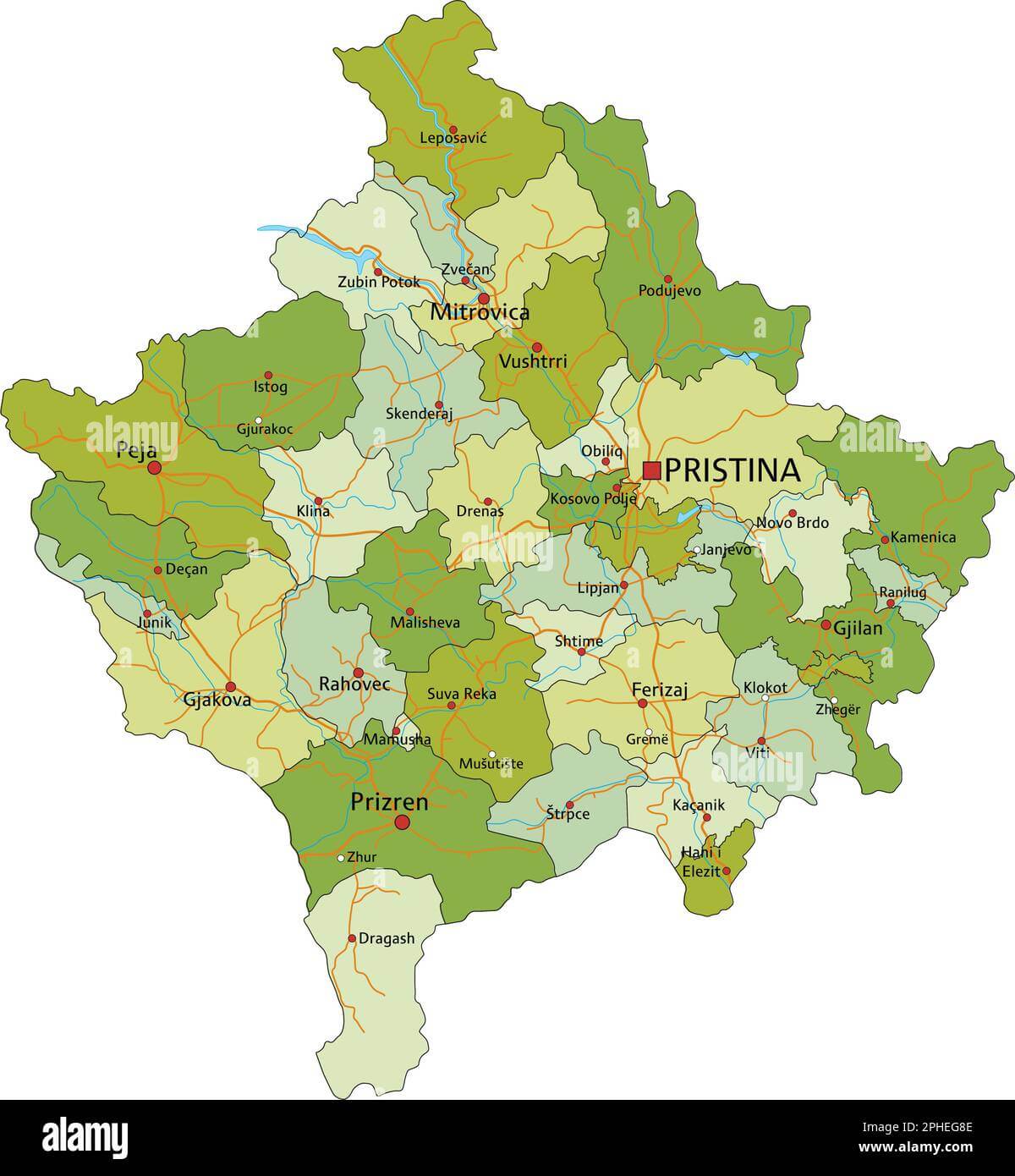 This highly detailed political map of Kosovo depicts the country’s administrative boundaries, including cities such as Pristina, Mitrovica, and Prizren, as well as surrounding geographic features. The map highlights the various municipalities and major highways, providing a clear representation of Kosovo’s political landscape.
Kosovo Balkan Countries Turkey Map
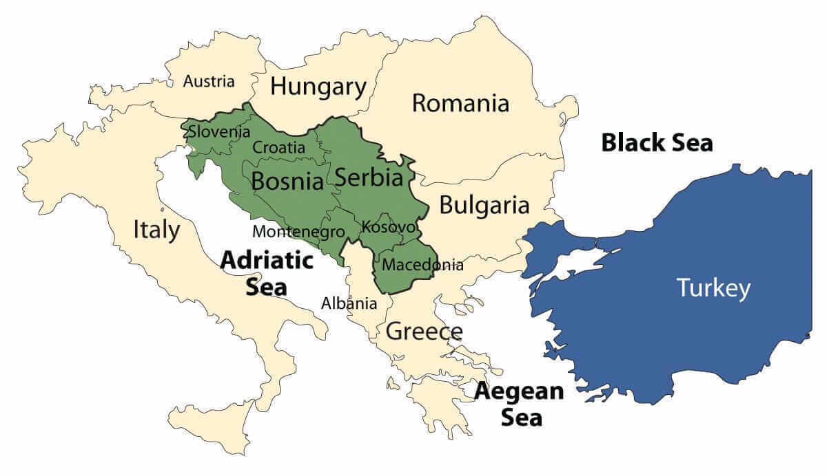 This map of Kosovo and its surrounding Balkan countries, including Serbia, Bosnia, and Turkey, provides a clear depiction of the geopolitical layout of the region. Highlighting Kosovo’s location and its proximity to key countries such as Albania, Montenegro, and Macedonia, the map also emphasizes the strategic position of Kosovo in the broader Balkan Peninsula, with the Adriatic, Aegean, and Black Seas surrounding the region. This visualization serves as an effective guide to understanding Kosovo’s position within the context of the Balkans and its relationship with neighboring countries.
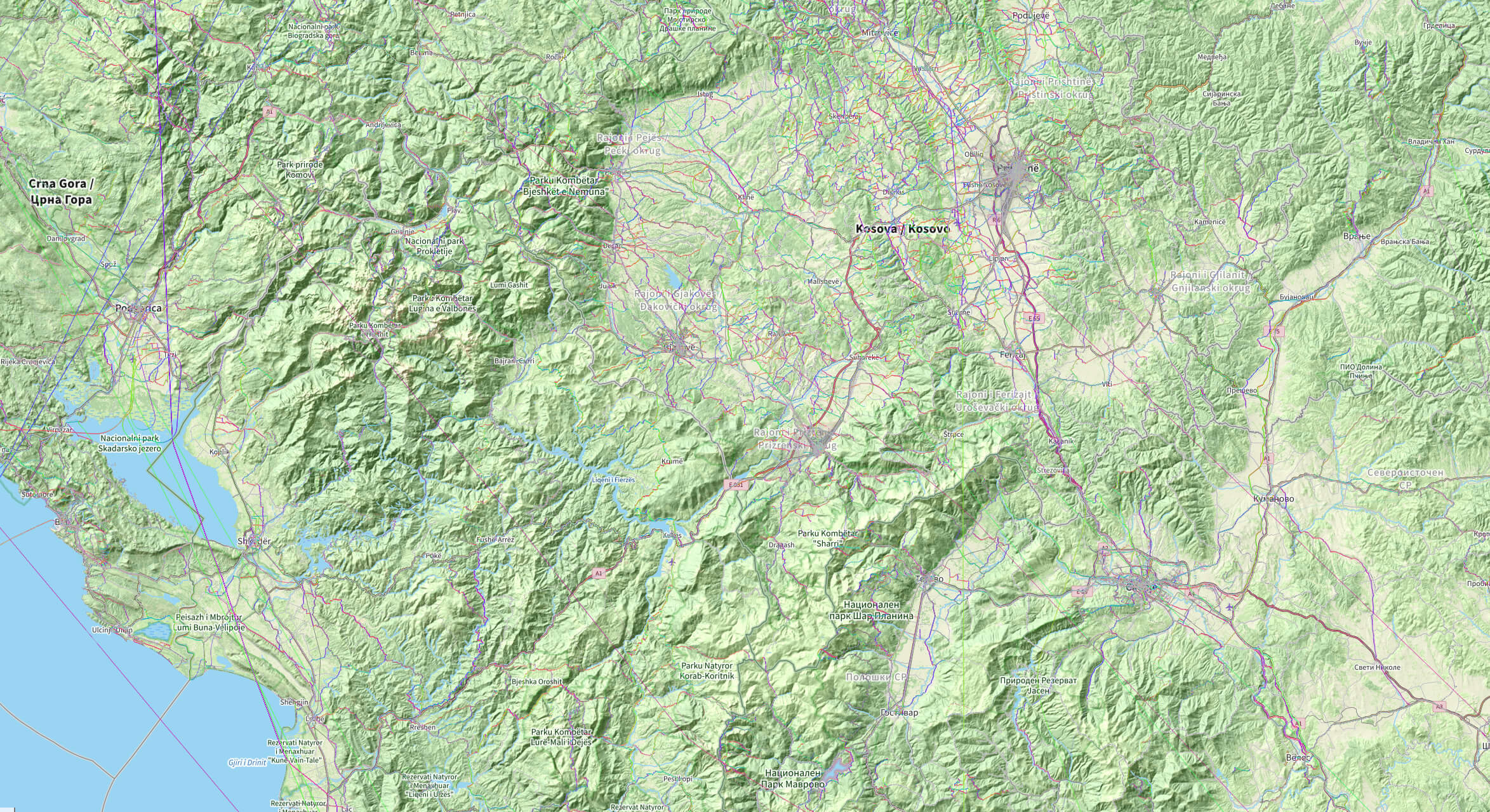
Kosovo GPS Map
Kingdom of Dardania Map Kosovo
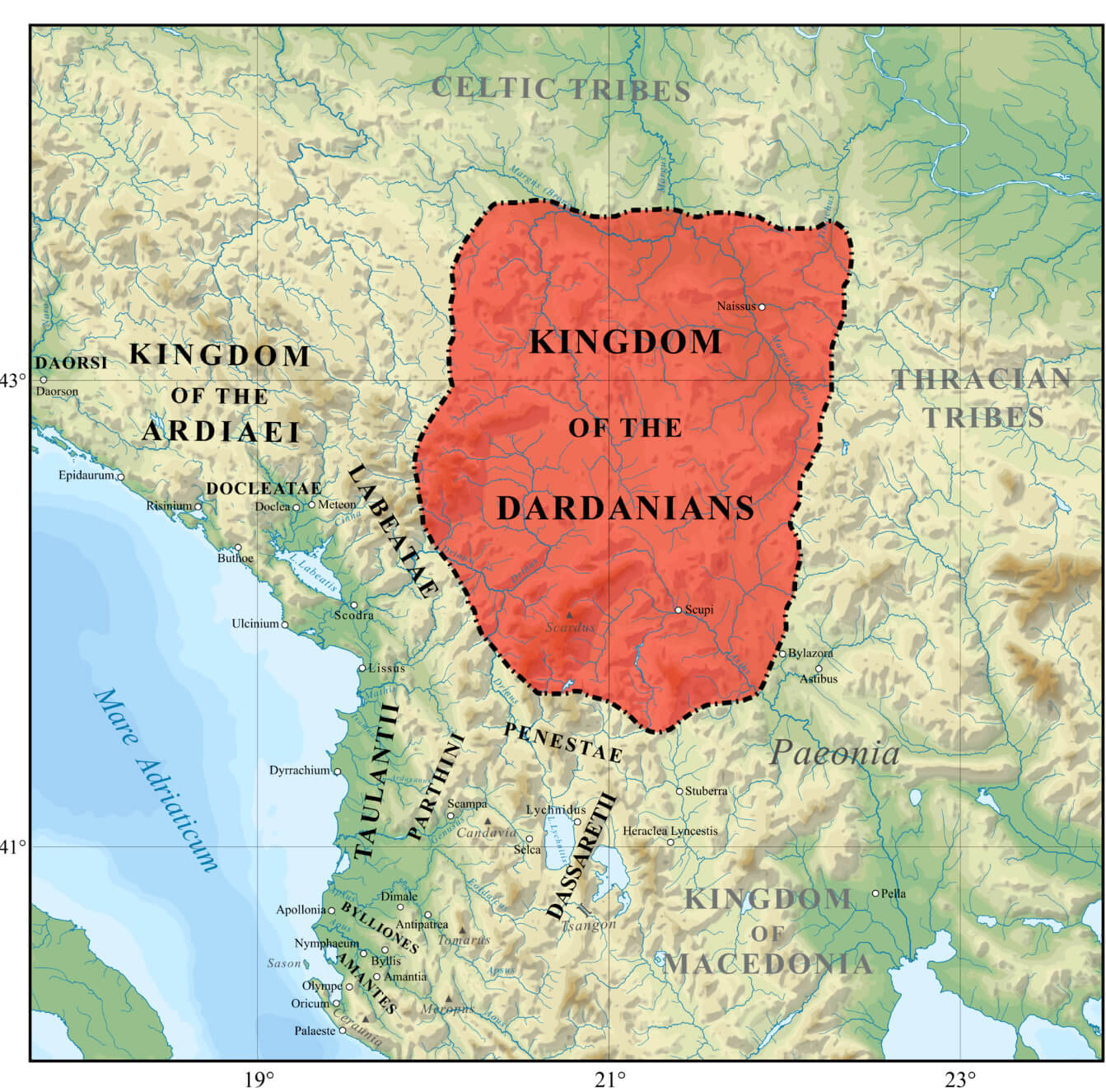 The Kingdom of Dardania map shows an ancient region in the central part of the Balkans, where modern Kosovo is located. Dardania was an important kingdom, and its territory covered parts of modern Kosovo, northern Macedonia, and Serbia. The Dardanians are known to have built a strong and influential kingdom by interacting with the surrounding Illyrian, Thracian, and Macedonian tribes. This map shows the strategic location of the Dardanians, bordered by other ancient kingdoms and tribes, highlighting their role in regional politics and culture during the classical era.
Ethnic Groups-in Kosovo 2011
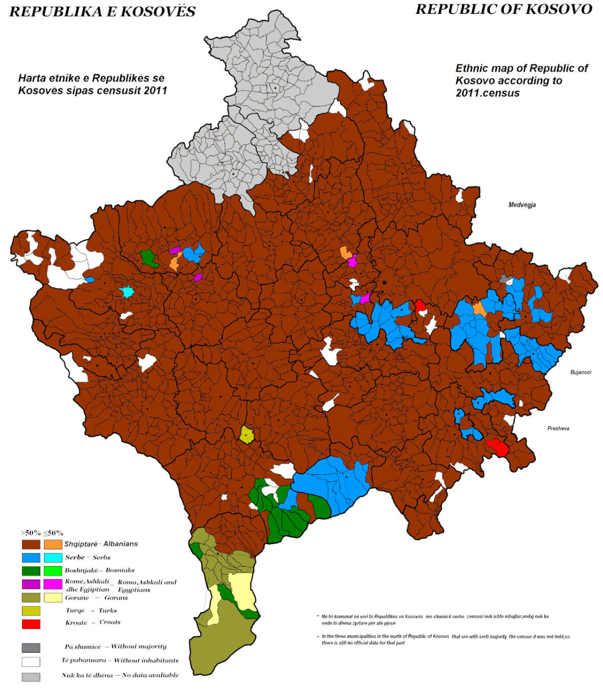 The map titled “Ethnic Groups in Kosovo 2011” visually represents the ethnic composition of Kosovo according to the 2011 census. The map highlights that the majority of the population is Albanian (depicted in brown), particularly dominating the central, western, and southern regions. Serbian populations (in blue) are concentrated primarily in the northern and eastern parts of the country. Other minority groups such as Bosniaks, Roma, Turks, and Gorani are represented in different colors across smaller regions. This demographic map provides valuable insight into the diverse ethnic makeup of Kosovo.
Kosovo Major Cities Map with Regions
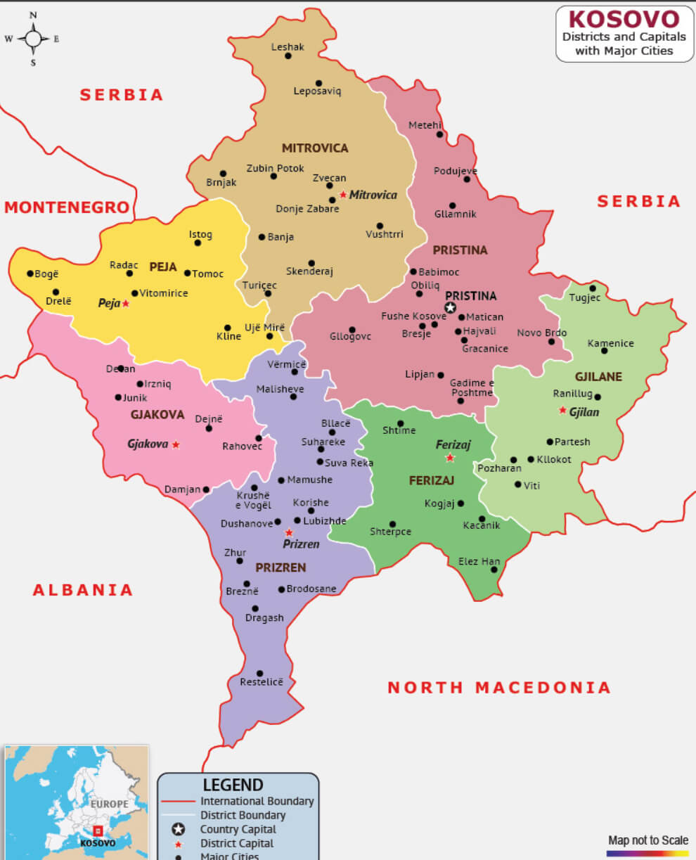 This map of Kosovo highlights its major cities and districts, with a clear representation of the country’s administrative divisions. Notable cities like Pristina, the capital, along with Prizren, Gjilan, and Mitrovica, are shown within their respective regions, emphasizing Kosovo’s geographic layout and its proximity to neighboring countries such as Serbia, Montenegro, Albania, and North Macedonia.
Kosovo Physical Map with Rivers
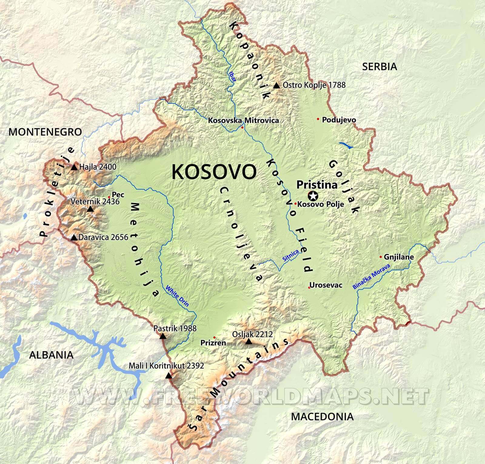 This
This
Detailed Political Map of Kosovo
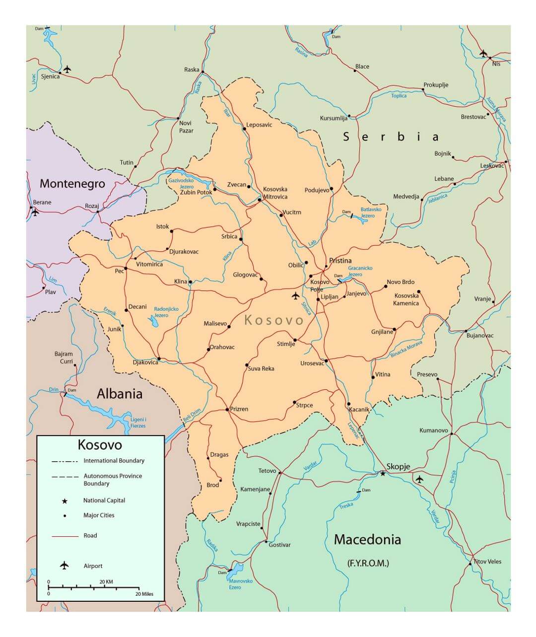 This detailed political map of Kosovo shows the country’s international boundaries with neighboring nations including Albania, Montenegro, Serbia, and North Macedonia. It also highlights major cities, the national capital of Pristina, major roads, and airports, providing a clear overview of Kosovo’s geographic and political divisions.
Kosovo Physical Map with Highways
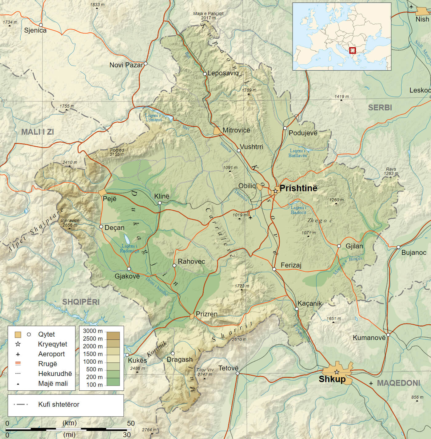 This map of Kosovo highlights its physical geography, showing major highways, cities, and key elevation points. Notable cities such as Prishtina, Mitrovica, and Peja are connected through the region’s roadways, while the map also details elevation levels, indicating the higher mountainous areas towards the western parts near Albania, such as Maja e Zeqës and Gjeravica, Kosovo’s highest peak.
Kosovo Roads and Rivers Map
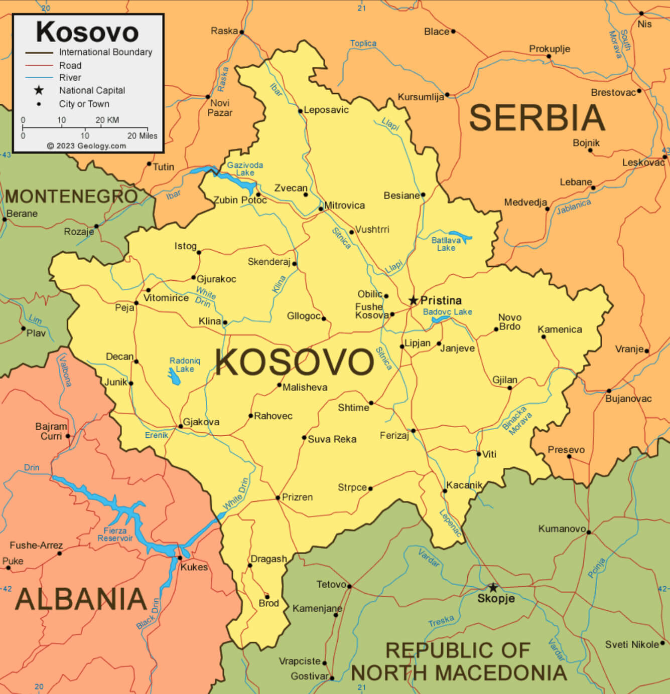 This is a map of Kosovo showing major roads, rivers and major cities. It highlights the transportation links within the country, including roads that connect Kosovo to its neighboring countries such as Albania, Serbia, North Macedonia, and Montenegro. Rivers such as the Drin River and lakes such as Radoniq and Badovac are also visible, showing the geographical features that complement the transportation infrastructure throughout the region.
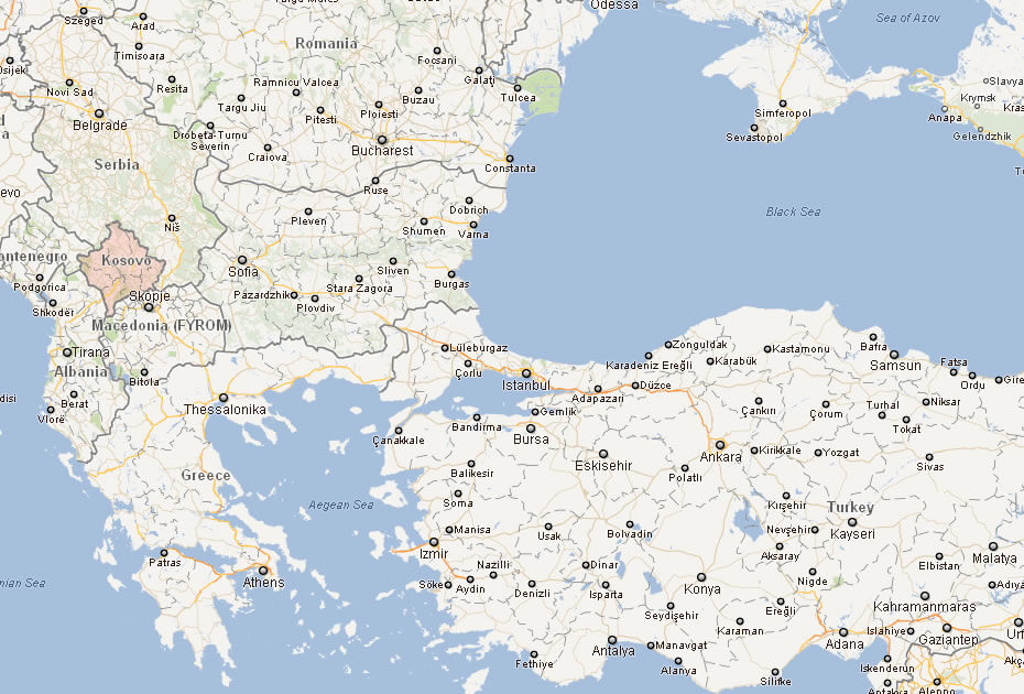
Map of Kosovo Balkans
Map of Kosovo World
Where is Kosovo on the Europe Map?
Show Google map, satellite map, where is the country located.
Get directions by driving, walking, bicycling, public transportation and travel with street view.
Feel free to explore these pages as well:
- Italy Map ↗️
- Map of Italy ↗️
- The 10 Best Things to Do in Venice ↗️
- A Tourist’s Guide to Venice’s Top 10 Attractions ↗️
- A Collection of Italy Maps ↗️
- Discovering Catania: A Jewel at the Foot of Mount Etna ↗️
- Experience Venice: A Complete Guide for the Adventurous Traveler ↗️
- A Tourist’s Guide to Venice’s Top 10 Attractions ↗️
- The 10 Best Things to Do in Venice ↗️
- Explore Italian Riviera Cinque Terre ↗️
- Discover Bari: Italy’s Enchanting Port City ↗️
- Discover Croatia: A Comprehensive Map Collection of Its Stunning Coastlines and Historic Cities ↗️
- A Collection of Europe Maps: Exploring the Continent in Detail ↗️
- Map of Europe ↗️
- Europe Map ↗️
- Map of Europe ↗️
- France Map ↗️
- Map of Spain ↗️
- Ireland Map ↗️
- United Kingdom Map ↗️
- Germany Map ↗️
- Turkey Map ↗️
- Map of Portugal ↗️
- Switzerland Map ↗️
