Explore Iraq maps and geography! Explore political, physical and satellite maps as well as detailed maps of cities, rivers, topography, elevation and terrain. Learn about Iraq’s location, regions, provinces, ethnic groups, history, neighbours and its unique geographical position in the Middle East.
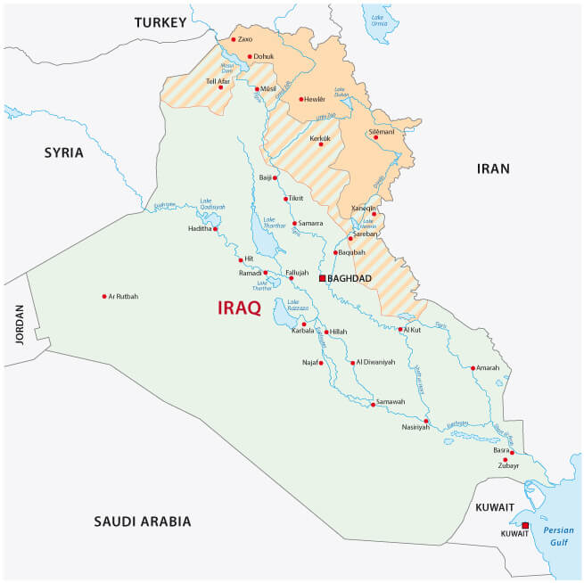
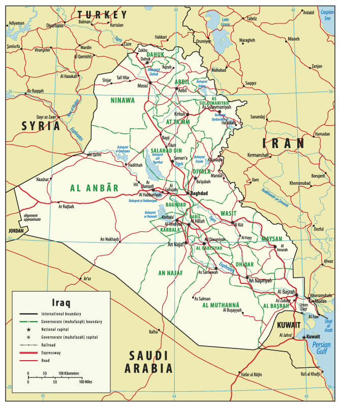
Iraq Political Map: Provinces and Neighboring Countries
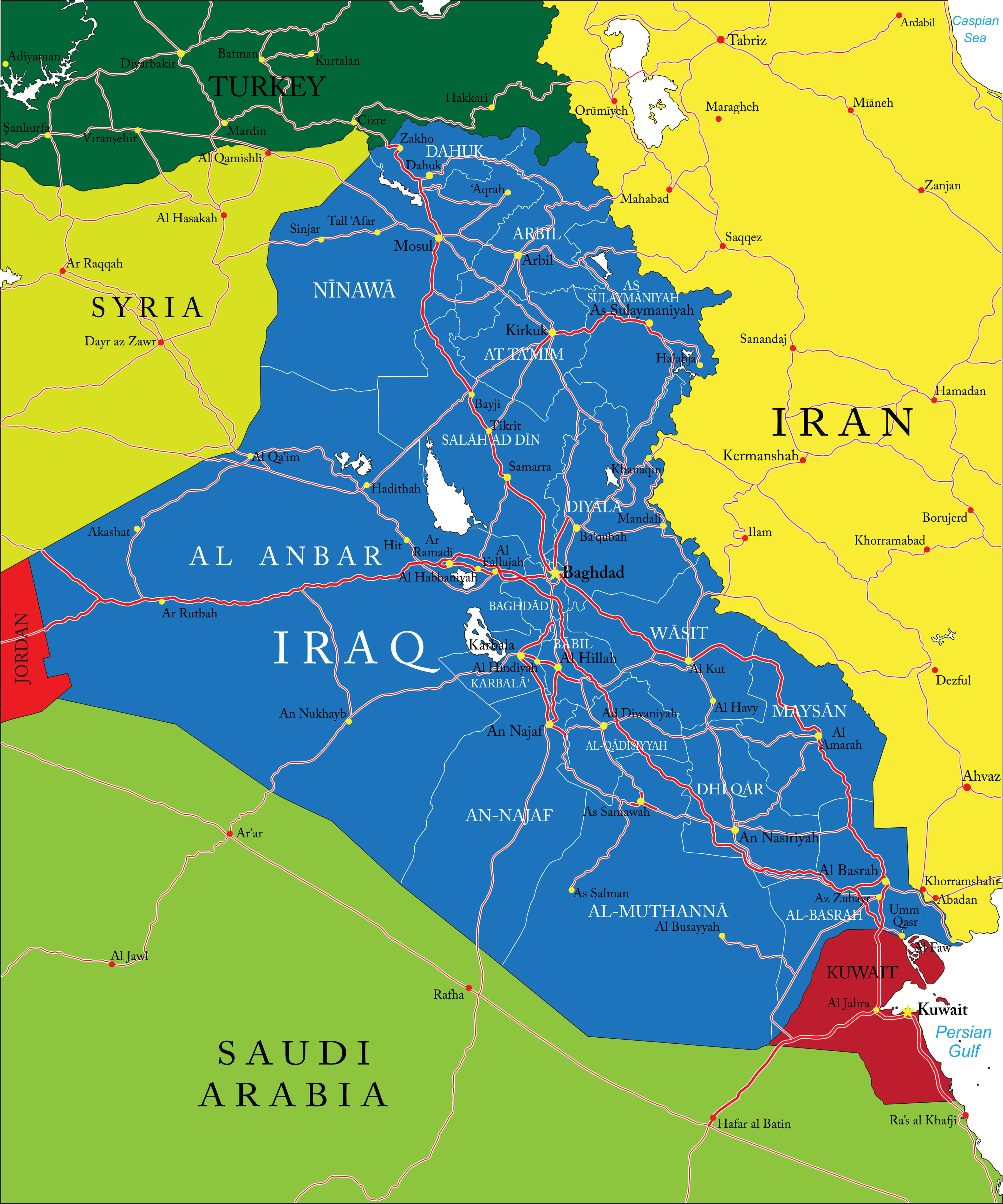 Iraq political map showing provinces, borders, and neighboring countries
A detailed political map of Iraq showing provinces, major cities such as Baghdad and Basra, borders with neighbouring countries including Turkey, Iran, Syria, Kuwait, Jordan and Saudi Arabia. Includes major roadways, rivers and geographic regions, providing a clear view of Iraq’s political divisions and environment.
Brief information about Iraq
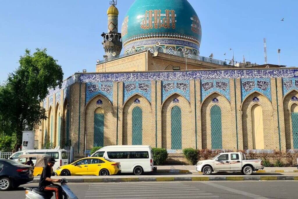
Situated In the heart of the Middle East, Iraq borders Turkey, Iran, Kuwait, Saudi Arabia, Jordan and Syria, and has a small coastline on the Persian Gulf. Its capital, Baghdad, is historically significant and was once a leading cultural centre during the Islamic Golden Age. Iraq is home to the ancient Mesopotamian civilisation, often referred to as the ‘Cradle of Civilisation’, where early developments in writing, law and urbanisation took place. Notable ancient sites include Babylon, Ur and Nineveh, reflecting Iraq’s rich historical heritage.
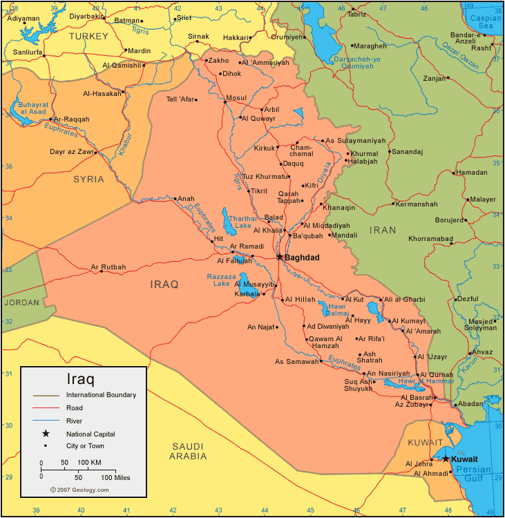
Iraq Map: Major Cities, Rivers, and Neighboring Countries
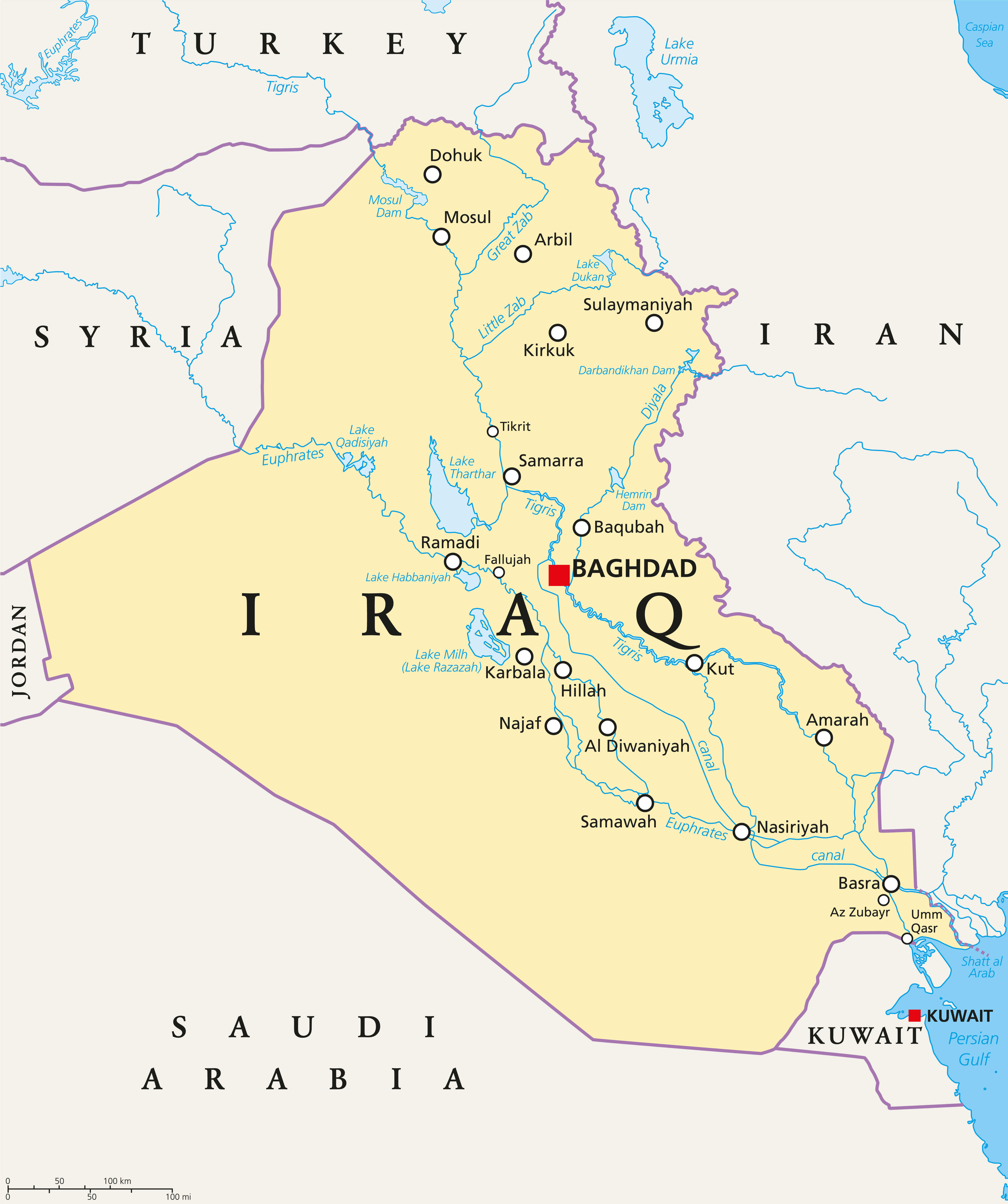 Iraq map showing major cities, rivers, and neighboring countries.
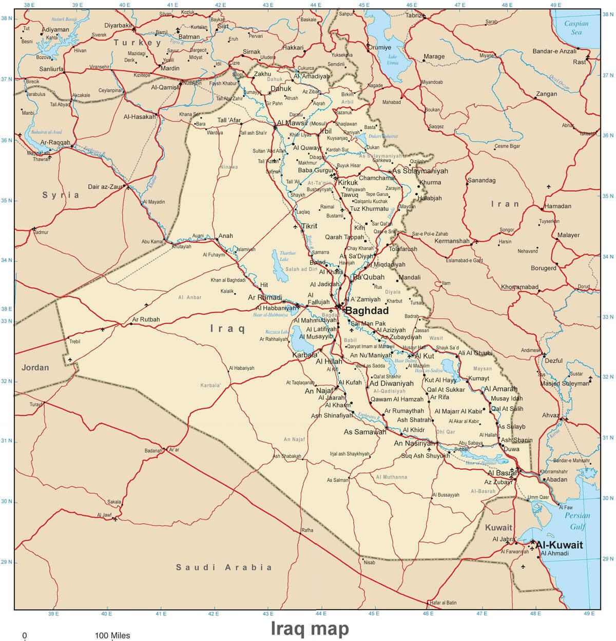
A comprehensive map of Iraq highlighting major cities like Baghdad, Basra, and Mosul, alongside key rivers such as the Tigris and Euphrates. Displays borders with neighboring countries including Turkey, Iran, Kuwait, Saudi Arabia, Jordan, and Syria, as well as geographic features like lakes and dams for an in-depth view of Iraq’s landscape.
Iraq Maps
The country has a diverse population, consisting mainly of Arabs and Kurds, with smaller communities of Turkmen, Assyrians and others. Islam is the dominant religion, with Shia Muslims in the majority, followed by a significant Sunni population. Economically, Iraq is heavily dependent on its vast oil reserves, which are among the largest in the world. Despite the challenges it has faced in recent decades, including wars and internal conflicts, Iraq remains a nation with a deep cultural heritage and significant natural resources.
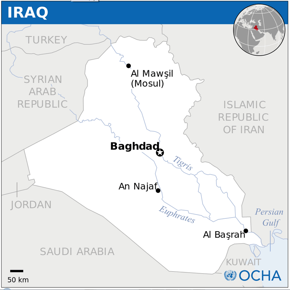
Where is located Iraq on the World Map ?
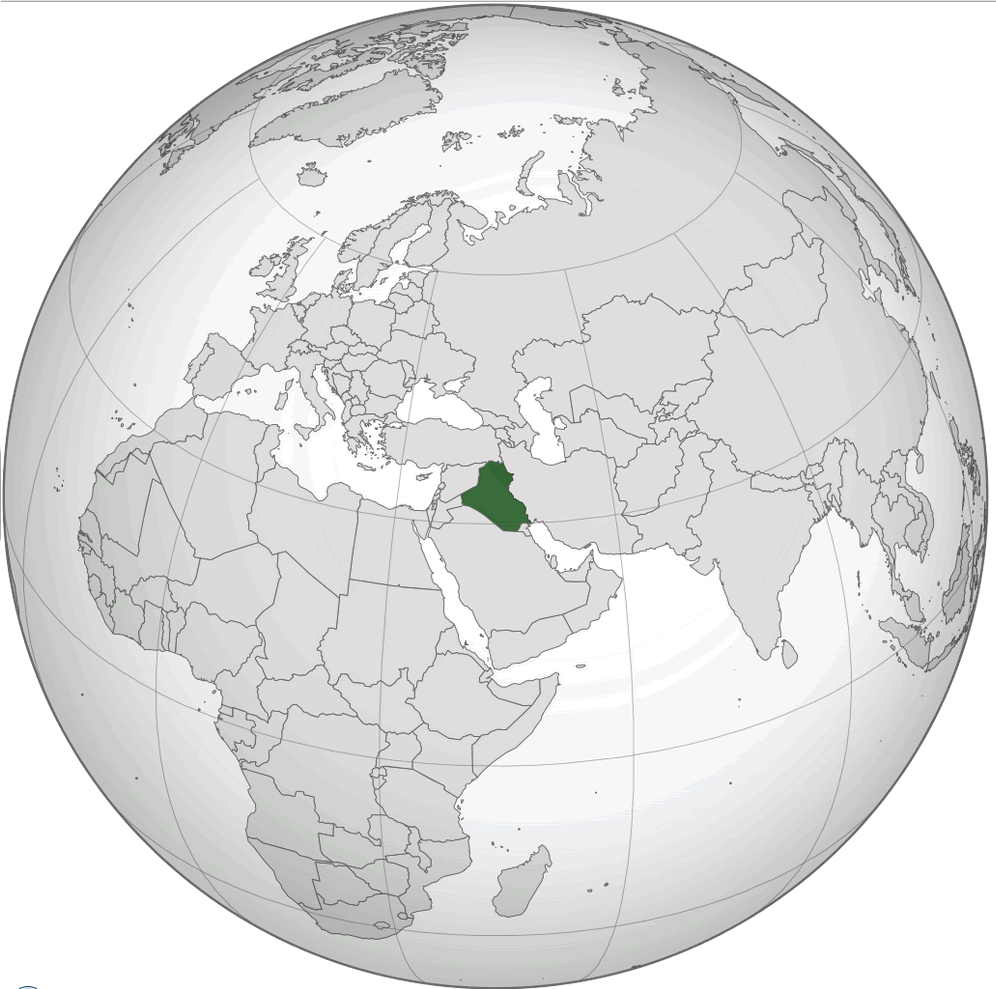 Where is located Iraq on the World Map
Iraq is located in the Middle East, sandwiched between several key countries in the region. It borders Turkey to the north, Iran to the east and Kuwait to the south-east. It borders Saudi Arabia to the south and Jordan and Syria to the west. Iraq also has a small but strategic coastline on the Persian Gulf.
On the world map, Iraq is located in a historically significant area known as Mesopotamia, where early human civilisations flourished. Often referred to as the “Cradle of Civilisation”, this area is home to the Tigris and Euphrates Rivers, which played a vital role in the development of agriculture, trade and early cities. Iraq’s central location has historically made it a crossroads for trade and cultural exchange between Asia, Europe and Africa.
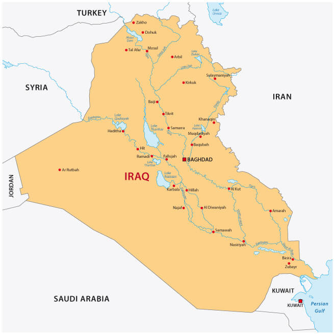
Iraq Map Highlighting Largest Cities and Regions
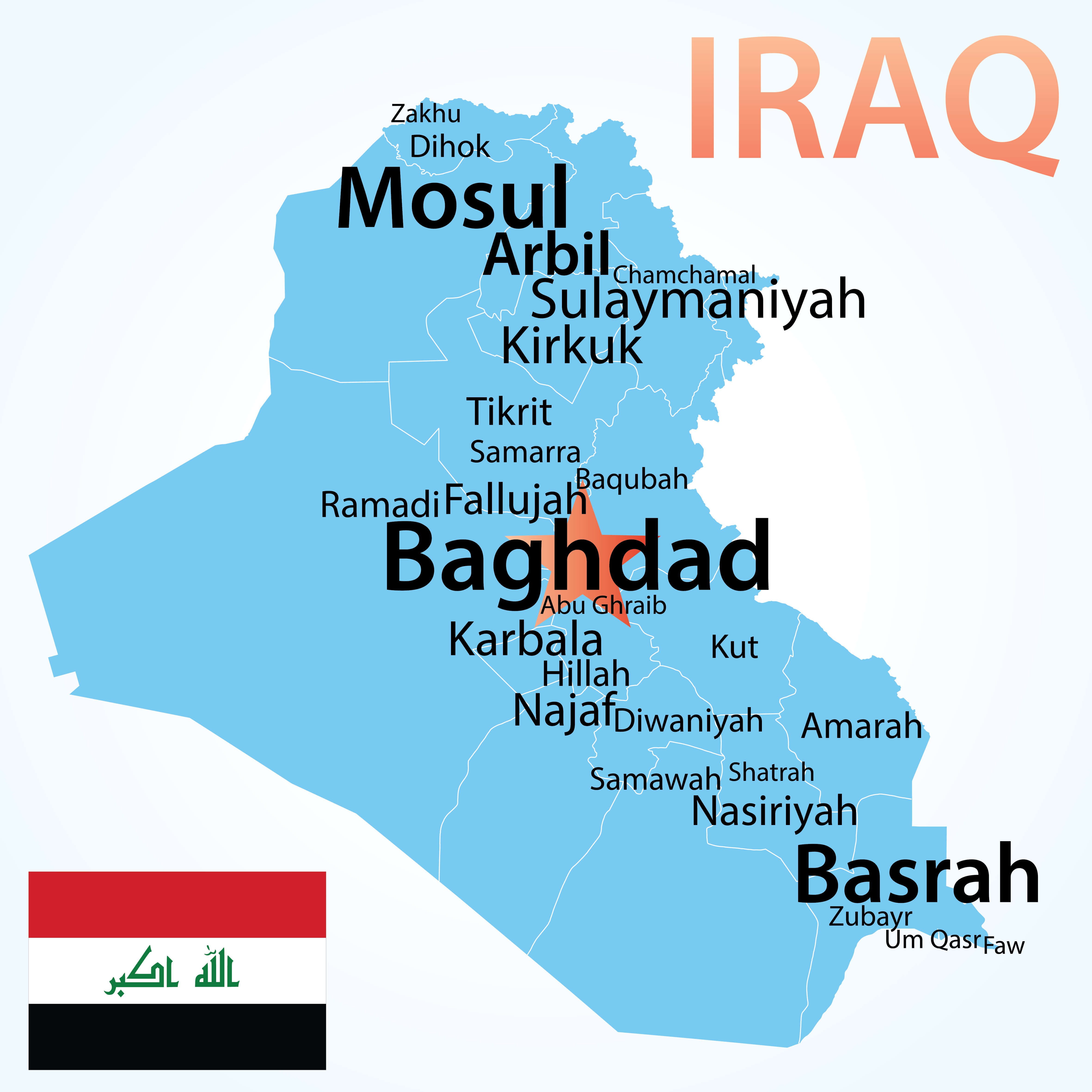 Iraq map with largest cities, including Baghdad, Basrah, Mosul, and Arbil.
A detailed map of Iraq featuring its major cities, including Baghdad, Basra, Mosul and Arbil. The map highlights urban centres as well as regional divisions, providing a clear view of Iraq’s urban landscape and key locations. Perfect for understanding the geographic and urban distribution of Iraq.
Iraq’s capital, Baghdad, is located near the centre of the country on the Tigris River and is one of the oldest cities in the region. Iraq’s location, surrounded by diverse cultures and nations, has influenced its complex social fabric, which includes Arab, Kurdish, Turkmen and Assyrian communities. Its location has also made Iraq a focal point in regional geopolitics, particularly due to its substantial oil reserves and strategic importance in the Middle East.
Here are some statistical information about Iraq:
Iraq Info Map
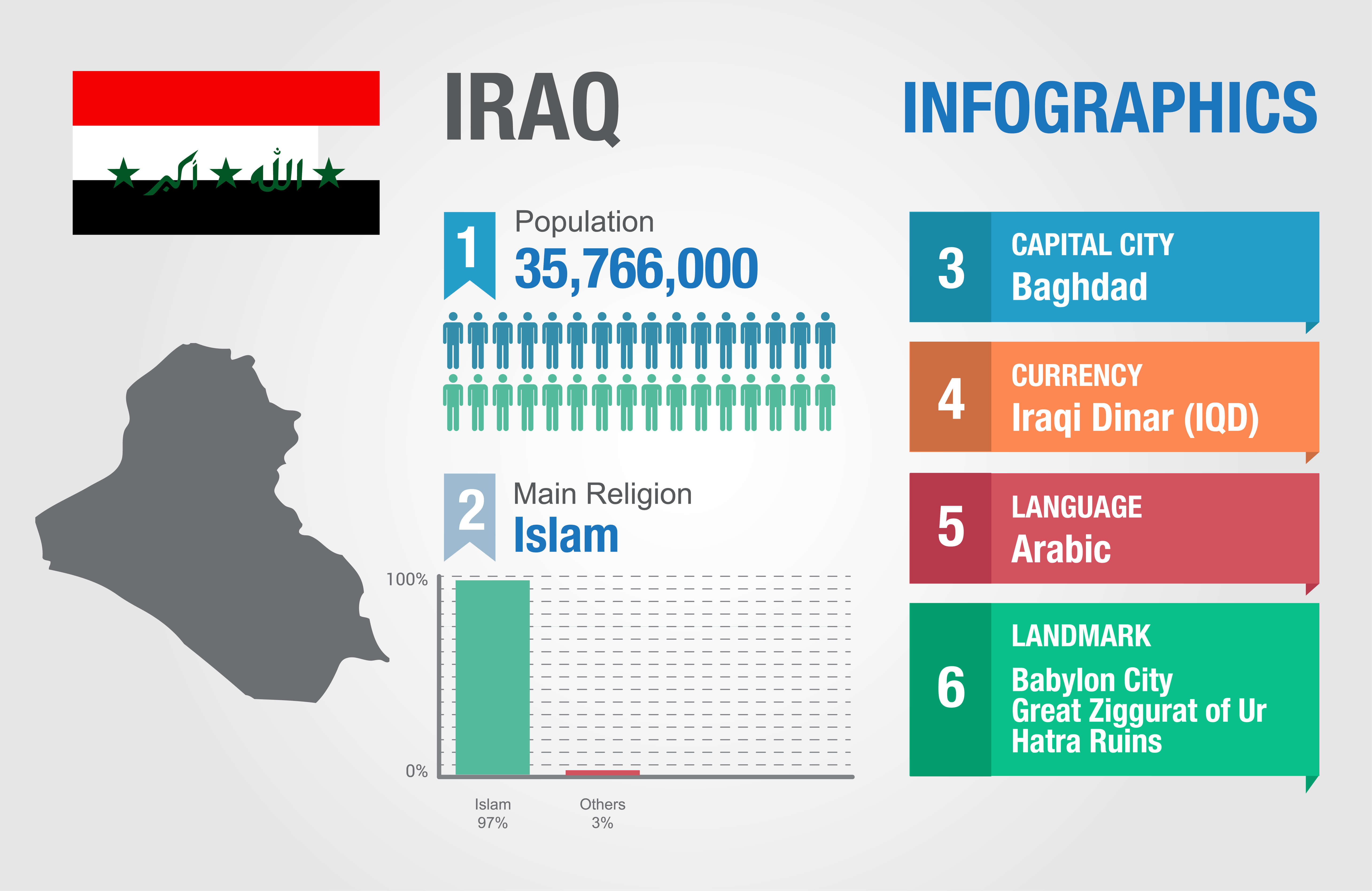 Capital city: Baghdad
 Iraq Ethnic Groups Map: Understanding Cultural Diversity
 Map of Iraq showing ethnic groups: Sunni Arabs, Shiite Arabs, Kurds, Assyrians, Yazidis, Turkmen
A comprehensive map of Iraq illustrating its ethnic diversity, including Sunni Arabs, Shia Arabs, Sunni Kurds, Assyrians, Yazidis and Turkmen. This map highlights the regions where each group is predominantly located, providing an insight into Iraq’s rich cultural and demographic landscape.
Religion: 90–95% Islam, 5–10% Christianity, Mandaeism, Yazidism, Judaism, Yarsanism, Zoroastrianism, irreligion, and others.Neo-Babylonian Empire Map (556–539 BC): Ancient Mesopotamia
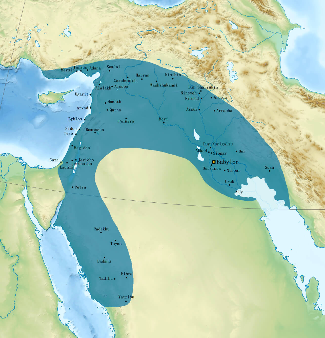 Neo-Babylonian Empire map highlighting its extent, including Babylon, Ur, and surrounding regions.
This map illustrates the Neo-Babylonian Empire during 556-539 BC, showing its territorial reach across Mesopotamia, including major cities such as Babylon, Uruk and Nineveh. The empire’s influence stretched from the Persian Gulf to the Mediterranean, including parts of modern Iraq, Syria and beyond.
Map of Iraq
Iraq Location Map
Iraq Map with Cities
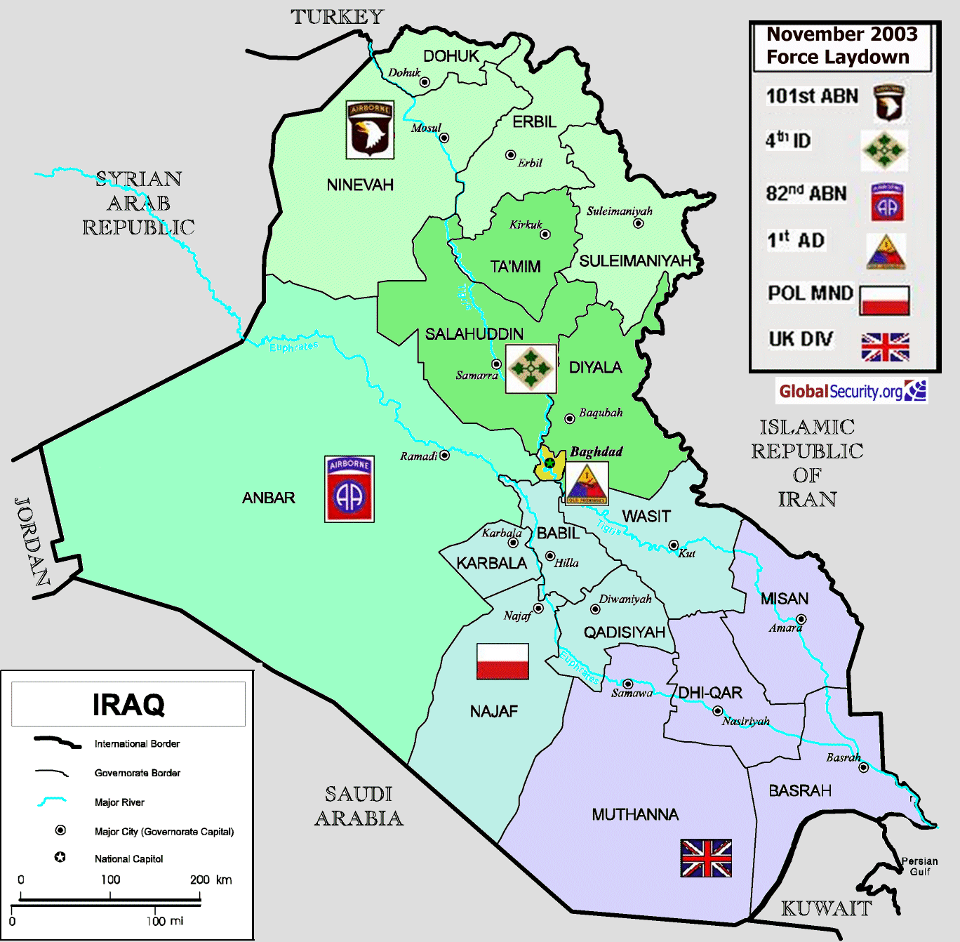 Map of Iraq showing provinces, major cities, and 2003 military deployment zones
This map of Iraq displays its provinces, major cities, and the military force deployment as of November 2003. Key provinces such as Nineveh, Baghdad, Basrah, and Anbar are highlighted along with the deployment of coalition forces, including the 101st Airborne Division, 82nd Airborne Division, and British forces. International borders, governorate boundaries, and major rivers are also marked, providing a view of both the geopolitical and military layout during the post-invasion period in Iraq.
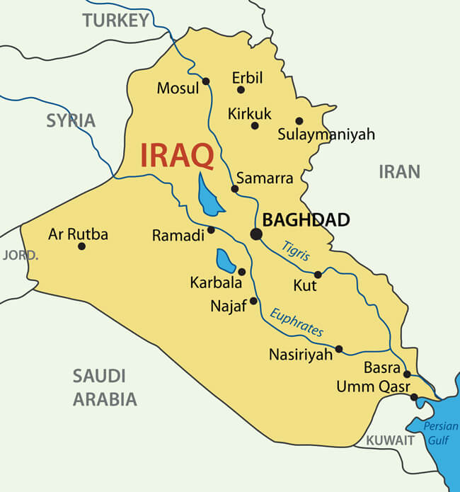
Iraq major cities map with rivers
Iraq Physical Map
Iraq Road Map
Iraq Relief Map
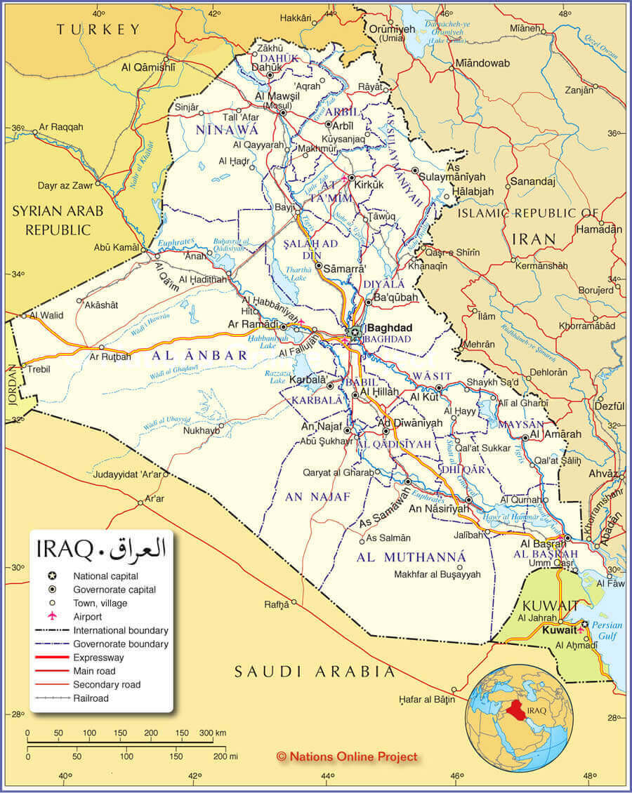
Iraq Maps
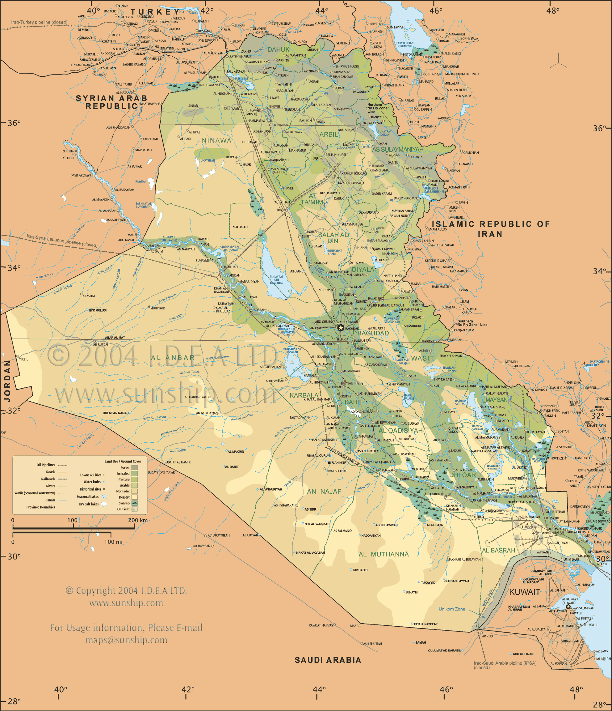
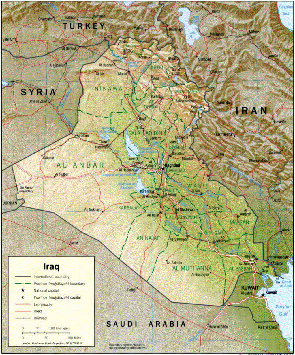
Map of Iraq showing provinces, major roads, cities, and neighboring countriesThis map of Iraq provides a detailed view of its provinces, major cities such as Baghdad, Basra, and Mosul, and key transportation routes, including expressways, main roads, and railroads. It shows Iraq’s borders with Turkey, Syria, Jordan, Saudi Arabia, Kuwait, and Iran. Airports and governorate capitals are marked, along with international boundaries, offering a comprehensive geographic overview of the country. The inset map locates Iraq within the broader Middle East.
Iraq Map Nofly Zone
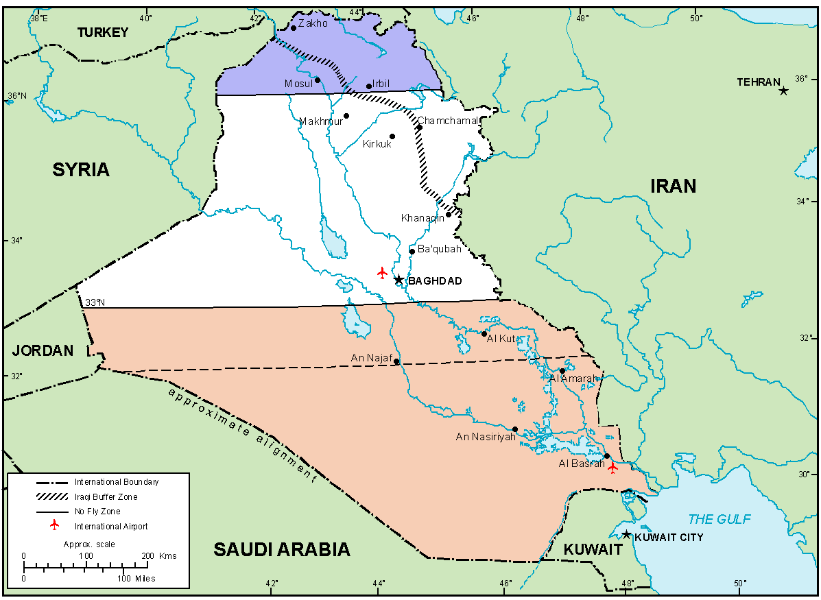 Map of Iraq showing no-fly zones, buffer zones, major cities, and borders
This map highlights Iraq’s no-fly zones (in shaded areas) and buffer zones established during past conflicts. Major cities, such as Baghdad, Basra, and Mosul, are marked, along with the country’s borders with neighboring countries, including Turkey, Iran, Syria, Jordan, Saudi Arabia, and Kuwait. The map also identifies key geographical features and international airports.
Iraq Map 1996
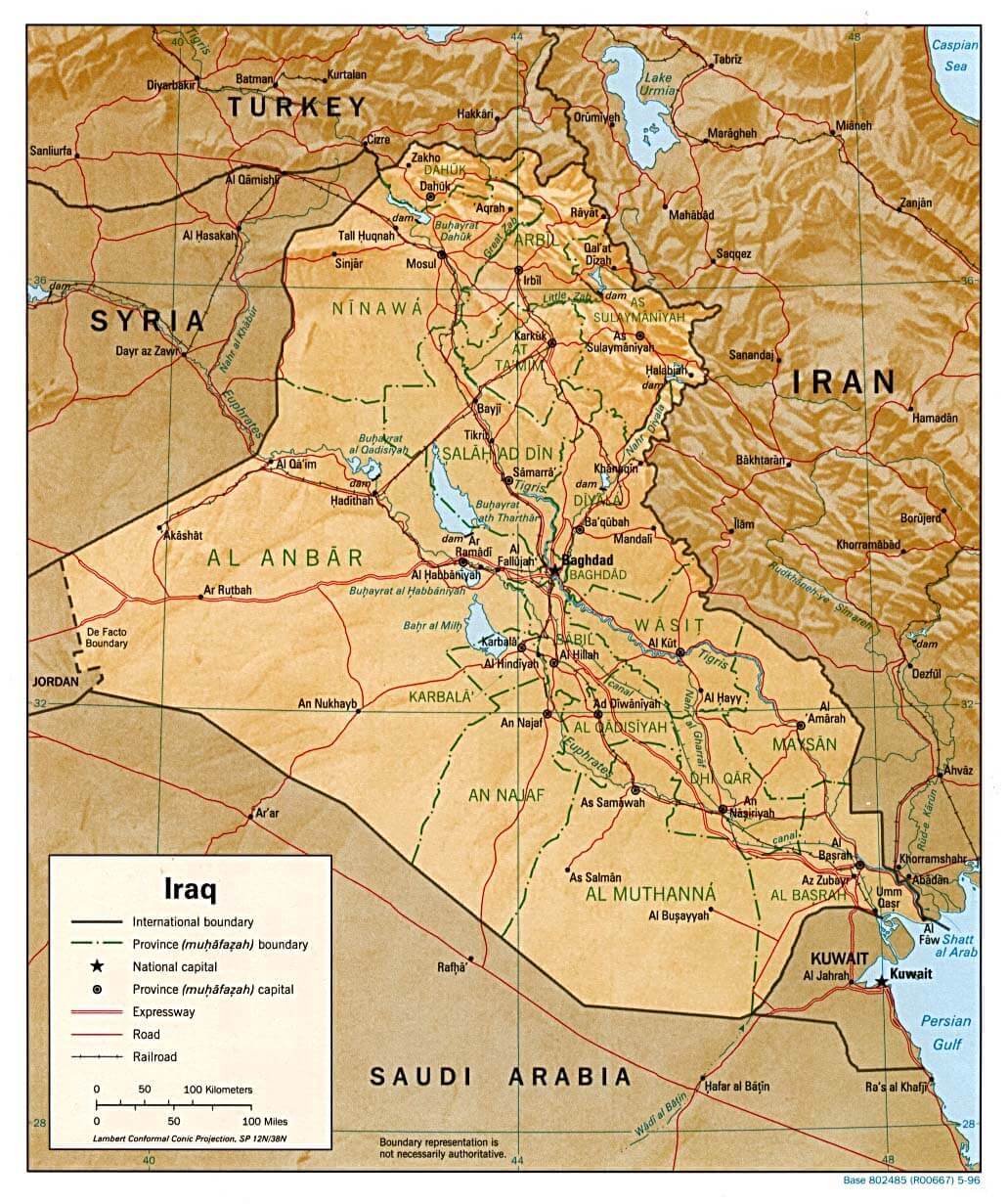
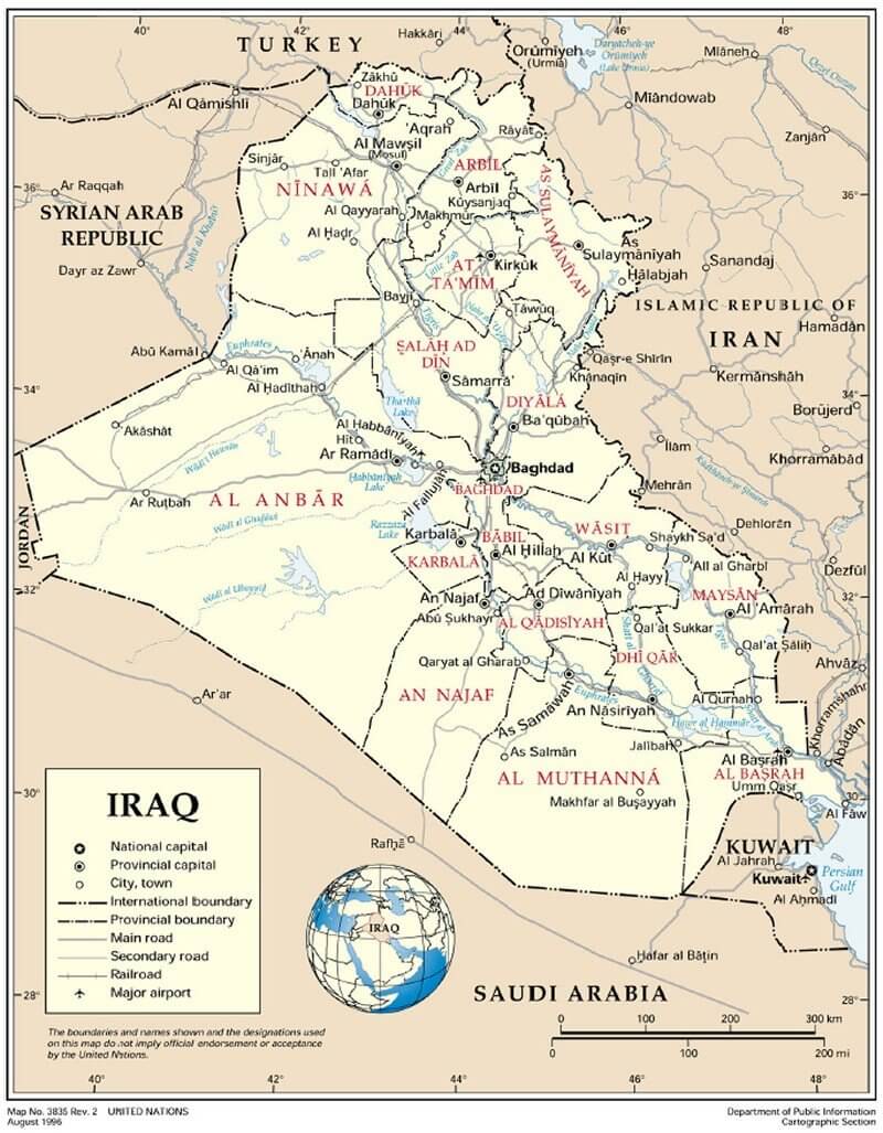 Map of Iraq showing provinces, major cities, and borders
This map of Iraq highlights its provinces, major cities such as Baghdad, Basra, and Mosul, and key geographical features. It shows Iraq’s borders with neighboring countries, including Turkey, Syria, Jordan, Saudi Arabia, Kuwait, and Iran. The map also details Iraq’s road and railroad networks, providing a clear view of its infrastructure and regional layout.
Iraq Earth Map
Physical Map of Iraq with Elevation
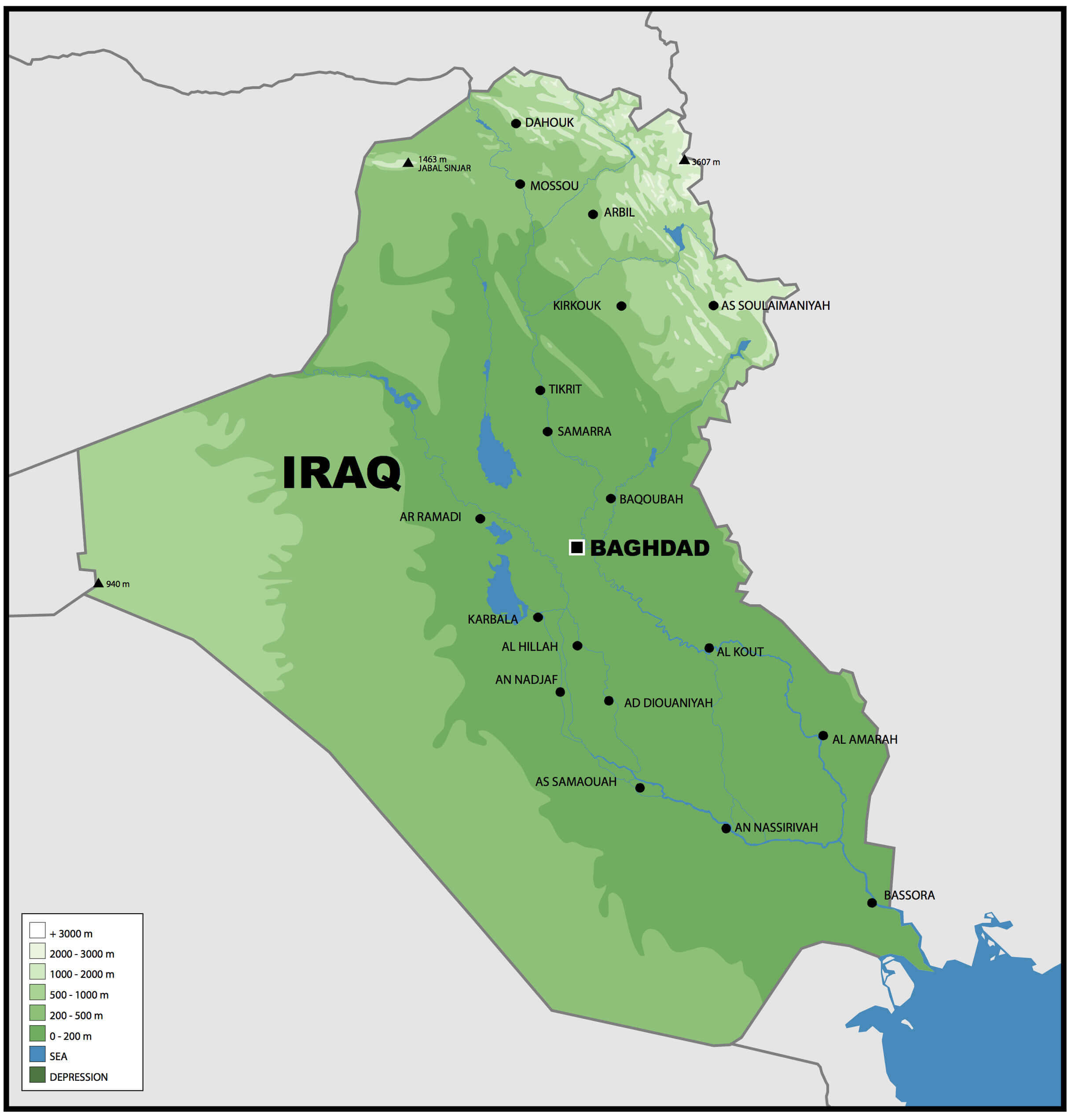 Physical map of Iraq highlighting elevation levels with a gradient of green shades.
This image is a Physical map of Iraq. It shows the topography of the country, highlighting elevations with a gradient of shades of green. Major geographical features such as rivers, including the Tigris and Euphrates, are marked. Major cities such as Baghdad, Mosul and Basra are labelled, along with other towns and landmarks. Elevations range from sea level to over 3,000 metres, as indicated in the legend.
3D relief map of Iraq
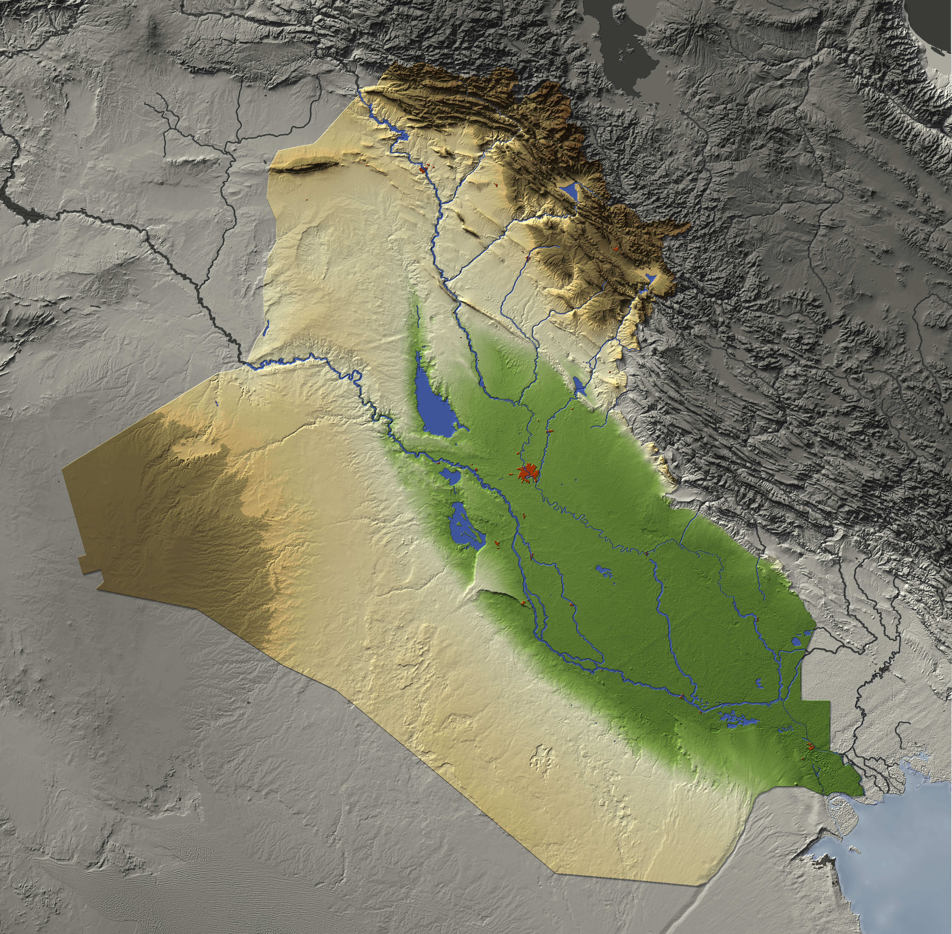 3D relief map of Iraq shows major cities and rivers.
3D relief map of Iraq shows major cities and rivers, surrounding territory greyed out. Colored according to terrain height. Iraq relif map contains path to mask out the background.
Iraq Regions Map: Administrative Divisions and Population
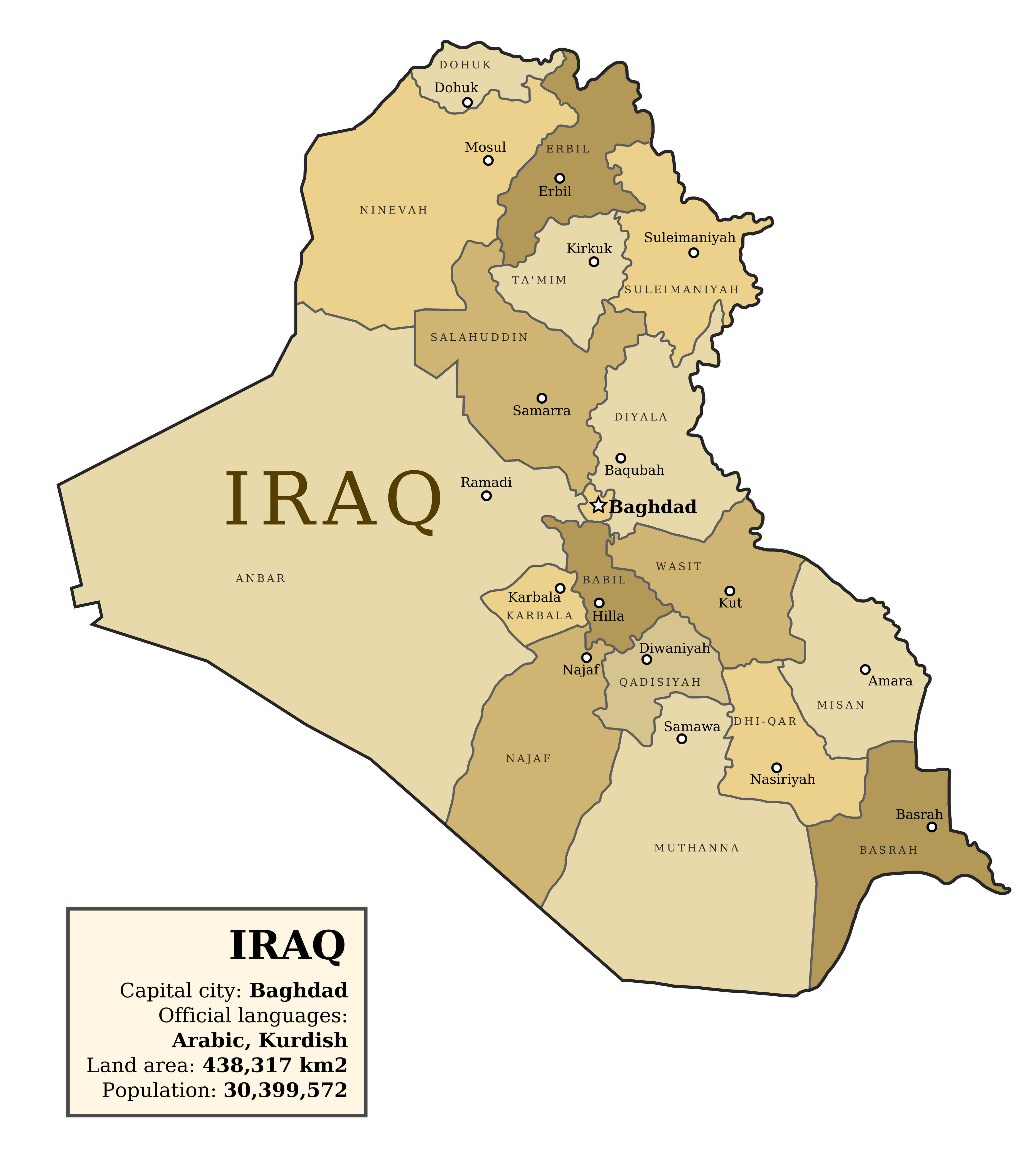 Map of Iraq showing regions, provinces, and key cities like Baghdad, Mosul, and Basra
Explore Iraq’s regions and administrative divisions with this detailed map. Highlighting provinces such as Baghdad, Basra, Nineveh, and Dohuk, it also includes key cities and population statistics. The map provides insights into the country’s land area, languages, and regional layout for a better understanding of Iraq’s geography and demographics.
Iraq Roads Map: Highways and Connectivity
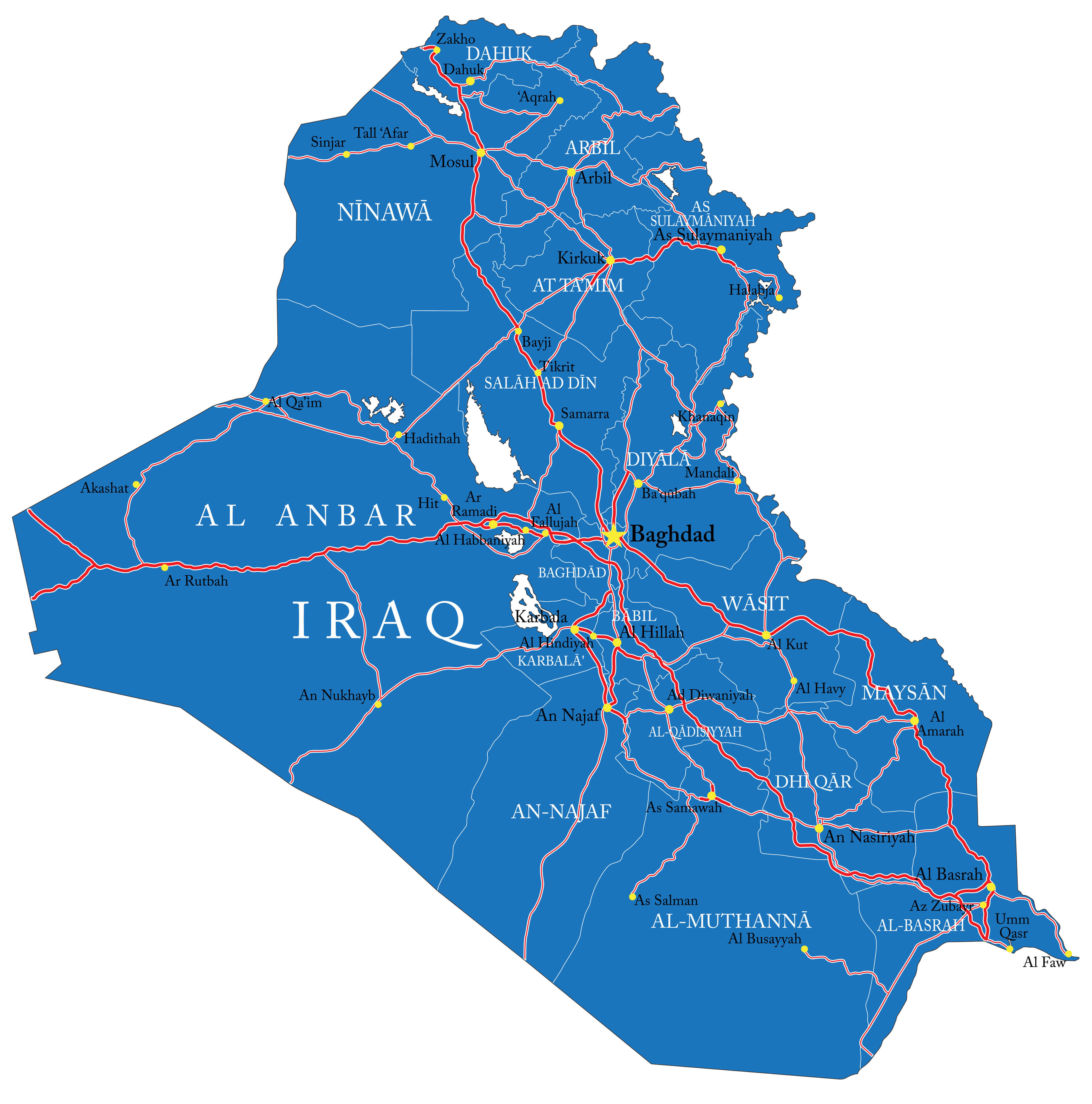 Map of Iraq highlighting highways, major roads, and regional connectivity.
A comprehensive map of Iraq’s road network, including highways, major roads and routes connecting major cities such as Baghdad, Basra, Mosul and Kirkuk. It illustrates the country’s transport infrastructure and links to neighbouring regions, providing an overview of Iraq’s logistics and travel routes.
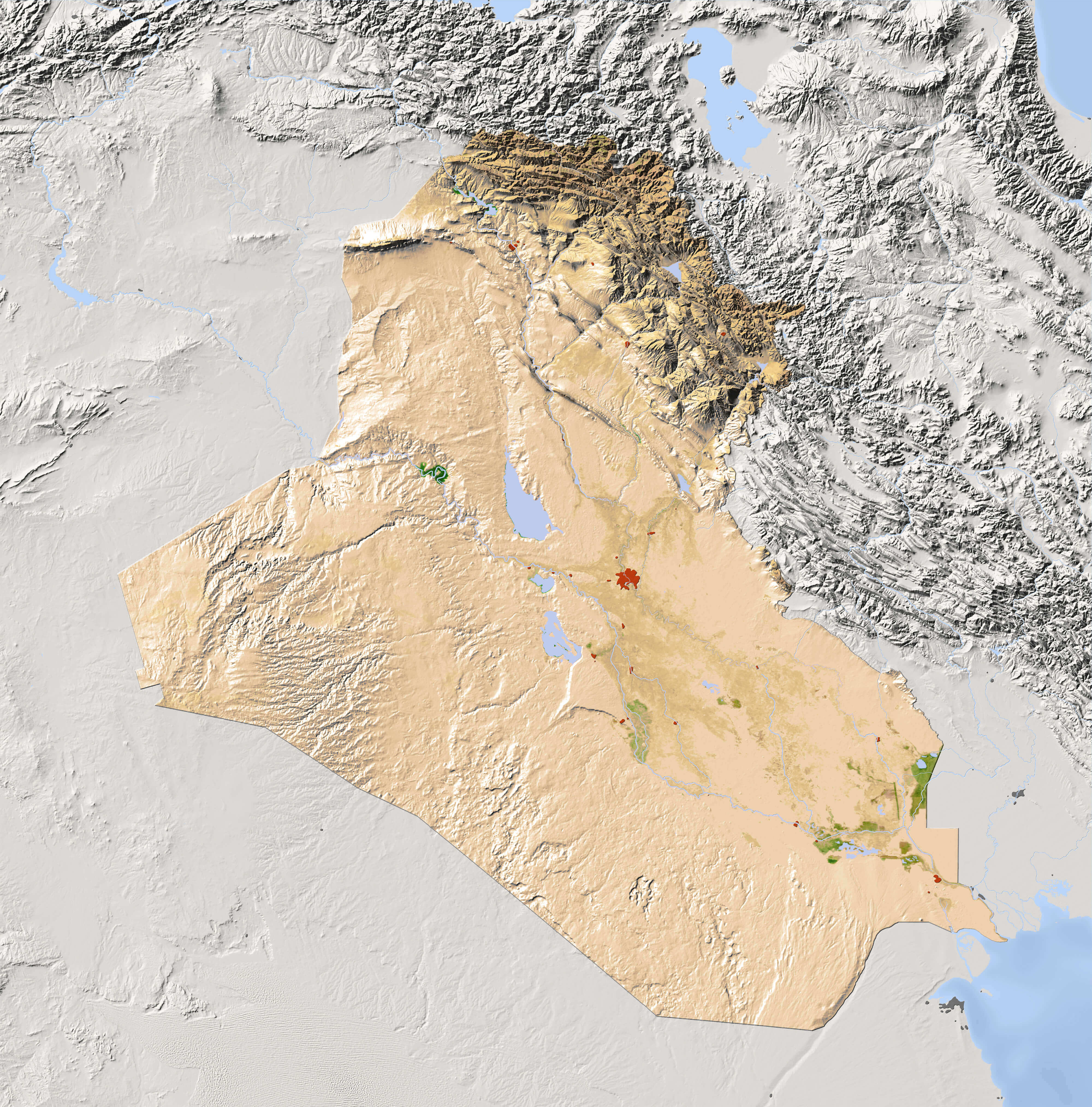
Iraq Physical Map: Landforms, Rivers, and Elevation
 Physical map of Iraq highlighting rivers, mountains, deserts, and vegetation zones
This Physical map of Iraq shows the country’s varied terrain, including the Tigris and Euphrates rivers, desert areas and mountainous regions in the north. It highlights key geographical features such as valleys, plateaus and elevation changes, providing an insight into Iraq’s natural landscape and Physical geography.
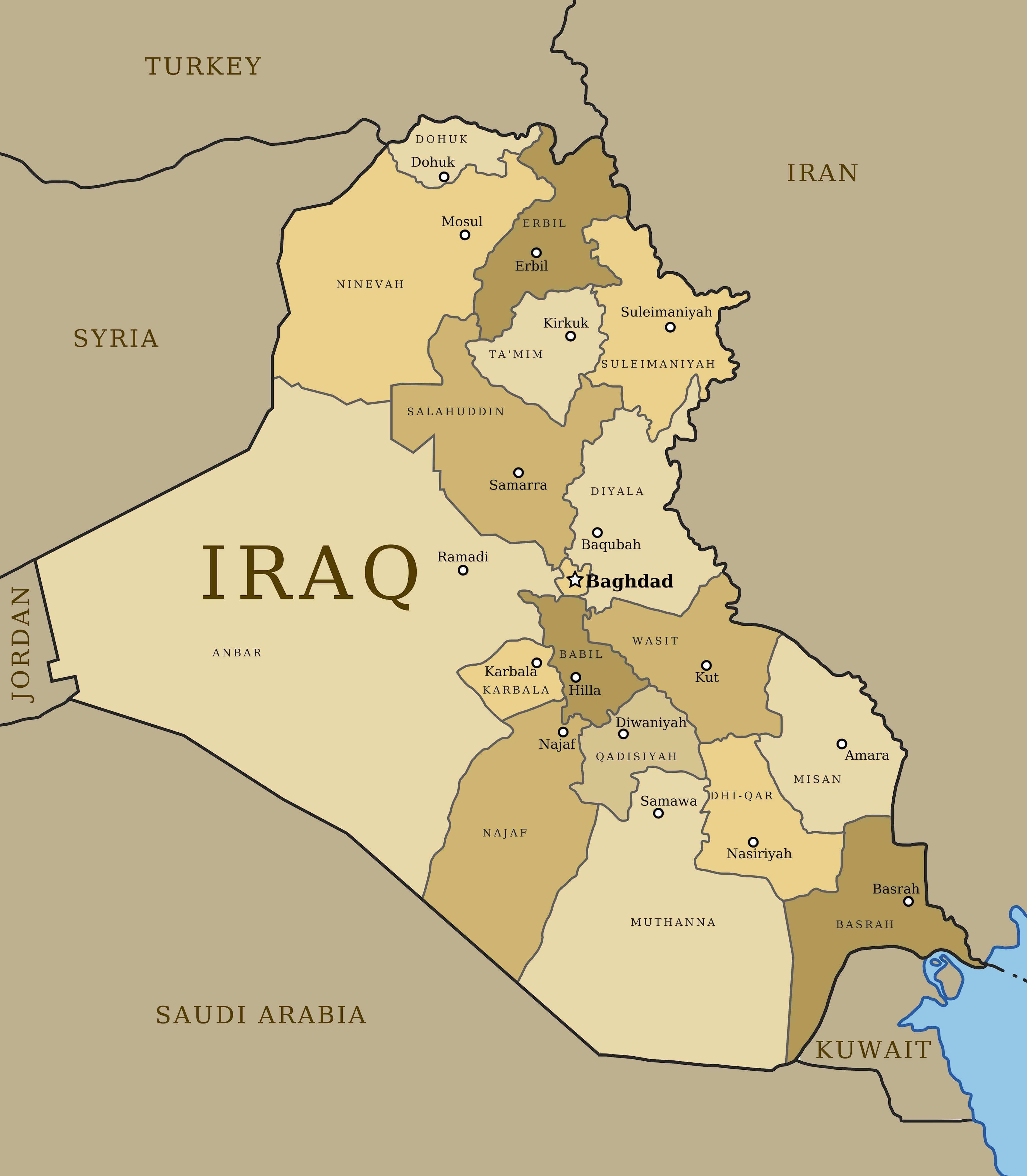
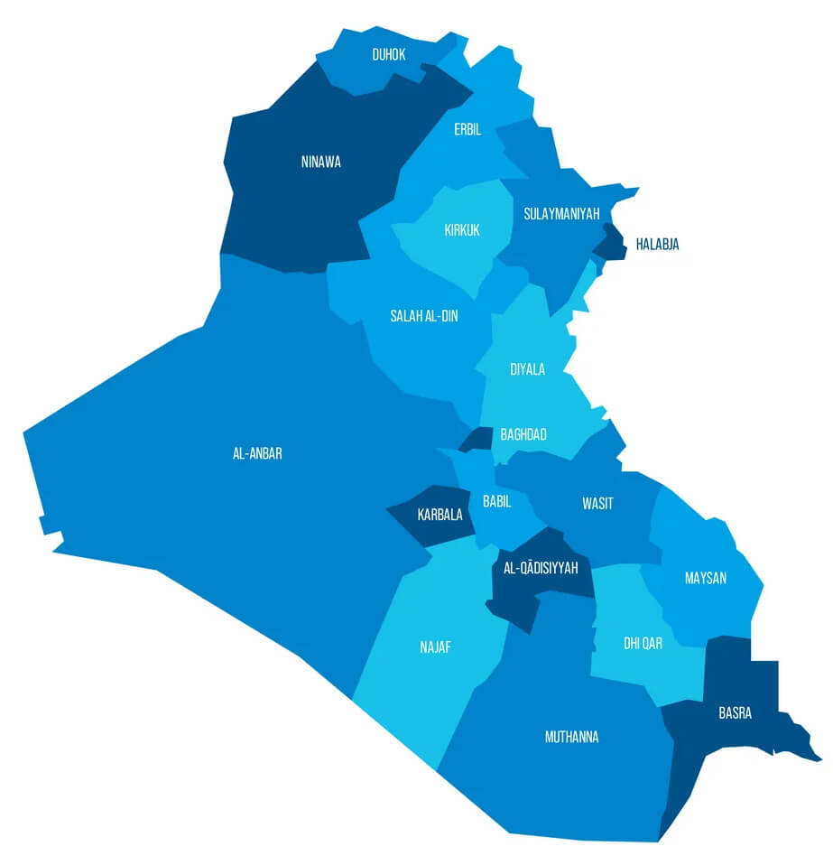
Iraq Administrative Map: Provinces and Boundaries
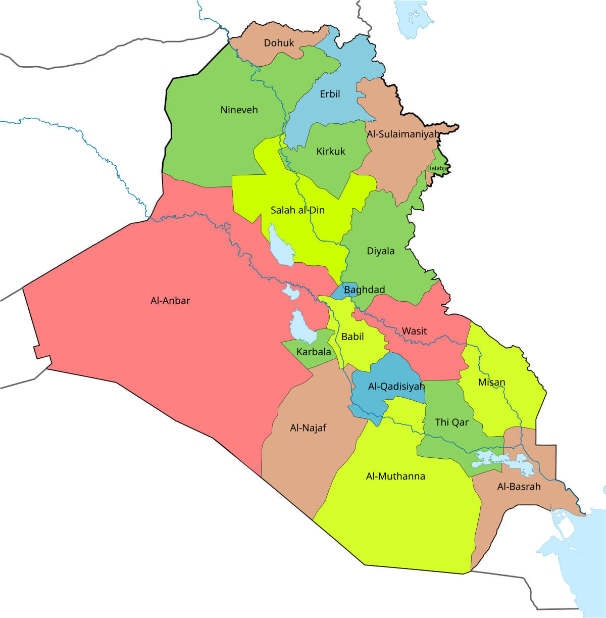 Administrative map of Iraq showing provinces and regional divisions in different colors.
This administrative map of Iraq highlights the country’s provinces, including Baghdad, Basrah, Nineveh, and more. Each region is distinguished by vibrant colors to define boundaries clearly. It provides a detailed view of Iraq’s political divisions, helping to understand the administrative organization of the nation.
Iraq Cities Map: Major Urban Centers Highlighted
 Map of Iraq showing major cities including Baghdad, Basrah, Mosul, Erbil, and Kirkuk.
This map of Iraq highlights major cities such as Baghdad, Mosul, Basra and Erbil, as well as major rivers such as the Tigris and Euphrates. It provides a geographical overview of Iraq’s urban landscape and shows the strategic locations of key cities in relation to neighbouring countries such as Syria, Iran and Saudi Arabia.
Iraqi Kurdistan Map: Regions and Cities
 Map of Iraq highlighting Iraqi Kurdistan region with key cities like Erbil and Sulaymaniyah.
This map highlights the Iraqi Kurdistan region in northern Iraq, showcasing its autonomous boundaries and major cities like Erbil, Sulaymaniyah, and Dohuk. It also displays Iraq’s geographic features, including the Tigris River and bordering countries like Turkey, Iran, and Syria, offering insights into the region’s strategic location.
Iraq and Middle East Map: Regional Overview
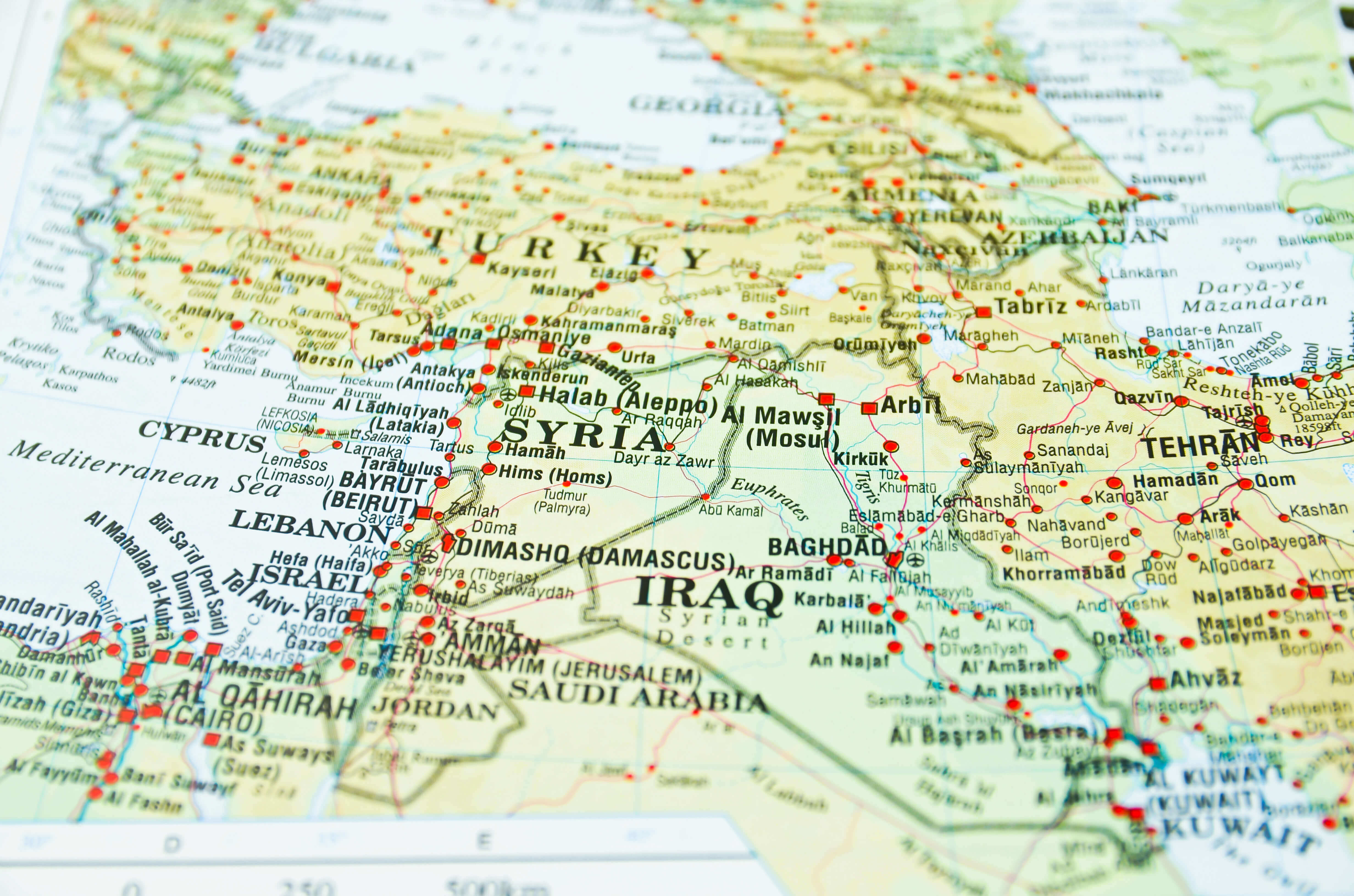 Map showing Iraq and neighboring Middle East countries with cities and key locations.
A detailed map highlighting Iraq’s position within the Middle East, showcasing its borders with countries like Syria, Turkey, Iran, Kuwait, and Saudi Arabia. The map includes major cities such as Baghdad, Mosul, and Basra, as well as neighboring capitals like Tehran, Damascus, and Beirut, illustrating regional connectivity.
Iraq Terrain Map
Map of Iraq
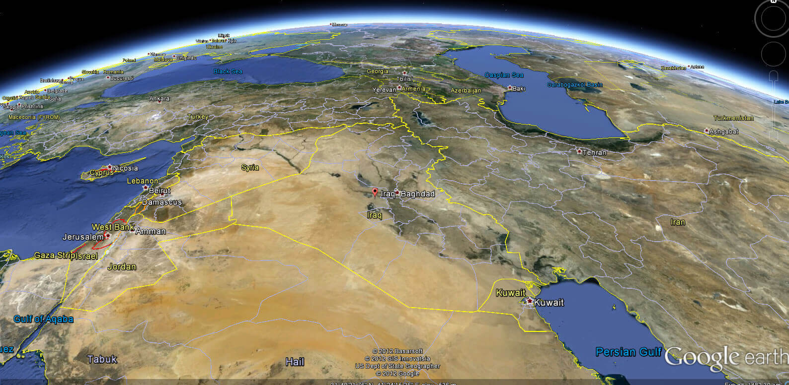
Iraq satellite map with middle east
Iraq Physical map with rivers lakes and mountains
Middle East satellite map with Iraq
Iraq blank map with provinces
Physical map of Iraq
Iraq Provinces Map
Iraq Relief Map
Iraq Road Map
Iraq Outline Map
Iraq international boundary map
Administrative map of Iraq with provinces
Where is Iraq on the Asia Map?
Show Google map, satellite map, where is the country located.
Get directions by driving, walking, bicycling, public transportation and travel with street view.
Feel free to explore these pages as well:
- Iran: The Rise and Fall of Empires ↗️
- Syria Map ↗️
- Jordan Map ↗️
- Israel Map ↗️
- Oman Map ↗️
- Saudi Arabia Map ↗️
- Where is Located Qatar in the World? ↗️
- United States Map ↗️
- United Kingdom Map ↗️
- Türkiye Map ↗️
- Europe Map ↗️
- Asia Map ↗️