Europe Road Map

HomeMapsEurope Road Map
- Advertisement -

Europe’s intricate network of roads, motorways and railways is a testament to its connectivity and efficiency. From busy city traffic maps to cross-country motorways and international road abbreviations, every route tells a story of interconnectedness. The continent’s extensive rail network, including high-speed lines, complements its roads, making travel seamless. Europe’s oil and gas pipelines span vast distances, fueling economies, while its rivers and waterways provide natural routes for trade and leisure. This diverse network not only supports daily life, but also demonstrates Europe’s commitment to innovation and accessibility in transport.

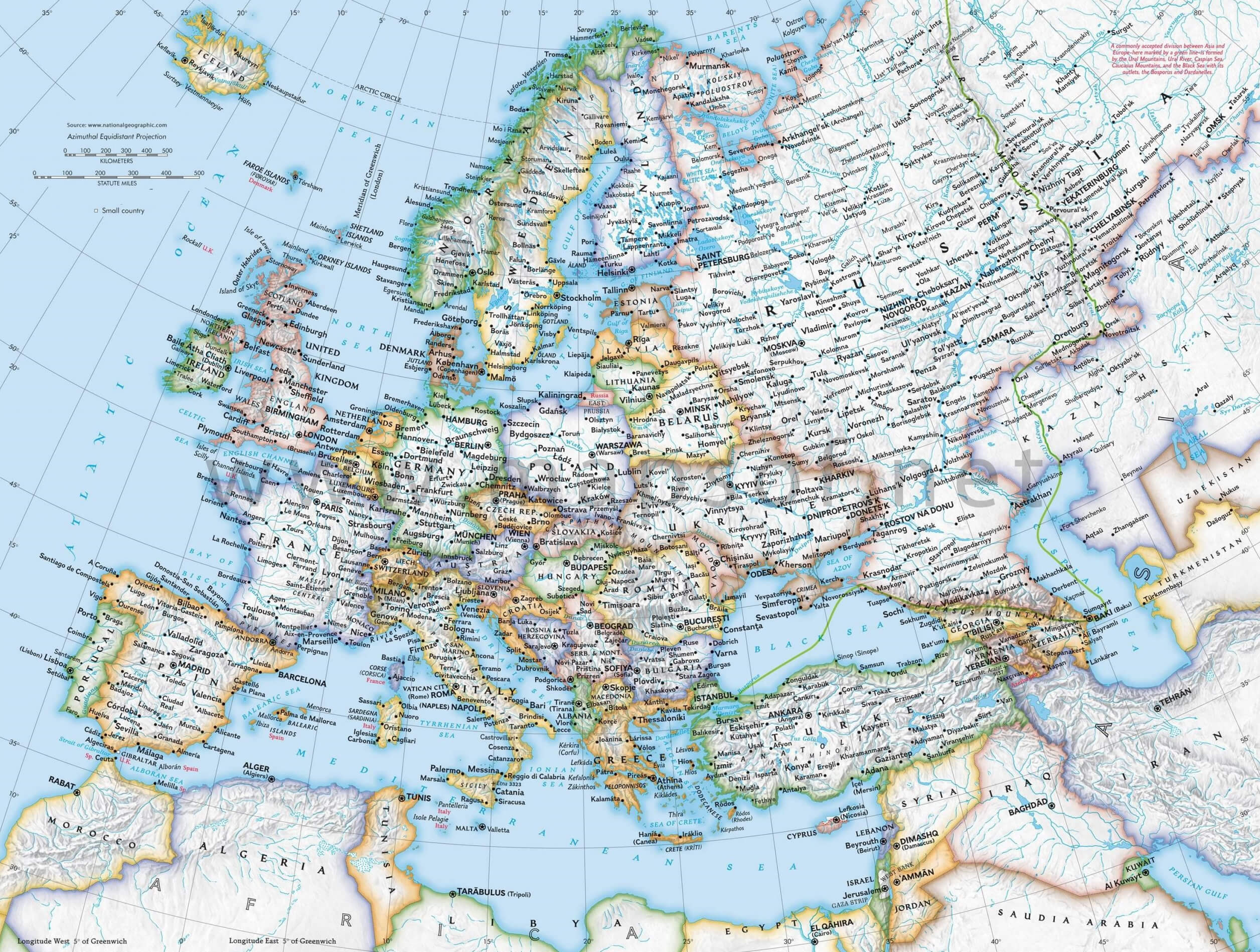
Comprehensive Road Map of Europe
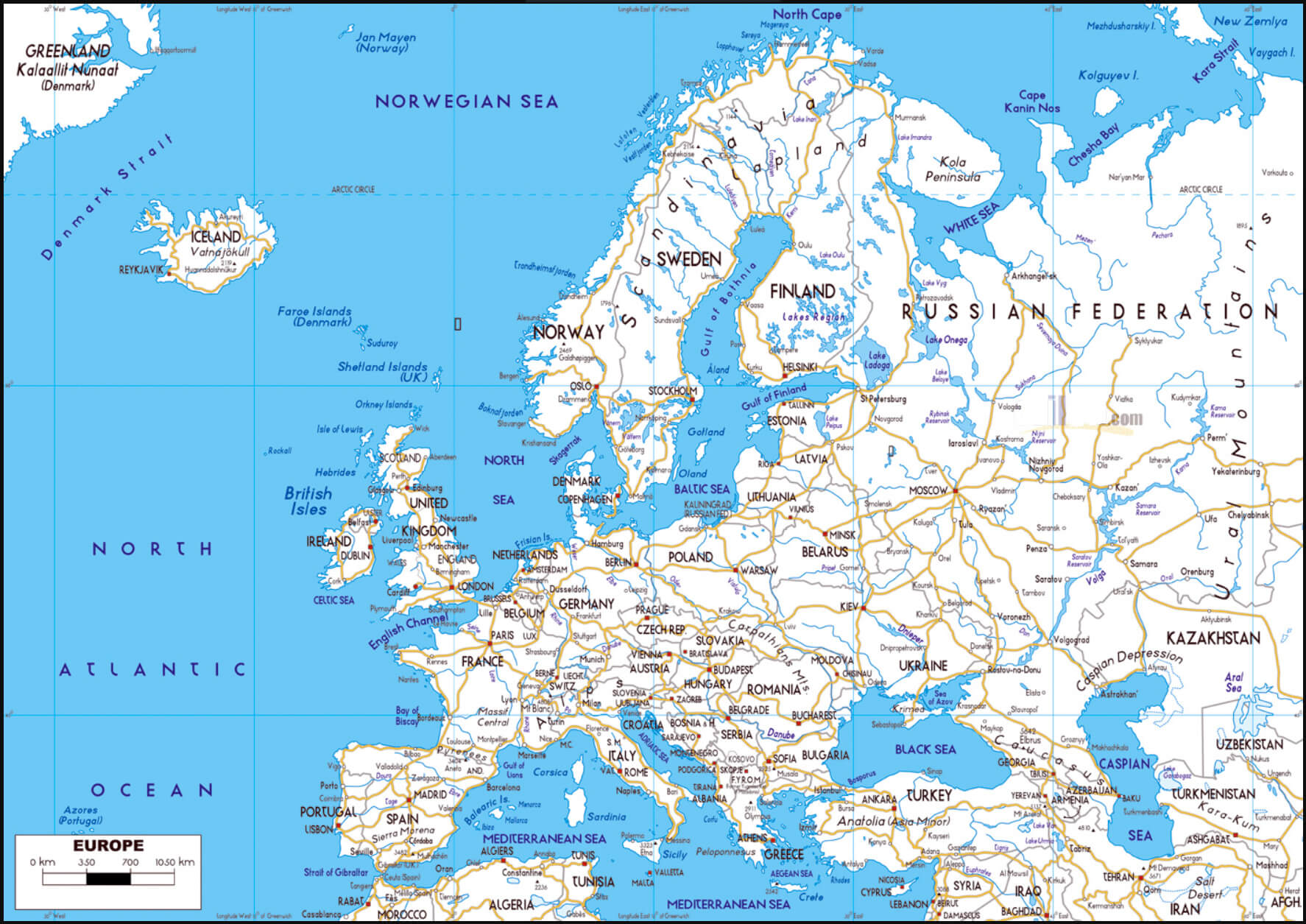
Map of Europe showing detailed road networks, cities, and geographical features
Map of Europe showing detailed road networks, cities, and geographical features.

This map highlights Europe’s extensive road network, linking cities and regions across the continent. It provides a detailed view of major motorways, secondary roads and key geographical landmarks, making it a valuable resource for planning travel and understanding Europe’s infrastructure.

Road Map of Europe

Detailed Road Map of Europe with Geographic Features
Map of Europe showing roads, cities, and geographical elevations in detail.

This map combines Europe’s extensive road network with geographic features such as elevation and terrain. It highlights major cities and transport routes, providing a detailed overview of connectivity and natural landscapes across the continent. Ideal for travel planning and geographical studies.

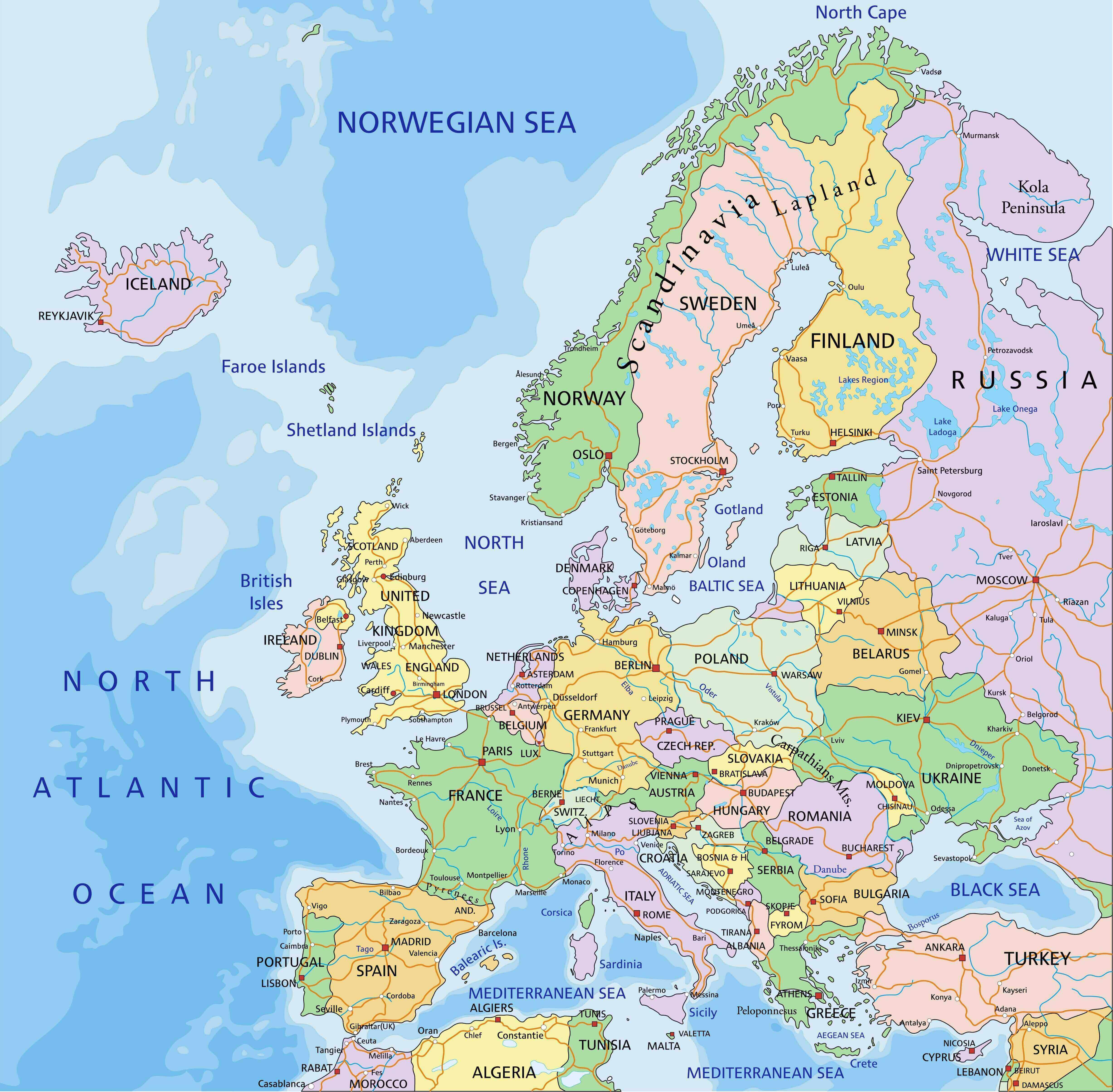
Political and Road Map of Europe

Political and Road Map of Europe
Map of Europe displaying political boundaries, major roads, and key geographic features.

This map illustrates Europe’s political divisions with clearly marked country borders, alongside major road networks connecting cities. It provides a comprehensive view of the continent’s geography, transportation routes, and regional layout, useful for travel and educational purposes.

Europe’s Busiest Airports by Passenger Traffic
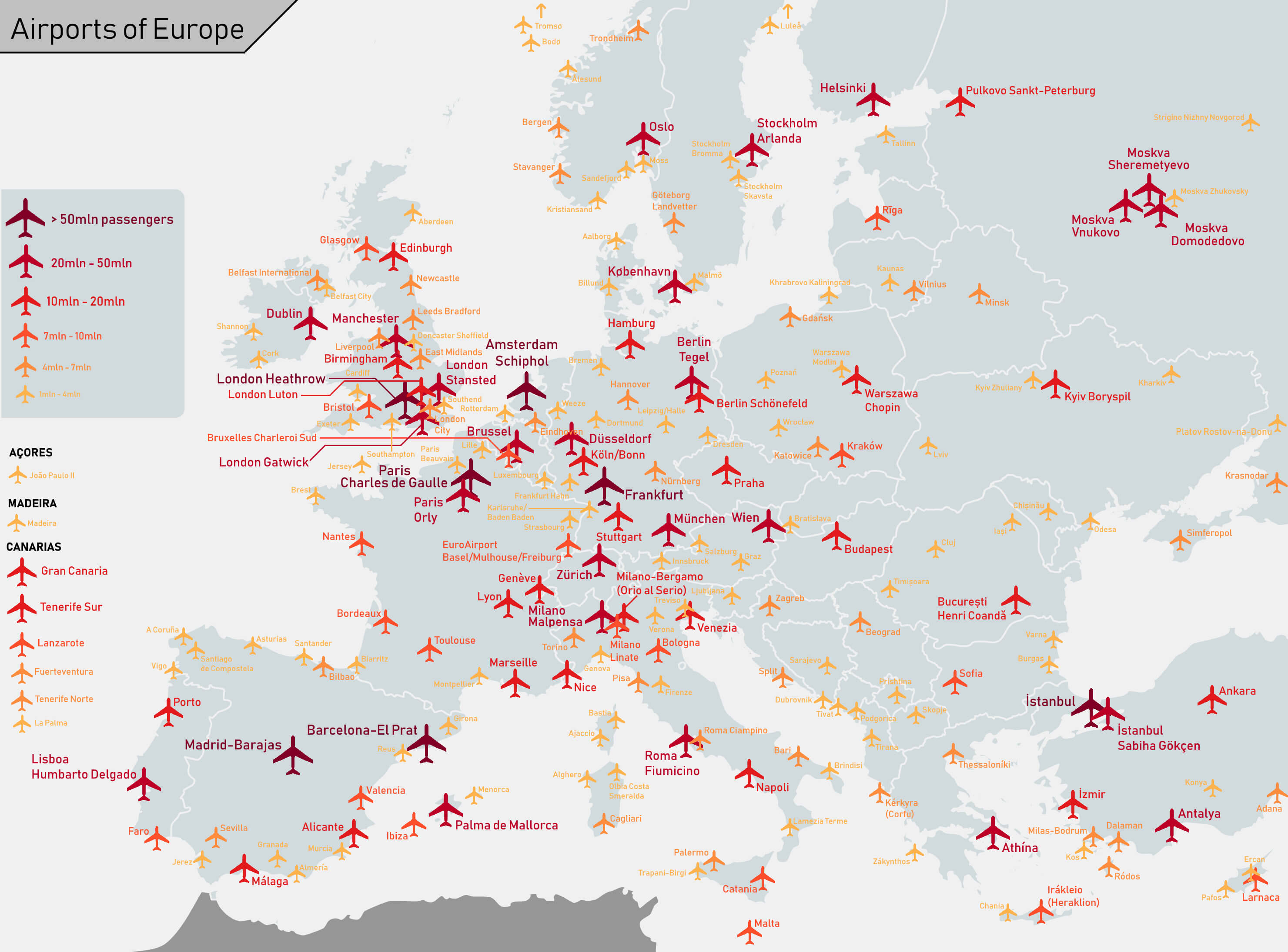
Europe's Busiest Airports by Passenger Traffic
Map of European airports, showing passenger traffic levels with color-coded icons

This map highlights the major airports in Europe, categorised by annual passenger traffic, from over 50 million passengers to under 4 million. It provides a clear visual representation of connectivity across the continent.

Europe and Wales location map on the World
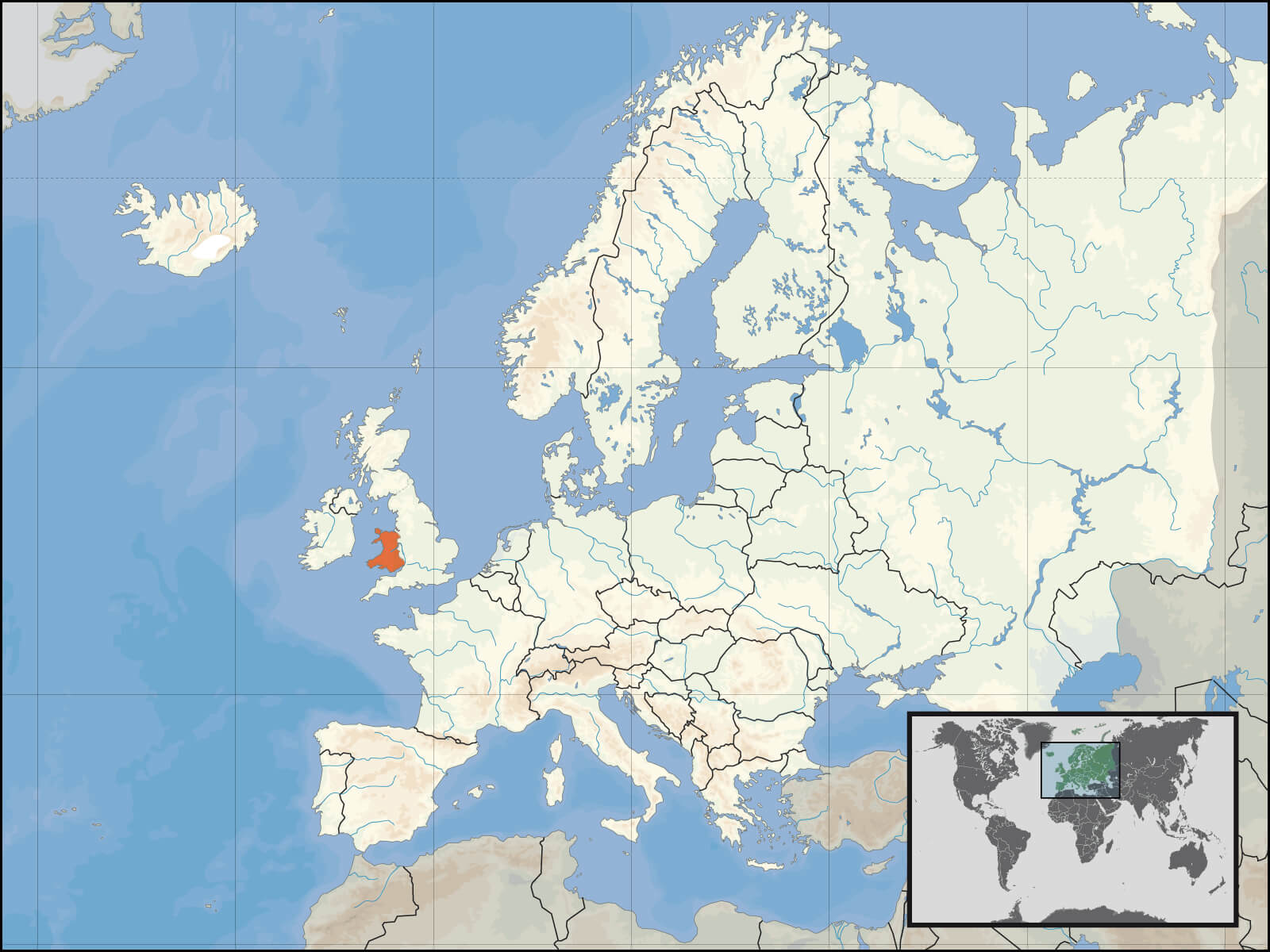
Europe and Wales location map on the World

Europe country ace abbreviations map
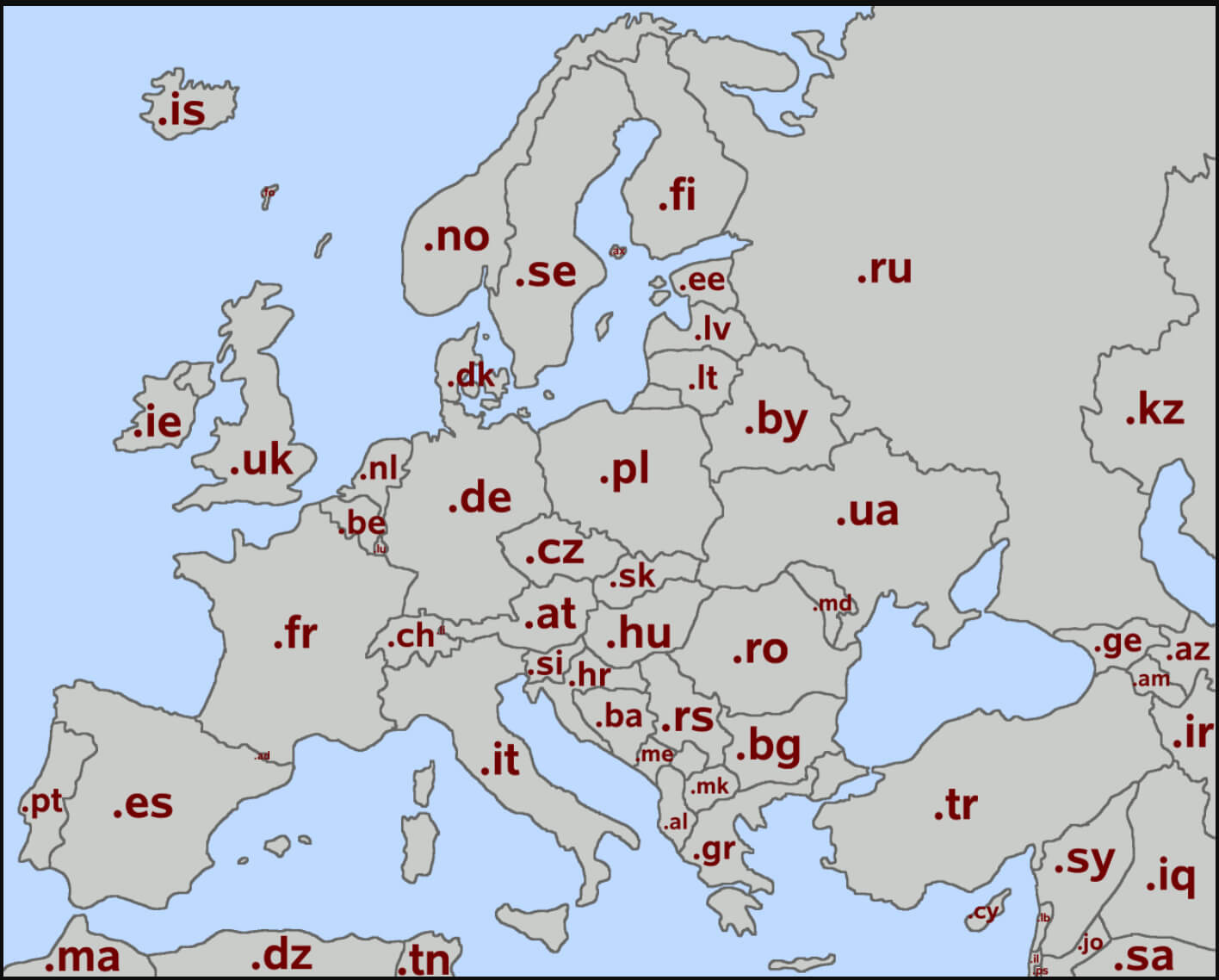
Europe country ace abbreviations map

Europe’s High-Speed Rail Network Map
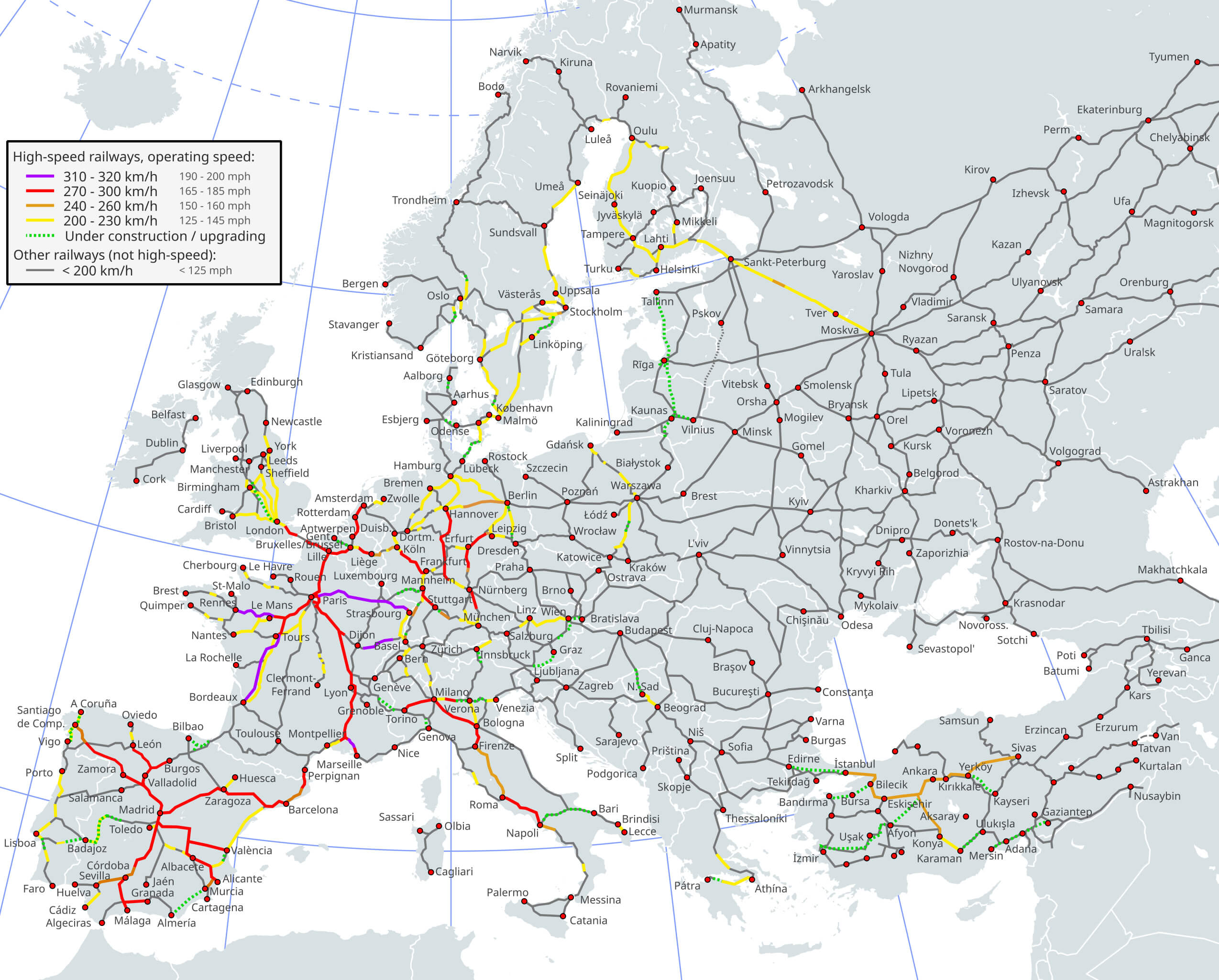
Map of Europe shows high-speed railway lines and operating speeds by color
Map of Europe highlighting high-speed railway lines and operating speeds by color.

This map shows Europe’s high-speed rail network, categorised by operating speeds from 200 to 320 km/h. It highlights existing lines, lines under construction and future upgrades, illustrating Europe’s commitment to fast and efficient rail connectivity.

Europe’s Highways and National Borders Map
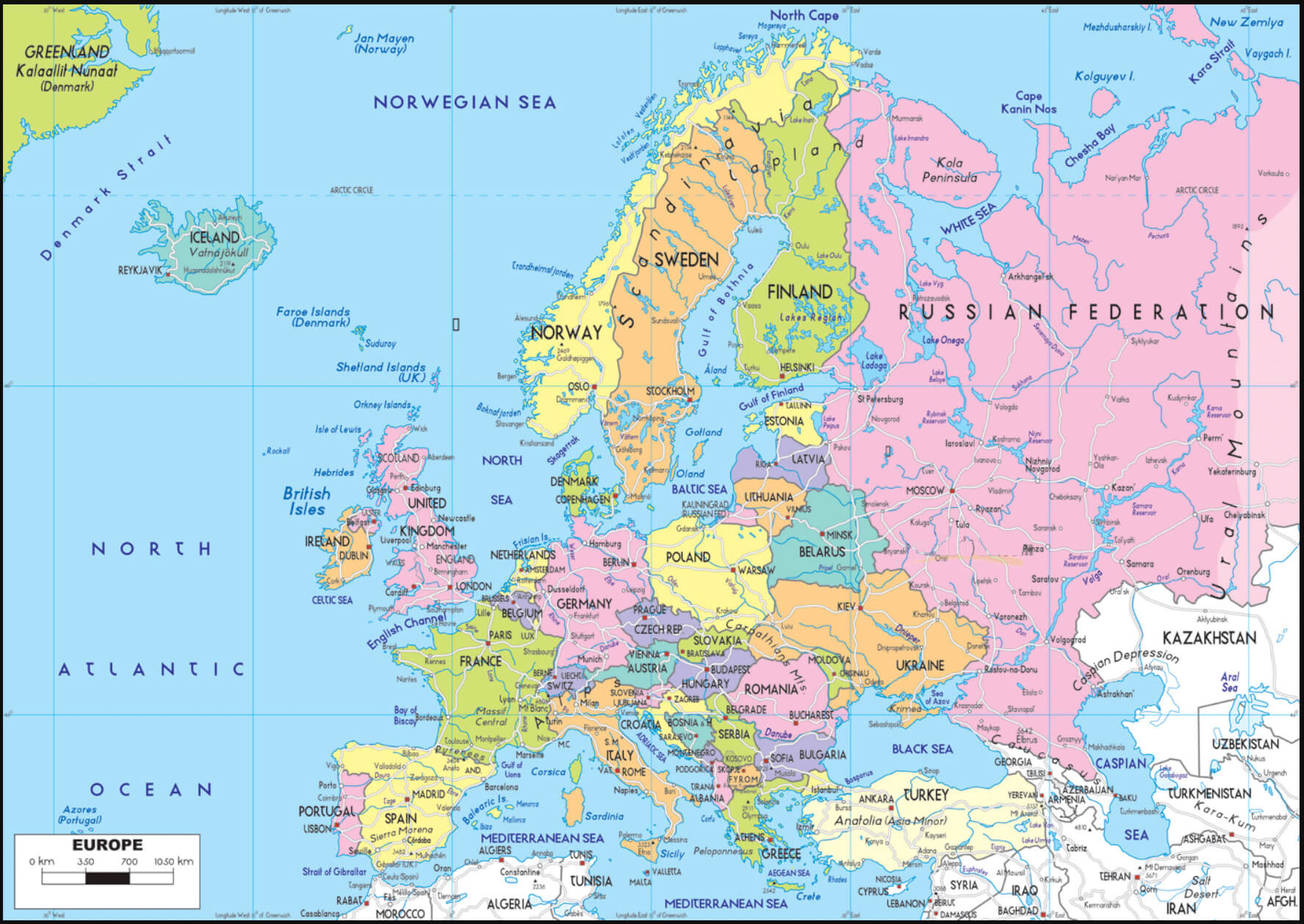
Europe’s Highways and National Borders Map
Map of Europe showing highways, national borders, and major cities with geographic detail.

This map illustrates Europe’s extensive highway network alongside national borders and major cities. It highlights the interconnected routes that facilitate travel and trade across the continent, showcasing Europe’s accessibility and strategic infrastructure.

Europe oil gas pipelines map

Europe oil gas pipelines map

Europe rivers and routes map
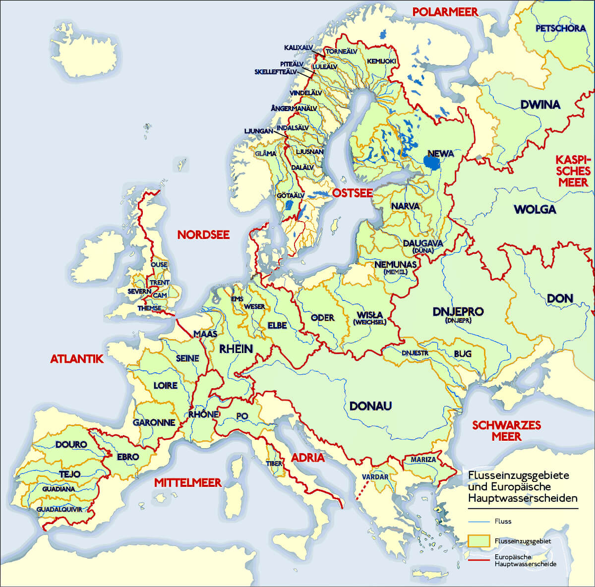
Europe rivers and routes map

Europe rivers road map
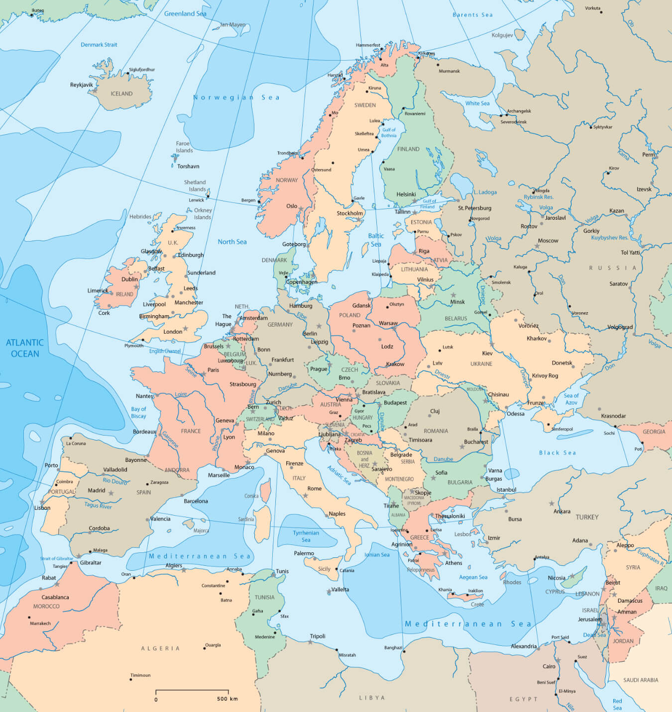
Europe rivers road map

Europe rivers route map
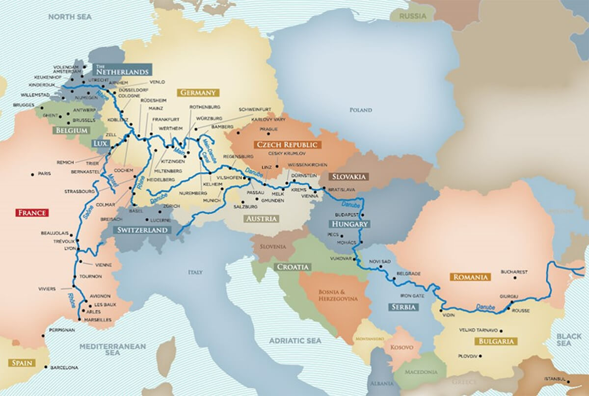
Europe rivers route map

Europe’s Detailed Routes and Connections Map
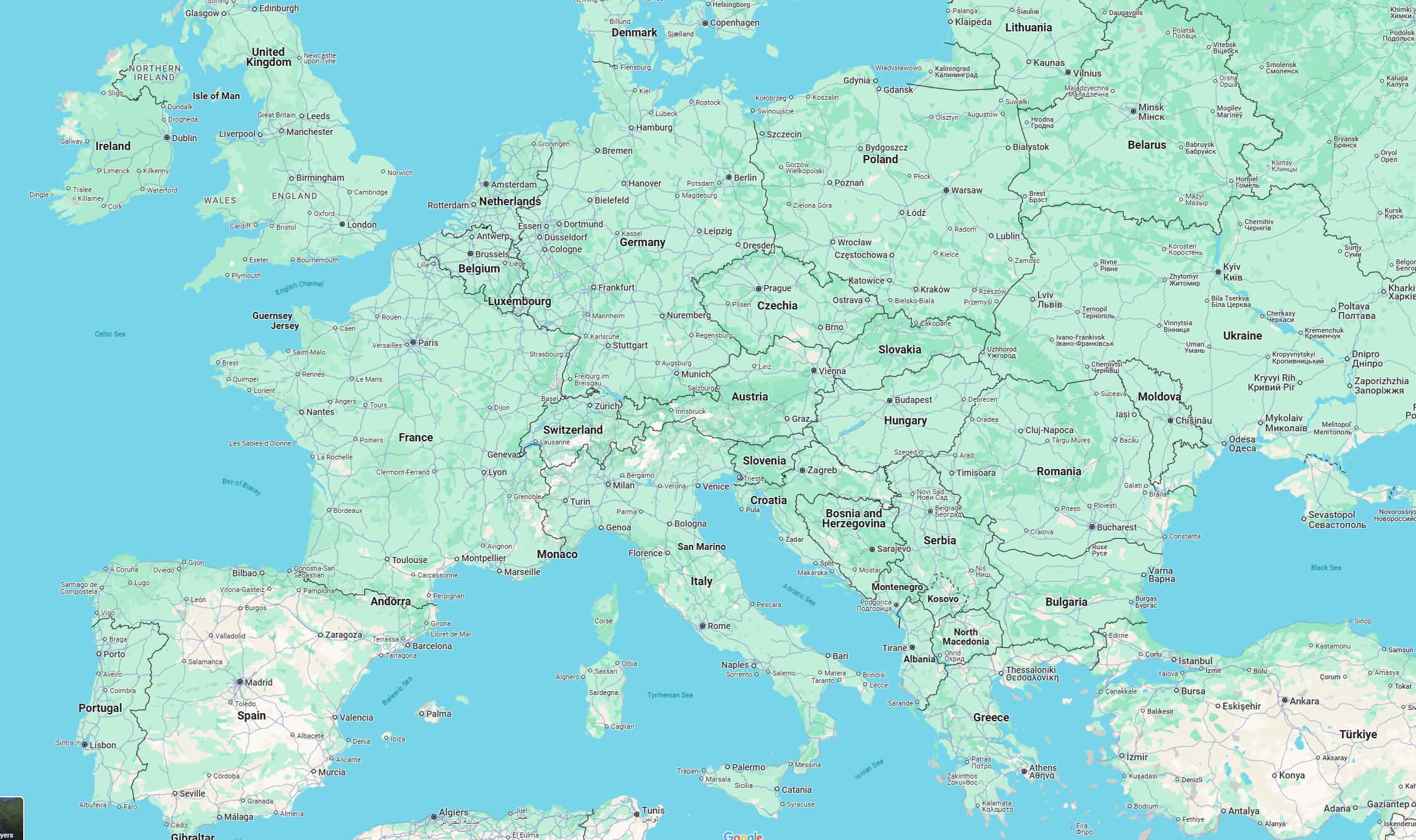
Europe’s Detailed Routes and Connections Map
Map of Europe showing detailed routes, cities, and transport connections.

This map shows Europe’s network of routes and connections, including cities and major transport routes. It provides a clear view of how different regions are connected, making it easy to navigate and plan routes across the continent.

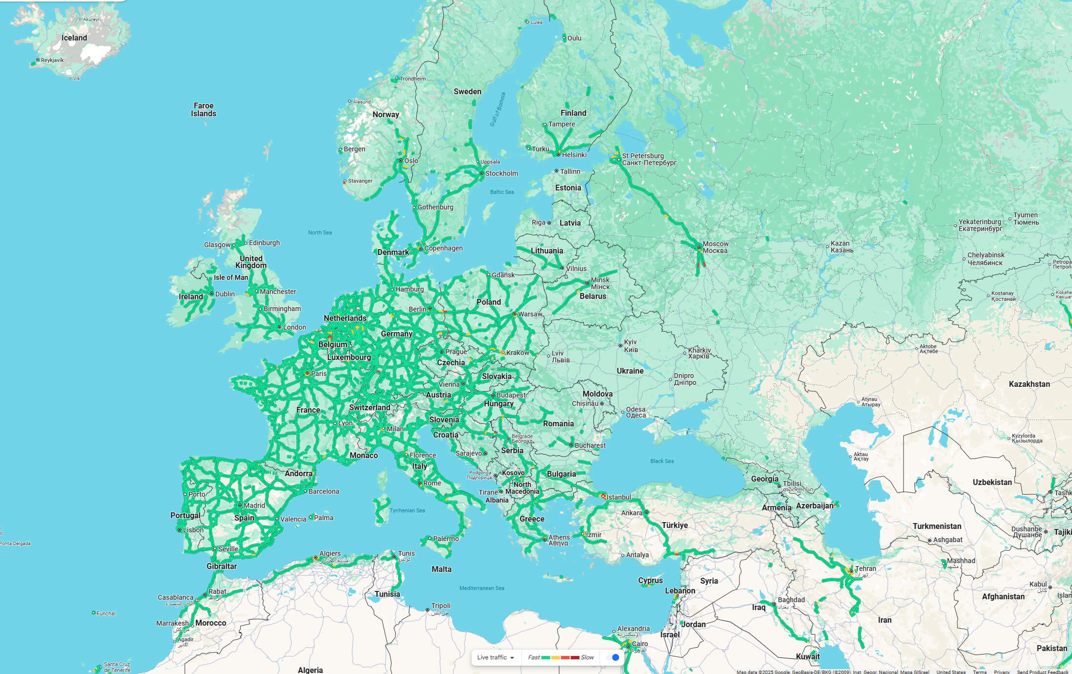
Europe traffic map

Europe traffic map

Europe’s High-Speed Rail Network Overview
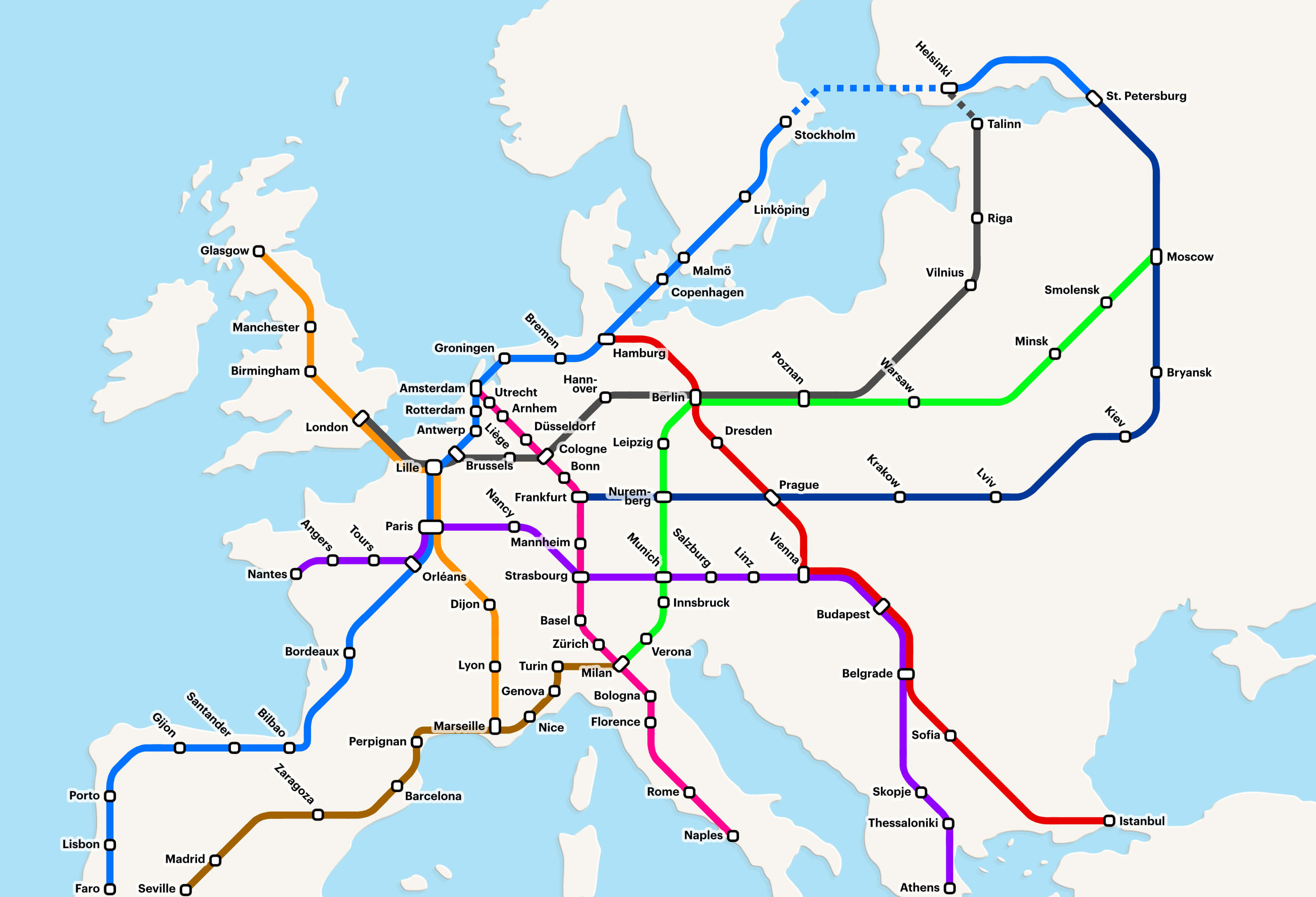
Simplified map of Europe showing major high-speed rail routes and key cities
Simplified map of Europe showing major high-speed rail routes and key cities.

This map provides a simplified overview of Europe’s high-speed rail network connecting major cities across the continent. It highlights key routes, making it easy for travellers and commuters to understand Europe’s efficient and extensive rail infrastructure.

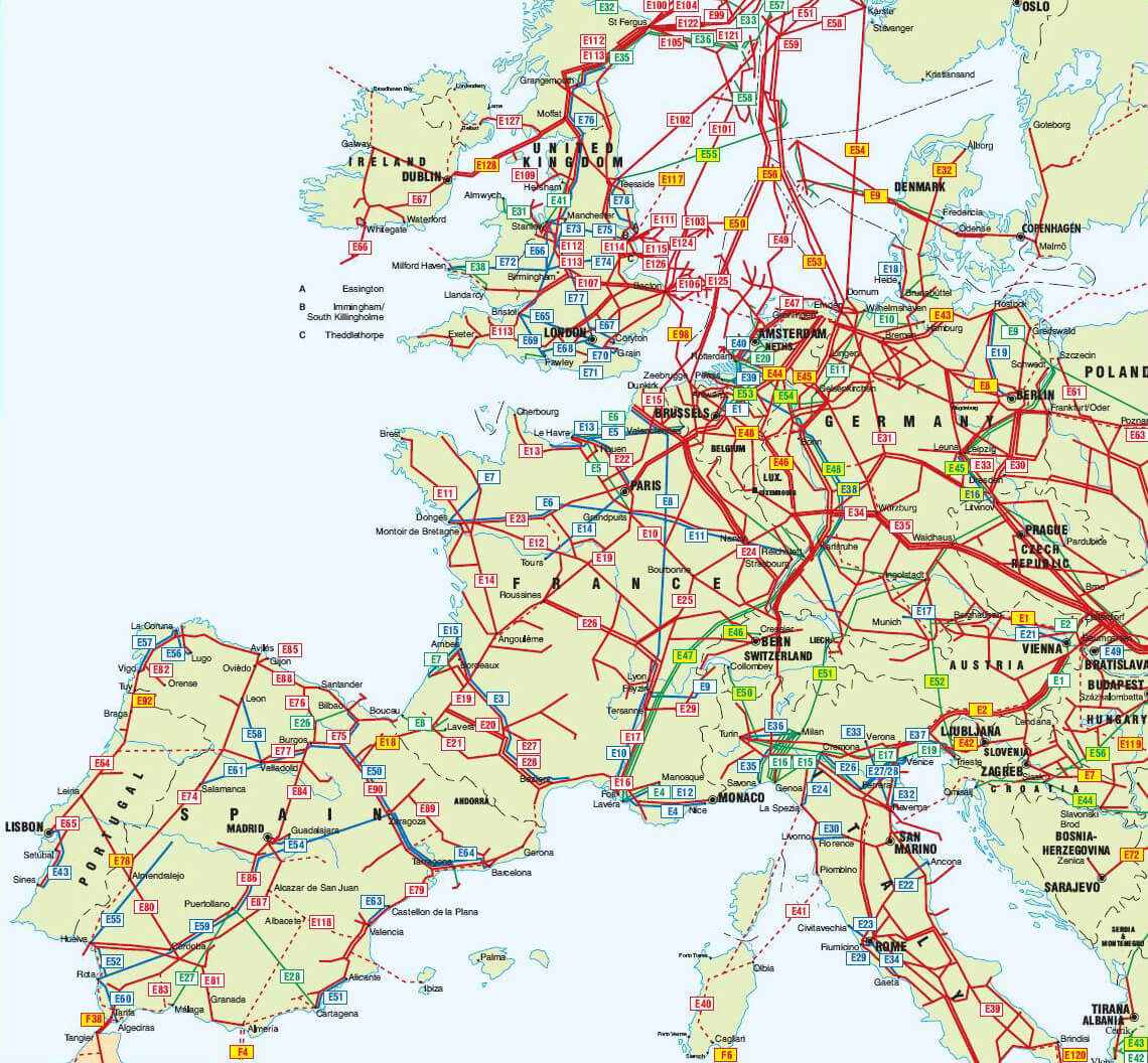
Map of the international Europe e-road network
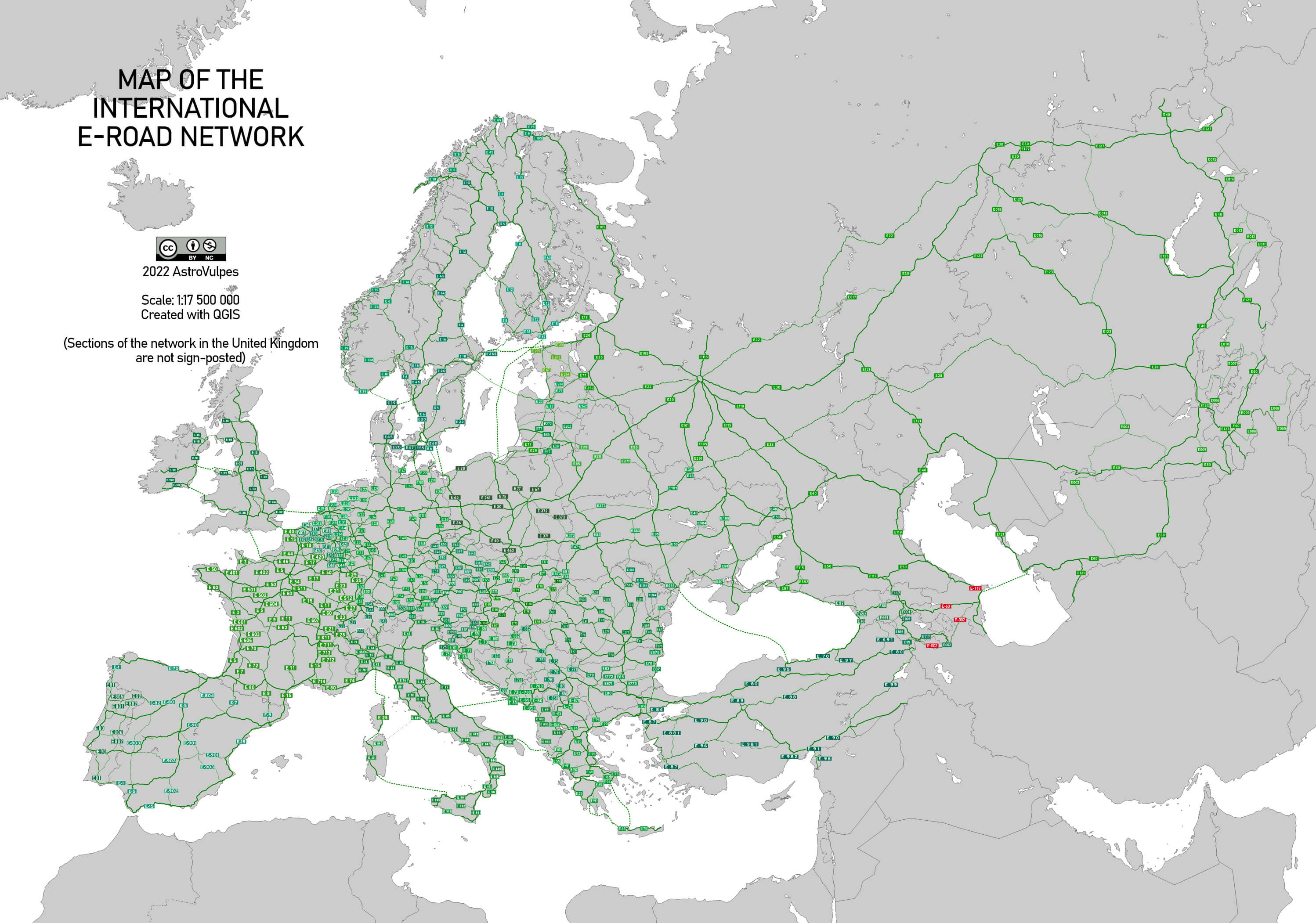
Map of the international Europe e-road network

Physical rivers route map of Europe
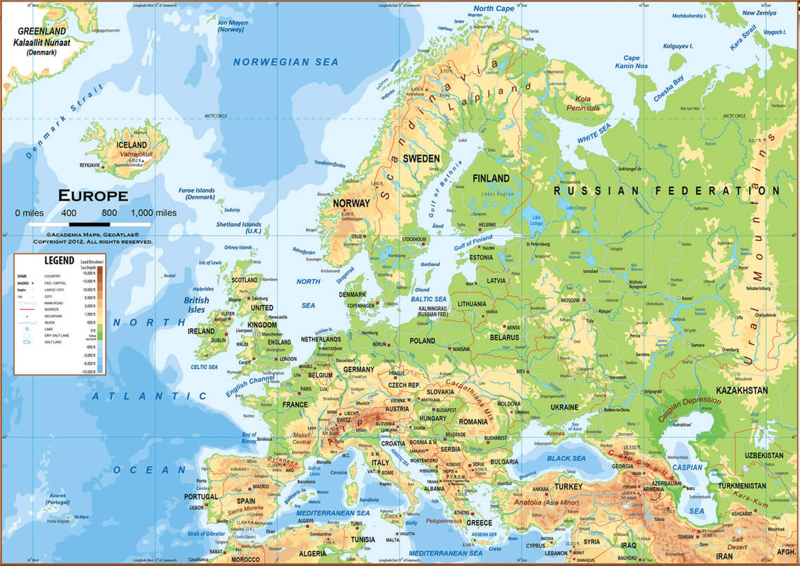
Physical rivers route map of Europe

Where is Europe on the World Map?

Show Google Interactive Maps and satellite maps of where the country is located.

Get directions by driving, walking, bicycling, public transportation and travel with street view.

Feel free to explore these pages as well:

- Advertisement -
Previous article
Next article

Discover

Sponsor

Latest Posts

Andorra La Vella Map

Where is Andorra La Vella, geography of Andorra La Vella, enlargeable topographic map of Andorra La Vella, including political maps, physical map, cities map,...

Kentucky Photos

A Collection of Kentucky Photos Skylines Downtown Louisville View of Skyline downtown Louisville in Kentucky USA. Horse Farm in Kentucky Horse farm in Kentucky, United States of America. Kentucky...

Discover the Timeless Charm of Athens: The Heart of Ancient Greece

In the heart of the Mediterranean, where the whispers of ancient philosophers still echo through the alleyways and where modern life thrives amidst millennia-old...

Taiwan Photos

About Taiwan, destinations of Taiwan, photos, statistics, images, touristic attractions and google map. National Taiwan University, Taiwan Taipei, Taiwan skyline over National Taiwan University. New Taipei, Taiwan New...

Map of North Korea

A collection maps of North Korea; View a variety maps of North Korea physical, political, relief map. Satellite image of North Korea, higly detalied...