- Advertisement -
Explore the diverse geography and history of Europe through a collection of maps, including the political map of European countries, the European Union member state map, historical maps of Europe and Europe in the context of the world map. Explore regional divisions such as Northern, Southern, Western and Eastern Europe, as well as economic and regional border maps that reveal the continent’s rich complexity and global importance.
A Comprehensive Map of European Countries
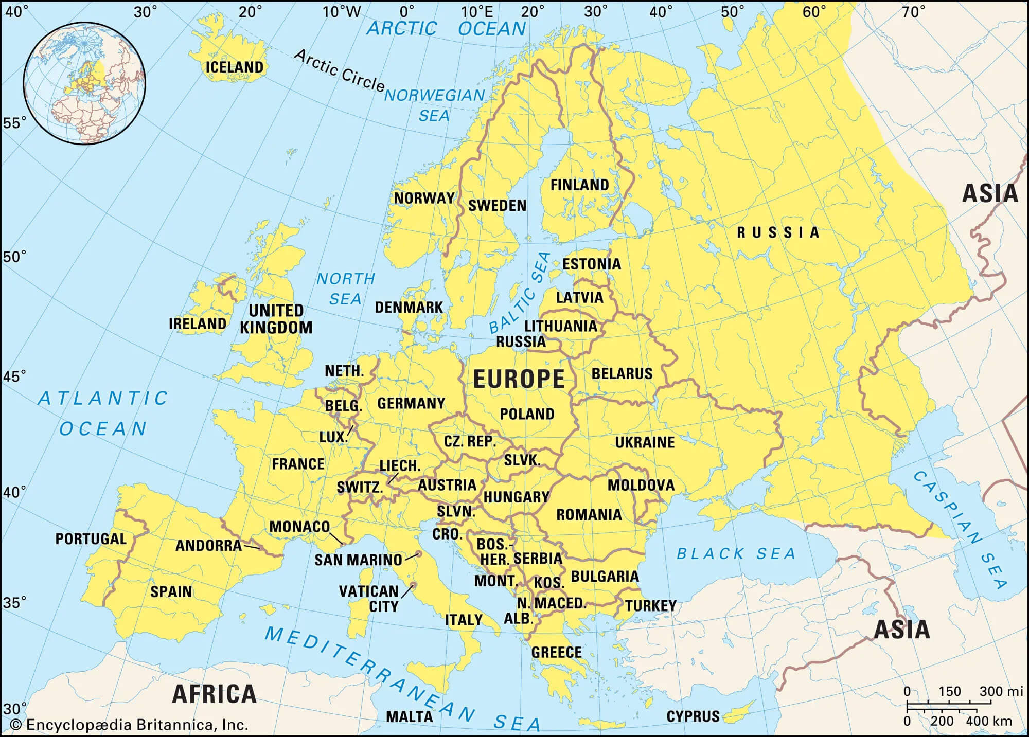
 Map of Europe highlighting countries and geographic features.
A vibrant map showcasing European countries and their geographic boundaries. Discover key regions, capitals, and neighboring countries across Europe, from Scandinavia to the Mediterranean, perfect for geography enthusiasts and travelers.
Physical Map of Europe with Country Boundaries
 Physical map of Europe showing countries, rivers, and mountain ranges.
A detailed physical map of Europe showing country boundaries, rivers and mountain ranges. Discover geographical features such as the Alps, Urals and major bodies of water, as well as key regions of the continent. Perfect for geography and travel enthusiasts.
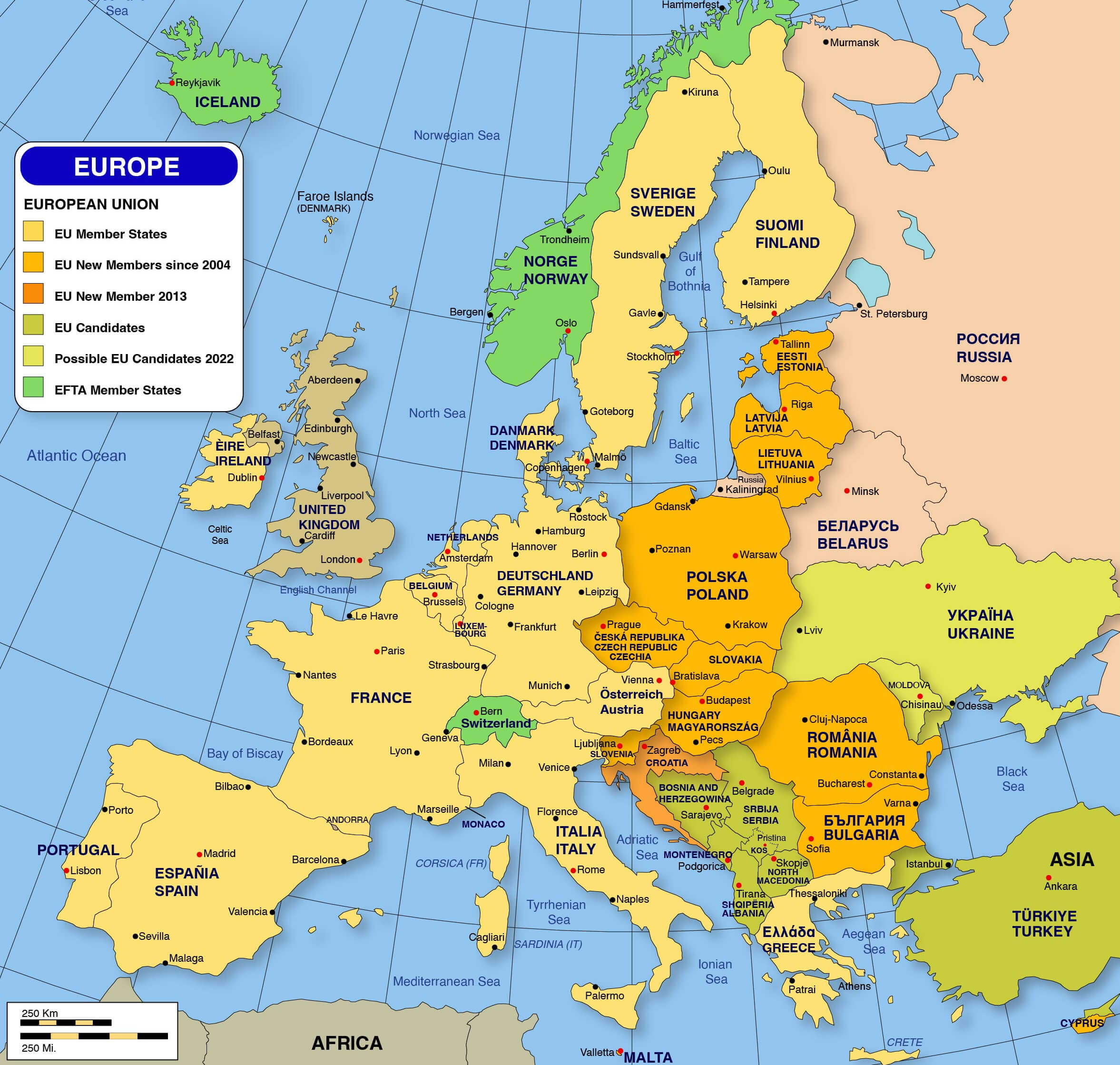
Map of Europe Highlighting EU Member States and Candidates

Map of Europe showing EU member states and candidate countries.
A map of Europe showing EU member states, new members since 2004 and candidate countries. Easily identify regions within the European Union, EFTA members and potential future members. A great resource for understanding Europe’s political and economic landscape.
Map of Europe Featuring Countries and Major Cities
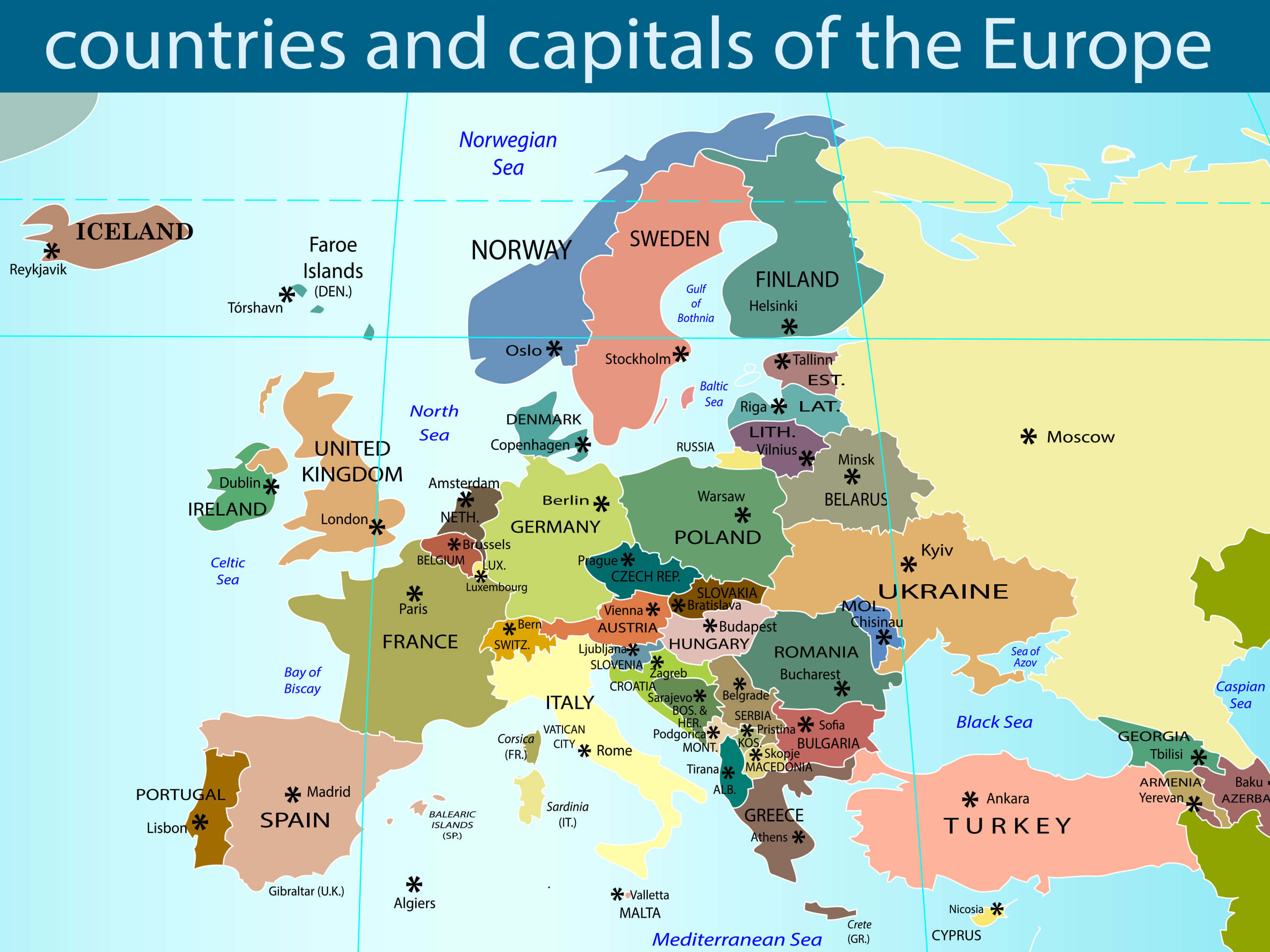
 Map of Europe with countries, capitals, and major cities labeled.
A detailed map of Europe showing country boundaries, capitals and major cities. Perfect for exploring the geographical layout of the continent, from the British Isles to Eastern Europe, with key regions and major cities highlighted throughout the map.
Map of European Countries with National Borders
 Map of Europe showing national borders and country names.
A map of Europe showing national boundaries, country names and major cities. Explore the geographical layout of European nations and their neighbouring regions, from Scandinavia to the Mediterranean, perfect for travellers and geography enthusiasts seeking a detailed overview.
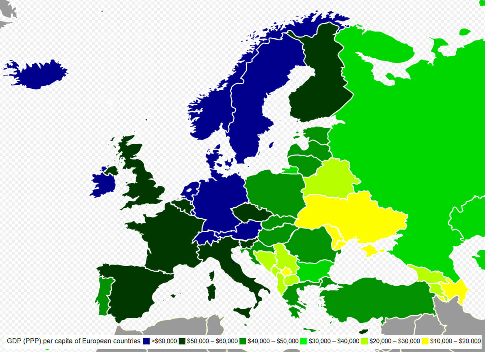
GDP Per Capita Across European Countries

Map of Europe showing GDP per capita by country with color-coded ranges.
A map showing the GDP per capita (PPP) of European countries using a colour-coded gradient. It highlights economic disparities, ranging from high-income countries in dark blue to low-income regions in yellow and green. Perfect for understanding Europe’s economic geography at a glance.
Map Highlighting Northern European Countries
 Map of Northern Europe with countries highlighted in orange.
A map focusing on the countries of Northern Europe, including Iceland, Ireland, the UK, Denmark, Norway, Sweden, Finland, Estonia, Latvia and Lithuania. It shows their geographical positions and provides a clear visual representation of the region. Ideal for understanding the layout of Northern Europe and its nations.
Map Highlighting Eastern European Countries
 Map of Eastern Europe with countries highlighted in orange.
A map showcasing Eastern European countries, including Poland, Belarus, Ukraine, Czechia, Slovakia, Hungary, Moldova, Romania, Bulgaria, and parts of Russia. It provides a clear visual of the region’s geography, ideal for understanding the political and cultural layout of Eastern Europe.
Map Highlighting Southern European Countries
 Map of Southern Europe with countries highlighted in orange.
A map of southern European countries including Portugal, Spain, Andorra, Italy, Vatican City, San Marino, Malta, Slovenia, Croatia, Greece and more. This map visually highlights the Mediterranean region and provides an insight into the geographical and cultural landscape of Southern Europe.
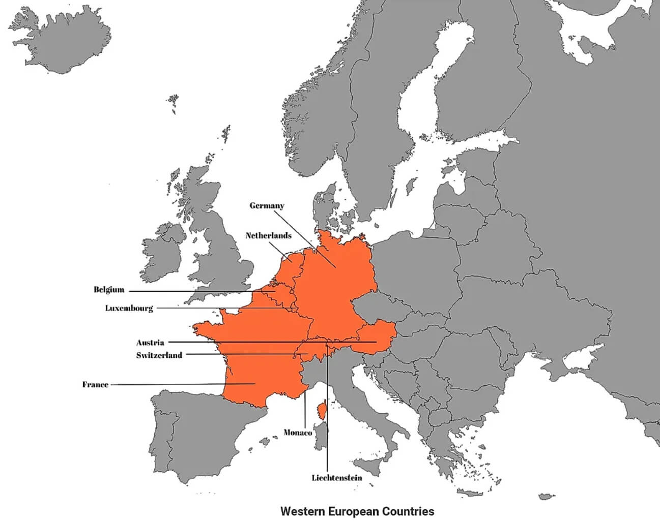
Map Highlighting Western European Countries

Map of Western Europe with countries highlighted in orange.
A map showcasing Western European countries, including France, Germany, Austria, Switzerland, Belgium, Netherlands, Luxembourg, Monaco, and Liechtenstein. It provides a clear visual of the region’s geography and cultural layout, emphasizing its central role in European history and development.
Explore Europe’s Capitals and Major Cities on a Detailed Map
 Map of Europe showing countries, capitals, and major cities in detail
A detailed map of Europe highlighting countries, capitals and major cities, perfect for travellers and geography enthusiasts. Easily identify places such as Paris, Rome, Berlin and Istanbul, as well as smaller towns and cities across Europe’s vast landscape.
Eastern Europe map

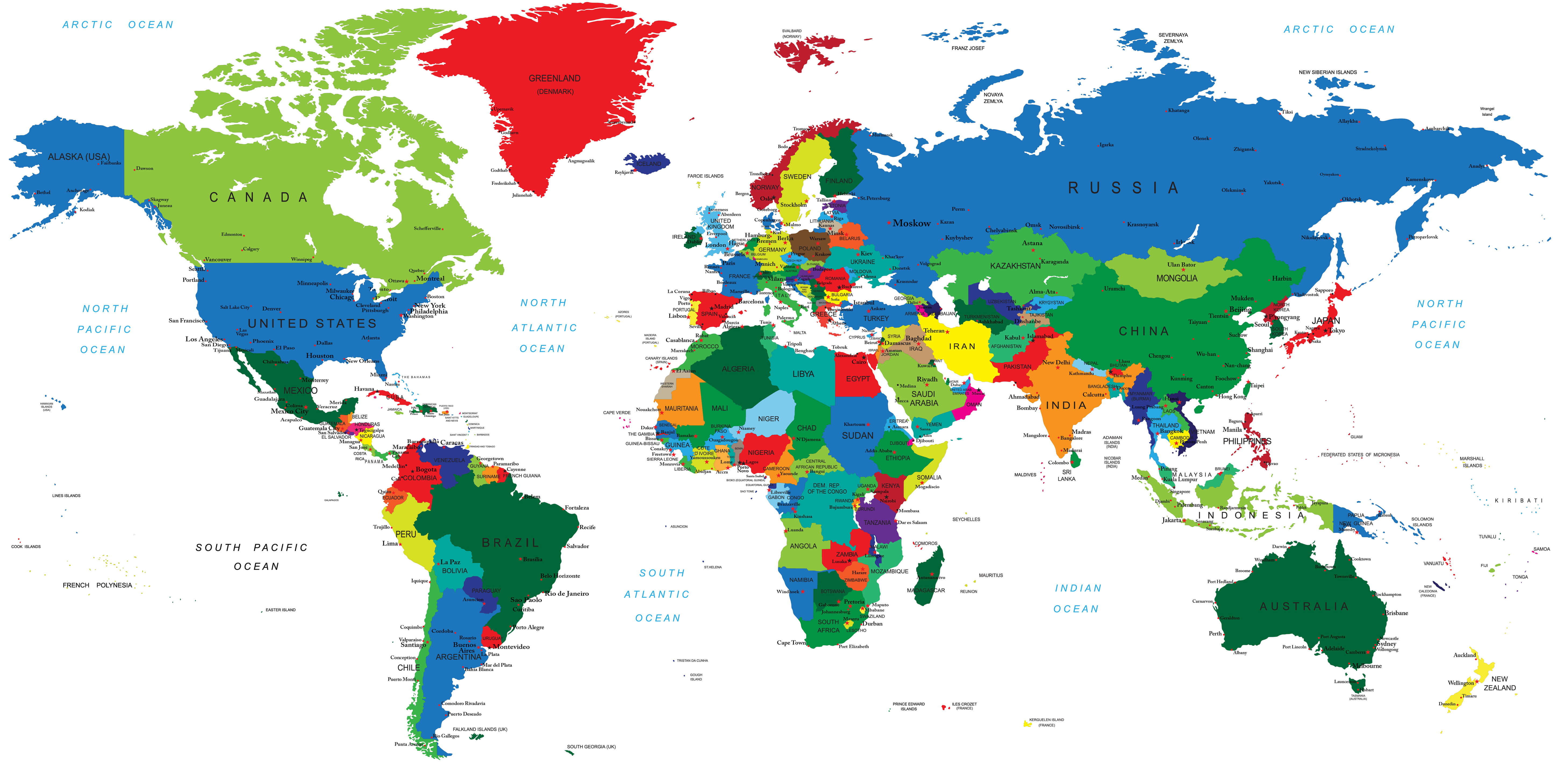
Europe and the World map

Map of Europe with countries

Map of Europe Highlighting EU Member States and Candidates
 Map of Europe showing EU member states and candidate countries.
A map of Europe showing EU member states, new members since 2004 and candidate countries. Easily identify regions within the European Union, EFTA members and potential future members. A great resource for understanding Europe’s political and economic landscape.
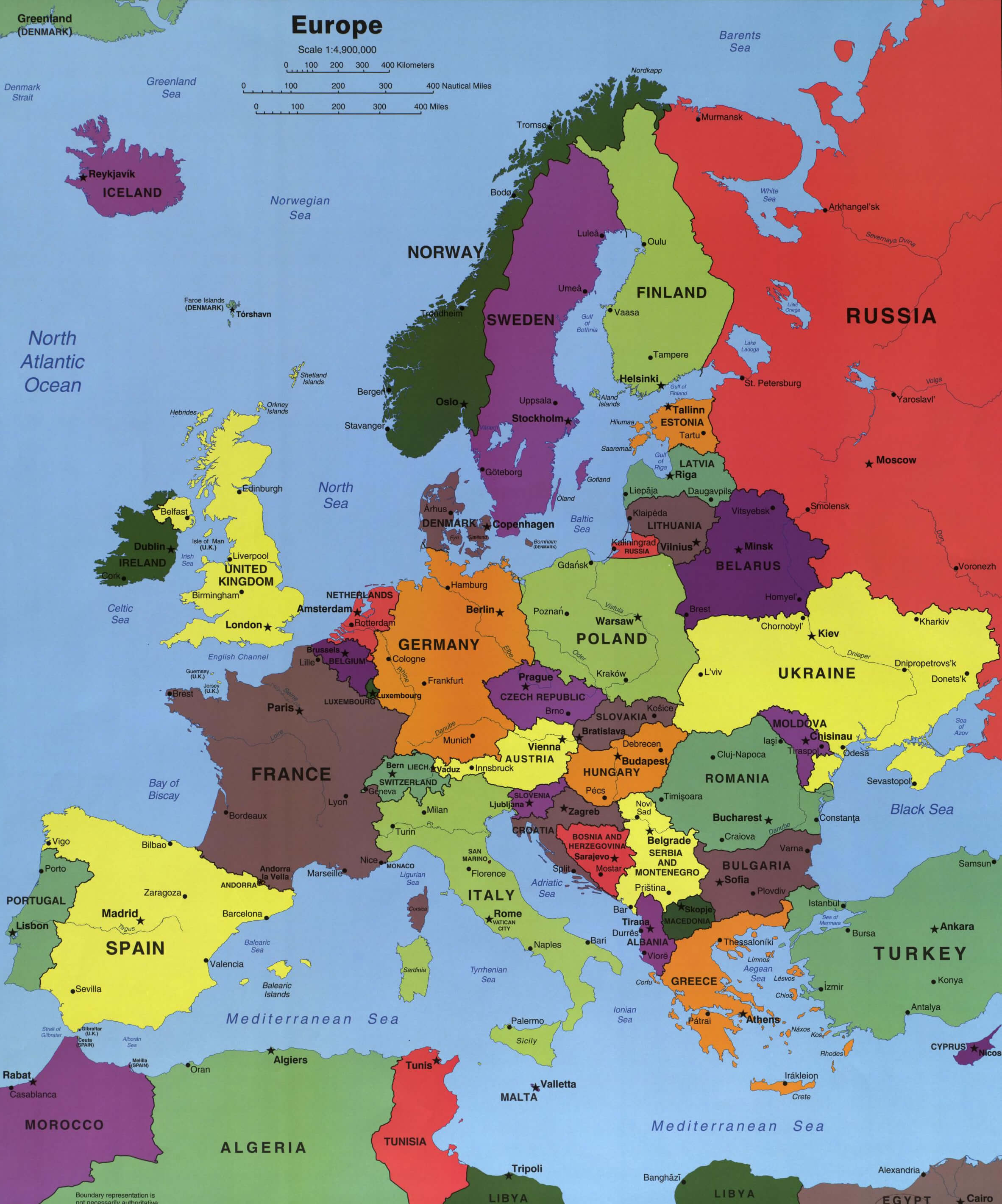
Europe Countries Map

Maps of European Countries

Europe countries map with Asia and Africa

Countries capitals of the Europe map

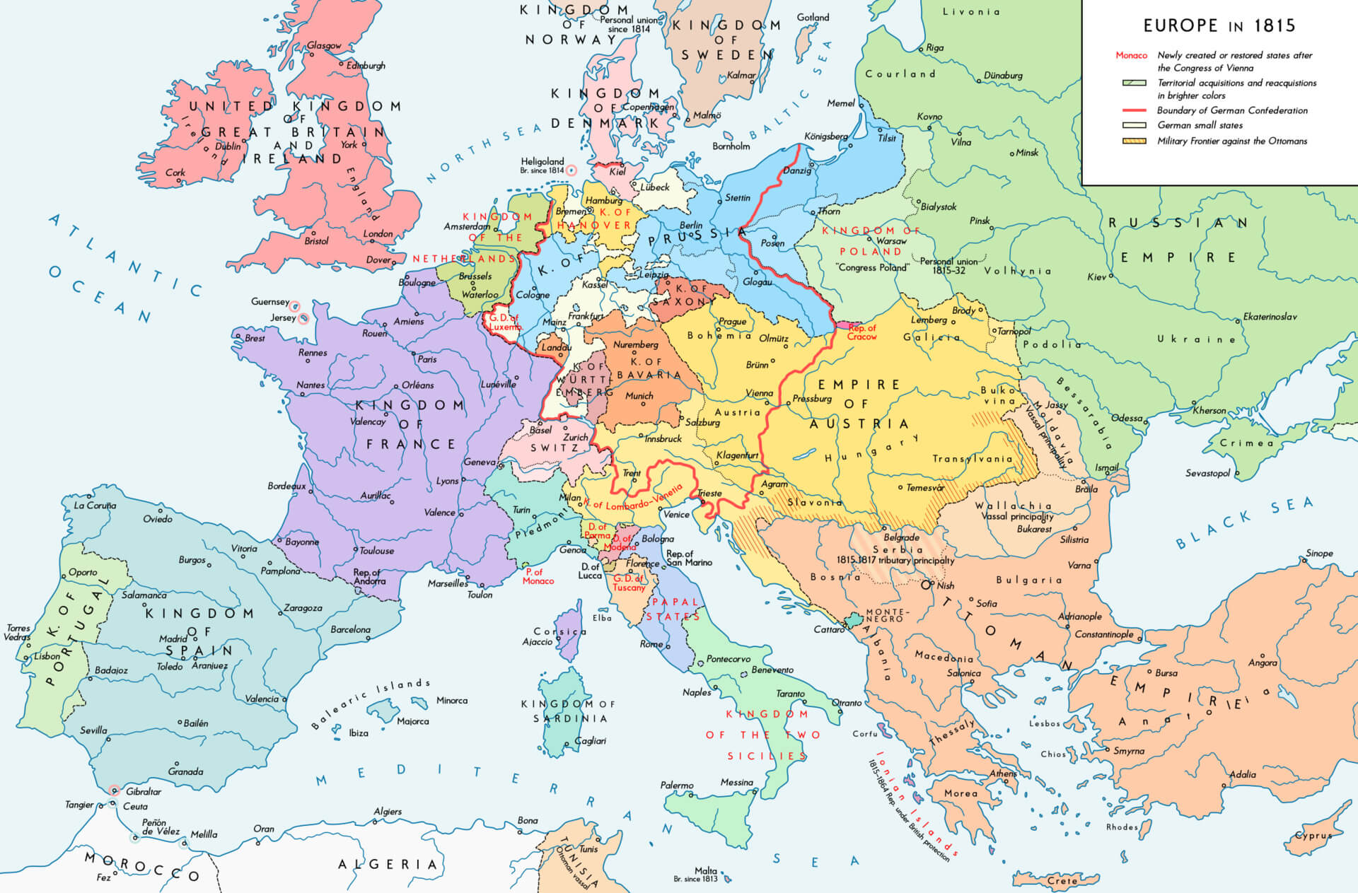
Historical Map of Europe in 1815 Post-Congress of Vienna
 Map of Europe in 1815 after the Congress of Vienna, showing borders and kingdoms.
A historical map of Europe in 1815, illustrating the political boundaries established after the Congress of Vienna. Explore restored states, territorial acquisitions, and key empires like Austria, Prussia, and Russia during this pivotal post-Napoleonic era in European history.
Europe Maps

Map of Europe’s Main Regions by Borders and Cultural Proximities
 Map of Europe divided into main regions based on state borders and cultural proximities.
A map highlighting the main regions of Europe – Northern, Western, Central, Southern and Southeastern Europe – based on actual state borders and cultural proximity. Explore the continent’s diverse cultural and geographic divisions with this visually detailed map.
Blank Map of Europe

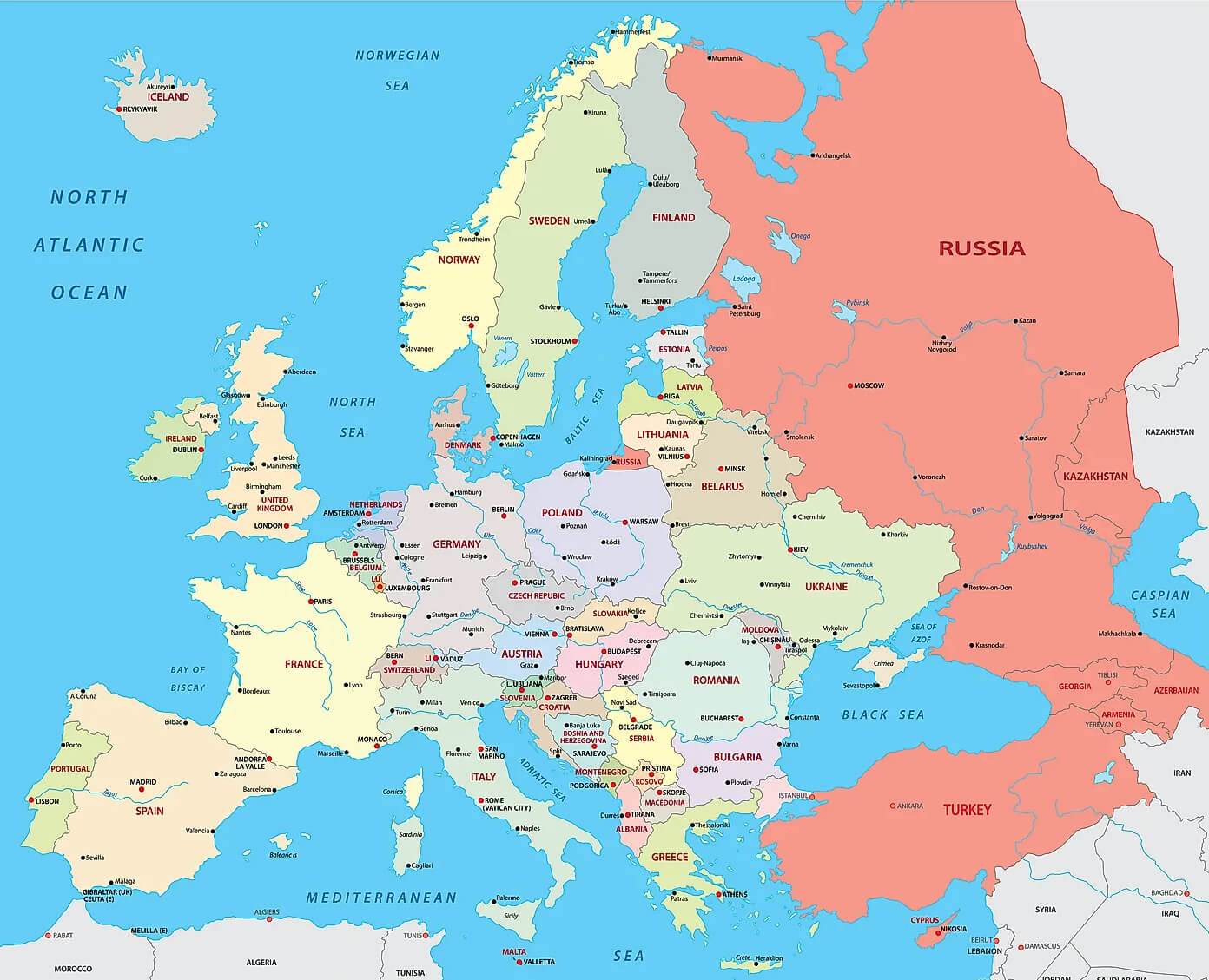
Map of European Countries with National Borders
 Map of Europe showing national borders and country names.
A map of Europe showing national boundaries, country names and major cities. Explore the geographical layout of European nations and their neighbouring regions, from Scandinavia to the Mediterranean, perfect for travellers and geography enthusiasts seeking a detailed overview.
European countries map

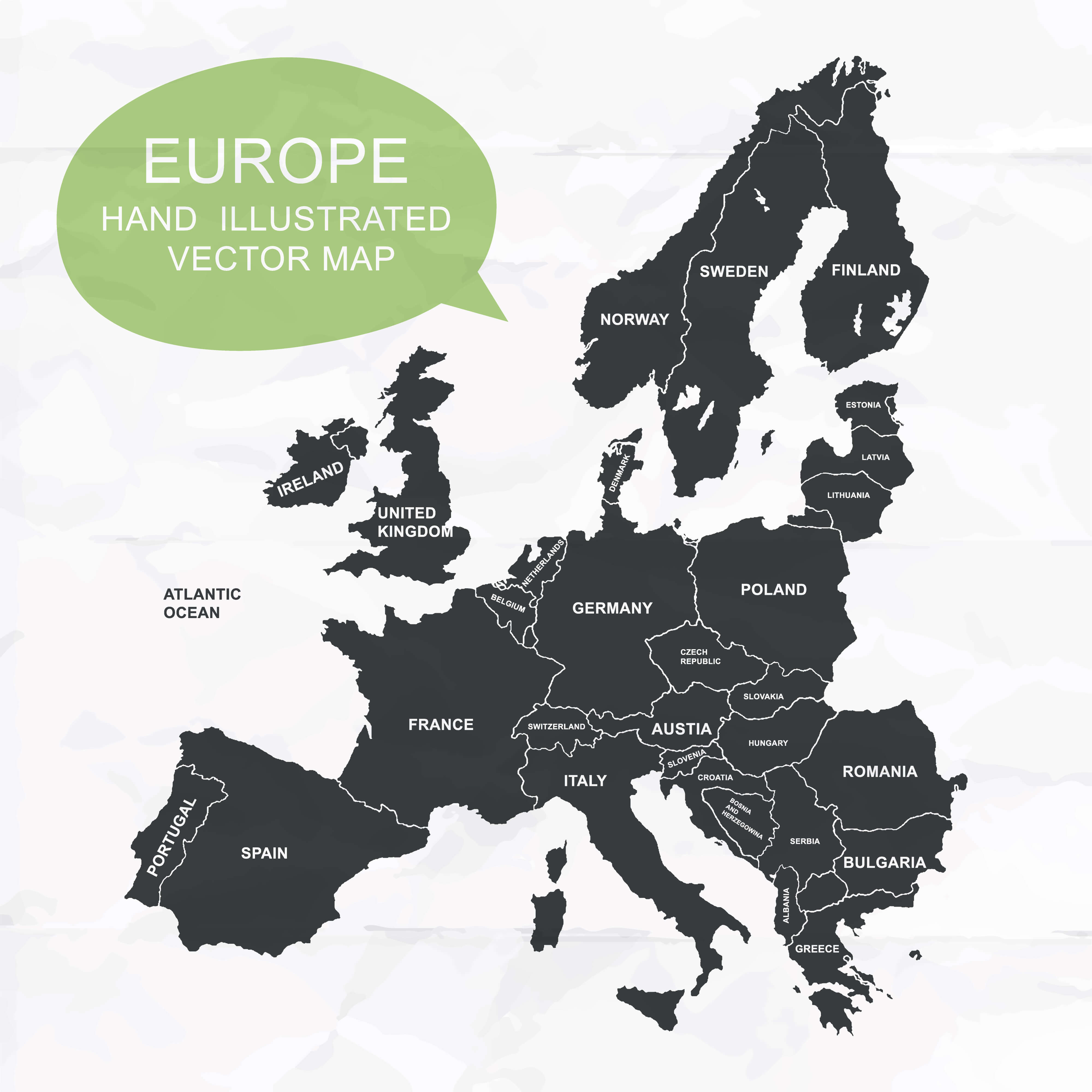
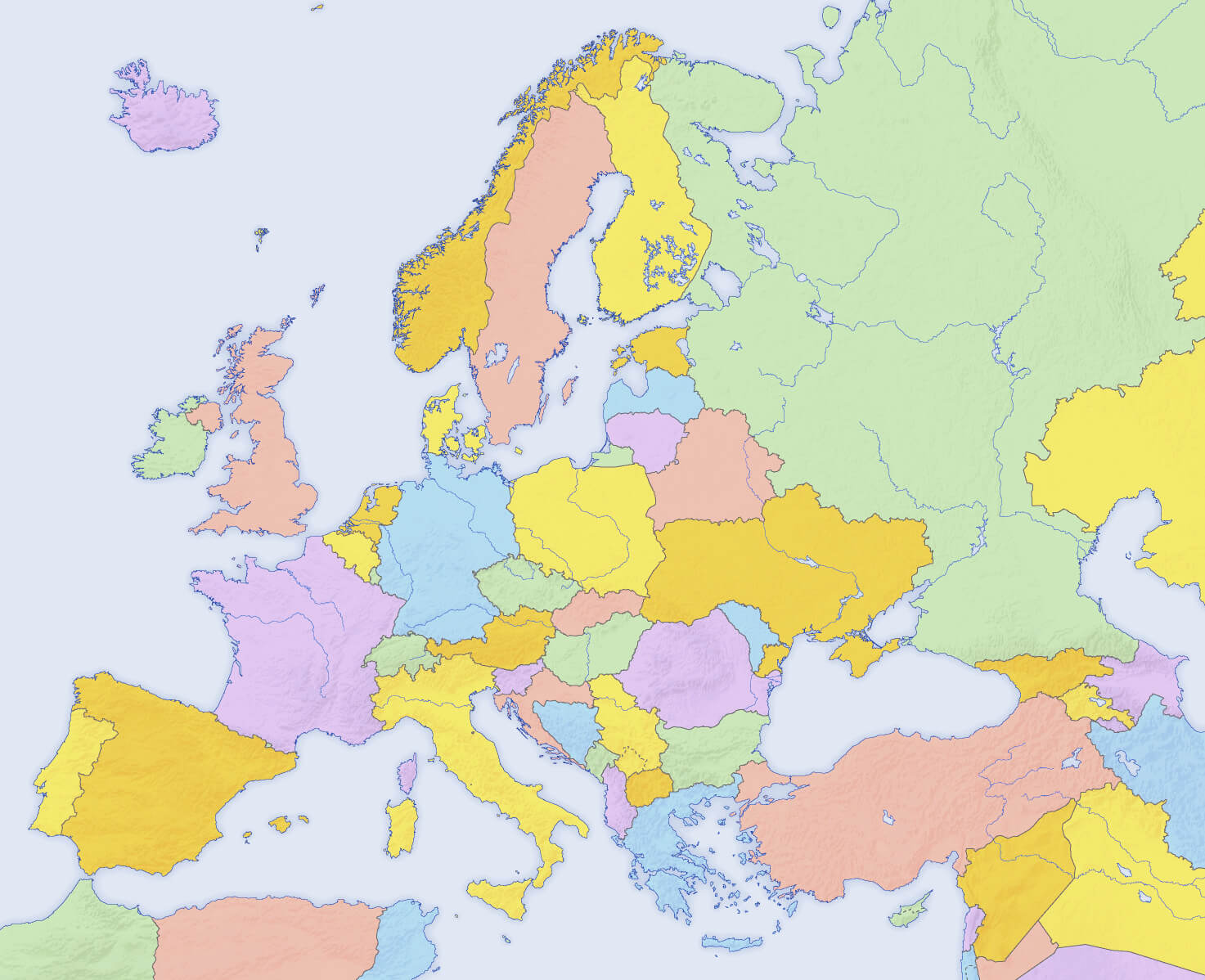
Europe colorful countries blank map

Colonization Map of European Powers in 1914
 Map of European countries and their colonies worldwide in 1914.
A map showcasing the colonial empires of European countries in 1914, just before World War I. It highlights territorial control across Africa, Asia, and the Americas by powers like the UK, France, Germany, and Russia, offering insights into the global influence of European nations during this period.
Where is Europe on the World Map?
Show Google Interactive Maps and satellite maps of where the country is located.
Get directions by driving, walking, bicycling, public transportation and travel with street view.
Feel free to explore these pages as well:
- Advertisement -
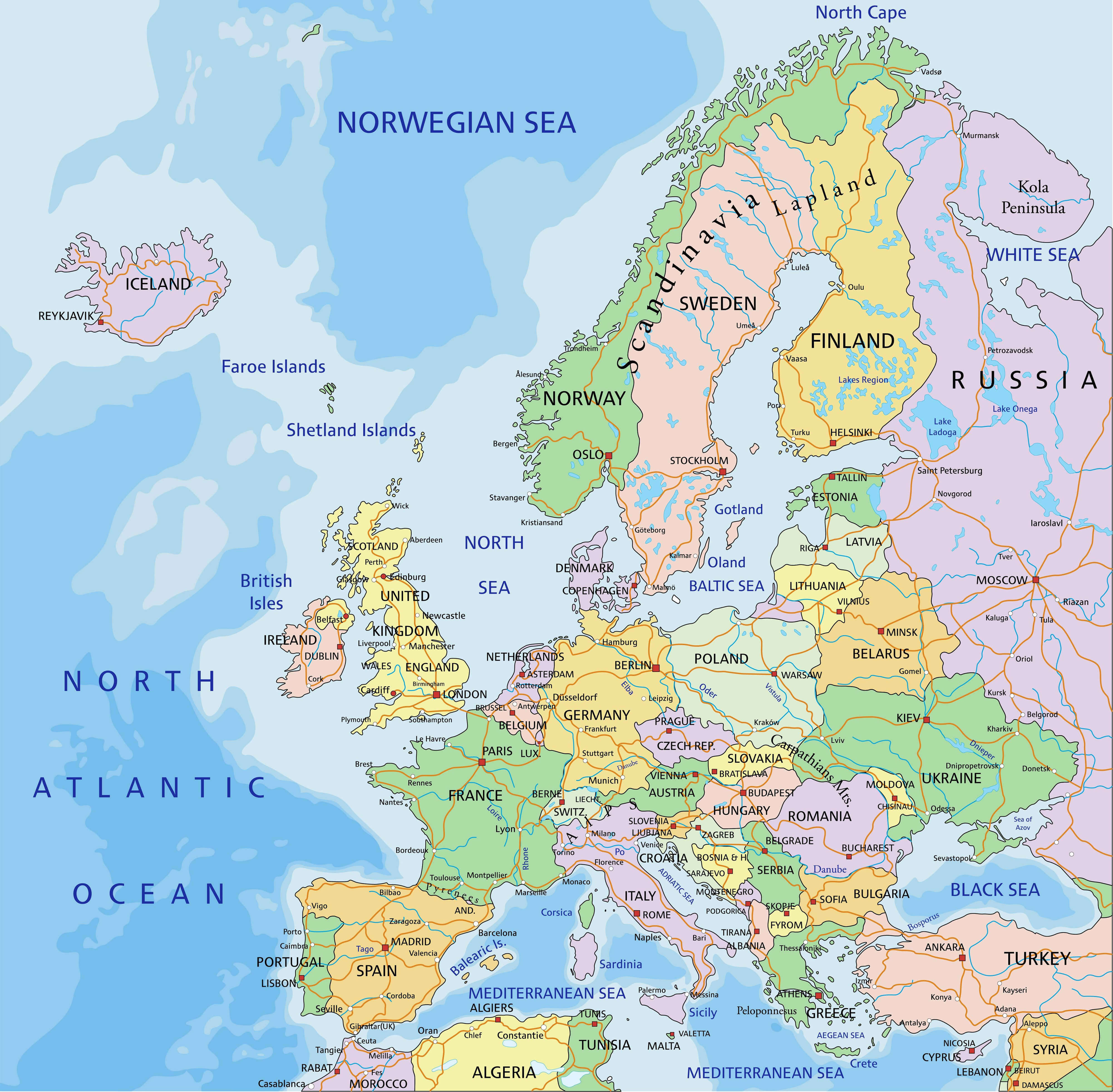 Map of Europe highlighting countries and geographic features.
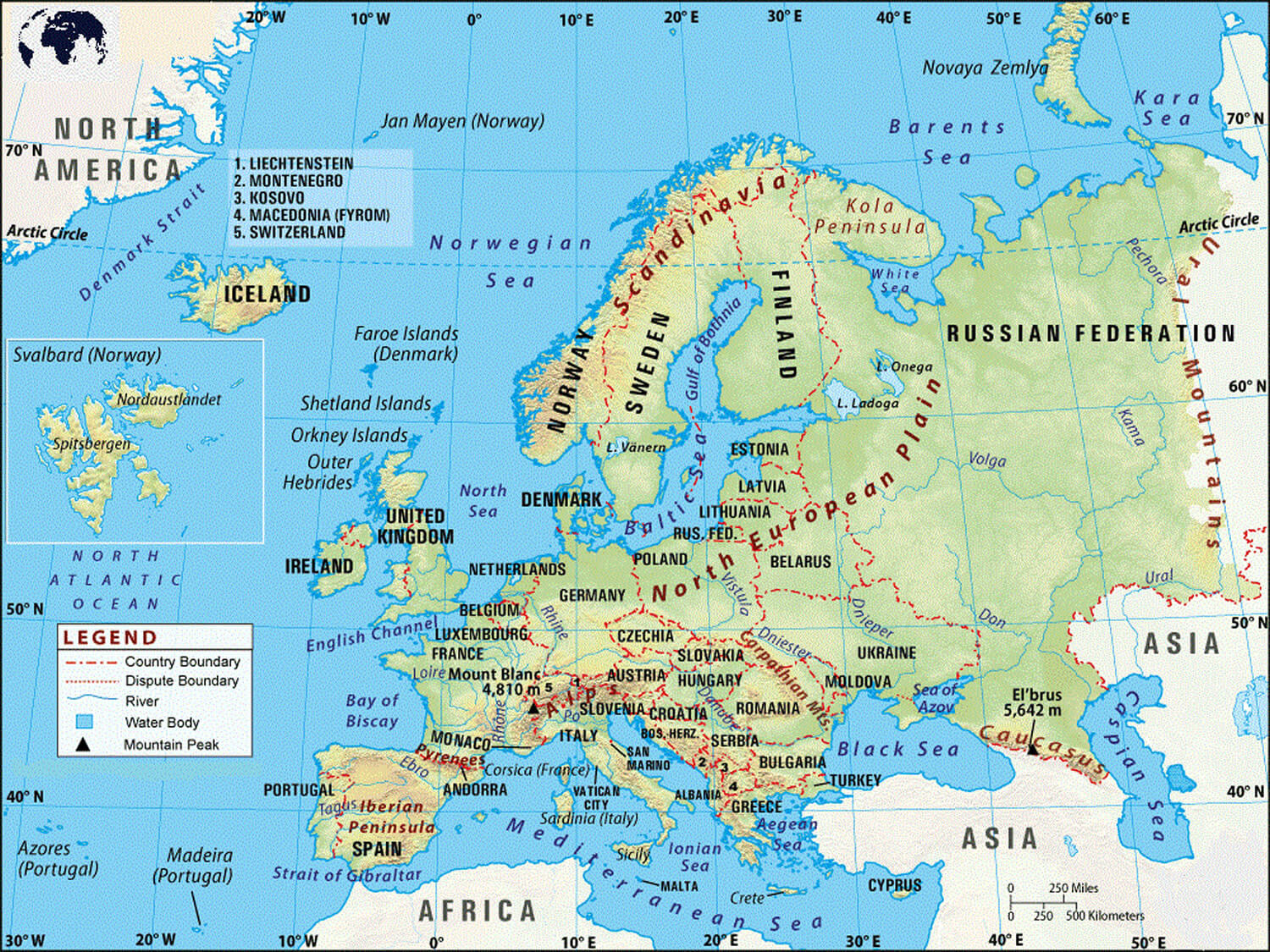 Physical map of Europe showing countries, rivers, and mountain ranges.
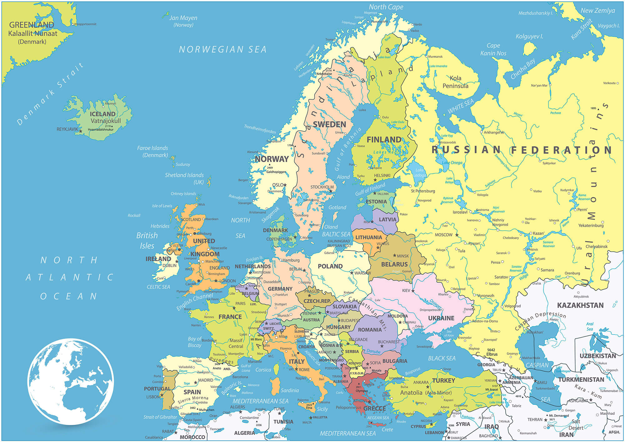 Map of Europe with countries, capitals, and major cities labeled.
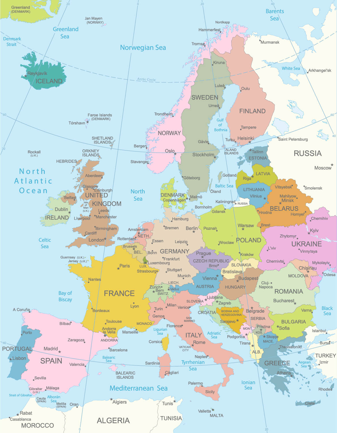 Map of Europe showing national borders and country names.
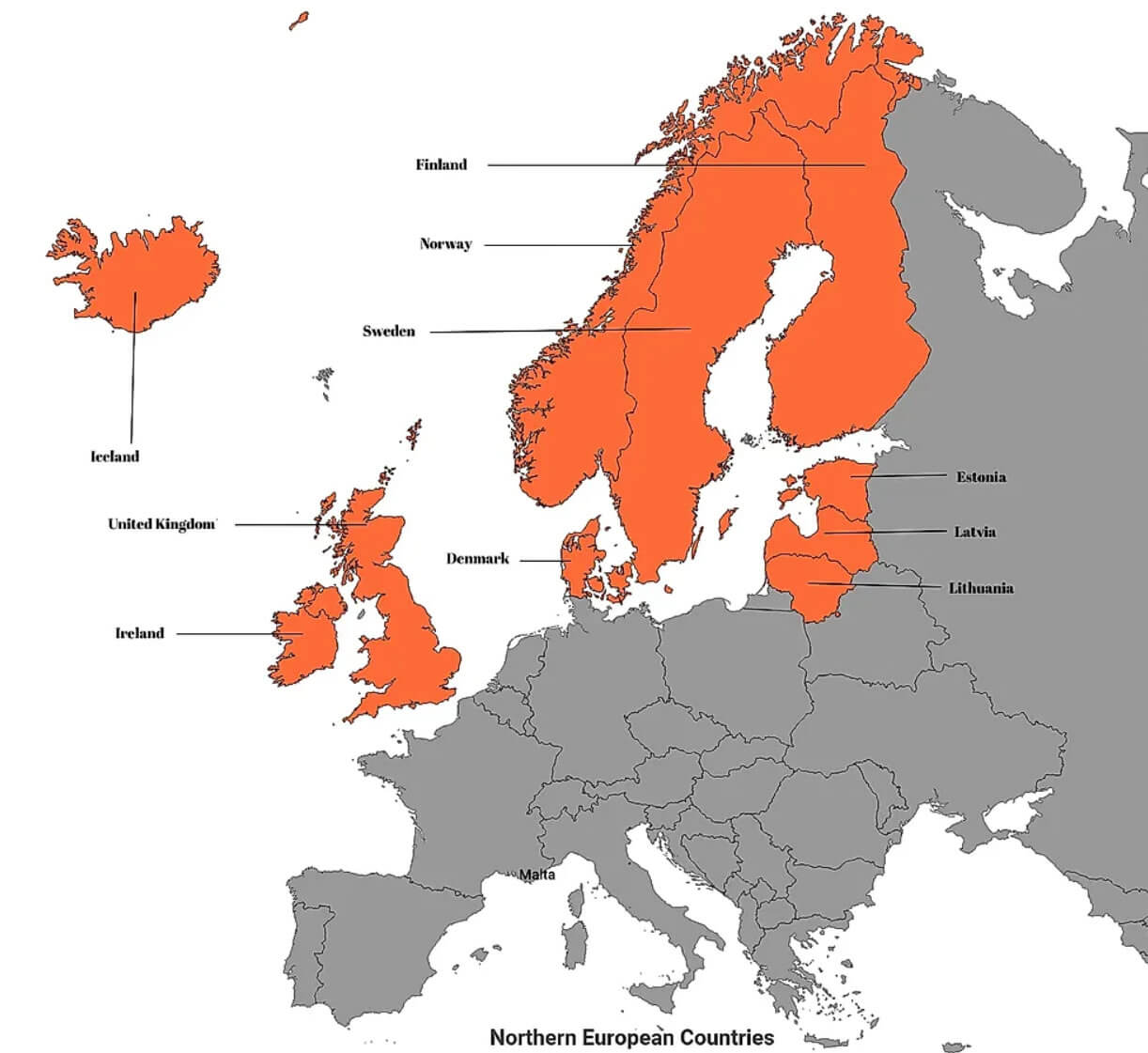 Map of Northern Europe with countries highlighted in orange.
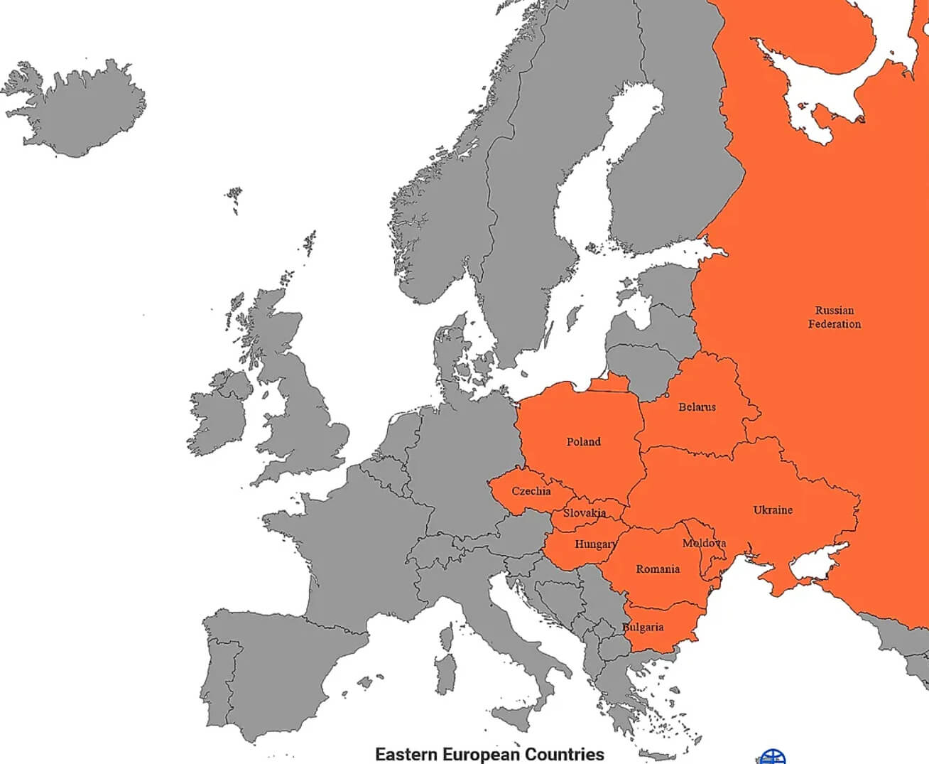 Map of Eastern Europe with countries highlighted in orange.
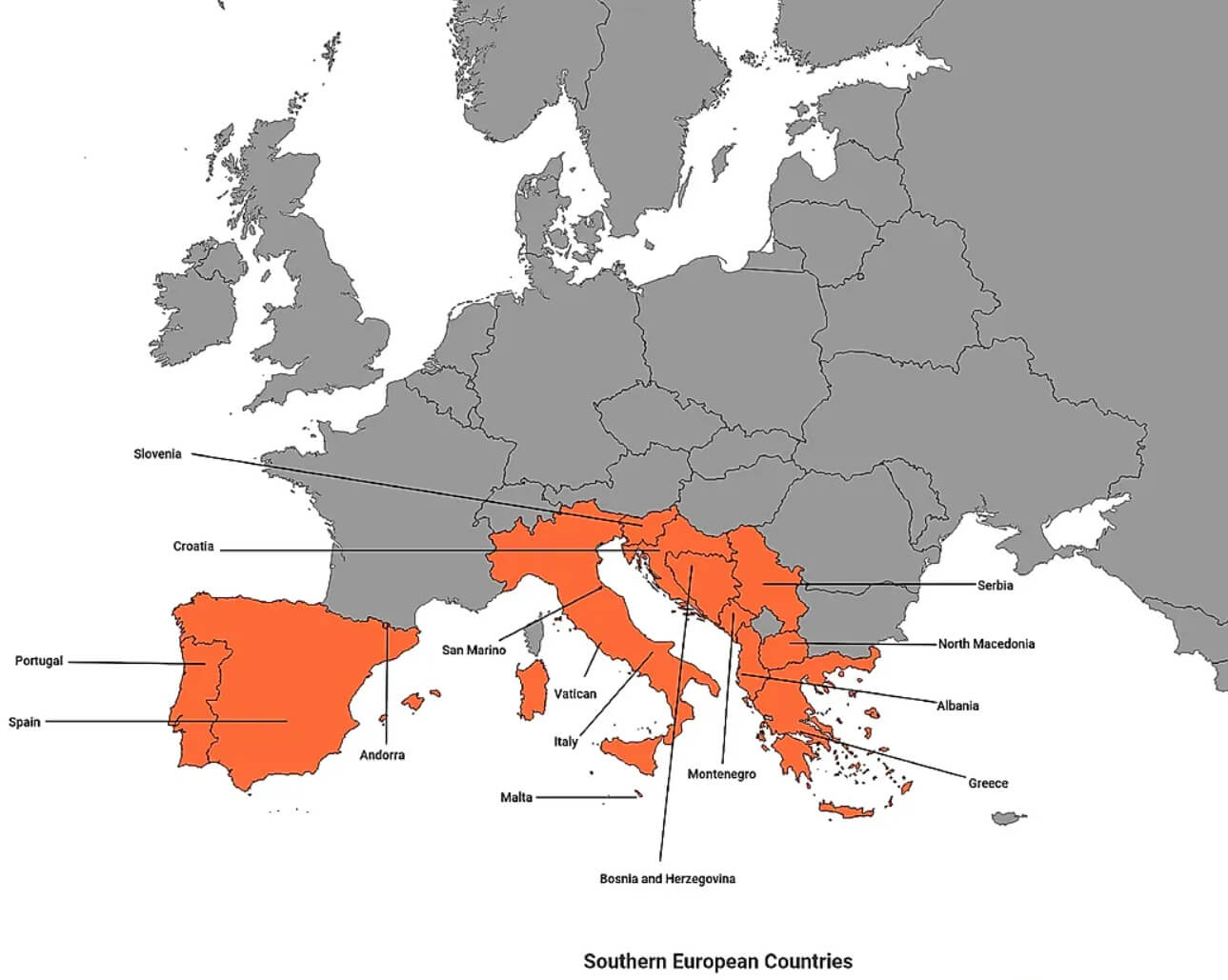 Map of Southern Europe with countries highlighted in orange.
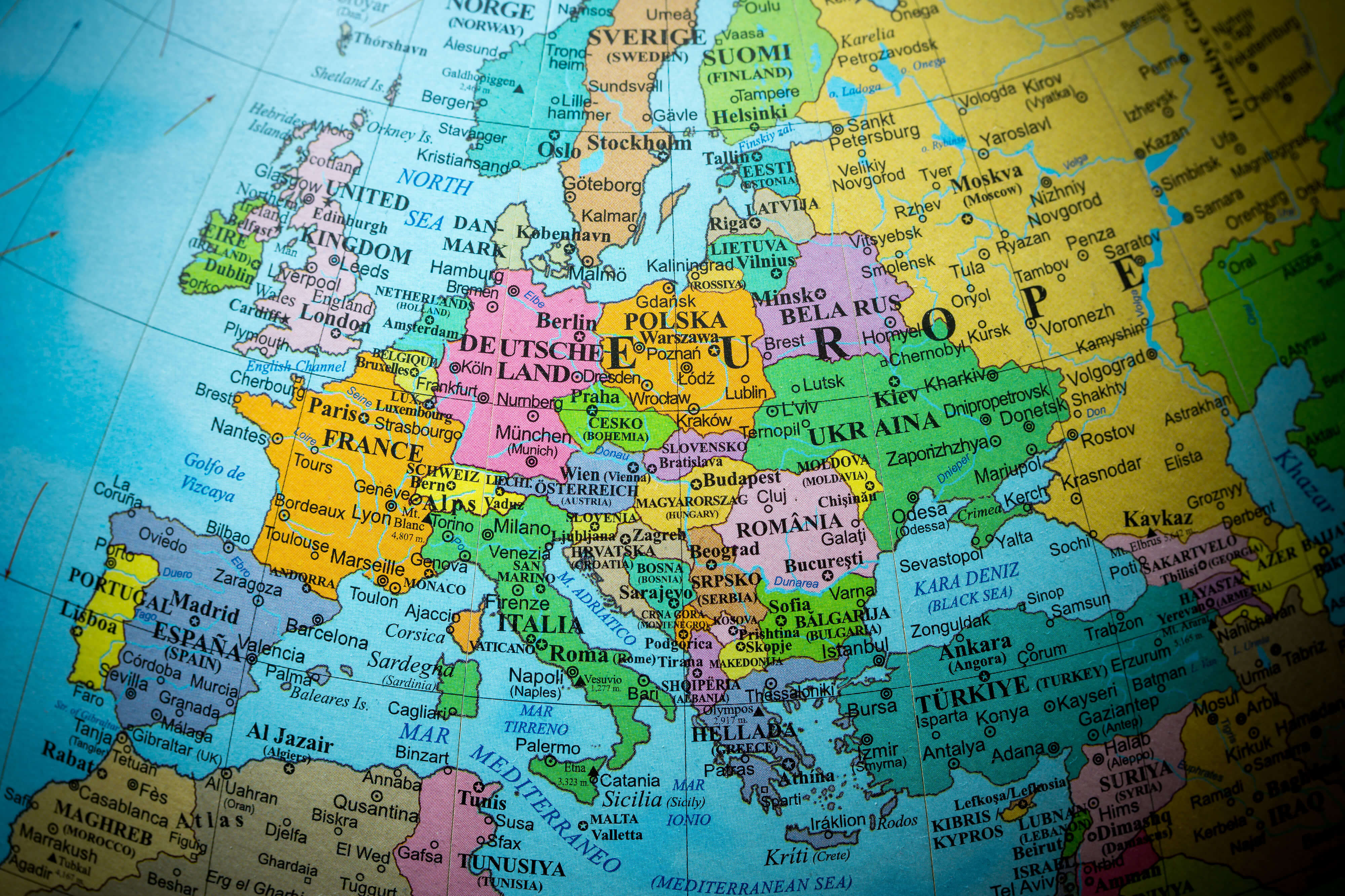 Map of Europe showing countries, capitals, and major cities in detail
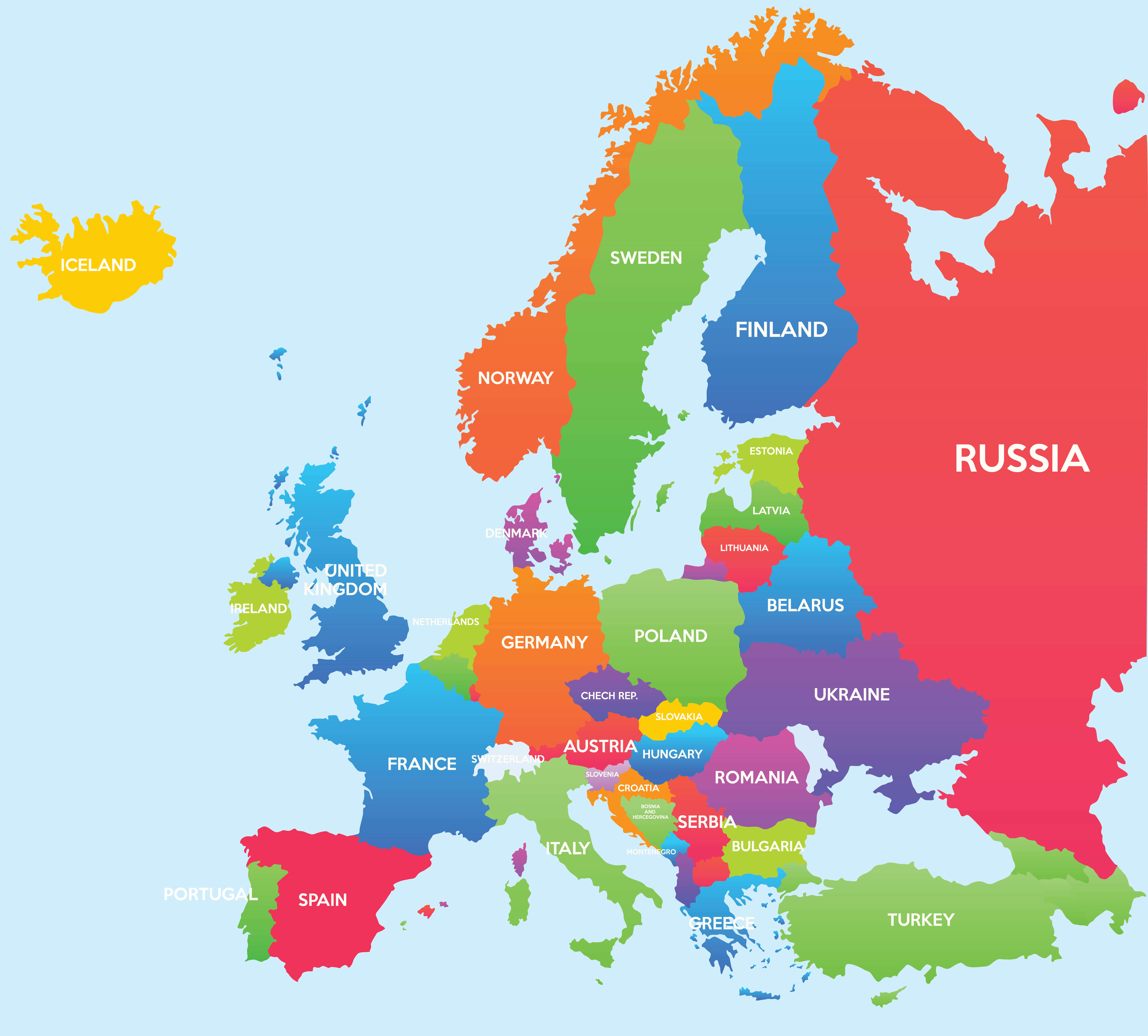
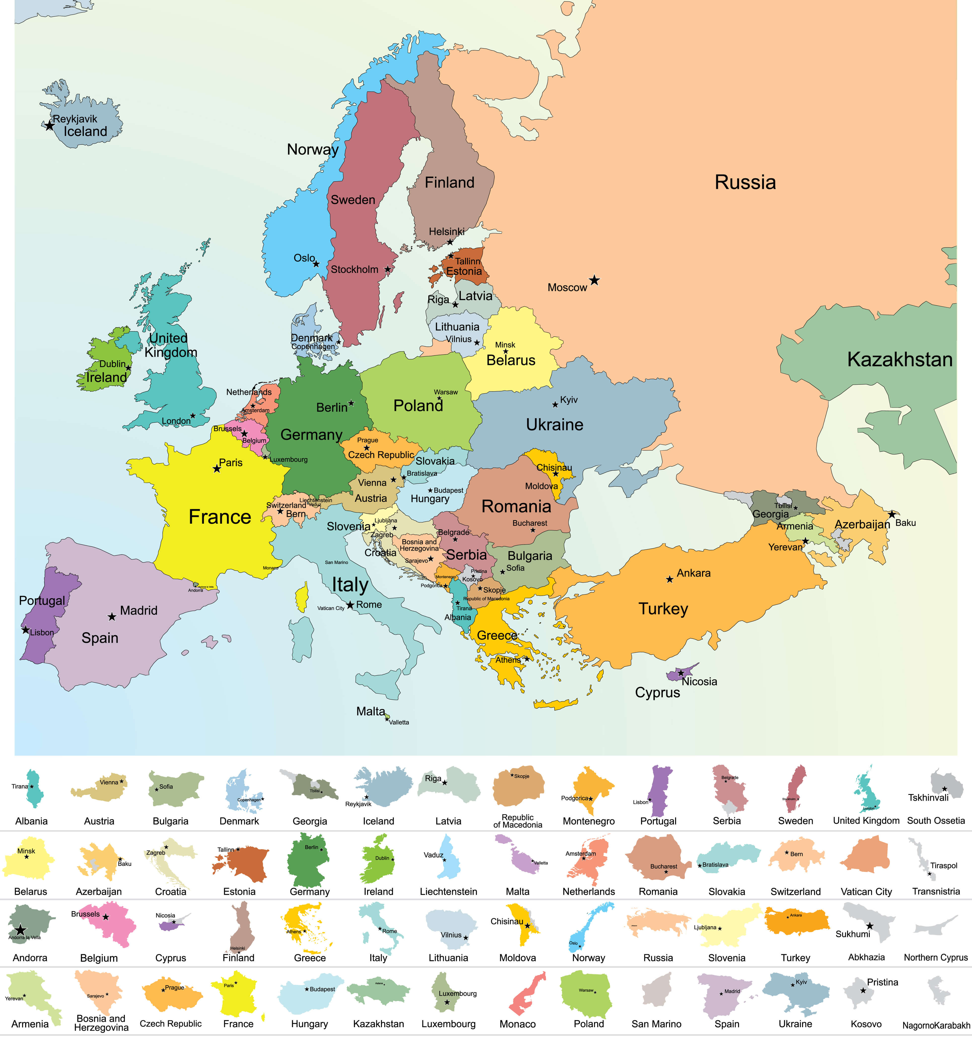
 Map of Europe showing EU member states and candidate countries.
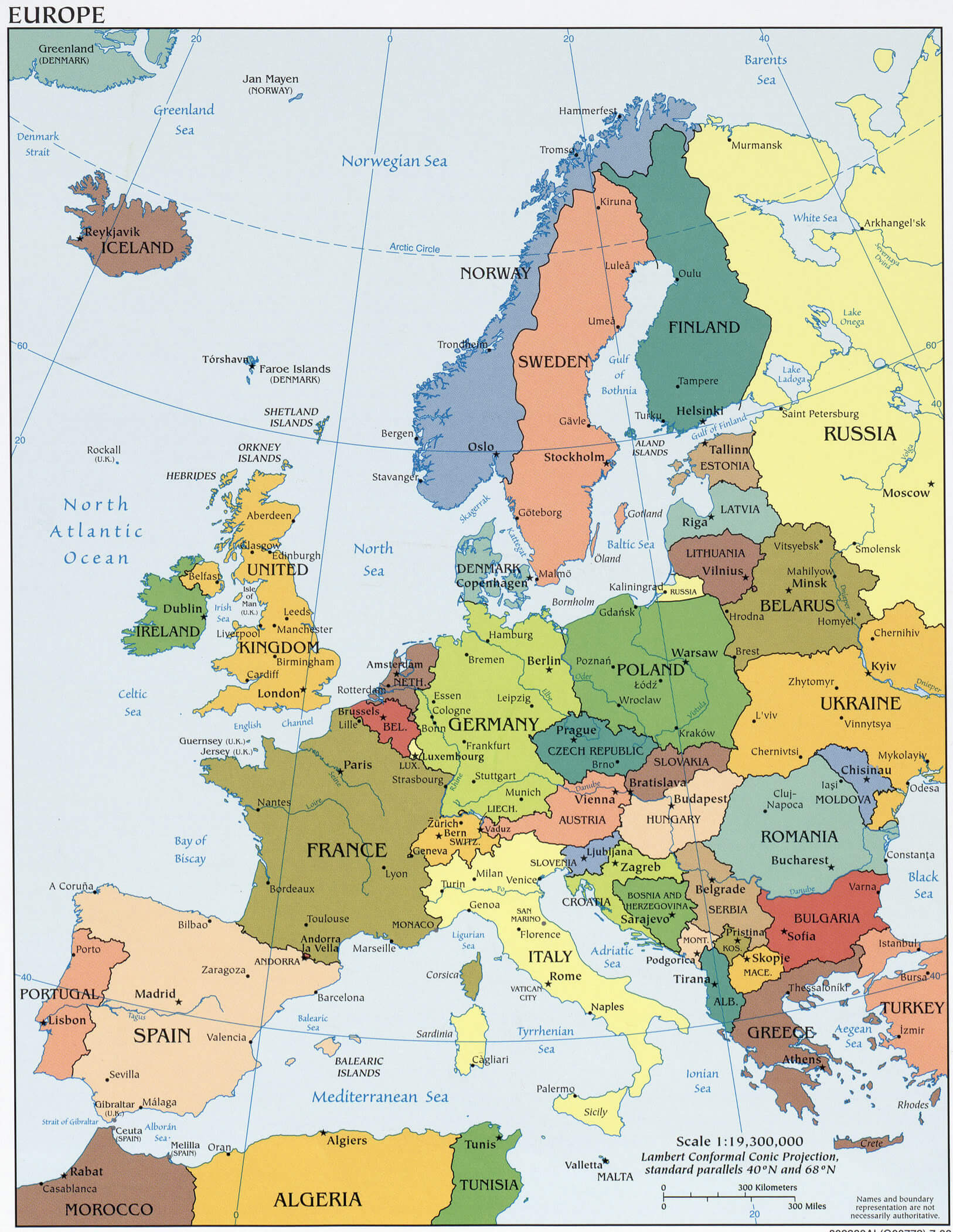
 Map of Europe in 1815 after the Congress of Vienna, showing borders and kingdoms.
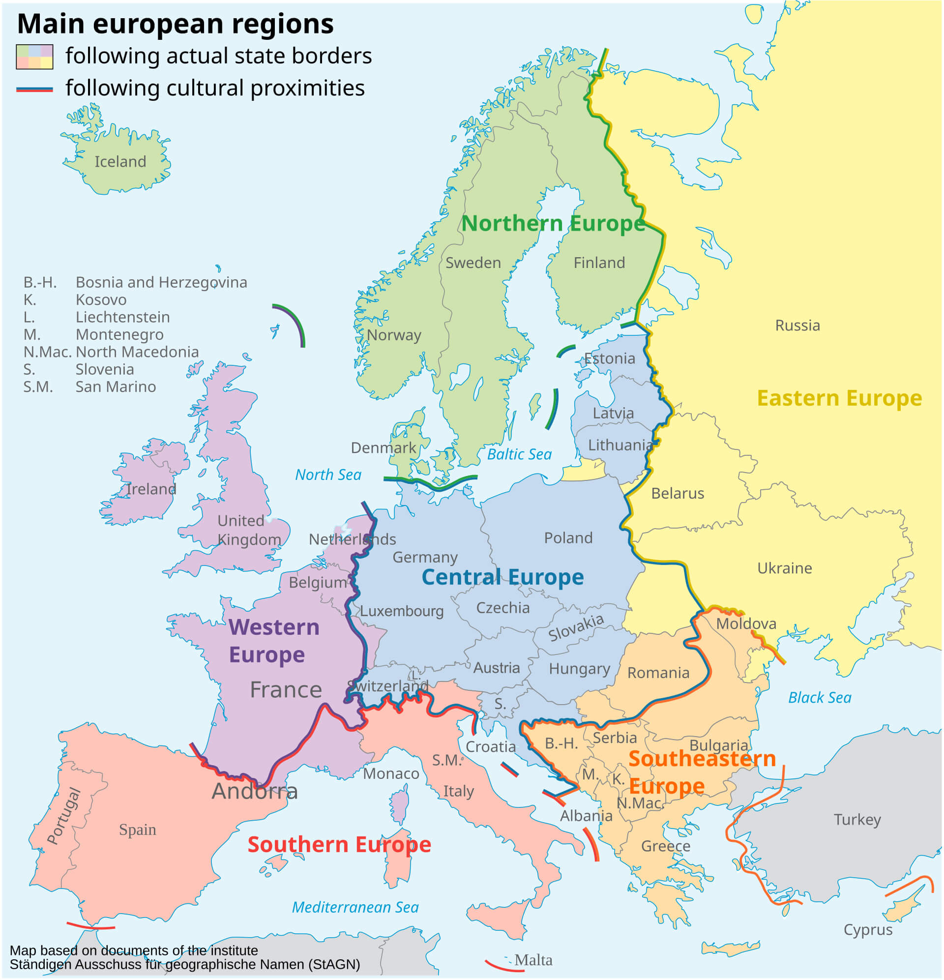 Map of Europe divided into main regions based on state borders and cultural proximities.
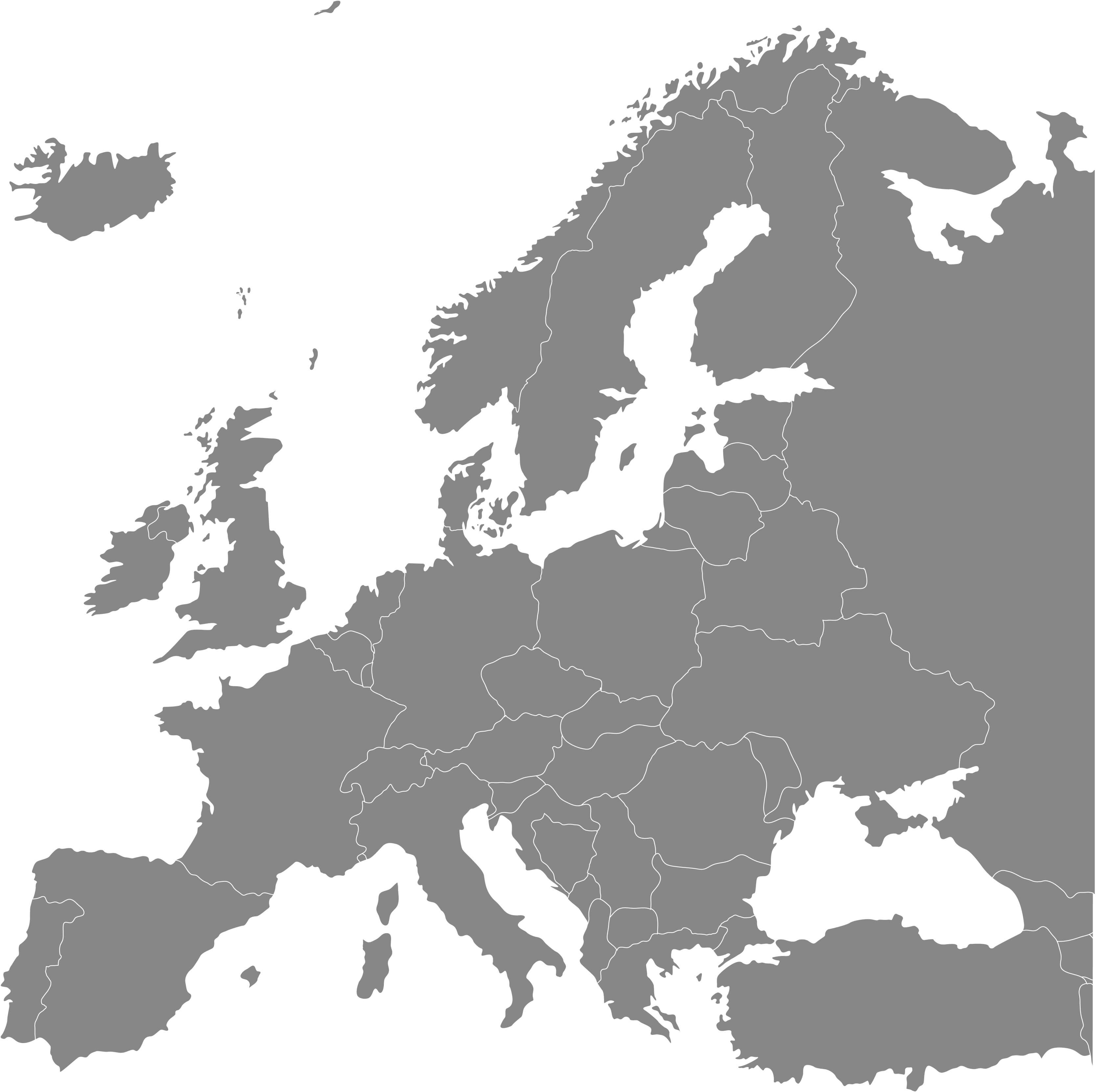
 Map of Europe showing national borders and country names.
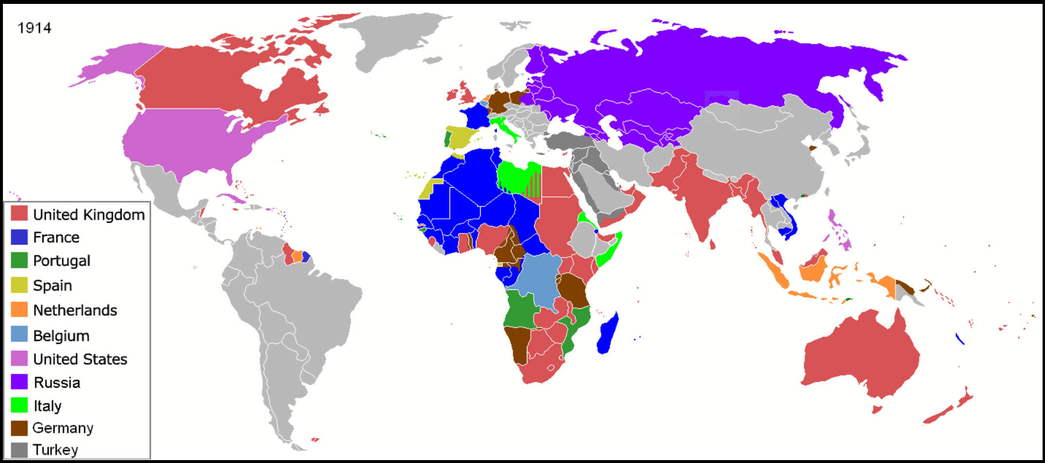 Map of European countries and their colonies worldwide in 1914.