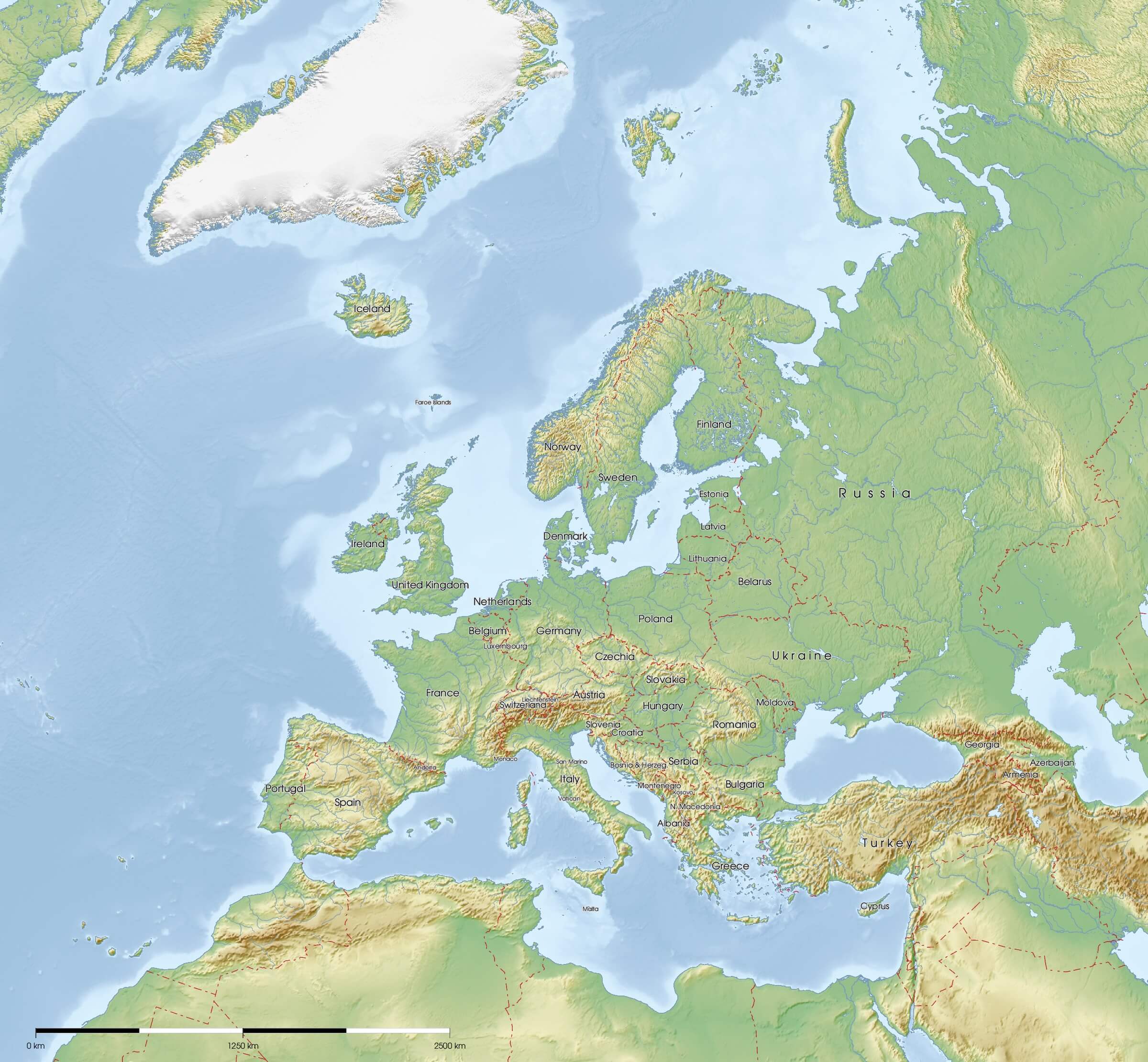
Europe Physical Map

HomeMapsEurope Physical Map
- Advertisement -

Europe’s geography comes to life on the physical maps, showing topography, mountains, plateaus and rivers, as well as the iconic Mediterranean coastline. Explore detailed maps of European countries, EU borders and satellite imagery showing the region by day and by night. From elevation maps to combined geographic visuals of Europe with Russia, the UK, Germany, France, Spain, the Netherlands, Belgium, Ireland and Africa, these maps provide a comprehensive perspective of the continent’s natural and political landscapes.

Europe Physical Map

Europe Physical Map
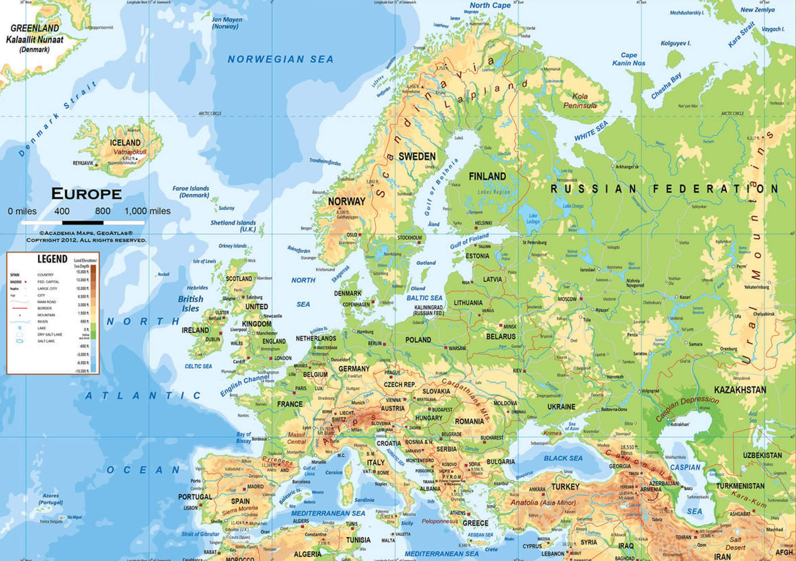
Physical map of Europe showing topography, mountains, rivers, and surrounding seas.

This map highlights Europe’s physical features, including its mountain ranges, rivers and surrounding bodies of water such as the Mediterranean, Baltic and North Seas. It provides a detailed view of the continent’s topography and natural landmarks.

Europe Physical Map with Russia

Europe Physical Map with Russia
Europe physical map showing Russia, mountains, rivers, and land elevation details.

A detailed physical map of Europe including Russia, highlighting geographical features such as mountain ranges, rivers and land elevation. This map provides a comprehensive overview of the terrain and physical geography of Europe and Russia.

Satellite Map of Europe

Satellite Map of Europe

Physical Map of Europe and Russia
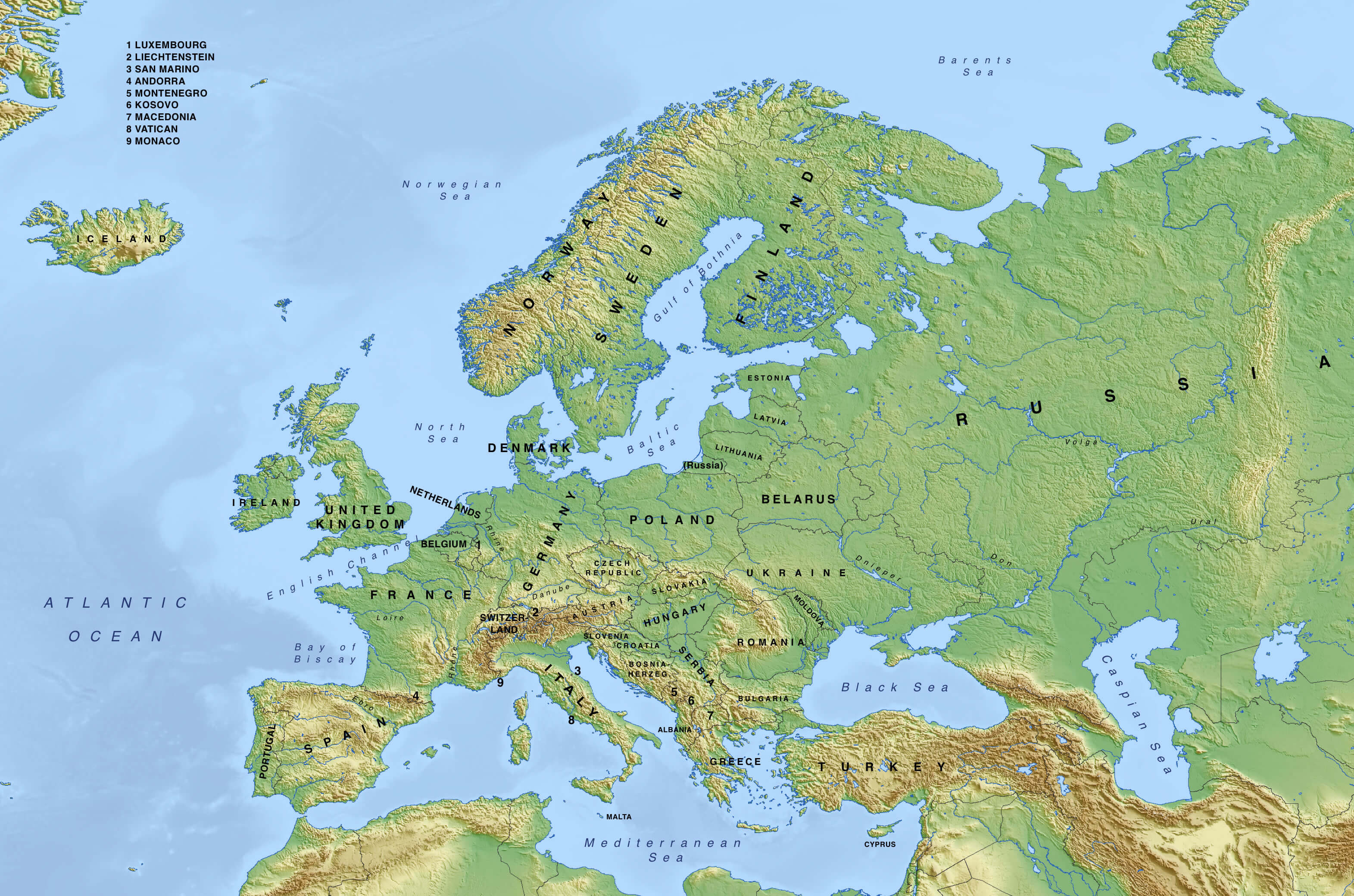
Physical Map of Europe and Russia
Physical map of Europe including Russia, showing topography, mountains, and rivers.

This detailed physical map highlights the natural features of Europe and Russia, including mountain ranges, plains and major rivers. It provides a clear view of the continent’s and Russia’s topography and geographical boundaries.

Europe, France, and Germany satellite map in the night
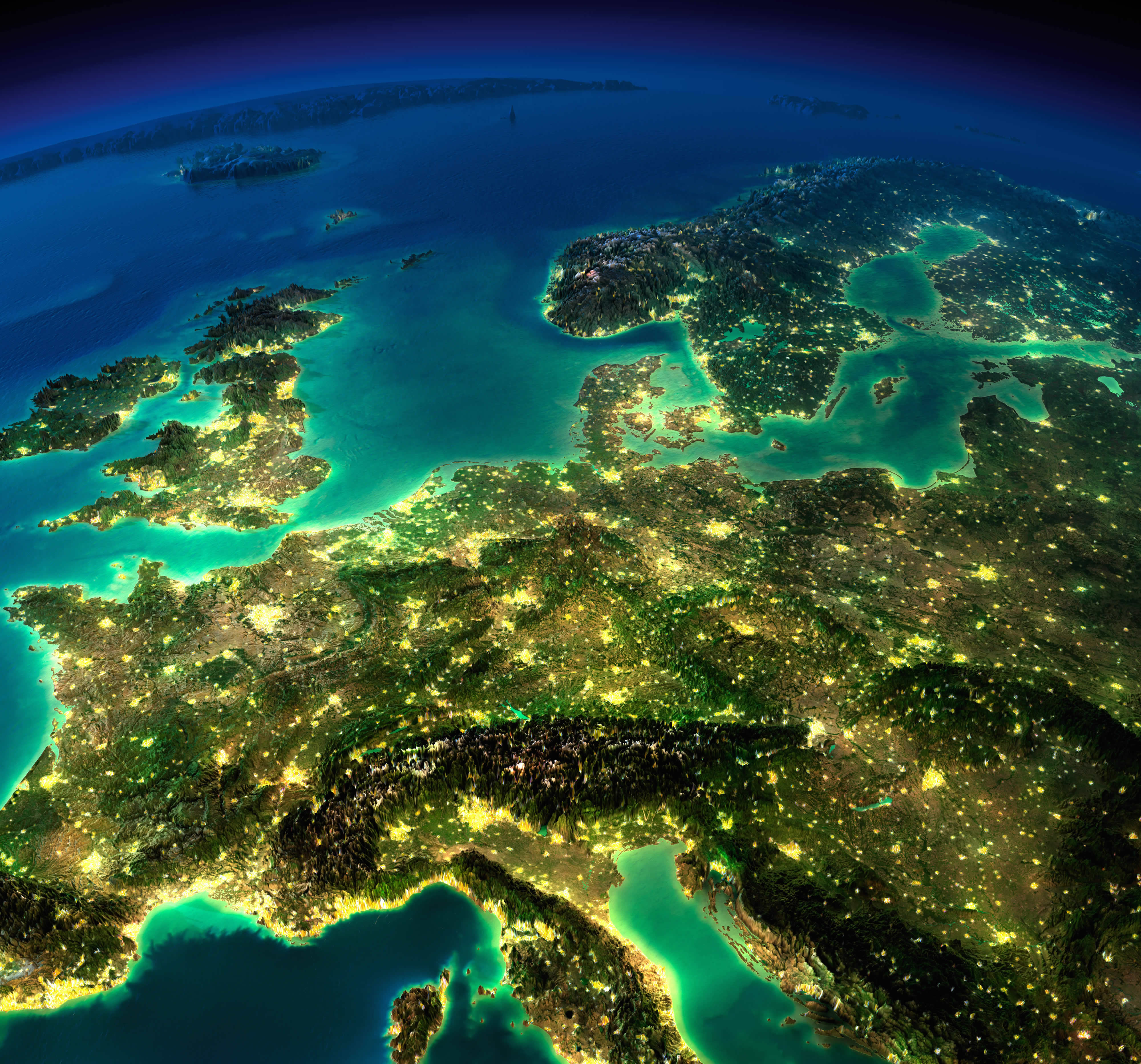
Europe, France, and Germany satellite map in the night

Europe satellite view from space
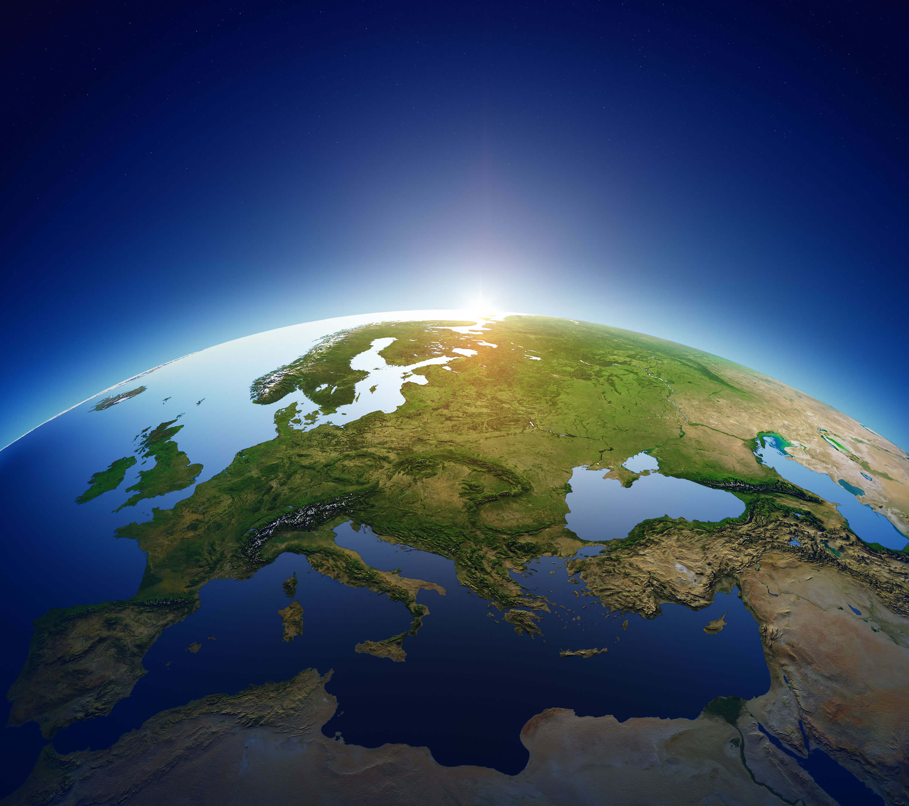
Europe satellite view from space

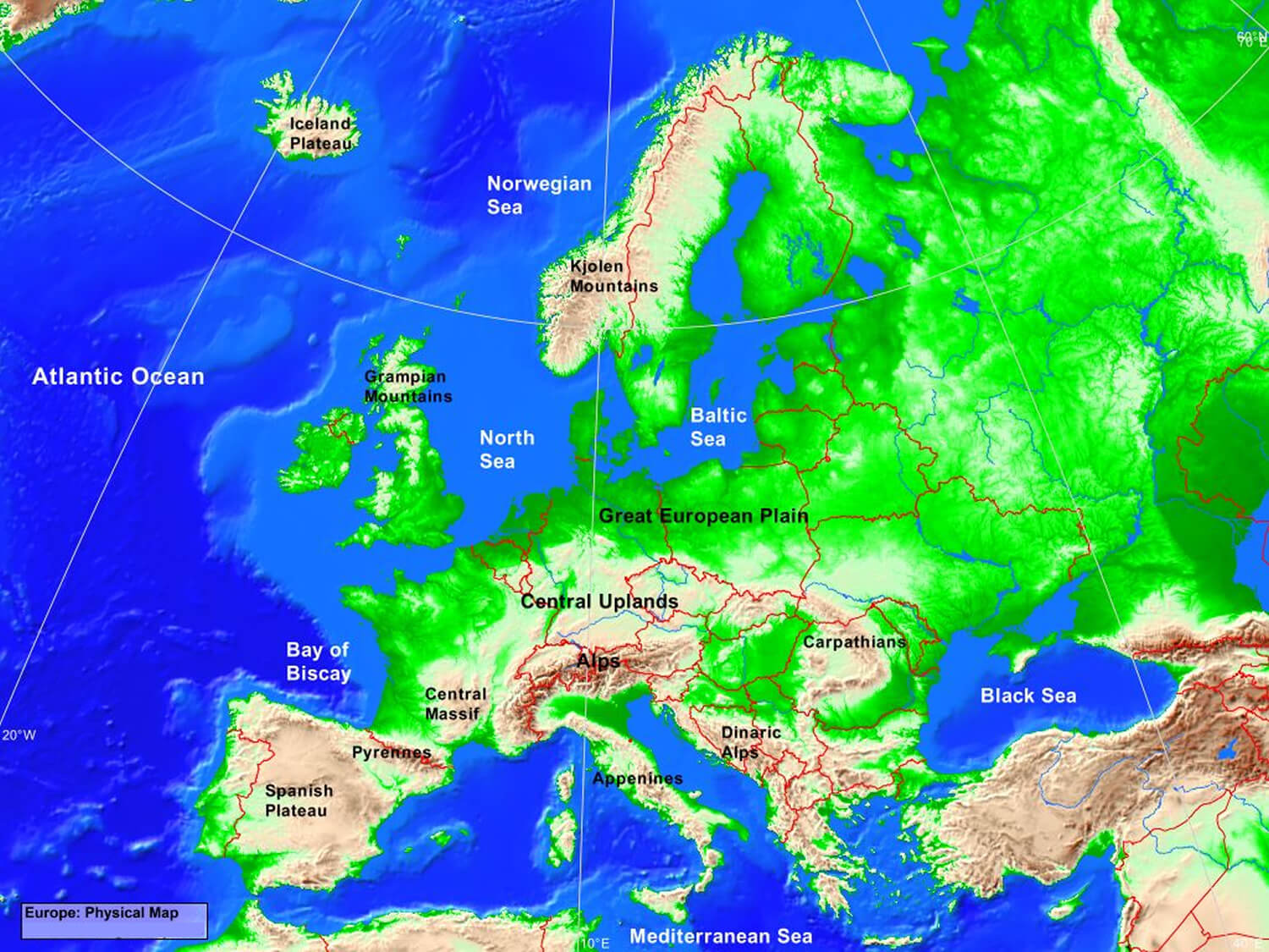
Europe Physical Map with Mountains and Plains
Europe Physical Map with Mountains and Plains
Europe physical map showing mountains, plains, seas, and key geographic features.

A detailed physical map of Europe, highlighting major mountain ranges such as the Alps, Pyrenees and Carpathians, as well as vast plains such as the Great European Plain. The map also shows the surrounding seas and important geographical landmarks.

Europe Topography Map

Europe Topography Map
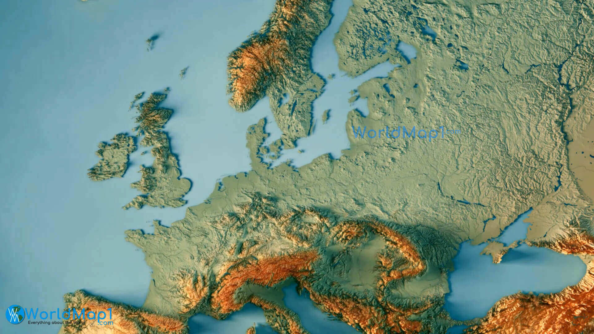
Europe topography map showing elevation and terrain features.

A detailed topographic map of Europe showcasing elevation changes, mountain ranges, plains, and valleys. The map highlights significant geographical features like the Alps, Scandinavian Mountains, and lowlands, providing a clear view of the continent’s diverse terrain.

Europe Geography Map

Europe geography map with physical and terrain details
Europe geography map with physical and terrain details.

A comprehensive geographical map of Europe showing physical features such as mountains, rivers, plains and coastlines. The map provides a clear representation of the continent’s natural landscapes, including the Alps, the Mediterranean region and the Scandinavian peninsula.

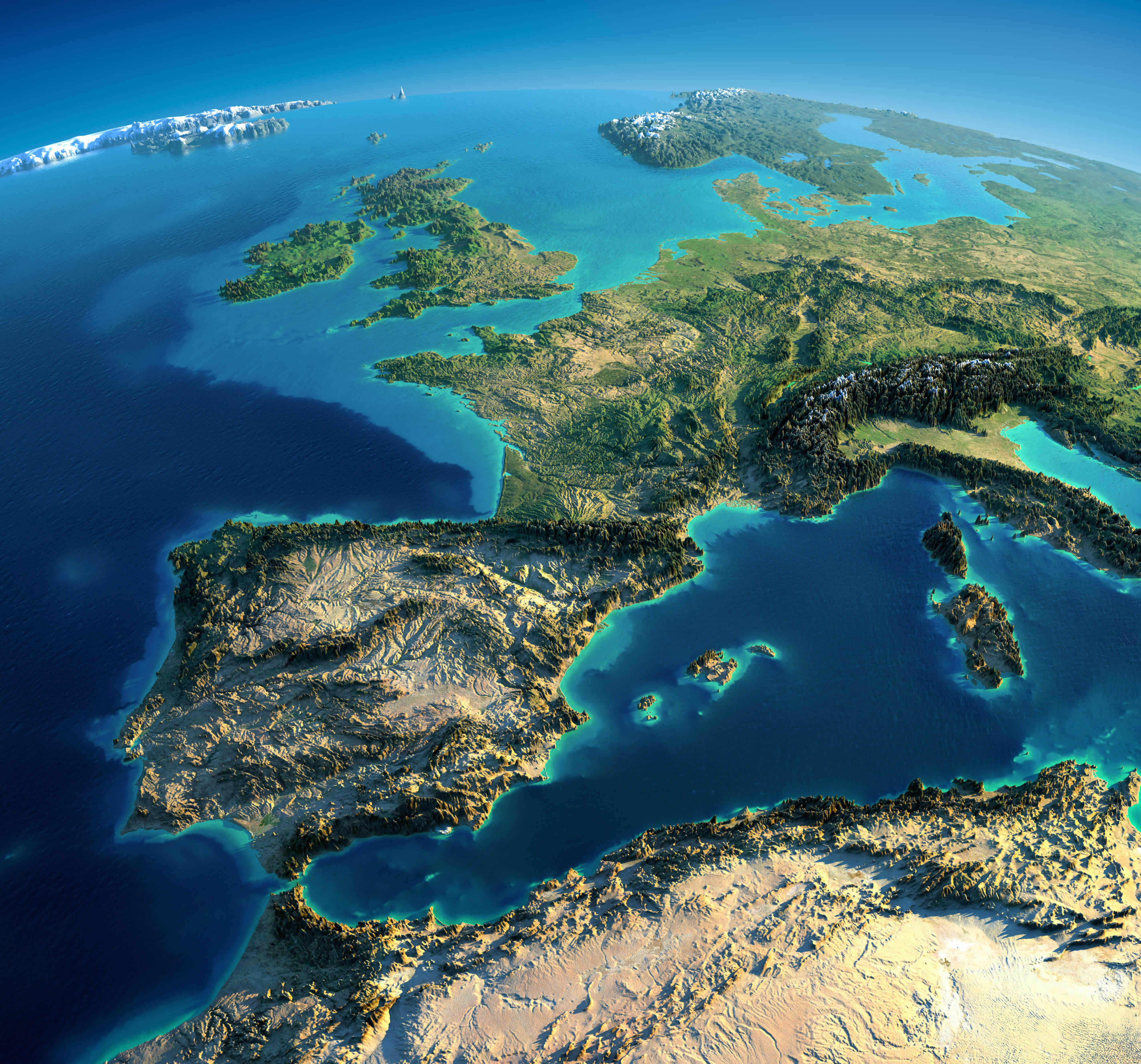
Europe Satellite Image: Spain, France, and Italy
Europe Satellite Image: Spain, France, and Italy
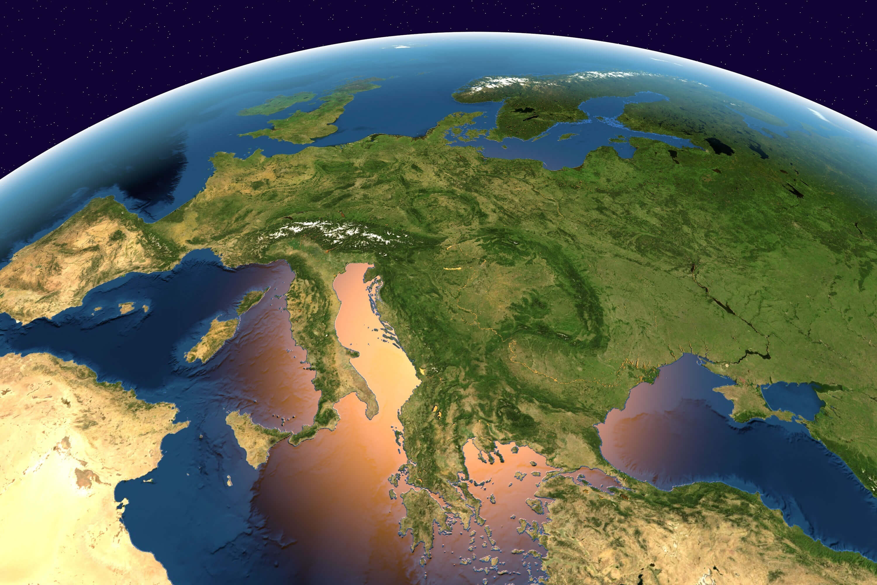
Europe satellite image showing Spain, France, and Italy in stunning detail.

A stunning satellite image showing the geographical features of Spain, France and Italy. The map highlights mountain ranges, coastlines and the Mediterranean Sea, providing a realistic and detailed view of Southern Europe from space.

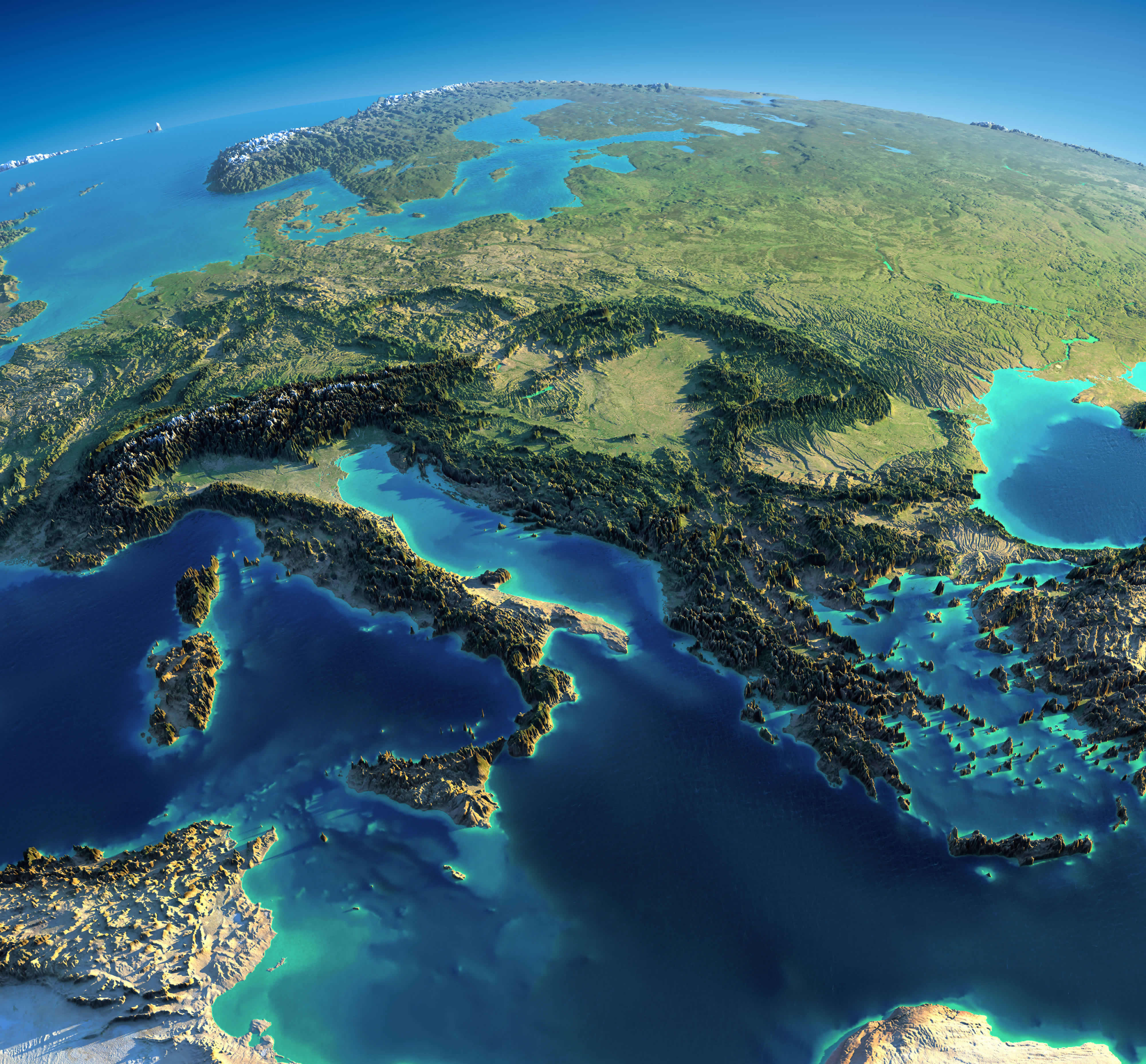
Satellite Map: Italy, Greece, and the Mediterranean Sea
Satellite Map: Italy, Greece, and the Mediterranean Sea
Europe satellite map showing Italy, Greece, and the Mediterranean Sea.

A stunning satellite view of the geographical beauty of Italy, Greece and the Mediterranean. The map highlights the Italian peninsula, Greek islands and surrounding waters, providing a vivid and detailed representation of this iconic European region.

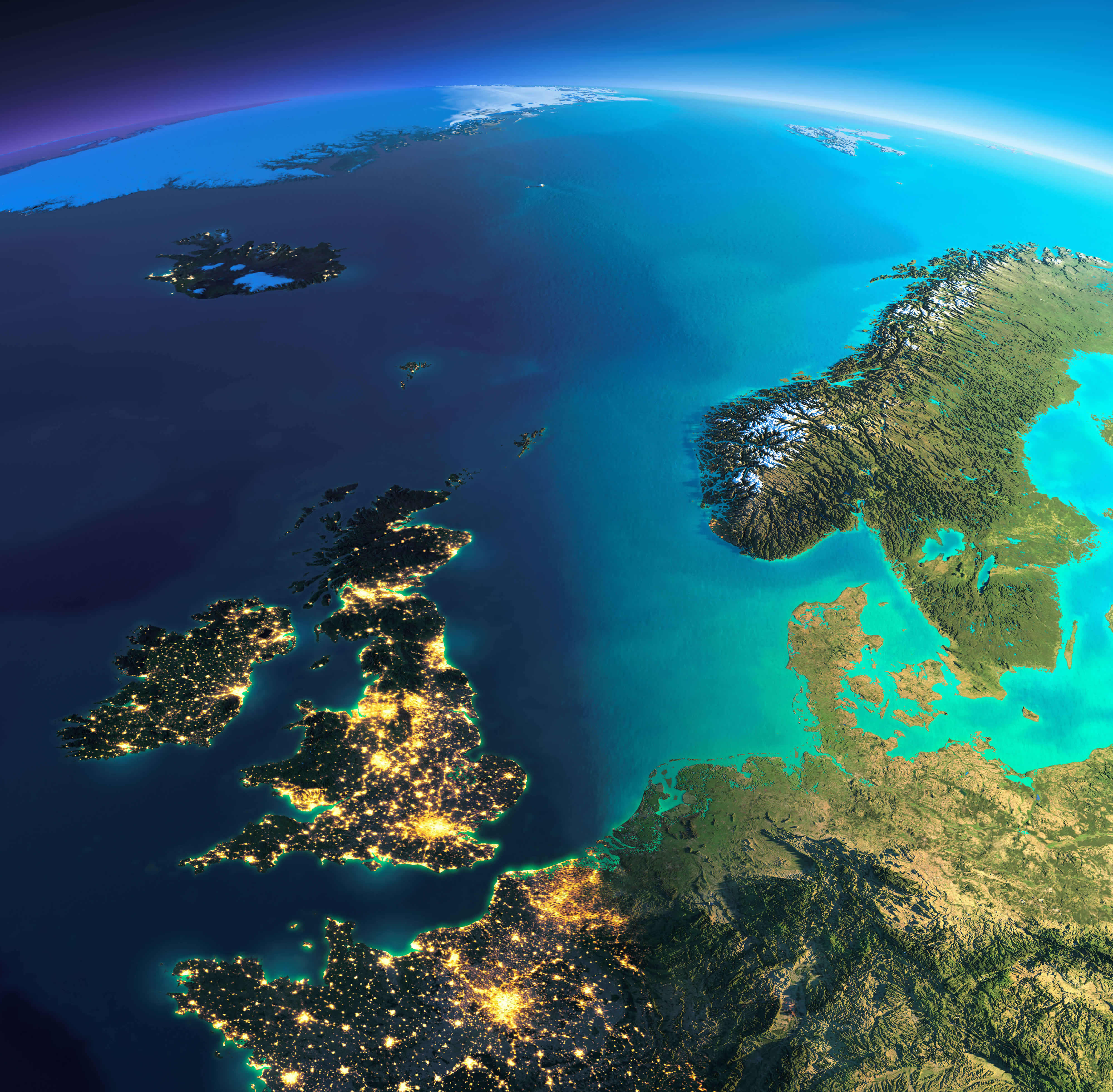
Nighttime Satellite Map: Ireland, UK, Sweden, and Norway
Nighttime Satellite Map: Ireland, UK, Sweden, and Norway
Europe satellite map showing Ireland, UK, Sweden, and Norway illuminated at night.

A breathtaking nighttime satellite view of Europe, highlighting the illuminated cities of Ireland, the UK, Sweden, and Norway. The map showcases the vibrant glow of urban centers against the dark backdrop, with clear views of the North Sea and surrounding geography.

Nighttime Satellite Map: Denmark, Norway, Sweden, and Finland
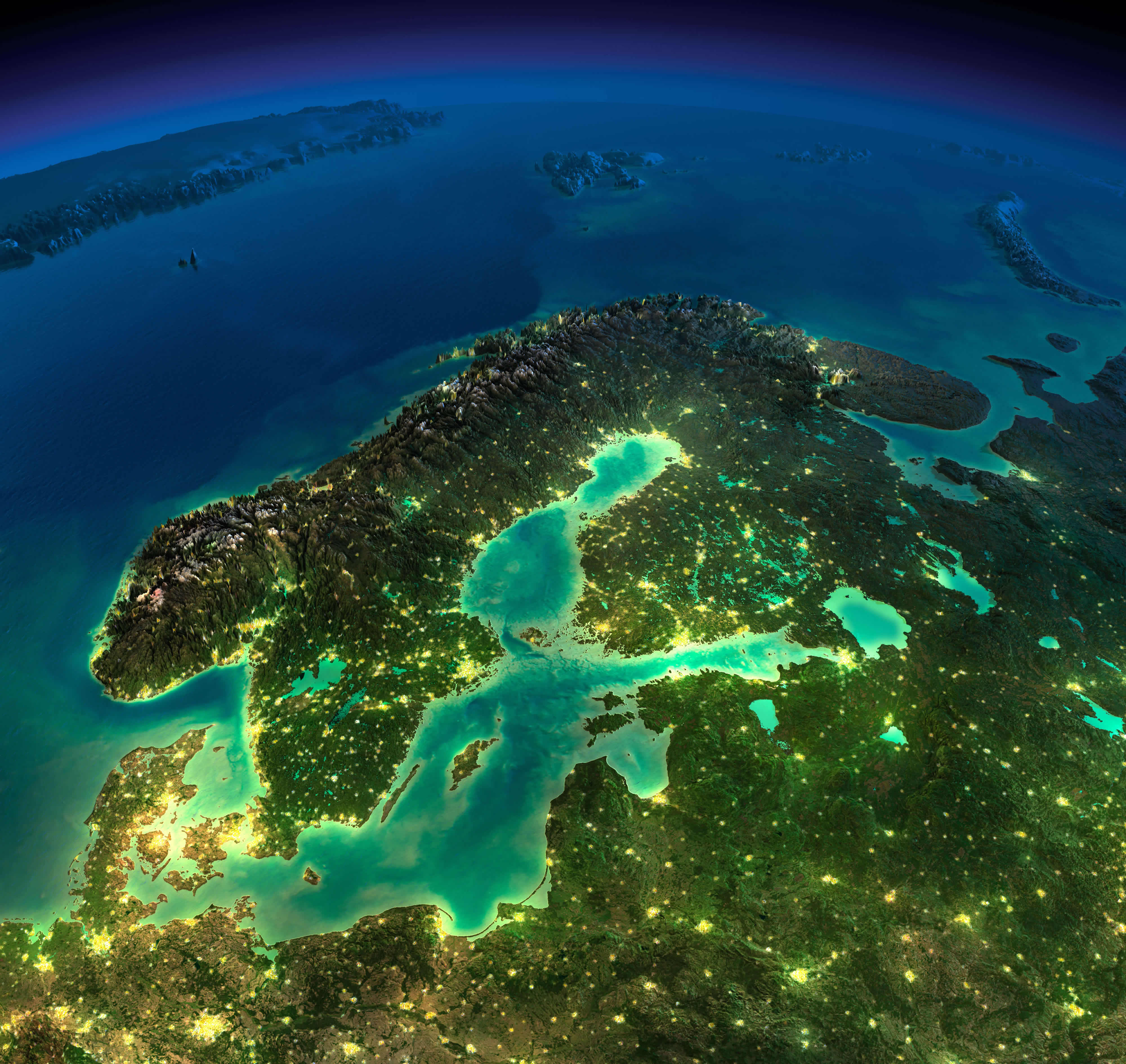
Nighttime Satellite Map: Denmark, Norway, Sweden, and Finland
Europe satellite map featuring Denmark, Norway, Sweden, and Finland illuminated at night.

A stunning night-time satellite image of Northern Europe showing Denmark, Norway, Sweden and Finland. The illuminated urban areas contrast beautifully with the surrounding landscapes, highlighting the Baltic Sea and the Scandinavian peninsula under a starry sky.

Europe, Spain, France, and Italy satellite image

Europe, Spain, France, and Italy satellite image

Europe from Spain map
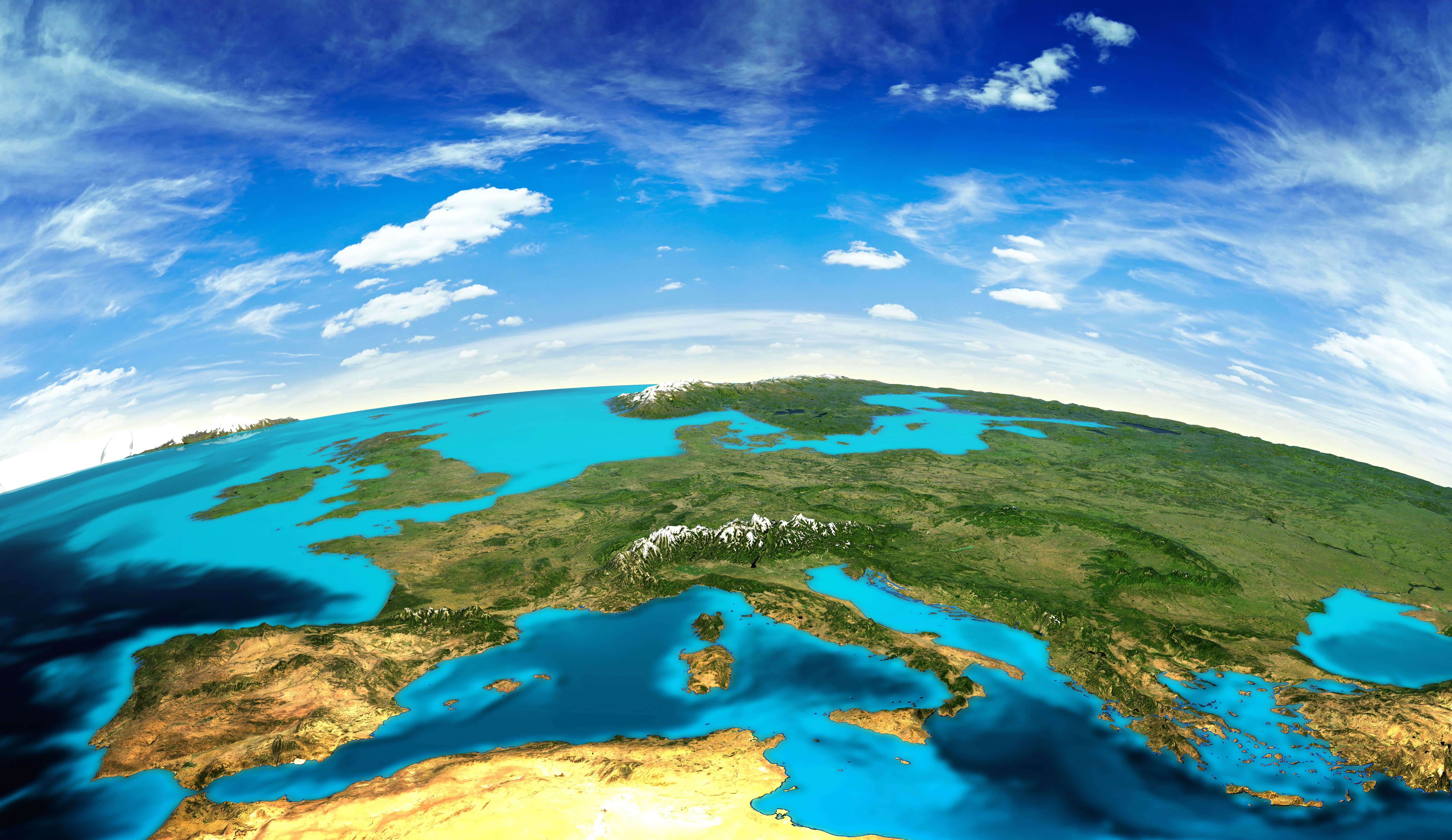
Europe from Spain map

Europe, Belgium, and Netherlands satellite map
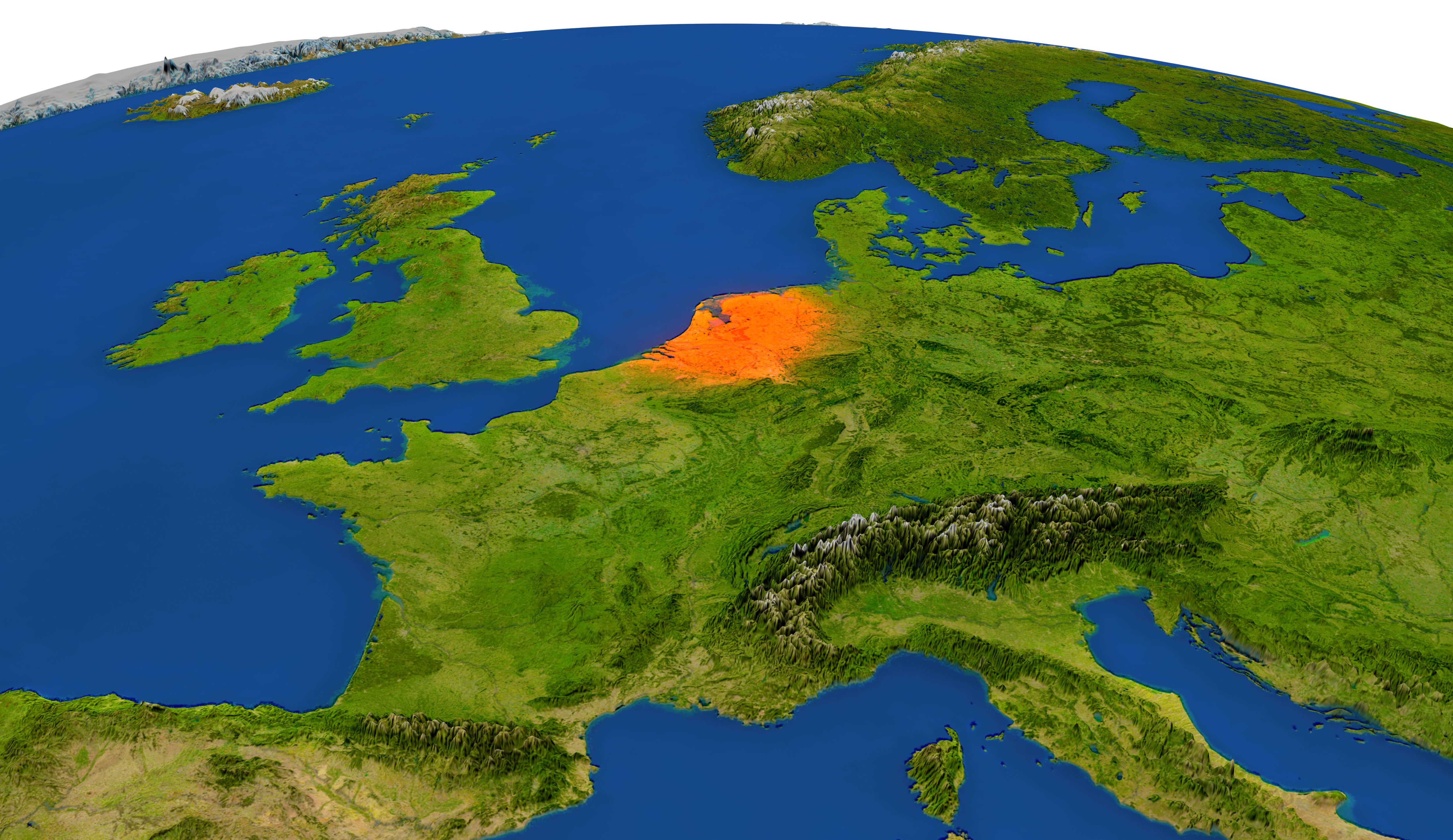
Europe, Belgium, and Netherlands satellite map

Europe satellite map in the night
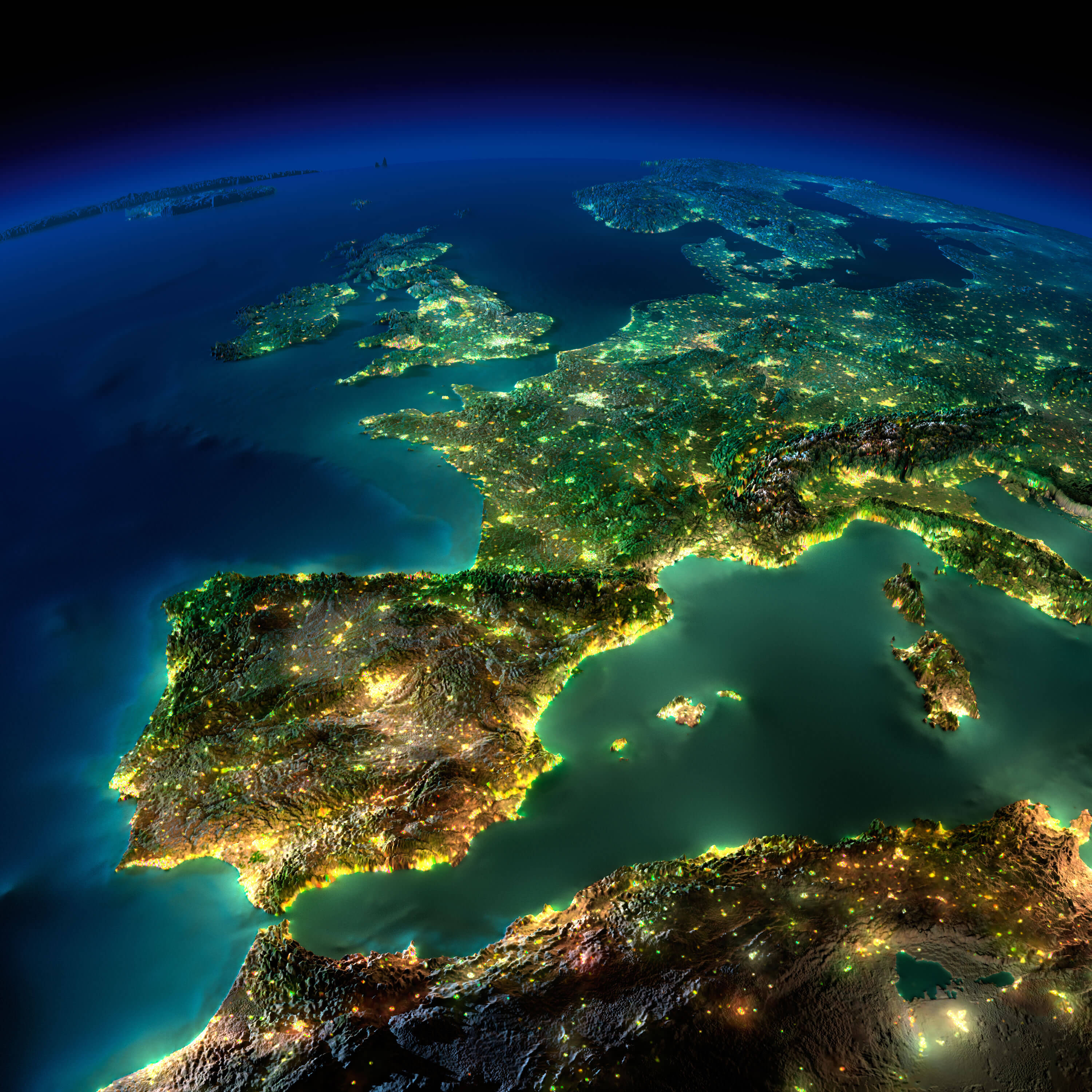
Europe satellite map in the night

Physical Map of Europe and Asia
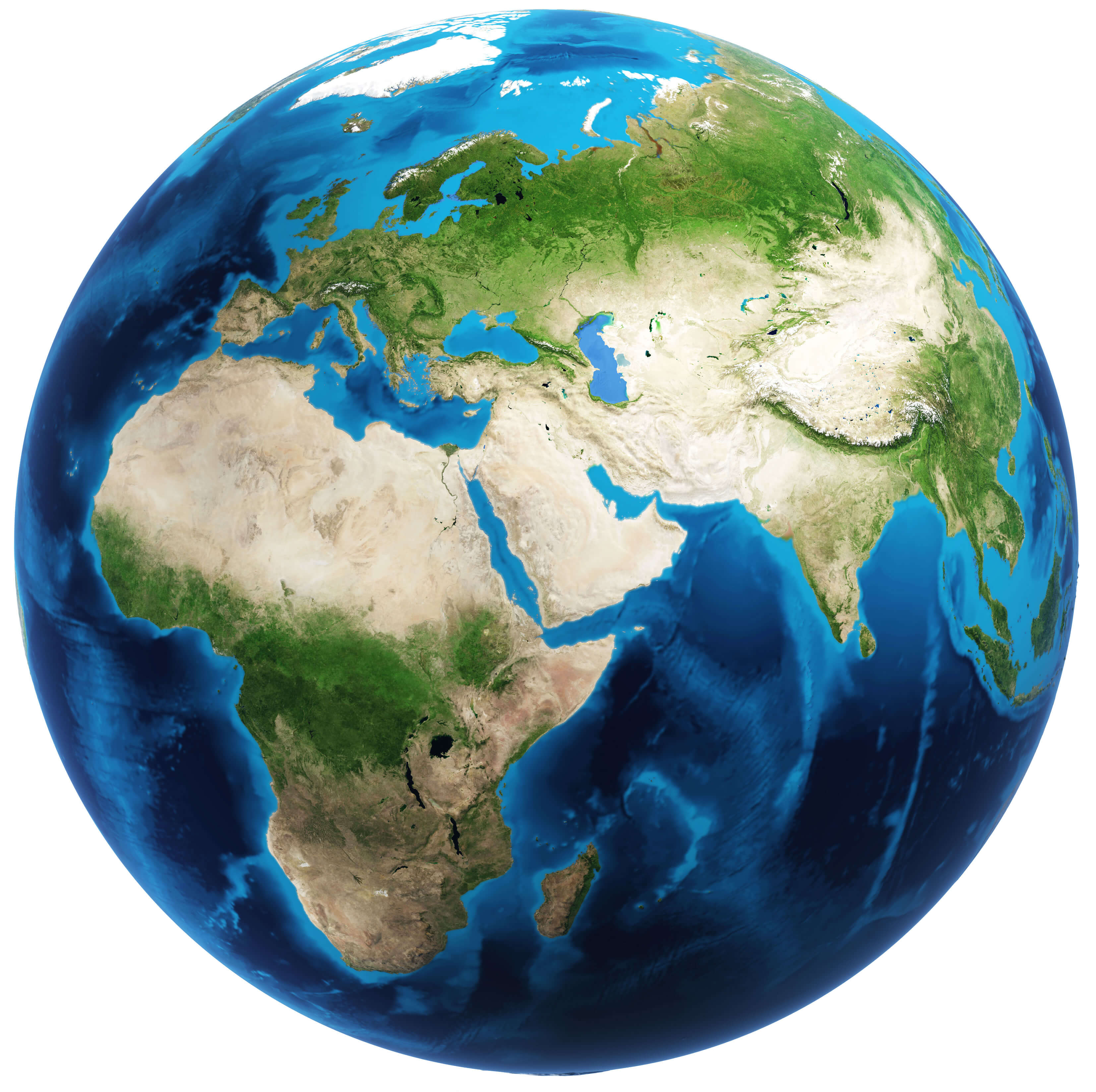
Physical Map of Europe and Asia

Europe physical map in German
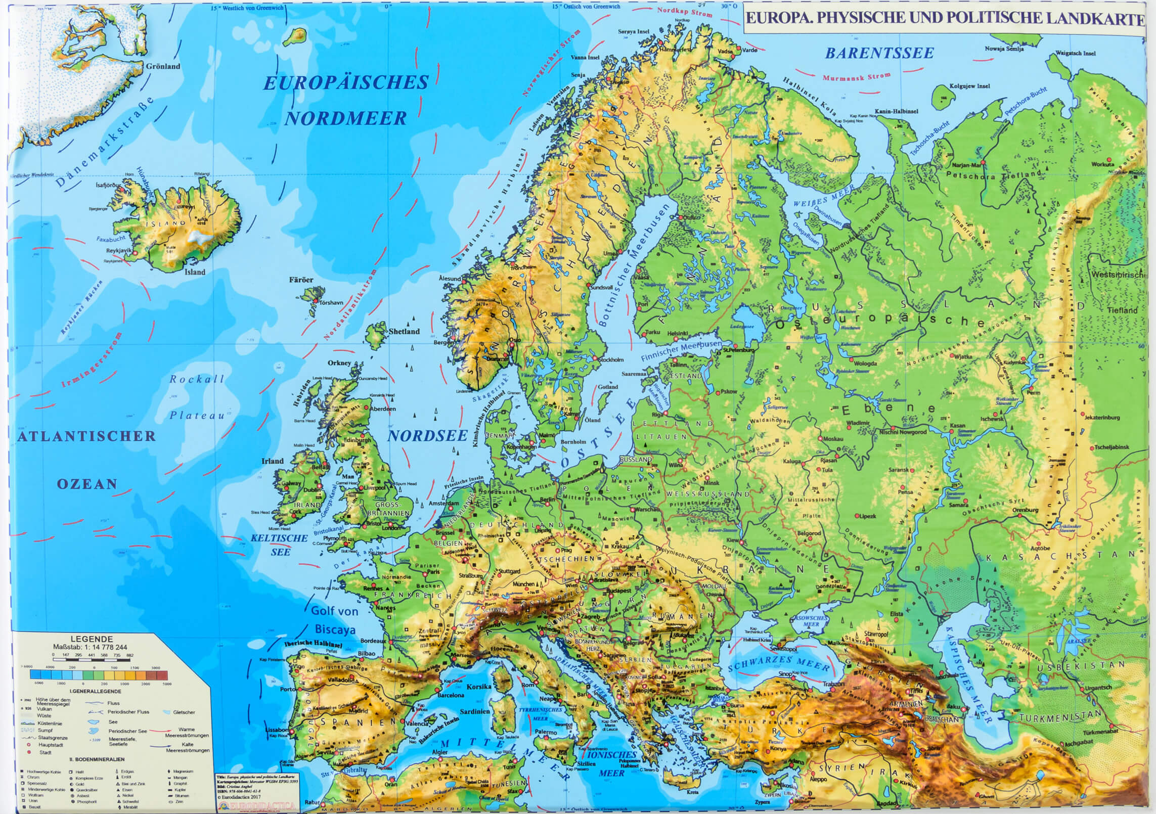
Europe physical map in German

Europe Elevation Map
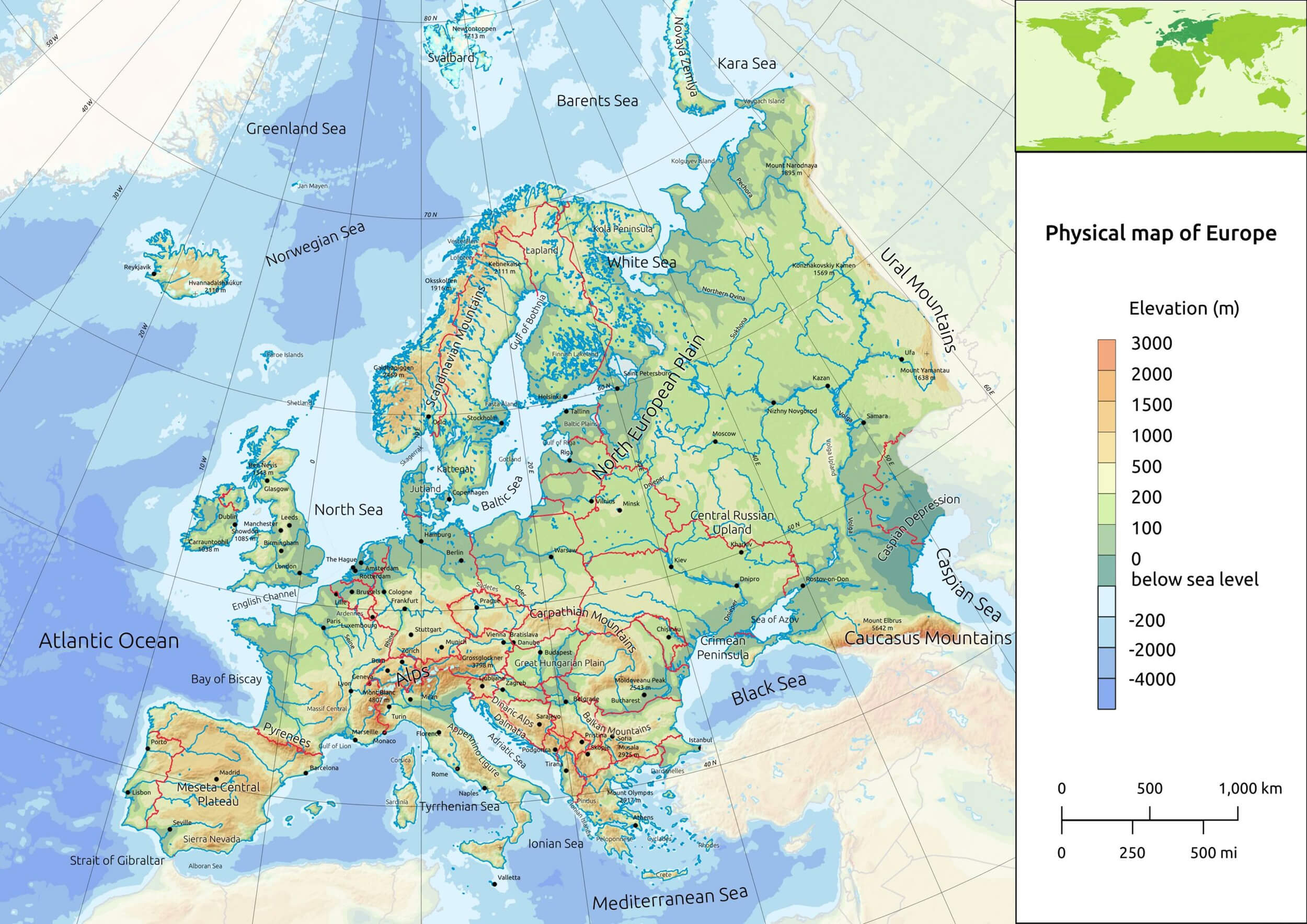
Europe elevation map

Physical Map of Europe

Physical map of Europe shows elevation, mountains, rivers, and seas
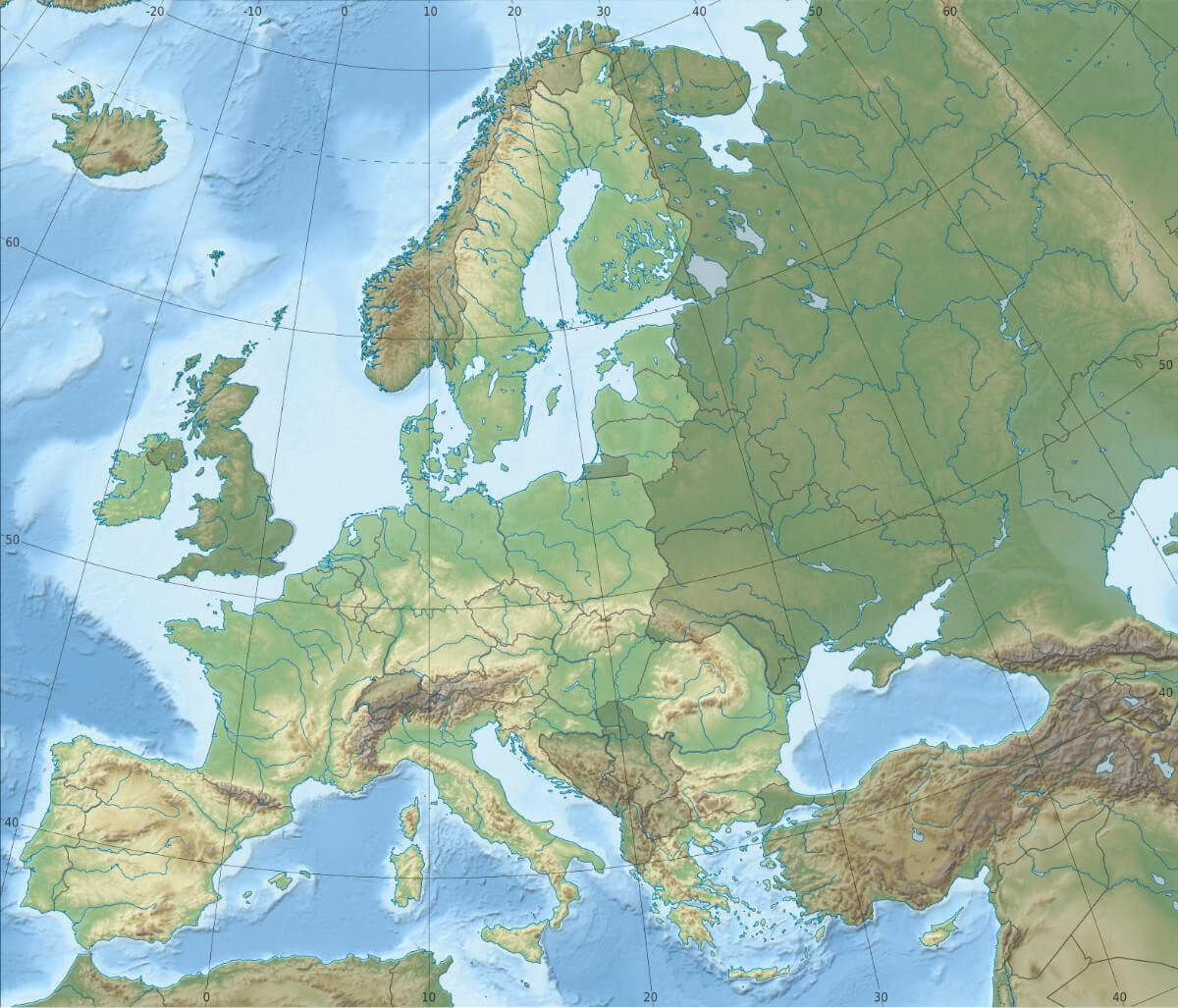
Physical map of Europe highlighting elevation, mountains, rivers, and seas.

A comprehensive physical map of Europe showcasing geographical features such as mountain ranges, rivers, seas, and elevation levels. The map provides a clear view of Europe’s natural topography, including major landforms and water bodies.

EU physical map

EU physical map

Europe physical map with international boundary
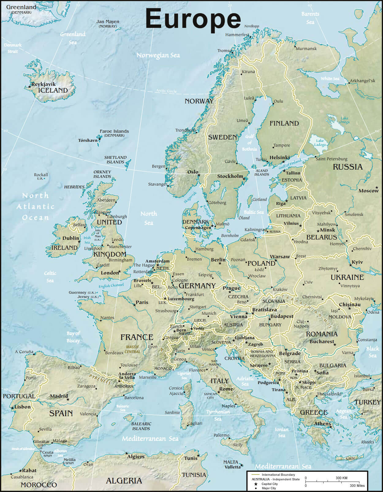
Europe physical map with international boundary

Europe physical map with mountains and rivers
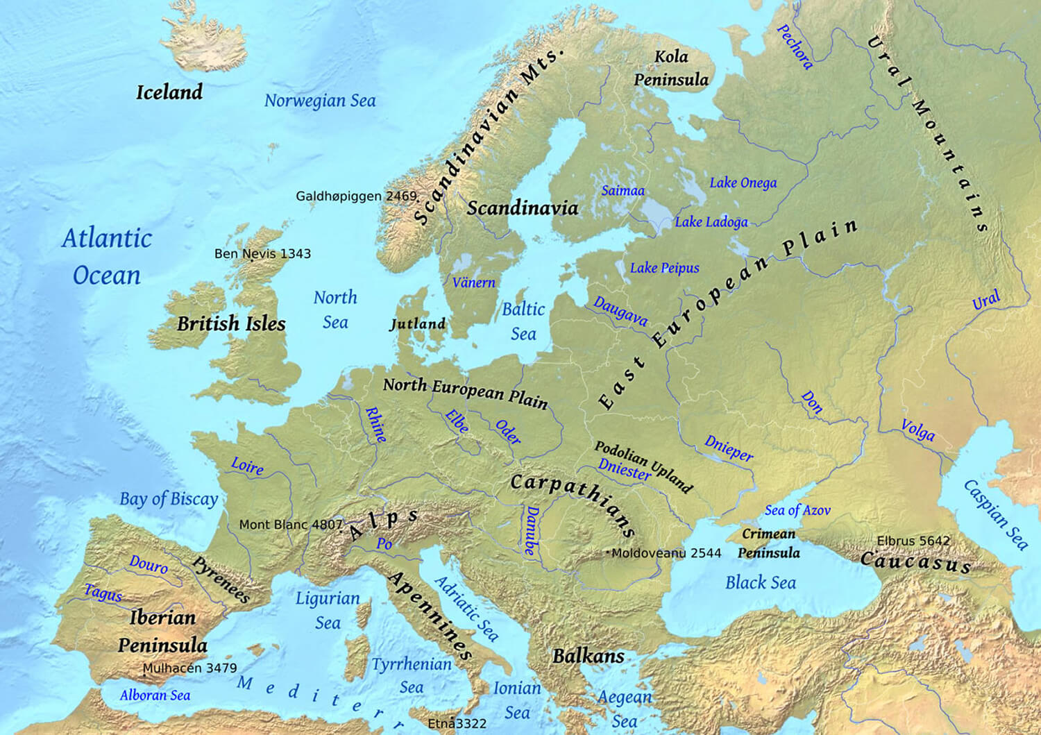
Europe physical map with mountains and rivers

Europe France, and Germany satellite map in the night

Europe France, and Germany satellite map in the night

Europe topographic map
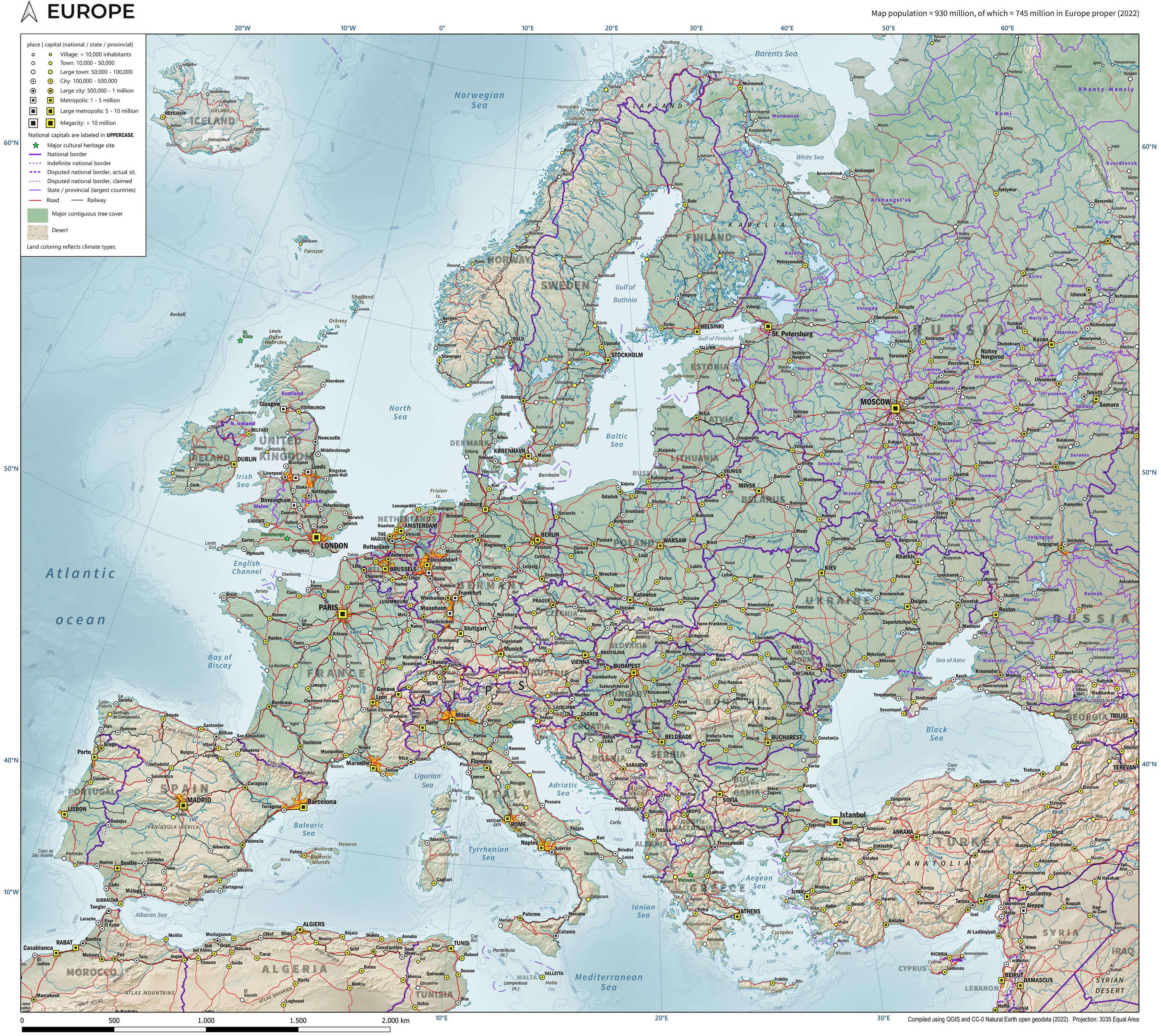
Europe topographic map

Where is Europe on the World Map?

Show Google Interactive Maps and satellite maps of where the country is located.

Get directions by driving, walking, bicycling, public transportation and travel with street view.

Feel free to explore these pages as well:

- Advertisement -
Previous article
Next article

Discover

Sponsor

Latest Posts

Alexandria Unveiled: The Pearl of the Mediterranean

As the golden sun descends and casts a shimmering hue over the Mediterranean, the city of Alexandria reveals its timeless allure. Once the epicenter...

Africa Map I

https://youtu.be/3B2fpd3A1nk Where is Africa, geography of Africa, enlargeable topographic map of Africa, including political maps, physical map, cities map, satellite images of Africa, location, itinerary,...

Map of Norway

Explore a comprehensive collection of maps of Norway, including physical, political, and relief maps. You’ll find detailed satellite images, blank maps, and various topographical...

Map of Italy

A collection maps of Italy; View a variety maps of Italy physical, political, relief map. Satellite image of Italy, higly detalied maps, blank map...

Cuba

Cuba has a population of 11,163,934 people, Cuba's largest city Havana is the capital of country. Cuba's personel income per capita $6,106 (88th in the...