Discover the rich history, diverse geography, physical, political, major cities, rivers, roads and cultural landmarks of England through this curated collection of maps.
Brief information about England
England is the largest country in the United Kingdom and is located on the island of Great Britain in northwestern Europe. It borders Scotland to the north, Wales to the west and is surrounded by the North Sea, the Irish Sea and the English Channel. London, the capital of both England and the United Kingdom, is a global centre of finance, culture and history.
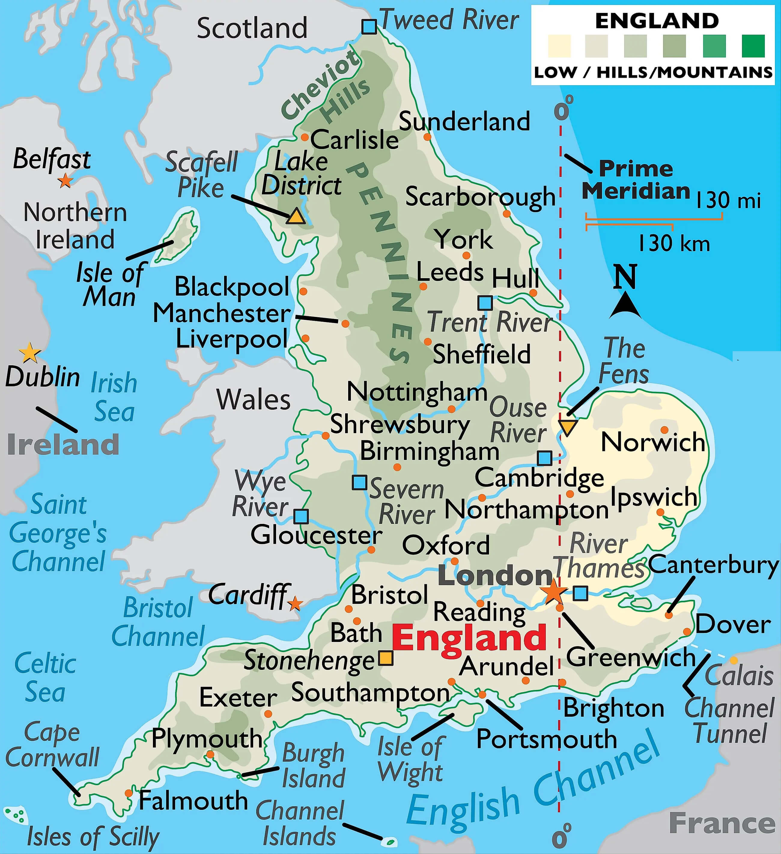
Known for its rich history, England is the birthplace of the English language and home to historic landmarks such as Stonehenge, the Tower of London and Buckingham Palace. The country played a major role in the Industrial Revolution and was once the centre of a vast global empire. Today, England is renowned for its rich cultural heritage, renowned universities such as Oxford and Cambridge, and its contributions to literature, science and the arts.
Where is located England on the World Map
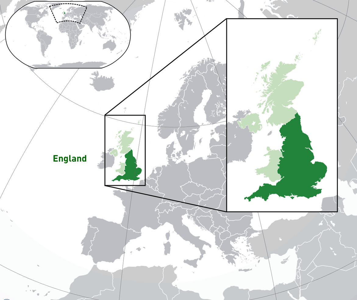 Where is located England on the World Map
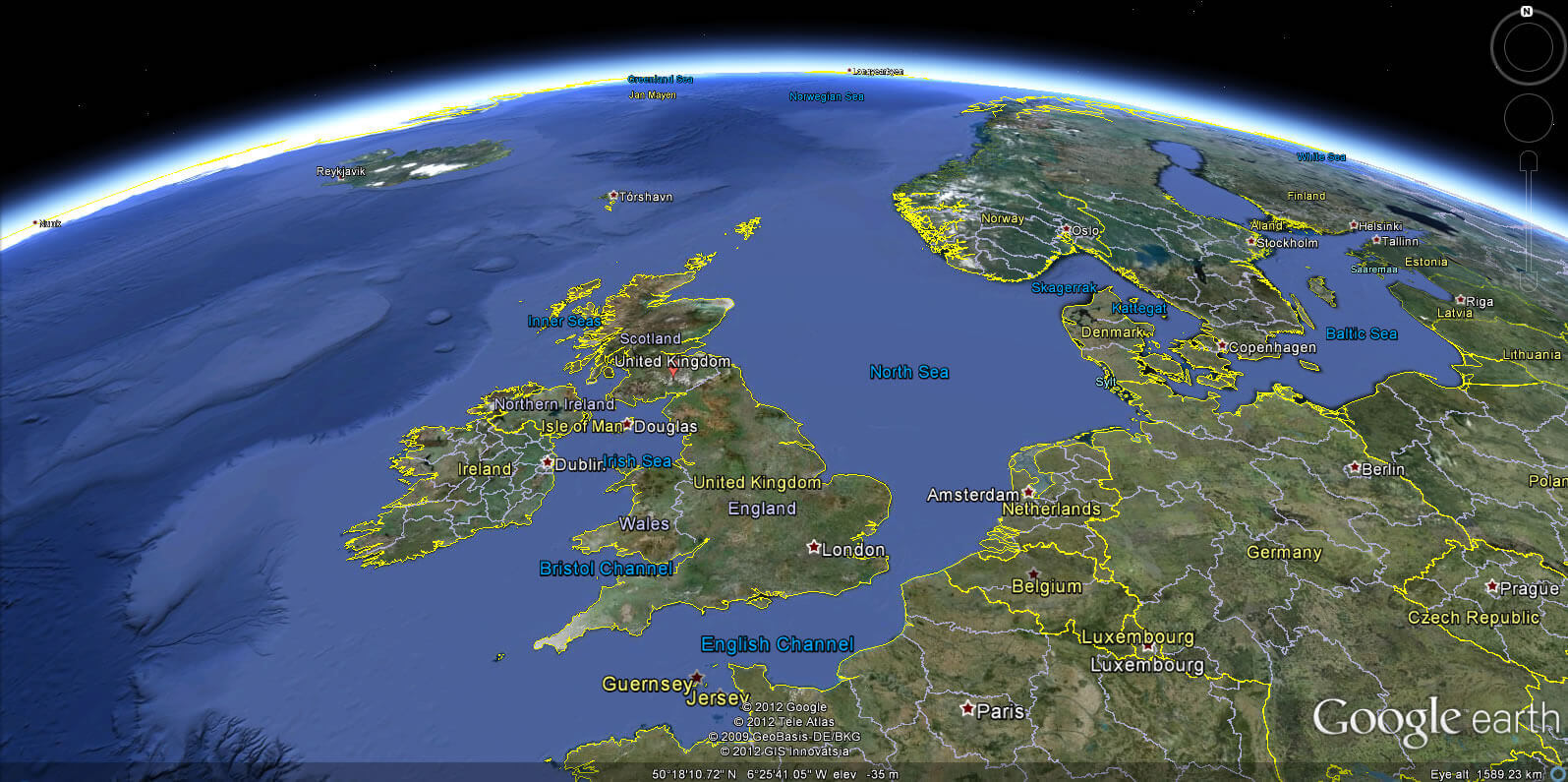
England is located in Western Europe, on the southern part of the island of Great Britain. It is part of the United Kingdom and shares land borders with Scotland to the north and Wales to the west. England is surrounded by water: the North Sea to the east, the Irish Sea to the north-west and the English Channel to the south, which separates it from mainland Europe.
On the world map, England is located just off the northwest coast of continental Europe, directly across the Channel from France. London, England’s capital, is one of Europe’s largest cities and a major global centre for finance, culture and politics. England’s location has historically made it an influential maritime nation with easy access to Europe, America and beyond.
England Galler, Ireland, and Scotland Map
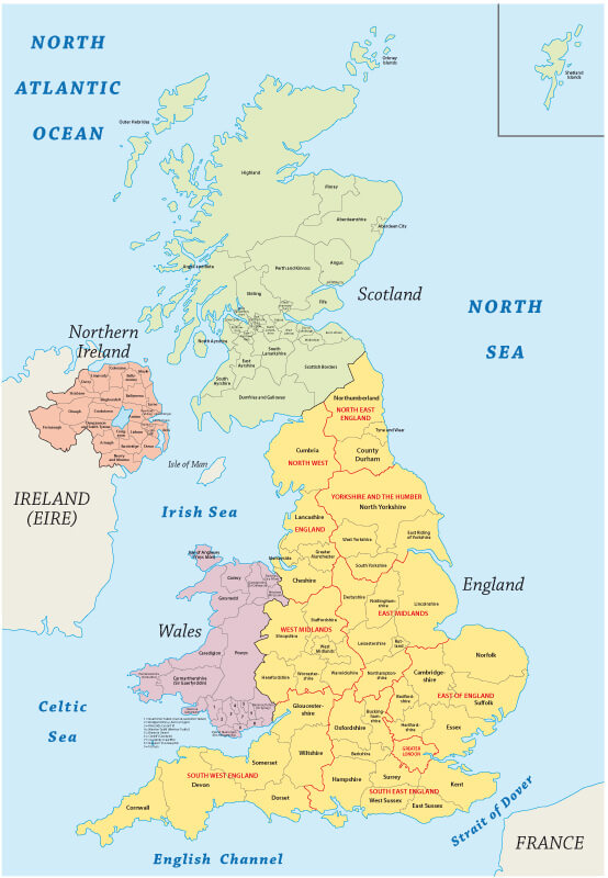
England’s position in the British Isles and proximity to other European nations has shaped its culture, history and trade. Its temperate climate, varied landscape and historic landmarks make it a remarkable place for visitors from all over the world.
Here are some statistical information about England:
 Area: 132,932 km2 (51,325 sq mi)
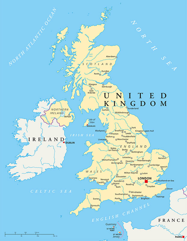
Detailed map of the United Kingdom with England, Scotland, Wales, and Northern Ireland
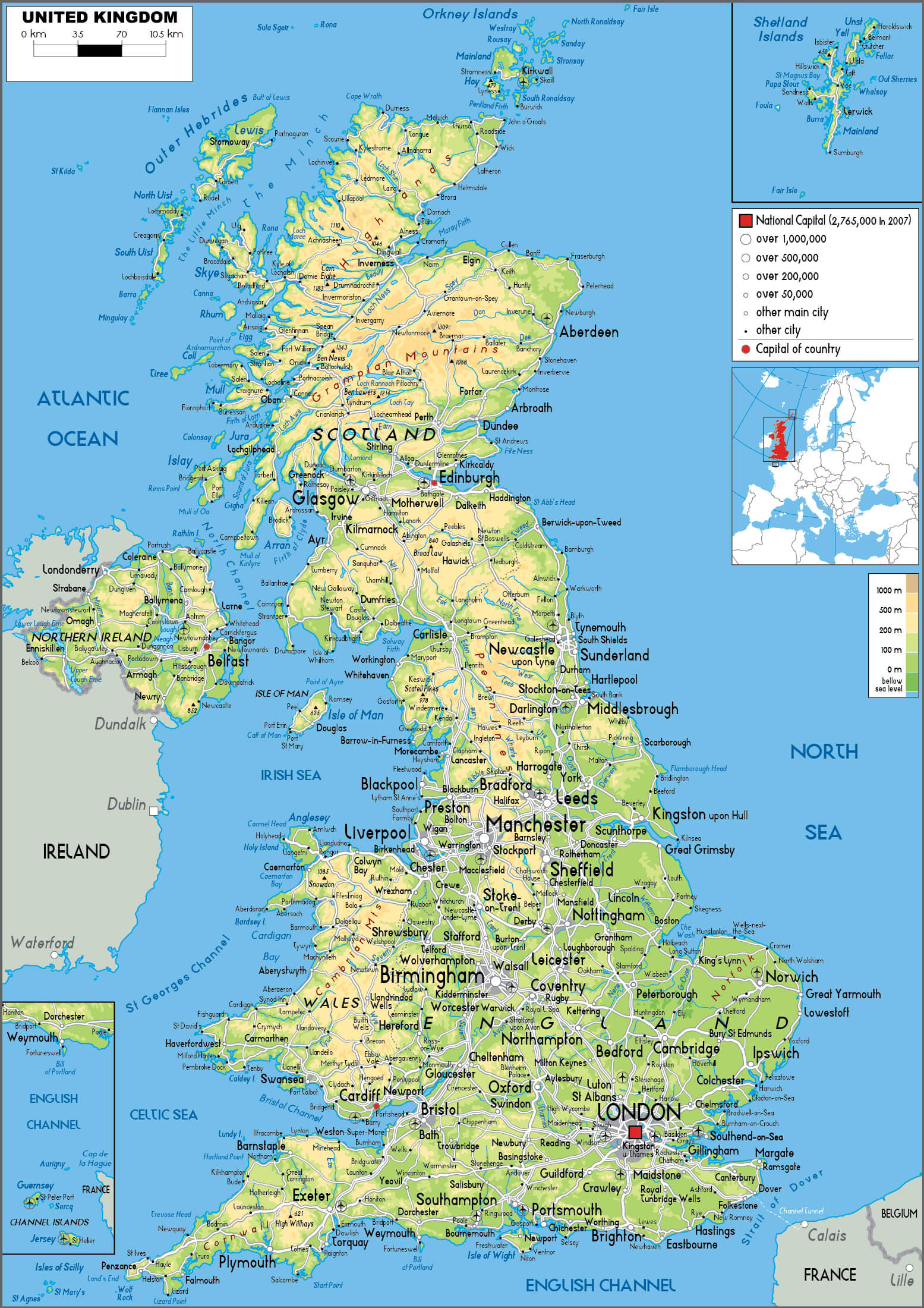 Map of the UK with England, Scotland, Wales, and Northern Ireland
This map shows the United Kingdom, highlighting England, Scotland, Wales and Northern Ireland. Major cities such as London, Edinburgh and Belfast are labelled, along with major rivers, seas and landmarks. The map also shows surrounding islands and geographical details.
GDP (nominal): £2.162 trillion (2022 estimate)England and United Kingdom cities Map
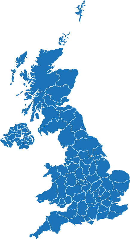
United Kingdom England Blank Map
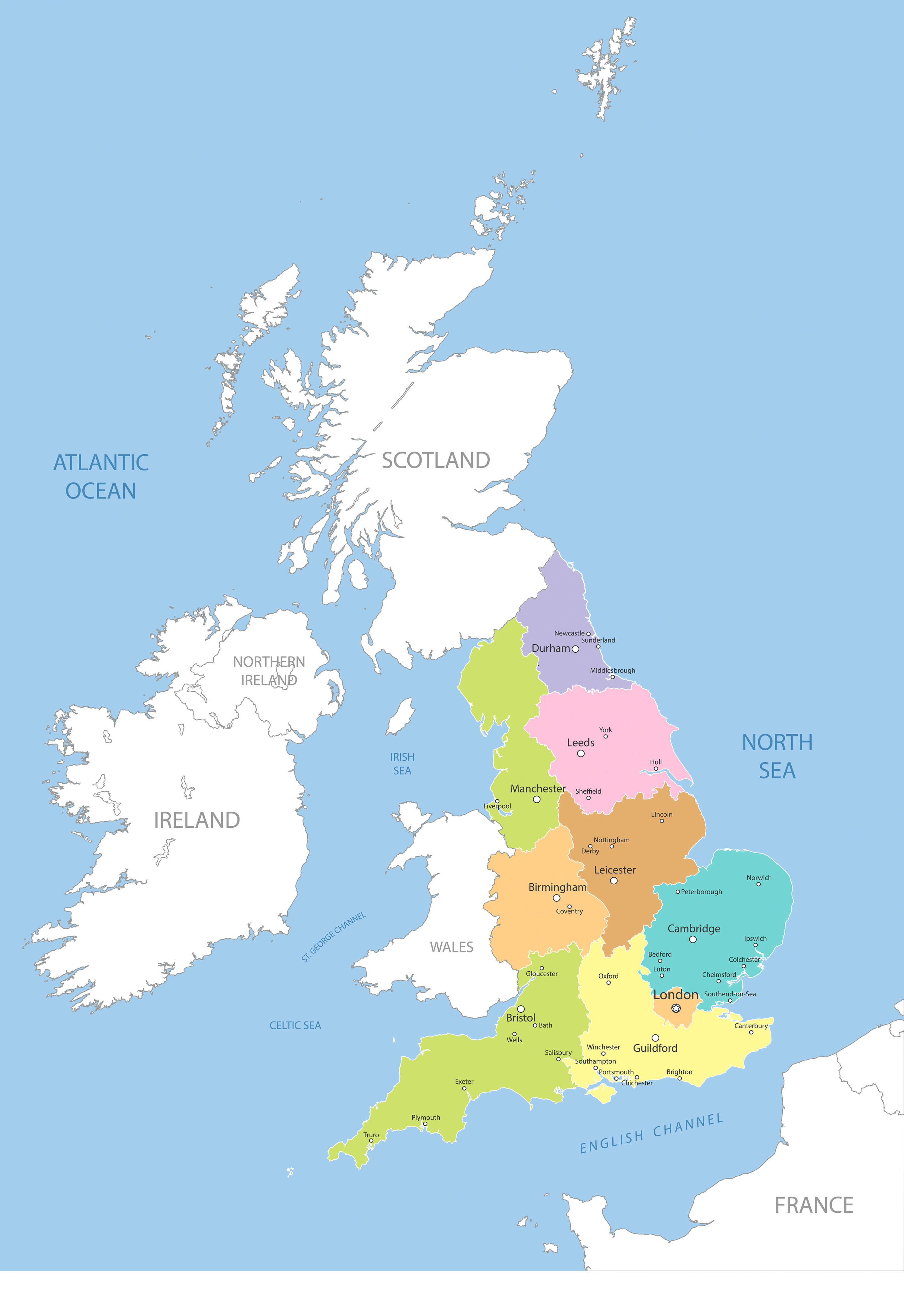
England Regions Map
England and UK main roads map
England Satellite Map
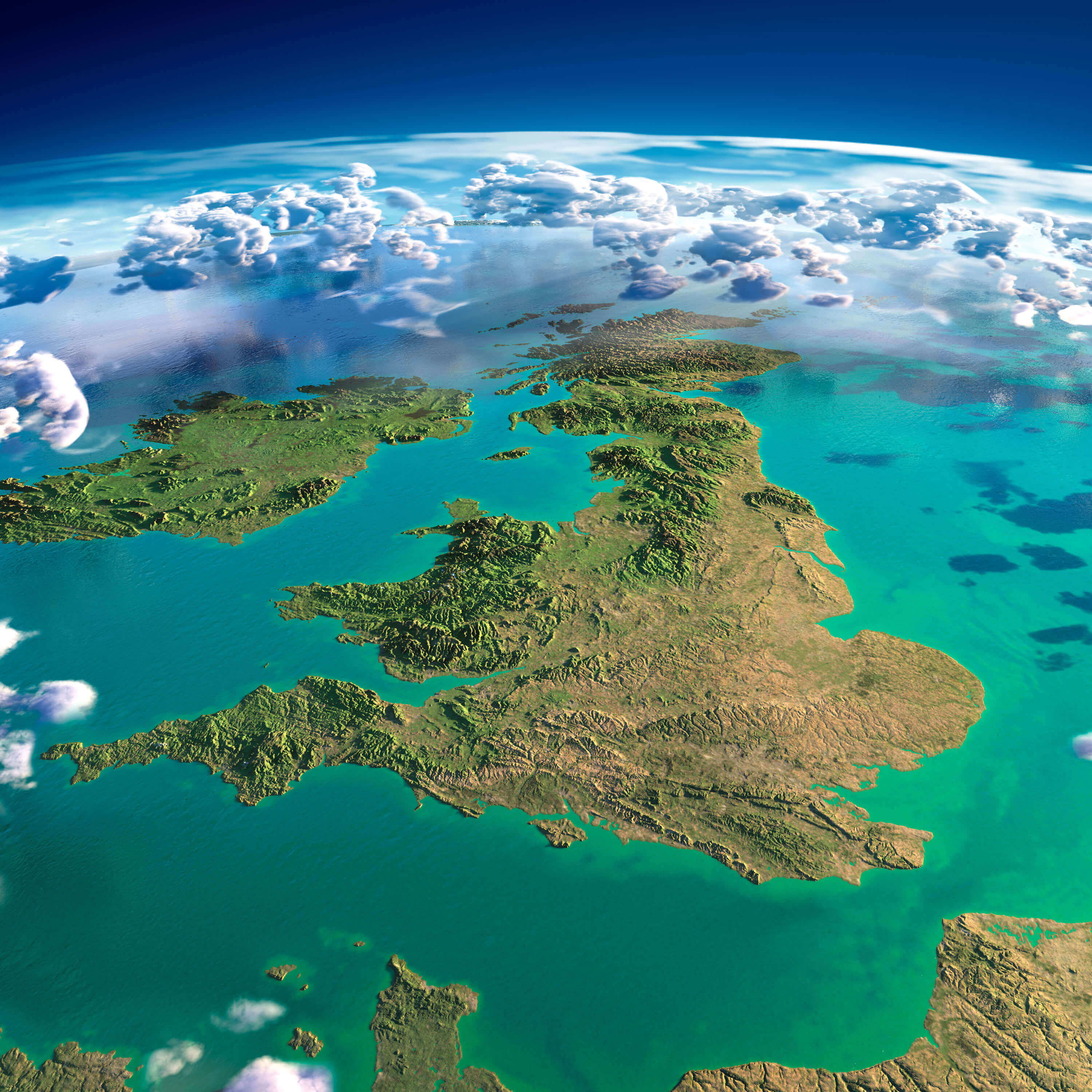
England, Ireland, Scotland, and Wales Map
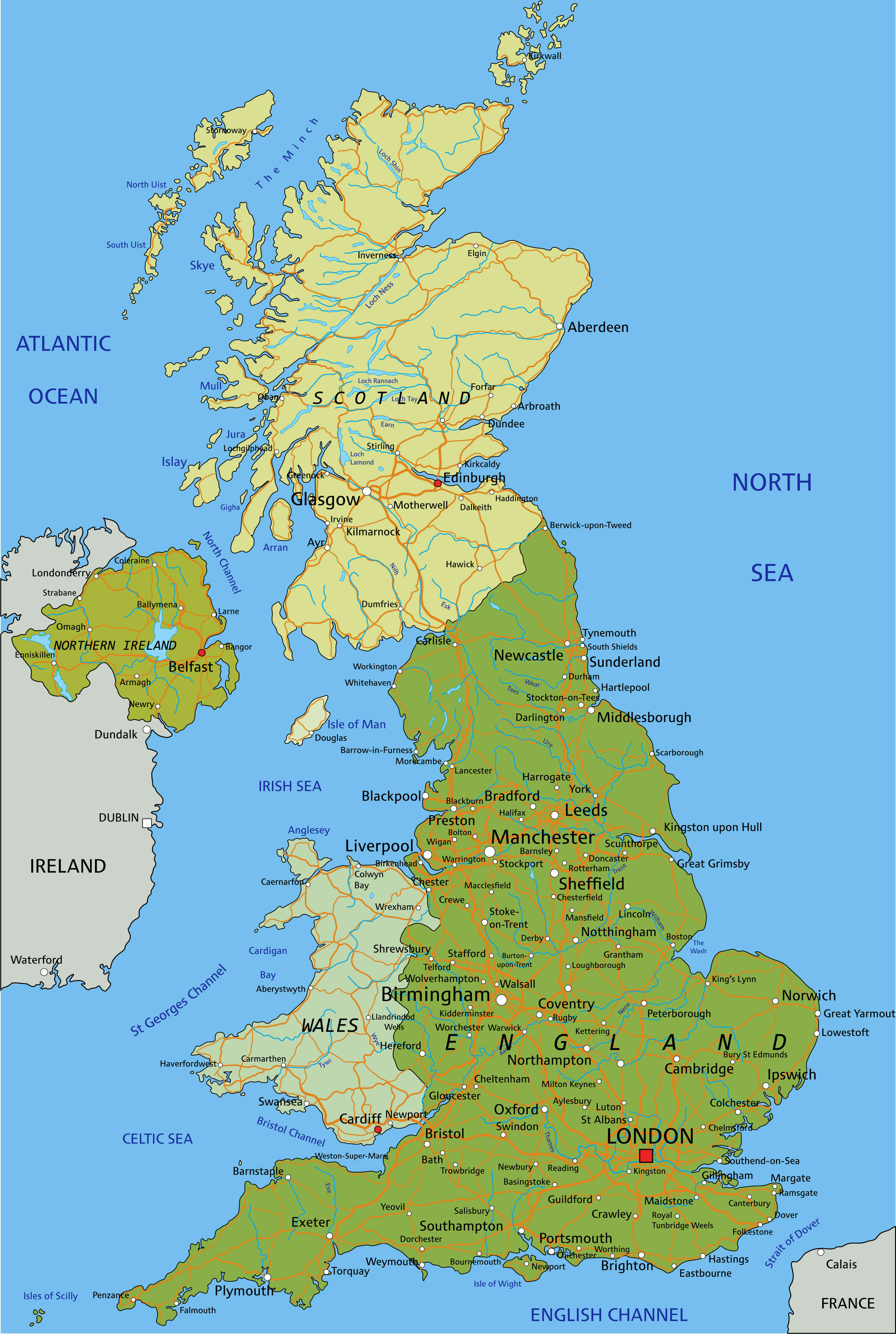
Physical Map of England
 Map of England with cities, rivers, mountains, and surrounding seas
This physical map of England highlights major cities like London, Manchester, and Birmingham, along with notable geographical features such as the Pennines, Cheviot Hills, and the Lake District. Key rivers, including the Thames, Trent, and Severn, are marked, as well as surrounding seas like the North Sea, Celtic Sea, and English Channel. The map also shows neighboring countries and regions, including Scotland, Wales, and Northern Ireland, providing a comprehensive view of England’s landscape and location within the British Isles.
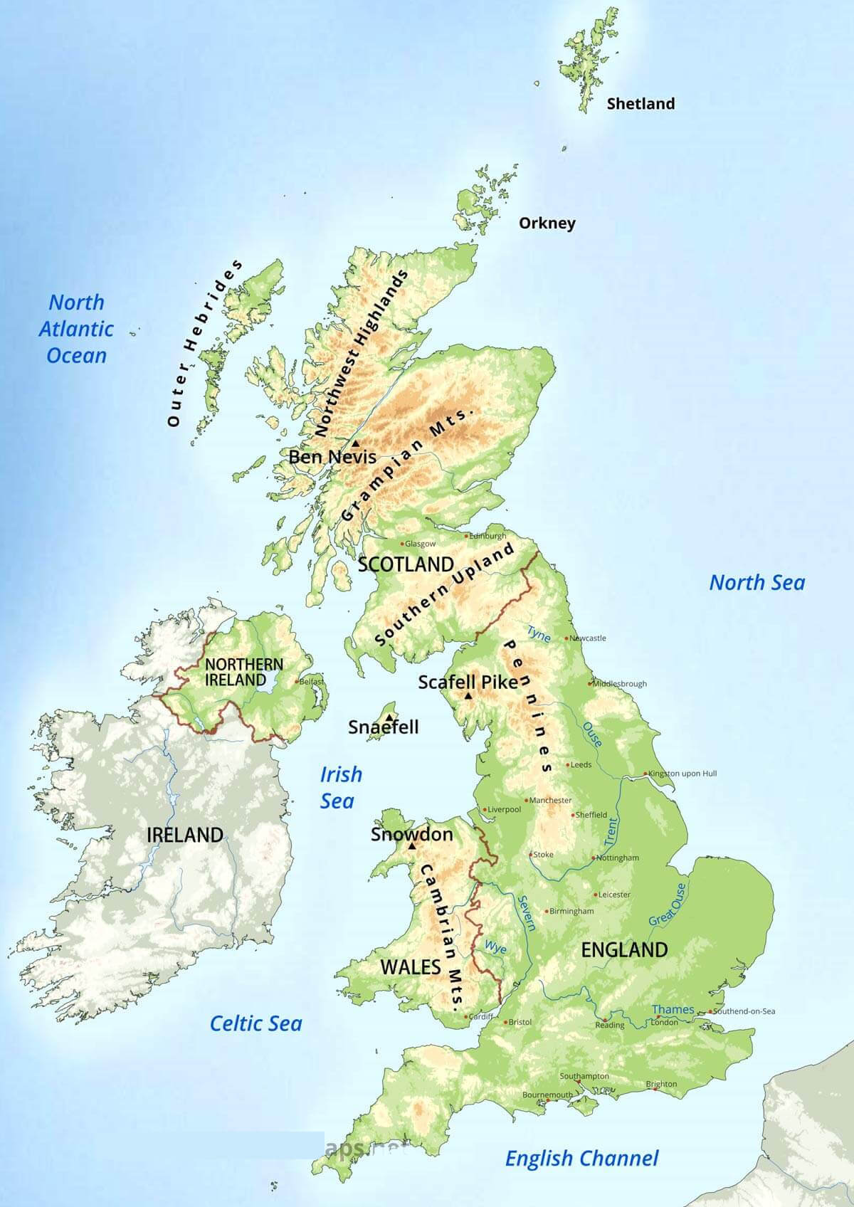
Geography Map of the United Kingdom
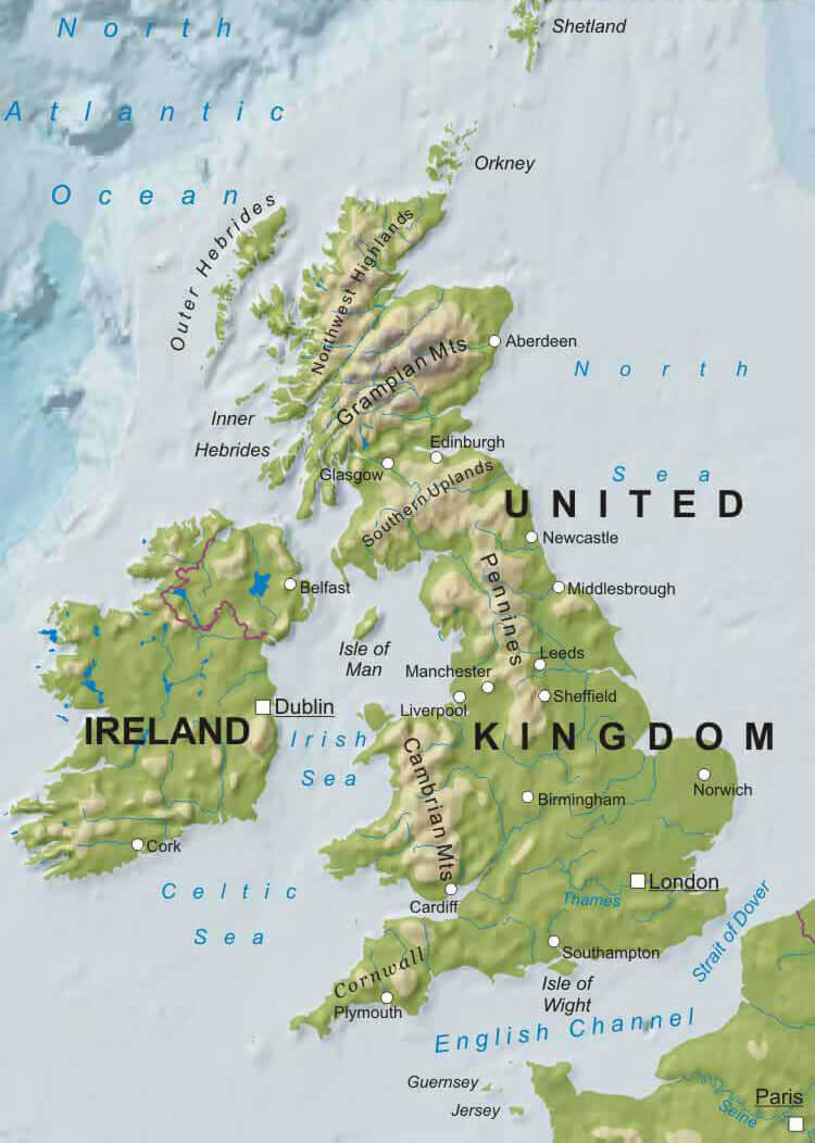 Geographic map of the United Kingdom and Ireland showing mountains, rivers, and regions.
This map illustrates the geography of the United Kingdom, including key mountain ranges like the Grampian Mountains and Southern Uplands, major rivers such as the Thames, and coastal features. It also highlights regions of Ireland and prominent cities like London, Edinburgh, and Dublin.
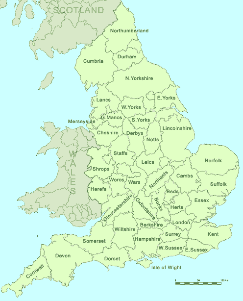
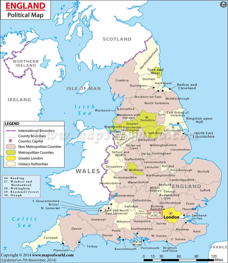
England Counties Map
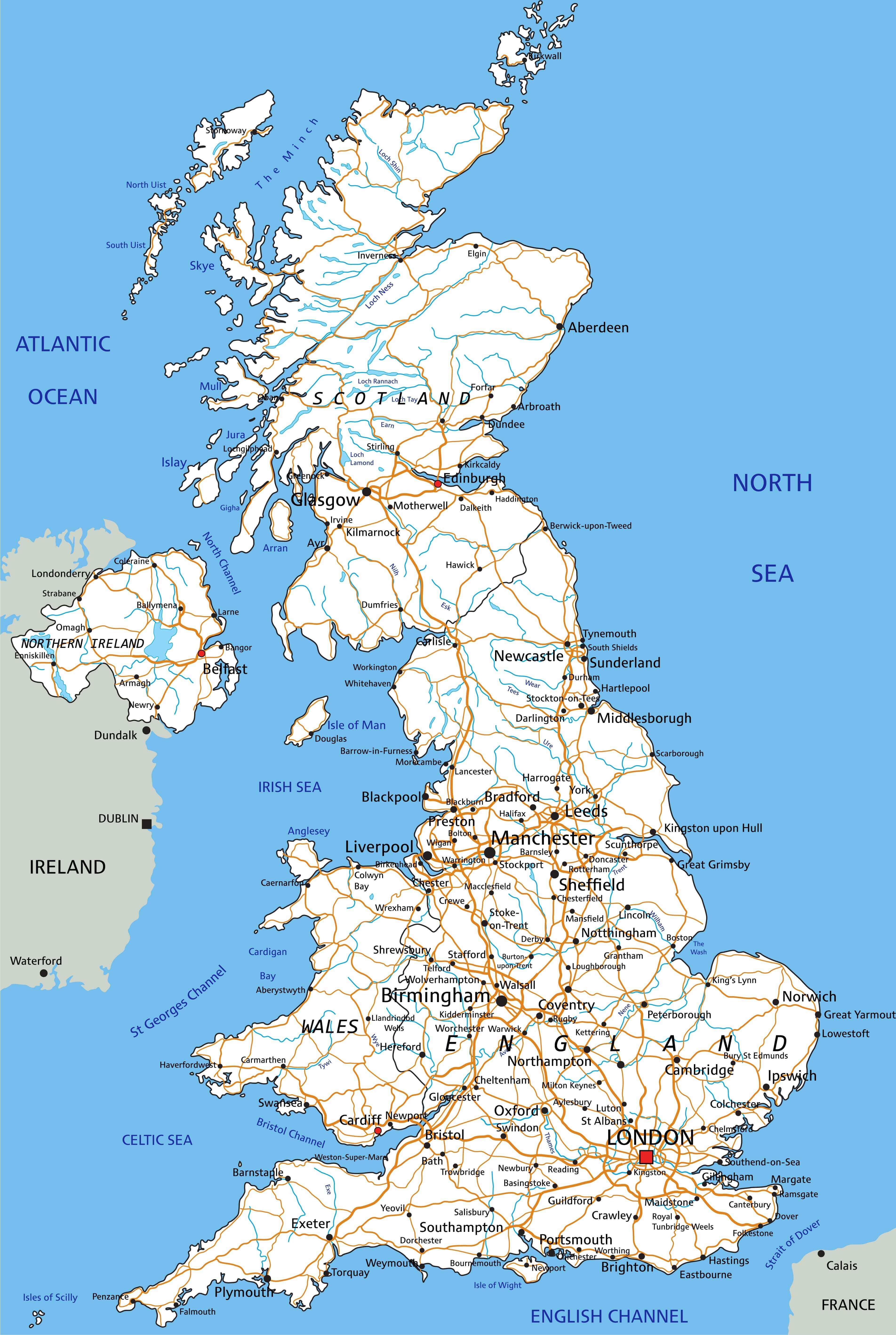
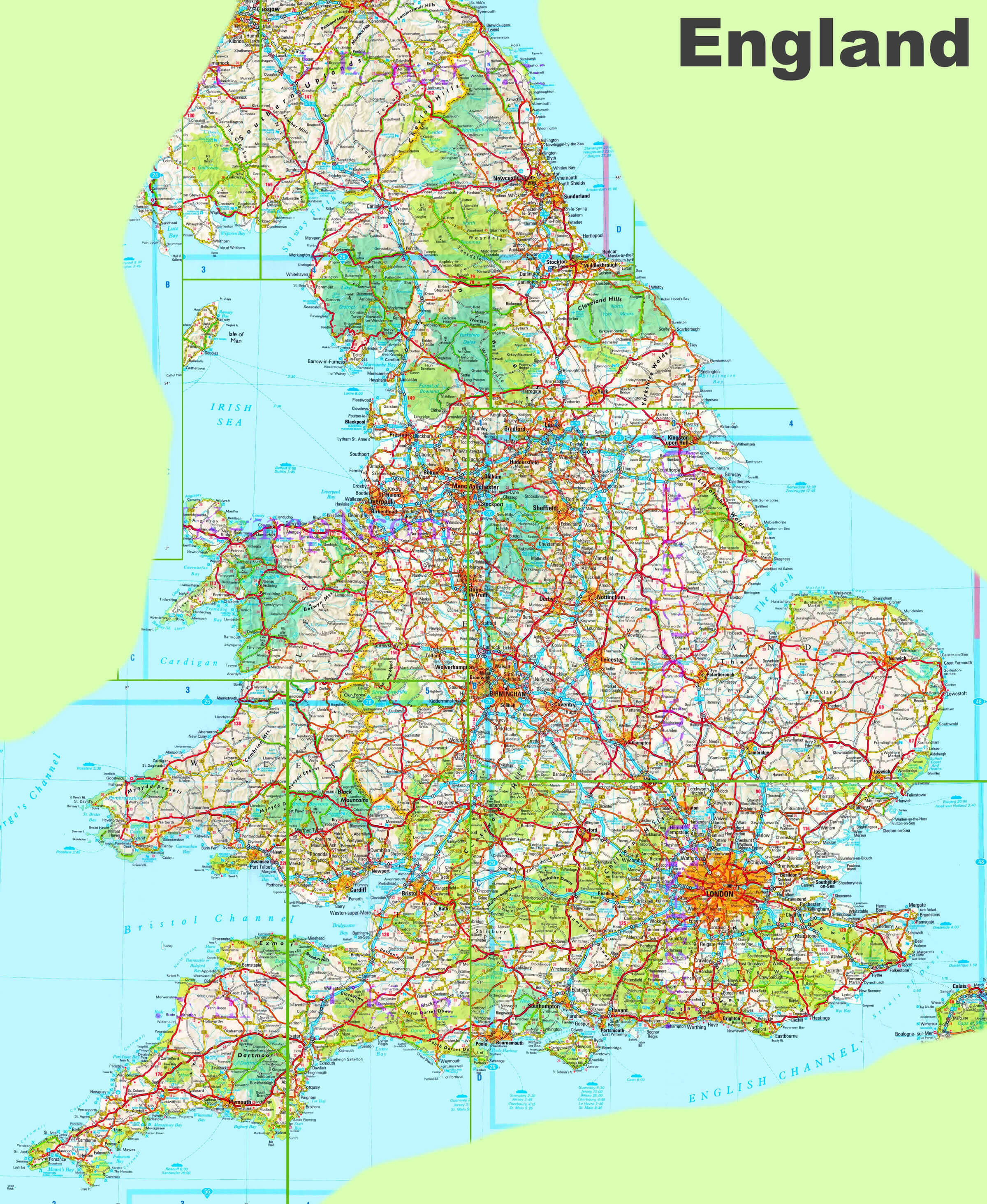
Road and River Map of the United Kingdom
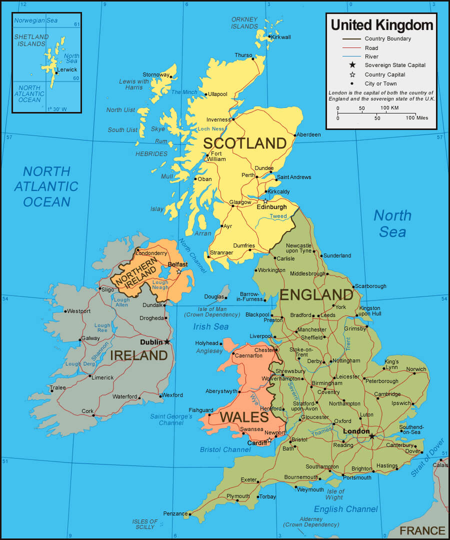 Map of the United Kingdom showing roads, rivers, and country boundaries.
This map shows the road and river network in the United Kingdom, including England, Scotland, Wales and Northern Ireland. Major cities such as London, Edinburgh and Cardiff are labelled. Country boundaries and geographical features such as rivers and coastlines are also clearly shown.
Topographic Map of England and the United Kingdom
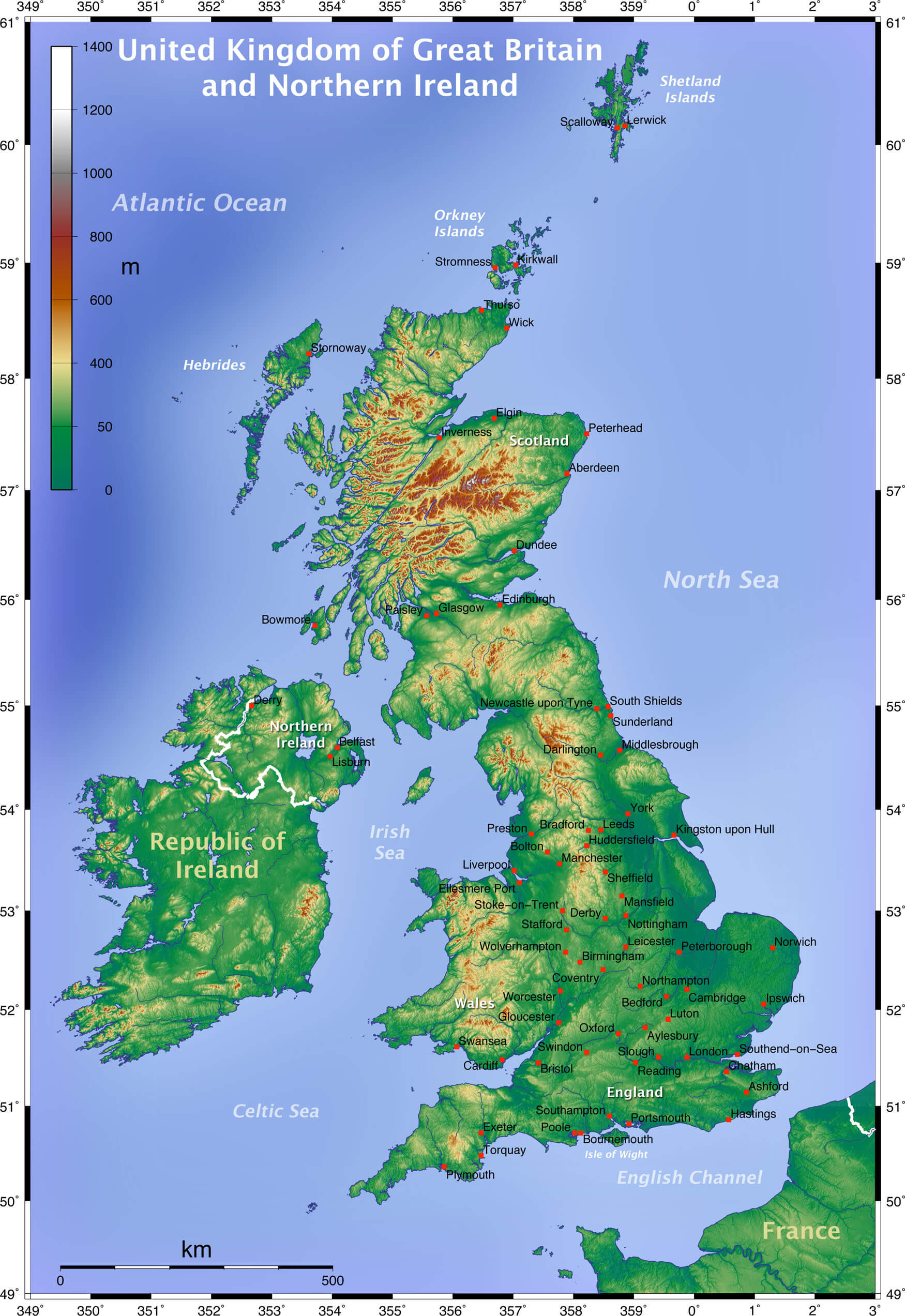 UK Topographic map showing England, Scotland, Wales, and Northern Ireland with elevation
This map highlights the United Kingdom’s topography, including England, Scotland, Wales, and Northern Ireland. Elevations are marked with a color gradient, and key cities like London, Edinburgh, and Belfast are labeled. Surrounding seas and nearby regions, such as Ireland and the English Channel, are also visible.
Map of England
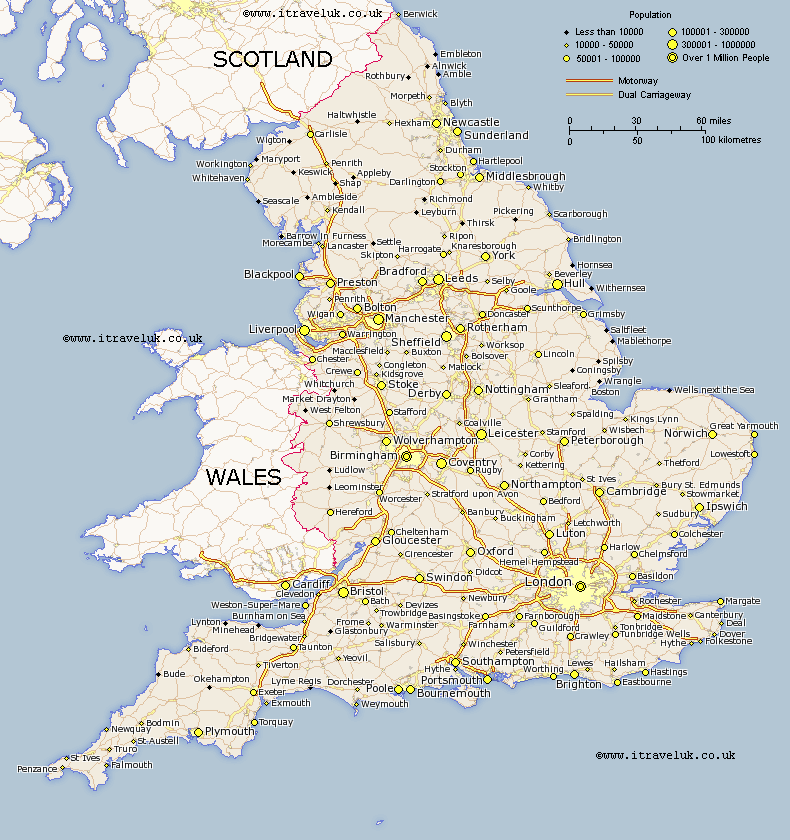 Map of England showing population density, cities, and motorways
This map of England illustrates population density across various cities, with markers indicating the population size—ranging from less than 10,000 to over 1 million people. Major cities such as London, Birmingham, and Manchester are highlighted, along with a detailed network of motorways and dual carriageways connecting the country. The map also shows boundaries with Scotland and Wales, providing a comprehensive view of England’s urban centers and transportation routes.
England County Map
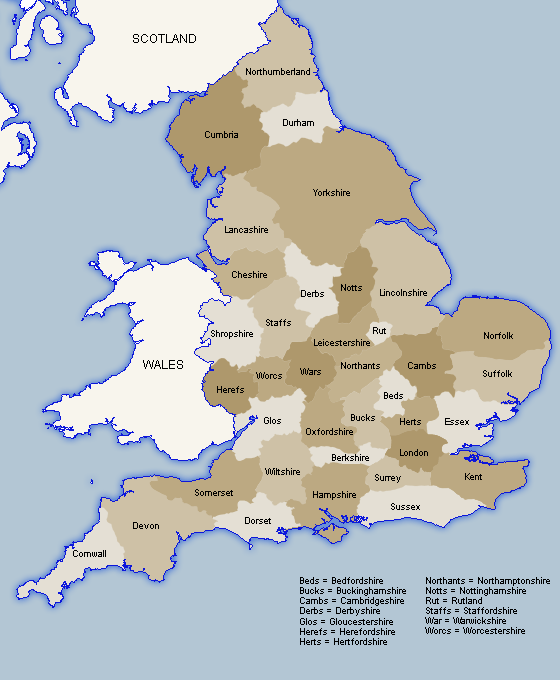 England map showing counties and their abbreviations
This map of England displays the country’s counties with common abbreviations, such as Yorks for Yorkshire, Lancs for Lancashire, and Glos for Gloucestershire. It provides a clear view of England’s county layout, with each county labeled for easy reference, helping to identify regional divisions across the country.
England Google Map
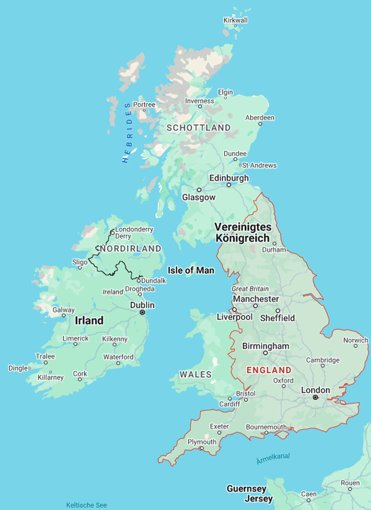
England Political Map
England Physical Map
England Highways Map
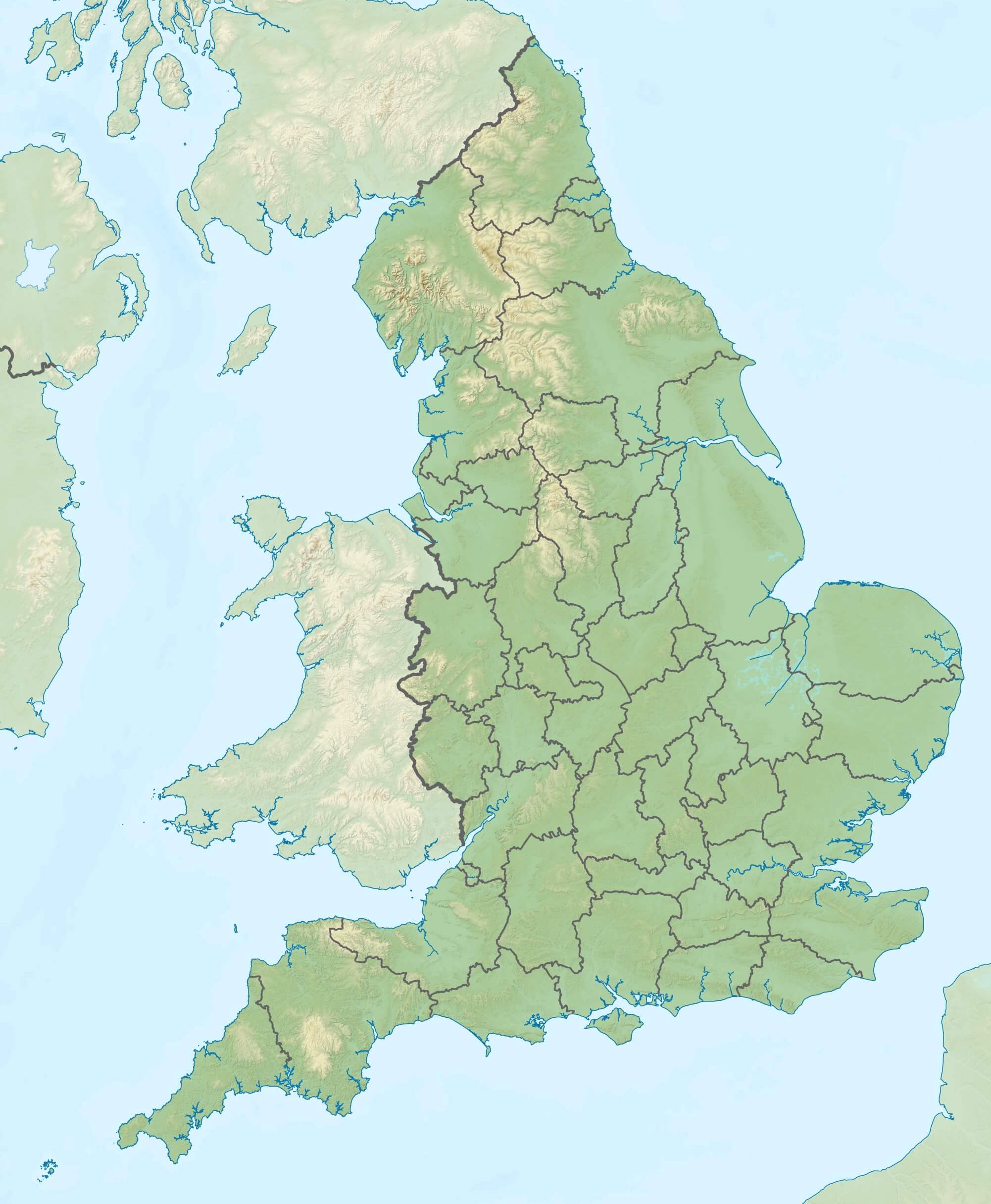
England Relief Location Map
England Earth Map
England Admin Counties 1965-1974
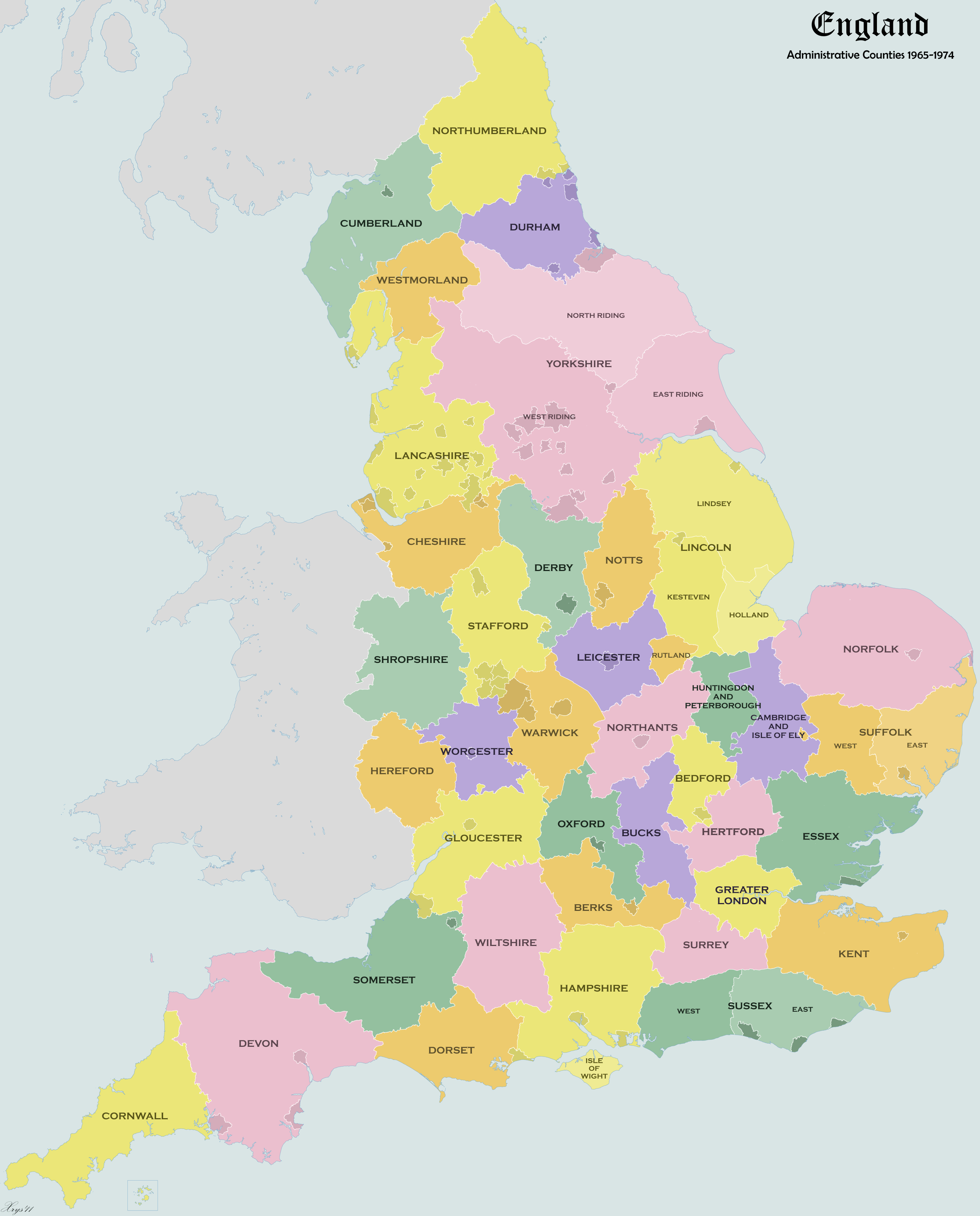 England administrative counties map from 1965 to 1974
This map shows the administrative counties of England as they existed between 1965 and 1974. Key counties such as Yorkshire, Lancashire, Devon, and Greater London are marked, with each county color-coded for clarity. The map provides a historical view of England’s county boundaries and administrative divisions before the restructuring that occurred in later years.
Where is Located England on the UK Map?
Show Google interactive map, satellite map, where is the country located.
Get directions by driving, walking, bicycling, public transportation, and traveling with street view.
Feel free to explore these pages as well:
- A Collection of United Kingdom Maps ↗️
- Map of United Kingdom ↗️
- United Kingdom Map ↗️
- England Map ↗️
- Discovering Cardiff: A Gem in the Heart of Wales ↗️
- Birmingham Unveiled: The Heart of England’s Hidden Gems ↗️
- Discovering Belfast: The Northern Gem of the UK ↗️
- Bradford, United Kingdom: A Vibrant Tapestry of Culture and History ↗️
- United States Map ↗️
- France Map ↗️
- Canada Map ↗️
