- Advertisement -
Here’s a diverse collection of maps of the stunning Murcia region in southeastern Spain, providing an insight into its geography, attractions, and key landmarks.
Brief information about Murcia, Spain
Murcia is a charming city in south-eastern Spain, renowned for its rich history, warm Mediterranean climate and vibrant culture. Founded by the Moors in 825 AD, it retains a blend of Islamic, Christian and modern influences in its architecture and lifestyle. Situated on the River Segura, the city is surrounded by fertile farmland, earning it the nickname ‘Europe’s Orchard’ for its abundant production of fruit, vegetables and flowers. Murcia is also famous for its impressive Baroque and Gothic architecture, particularly in landmarks such as Murcia Cathedral, which boasts a unique blend of Gothic, Renaissance and Baroque styles.
 Murcia City Hall in Spain
The region around Murcia is popular with tourists seeking a quieter Spanish experience, away from the bustling coastal resorts. With nearby natural attractions such as the Sierra Espuña mountains and the Mar Menor lagoon, Murcia offers excellent hiking, sailing and other outdoor activities. The city is also known for its lively festivals, such as the Spring Festival and the Bando de la Huerta, which showcase traditional Murcian culture, food and music. As a university city, Murcia has a youthful atmosphere with a vibrant nightlife, cafes and a range of museums and galleries, making it a well-rounded destination for history buffs, nature lovers and food lovers alike.
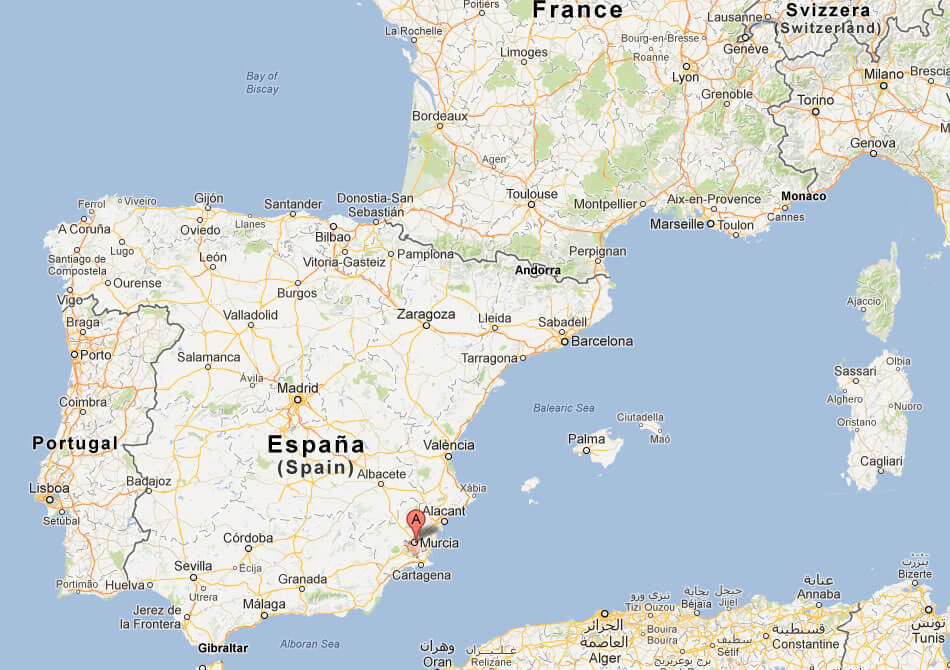
Where is located Murcia on the Spain Map

Murcia is located in the south-east of Spain, inland from the Mediterranean coast. It lies in the heart of the Autonomous Community of the Region of Murcia, nestled along the River Segura. It is bordered to the north-east by the neighbouring autonomous community of Murcia and to the west by Andalusia. Roughly equidistant from major Spanish cities such as Alicante to the north-east and Cartagena to the south, the city of Murcia is centrally located within the region, with easy access to other key locations in south-east Spain. This location gives Murcia a unique inland charm, while still being close enough to the coast for those wishing to explore Spain’s famous beaches.
On the map, the region of Murcia stretches from the mountains to the sea, encompassing not only the city itself, but also a diverse landscape of vineyards, orchards and coastal areas. The province is renowned for its agricultural production, which flourishes in the fertile plains around the Segura River. To the east of Murcia are popular coastal towns such as San Pedro del Pinatar and Los Alcázares on the Mar Menor, a saltwater lagoon separated from the Mediterranean by La Manga, a narrow sandbar. Murcia’s central location in the region makes it a hub for both urban and rural tourism, offering a rich blend of cultural heritage and natural beauty.
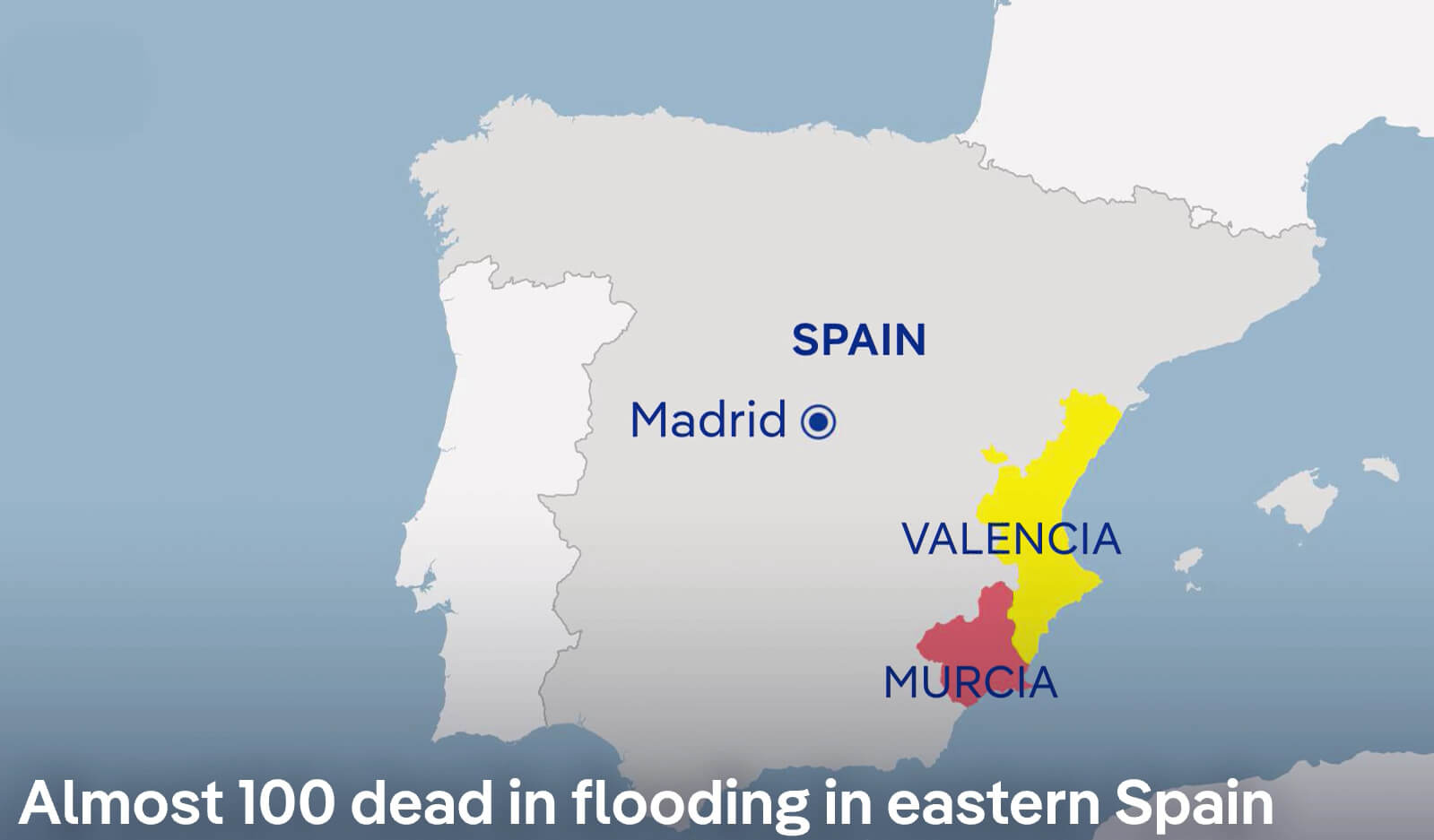
Severe Flooding in Eastern Spain (Valencia and Murcia) – October 30, 2024

Map showing flooding in Valencia and Murcia, eastern Spain, October 30, 2024.
This map shows the regions of Valencia and Murcia in eastern Spain, where severe flooding has tragically claimed nearly 100 lives as of 30 October 2024. The map shows Valencia in yellow and Murcia in red, indicating the severely affected areas. Unusually heavy rainfall has led to catastrophic flooding, affecting communities, infrastructure and emergency services. The proximity of these regions to the Mediterranean Sea, combined with recent weather patterns, has contributed to the extent of the flooding. This event highlights the severe impact of extreme weather on the east coast of Spain.
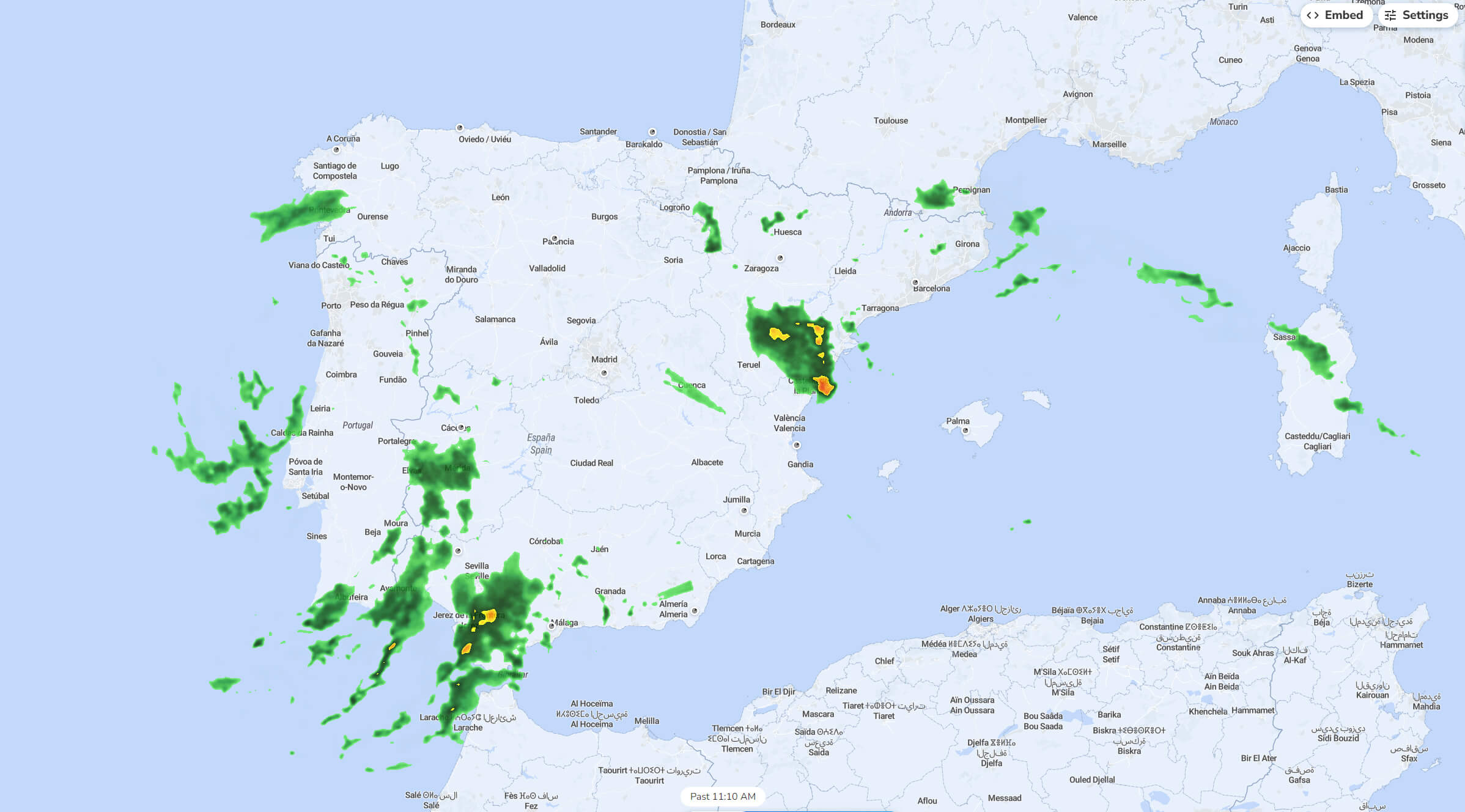
Rainfall Distribution in Spain (October 2024)
 Rainfall map of Spain in October 2024, showing precipitation areas.
This rainfall map of Spain from October 2024 shows areas of precipitation across the country. Dark green areas indicate moderate rainfall, while yellow areas indicate heavier rainfall. The heaviest rainfall is concentrated in the southeastern region around Valencia and in the southern parts near Seville. Other areas, such as Galicia in the north-west and parts of the north coast near the Pyrenees, will also see rain. Some lighter, scattered showers are present in central Spain, while the eastern Mediterranean coast and parts of the Balearic Islands show minimal precipitation. This map reflects Spain’s varied autumn weather, with coastal and mountainous regions receiving more rain than inland areas.
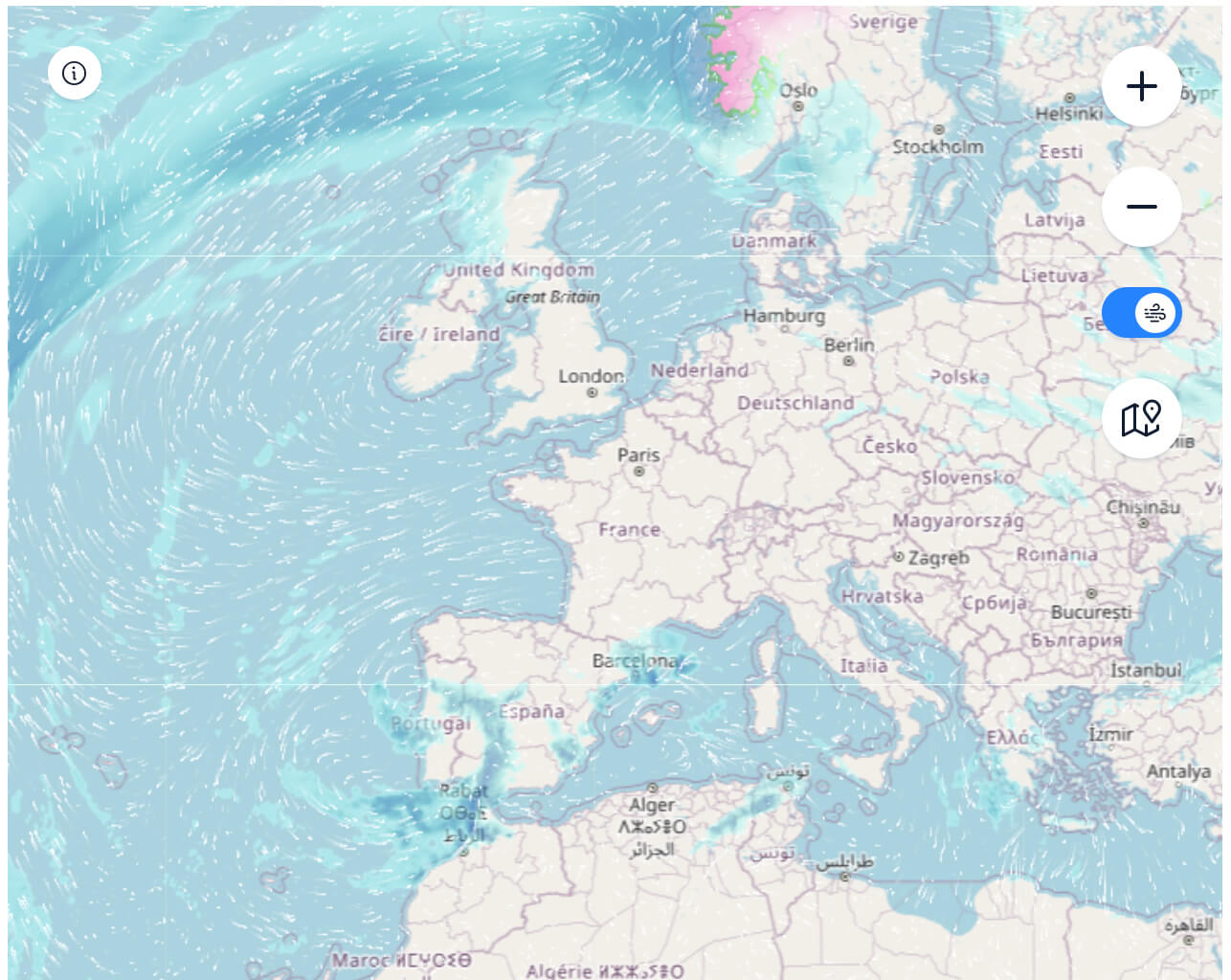
Spain Satellite Rainfall and Weather Map (October 30, 2024)
 Satellite map of Spain’s rainfall and wind patterns on October 30, 2024.
This satellite weather map from 30 October 2024 shows rainfall and wind patterns affecting Spain and surrounding areas in Europe. Heavy rainfall is seen over parts of Ireland, the UK and Norway, while lighter precipitation is seen over parts of western France and the northern coast of Spain. Wind flow lines over the Atlantic indicate a strong circulation, pushing rain-bearing clouds towards the European mainland and influencing the weather over Spain and its neighbours. Spain itself experiences light rainfall along its northern coast, while the central and southern regions appear mostly dry. This map shows the movement of Atlantic weather fronts affecting European weather on this particular day.
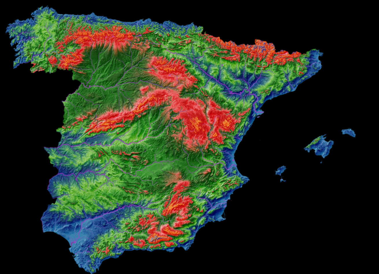
Elevation Map of Spain

Elevation map of Spain showing mountain ranges and altitude variations.
This elevation map of Spain uses colour gradients to represent different altitudes, with red indicating higher elevations and blue indicating lower areas. The Pyrenees in the north-east and the Sierra Nevada in the south appear prominently in red, highlighting their significant altitude. The central meseta plateau, which covers much of inland Spain, is shown in shades of green, indicating moderate altitude. Coastal regions, particularly along the Mediterranean and Atlantic coasts, are shown in blue, reflecting the lowland areas. This map visually emphasises Spain’s mountainous terrain and the contrast between the highland interior and the lower coastal plains.
Here are some statistical information about Spain:
Founded: 825 AD
Area: 881.86 km2 (340.49 sq mi)
Elevation: 43 m (141 ft)
Population: 672,773 (Urban Area – 2021)
GDP: €29.720 billion (2020)
Time zone: UTC+1 (CET) – Summer (DST) UTC+2 (CEST)
Dialing code: 968 / 868
Website: www.murcia.es
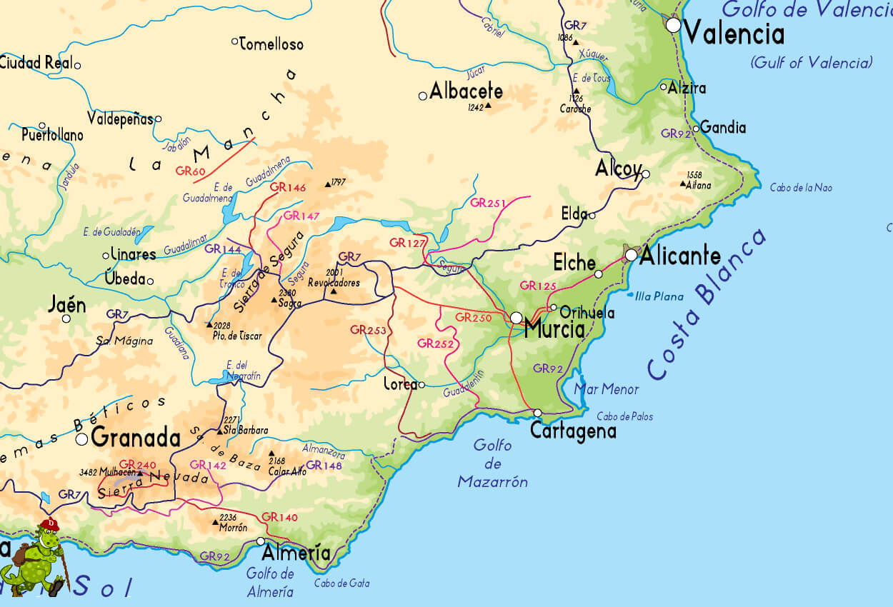
Map of Murcia, Alicante, and Cartagena Areas
 Map of Murcia, Alicante, and Cartagena areas in Spain
This map covers southeastern Spain, highlighting major cities such as Murcia, Alicante and Cartagena, coastal areas such as the Costa Blanca and walking routes. It provides a geographical overview of popular locations and natural attractions.
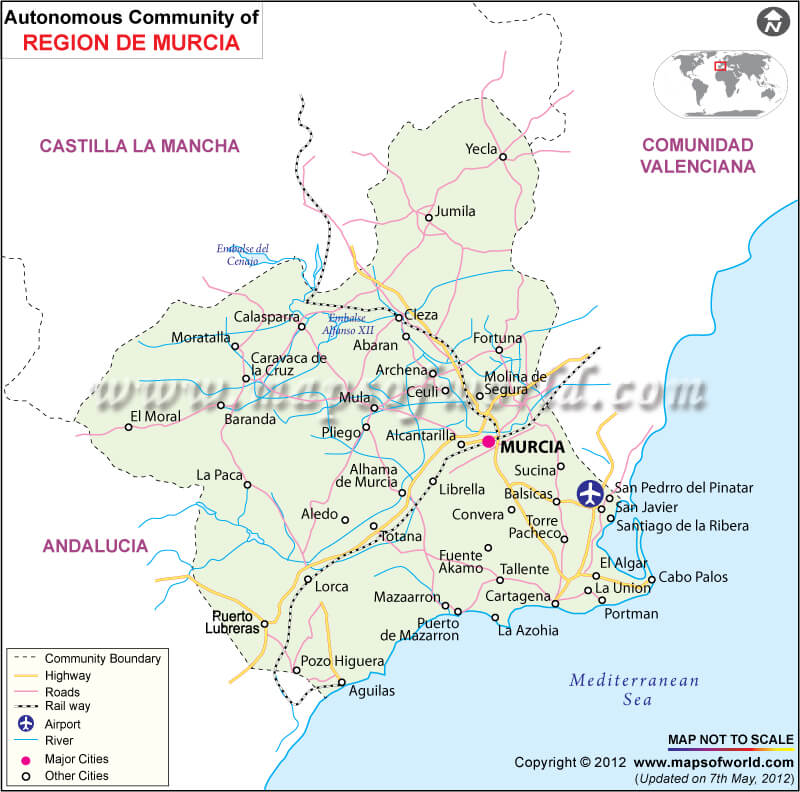
Autonomous Community Map of Murcia, Spain
 Map of the Autonomous Community of Murcia, Spain
This map shows the Autonomous Community of Murcia in detail, highlighting the main towns, roads, motorways and natural features. It shows the borders with neighbouring regions such as Castilla La Mancha and Comunidad Valenciana.
Murcia and Cartagena Region Map
 Map of Murcia and Cartagena region with coastal towns
This map illustrates the Murcia and Cartagena area, including nearby towns like San Pedro del Pinatar, Los Alcázares, and Torre Pacheco, with detailed coastal features around Mar Menor and the Golfo de Mazarrón.
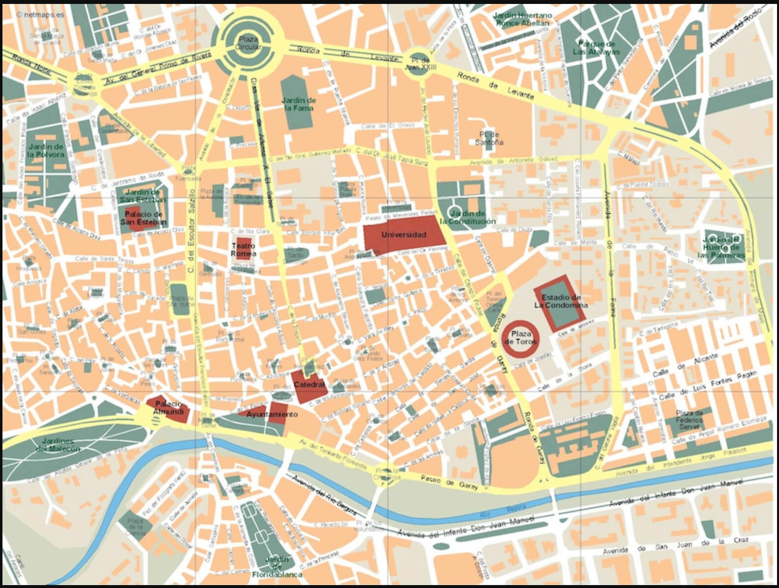
Map of Murcia City Center

Map of Murcia city center with landmarks and main streets
This detailed map of Murcia’s city center highlights major landmarks, including Plaza Circular, the University, Teatro Romea, Palacio de San Esteban, and Estadio de La Condomina. Key roads and green spaces are also indicated for easy navigation.
Highways Map of Murcia and Alicante Regions
 Murcia and Alicante highways map with major routes
This map showcases the highway network connecting Murcia and Alicante, including major routes to towns like Torrevieja, Orihuela, Elche, and Cartagena. Key coastal points along the Costa Blanca and Mar Menor are also highlighted.
Map of Murcia Region and Surrounding Areas
 Location map of Murcia with nearby towns and highways
This map displays Murcia’s location, highlighting nearby towns such as Orihuela, Elche, and Torrevieja. It includes major highways (A-7, A-30) and natural parks, showing Murcia’s proximity to Alicante and coastal areas like Mar Menor.
Map of Murcia and Surrounding Cities
 Map of Murcia with cities, national parks, and Costa Cálida
This map shows Murcia and nearby cities like Cartagena, Lorca, and Cieza, along with national parks and coastal areas like Costa Cálida. Key locations, including airports and notable towns like Yecla and Jumilla, are highlighted.
Map of Murcia and Mediterranean Coastline
 Map of Murcia with Mediterranean coastline and major highways
This map highlights the Murcia region, extending along the Mediterranean coast, including nearby cities such as Valencia, Alicante, and Cartagena. Major highways, coastal towns, and geographical features, like Golfo de Valencia and Costa Cálida, are also marked.
Physical Map of Murcia Region in Spain
 Physical map of Murcia region in Spain with rivers and cities
This physical map shows the topography of Murcia, Spain, highlighting its mountainous areas, valleys, and river systems, such as the Segura River. Key cities like Murcia, Lorca, and Cartagena are marked, showcasing the region’s geographic diversity.
Map of Murcia Province in Spain
 Map showing Murcia Province, Spain, in orange
This map highlights Murcia, a province in southeastern Spain, in orange. Bordered by the Mediterranean Sea to the east, Murcia is shown in relation to nearby countries and regions, including Portugal, France, and Africa across the sea
Murcia province on map Spain
 Murcia province on map Spain
Wine and Agricultural Regions of Murcia Province, Spain
 Map of wine regions in Murcia, Spain with DOP and IGP areas
This map of Murcia, Spain highlights key wine regions with DOP (Denomination of Protected Origin) areas such as Yecla, Jumilla and Bullas, and IGP (Protected Geographical Indication) areas, Abanilla and Campo de Cartagena, showing regional wine and agricultural zones.
Detailed Relief Map of Murcia, Spain
 Relief map of Murcia, Spain, showing terrain, towns, and roads
This relief map of Murcia shows the geography of the region, including mountains, valleys and natural parks. Major cities such as Murcia, Cartagena and Lorca are shown, along with major roads, rivers and coastal areas along the Costa Cálida, with detailed topography.
Road Map of Murcia Region, Spain
 Detailed road map of Murcia region in southeastern Spain
This road map of Murcia highlights major highways and routes connecting key cities like Murcia, Cartagena, and Lorca, as well as surrounding regions like Alicante and Albacete. Coastal and inland routes, airports, and natural landmarks are also marked for navigation.
Satellite View of Murcia Region, Spain
 Satellite map showing terrain and coastline of Murcia, Spain
This satellite map offers a bird’s-eye view of Murcia, highlighting its diverse landscapes, from mountains and agricultural fields to coastal areas along the Mediterranean. Major locations like Murcia city, Los Alcázares, and surrounding towns are visible.
Travel Map of Murcia Region, Spain
 Murcia travel map with key cities, parks, and coastal areas
This travel map of Murcia highlights major towns, natural parks, and popular coastal areas like La Manga del Mar Menor and the Gulf of Mazarrón. It provides an overview for visitors, including parks like Sierra Espuña and regional landmarks for exploration.
Location of Murcia Region on the Map of Spain
 Map highlighting Murcia region in red on Spain’s map
This map highlights the Region of Murcia in red within Spain’s national borders. Located in southeastern Spain, Murcia is bordered by the Mediterranean Sea and neighboring regions, showcasing its geographic position relative to the rest of the country.
Where is Murcia on the Spain Map?
Show Google interactive map, satellite map, where is the country located.
Get directions by driving, walking, bicycling, public transportation and travel with street view.
Feel free to explore these pages as well:
- Advertisement -
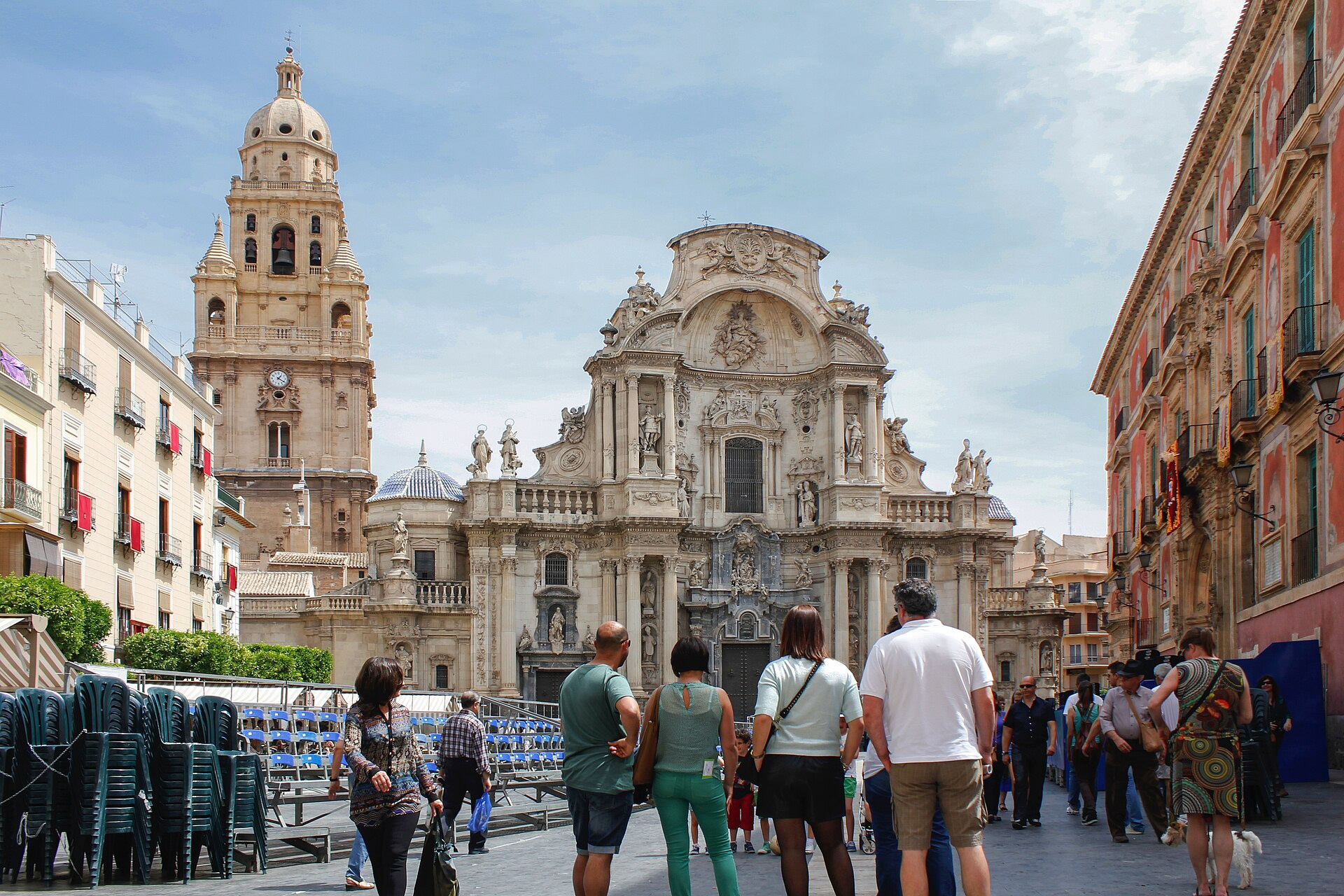 Murcia City Hall in Spain
 Rainfall map of Spain in October 2024, showing precipitation areas.
 Satellite map of Spain’s rainfall and wind patterns on October 30, 2024.
 Map of Murcia, Alicante, and Cartagena areas in Spain
 Map of the Autonomous Community of Murcia, Spain
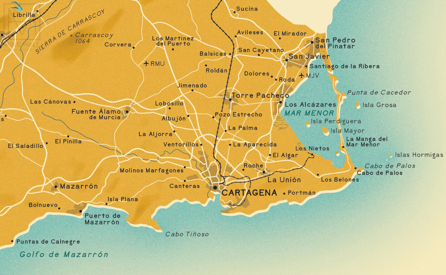 Map of Murcia and Cartagena region with coastal towns
 Murcia and Alicante highways map with major routes
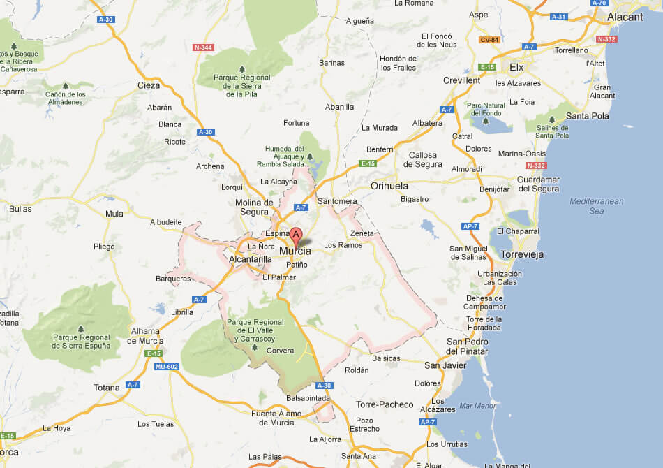 Location map of Murcia with nearby towns and highways
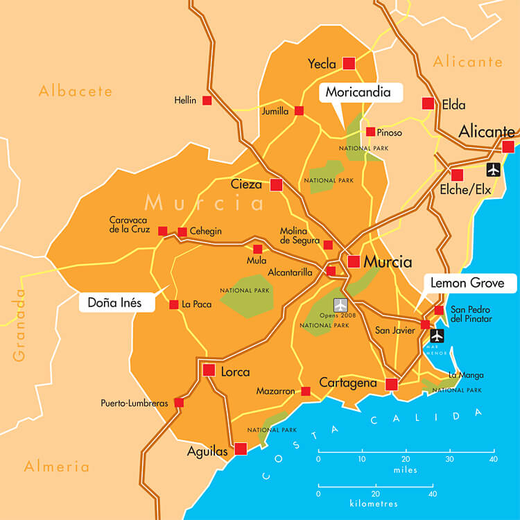 Map of Murcia with cities, national parks, and Costa Cálida
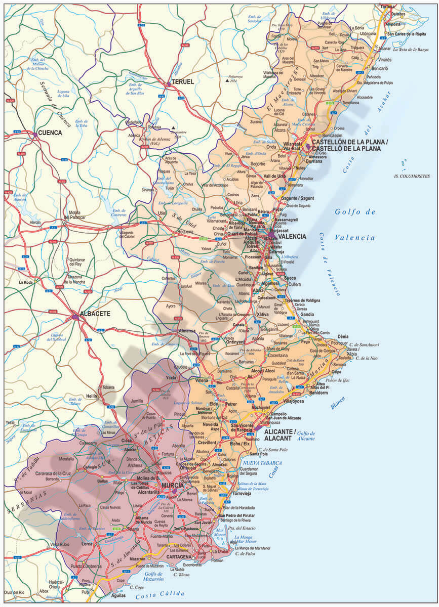 Map of Murcia with Mediterranean coastline and major highways
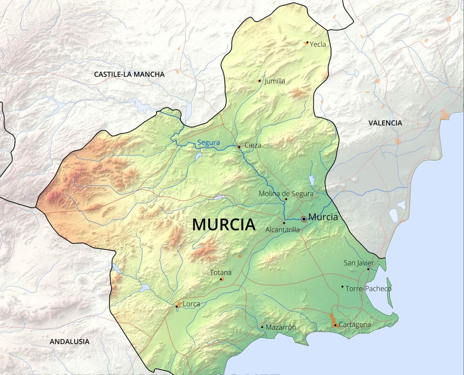 Physical map of Murcia region in Spain with rivers and cities
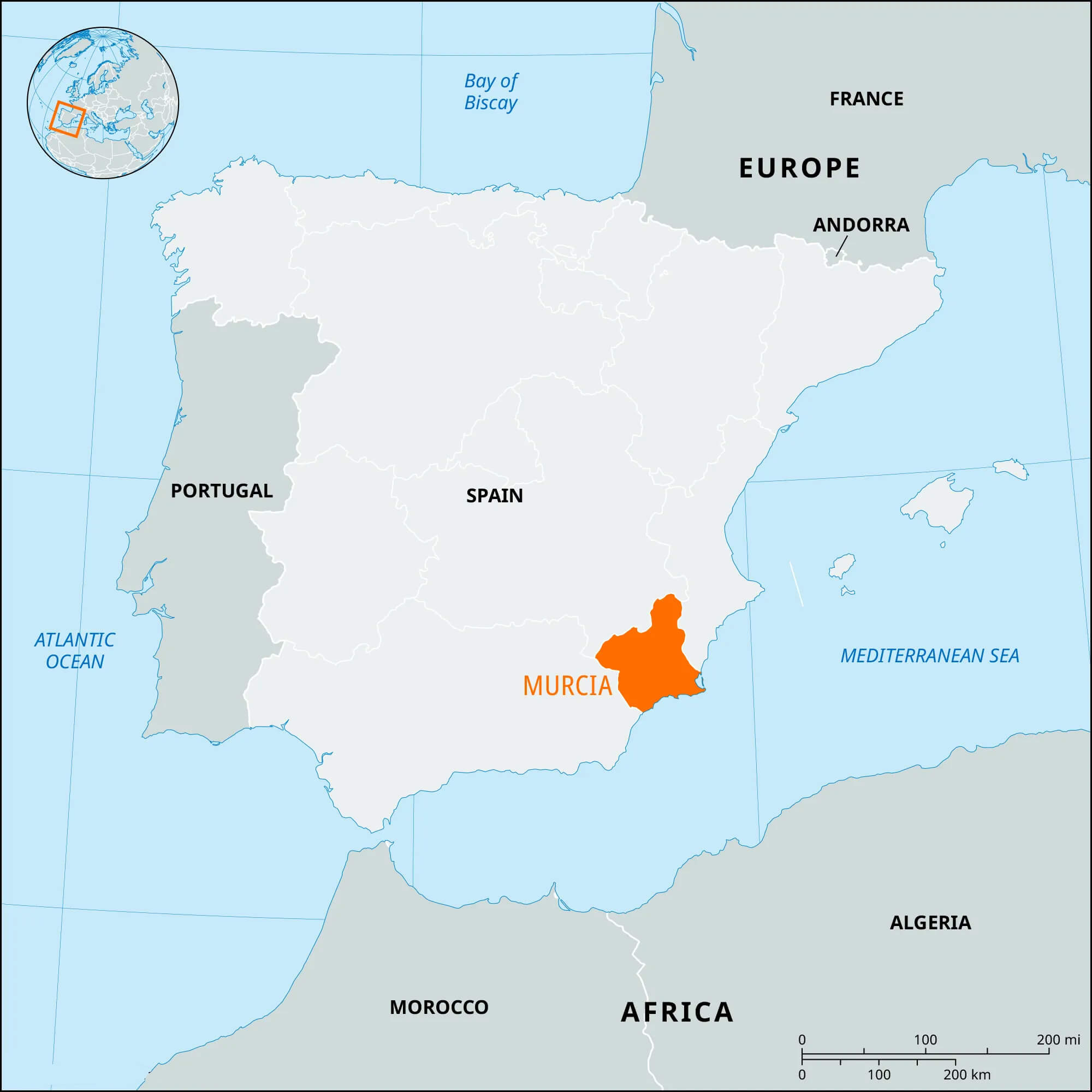 Map showing Murcia Province, Spain, in orange
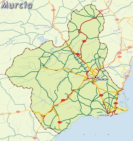 Murcia province on map Spain
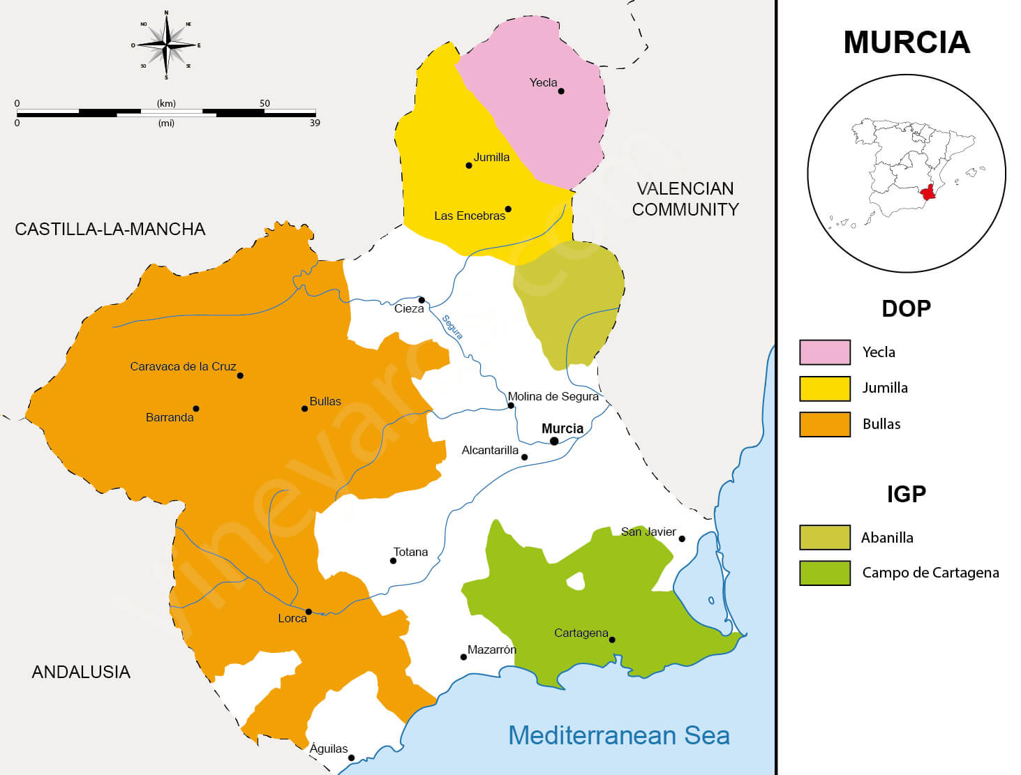 Map of wine regions in Murcia, Spain with DOP and IGP areas
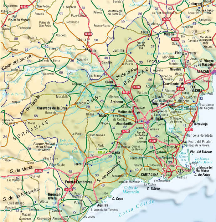 Relief map of Murcia, Spain, showing terrain, towns, and roads
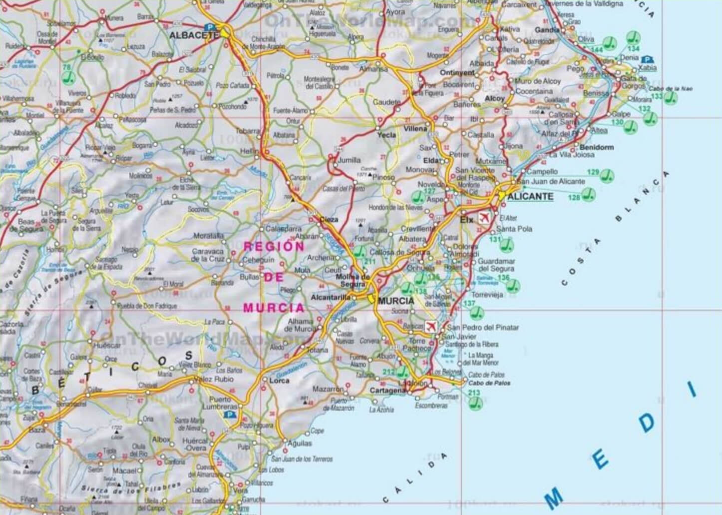 Detailed road map of Murcia region in southeastern Spain
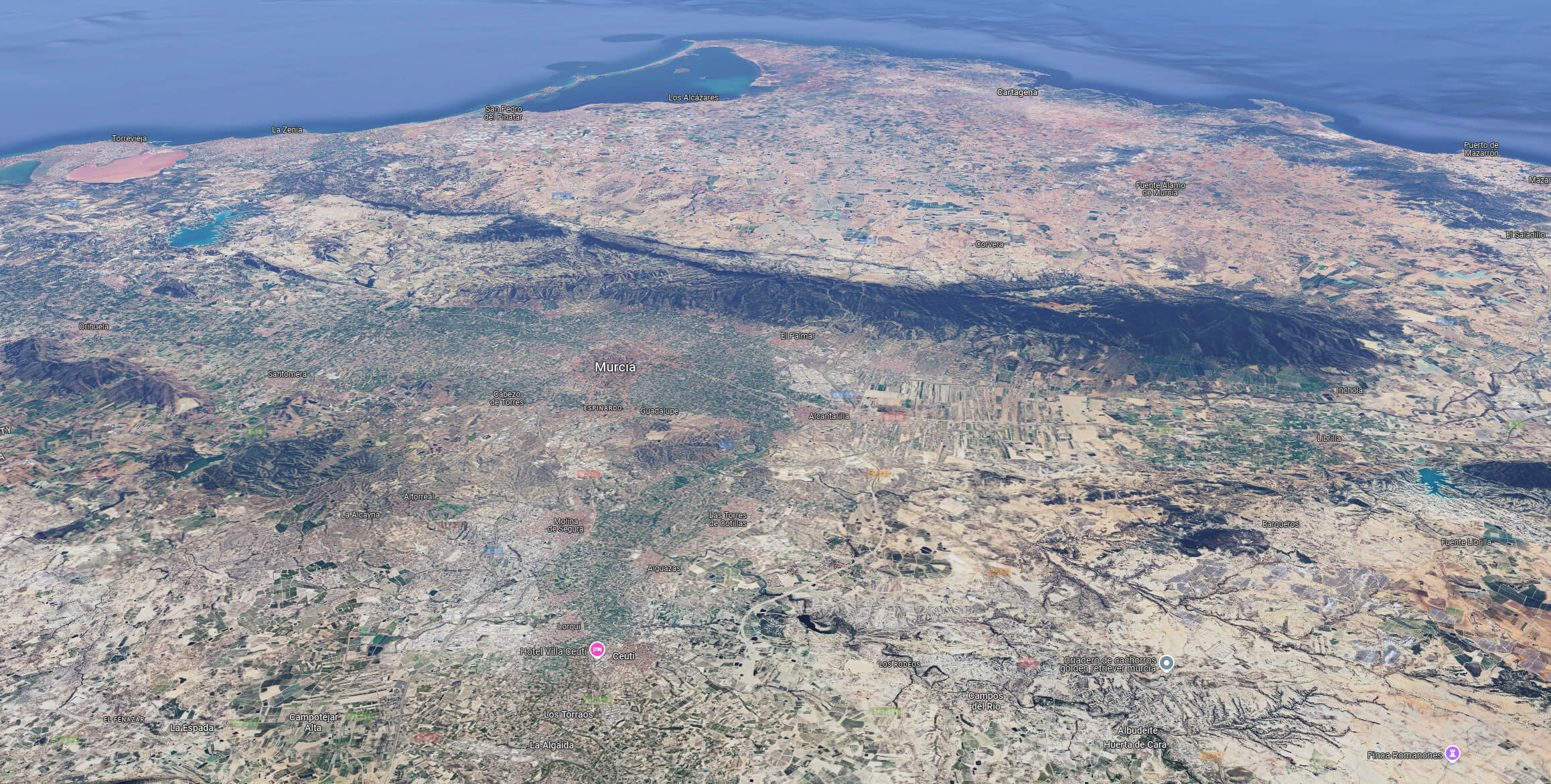 Satellite map showing terrain and coastline of Murcia, Spain
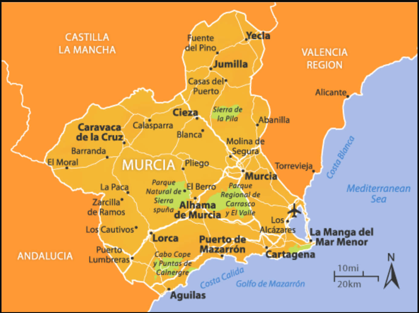 Murcia travel map with key cities, parks, and coastal areas
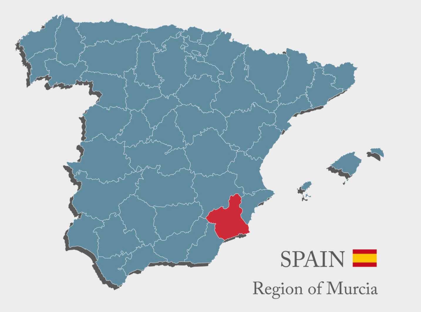 Map highlighting Murcia region in red on Spain’s map