Nestled in the Iberian Peninsula, Spain boasts a diverse tapestry of cultures, languages, and landscapes. It’s a land where passionate Flamenco dances, awe-inspiring architectural marvels, and flavorsome paellas come to life. And as you journey from the golden beaches of Costa del Sol to the historic alleys of Toledo, there’s no better companion than a well-detailed map. Welcome to our comprehensive collection dedicated solely to Spain! With this guide, we invite you to navigate and explore Spain’s multifaceted charm from various lenses – be it geographical, political, or historical.
1. Detailed Geographical Map of Spain
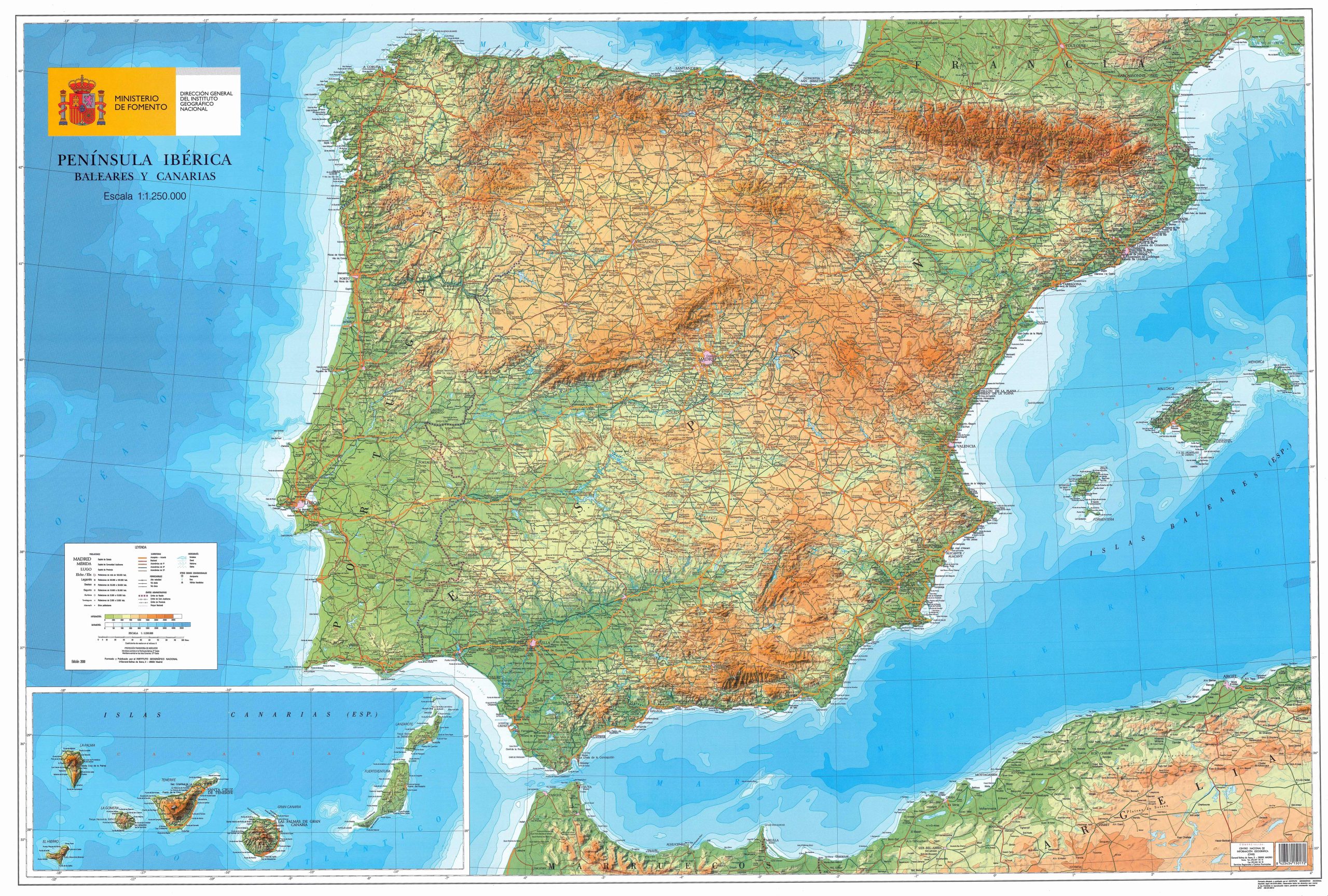
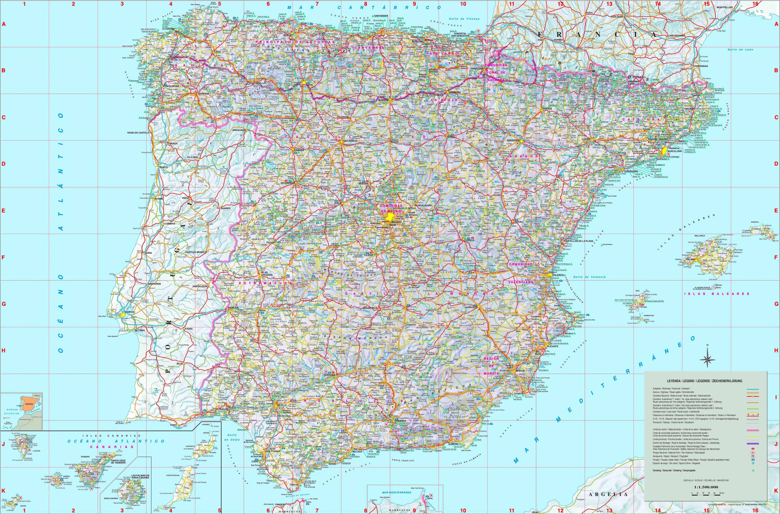
Dive deep into Spain’s nooks and crannies. From the bustling cities to the serene countryside, get a detailed look into the geographical layout of this diverse country.
2. Spain Physical Map
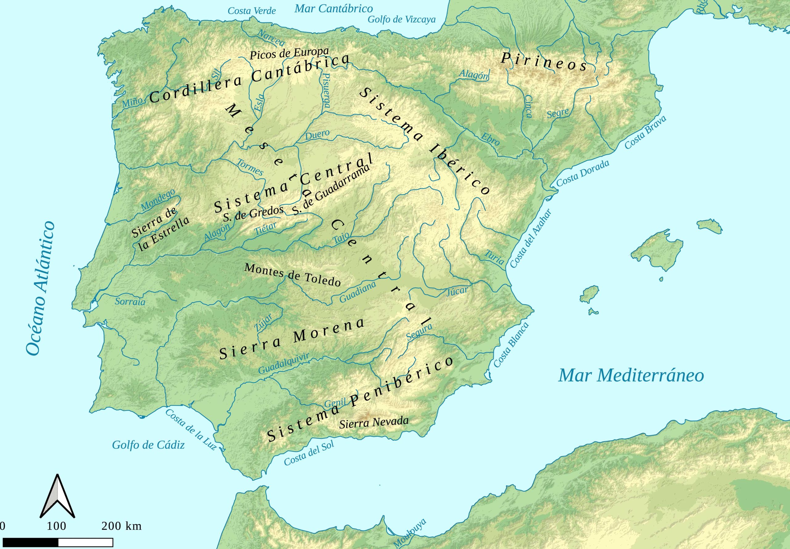
Explore Spain’s natural terrains – the majestic mountains, rolling plains, and its extensive coastline.
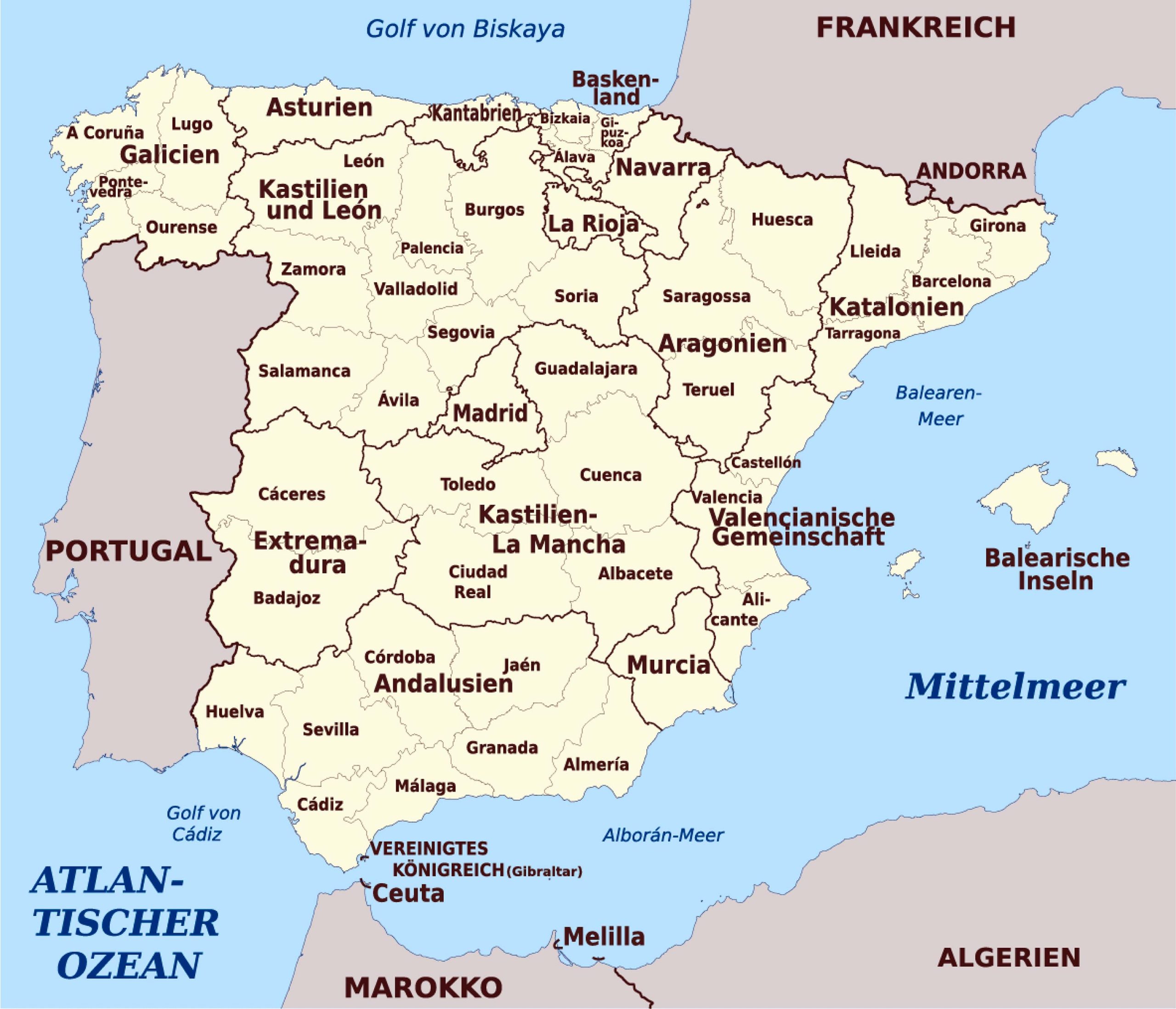
3. Detailed Map of Spain
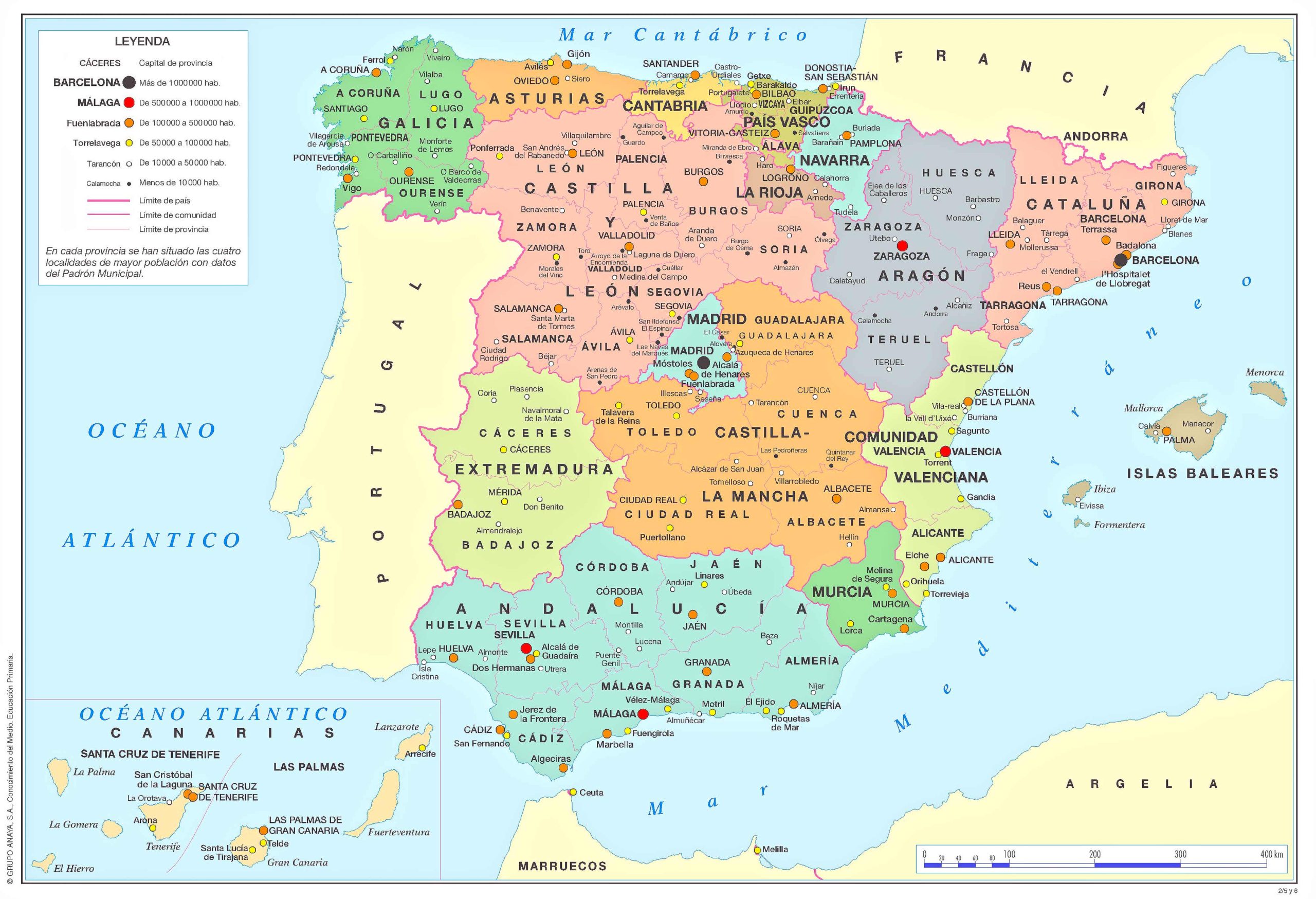
Discover the political divisions, from its provinces to the autonomous regions.
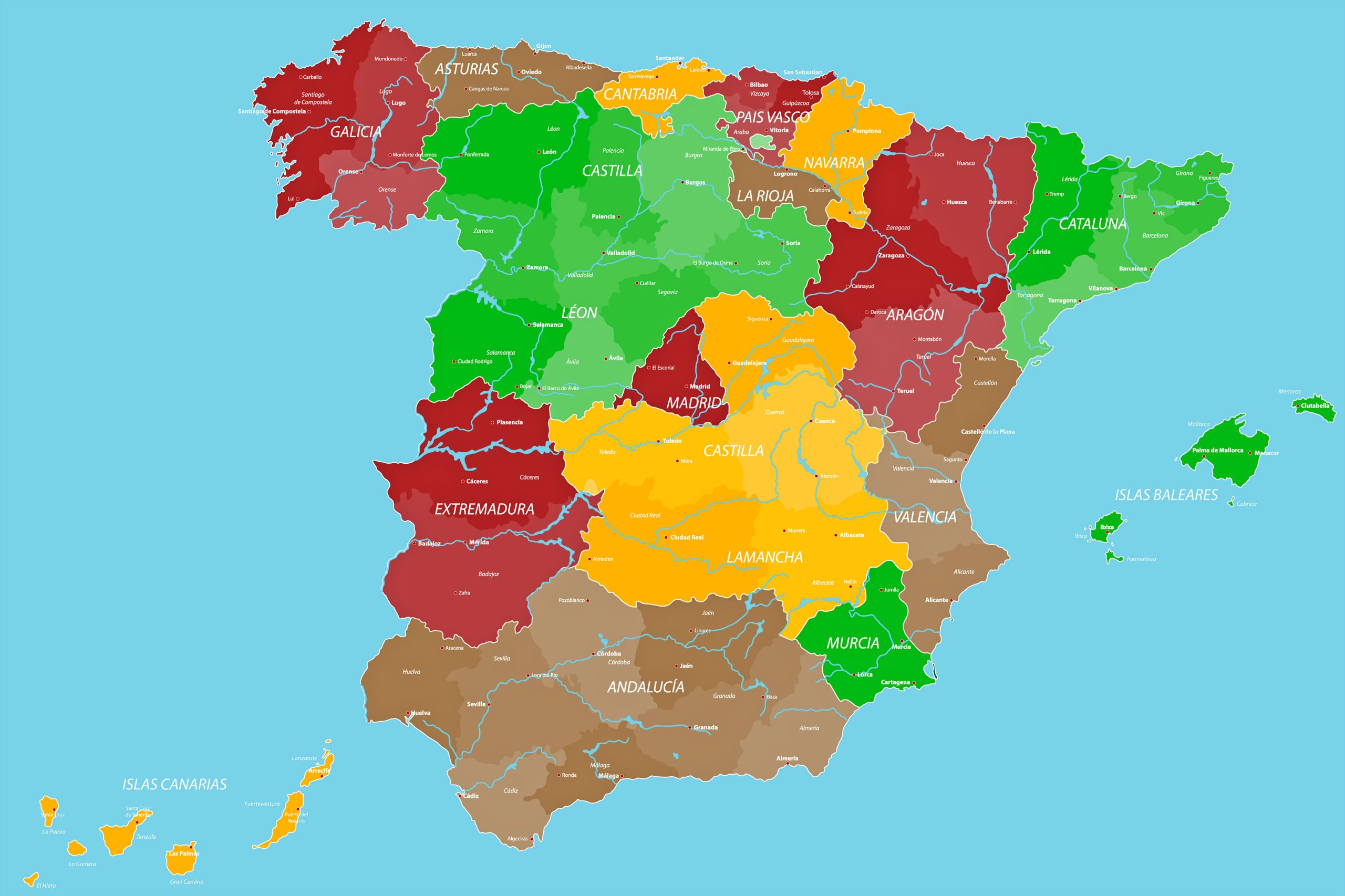
4. Spain Political Map
Discover the political divisions, from its provinces to the autonomous regions.
5. Spain Administrative Map
Get insights into Spain’s administrative divisions and the nuances of its governance.
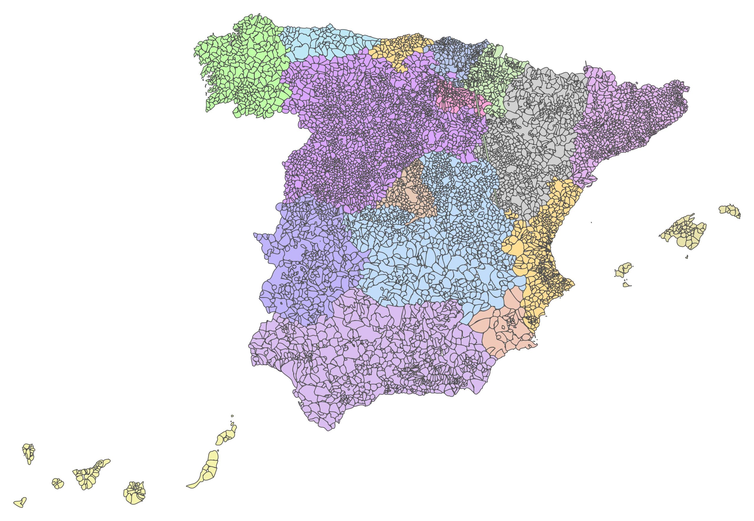
6. Spain Municipalities Blank Map
A blank canvas! This map showcases the various municipalities, perfect for educators and students.
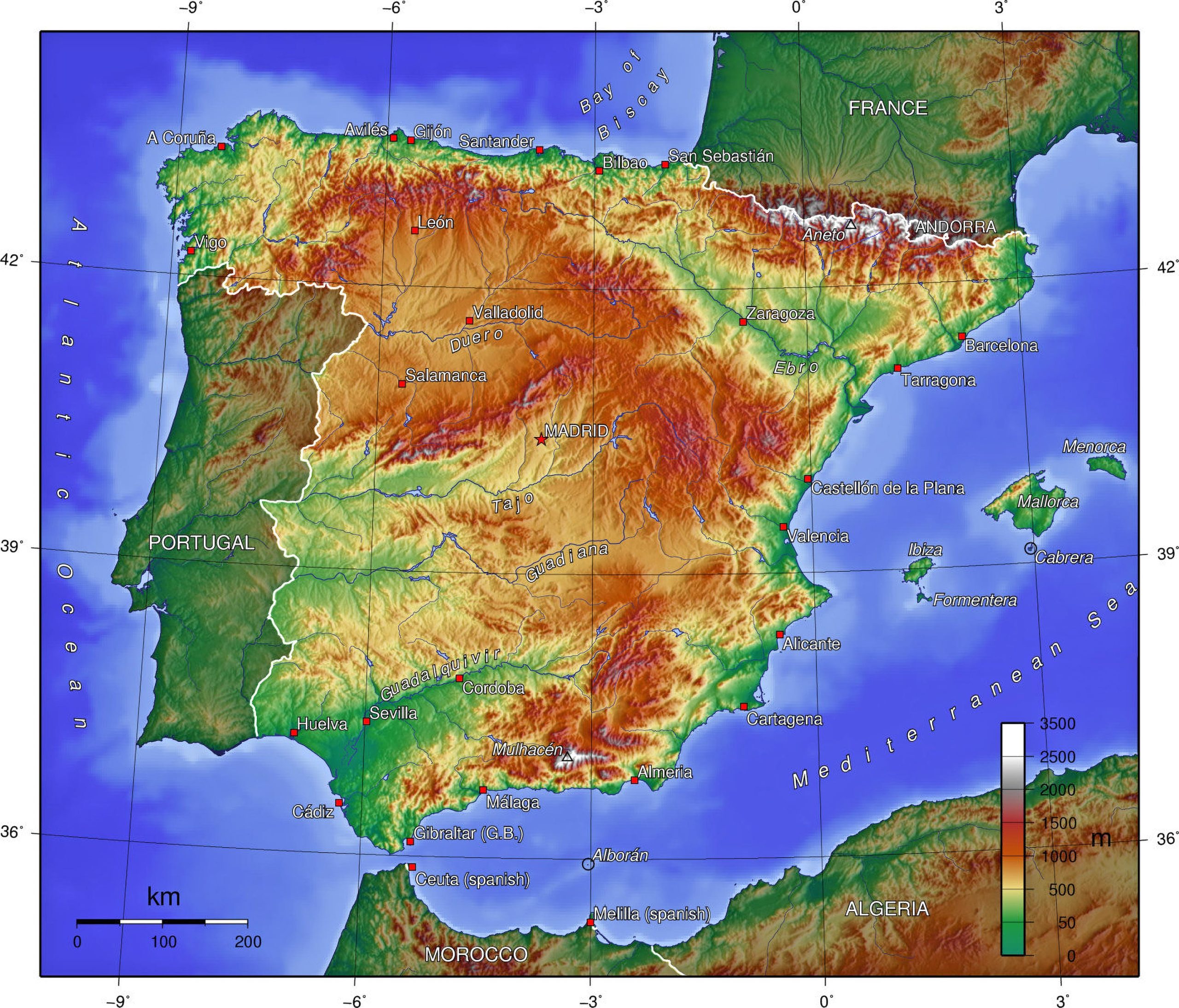
7. Spain Topographic Map
The highs and lows of Spain, laid out with precision. Navigate the contours and elevations of this beautiful country.
8. Spain Geographical Map
The Spain Geographical Map provides an intricate overview of the nation’s diverse landscapes, capturing the essence of the Iberian Peninsula in detail.
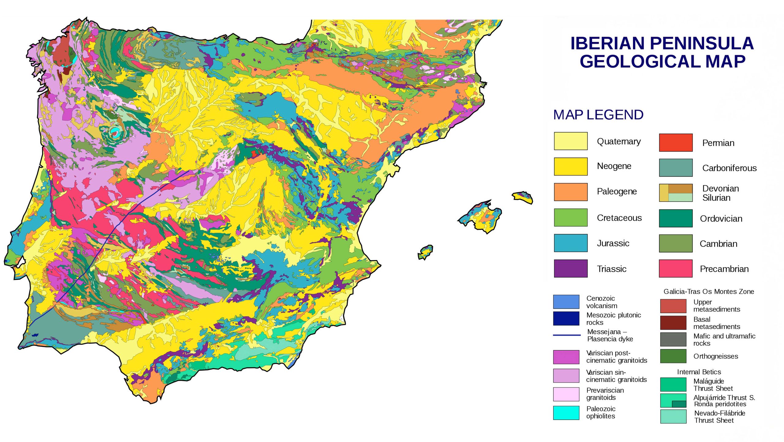
9. Spain Geological Map
Dig deeper into the ground and uncover Spain’s geological wonders.
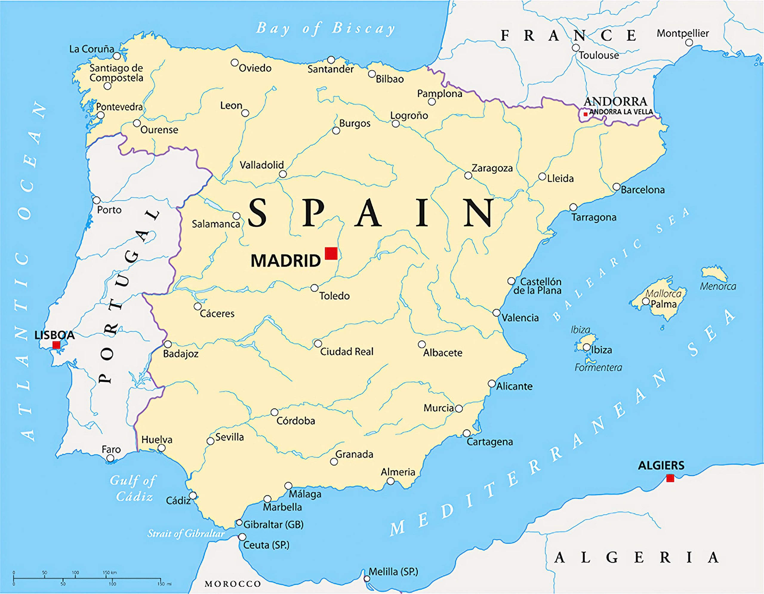
10. Spain Cities (Urban) Map
From Madrid to Barcelona, get an urban perspective of Spain’s bustling cities.
11. Spain Regions Map
Discover the unique characteristics of each of Spain’s regions.
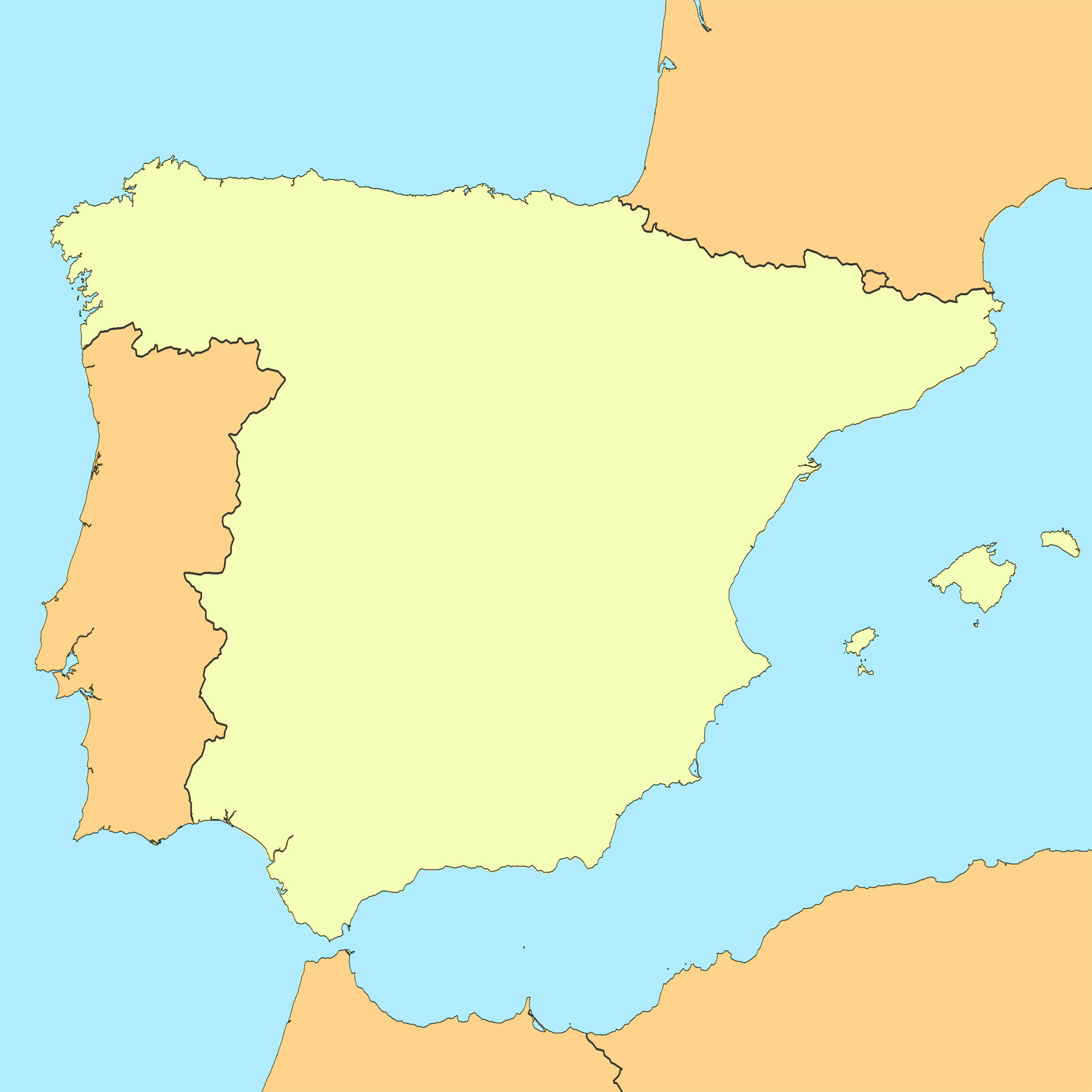
12. Spain Blank Map
The Spain Blank Map offers a clear, unmarked canvas, ideal for educators, students, and enthusiasts to customize and annotate based on their specific needs.
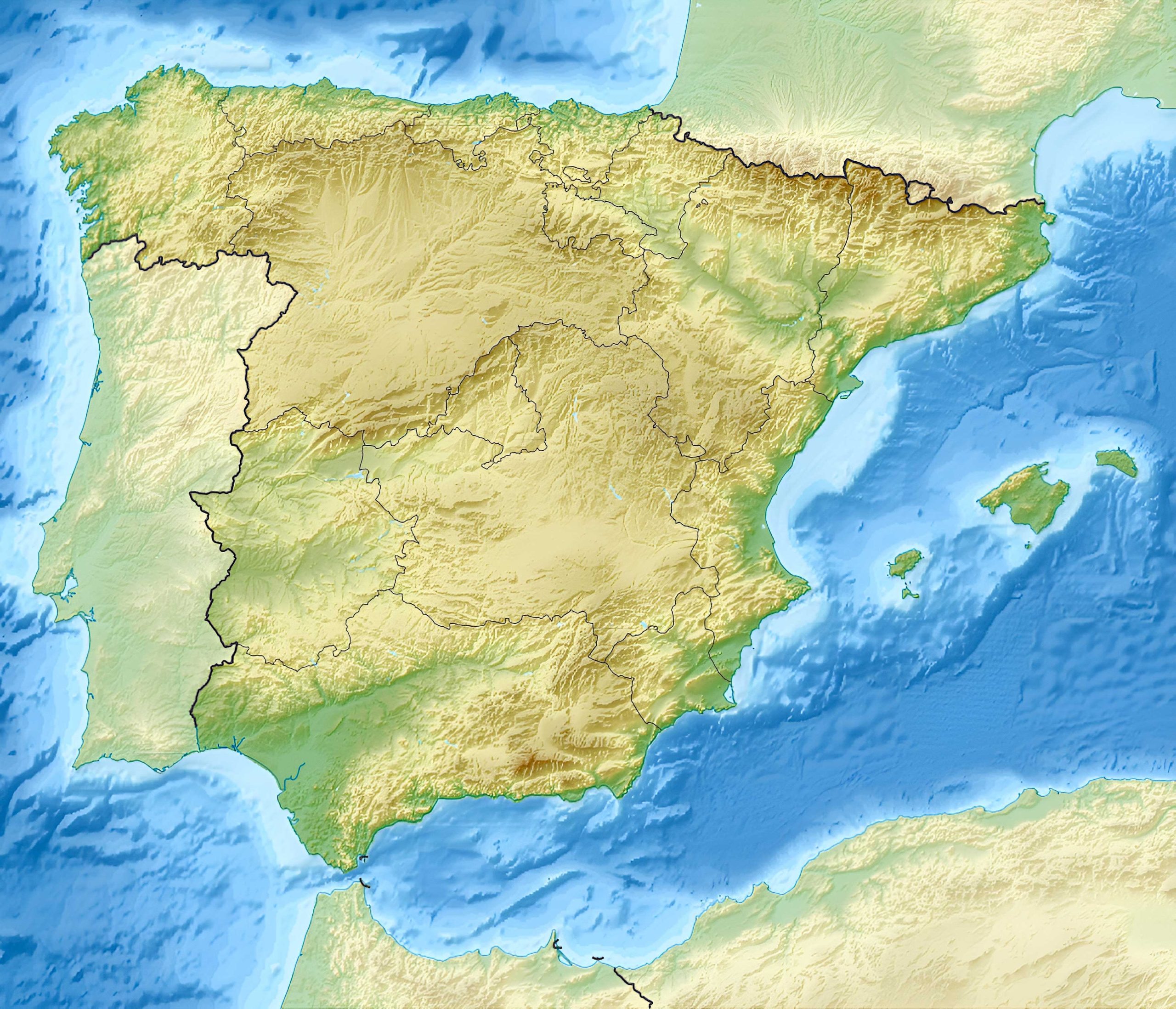
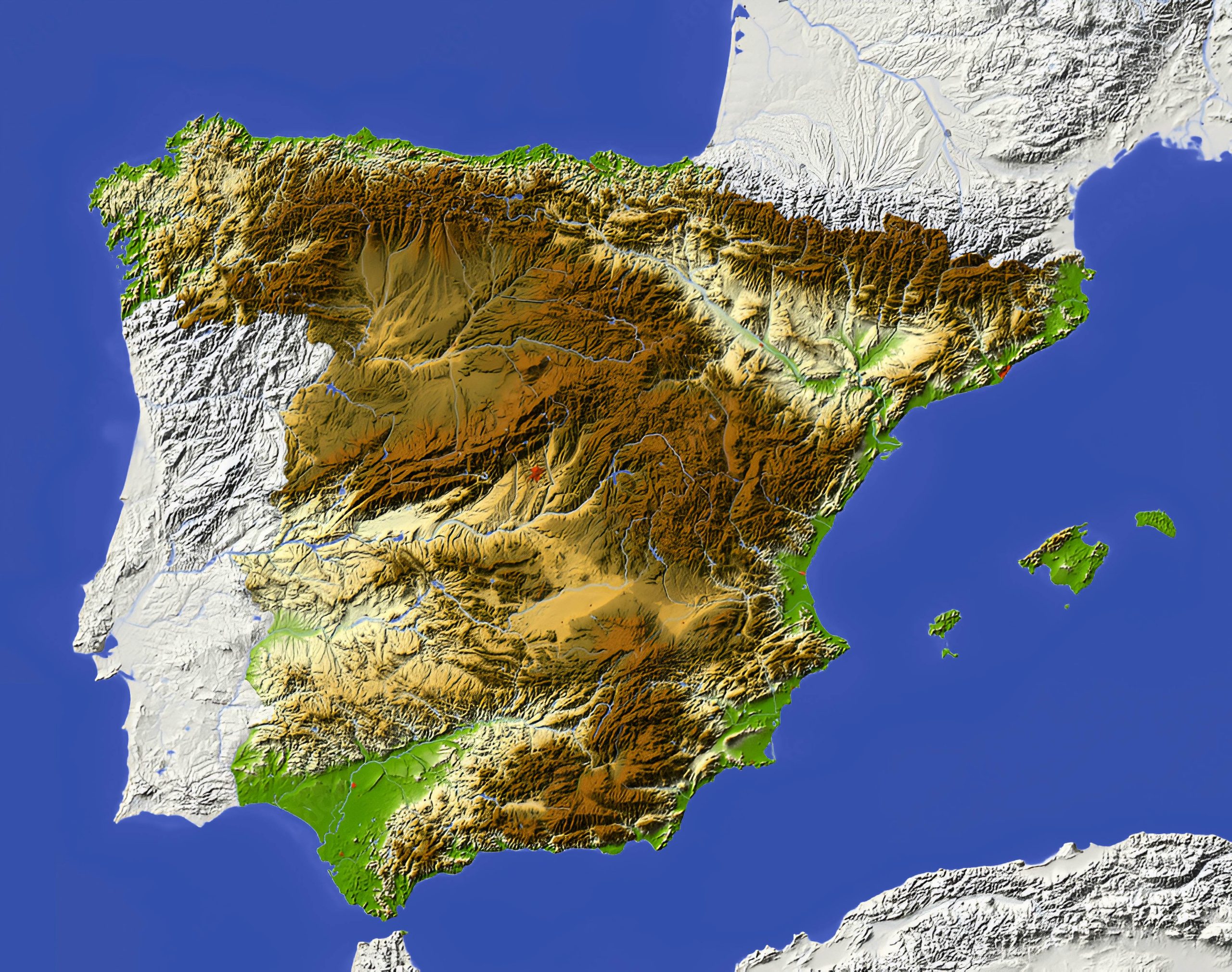
13. Spain Relief Map
The Spain Relief Map vividly highlights the country’s varied elevations and terrains, showcasing its majestic mountains, valleys, and plateaus.
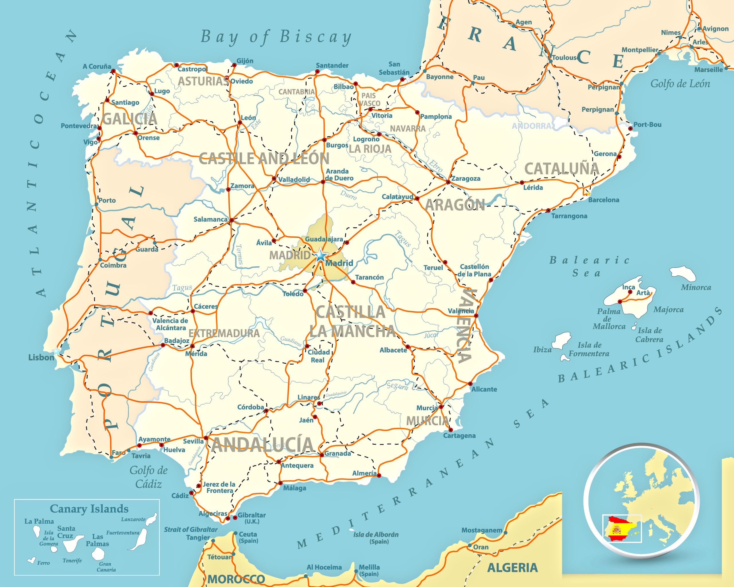
14. Spain Transit Map
The Spain Transit Map delineates the nation’s transportation networks, guiding travelers through its interconnected routes and hubs.
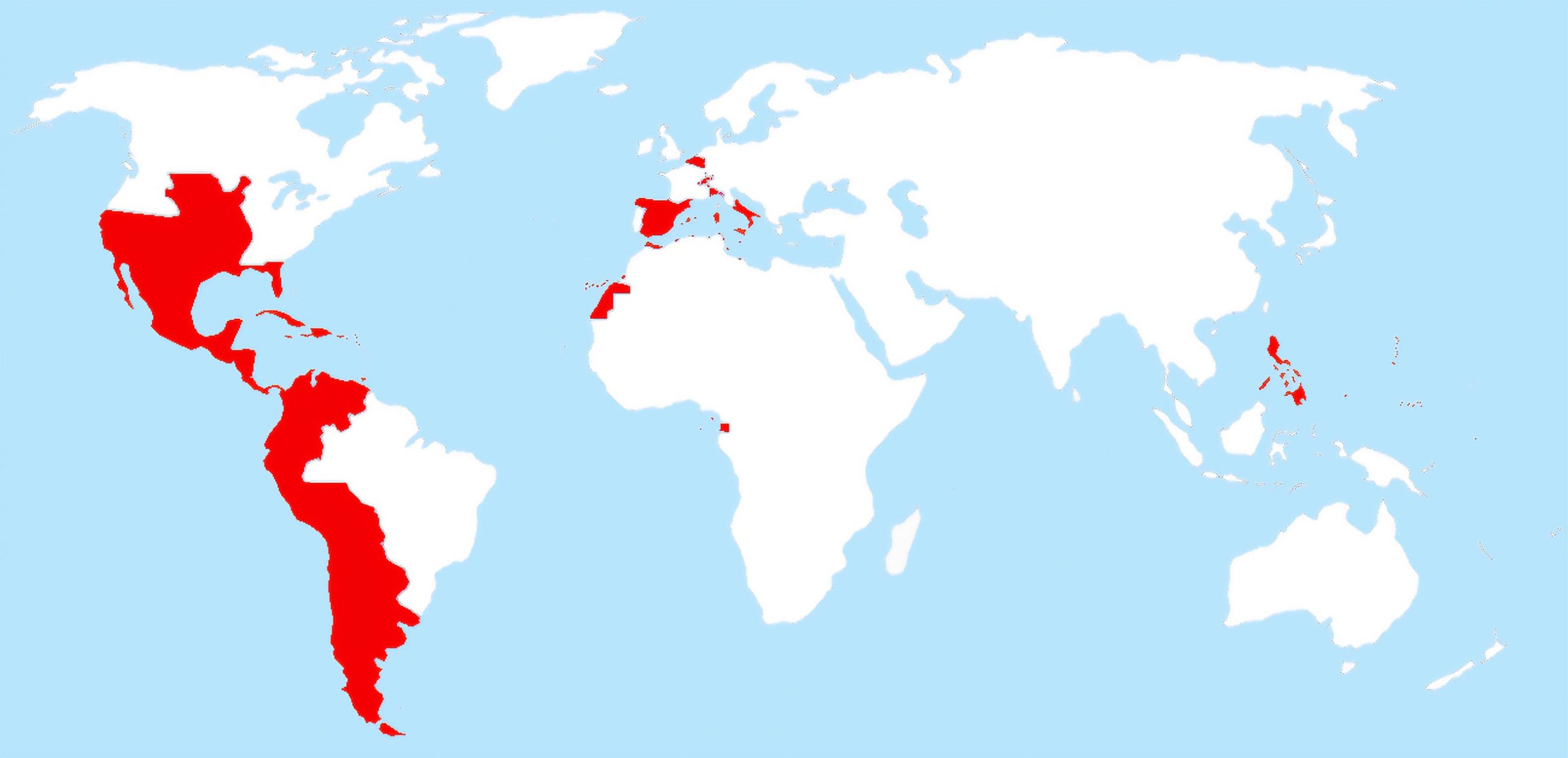
15. Spain Colonial Map (Spanish Empire – 1580-1640)
Travel back in time and discover the vastness of the Spanish Empire during its golden age.
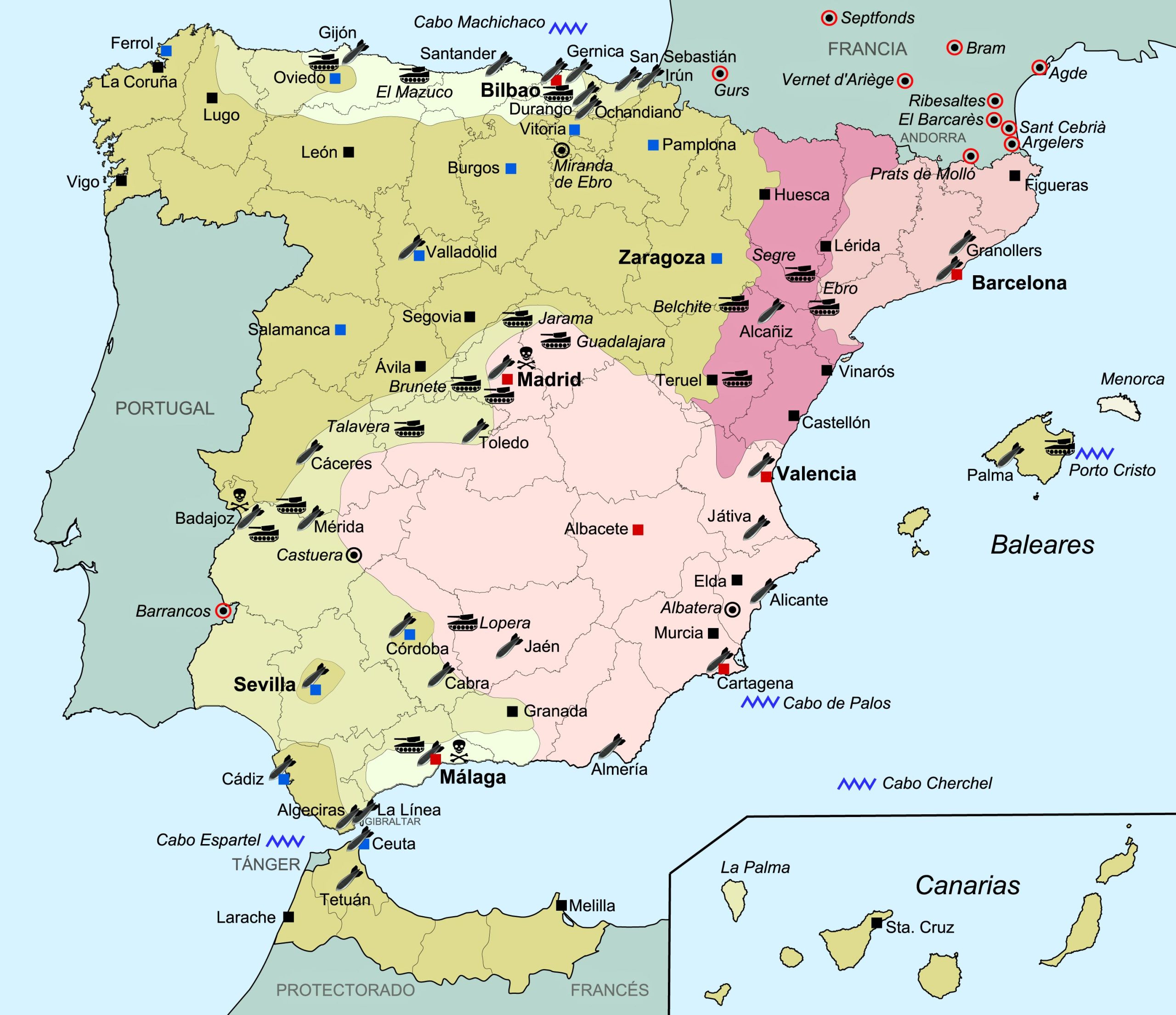
16. Spanish Civil War Map (1936–1939)
A poignant look into one of Spain’s most turbulent times.
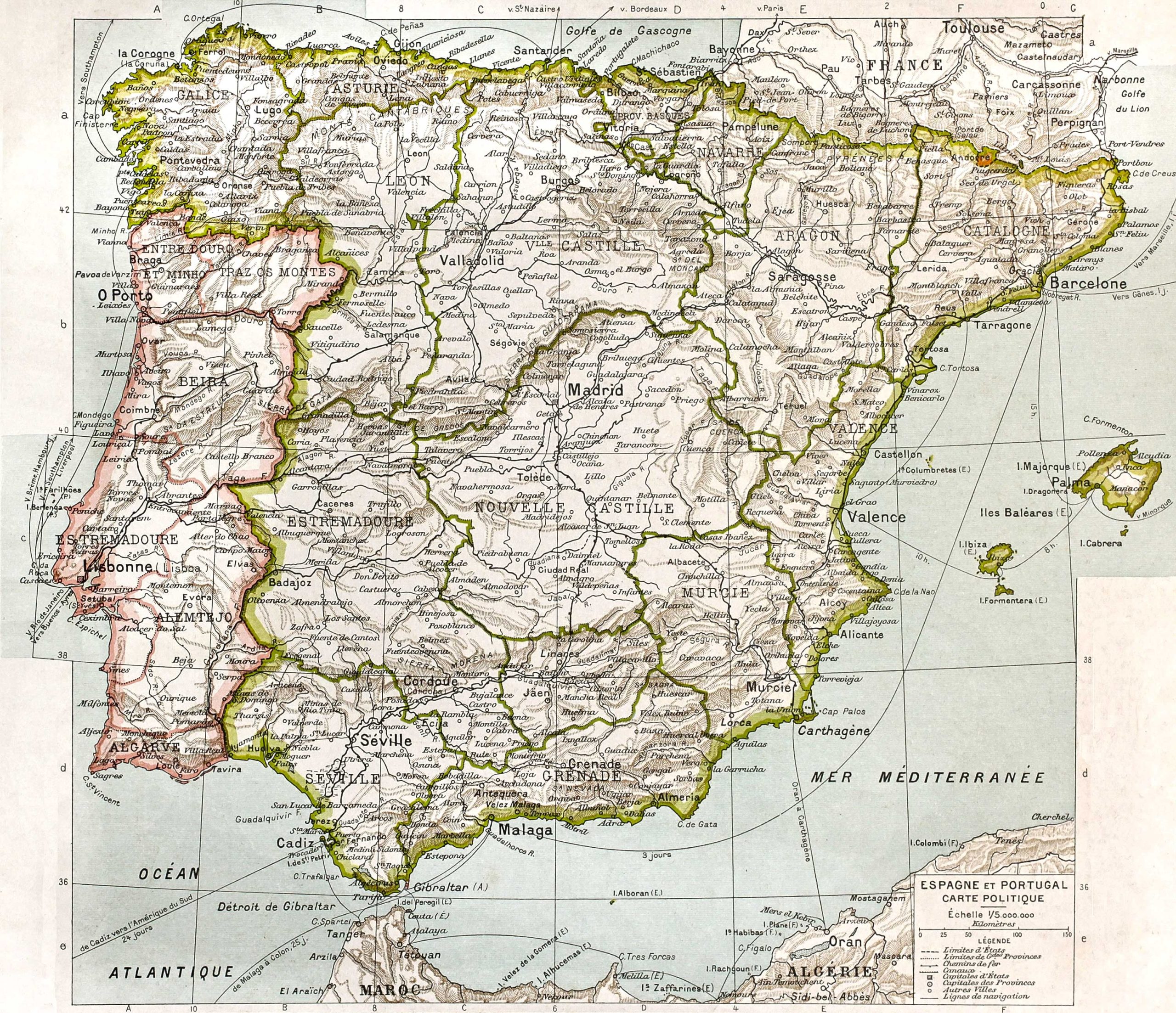
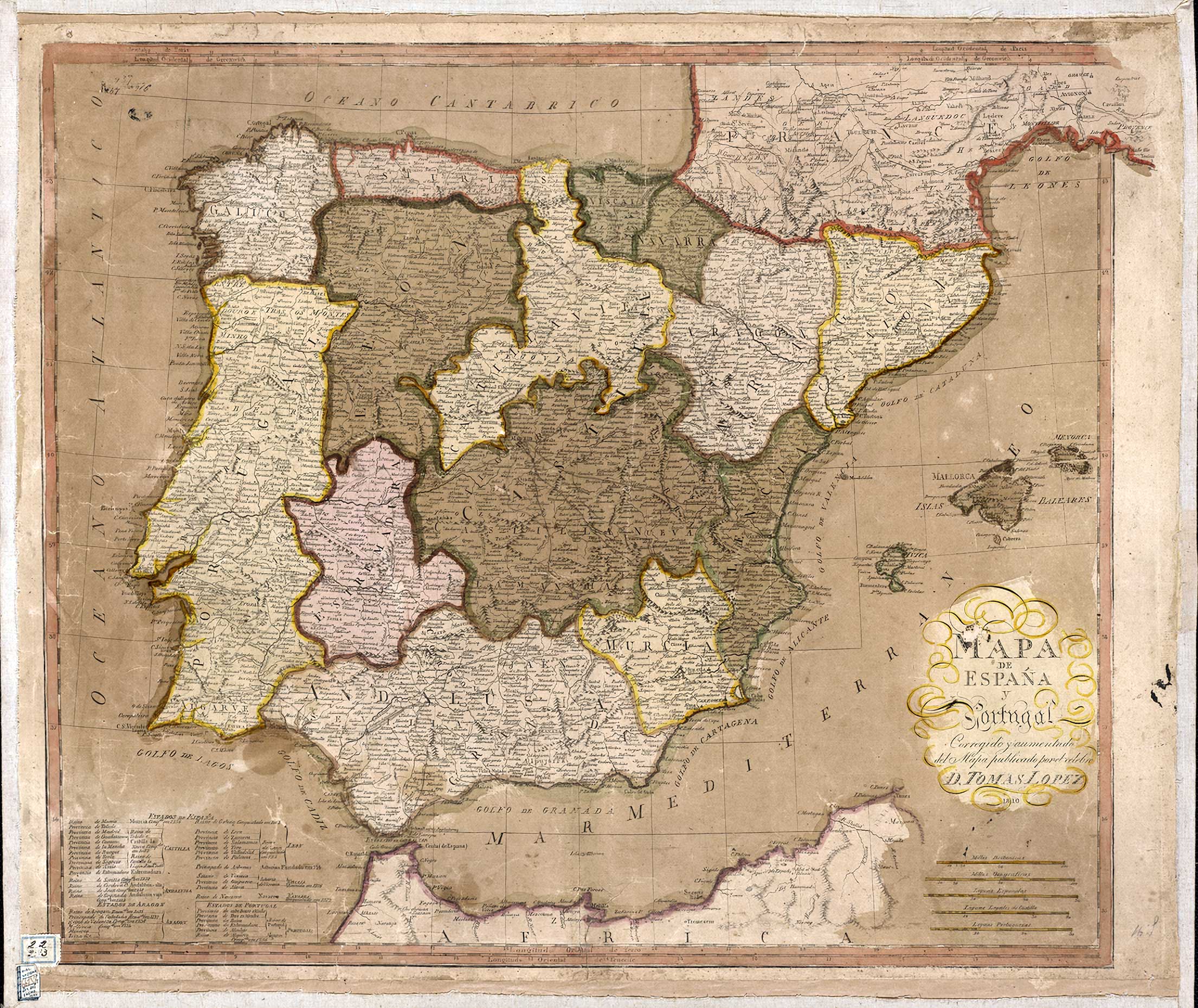
17. Spain Historical Map
Map of Spain and Portugal, Corrected and Augmented from the Map Published by D. Tomas Lopez. 1810.
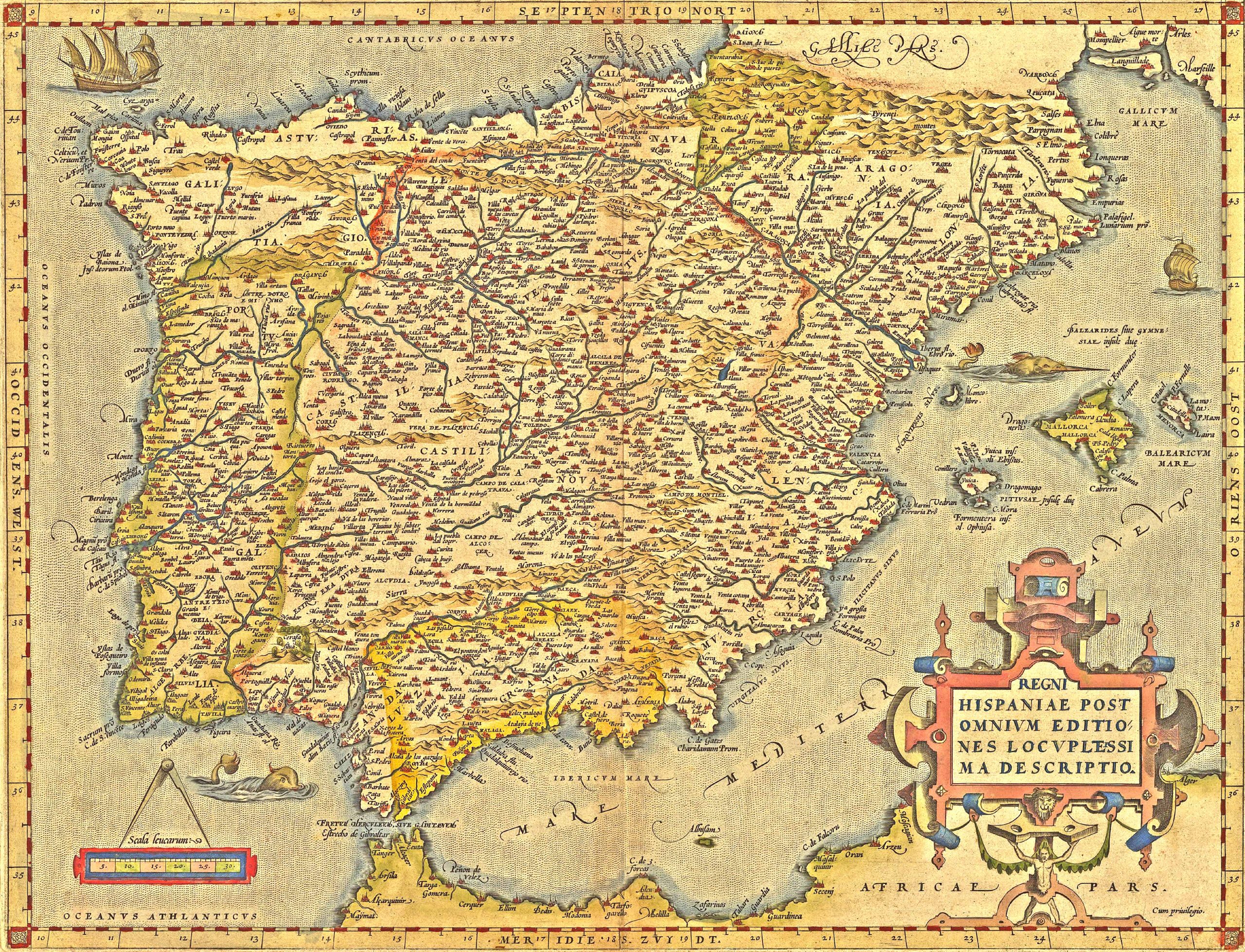
18. Spain Historical Antique Map
Journey through different eras, understanding the evolution of Spain through the centuries.
19. Map of Spain and Portugal (D. Tomas Lopez – 1810)
A vintage throwback to the Iberian Peninsula during the early 19th century. (Source: Wikipedia)
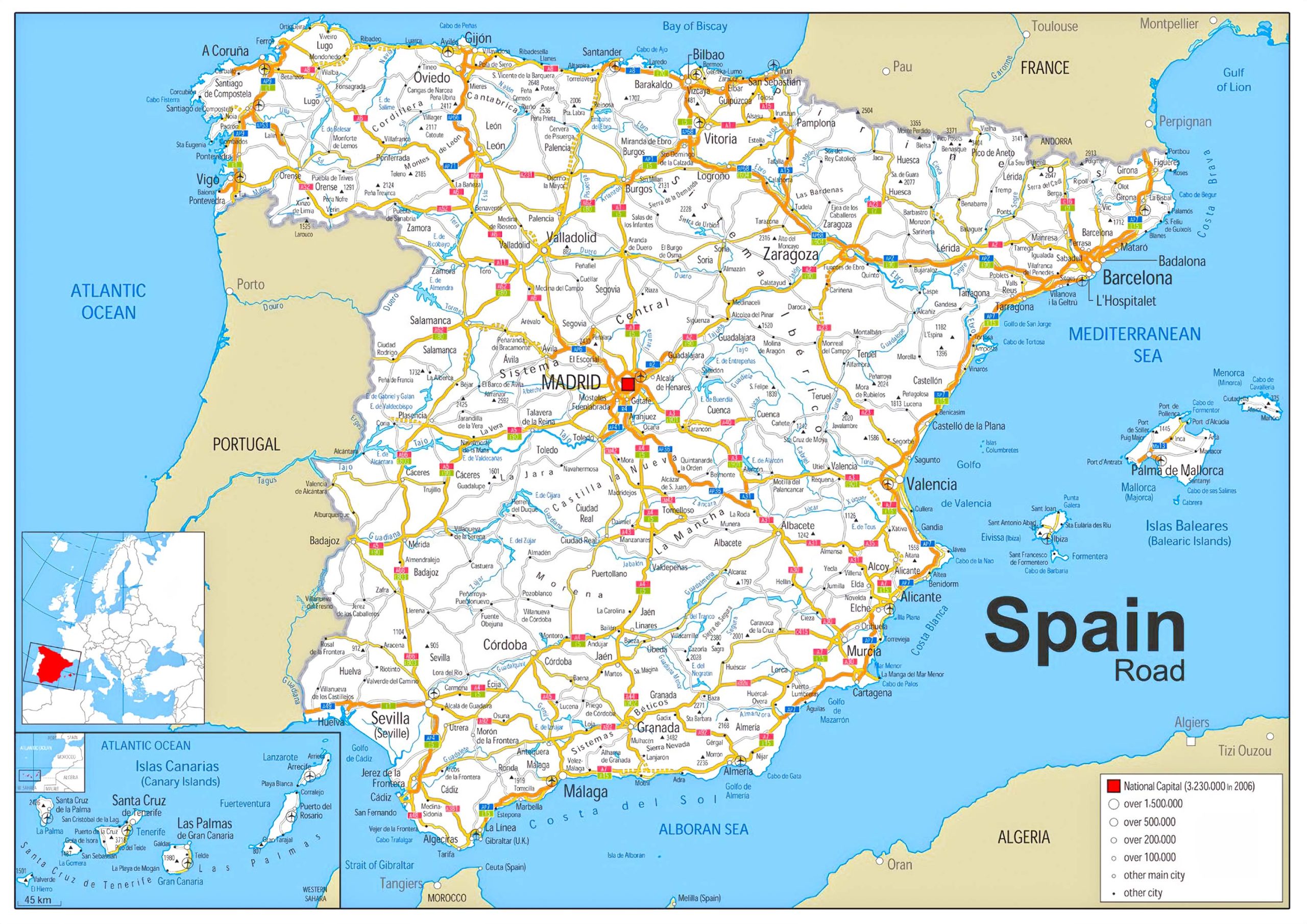
20. Spain Road Map
Navigate Spain’s modern transport avenues, whether by road or rail.
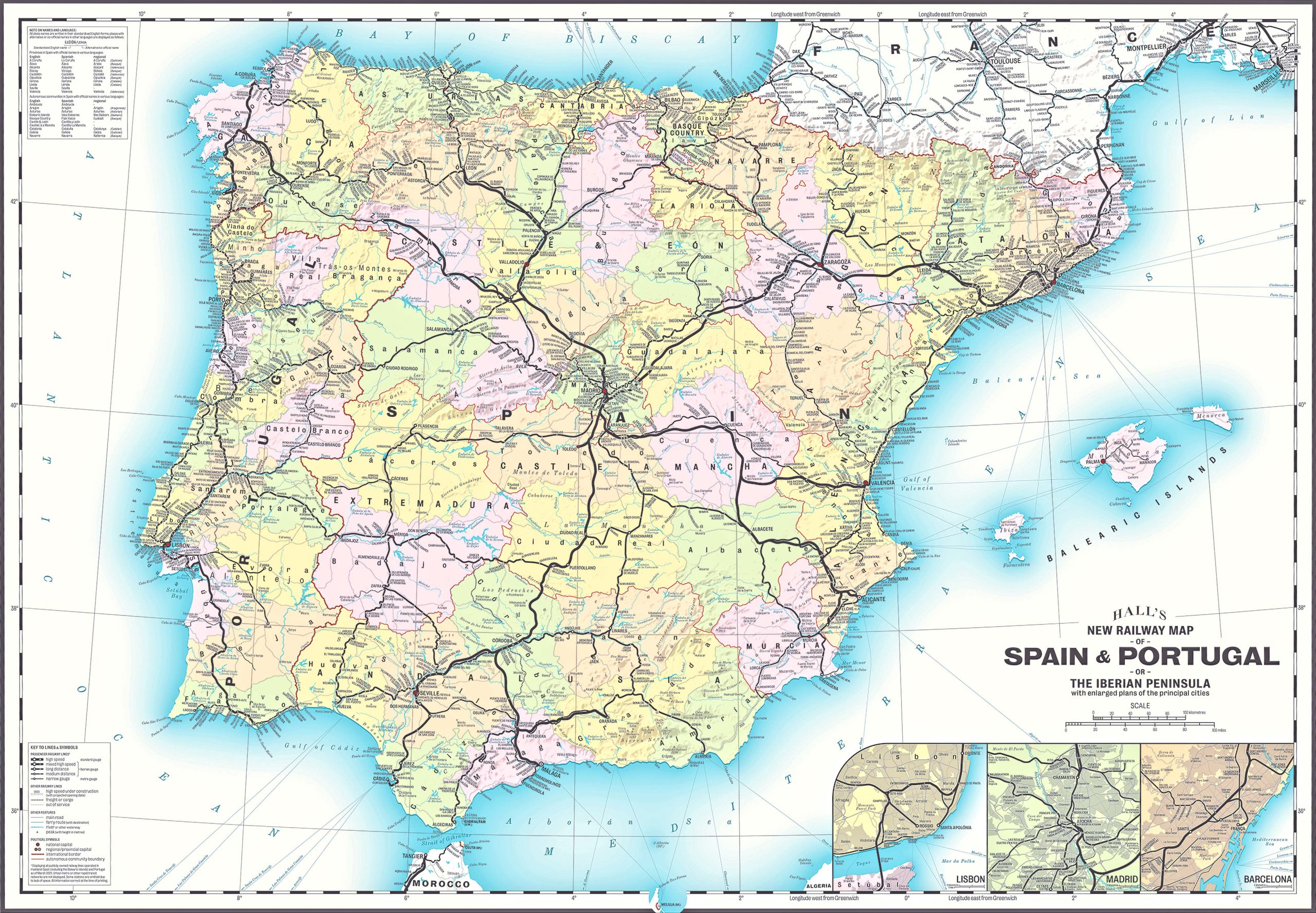
21. Spain Train-Rail Map
Discover Spain’s extensive rail network that connects not just cities but also small towns. Source: Mike Hall (Behance)
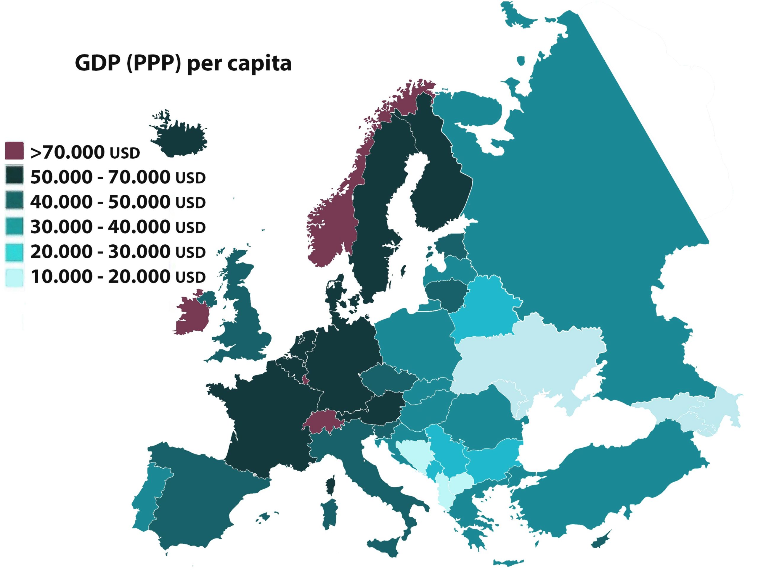
22. Spain GDP (PPP) Per Capita Map in Europe (2021)
Understand Spain’s economic position in Europe with this insightful map.
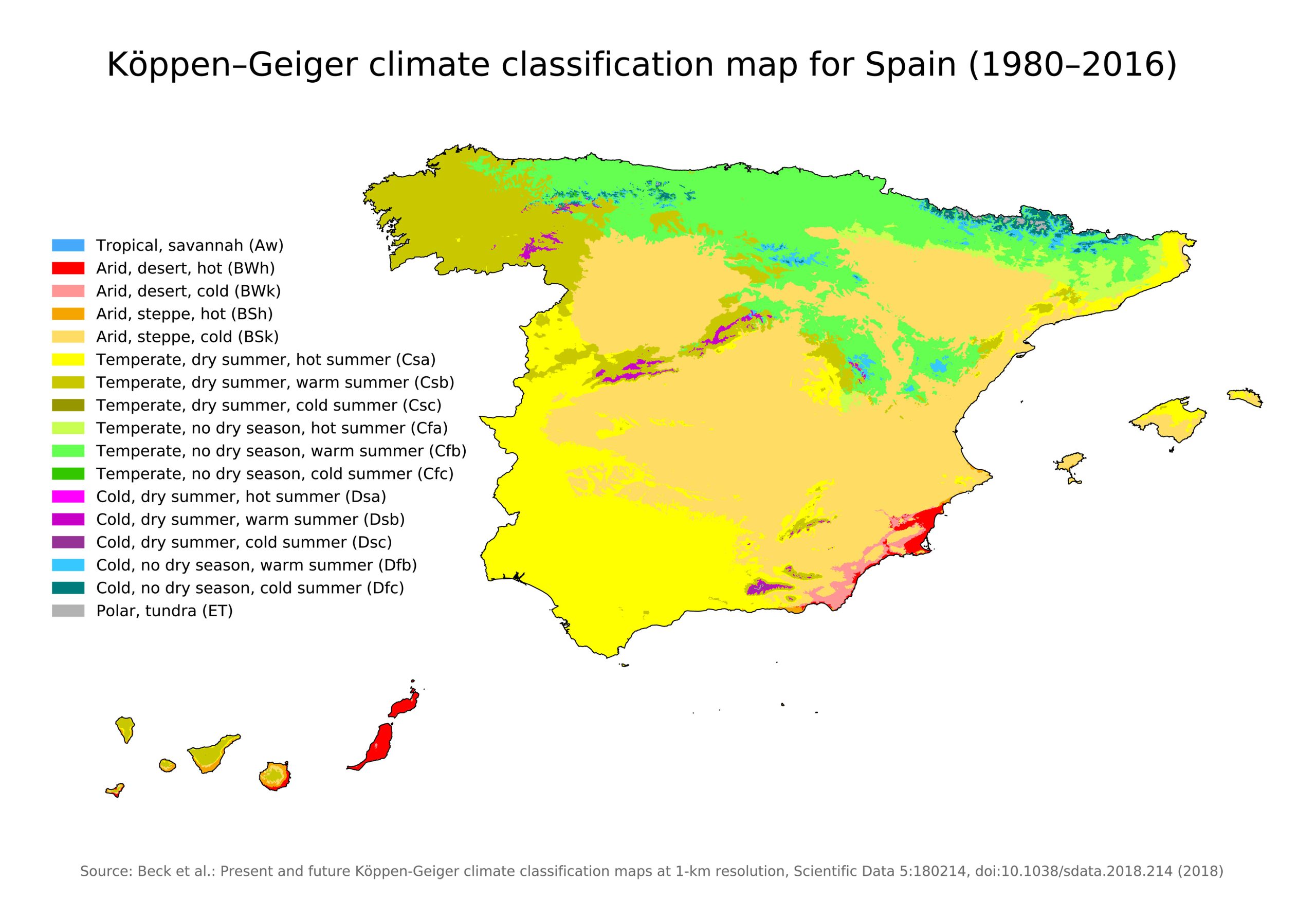
23. Spain Climatic Map
The Spain Climatic Map offers insights into the country’s diverse weather zones, revealing the intricate tapestry of temperatures and precipitation patterns across the Iberian Peninsula.
24. Spain Water Map (River)
The Spain Water Map (River) intricately charts the flow of Spain’s rivers, tracing their paths from mountain springs to coastal deltas.
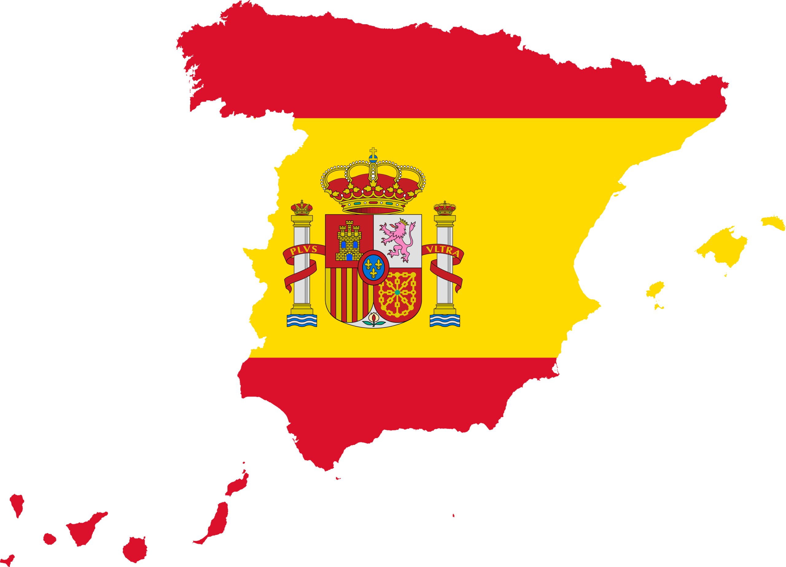
25. Spain Flag Map
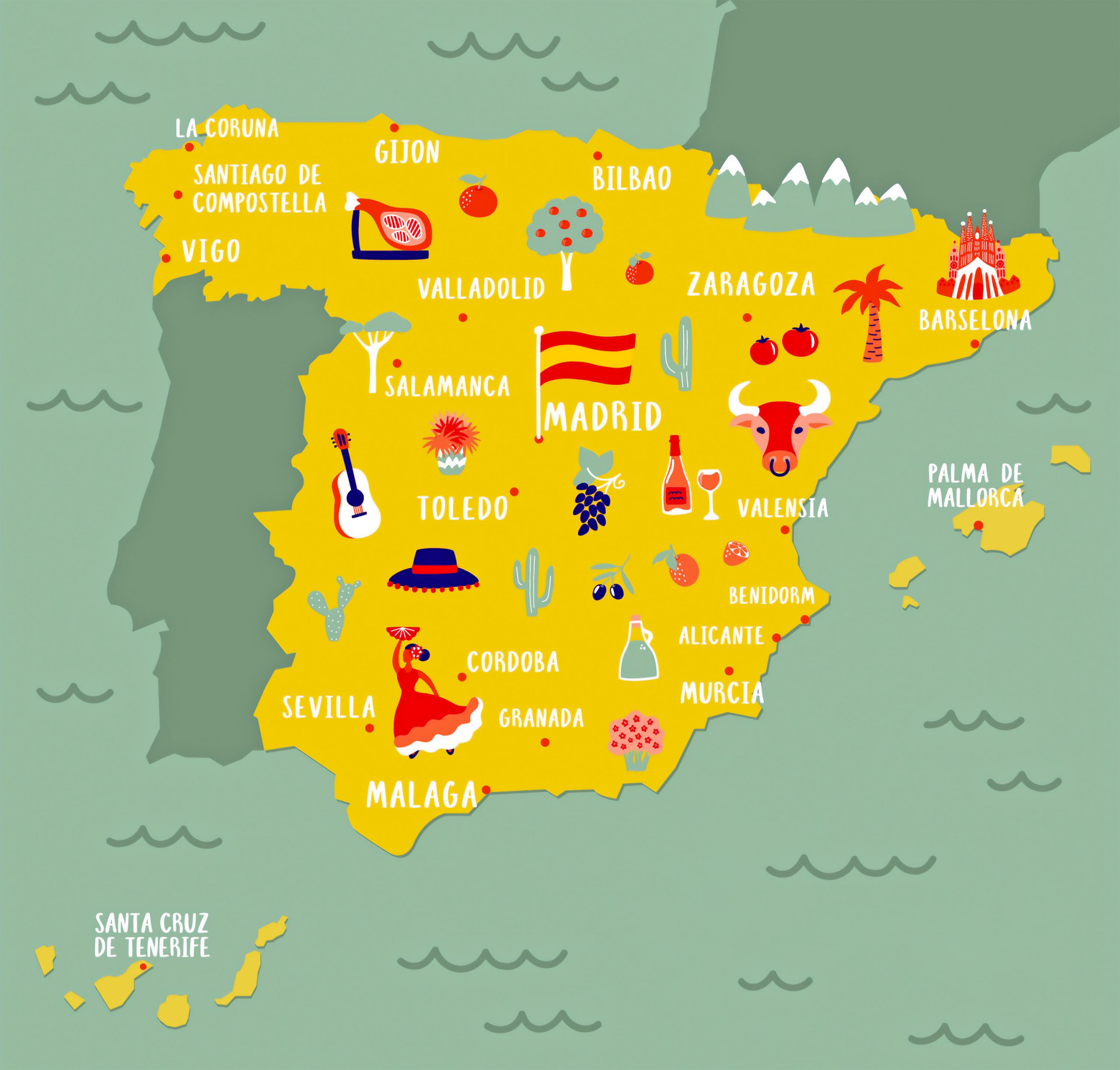
The Spain Flag Map overlays the national emblem onto the country’s contours, merging patriotic symbolism with geographical boundaries.
26. Spain Travel (Tourist) Map
From patriotic displays to traveler essentials – these maps have got you covered.
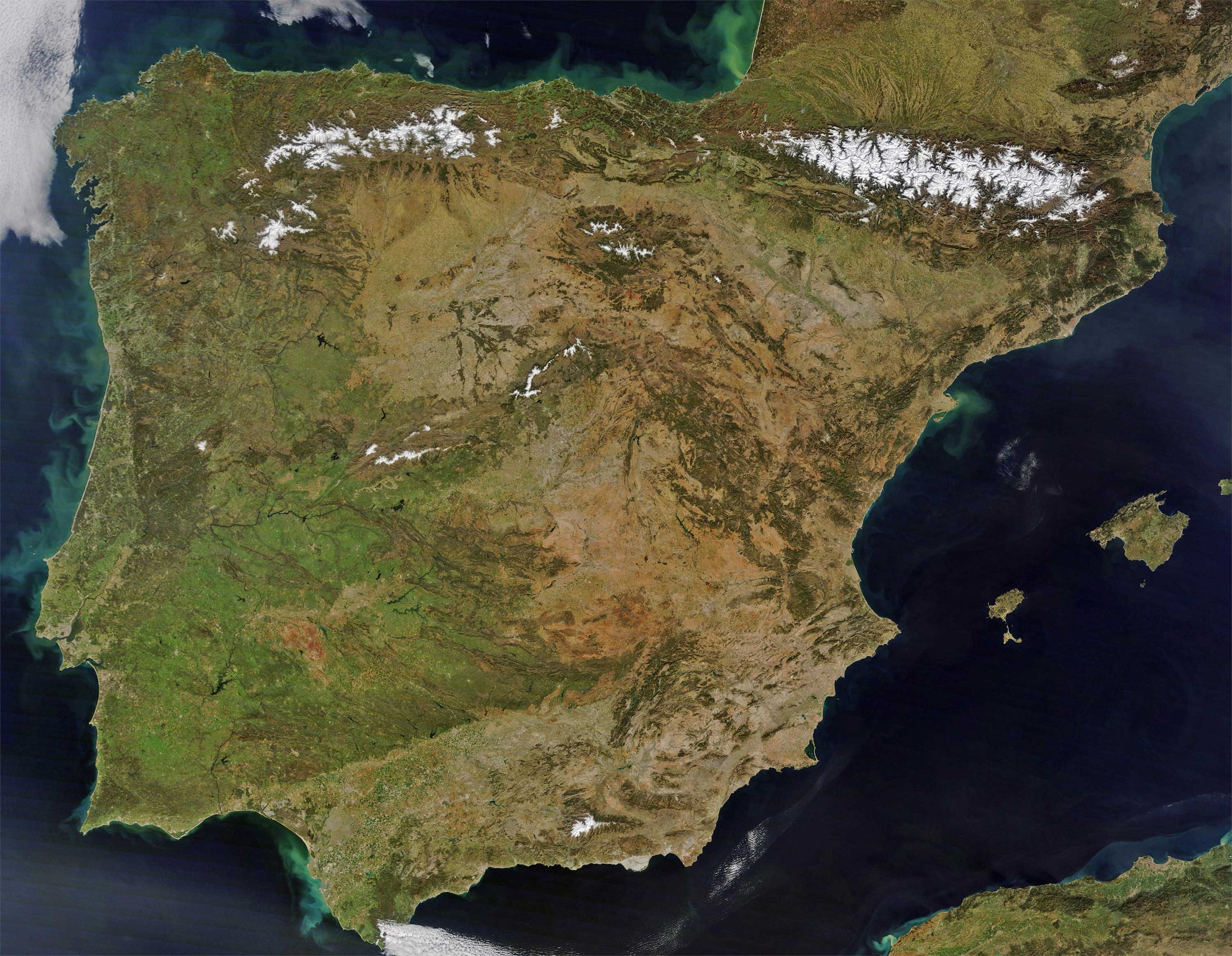
27. Spain Earth Satellite Map
The Spain Earth Satellite Map presents a breathtaking aerial perspective, capturing the nation’s vast landscapes from a celestial viewpoint.
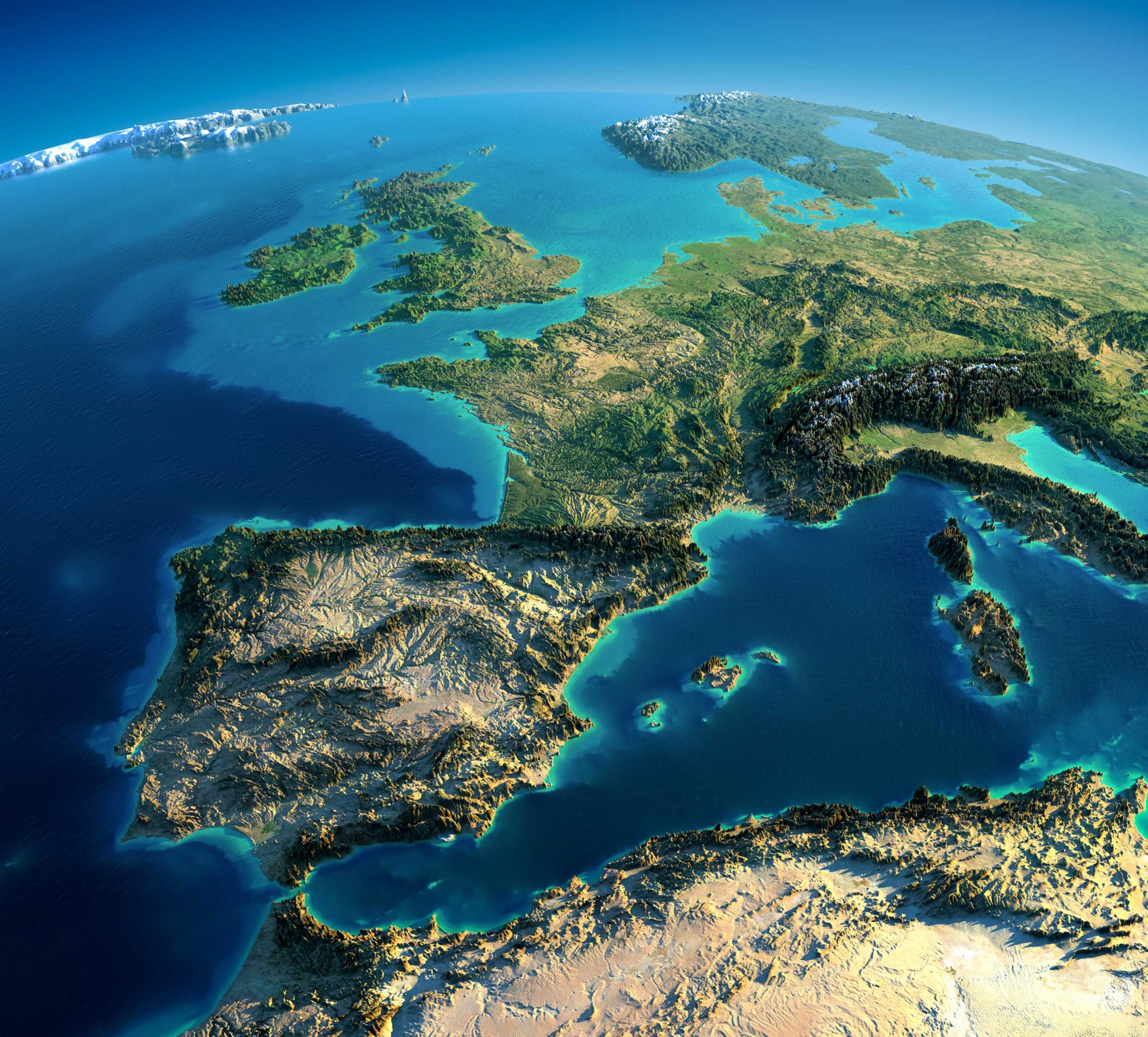
27. Spain 3D View From Space
The Spain 3D View From Space offers a stunning, three-dimensional depiction of the country, giving viewers a unique, top-down perspective of its geographical features.
Mapping the intricate landscapes, cultures, and histories of Spain has been a profound journey. These cartographic tales, more than just lines and colors, weave the story of a nation alive with passion, resilience, and beauty. As you navigate these maps, remember that each one captures a fragment of Spain’s soul, waiting for you to discover and cherish. Whether you’re plotting a future trip, indulging in academic pursuits, or just satisfying a wave of wanderlust from your armchair, Spain’s allure remains undeniable. Thank you for embarking on this geographical journey with us. Keep exploring, keep wondering, and always let your curiosity guide your path. ¡Hasta la próxima!
Where is Spain on the Europe Map?
Show Google map, satellite map, where is the country located.
Get directions by driving, walking, bicycling, public transportation and travel with street view.
Feel free to explore these pages as well:
- Exploring the Vibrant Corners of Cartagena, Spain ↗️
- Discovering Alicante: The Gem of Spain’s Costa Blanca ↗️
- A Collection of Spain Maps ↗️
- Discover Moorish Andalucia, Spain 1 ↗️
- Discover Moorish Andalucia, Spain 2 ↗️
- Spain Map ↗️
- Map of Spain ↗️

