- Advertisement -
Discover a diverse collection of maps that showcase the vibrant city of Valencia, offering insights into its geography, transportation, and historical landmarks.
Brief information about Valencia, Spain
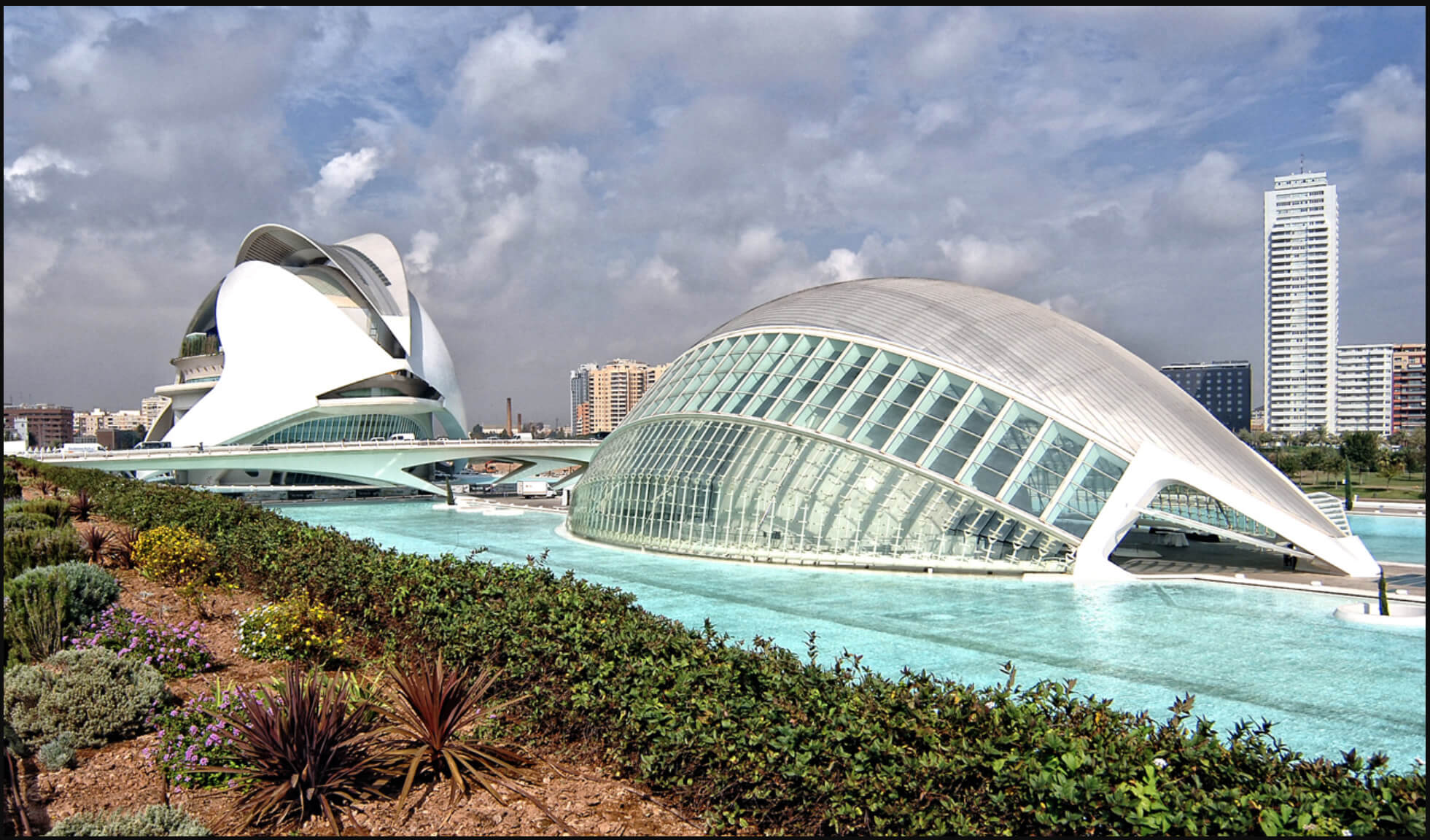
Valencia, located on the south-eastern coast of Spain on the Mediterranean Sea, is the capital of the autonomous community of Valencia. Known for its vibrant cultural heritage, Valencia combines historic architecture with modern innovation, making it a popular destination for travellers. The city is famous for its stunning City of Arts and Sciences, an impressive cultural and architectural complex that includes an opera house, planetarium, and oceanographic park. Valencia is also known for its beautiful beaches, such as Malvarrosa and Las Arenas, which offer a perfect blend of city life and coastal relaxation.
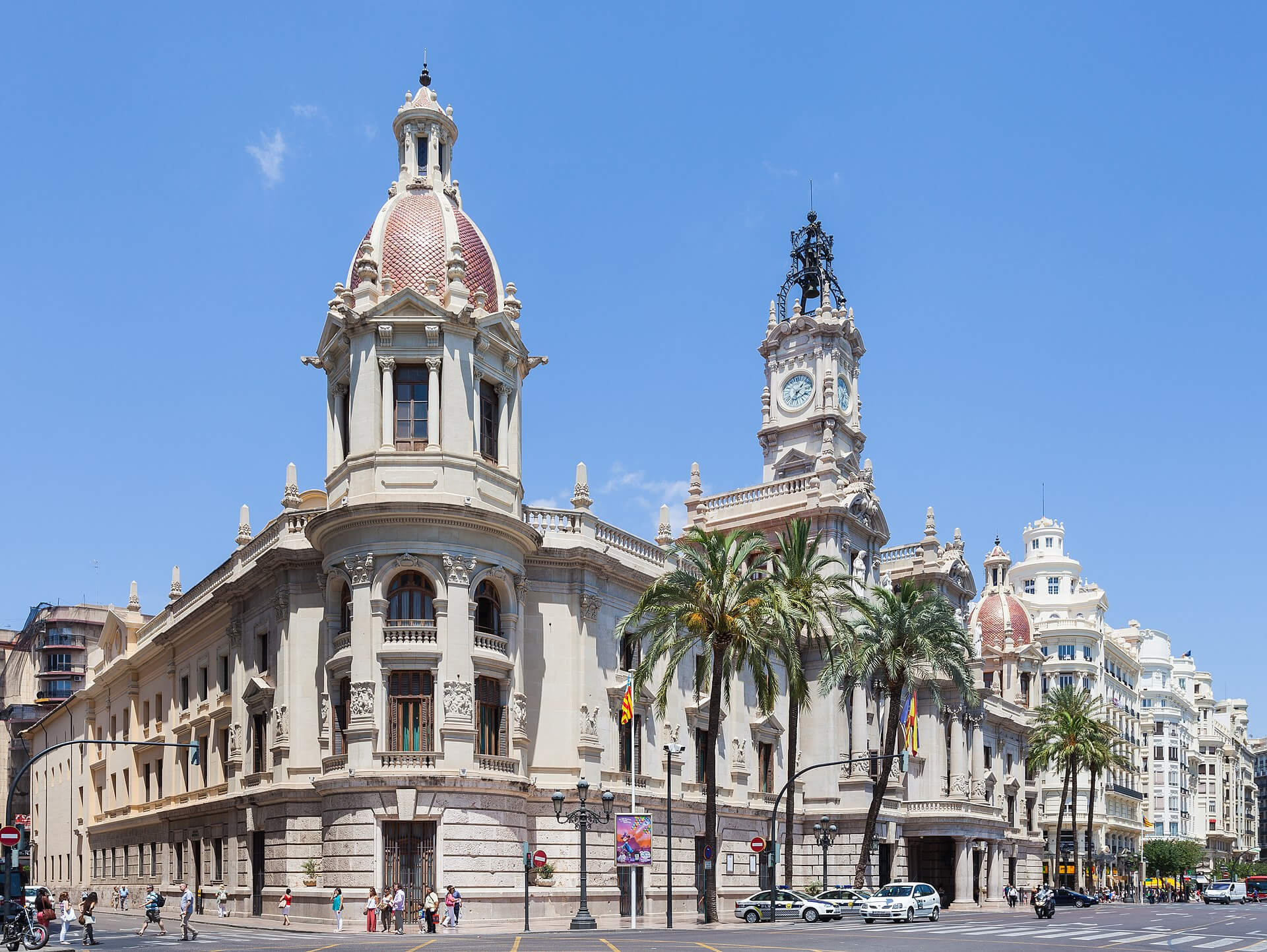
 Valencia City Hall in Spain
The city has deep historical roots, with landmarks such as Valencia Cathedral, which is said to house the Holy Grail, and the medieval Torres de Serranos, one of the twelve gates that once formed part of the ancient city walls. Valencia is also the birthplace of paella, a traditional Spanish rice dish, and visitors can enjoy an authentic taste of this local speciality in the city’s many restaurants. Every March, the city hosts Las Fallas, a vibrant festival with fireworks, parades, and elaborate sculptures that are set alight in a spectacular display. With its unique blend of history, gastronomy, and modern attractions, Valencia offers visitors a rich and varied experience.
Where is located Valencia on the Spain Map

Valencia is located on the eastern coast of Spain, on the Mediterranean Sea, in the central part of Spain’s eastern coastline. It lies within the autonomous community of the same name – Valencia – and serves as both the regional capital and a major urban centre. On the map of Spain, Valencia is located south of Catalonia, northeast of Murcia, and immediately east of Castilla-La Mancha, giving it a strategic location that has historically facilitated trade and cultural exchange across the Mediterranean.
The city’s coastal location provides easy access to the Balearic Islands, with regular ferry services from Valencia’s port. Valencia is approximately 350 kilometres (220 miles) southeast of Madrid, Spain’s capital, making it accessible from the central regions by road and high speed train. Its proximity to both the sea and central Spain makes Valencia an important commercial and tourist hub, attracting visitors who can easily locate it on the map as a key point on Spain’s eastern coast.
Here are some statistical information about Valencia:

Area: 134.65 km2 (51.99 sq mi)
Population: 2,522,383 (Valencia Metro – 2023)
Website: www.valencia.es
Time zone: UTC+01:00 (CET (GMT))
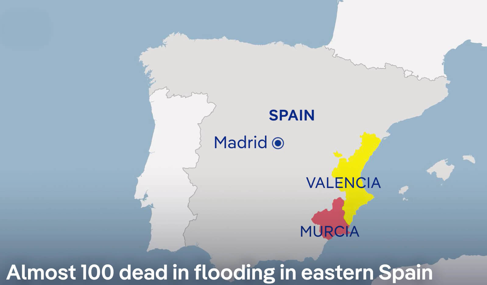
Severe Flooding in Eastern Spain (Valencia and Murcia) – October 30, 2024
 Map showing flooding in Valencia and Murcia, eastern Spain, October 30, 2024.
This map shows the regions of Valencia and Murcia in eastern Spain, where severe flooding has tragically claimed nearly 100 lives as of 30 October 2024. The map shows Valencia in yellow and Murcia in red, indicating the severely affected areas. Unusually heavy rainfall has led to catastrophic flooding, affecting communities, infrastructure and emergency services. The proximity of these regions to the Mediterranean Sea, combined with recent weather patterns, has contributed to the extent of the flooding. This event highlights the severe impact of extreme weather on the east coast of Spain.
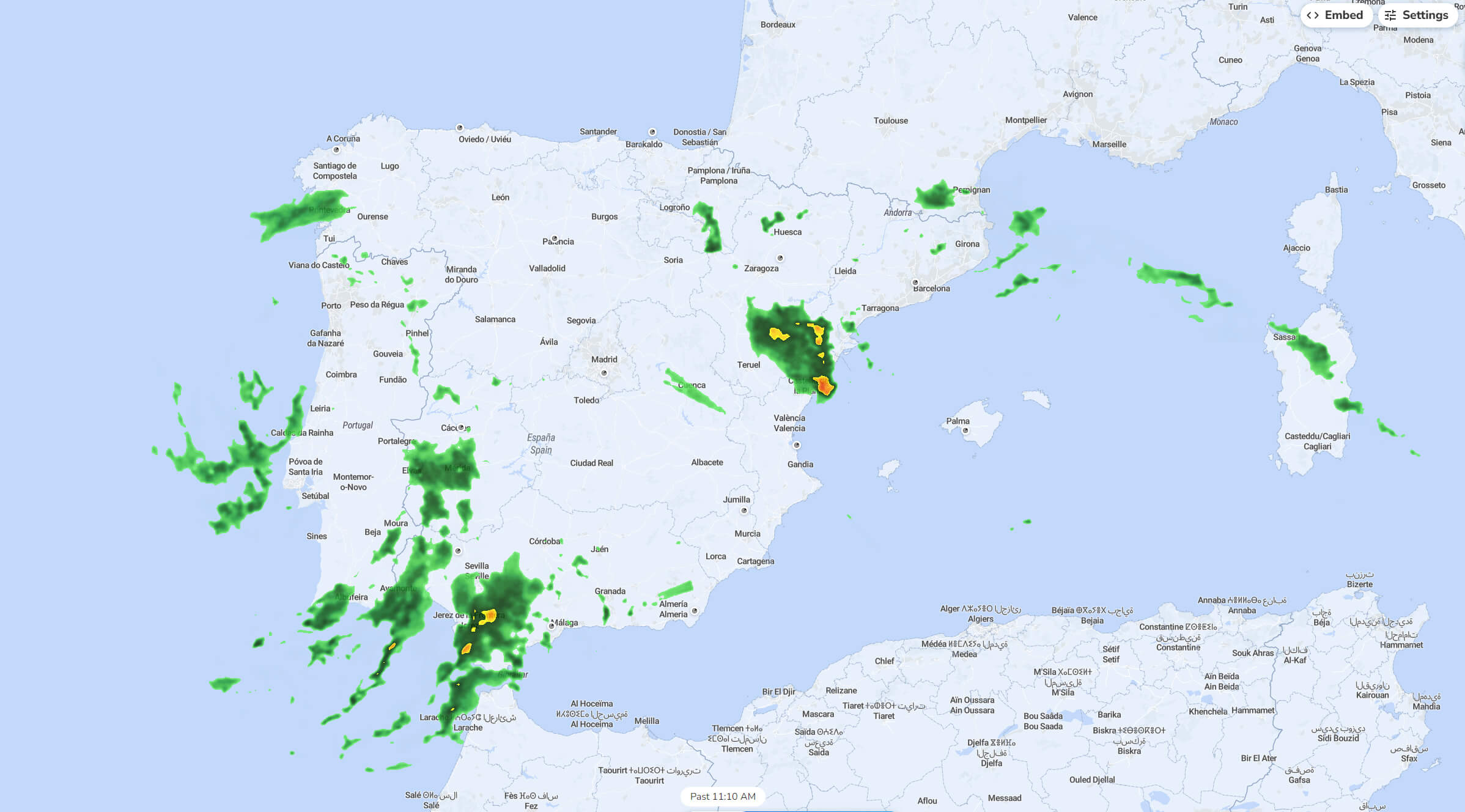
Rainfall Distribution in Spain (October 2024)
 Rainfall map of Spain in October 2024, showing precipitation areas.
This rainfall map of Spain from October 2024 shows areas of precipitation across the country. Dark green areas indicate moderate rainfall, while yellow areas indicate heavier rainfall. The heaviest rainfall is concentrated in the southeastern region around Valencia and in the southern parts near Seville. Other areas, such as Galicia in the north-west and parts of the north coast near the Pyrenees, will also see rain. Some lighter, scattered showers are present in central Spain, while the eastern Mediterranean coast and parts of the Balearic Islands show minimal precipitation. This map reflects Spain’s varied autumn weather, with coastal and mountainous regions receiving more rain than inland areas.
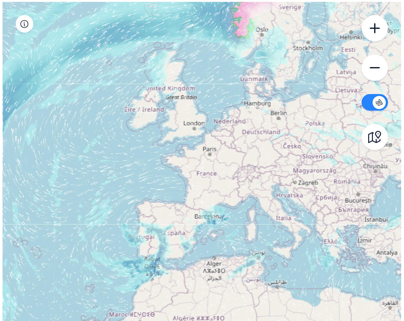
Spain Satellite Rainfall and Weather Map (October 30, 2024)

Satellite map of Spain’s rainfall and wind patterns on October 30, 2024.
This satellite weather map from 30 October 2024 shows rainfall and wind patterns affecting Spain and surrounding areas in Europe. Heavy rainfall is seen over parts of Ireland, the UK and Norway, while lighter precipitation is seen over parts of western France and the northern coast of Spain. Wind flow lines over the Atlantic indicate a strong circulation, pushing rain-bearing clouds towards the European mainland and influencing the weather over Spain and its neighbours. Spain itself experiences light rainfall along its northern coast, while the central and southern regions appear mostly dry. This map shows the movement of Atlantic weather fronts affecting European weather on this particular day.
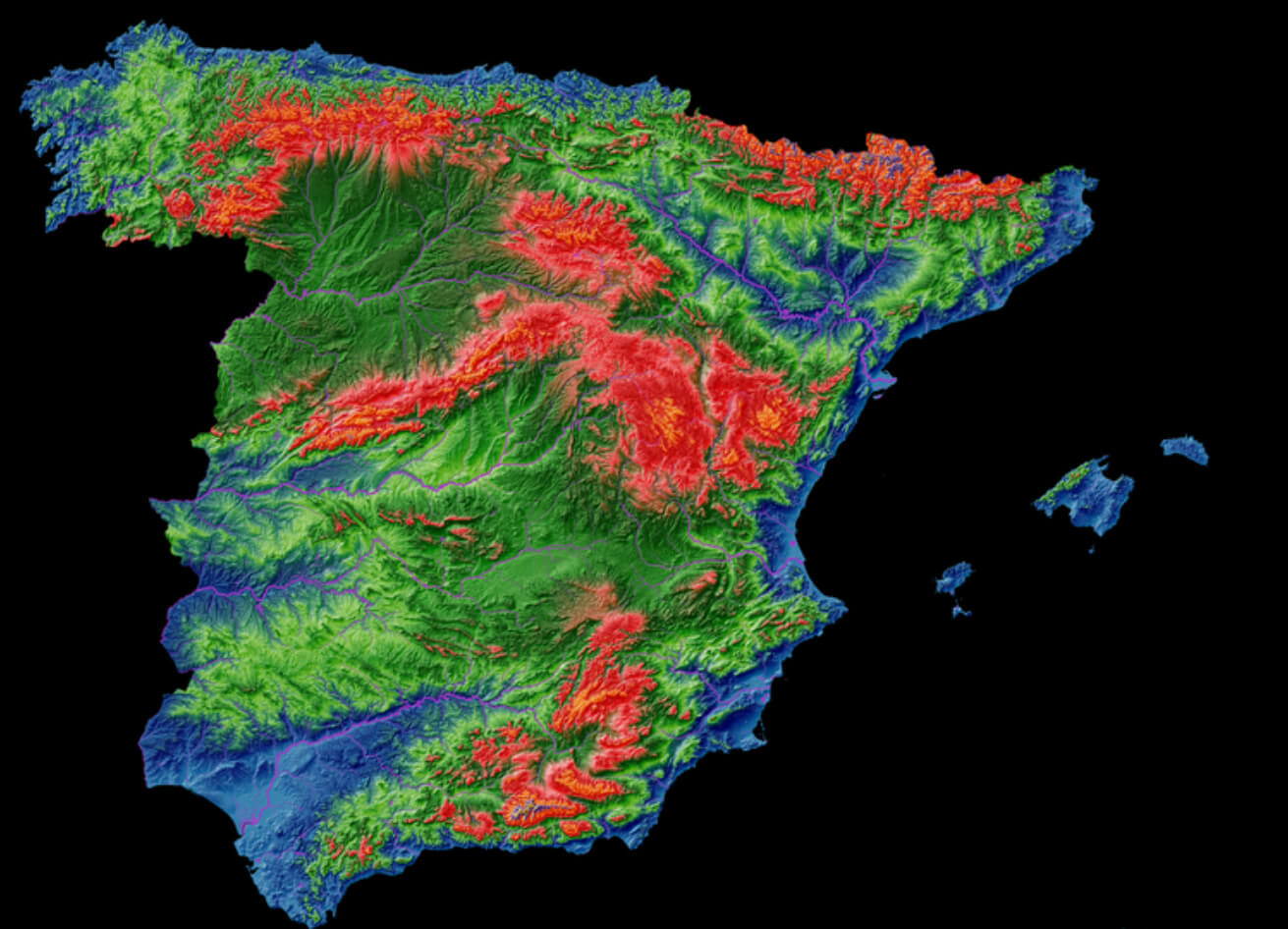
Elevation Map of Spain
 Elevation map of Spain showing mountain ranges and altitude variations.
This elevation map of Spain uses colour gradients to represent different altitudes, with red indicating higher elevations and blue indicating lower areas. The Pyrenees in the north-east and the Sierra Nevada in the south appear prominently in red, highlighting their significant altitude. The central meseta plateau, which covers much of inland Spain, is shown in shades of green, indicating moderate altitude. Coastal regions, particularly along the Mediterranean and Atlantic coasts, are shown in blue, reflecting the lowland areas. This map visually emphasises Spain’s mountainous terrain and the contrast between the highland interior and the lower coastal plains.
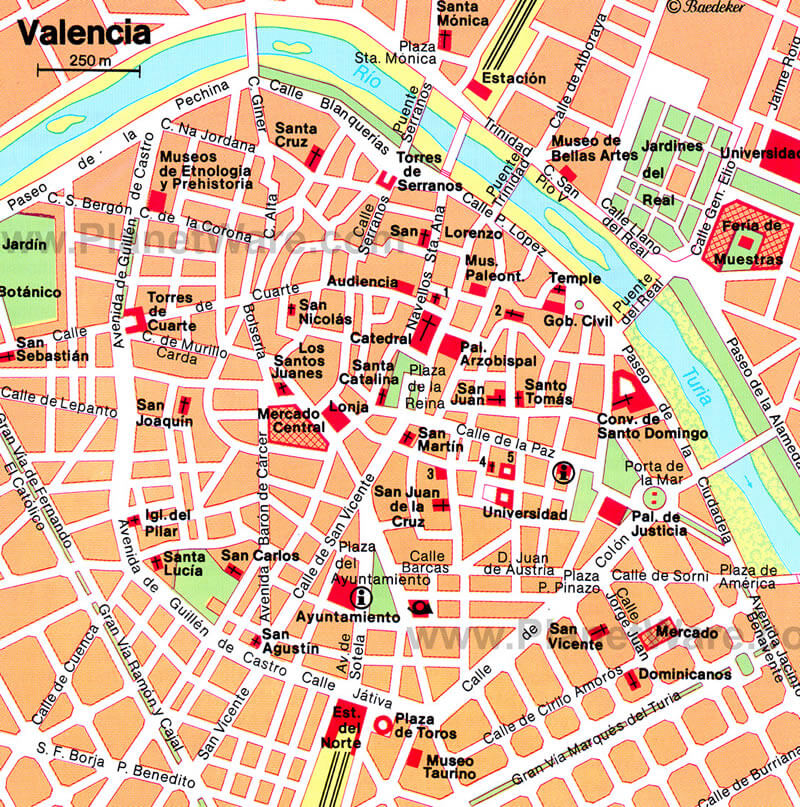
Valencia City Center Map Overview
 Map of Valencia city center with major landmarks and streets labeled
This detailed map shows the central area of Valencia, highlighting the main monuments, historic sites and main streets. Notable sites such as the Cathedral, Plaza de la Reina, Mercado Central and Torres de Serranos are prominently marked. The River Turia, now a green space after being diverted, runs along the top of the map, providing a reference point for orientation. The map also shows important squares, such as Plaza del Ayuntamiento and Plaza de San Martín, and major museums, such as the Museo de Bellas Artes and the Museo de Etnología y Prehistoria, making it an ideal guide for navigating Valencia’s vibrant historic centre.
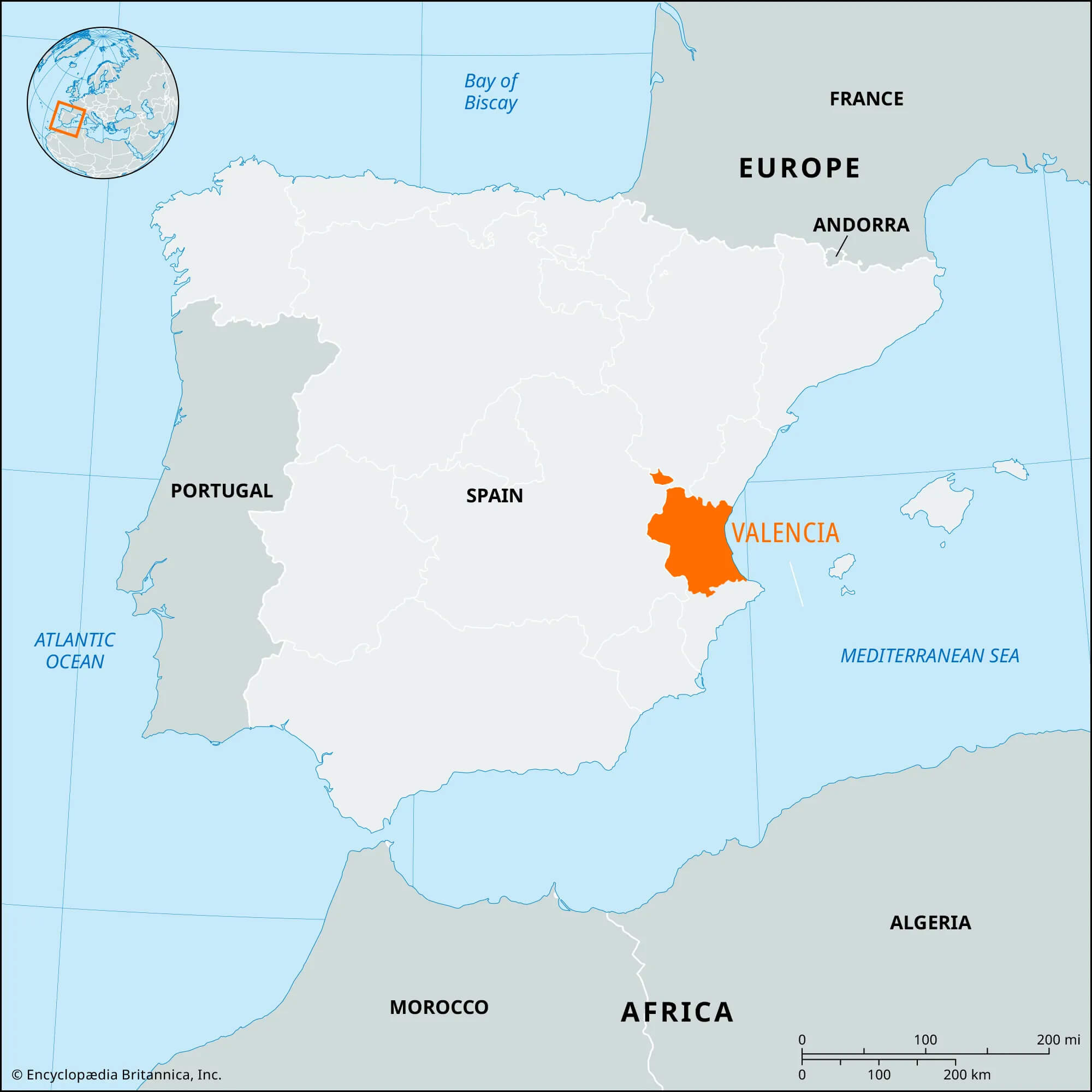
Valencia Province Map in Spain
 Map showing Valencia province on Spain’s eastern Mediterranean coast.
This map shows the province of Valencia, located on the eastern coast of Spain along the Mediterranean Sea. Valencia is one of Spain’s autonomous communities and is known for its rich history, cultural heritage, and economic importance. The province is marked in orange, making it stand out on the larger map of Spain and showing its position in relation to neighbouring countries such as France to the north and Portugal to the west. Valencia’s coastal location has historically contributed to its role as an important commercial and cultural centre, linking Spain to the Mediterranean world.
Valencia Historical Map (1832)

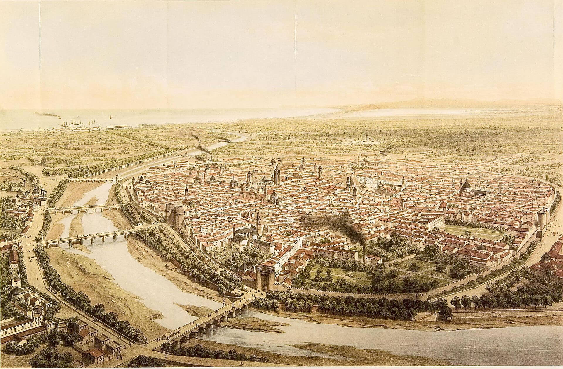
Valencia city historical map with walls and Turia River, 1832
This historic map of Valencia from 1832 provides a detailed view of the city as it appeared in the early 19th century, showing its architecture, layout and surroundings. Valencia is shown bounded by the old city walls, with prominent structures such as cathedrals, towers and civic buildings rising above the urban landscape. The map highlights the River Turia, which runs through the city, with bridges connecting different parts of the city, allowing for trade and movement. This depiction reflects Valencia’s historic role as a major cultural and economic centre on the east coast of Spain, with its strategic location close to the Mediterranean Sea encouraging growth and links with other Mediterranean regions.
Valencia Location on the Map of Spain
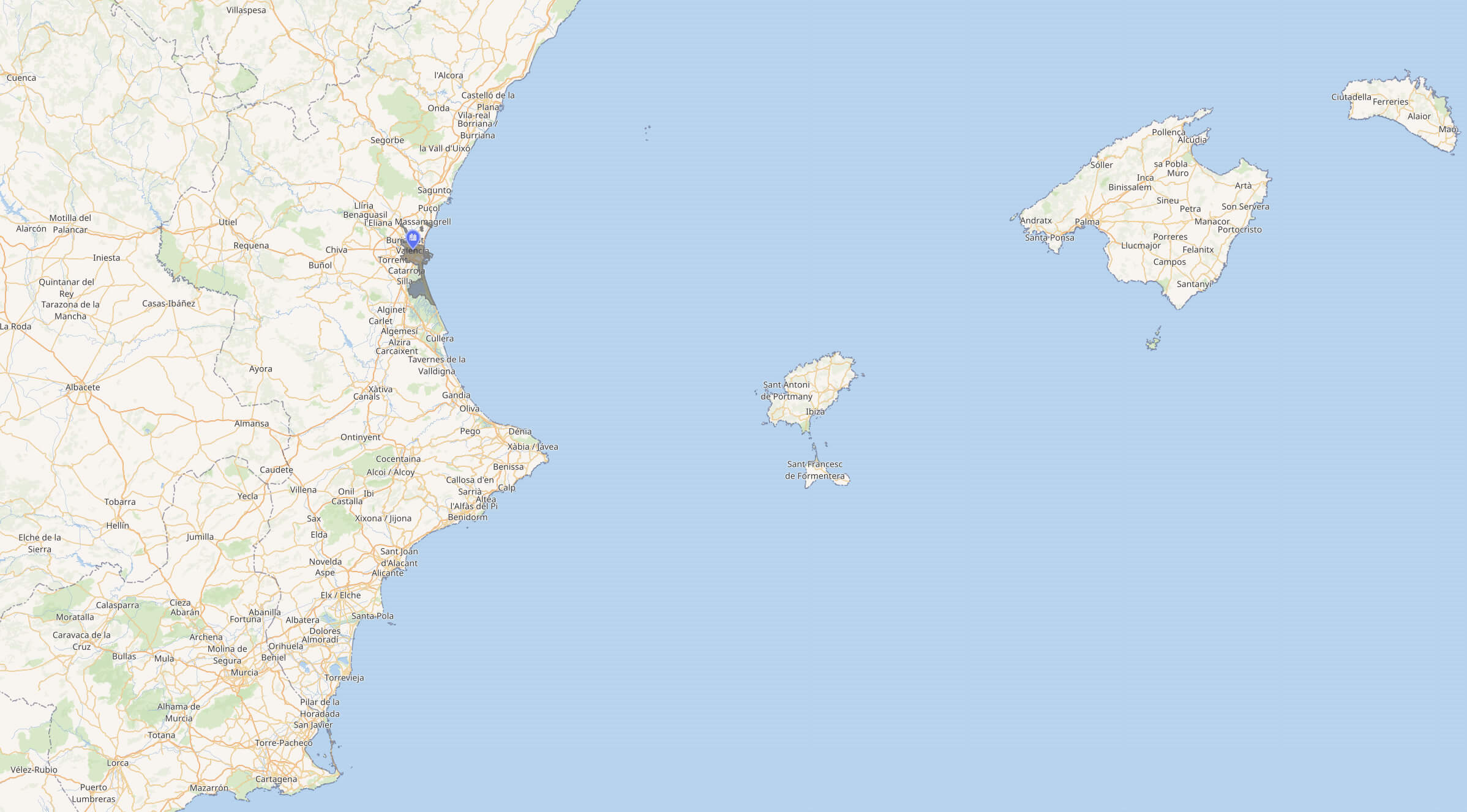
 Map showing the Valencia region on Spain’s eastern Mediterranean coast.
This map shows the coastal region of Valencia, located on the east coast of Spain along the Mediterranean Sea. Valencia, Spain’s third largest city, is marked close to the coast, indicating its proximity to nearby islands such as Ibiza and Mallorca to the east. This strategic location has historically made Valencia an important port city, contributing to its vibrant cultural and economic activities. Surrounding towns and cities, as well as major roads, illustrate Valencia’s links with the rest of Spain and the Mediterranean region.
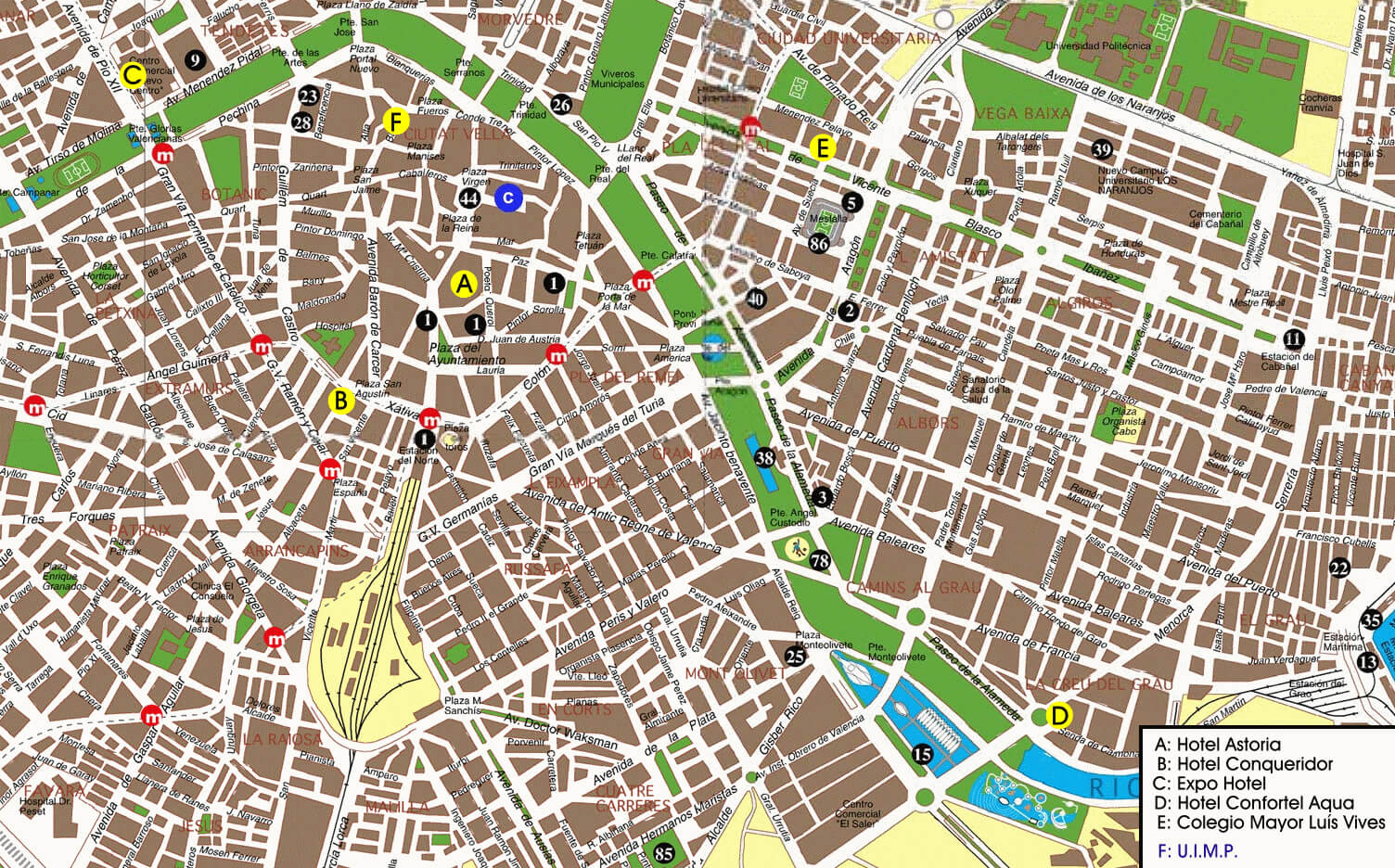
Valencia street map
 Valencia street map
Valencia Metro System Map Overview
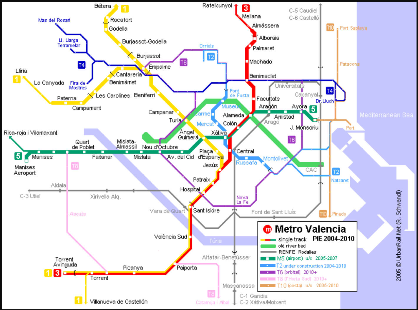
 Valencia metro map showing various subway lines and stations
This
Valencia Historic City Map with Event Locations
 Valencia historical map with landmarks and event locations labeled.
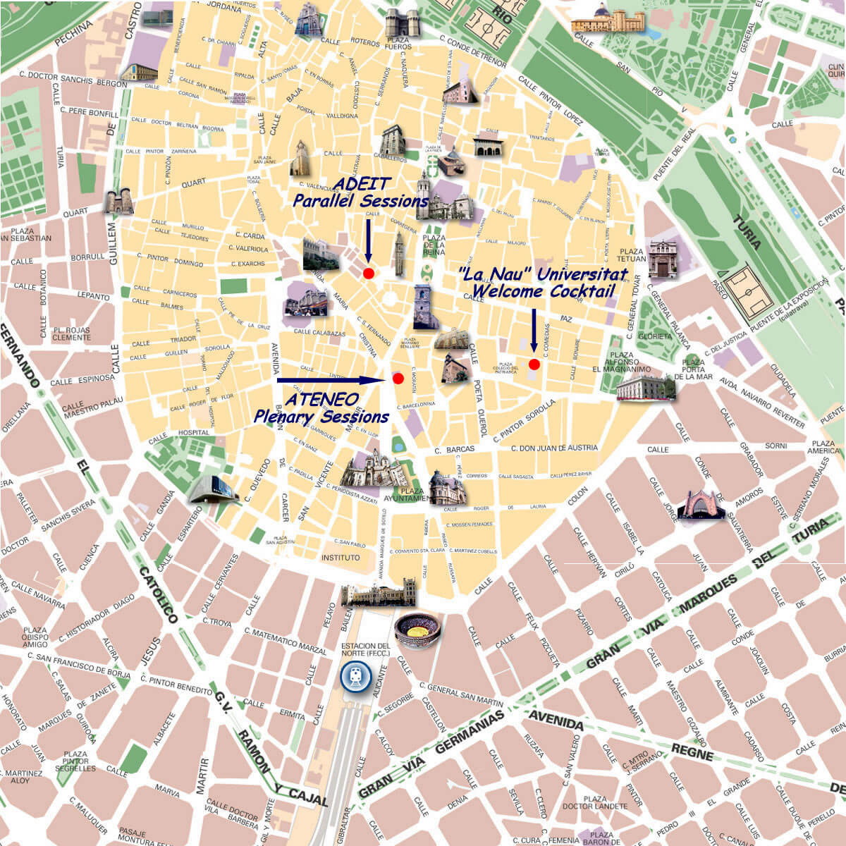
This historical map of Valencia’s city centre highlights key landmarks, venues and main streets. Notable locations such as the Universidad de Valencia, where welcome cocktails will be held at ‘La Nau’, the Ateneo for plenary sessions and ADEIT for parallel sessions are marked. The map provides a visual guide to iconic locations, including central squares and historic buildings such as the Torres de Serranos, the Cathedral and the Plaza del Ayuntamiento, making it ideal for conference delegates to navigate and explore Valencia’s cultural and architectural heritage while attending events.
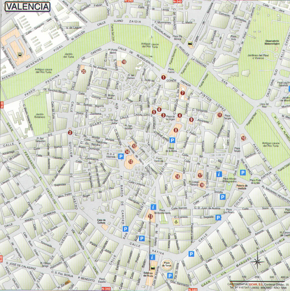
Valencia Downtown Map
 Valencia Downtown Map
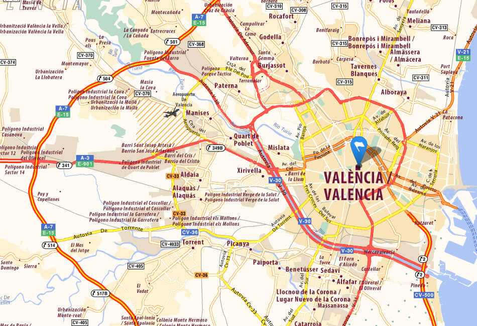
Valencia City Center Map with Key Roads and Surrounding Areas
 Valencia city center map with main roads and surrounding areas.
This map of Valencia city centre shows the main roads and routes leading in and out of the heart of the city, ideal for navigating key areas and accessing surrounding towns and neighbourhoods. Major motorways such as the E-15 and A-7 encircle Valencia, providing easy access to other parts of Spain. The map highlights key points of interest, neighbourhoods and transport hubs, including Valencia Airport near Manises. With a detailed network of major and local roads, this map is a practical guide for understanding Valencia’s urban layout and planning routes in and around the city centre.
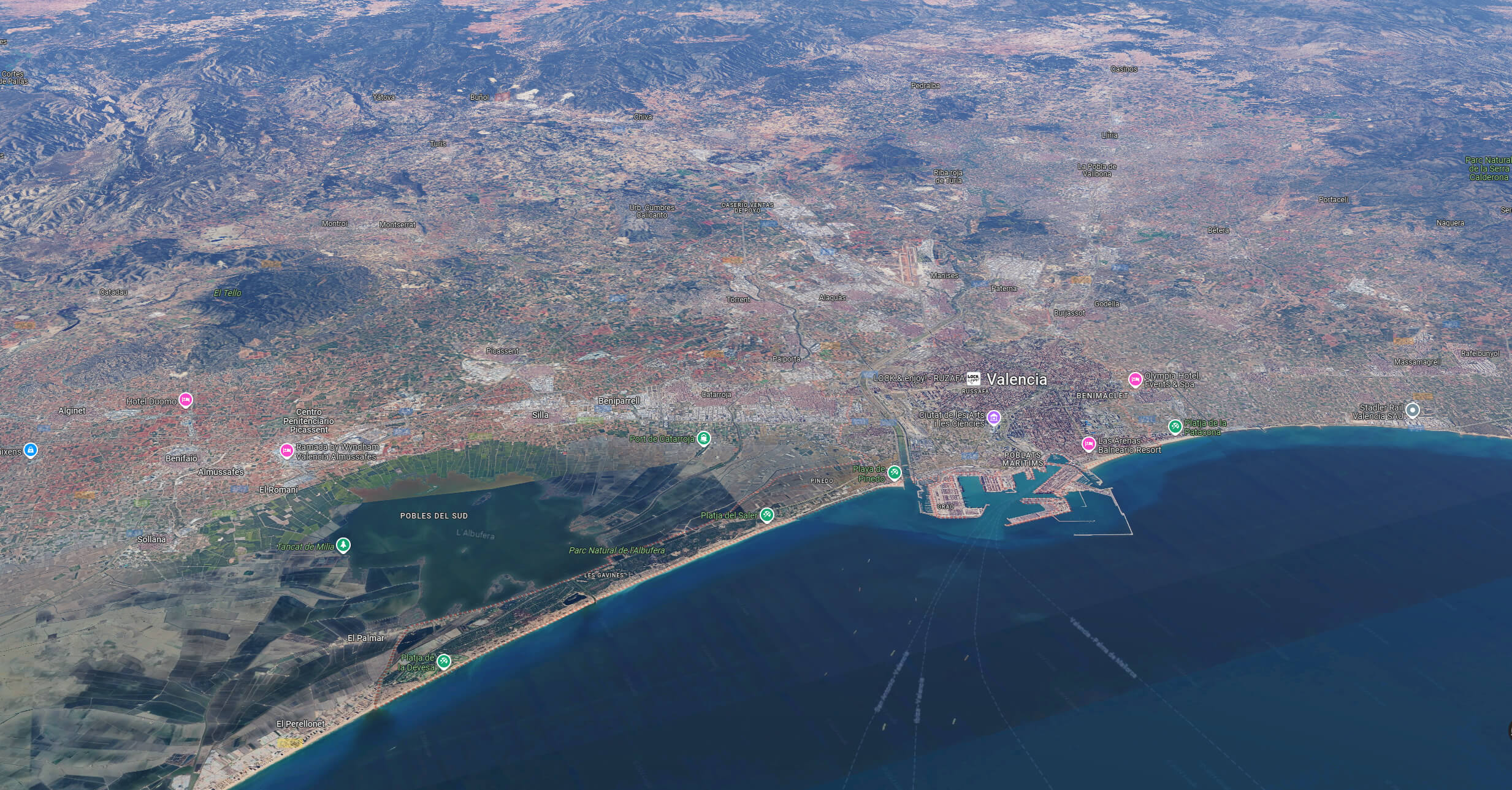
Valencia Aerial View Map
 Valencia Aerial View Map
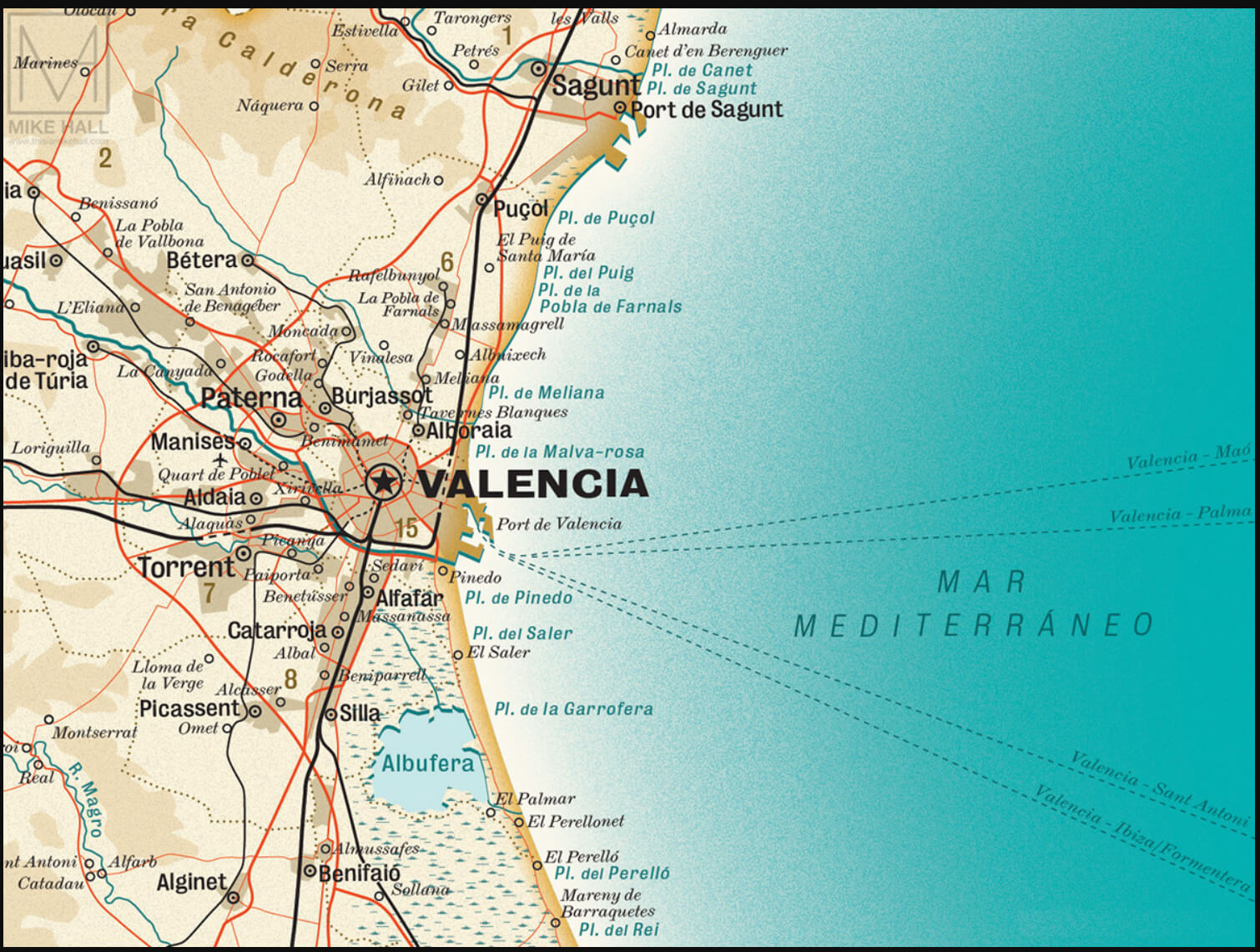
Valencia City Map Spain
 Valencia city map Spain
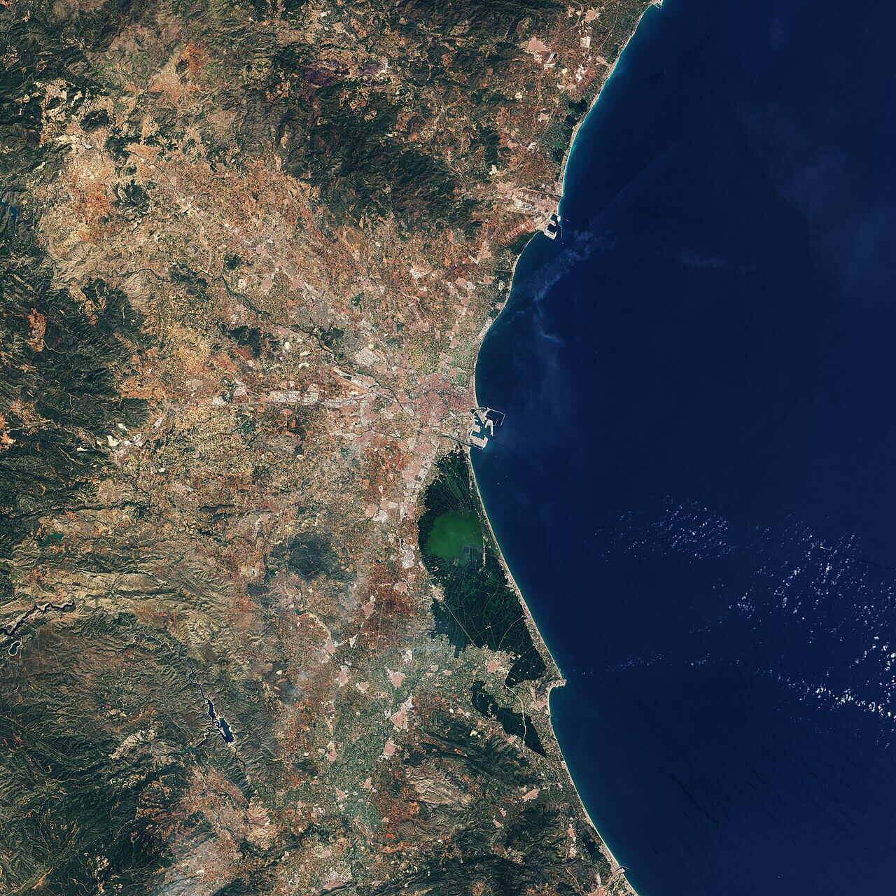
Valencia Satellite Map: Coastal and Inland Features of Eastern Spain
 Valencia satellite map showing city, coast, and inland areas of Spain.
This
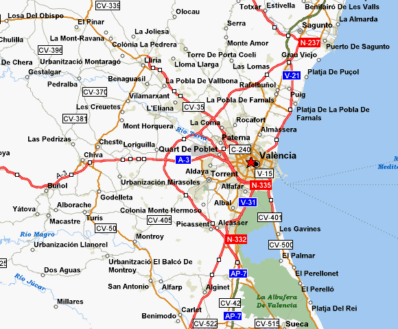
Valencia Regional Map: Key Roads and Surrounding Towns
 Valencia regional map with main highways and surrounding towns
This regional map of Valencia, Spain shows the main road networks and neighbouring towns around the city. Major motorways such as the AP-7, A-3 and V-21 link Valencia to other cities and coastal areas, showing its accessibility within the region. The map highlights nearby towns and suburbs, including Quart de Poblet, Paterna and Sagunto, as well as coastal areas such as Playa de Pinedo. Such a layout emphasises Valencia’s central role in regional connectivity, serving as a hub for both local travel and access to the Mediterranean coast.
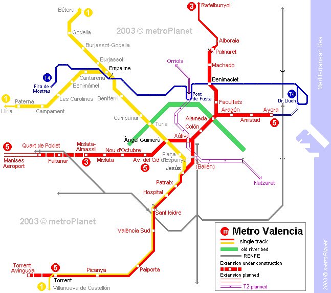
Valencia Metro Map Overview
 Valencia metro map with main lines and key transfer stations.
The Valencia Metro map shows the main metro lines that serve the city, efficiently connecting the main locations and suburbs. The map includes several lines: Line 1 (yellow), Line 3 (red), Line 4 (blue), Line 5 (green) and Line 6 (purple), as well as major stations such as Xàtiva, Colón and Angel Guimerá, which are centrally located and offer transfers between lines. The metro system serves the city centre as well as outlying areas such as the airport (Manises Aeroport) and coastal regions. Colour-coded routes help commuters navigate the extensive network, ensuring easy access to business, residential, and leisure areas in and around Valencia.
Where is Valencia on the Spain Map?
Show Google interactive map, satellite map, where is the country located.
Get directions by driving, walking, bicycling, public transportation and travel with street view.
Feel free to explore these pages as well:
- Advertisement -
 Valencia City Hall in Spain
 Map showing flooding in Valencia and Murcia, eastern Spain, October 30, 2024.
 Rainfall map of Spain in October 2024, showing precipitation areas.
 Elevation map of Spain showing mountain ranges and altitude variations.
 Map of Valencia city center with major landmarks and streets labeled
 Map showing Valencia province on Spain’s eastern Mediterranean coast.
 Map showing the Valencia region on Spain’s eastern Mediterranean coast.
 Valencia street map
 Valencia metro map showing various subway lines and stations
 Valencia historical map with landmarks and event locations labeled.
 Valencia Downtown Map
 Valencia city center map with main roads and surrounding areas.
 Valencia Aerial View Map
 Valencia city map Spain
 Valencia satellite map showing city, coast, and inland areas of Spain.
 Valencia regional map with main highways and surrounding towns
 Valencia metro map with main lines and key transfer stations.