- Advertisement -
Hurricane Milton is an extremely powerful tropical cyclone in the Gulf of Mexico. It is currently impacting the Yucatán Peninsula and threatening the U.S. state of Florida less than two weeks after Hurricane Helene devastated the Big Bend region.
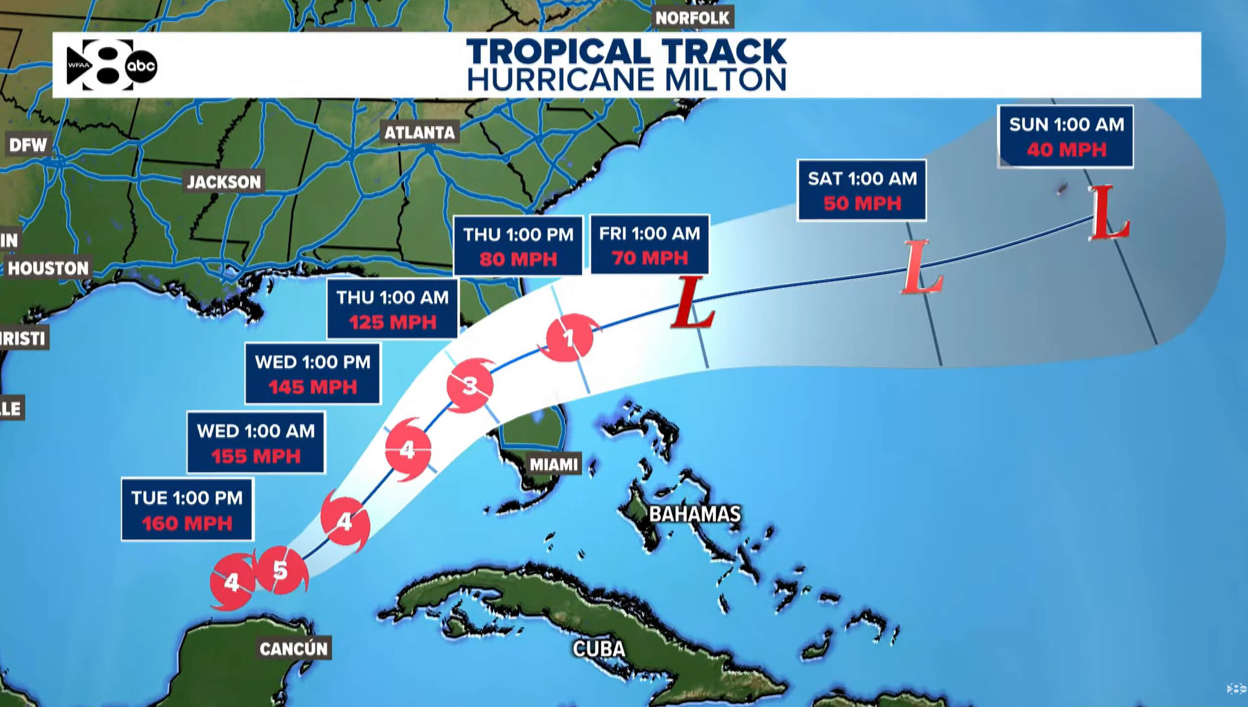
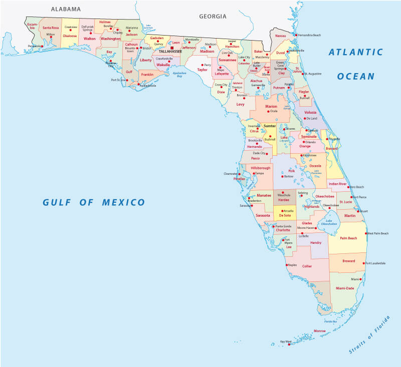
The thirteenth named storm, ninth hurricane, fourth major hurricane, and second Category 5 hurricane of the 2024 Atlantic hurricane season, Milton formed from a long-tracked tropical disturbance which originated in the western Caribbean Sea and consolidated in the Bay of Campeche on October 5. The storm then underwent explosive intensification, and became a Category 5 hurricane on October 7.Hurricane Milton Florida Map 2024
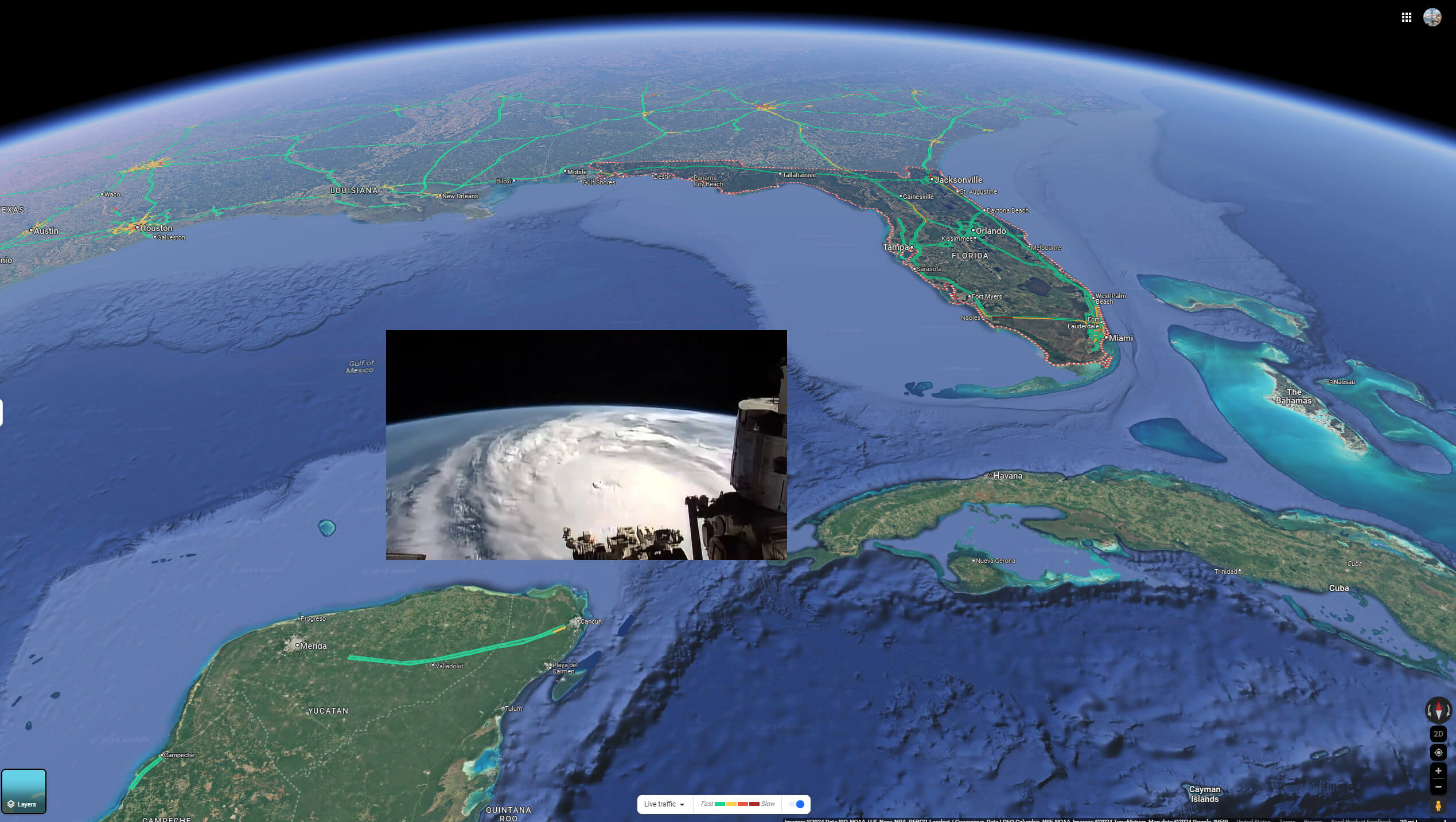
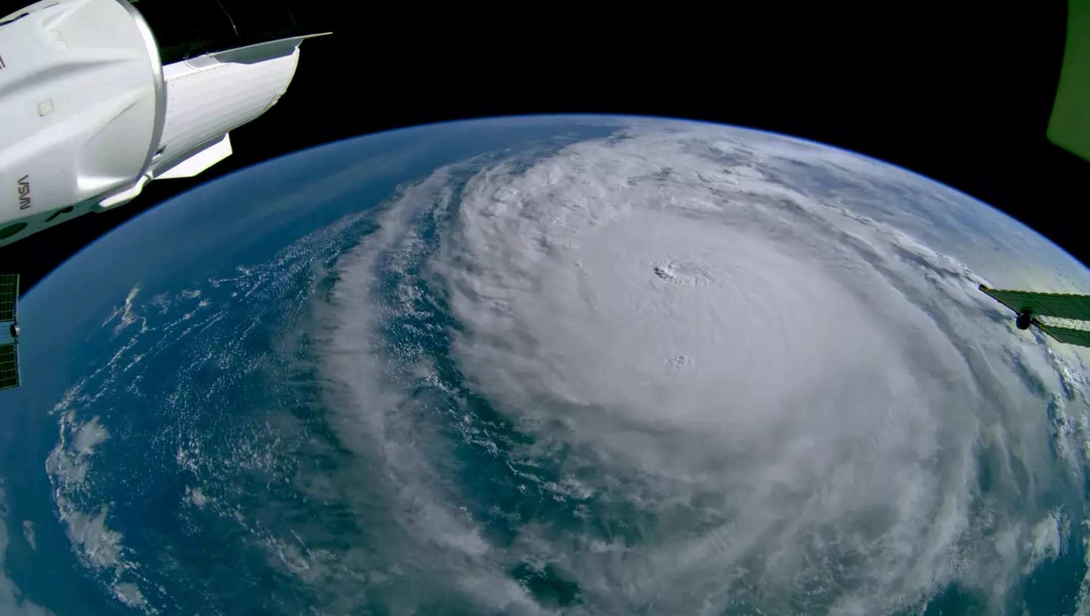
Hurricane Milton Map from Space 2024
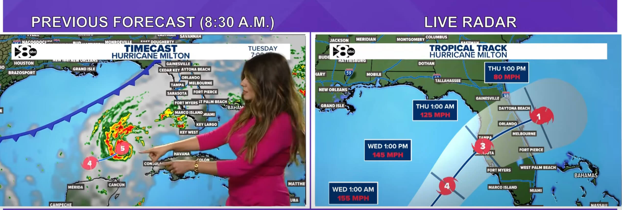
Hurricane Milton Live Radar Map 2024
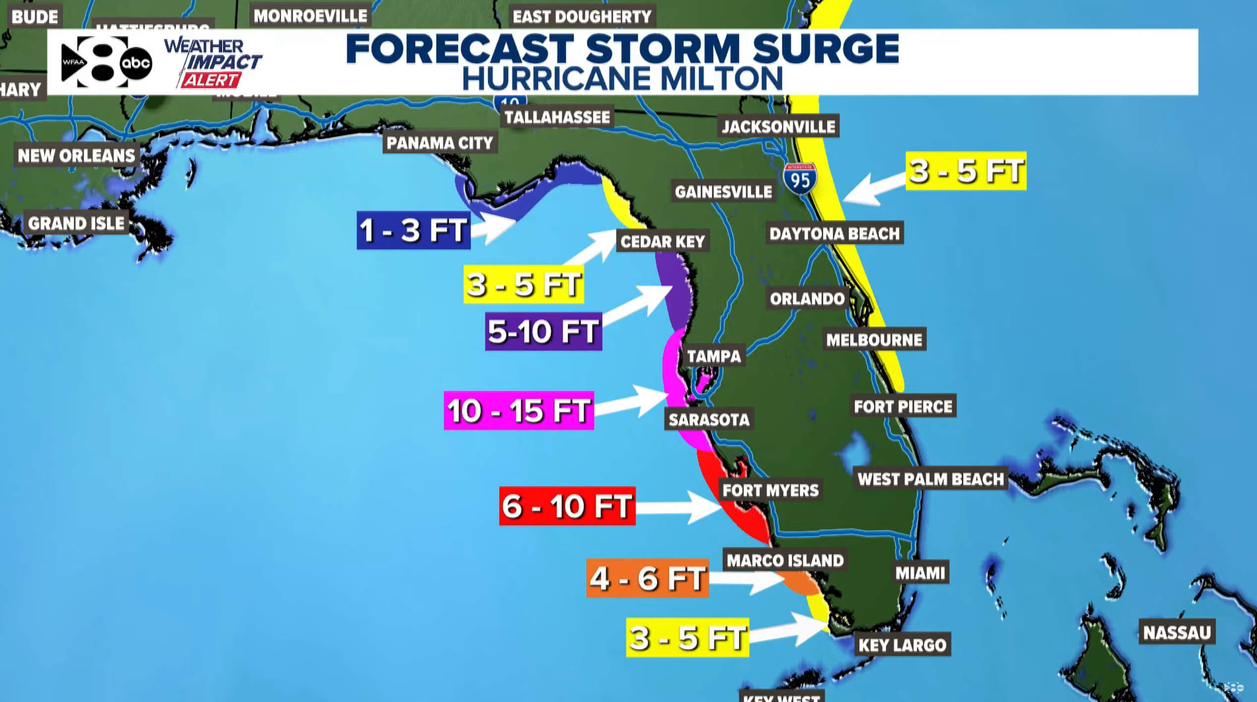
Hurricane Milton Storm Surge Map 2024
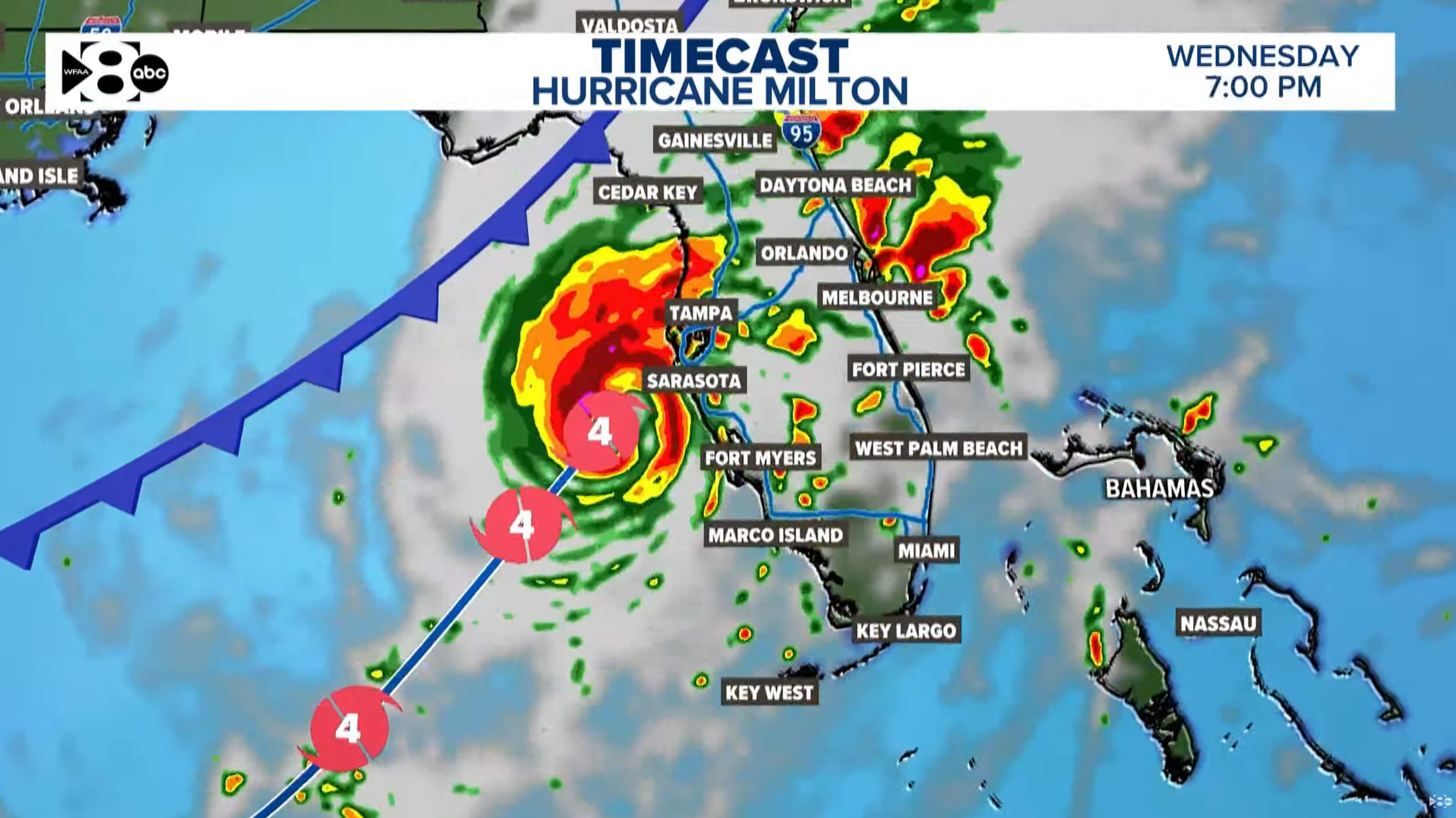
Hurricane Milton Timecast Map 2024
Hurricane Milton Track Map 2024
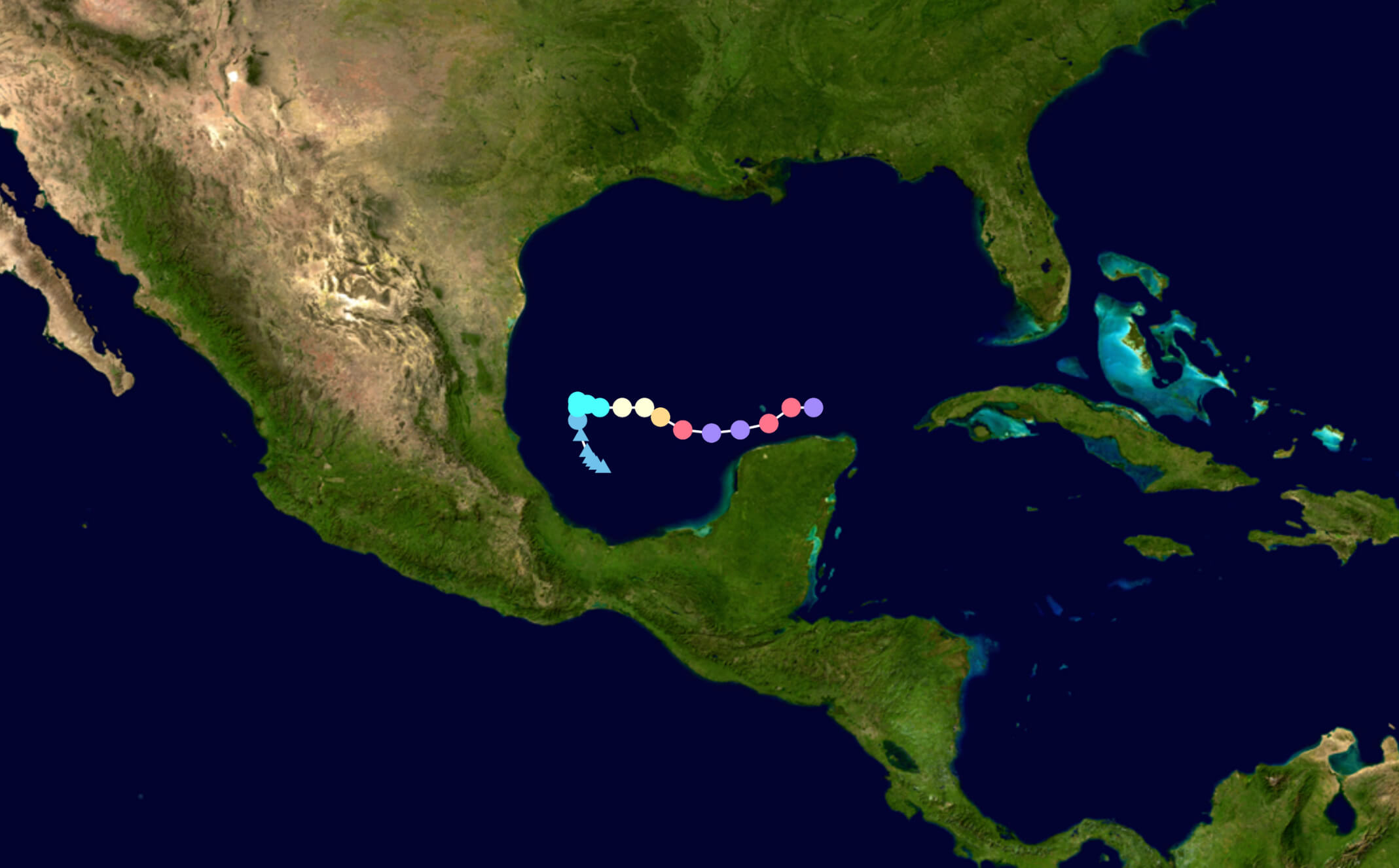
Hurricane Milton US Mexico Map 2024
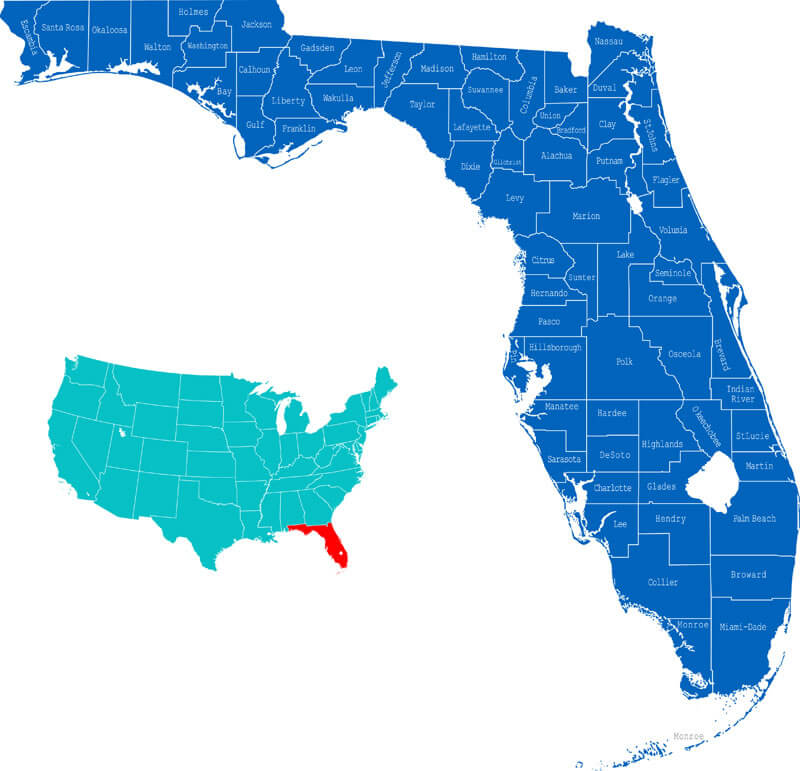
Where is located Florida on the US Map?
Milton’s Timeline: What to Expect Hour-by-Hour in Florida’s Vulnerable Zones
Here is a timeline for key areas along Milton’s path:Tampa:
- Storm duration: Wednesday 2 p.m. to Thursday 2 p.m.
- Peak wind: 80 to 100 mph with gusts to 115 mph, Thursday 12 a.m. to 5 a.m.
- Rainfall: 8 to 12 inches
- Peak Rainfall: Wednesday 2 p.m. to Thursday 8 a.m.
- Storm Surge: 10 to 15 feet above ground in flood prone areas, peaking Wednesday 10 p.m. to Thursday 6 a.m.
About Tampa
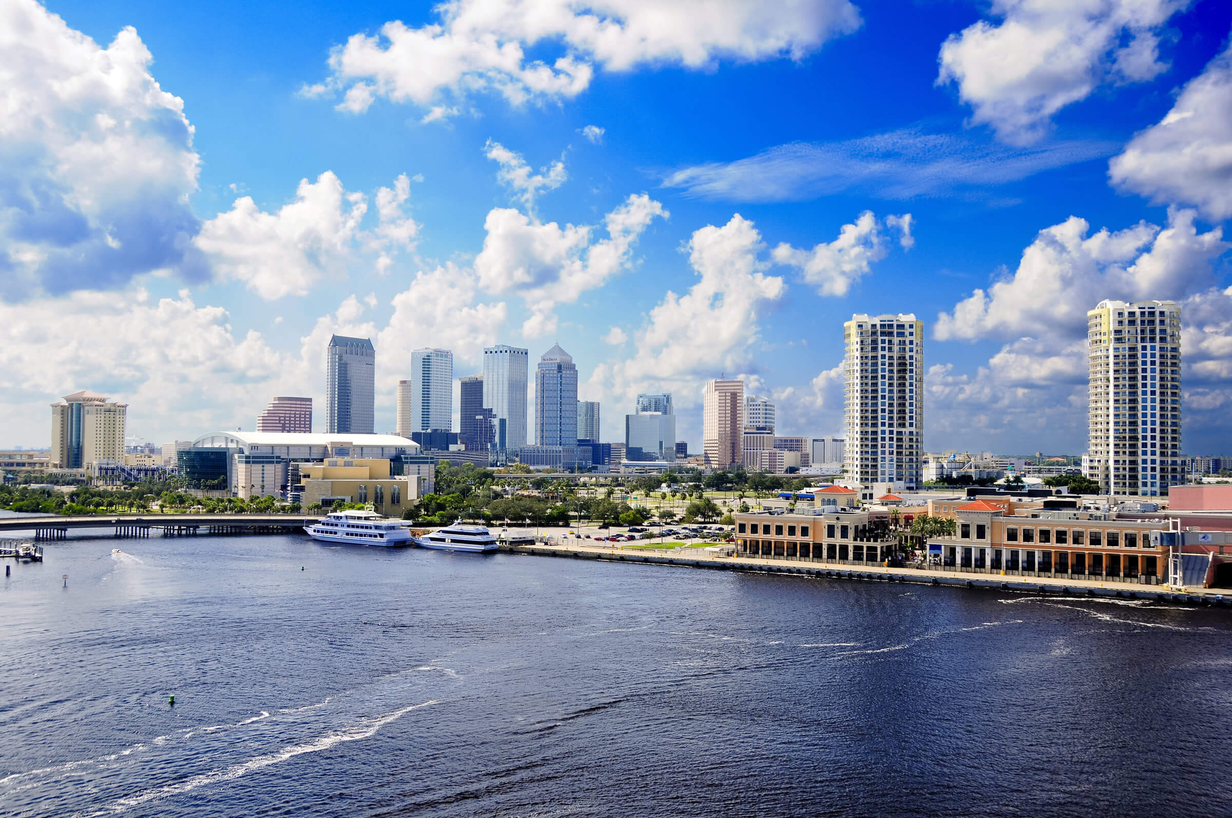
Where is located Tampa on the Florida Map?
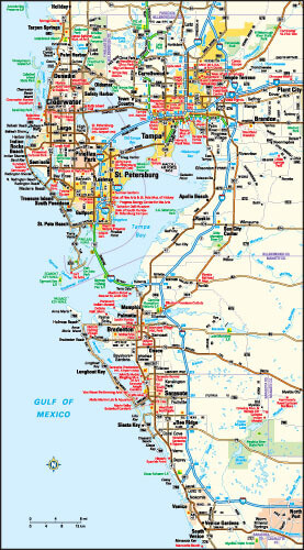
Sarasota:
- Storm duration: Wednesday 2 p.m. to Thursday 2 p.m.
- Peak wind: 90 to 110 mph with gusts to 125 mph, Thursday 12 a.m. to 5 a.m.
- Rainfall: 4 to 8 inches
- Peak Rainfall: Wednesday 2 p.m. to Thursday 8 a.m.
- Storm Surge: 10 to 15 feet above ground in flood prone areas, peaking Wednesday 10 p.m. to Thursday 6 a.m.
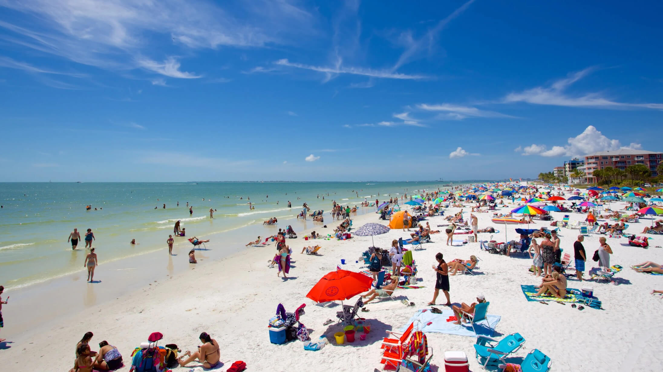
About Sarasota
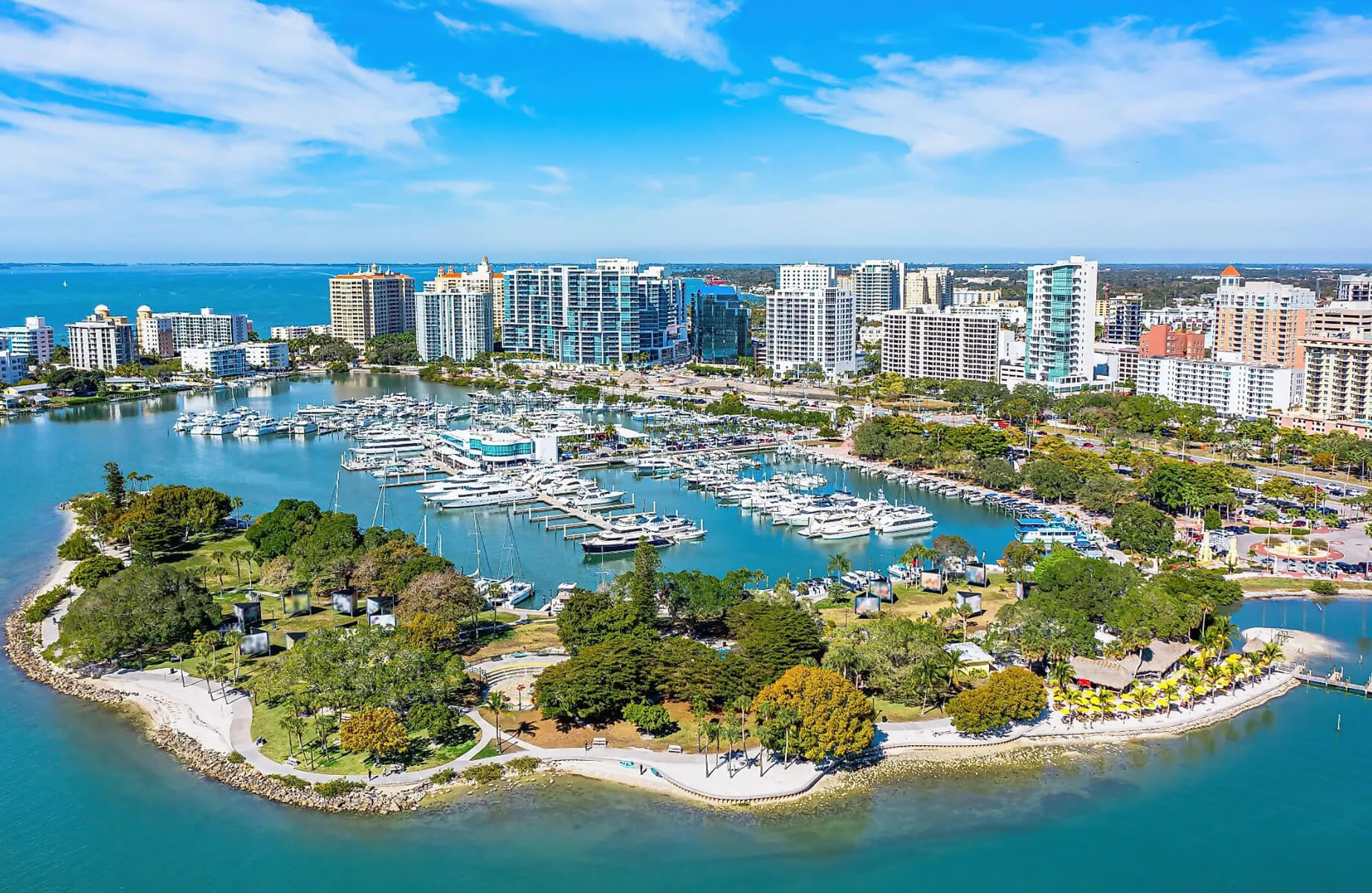 Sarasota, Florida, located on the southwestern coast along the Gulf of Mexico, has a population of approximately 57,000 residents as of recent estimates. Known for its beautiful beaches and cultural amenities, Sarasota is a popular destination for both tourists and retirees.
Where is located Sarasota on the Florida Map?
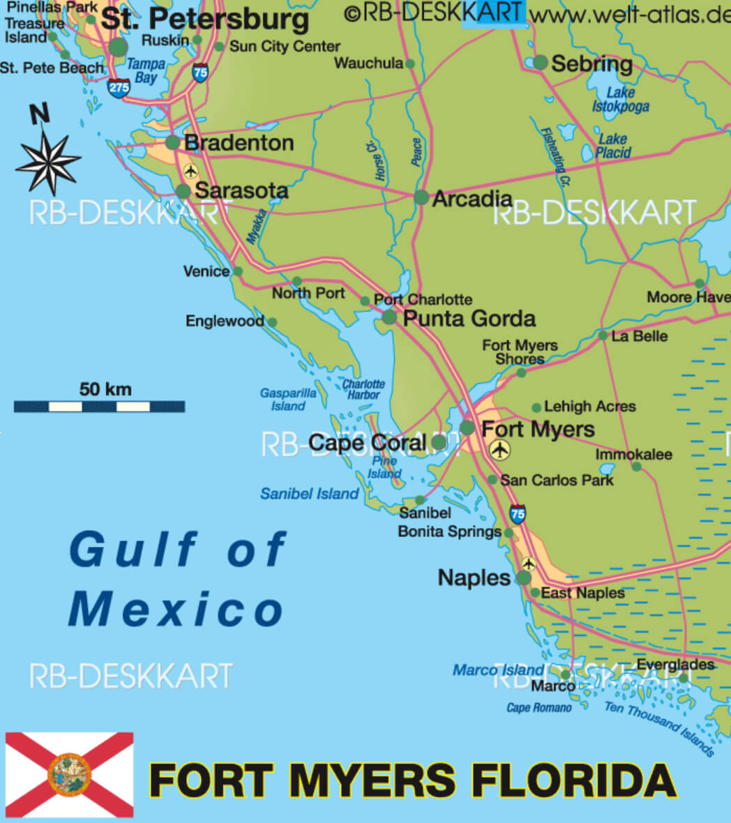
Fort Myers:
- Storm duration: Wednesday 6 p.m. to Thursday 1 p.m.
- Peak wind: 25-35 mph with gusts to 55 mph, Wednesday 9 p.m. – Thursday 6 a.m.
- Rainfall: 2 to 4 inches
- Peak Rainfall: Wednesday 8 a.m. to Thursday 2 a.m.
- Storm Surge: 6 to 10 feet above ground in flood prone areas, peaking Thursday 12 a.m. to Thursday 6 a.m.
About Fort Myers
 Fort Myers, Florida, located on the southwest coast of the state along the Caloosahatchee River, has a population of approximately 92,000 as of the latest estimates. It is a popular destination known for its beautiful beaches, proximity to Sanibel Island, and historic landmarks such as the winter estates of Thomas Edison and Henry Ford.
Where is located Fort Myers on the Florida Map?
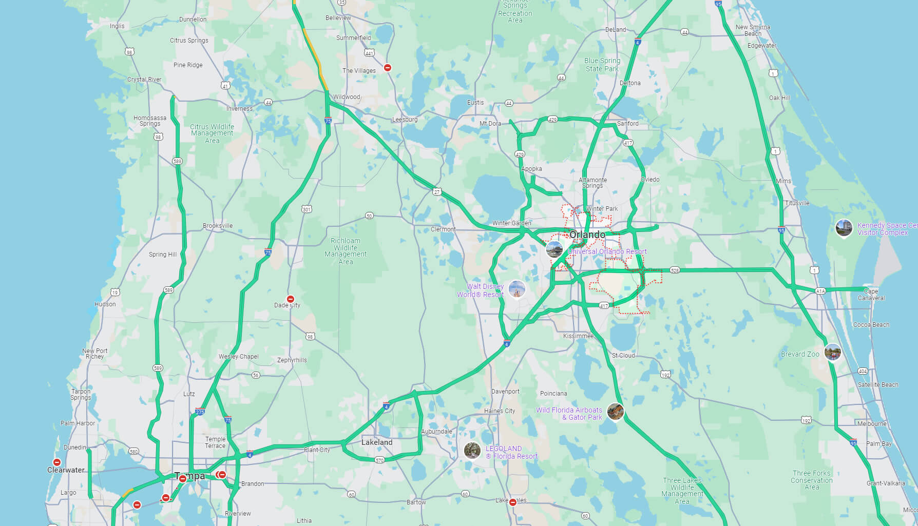
Orlando:
- Storm duration: Wednesday 8 p.m. to Thursday 5 p.m.
- Peak wind: 70-90 mph with gusts to 100 mph Thursday 6 a.m. – Thursday 12 p.m.
- Rainfall: 4 to 8 inches
- Peak Rainfall: Wednesday 8 a.m. to Thursday 11 a.m.
About Orlando
 Orlando, Florida, located in central Florida, is home to a population of approximately 320,000 residents as of the latest estimates. Known for its world-renowned theme parks, including Walt Disney World and Universal Studios, Orlando is a major tourist destination attracting millions of visitors each year..
Where is located Orlando on the Florida Map?
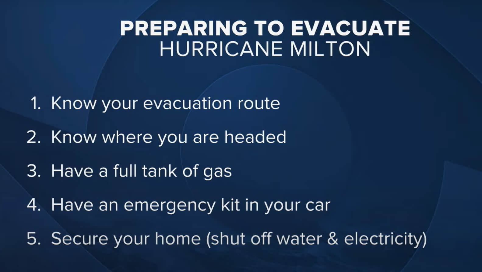
Milton Hurricane Preparing to Evacuate
 To properly prepare for evacuation due to Hurricane Milton, it’s essential to know your evacuation route, have a clear destination in mind,
- Ensure your car has a full tank of gas,
- pack an emergency kit,
- secure your home by turning off water and electricity before leaving.
.
Hurricane Milton Evacuations Centers in Florida, US
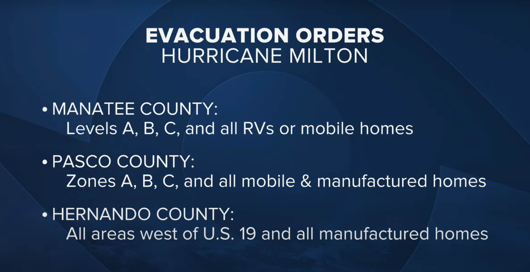
The evacuation orders for Hurricane Milton include Manatee, Pasco, and Hernando counties.
- Manatee County has issued evacuation orders for levels A, B, and C, as well as all RVs and mobile homes.
- Pasco County is evacuating zones A, B, and C, along with all mobile and manufactured homes.
- In Hernando County, the evacuation applies to all areas west of U.S. 19 and all manufactured homes.
These precautionary measures aim to ensure the safety of residents in the face of Hurricane Milton’s approach.
.
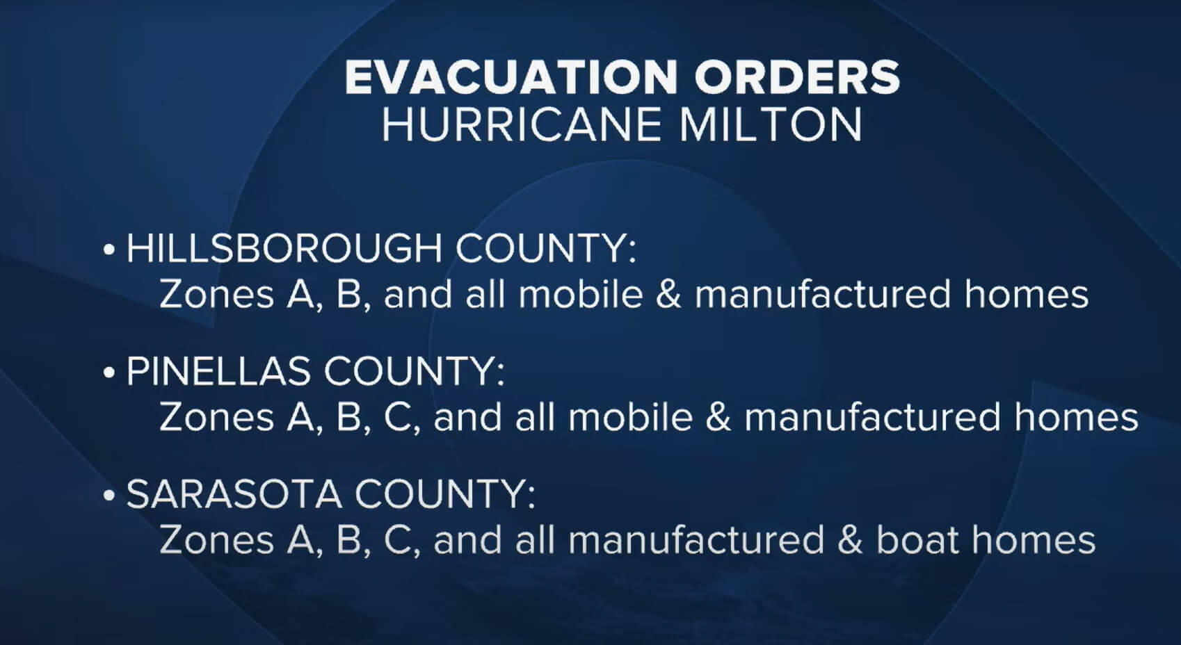
The evacuation orders for Hurricane Milton have been issued for three key counties in Florida. .
- In Hillsborough County, residents in Zones A, B, and all mobile and manufactured homes are required to evacuate.
- In Pinellas County, evacuation orders apply to Zones A, B, C, and all mobile and manufactured homes.
- Similarly, in Sarasota County, evacuation orders cover Zones A, B, C, and all manufactured and boat homes.
.
These zones are prioritized due to their heightened vulnerability to hurricane-related impacts such as storm surges and high winds..
Where is Florida on the US Map?
Show Google map, satellite map, where is the country located.
Get directions by driving, walking, bicycling, public transportation, and travel with street view.
Feel free to explore these pages as well:
- Hurricane Milton’s Path ↗️
- Florida US Map ↗️
- Map of Florida ↗️
- Florida Map ↗️
- All About Florida ↗️
- The Traveler’s Top 10 Travel Guide to Orlando ↗️
- Miami’s Magic Uncovered ↗️
- Dive Into The Bahamas ↗️
- Miami’s Magic Uncovered: Your Essential Guide to the City’s Top 10 Attractions ↗️
- California Map ↗️
- Texas Map ↗️
- New York Map ↗️
- United States Map ↗️
- Map of United States ↗️
- North America Map ↗️
- Map of North America ↗️
- Advertisement -
 To properly prepare for evacuation due to Hurricane Milton, it’s essential to know your evacuation route, have a clear destination in mind,
 The evacuation orders for Hurricane Milton include Manatee, Pasco, and Hernando counties.
- Manatee County has issued evacuation orders for levels A, B, and C, as well as all RVs and mobile homes.
- Pasco County is evacuating zones A, B, and C, along with all mobile and manufactured homes.
- In Hernando County, the evacuation applies to all areas west of U.S. 19 and all manufactured homes.
 The evacuation orders for Hurricane Milton have been issued for three key counties in Florida. .
- In Hillsborough County, residents in Zones A, B, and all mobile and manufactured homes are required to evacuate.
- In Pinellas County, evacuation orders apply to Zones A, B, C, and all mobile and manufactured homes.
- Similarly, in Sarasota County, evacuation orders cover Zones A, B, C, and all manufactured and boat homes.
Where is Florida on the US Map?
Show Google map, satellite map, where is the country located.
Get directions by driving, walking, bicycling, public transportation, and travel with street view.
Feel free to explore these pages as well:
- Hurricane Milton’s Path ↗️
- Florida US Map ↗️
- Map of Florida ↗️
- Florida Map ↗️
- All About Florida ↗️
- The Traveler’s Top 10 Travel Guide to Orlando ↗️
- Miami’s Magic Uncovered ↗️
- Dive Into The Bahamas ↗️
- Miami’s Magic Uncovered: Your Essential Guide to the City’s Top 10 Attractions ↗️
- California Map ↗️
- Texas Map ↗️
- New York Map ↗️
- United States Map ↗️
- Map of United States ↗️
- North America Map ↗️
- Map of North America ↗️
- Advertisement -