Discover the Beauty of Iceland Through Maps: Explore Iceland’s stunning landscapes with our comprehensive map collection. These maps cover the entire island’s physical and political features, from volcanic terrain to glacial rivers. With detailed political, physical, and topographic maps, this collection is perfect for travelers, students, and geography enthusiasts eager to explore Iceland’s breathtaking landscapes.
Brief information about Iceland
Iceland, known as the “Land of Fire and Ice,” is a country of stunning contrasts. Located in the North Atlantic, this small island nation is famous for its dramatic landscapes featuring glaciers, volcanoes, geysers, and hot springs. It’s a paradise for nature lovers and adventurers, offering activities like glacier hiking, whale watching, and exploring the Golden Circle, a popular tourist route showcasing the best of Icelandic nature.
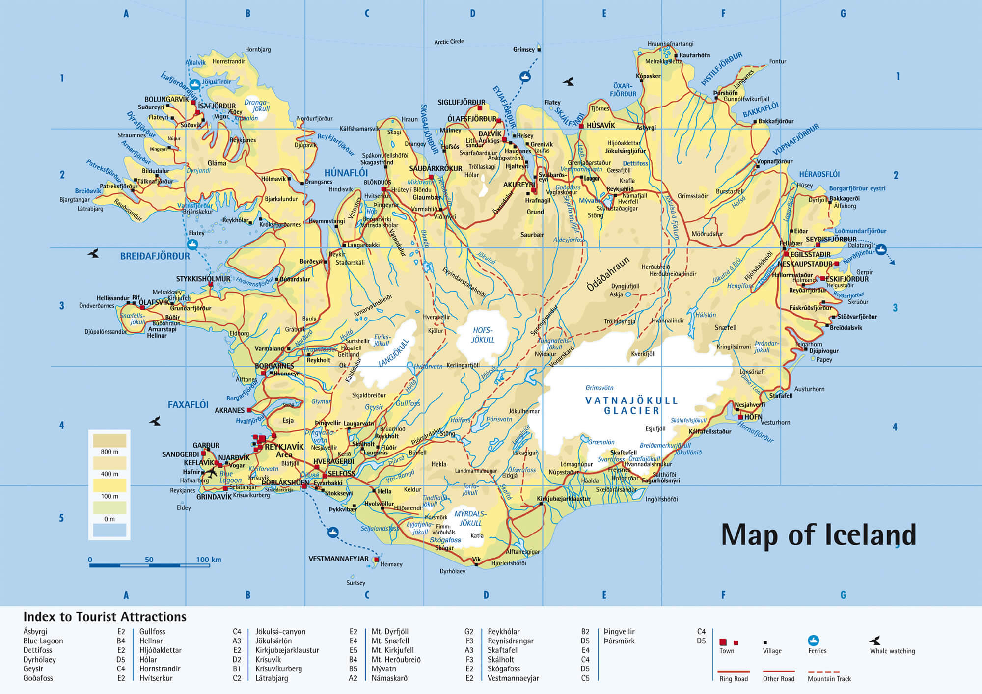
Iceland Tourist Map
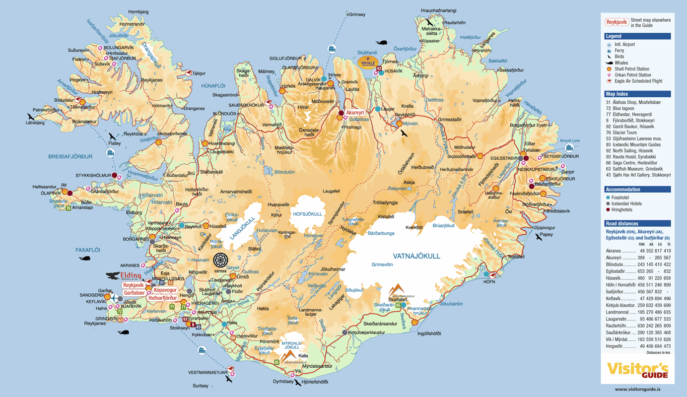
This image is a tourist map of Iceland, highlighting key towns, natural landmarks, road distances, and travel routes, with major attractions like glaciers, volcanoes, and national parks clearly marked for visitors.
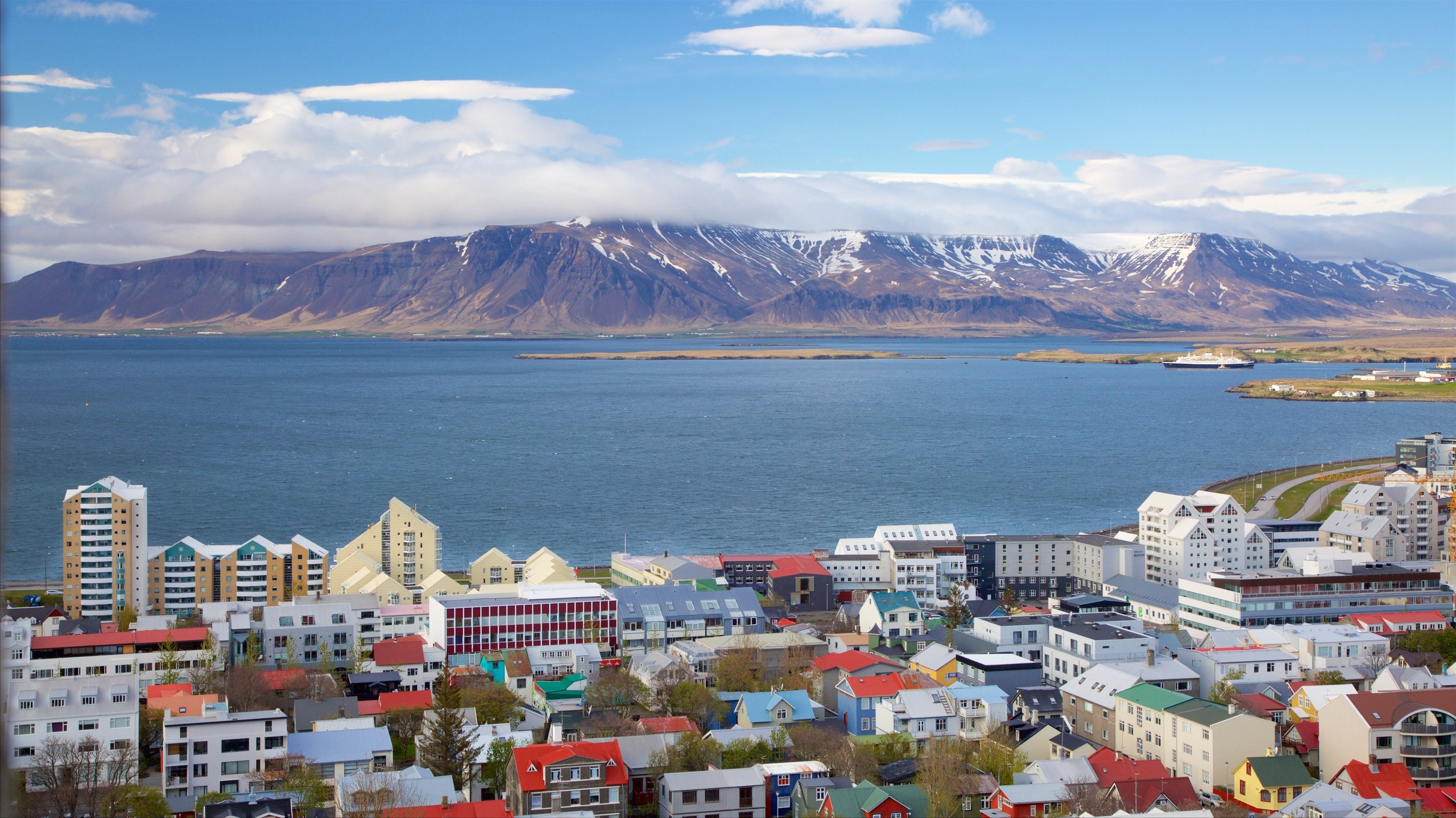
Despite its remote location and rugged environment, Iceland has a rich cultural heritage and a modern, vibrant capital in Reykjavik. The city is home to quirky architecture, fascinating museums, and a lively arts scene. Visitors can also unwind in the famous Blue Lagoon, a geothermal spa that offers a one-of-a-kind experience in Iceland’s surreal landscapes.
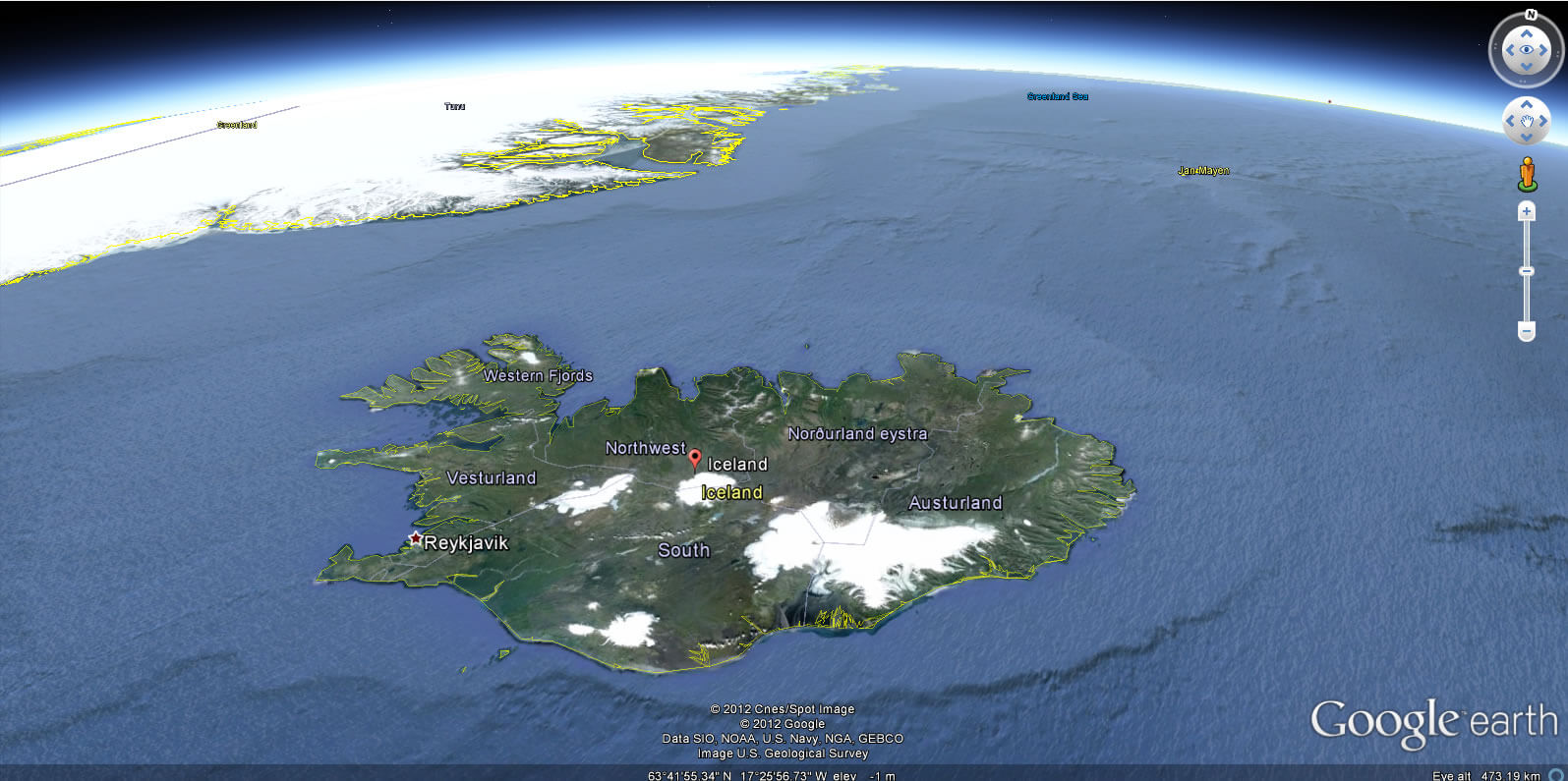
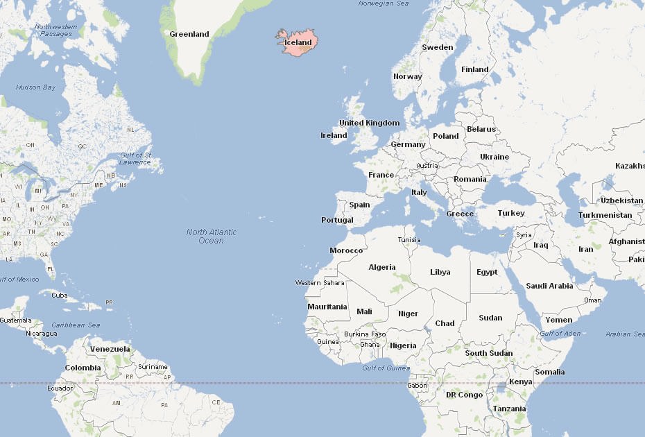
Where is located Iceland on the World Map
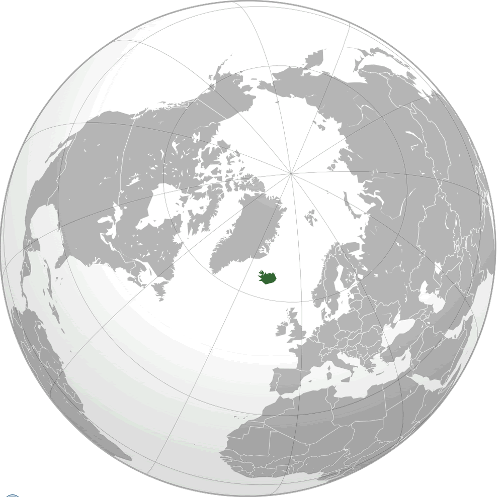
Iceland is located in the North Atlantic Ocean, just below the Arctic Circle. It sits between Greenland and Norway, with its closest European neighbors being the Faroe Islands to the southeast. While Iceland may seem far north, it’s strategically positioned between North America and Europe, making it a popular stopover for flights crossing the Atlantic.
Despite its northern location, Iceland enjoys a relatively mild climate thanks to the Gulf Stream, which brings warmer ocean currents from the south. This unique positioning means Iceland experiences cooler summers and milder winters than many other places at similar latitudes, like parts of Canada or Russia.
On the world map, Iceland is often seen as a small island with a unique, isolated presence. Its remoteness adds to its mystique, attracting travelers who seek dramatic landscapes, vibrant culture, and the feeling of being at the edge of the world. With its volcanic terrain and glaciers, it truly stands out in the North Atlantic.
Here are some statistical information about Iceland:
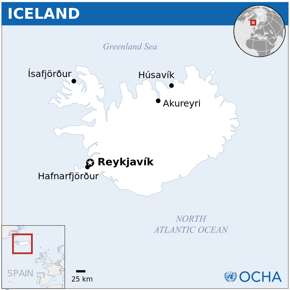
Iceland Location Map
Iceland Physical Map
Road Map of Iceland
This image is a detailed road map of Iceland, showcasing major highways, towns, tourist attractions, and natural landmarks like glaciers and waterfalls, designed to help travelers navigate the country.
Iceland Politican Map
This map highlights key locations in Iceland, including major towns, natural landmarks like glaciers and national parks, as well as notable tourist attractions such as Gullfoss and Geysir.
Iceland Maps
This image is a detailed physical map of Iceland, displaying its major geographical features like glaciers, mountains, and volcanoes, along with roads, airfields, and population centers.
Iceland Earth Map
Map of Iceland
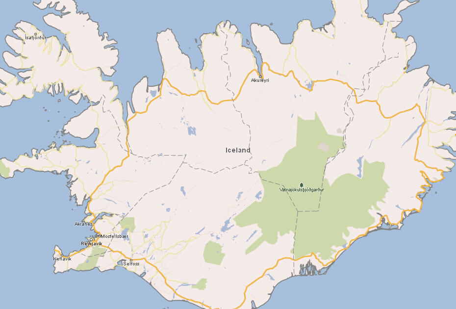
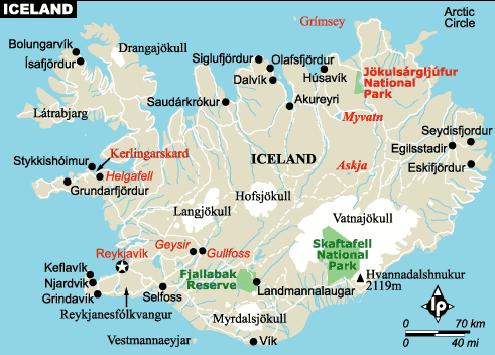
This image shows a simplified map of Iceland, highlighting major cities like Reykjavik and Akureyri, along with key roads and the Vatnajökull National Park.
Iceland National Map with Regions Cities
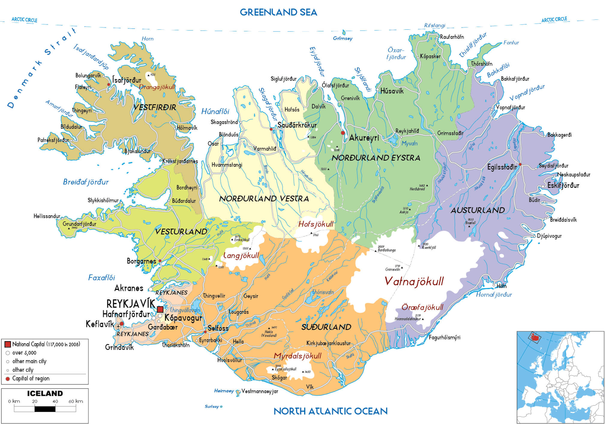 This map of Iceland shows its various regions, cities, and major geographic features, with Reykjavík as the national capital. Regions such as Vestfirðir, Austurland, and Suðurland are highlighted, showing major towns and natural landmarks such as glaciers Vatnajökull and Þórisvatn. The map provides a clear overview of Iceland’s urban areas, including Akureyri in the north and Egilsstaðir in the east, as well as major fjords and mountain ranges that reflect the country’s diverse landscape.
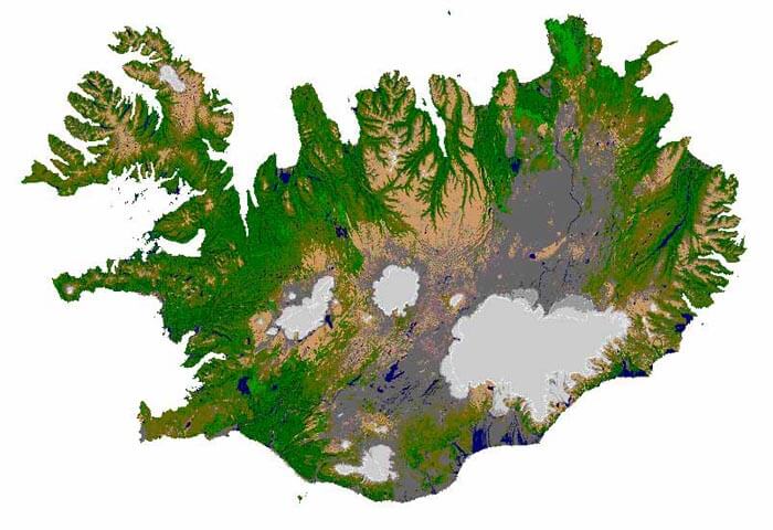
Iceland Geographical Map
 This geographic map of Iceland showcases the country’s diverse topography, with rugged mountain ranges, vast glaciers, active volcanoes, and extensive lava fields. The map highlights notable features such as Vatnajökull, Europe’s largest glacier, and the Mid-Atlantic Ridge, which runs through the island, highlighting Iceland’s dynamic geological activity. Key regions such as the Westfjords, highlands and coastal lowlands are clearly marked, illustrating the unique natural landscapes that define Iceland.
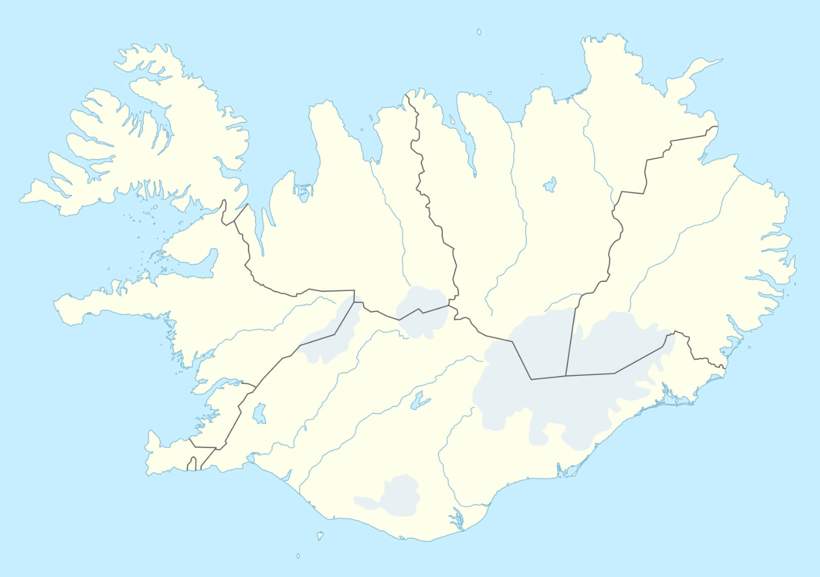
Iceland Regional Boundary Map with Roads
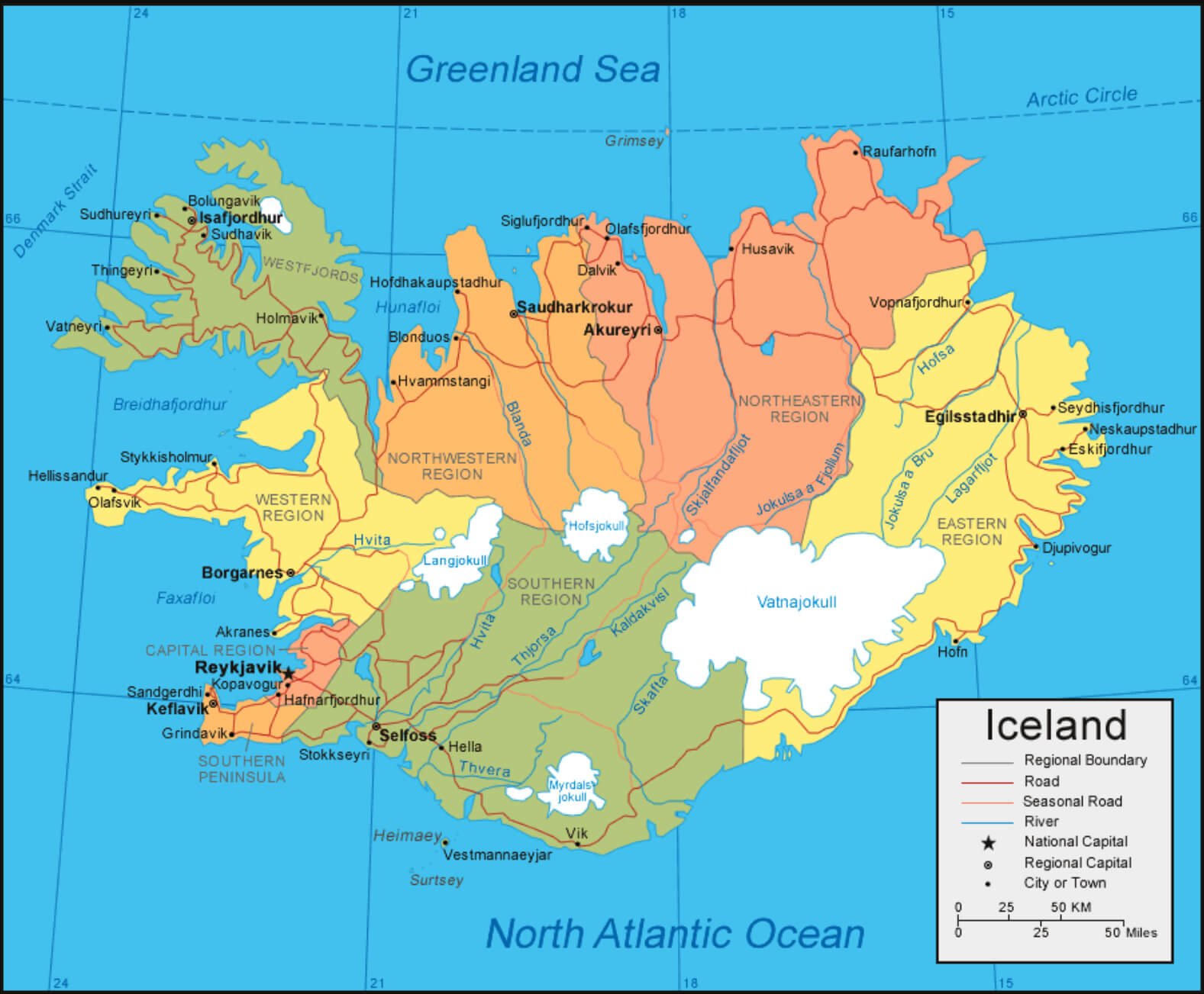 This map of Iceland shows regional boundaries and the major roads that connect the country’s major cities and towns. Each region, such as Western Region, Southern Region and Northeastern Region, is clearly marked and color-coded, while major transportation routes, including roads and seasonal roads, help guide travelers through Iceland’s diverse and scenic landscapes. The map highlights important geographic features such as glaciers and rivers, and highlights major urban centers, with Reykjavik, the capital, prominently featured in the Capital Region.
Iceland Historical Map in 17th Century
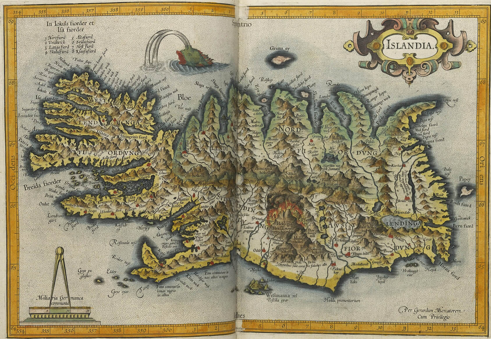 This map shows Iceland in the 17th century and illustrates its historical geography. During this time, Iceland was under Danish rule, and cartographers depicted the rugged terrain of the island with an emphasis on its volcanic activity and fjords. The artistic details, including sea creatures and mythical elements, reflect the cartographic style of the period. This map is a fascinating glimpse into how Iceland’s geography was understood and illustrated centuries ago.
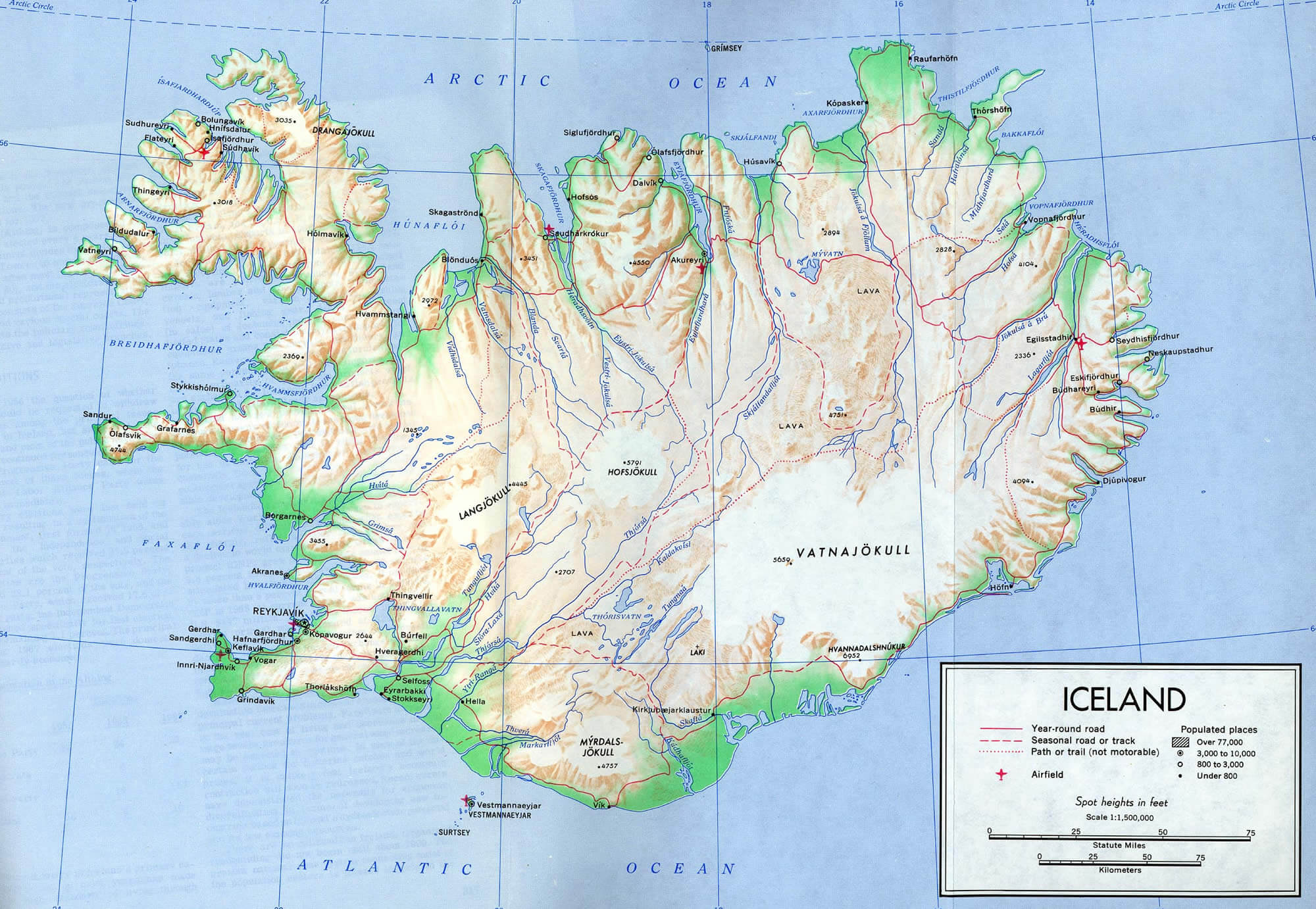
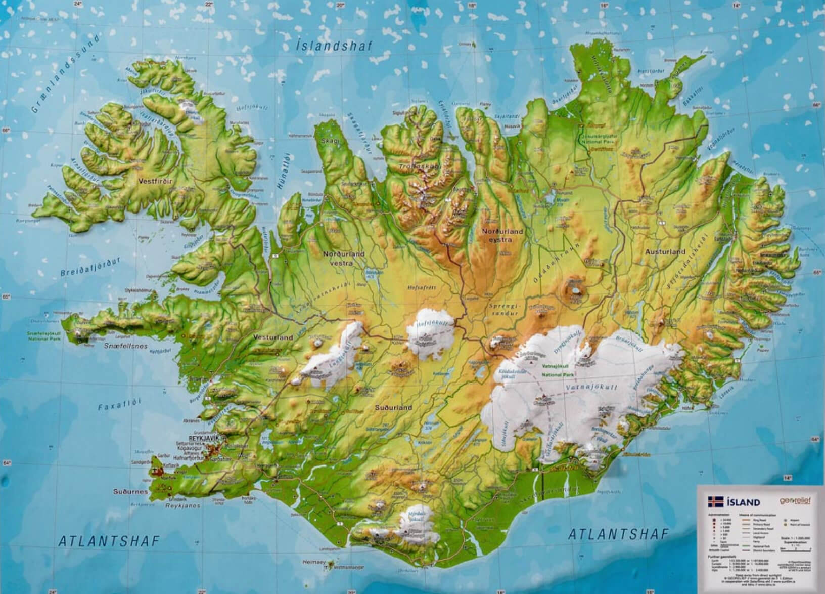
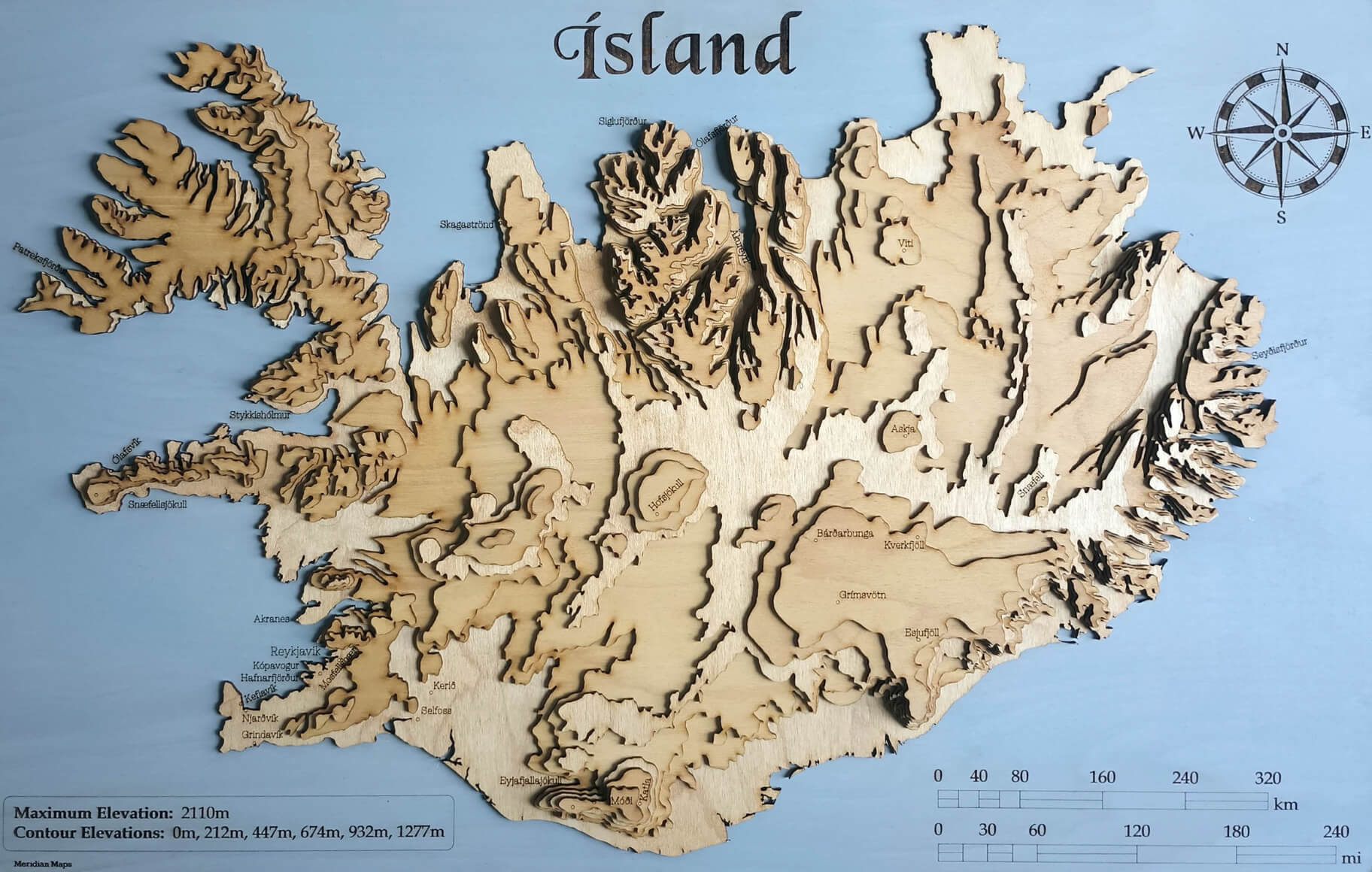
Iceland Topographic Map
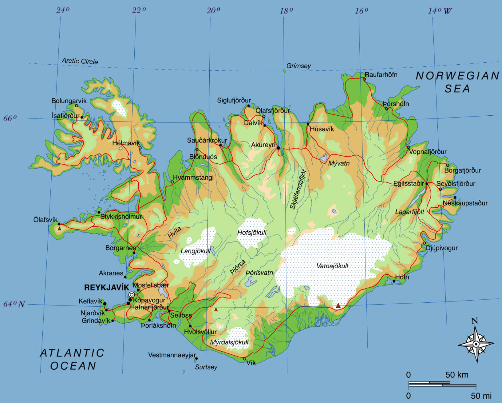 This topographical map of Iceland provides a detailed view of the country’s unique geography. It highlights various geographic features, including vast glaciers such as Vatnajökull and Hofsjökull, volcanic areas, and highland plateaus. The map also illustrates Iceland’s rugged coastline, numerous fjords and major cities such as Reykjavik, Akureyri and Egilsstaðir. Contours and elevation shading show Iceland’s dramatic terrain, much of which is shaped by volcanic and geothermal activity.
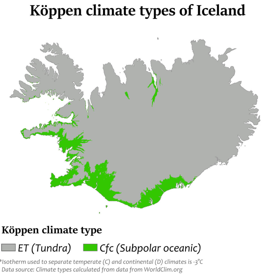
Iceland Climate Map
Iceland Blank Map
Iceland Regions Map
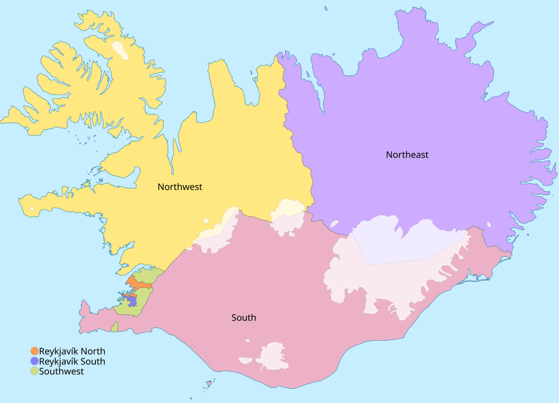 This map of Iceland shows the country divided into several regions, including Northwest, Northeast, South, Reykjavik North, Reykjavik South, and Southwest. Each region is clearly color-coded, providing a clear geographical representation of the country. The map helps to visually understand how Iceland’s landmass is organized for administrative and geographic purposes.
Iceland Provinces Map with Cities
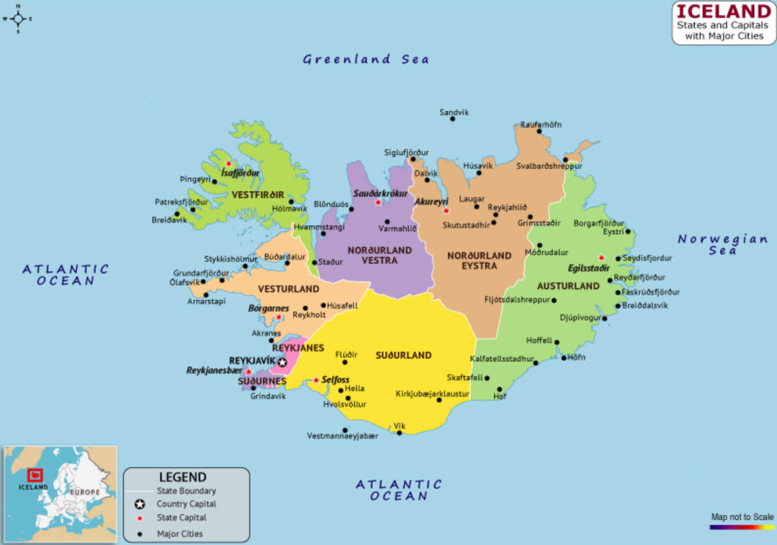 This map illustrates the provinces of Iceland and highlights the major cities within each region. The country is divided into several administrative regions, such as Suðurland, Austurland, and Norðurland, with Reykjavík prominently marked as the capital in the southwest. Each province is clearly color-coded, providing a clear geographical representation of where cities like Akureyri in Norðurland Eystra or Selfoss in Suðurland are located. The map also emphasizes the proximity of the country to surrounding seas, such as the Atlantic Ocean and the Greenland Sea.
Iceland Tourism Map
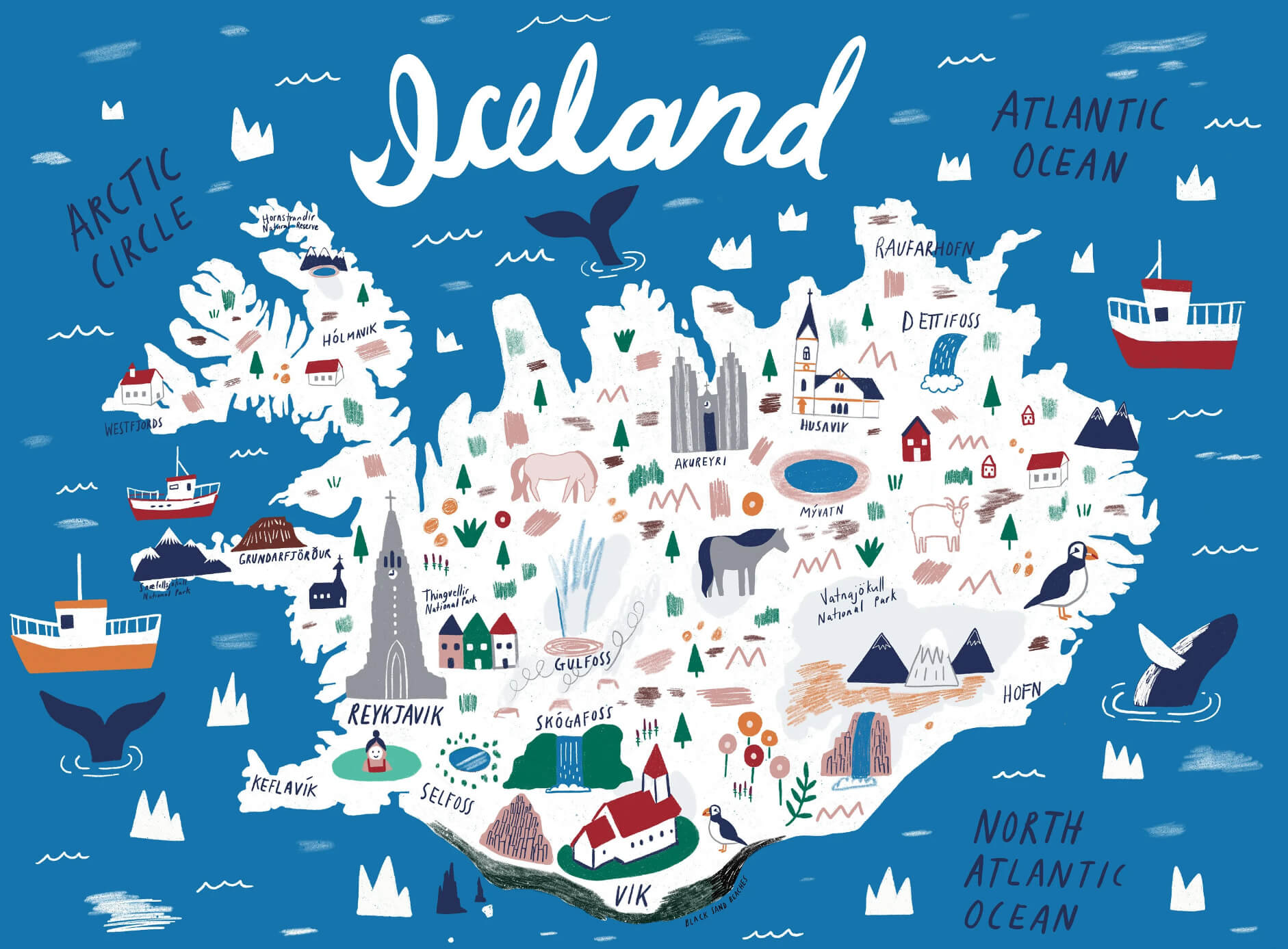 This tourist map of Iceland provides a full-color, illustrated overview of major landmarks and attractions throughout the country, including natural wonders such as Vatnajökull National Park, Gullfoss waterfall, and Skógafoss. Major cities such as Reykjavik and Akureyri are also highlighted, along with popular sites such as Thingvellir National Park, Dettifoss and the famous black sand beaches near Vik. The map playfully captures Iceland’s rich mix of natural beauty and cultural landmarks, making it ideal for visualizing a travel itinerary.
Iceland Elevation Map
 This map of Iceland depicts the elevation of the island, showing its varied topography. It highlights the distinct mountainous regions, including Iceland’s highest peaks such as Hvannadalshnjúkur. The map also illustrates the coastal areas and plateaus, giving a clear understanding of Iceland’s unique geological formations and the volcanic landscapes that shape much of the country.
Map of Iceland Europe
Map of Iceland World
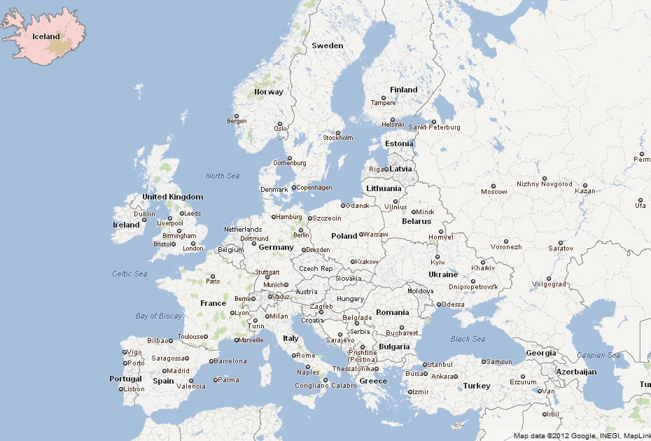
Where is Iceland on the Europe Map?
Show Google map, satellite map, where is the country located.
Get directions by driving, walking, bicycling, public transportation and travel with street view.
Feel free to explore these pages as well:
- United Kingdom Map ↗️
- Map of United Kingdom ↗️
- A Collection of United Kingdom Maps ↗️
- Ireland Map ↗️
- Map of Ireland ↗️
- Discovering Cardiff: A Gem in the Heart of Wales ↗️
- Birmingham Unveiled: The Heart of England’s Hidden Gems ↗️
- Discovering Belfast: The Northern Gem of the UK ↗️
- Bradford, United Kingdom: A Vibrant Tapestry of Culture and History ↗️
- Map of Europe ↗️
- Europe Map ↗️
- A Collection of Europe Maps ↗️