A collection of Italy Maps; View a variety of Italy physical, political, administrative, relief map, Italy satellite image, higly detalied maps, blank map, Italy world and earth map, Italy’s regions, topography, cities, road, direction maps and atlas.
Map of Italy
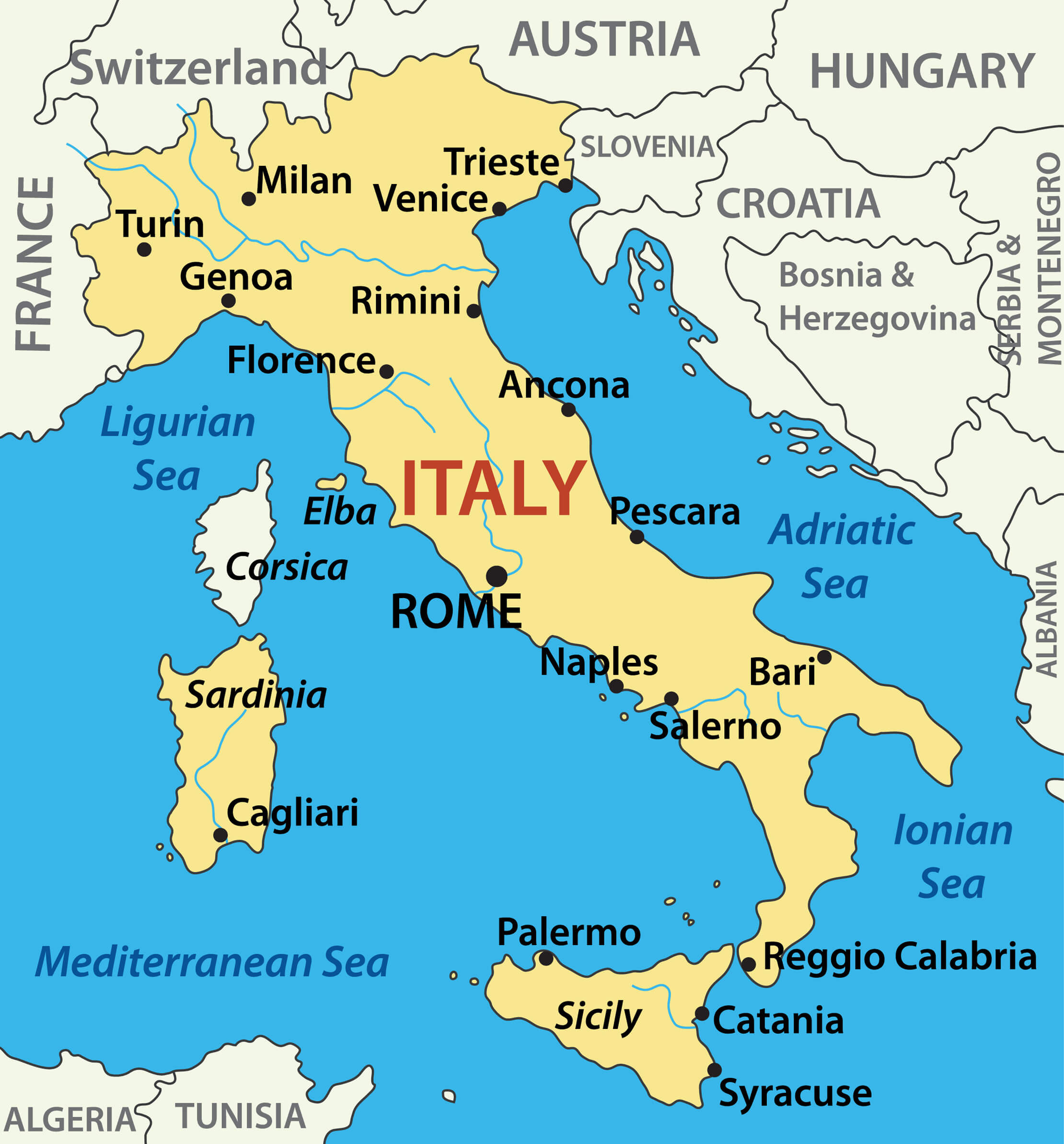 Map of Italy and main cities.
Italy map with major cities, neighboring countries, and surrounding seas.
This map of Italy highlights major cities such as Rome, Milan, Naples, Florence, Palermo, Bari, Genoa, and Cagliari as well as important regions such as Sicily and Sardinia. Map of Italy also shows Italy’s neighbours – France, Switzerland, Austria and Slovenia – and surrounding bodies of water such as the Mediterranean, Adriatic and Ionian seas. These Italy maps offers a comprehensive overview of Italy’s administrative districts, and regions.
Italy Political Map with Regions, Major Cities, and Neighboring Countries
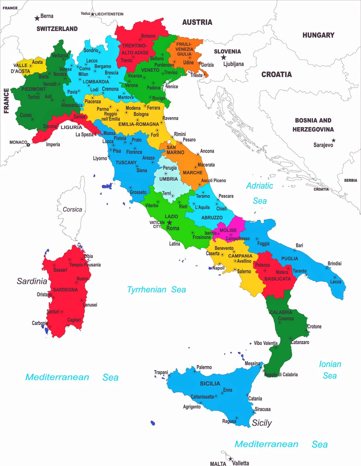
Color-coded political map of Italy showing regions, cities, and neighboring countries.
This political map of Italy divides the country into distinct regions, each colour-coded for easy identification. Major cities such as Rome, Milan, Naples and Venice are clearly marked, as are Italy’s neighbouring countries – France, Switzerland, Austria and Slovenia. The map also shows the surrounding seas: the Mediterranean, Tyrrhenian, Adriatic and Ionian.
Italy Satellite Map
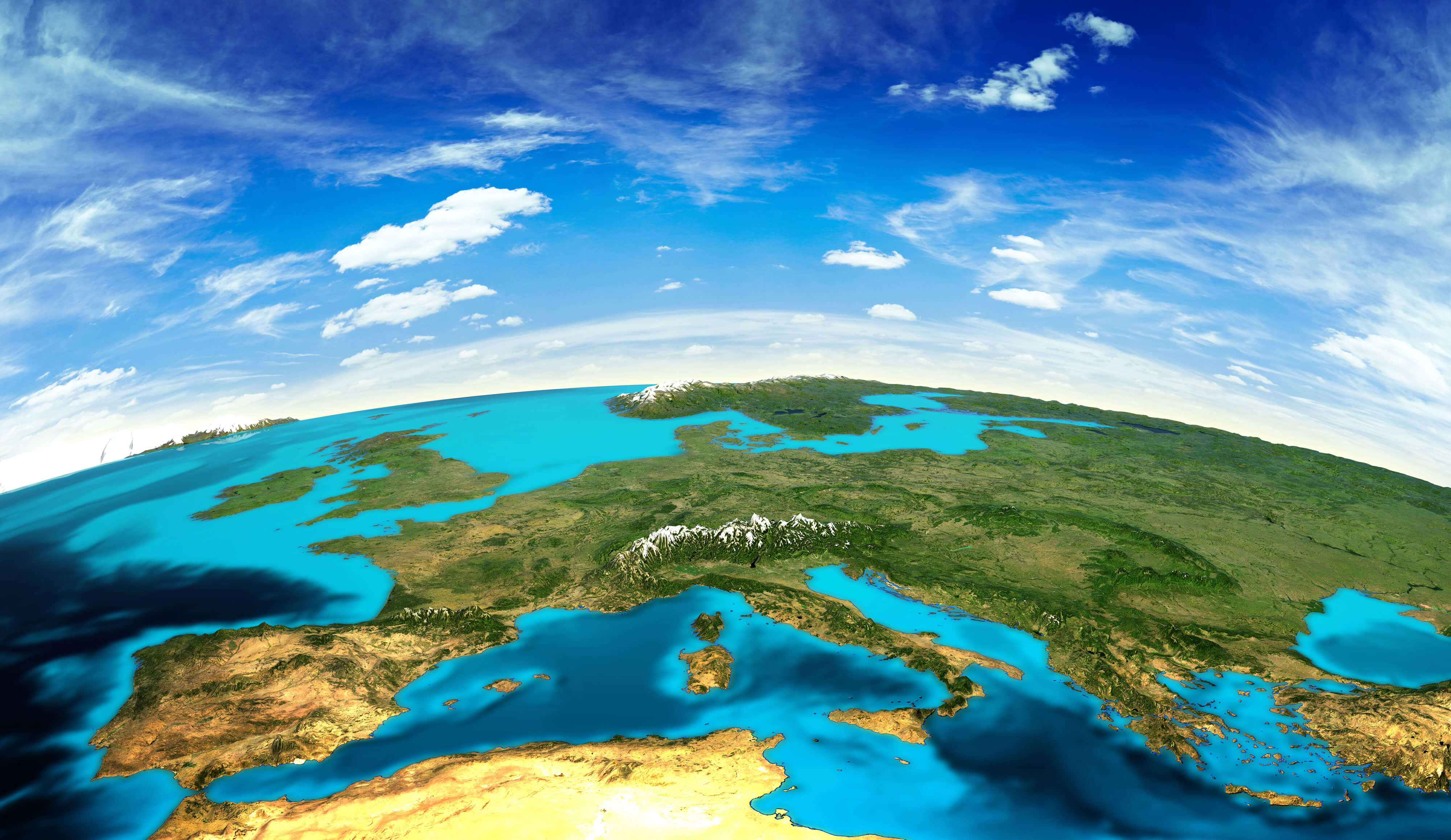
Map of Italy, the time of Emperor Augustus
 Map of Italy, the time of Emperor Augustus. Publication of the book “Meyers Konversations-Lexikon”, Volume 7, Leipzig, Germany, 1910
Vintage-Style Ink Map of Italy with Cities and Seas
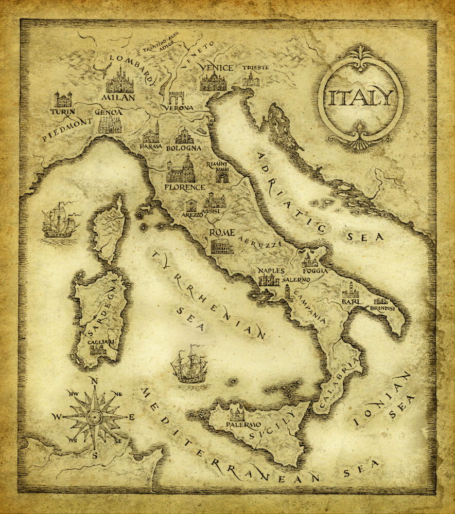
Ink-drawn vintage map of Italy showing cities and seas with ornate details.
This vintage-style map of Italy, drawn with ink on aged paper, beautifully illustrates Italy’s major cities, including Rome, Venice, Florence, and Naples. The map also highlights surrounding seas—Adriatic, Tyrrhenian, Ionian, and Mediterranean—adding an old-world charm. Intricate details, like a compass rose and historic ships, enhance the antique aesthetic.
Italy Map Created with Iconic Vector Illustrations of Culture and Landmarks
![]()
Italy map illustration with vector icons representing culture, food, and landmarks.
This unique map of Italy is formed with colorful vector icons that showcase Italian culture and landmarks. Icons include the Leaning Tower of Pisa, the Colosseum, gondolas, coffee, wine, pizza, and pasta, capturing the essence of Italy’s culinary and architectural heritage. The playful illustration visually represents Italy’s iconic symbols in a vibrant and artistic style.
Political and Administrative Map of Italy with Regions and Major Cities
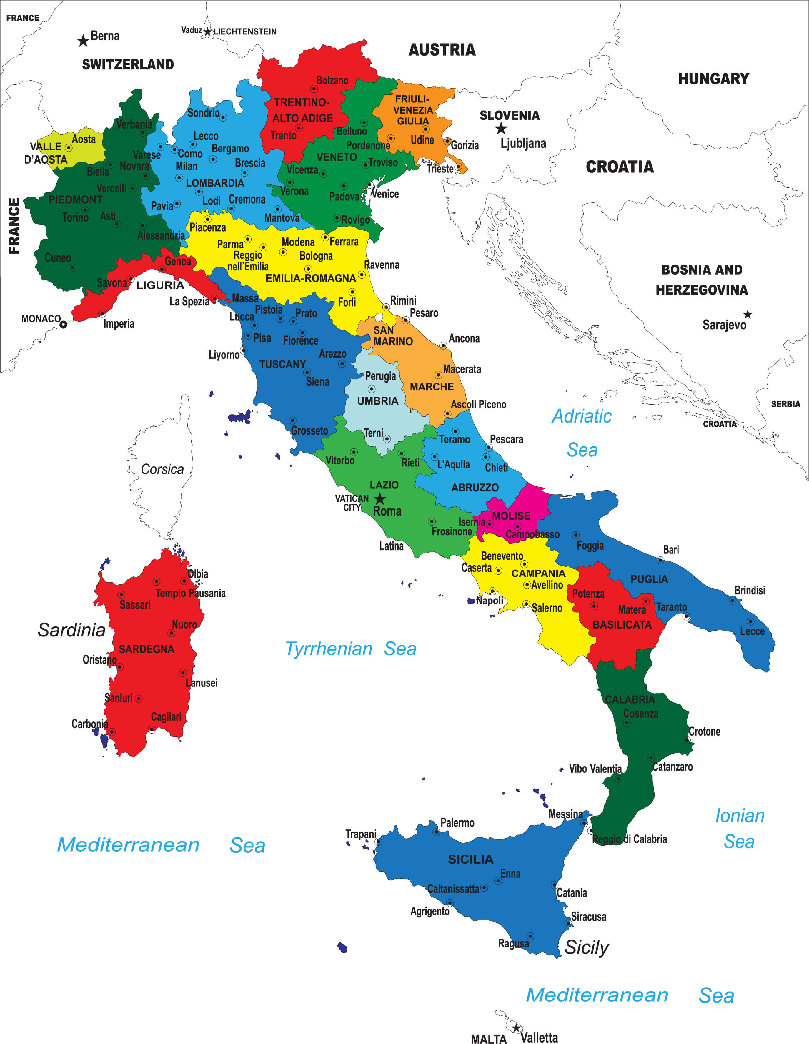
Italy administrative map showing regions, cities, and neighboring countries.
This administrative map of Italy color-codes the country’s regions, highlighting major cities such as Rome, Milan, and Naples, along with regional capitals. Surrounding seas, including the Mediterranean, Tyrrhenian, Adriatic, and Ionian, are labeled, and Italy’s neighboring countries are shown, making this map a detailed view of Italy’s political geography.
Italy Map with Highlighting Regions and Major Cities
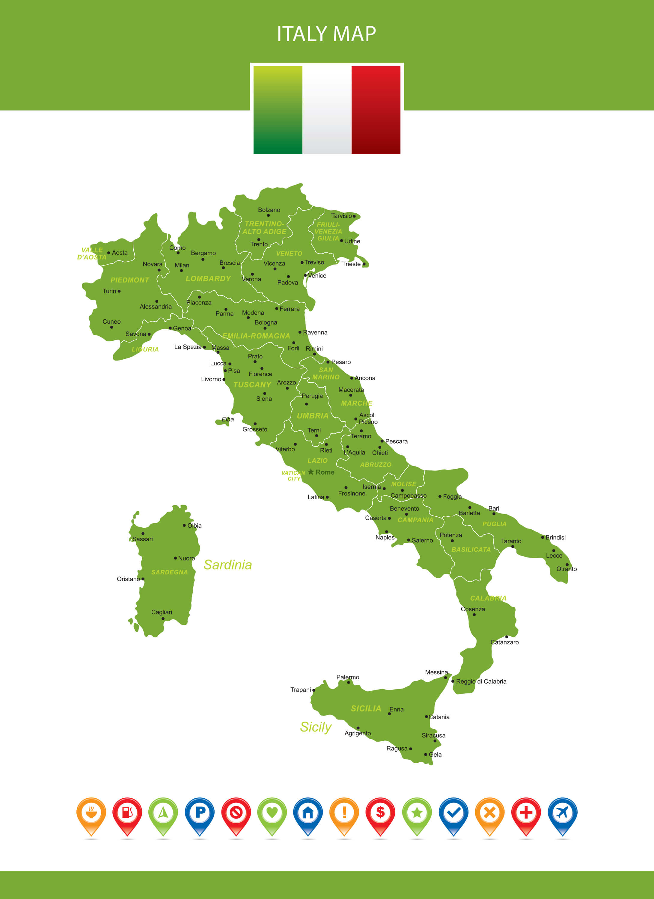
Italy map with regions and major cities highlighted in green.
This map of Italy shows the country’s regions and major cities in a crisp green design. It includes prominent cities such as Rome, Milan, Venice and Florence, as well as regional names. The map is visually organised and easy to read, with additional icons at the bottom representing various points of interest to enhance its informative value.
Italy Geological Map
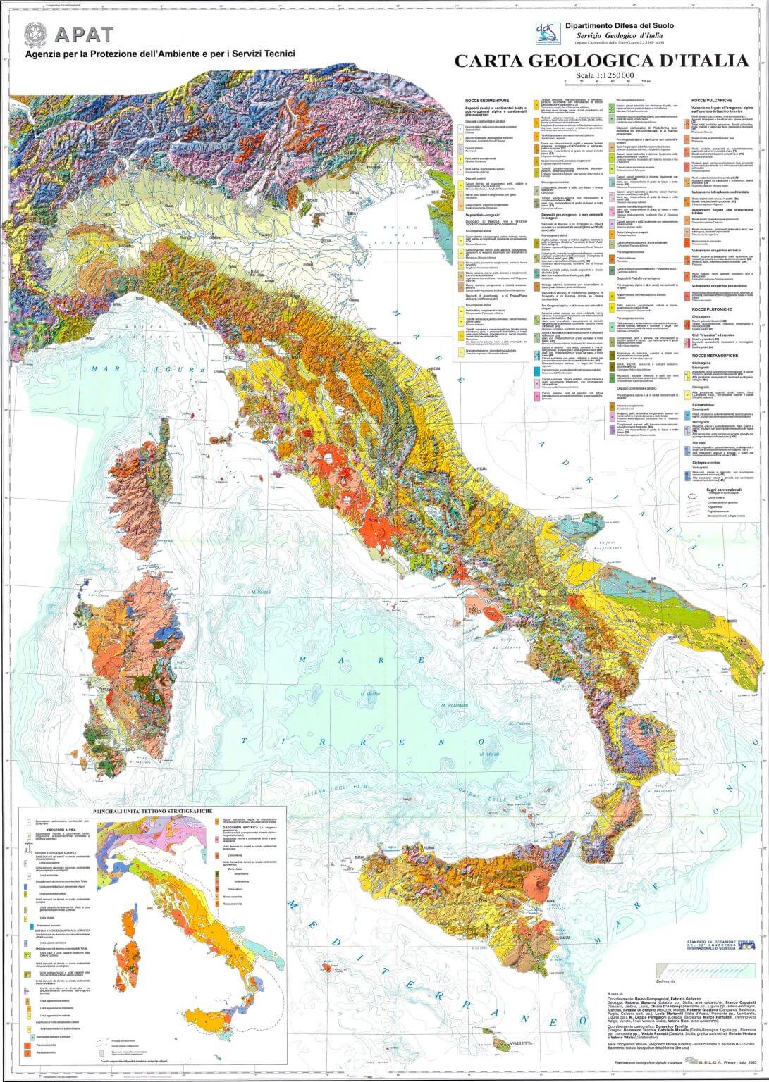
Detailed Geological Map of Italy with Rock Types and Tectonic Features.
This geological map of Italy provides an in-depth look at the country’s rock types and tectonic structures. With vibrant color coding, it distinguishes between sedimentary, volcanic, and metamorphic rocks across Italy and its islands. Detailed legends explain various geological formations, offering insights into Italy’s complex geological landscape and tectonic activity.
Italy Regions and Cities Map
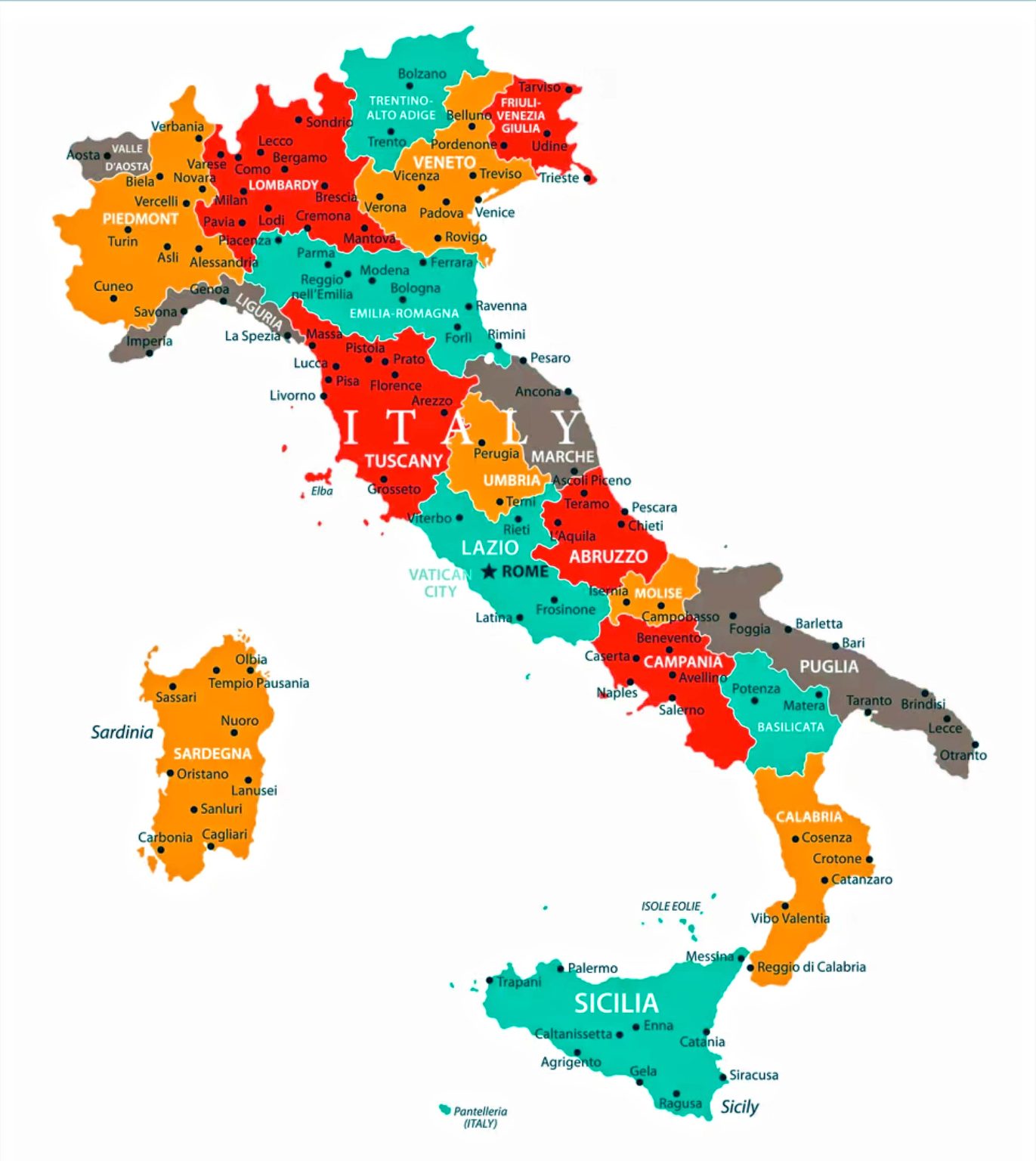
Italy map highlighting regions and major cities in vibrant colors.
This colourful map of Italy shows the country’s regions and major cities in vibrant shades, making it easy to distinguish areas such as Tuscany, Lazio and Sicily. Cities such as Rome, Florence, Naples and Milan are prominently featured. This map visually separates the regions, providing a clear and engaging view of Italy’s political and geographical divisions. Each of Italy’s 20 regions has its charm. This map will help you understand the geographical divisions of Italy’s regions.
Italy Relief Map
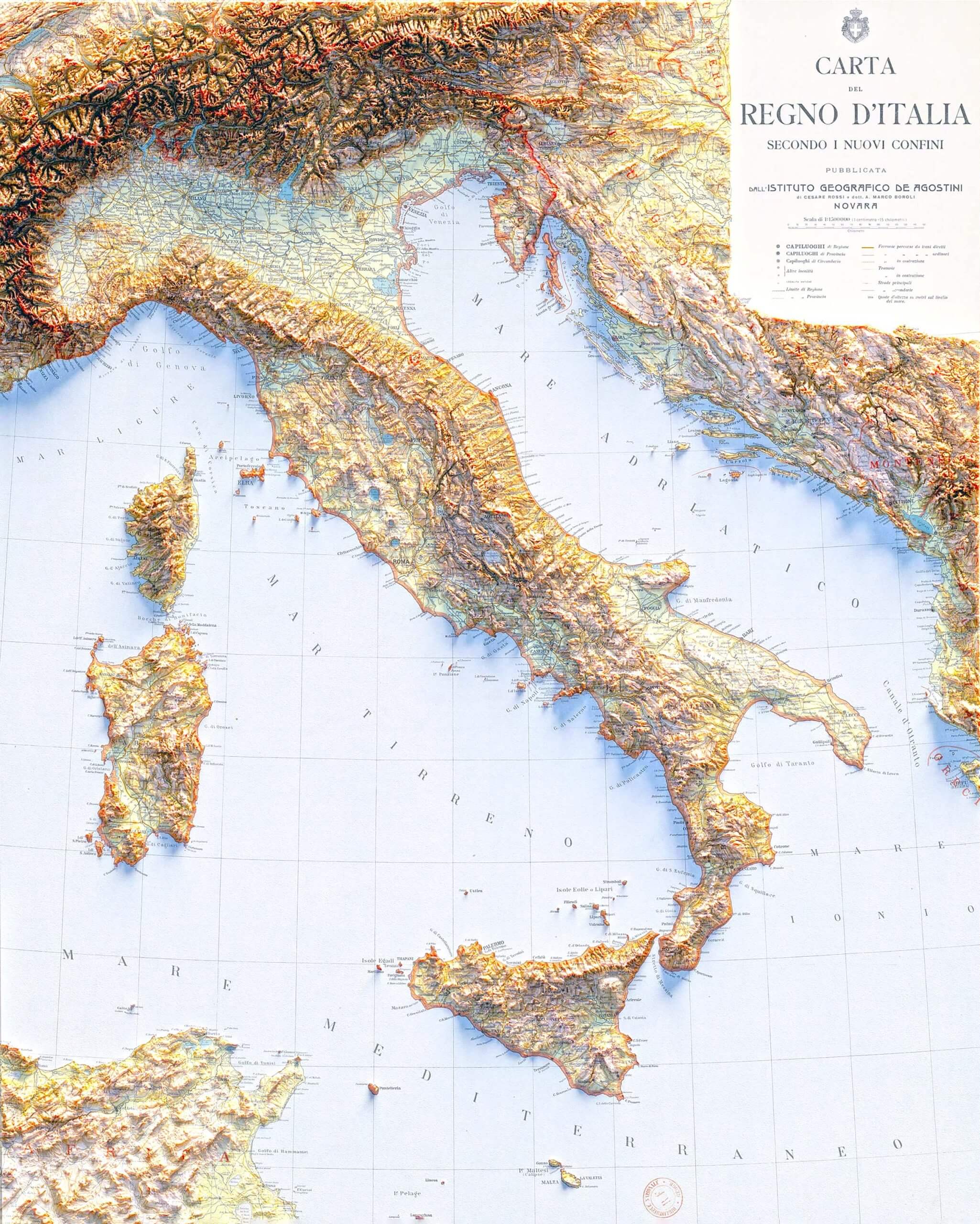
Italy relief map highlights the country’s mountainous terrain, with the Alps.
This relief map of Italy highlights the country’s mountainous terrain, particularly the Alps in the north and the Apennine range running through the central and southern regions. It shows the detailed topography of Italy, including the rugged islands of Sardinia and Sicily, and the various coastal plains and valleys nestled between Italy’s dramatic mountain ranges. This type of map is useful for understanding the physical landscape, elevations and geographic diversity of the Italian peninsula.
Italy Transit Map
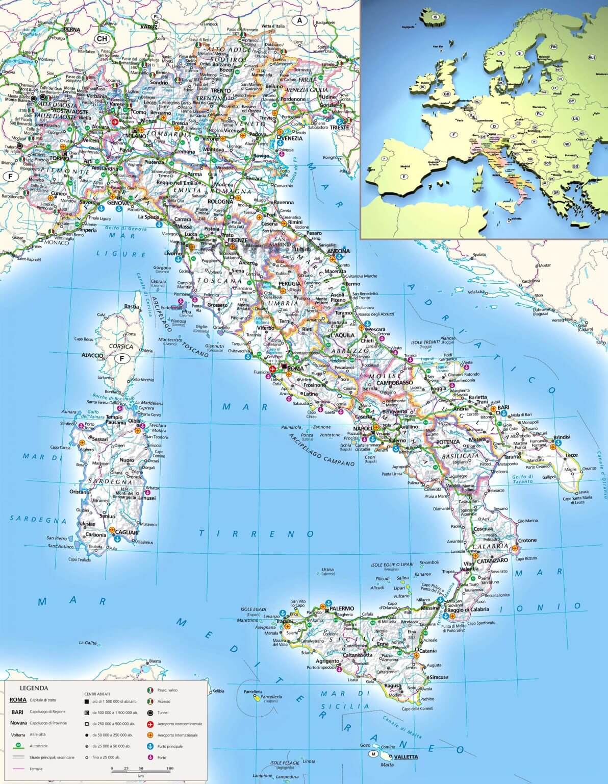
Italy transit map highlights transit network, major highways, rail lines, and main cities.
This map of Italy provides an extensive view of the country’s transit network, showcasing major highways, rail lines, and key cities, including Rome, Milan, Venice, and Naples. The map also highlights important transportation hubs and routes connecting regions from the mainland to the islands of Sardinia and Sicily. It offers a clear depiction of how Italy’s transit system interlinks different areas of the country, emphasizing the accessibility and connectivity of Italy’s major urban centers and tourist destinations.
Italy Historical Map
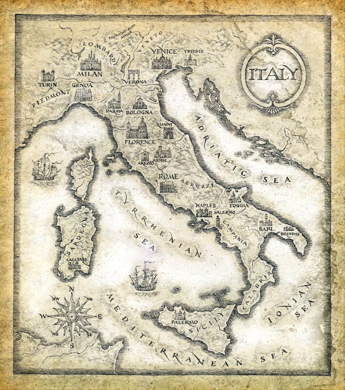
This antique-style historical map of Italy beautifully depicts the country’s major cities, including Rome, Florence, Venice, Milan and Naples, as well as the surrounding seas, including the Tyrrhenian, Adriatic and Ionian. The intricate detailing highlights significant landmarks and geographic layout, evoking a sense of Italy’s rich history and cultural significance. With artistic touches such as ships on the Mediterranean and a classic compass rose, this map captures the timeless appeal of Italy’s historical and geographical past.
Country Map of Italy
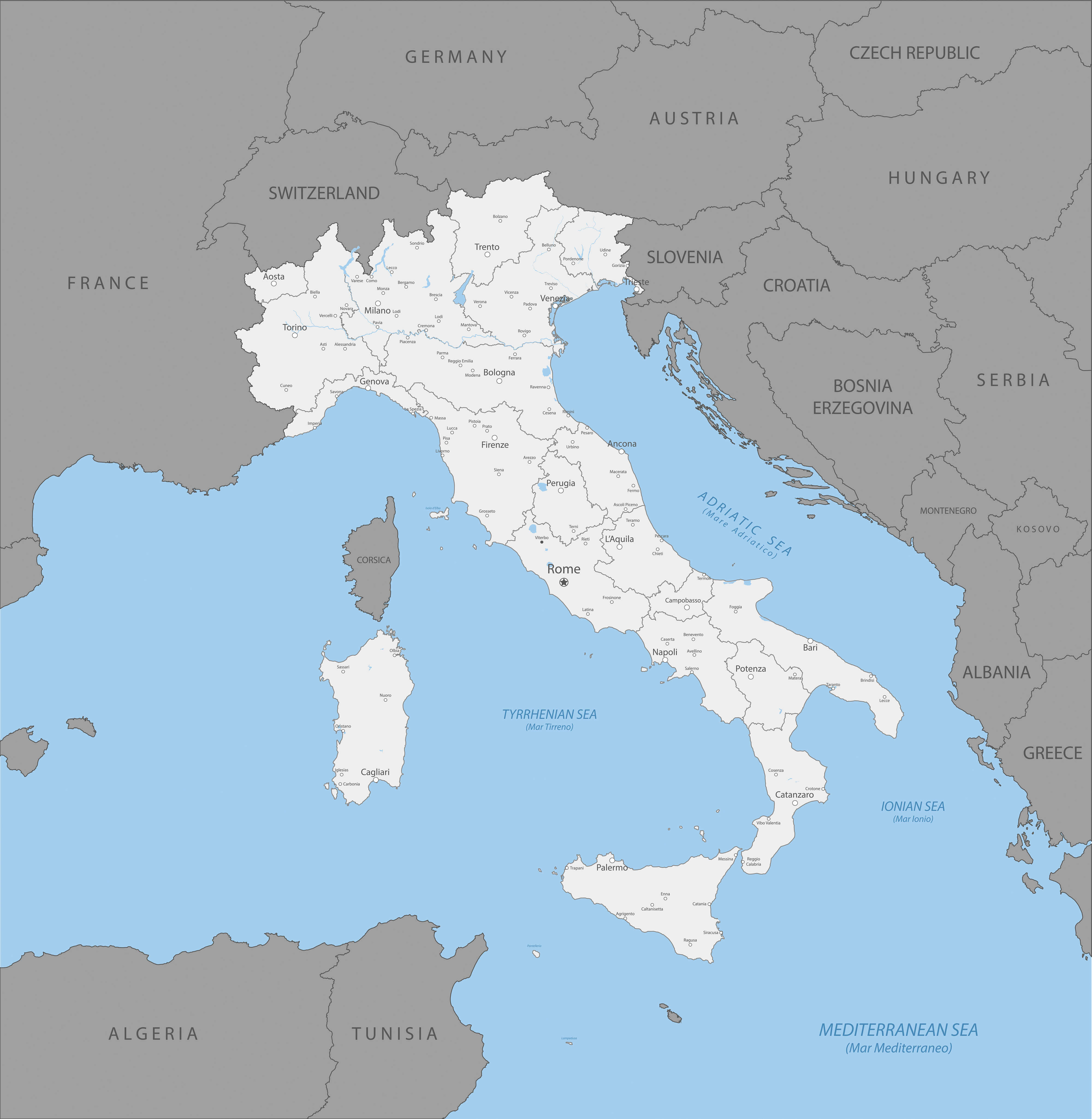
This map of Italy highlights the country’s major cities, regions and surrounding seas such as the Adriatic, Ionian and Tyrrhenian. Major cities such as Rome, Milan and Naples are clearly marked, while borders with neighbouring countries such as France, Switzerland and Croatia are shown. The map also shows the islands of Sardinia and Corsica, as well as Italy’s proximity to Tunisia and Algeria across the Mediterranean. This geographical layout provides a detailed view of Italy’s location in Southern Europe.
Italy Map Rivers Cities Borders
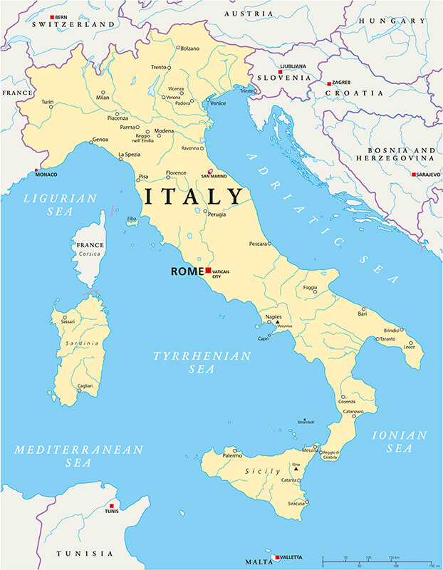
This map of Italy highlights its major cities such as Rome, Milan and Venice, as well as major rivers such as the Po and Arno. The country is surrounded by the Tyrrhenian, Ionian and Adriatic seas, with clear borders with neighbouring countries such as France, Switzerland and Slovenia. This detailed political map provides a great overview of Italy’s geography, including islands such as Sicily and Sardinia, and its neighbouring countries in southern Europe.
Italy Administrative Map
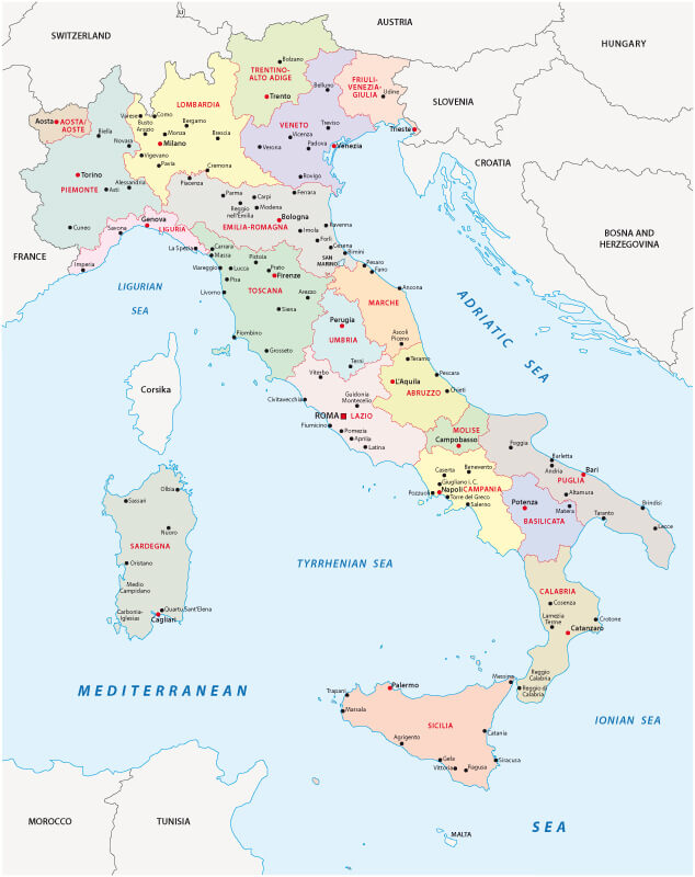
This administrative map of Italy shows the country’s regions, highlighting boundaries, major cities and geographical features such as the Tyrrhenian, Adriatic and Ionian seas. The map also highlights key locations such as Rome, Milan, Naples and Venice, making it easy to visualise Italy’s administrative divisions and how they relate to neighbouring countries such as France, Switzerland and Austria. The map provides a clear overview of Italy’s regional structure, from the islands of Sardinia and Sicily to the northern regions bordering the Alps.
Italy Regions Map
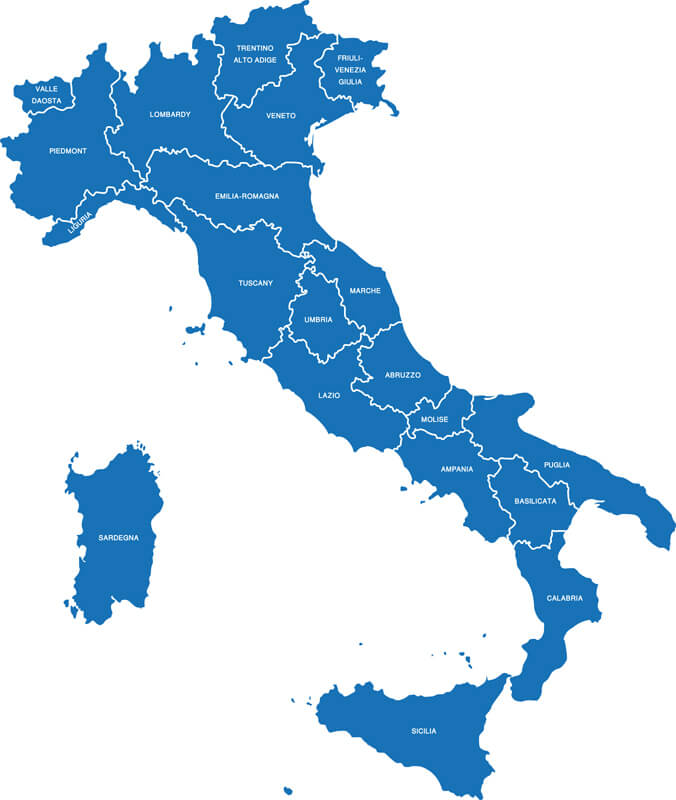
This map shows Italy divided into its administrative regions, each clearly marked with its name. The regions include prominent areas such as Tuscany, Lazio, Sicily and Lombardy, illustrating the geographical diversity and political divisions within the country. The islands of Sardinia and Sicily are also highlighted as part of the national map.
Regions Map of Italy
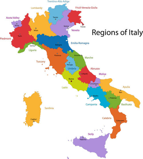
This colourful regional map of Italy shows the country’s various administrative divisions, with each region highlighted in a different colour. The map visually highlights Italy’s diverse regions, including prominent areas such as Tuscany, Sicily and Lazio, which includes the capital city of Rome. This map provides a clear representation of the geographical and cultural diversity within Italy, making it easier to understand the layout of its regions, from the northern Alpine areas to the southern coastal regions.
Italy Provinces Map
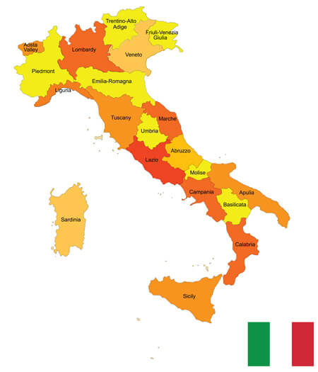
This Italy provinces map visually highlights the country’s administrative divisions, showing Italy’s regions in different colours, including prominent areas such as Sicily, Lombardy, Tuscany and Lazio. The provinces are clearly labelled, giving a detailed view of how Italy is divided geographically, along with a small representation of the Italian flag to reinforce national identity.
Italy Satellite Map
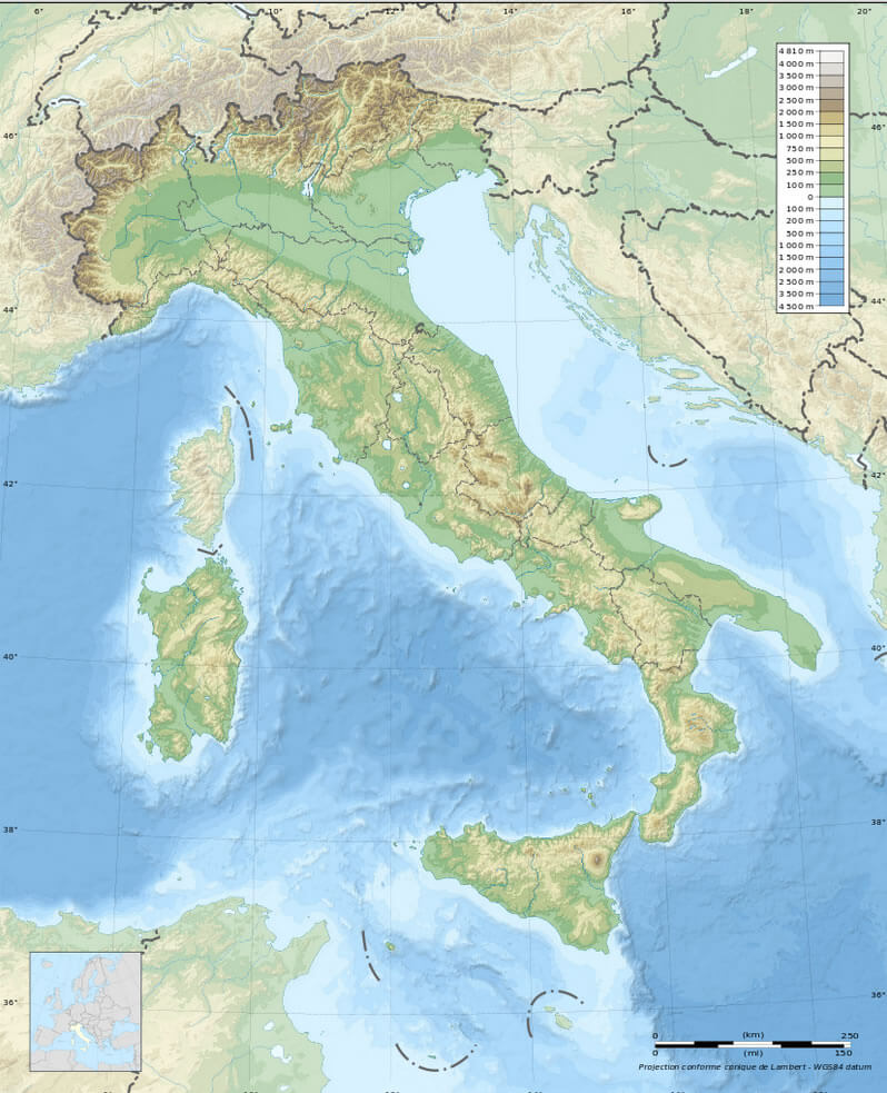
This satellite map of Italy shows its geographical diversity, from the rugged Alpine regions in the north to the rolling hills and plains of the central and southern parts. The Tyrrhenian, Adriatic and Ionian seas surrounding the peninsula are clearly visible, as are the major islands of Sardinia and Sicily. The topography emphasises Italy’s mountains, rivers and coastal regions, giving a clear view of the natural landscape throughout the country.
Where is Italy on the World Map
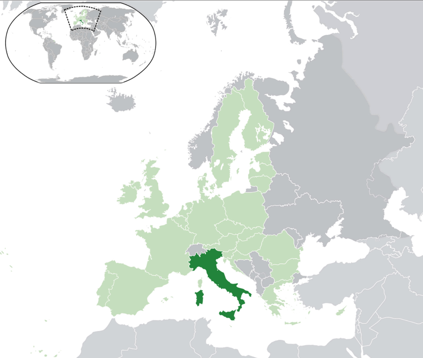
This map shows Italy’s position on the world map, with the country in southern Europe. Italy is prominently shown in green, surrounded by countries such as France, Switzerland, Austria and Slovenia to the north, while its southern regions extend into the Mediterranean Sea. The inset in the top left corner provides a global perspective, showing Italy’s position within Europe in relation to other continents. The map effectively illustrates Italy’s central position in the Mediterranean and its proximity to major European nations..
Italy Main Cities Map
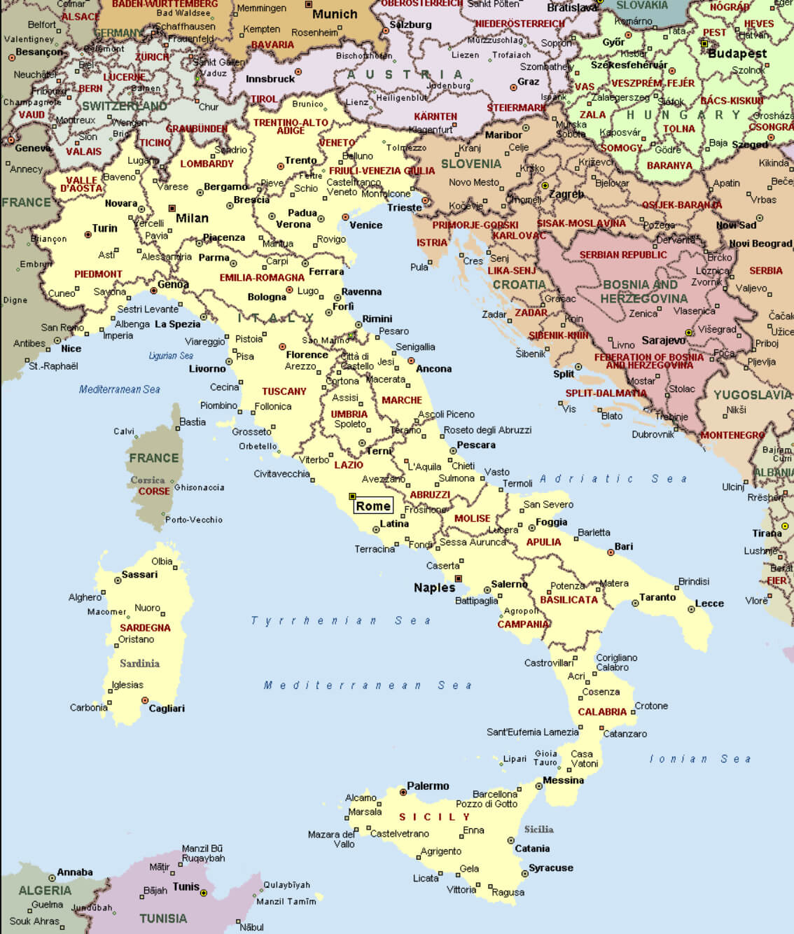
This map of Italy shows major cities such as Rome, Naples, Milan, Venice and Florence. It also shows Italy’s geographical borders with neighbouring countries such as France, Switzerland, Austria and Slovenia. You can clearly see the different regions of Italy, its coastal cities along the Mediterranean and Adriatic Seas, as well as its islands, Sicily and Sardinia. The map highlights the layout of major urban areas and transport networks, giving a sense of Italy’s regional diversity and the proximity of its cities to international borders.
Italy Road Map
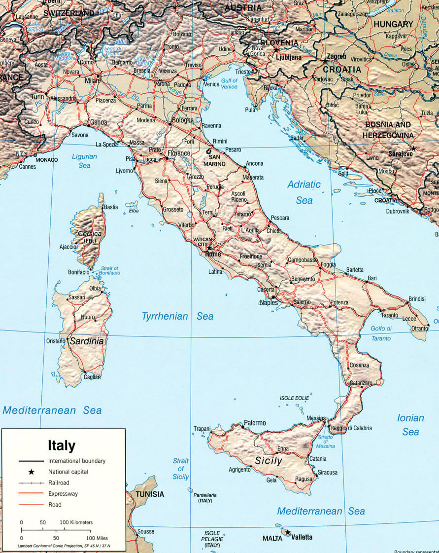
This map of Italy highlights the country’s road network, showing major cities such as Rome, Milan and Naples, as well as links between regions via motorways, railways and roads. The map also outlines Italy’s topography, with mountainous areas such as the Alps in the north and the Apennines running down the centre of the peninsula, and coastal roads near the Adriatic and Tyrrhenian seas. Italy’s islands, Sicily and Sardinia, are also represented with their respective road networks.
Italy Population Map
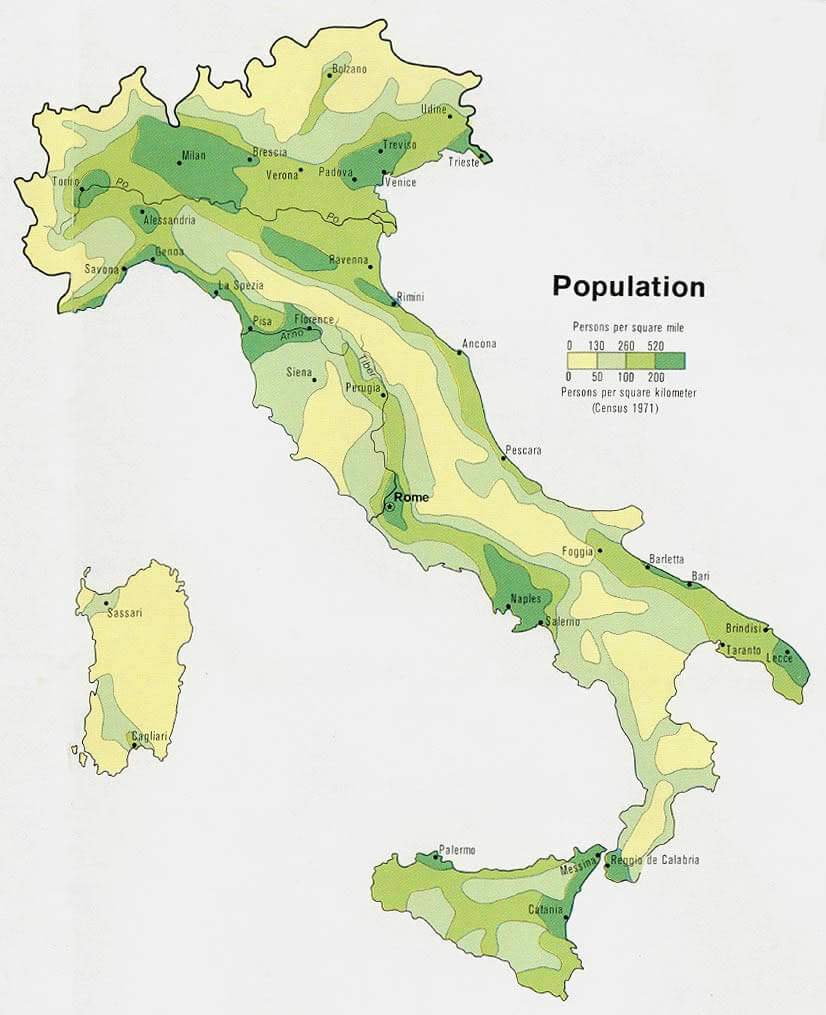
This population density map of Italy highlights the distribution of people across the country, with higher concentrations in major cities like Milan, Rome, and Naples. It illustrates how population density is greater in northern and central regions compared to the southern areas, including Sicily and Sardinia, which have relatively lower density. This visualization is helpful in understanding Italy’s demographic patterns.
Map of Italy
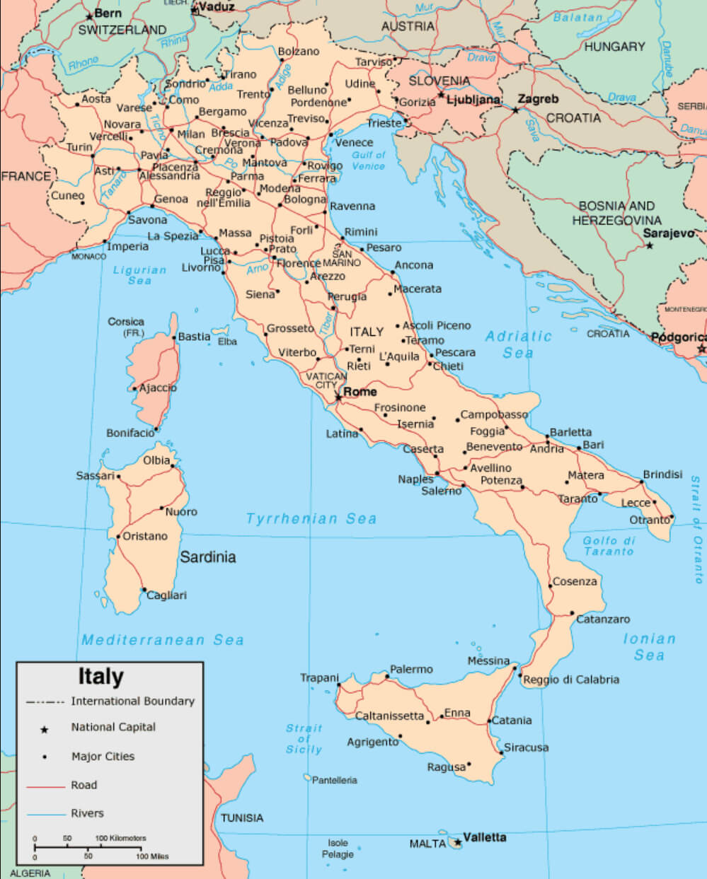
This detailed map of Italy shows the country’s major cities, including the capital Rome, as well as key geographic features such as rivers and borders with neighbouring countries. The map also shows Italy’s major roads and national boundaries, giving a clear picture of the country’s structure from the northern Alps to the southern islands of Sicily and Sardinia.
Italy Provinces Map with Regions
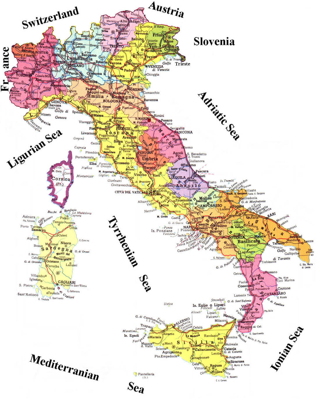
This map of Italy highlights the country’s provinces within their respective regions, showing its international borders with France, Switzerland, Austria, and Slovenia. Additionally, it outlines the surrounding seas, including the Adriatic Sea to the east, the Tyrrhenian Sea to the west, and the Mediterranean Sea to the south. The map provides a detailed view of Italy’s internal divisions while emphasizing its geographic location in southern Europe.
Where is Italy on the World Map?
Show Google interactive map, satellite map, where is the country located.
Get directions by driving, walking, bicycling, public transportation and travel with street view.
For More Map of Italy
A Collection of Italy Maps Youtube Video
Feel free to explore these pages as well:
- Italy Map ↗️
- Map of Italy ↗️
- The 10 Best Things to Do in Venice ↗️
- A Tourist’s Guide to Venice’s Top 10 Attractions ↗️
- A Collection of Italy Maps ↗️
- Discovering Catania: A Jewel at the Foot of Mount Etna ↗️
- Experience Venice: A Complete Guide for the Adventurous Traveler ↗️
- A Tourist’s Guide to Venice’s Top 10 Attractions ↗️
- The 10 Best Things to Do in Venice ↗️
- Explore Italian Riviera Cinque Terre ↗️
- Discover Bari: Italy’s Enchanting Port City ↗️
- San Marino Map ↗️
- Vatican Map ↗️
- Discover Croatia: A Comprehensive Map Collection of Its Stunning Coastlines and Historic Cities ↗️
- A Collection of Europe Maps: Exploring the Continent in Detail ↗️
- Map of Europe ↗️
- Europe Map ↗️
- Map of Europe ↗️
- France Map ↗️
- Map of Spain ↗️
- Ireland Map ↗️
- United Kingdom Map ↗️
- Germany Map ↗️
- Turkey Map ↗️
- Map of Portugal ↗️
- Switzerland Map ↗️
