Florida Map with the Counties and US States

Florida Geographical Map
Map view of Florida on a geographical globe.
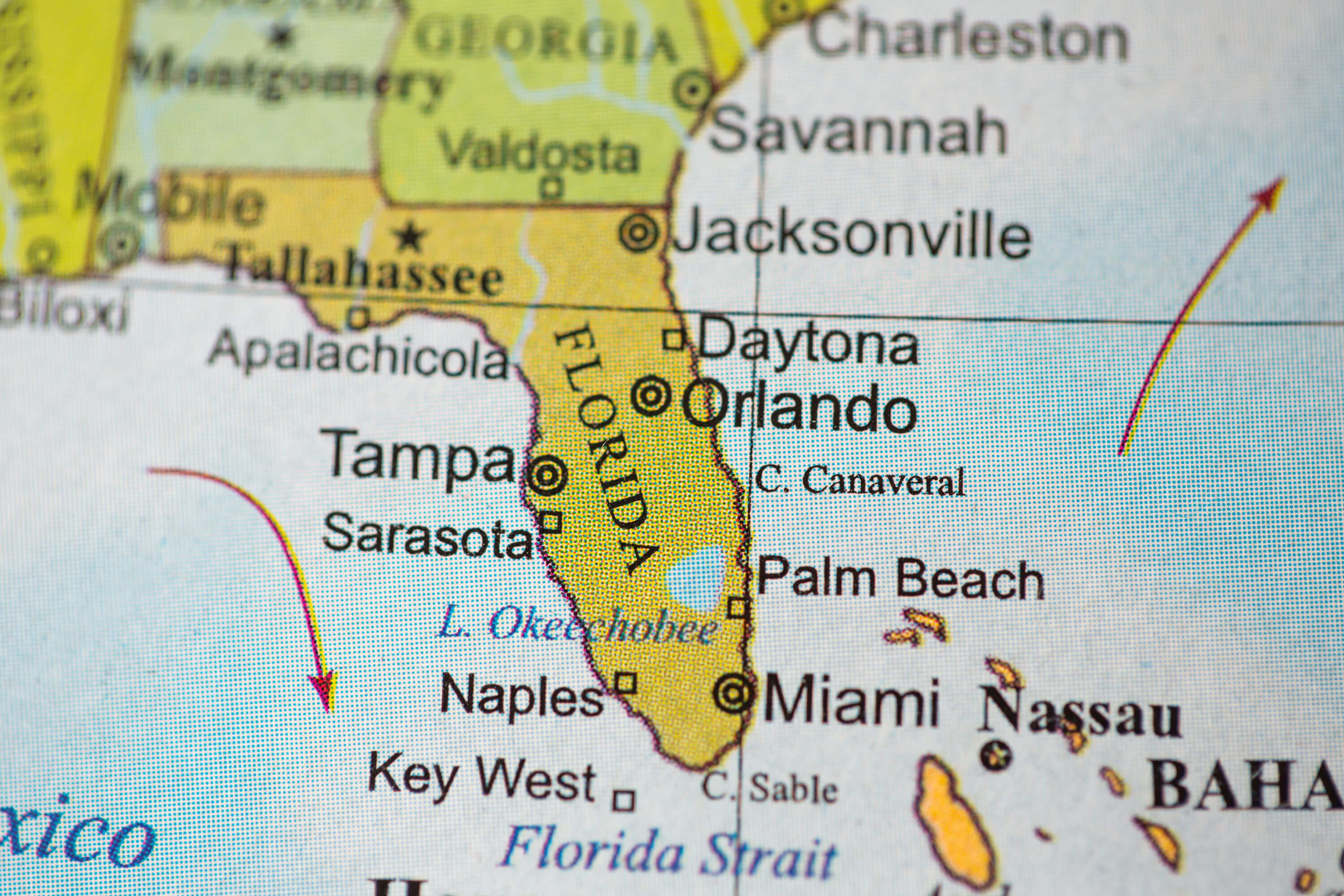
Hurricane Milton’s Path: Tracking the Storm’s Approach to Florida’s Major Cities ↗️
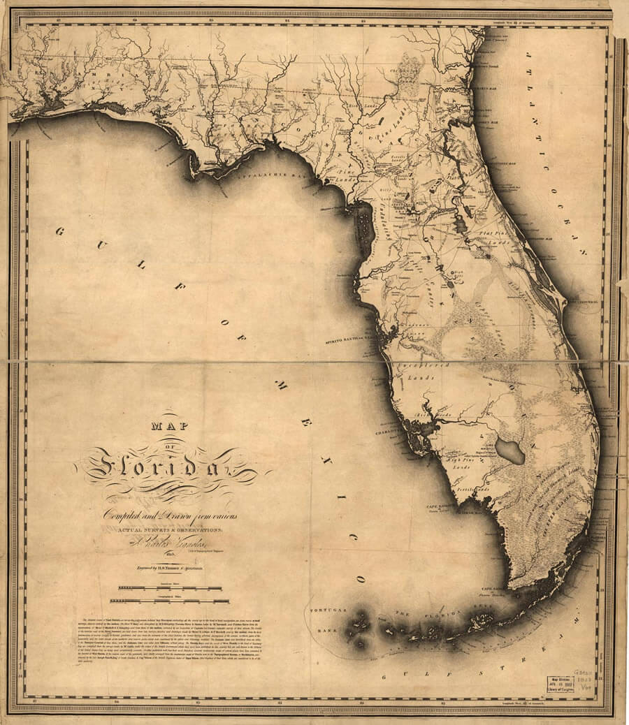
Antique Map of Florida, 1841
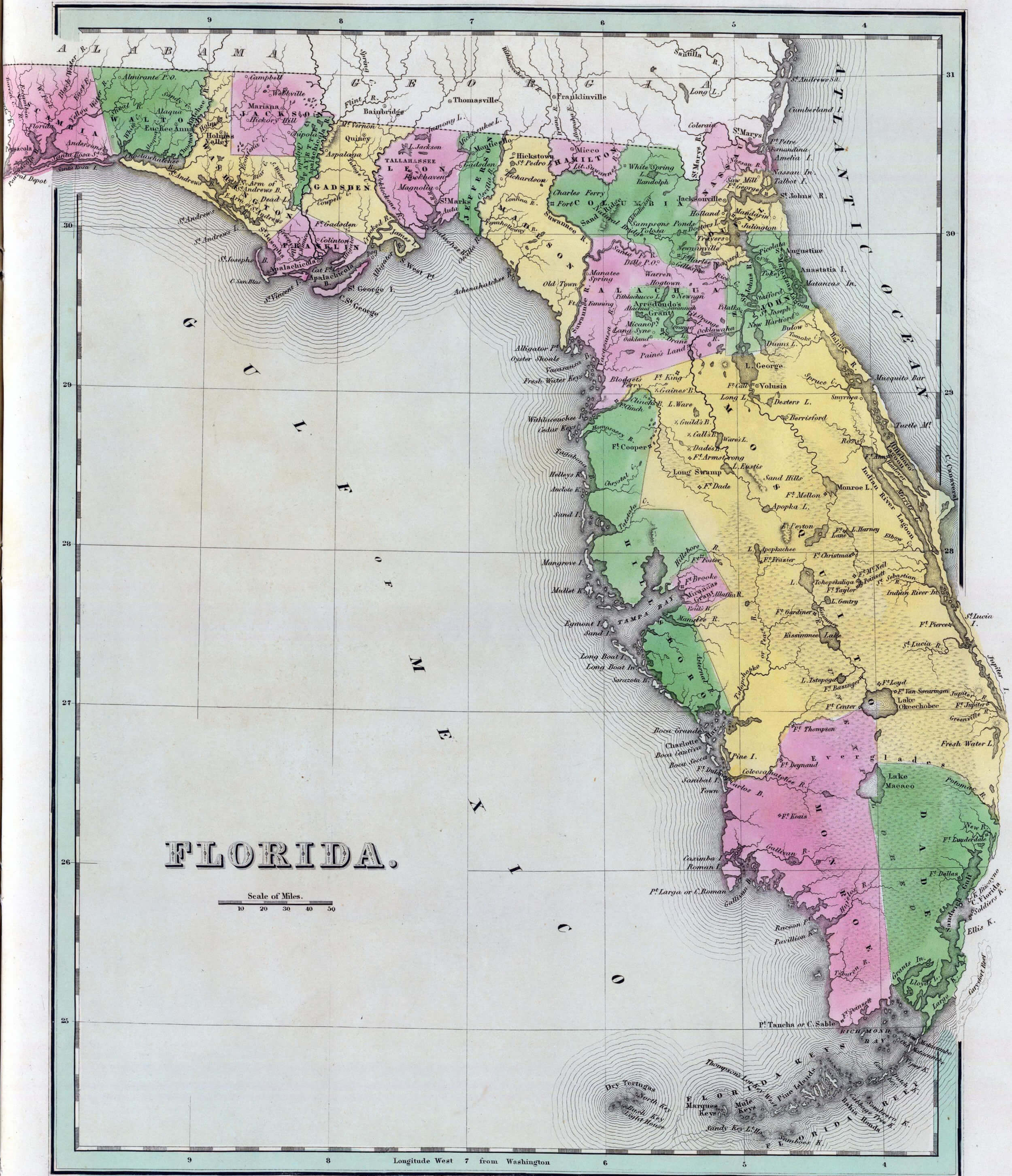
Antique map of Florida from the out of print 1841 Goodrich atlas
Florida Satellite Map, USA
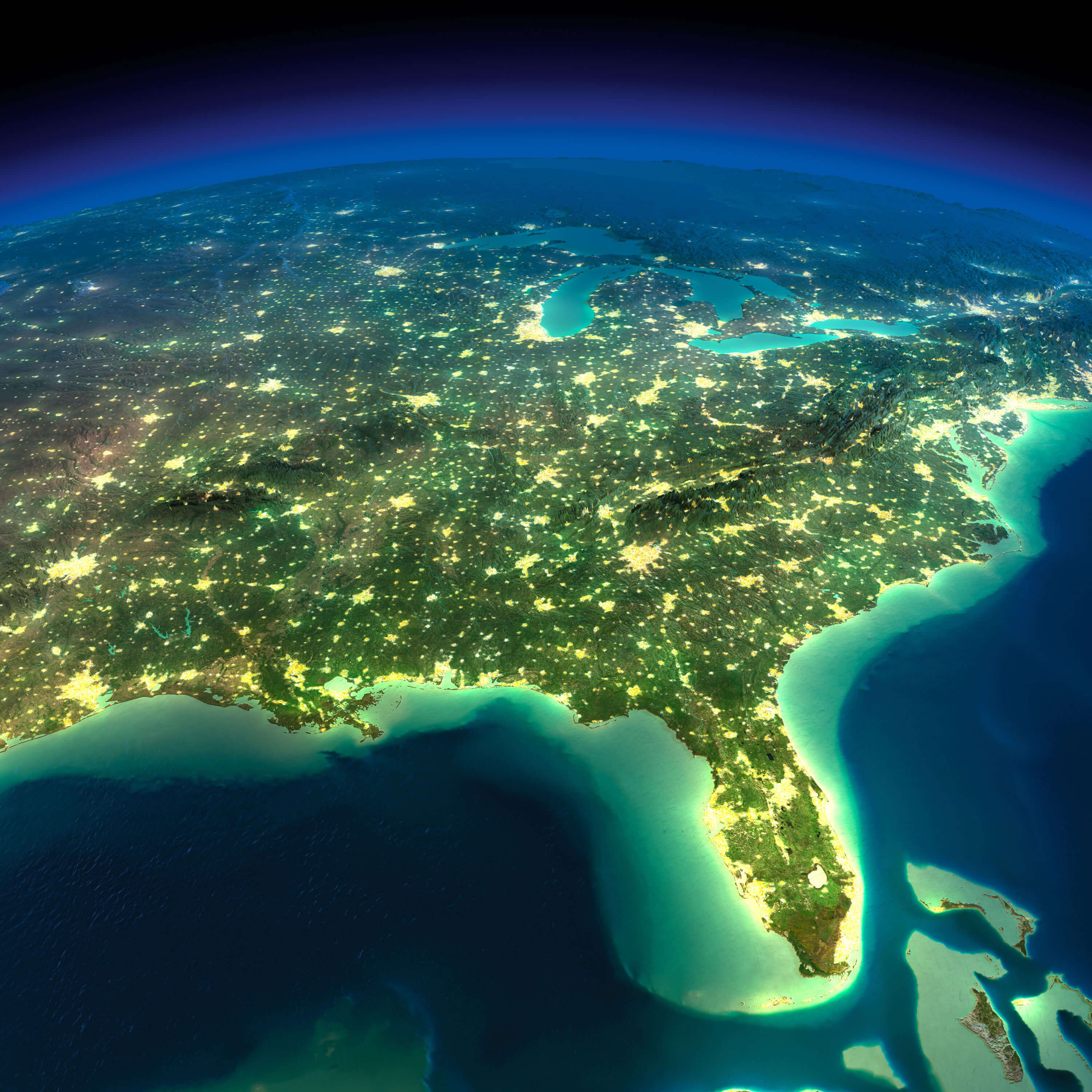
Florida Satellite Map, USA in night.
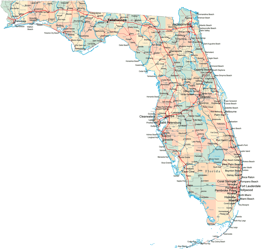
Florida Map with the Counties and US States
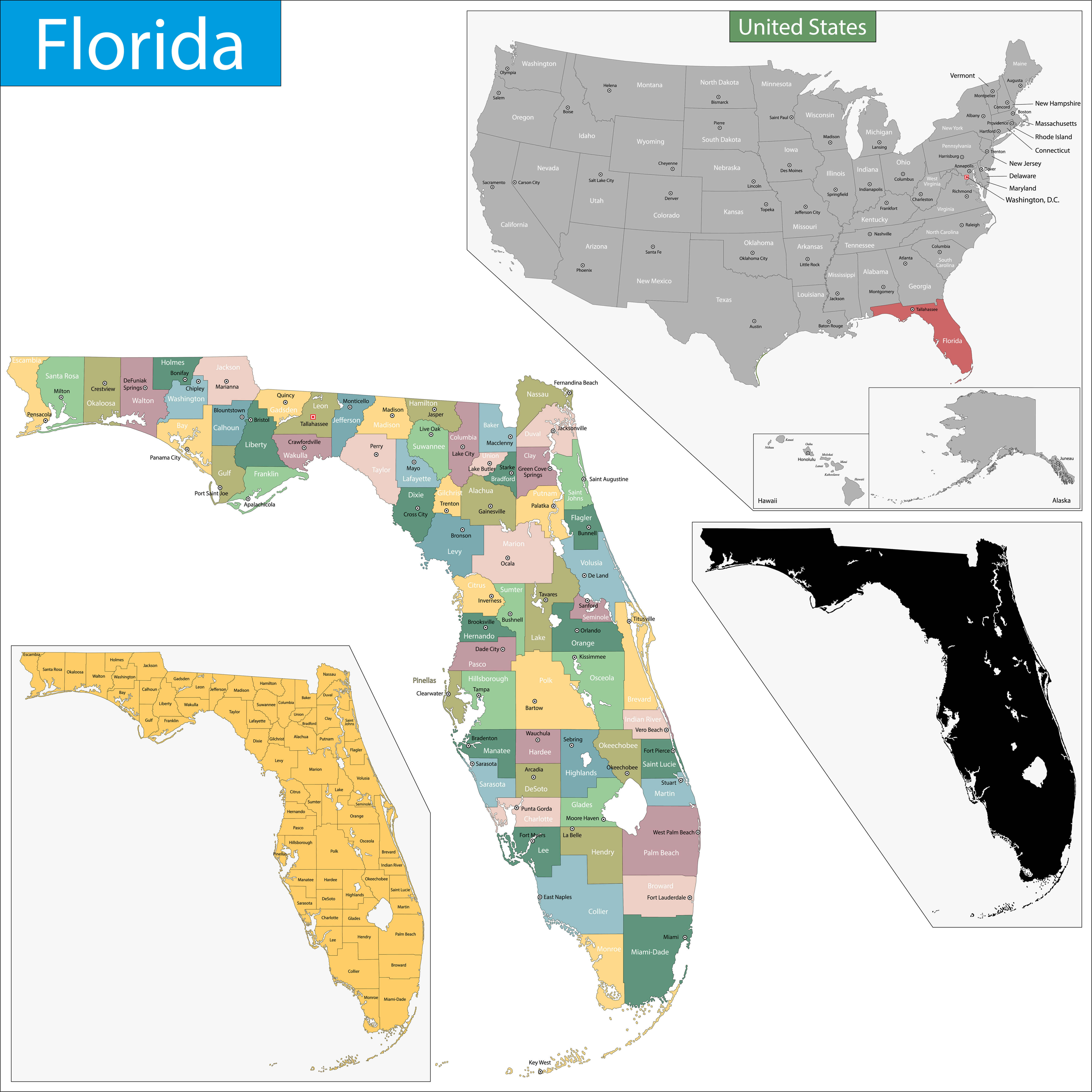
Map of Florida state designed in illustration with the counties and the county seats.
Tampa Bay Area Map, Florida
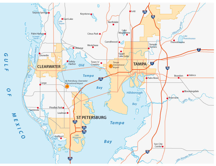
Tampa Bay Area Map, Florida with state roads.
Florida Counties Map
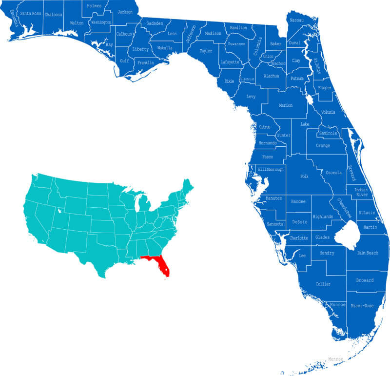
This map shows the state of Florida in the southeastern United States, with all of its counties clearly marked. Florida is made up of 67 counties, including notable regions such as Miami-Dade in the south and Duval in the north-east. The inset map provides a broader context of Florida’s location within the continental United States, where it is highlighted in red. Florida’s position on the map emphasises its peninsular geography, surrounded by the Atlantic Ocean and the Gulf of Mexico.
Florida Interstate Highway Map
This map of Florida’s interstate highways highlights the major interstate routes throughout the state, such as I-10, which runs horizontally across northern Florida, connecting cities such as Pensacola and Tallahassee, and I-95, which runs along the east coast, passing through Jacksonville, Daytona Beach and Miami. The map also shows the well-known I-75, which runs through central and southwest Florida, connecting cities such as Tampa and Naples. These highways are major arteries for transportation, tourism and commerce throughout Florida, linking its major urban centres and natural attractions.
Florida Administrative Map
This Florida administrative map shows the state’s counties, major cities, and surrounding bodies of water such as the Gulf of Mexico and Atlantic Ocean. It highlights the detailed division of Florida into administrative regions, making it easier to understand its geographic and political layout.
Florida National Parks Map
This map of Florida highlights several national parks, including the famous Everglades National Park, one of the largest subtropical wildernesses in the United States, located at the southern tip of Florida. The map also highlights other important parks such as Dry Tortugas National Park, located west of Key West and known for its historic forts and coral reefs.
Florida Main Cities Map
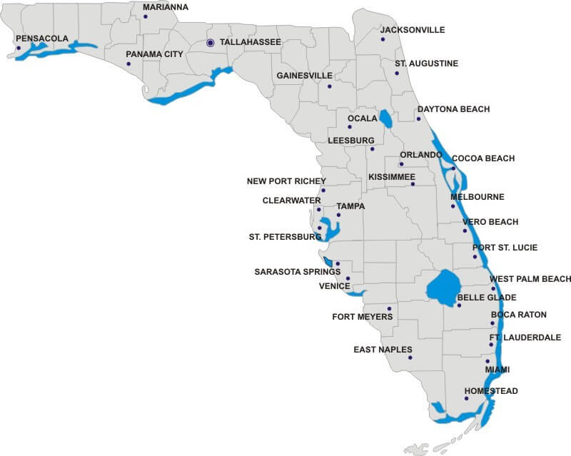
This Florida Main Cities Map highlights major cities such as Miami, Tampa, Orlando, and Jacksonville. The map emphasizes the state’s coastal urban areas along the Atlantic Ocean and the Gulf of Mexico, illustrating how population centers are concentrated near these bodies of water, with notable cities like Fort Lauderdale and St. Petersburg. The distribution of cities reflects Florida’s geographical connection to beaches and waterways, making it a prime location for tourism, trade, and cultural activities.
Florida Blank Map
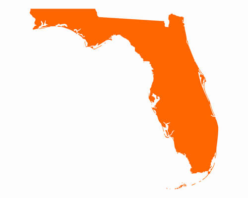
This is a blank map of Florida showing the outline of the state with no internal markings or labels. It highlights Florida’s distinctive peninsular shape, surrounded by the Atlantic Ocean to the east, the Gulf of Mexico to the west, and the Straits of Florida to the south. This type of map is often used for a variety of purposes such as education, geography quizzes or custom map design.
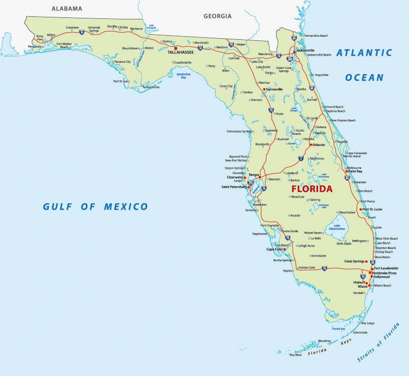
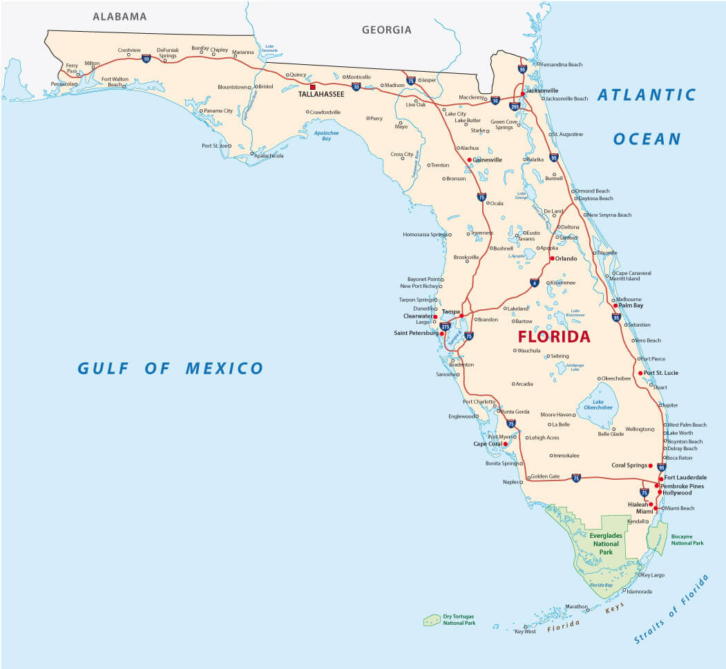
Florida Road Map
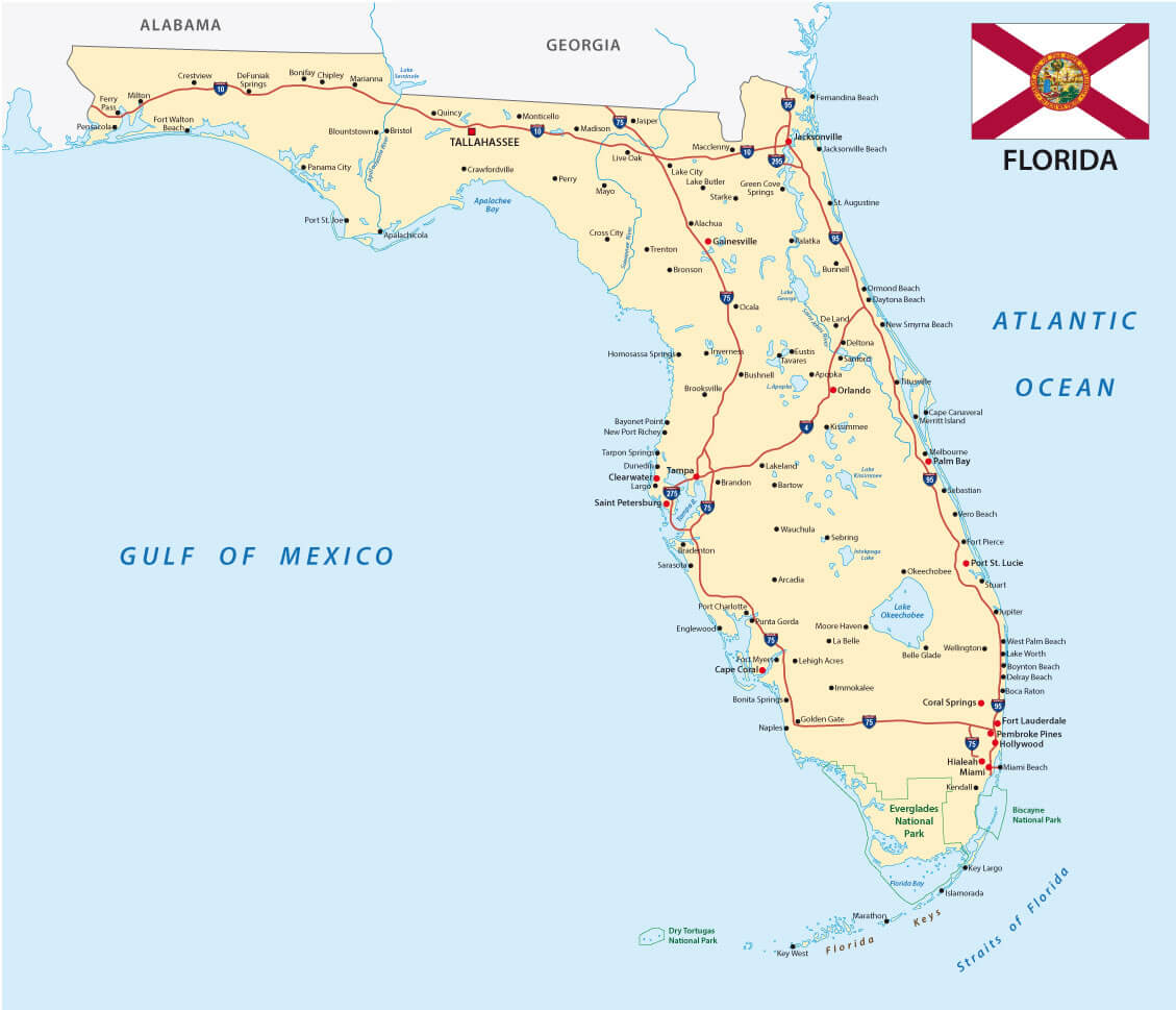
This map of Florida highlights the major highways and roads across the state, connecting major cities such as Tallahassee, Jacksonville, Orlando, Tampa and Miami. These routes facilitate travel along the Gulf of Mexico coast, the Atlantic Ocean side and into neighbouring states like Alabama and Georgia.
Florida in Night Earth Map with Cuba Haiti Jamaica
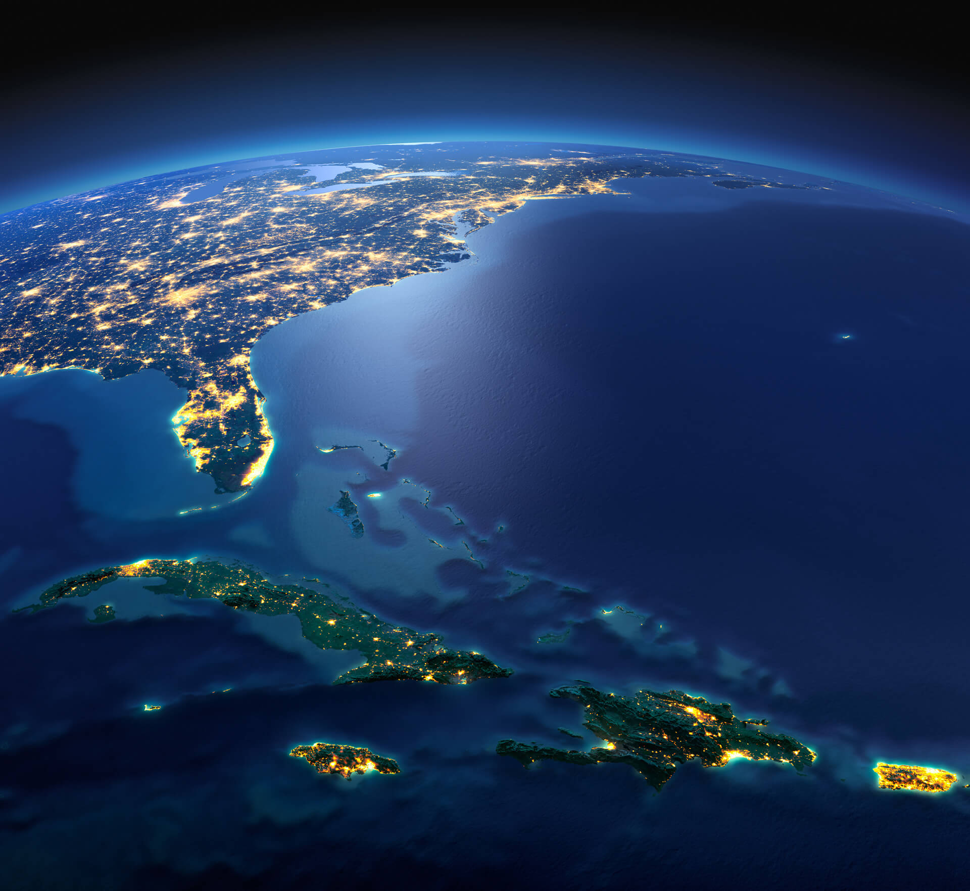
This map shows a stunning satellite view of the southeastern United States, highlighting Florida at night, with its cities illuminated by lights. In the same view, the islands of Cuba, Haiti, and Jamaica are visible to the south. The glow from the cities and towns across these regions creates a captivating image of human activity against the vast darkness of the Atlantic Ocean. This perspective gives a sense of proximity between Florida and the Caribbean islands, emphasizing the connections between the U.S. and its southern neighbors.
Florida Satellite Map
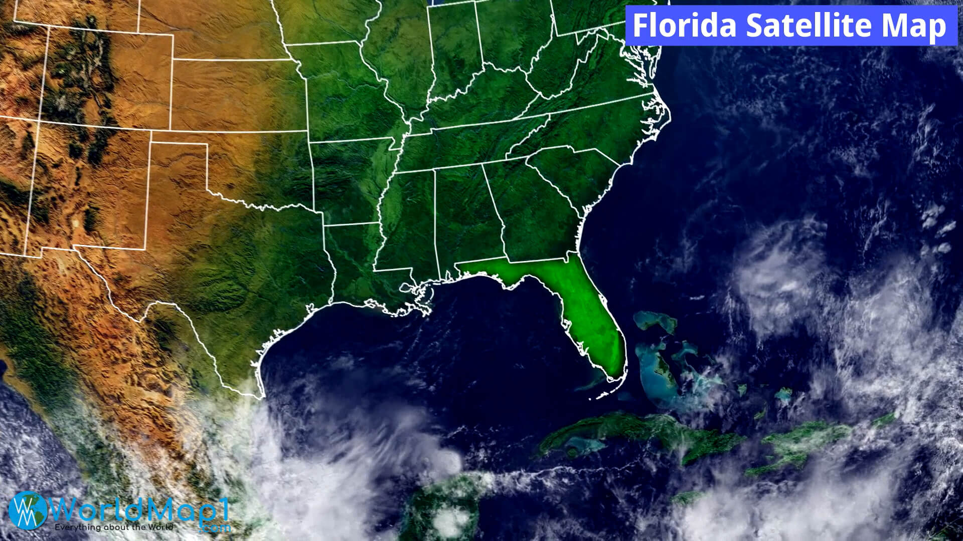
This map provides a satellite view of Florida and its surrounding regions, showcasing its geography and natural features. You can see the green landmass of Florida standing out prominently against the deep blue waters of the Atlantic Ocean and Gulf of Mexico, with surrounding states like Georgia and Alabama also visible. Additionally, the map highlights Florida’s proximity to nearby islands such as Cuba and the Bahamas. This image emphasizes Florida’s peninsular shape, surrounded by water on three sides, and its key location within the southeastern United States.
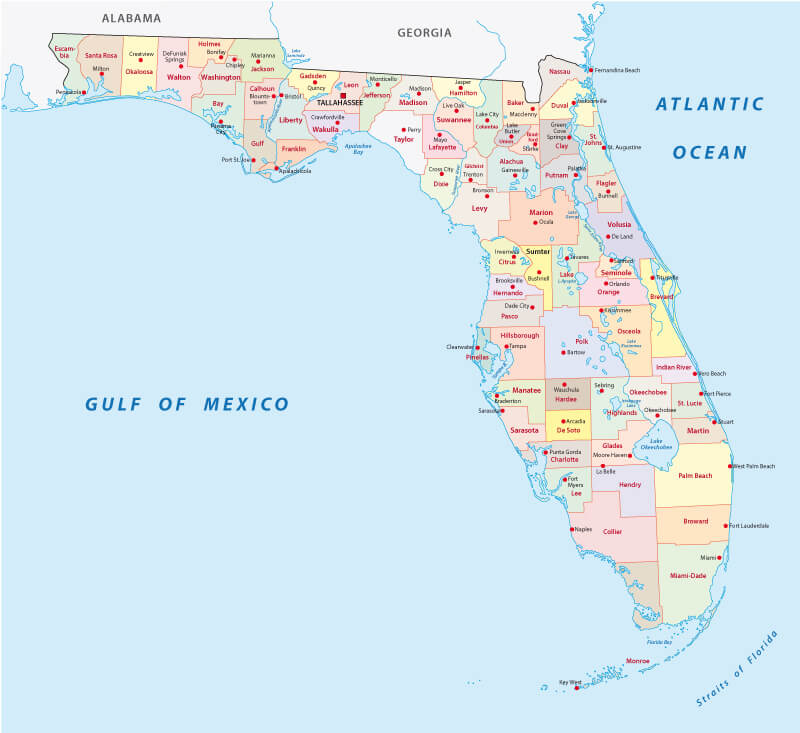
Florida Counties Road Map
This map of Florida depicts the state’s counties along with major roads and highways, making it an excellent reference for understanding Florida’s transportation network and administrative boundaries. Major cities such as Jacksonville, Miami and Tampa are clearly marked, showing how highways connect different regions of the state.
Florida Historical Map in 1500
This historical map of Florida from the 1500s offers a fascinating glimpse into the early cartographic representation of the region. It highlights key geographical features such as the Gulf of Mexico, the Atlantic Ocean, and early settlements and territories. While the map lacks the detail of modern maps, it showcases Florida’s early colonial and exploration history, illustrating how explorers and cartographers of the era viewed the land’s boundaries and its position in the broader context of the Americas.
Florida Regions and Cities Map
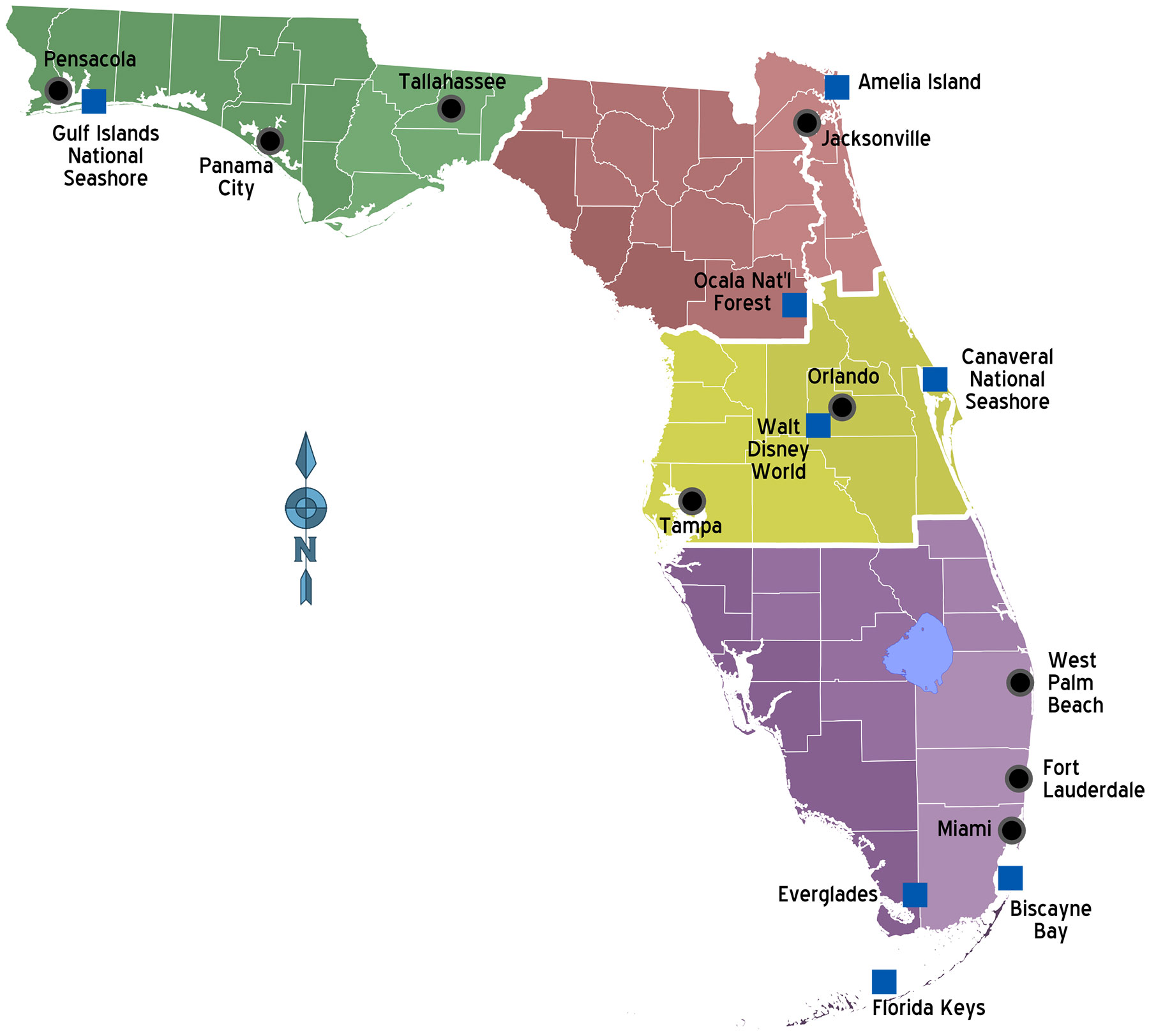
This map of Florida showcases its distinct regions and major cities, highlighting well-known attractions such as Walt Disney World in Orlando, the Everglades in the southern part of the state, and natural sites like the Gulf Islands National Seashore and Canaveral National Seashore. Major cities like Miami, Tampa, and Jacksonville are also prominent, providing a clear representation of the state’s urban centers and their proximity to various natural parks and coastal areas.
Where is Florida on the US Map?
Show Google map, satellite map, where is the country located.
Get directions by driving, walking, bicycling, public transportation, and travel with street view.
Feel free to explore these pages as well:
- Hurricane Milton’s Path ↗️
- Florida US Map ↗️
- Map of Florida ↗️
- Florida Map ↗️
- All About Florida ↗️
- The Traveler’s Top 10 Travel Guide to Orlando ↗️
- Miami’s Magic Uncovered ↗️
- Dive Into The Bahamas ↗️
- Miami’s Magic Uncovered: Your Essential Guide to the City’s Top 10 Attractions ↗️
- California Map ↗️
- Texas Map ↗️
- New York Map ↗️
- United States Map ↗️
- Map of United States ↗️
- North America Map ↗️
- Map of North America ↗️