Discover political, physical and satellite maps of Brunei, including its cities, rivers, topography, altitude, relief, population density, roads and terrain. Visit the place of Brunei in Asia and the world, its neighbours and its location on the island of Borneo.
Brunei Political Map: Districts and Key Cities
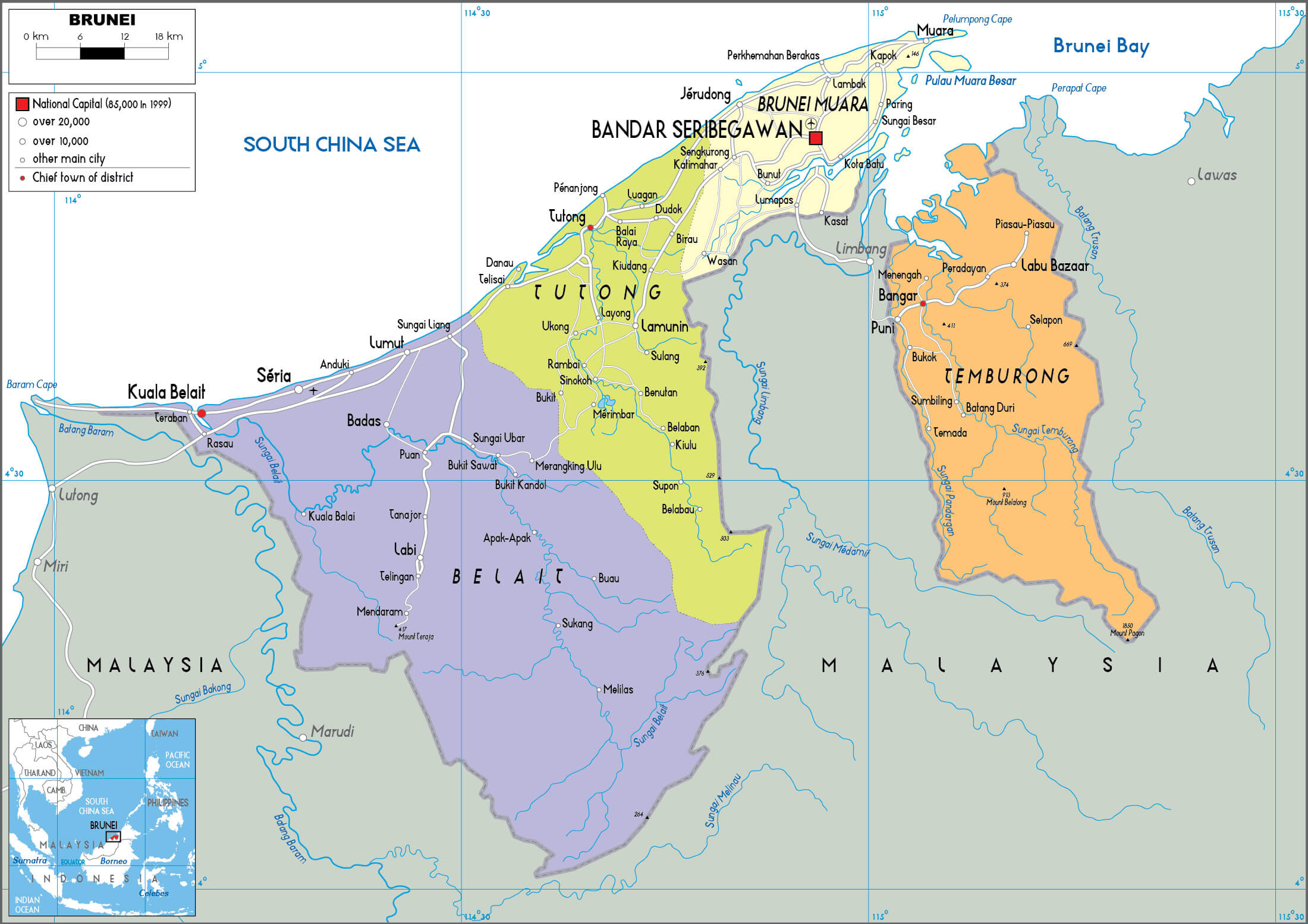 Brunei political map showing districts, cities, rivers, and neighboring Malaysia
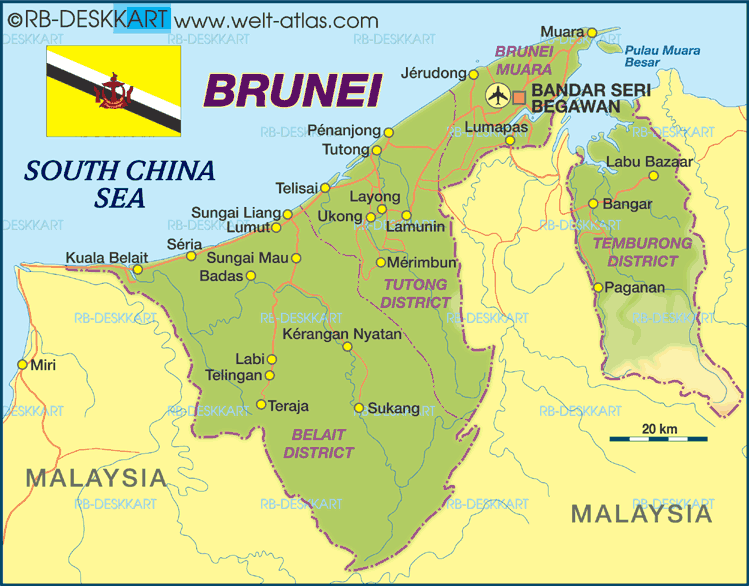
This political map of Brunei shows the country’s districts, including Brunei-Muara, Tutong, Belait and Temburong. It also shows the capital, Bandar Seri Begawan, and major towns and rivers. The map also shows Brunei’s location on the island of Borneo, its borders with Malaysia and its proximity to the South China Sea.
Brief information about Brunei
Brunei, officially known as Brunei Darussalam, is a small, wealthy nation on the island of Borneo in Southeast Asia. It borders Malaysia and has a coastline along the South China Sea. Brunei is known for its abundant oil and gas reserves, which have made it one of the richest countries in the region and led to a high standard of living for its citizens.
Brunei Cities Map: Major Towns and Roads
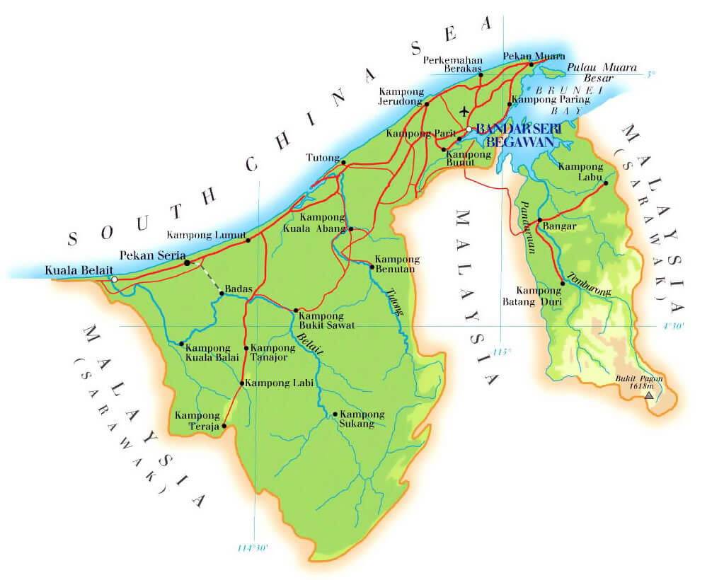
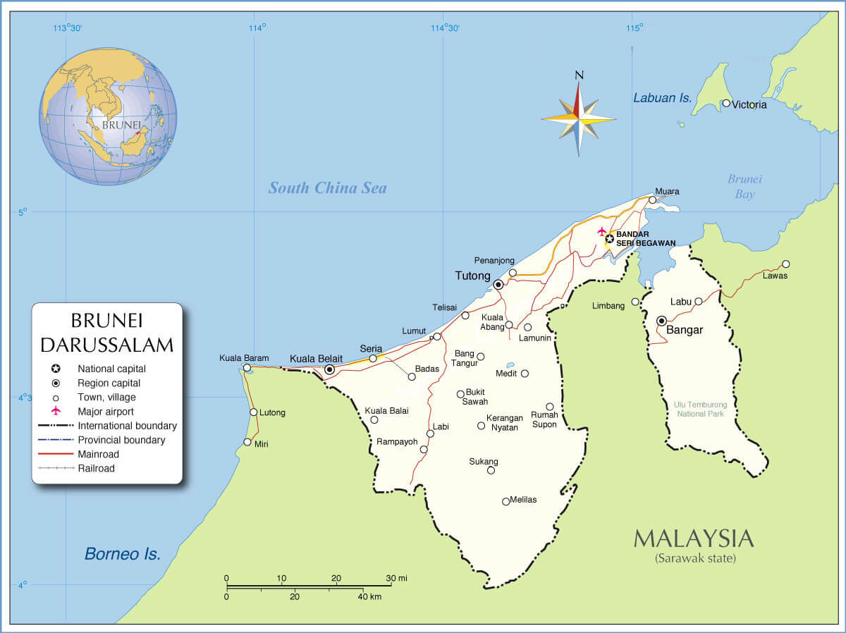 Map of Brunei showing cities, roads, and boundaries.
This map highlights Brunei’s cities and towns, including Bandar Seri Begawan, Kuala Belait and Bangar. It also shows major roads, railways and the country’s border with Malaysia. The map also shows Brunei’s location on the island of Borneo and its coastline along the South China Sea, highlighting major transport routes and settlements.
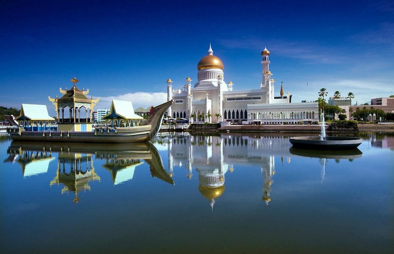
The country is a constitutional sultanate ruled by Sultan Hassanal Bolkiah, one of the world’s longest-reigning monarchs. Islam is the official religion and the sultanate follows a mixture of traditional and modern laws, including Sharia. Brunei’s capital, Bandar Seri Begawan, is famous for its grand mosques, such as the Sultan Omar Ali Saifuddien Mosque, and the opulent Istana Nurul Iman Palace, the Sultan’s residence. Known for its pristine rainforests and biodiversity, Brunei is also an eco-tourism destination.
Where is located Brunei on the World Map

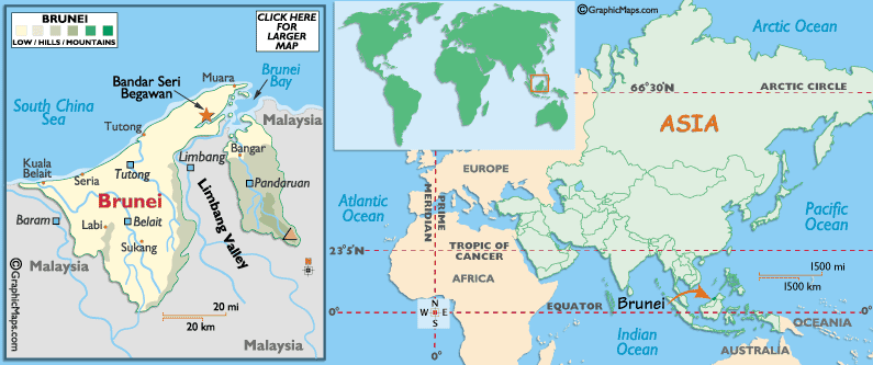
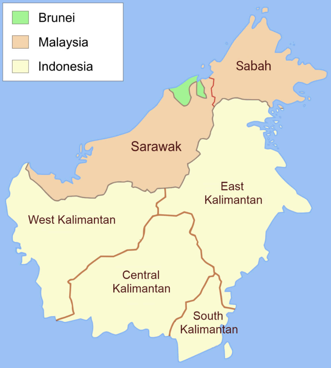
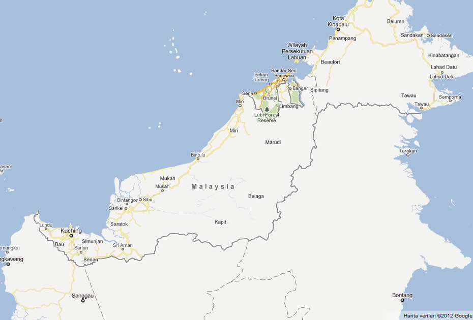
Brunei is located in Southeast Asia, on the northern coast of the island of Borneo. It is bordered on all sides by Malaysia and has a coastline along the South China Sea to the north. This small nation is divided into two parts by the Malaysian state of Sarawak, making it geographically unique.
Brunei Physical Map: Elevation and Natural Features
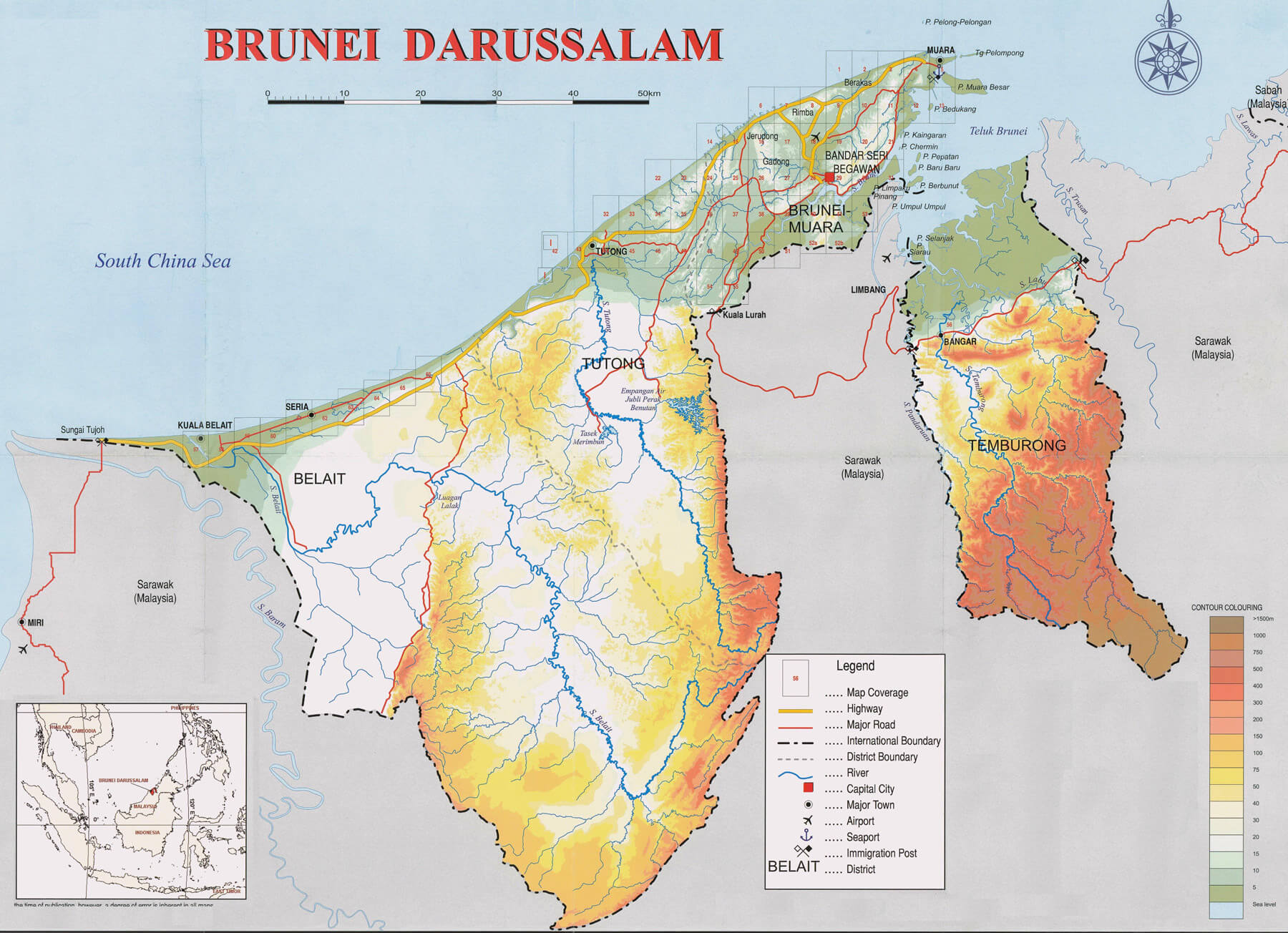
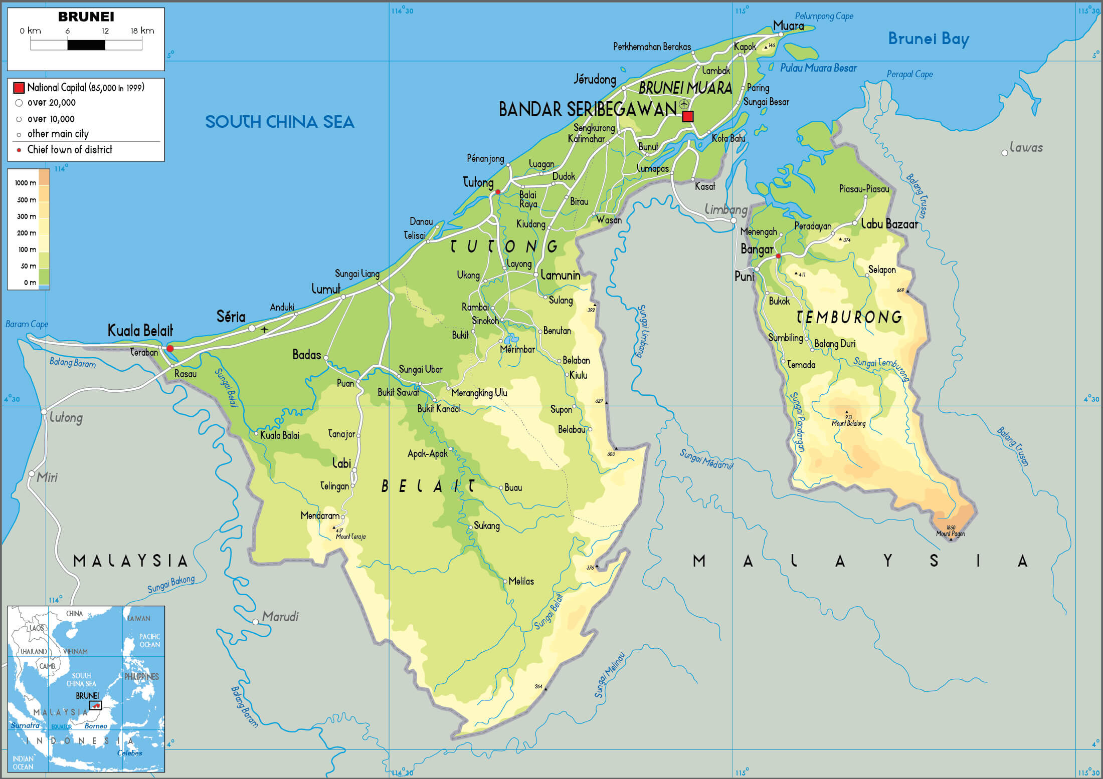 Brunei physical map showing terrain, rivers, and elevation levels.
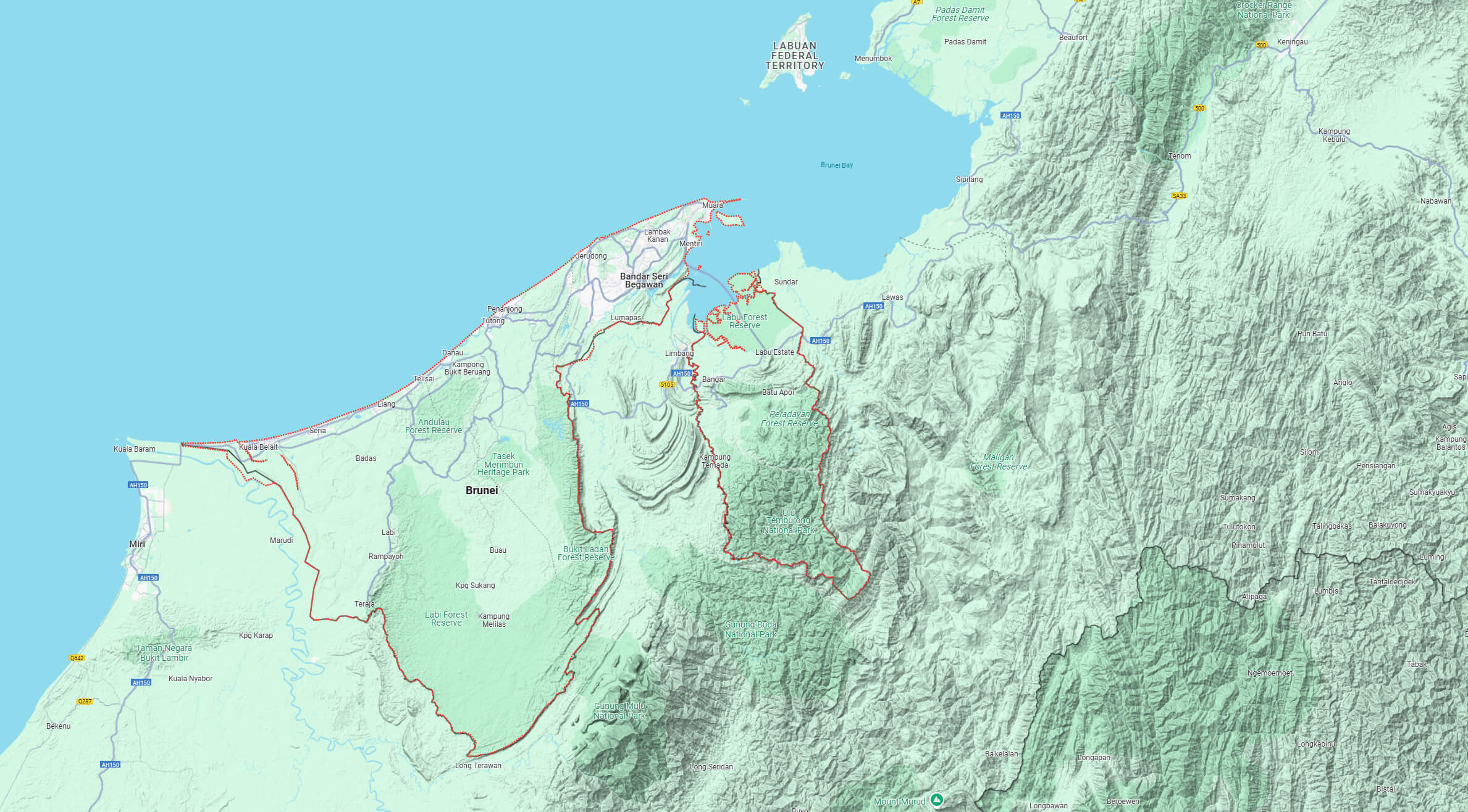
This physical map of Brunei highlights its terrain, elevation levels, and natural features, including rivers, hills, and coastal areas. It marks key districts such as Brunei-Muara, Tutong, Belait, and Temburong. The map also showcases Brunei’s location on Borneo Island and its proximity to the South China Sea and Malaysia.
Situated close to the equator, Brunei has a tropical rainforest climate with hot and humid weather throughout the year. Despite its small size, Brunei’s strategic location in the South China Sea puts it close to major shipping lanes and other Southeast Asian nations, including Indonesia, Malaysia and the Philippines.
On the world map, Brunei appears in the Western Pacific, close to the major economies of Southeast Asia. Its wealth is largely derived from its rich oil and natural gas reserves, making it one of the richest countries in the region per capita.
Here are some statistical information about Brunei:
 Area: 5,765 km2 (2,226 sq mi)
 Brunei road map
Map of Brunei
 GDP (nominal): $15.783 billion (2024 estimate)
 Brunei terrain map
Brunei population density map
Brunei map with Malaysia and Indonesia
Brunei map with cities
Brunei Map Indonesia
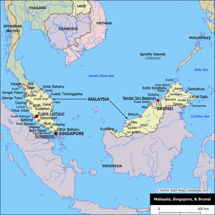 em style=”font-size:14px;”>Map of Brunei, Malaysia, and Singapore with key cities and borders
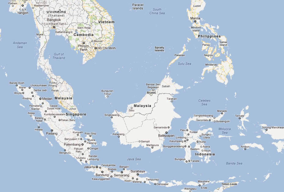
This map shows Brunei’s location on the island of Borneo, neighboring Malaysia and close to Singapore. Major cities such as Bandar Seri Begawan (Brunei), Kuala Lumpur (Malaysia), and Singapore are highlighted. The map also includes surrounding countries like Indonesia, the Philippines, and Thailand, with the South China Sea to the east and the Celebes Sea to the south.
Brunei Map Regional
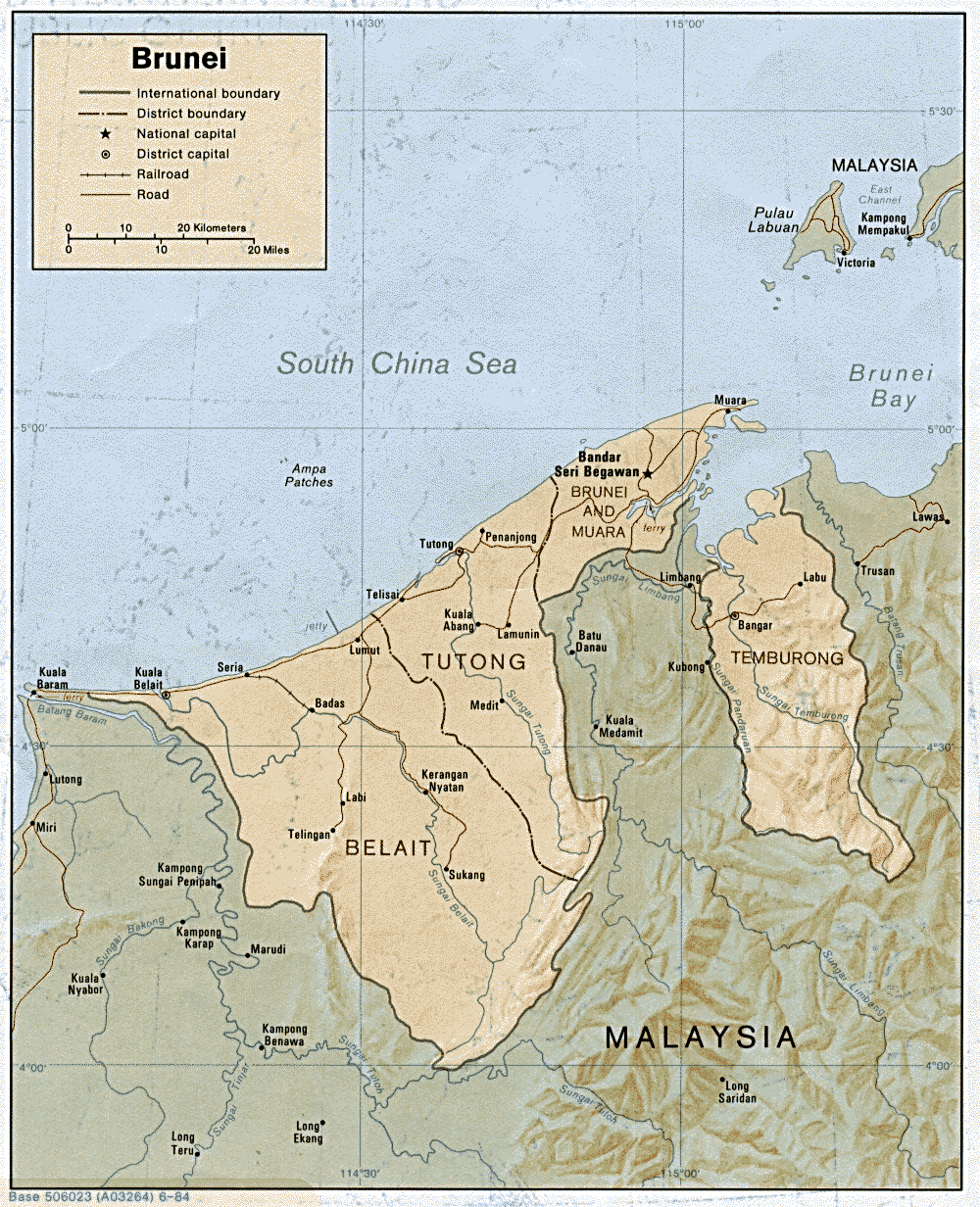 Map of Brunei showing districts, main cities, and borders with Malaysia
This map of Brunei shows its four main districts: Brunei-Muara, Tutong, Belait, and Temburong. Key cities, including the capital Bandar Seri Begawan, are marked, as well as major roads and railroads. The map highlights Brunei’s coastline along the South China Sea and its borders with Malaysia.
Brunei Regional Map
Brunei Map
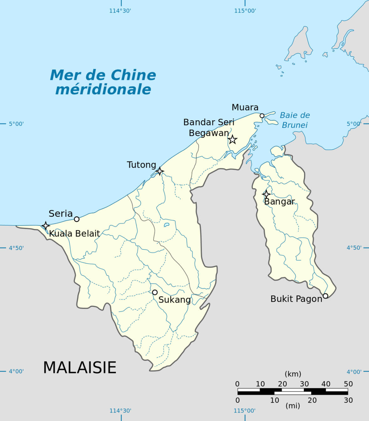
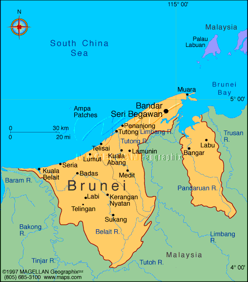 Map of Brunei showing major cities, coastline, and borders
This map of Brunei highlights its key cities, including the capital Bandar Seri Begawan, and important towns such as Kuala Belait and Seria. The map shows Brunei’s coastline along the South China Sea and its border with Malaysia, which divides the country into two main parts.
Map of Brunei Malaysia
Political Map of Brunei
Brunei Maps
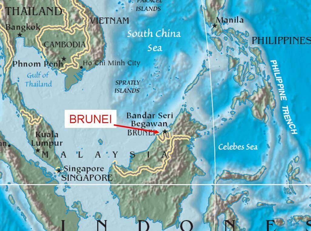 Map showing Brunei’s location in Southeast Asia near Malaysia
This map highlights Brunei’s location on the island of Borneo in Southeast Asia, bordered by Malaysia and near the South China Sea. Neighboring countries, including Thailand, Vietnam, the Philippines, and Indonesia, are also shown, with Brunei positioned close to major regional hubs.
Brunei Earth Map
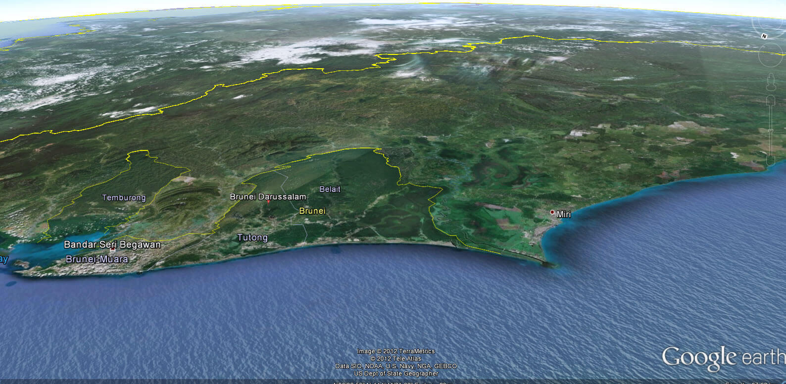
Brunei satellite map
Brunei topography map
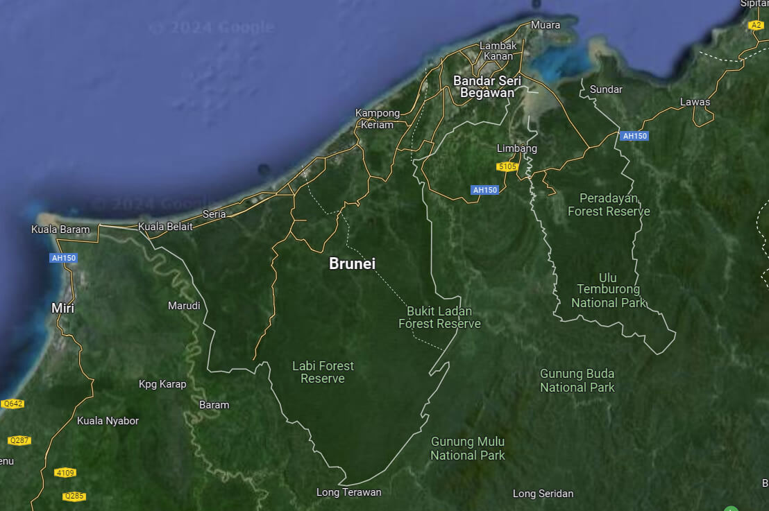
Satellite Map of Brunei
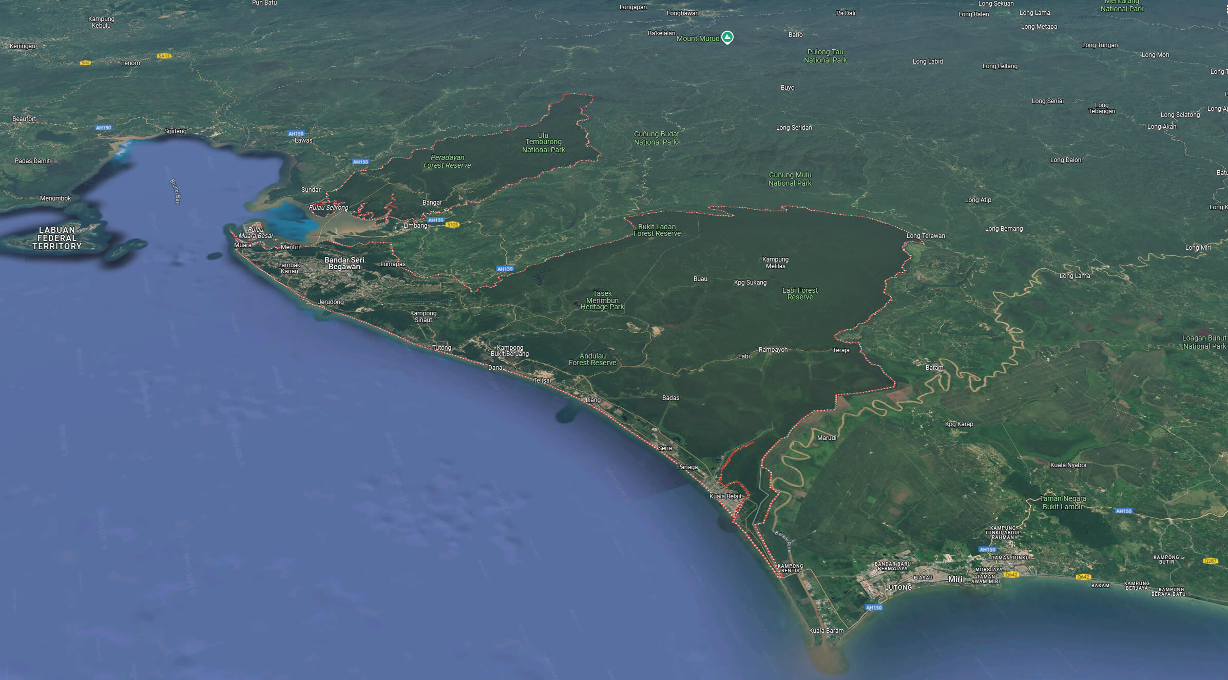
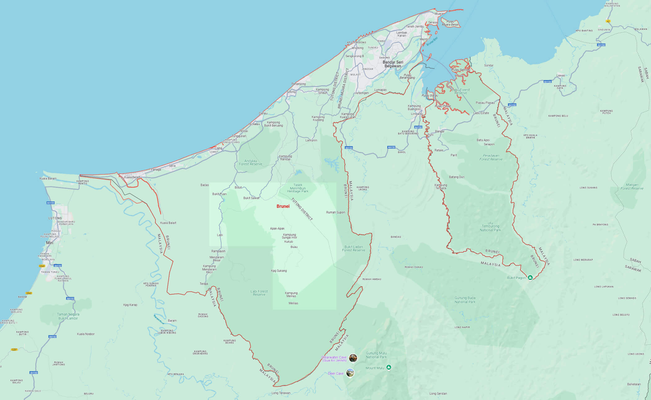
Brunei map with national borders
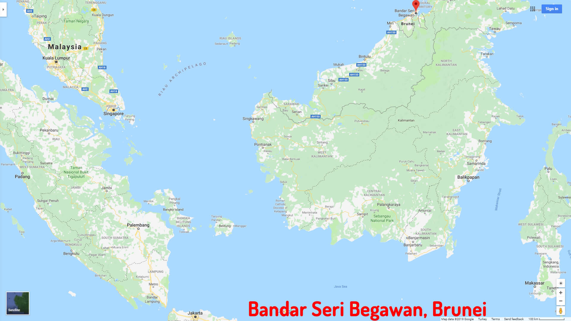
Bandar Seri Begawan map Brunei
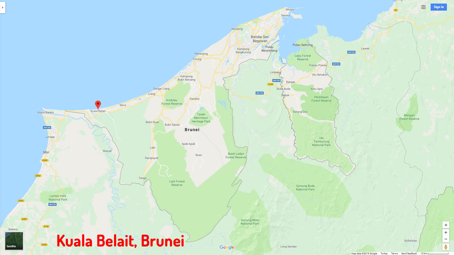
Kuala Belait map Brunei
Where is Brunei on the Asia Map?
Show Google map, satellite map, where is the country located.
Get directions by driving, walking, bicycling, public transportation and travel with street view.
