Explore Gibraltar with our detailed map featuring its landmarks, geography, satellite, road, political maps and where is located Gibraltar on the World map. Plan your trip to this fascinating British Overseas Territory at the southern tip of Europe.
Brief information about Gibraltar
Gibraltar is a British Overseas Territory located on the southern coast of Spain, at the entrance to the Mediterranean Sea. Known for the iconic Rock of Gibraltar, this small peninsula has a strategic location that has made it historically important for maritime and military purposes. Its location near the Straits of Gibraltar allows it to control the narrow waterway that connects the Atlantic Ocean to the Mediterranean Sea, making it a valuable asset for centuries.
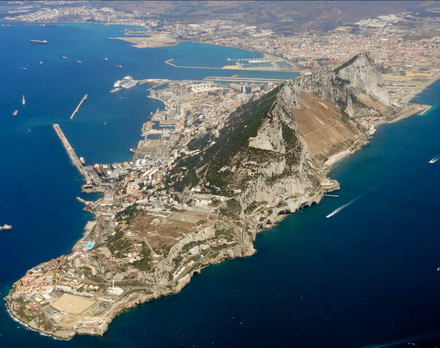
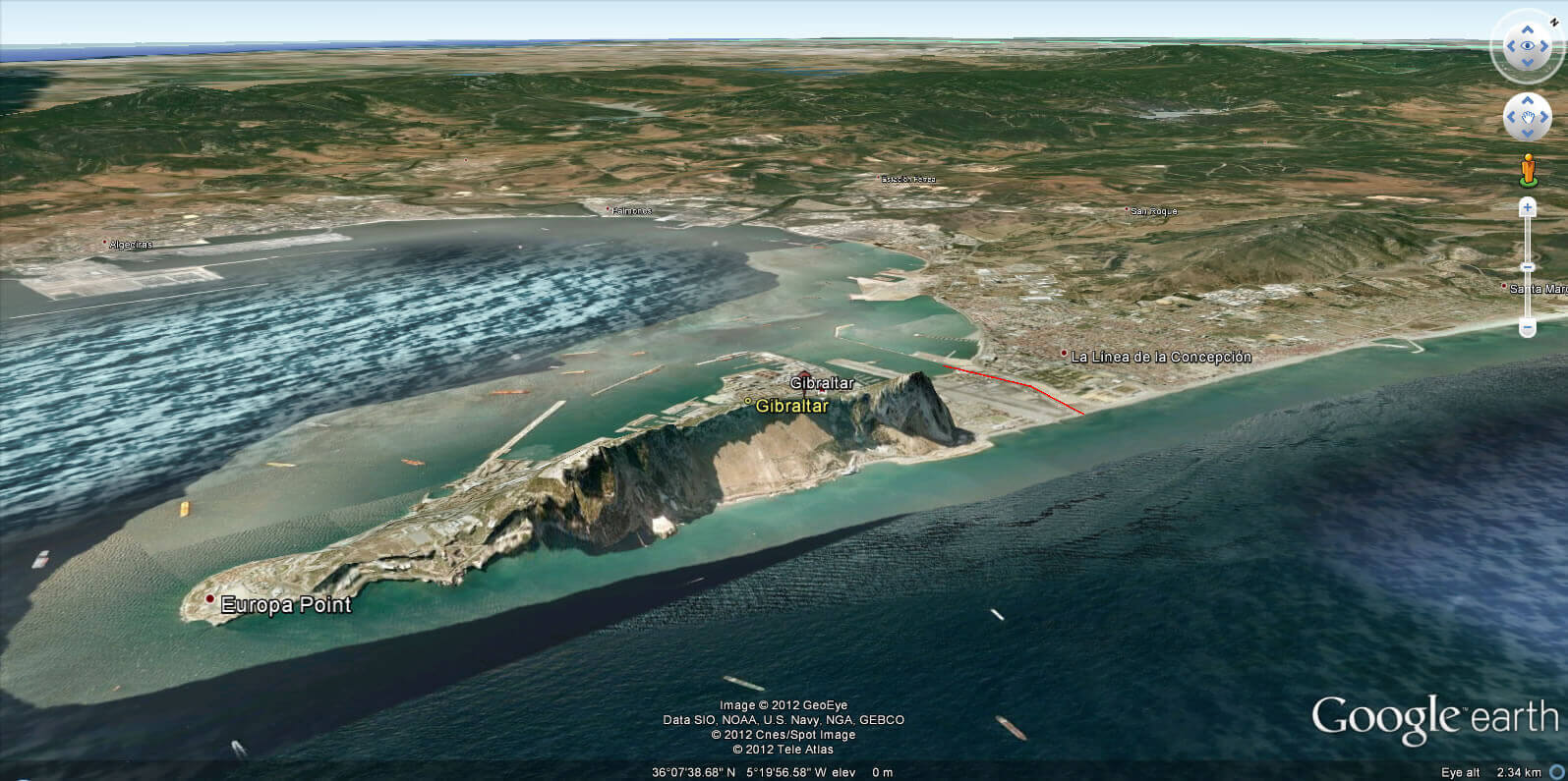
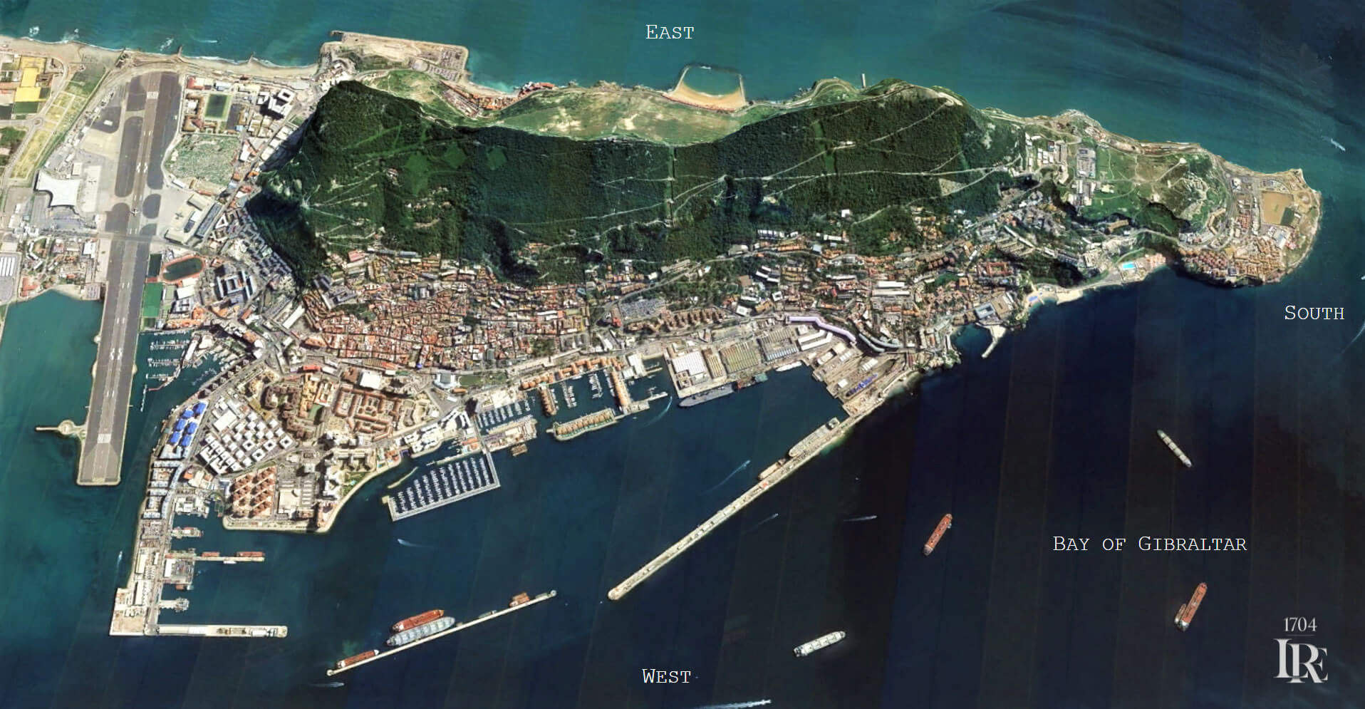
Aerial View of Gibraltar
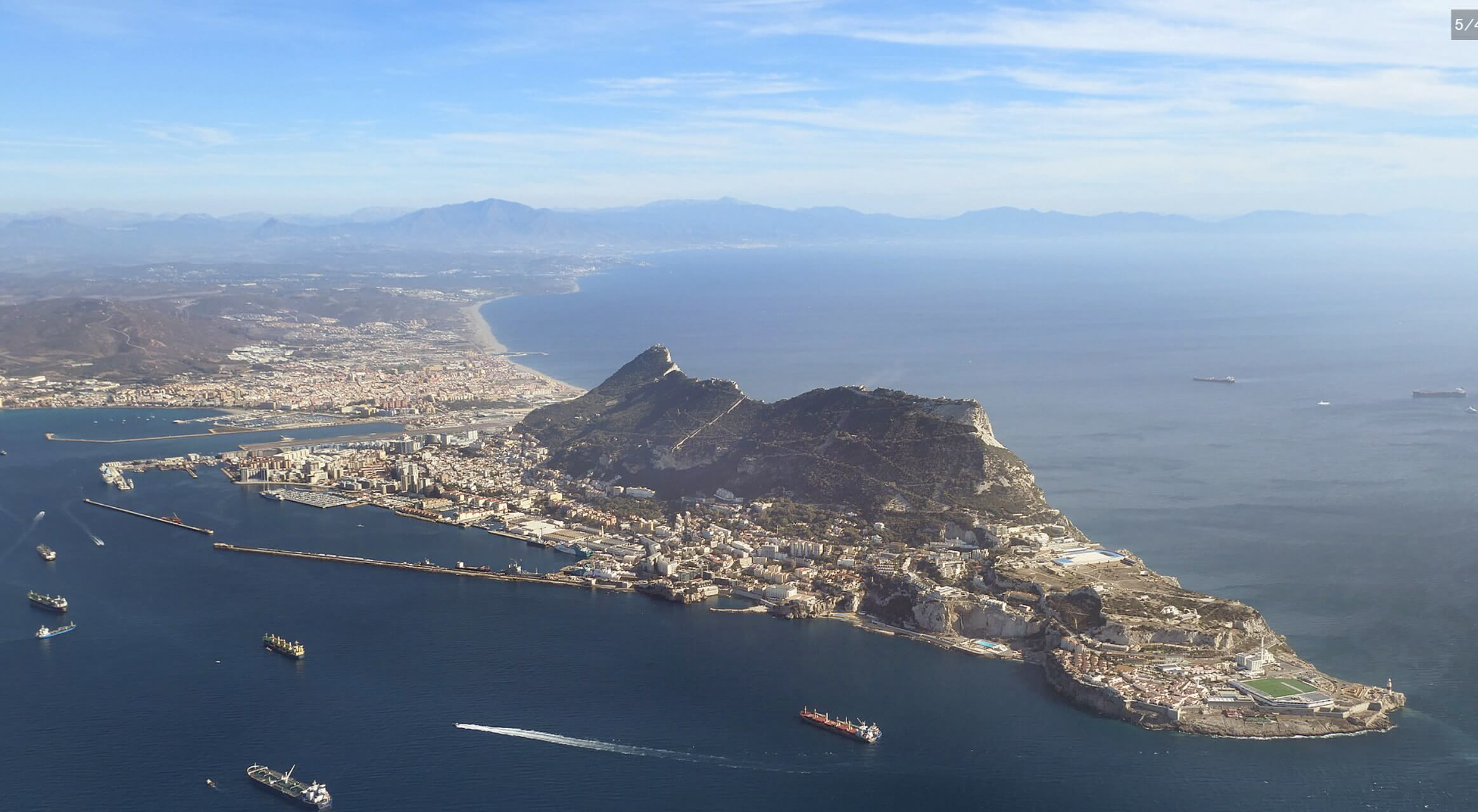
Today, Gibraltar is known not only for its strategic importance, but also for its unique blend of British and Mediterranean cultures. The territory attracts tourists with its historic sites, beautiful views and famous Barbary macaques, Europe’s only wild monkeys. Despite its small size, Gibraltar has a vibrant atmosphere with influences from British, Spanish and North African cultures, creating a unique and memorable experience for visitors.
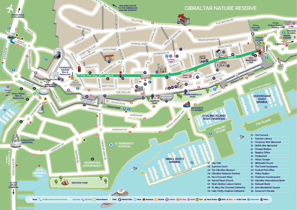
Gibraltar city center map with road
Where is located Gibraltar on the World Map
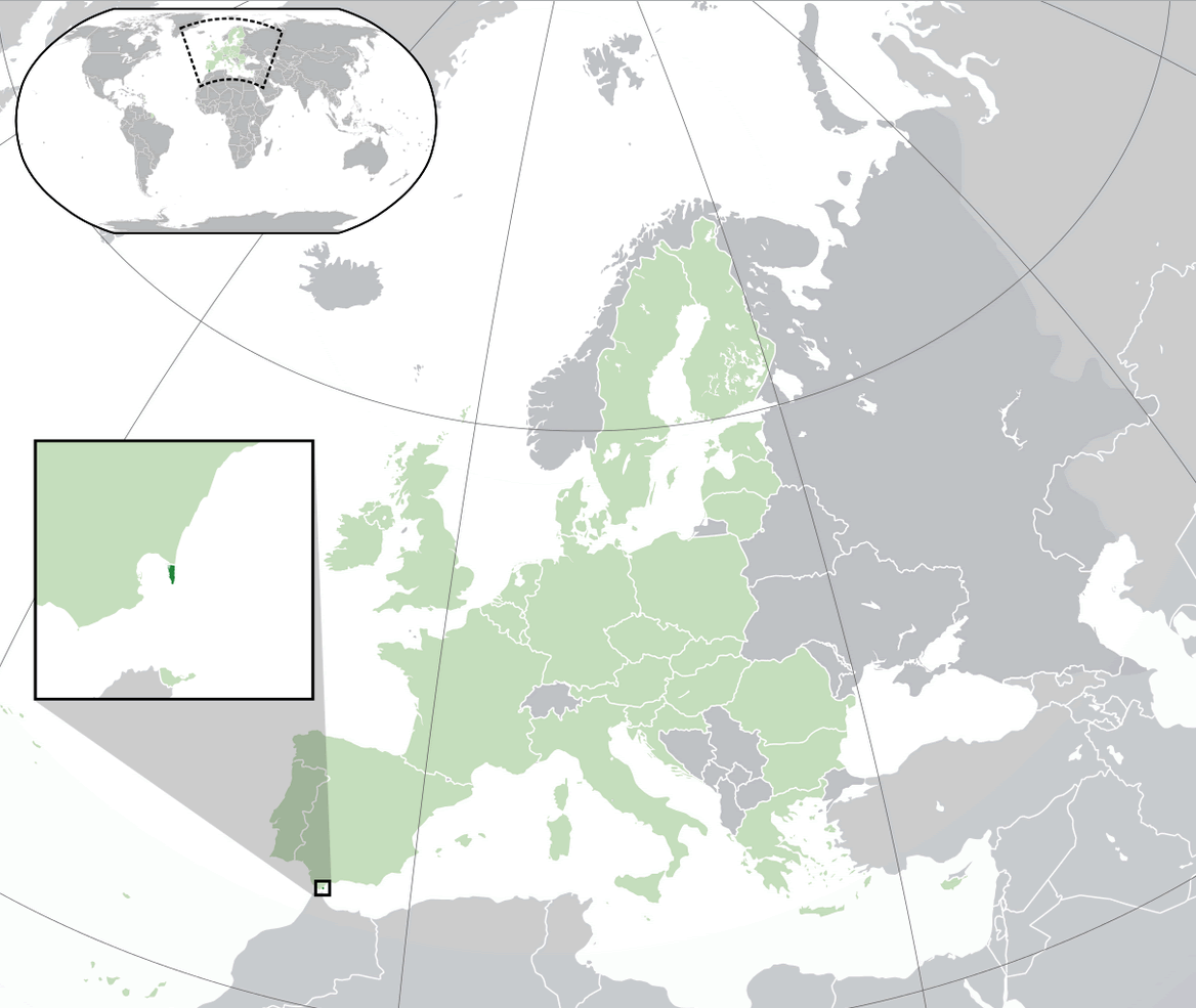
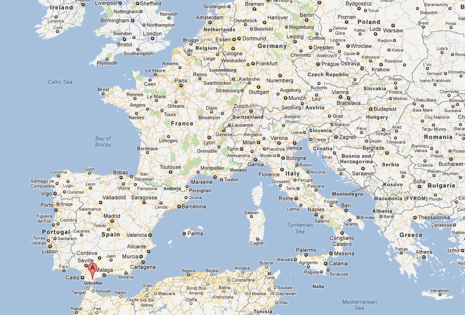
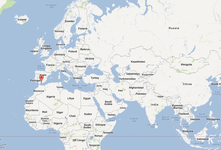
Gibraltar is a small British Overseas Territory on the southern tip of the Iberian Peninsula, bordering Spain. Situated at the entrance to the Mediterranean Sea, it lies along the narrow Strait of Gibraltar, which separates Europe from Africa by just 14 kilometres (9 miles). This strait connects the Atlantic Ocean with the Mediterranean Sea, making Gibraltar one of the most strategically important locations in the world. This strait connects the Atlantic Ocean with the Mediterranean Sea, making Gibraltar one of the most strategically important locations in the world.
To the north, Gibraltar shares its only land border with Spain, specifically the Spanish region of Andalusia. To the south, across the strait, is the northern coast of Morocco, placing Gibraltar at a natural crossroads between Europe and Africa. This unique location has given Gibraltar significant military and commercial value throughout history, as it controls one of the busiest shipping lanes in the world.
Gibraltar may appear small on the world map, but its location is vital. It serves as a gateway for ships travelling between the Atlantic and the Mediterranean, and its iconic Rock of Gibraltar is a recognisable landmark. Despite its tiny size, Gibraltar’s location makes it a key point of interaction between different continents and cultures, and a place of enduring strategic importance.
Here are some statistical information about Gibraltar:
 Area: 6.8 km2 (2.6 sq mi)
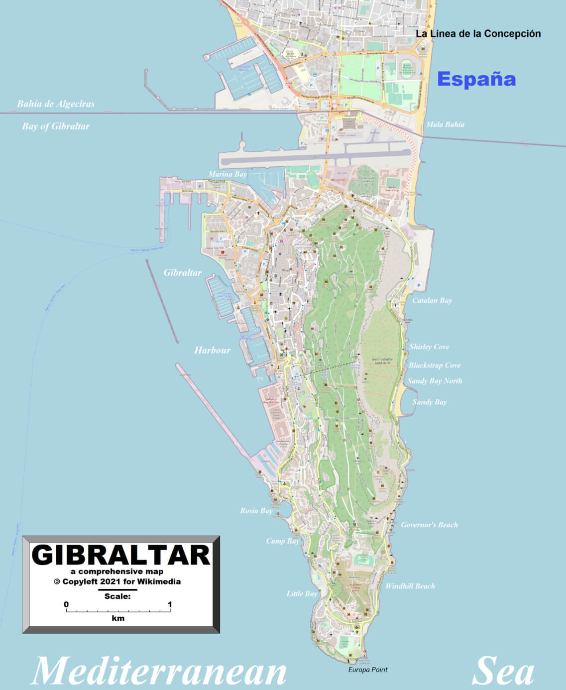
Detailed Map of Gibraltar
 Official languages: English
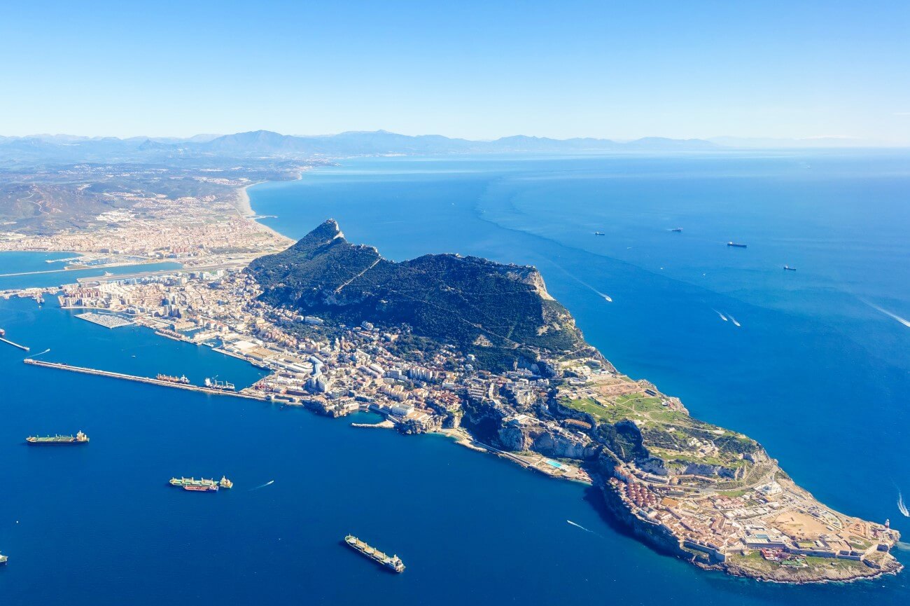
 Gibraltar aerial view map
 Currency: Pound sterling, Gibraltar pound (£) (GIP)
 Map of Gibraltar
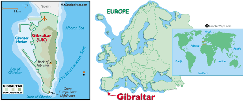 Map of Gibraltar’s local landmarks and its location in Europe.
This map provides both a detailed view of Gibraltar and its location within Europe and the world. On the left, the detailed map of Gibraltar shows key landmarks, including the Rock of Gibraltar, Gibraltar Harbour, the Bay of Gibraltar and the Great Europe Point lighthouse. The territory is located at the southern tip of the Iberian Peninsula, near the Straits of Gibraltar. On the right, an inset world map highlights Gibraltar’s global position at the entrance to the Mediterranean Sea, acting as a natural bridge between Europe and Africa. This strategic location has given Gibraltar great historical and commercial importance.
Map of Gibraltar with Spain
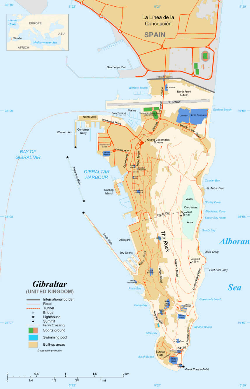 Map of Gibraltar showing borders, landmarks, and infrastructure.
This map of Gibraltar, a British Overseas Territory, provides a detailed look at its infrastructure, landmarks and natural features. It shows the northern border with Spain at La Línea de la Concepción and includes the airport runway, which crosses Gibraltar’s main road. Important sites such as the Port of Gibraltar, Casemates Square and the historic areas around the Rock of Gibraltar are marked, along with recreational areas such as sports grounds and swimming pools. The southern section includes natural attractions such as Sandy Bay, Little Bay and Europa Point, the latter offering panoramic views of the Strait of Gibraltar. The map also highlights major roads, tunnels and facilities, providing a comprehensive overview of this small but strategically important area.
Gibraltar Map
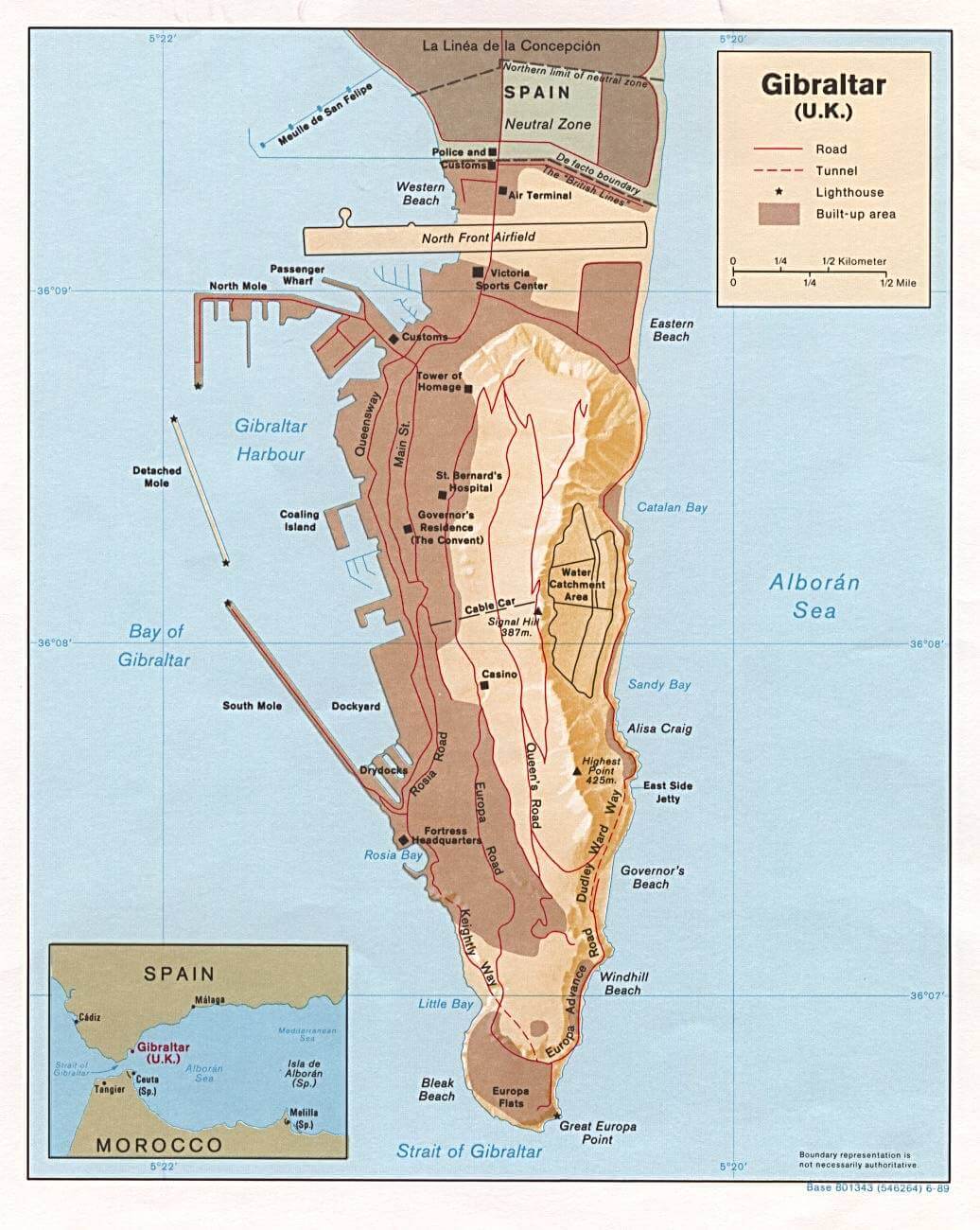 Detailed map of Gibraltar showing landmarks, roads, and key features.
This map provides a close-up view of Gibraltar, showing its main geographical and structural features. The northern section borders on Spain, with the Neutral Zone and North Front Airfield visible. Key areas such as the Rock of Gibraltar, Gibraltar Harbour and Great Europe Point at the southern tip are shown, along with beaches such as Western Beach, Eastern Beach and Governor’s Beach. Major roads, tunnels and landmarks such as the Tower of Homage and St Bernard’s Hospital are shown to give an overview of Gibraltar’s infrastructure. The map also includes details such as lighthouses and docks, emphasising Gibraltar’s importance as a maritime hub.
Gibraltar Maps
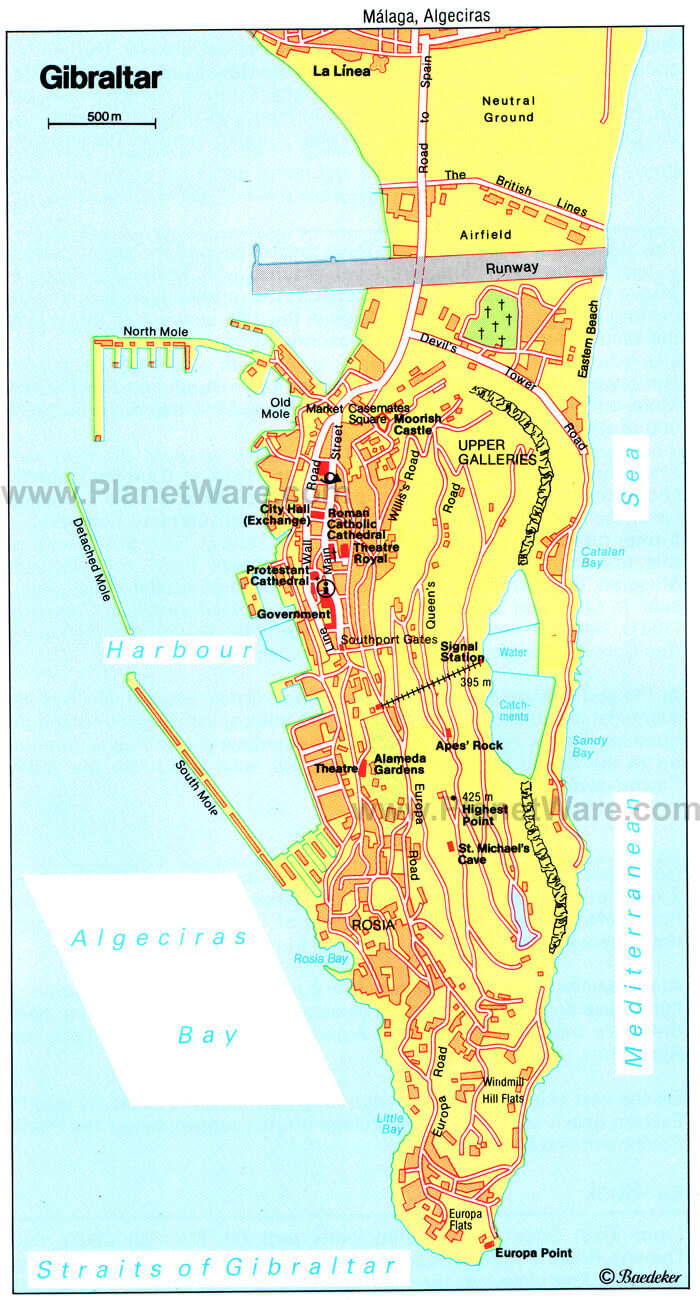 Tourist map of Gibraltar with landmarks and major roads.
This map of Gibraltar highlights the main attractions and landmarks, making it useful for tourists. Starting from the north, it shows the border with Spain at La Línea and the Neutral Zone, as well as the airfield over Gibraltar. Moving south, the historic Moorish Castle, the Upper Galleries and the central area with the Market Casemates Square, the Roman Catholic Cathedral and the Protestant Cathedral. Further south are the Alameda Gardens, St Michael’s Cave and the iconic Europa Point at the southern tip, which offers views across the Strait of Gibraltar. The map also highlights major roads and coves, providing an easy navigation guide for exploring Gibraltar’s rich heritage and natural beauty.
Map of Gibraltar Europe
Map of Gibraltar World
Gibraltar Road Map
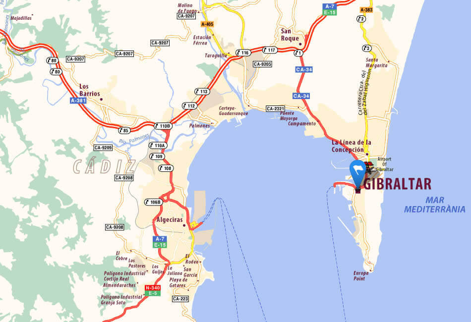
Spain Gibraltar Map
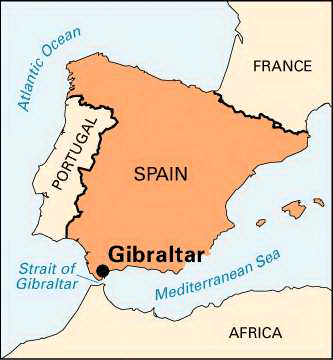
Strait Gibraltar Map
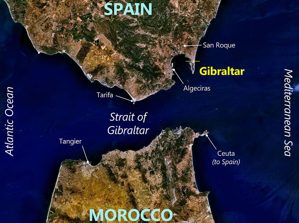
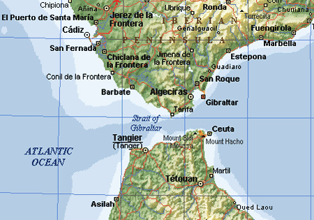 Map showing the Strait of Gibraltar, with nearby cities in Spain and Morocco.
This map highlights the Strait of Gibraltar, the narrow waterway that separates southern Spain from northern Morocco, connecting the Atlantic Ocean to the Mediterranean Sea. Key nearby locations include Gibraltar on the European side, with the Spanish cities of Algeciras, Tarifa and Ceuta to the east. On the African side, the Moroccan cities of Tangier and Tétouan are visible, emphasising the proximity between Europe and Africa. The strait is one of the busiest shipping routes in the world, vital for ships travelling between the two great bodies of water. This strategic passage has long been of historical, commercial and military importance, serving as a gateway between the continents.
Gibraltar Earth Map
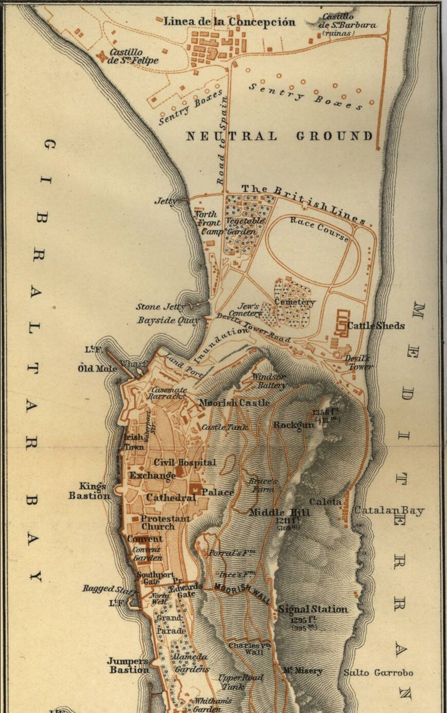
Gibraltar historical map
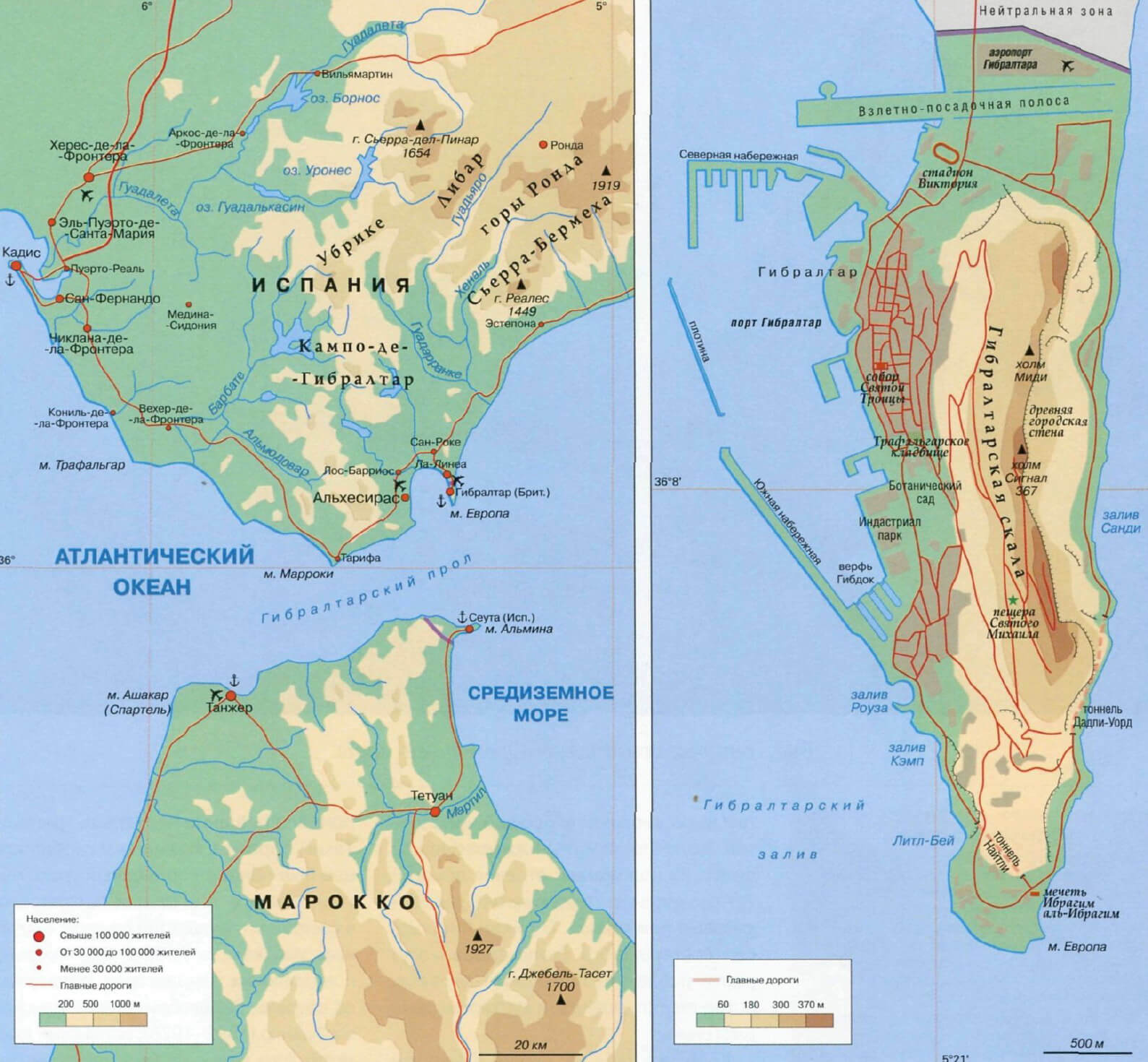
Gibraltar physical map
Gibraltar satellite map with airport
Gibraltar satellite map with spain and morocco
where is located Gibraltar in the world
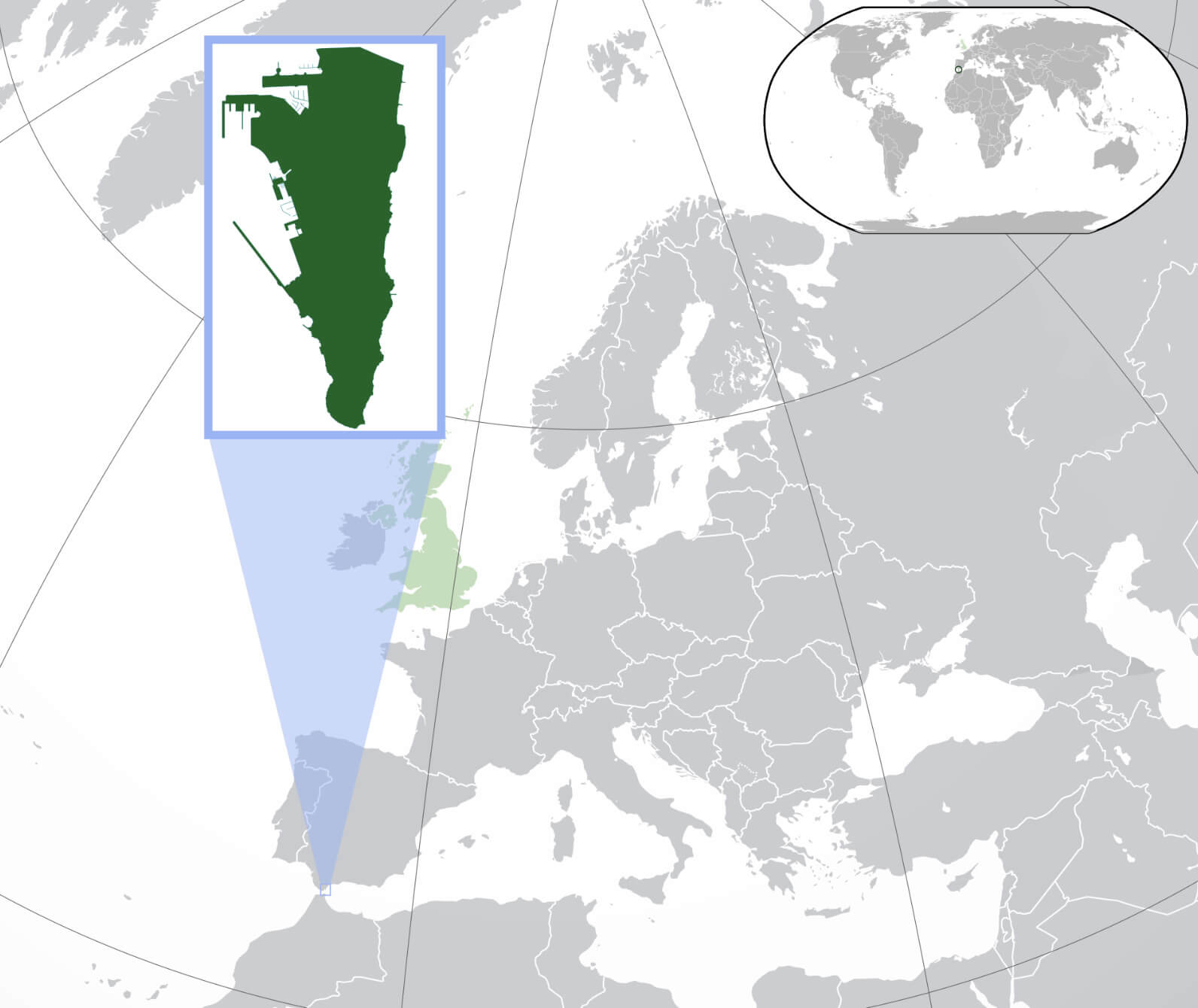
Where is Located Gibraltar on the Europe and the World Map?
Show Google interactive map, satellite map, where is the country located.
Get directions by driving, walking, bicycling, public transportation, and traveling with street view.
Feel free to explore these pages as well:
- Map of Spain ↗️
- Valencia Map ↗️
- Murcia Map ↗️
- Exploring the Vibrant Corners of Cartagena, Spain ↗️
- Discovering Alicante: The Gem of Spain’s Costa Blanca ↗️
- A Collection of Spain Maps ↗️
- Discover Moorish Andalucia, Spain 1 ↗️
- Discover Moorish Andalucia, Spain 2 ↗️
- Marrakech Traveler’s Guide: 10 Can’t-Miss Attractions for Tourists ↗️
- Italy Map ↗️
- France Map ↗️
- Europe Map ↗️
