- Advertisement -
A collection of Oklahoma Maps; View a variety of Oklahoma physical, political, administrative, relief map, Oklahoma satellite image, higly detalied maps, blank map, Oklahoma USA and earth map, Oklahoma’s regions, topography, cities, road, direction maps and atlas.
Oklahoma Shaded Relief Map
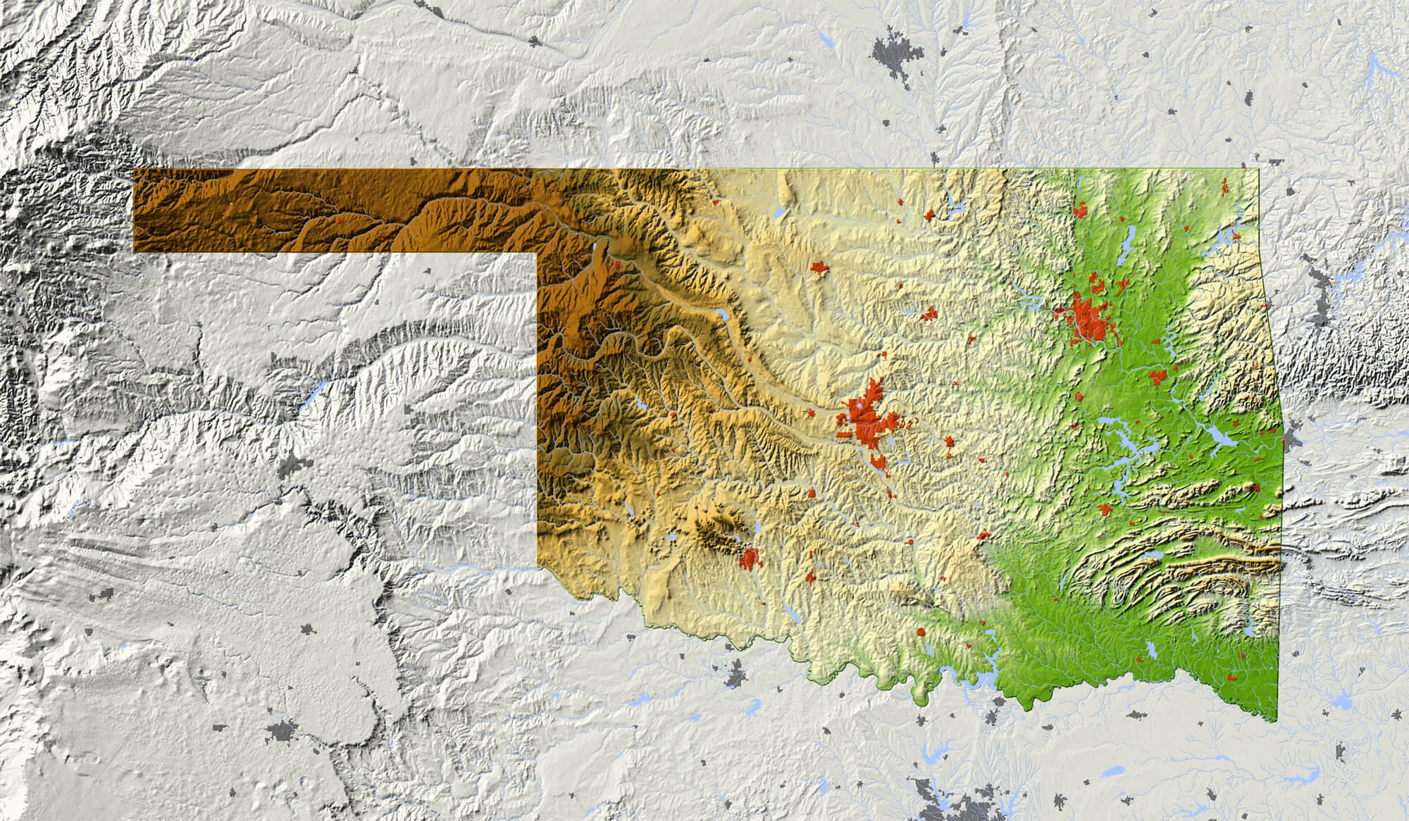
Oklahoma Shaded relief map, with major urban areas and rivers, surrounding territory greyed out. Colored according to elevation. Clipping path for the state area included. Data source: NASA
Oklahoma Locatation Map
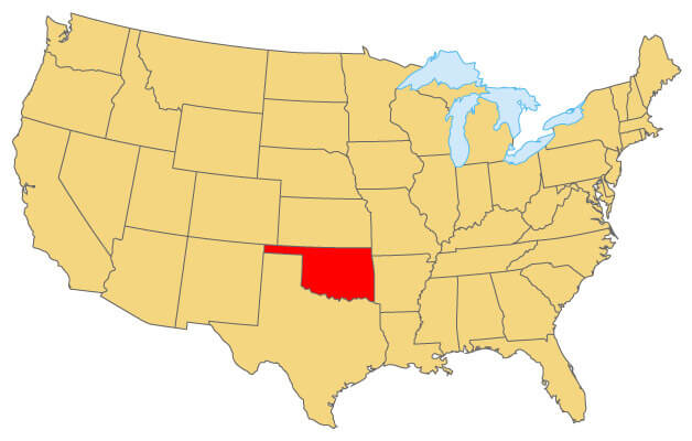
Oklahoma Locatation Map where the state is located in United States.
Color Map of Oklahoma
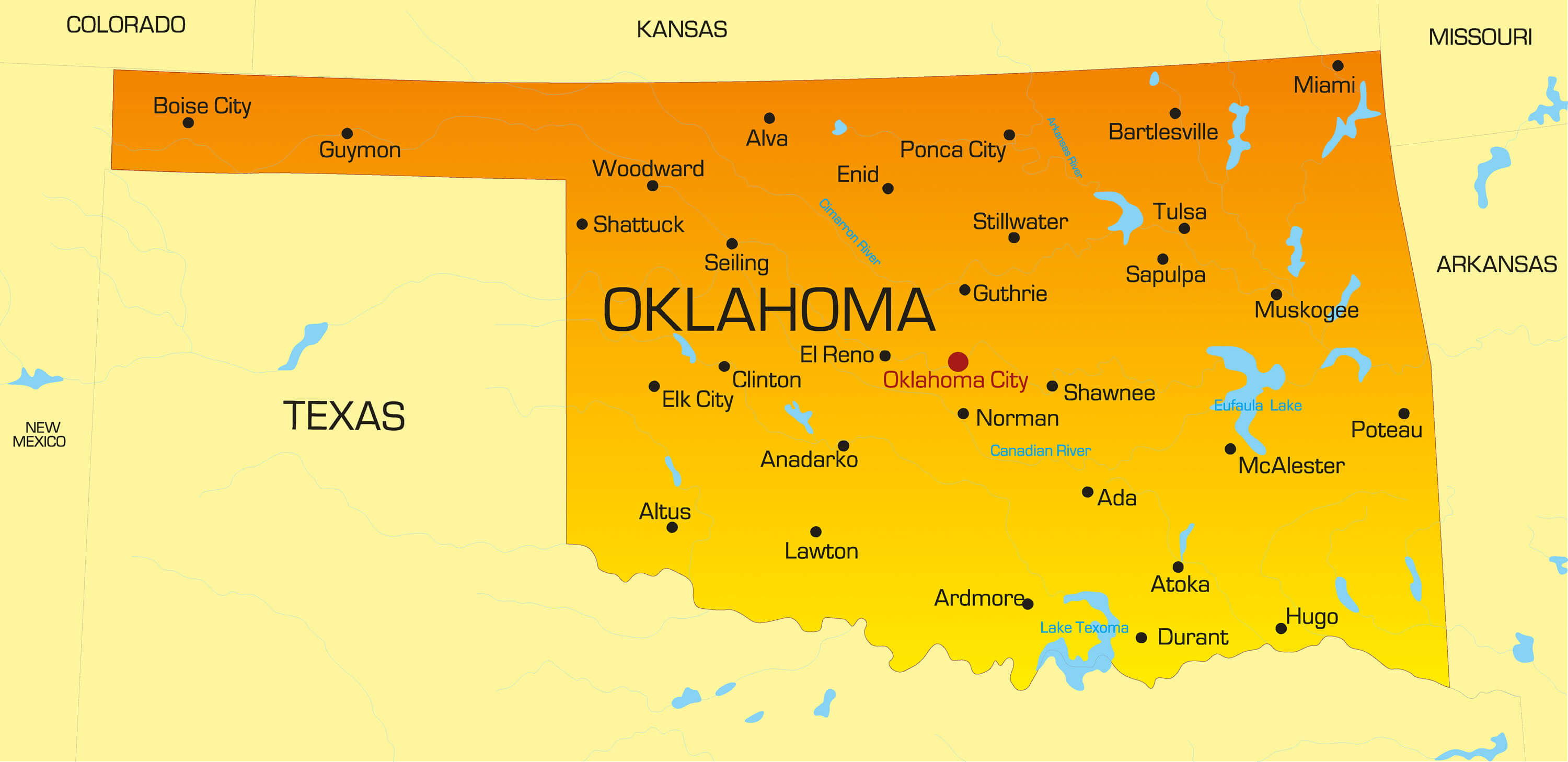
Vector color map of Oklahoma state, USA.
Tulsa Map, Oklahoma
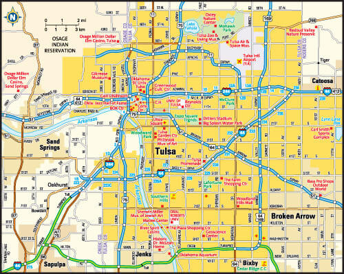
Tulsa, Oklahoma area map, US.
Oklahoma Maps and Photos
- Please Click for more Oklahoma Map
- Please Click for Map of Oklahoma
- Please Click for more Oklahoma Photos
Where is Oklahoma on the US Map?
Show Google interactive map, satellite map, where is the country located.
Get directions by driving, walking, bicycling, public transportation and travel with street view.
Feel free to explore these pages as well:
- California Map ↗️
- Texas Map ↗️
- New York Map ↗️
- Florida Map ↗️
- Illinois Map ↗️
- Pennsylvania Map ↗️
- Ohio Map ↗️
- Michigan Map ↗️
- Georgia Map ↗️
- New Jersey Map ↗️
- North Carolina Map ↗️
- Virginia Map ↗️
- Massachusetts Map ↗️
- Indiana Map ↗️
- Tennessee Map ↗️
- Arizona Map ↗️
- Missouri Map ↗️
- Maryland Map ↗️
- Washington Map ↗️
- Minnesota Map ↗️
- Colorado Map ↗️
- Alabama Map ↗️
- Louisiana Map ↗️
- South Carolina Map ↗️
- Kentucky Map ↗️
- Oregon Map ↗️
- Oklahoma Map ↗️
- Connecticut Map ↗️
- Iowa Map ↗️
- Mississippi Map ↗️
- Arkansas Map ↗️
- Kansas Map ↗️
- Utah Map ↗️
- Nevada Map ↗️
- District of Columbia Map ↗️
- United States Map ↗️
- Map of United States ↗️
- North America Map ↗️
- Map of North America ↗️
- Advertisement -