A collection of Indiana Maps; View a variety of Indiana physical, political, administrative, relief map, Indiana satellite image, higly detalied maps, blank map, Indiana USA and earth map, Indiana’s regions, topography, cities, road, direction maps and atlas.
Color Map of Indiana
Vector color map of Indiana state, USA.
Indiana State Road Map

Indiana state road map with Interstates, U.S. Highways and state roads.
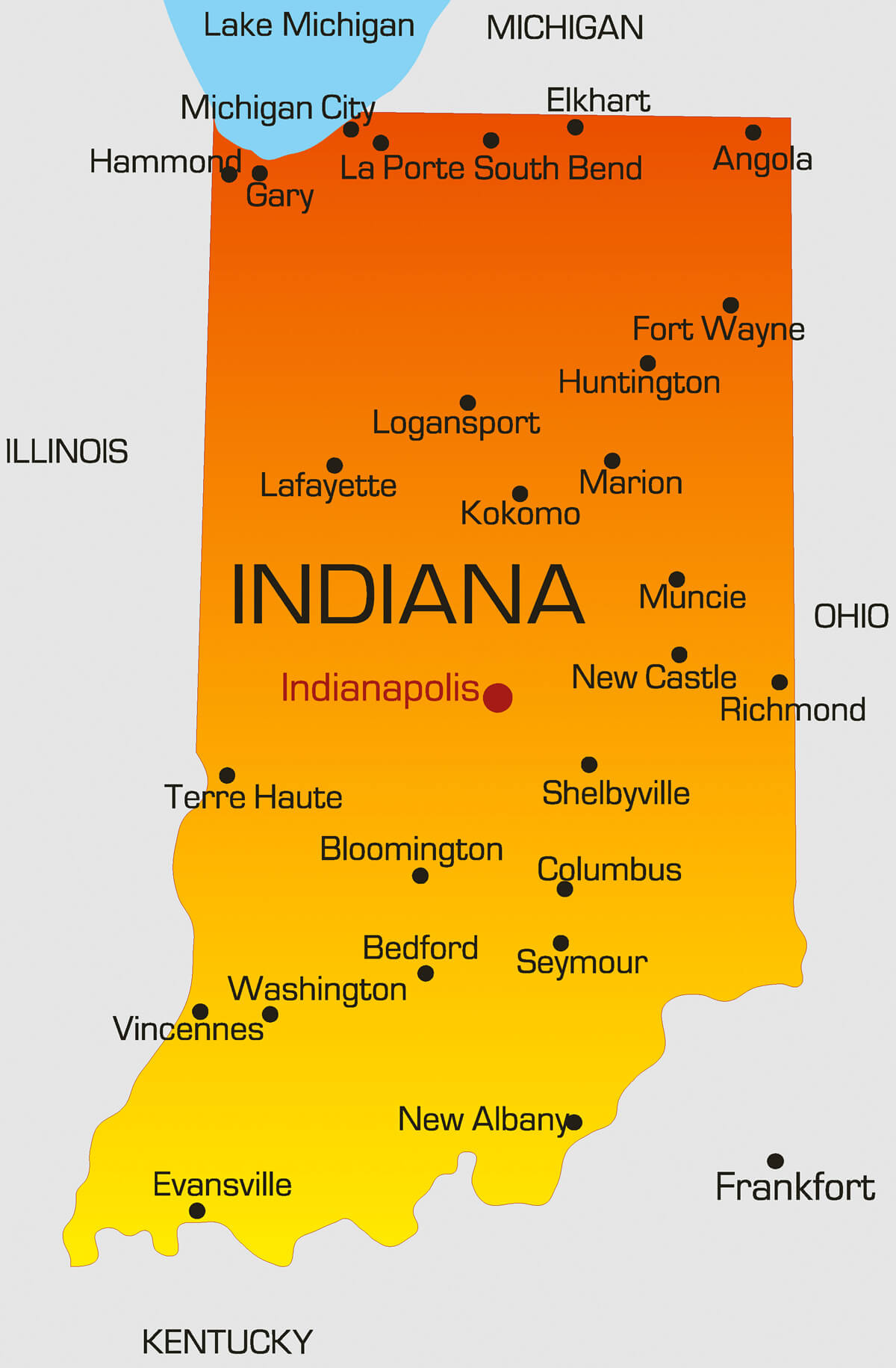
Indiana State Map
Indiana State Map, Indianapolis, towns and main cities.
Indiana Map 1900
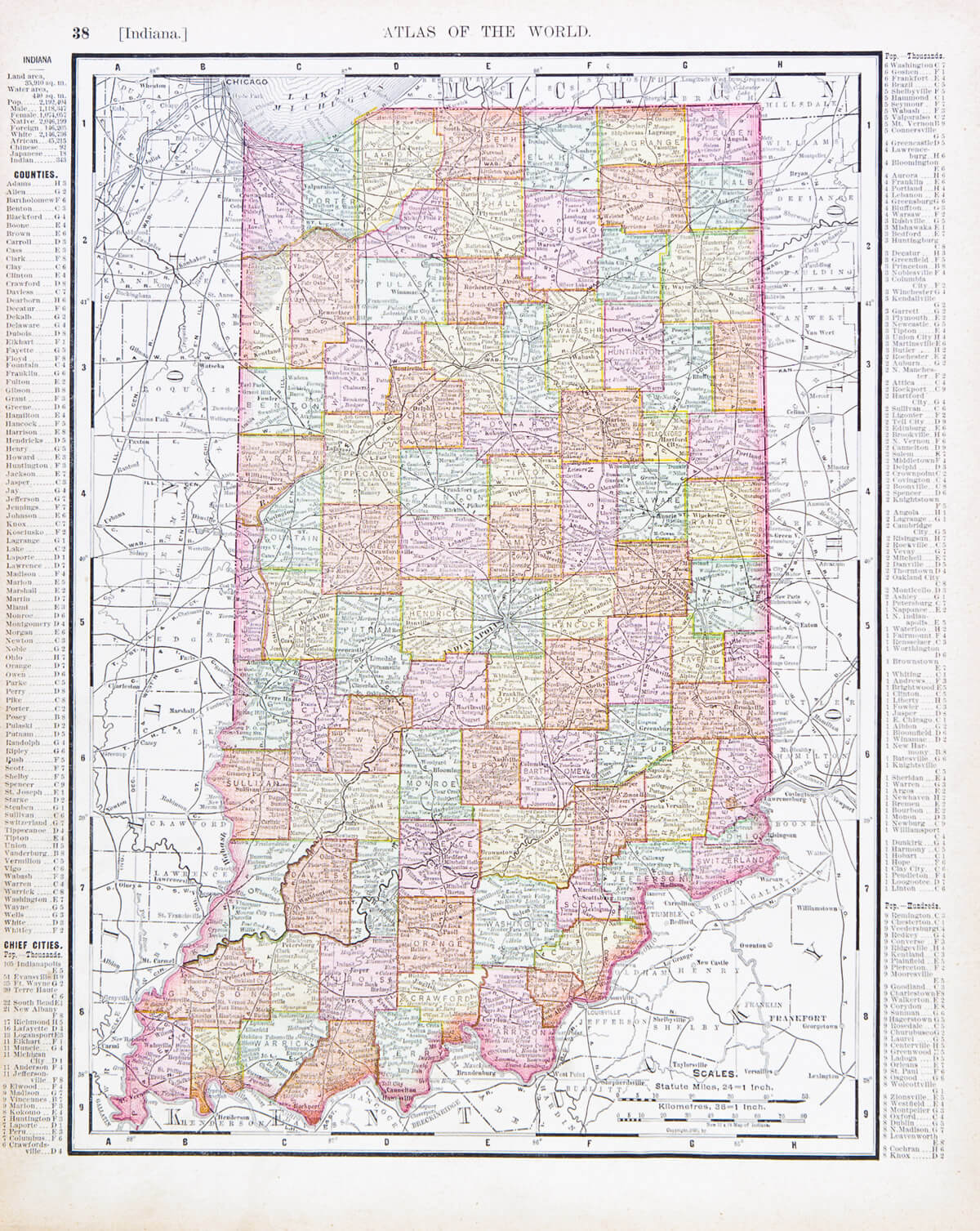
A map of Indiana, USA from Spofford’s Atlas of the World, printed in the United States in 1900.
Indiana Locate Map
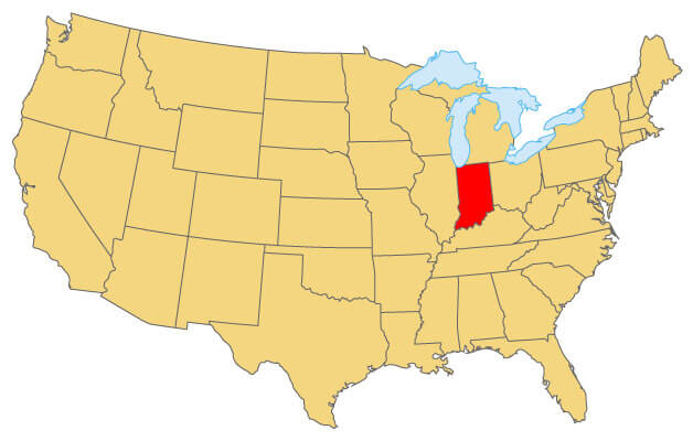
Indiana Locate Map where the state in United States.
Evansville Map, Indiana
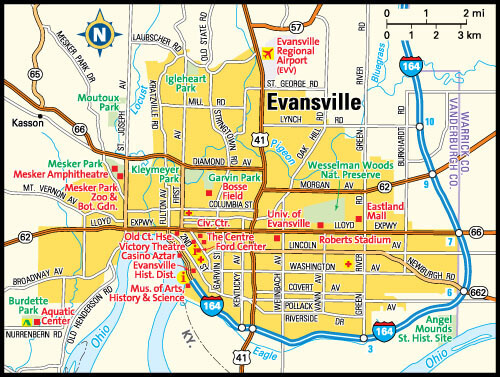
Evansville, Indiana area map.
Indianapolis Map, Indiana
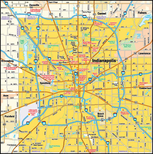
Indianapolis, Indiana area map.
Indiana Road Map
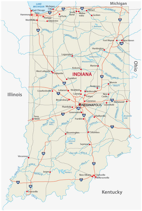
Indiana road map with Interstates, U.S. Highways and state roads.
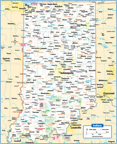
Indiana Administrative Map
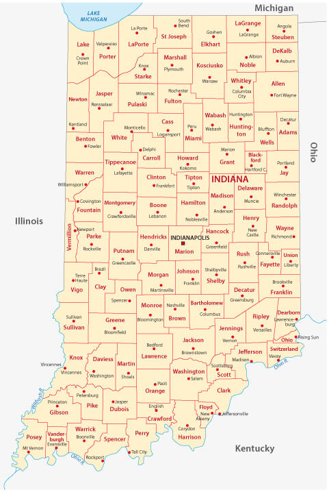
Indiana administrative map with counties, USA.
Indiana Maps and Photos
- Please Click for more Indiana Map
- Please Click for Map of Indiana
- Please Click for more Indiana Photos
Where is Indiana on the US Map?
Show Google interactive map, satellite map, where is the country located.
Get directions by driving, walking, bicycling, public transportation and travel with street view.
Feel free to explore these pages as well:
- California Map ↗️
- Texas Map ↗️
- New York Map ↗️
- Florida Map ↗️
- Illinois Map ↗️
- Pennsylvania Map ↗️
- Ohio Map ↗️
- Michigan Map ↗️
- Georgia Map ↗️
- New Jersey Map ↗️
- North Carolina Map ↗️
- Virginia Map ↗️
- Massachusetts Map ↗️
- Indiana Map ↗️
- Tennessee Map ↗️
- Arizona Map ↗️
- Missouri Map ↗️
- Maryland Map ↗️
- Washington Map ↗️
- Minnesota Map ↗️
- Colorado Map ↗️
- Alabama Map ↗️
- Louisiana Map ↗️
- South Carolina Map ↗️
- Kentucky Map ↗️
- Oregon Map ↗️
- Oklahoma Map ↗️
- Connecticut Map ↗️
- Iowa Map ↗️
- Mississippi Map ↗️
- Arkansas Map ↗️
- Kansas Map ↗️
- Utah Map ↗️
- Nevada Map ↗️
- District of Columbia Map ↗️
- United States Map ↗️
- Map of United States ↗️
- North America Map ↗️
- Map of North America ↗️