A collection of South Carolina Maps; View a variety of South Carolina physical, united states political map, administrative, relief map, South Carolina satellite image, higly detalied maps, blank map, South Carolina USA and earth map, South Carolina’s regions, topography, cities, road, United States of America direction maps and US atlas.
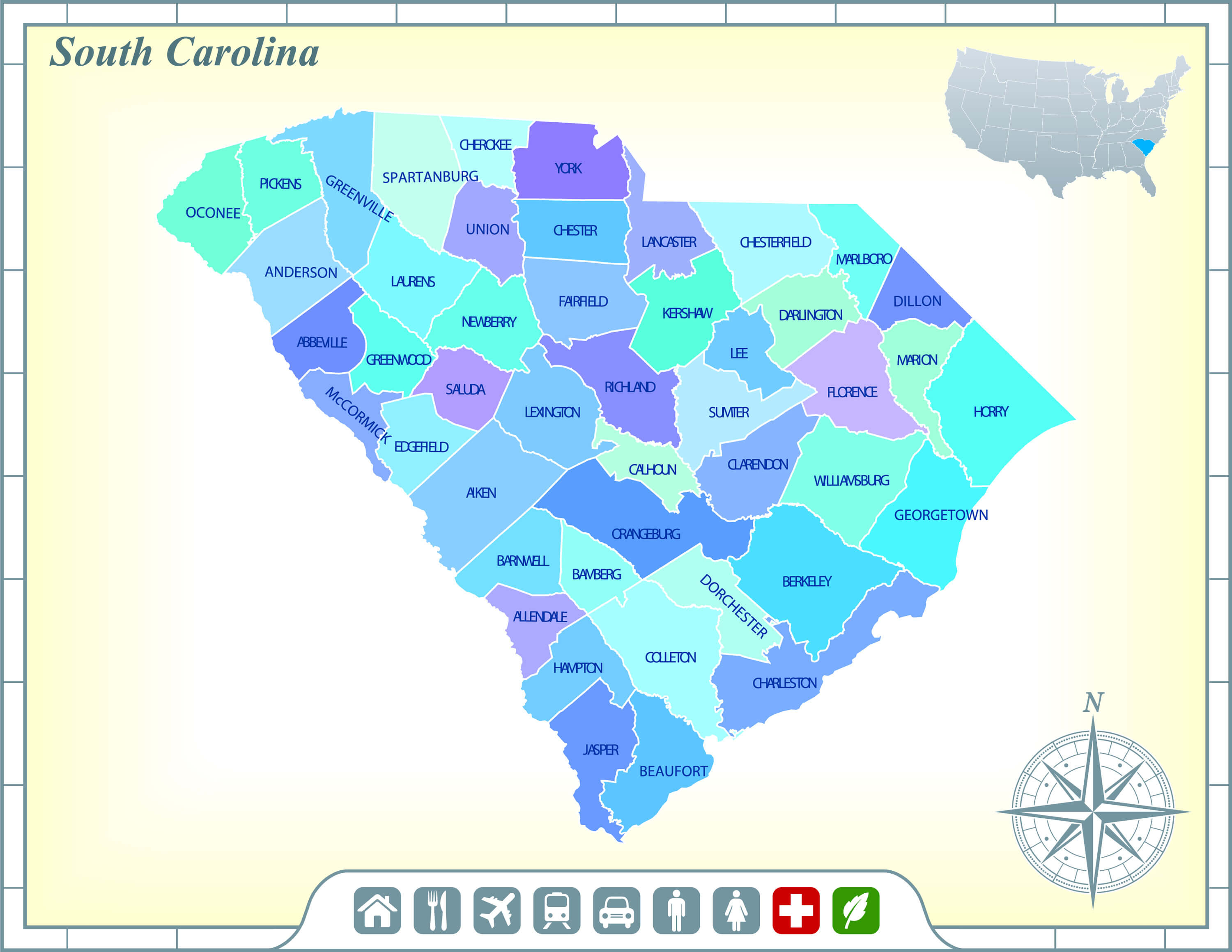
Color Map of South Carolina

Vector color map of South Carolina state, USA.
South Carolina State Map
South Carolina State Map with Community Assistance and Activates.
South Carolina State Map, US
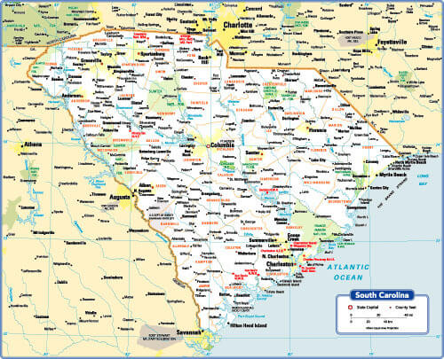
South Carolina State Map with major cities and interstates.
Charleston Map, South Carolina
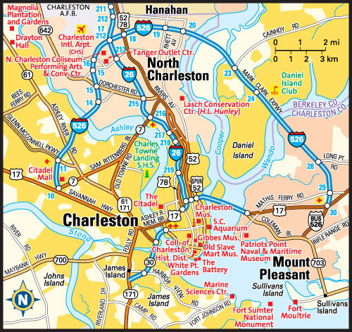
Charleston, South Carolina area map, North Charleston, Hanahan, Mount Pleasant, United States
Greenville and Spartanburg Map, South Carolina
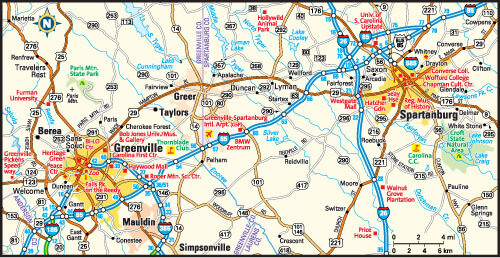
Greenville and Spartanburg, South Carolina area map, North Charleston, Hanahan, Mount Pleasant, United States
Where is South Carolina on the US?
Show Google map, satellite map, where is the country located.
Get directions by driving, walking, bicycling, public transportation and travel with street view.
Feel free to explore these pages as well:
- South Carolina Maps ↗️
- Map of South Carolina ↗️
- South Carolina Photos ↗️
- South Carolina Maps ↗️
- Exploring the Dynamic Allure of Charlotte: A Traveler’s Treasure Trove ↗️
- United States Map ↗️
- North America Map ↗️