A Collection of Liechtenstein Maps; Explore Liechtenstein with our detailed map featuring its municipalities, landmarks, political, physical, road, satellite maps and scenic landscapes. Plan your visit to this charming Alpine microstate nestled between Switzerland and Austria.
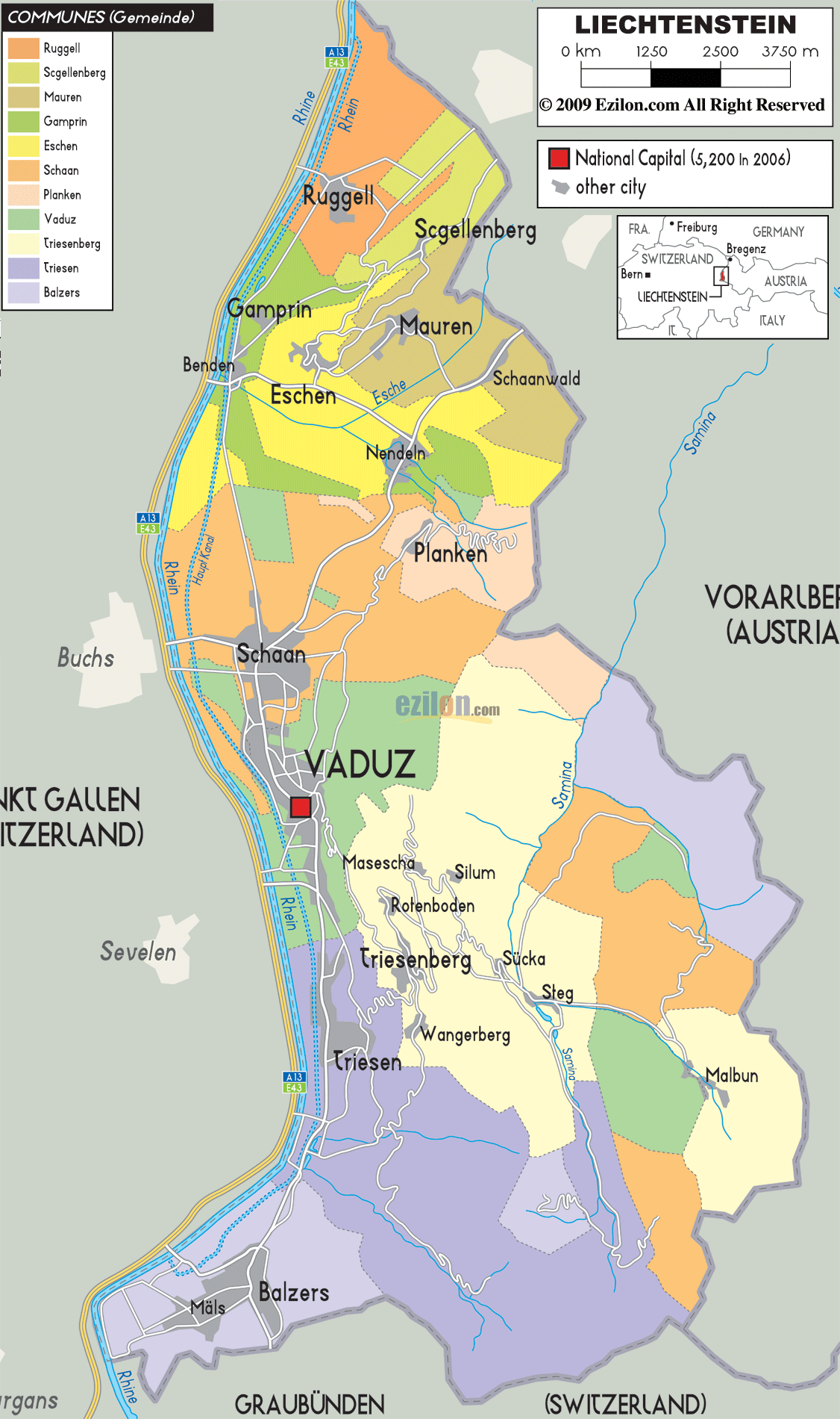
Administrative Divisions of Liechtenstein Map
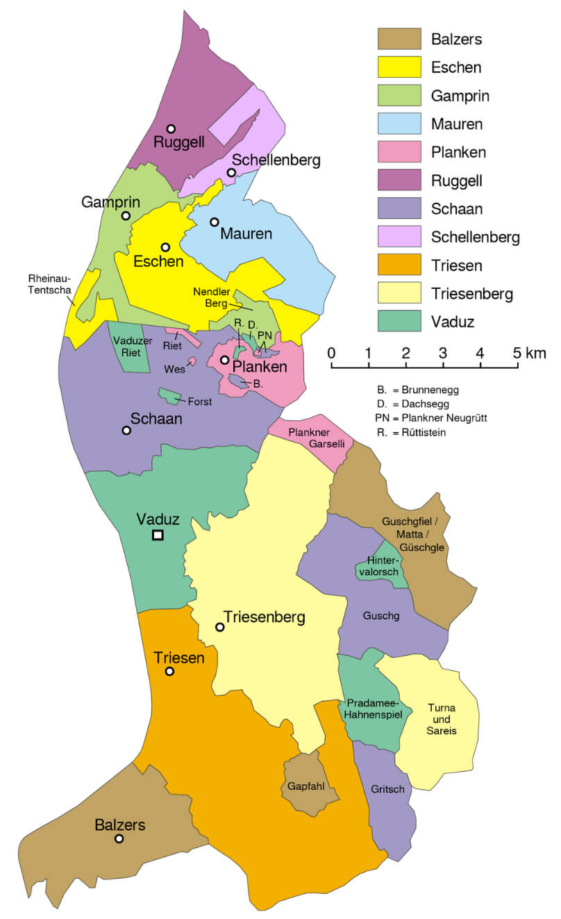 Map of Liechtenstein showing its administrative divisions, regions, and municipalities.
This map illustrates the administrative divisions of Liechtenstein, highlighting its municipalities such as Vaduz, Schaan, Triesen, and Balzers. Each region is color-coded for clarity, showcasing the country’s structure and geographical layout.
Brief information about Liechtenstein
Liechtenstein, a tiny but wealthy country nestled between Switzerland and Austria, is known for its stunning alpine scenery and strong economy. Despite its small size of just 160 square kilometres, it boasts a high standard of living, low taxes and a stable political environment. Vaduz, the capital, is famous for its picturesque castle overlooking the city and its status as a financial centre.
Liechtenstein road map
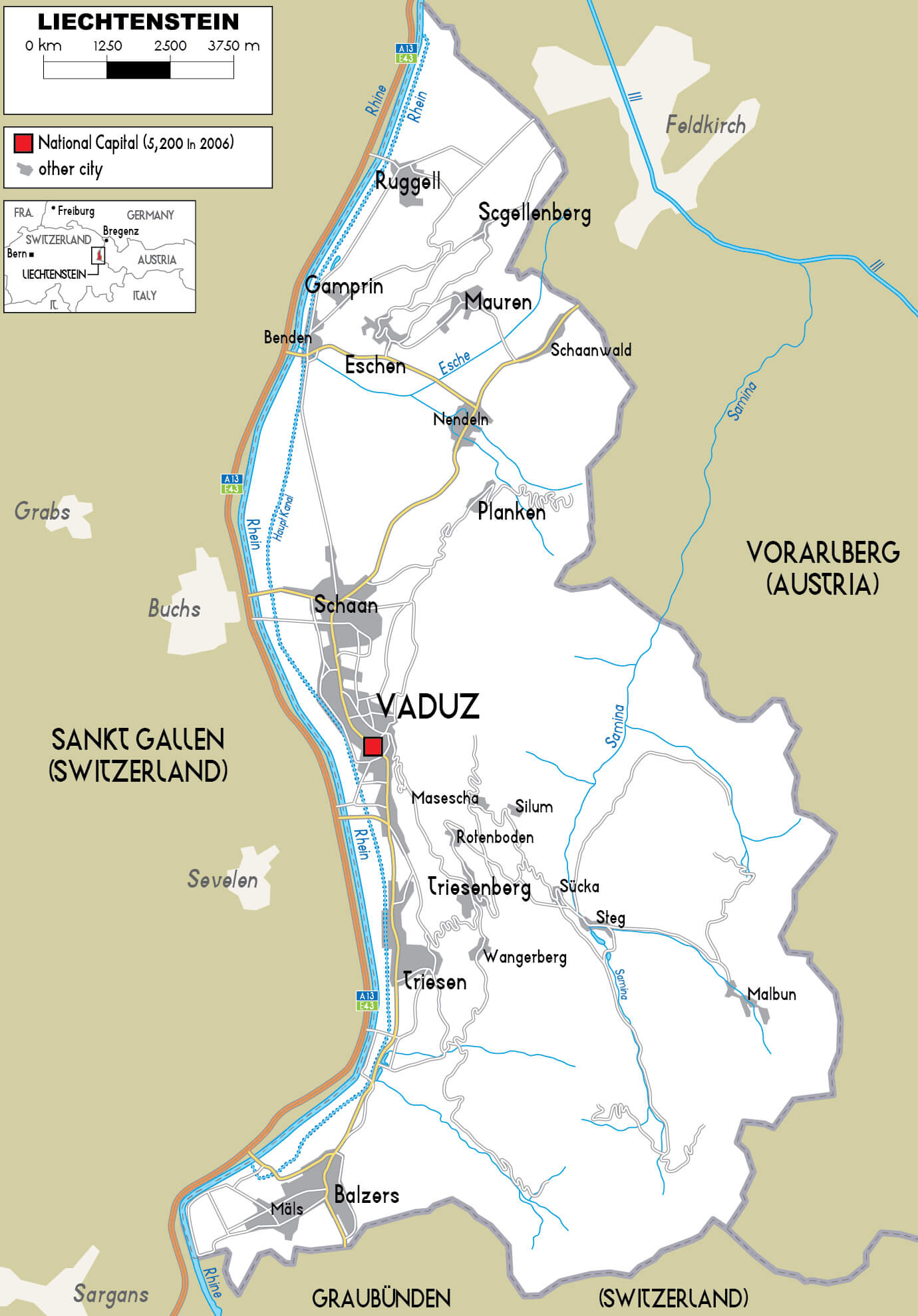
A constitutional monarchy ruled by the Prince of Liechtenstein, Liechtenstein is a unique blend of modernity and tradition. A German-speaking nation with deep cultural ties to its neighbours, Liechtenstein is an active participant in European and international organisations, although it is not a member of the European Union. Popular with tourists for its hiking trails, winter sports and picturesque villages, this charming principality offers a peaceful retreat in the heart of the Alps.
Where is located Liechtenstein on the World Map ?
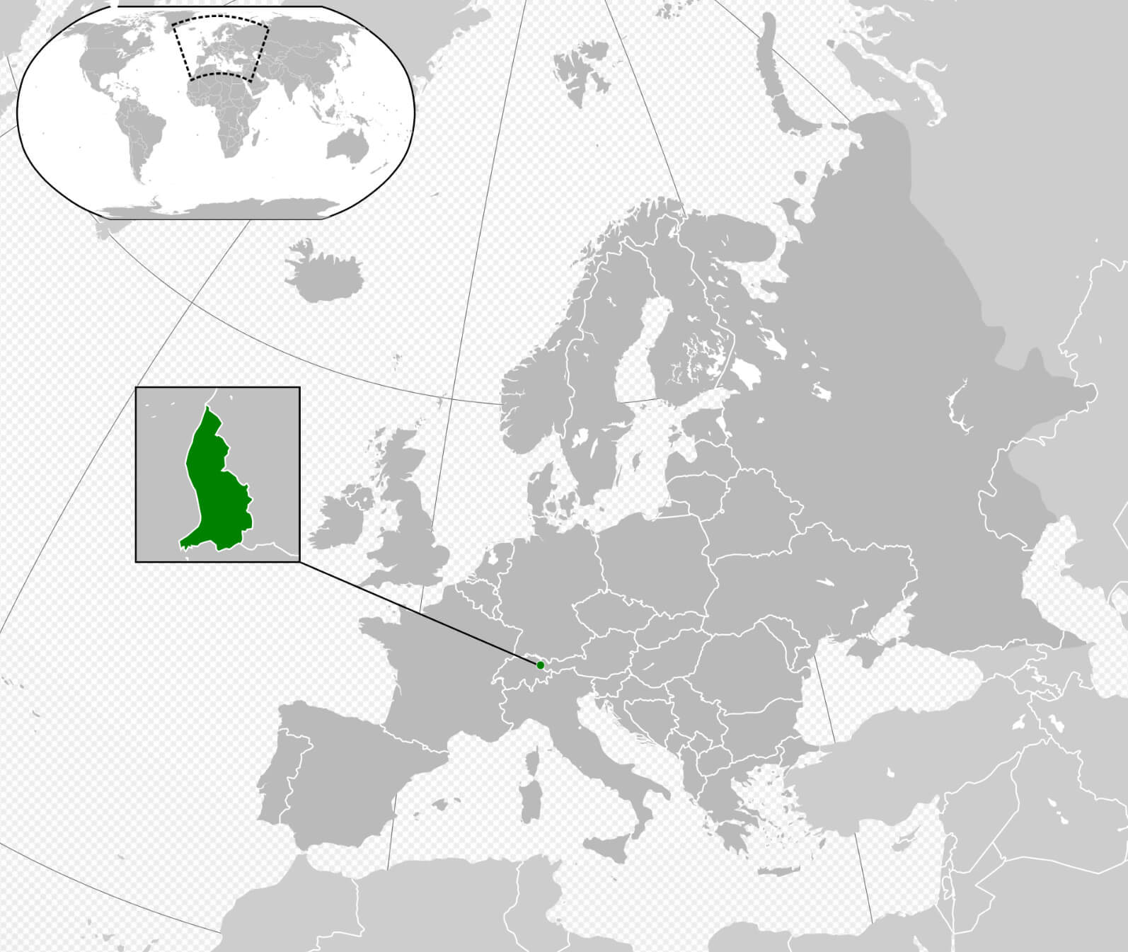
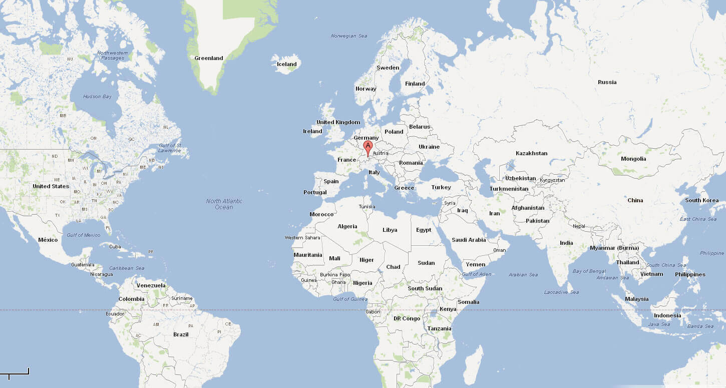
Liechtenstein is a small, landlocked country in Central Europe, nestled between Switzerland to the west and south and Austria to the east. With an area of just 160 square kilometres, it’s one of the smallest countries in the world, but it’s in a prime location in the Alps, making it famous for its breathtaking mountain scenery.
On a world map, Liechtenstein can be found as a tiny dot in the heart of Europe, close to larger nations such as Germany and Italy. Despite its modest size, its strategic location has historically provided it with cultural influences from its neighbours, particularly German-speaking countries. Liechtenstein is the only country in the world with German as its official language that does not share a border with Germany.Topgraphic Map of Liechtenstein in German
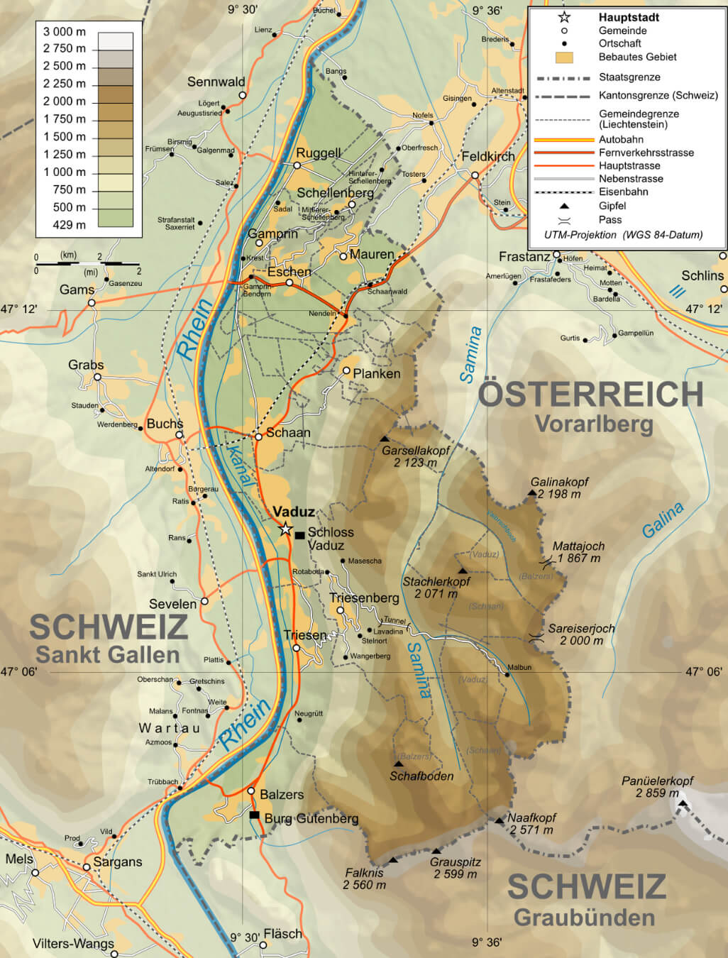
Despite its small size, Liechtenstein is easily accessible by road and rail from nearby Swiss and Austrian cities. Although it doesn’t have its own airport, the nearest international airport is in Zurich, Switzerland, just an hour’s drive away. This central European location makes it an ideal destination for travellers looking to explore both Alpine beauty and cultural heritage in a peaceful, scenic setting.
Here are some statistical information about Liechtenstein:
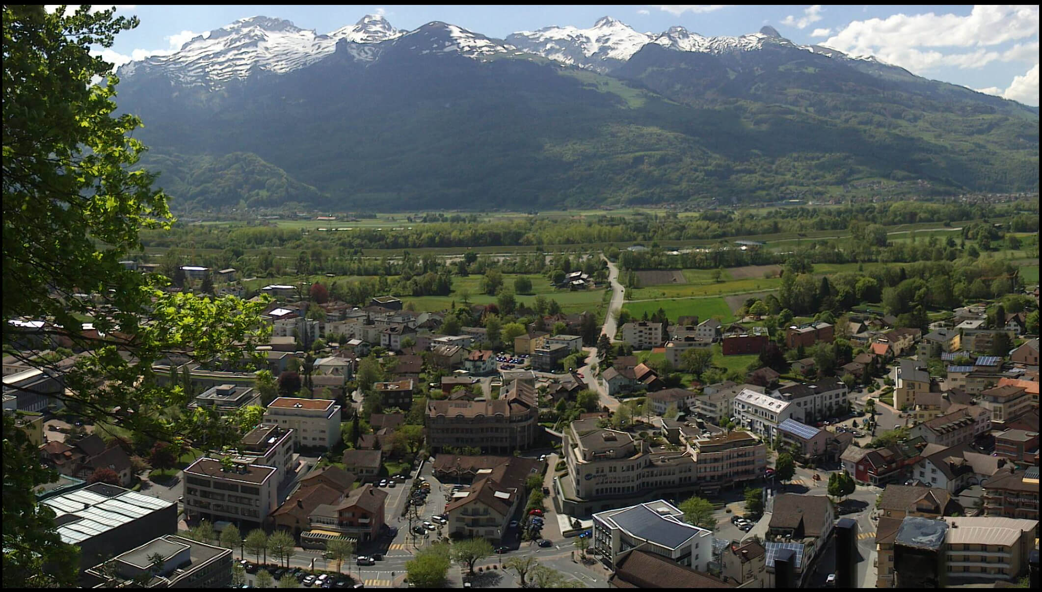 Area: 160.50 km2 (61.97 sq mi)
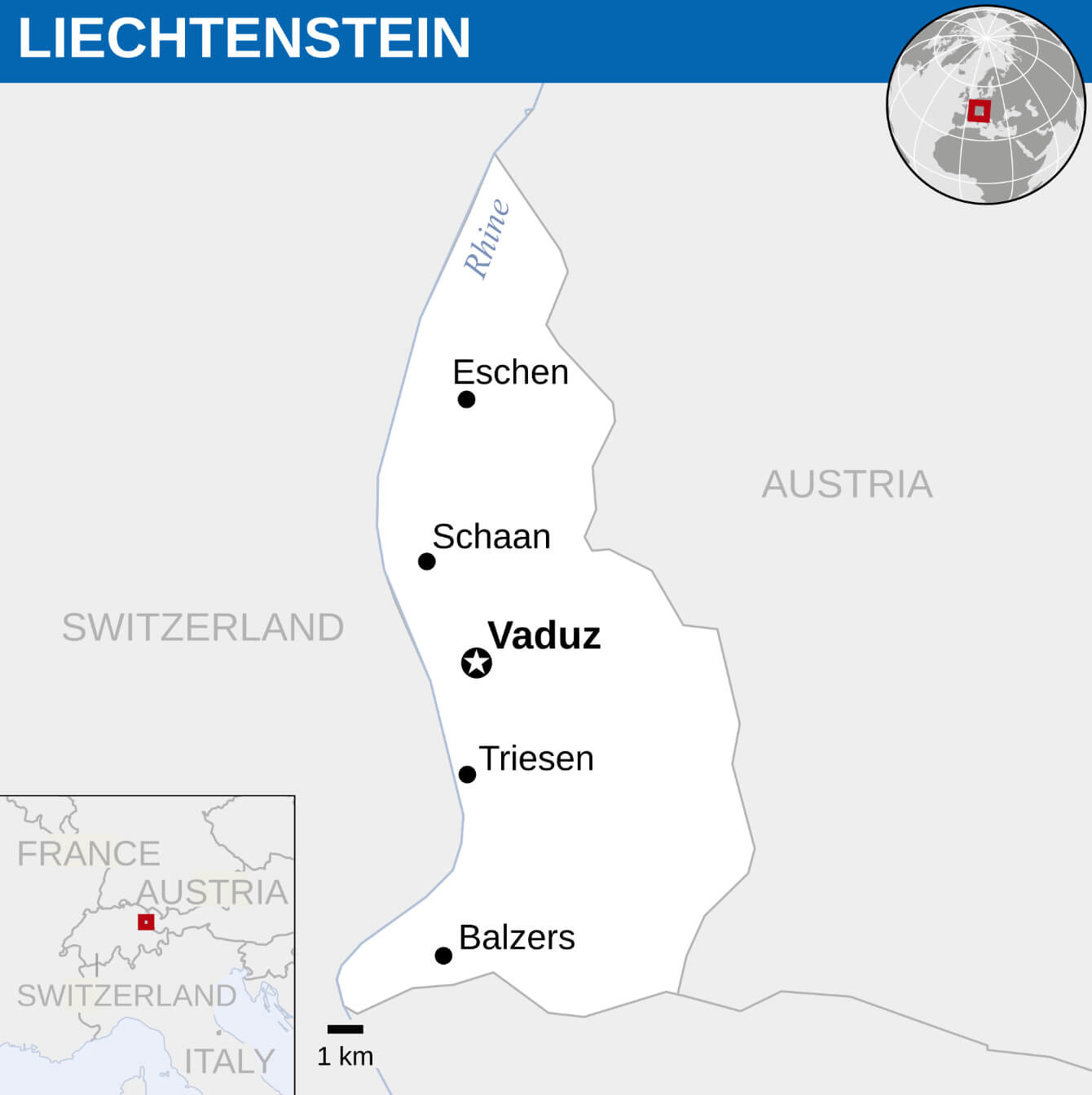
Liechtenstein Location Map
Liechtenstein Political Map
Liechtenstein Tourist Map
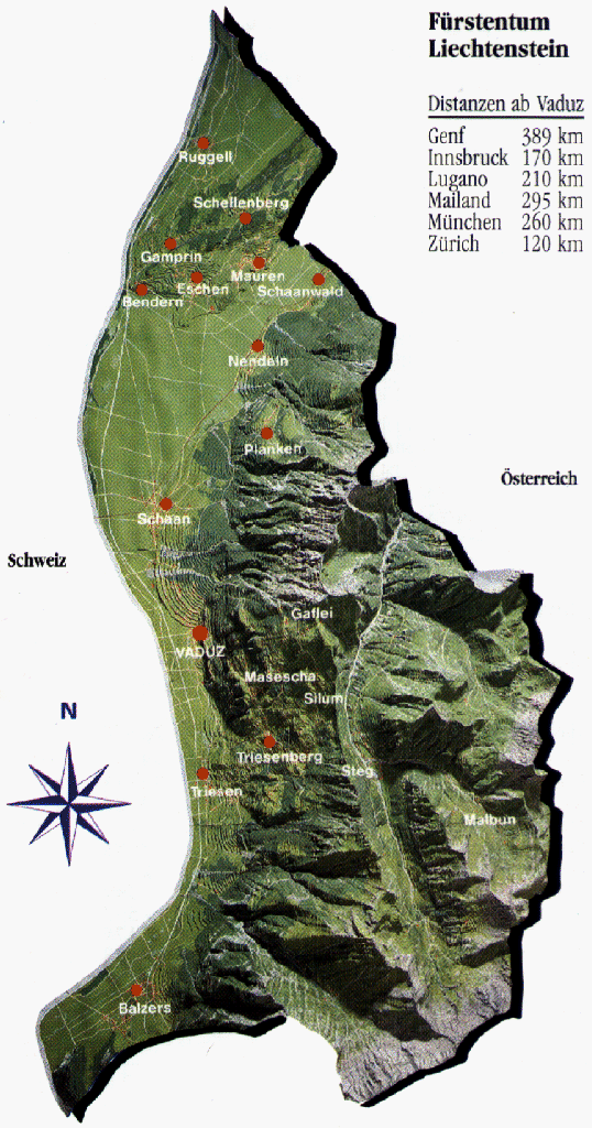 Liechtenstein tourist map showing towns and distances to major cities
This tourist map of Liechtenstein highlights key towns like Vaduz, Triesen, and Balzers. Distances to nearby cities such as Zurich and Munich are noted, offering context for travel planning. The map also shows the mountainous terrain, emphasizing the scenic landscape..
Liechtenstein Relief Map
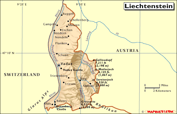 Liechtenstein relief map showing elevation and major landmarks
This relief map of Liechtenstein displays the country’s mountainous terrain, with elevation points such as the Grauspitz and prominent landmarks like Vaduz Castle. Major towns, borders with Austria and Switzerland, and notable peaks are also highlighted, offering a geographical overview.
Map of Liechtenstein Switzerland
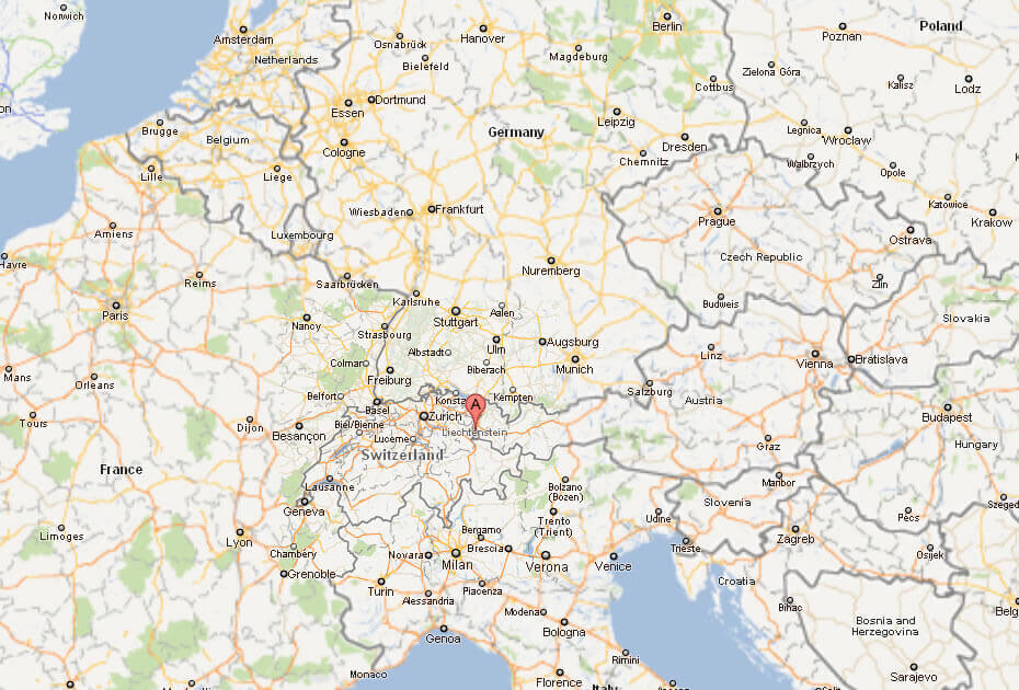
Map of Liechtenstein World
Map of Liechtenstein
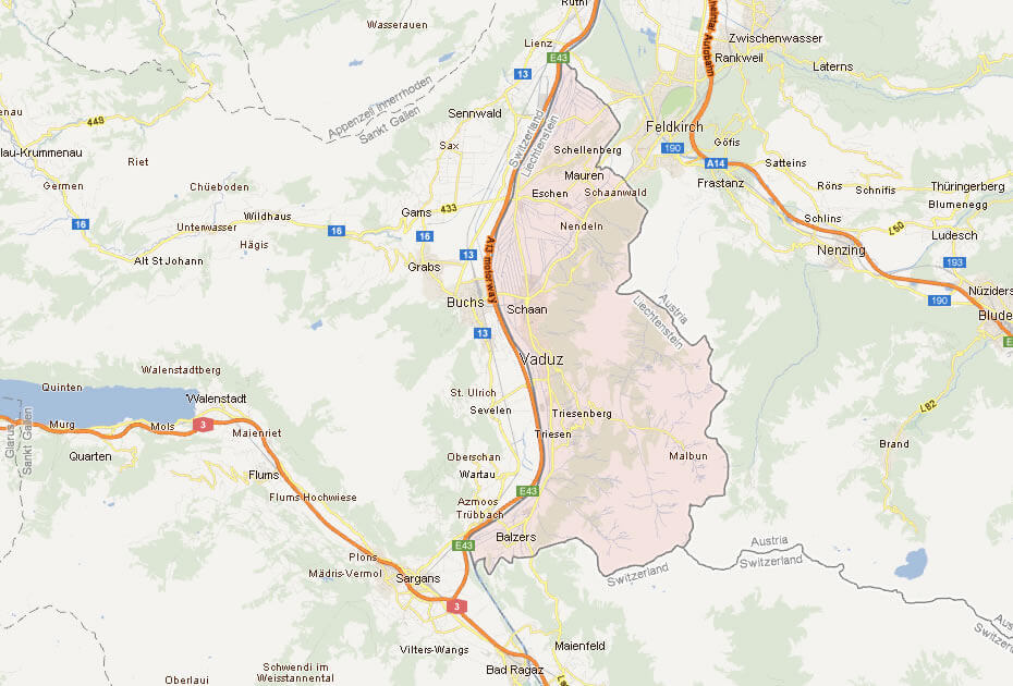
Map of Liechtenstein
 Satellite map of Liechtenstein with nearby Swiss and Austrian areas
This satellite map shows Liechtenstein and its surroundings, including parts of Switzerland and Austria. Major roads, towns, and natural features are highlighted, with Vaduz clearly marked. The map provides a detailed view of Liechtenstein’s alpine terrain and connections.
Physical Map of Liechtenstein
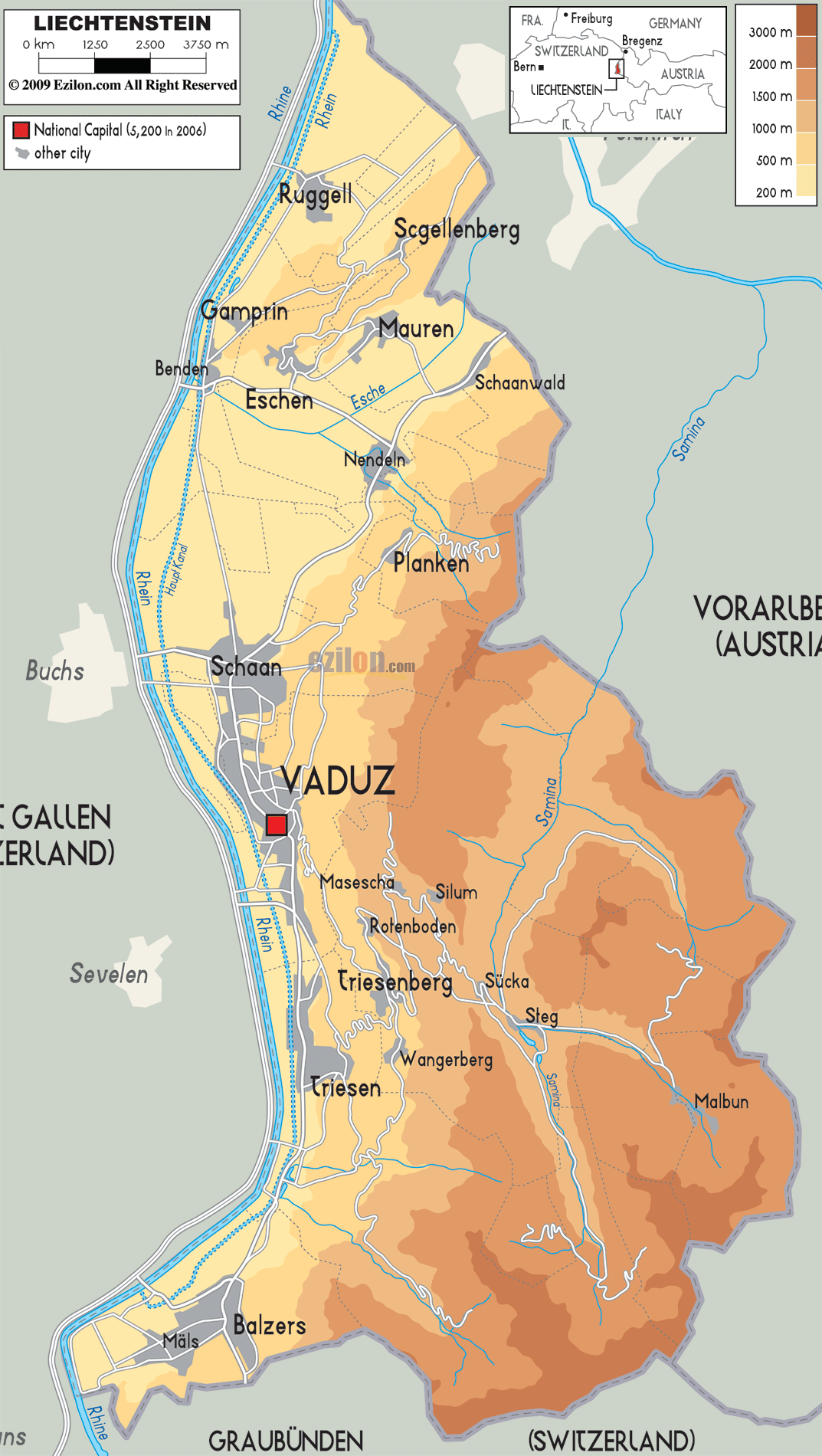 Liechtenstein physical map showing elevation and major towns
This physical map of Liechtenstein highlights the country’s elevation levels, with shading indicating altitudes from 200m to 3000m. Major towns like Vaduz, Balzers, and Triesen are marked, along with rivers and the surrounding borders with Austria and Switzerland.
Principality Liechtenstein Map
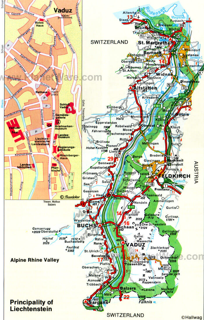 Map of Liechtenstein with main towns, roads, and surrounding areas
This map shows the Principality of Liechtenstein, highlighting major towns like Vaduz, key roads, and the surrounding Alpine Rhine Valley. The map also includes sections of Switzerland and Austria, indicating Liechtenstein’s central position in the Alps.
Liechtenstein aerial view map
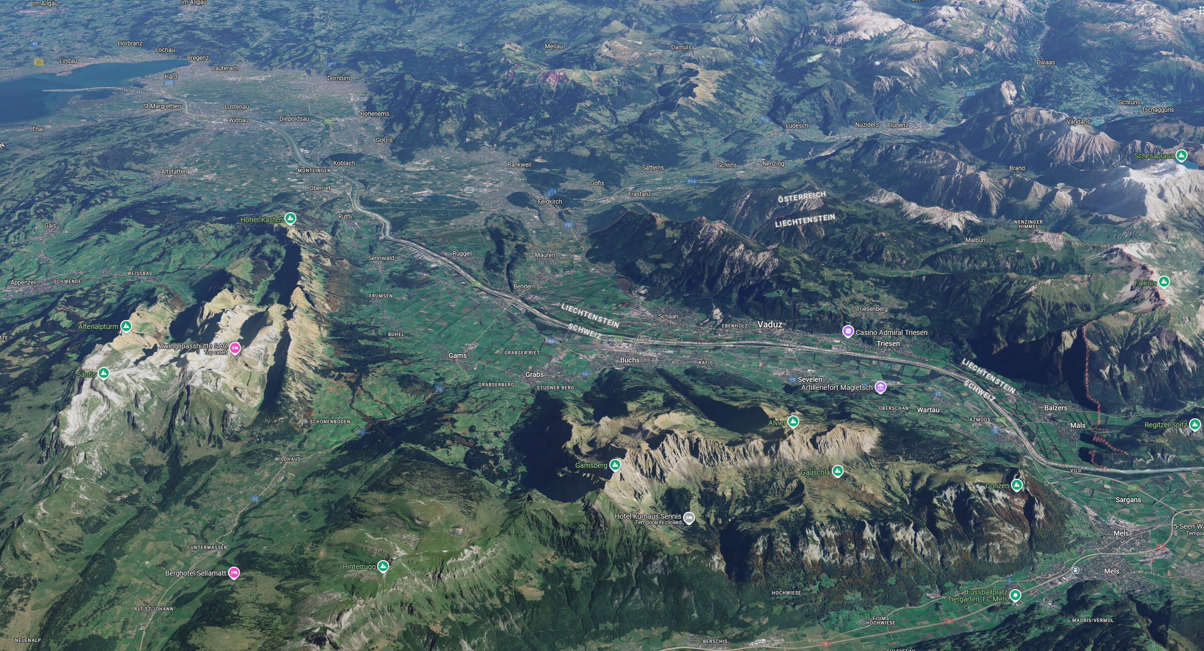
Liechtenstein satellite map
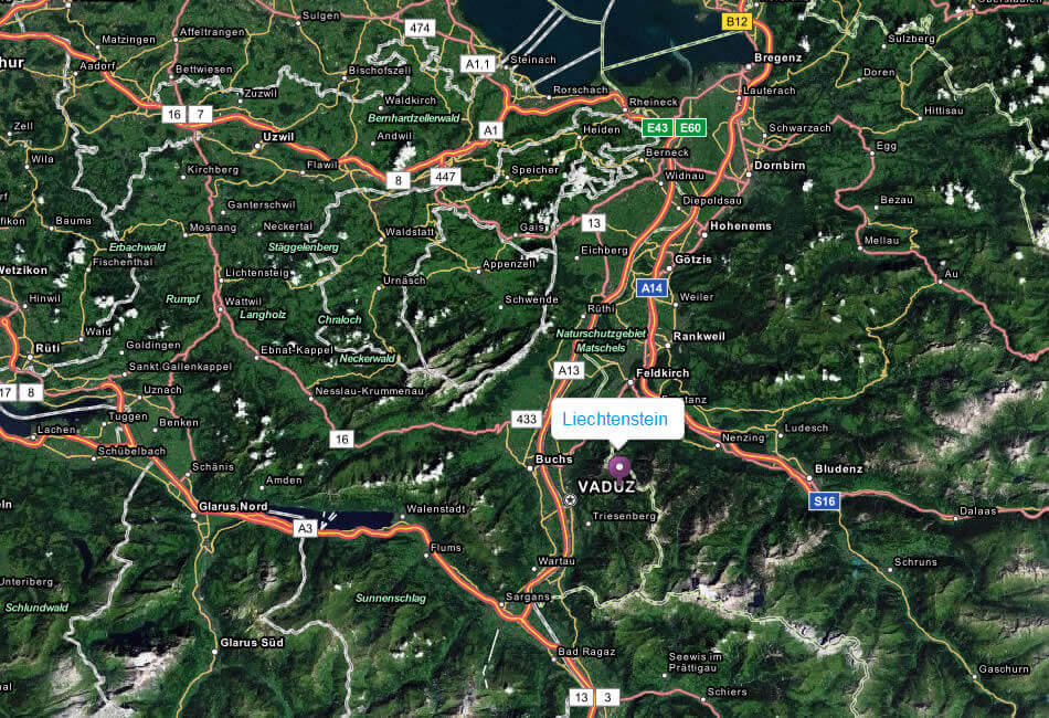
Liechtenstein terrain map
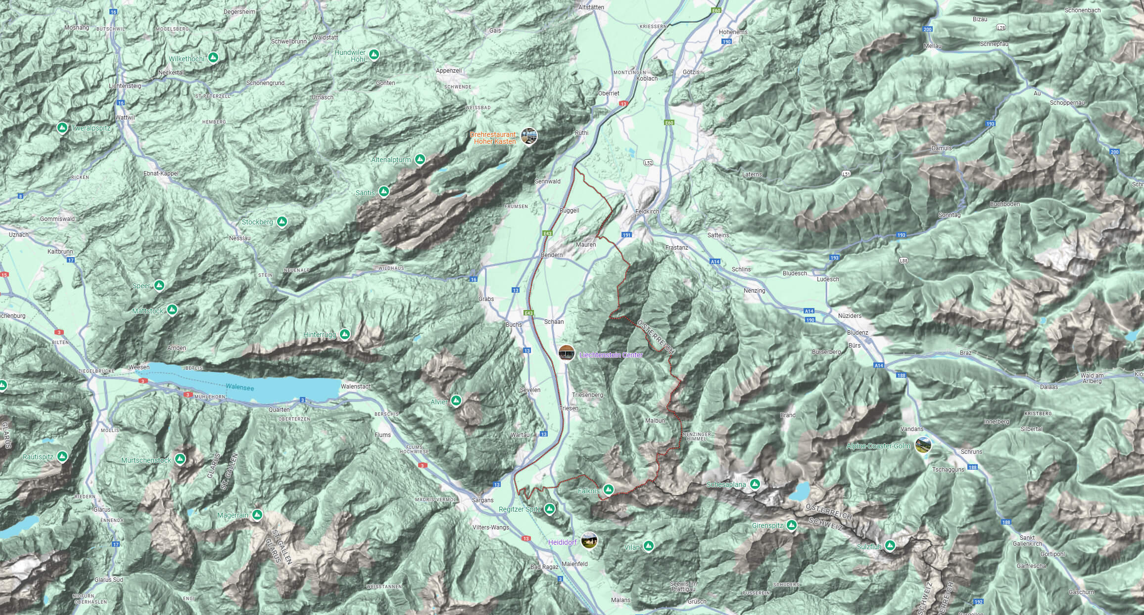
Political map of Liechtenstein, Switzerland and Austria
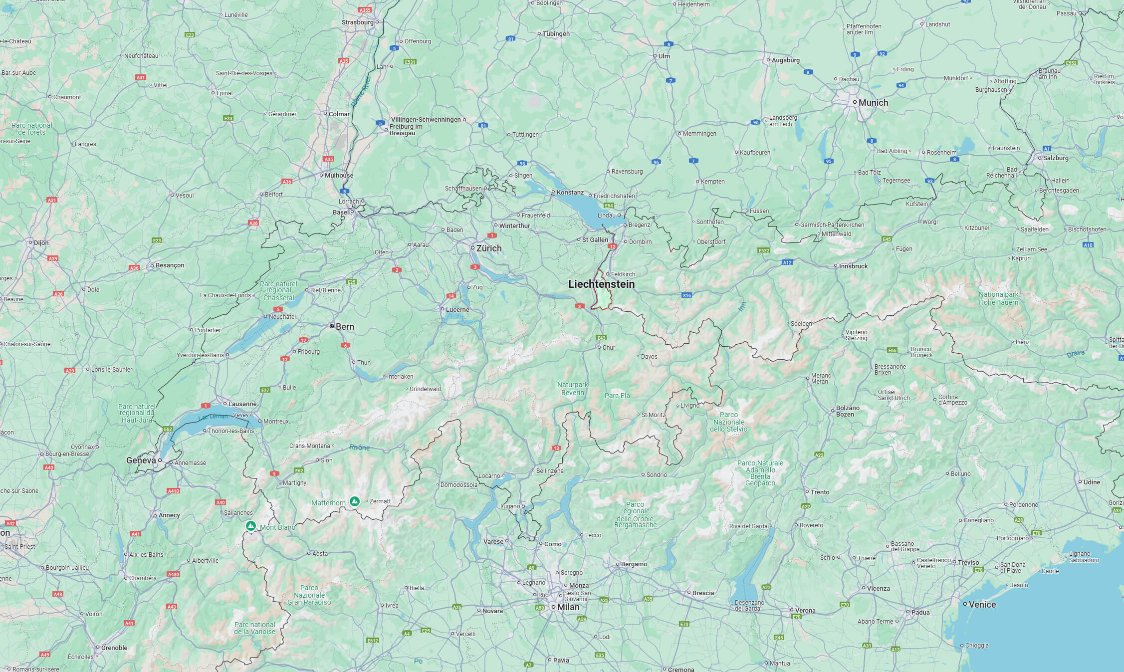
Where is Liechtenstein on the Europe Map?
Show Google map, satellite map, where is the country located.
Get directions by driving, walking, bicycling, public transportation and travel with street view.
Feel free to explore these pages as well:
- Switzerland ↗️
- Germany Map ↗️
- Austria Map ↗️
- Italy Map ↗️
- France Map ↗️
- Map of Switzerland ↗️
- Switzerland Map ↗️
- Discovering Basel: Switzerland’s Enchanting Corner ↗️
- Switzerland Photos 1 ↗️
- Top 10 Must-Visit Attractions When in Geneva ↗️
- Zurich’s 10 Best Place List for Every Adventurous Traveler ↗️
- The 10 Must-Visit Cities from the 2023 Liveability Index ↗️
